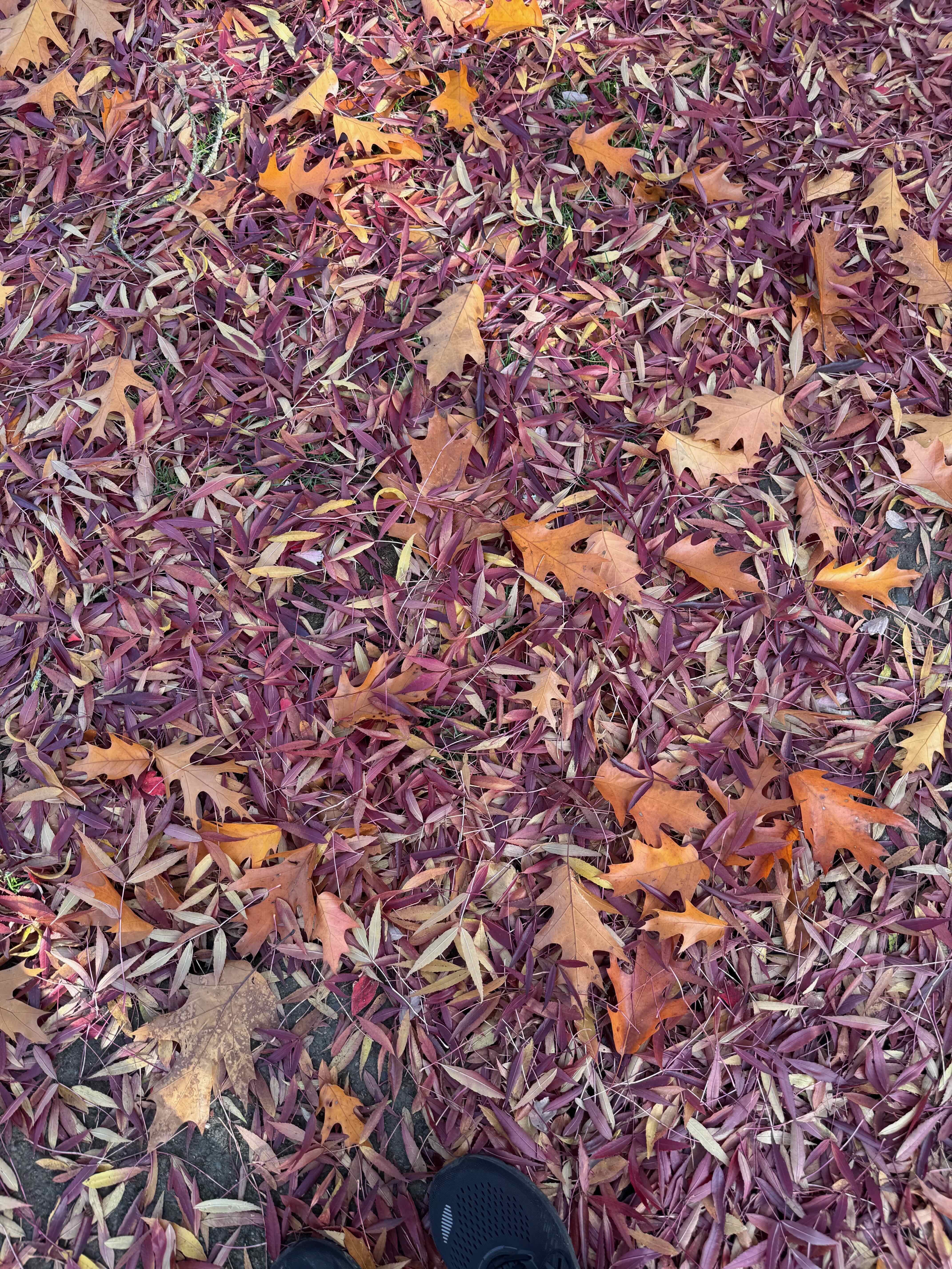
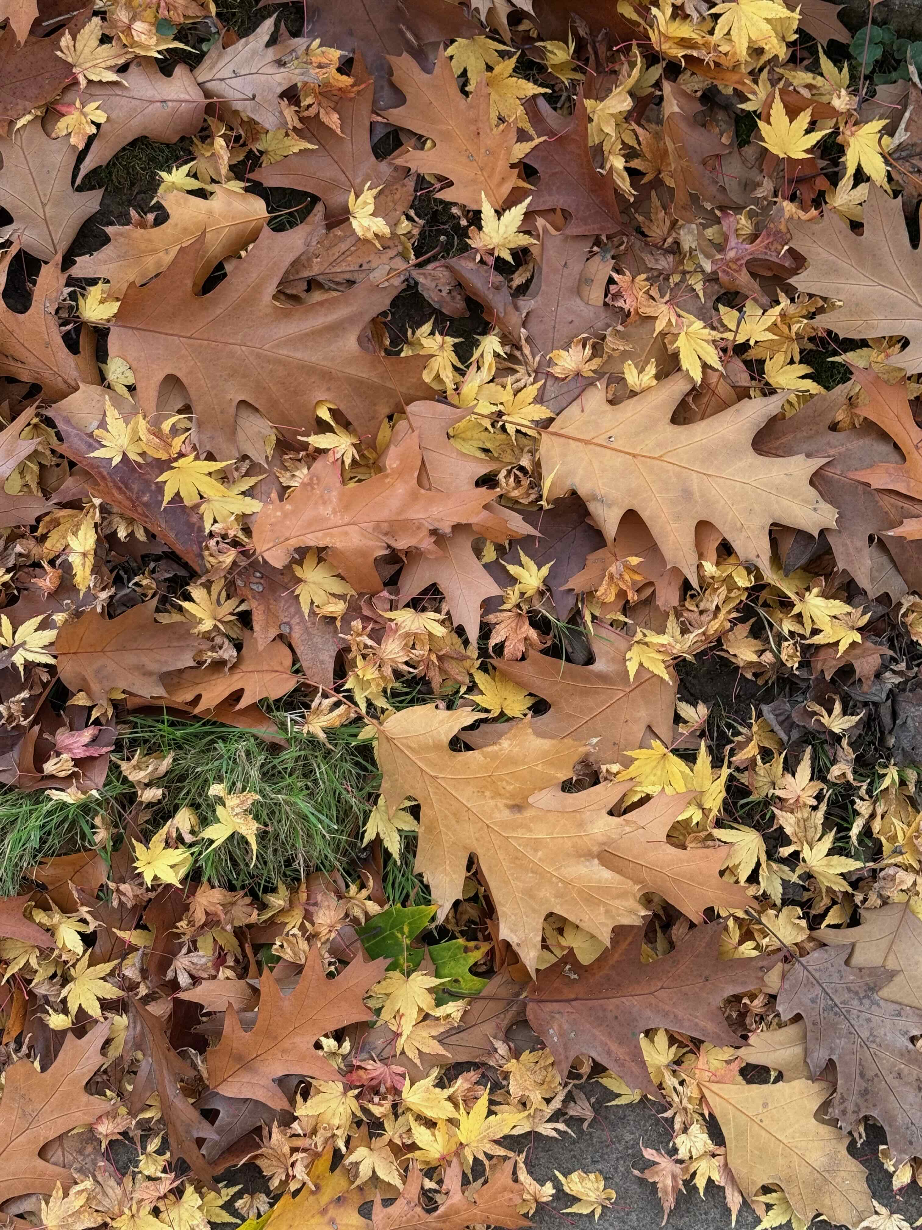
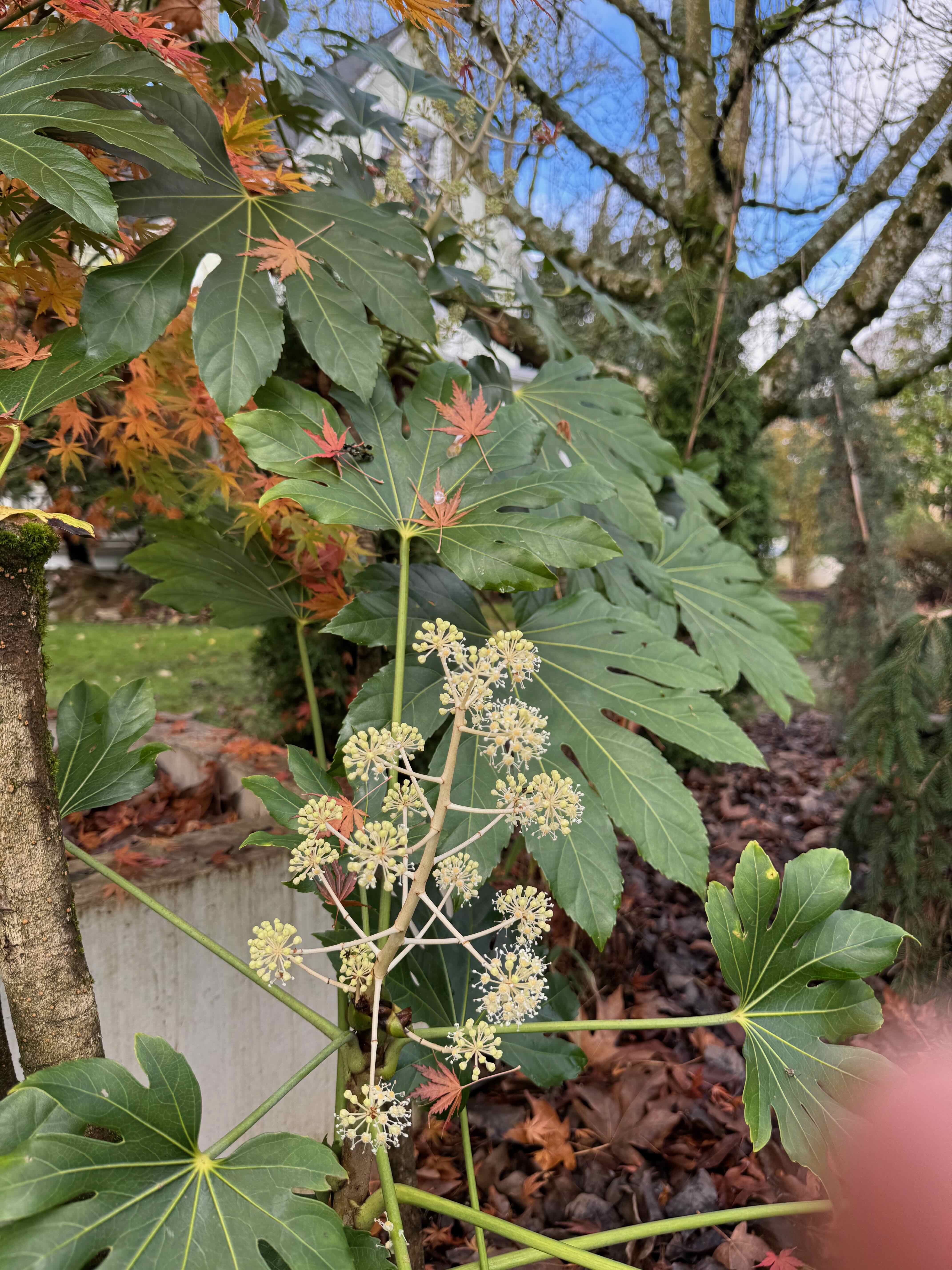
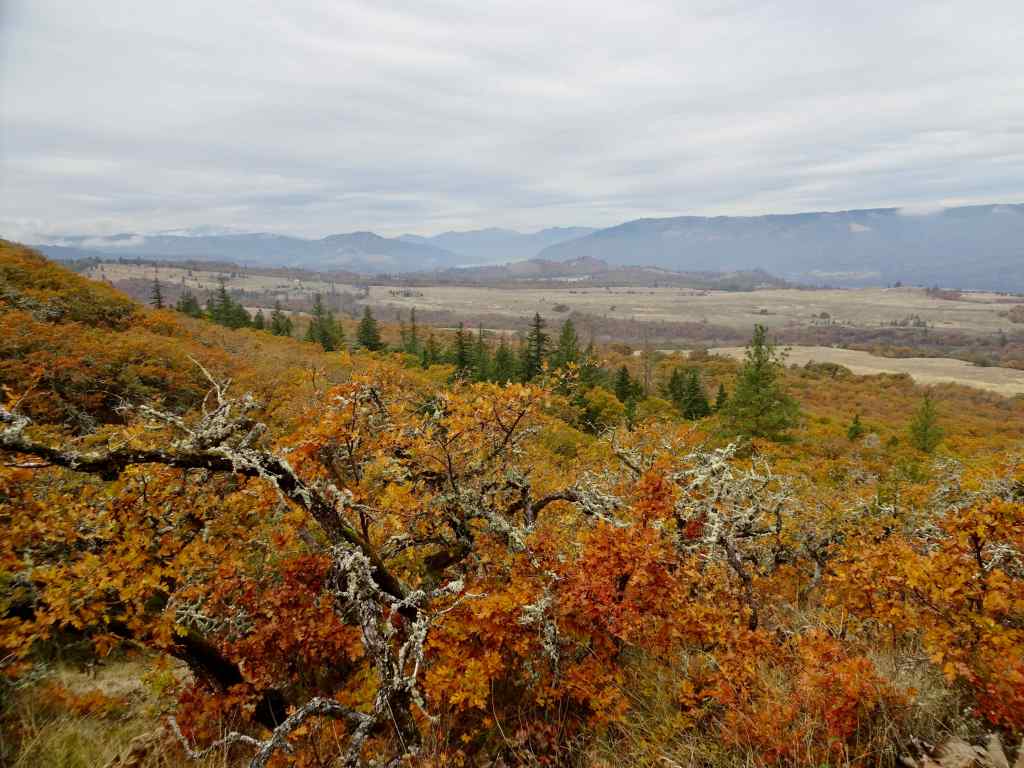
We only went on two hikes in December, one in town, and one out in the eastern gorge.
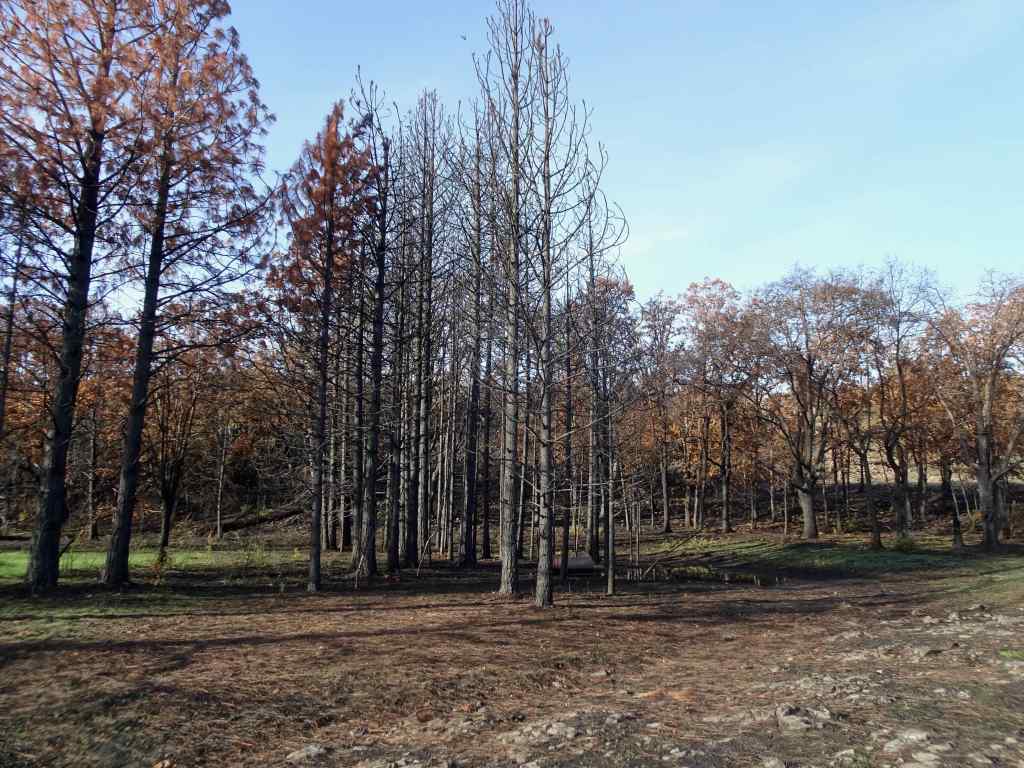
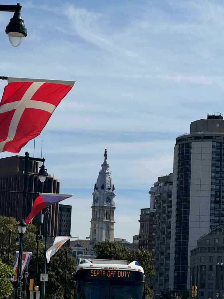
12/1/2025 – Mt Tabor, Portland
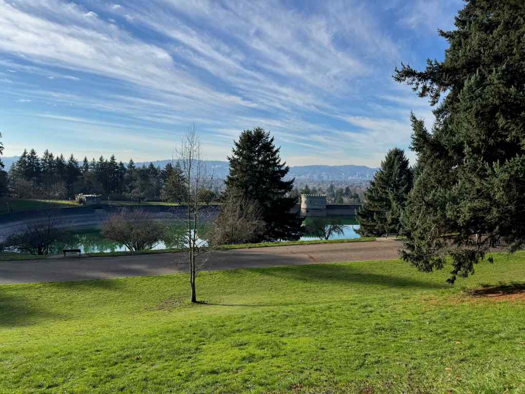
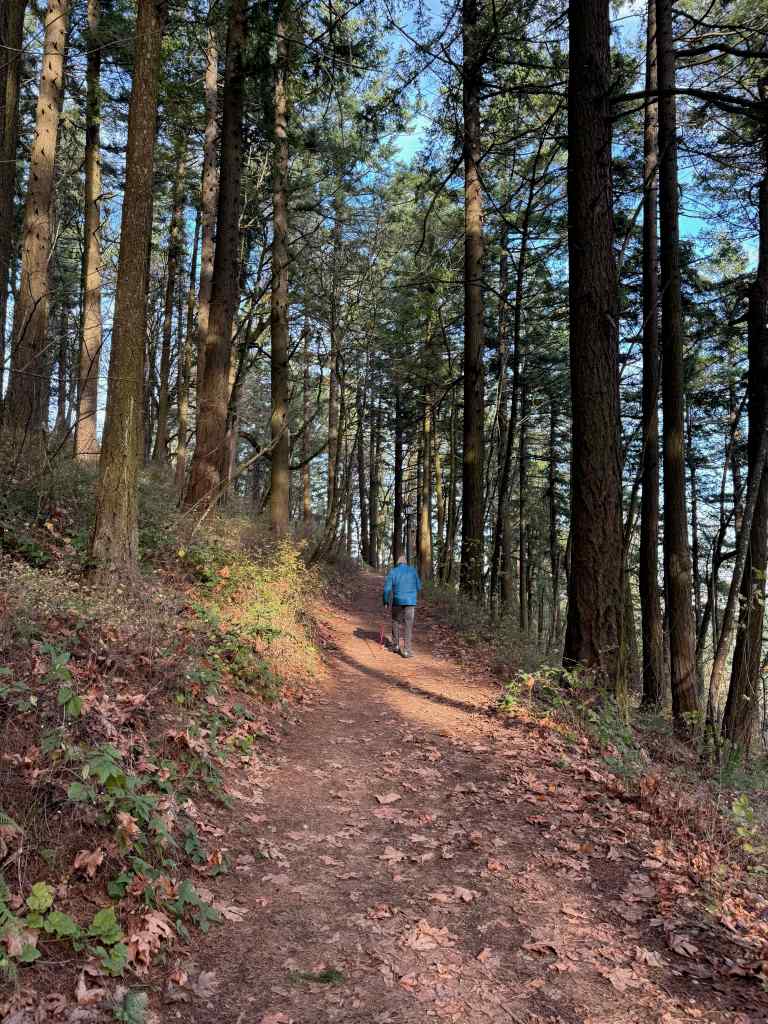
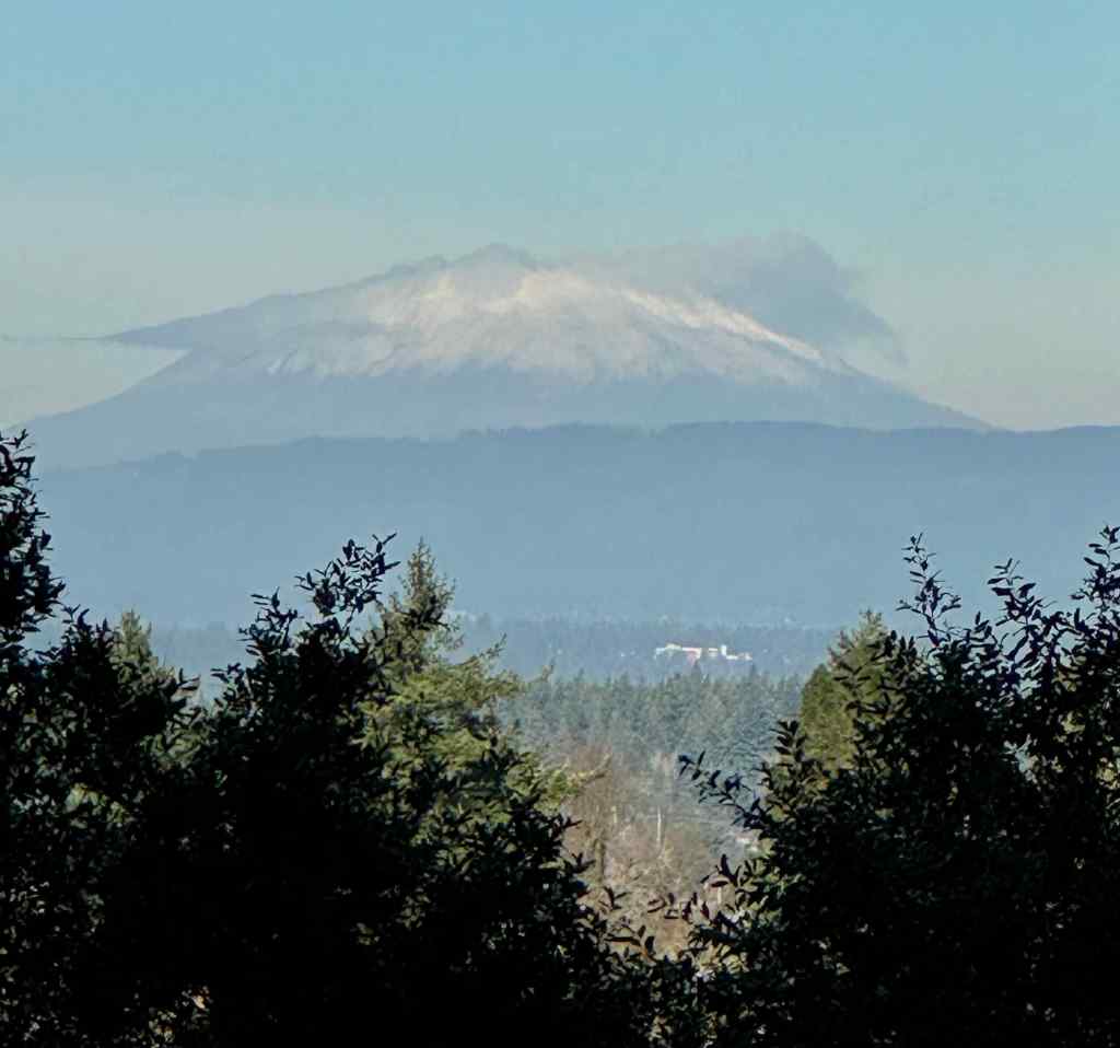
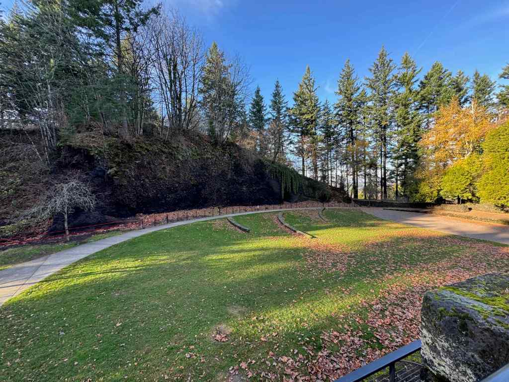
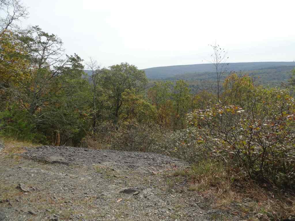
On a sunny day, we drove to our nearest extinct volcano, and walked around its circumference and up to the top, taking in views, and getting a good leg stretch (2 miles, 200 feet). There are many trails that circle around and through the park, and many users, running, walking, and stair climbing. It is a great public space on the east side of Portland.
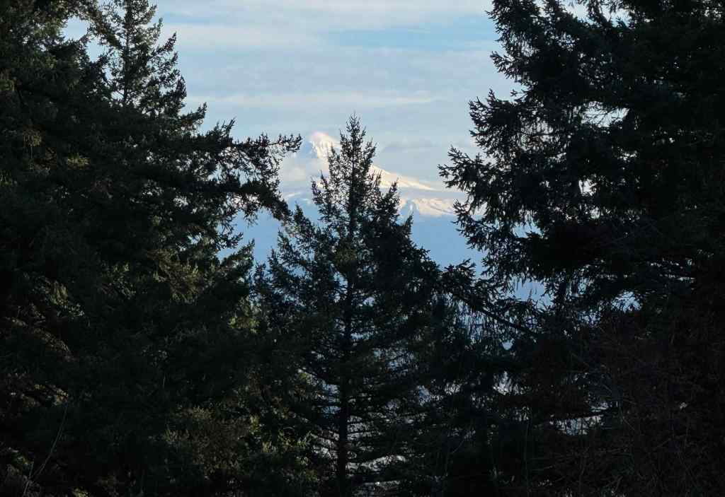
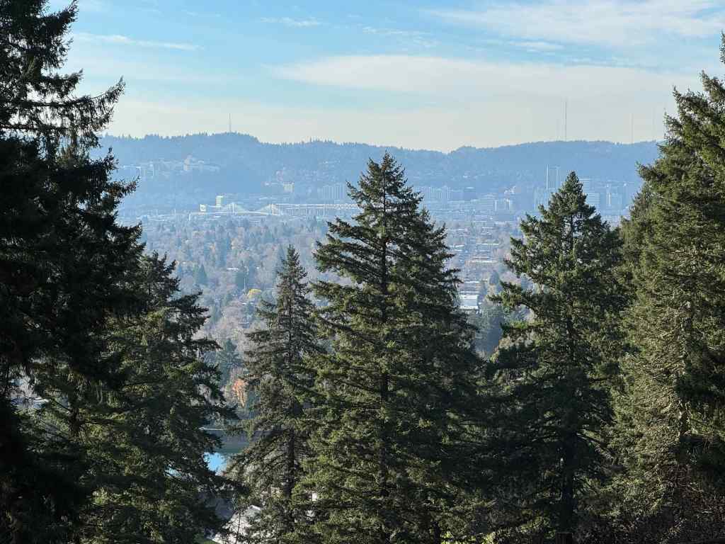
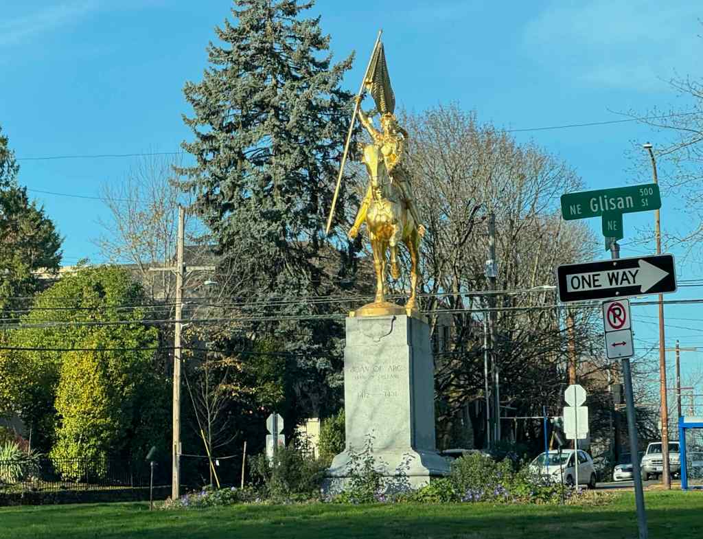
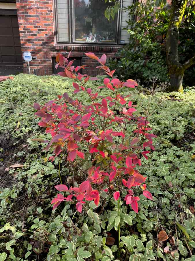
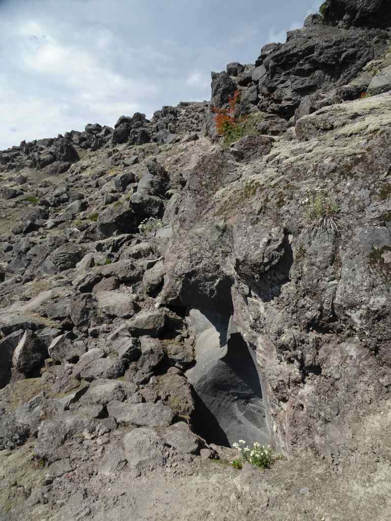
As we gained elevation, we got a western view toward downtown Portland across one of the reservoirs.We continued upward on one of the forested trail to the top.There is a view to Mt Hood through the trees near the summit.And another view toward downtown.We hiked down the northern slope, and got a peek at Mt St Helens.The amphitheater near the parking lot has an outcrop of the volcanic layers.We passed Joan of Arc, glittering defiantly in the sun, in her traffic circle, on the drive home.
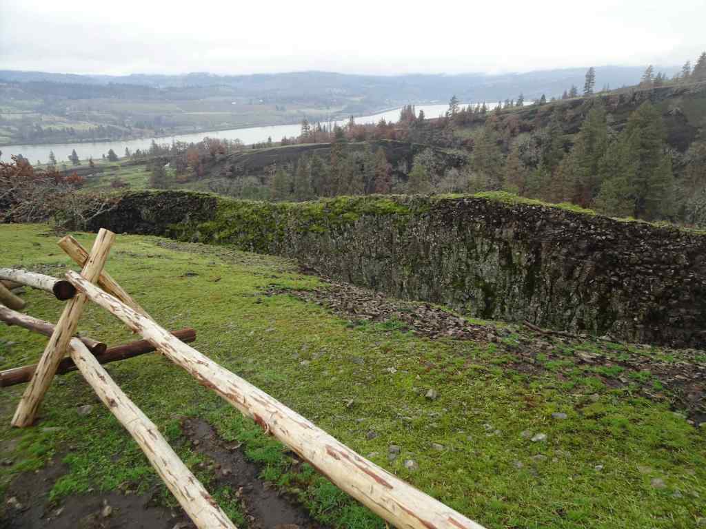
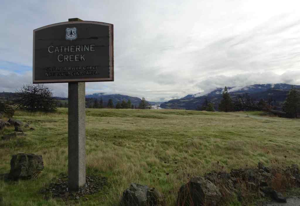
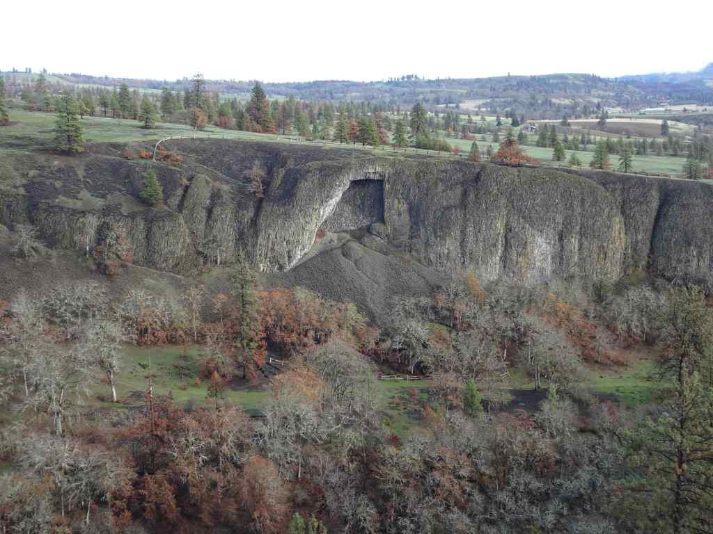
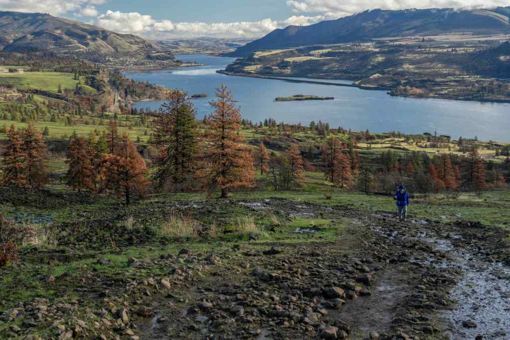
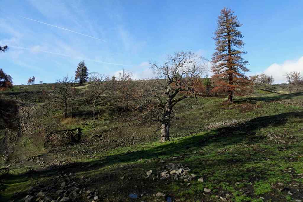
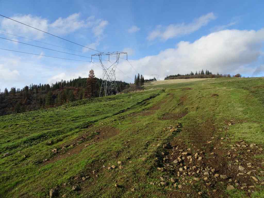
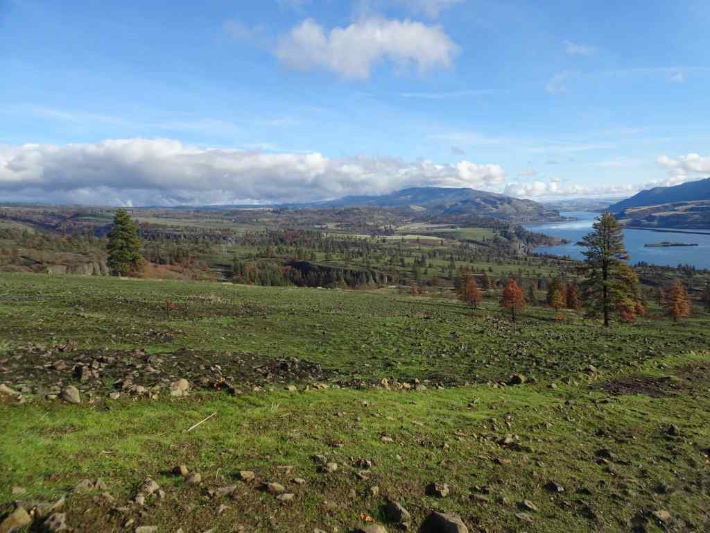
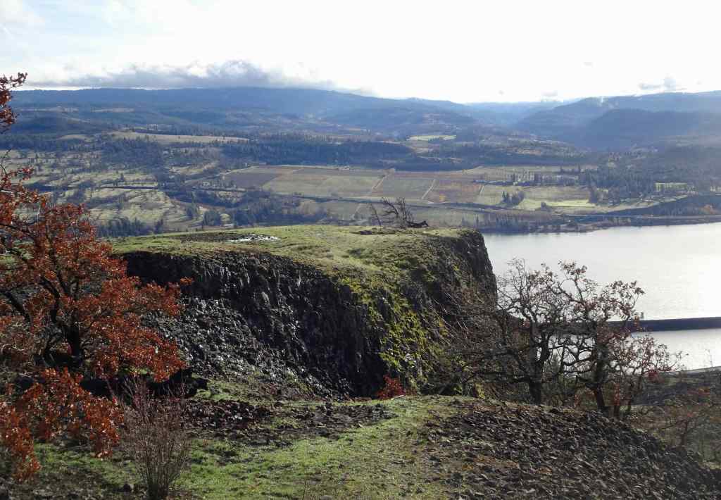
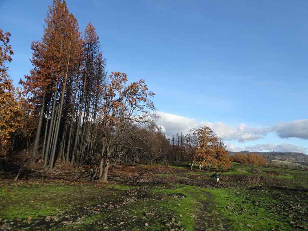
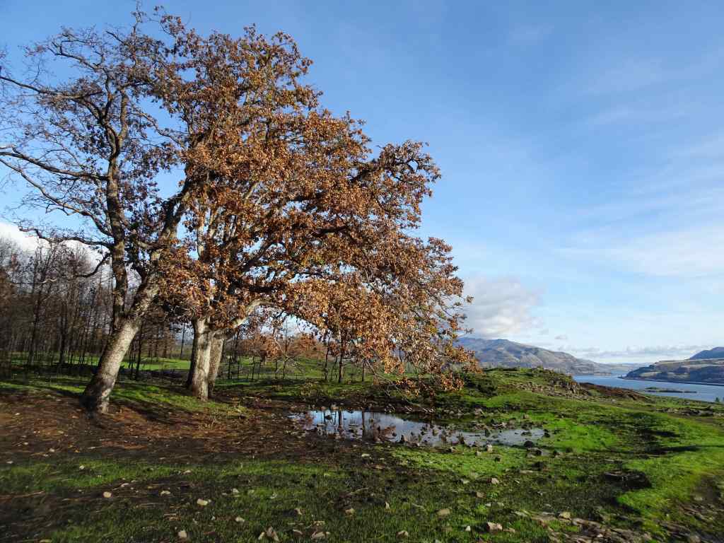
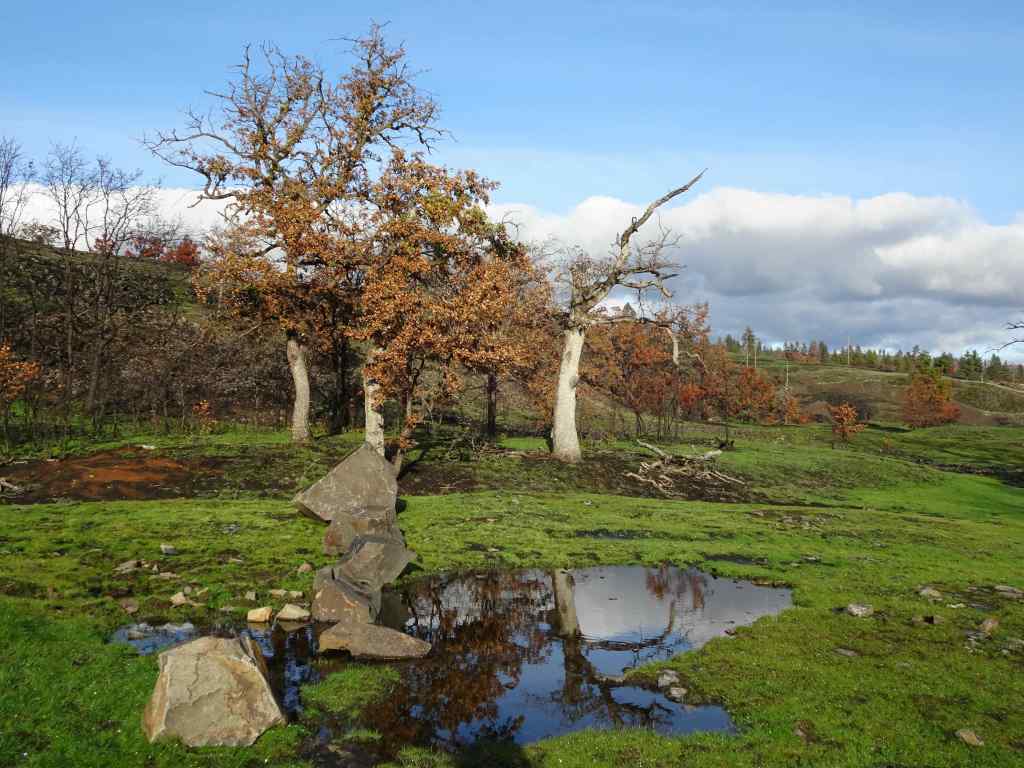
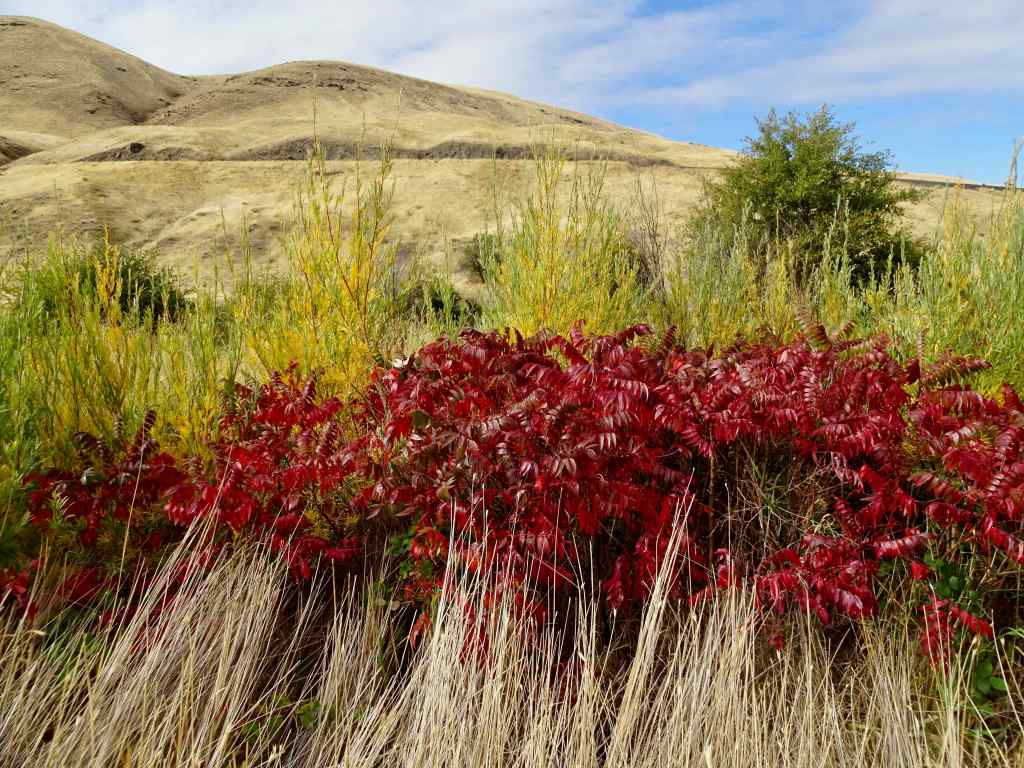
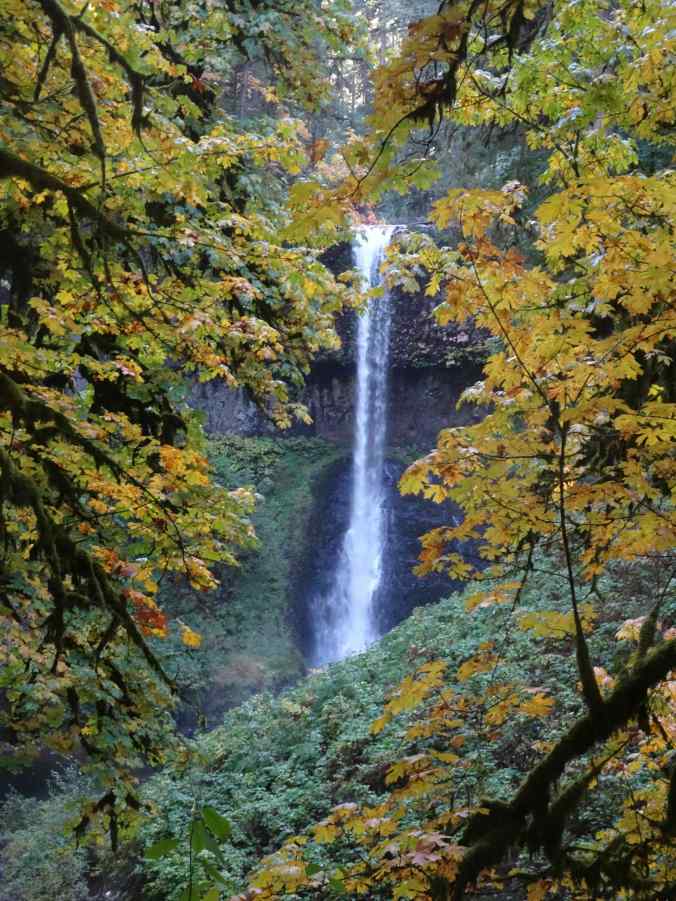
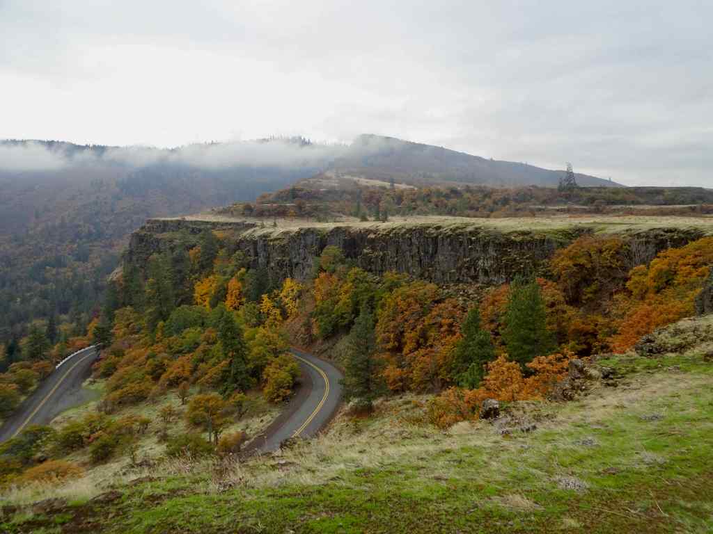
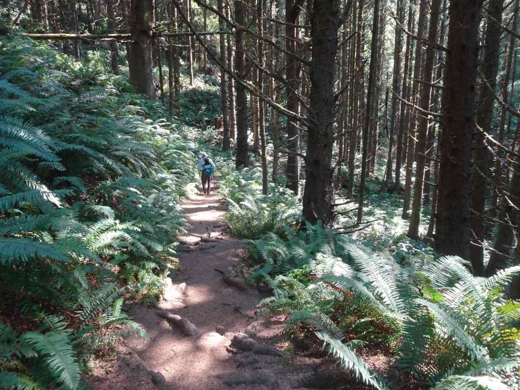
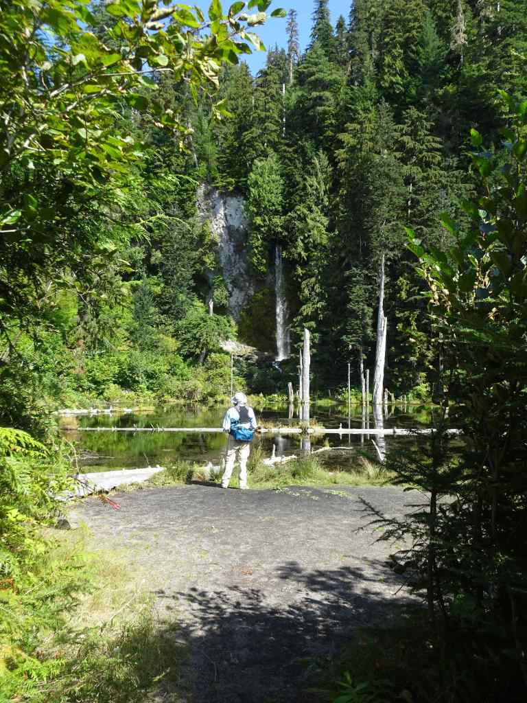
12/23/2025 – Catherine Creek, WA
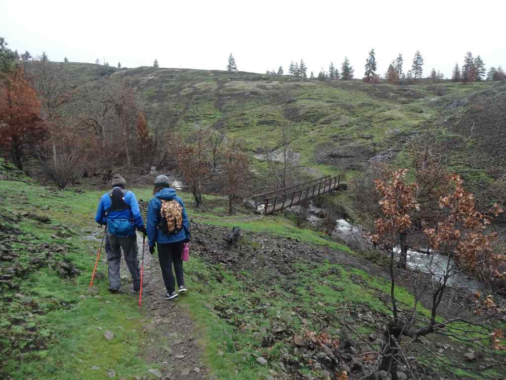
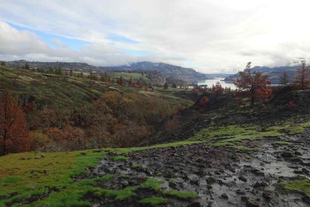
We went with our daughter to this favorite winter hiking spot. This is our second time here since the Burdoin Fire last July. This time, we walked the East Loop above the Arch, and also made a quick trip down to the waterfall viewpoint on the lower ADA trail. (3 miles, 450 feet).
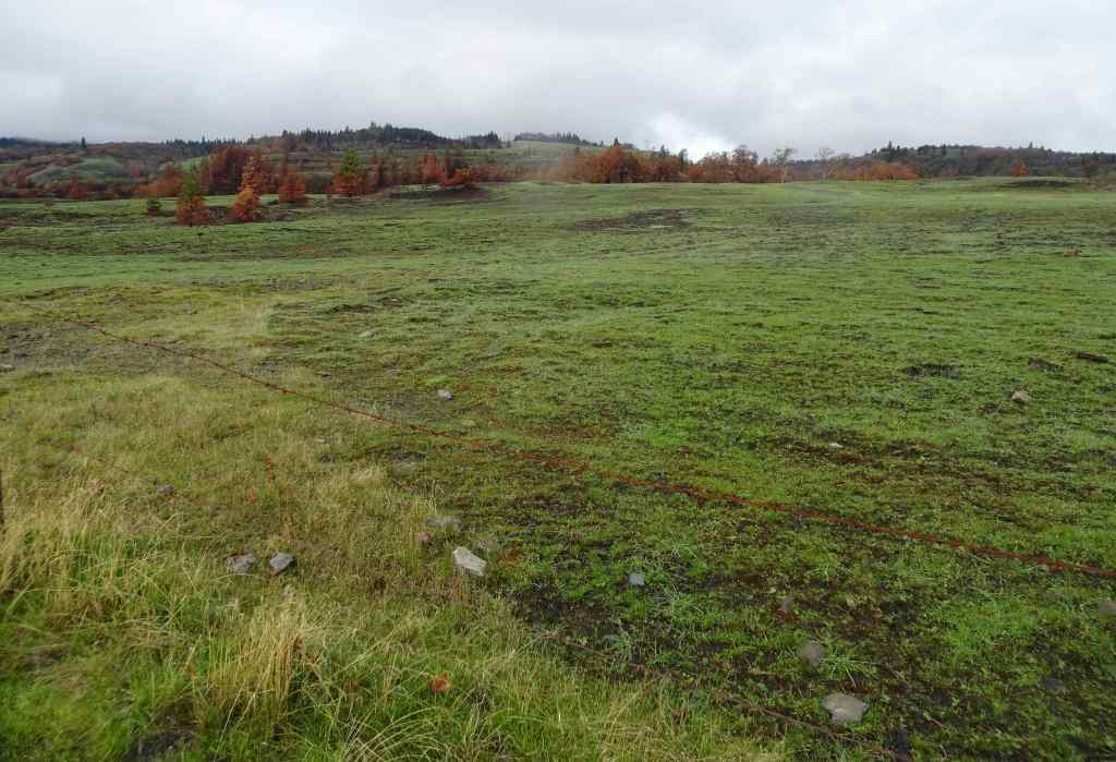
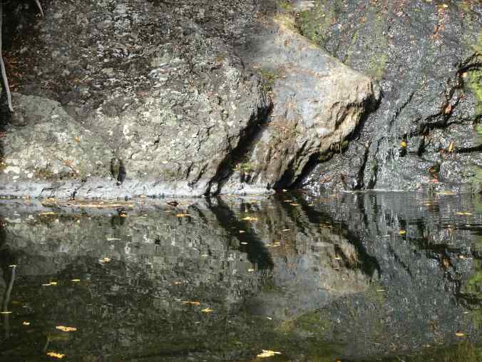
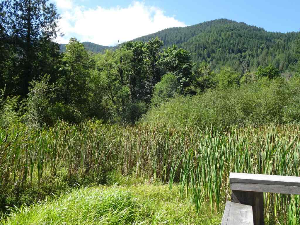
At first we planned to walk the loop that returns by crossing the creek below the Arch, but we wanted to be sure the creek crossing was possible, so we went to look.
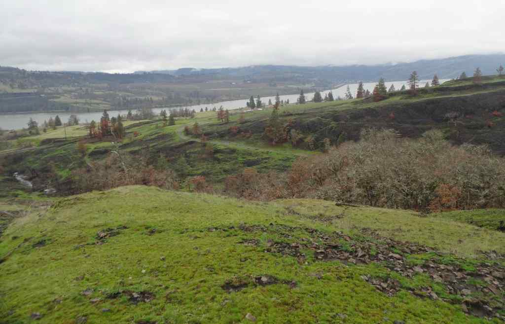
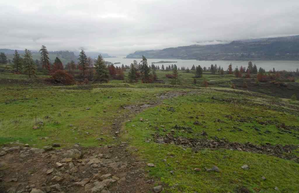
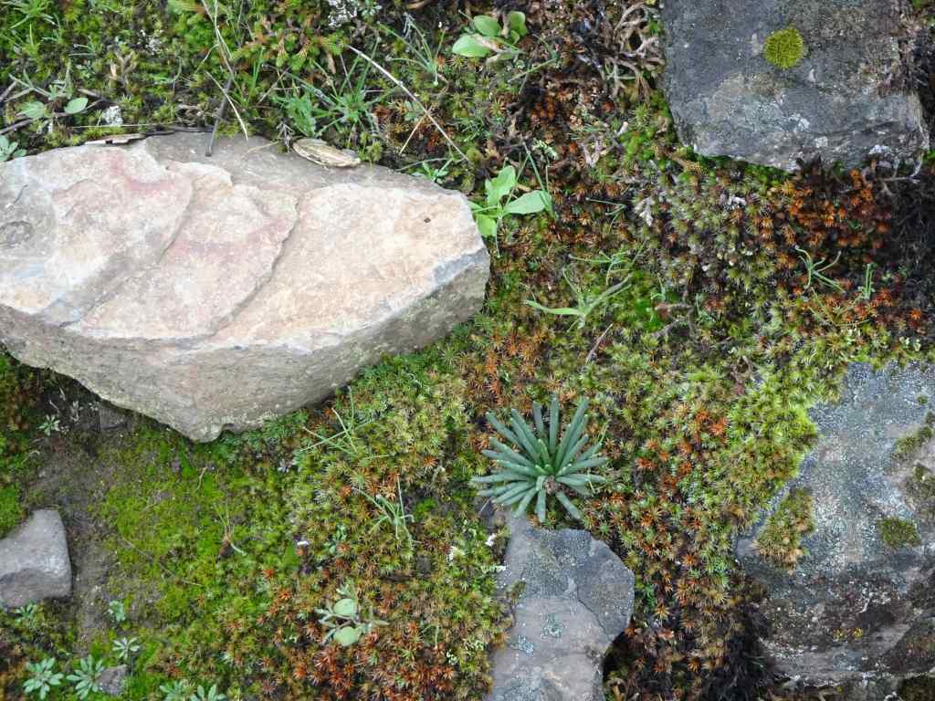
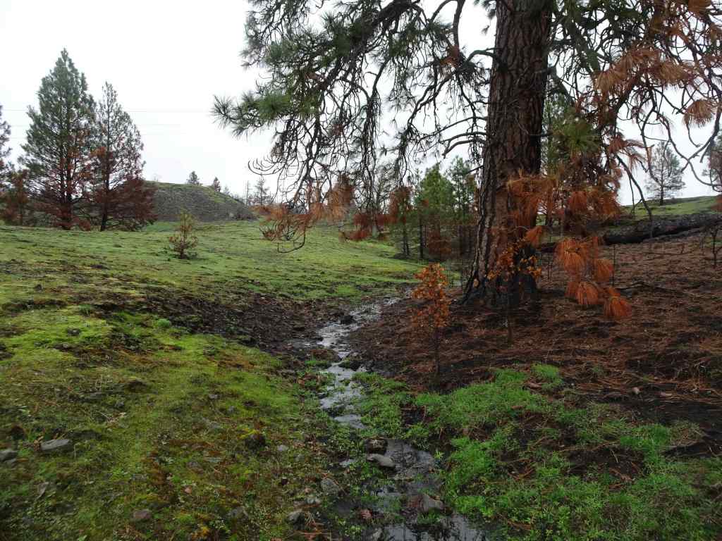
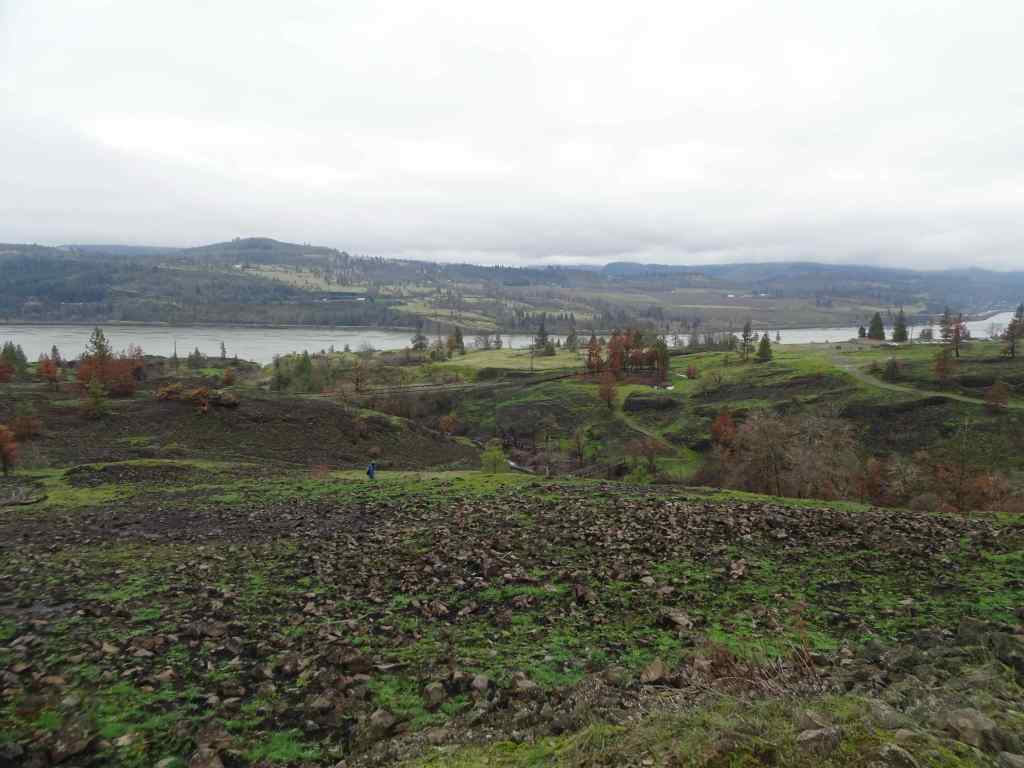
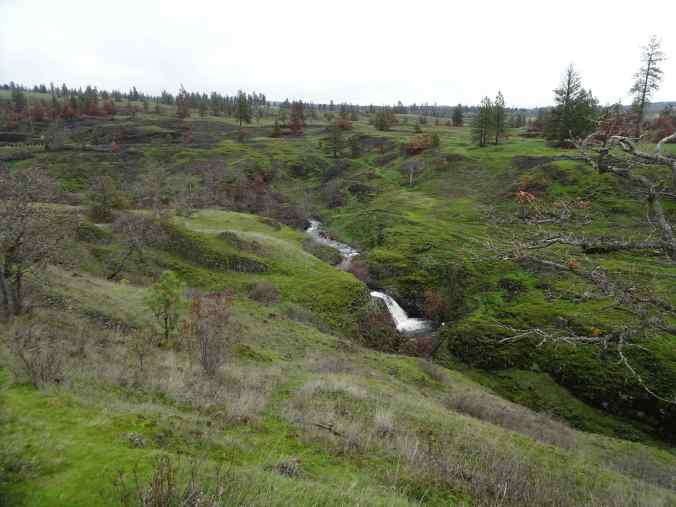
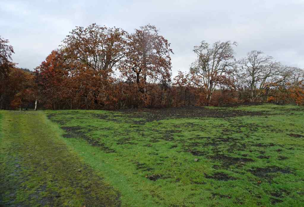
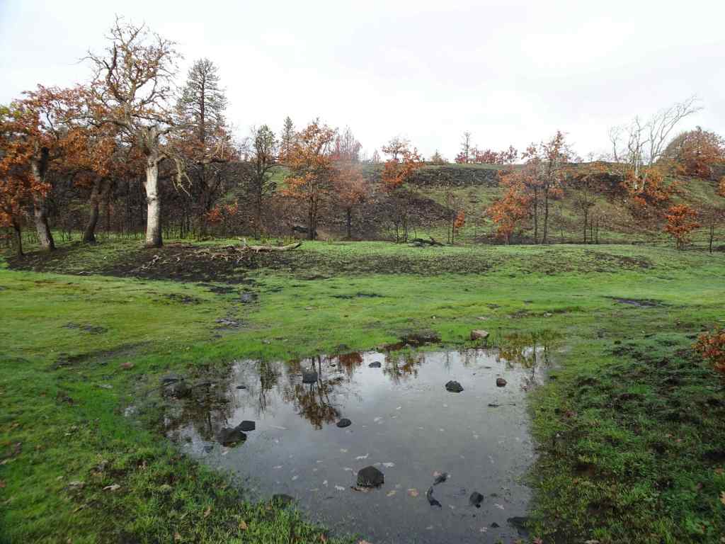
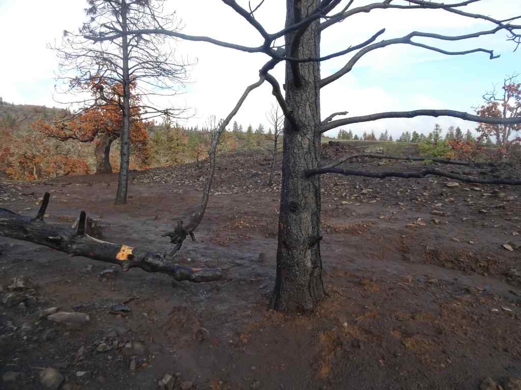
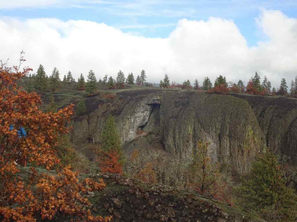
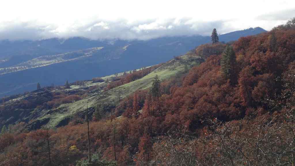
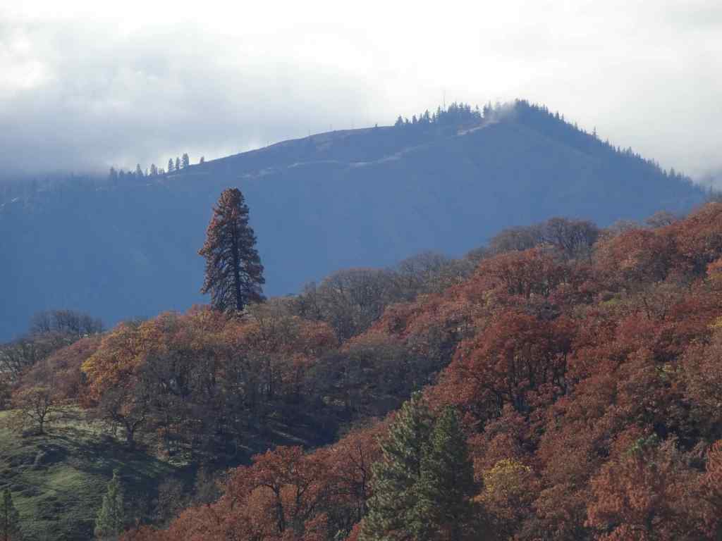
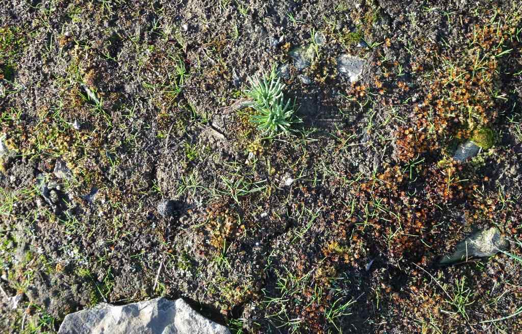
Catherine Creek crossing on the lower Arch trail. The waterfall-like step is actually the plank bridge, now broken and underwater. The road/trail was not accessible without serious wading. So we took the trail above the Arch, and then the eastern return loop.Walking across the burned slopes toward the lower bridge across Catherine Creek. This one survived the fire.Once we reached the slopes near the Arch, we could see across the Columbia River to the west,And to the east.Bitterroot foliage coming up through a rocky, mossy area that likely escaped burning. There were a few unburned areas within this mostly burned slope.View from the top of the Arch, new fence in place.We ate lunch on the rocky outcrop just north of the Arch, then continued our loop to the east, passing scorched pine trees.We returned back across the lower bridge.
Then we took a quick walk down the paved ADA trail south of the parking area, to see the waterfall.
Catherine Creek Waterfall. This side of the road has dead, dry grasses on the slopes because it didn’t burn along the paved trail. But it looks like it did burn across the river.
We enjoyed this hike on an overcast but not rainy day. It was nice to spend some outdoor time with our daughter. And it will be interesting to watch the land here as it recovers from the fire damage.
I managed to do many of the traditional December things this year, despite the lead up to the winter solstice being a little darker than usual, as I carried the grief of losing two family members in November, and the chaos of our national wrecking ball situation. In some ways, the traditions kept me going through the otherwise difficult days. The solstice arrived, bringing longer days and more light. And we thoroughly enjoyed a two week visit from our daughter.
Knitting:
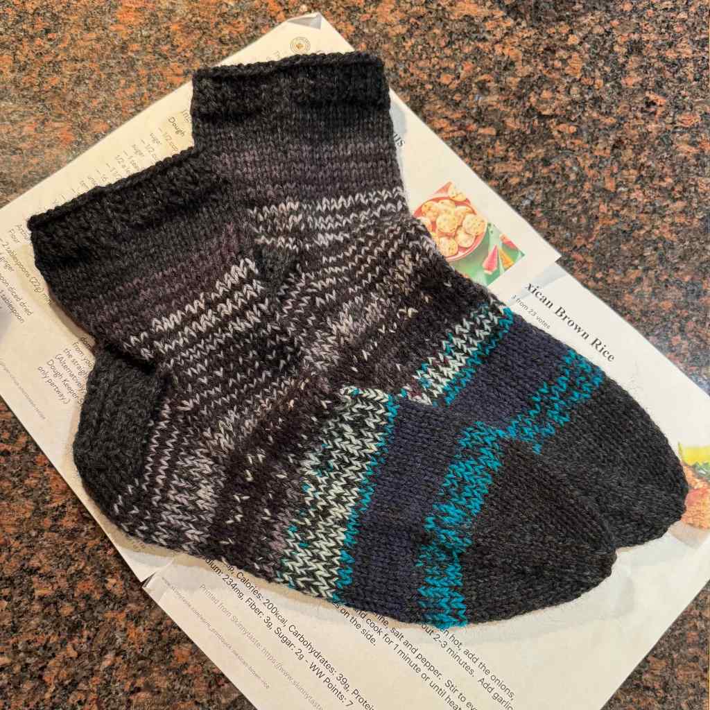
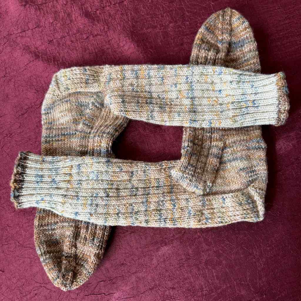
I finished two pairs of gift socks, and then re-made a cowl into a felted bowl.
Gift socks – Malabrigo Sock, PocionGift socks, Patons Kroy scraps held double.Lancelot Cowl, as finished last year, in a bulky alpaca yarn called Hobbii Apricity.
When I tried the cowl on this winter, it was just a bit too itchy for me. Since I knew the yarn would shrink and felt, I decided to unravel the last six rows and reknit it with a closed bottom into a bowl shape. Then I machine washed and dried it, and the fiber shrank and felted into a small bowl, with the textured stitches still visible in the fabric. I count it as a success!
Remade into a felted bowl..
Books:
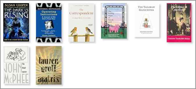
I finished 8 books in December. The Correspondent, by Virginia Evans was probably my favorite of the bunch. I enjoyed seasonal rereads of The Tailor of Gloucester and The Dark is Rising. I learned a lot about the Gilded Age lifestyle in Consuelo Vanderbilt’s autobiography – The Glitter and the Gold.
December books
Museum Day:
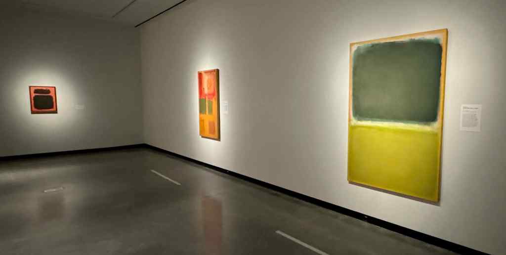
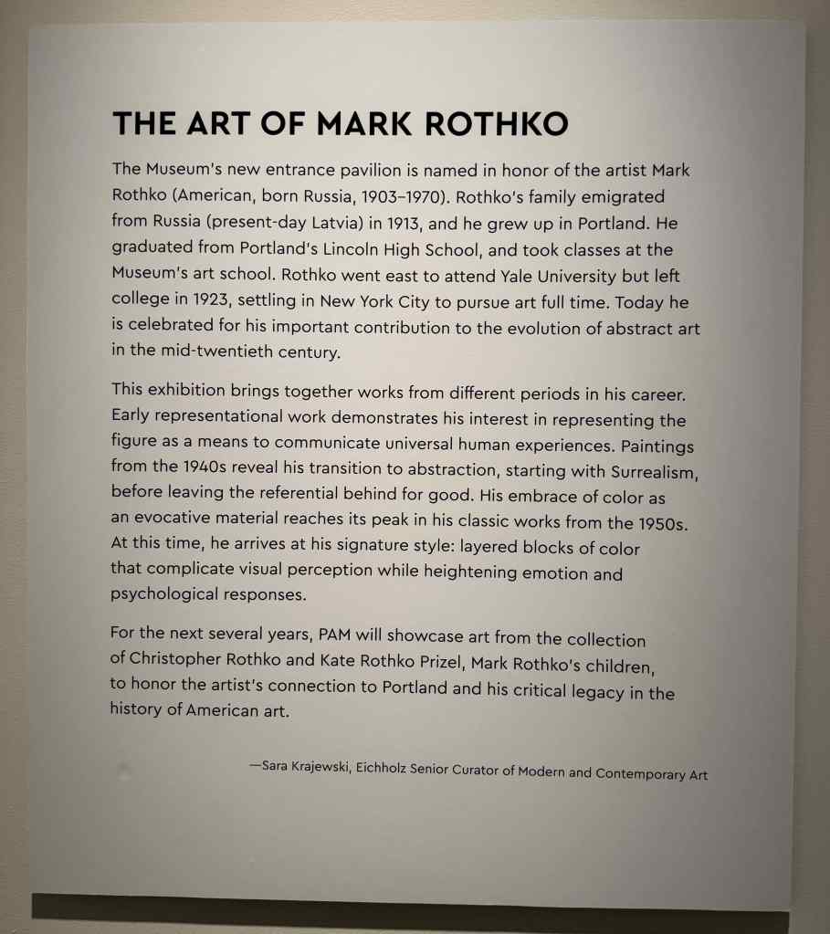
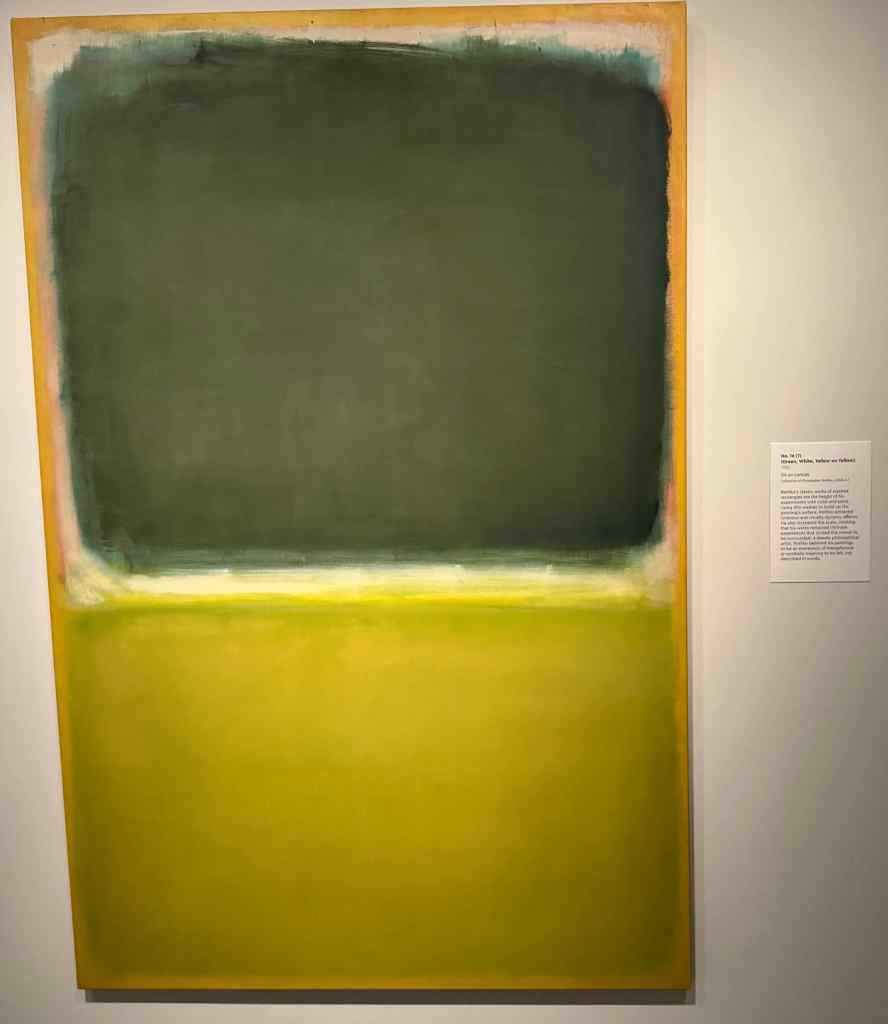
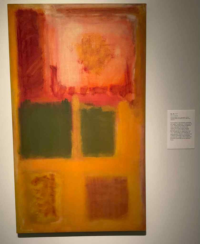
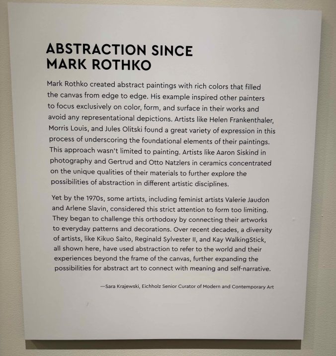
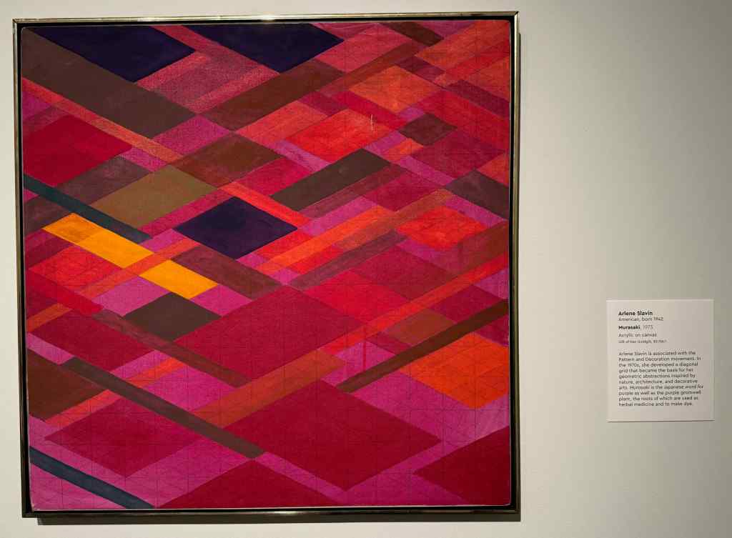
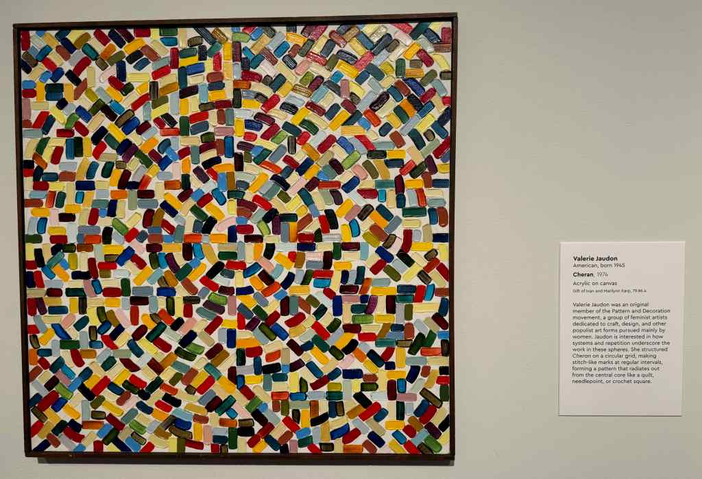
The Portland Art Museum has just opened their newly expanded and remodeled gallery space. We bought a membership, and I hope to go monthly to see all the new exhibits and spaces. Today, we focused on the Rothko exhibit, where we saw examples of this Portland grown artist, from early career to the abstract art he is famous for. There was an adjacent exhibit presenting Abstraction Since Rothko.
Part of the Rothko GalleryMark Rothko placardNo. 16 (?)No. 10Abstraction Since RothkoMurasaki by Arlene SlavinCheran by Valerie Jaudon
I am always attracted to bright colors and patterns. And I love to see the close up view of the texture of the paint layers and brush strokes on the canvas. I am looking forward to looking at a lot of art next year.
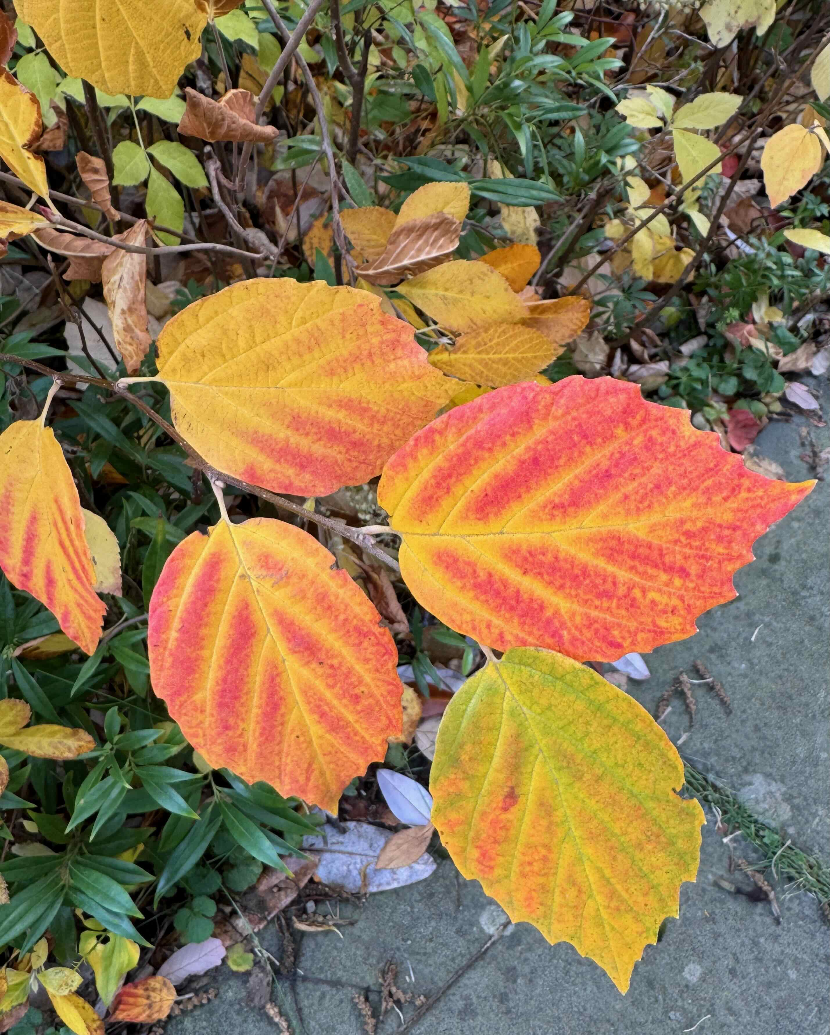
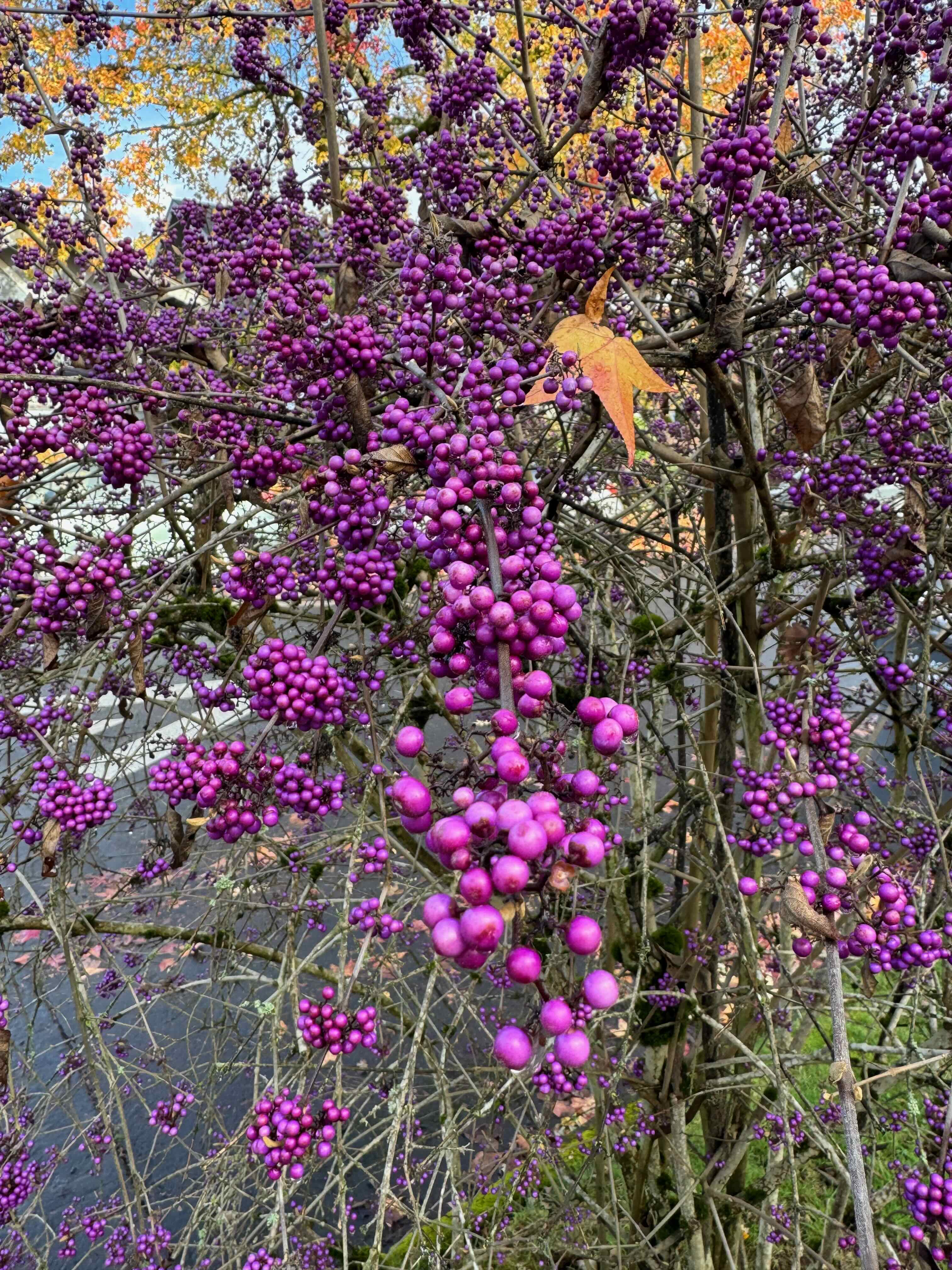
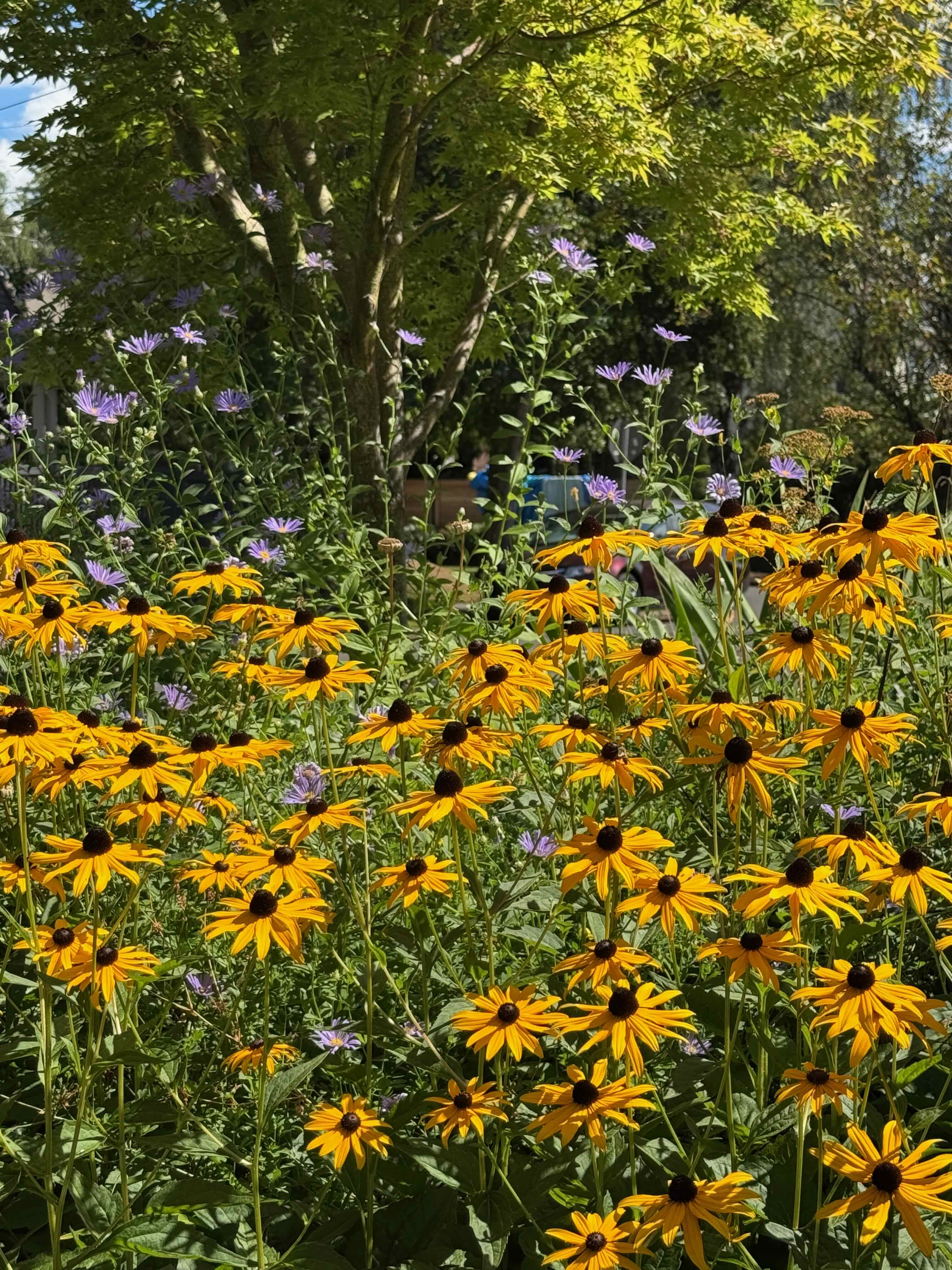
Neighborhood walks:
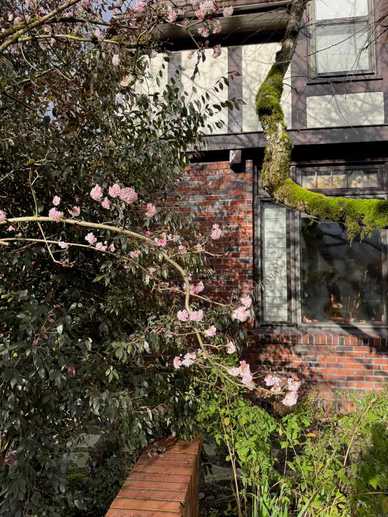
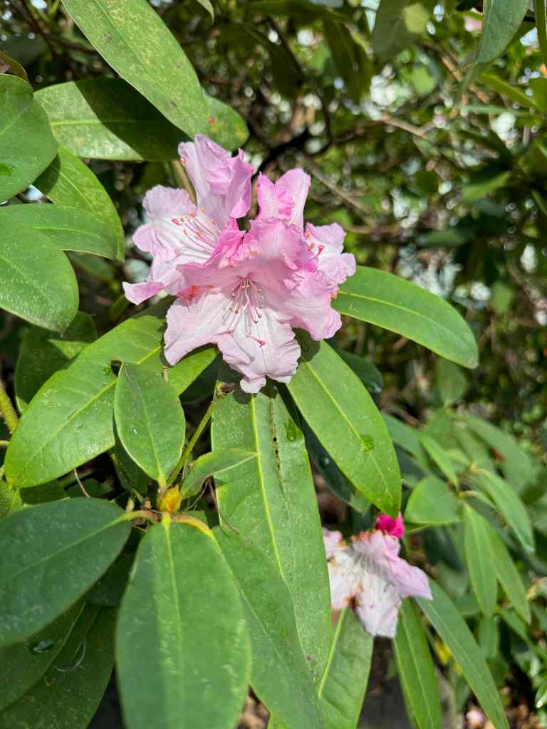
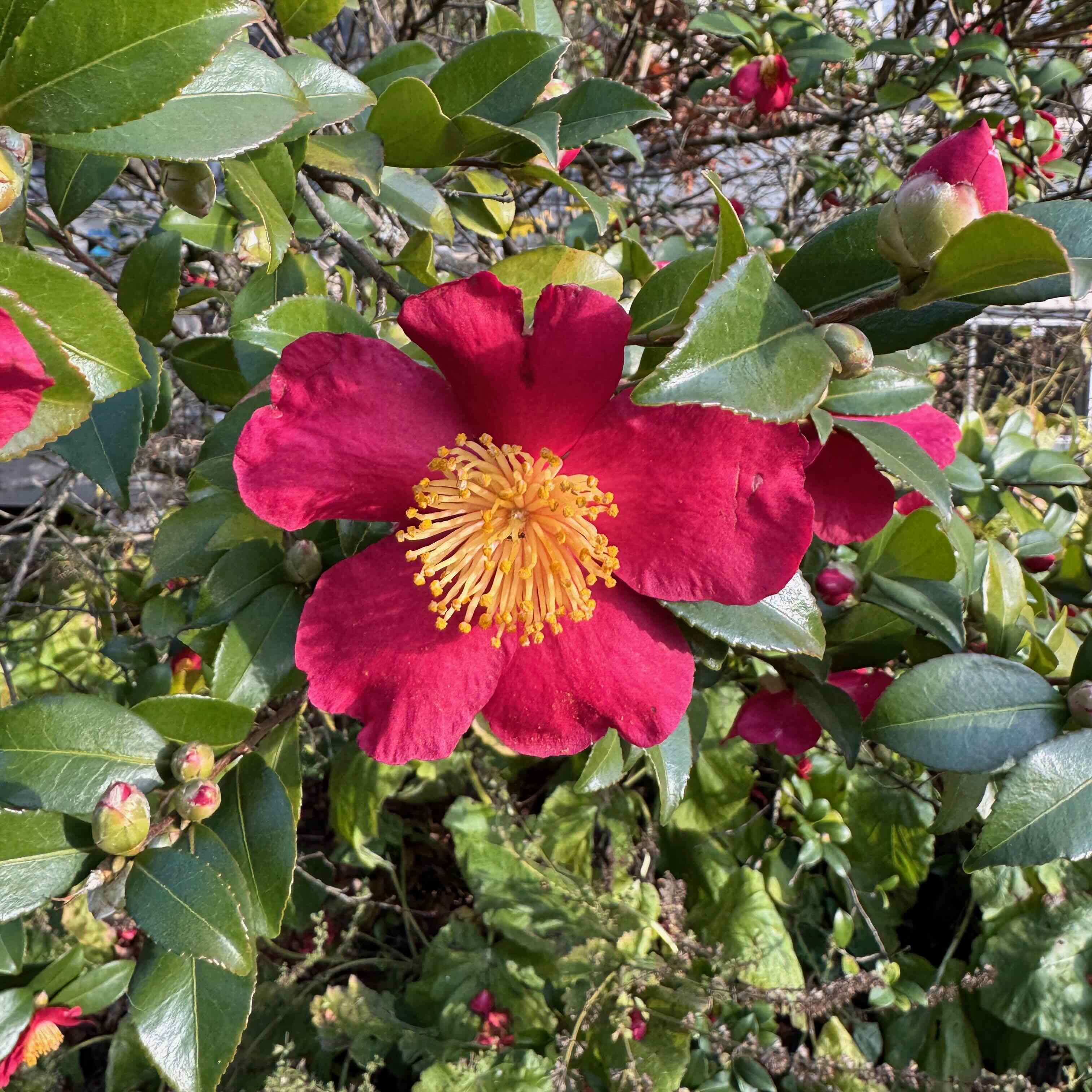
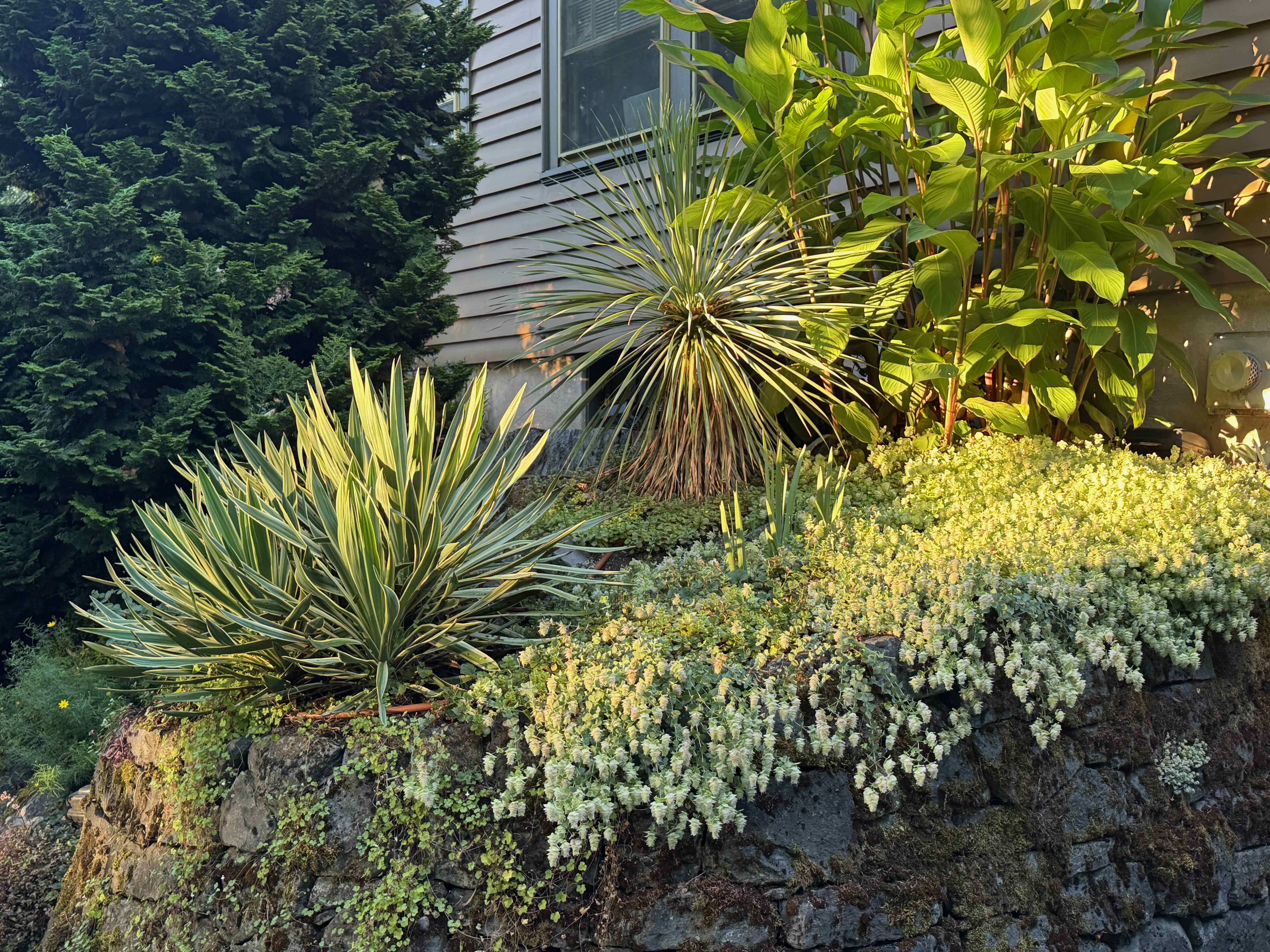
The flowers of December sparkled amidst the holiday and protest decorations.
ViburnumRhododendronRose
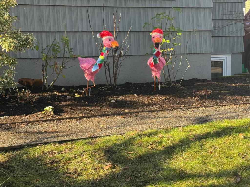
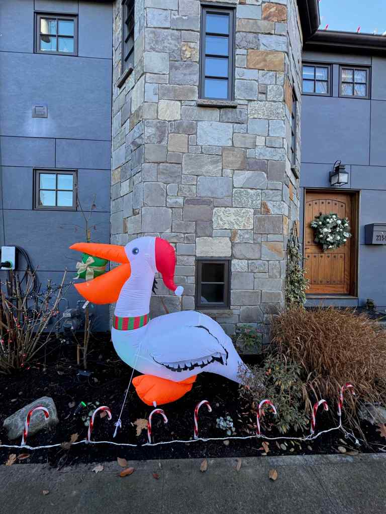
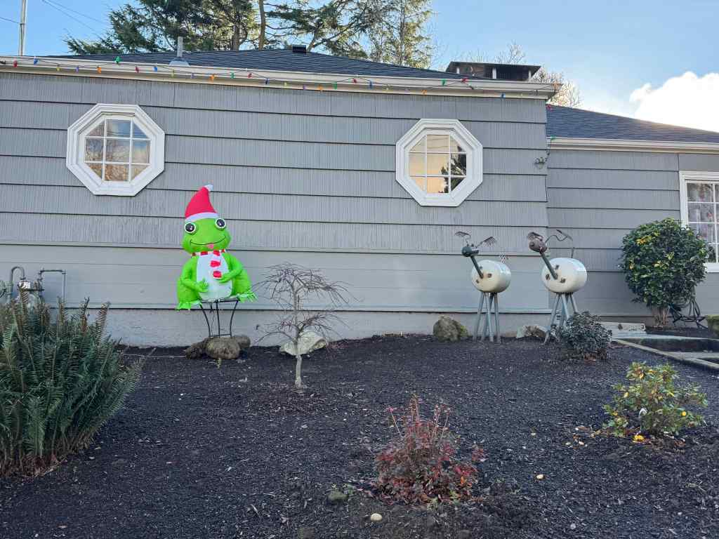
Holiday decorations somewhat overlapped with the ongoing protest signs. New this year were some birds, and some frogs.
FlamingosPelicanFrog added into to this traditionally elaborate displayAnother frogA mixture of holiday and protestStraight protest.
Celebrations:
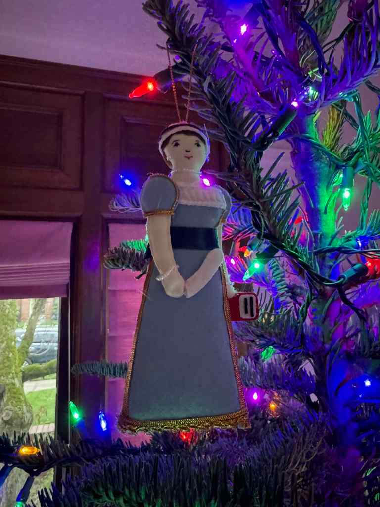
The first December celebration was Jane Austen’s 250th birthday, on December 16th.
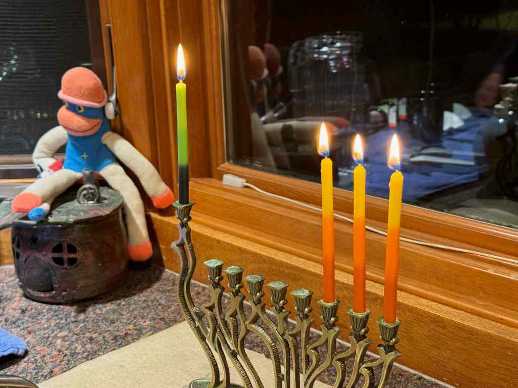
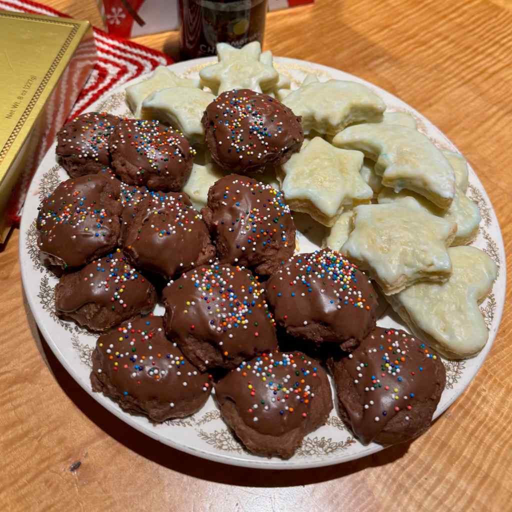
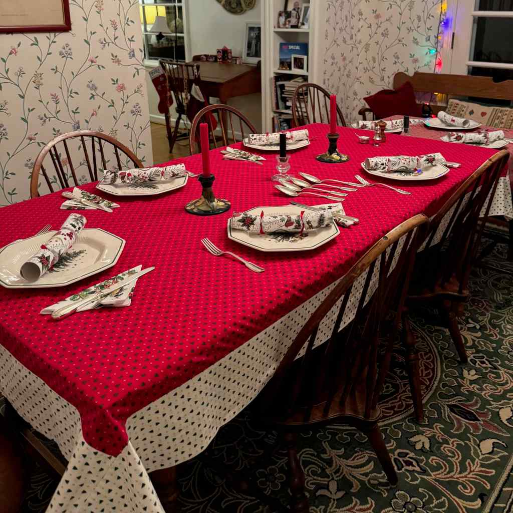
Long my favorite author! (Internet meme)I have her ornament, which I bought at her house in Chawton, UK, hanging on my tree.I slowly put all the decorations on the tree,And hung a wreath on the door.We lit Hanukkah candles.The shortest day went by.We baked a very few cookies,and had a lovely traditional Christmas dinner with long time friends.
We also went on a few outdoor walks and a hike, to be detailed in the next post.
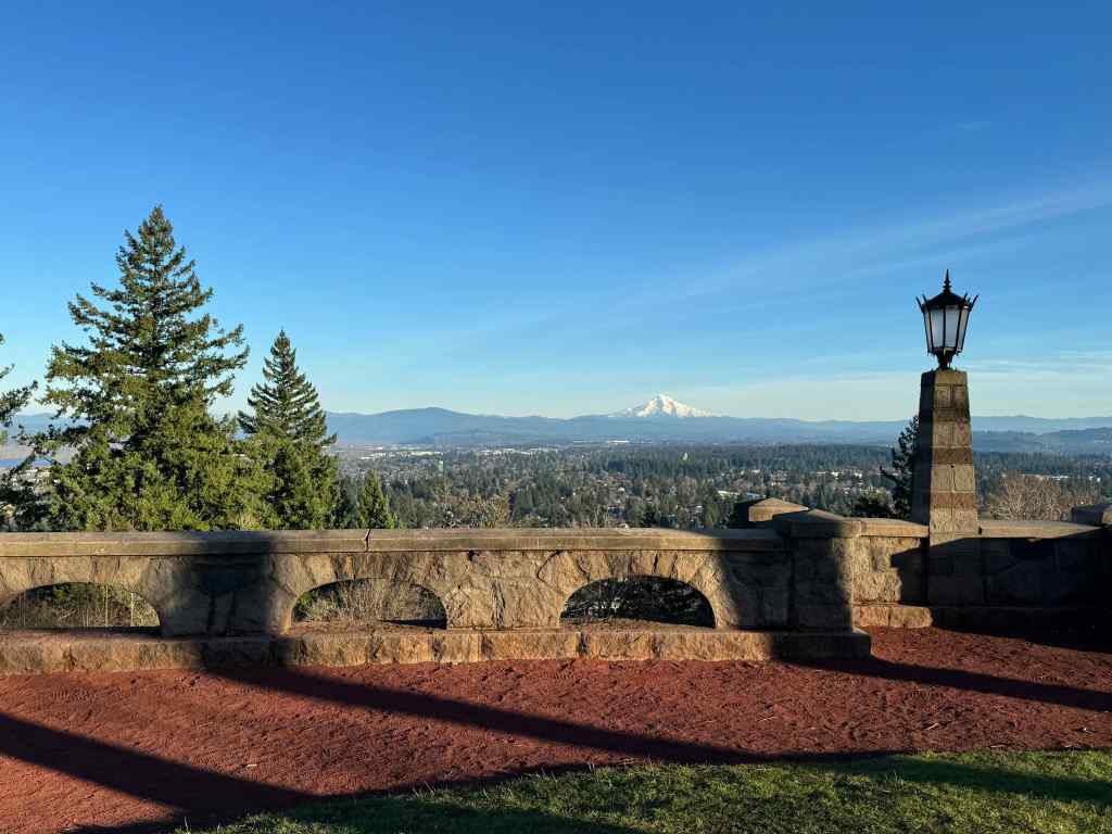
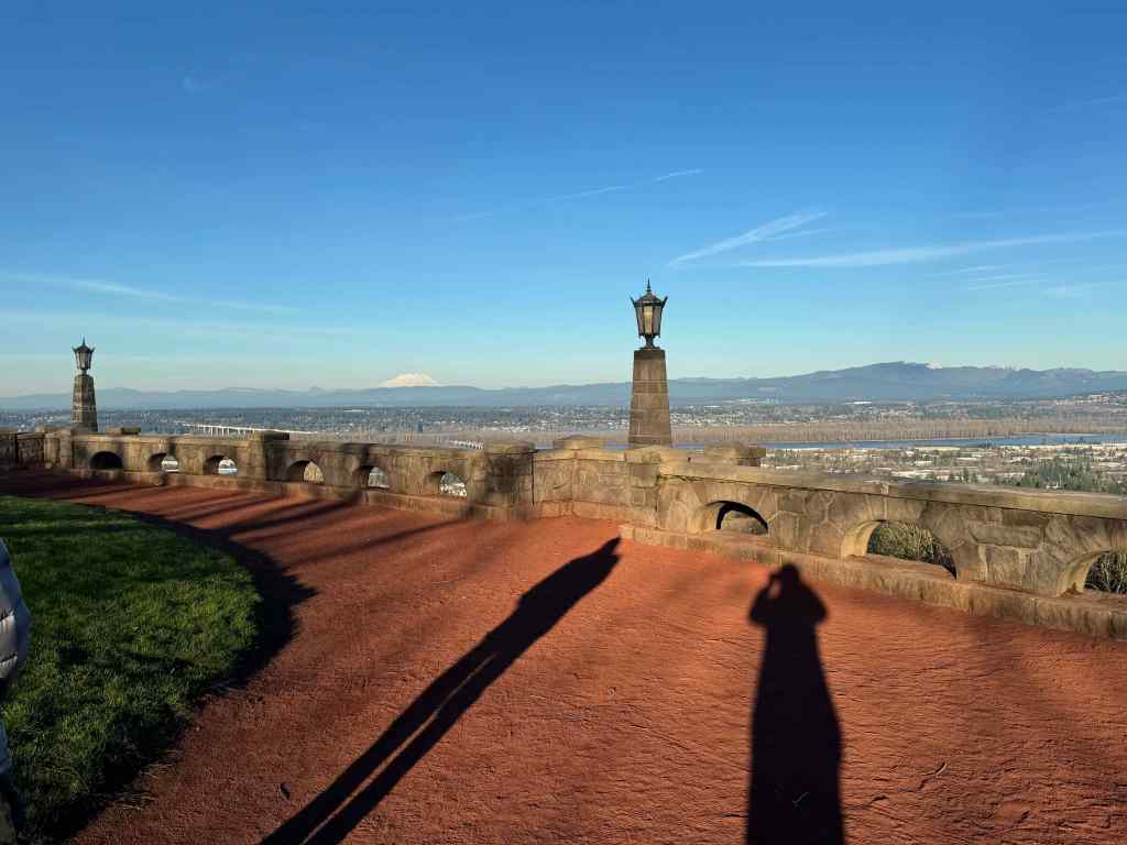
On New Years Eve, we stopped on our way home from doing errands to look at our volcanoes from the top of Rocky Butte.
Clear and cold view to Mt Hood from Rocky Butte on New Year’s Eve.Mt St Helens and our long shadows.
We had a delightful Thai takeout dinner with our daughter and several of her childhood friends, who also happened to be in town for the holidays. Then they went out on the town for the night, and we were early to bed, ready to say goodbye to this difficult year, with hope for better things in 2026.
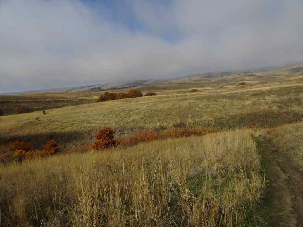
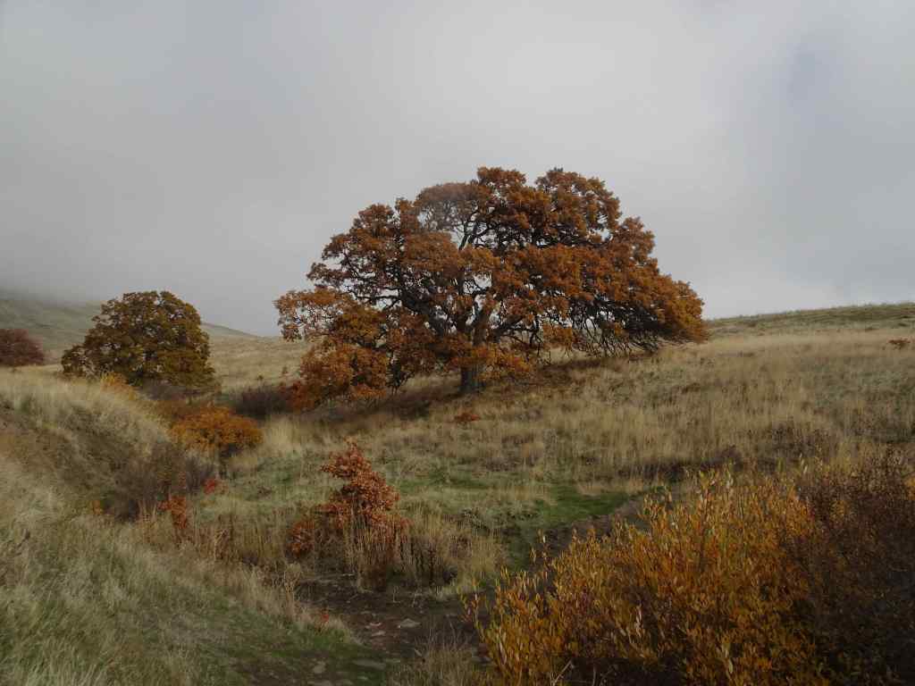
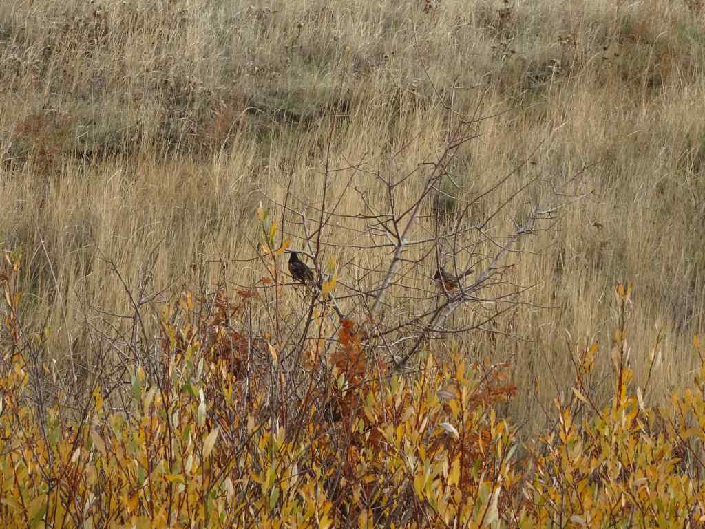
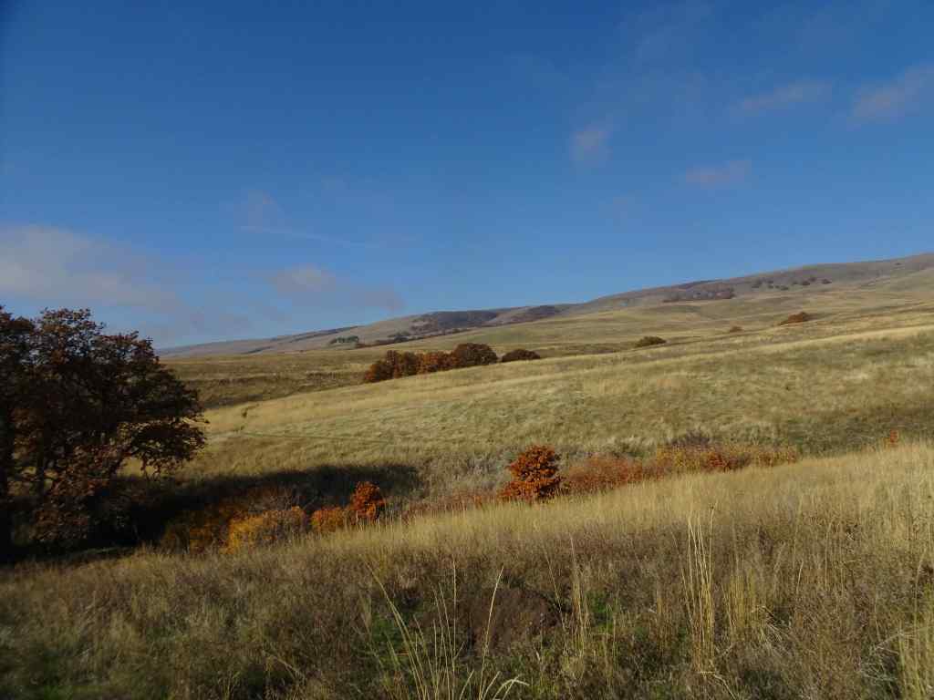
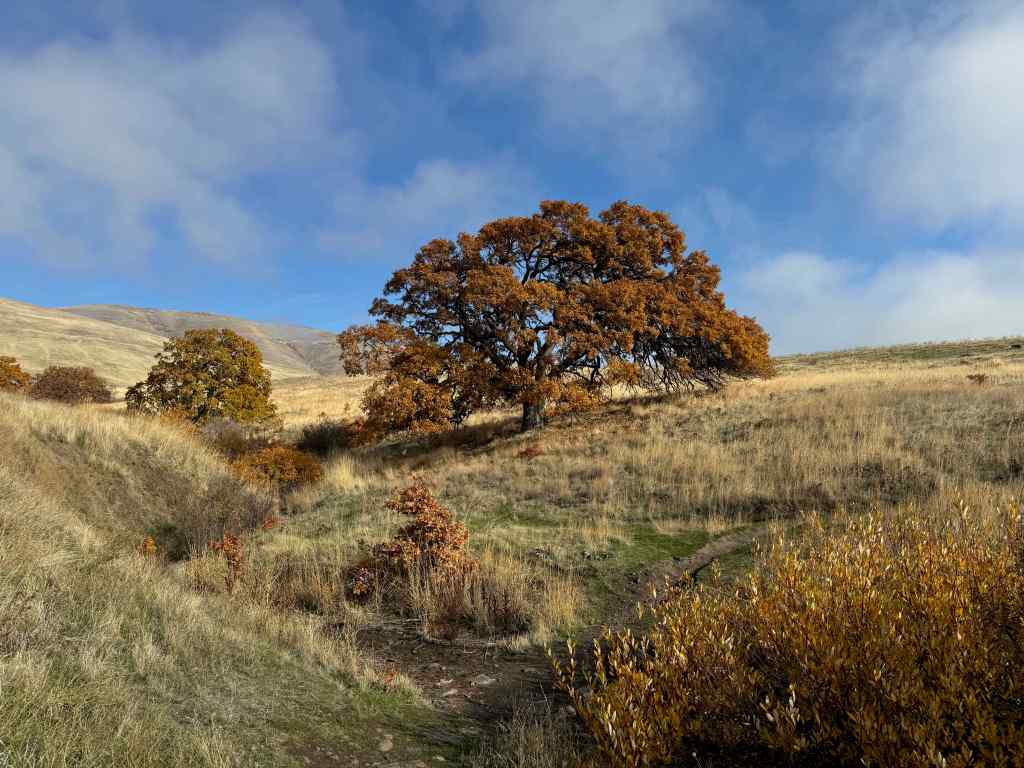
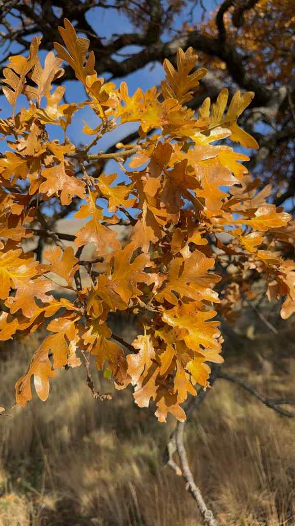
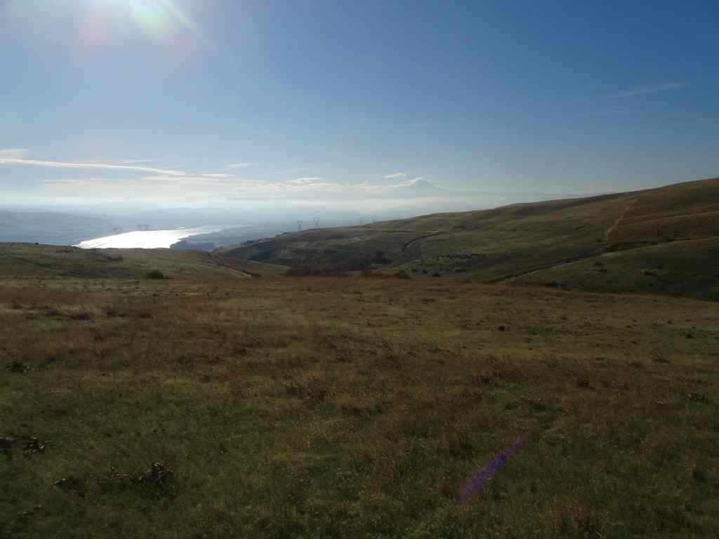
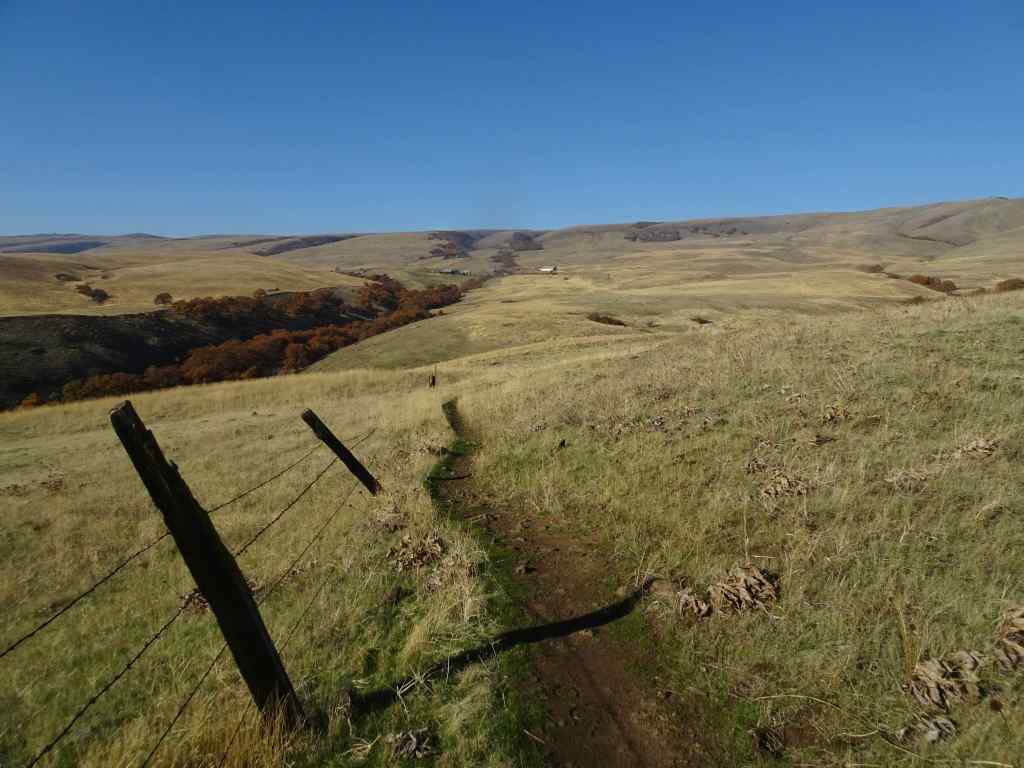
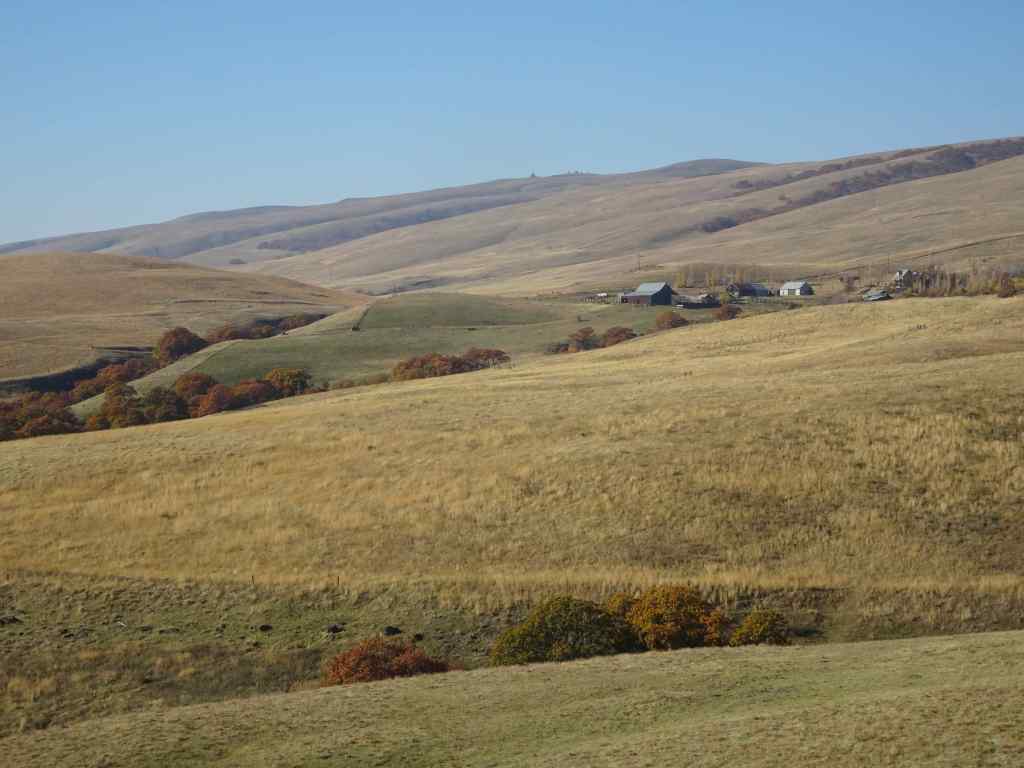
We hiked the upper loop from the ranch ( 4 miles, 450 feet). We began the day with fog and mist, which evaporated by lunch time, and we finished our hike under clear blue skies. We visited the ‘one tree’, and had a quiet day on the trail.
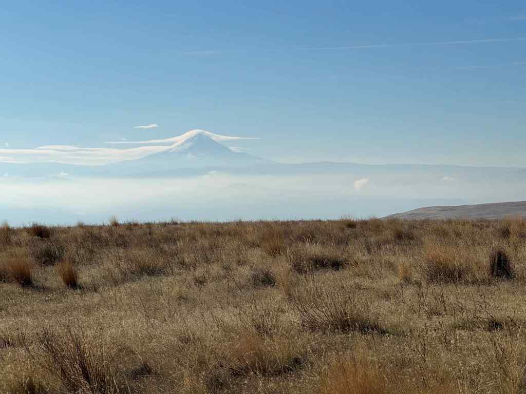
Looking up into the Columbia Hills at the start of the hike. Lots of dried balsam root foliage in the foreground.The hills were still misty when we sat down for our lunch break,right near my favorite oak tree.I watched a flock of towhees in the nearby bushes,By the time we finished our lunch, the mists had evaporated, and the oak tree was illuminated under a blue sky,its leaves glowing in the sun.After lunch, we continued our hiking loop, which circles down to a view of the Columbia River and The Dalles. The sun angle was wrong for photography, but we could see Mt Hood under its cloud cap on the far horizon.We hiked back up to the Ranch along Eight Mile Creek.A satisfying hike on an autumn day, with very few other trail users today.
11/25 Portland Arboretum
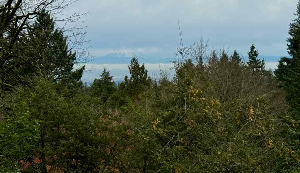
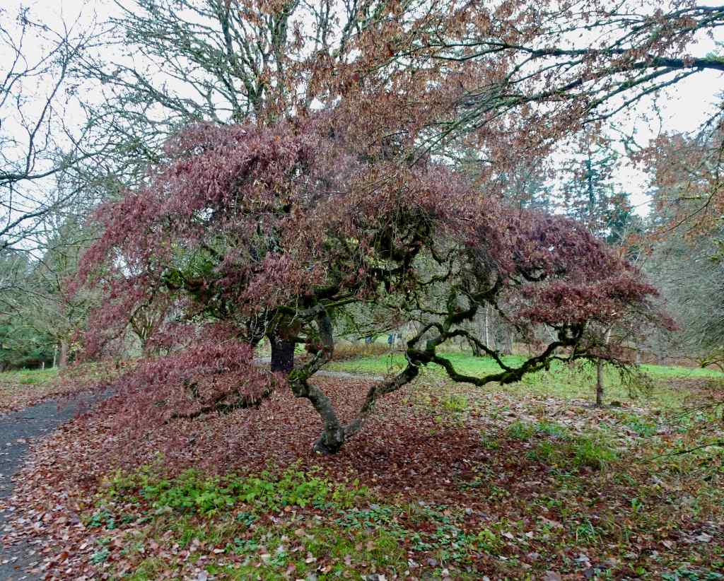
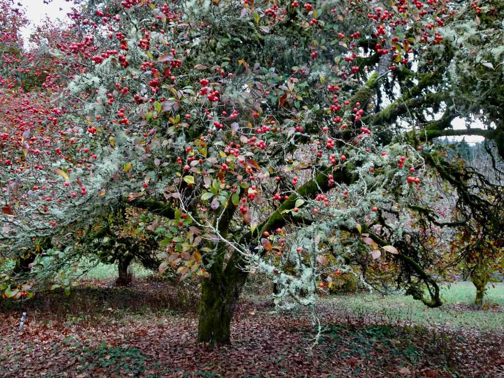
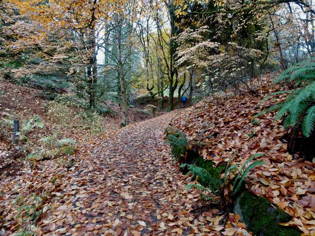
We hiked a short loop (2.5 miles, 200 feet), past the view of Mt St Helens and our favorite Japanese maple tree, through the Winter Garden, and then back up the Beech Trail.
The snowy top of Mt St Helens was floating like a cream puff on the horizon.The maple tree was past its prime, color faded, but not yet leafless.Red hawthorne berries were glowing, as were the camellias and some of the foliage in the Winter Garden.Beech leaves lined our trail back to the start.
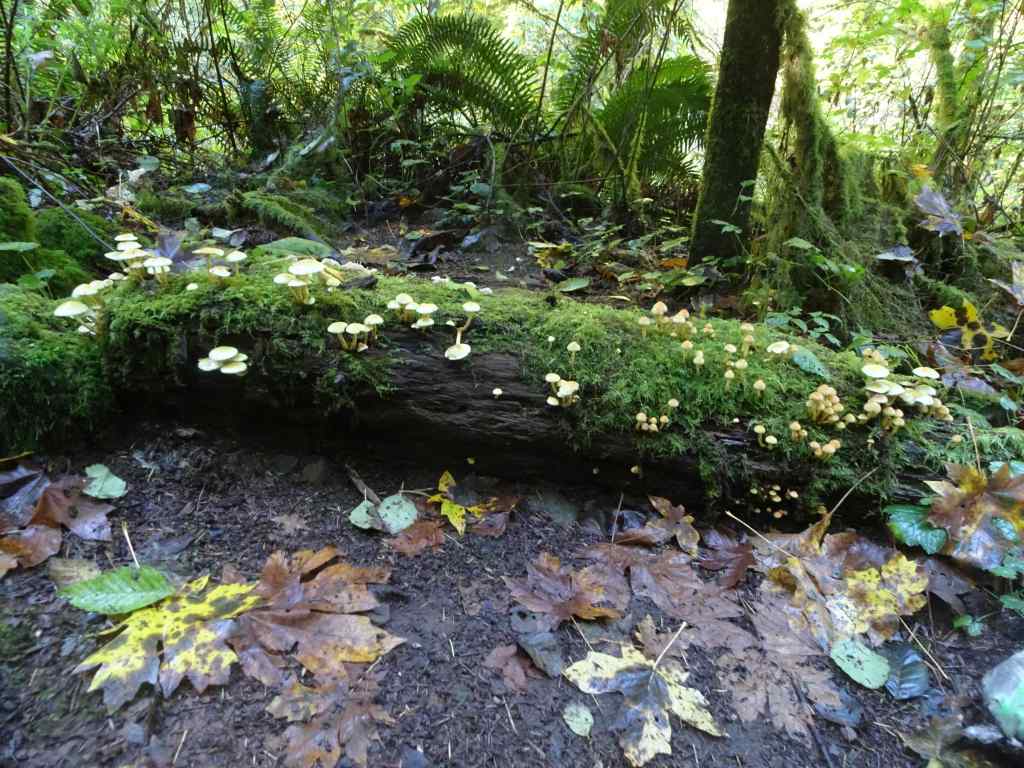
11/28 Catherine Creek/Rowland Wall
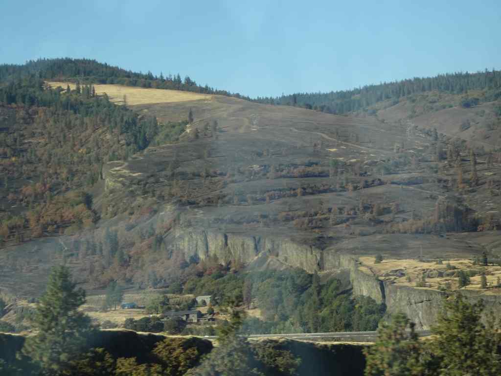
This was our first return to this favorite hike since the Burdoin Fire in July (2.7 miles, 720 feet). The blackened slopes have become green with newly sprouting grass. We passed many charred trees, and many that survived the conflagration.
The area of Lower Trail, south of Old Highway 8, did not burn, so looks same as it ever does in winter, with dried grasses fringing the landscape.
Unburned landscape south of the highway.
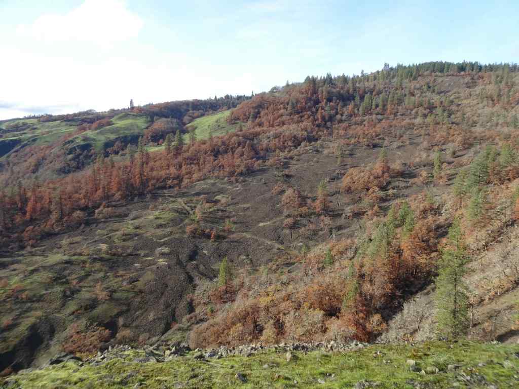
North of the highway, where the fires swept through, most of the golden grasses and shrubs were completely removed, and the landscape is covered with blackened earth and newly sprouted grasses.
Looking north from the parking area across the burned slope.We began by walking up to the Fairy Ponds.Trees near the Fairy Ponds show fire damage.
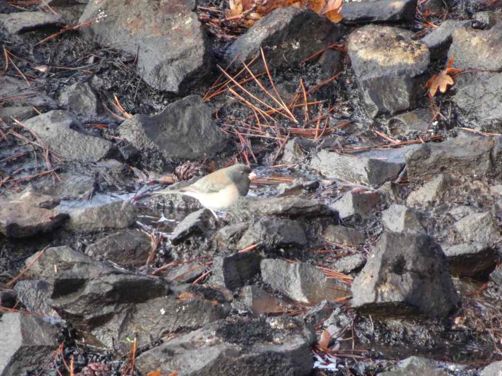
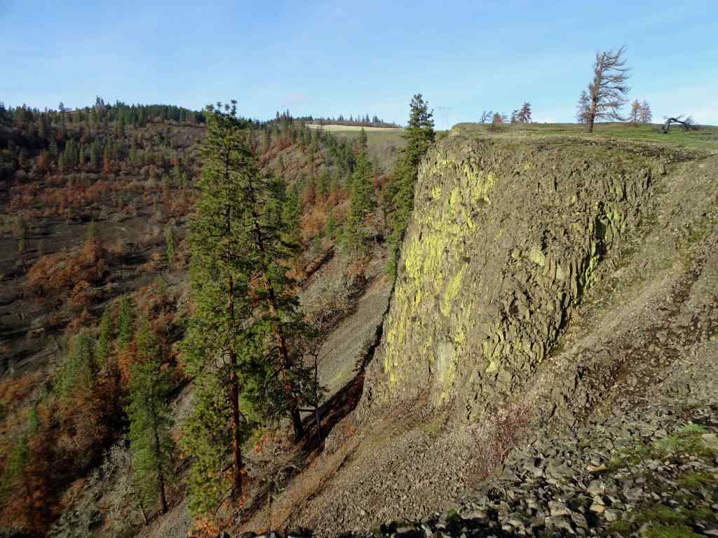
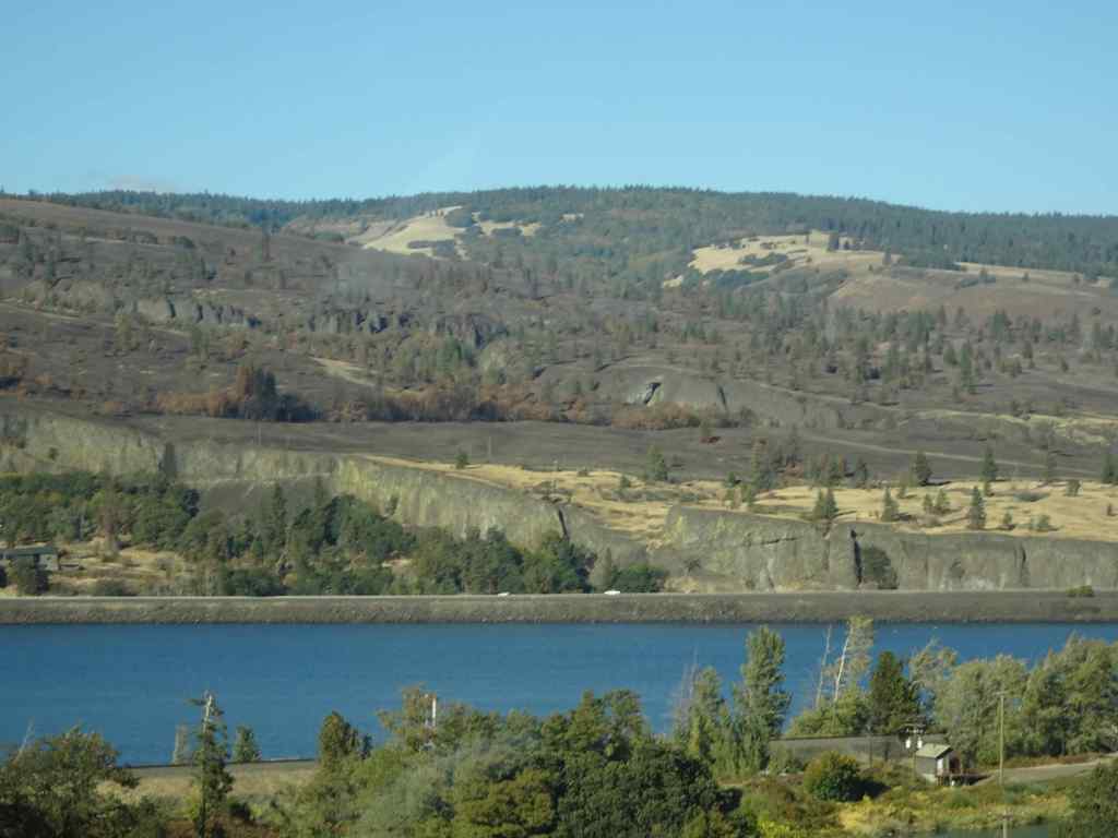
We continued walking up the Bitterroot Trail, to the ridge just west of Catherine Creek.Looking upriver from the ridge, all the way to the town of Lyle, where the fire stopped at the Klickitat River.Blackened soil and trees.Juncos were pecking around in the dirt here.Looking across to the Arch, which already has new fencing in place.Wider view of the Arch, and the lower trail in front of the Arch.
We walked up slope, and past the power pylons to the edge of Rowland Wall.
Looking eastward across the landscape, up the Columbia River. Oddly, green areas are burned, golden areas are unburned. Orange pine trees are fire damaged.Continuing uphill toward the power pylons.Near our turning place – the golden, unburned area at the top was burned in last year’s controlled burn of the area, and I guess they held a fire line there in July.Eastward from our high point. It was a gorgeous day!
From the edge of Rowland Wall, we looked at our familiar landmarks to the west to see how they fared.
The tall tree here can be seen from many of the trails in the area – I think of it as the ‘guide’ tree.Zooming in – it is still standing, but appears to have some fire damage.Next, we hiked down the Rowland Wall cliffs…I found bitterroot foliage in the usual places – a good omen!Chartreuse lichen on the cliffs – not burned.Wider view: guide tree on the skyline. Lots of burned trees in the volcanic landscape below the wall.
Next, the trail takes us back east toward our parking area. Some of the lower tree stands in this area were very badly burned.
View back toward the parking area.Many burned pine trees.I hope the frogs will be back in this pond, where we often hear them.This is the first time I have seen the rock cliffs behind these trees – all the undergrowth is gone.The ponds are still reflective on this beautiful day.
The experience was a little heartbreaking, but also hopeful – there were still birds, and some of the wildflowers were beginning to sprout up in the blackened dirt. We will return in spring to monitor the changes. I’m glad we can continue to hike here on rainy days in Portland!
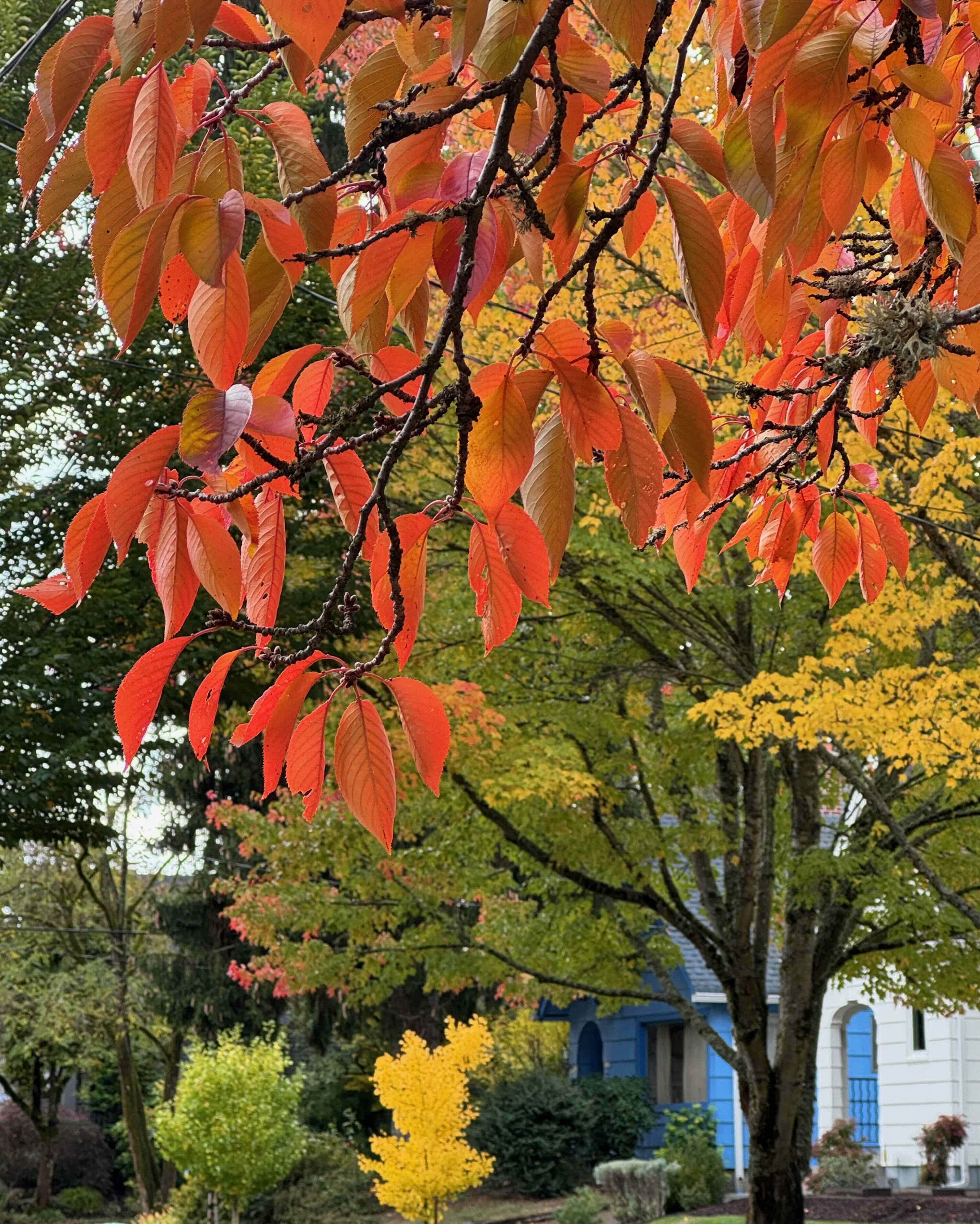
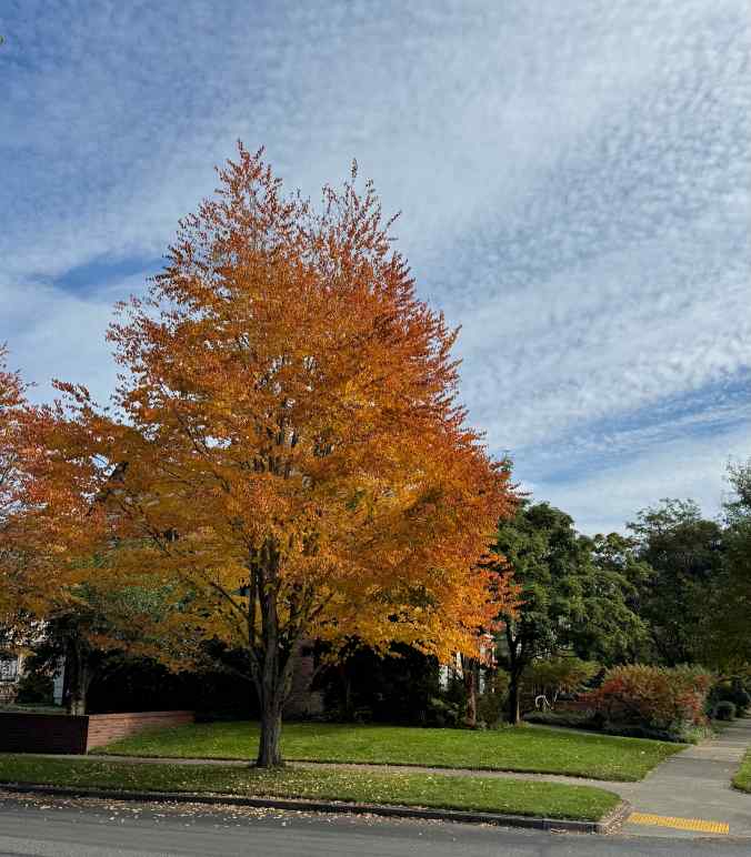
I took many neighborhood walks this month, watching the season change, and contemplating sad partings.
Fall colors in Northeast Portland
The leaves…
Berries and late blooming or winter flowers…
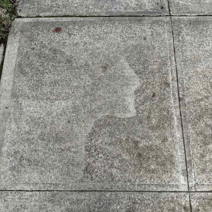
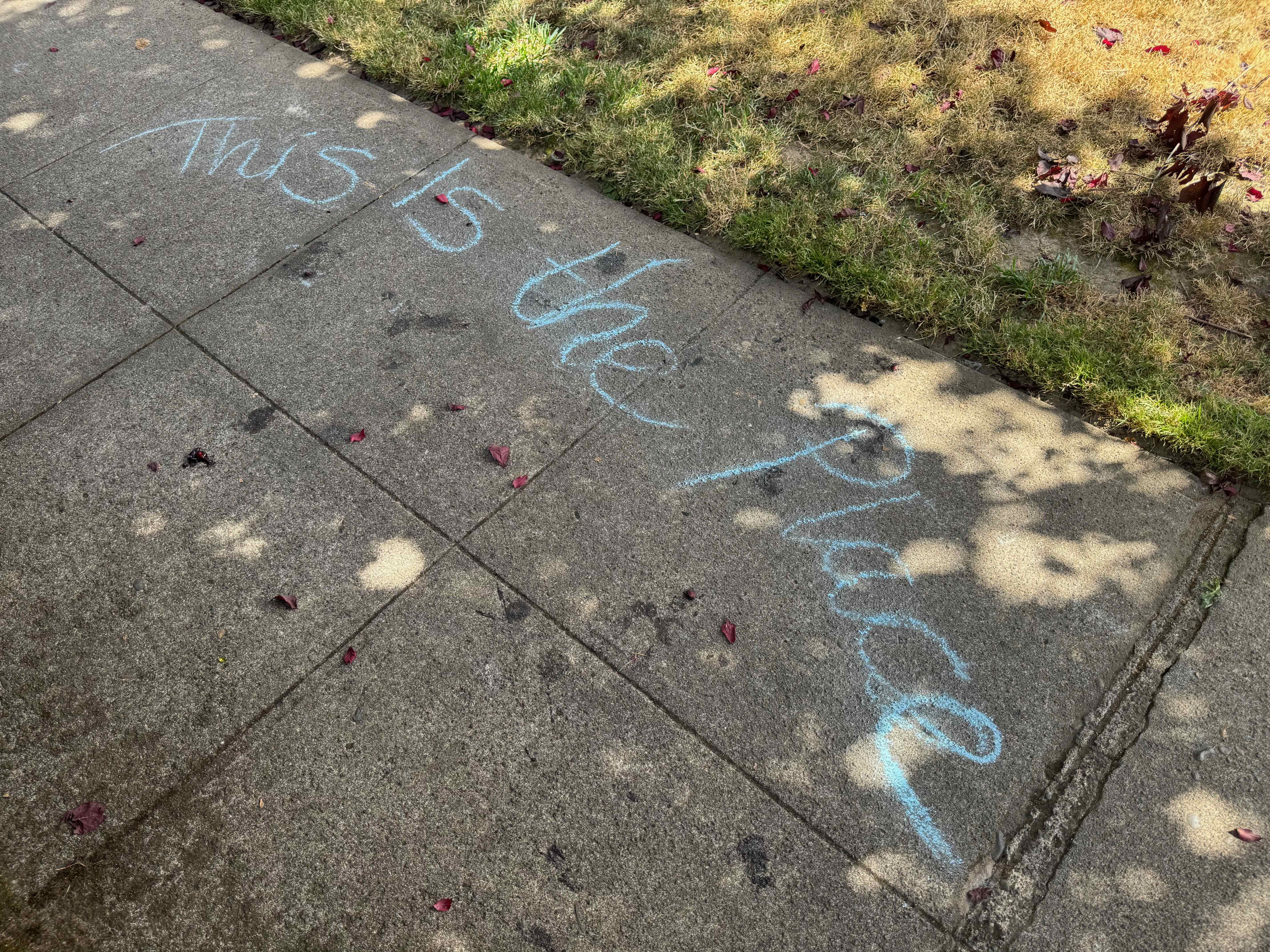
Sidewalk square of the month…
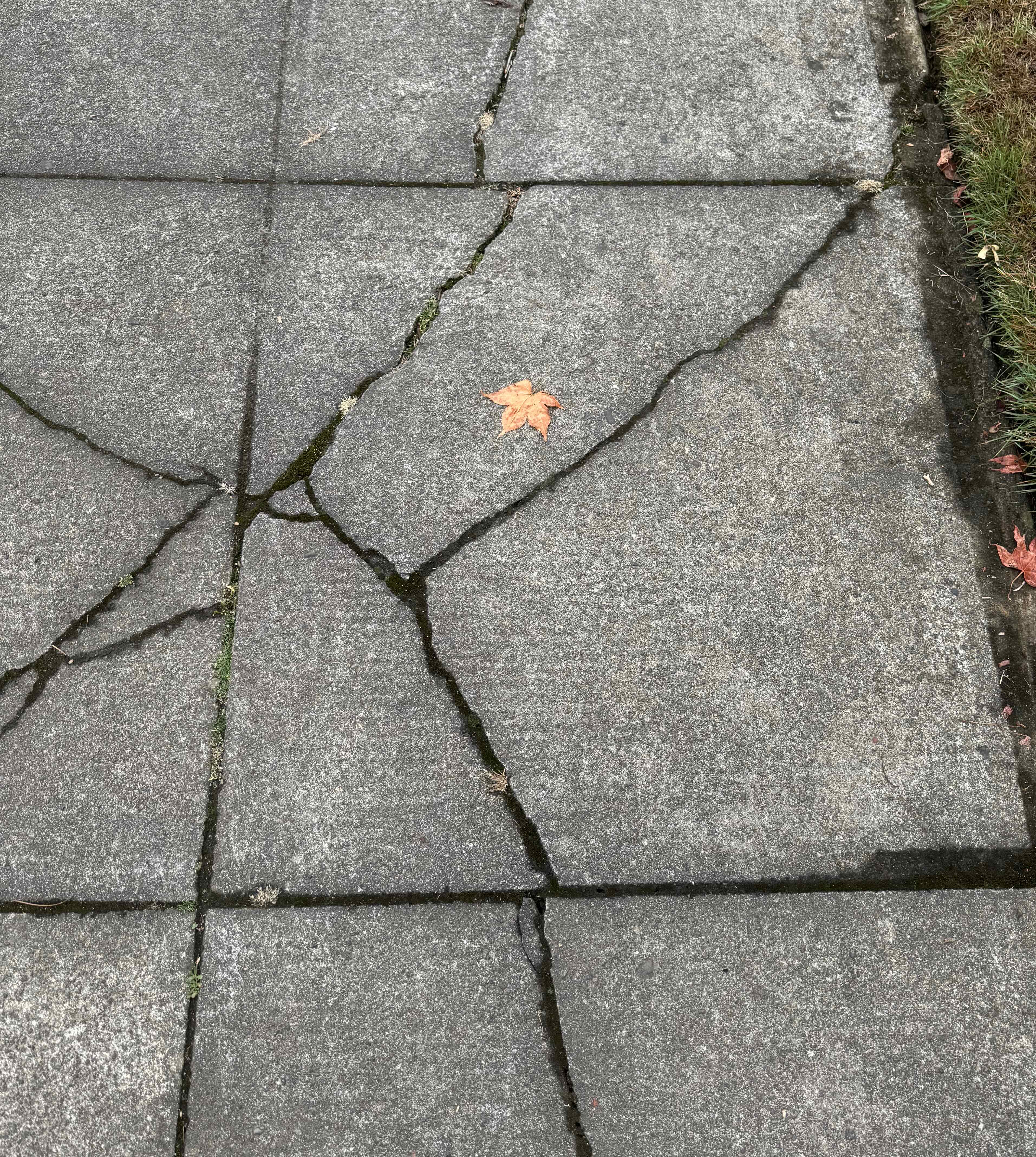
This one has a human profile etched in the weathered cement.
And of course, the early holiday decorations…
Santa penguins, wondering where the snow is.
Knitting
I finished one cowl, which I am wearing almost every day. The pattern is Ella Improv by Cecelia Campochiaro. The yarn in Malabrigo Lace.
Ella Improv cowl
Reading
I finished six books in November. The most compelling was The Mountains Sing by Nguyen Phan Que Mai, a saga of family life in Viet Nam in the twentieth century.
Books of November
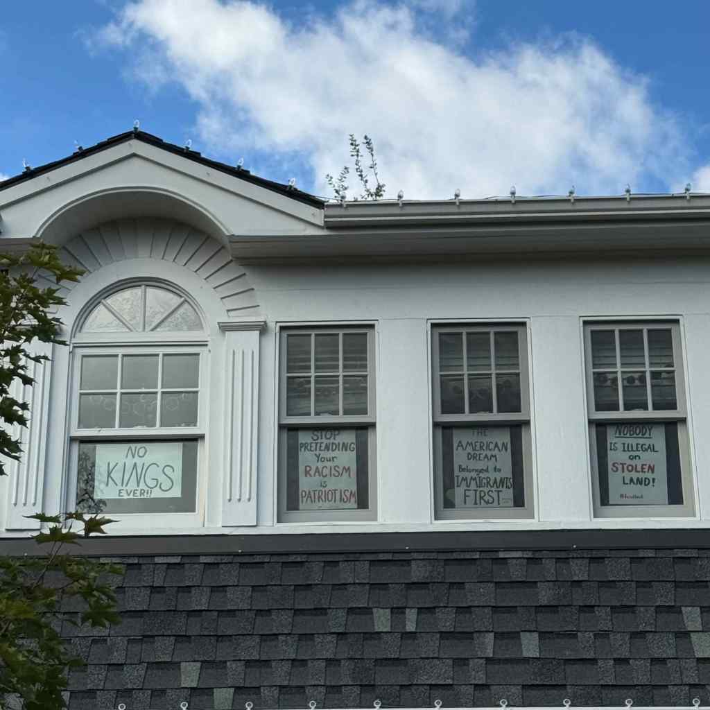
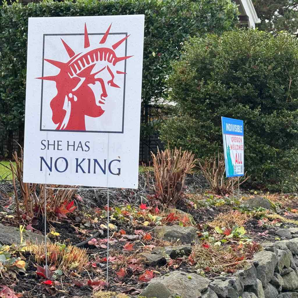
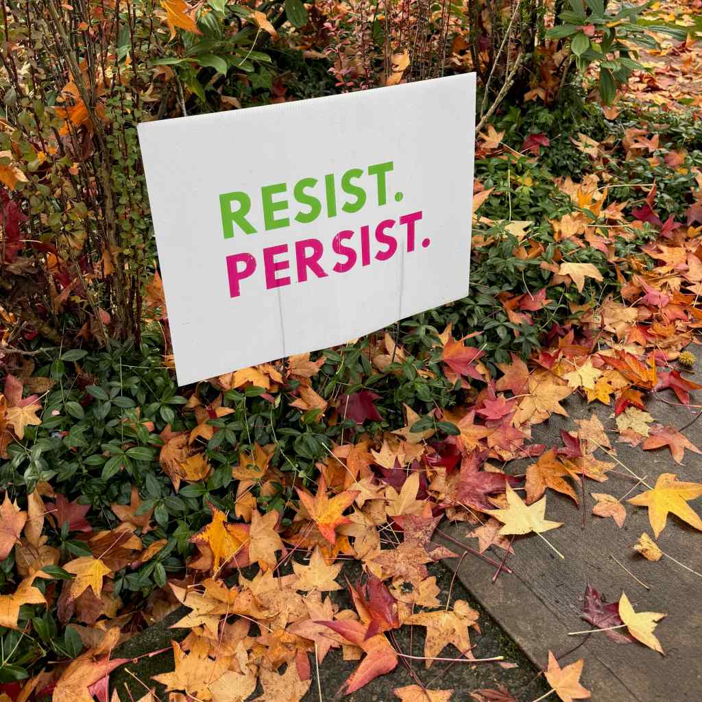
Signs of Resistance
My neighborhood is always heartening in the display of signs of resistance. There seem to be more and more all the time.
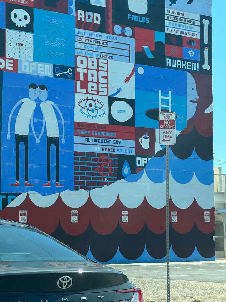
Window signs, telling the world how they really feel!These signs were displayed in front of almost every house on this block.Including this one, with an Anne Frank tribute as well.Lady LibertyKeeping it brief.The wall mural I see on the way home from the library, in the low autumn light.
Sadness
This month I lost two close family members; one older, one younger, one with a long illness, both quite sudden. This was unexpected and sad and I have been feeling shaken and unanchored in time. As a family we are scattered geographically, but with the miracles of technology, we have been able to grieve together. It is hard. And it is human. We are all on that train. We are stopped in our tracks by the loss. We are determined to live well in response. Both paths seem wrong. But we go on.
Thanksgiving was celebrated with close friends who invited us for the day, and for whom I am grateful, especially this year.
Three hikes this month. Our fall hiking areas on the Washington side of the eastern Columbia River Gorge are still impacted by Burdoin Fire damage. We hiked twice on the Oregon side, and once in the Cascade foothills east of Salem.
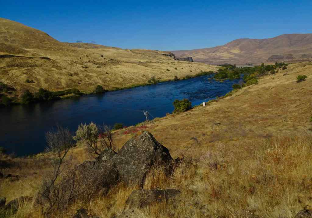
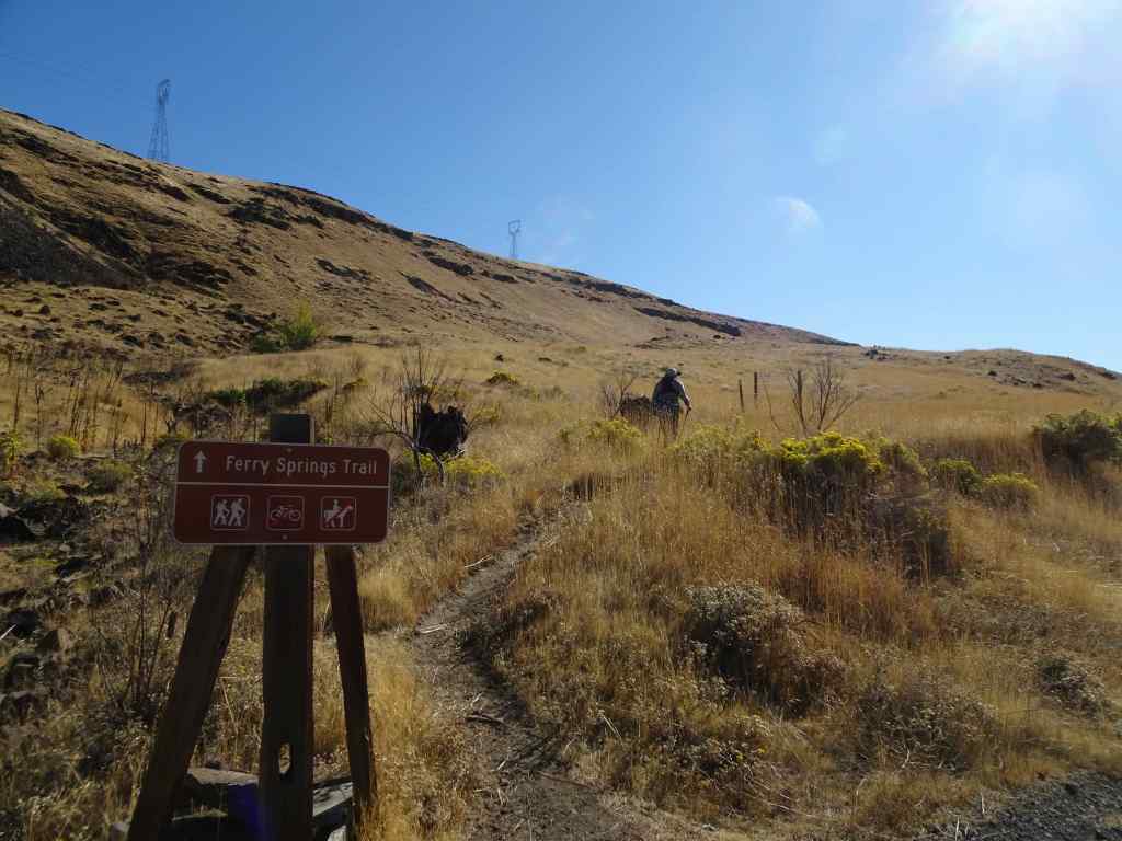
10/14 – Deschutes River Trail, Oregon
Our usual loop, up to Ferry Springs, and then return along the Deschutes River (4.5 miles, 600 feet).
Blue sky today, a light breeze.
Walking along the Deschutes River. Reflections, a few water birds.Rising up above the river, view to the confluence with the Columbia River.Upstream viewUphill toward Ferry Springs.
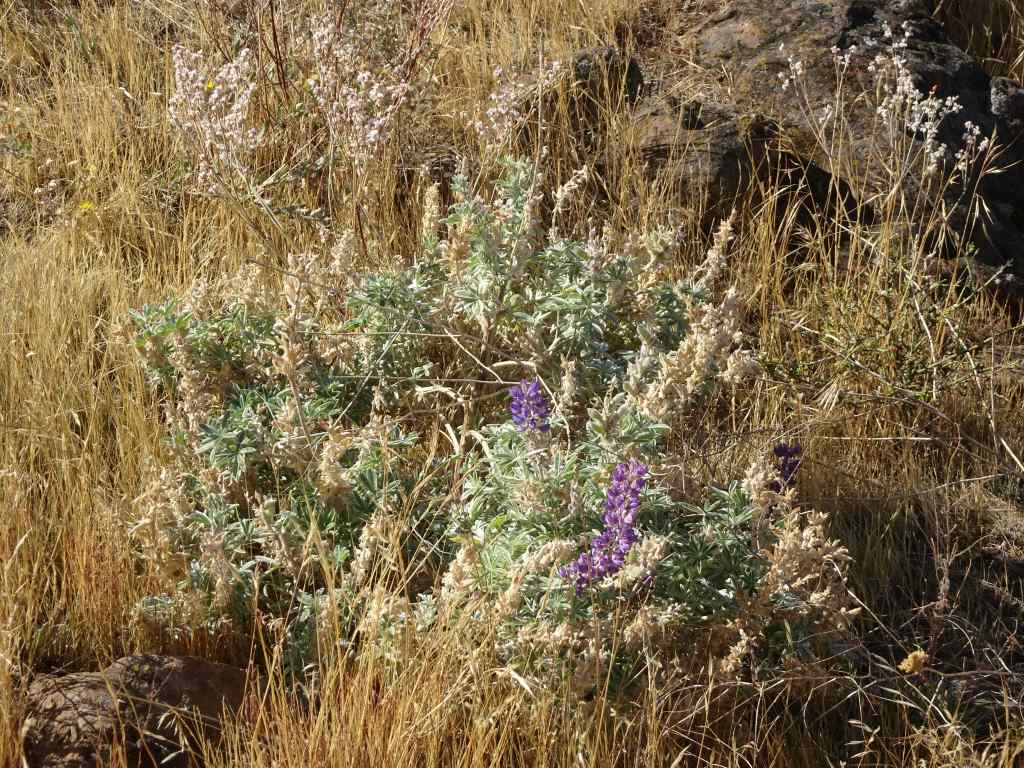
Still losing my breath on the uphill. There are clumps of white and pink blooming buckwheat, yellow rabbit brush, and a few scrabbling lupines. Dried out balsamroots and thistles punctuate the slopes of golden grass where it was blackened and burned a few years ago. Very little sign of the fires now, so much has regrown. Once again, it is peaceful out here – down by the river there are many people fishing for steelhead; we saw one train on the western bank; otherwise a rock wren, a raven call, and us.
RabbitbrushSnow buckwheatLupine
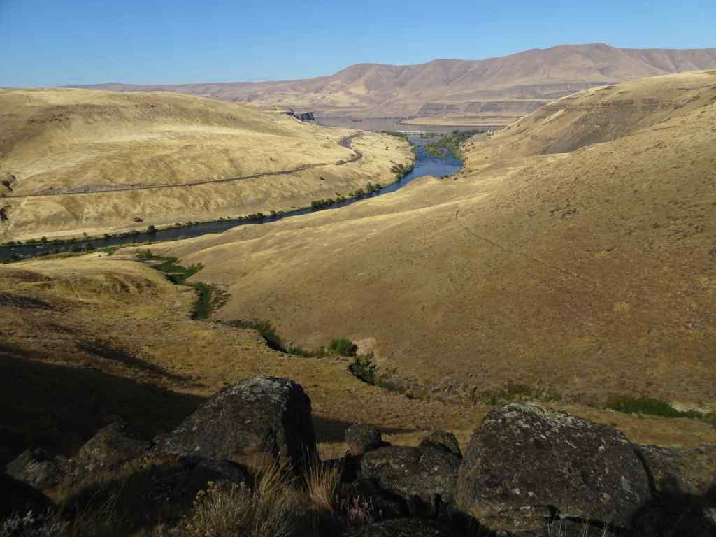
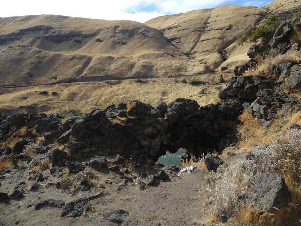
We crossed over Ferry Springs, then looked down toward the river.
The Ferry Springs CrossingLooking down on Ferry Springs as it joins the Deschutes River.And the view to the Columbia River and Columbia Hills.Almost back to river level, looking through the arch.
Back along the river, walking north –
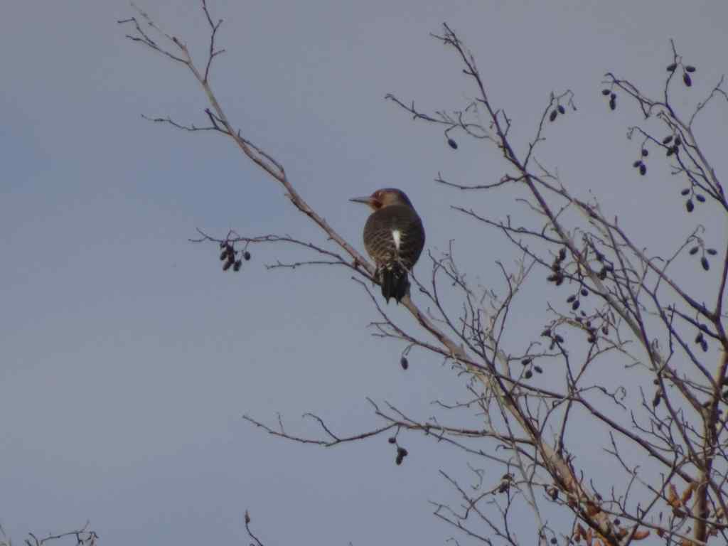
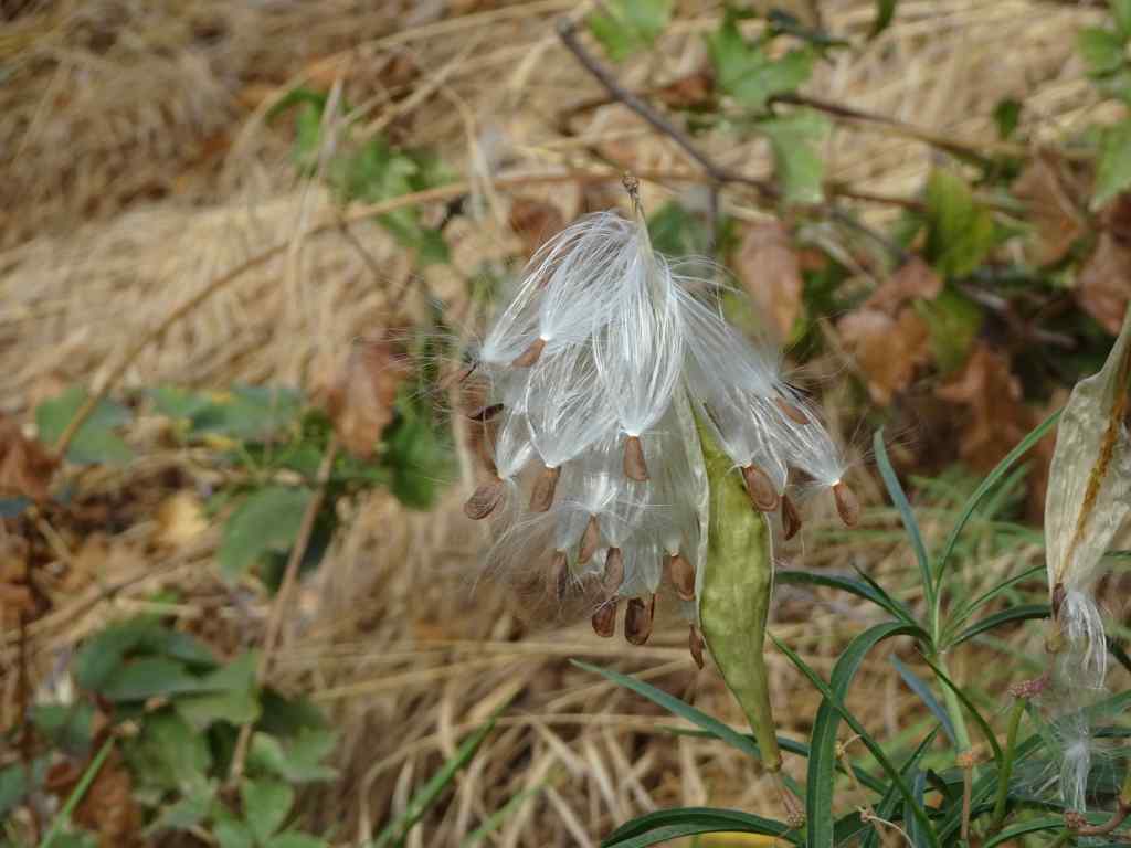
SumacSumacRiver viewDucksNorthern flickerMilkweed seeds getting ready to disperse.Milkweed seed
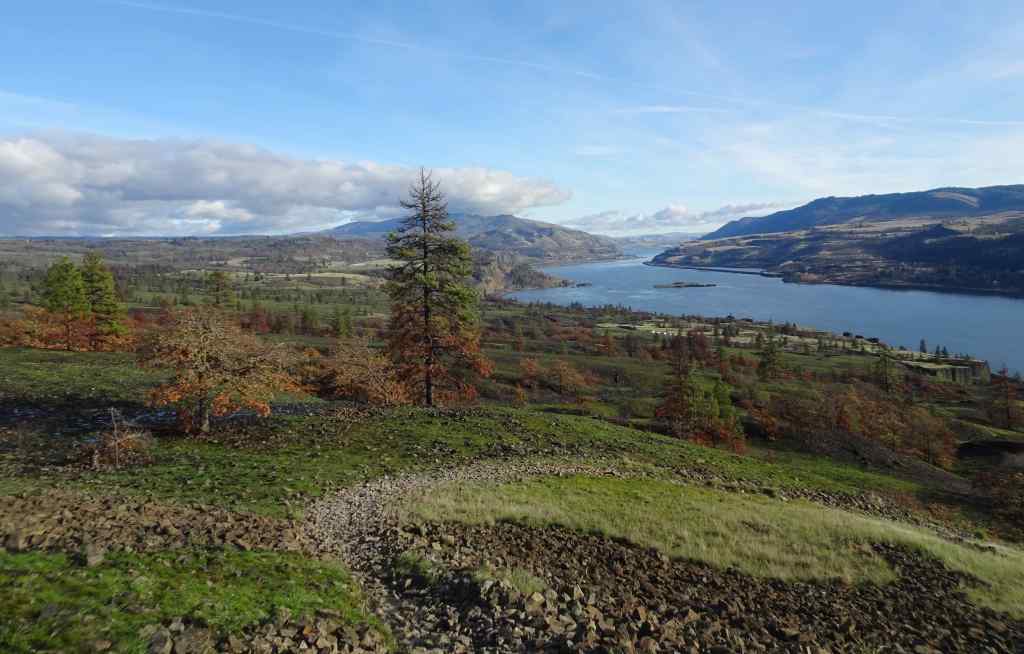
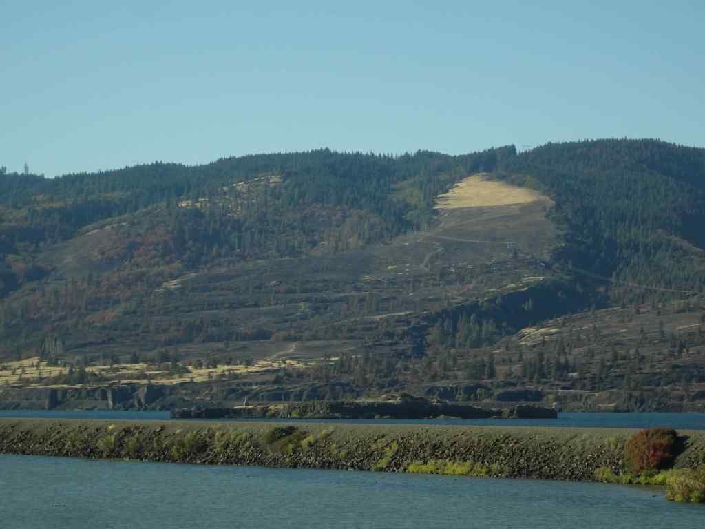
We appreciated the golden slopes we just walked down, especially after seeing the blackened slopes at Catherine Creek. As we drove back west along south side of the Columbia River, I took a few shots of the Burdoin Fire area in Washington that was burned last summer. There are some very black slopes, but also some unburned areas. I can’t quite see my favorite trees from this view.
Catherine Creek hiking area, from I-84, westbound.Catherine Creek areaCatherine Creek area. The Arch and Tracy Hill.
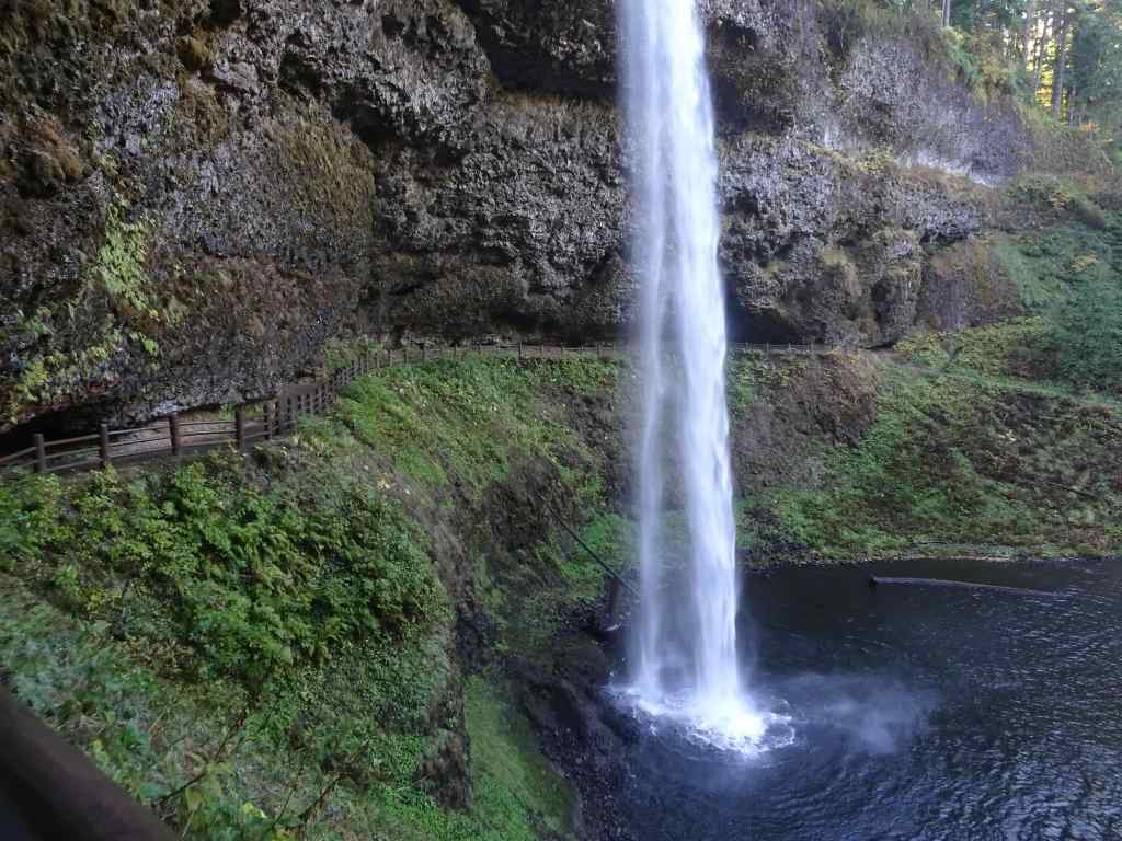
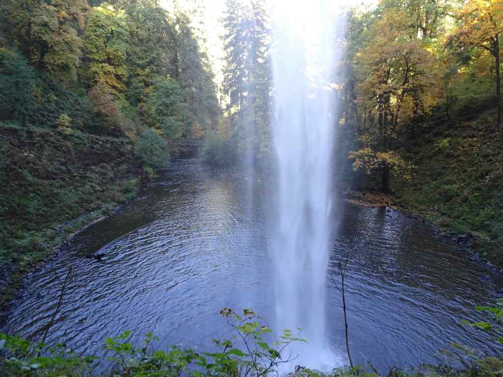
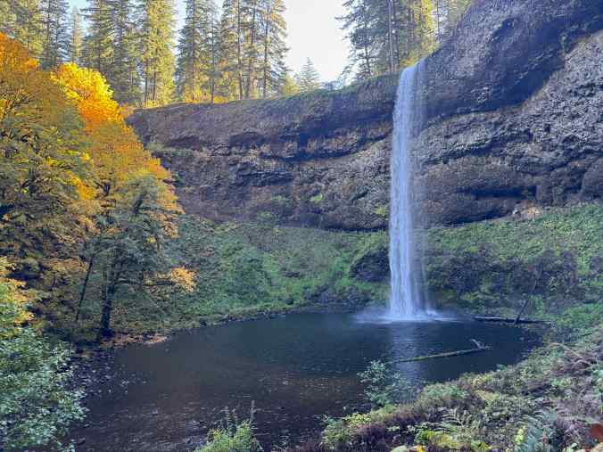
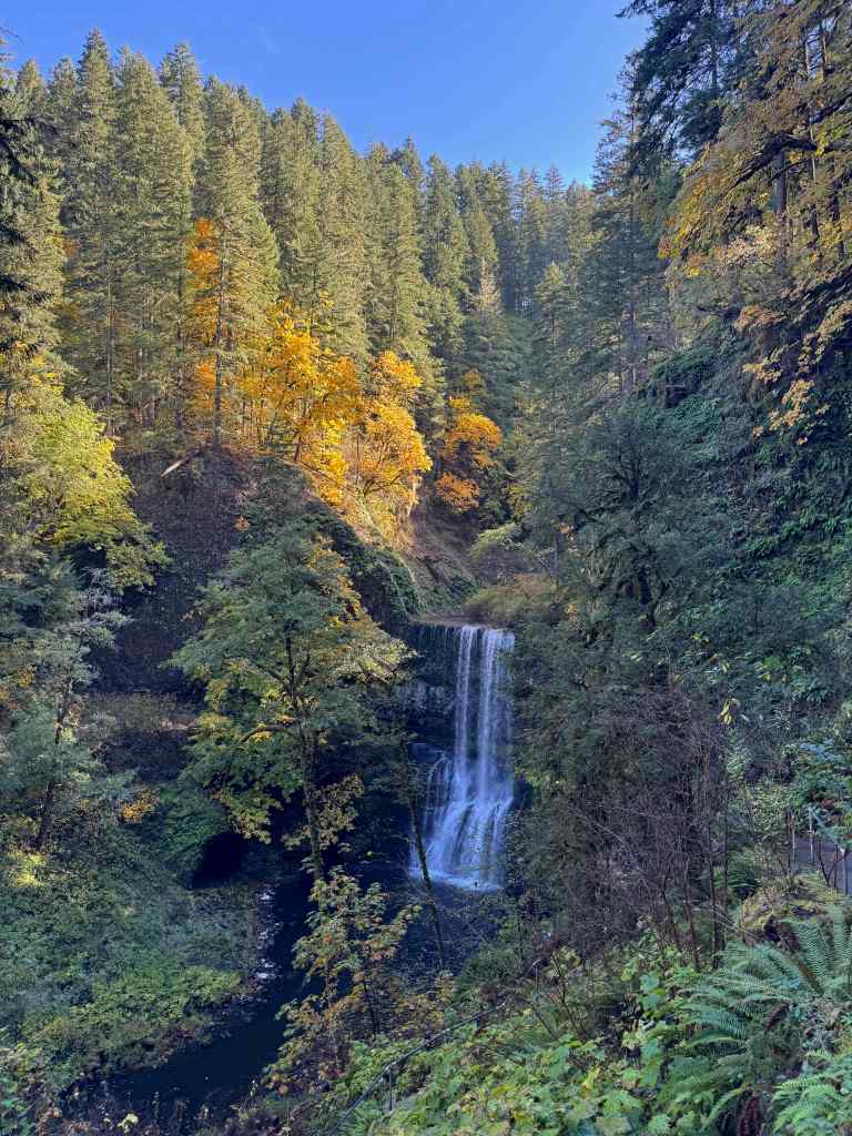
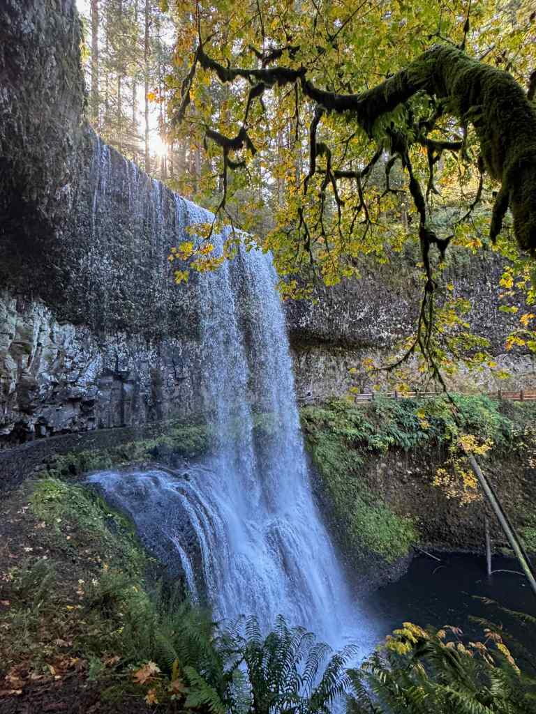
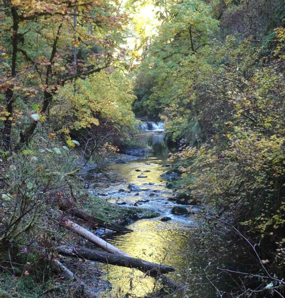
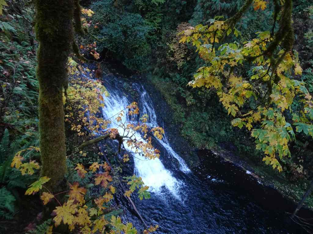
10/20 – Silver Falls State Park, Oregon
Another place we have hiked many times. Today we saw six of the ten famous falls (5.8miles, 600 feet).
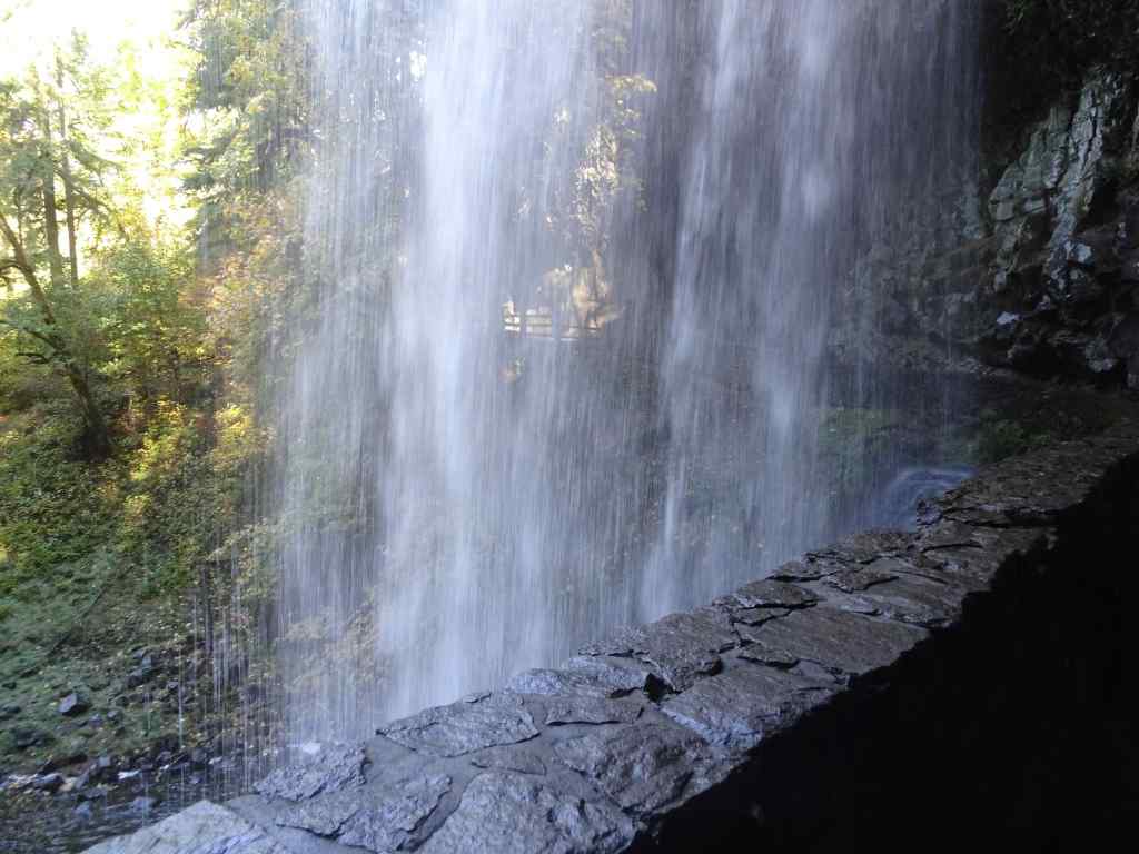
South Falls
Looking down toward South Falls.Our trail goes behind the falls.Looking downstream from behind the falls. This time of year the spray doesn’t soak us.Looking up toward the rim.And looking back from the other side.
Lower South Falls – We continued downstream along the South Fork of Silver Creek, eventually descending switchbacks and staircases to walk behind Lower South Falls.
Descending toward Lower South Falls.Walking behind the falls.Downstream view.Looking back from the other side.
Lower North Falls – Next, we passed the confluence of the North and South Forks of Silver Creek, and began walking upstream along the North Fork.
Mushrooms and mossCrossing the North Fork.Lower North Falls
Drake Falls – Continuing upstream along the North Fork…
Autumnal trail – lots of big leaf maple leaves drifting down.We only get a sideways view of Drake Falls from the viewing platform.
Middle North Falls – A side trail goes under the falls, but we didn’t take it today.
Middle North Falls
Winter Falls – From here, we crossed the river again, and passed the nearly dry Winter Falls while ascending to the rim and walking back to our starting point.
Winter Falls trickling down.
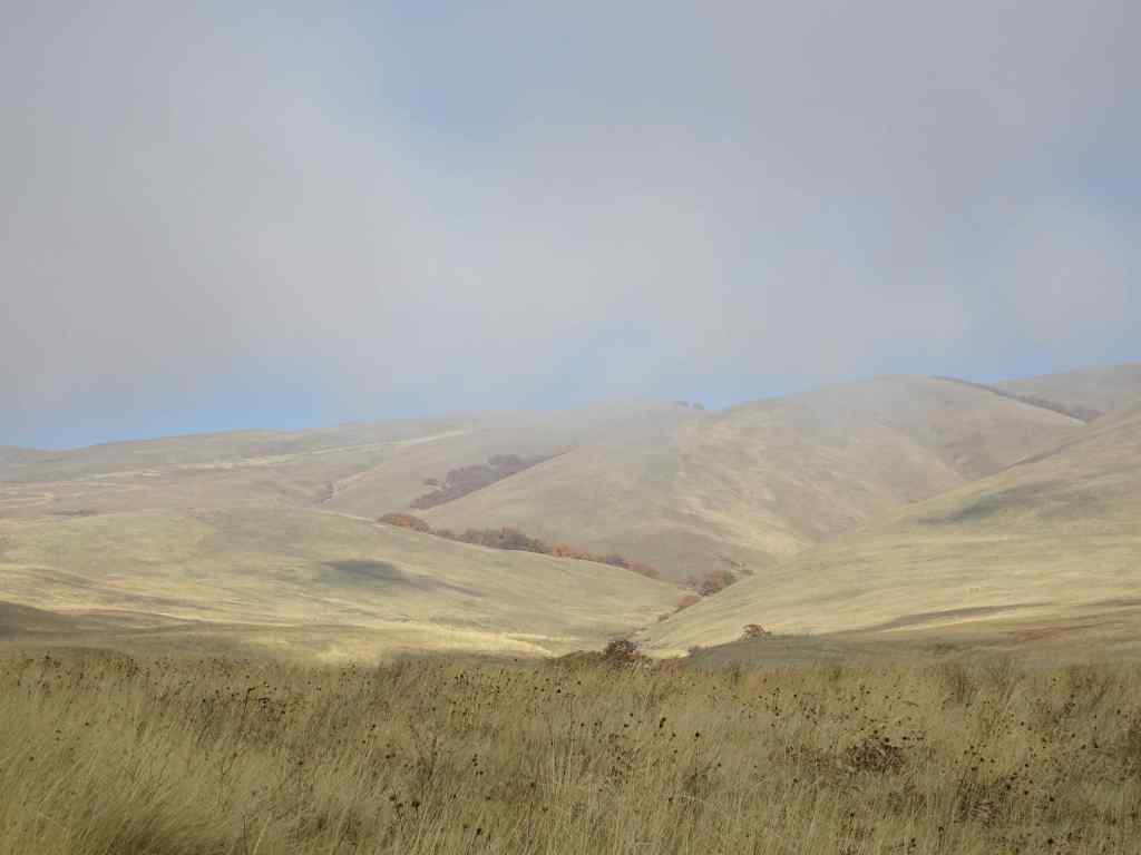
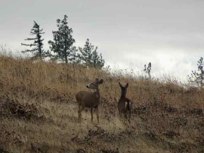
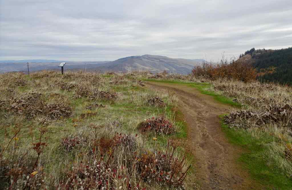
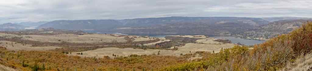
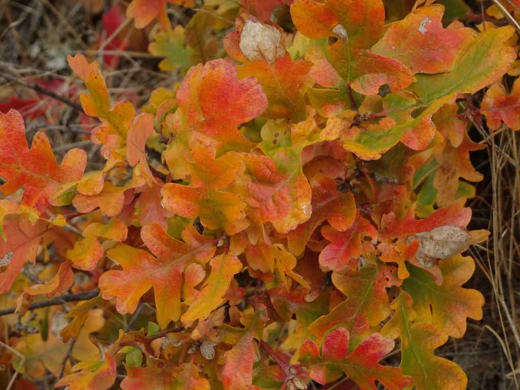
10/28 – Tom McCall Point, Oregon
One of the prime wildflower locations of spring; orange oak leaves color the slopes on this quiet autumn day (3.6 miles, 1000 Feet).
Our destination – Tom McCall Point, through the mist.Parsley alley is rather bare.Looking north from the lower plateau – Rowena Curves below; Lyle, Washington across the Columbia River.Bright orange oak leaves; Memaloose Hills to the west.Zooming in on the shoulders of Mt Adams – the most we would see of it today.
We startled a small family of deer near the summit.
Mule deerMule deerSummit of Tom McCall Point, covered with clumps of dried balsamroot foliage.View toward the Columbia HillsPanorama from this top of the world…The neon orange oak leaves that brightened our day.
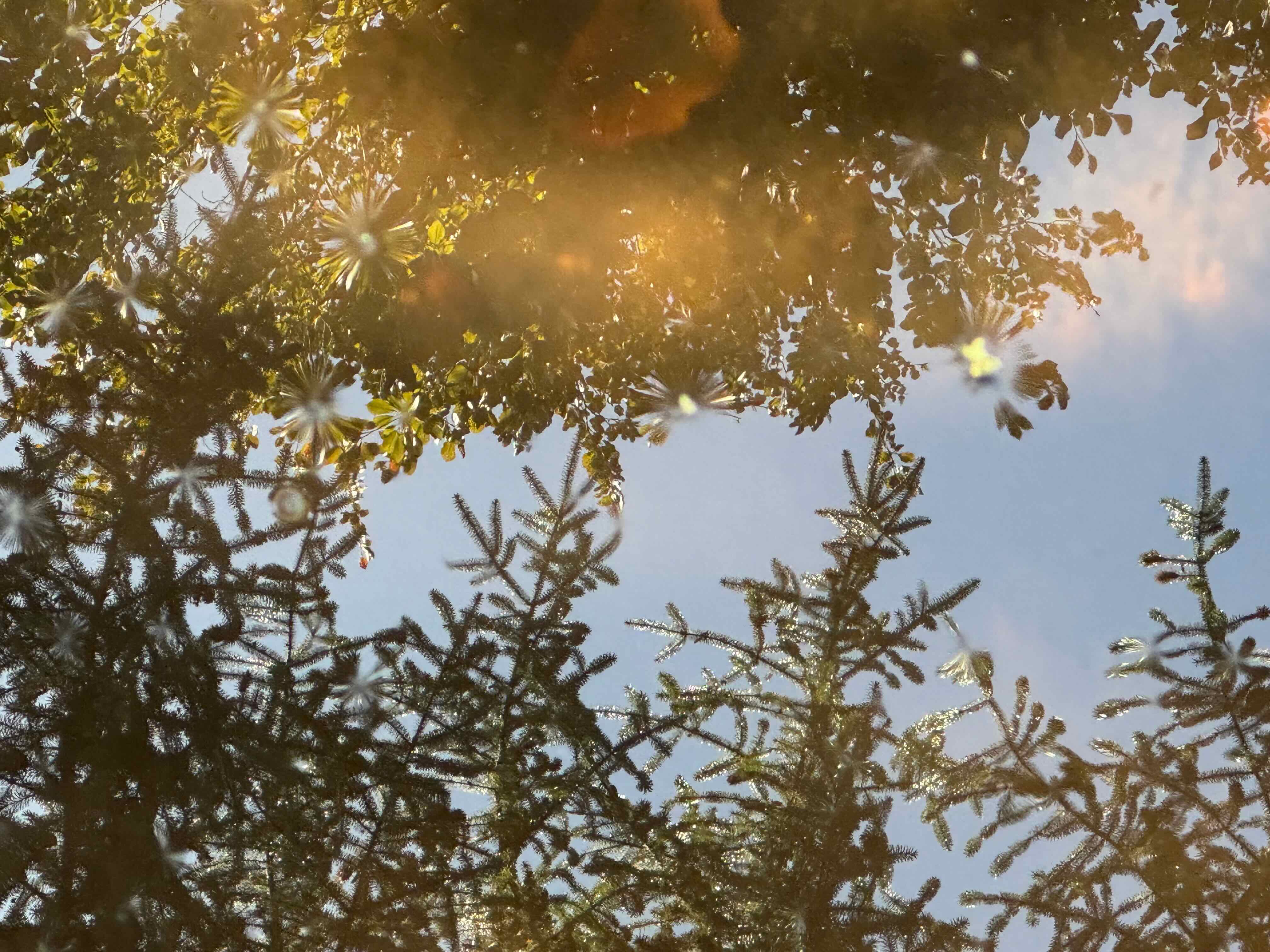
We returned from Philadelphia during the first week in October. I have been at home for the remainder of the month, watching the Halloween enthusiasm and the changing foliage fill the neighborhood with color and whimsy, against a background of quiet and not so quiet resistance throughout our city.
Around the neighborhood…
Halloween decorations. Some folks go all out. New or notable for me this year:
I finished three hats for donation, a scarf, and a pair of socks:
Books
I finished eight books in October:
October books
Ribbitting with the resistance in PDX…
National ‘leadership’ continues smashing everything, like a giant wrecking ball. I am proud of my Portland people for exhibiting a mostly peaceful resistance, responding with whimsy and relentless persistence. Some highlights of the month:
Some of our famous Portland Frogs, from Instagram.Still protestingNeighborhood poetry postWall muralAnd my son took this picture in Paris, France!
We went to Connecticut and Pennsylvania to visit family. There were meetups and restaurant dinners; hikes, art museums, and historical sites; a fair amount of driving, and then the hunt for elusive parking spots in Philly.
General Location Map for this trip.
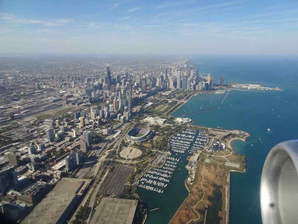
9/26 – Portland to southern Connecticut
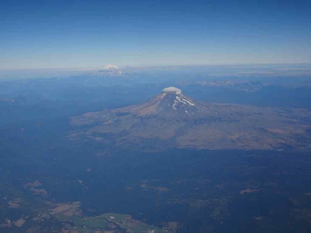
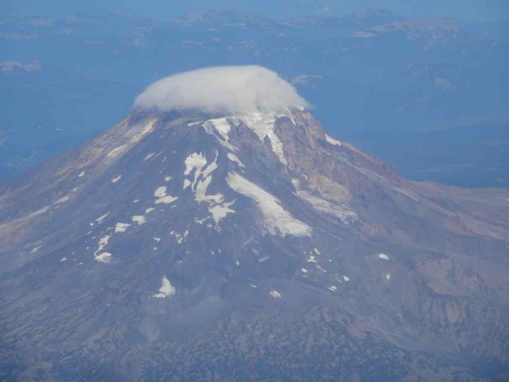
From my window seat today, I saw Cascade Mountains, Great Lakes, and the Statue of Liberty as we flew into Newark Airport.
Shortly after take off, I had a great view of Mt Adams, with Mt Rainier in the distance.Close view of the cloud cap on Mt Adams.
For most of the midwest, there was cloud cover, and not many views. But as we approached the Great Lakes, the cloud layer separated into a sheet of puffs, and I knew I had seen them before in the Art Institute of Chicago, as painted by Georgia O’Keeffe!
Clouds over the midwest as we approached the Great Lakes.Sky above Clouds IV, by Georgia O’Keeffe, 8 feet by 24 feet!Sky above Clouds IV caption, Art Institute of Chicago
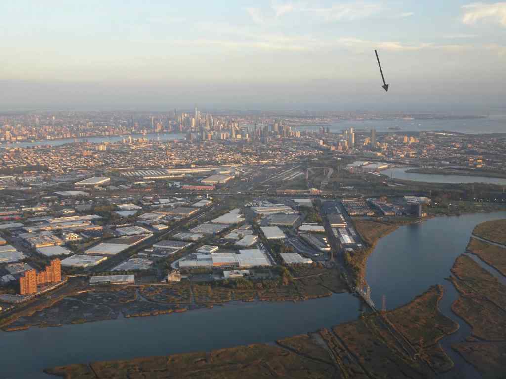
The New York City metropolitan area was glinting in the afternoon sun as we approached the Newark Airport. I even picked out the Statue of Liberty on her Island,
Descending toward Newark; Lady Liberty under the arrow.Fuzzy view of Lady Liberty.
We rented a car and drove north on the New Jersey Turnpike toward Connecticut. Oregon is known for its patient and polite drivers. Not so much, New Jersey!
New York City to the east as we drive north on the New Jersey Turnpike.City view as we cross the Hudson River on the George Washington Bridge.
We made it to Hamden, CT, not far from New Haven, and spent three days with family, friends, and dogs there.
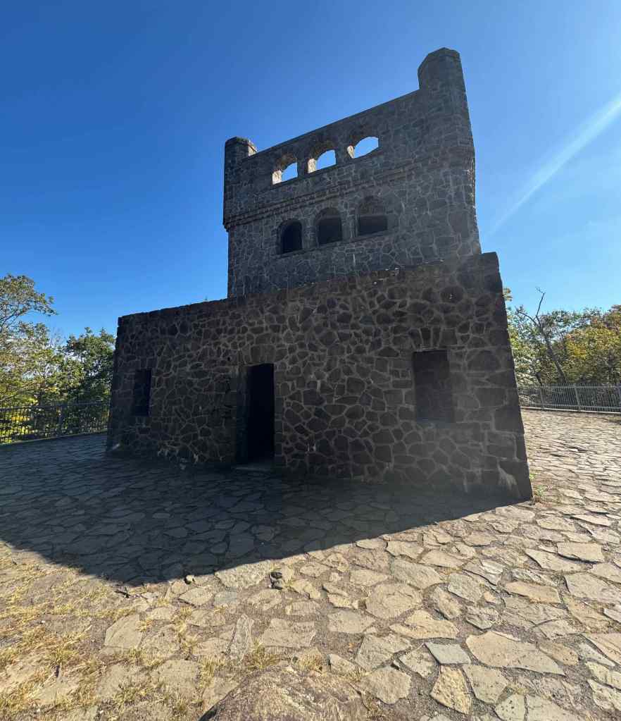
9/28 – Sleeping Giant State Park, CT
This small mountain near Hamden is popular hiking locale. We opted for the three mile Tower Trail, about 600 feet elevation gain. There were a few late wildflowers blooming, and plenty of other people on this 80 degree day. I appreciated the shade! And the first glimmers of fall color.
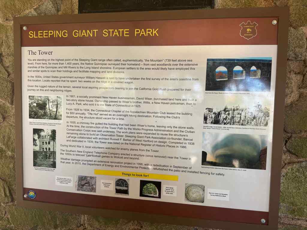
Sleeping GiantTrailhead – the trail is a gently graded gravel road.Wildflowers – asters, silver rod and goldenrod. Sassafras leaves turning orangeAnd the eastern version of poison oak.The tower ahead…The towerView across the parapetsA ‘territorial’ view toward Long Island Sound from the top.History of The Tower and the area.
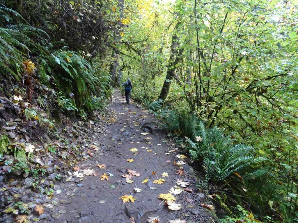
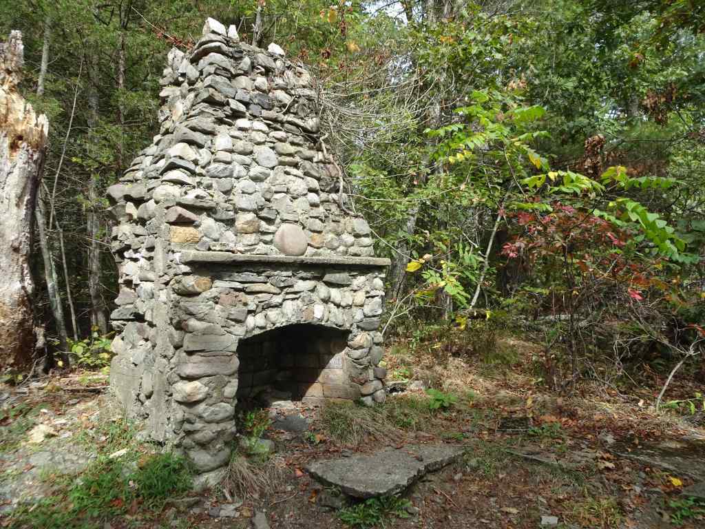
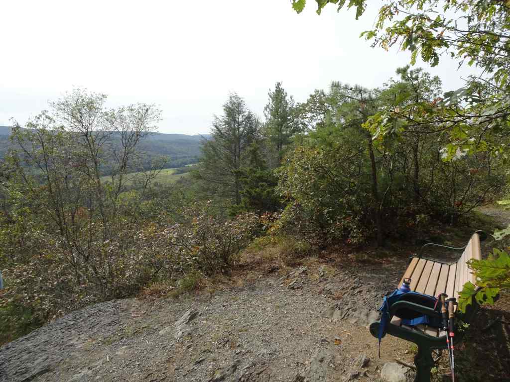
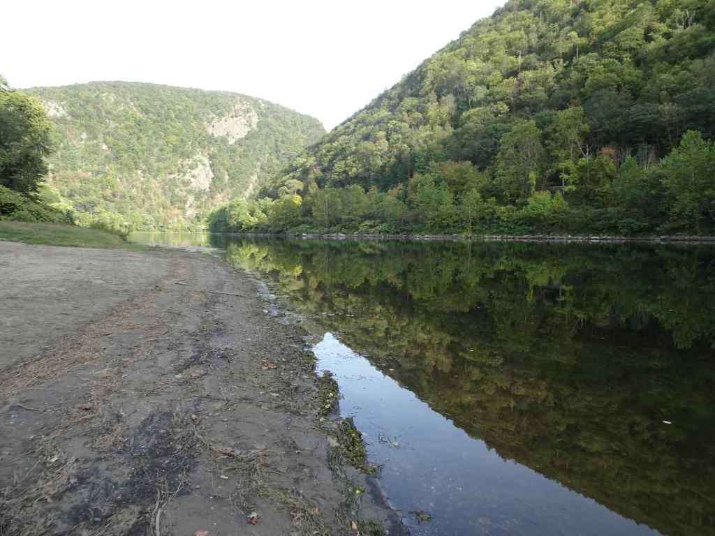
9/29 to 30 – Delaware Water Gap, PA
The next day, we drove west to the Pocono Mountains in Pennsylvania, and then spent the following day exploring Delaware Water Gap National Recreation Area. After a stop at the Visitor Center, we decided to hike the Tumbling Falls Trail – shady and not too steep, as it was another hot day, and I was still regaining my hiking stamina. It was a pretty hike through oak and pine woodlands.
Visitor Center, Delaware Water Gap. We would see this view of Mt Tammany later in the day.The Tumbling Falls Trail – a 3 mile, 400 foot loop, through pine and oak forest.Old stone fireplace along the trail.Bench with a view for lunch.Lunch view across the Delaware River to the Jersey side.Tumbling Falls – just a trickle this time of year.Nice reflections in the pool.Stairs back up…Pickerel Pond, near the trailhead. Again, just the beginning of fall color on the trees.
After our hike, we drove south, to a couple of viewpoints of the Gap.
The road along the Delaware River was like a green tunnel.We saw a few wild turkeys.We went to the Point of Gap Overlook for this classic view of Mt Tammany, NJ.Closer view of the Paleozoic rocks on Mt Tammany
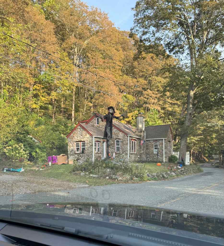
Then we drove across the river to the Kittatinny Point Visitors Center.
This sign explains how the Gap formed by stream capture.Calm and reflective Delaware River at Kittatinny Point.Mt Minsi to the south, on the Pennsylvania side of the Gap.As we were driving in the area, we spotted this stone house, ready for Halloween about a month early.
10/1 – Washington Crossing Historic Park, PA
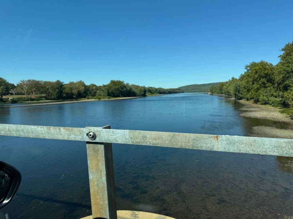
We spent the first part of the day driving to Philadelphia. The Washington Crossing Historical Park on the Pennsylvania side of the Delaware River was a convenient lunch stop.
We crossed the river on an auto bridge, looking toward the Washington Crossing. The park has wide green fields on both sides of the river – plenty of room for the annual reenactments that happen here.A plinth tribute to George Washington stands along an avenue, with flags of the colonies.George Washington atop his plinth.We sat on a bench to eat our lunch, with this lovely view of the crossing. There is a very nice path along the river, and more construction was underway.On the night of December 25th, 1776, there was a blinding snowstorm here, and the Delaware River was choked with ice. The Continental Army successfully crossed, despite the conditions, and went on to defeat the Hessians in Trenton.Today there are only geese and ducks swimming around.We stepped briefly into the Visitor Center, just long enough to see George, and a nearby plaque honoring Thomas Paine.“Tyranny, like hell, is not easily conquered.”…words for the ages.
10/1 to 5 – Philadelphia
After lunch, we continued on to Philadelphia. Our son lives near the center of the city, and we stayed in a nearby condo hotel. Over the next few days, we ate in several great restaurants – Thai, Italian, and our first Philly ‘cheese steaks’ (I’m not sure it counts if you opt for vegetarian or chicken versions). We walked to two museums on Franklin Boulevard. It was nice weather, and we really enjoyed our time, especially with the people we got to visit.
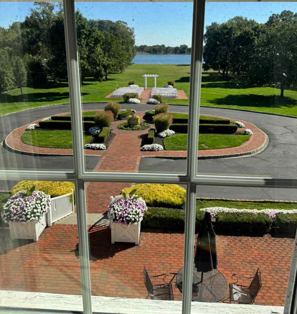
On our first day, we got to meet these two cats of Philadelphia, named Cowboy and Ghoul.We also toured this venue space, that we will visit again next summer.View to the Delaware River from the Pen Ryn Estate.And we met this artful zebra(?) in our hotel lobby.
10/2 – Barnes Foundation
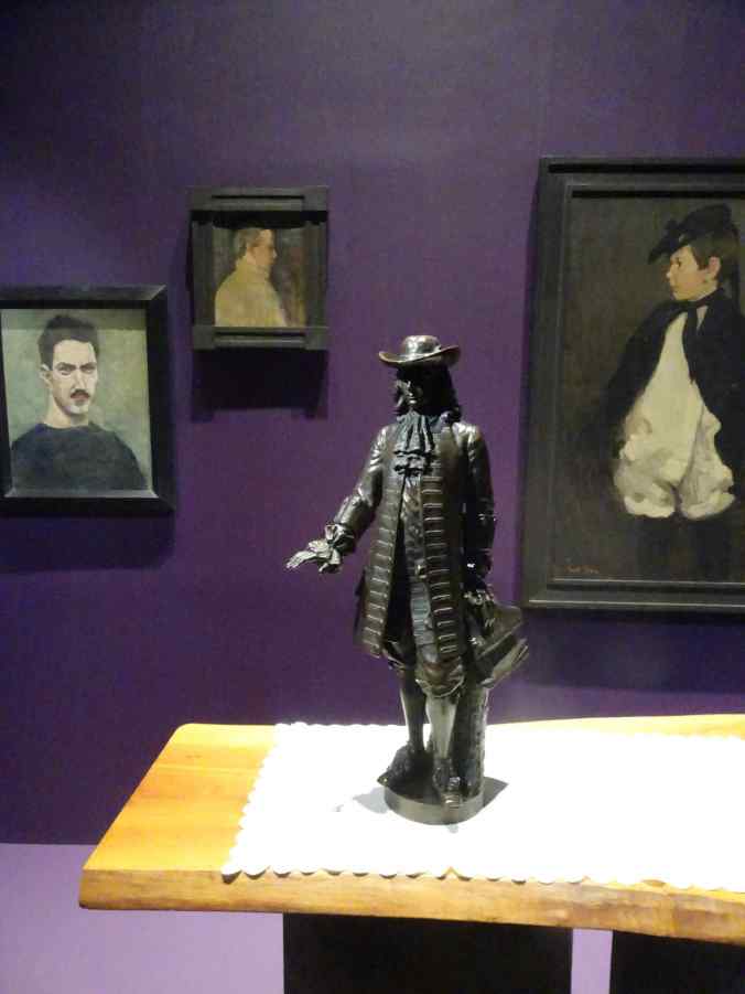
We walked to the Barnes Foundation, an art museum on Franklin Parkway that is particularly known for its enormous collection of Impressionist Art, especially by Renoir. The collection is displayed without placards, and arranged in settings that juxtapose many different artists and media in each room. One must scan the art with a phone to find out the maker or context. The collector, Albert C. Barnes (1872-1951), acquired this art after making a fortune in pharmaceuticals, and he created his foundation to provide art education for everyone. I admired much of the work, and if I lived in the area, I could become familiar with the many types of art and artists on display. For a casual walk through, I found it a bit overwhelming to have to interface through my phone to learn about the art and artists.
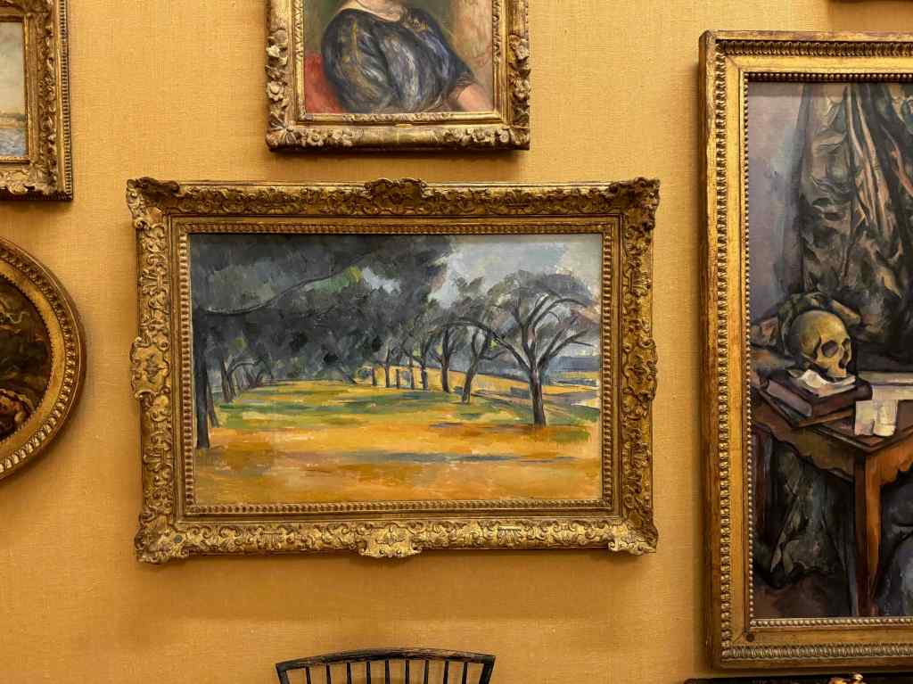
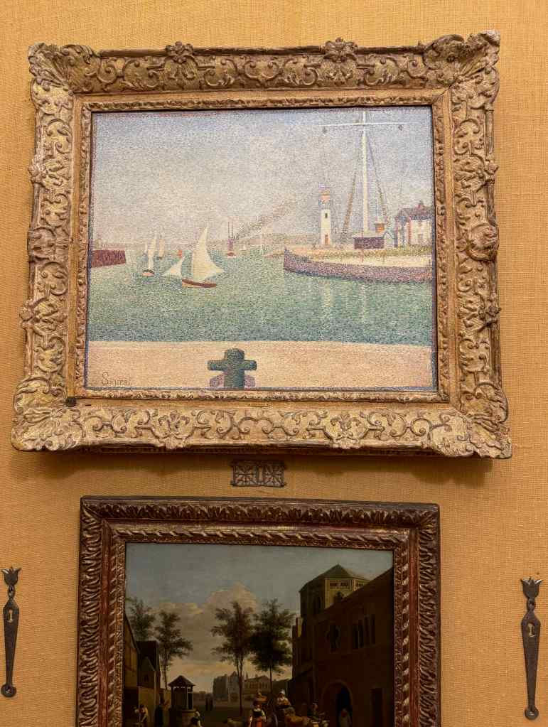
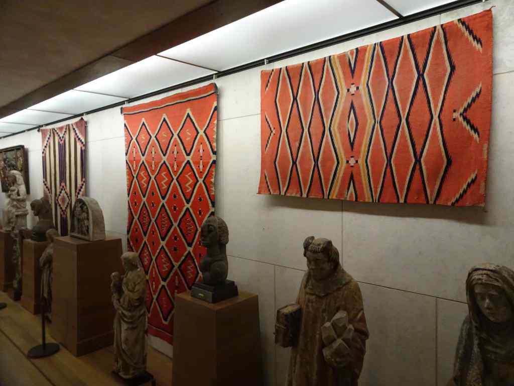
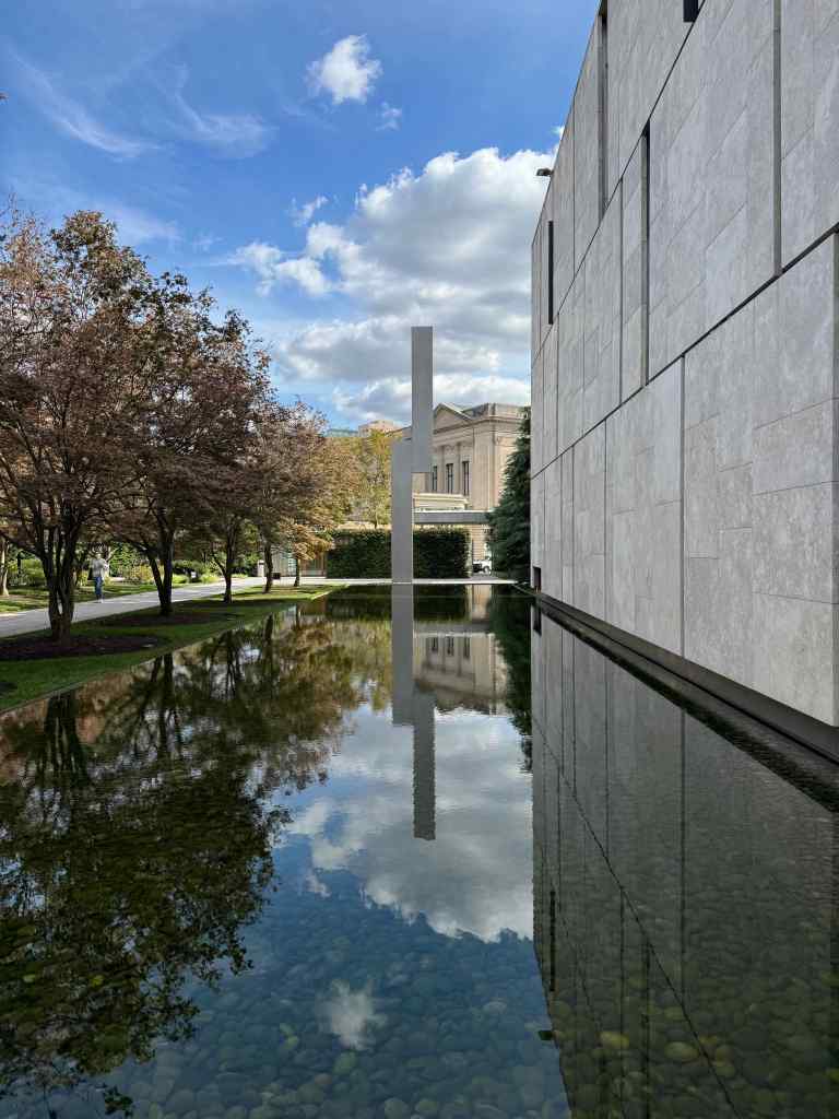
Walking toward the Barnes Foundation on Franklin ParkwayThe reflecting pool outside the museum.Artwork arranged in ensembles chosen by Barnes.Pierre-Auguste Renoir. Autumn Landscape, c. 1884.Pierre-Auguste Renoir. Bois de la Chaise,1892.Paul Cézanne. The Allée at Marines, 1898.Paul Cézanne. Mont Sainte-Victoire,1892–1895.Georges Seurat. Entrance of The Port of Honfleur, 1886.Pottery displayTextiles and sculpturesWalking by the reflecting pool again, on the way out.And of course, we visited ‘The Thinker’ again, at the nearby Rodin Museum, before walking back to our hotel.The Thinker placard
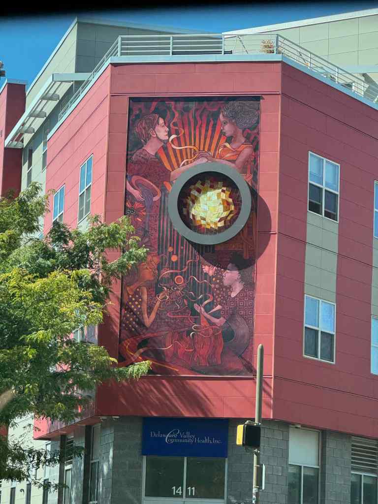
As we walked around for these two days, I admired the juxtaposition of old and new buildings, and of many huge murals on the sides of some of the buildings.
Old and new buildingsCity Hall with William Penn on top.Shiny new reflective buildings.Older architectural elementsCity scape with giant muralCloser viewAnother giant mural on an older buildingCloser viewMuralMural
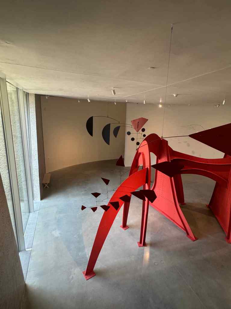
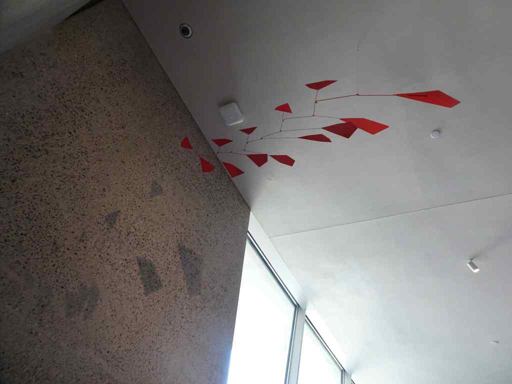
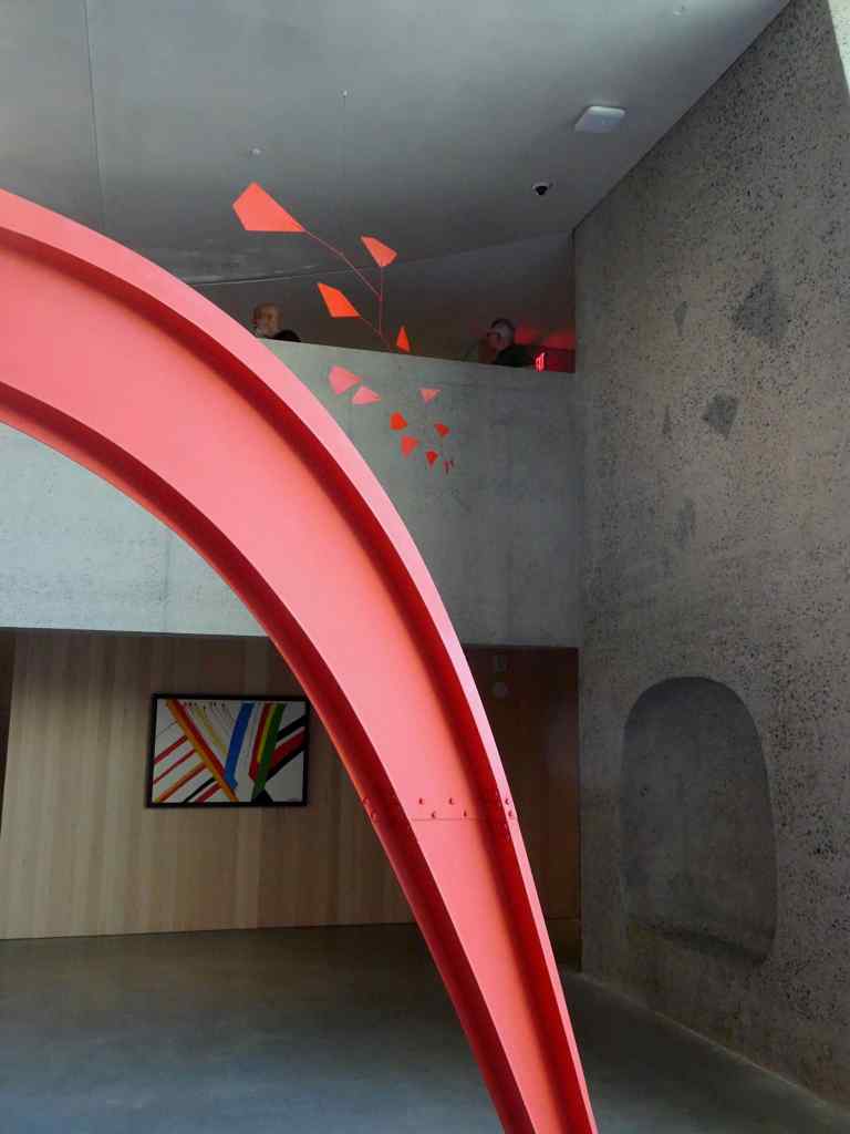
10/3 – Calder Gardens
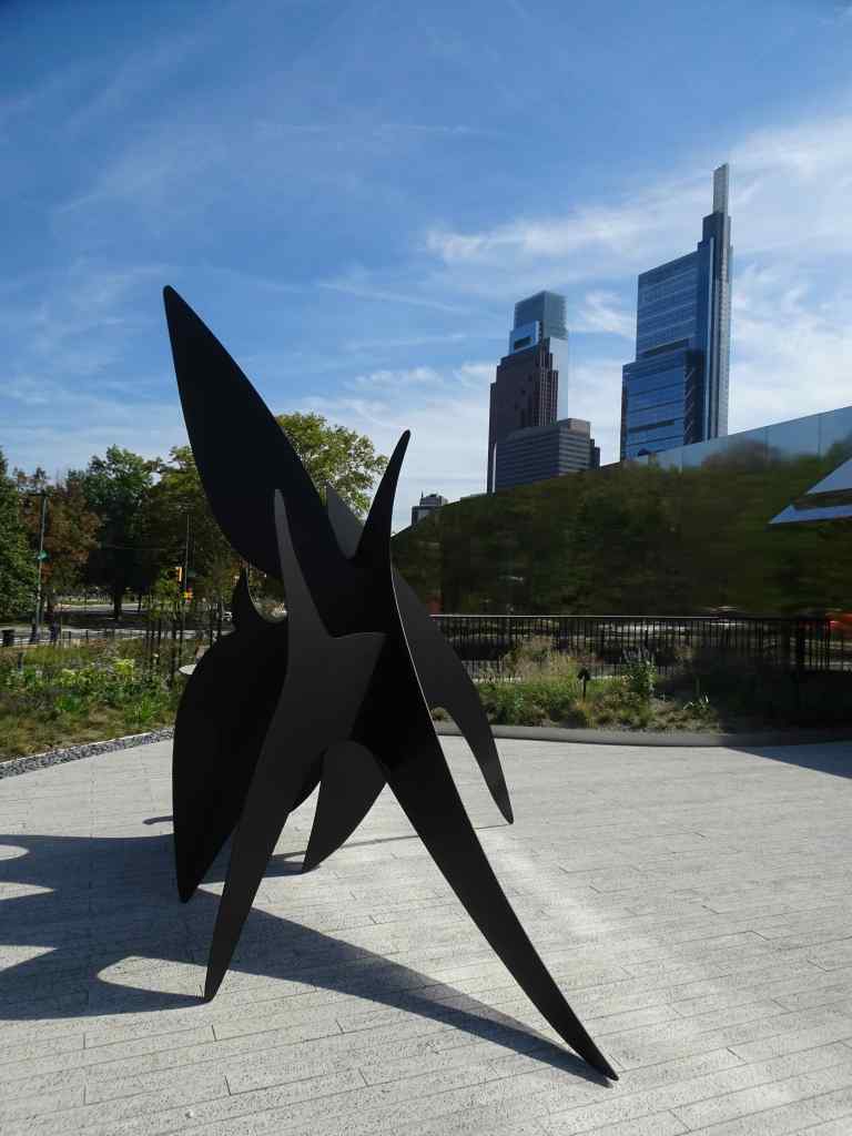
The next day, we planned to meet some cousins in the afternoon, and to visit a new museum on Franklin Parkway, dedicated entirely to the art of Alexander Calder (1898-1976). Calder, from Philadelphia, is particularly known for three dimensional mobile and stabile sculptures, made of wire and steel. His works are displayed both indoors, and in the outdoor garden grounds.
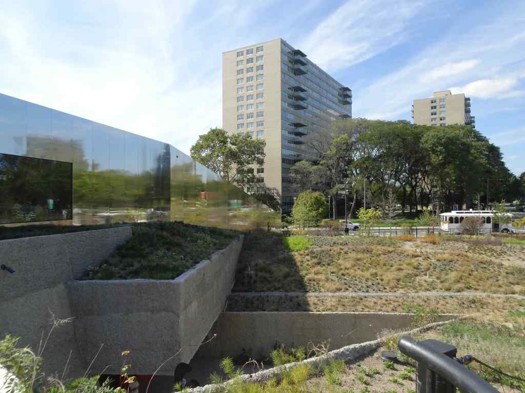
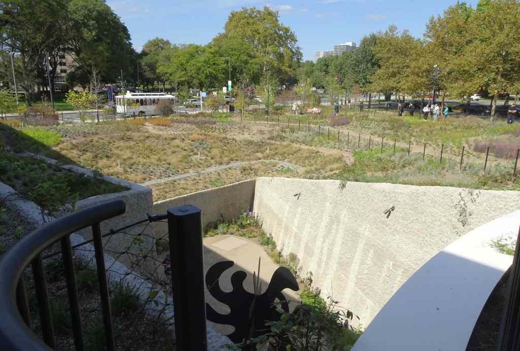
The museum is partially below ground level, set in a newly landscaped outdoor gardens with paths and sculptures. The outdoor wall of the museum is reflective, presenting distorted views of both the garden and the city scape.Some of the sculptures are in lower level outdoor galleries, accessible from within the museum.This sculpture (The Cock’s Comb, 1960) is near the museum entrance.
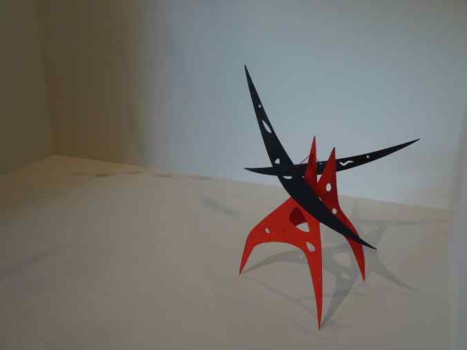
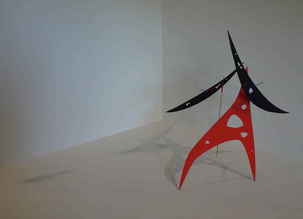
Once inside, there is a balcony that overlooks the lower galleries. It seems an effective way to display both hanging and standing sculptures. And it is interesting to be able to see them from various angles.
Jerusalem Stabile II, 1976Both of these sculptures have the same inspiration. Black Widow, 1948 (hanging); Black Widow, 1959.Untitled, c. 1952.Myxomatose, 1953.Sword Plant, 1947Sword Plant, 1947, from another angle.Looking back toward the balcony from below.
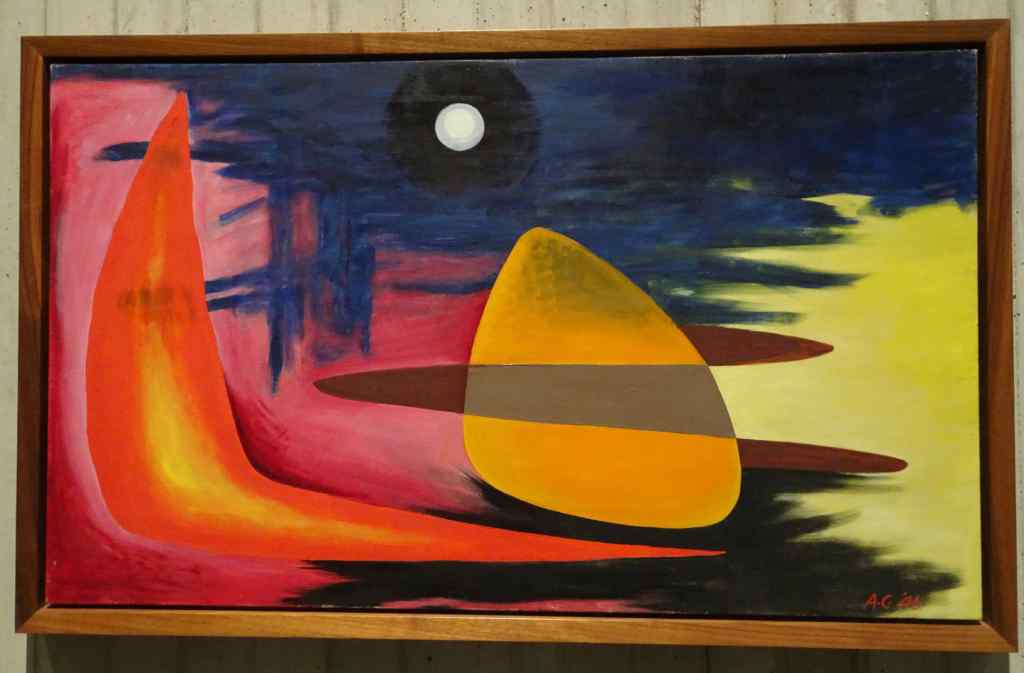
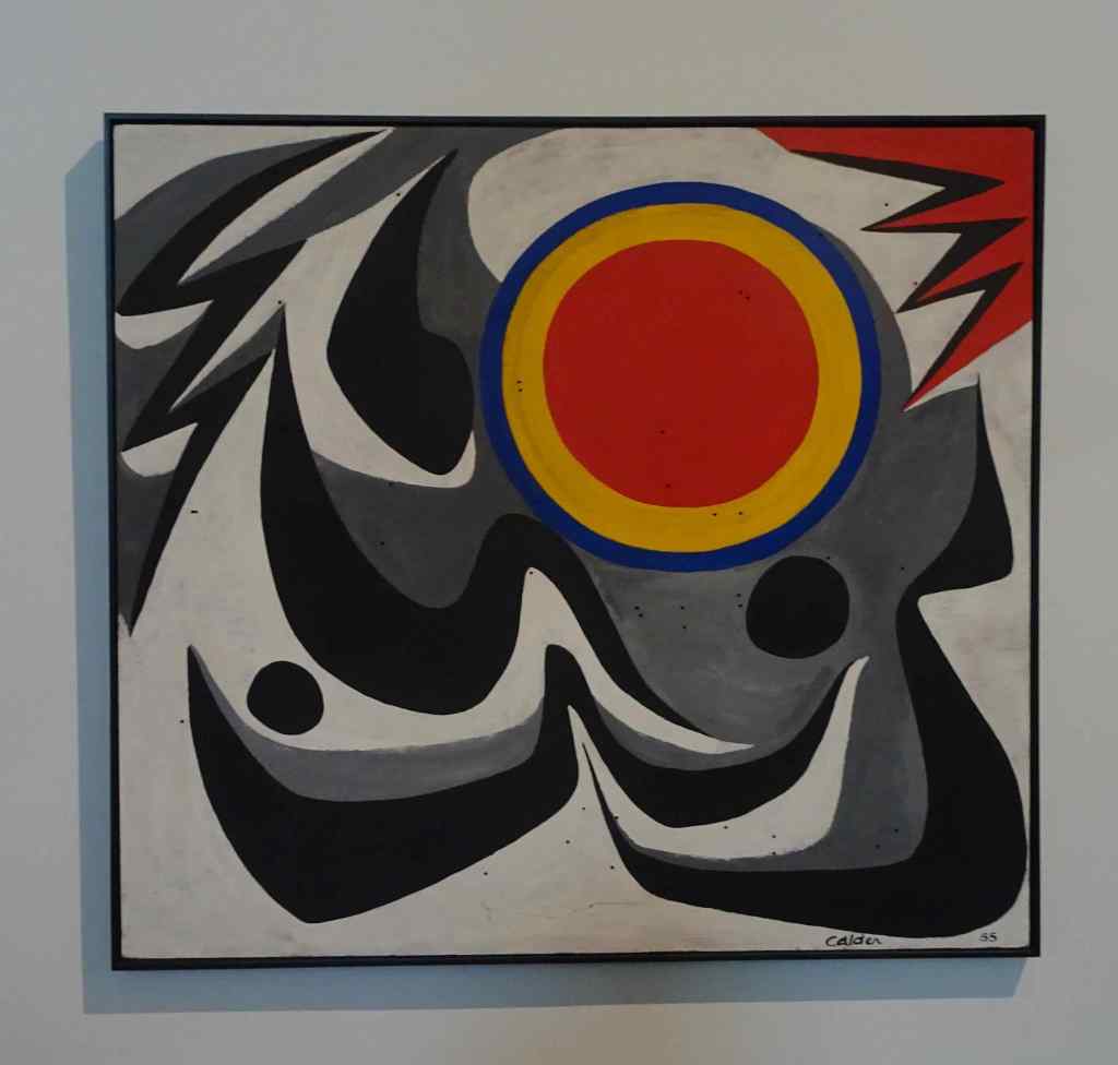
There were many colorful paintings in the lower gallery. I love the bright colors and organic shapes!
Untitled, c. 1945Untitled, 1946São Paulo, 1955The Green Stripe, 1963William Penn, 1888, by Alexander Milne Calder. This is a smaller version of the bronze William Penn Statue atop the Philadelphia City Hall, which was created by Alexander Calder’s grandfather.
After our museum visit, we walked around in the Passyunk neighborhood, and found an Italian Restaurant for another delicious dinner.
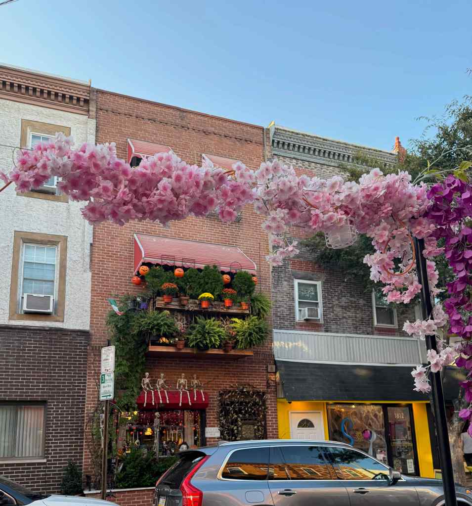
East Passyunk Avenue NeighborhoodHalloween prepPub marqueePhiladelphia themed store.
10/4 – Valley Forge, PA
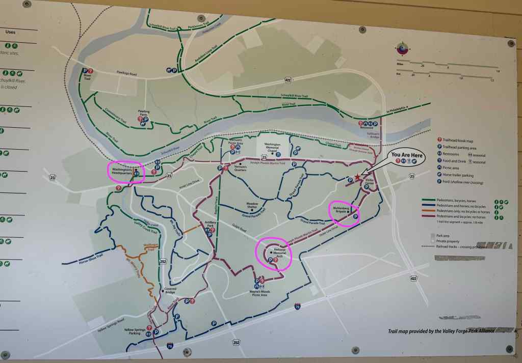
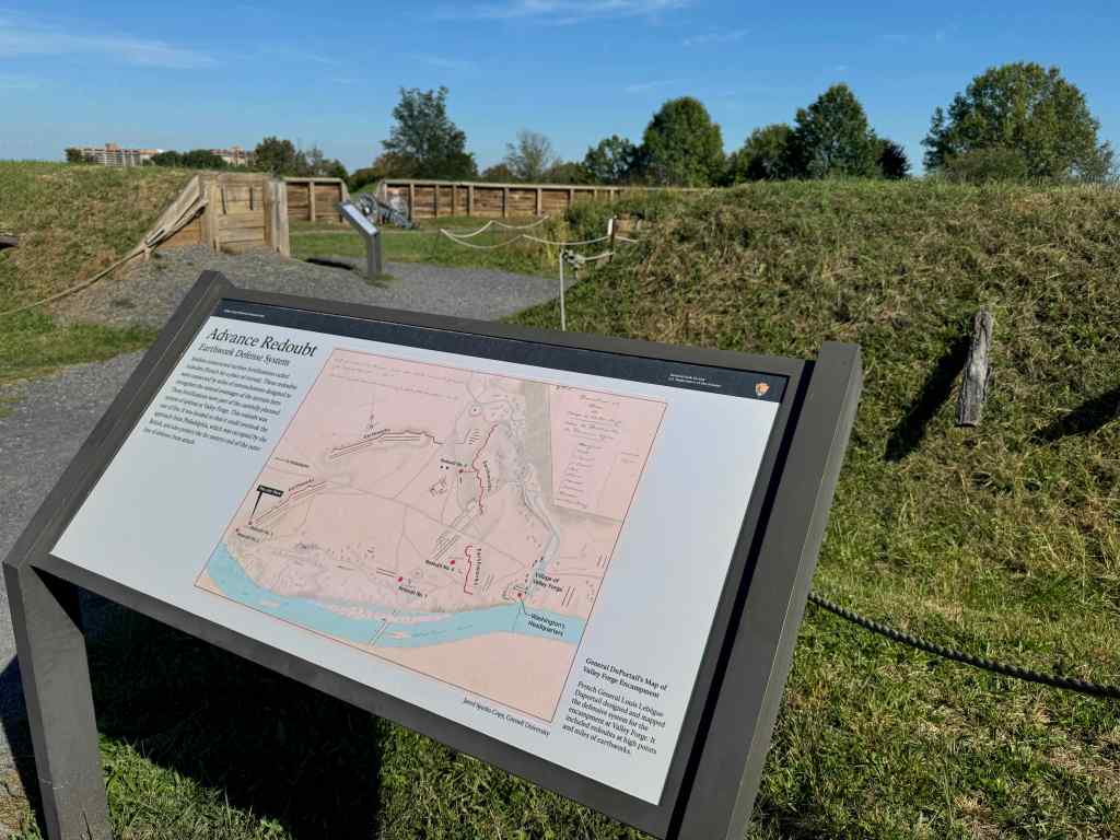
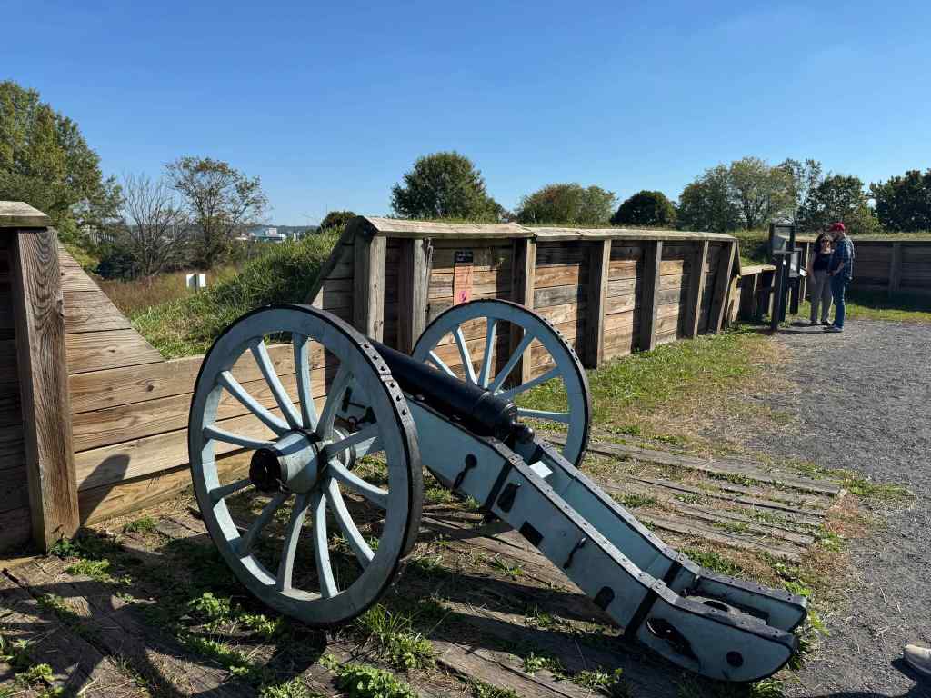
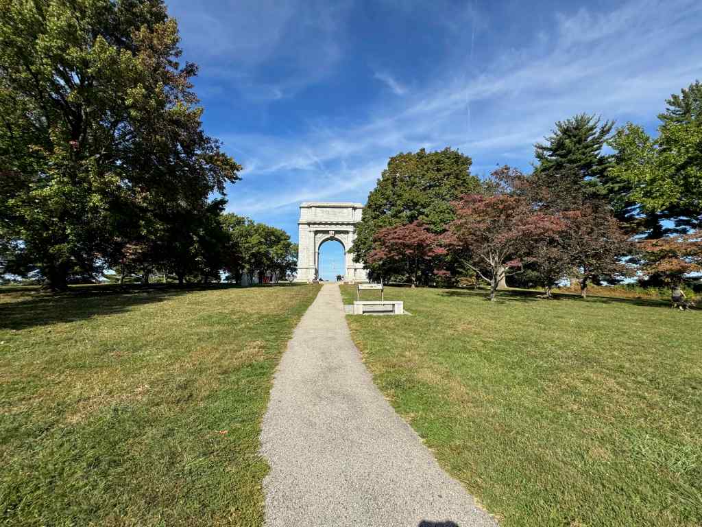
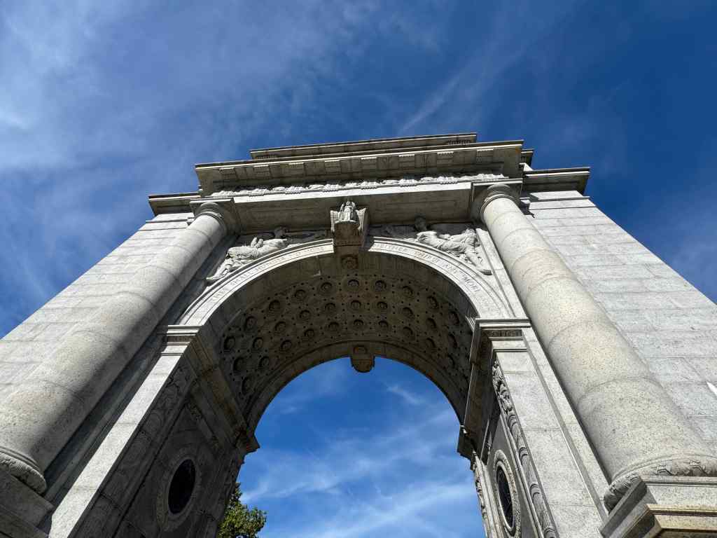
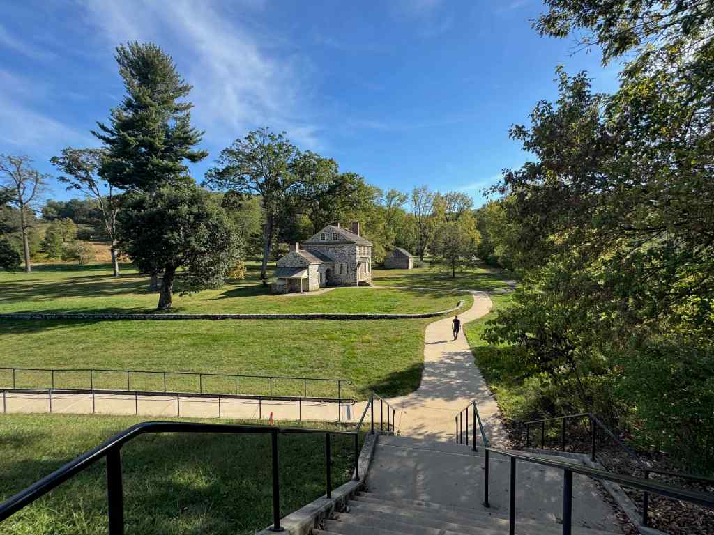
We visited Valley Forge Historic Site, where George Washington’s army of 12,000 people camped during the winter of 1777-1778. This park is huge, encompassing 3500 acres. There are miles of walking trails, and bike and horse paths. We looked at reconstructed cabins and defensive structures, the National Memorial Arch, and George Washington’s Headquarters.
Map of Valley Forge; sites we visited circled in pink.A redoubt, or defensive structure. Note the city skyline in the distance.One of the cannons.Reconstructed cabins; each provided accommodation for 12 soldiers.The National Memorial Arch, dedicated in 1917.Memorial Arch inscription.Memorial ArchGeorge Washington’s HeadquartersRestored in 2009.Tours of this building were unavailable today due to the government shut down.
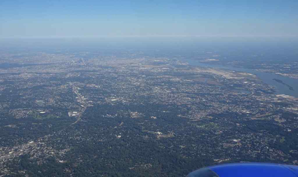
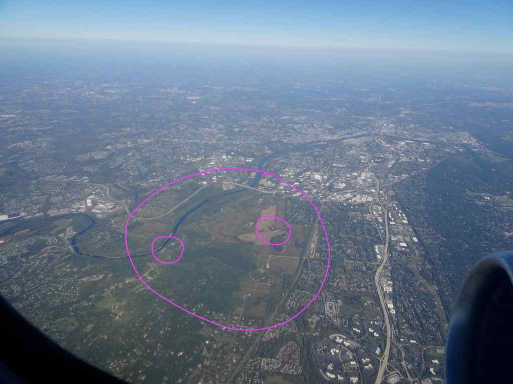
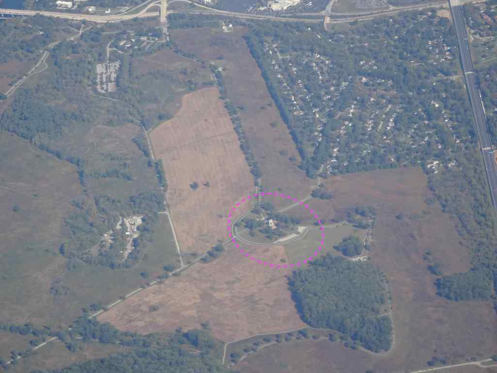
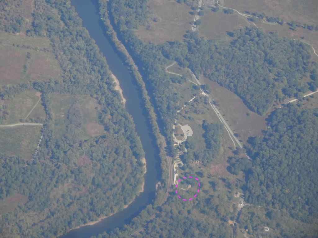
Unfortunately, none of the buildings or Visitor Centers were open, and it was too hot to stay outside. We went to nearby King of Prussia to find a cold beverage, and then to meet up with our soon to be in-laws for dinner. What I didn’t expect was that I would see Valley Forge from the air during our flight home tomorrow.
10/5 – Philly to Chicago, then PDX
I had great views on our flight to Midway Airport, Chicago. Once we left Philadelphia, I realized we were flying over Valley Forge. Having been there the day before, I recognized the road pattern and the Schuylkill River.
Goodbye to Philadelphia and the Delaware River.Valley Forge circled in pinkNational Memorial ArchGeorge Washington’s Headquarters on the Schuylkill River.
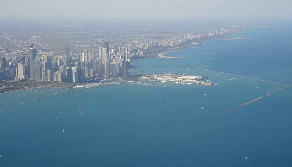
We flew on, over lots of checkerboard farm fields, and rivers cutting through the folded landscape. I also got a good look at Cleveland and Chicago (and their giant football arenas!)
Looking down on Cleveland, on the shore of Lake Erie, with the Cuyahoga River winding through.Flying over Lake Michigan into Chicago.Closer view as we descend to Midway Airport.
Our connecting flight to Portland was after sunset, so I didn’t see much. I thought about watching the earth go by beneath me from the air; all the baseball diamonds and soccer fields, farms and towns, all the people down there going about their day while I fly above. It gives me perspective about my tiny place in this great big world. Overall it was an enjoyable trip, especially for the family connections reinforced and new connections made.
In September we visited an art festival, and went on two hikes in the mountains, and one at the beach. I took my usual neighborhood walks, read a few books, and made very little notable progress on my ongoing knitting projects. At the end of the month, we flew to the east coast to visit family there (next post).
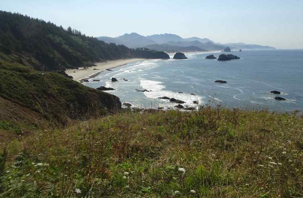
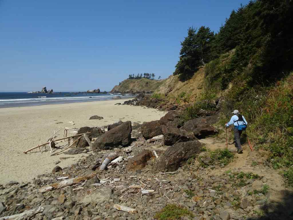
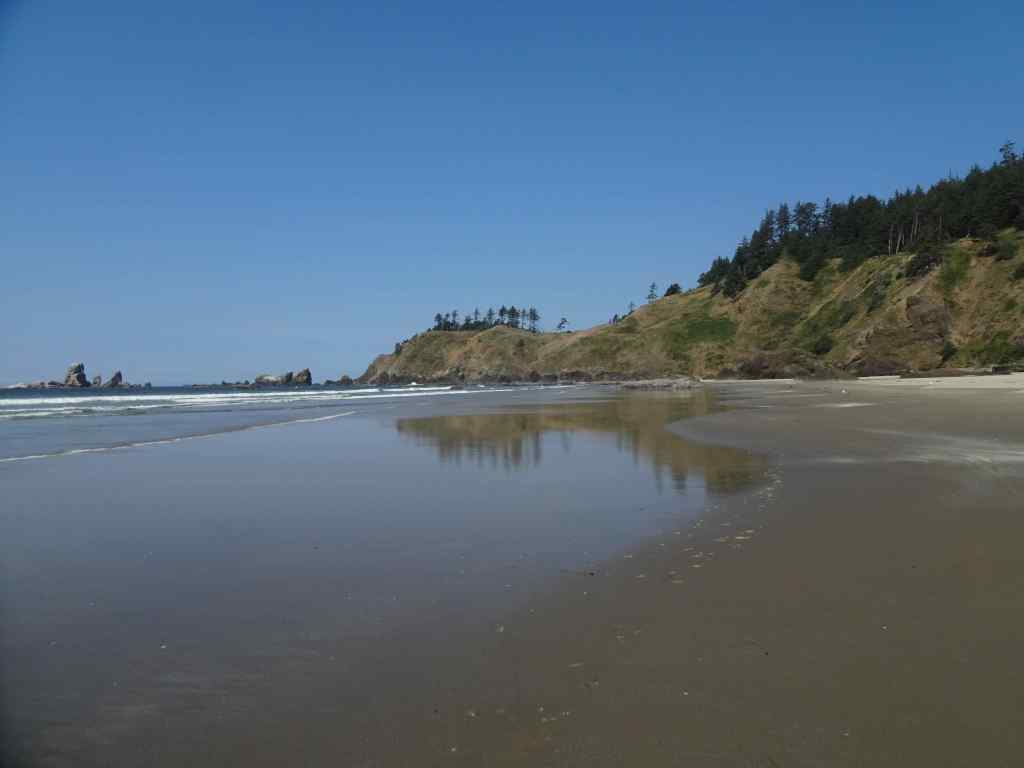
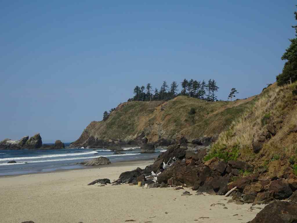
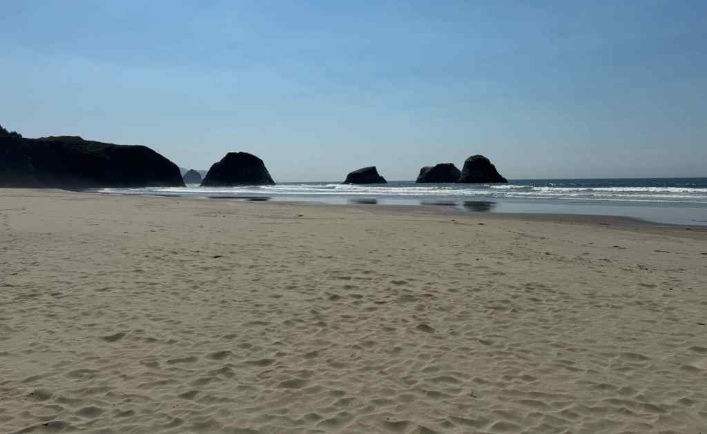
A hot day in Portland. We drove to the coast for a short hike to Crescent Beach in Ecola State Park, then went to Cannon Beach to walk near Haystack Rock at low tide.
View to Crescent Beach and Cannon Beach from Ecola Point.Trail through the forest, about 3 miles round trip.Descending to Crescent Beach, looking south.Looking north.We walked down the beach and found a spot to eat lunch.Zooming in on Ecola Point, where we began our hike. We hiked back up after lunch.South view along Crescent Beach.
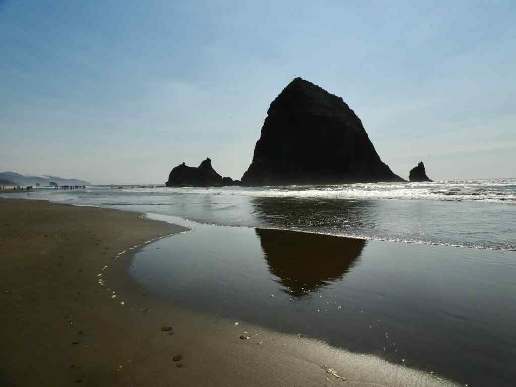
After an ice cream break in Cannon Beach, we walked toward Haystack Rock. It wasn’t a particularly low low tide today. My husband took a much longer walk, while I found a good perch right in front of the Needles, and watched several pods of pelicans fly north along the breaker zone.
Walking toward Haystack Rock.View from my perch in the sand.Zooming in on The Needles, with pelican.Pelicans.
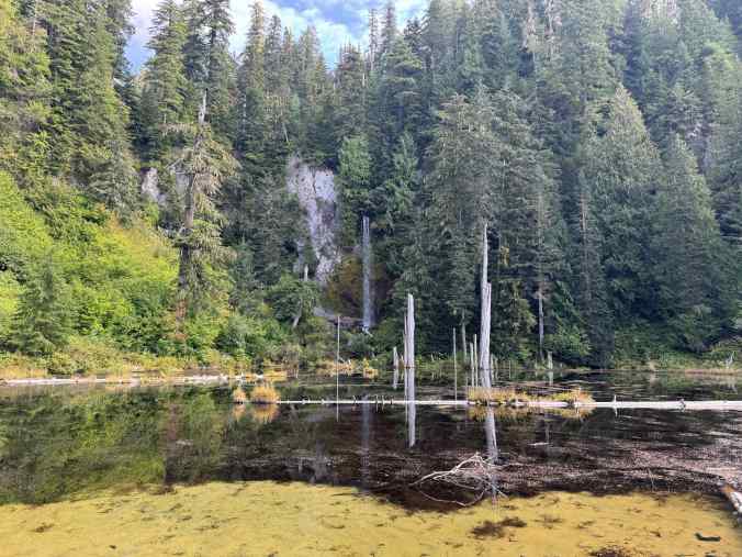
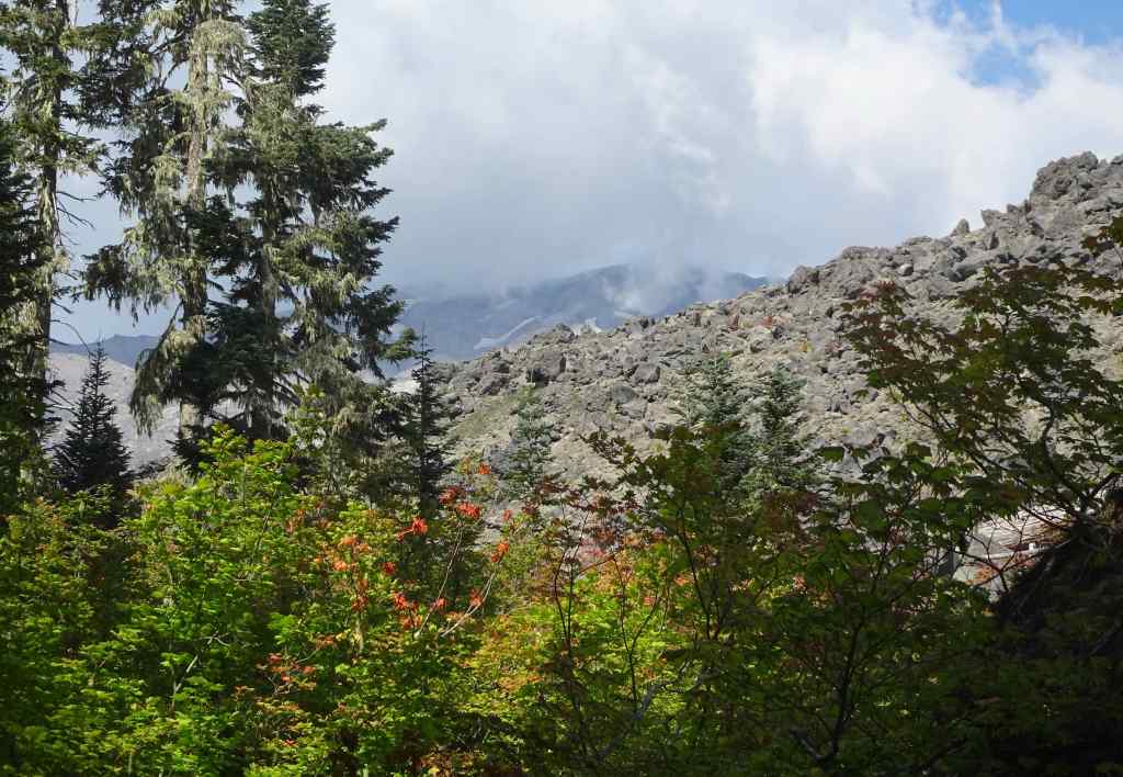
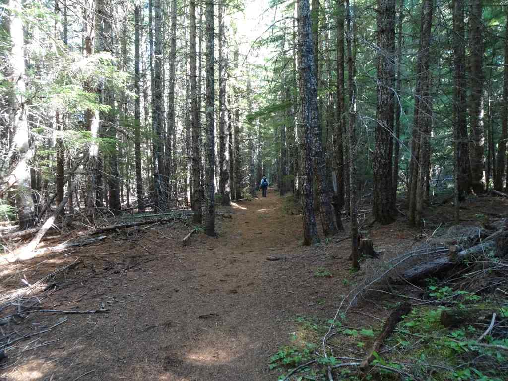
9/10 – June Lake, Mt St Helens, WA
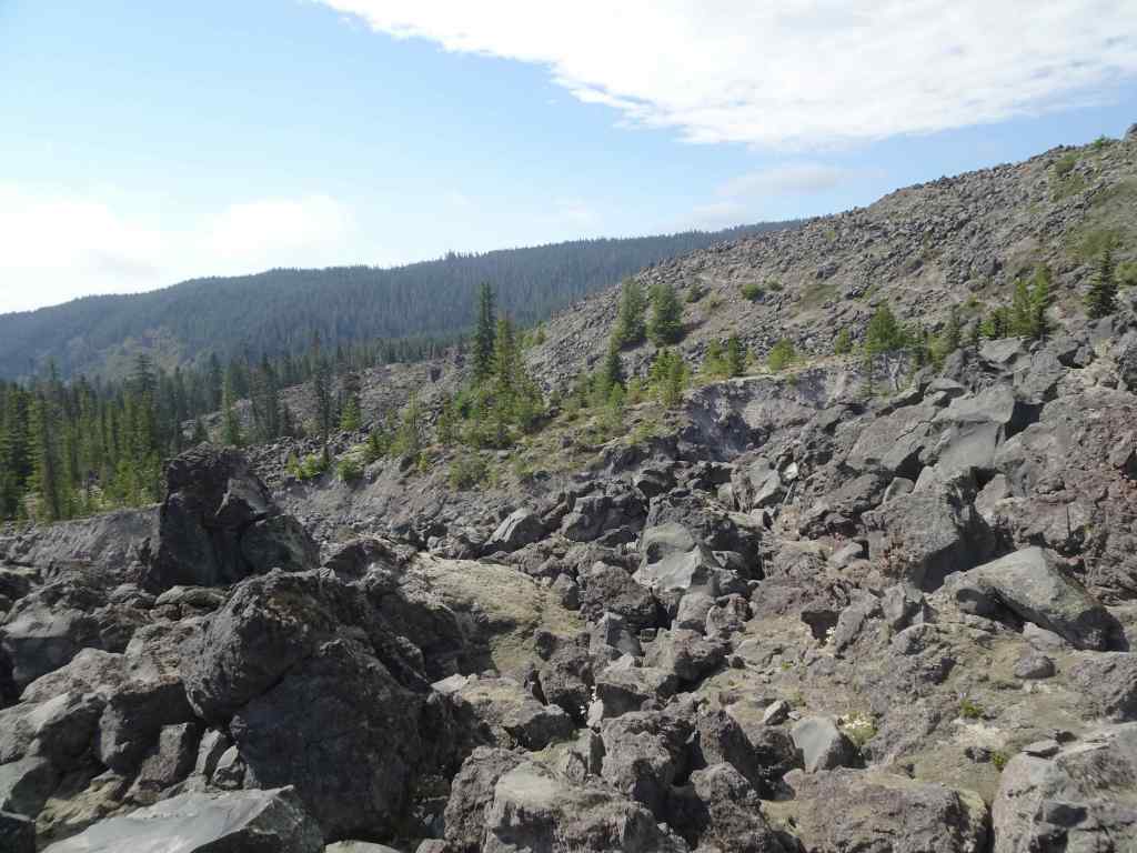
Another hot day. Another relatively easy hike, first to June Lake, then up onto some of the lava flows (Worm Flows) on the south side of the mountain (4 miles, 800 feet).
Trail to June Lake through the forest.
Some of the late wildflowers along the way:
PenstemonFireweed and Pearly everlastingBunchberry
June lake is calm, reflecting the waterfall coming out of the lava flow above.
June Lake
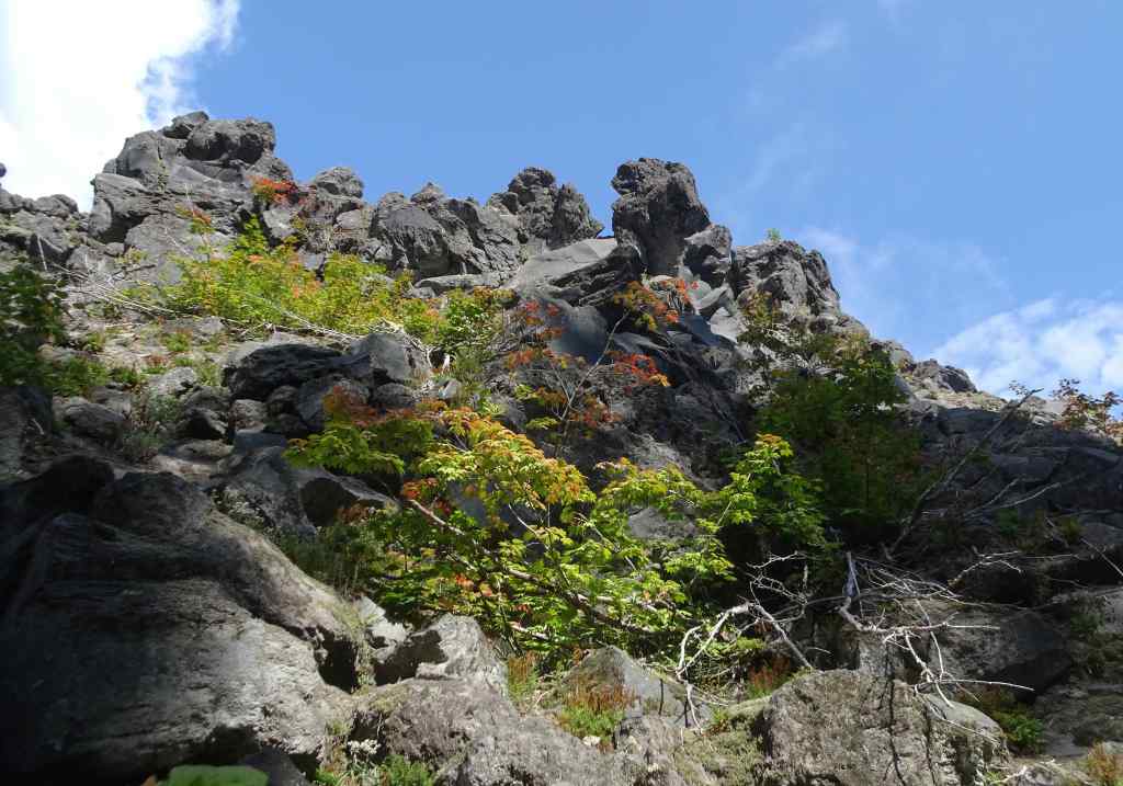
Then we went up a fairly steep trail, and onto the Loowit Trail, and the lava flows:
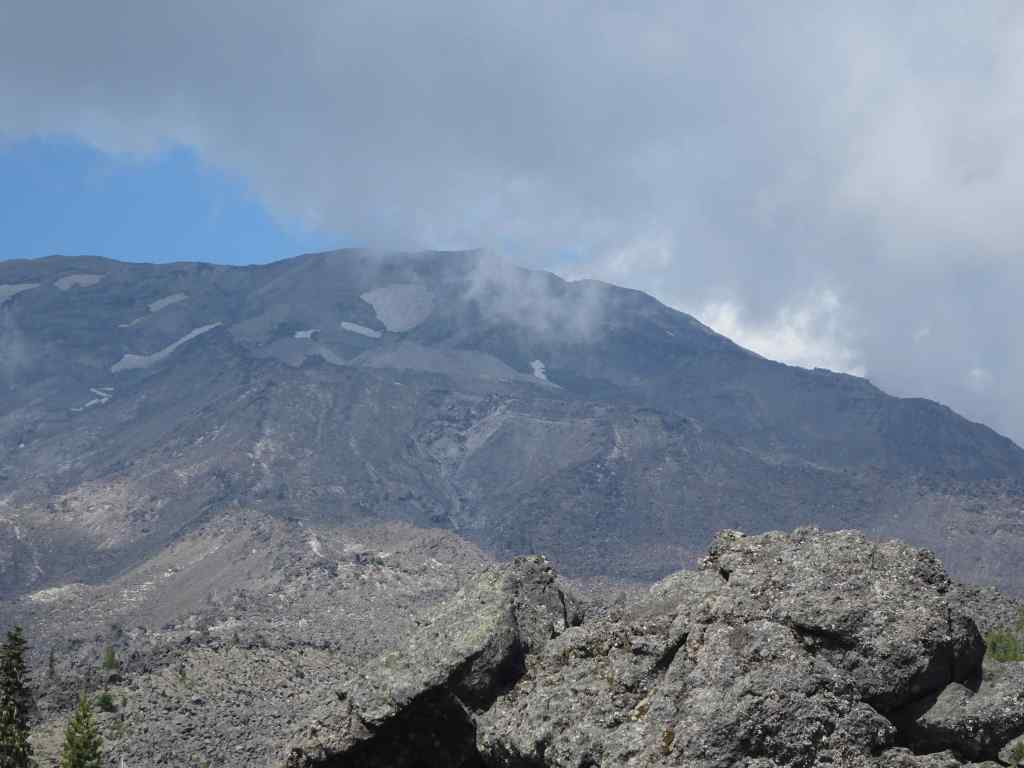
Up the Worm Flows…Vine Maples beginning to turn orange.A few flowers along the rocky trail.A glimpse of the top of Mt St Helens beyond the clouds.We went just high enough to get the full mountain view.Zooming in on a glacier near the summit ridge.The trail not taken ahead – our knees and balance had enough for the day.
We descended, with another stop at the beautifully reflective June Lake…
June LakeJune Lake
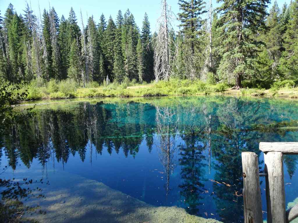
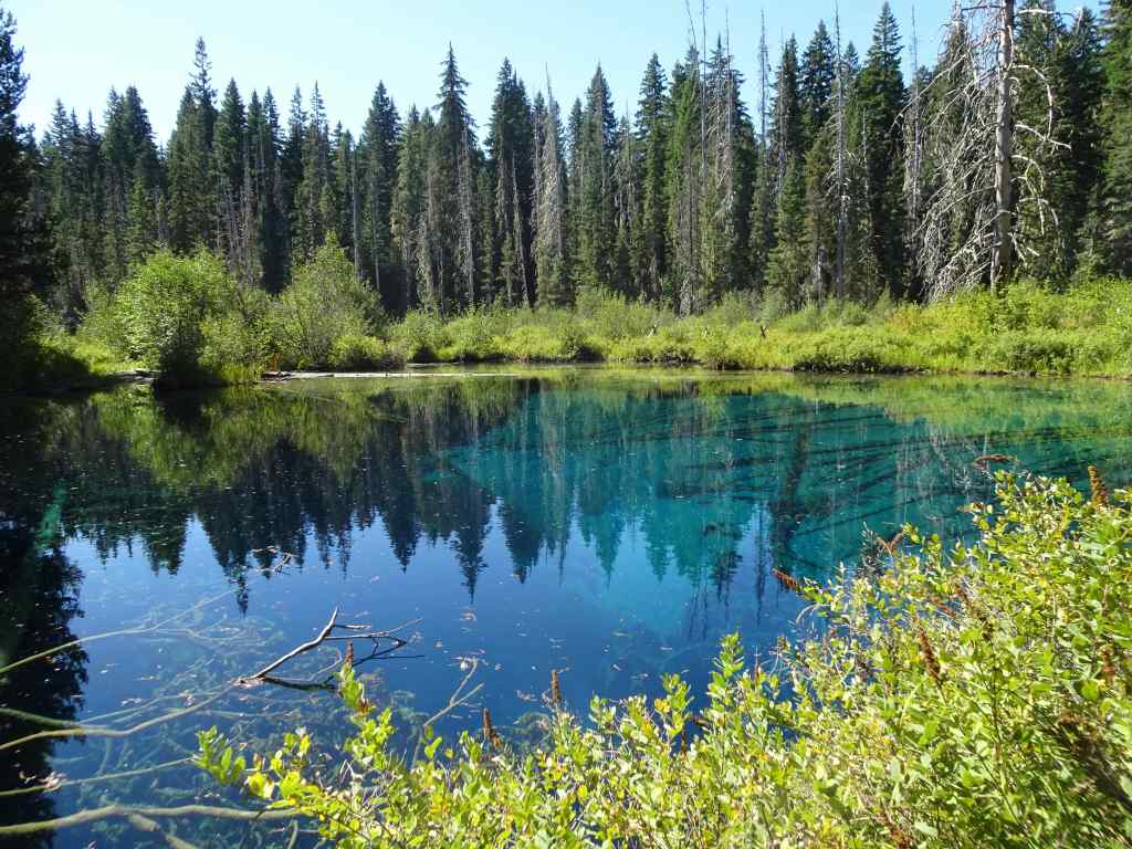
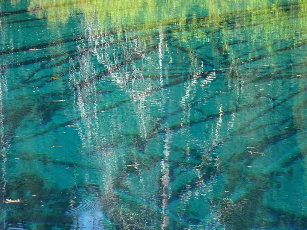
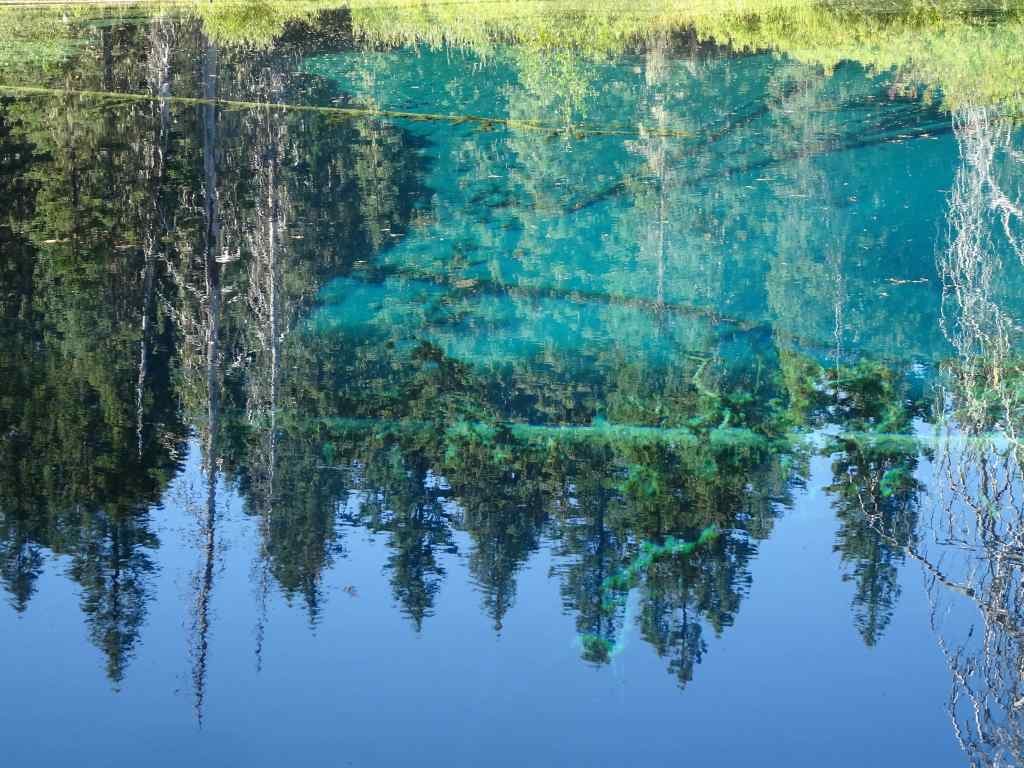
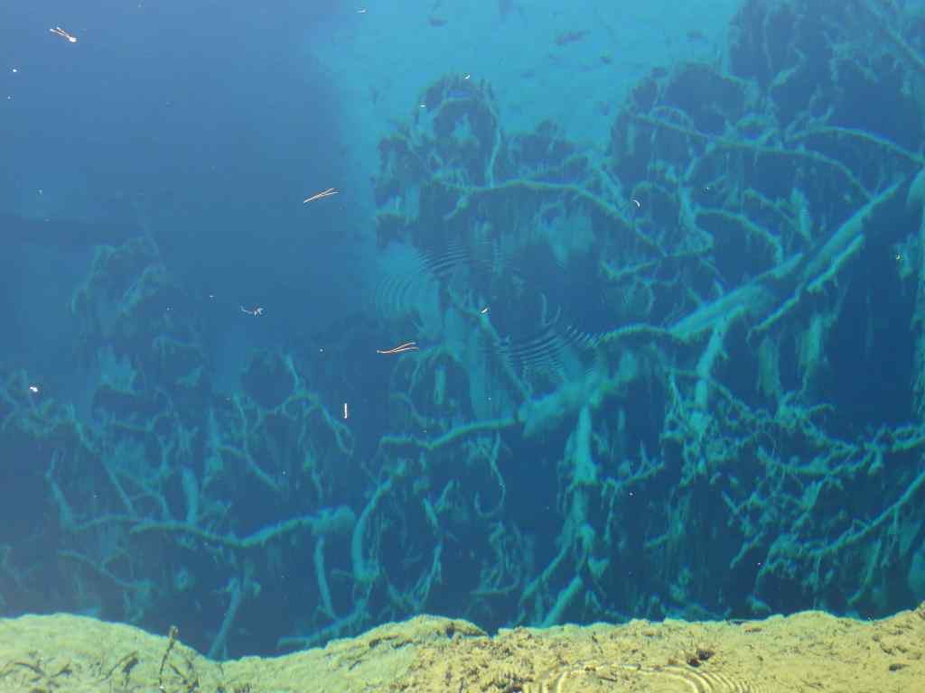
9/16 – Little Crater Lake, Mt Hood, OR
And yet another hot day! Another easy hike, first to Little Crater Lake, then to the eastern edge of Timothy Lake along the Pacific Crest Trail (3.5 miles, 50 feet).
This small artesian spring-fed lake is always a treat, with its deep turquoise color, reflections and transparency. An indulgent photo stop.
Little Crater LakeReflectionsTransparencyGlowing imagesUpside down treesSubmerged branches
We walked to the eastern edge of Timothy Lake, then retraced our steps.
Timothy LakePacific Crest Trail – nice and shady on a hot day.Passing by Little Crater Lake again.
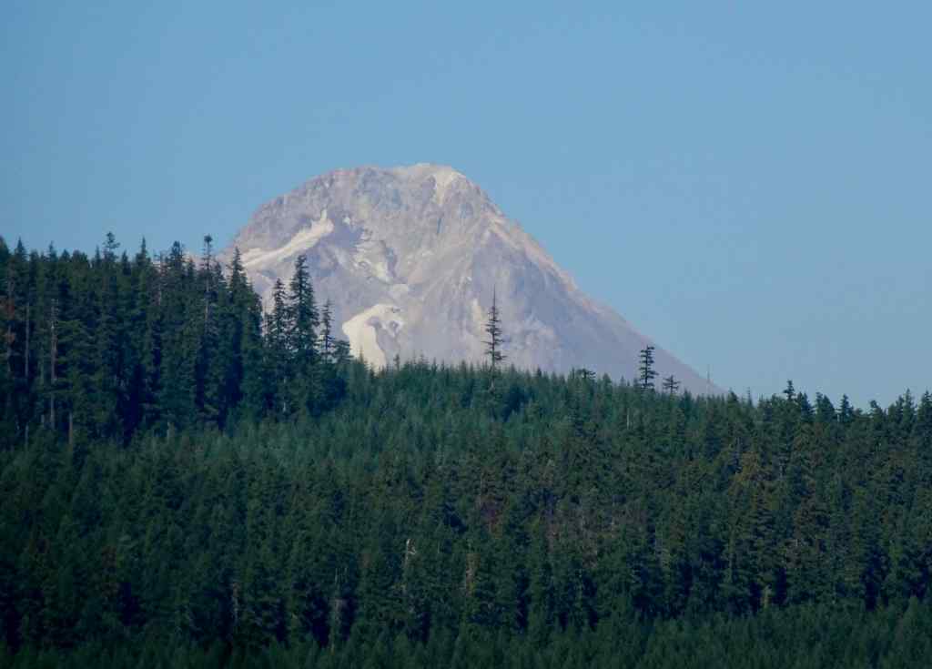
We were told we could see Mt Hood from the Timothy Lake Dam, so we drove around the lake to see the view – it was just a glimpse over a ridge.
Timothy Lake, Mt Hood in the distance.Zoom in to Mt Hood – almost snow free!
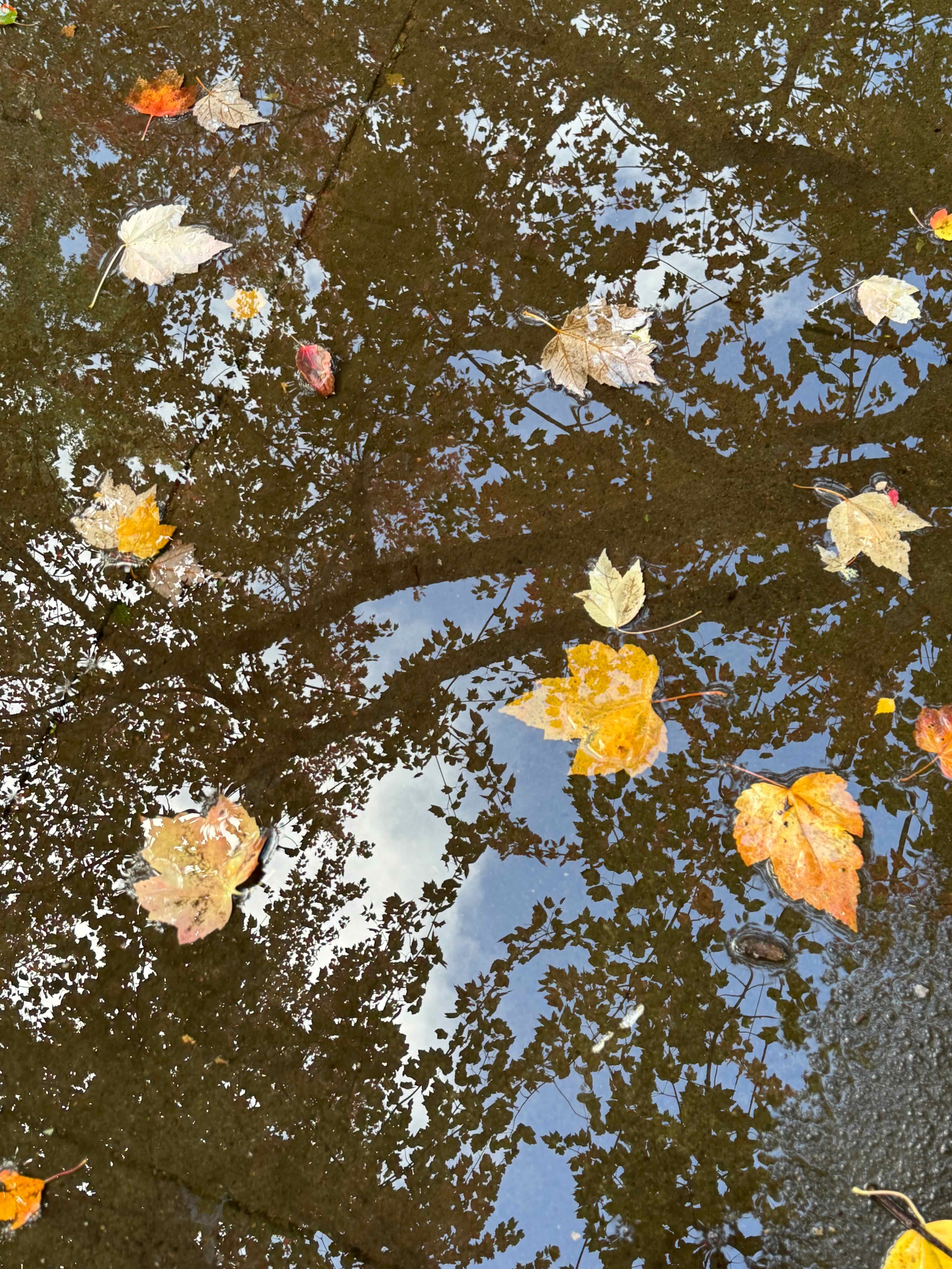
Neighborhood walks
Flowers and landscape elements I noticed in September:
LantanaSunflowersArbutus
I haven’t done much quilting lately, so I composed a concrete quilt from some of my favorite sidewalk cracks.
September books
September books
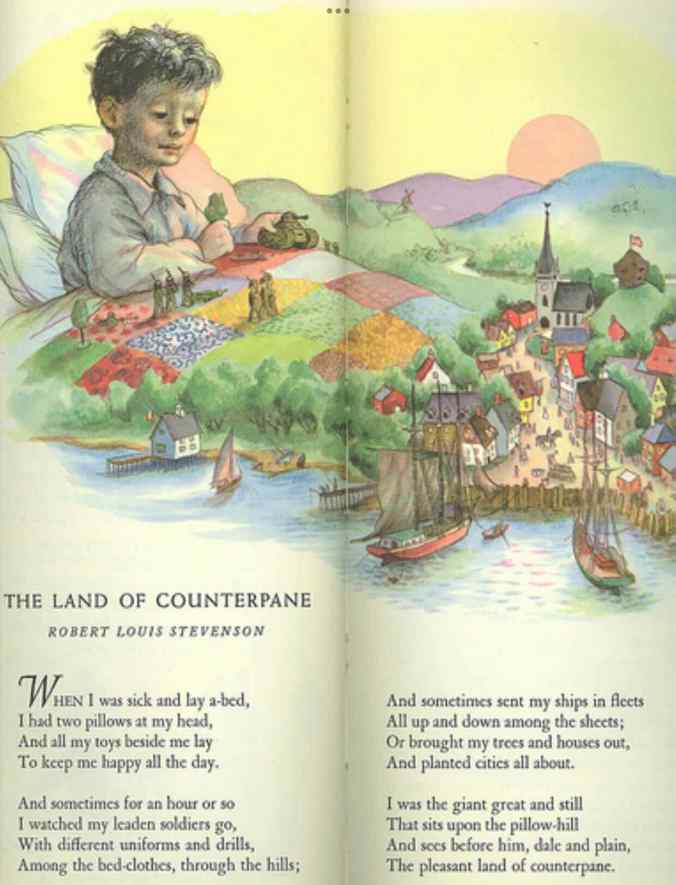
I finished six books in September. The most inspiring was the biography of Robert Louis and Fanny Stevenson – A Wilder Shore, by Camille Peri. They were a very unusual couple for their time. He chose writing instead of the family business of lighthouse engineering. She grew up in rural Indiana, spent time with her first husband in the mining camps of Nevada, then in bohemian San Francisco, before going to France with her children to study art. They traveled all over the world, by horse carriage, train and ship, eventually settling in Samoa. It seems amazing to me that they were so widely travelled, and that she lived her own style, ignoring much of the expected behavior of a proper Victorian lady. I was inspired to reread my childhood copy of his poem, The Land of Counterpane, from A Child’s Garden of Verses, with illustration by Garth Williams – this is one of the definitive visual memories from my childhood – the quilt, and the imaginary play it inspired.
From The Tall Book of Make Believe
Also in Portland…
Things started to heat up. Deliberate misinformation reported a ‘war zone’ throughout the city. The only actual activity is near the Federal ICE facility in southwest Portland, where the true spirit of Portland is on display in peaceful protests that defend free speech and due process. I am writing this in October, when things have gotten crazier but in September, we were just getting ready for threatened invasion! I’m sure I will be adding something about the frogs next month.
Wall art in my neighborhood.Screen shot of local fiber arts.
August began with a birthday week stay in Bandon on the southern Oregon coast. The rest of the month went by with the usual home activities, in Portland, Oregon, which, contrary to some news reports, is a very pleasant place to live.
Around the neighborhood –
Lots to look at this month while walking – gardens…
Sidewalk art, architecture, and more Portland quirkiness…
Yard creatures…
Homegrown treats…
Asters that survived the roofing, painting and tuck pointing.Our neighbors shared their abundant tomatoes.
Knitting –
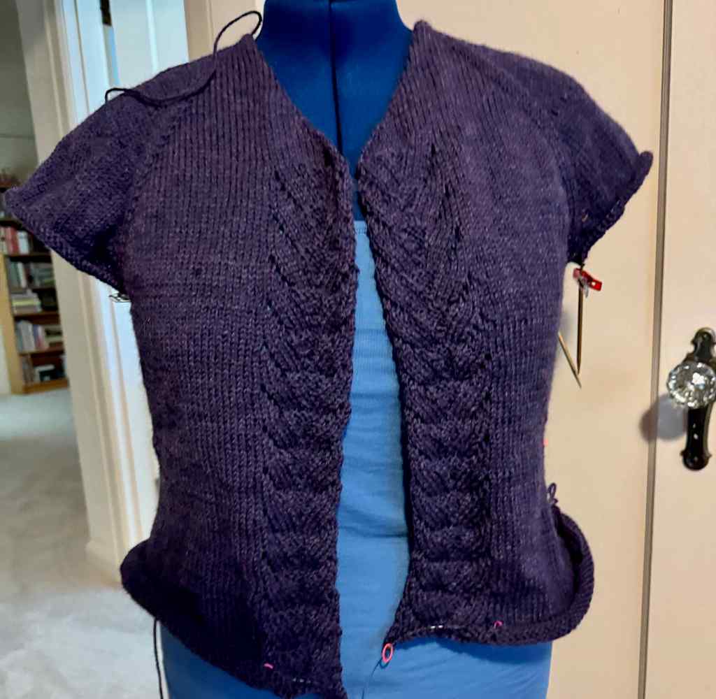
I made progress on my cardigan and a pair of socks. Our local coffee shop, KISS Coffee, has taken to reserving our Friday morning knitting table.
Reading –
Of the eight books I finished in August, my favorite was There Are Rivers In The Sky, by Elif Shafak. It is set in Victorian and modern London, and ancient and modern Mesopotamia, and links several character’s lives through water and literature. There is a hopeful conclusion, despite the hardships endured. I also enjoyed rereading the Elizabeth Von Amin books set in her German garden.
Eight books read in August 2025
8/19 – A walk in the Wildwood Recreation Area –
This was the only hike for me in August, after our trip to Bandon. Usually August is a prime hiking month for us, but I had to address some health issues. There were many appointments, including PT for my wonky hip. Everything seems to be getting better, so I hope to have many more challenging hikes in the future. But one hot day, we drove up Mt Hood to the Wildwood Recreation Area, which we had not visited before. This is a BLM site, at about 1200 feet elevation, on the Salmon River. There are several miles of mostly flat trails through shady forest, and along the Salmon River. I imagine many school field trips come here because of the easy access, and abundance of educational signage and picnic tables.
Trailhead sign… we walked trails on both sides of the Salmon River.In the parking lot, I watched a Big Leaf Maple leaf slowly float to the ground.The first leaf of fall?Salmon River from the bridgeView to the nearby ridge across a marsh on one of the nature trails.Shady reflections in the waterForest bathing here…More reflectionsSalmon sculptureRiver access for picnickersUnderwater viewing chamberWe saw a few very small fish in the viewing window. Salmon pass through here in spawning season.
The Wildwood Recreation Area was a great spot for some easy forest bathing on a hot summer day.
And lastly –
A few birthday gifts and cards…
An aspirational window sticker seen in the neighborhood…
There is so much going on that I am constantly whiplashing between system overload and full ostrich. It is a challenging time, and yet we will continue to do what we can to be hopeful and helpful.