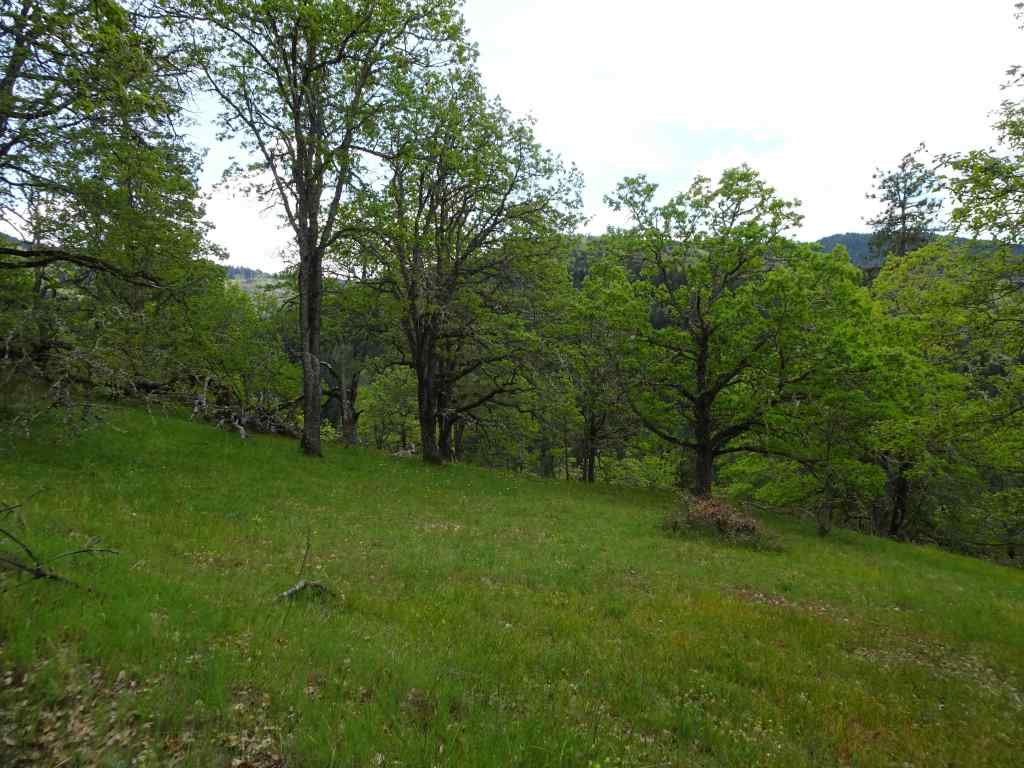
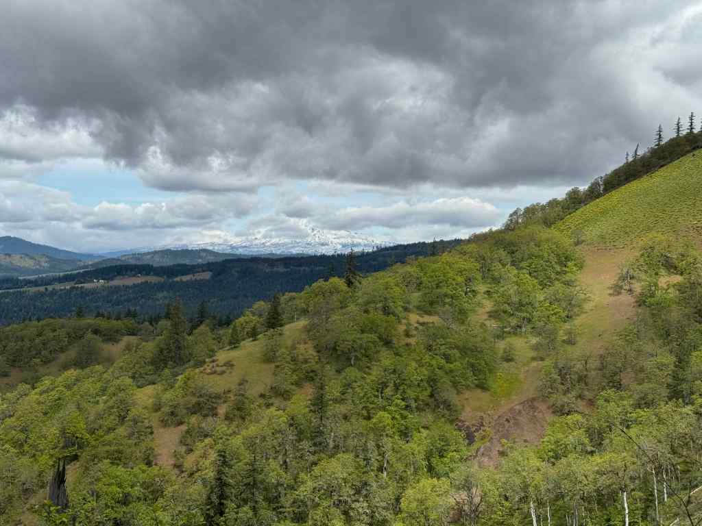
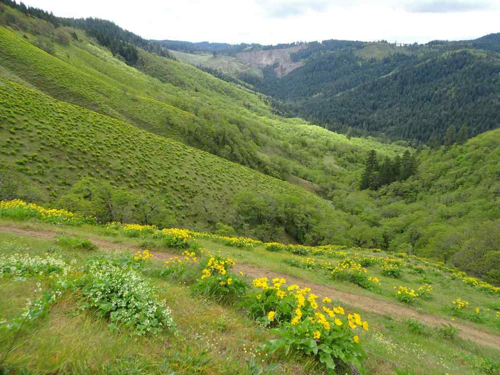
We are back to our usual weekly hiking schedule, with four hikes in May; all repeat hikes, with wildflowers and waterfalls.
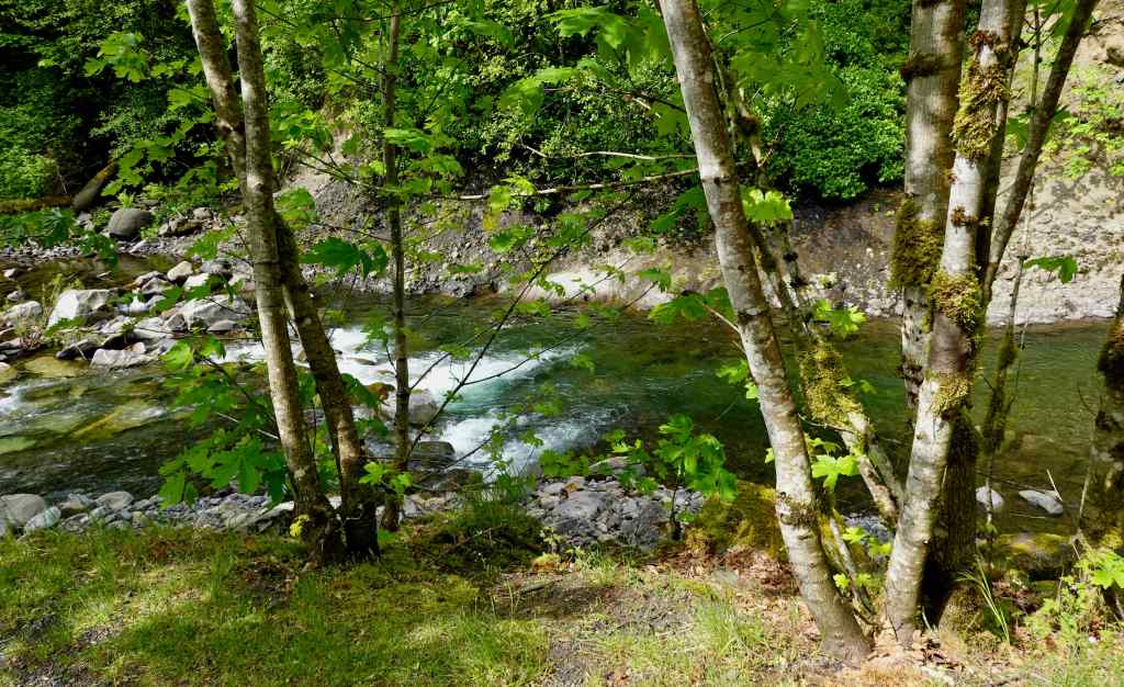
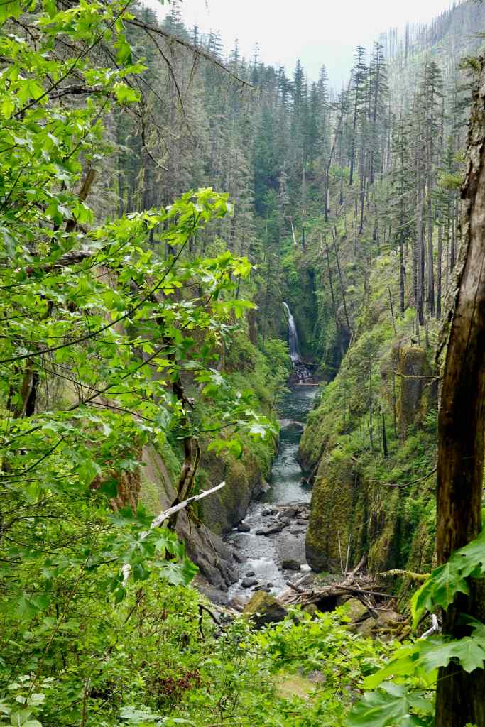
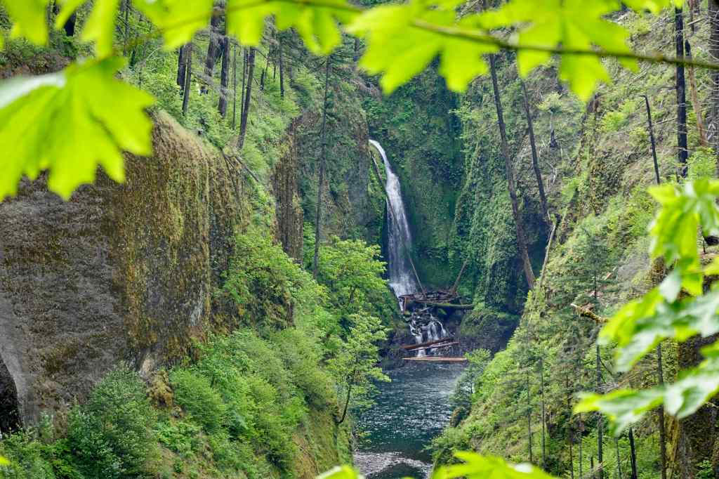
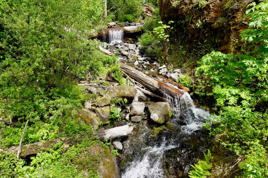
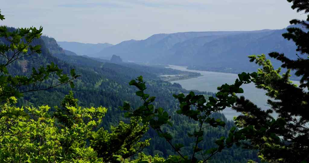
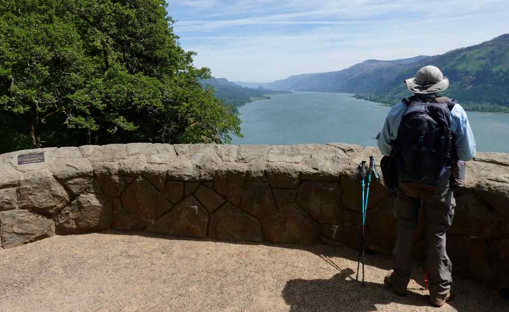
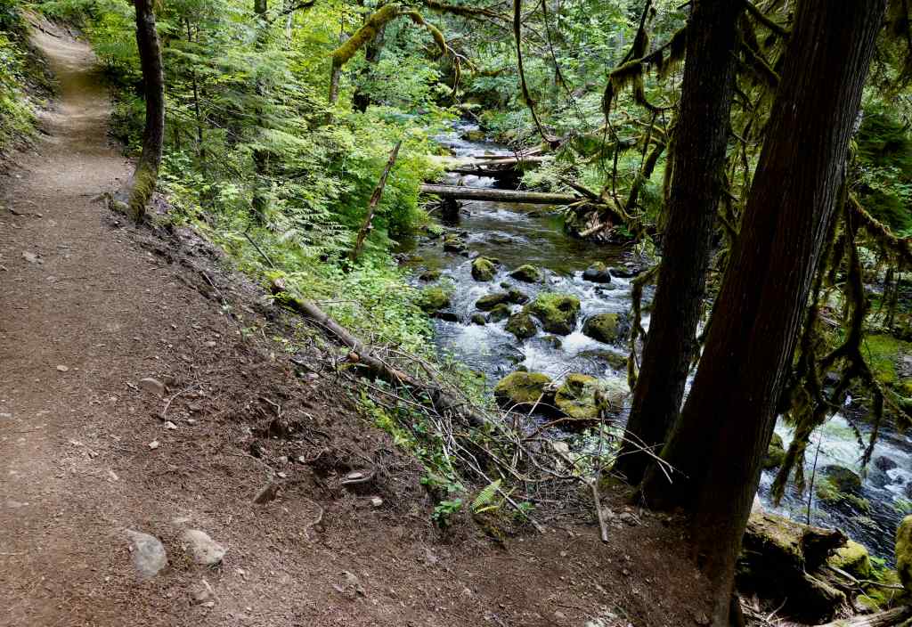
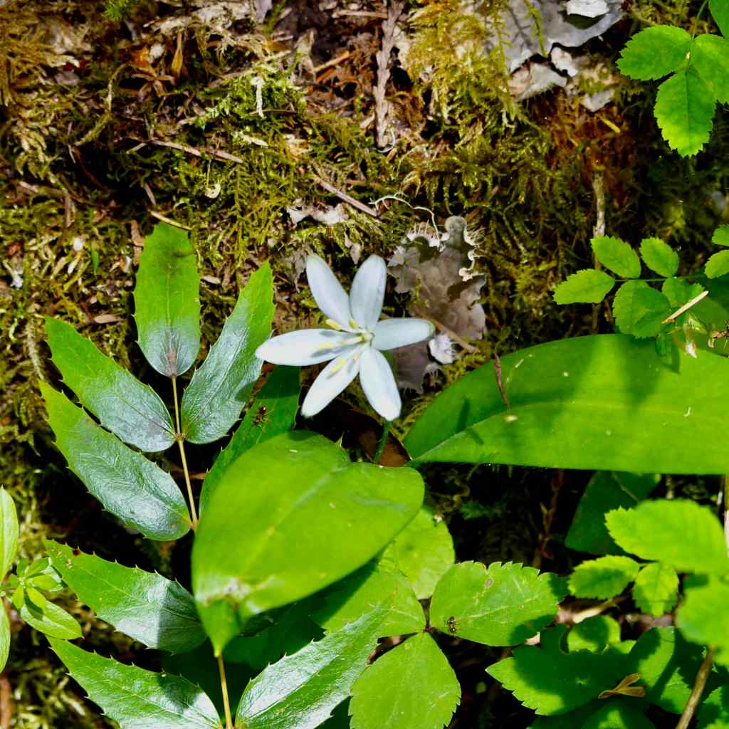
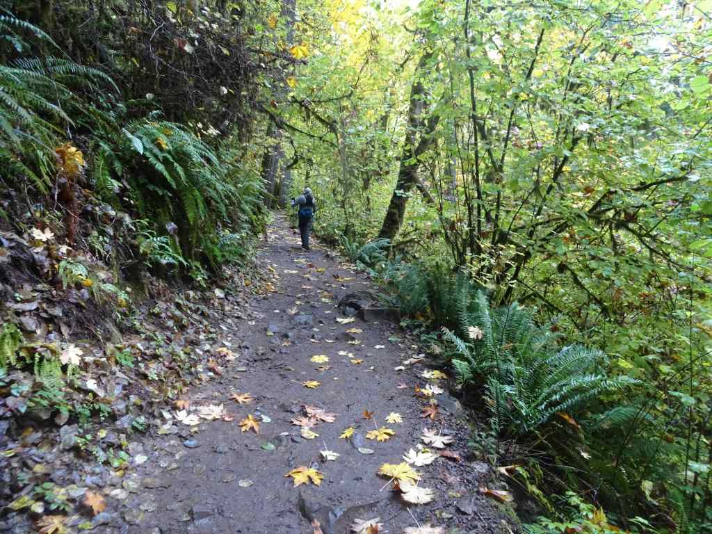
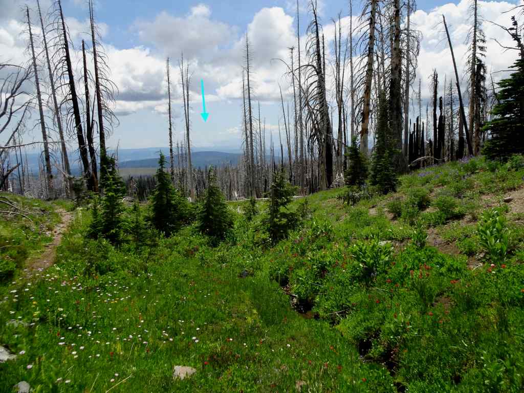
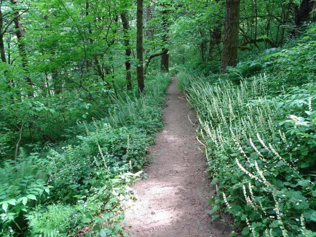
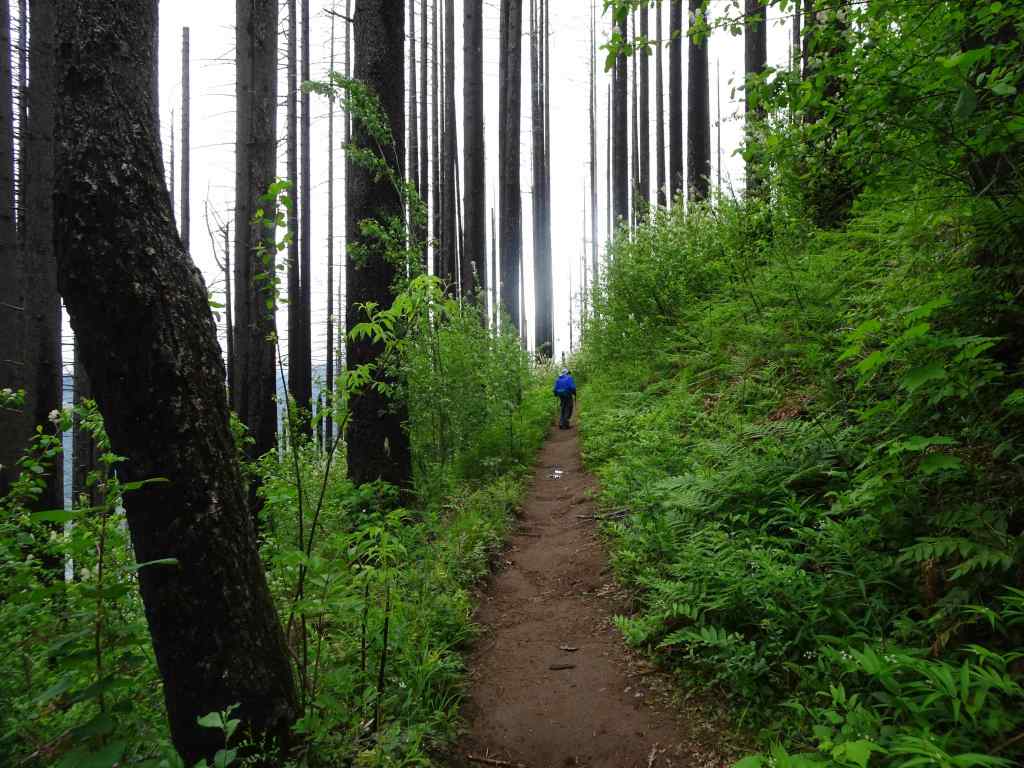
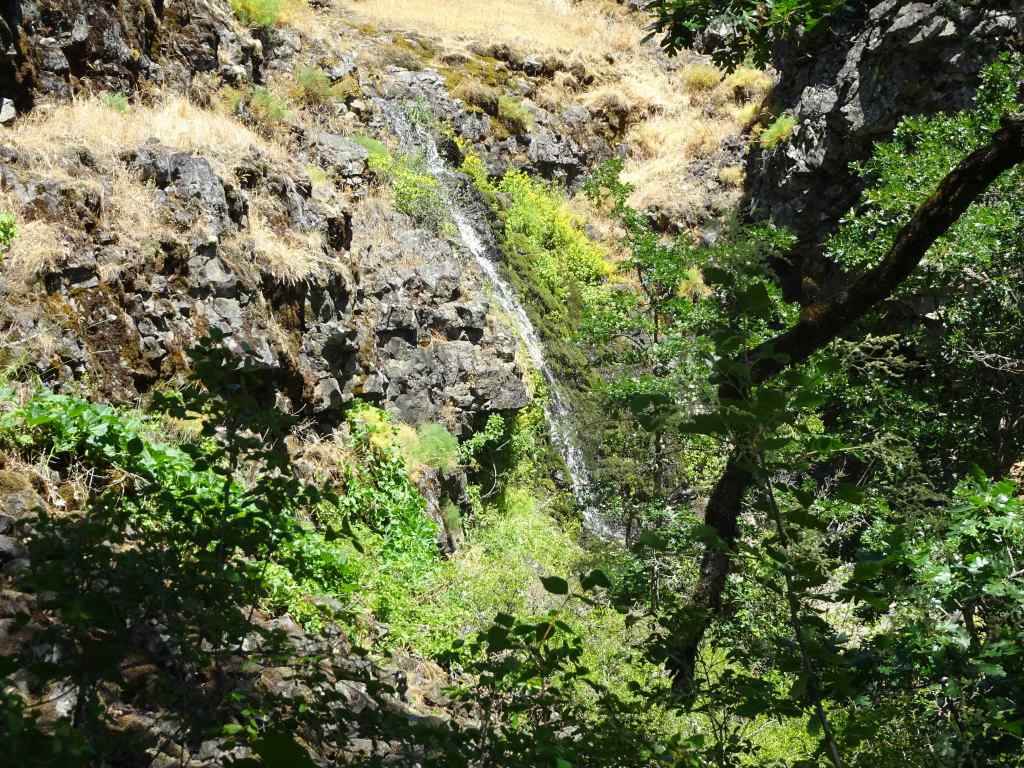
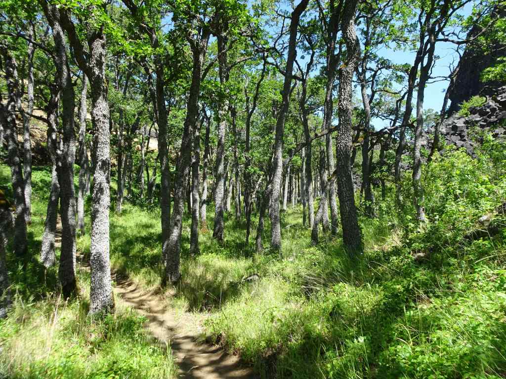
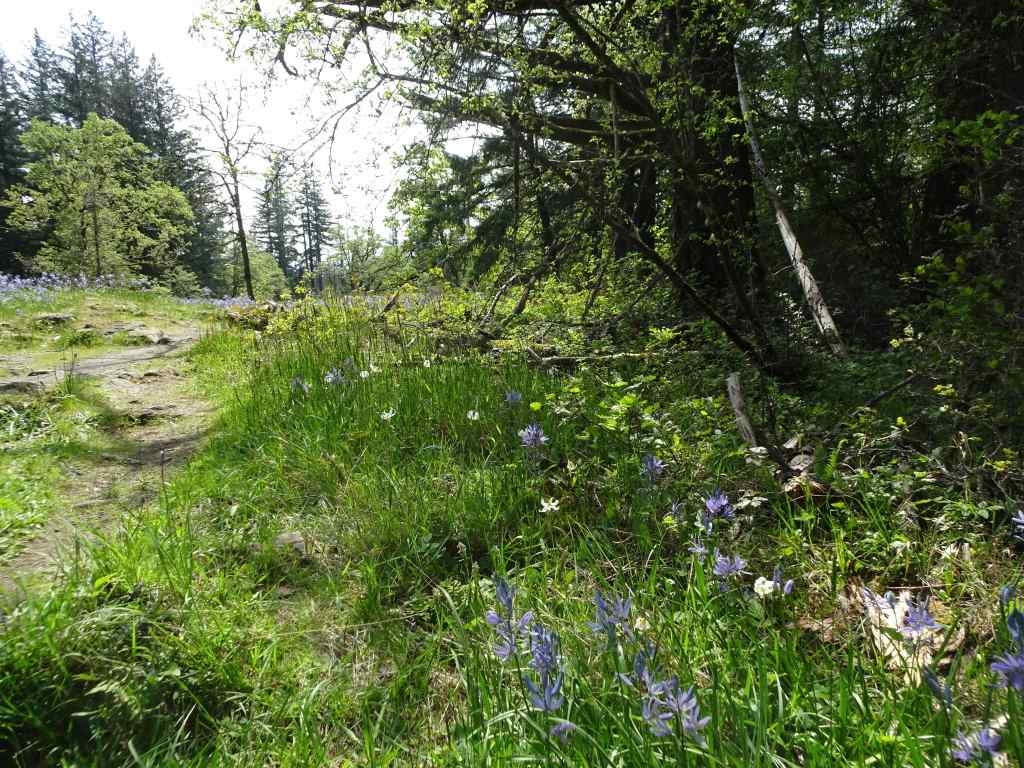
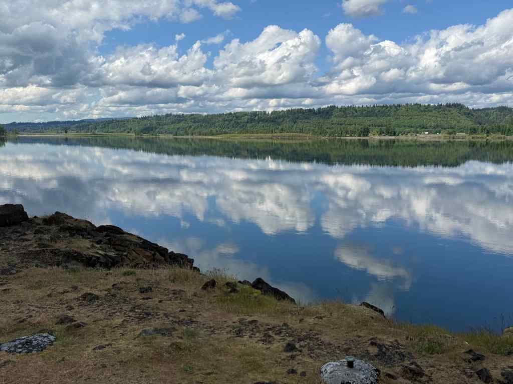
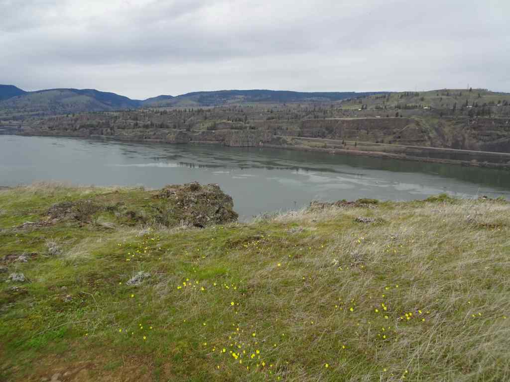
5/6 – Eagle Creek, OR
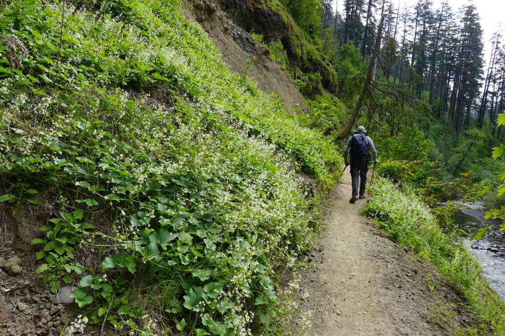
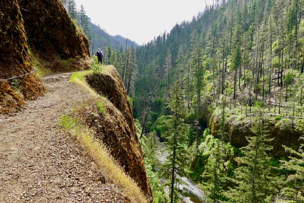
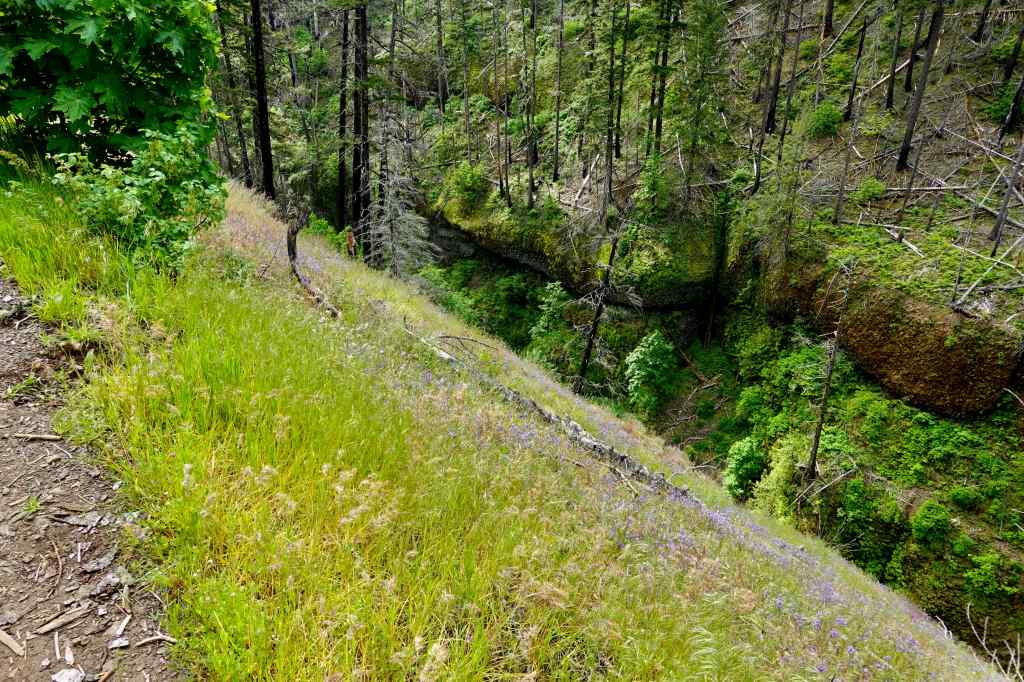
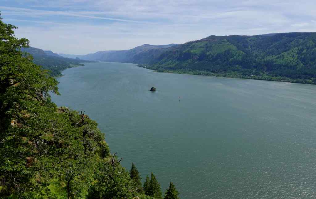
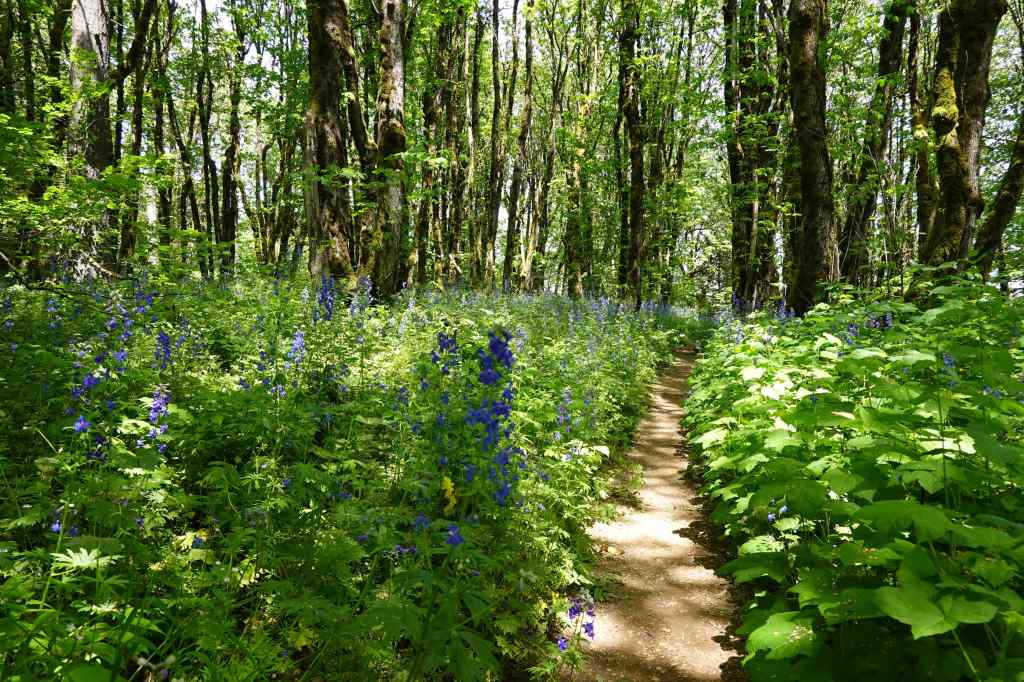
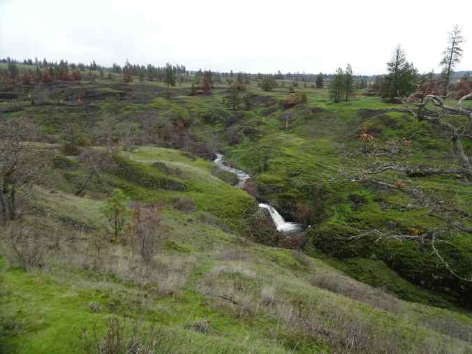
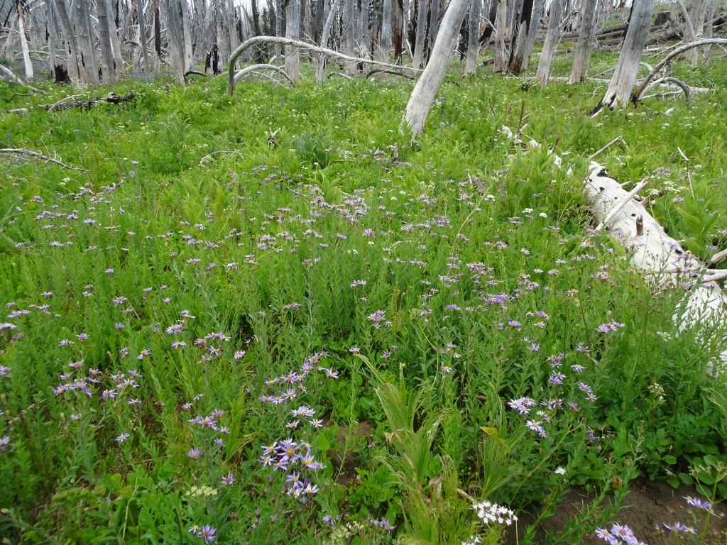
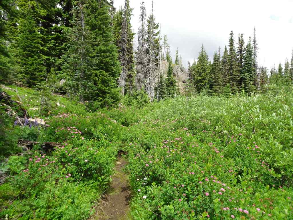
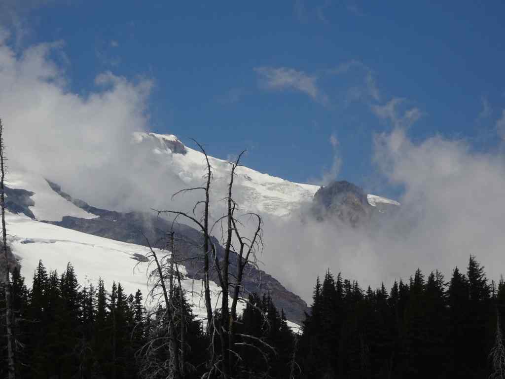
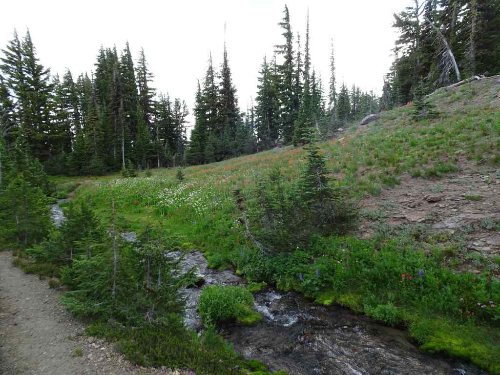
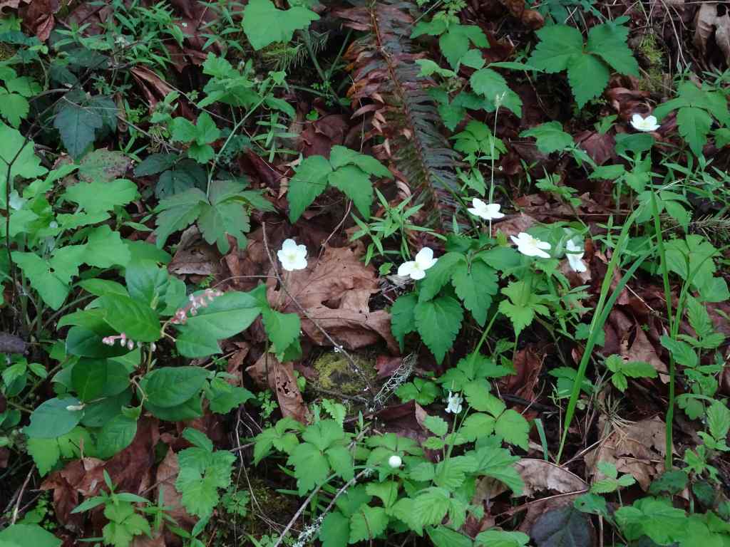
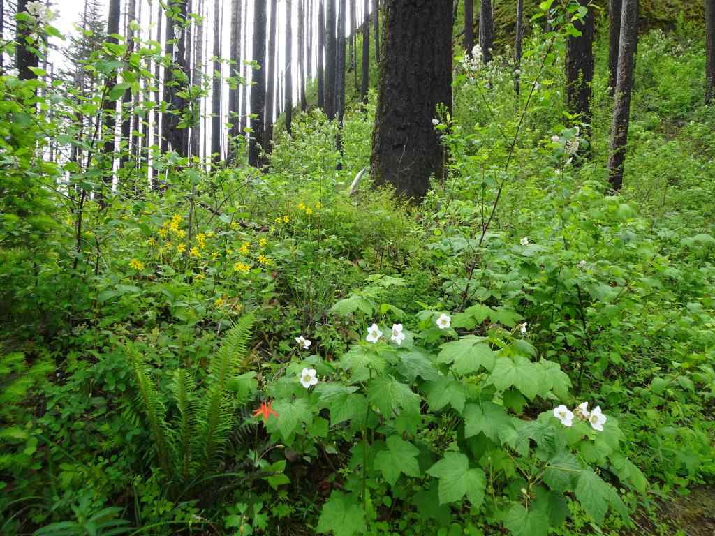
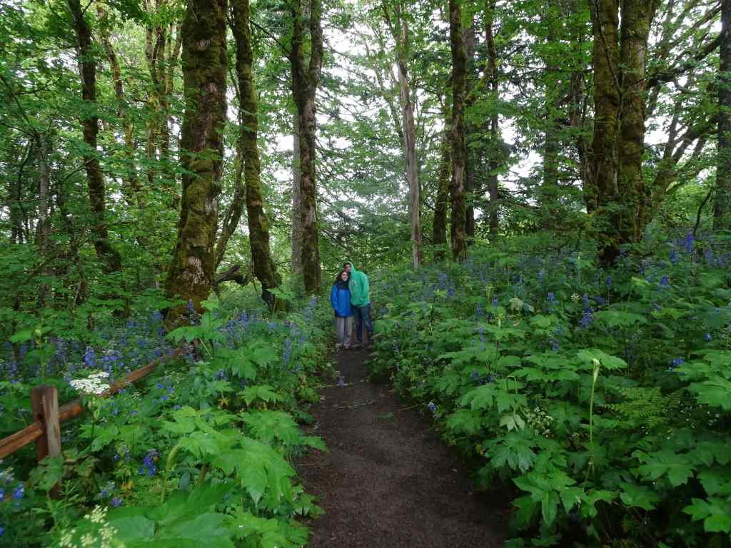
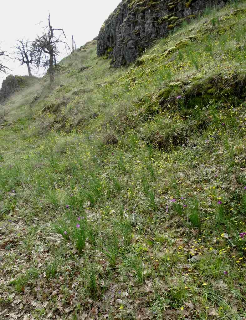
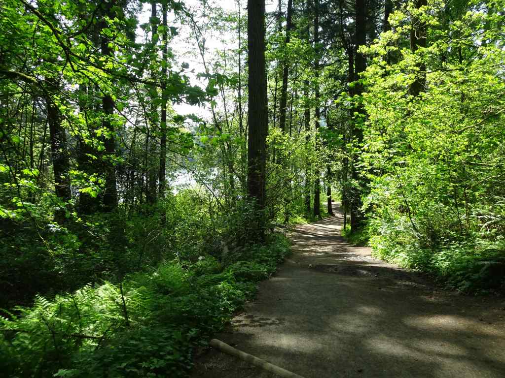
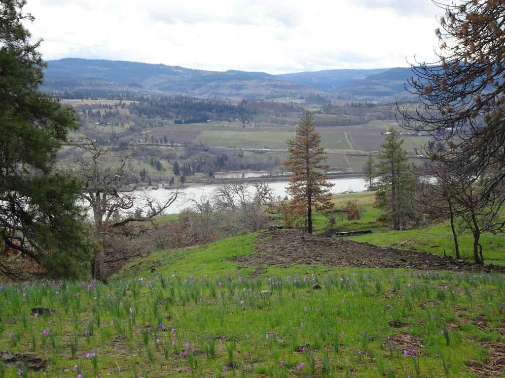
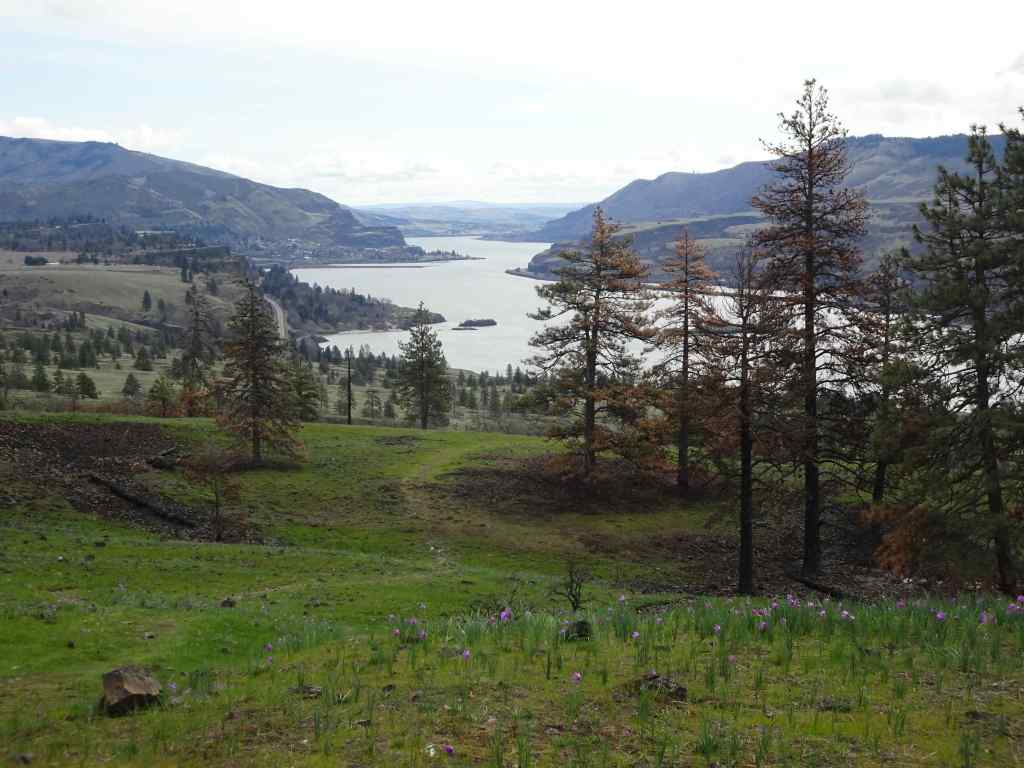
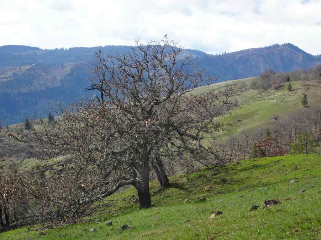
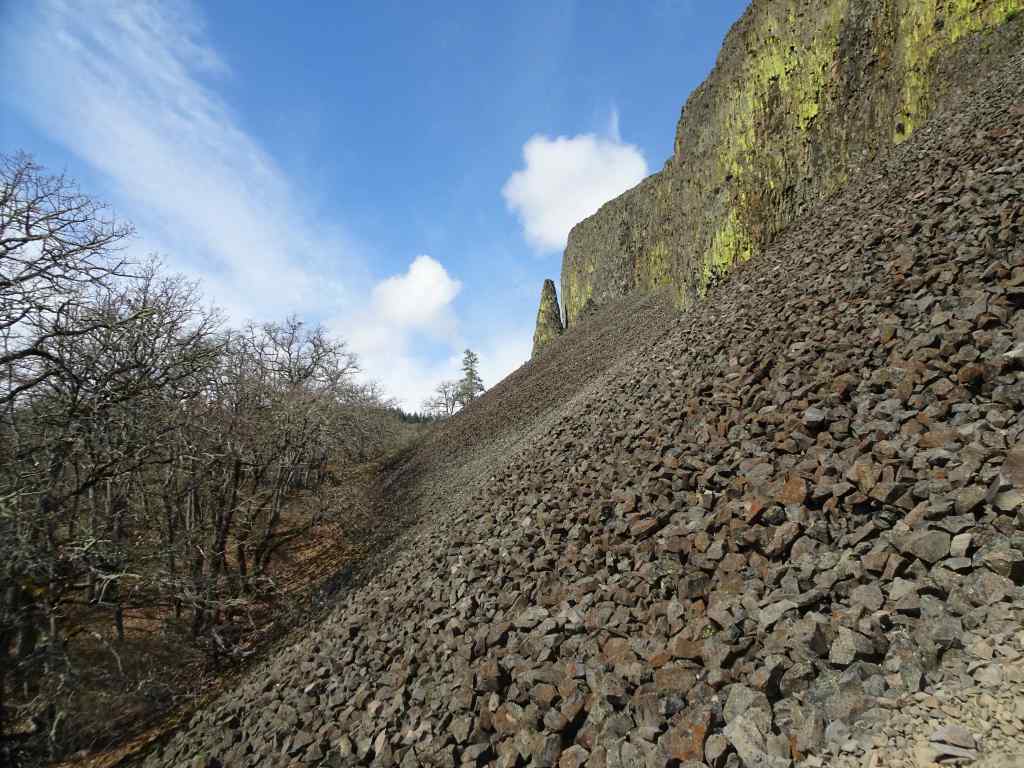
We walked most of the way to the High Bridge on this warm day (5.8 miles, 600 feet). The trail has been recently reopened after repair of landslide and fallen trees from last winter. Still beautiful, with lots of wildflowers.
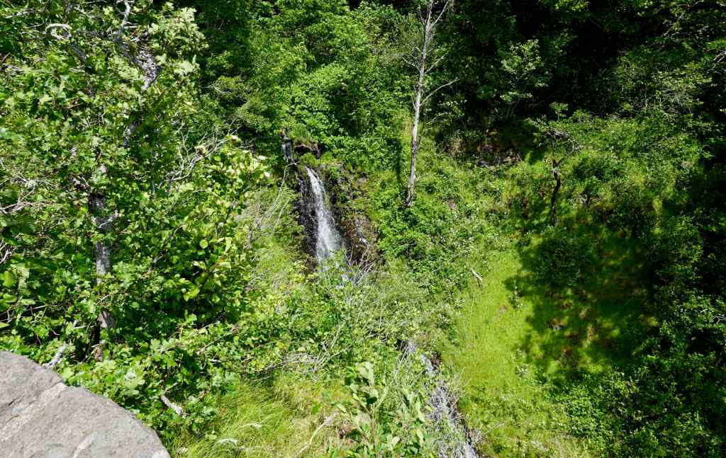
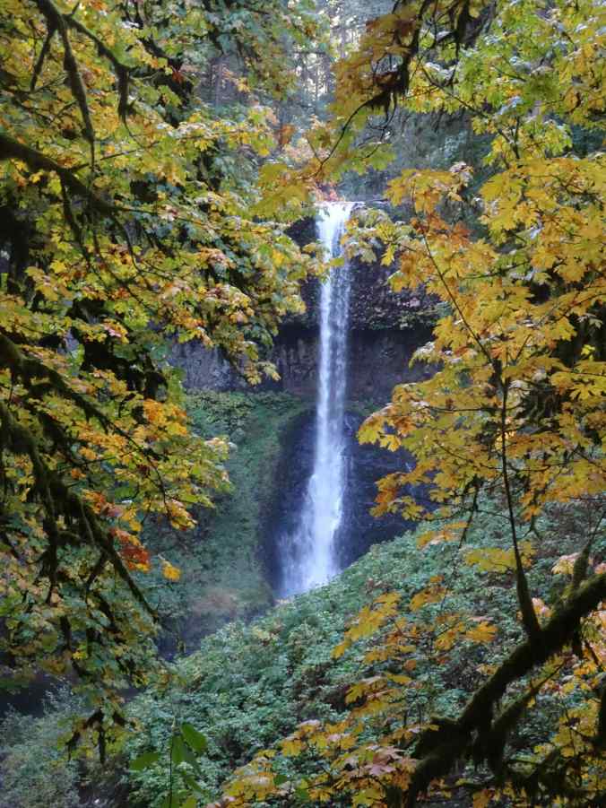
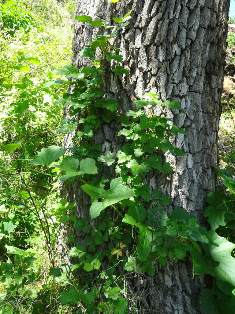
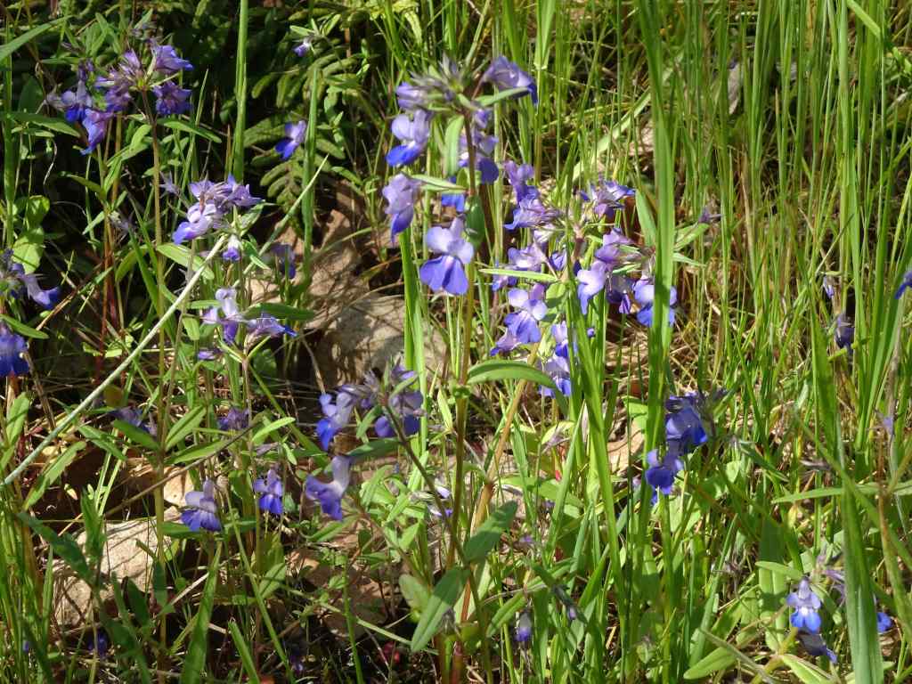
Eagle Creek near the trailhead – the water has a distinctive beautiful green color.The trail rises gently above the canyon. Here the rocky slopes are covered with manroot and fringe cup blooms.In places, the trail is cut into the cliff edge, as the gorge deepens.Farther along, the cliff edge is more of a steep slope, in this case, covered with blue-eyed Mary meadows.From the trail edge, the view to Metlako Falls.Zooming in on Metlako Falls.Eventually, we could look down onto Punchbowl Falls, with the burned slopes from the 2017 fire beyond.Closer view of Punchbowl Falls.Cascades on Fern Creek, from a trail bridge across this side stream.
We had to get home for an appointment, so didn’t quite make it to High Bridge, about 3 miles in.
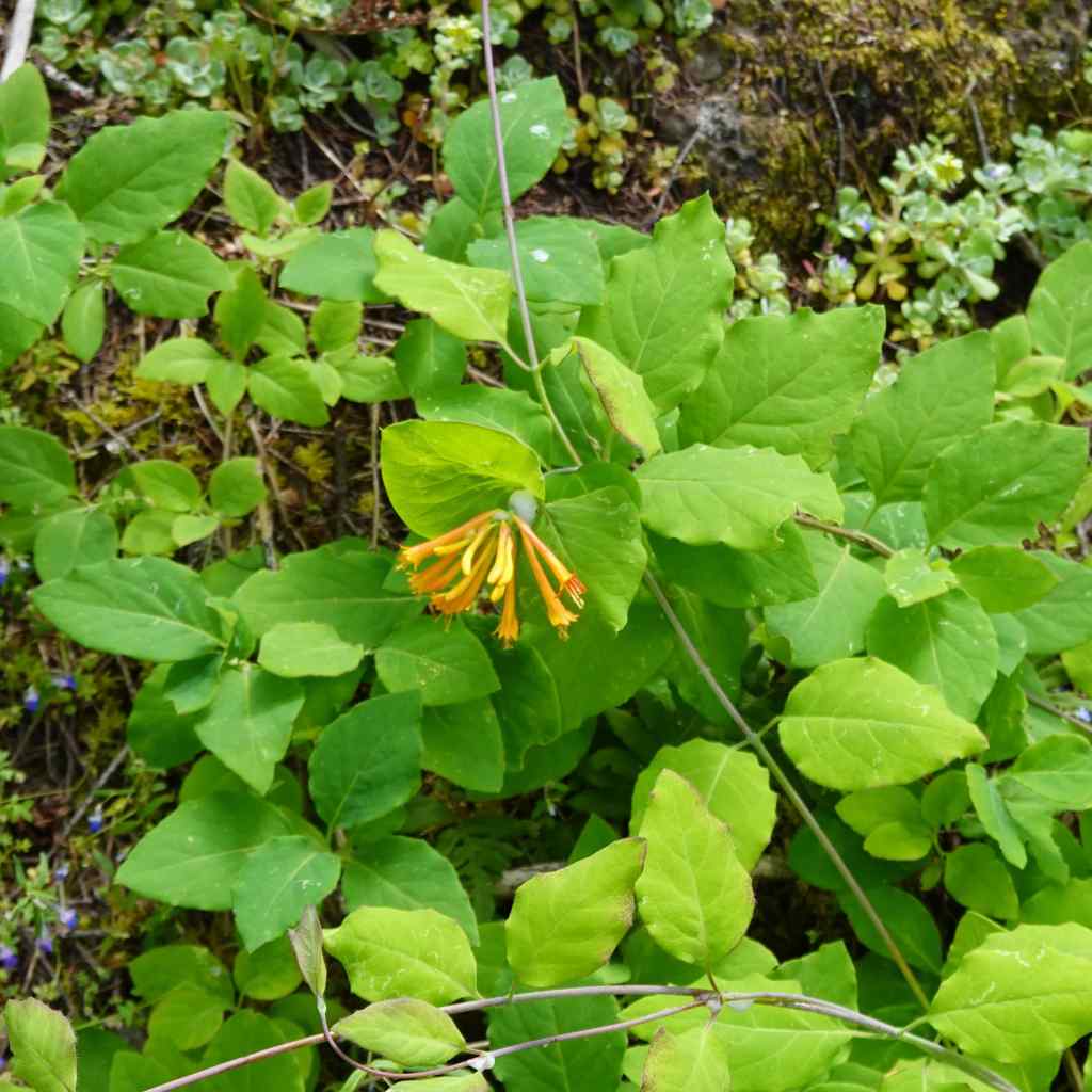
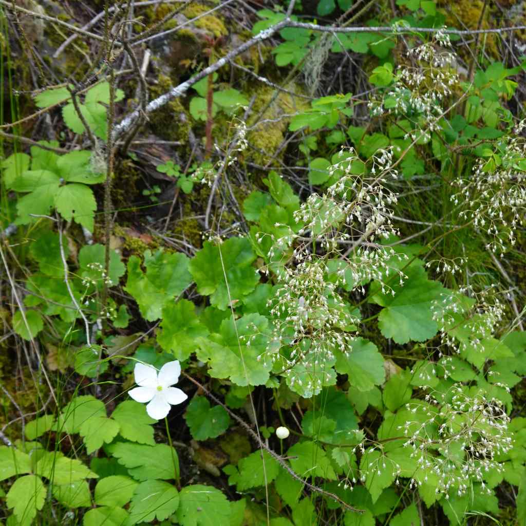
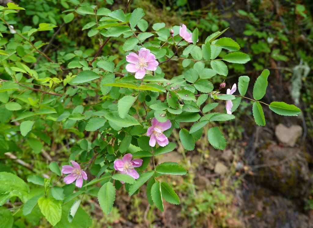
A few more of the many wildflowers we saw today:
HoneysuckleAnemone and foamflowerRose
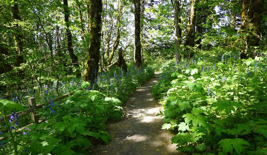
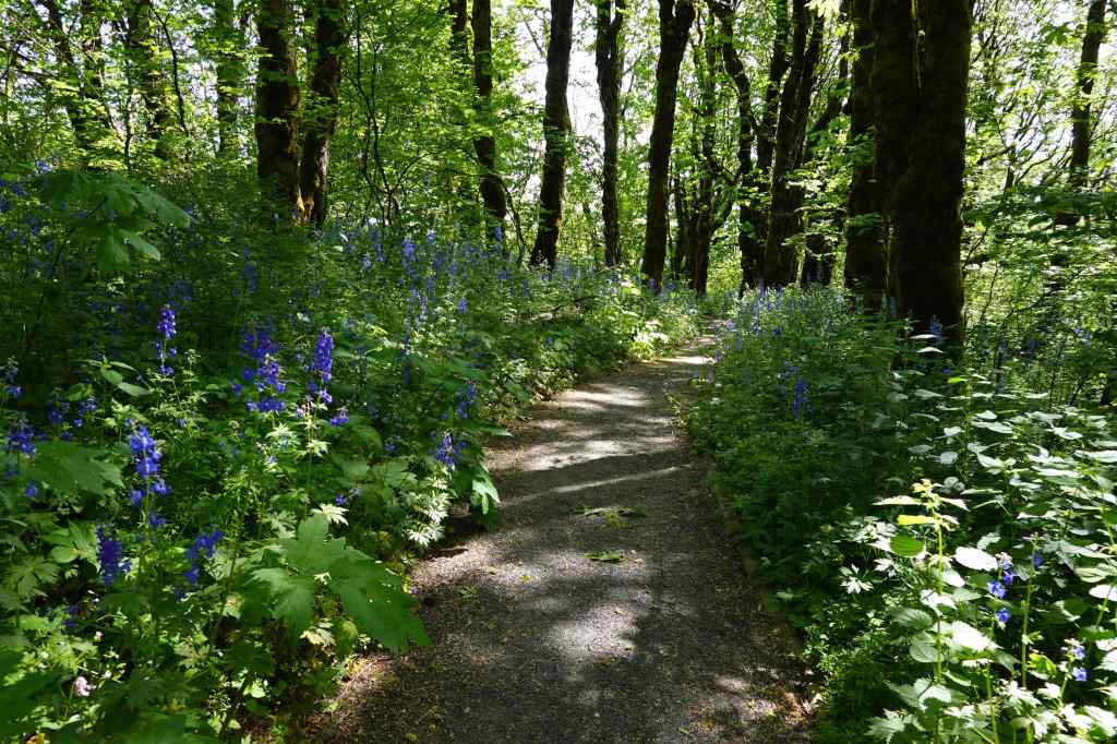
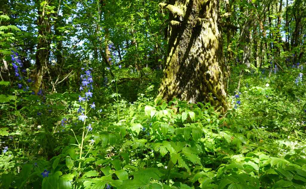
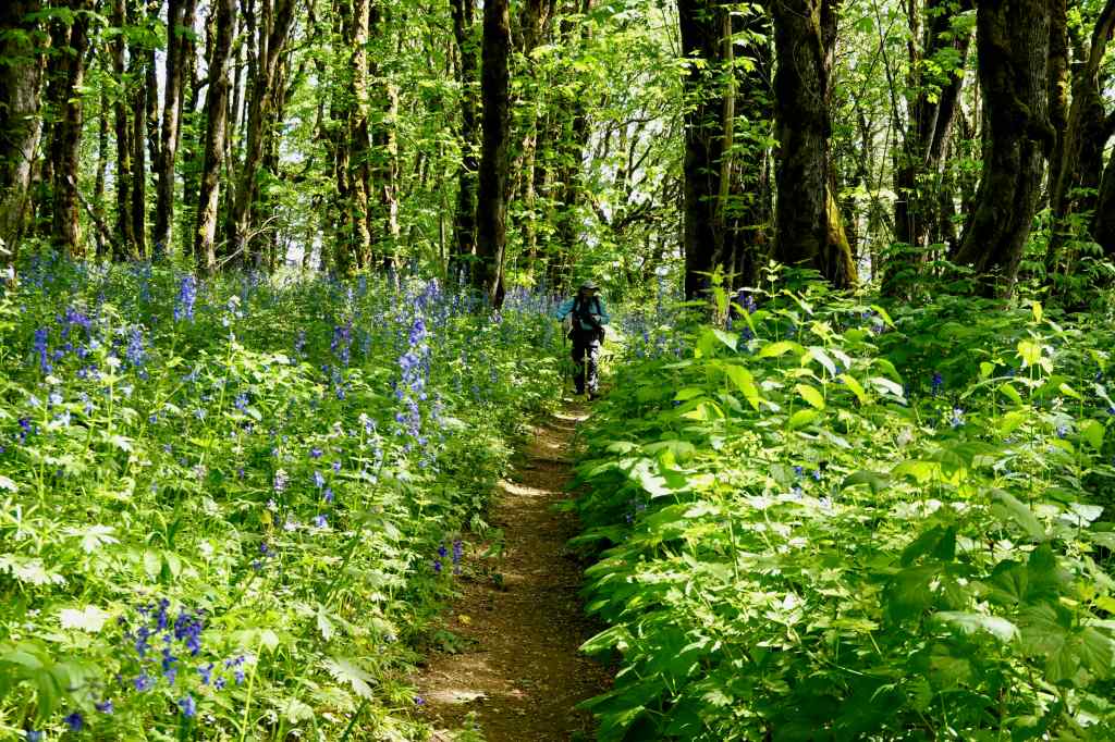
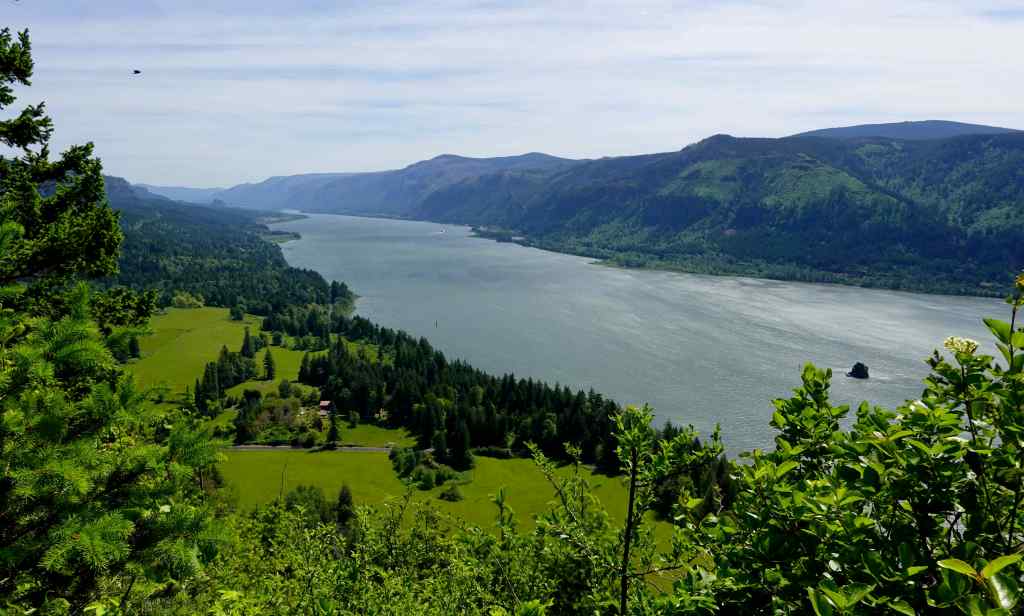
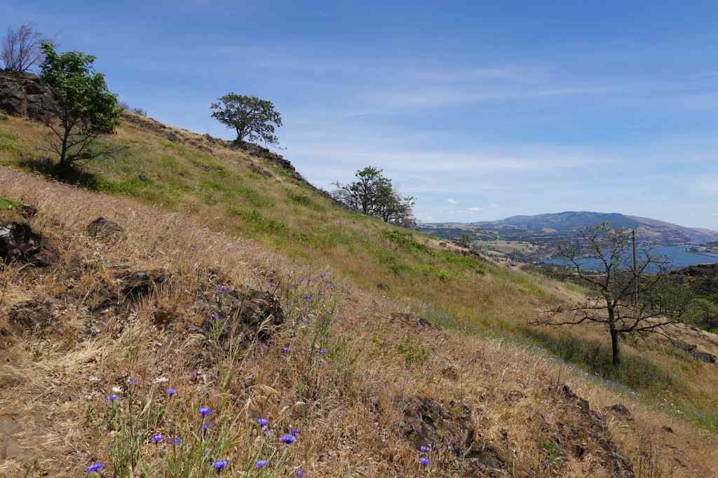
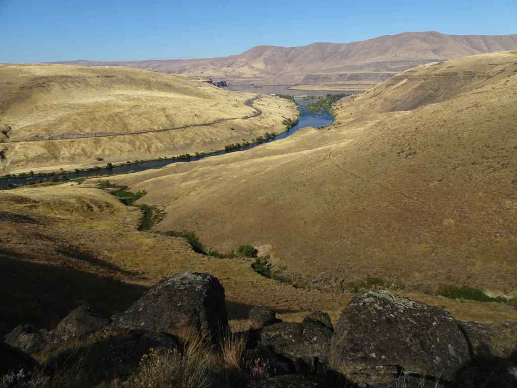
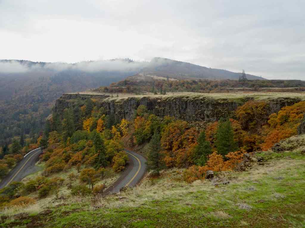
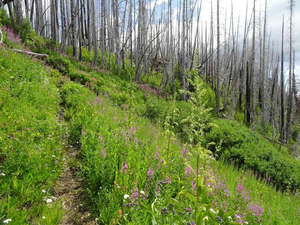
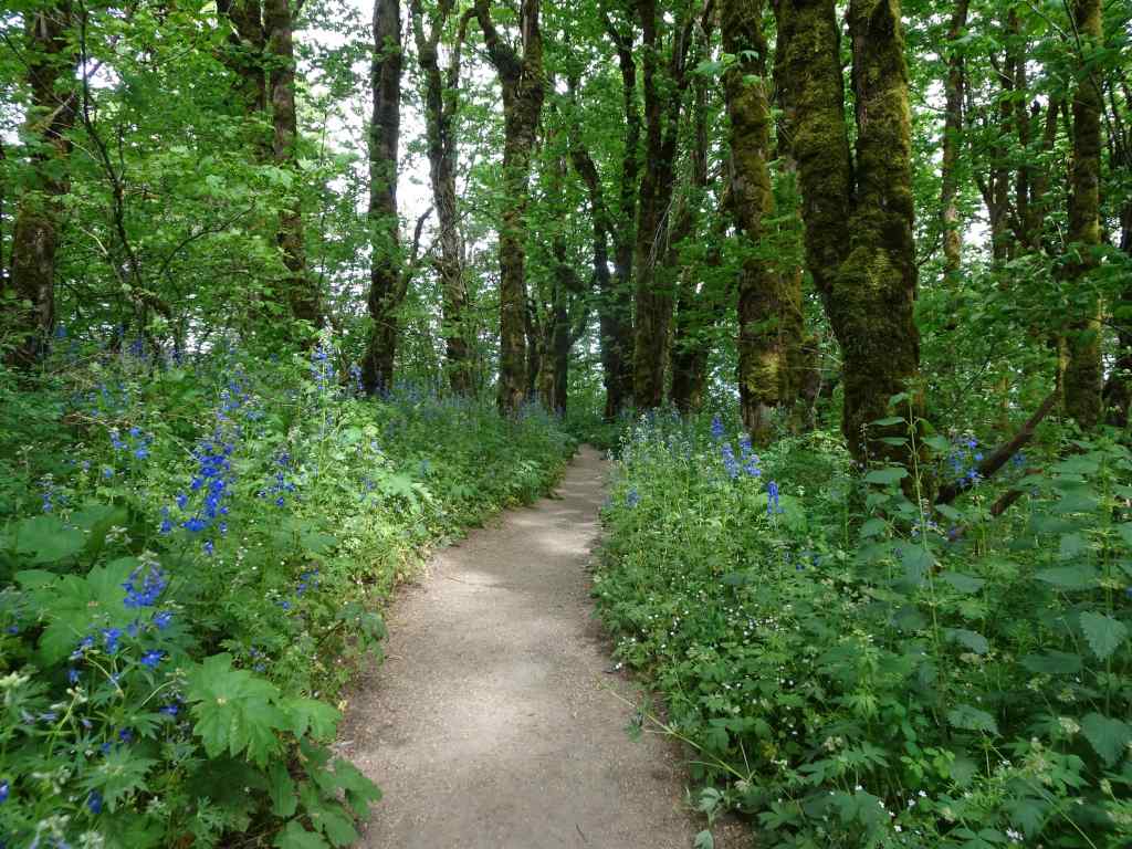
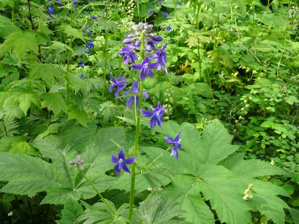
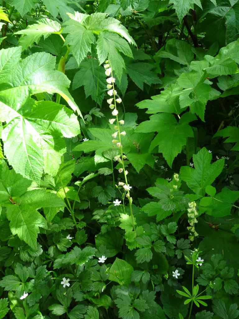
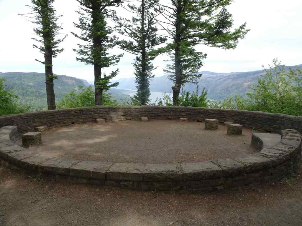
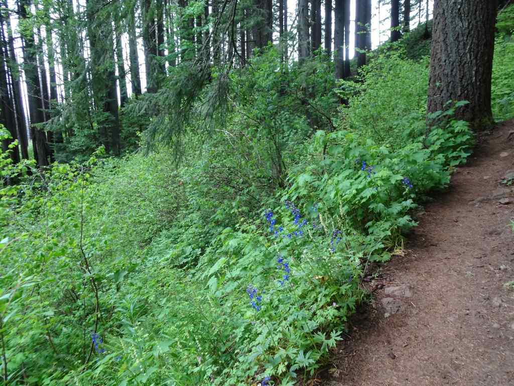
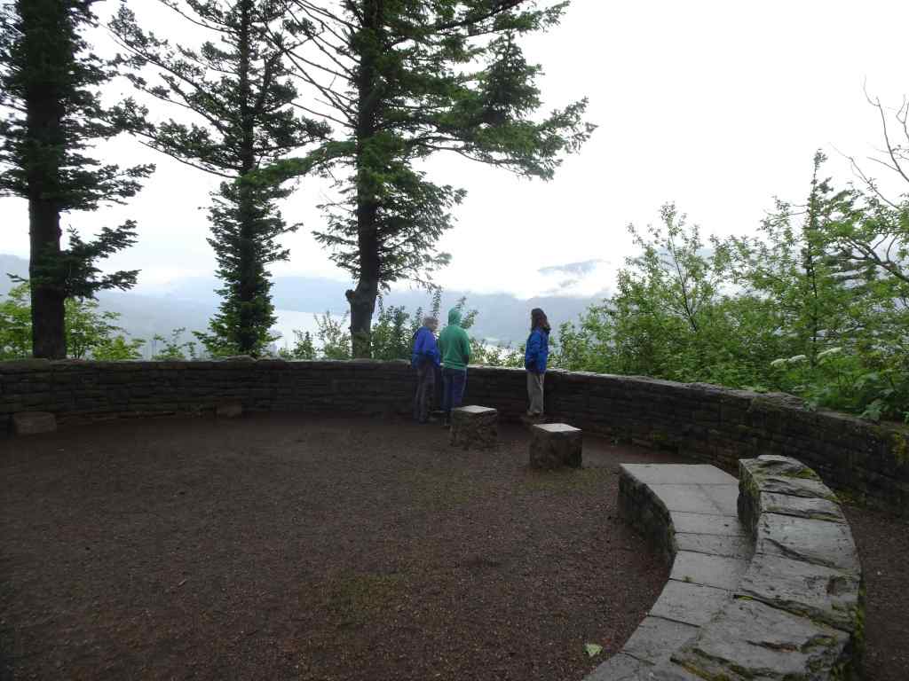
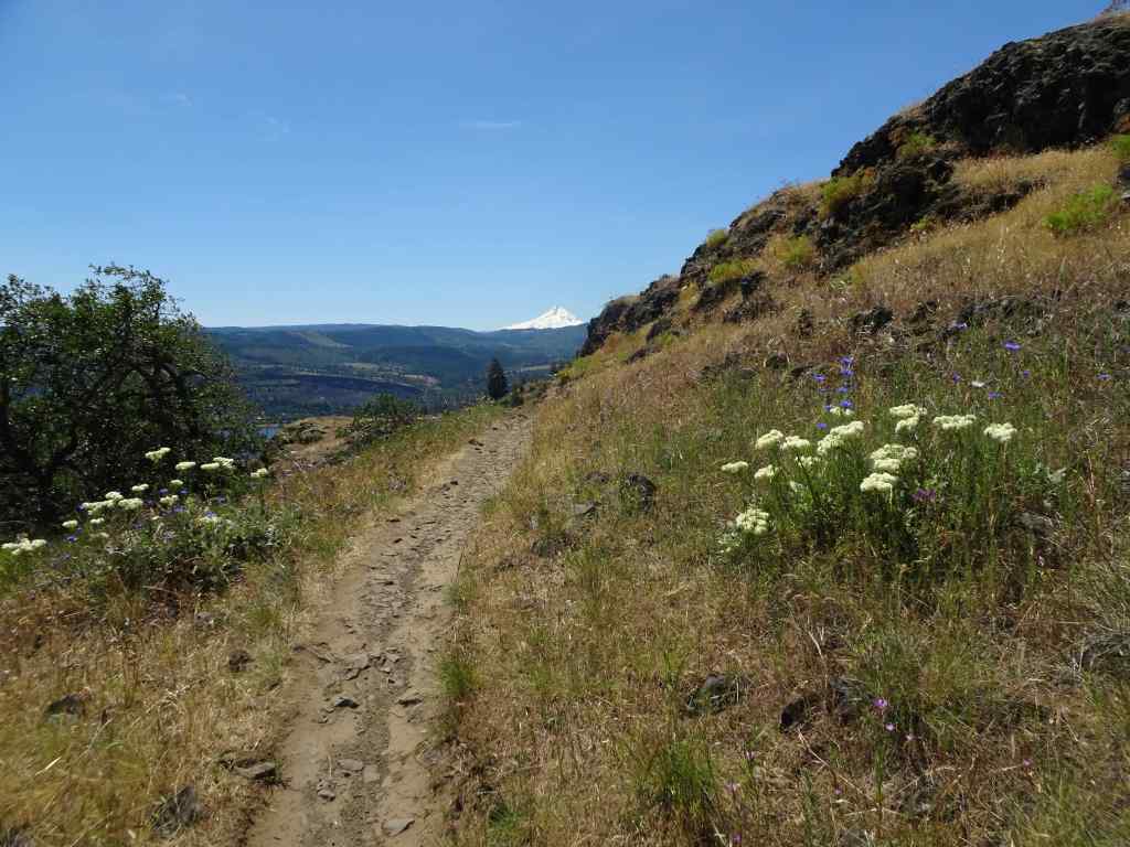
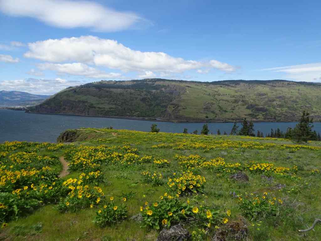
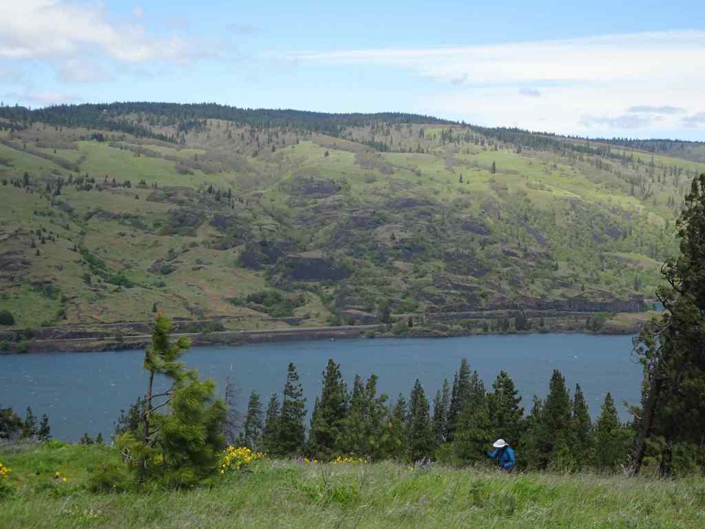
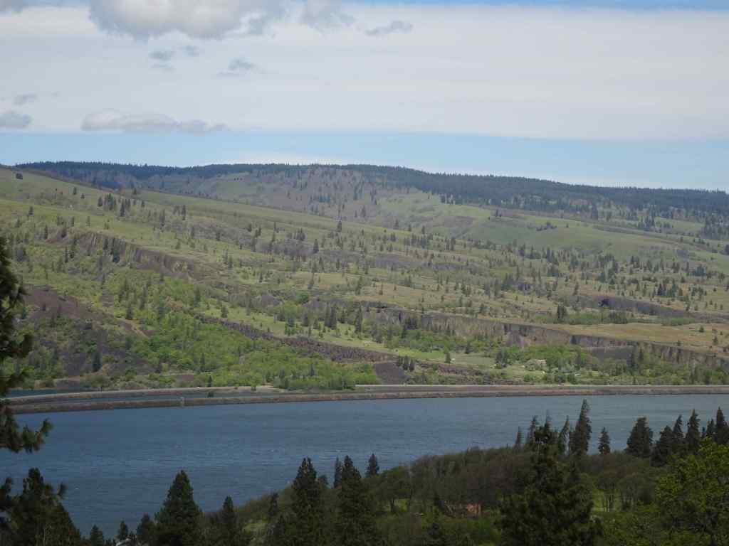
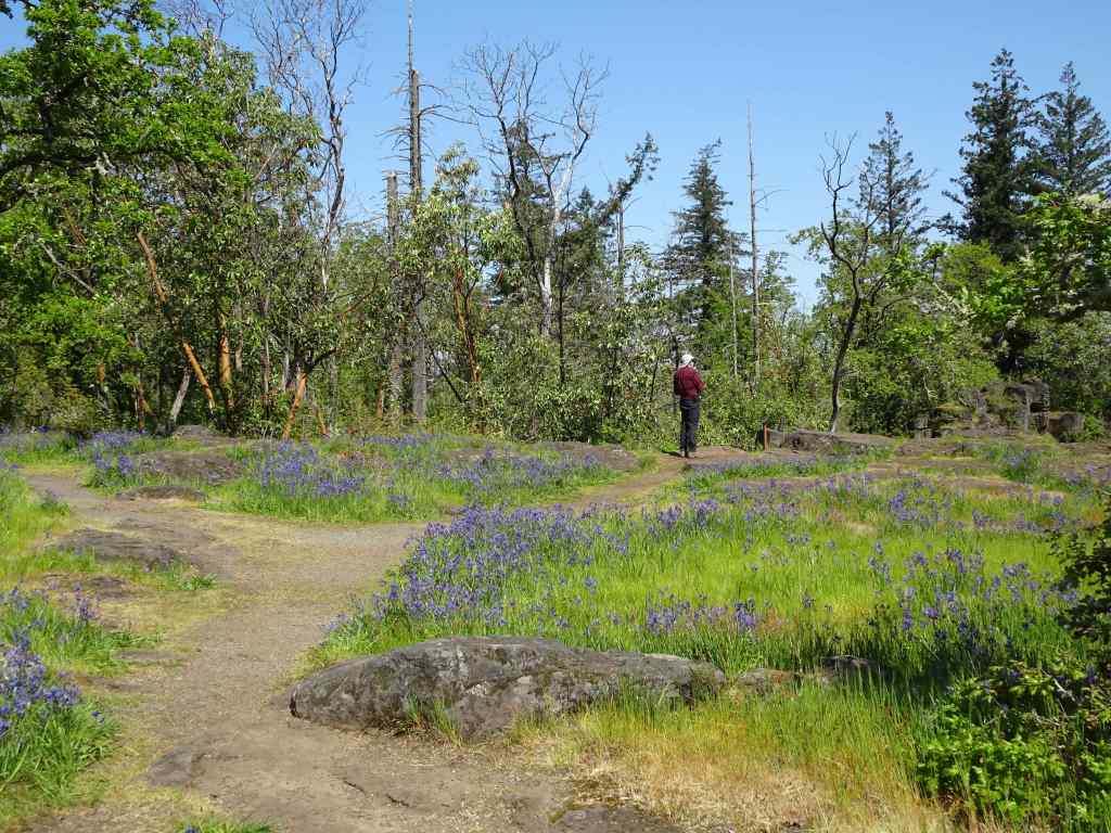
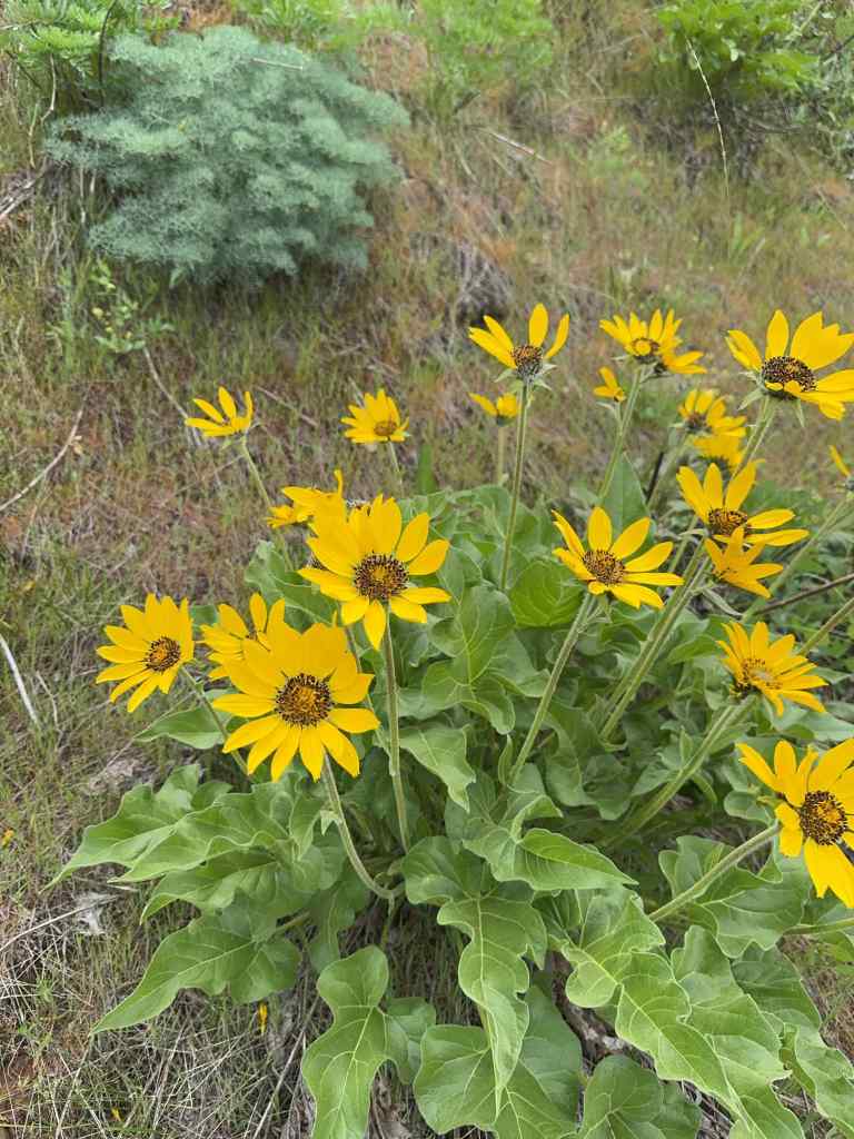
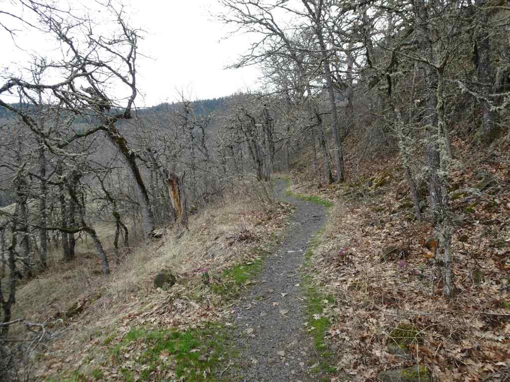
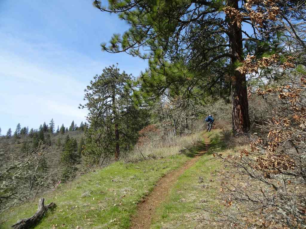
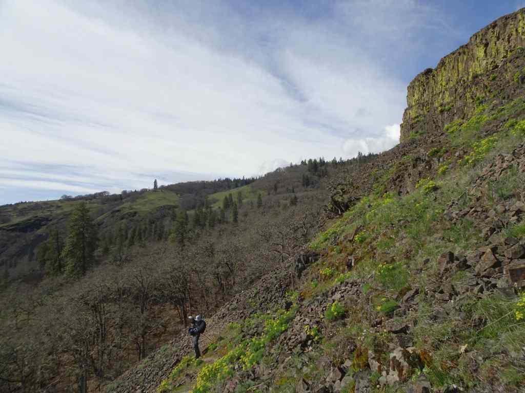
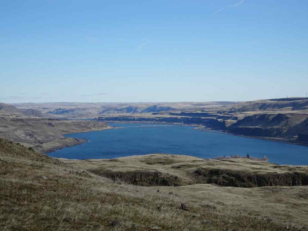
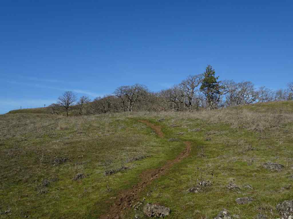
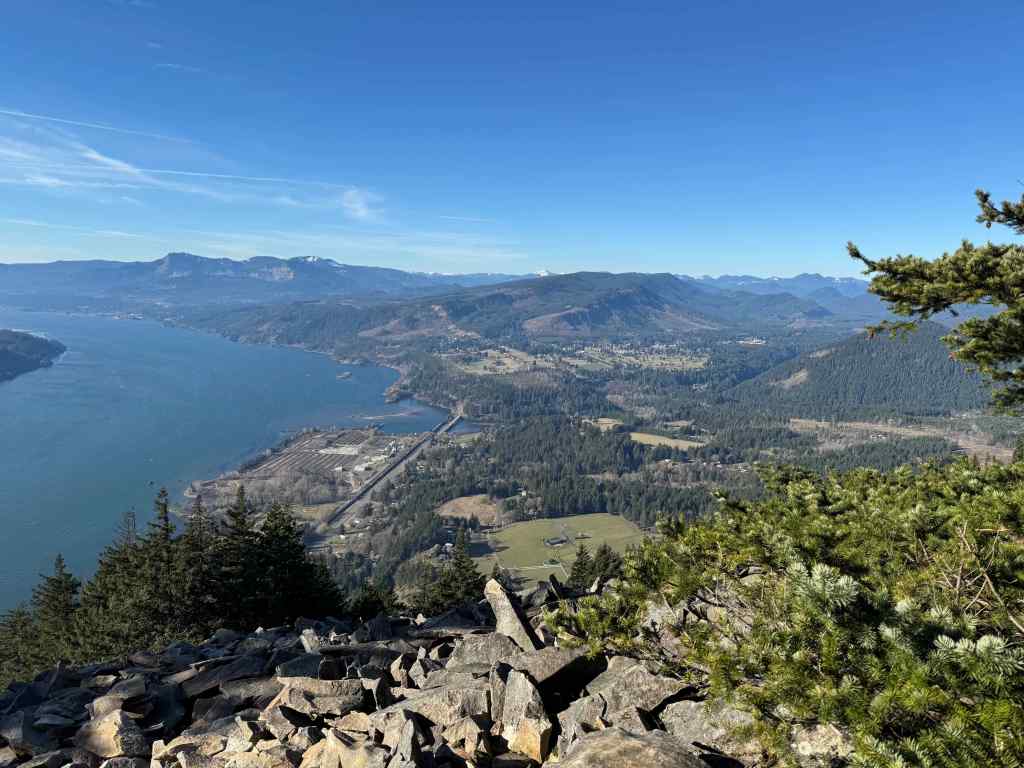
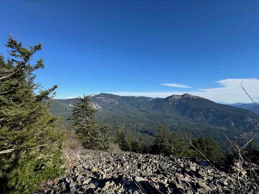
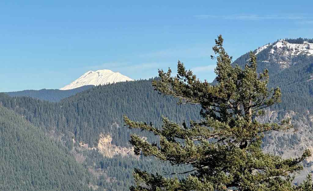
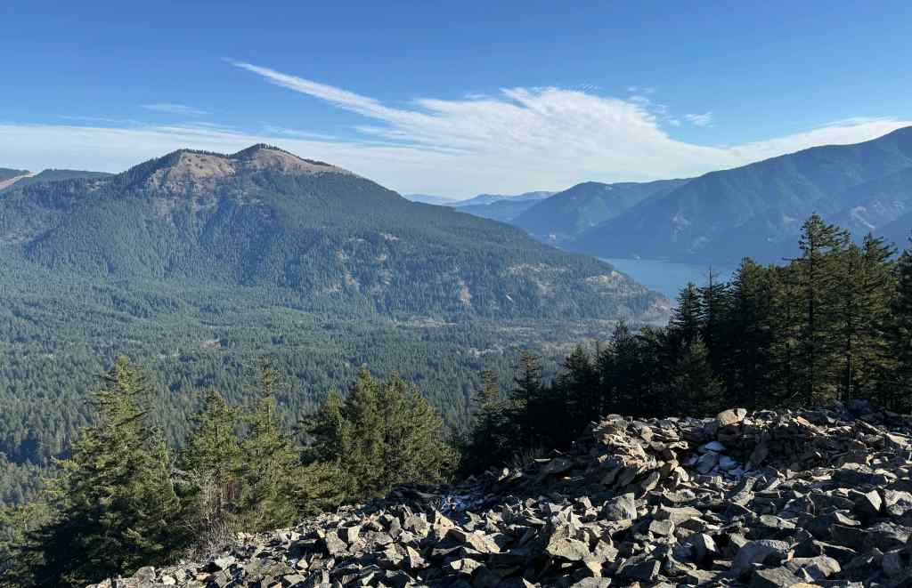
5/12 – Cape Horn, WA
Return to this easy-ish forest bathing walk during tall delphinium bloom season, from Strunk Road down to the Waterfall Overlook, and then back up (3.5 miles, 620 feet).
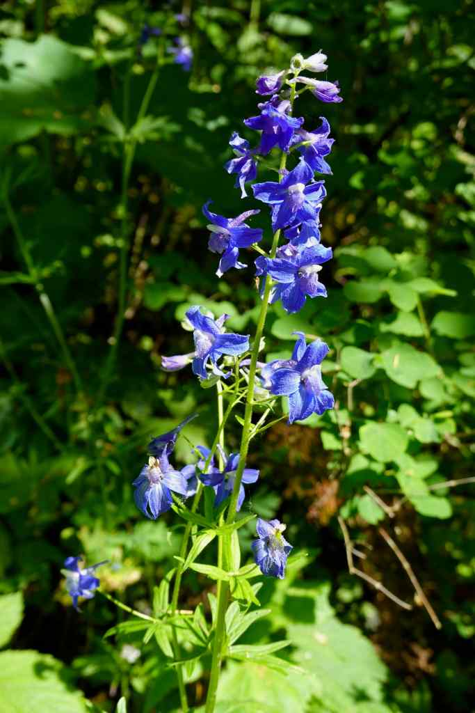
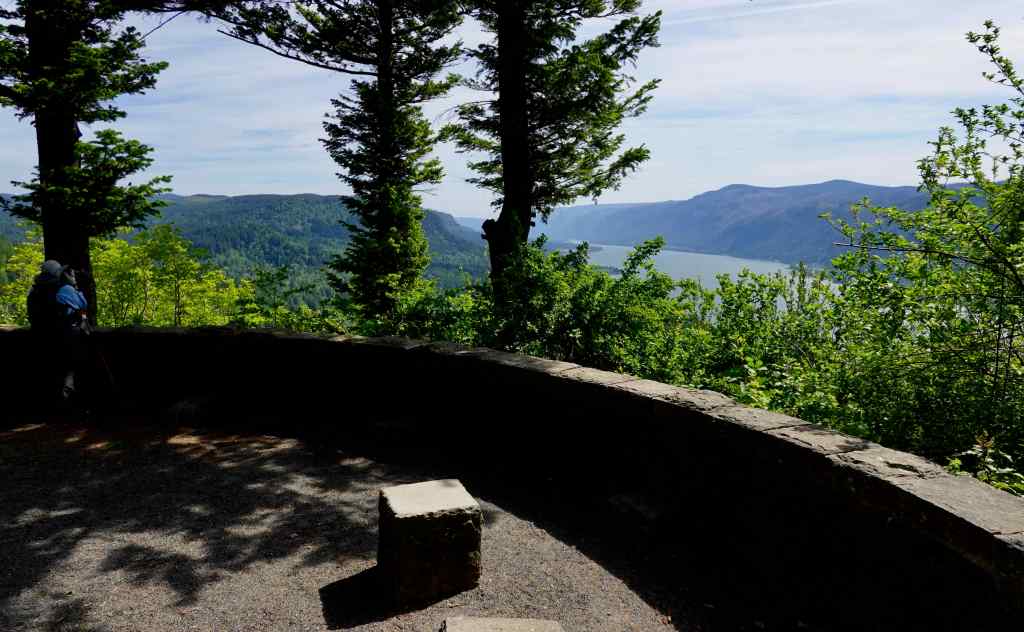
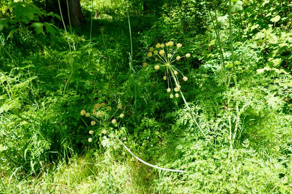
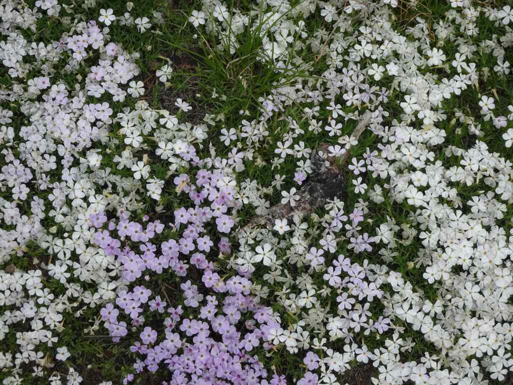
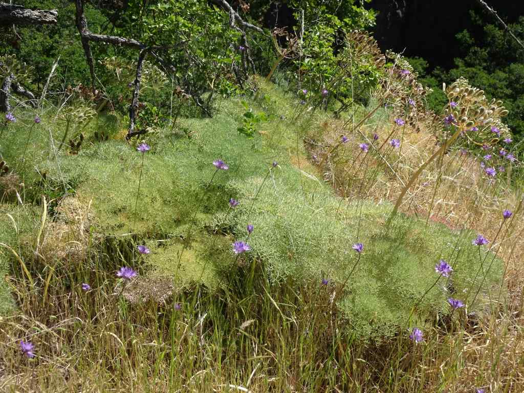
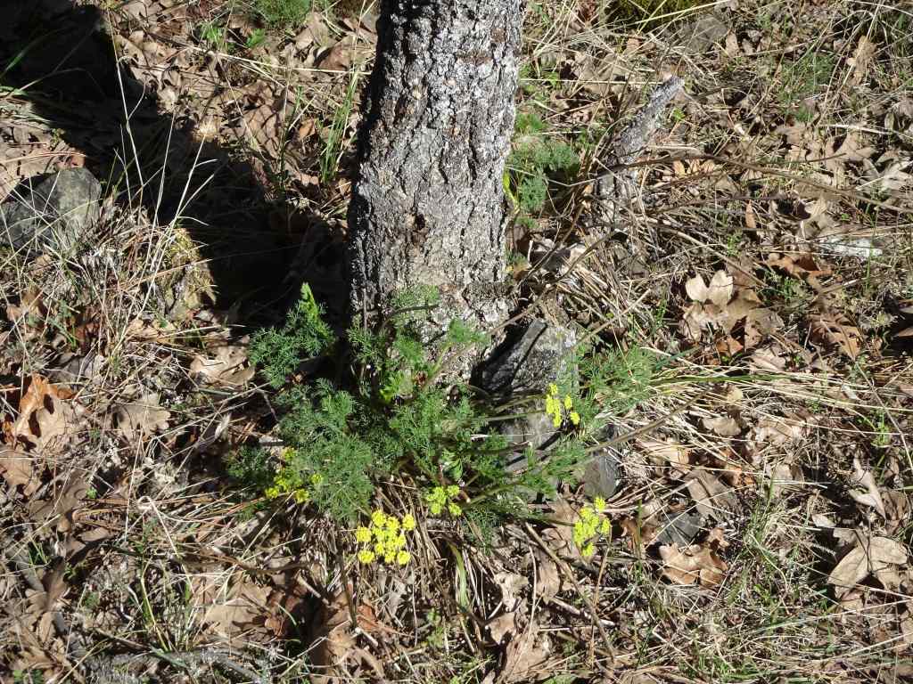
Once into the shady woods, the tall delphinium are blooming on both sides of the trail.DelphiniumAll the way down to the Nancy Russell Overlook…We always pause here to thank Nancy Russell for her lifetime of work preserving this trail area from development, and helping to create the Columbia River Gorge National Scenic Area. Thank you Nancy!The view to the eastern gorge from here.We continue down through more mossy woods,and delphinium-lined trail,to the next trailside overlook.A few irises were blooming in the sun here.We continued down, under the highway, to the Cape Horn Waterfall Overlook.A wide view up the eastern gorge to Beacon Rock.And a leaning over the edge view of the waterfall.Then back up, once again through delphinium blooms, to the trailhead.A fern leaf parsley, one of my favorites, near the end of the trail.
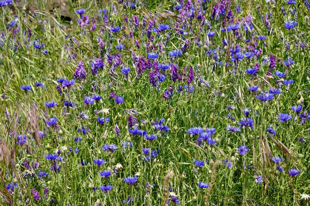
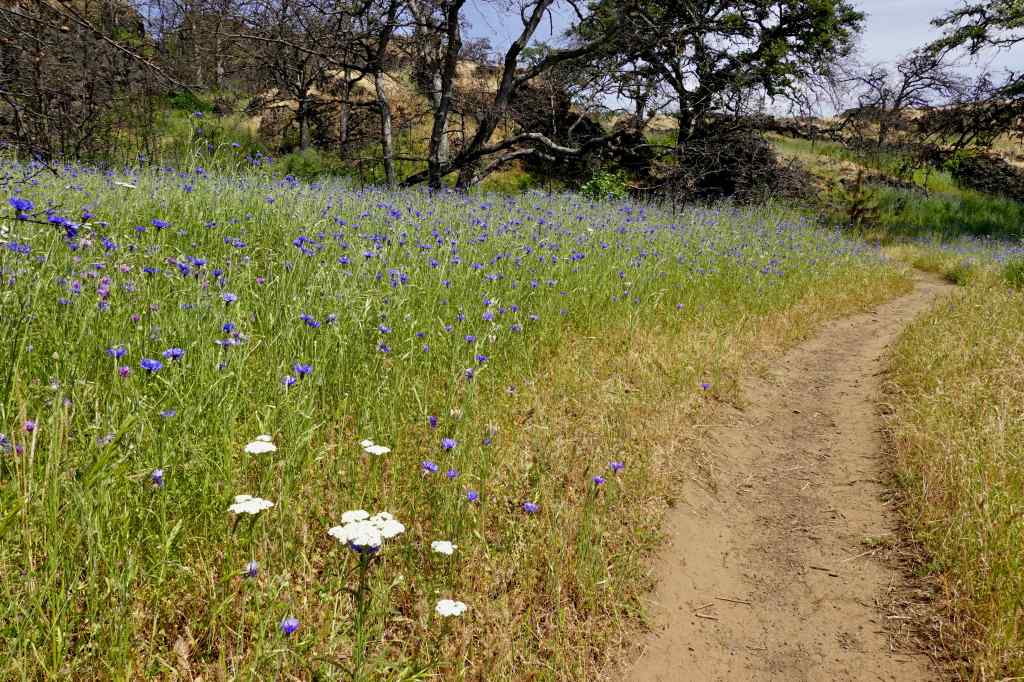
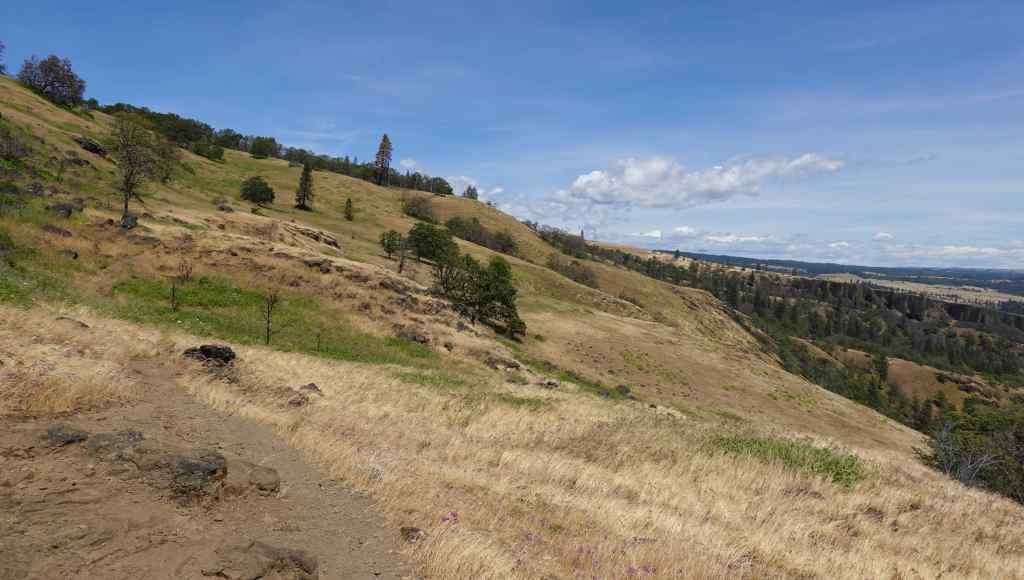
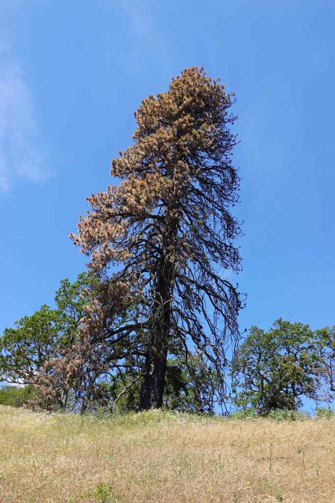
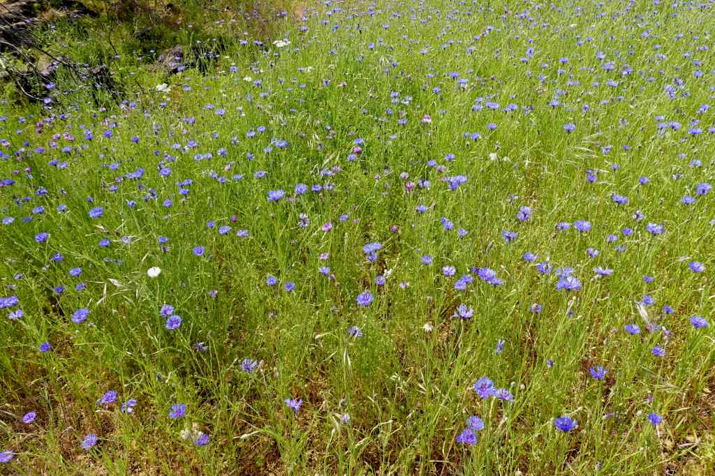
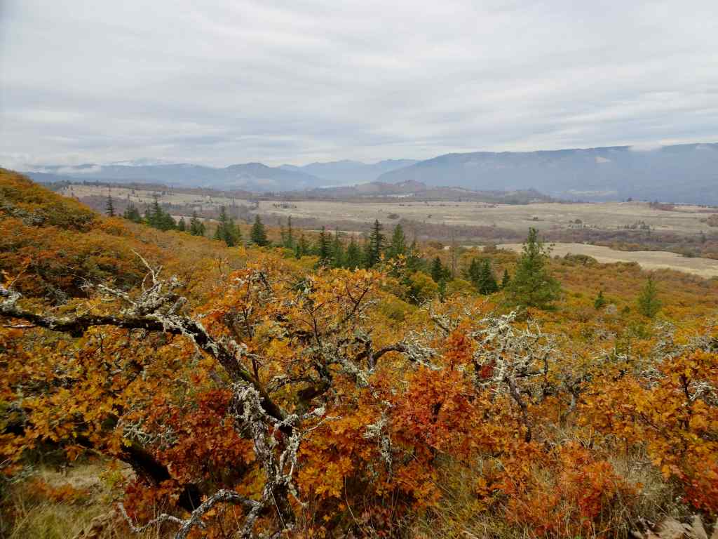
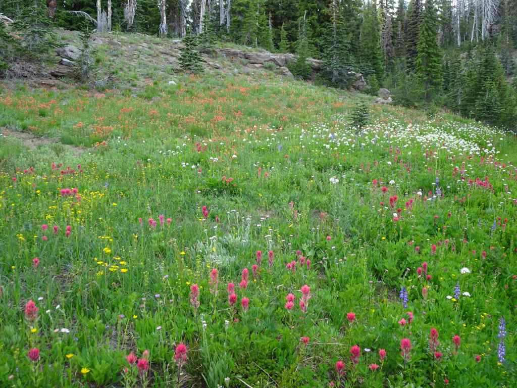
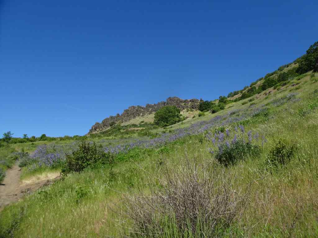
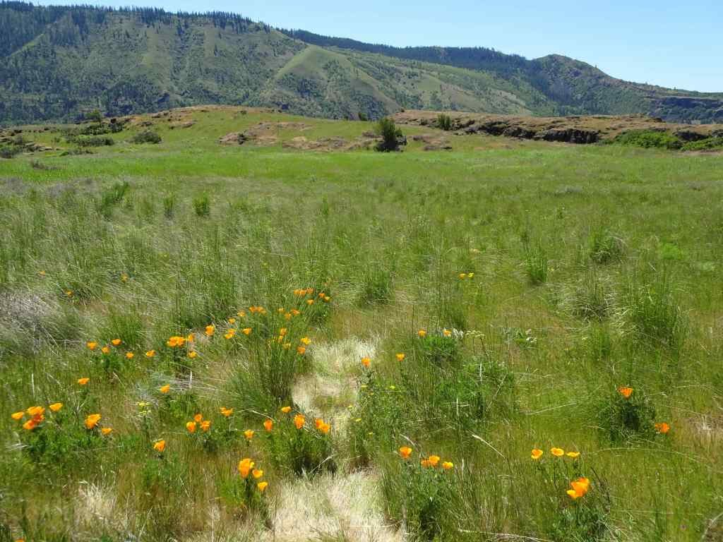
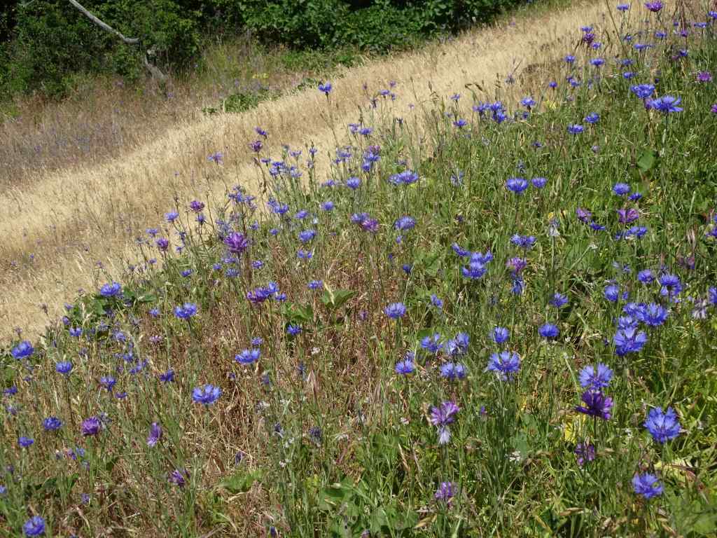
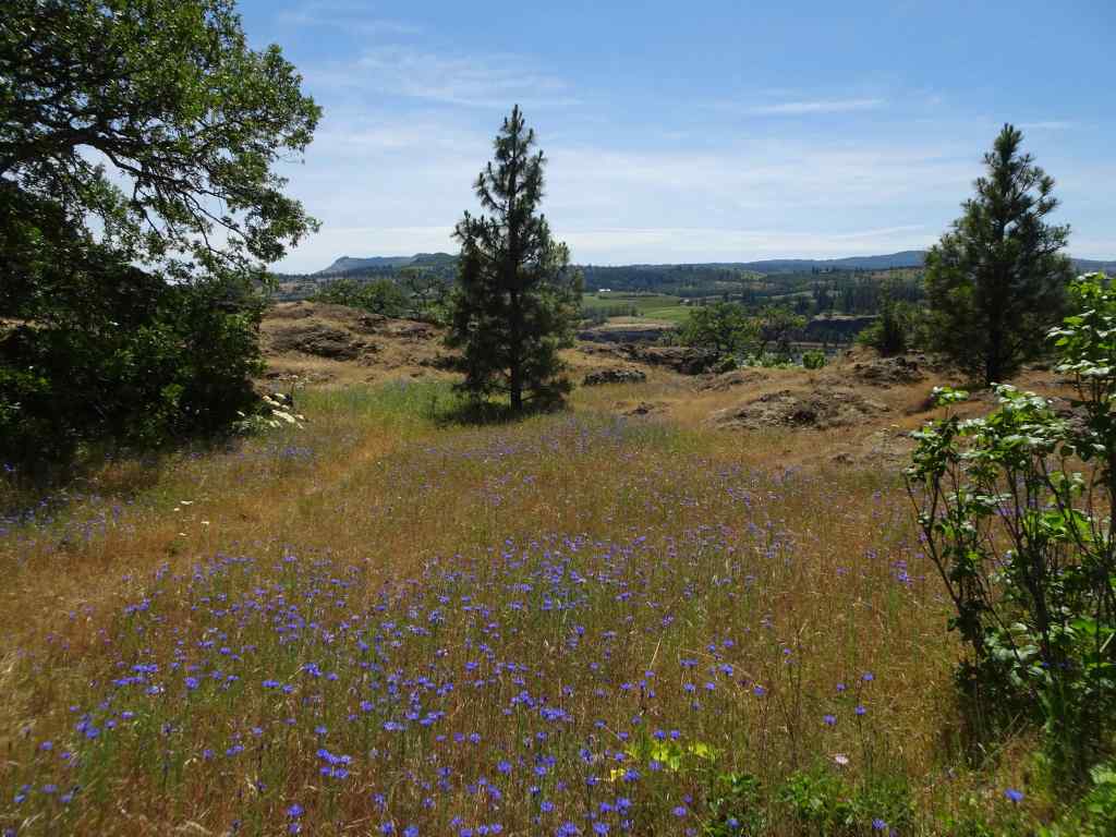
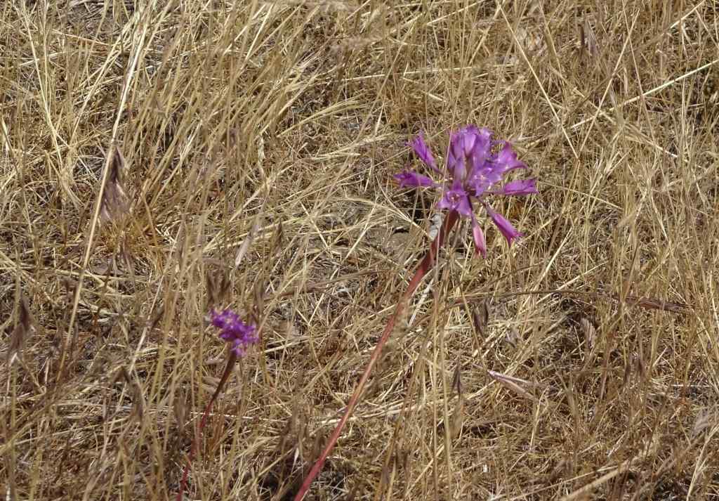
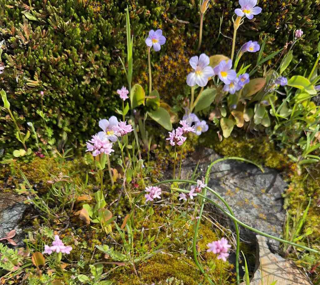
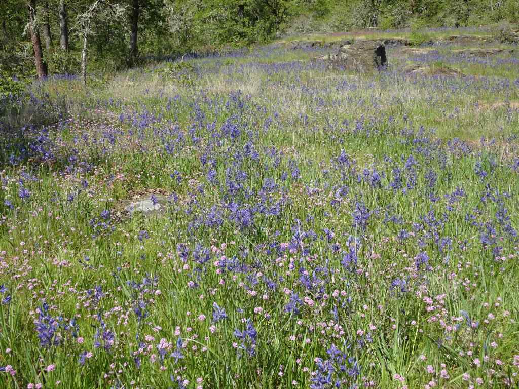
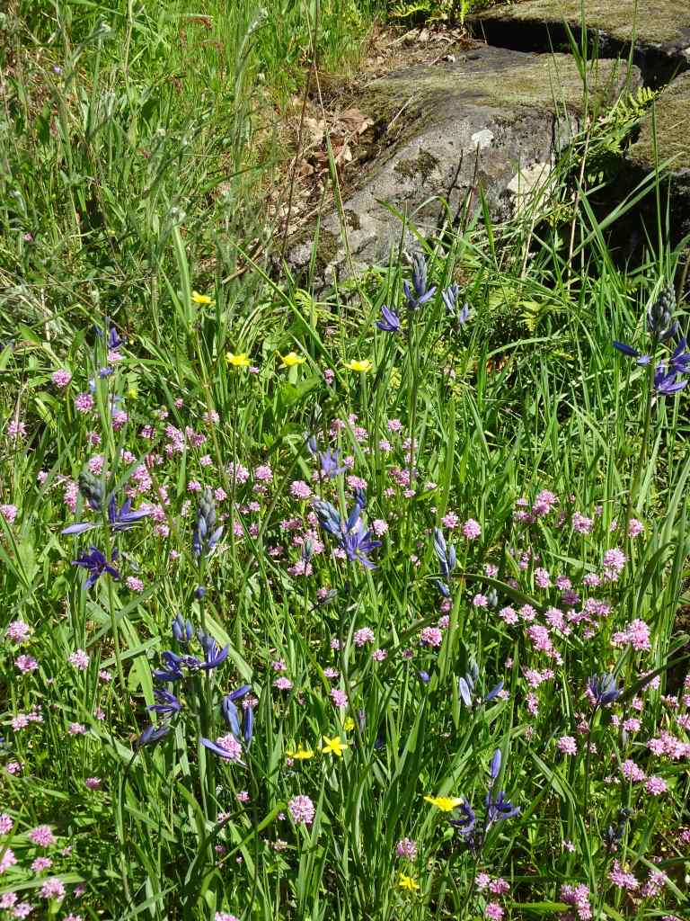
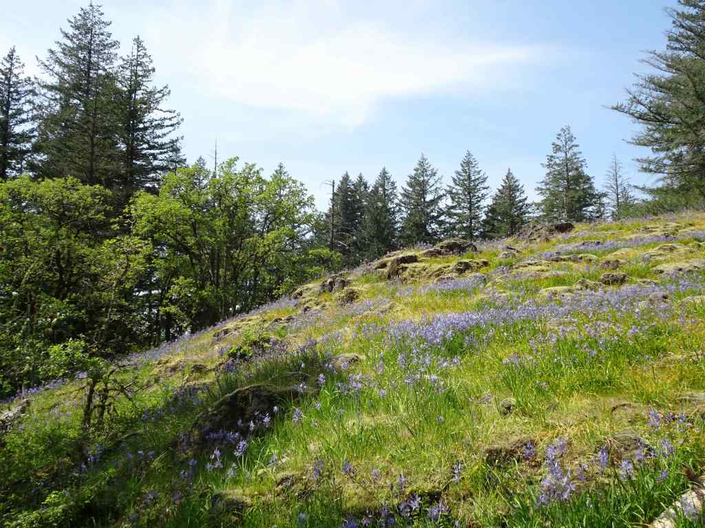
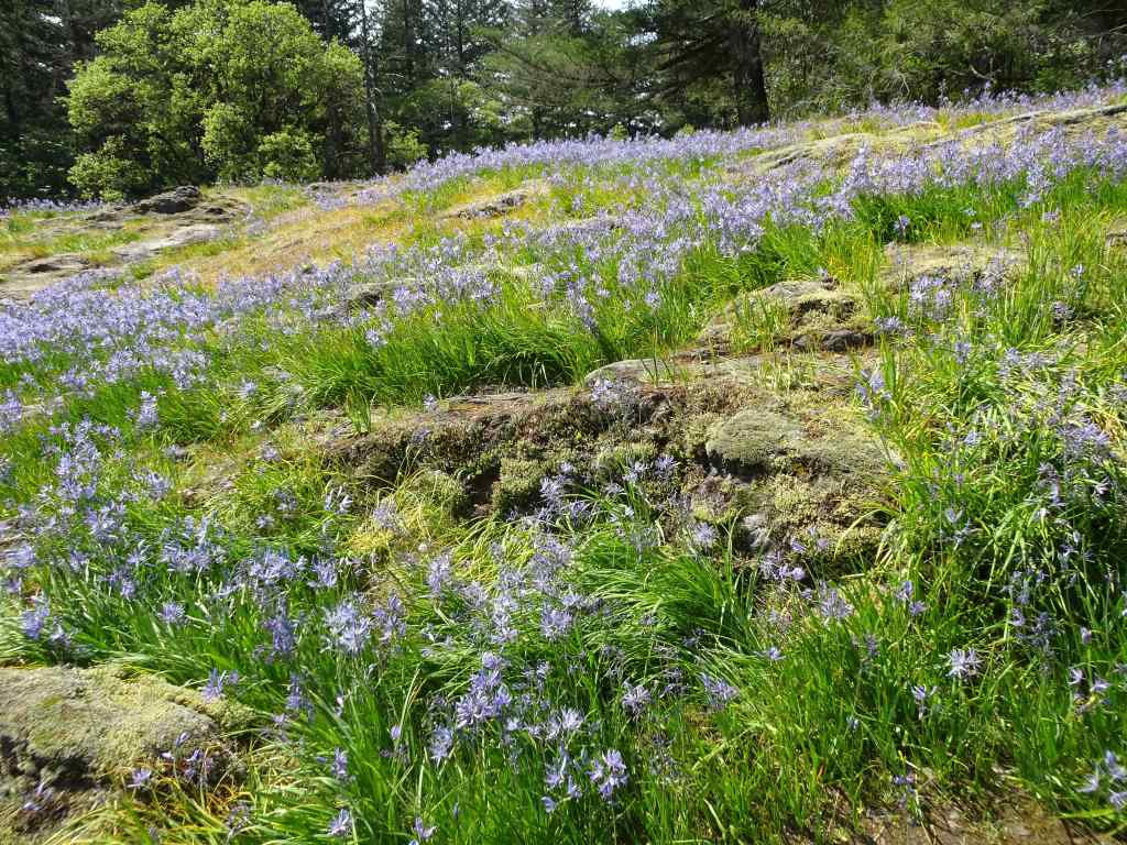
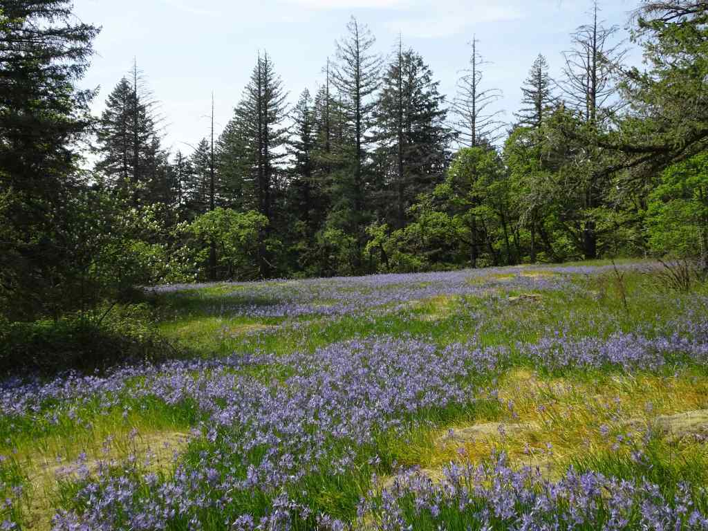
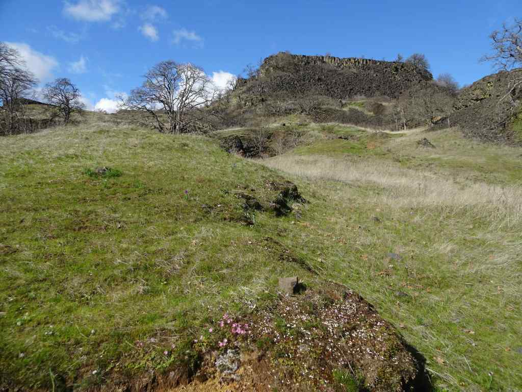
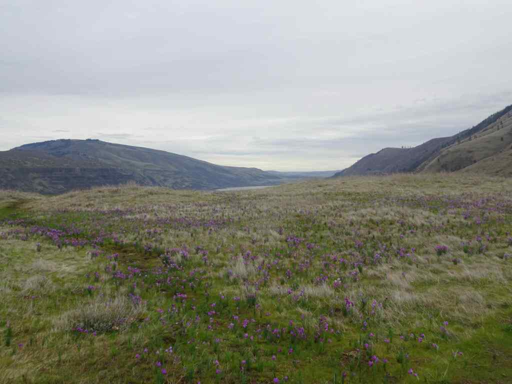
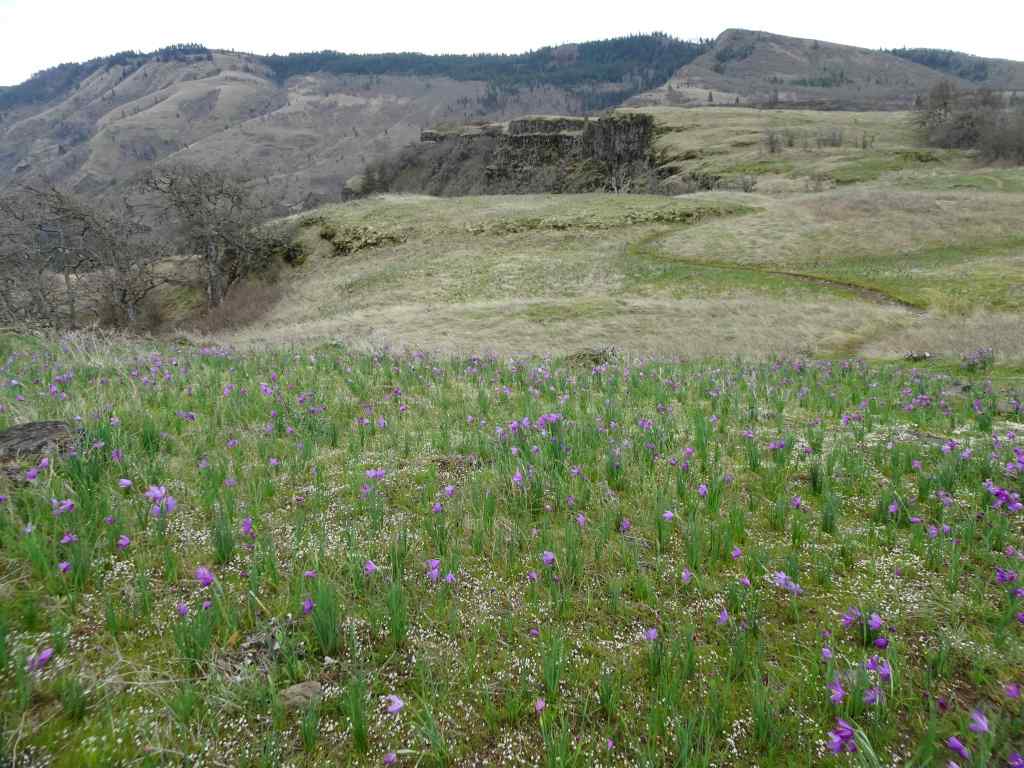
5/18 – Swaths of purple at The Labyrinth, WA
We visited this trail just slightly later in May last year (May 27, 2025). We saw similar flowers, but this year there were so many more. It was very purple there today (4 miles, 820 feet).
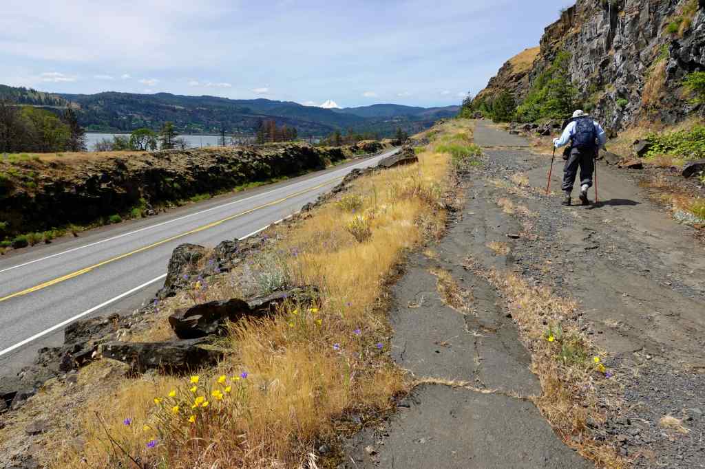
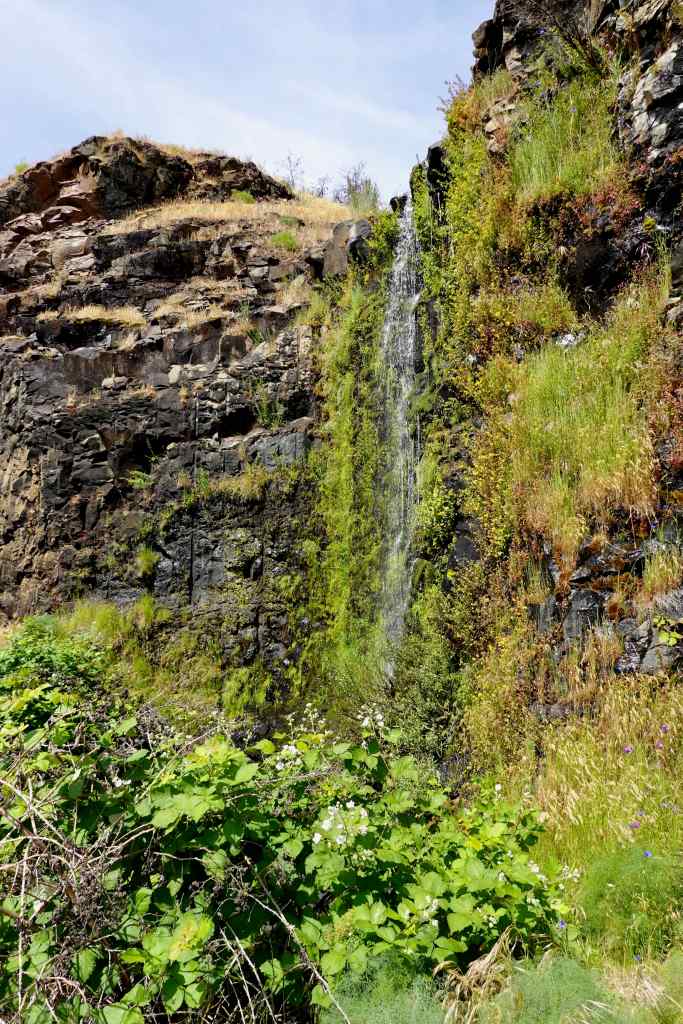
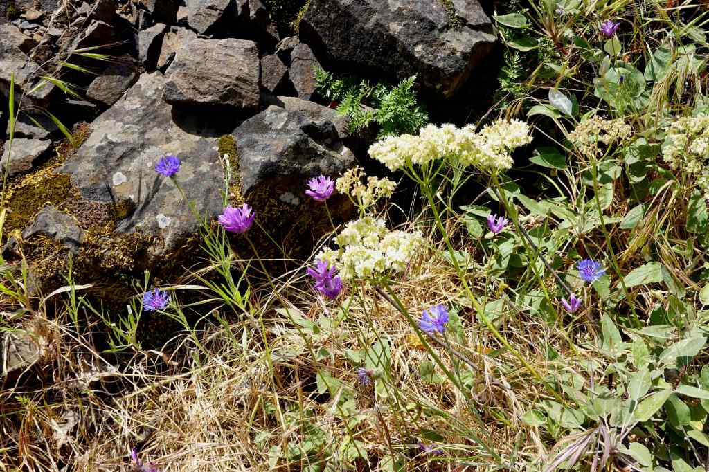
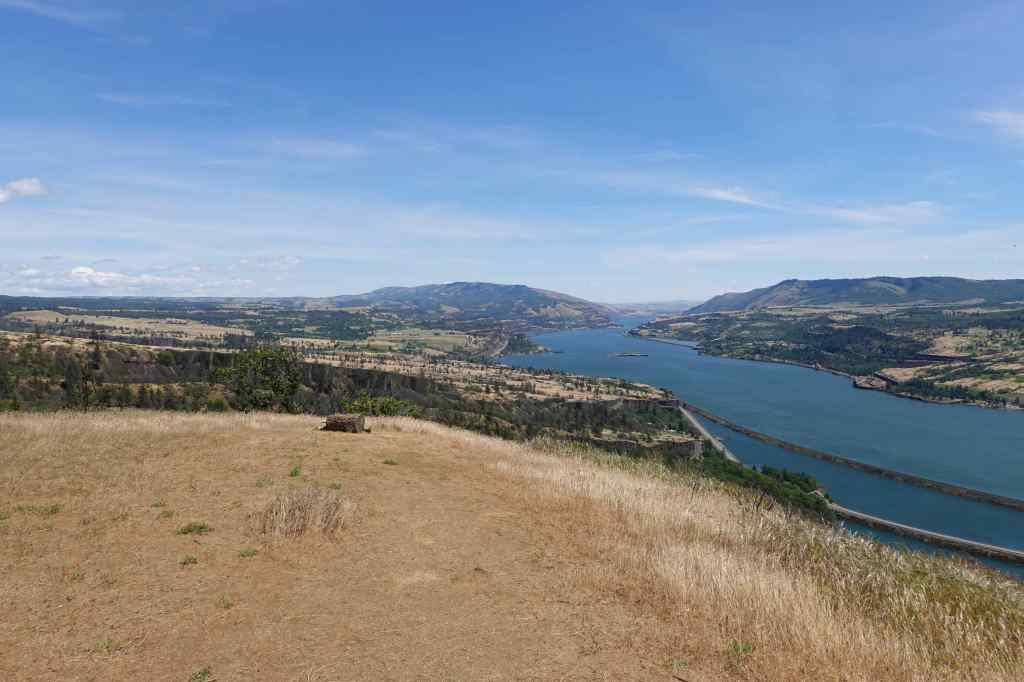
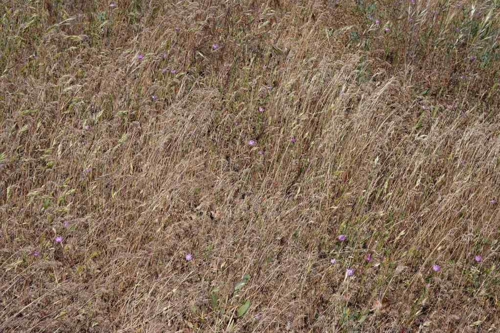
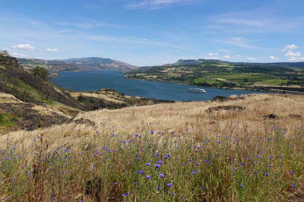
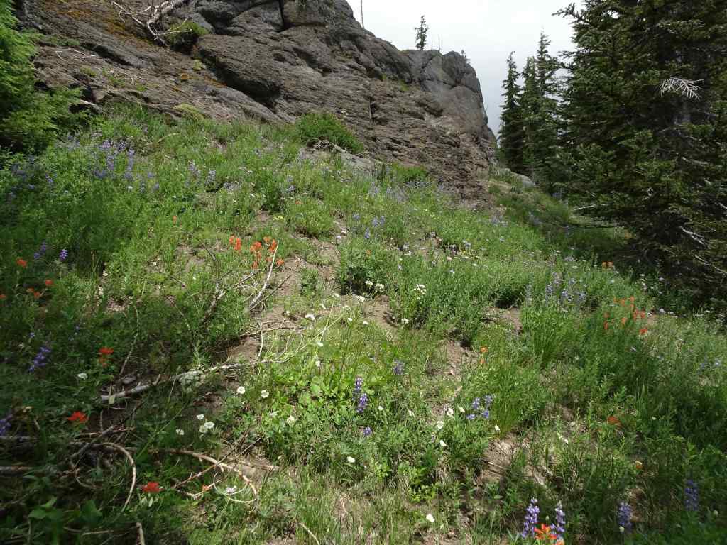
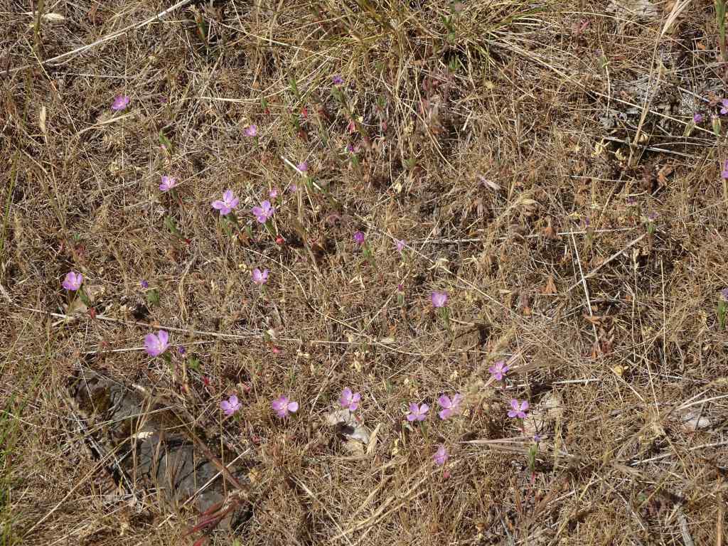
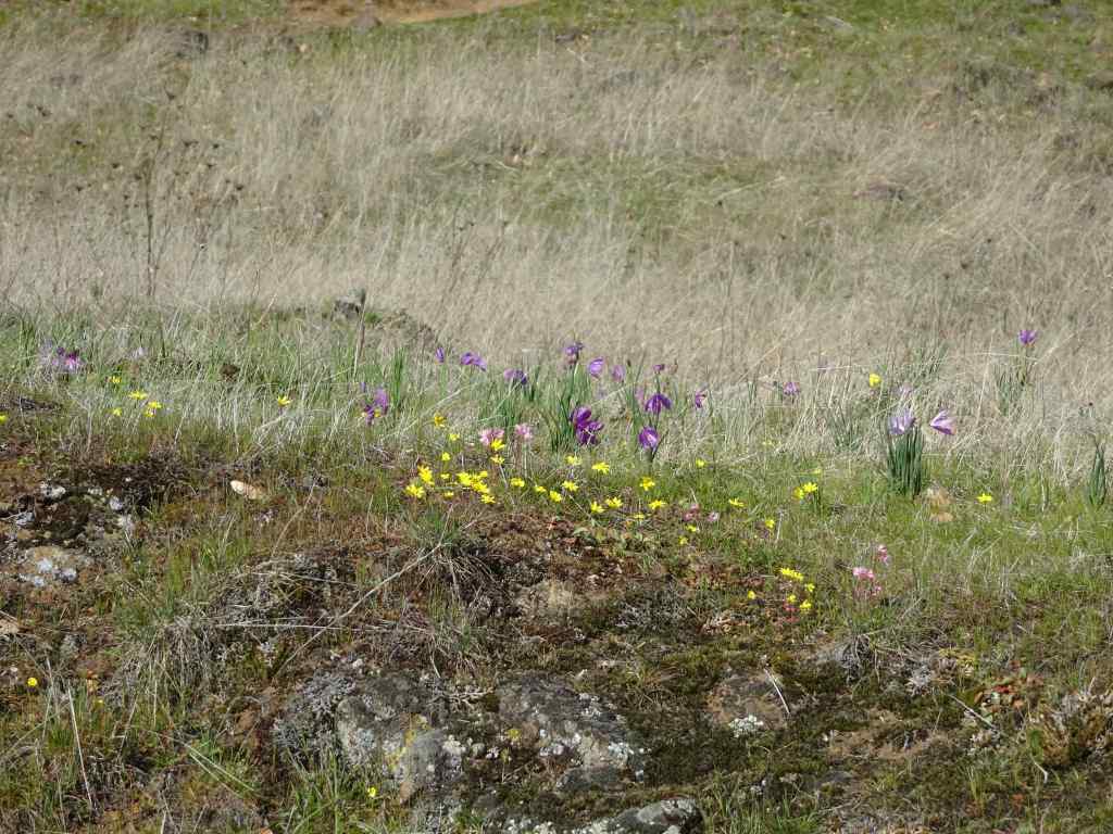
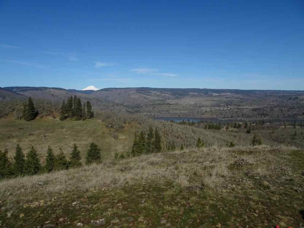
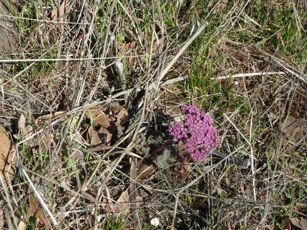
Approach trail along Hwy 8, with Mt Hood on the horizon. Poppies blooming in the verge.Near the lower waterfall, we began to see the flowers that would fill the slopes above.Cornflowers (or bachelor buttons), ookow, and creamy buckwheat.Purple vetch was intertwined with many of the flowers, adding another layer of color.Pink tapertip onions were also scattered along the way.Purple flowers filled the meadows all along the trail, with some white yarrow here.Bicolored cluster lilies also added a pale lavender clumps here and there.More purple fields as we approached the upper waterfall.Upper waterfall still tricking along.Purple fields below the columnar basalt butte.Purple flowers in the oak groves.Trail out to the lunch ledge – meadows that were filled with grass widows in March are now full of cornflowers.We noticed three hues of purple cornflowers.After lunch, we continued upward, still accompanied by the purple flowers, though the grasses are getting drier. Mt Hood ahead.I stopped to check for bitterroot on the rocky outcrop at the turn in the trail. I found the last bitterroot of spring.As we approached the ridgeline oak tree, we passed the last of the purple flowers Down the slope, the last yellow balsamroots of spring were fading.Our destination – the viewpoint near the tall ponderosa.As we got closer, I was hoping to see signs that it would recover from the Burdoin Fire of last summer. In March it still had green needles on this side, and I had a bit of hope that it would survive.As we got closer, I could see no green on the tree, despite the green oak trees all around. I hope it remains standing as a guide snag, at least for a while.From the viewpoint, the whole eastern gorge is on view.Pink winecup clarkia are hiding in the dry grass all over this hill.We hiked back down, through the meadows of purple. Down on the river, a cruise ship was passing through.Can they see the fields of purple from there?
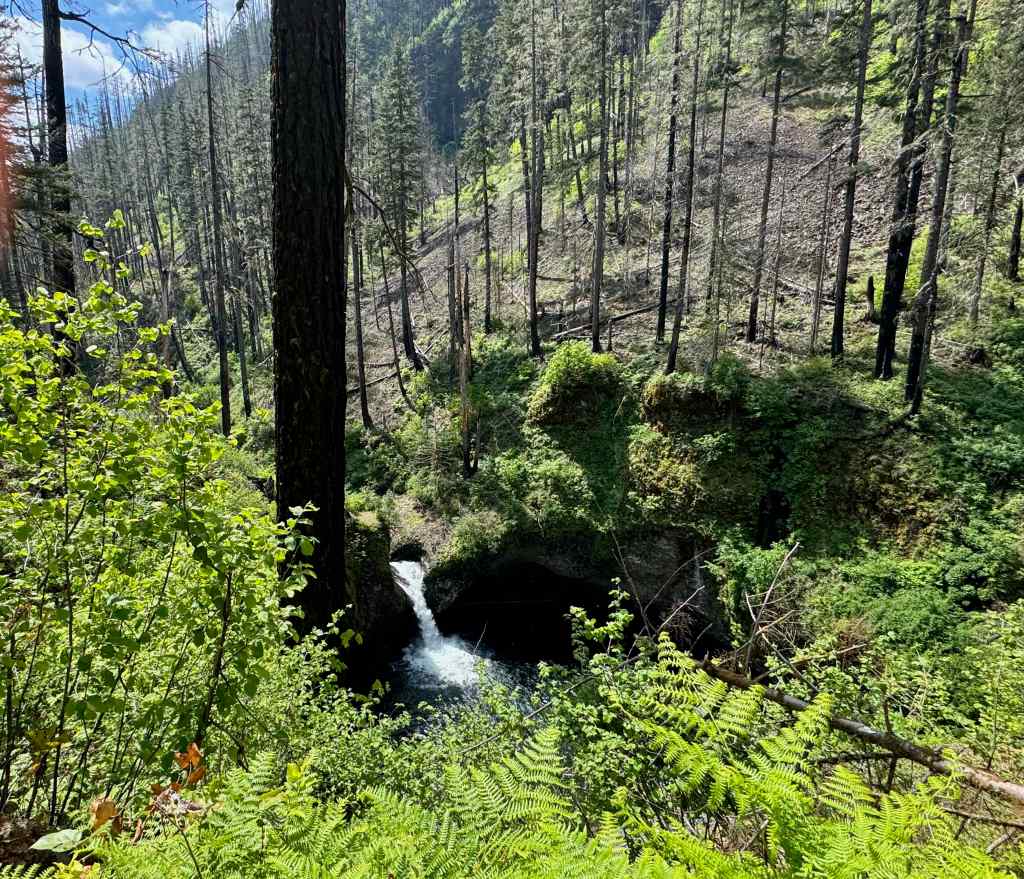
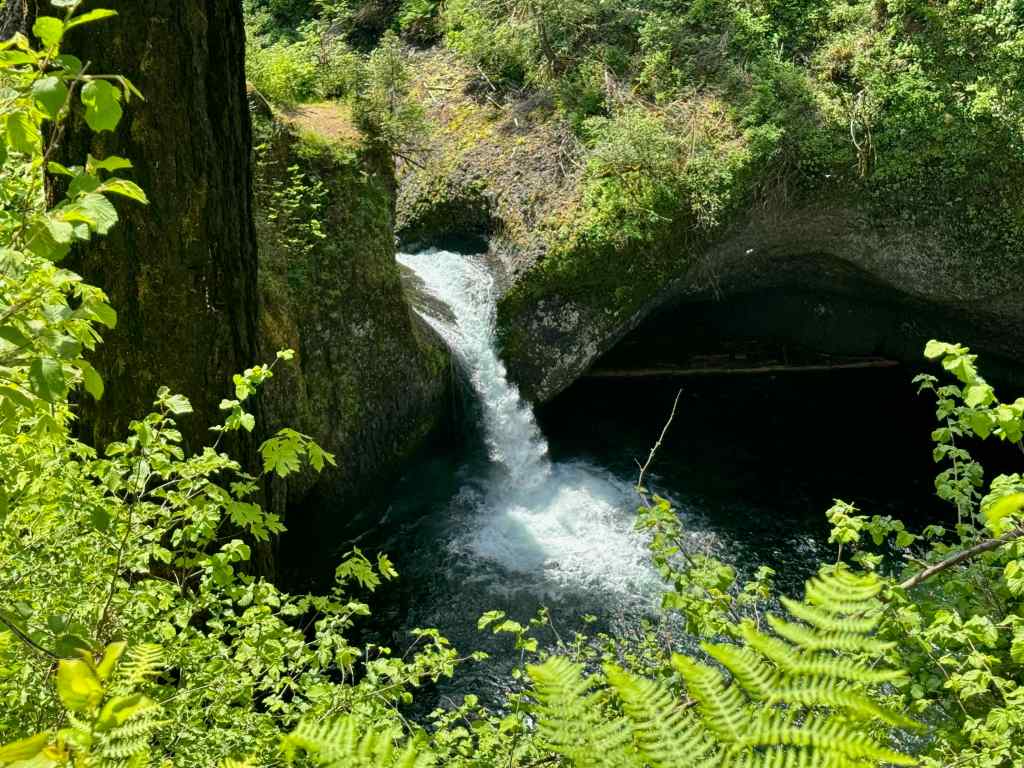
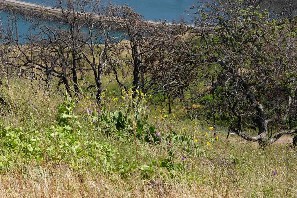
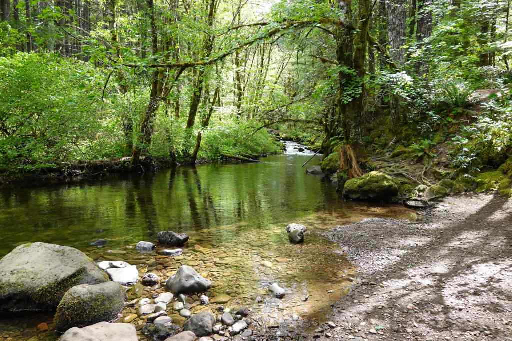
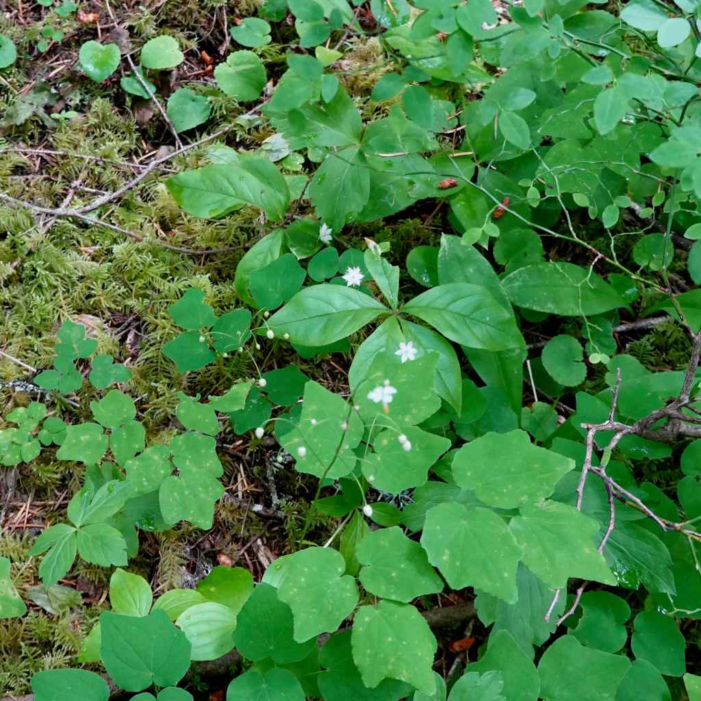
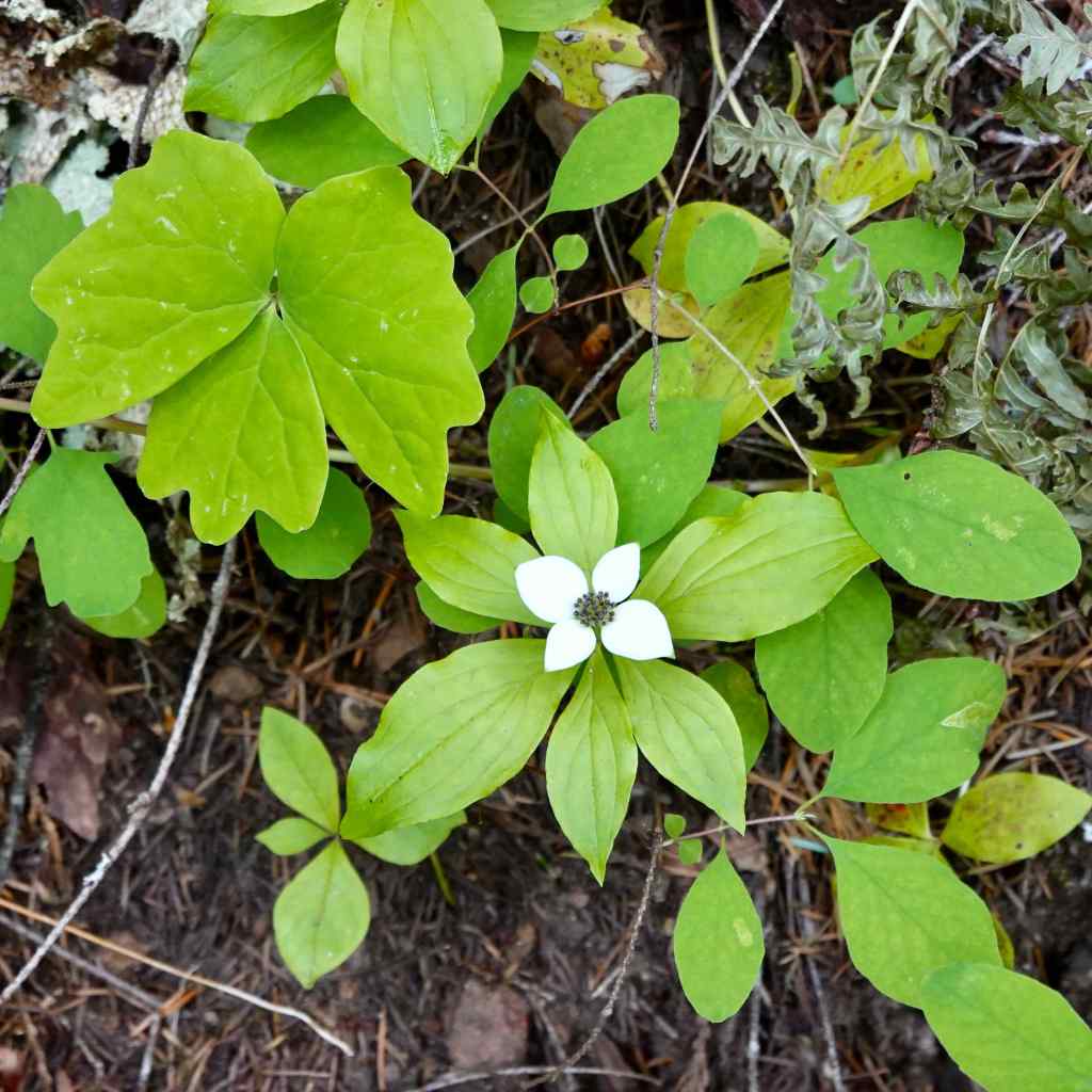
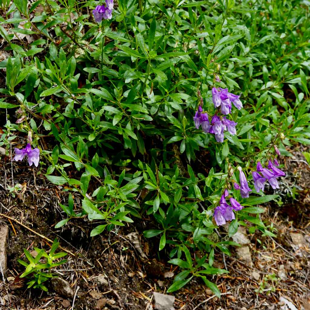
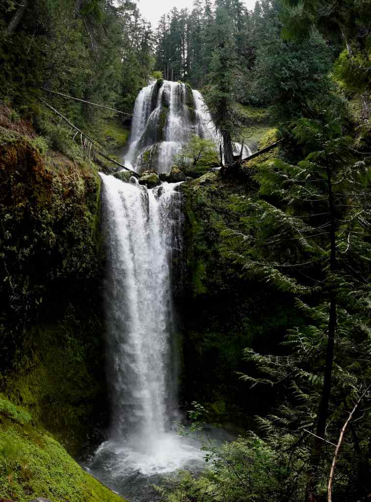
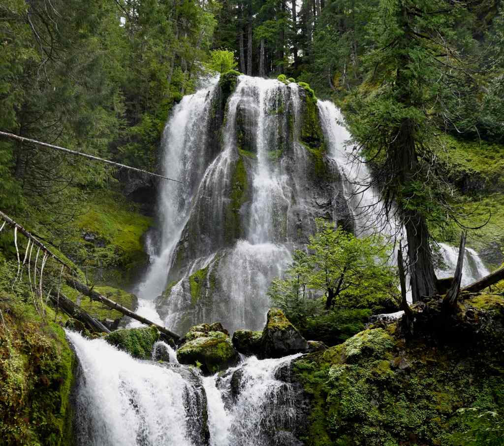
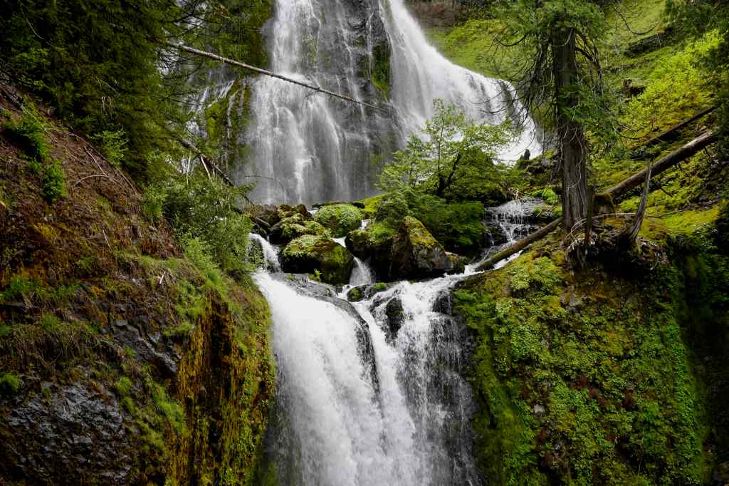
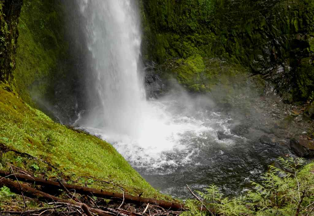
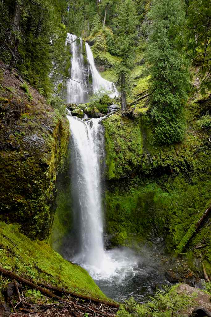
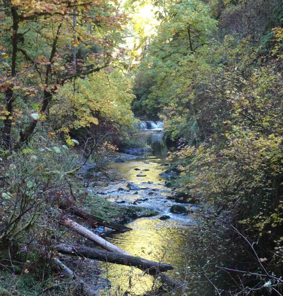
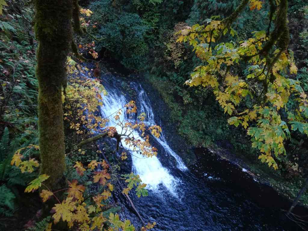
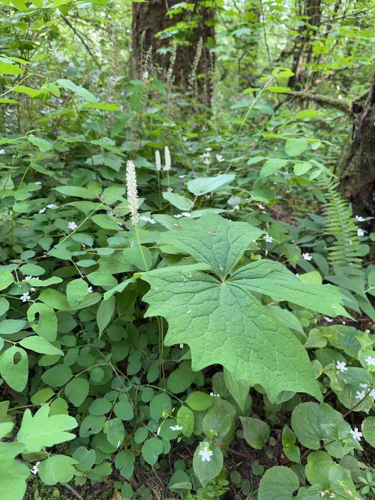
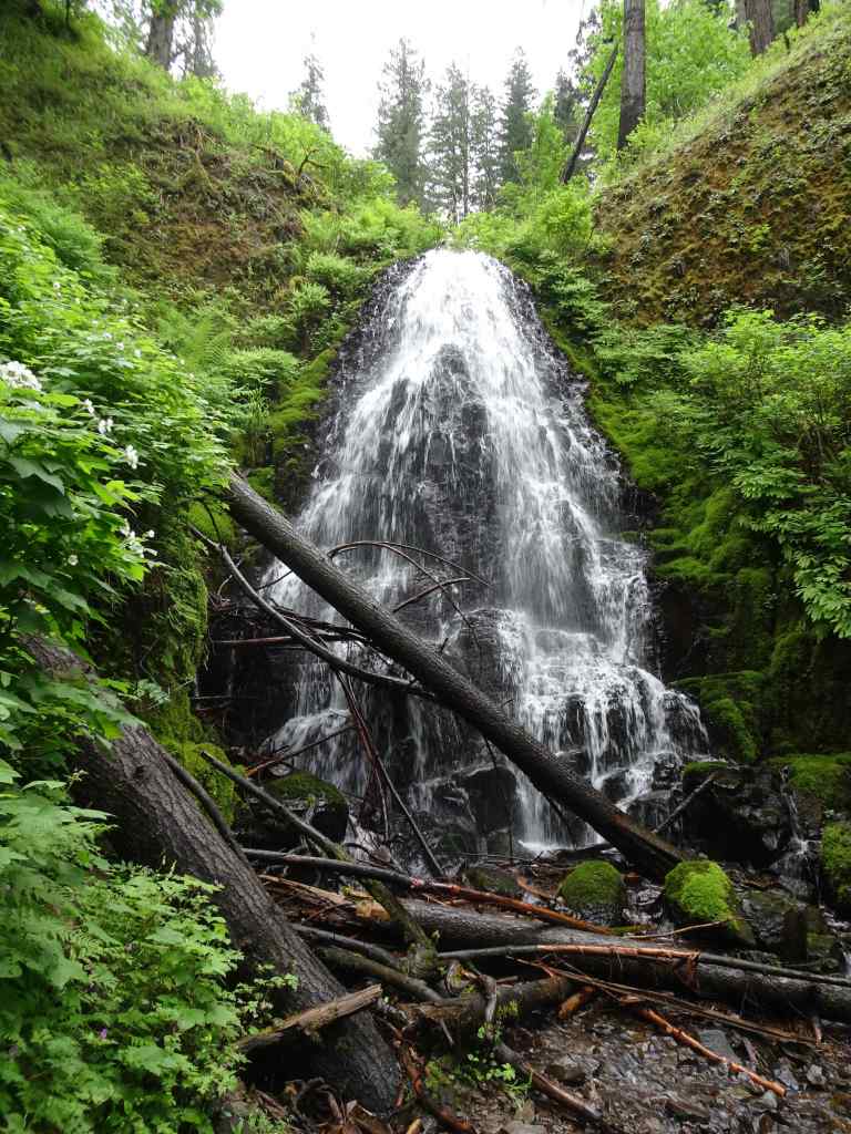
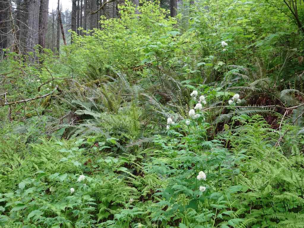
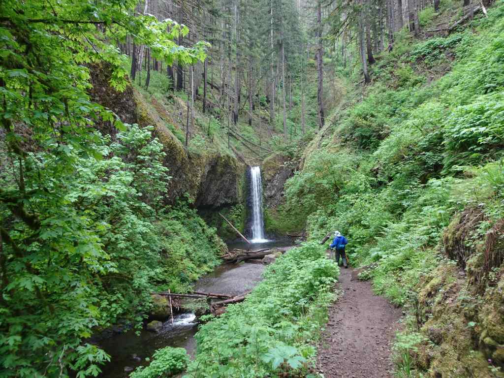
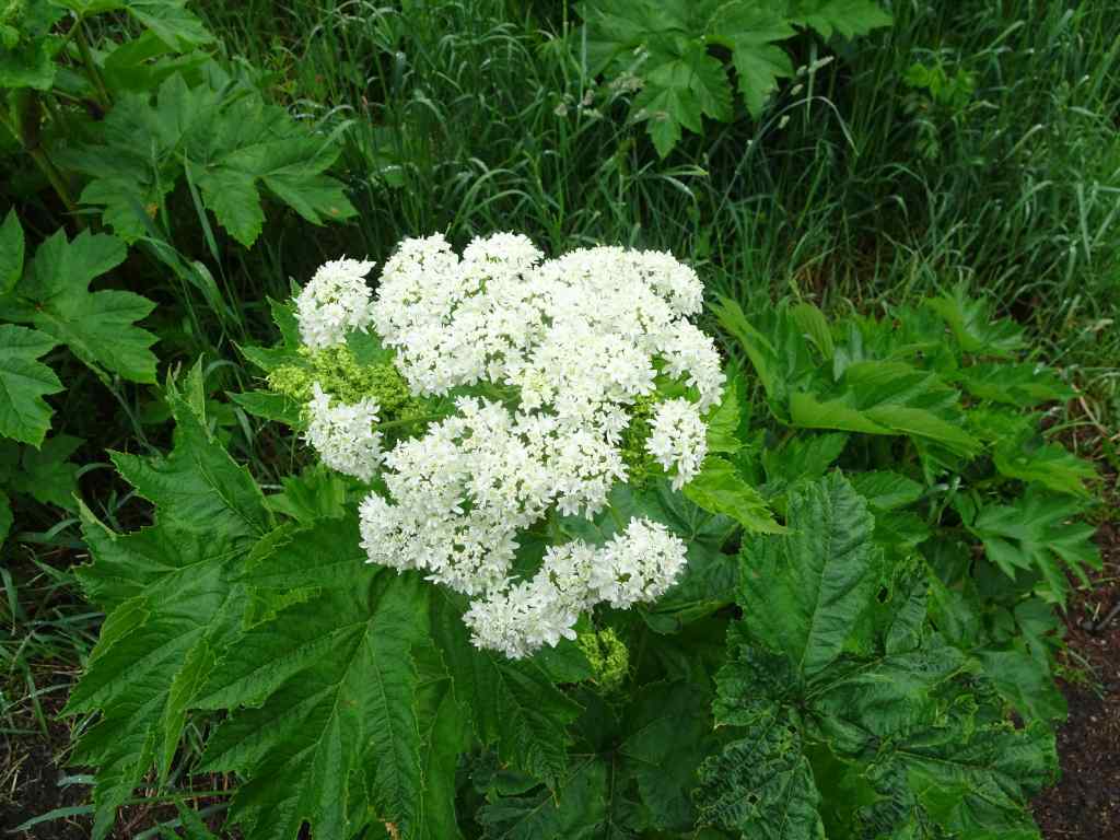
5/26 – Falls Creek Falls, WA
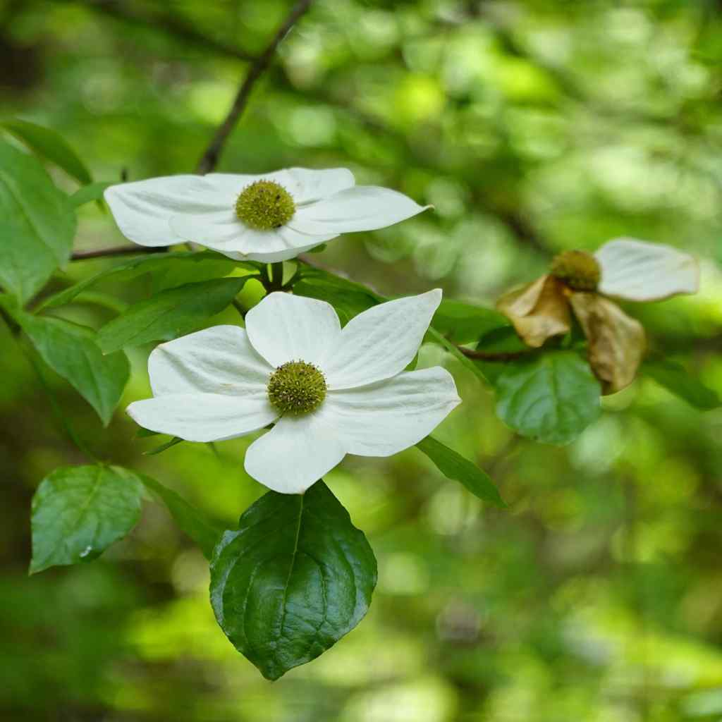
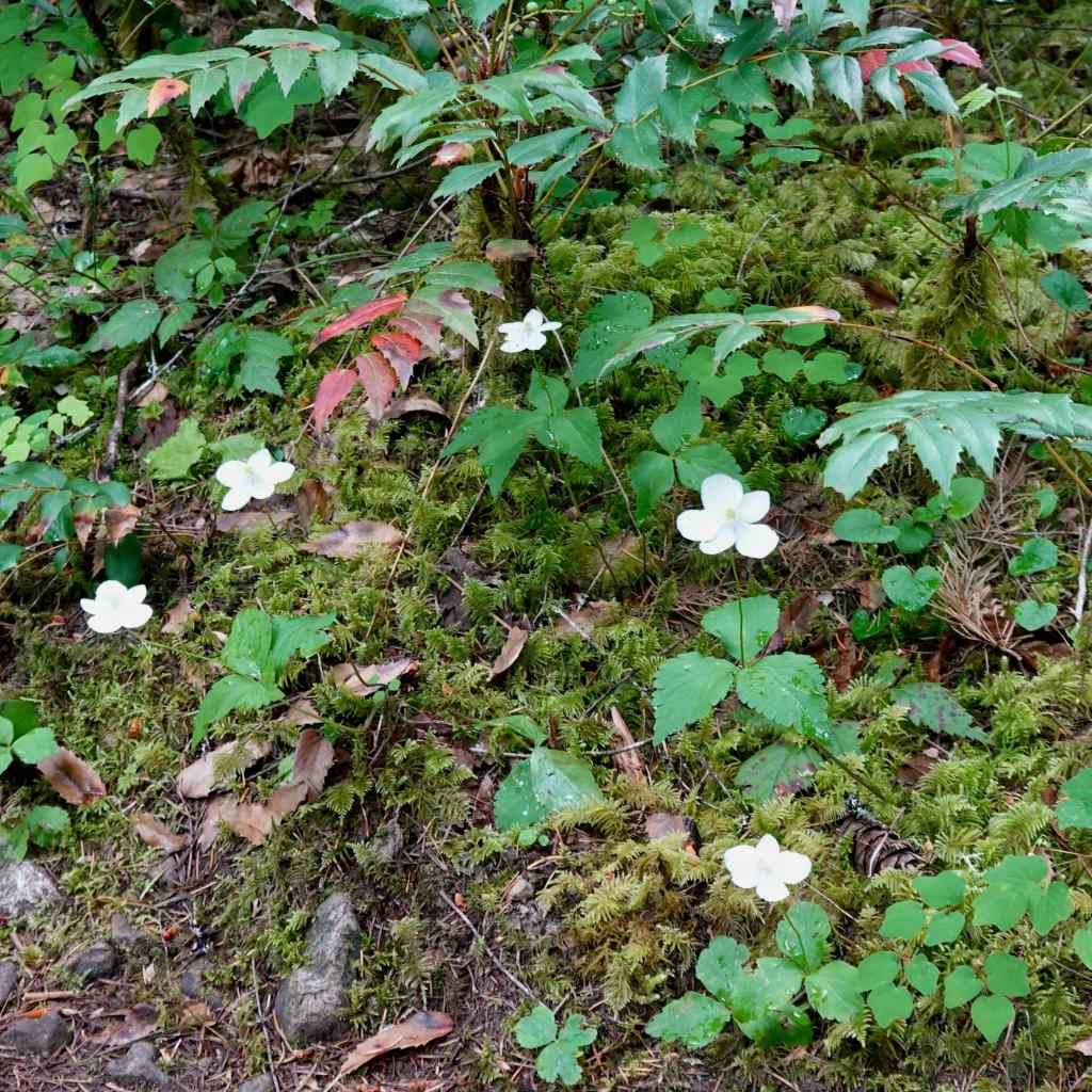
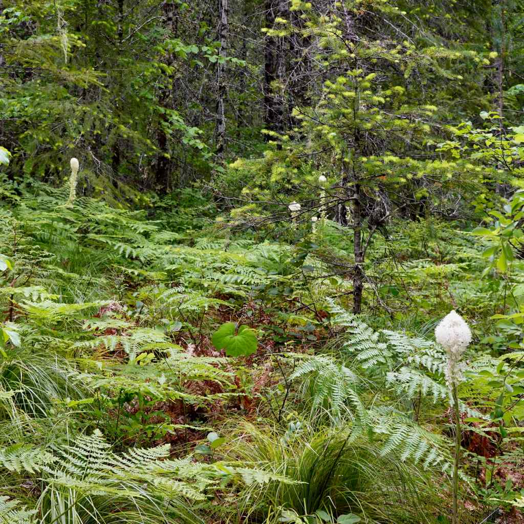
We enjoyed this relatively easy, mostly shaded hike on a warm day (3.4 miles, 620 feet). The last time I was here, in the fall of 2018, fall colors were on display. Today there were white flowers in the forest, a few colorful flowers in the sun, and the sound and glory of this enormous waterfall!!
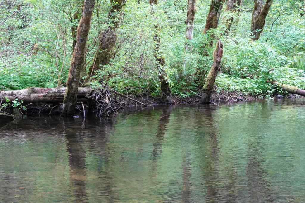
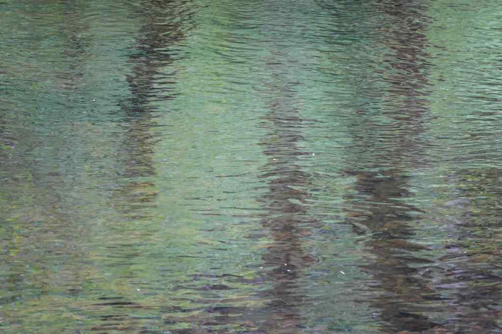
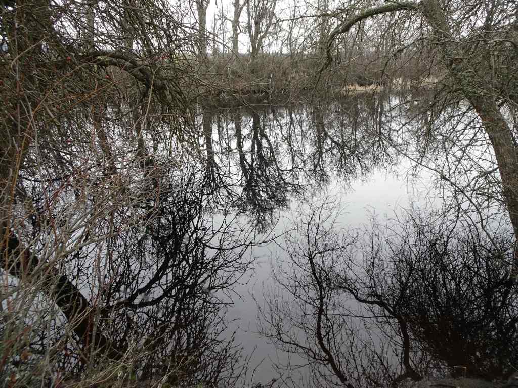
The trail follows Falls Creek for much of the way.The creek is tree lined and shady.Reflections of green and purple in the water.We passed a few cascading rapids, and crossed a bridge over a small gorge.
White flowers in the shady parts of the forest:
DogwoodAnemoneBeargrassBead liliesStar flowers and upside-down flowersBunch berries
A few more colorful flowers in the sunny spots:
PenstemonColumbine and anemone
And Falls Creek Falls at the end of the trail:
Falls Creek Falls – 335 feet total drop.Upper tierMiddle stepPlunge poolSlightly different view from our lunch perch.
And then a mostly easy downhill walk back along the creek to conclude this pleasant day in the forest.
We only went on two hikes in December, one in town, and one out in the eastern gorge.
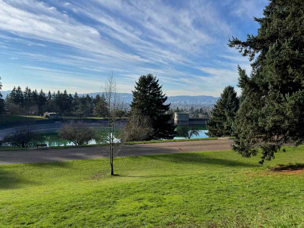
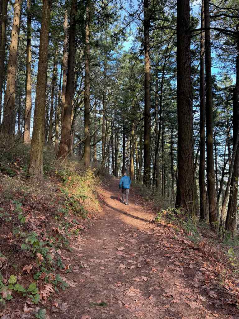
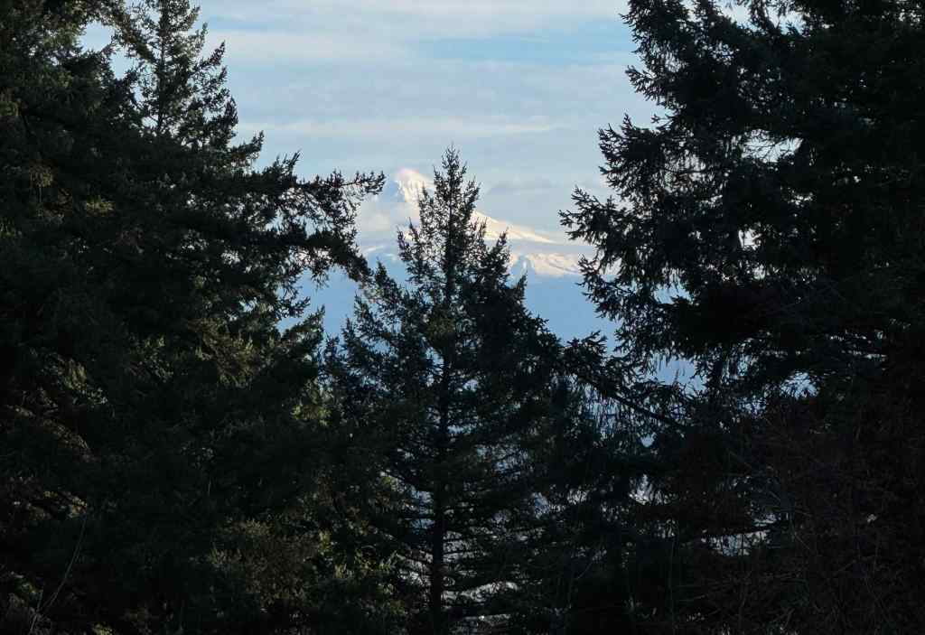
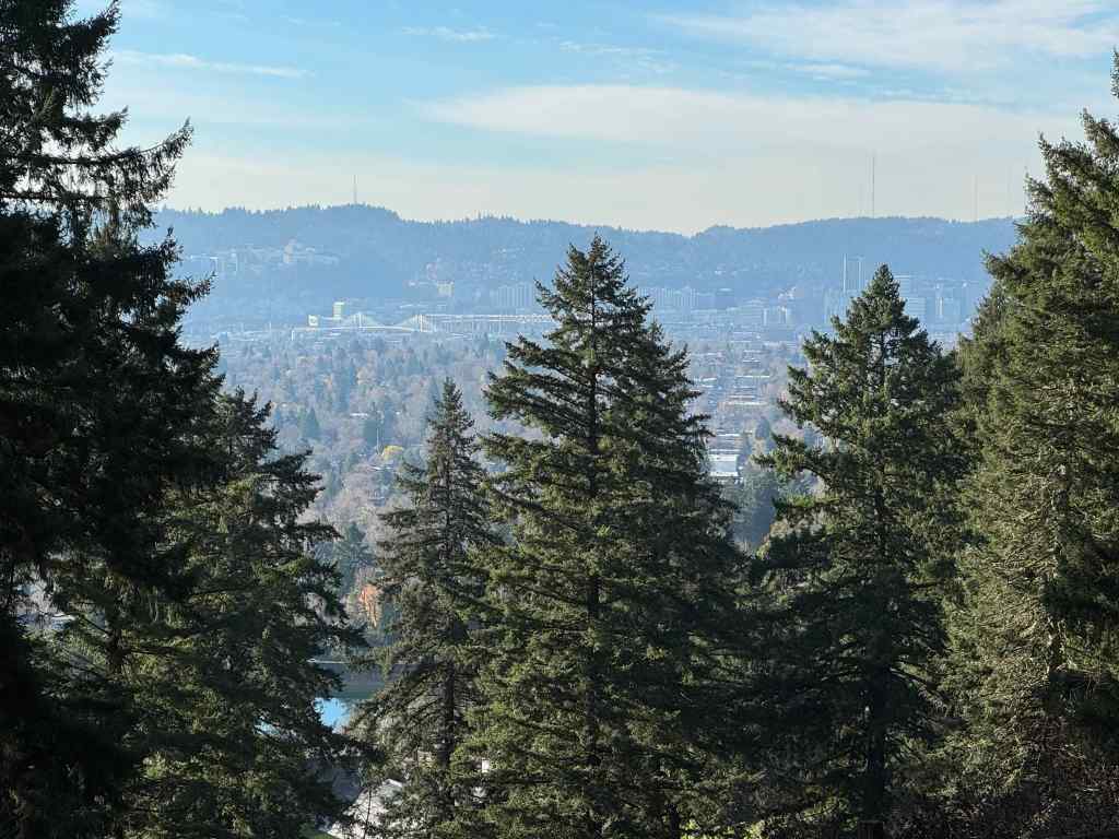
12/1/2025 – Mt Tabor, Portland
On a sunny day, we drove to our nearest extinct volcano, and walked around its circumference and up to the top, taking in views, and getting a good leg stretch (2 miles, 200 feet). There are many trails that circle around and through the park, and many users, running, walking, and stair climbing. It is a great public space on the east side of Portland.
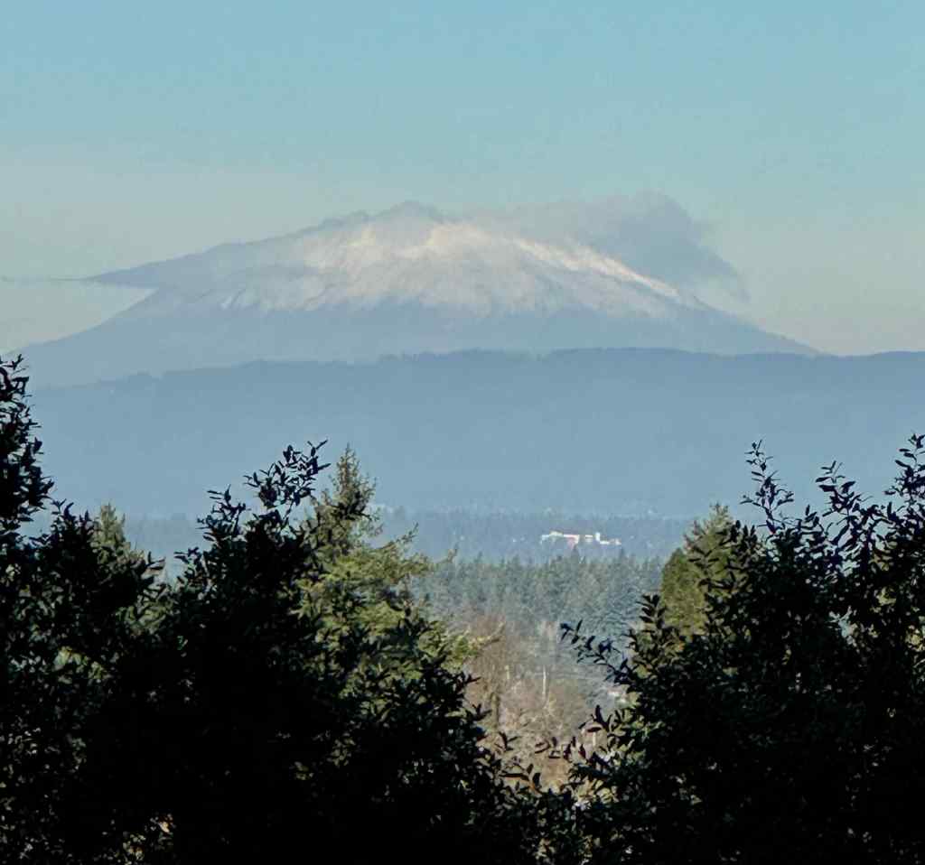
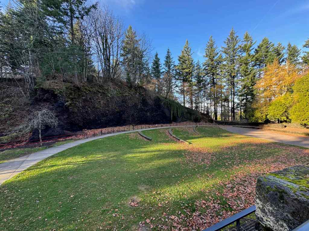
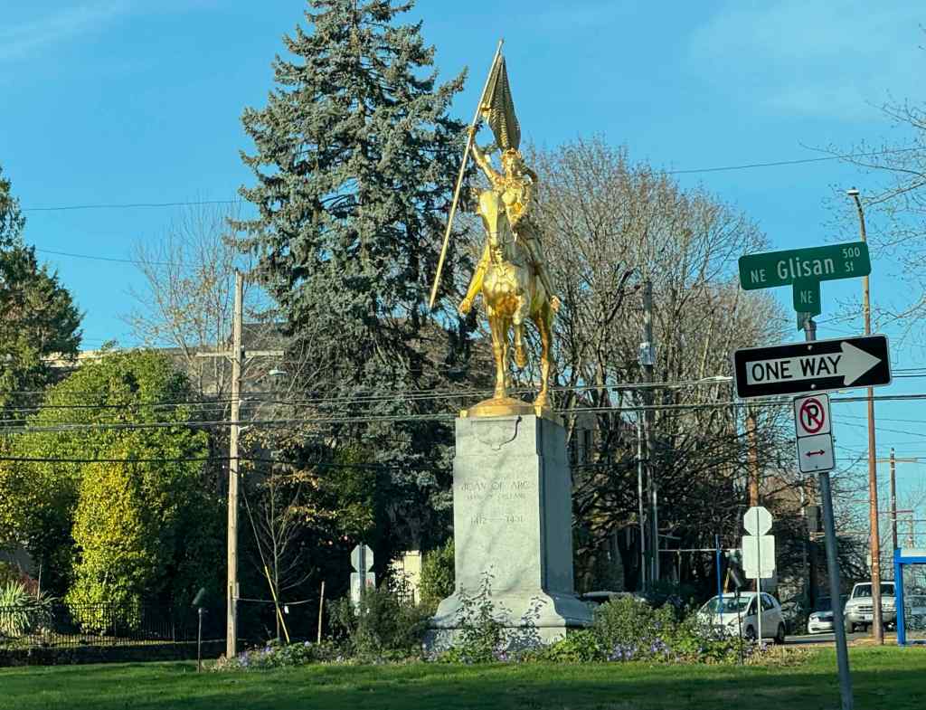
As we gained elevation, we got a western view toward downtown Portland across one of the reservoirs.We continued upward on one of the forested trail to the top.There is a view to Mt Hood through the trees near the summit.And another view toward downtown.We hiked down the northern slope, and got a peek at Mt St Helens.The amphitheater near the parking lot has an outcrop of the volcanic layers.We passed Joan of Arc, glittering defiantly in the sun, in her traffic circle, on the drive home.
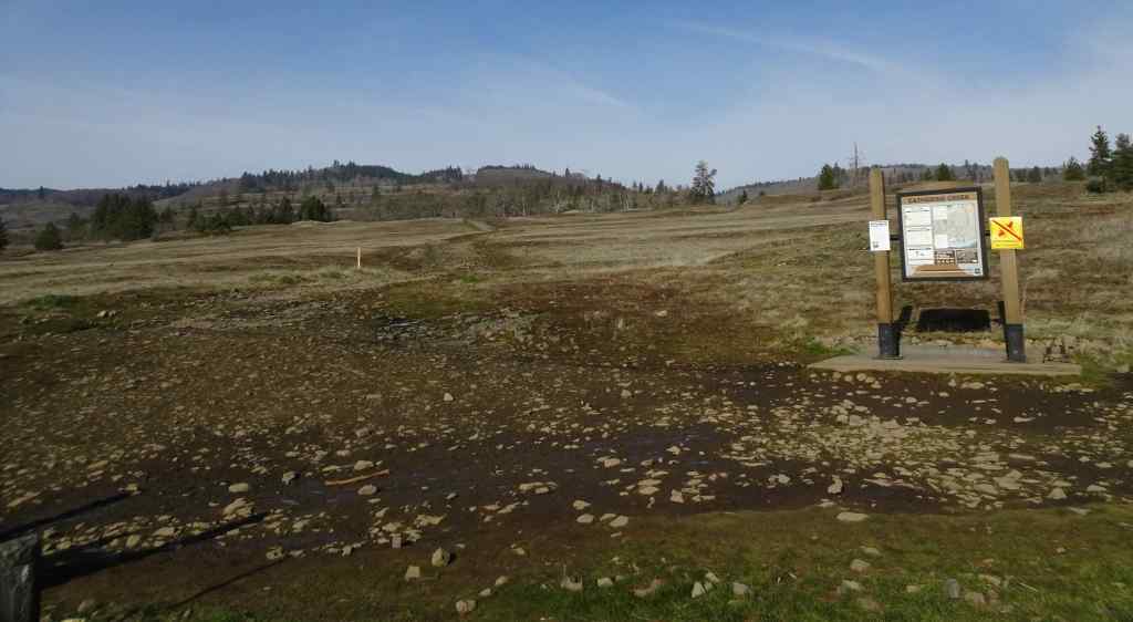
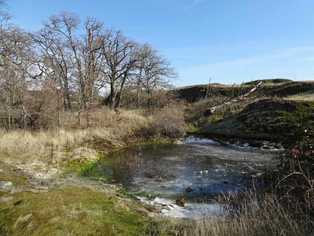
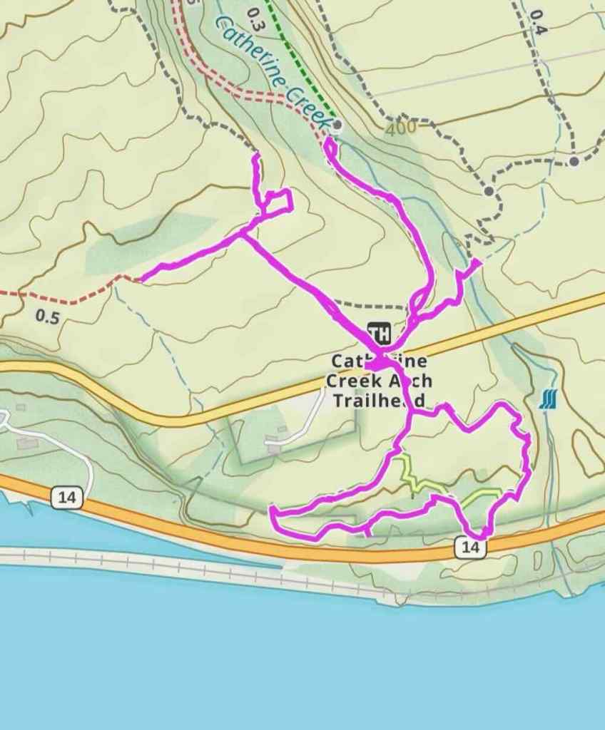
12/23/2025 – Catherine Creek, WA
We went with our daughter to this favorite winter hiking spot. This is our second time here since the Burdoin Fire last July. This time, we walked the East Loop above the Arch, and also made a quick trip down to the waterfall viewpoint on the lower ADA trail. (3 miles, 450 feet).
At first we planned to walk the loop that returns by crossing the creek below the Arch, but we wanted to be sure the creek crossing was possible, so we went to look.
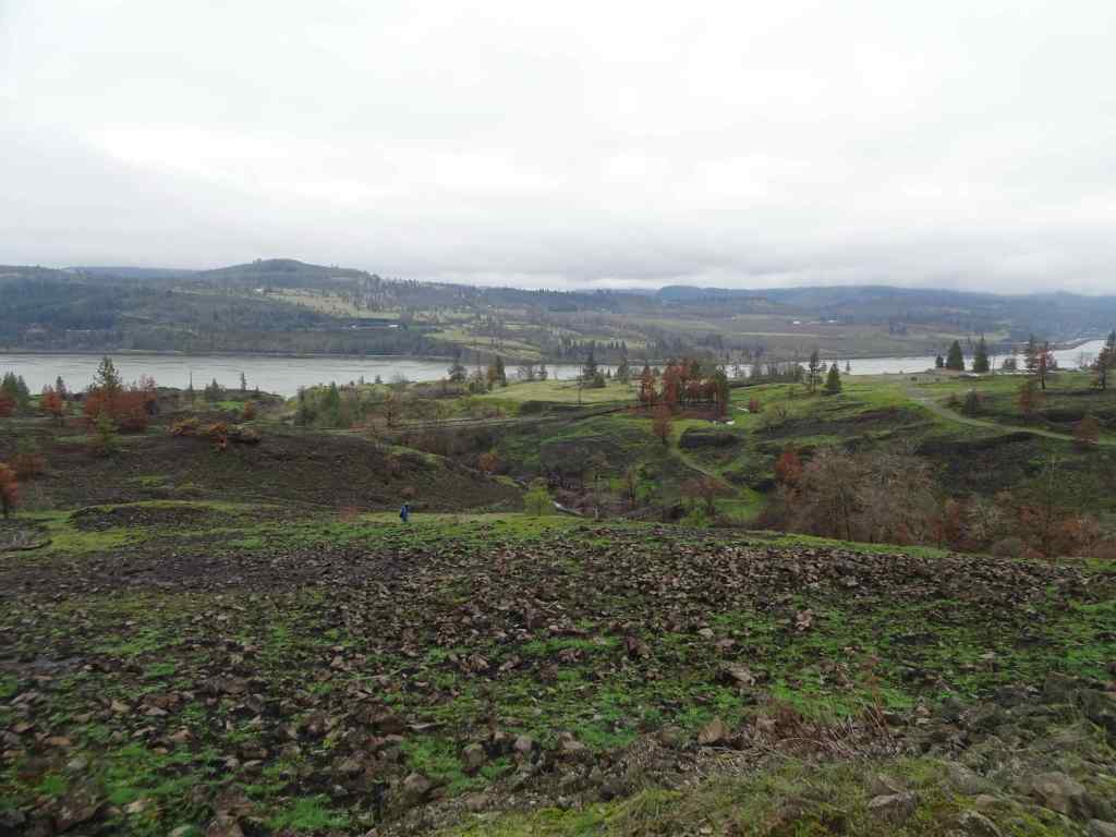
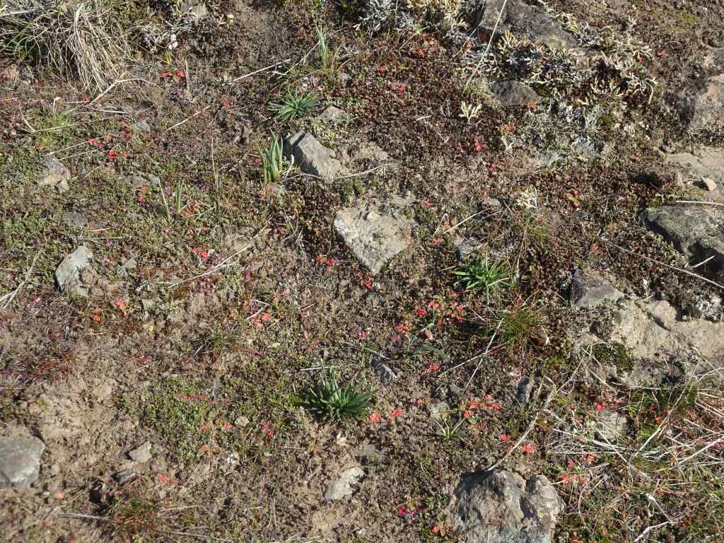
Catherine Creek crossing on the lower Arch trail. The waterfall-like step is actually the plank bridge, now broken and underwater. The road/trail was not accessible without serious wading. So we took the trail above the Arch, and then the eastern return loop.Walking across the burned slopes toward the lower bridge across Catherine Creek. This one survived the fire.Once we reached the slopes near the Arch, we could see across the Columbia River to the west,And to the east.Bitterroot foliage coming up through a rocky, mossy area that likely escaped burning. There were a few unburned areas within this mostly burned slope.View from the top of the Arch, new fence in place.We ate lunch on the rocky outcrop just north of the Arch, then continued our loop to the east, passing scorched pine trees.We returned back across the lower bridge.
Then we took a quick walk down the paved ADA trail south of the parking area, to see the waterfall.
Catherine Creek Waterfall. This side of the road has dead, dry grasses on the slopes because it didn’t burn along the paved trail. But it looks like it did burn across the river.
We enjoyed this hike on an overcast but not rainy day. It was nice to spend some outdoor time with our daughter. And it will be interesting to watch the land here as it recovers from the fire damage.
Three hikes this month. Our fall hiking areas on the Washington side of the eastern Columbia River Gorge are still impacted by Burdoin Fire damage. We hiked twice on the Oregon side, and once in the Cascade foothills east of Salem.
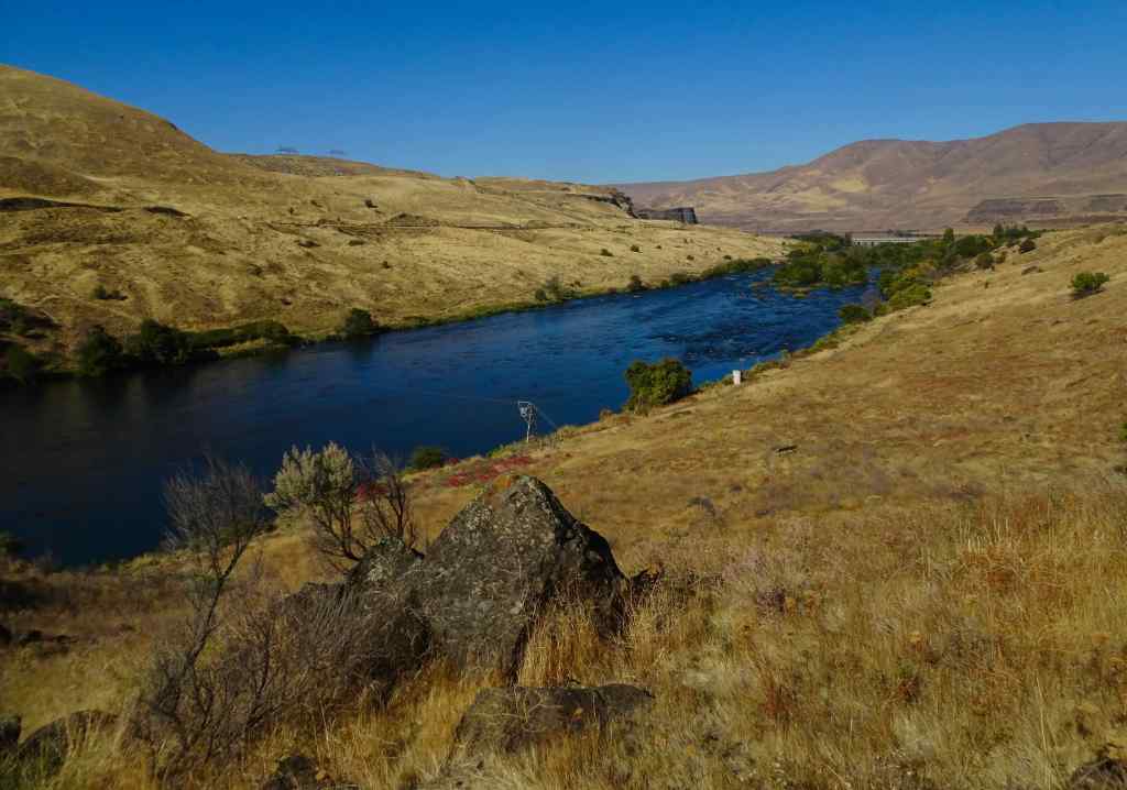
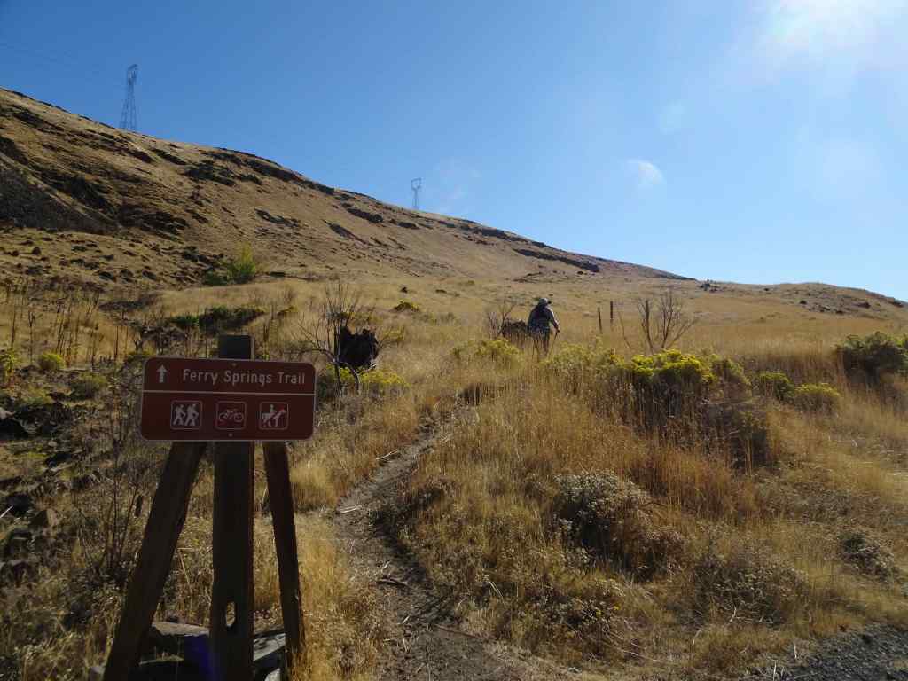
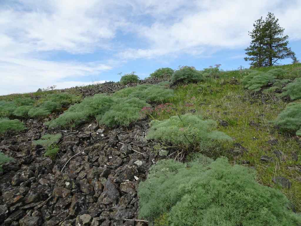
10/14 – Deschutes River Trail, Oregon
Our usual loop, up to Ferry Springs, and then return along the Deschutes River (4.5 miles, 600 feet).
Blue sky today, a light breeze.
Walking along the Deschutes River. Reflections, a few water birds.Rising up above the river, view to the confluence with the Columbia River.Upstream viewUphill toward Ferry Springs.
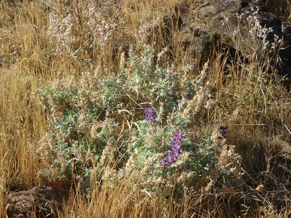
Still losing my breath on the uphill. There are clumps of white and pink blooming buckwheat, yellow rabbit brush, and a few scrabbling lupines. Dried out balsamroots and thistles punctuate the slopes of golden grass where it was blackened and burned a few years ago. Very little sign of the fires now, so much has regrown. Once again, it is peaceful out here – down by the river there are many people fishing for steelhead; we saw one train on the western bank; otherwise a rock wren, a raven call, and us.
RabbitbrushSnow buckwheatLupine
We crossed over Ferry Springs, then looked down toward the river.
The Ferry Springs CrossingLooking down on Ferry Springs as it joins the Deschutes River.And the view to the Columbia River and Columbia Hills.Almost back to river level, looking through the arch.
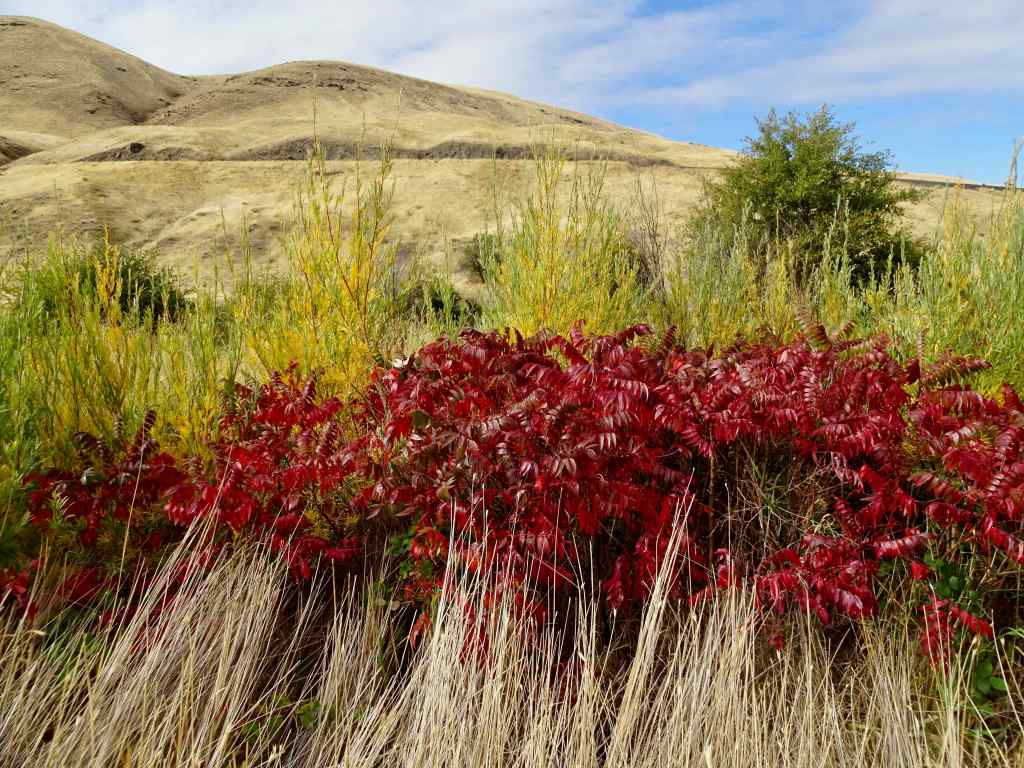
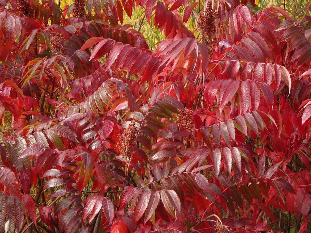
Back along the river, walking north –
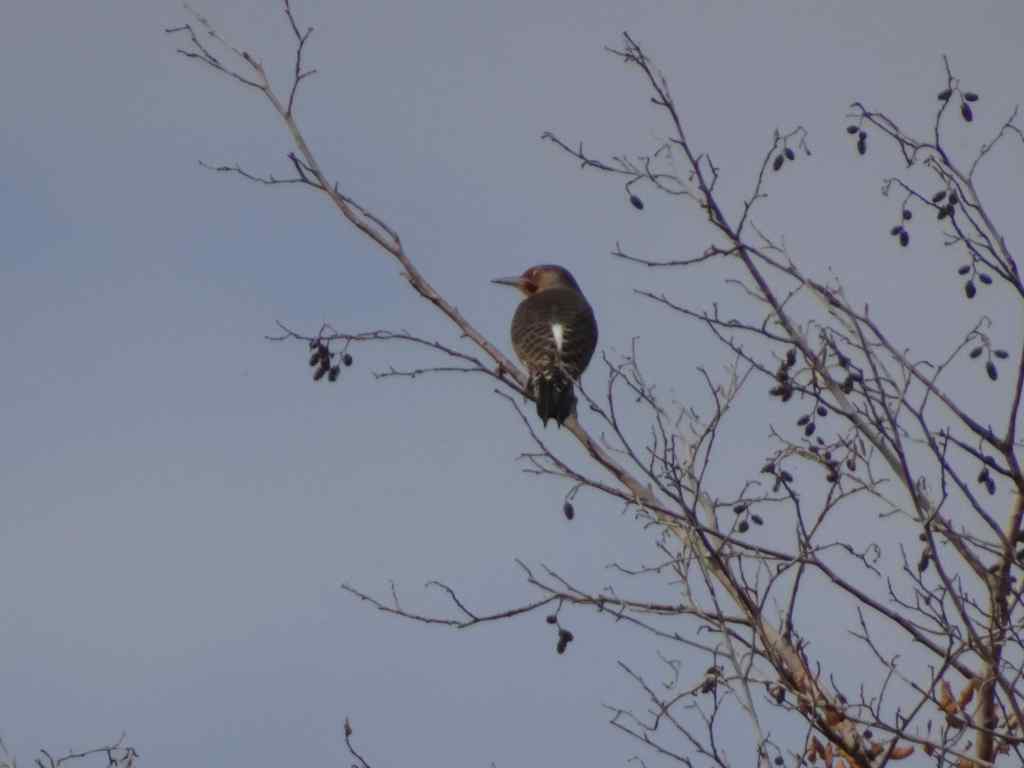
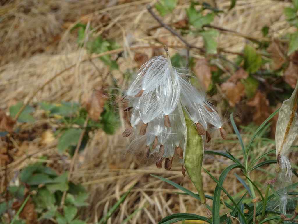
SumacSumacRiver viewDucksNorthern flickerMilkweed seeds getting ready to disperse.Milkweed seed
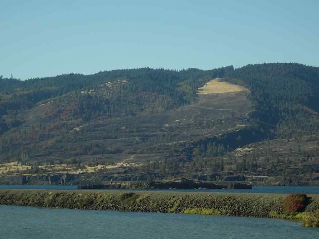
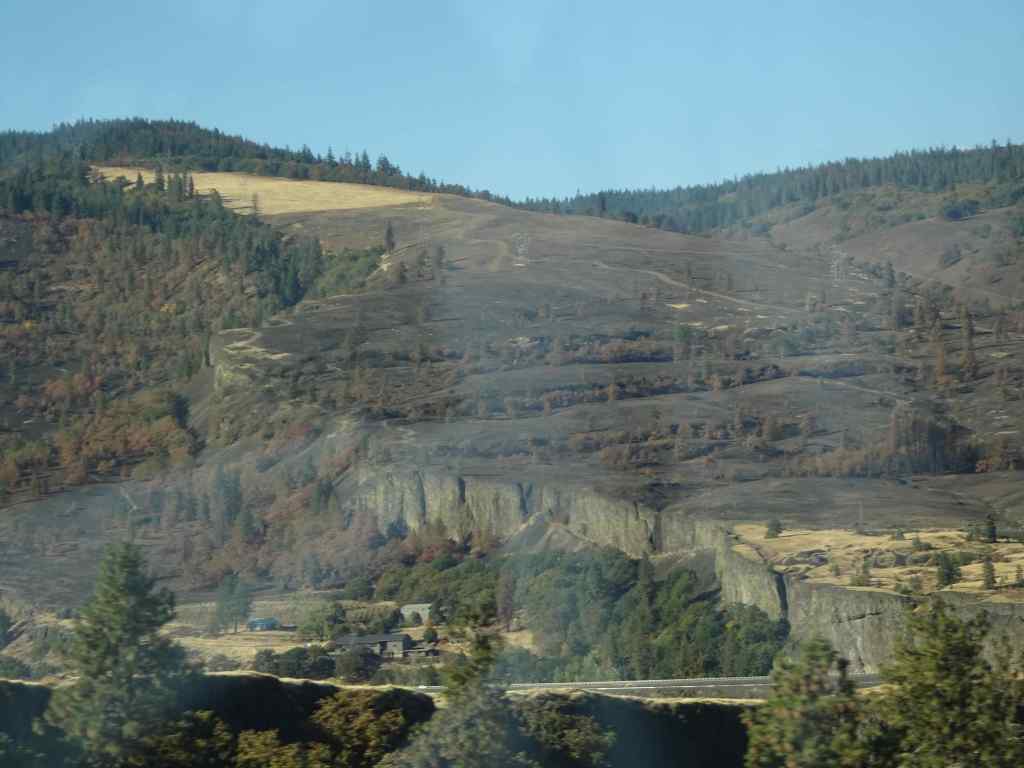
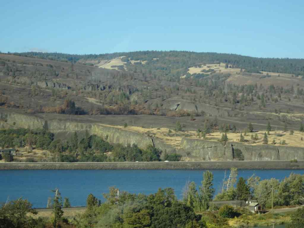
We appreciated the golden slopes we just walked down, especially after seeing the blackened slopes at Catherine Creek. As we drove back west along south side of the Columbia River, I took a few shots of the Burdoin Fire area in Washington that was burned last summer. There are some very black slopes, but also some unburned areas. I can’t quite see my favorite trees from this view.
Catherine Creek hiking area, from I-84, westbound.Catherine Creek areaCatherine Creek area. The Arch and Tracy Hill.
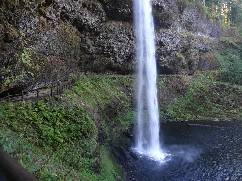
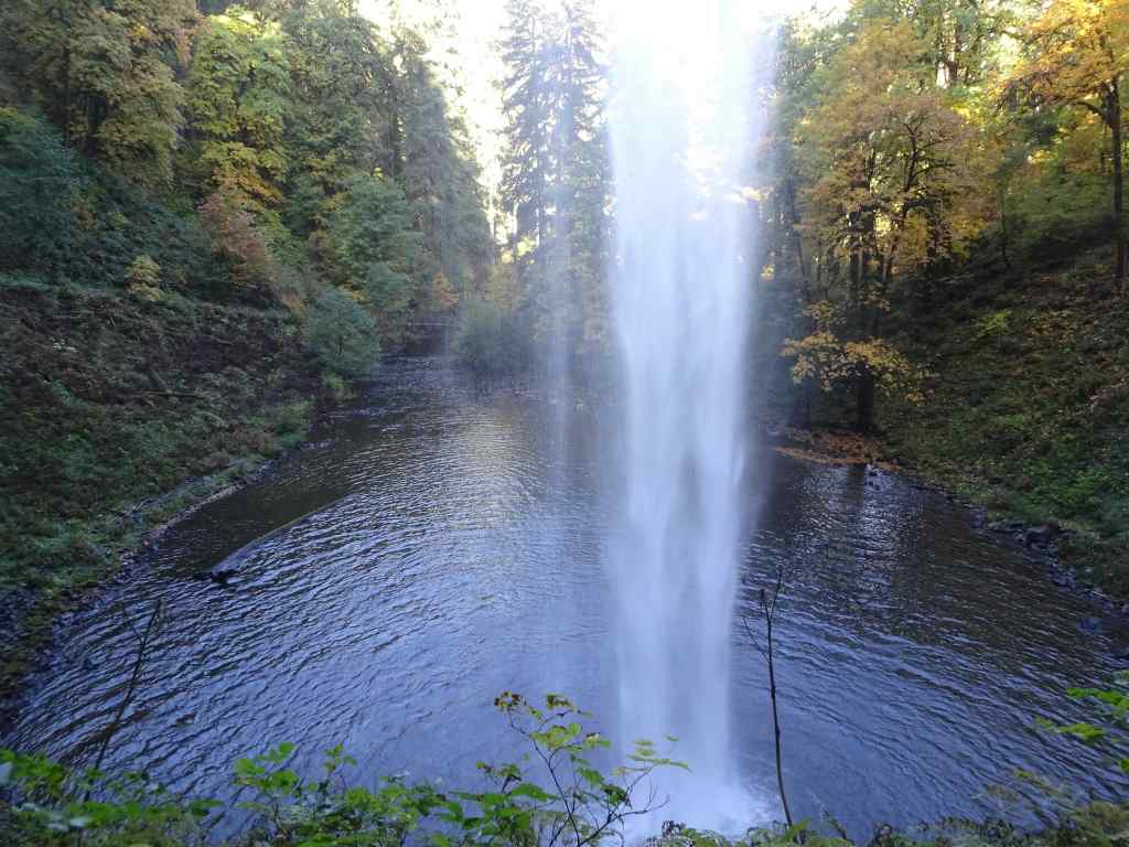
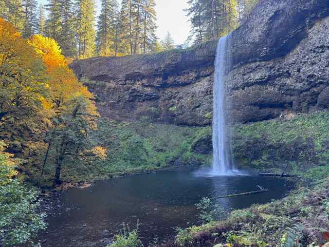
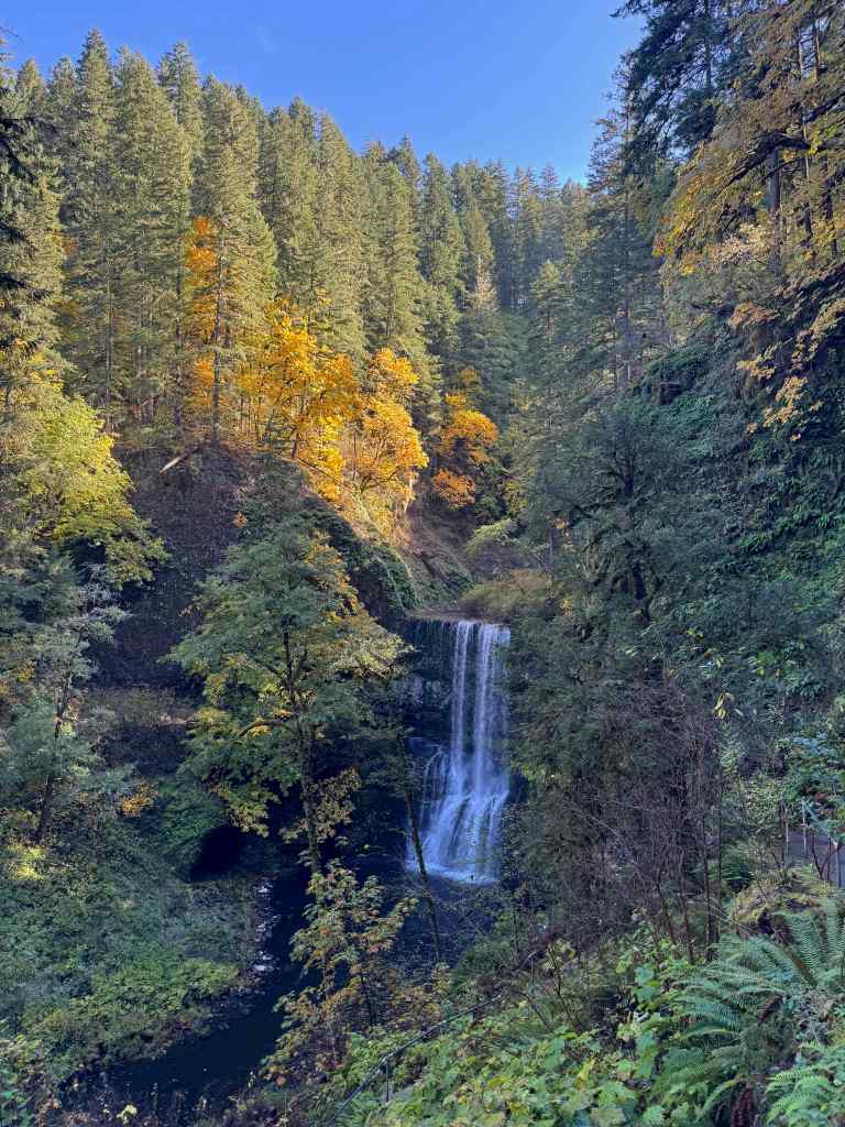
10/20 – Silver Falls State Park, Oregon
Another place we have hiked many times. Today we saw six of the ten famous falls (5.8miles, 600 feet).
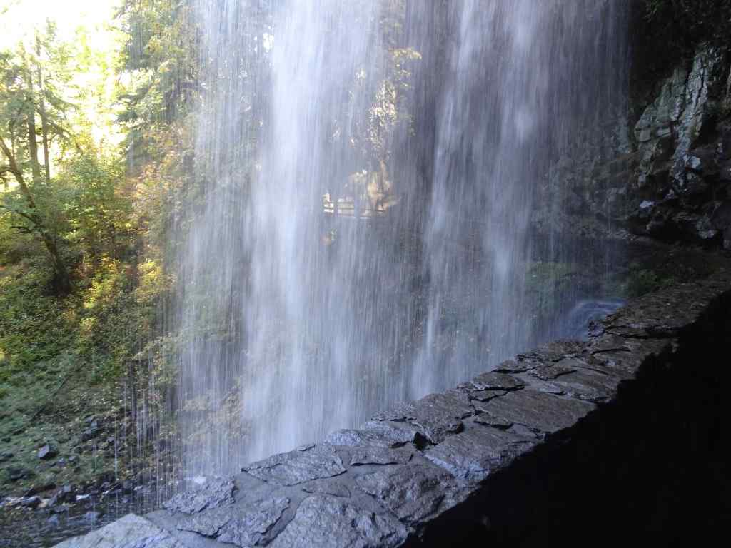
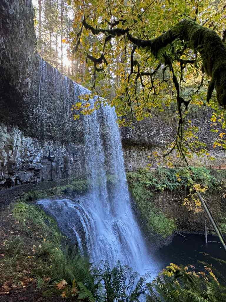
South Falls
Looking down toward South Falls.Our trail goes behind the falls.Looking downstream from behind the falls. This time of year the spray doesn’t soak us.Looking up toward the rim.And looking back from the other side.
Lower South Falls – We continued downstream along the South Fork of Silver Creek, eventually descending switchbacks and staircases to walk behind Lower South Falls.
Descending toward Lower South Falls.Walking behind the falls.Downstream view.Looking back from the other side.
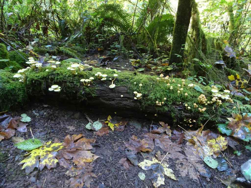
Lower North Falls – Next, we passed the confluence of the North and South Forks of Silver Creek, and began walking upstream along the North Fork.
Mushrooms and mossCrossing the North Fork.Lower North Falls
Drake Falls – Continuing upstream along the North Fork…
Autumnal trail – lots of big leaf maple leaves drifting down.We only get a sideways view of Drake Falls from the viewing platform.
Middle North Falls – A side trail goes under the falls, but we didn’t take it today.
Middle North Falls
Winter Falls – From here, we crossed the river again, and passed the nearly dry Winter Falls while ascending to the rim and walking back to our starting point.
Winter Falls trickling down.
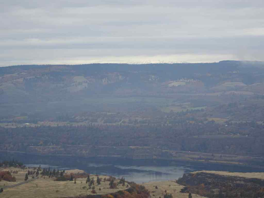
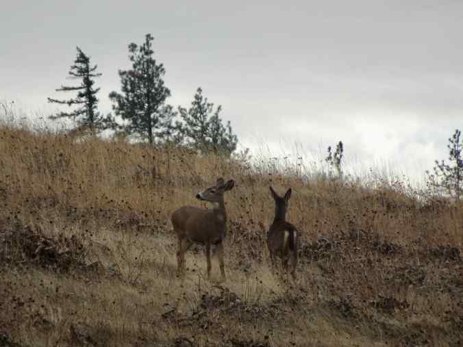
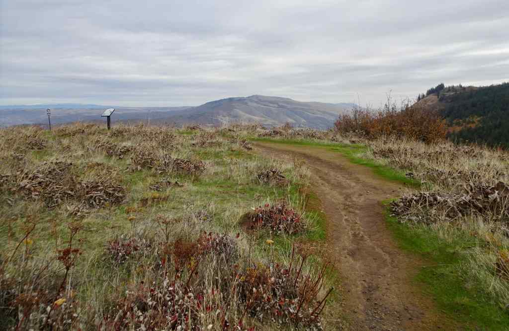
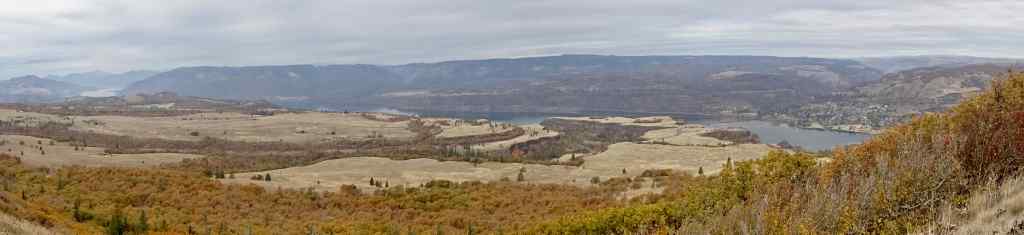
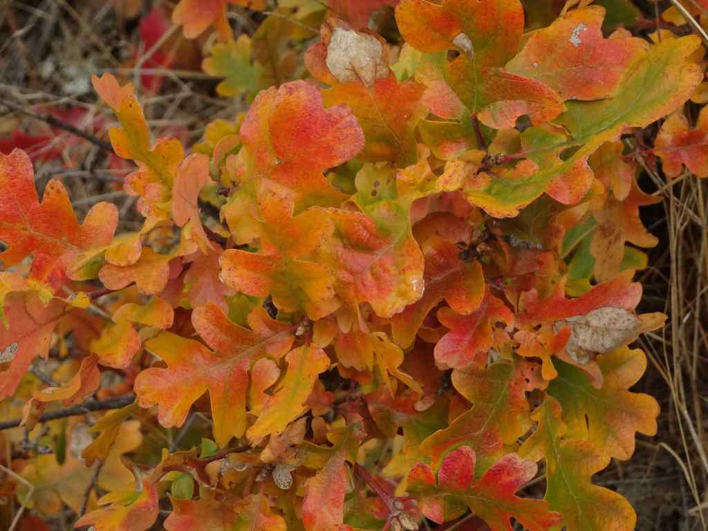
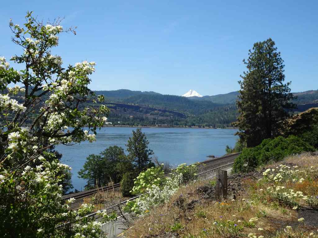
10/28 – Tom McCall Point, Oregon
One of the prime wildflower locations of spring; orange oak leaves color the slopes on this quiet autumn day (3.6 miles, 1000 Feet).
Our destination – Tom McCall Point, through the mist.Parsley alley is rather bare.Looking north from the lower plateau – Rowena Curves below; Lyle, Washington across the Columbia River.Bright orange oak leaves; Memaloose Hills to the west.Zooming in on the shoulders of Mt Adams – the most we would see of it today.
We startled a small family of deer near the summit.
Mule deerMule deerSummit of Tom McCall Point, covered with clumps of dried balsamroot foliage.View toward the Columbia HillsPanorama from this top of the world…The neon orange oak leaves that brightened our day.
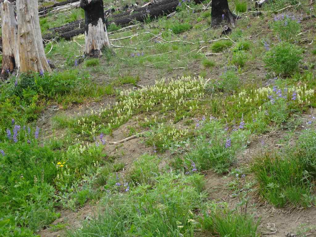
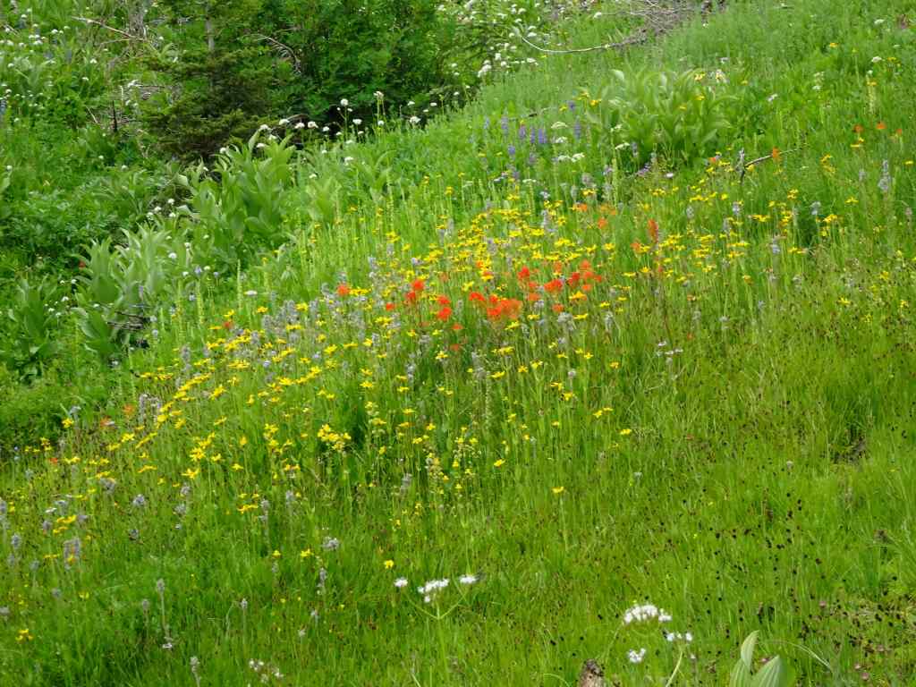
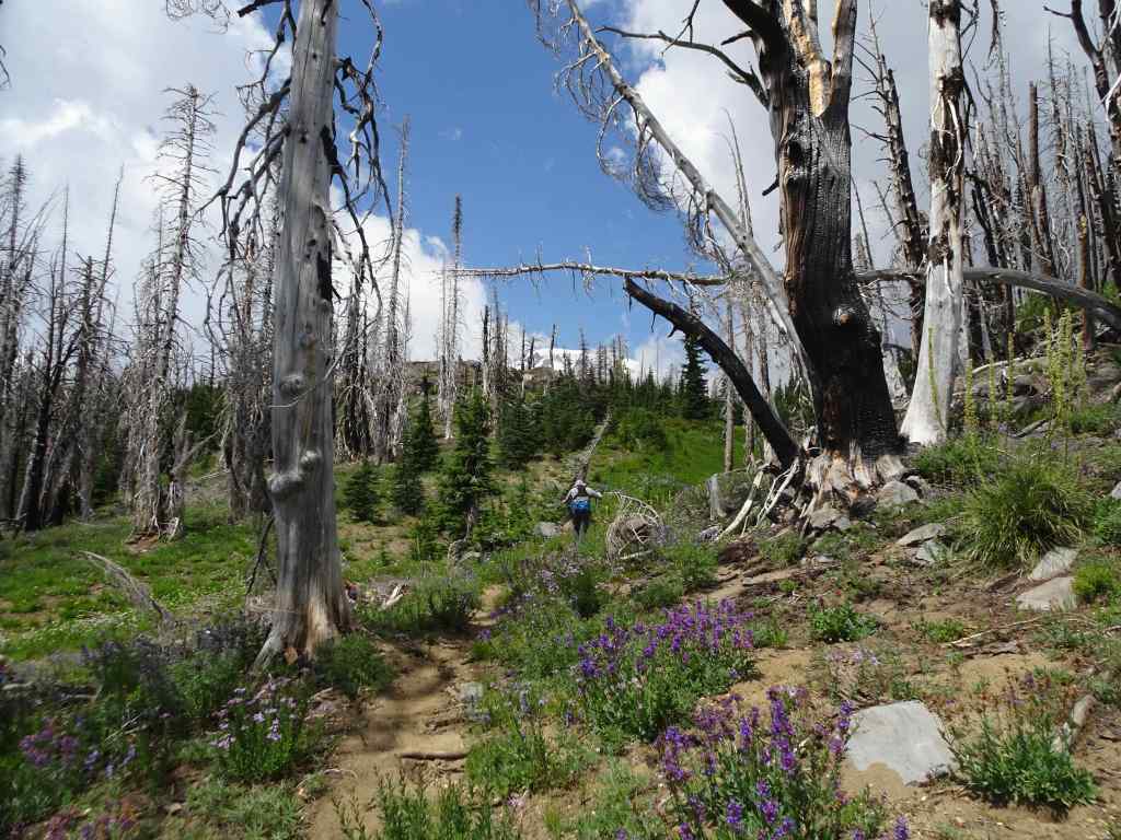
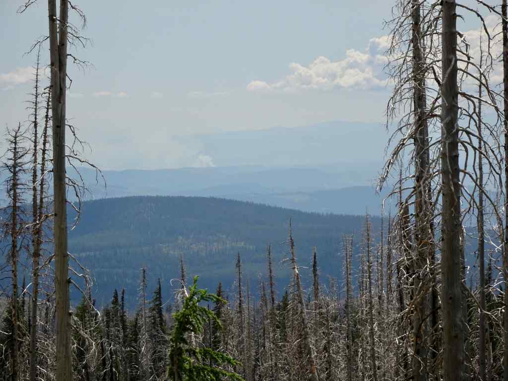
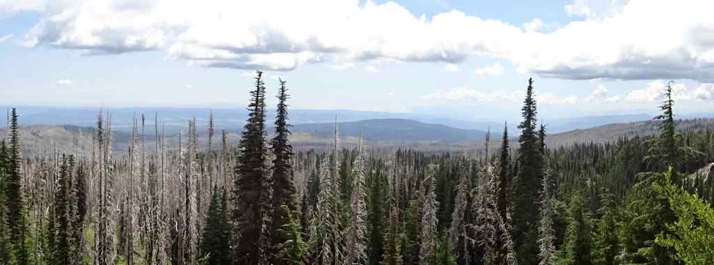
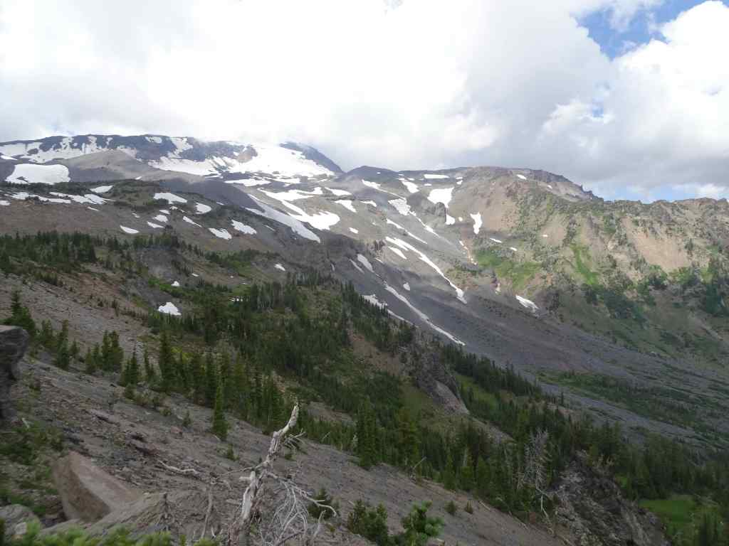
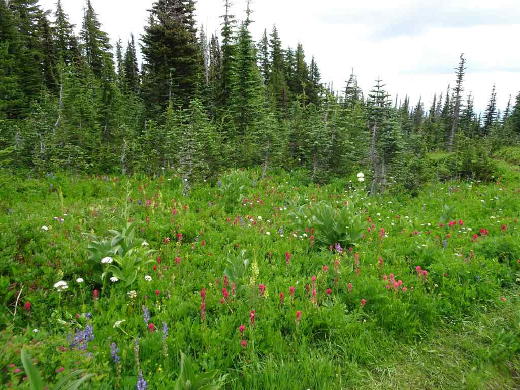
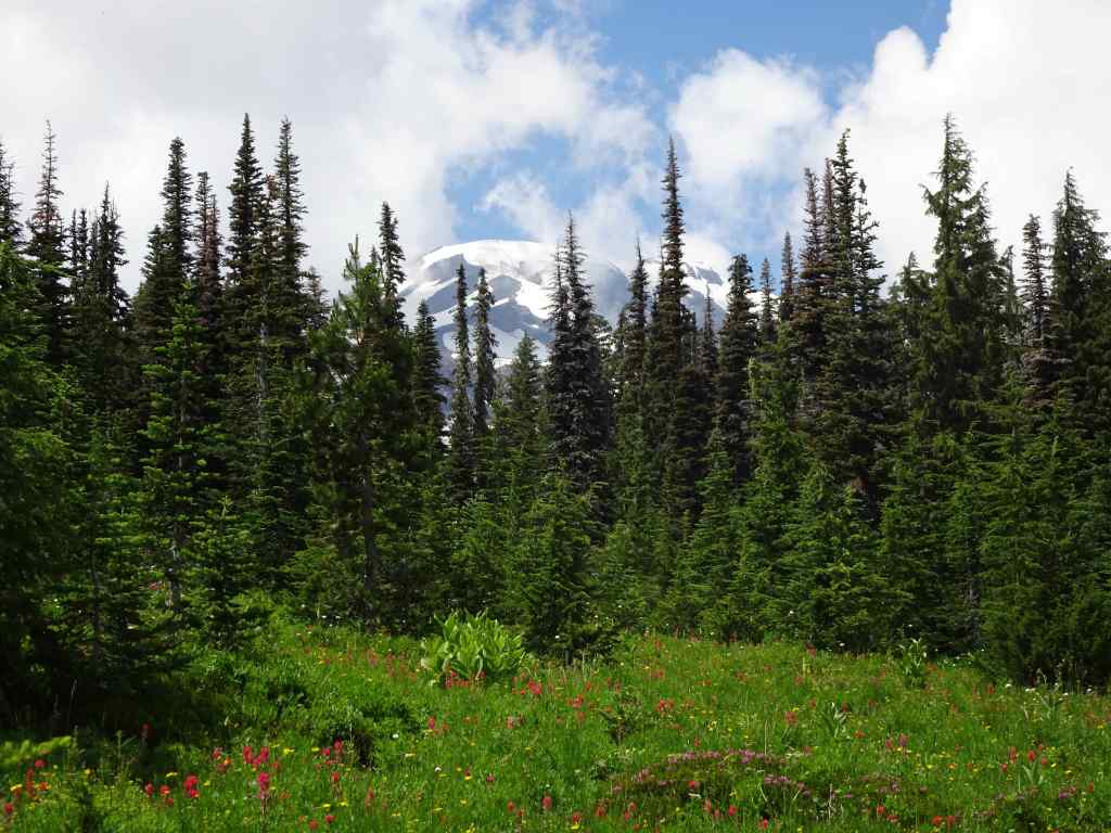
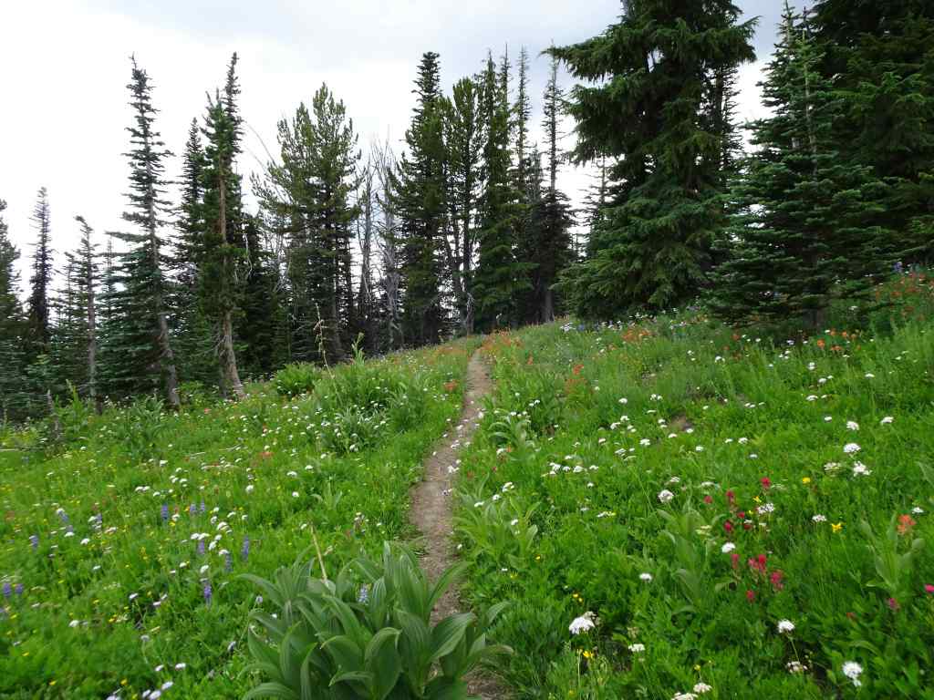
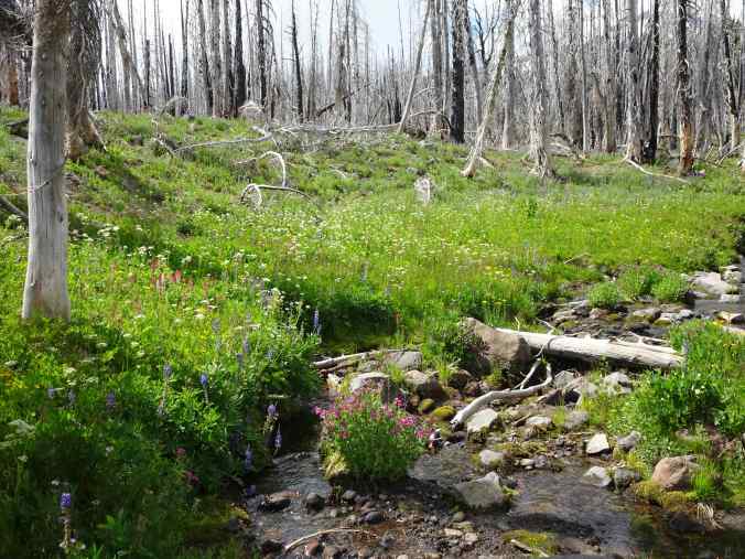
We hiked again where we have hiked before, through the lush wildflower meadows on the southern slopes of Mt Adams, on the Yakama Nation Tract D. We started at Bird Lake, and went counterclockwise uphill to the Hell Roaring Viewpoint of Mt Adams, then down along the Round the Mountain Trail and back to the lake (~5.5 miles, 1000 feet). We saw wildflowers, waterfalls, and some views through the burned forest, on a day when we only had fleeting glimpses of the mountain itself. The wildflower meadows were ‘beyond category’ today, and I took a lot of pictures!
Lower trail, from Bird Lake to Bluff Lake:
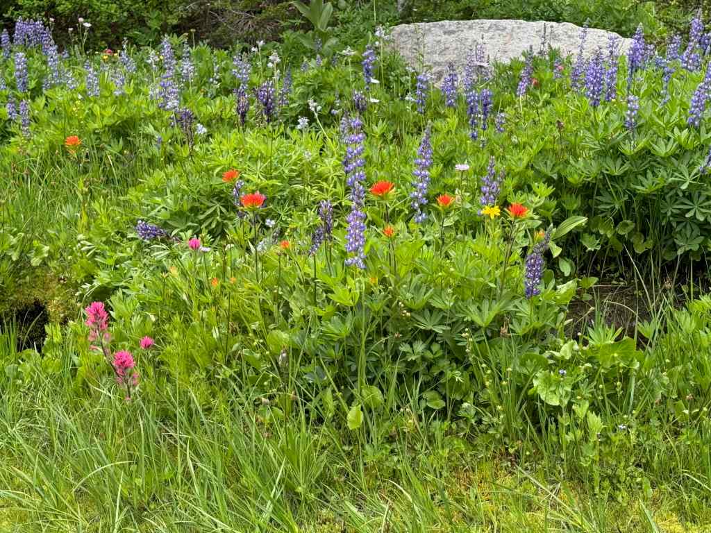
Bird Lake. Mountain not out, but pretty reflections in the lake.Partridgefoot and lupine on the lower trail.Asters under the burned trees.A frog in one of the stream crossings.Monkeyflower, lupine, lovageFireweed and false hellebore.Heather and magenta paintbrush.Bluff Lake
Next, continuing uphill to the Round the Mountain Trail:
BuckwheatMagenta paintbrush, lovage and lupineSpireaMossy waterfallUp the cliffs, with mariposa liliesMore meadowsBrilliant bouquets all along the trail…Staircase Falls, just below the Round the Mountain Trail.
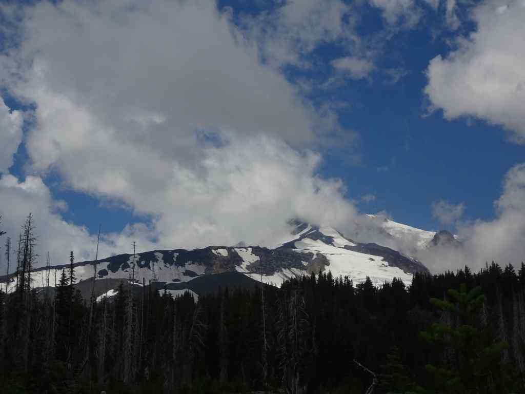
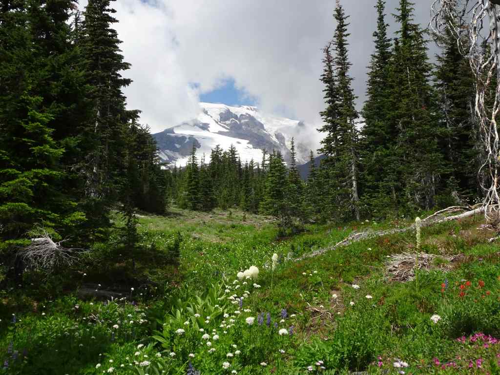
And continuing above the Round the Mountain Trail, on the Trail of Flowers, we finally had a glimpse of Mt Adams from under the clouds.
Mt Adams, with cloud cover.Closer viewBracted lousewort, with more magenta paintbrush and lupineA watchful treePhloxA brief view of the summit of Mt Adams.Orange paintbrush, yellow ‘daisies’ of some sort, and white sitka valerian.And another view of Mt Adams as we hiked up to the next rock ledge.
The ledge along the upper Trail of Flowers Loop provides a view to the landscape to the south.
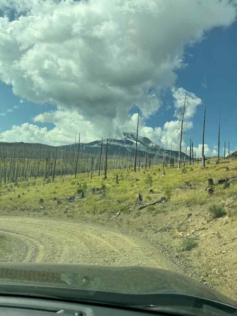
Looking south toward Oregon – blue arrow pointing to the smoke plume from the Burdoin Fire.Closer view of the Burdoin Fire smoke plume.And a wider view across the southern flanks of Mt Adams, and its ghostly forest, burned several times in the past twenty years.
We continued upward through more meadows to the Hellroaring Viewpoint…
Mt Adams on view from the upward trailSandwort and mariposa liliesHellroaring Viewpoint – top of the mountain back under the clouds.Mazama Glacier Hellroaring Falls
We retraced the trail back to the Trail of Flowers, then down to the Round the Mountain Trail, and continued westward through numerous meadows divided by small creeks that are all branches of Bird Creek.
Every kind of flower in these meadowsEasy walking,Another brief glimpse of Mt AdamsAnd more meadowsAll the flowers!A pondAnd more meadows! Next we crossed a slight rise, and then descended to our start point, by going down the Crooked Creek drainage…More meadows on the downward trail…This slope along Crooked Creek was so colorful!More color!Approaching Crooked Creek FallsCrooked Creek Falls
The slopes below Crooked Creek Falls are heavily burned, but the creeks are still colorful with flowers…
Monkey flower, lupine, Sitka valerian, paintbrush
And back to Bird Lake…
Back to Bird Lake, partial view of Mt Adams this afternoon.Meanwhile, dark clouds formed a backdrop for these glowing ghost treesAnd a last view of Mt Adams from the gravel road down.
It was a “wildflower bathing” day on the slopes of Mount Adams!
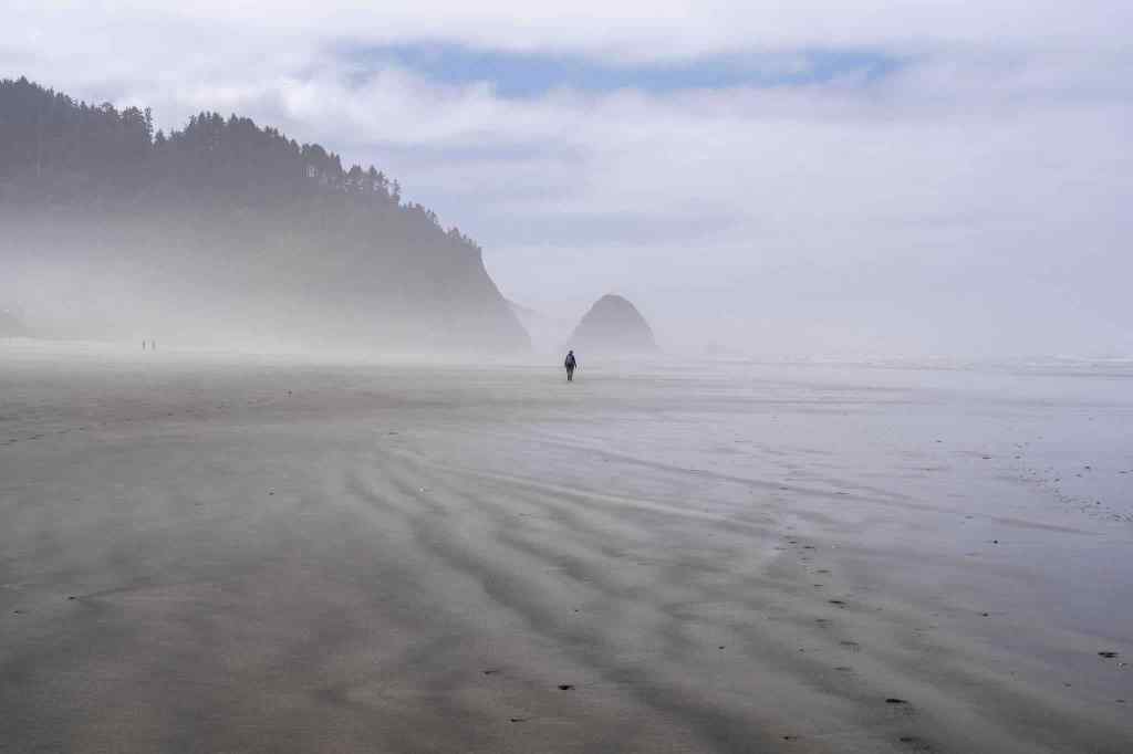
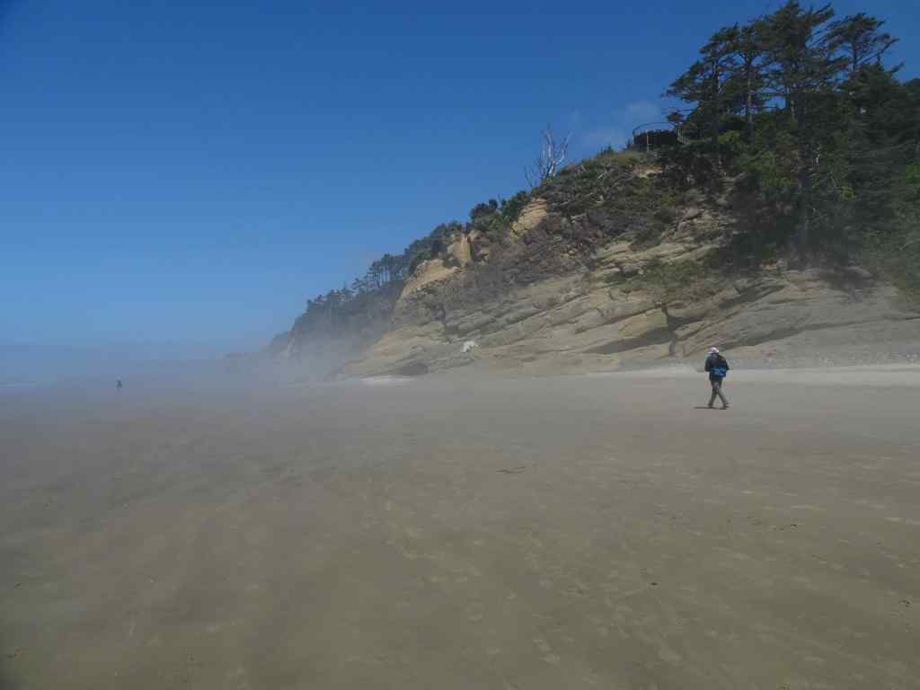
A hot day inland- a good day to go west to the Oregon Coast and walk on one of our favorite beaches, deliciously foggy at first, then sunny.
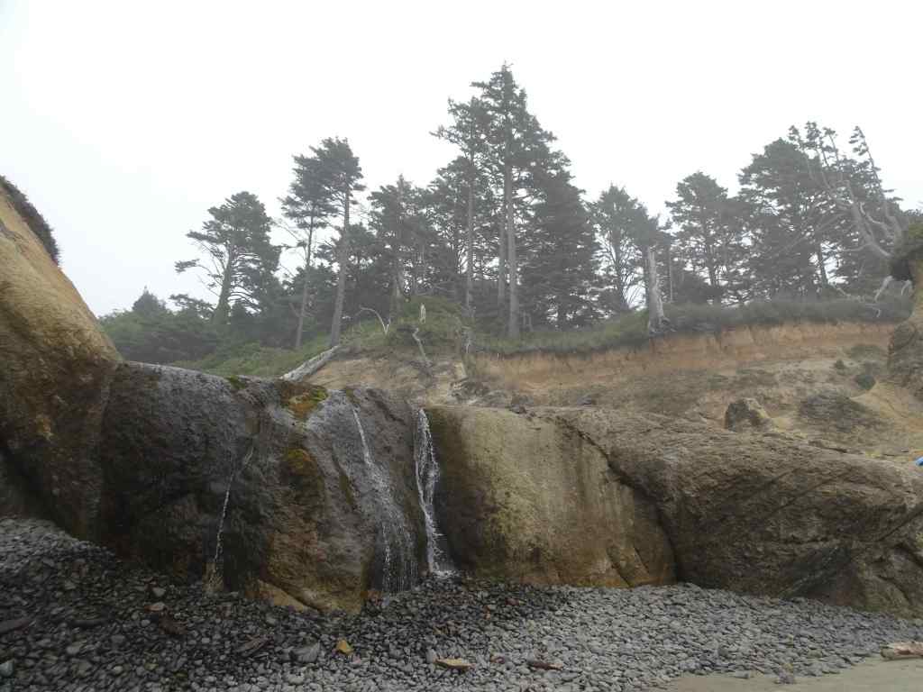
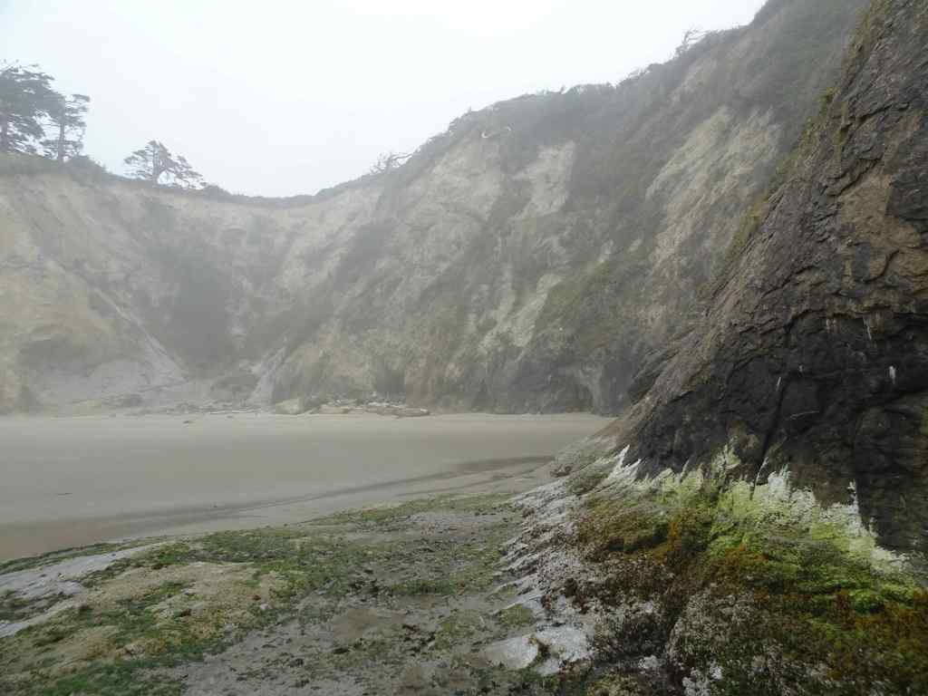
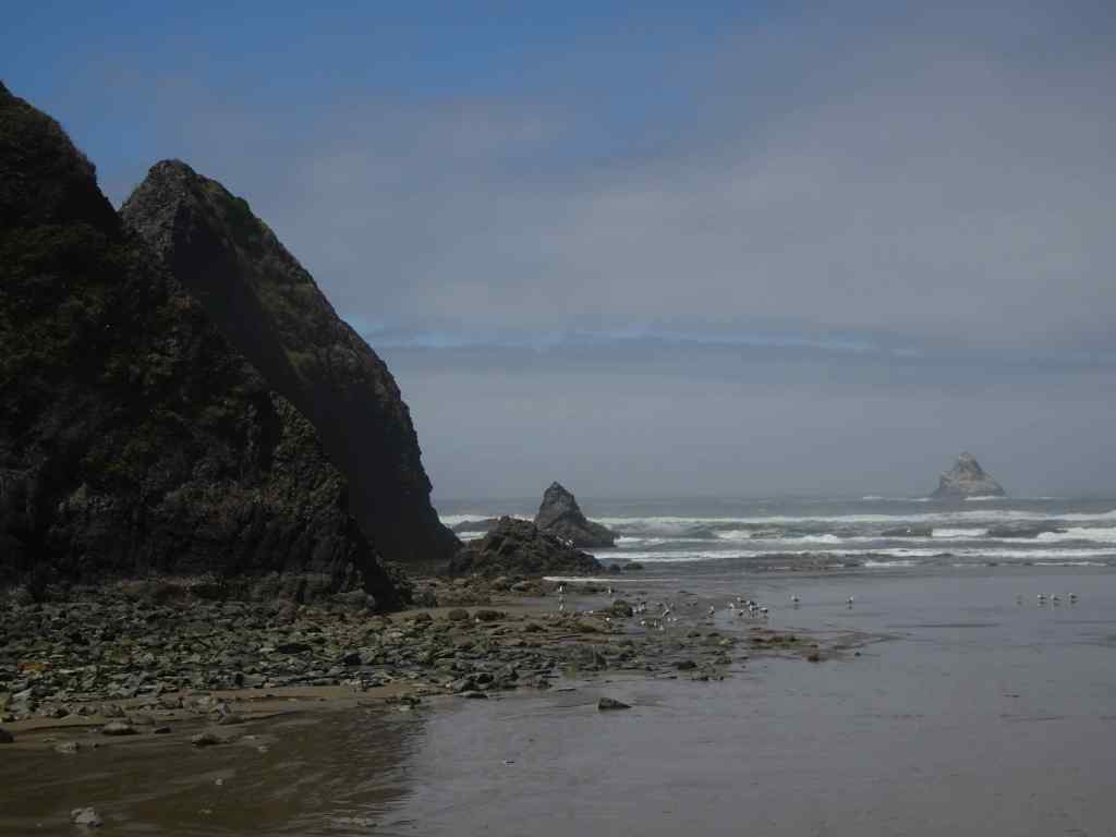
7/17 – Hug Point
We first walked over the old road at Hug Point – our timing was such that tide would be coming back in soon…
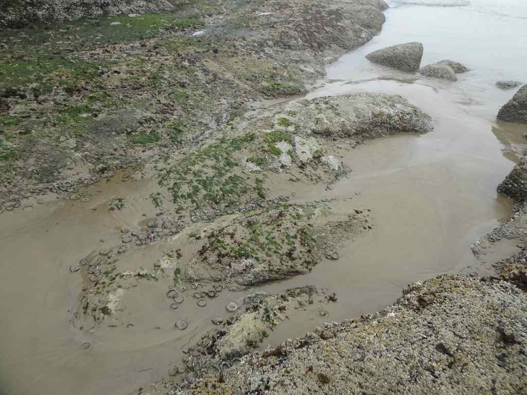
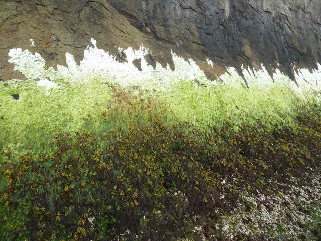
The waterfallApproach to the road around Hug Point.Circling the point.View north from the high point.Beach to the north.Sea anemones on the old road bedRock wall plant gradient.And back to the south side beach.
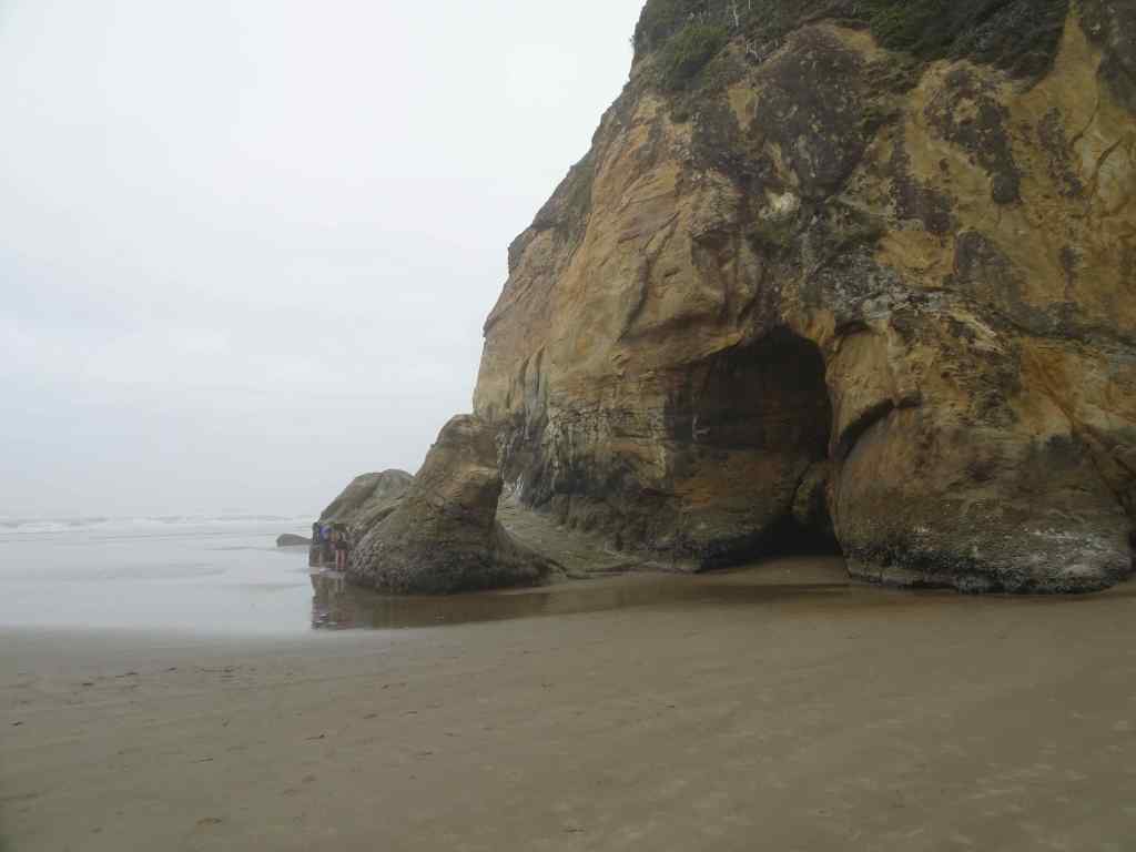
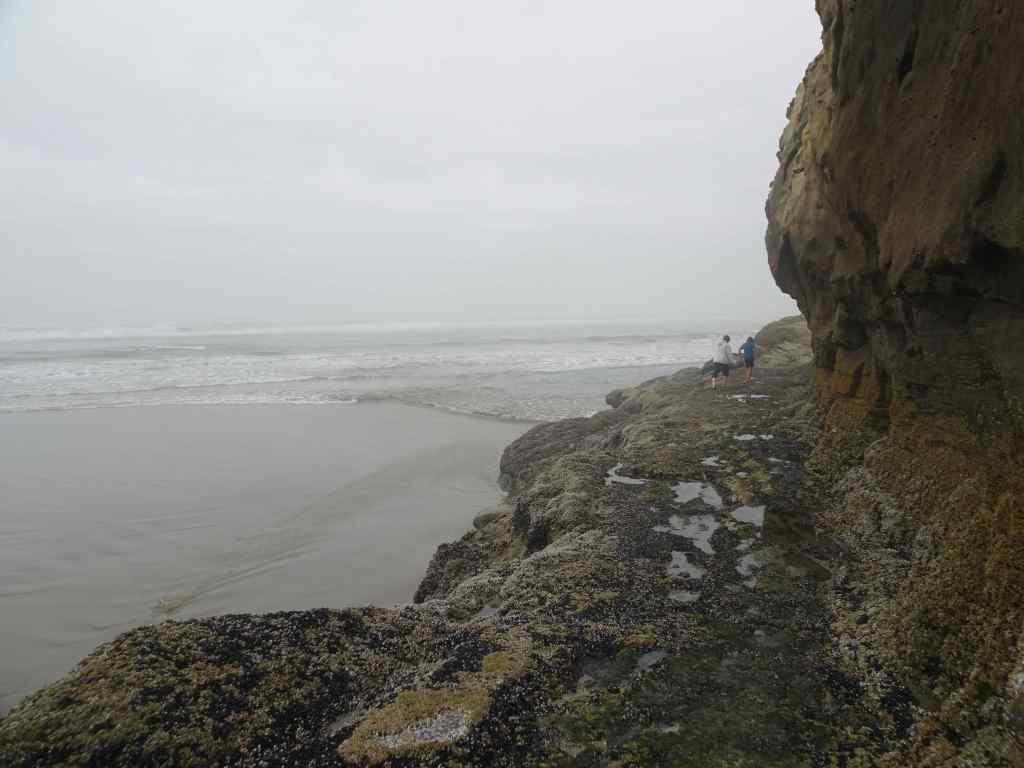
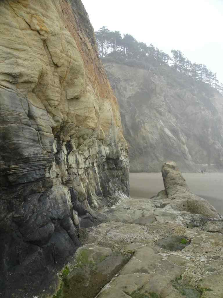
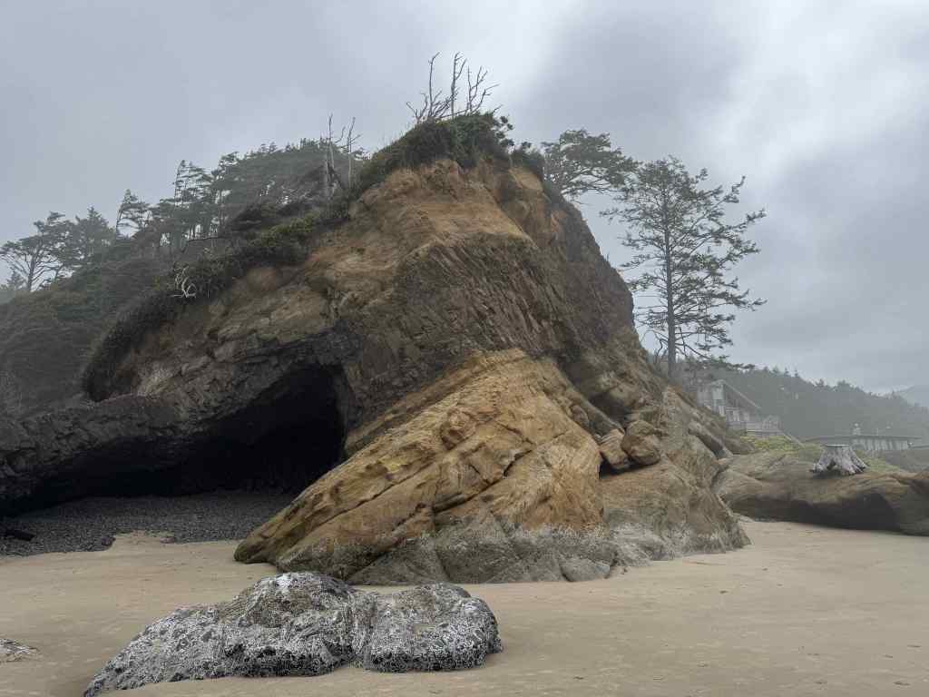
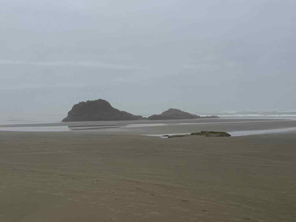
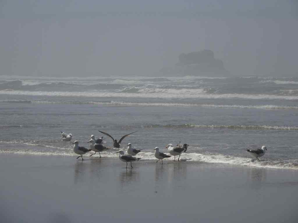
Then we walked all the way south to Arch Cape, passing our favorite landmarks…
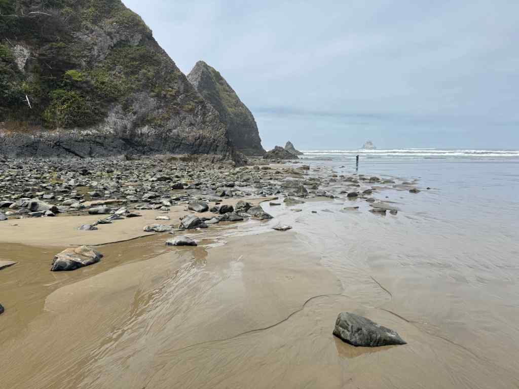
The cave – with an addition – a giant stump stranded on the rock ledge – probably from a winter storm.Big barnacle rock,with a few sea stars among the barnacles and mussels.Walking south toward Arch Cape, fog starting to disperse. Photo credit to my husband.Arch Cape Creek and Castle Rock.Lunch view near Arch Cape, with a flock of sea gulls.
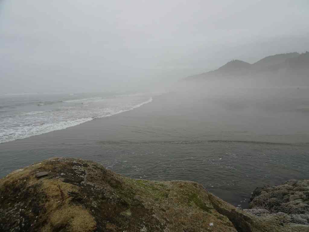
And the walk north – about five miles round trip today.
Fog rising, tide coming in.The seagull flock accompanied us most of the way.Blue skies ahead.
We went on five hikes in May, all in the Columbia River Gorge, following the wildflower bloom…
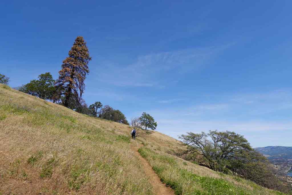
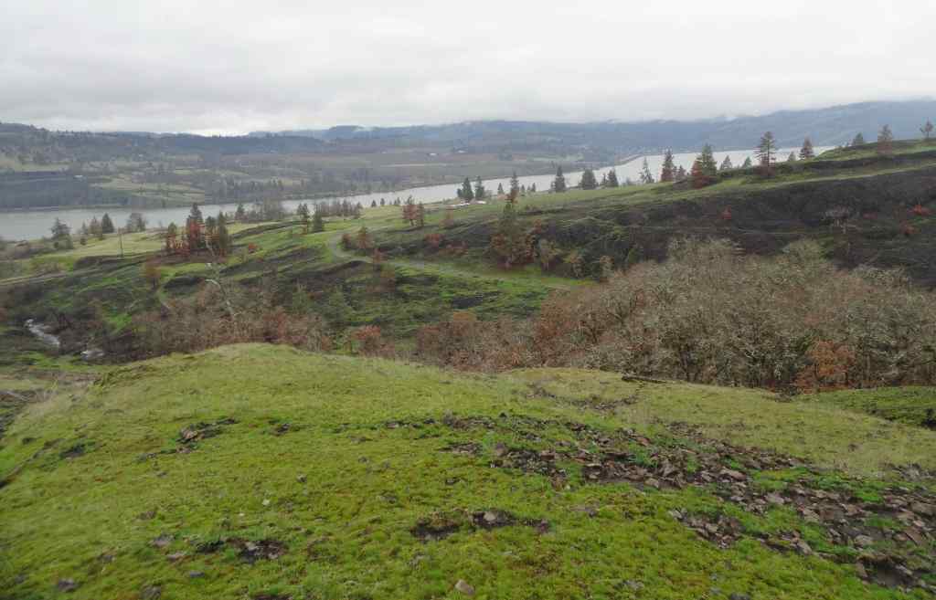
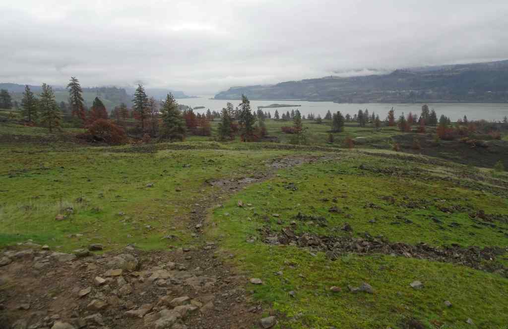
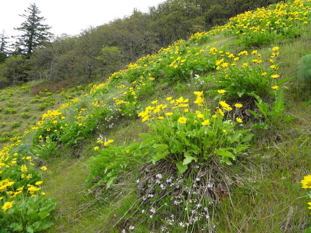
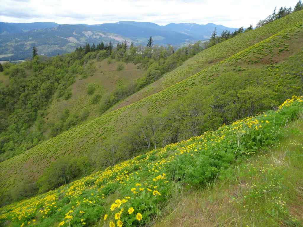
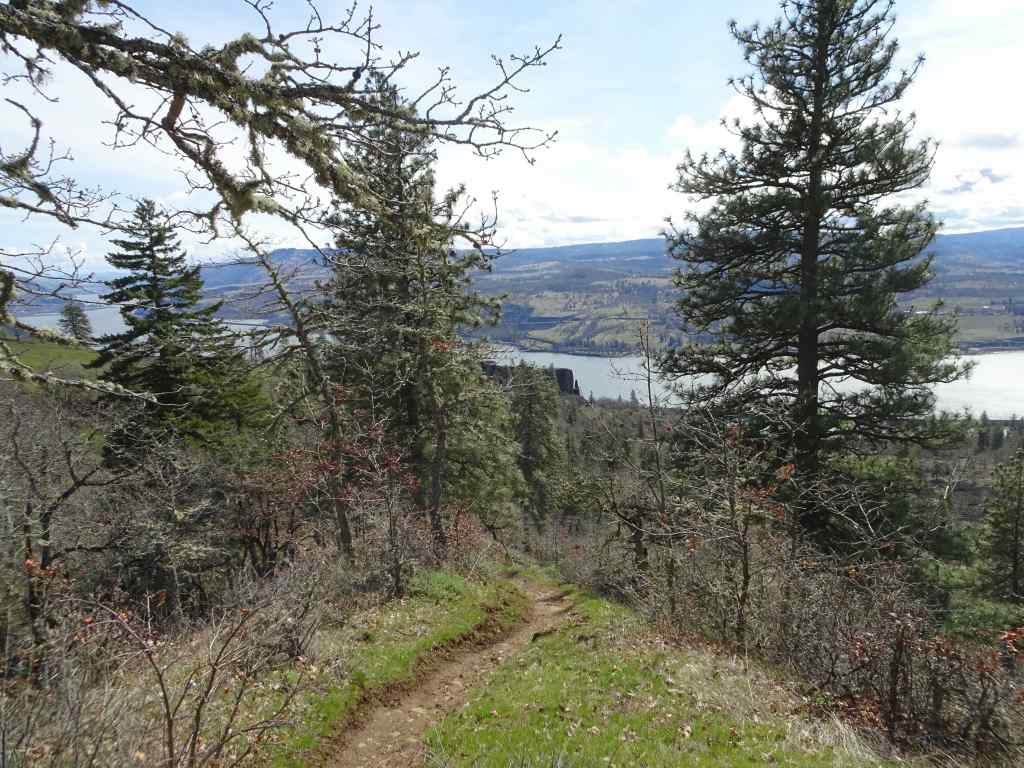
May 6 – Lyle Cherry Orchard, WA
Warm and a bit windy today – we got a chance to see the waning balsam root – everyone’s favorite!
Purple ookow blooming on the Convict Road.Ookow and the seedpods of Columbia desert parsleySwales of lupine on the middle plateauThe last of the yellow balsam rootA poppy patch.
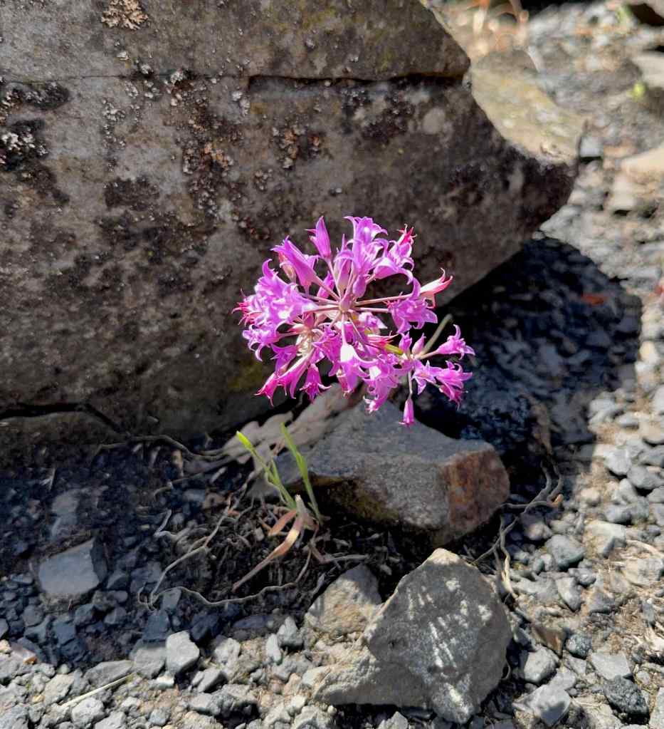
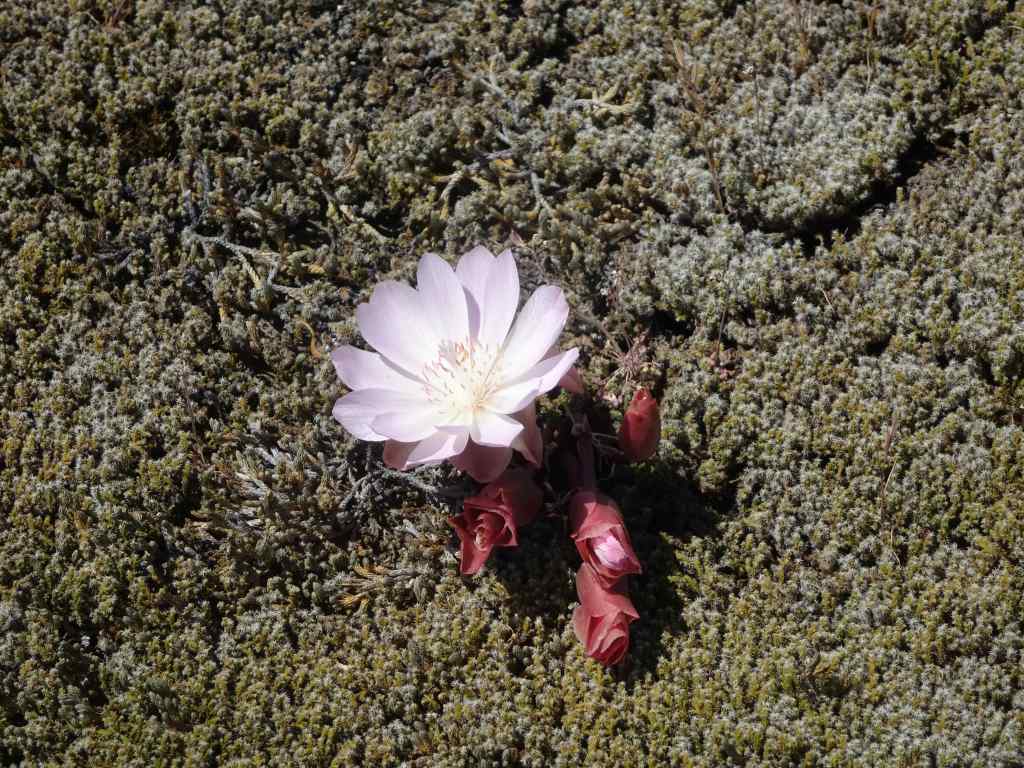
On our drive home, we stopped briefly at the Catherine Creek Trailhead so I could get a peek at the bitterroot that blooms there – probably my only chance this season.
And there it was, on the rocky outcrop just above the parking lot.Lewisia rediviva, bitterroot – one of my all time favorites!
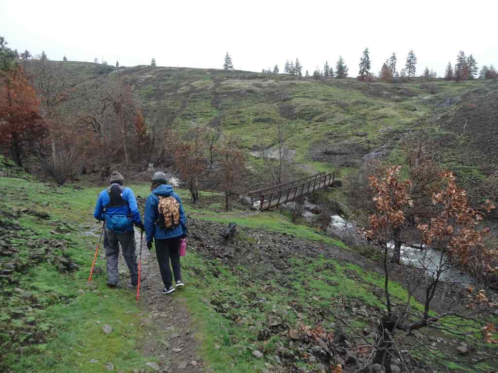
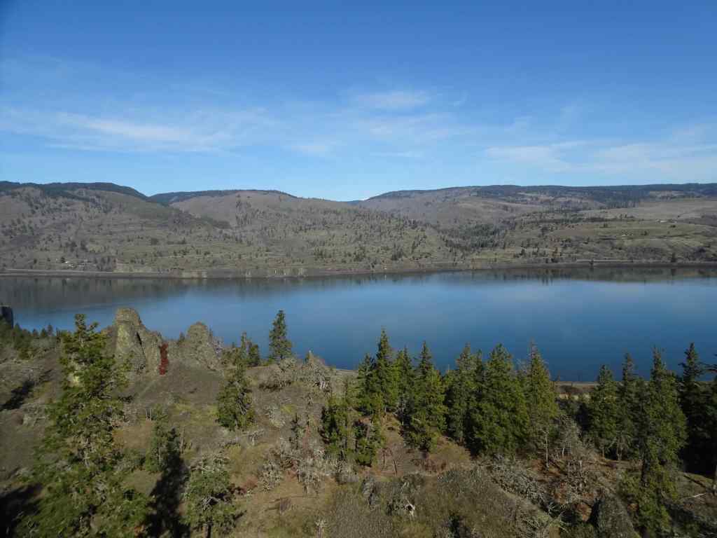
May 10 – Cape Horn, WA
Tall larkspur season at Cape Horn – it is always a treat to walk on the neatly groomed trails here. Today we started at Strunk Road, and walked to one of the lower overlooks – less than two miles, but with rain in the forecast for the next few days, we took our opportunity.
Tall larkspur along the pathCloser viewWhite fringe cup and candy flower also prolific today.Nancy Russell Overlook – we stop to look at the view and say, “Thank you!” to Nancy Russell for her conservation work.Up river view toward Beacon Rock.Continuing downward, the purple path continues…And the fringe cup…A few other flowers tucked in – Hooker’s fairy bells,Fern leaf biscuitroot,and vanilla leaf.
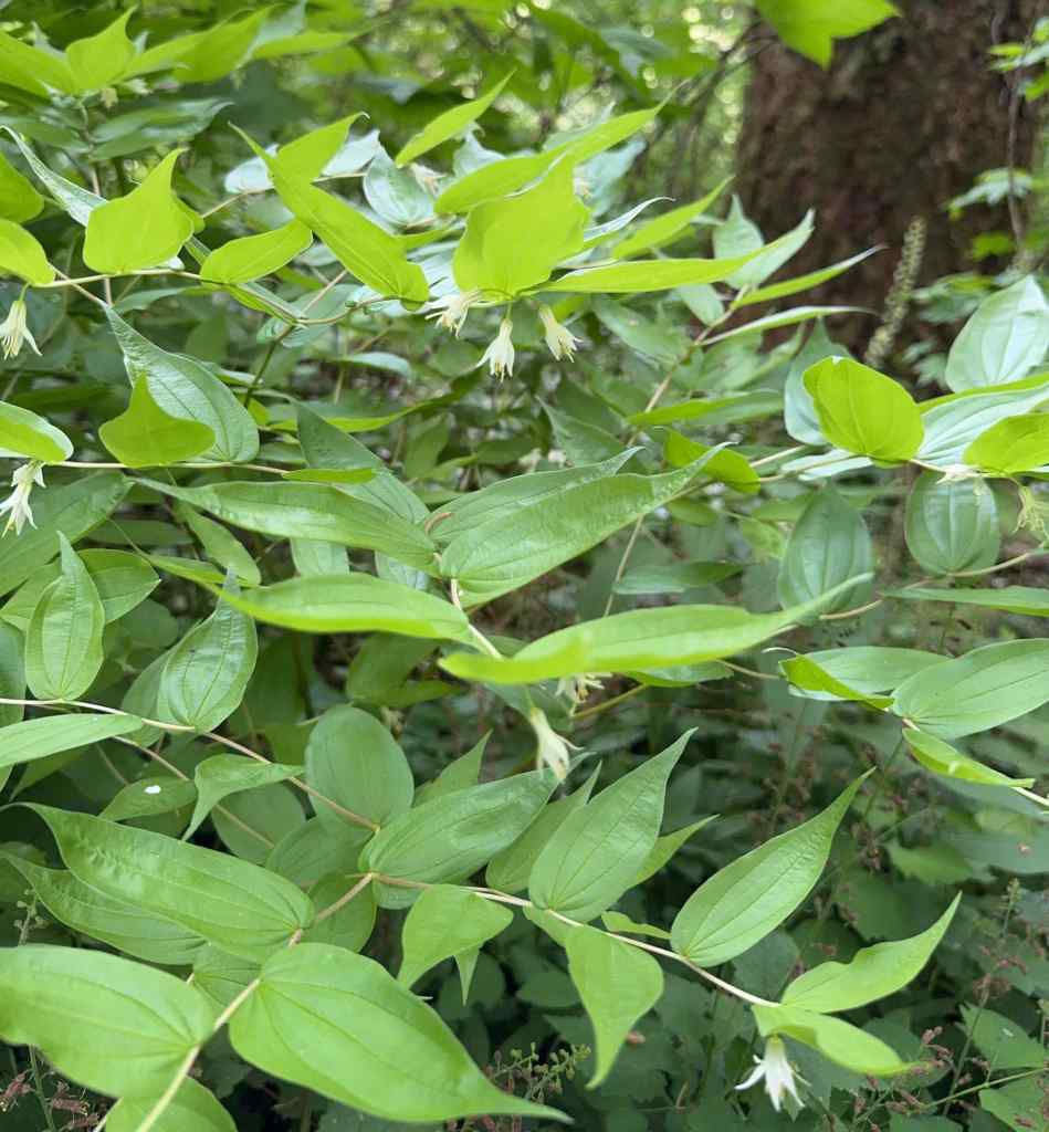
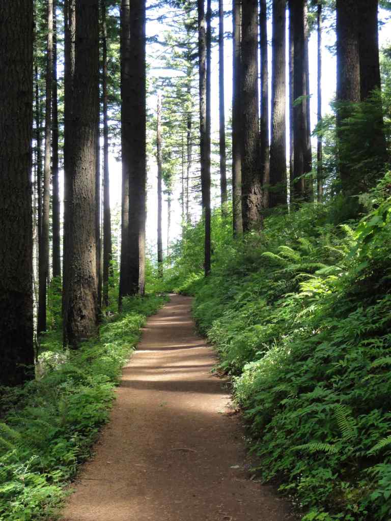
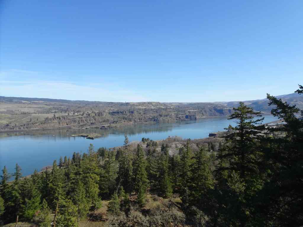
May 13 – Wahkeena-Multnomah Loop, OR
Back again to this five mile long, 1500 foot loop.
We began at Multnomah Falls, and started west along the old highway toward Wahkeena Falls.After passing Wahkeena Falls, the trail ascends up many wildflower-filled switchbacks,to Lemmon’s Viewpoint, overlooking the Columbia River.Continuing up Wahkeena Creek, past Fairy Falls,passing more wildflowers along the way. Columbia windflowers, and salalBaneberryA few fading trilliumLarkspur and fringe cup
After a lunch break at the trail junction, we walked eastward toward Multnomah Creek. This part of the trail has always felt rather magical to me – mostly flat, through a forest of tall firs. The undergrowth has changed a bit since the 2017 fire, but it is still one of my favorite places.
2013 Lookback – Magical trail before the fire.May 2025, Lots of redstem ceanothus filling the forest floor under the burned trees.Still very pretty, and with a view to the river…More wildflowers along the trail as it descends into Multnomah Creek – thimbleberry, columbine, arnica.CorydalisWiesendanger FallsHoneysuckle and inside out flowerBack to the trailhead at the bottom of Multnomah Falls.
May 22 – Cape Horn, WA, again
We wanted to take our son and his fiancee for a hike – though they didn’t bring proper shoes, and it was a bit rainy. We settled for going back to the tall larkspur-lined path from Strunk Road to the Nancy Russell Overlook at Cape Horn. It was less than two weeks since our previous visit, the tall larkspur were even more profuse, and the cow parsley were starting to spread their umbrella heads. Lovely, even with a bit of our Oregon sunshine misting us.
Previous week, May 10, with older hiking gentleman.Same path, May 22nd, with cow parsley and a cute young couple.Misty view from the overlook.Cow parsley
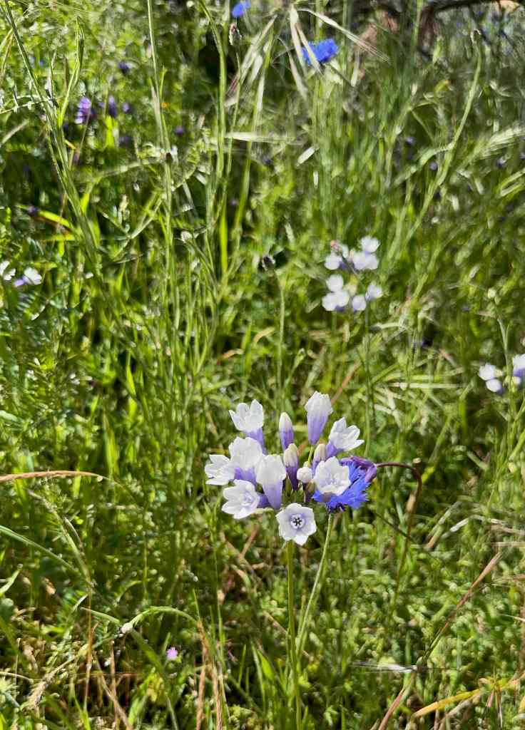
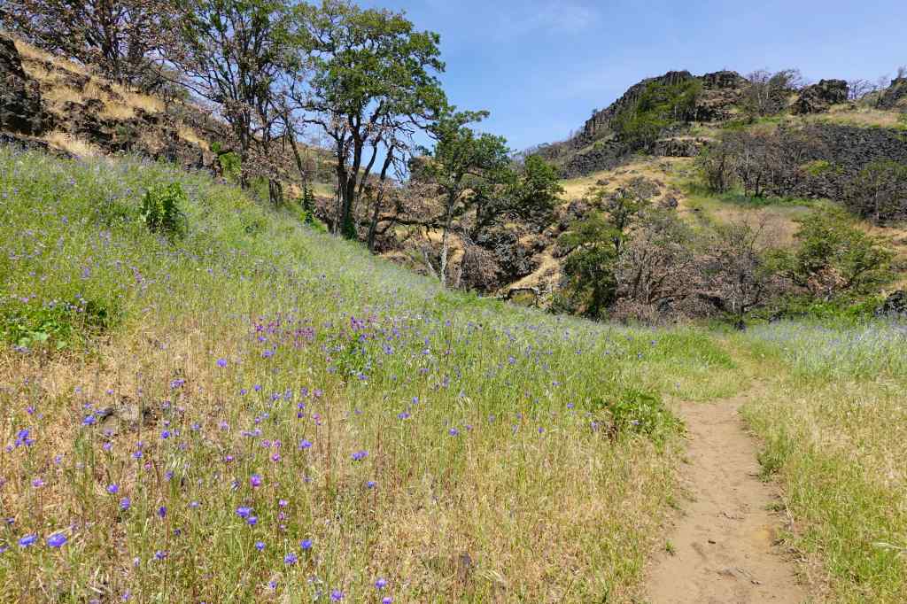
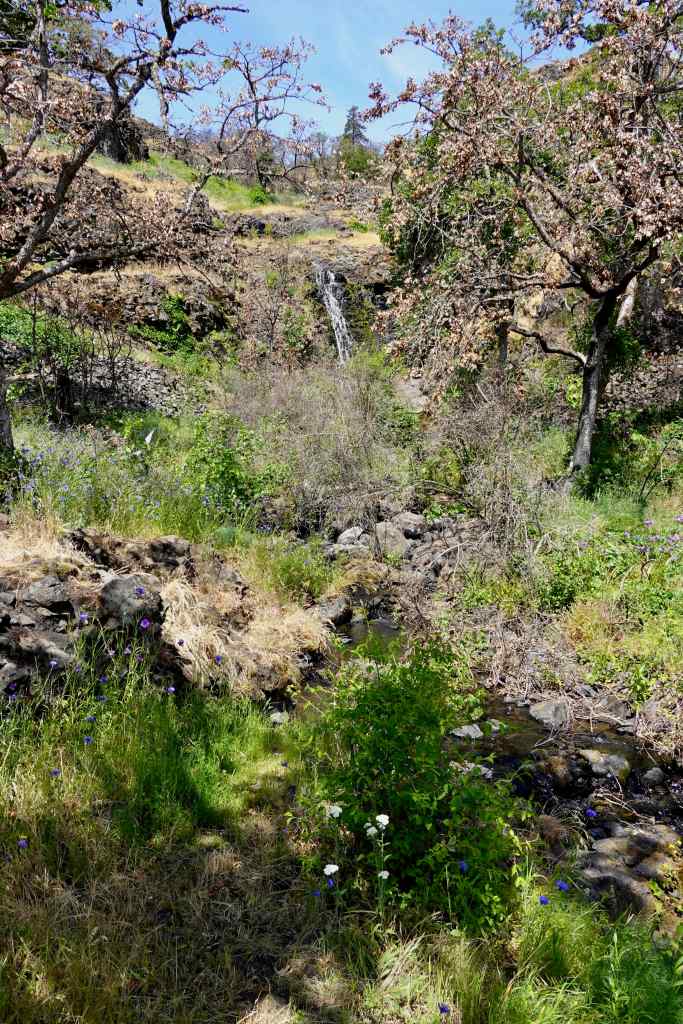
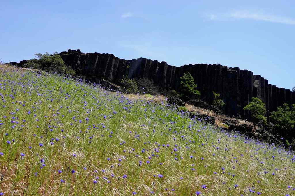
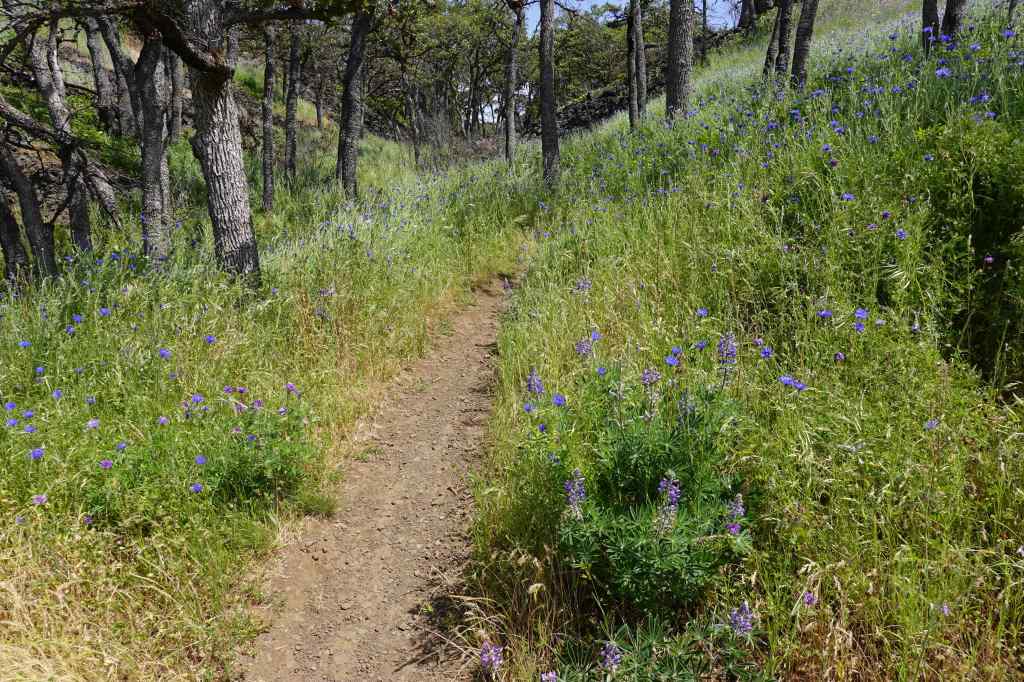
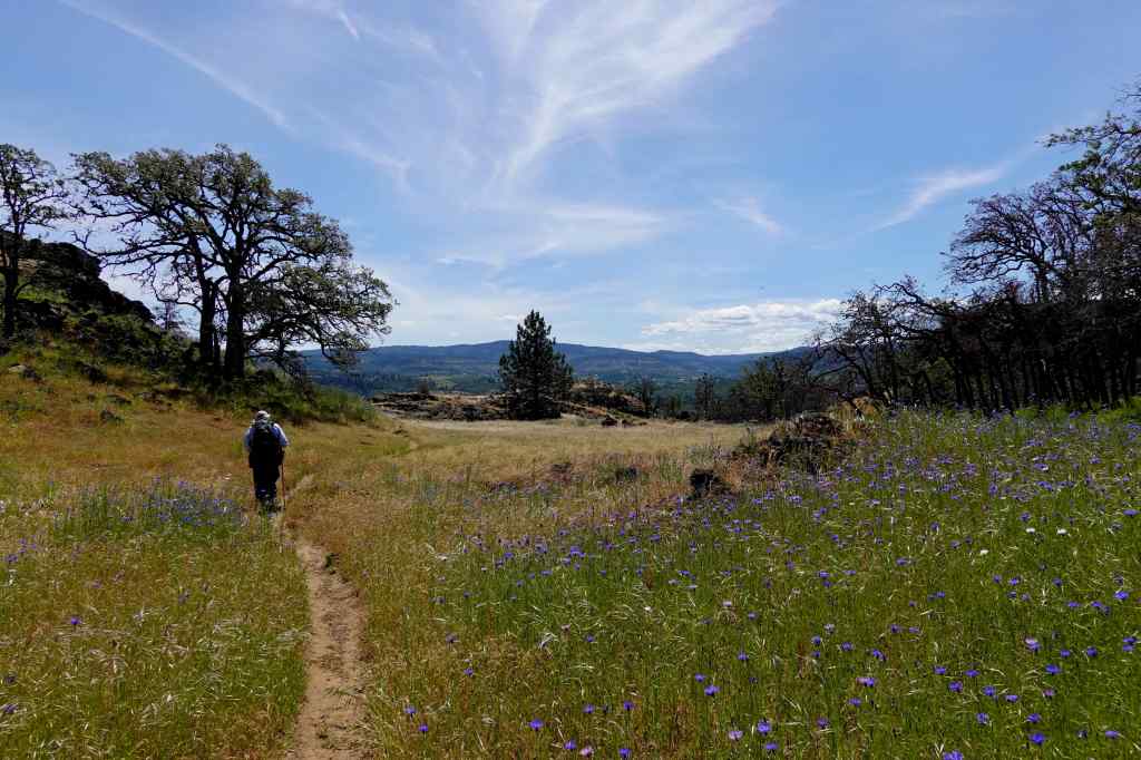
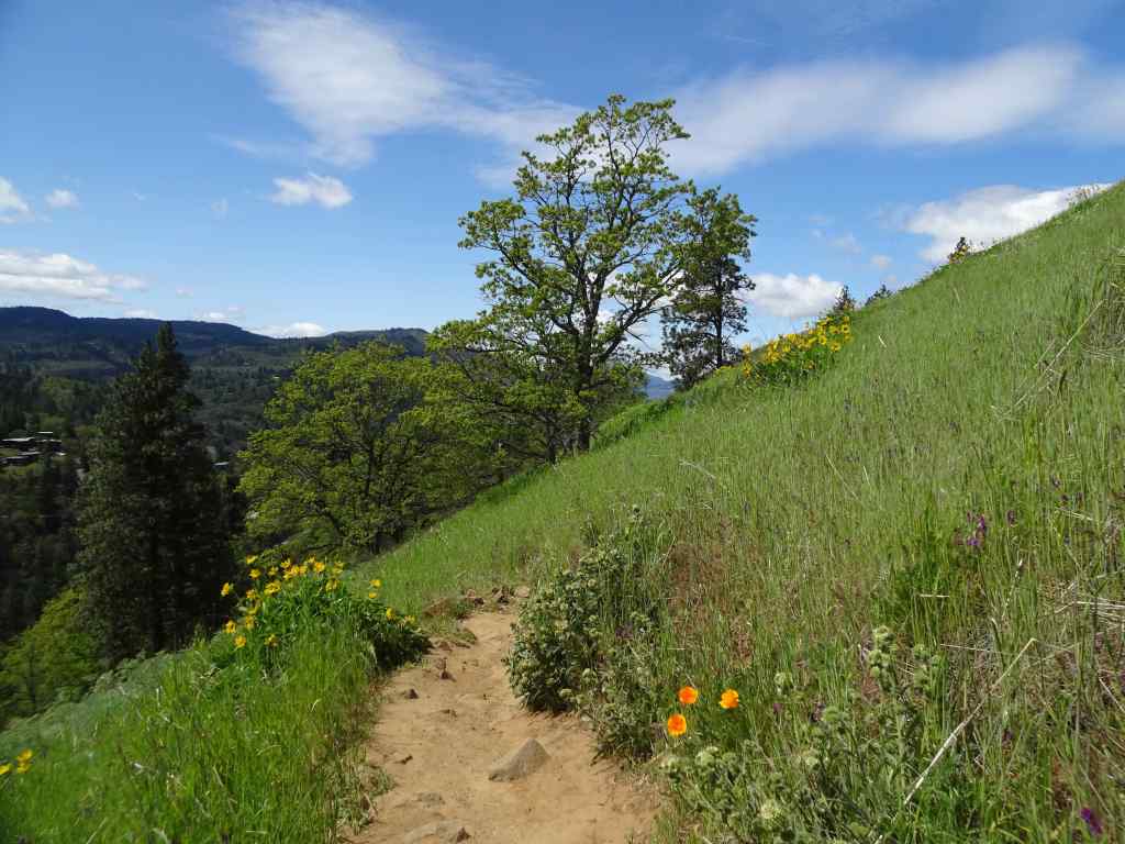
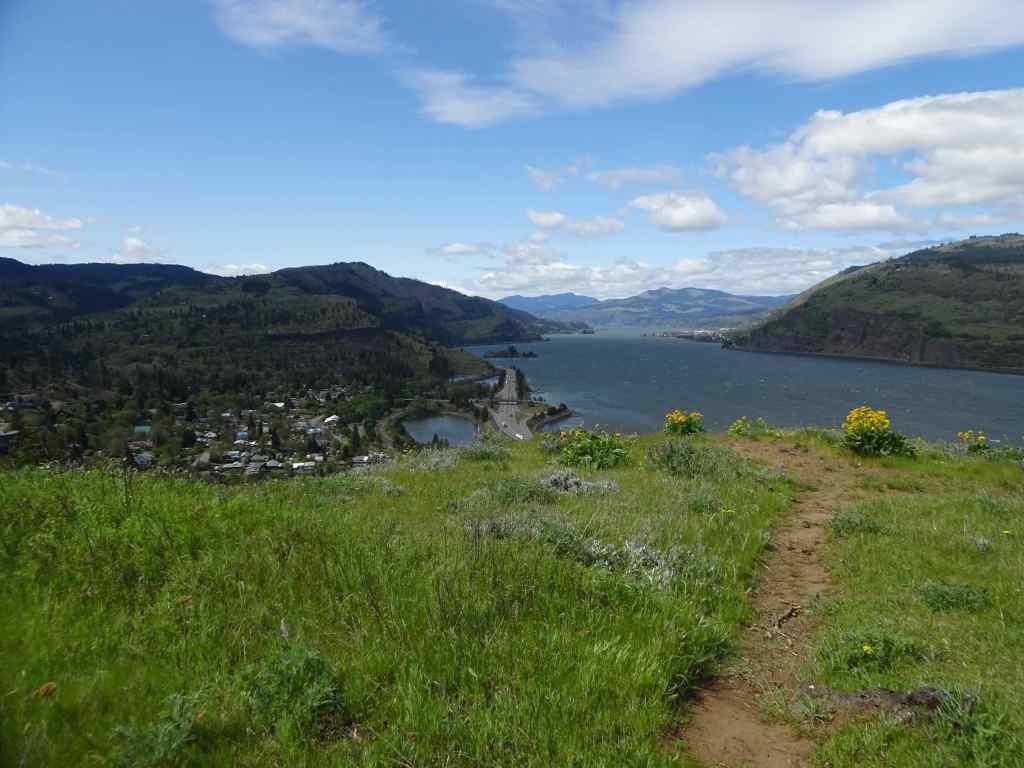
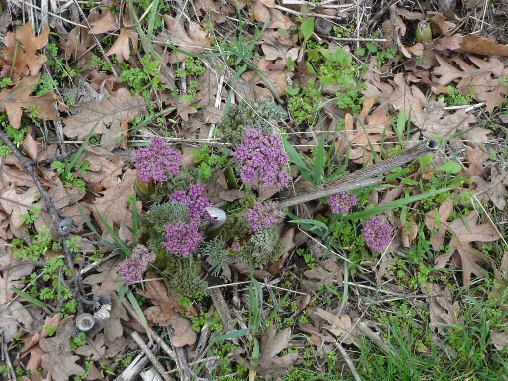
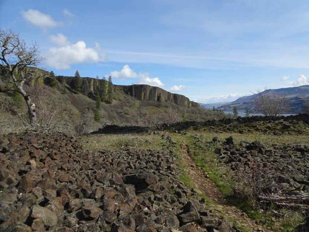
May 27 – The Labyrinth, WA
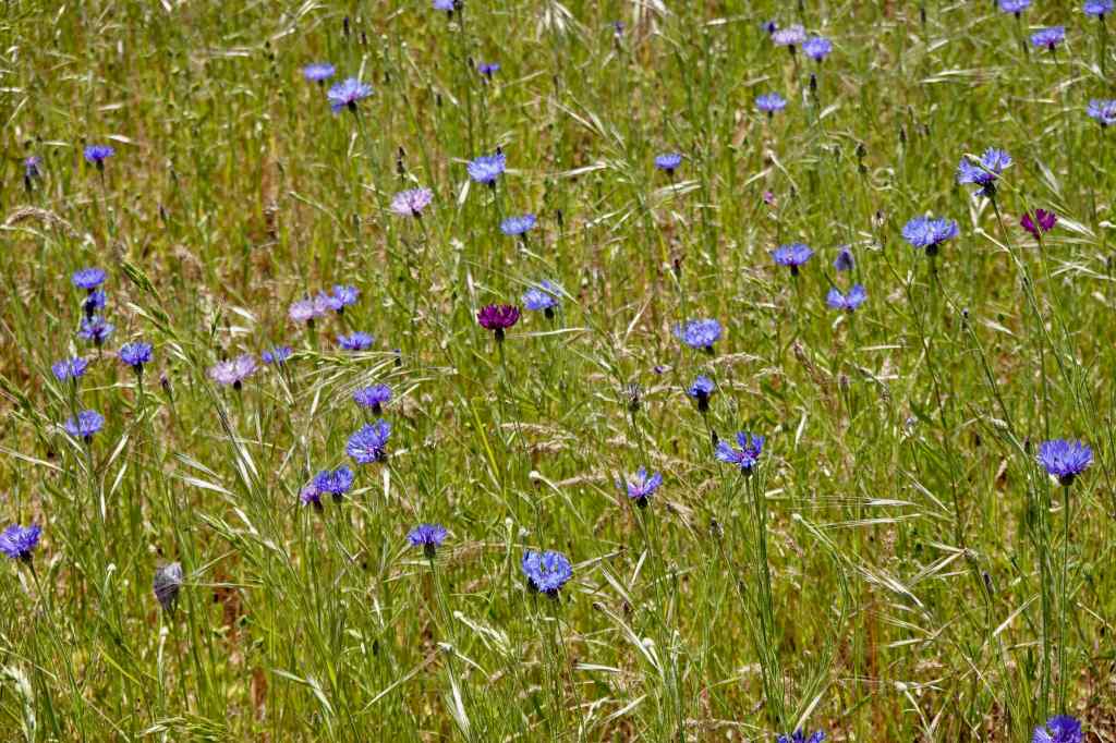
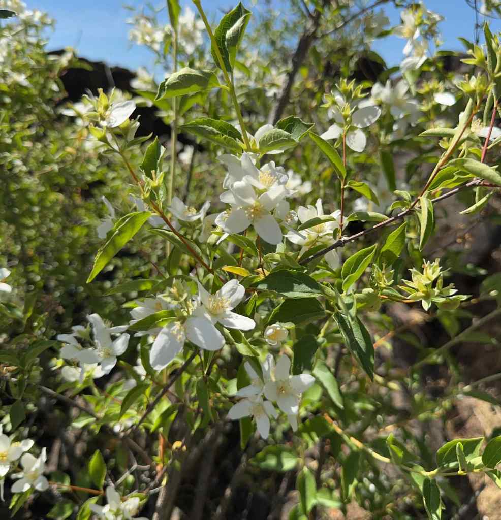
The Labyrinth was one of the first trails we ever hiked in the eastern gorge, and we have returned many times. The path winds through piles of columnar basalt that provide some protection from the wind, and the views are great! Wildflowers change throughout the bloom season. Today was the first time I have seen this particular suite of flowers – blue and purple bachelor buttons and ookow; white buckwheat, yarrow, and mock orange; pink clarkia and onions; all accompanied by a full gauntlet of poison oak.
The first surprise – abundant wildflowers surrounding the Lower Labyrinth Waterfall on the old highway approach trail – mock orange, bachelor button, ookow, buckwheat, and monkeyflowersMore mock orange, poppies and buckwheat, the Columbia River, and Mt Hood.Mock orange
Starting up the trail along Labyrinth Creek –
Buckwheat, golden grass with late season flowers. YarrowOokow, and bachelor buttons. The bachelor buttons are considered disturbed, but they do add a pretty color to the late season wildflower suite.Winecup clarkiaSwales of flowers in the drying grass
Continuing up along Labyrinth Creek –
Monkey flowers surrounding the upper waterfallHomage to the poison oak gauntlet that we carefully walked through today.Colorful slopes beneath one of the volcanic buttes.My favorite oak grove, with a lush poison oak understory.
Lunch views, with mule deer…
Westward, mule deer on the next ridgeMule deerEastward – Columbia River shimmeringHooker’s onions
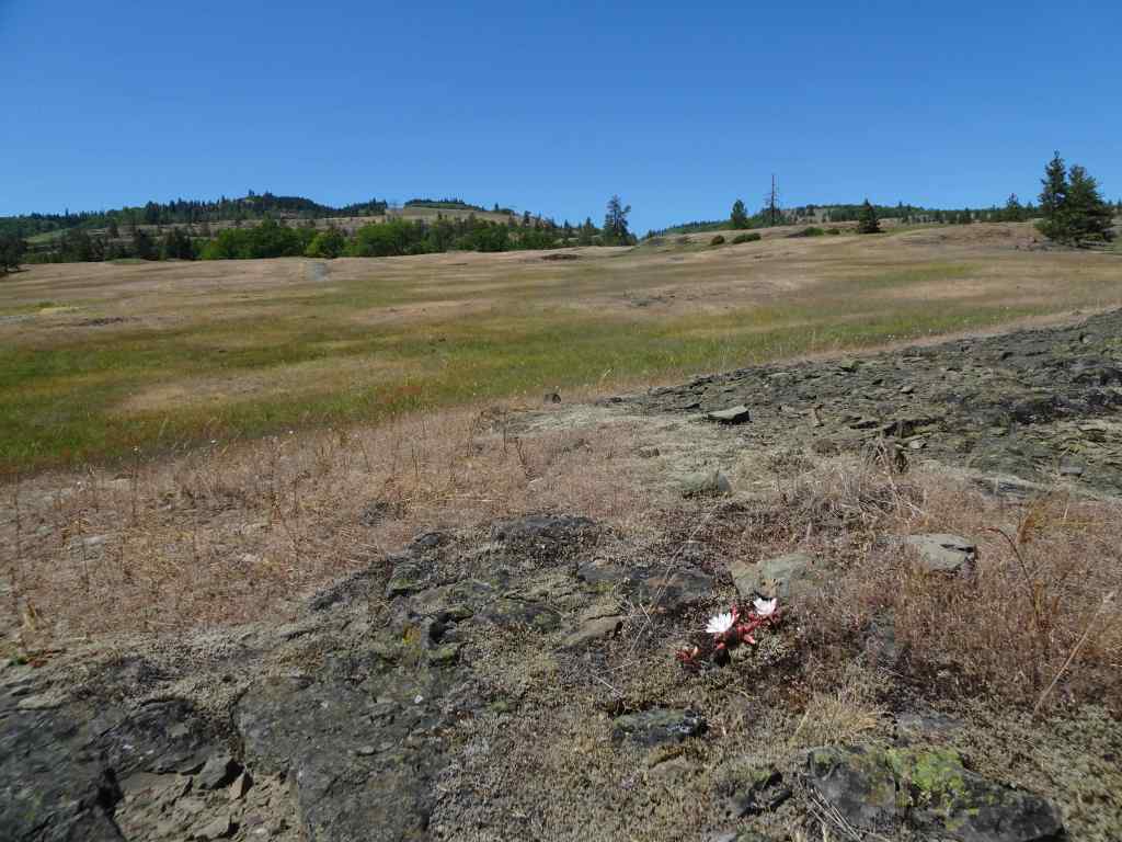
It was getting warm, and I was losing my uphill motivation, but I wanted to go a little higher, to the rocky bluff where bitterroot blooms.
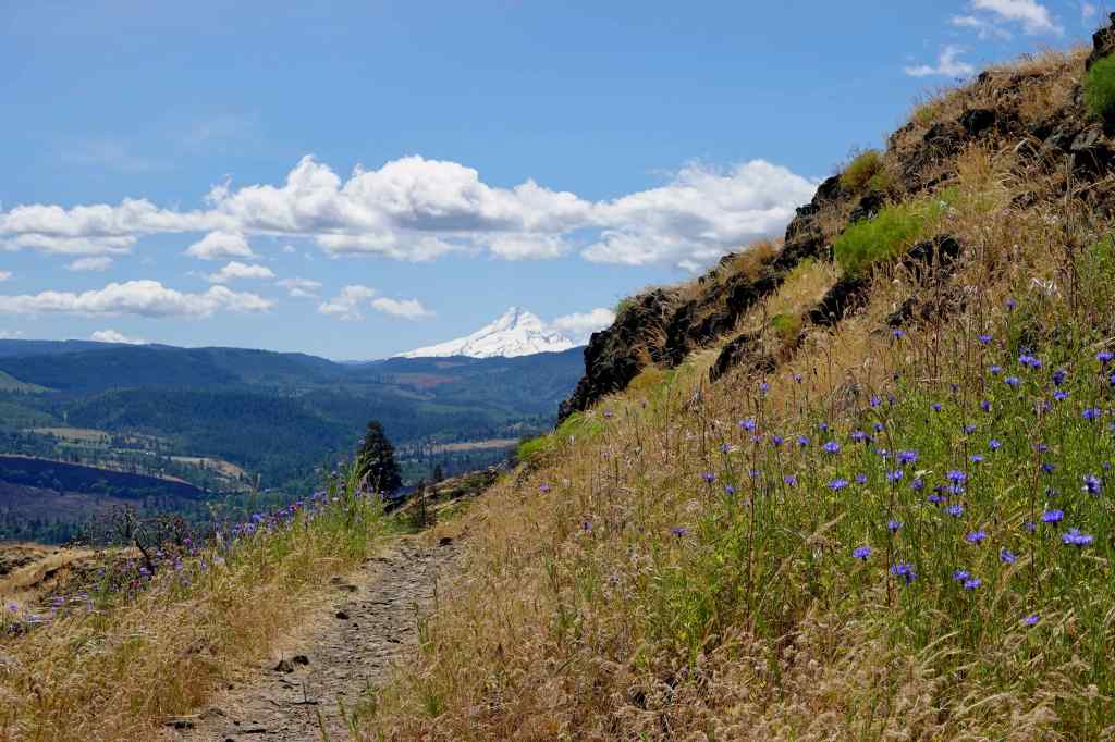
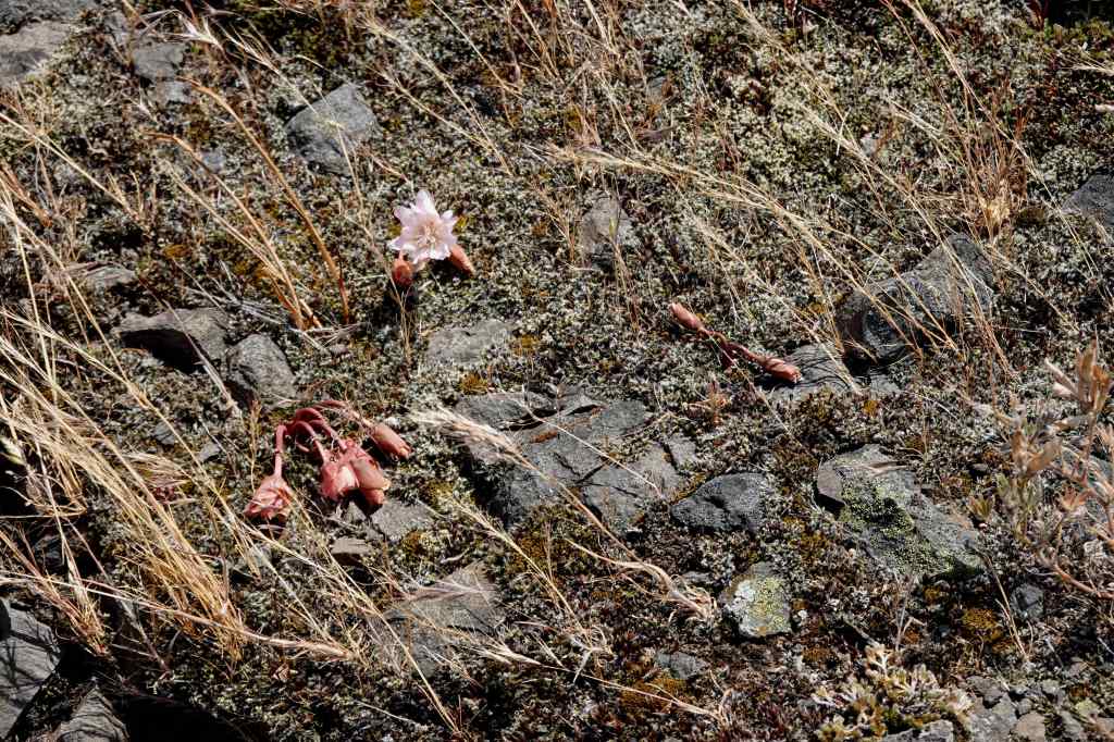
Mt Hood and buckwheatAs I expected, the bitterroot is shriveled up – I’ll have to wait until next year.Looking farther uphill, toward the slopes that lead to Coyote Wall – green grass turning to gold.Another look at Mt Hood, then we begin the return hike…I didn’t notice these White Brodiaea on the way up.Ceanothus blooming in the oak groveAnd past the waterfall again on our return to the trailhead.
It was beautiful day in the Labyrinth. But it is getting too hot for me in the eastern gorge – we may not be back until fall! I am going to southern Utah in June, where it is already very HOT, to help a family member. I may not hike much in the next month, but there will be red rocks and possibly some dinosaur tracks…
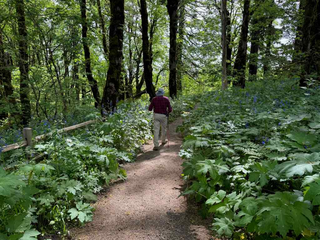
We went on one hike on April 1st, before my husband’s neck surgery on April 4th. After a couple of weeks of rest, we found some shorter, easier hikes in the last half of April, following the wildflower bloom, but keeping activity level within medical guidelines.
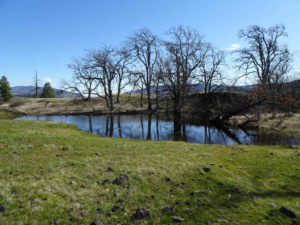
April 1 – Catherine Creek: Lower Tracy Hill – Arch Loop, WA
One of our usual trails. It was lovely to see the next phase of bloom in the meadows here.
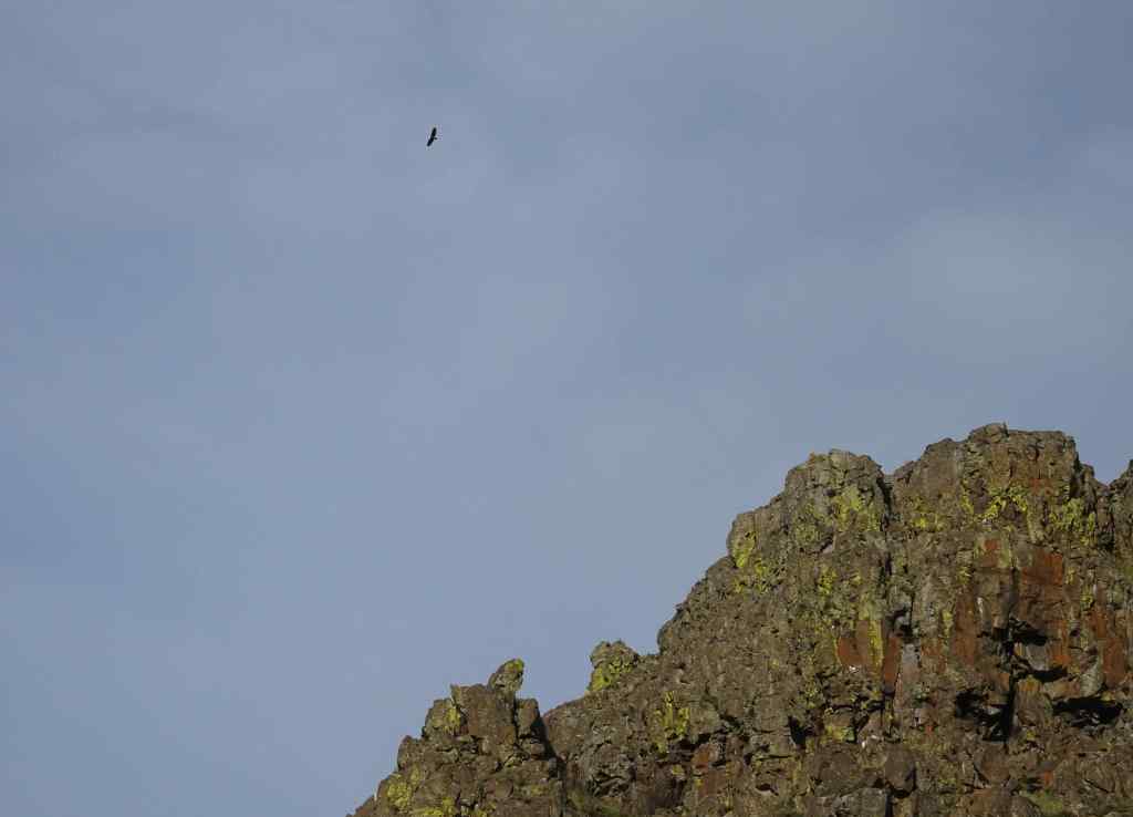
View from the trailhead: the meadows are full of white saxifrage, also purple shooting stars, and a few camas beginning to bloom.Looking south toward Mt Hood, the orchards of Mosier are glowing as the leaves unfurl.Along the trail – rosy plectritus and purple broomrape.Pockets of camas liliesSaxifrage and shooting starsColumbia desert parsleyPonderosas reflected in a vernal pool, and yellow desert parsley.Our trail passed above the ent who guards the slope…He’s still standing.On our return trail, we passed below the Arch, with eagles soaring above.Some early bloomers were hanging on in this cliff shadow – gold stars and grass widows.A few larkspur were just starting to bloom among them.
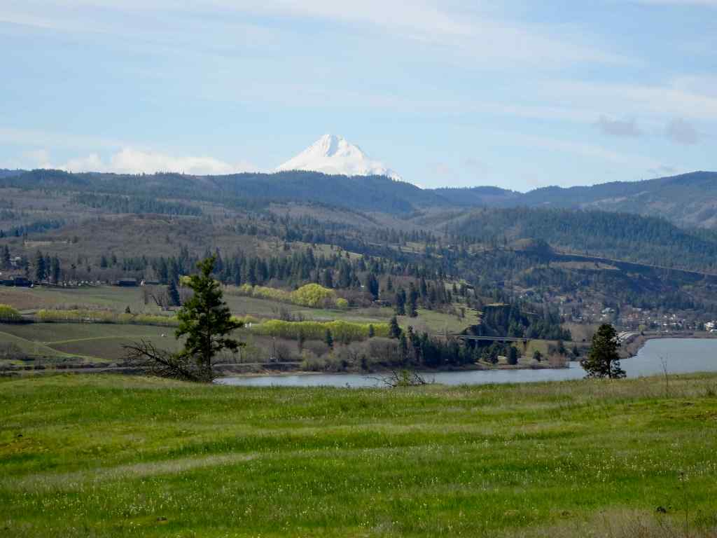
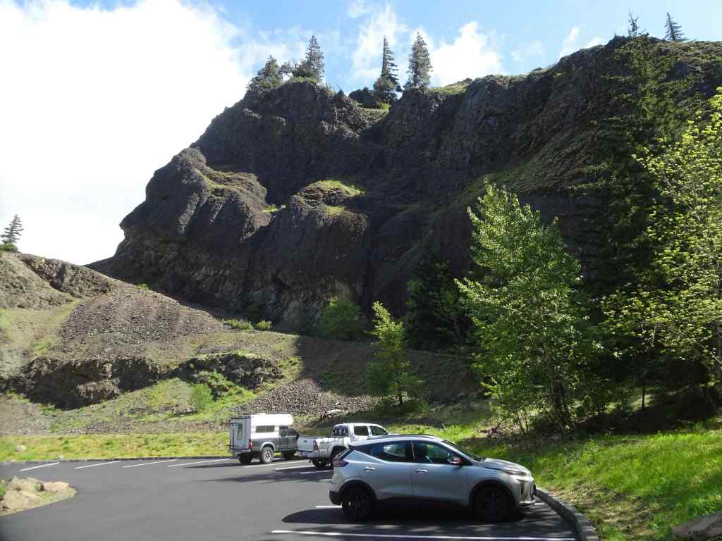
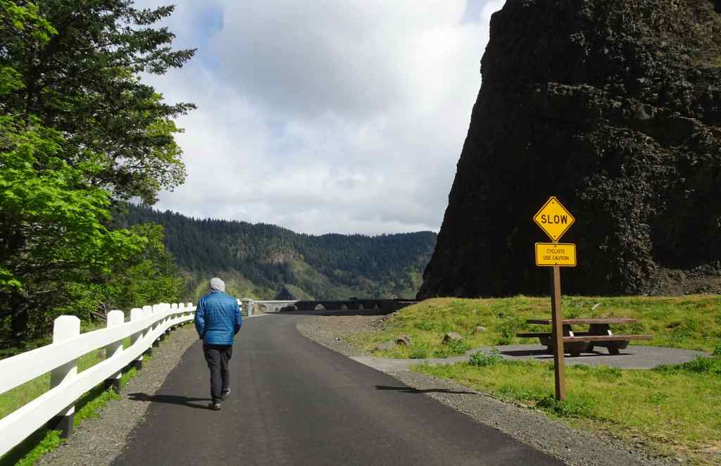
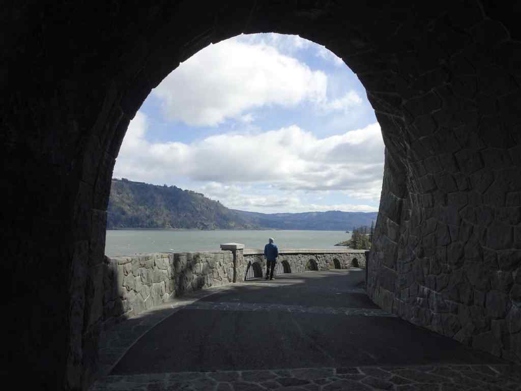
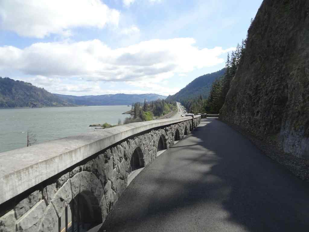
April 21 – Mitchell Point Tunnel and Mosier Plateau, OR
Last month I mentioned seeing the nearly completed Mitchell Point Tunnel from the highway as we drove by. The tunnel is now open. We stopped on our way to Mosier Plateau to see the views from the tunnel.
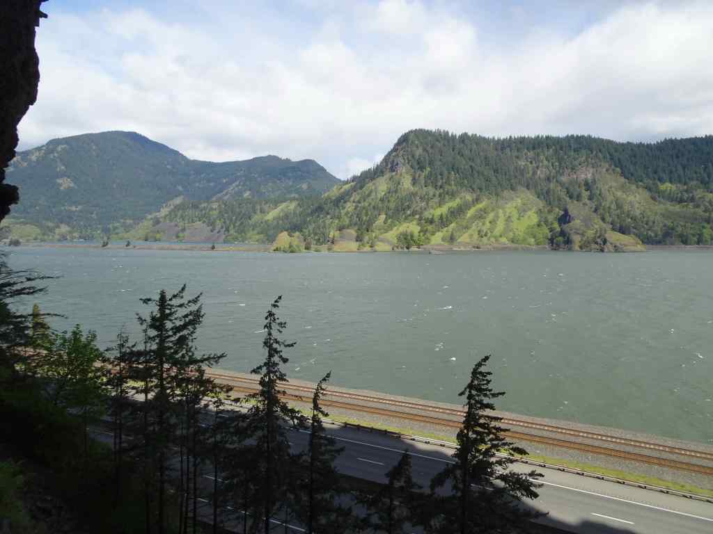
Mitchell Point from the parking lot. The new pedestrian and bicycle tunnel replaces the original automobile tunnel on the Old Columbia River Highway that was destroyed when Interstate 84 was built. The tunnel passes around the north side and through Mitchell Point.Western tunnel entranceWestern view from the western tunnel entrance on a windy day.There are five or six viewing windows in the 600 foot long tunnel.View through one of the windows.Another window view.Eastern tunnel opening.View from the eastern opening toward the highway and the eastern gorge.Back through the tunnel.The western entry patio was comfortably sheltered from the wind today.We walked a short way up the Mitchell Point Trail, which has been closed during tunnel construction. There were lots of wildflowers blooming in the woods. The trail becomes quite steep and rocky, and not suited for a surgical recovery hiker, so we didn’t go very far.
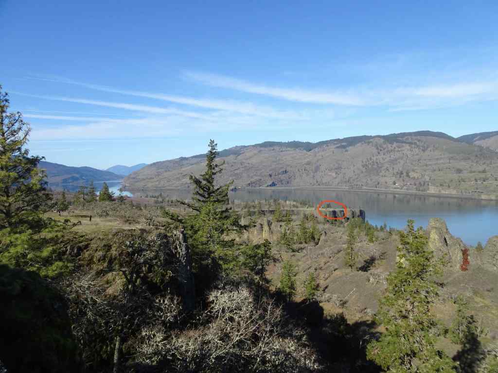
We drove on to Mosier Plateau, where the lower part of the hike is protected from the wind. Eventually, the trail emerges onto the open bench above the river, where the blooms and views were beautiful, but the wind too strong to want to walk the full length of the plateau.
Passing Mosier Creek Falls on the lower trail.Heading uphill within Mosier Creek drainage, well protected from the wind.Looking up along the trail,Northward, toward the river – clumps of bright yellow balsam root bloom becoming more abundant.BalsamrootWith a few poppiesOn the windy plateau, looking west down the Columbia River and toward Mosier.Northern view, looking directly at Coyote Wall in WashingtonA perfect view of the black basalt outcrops of the labyrinth, where I can pick out a couple of my favorite trees.And farther east toward Rowland Wall, Catherine Creek, and her famous Arch.
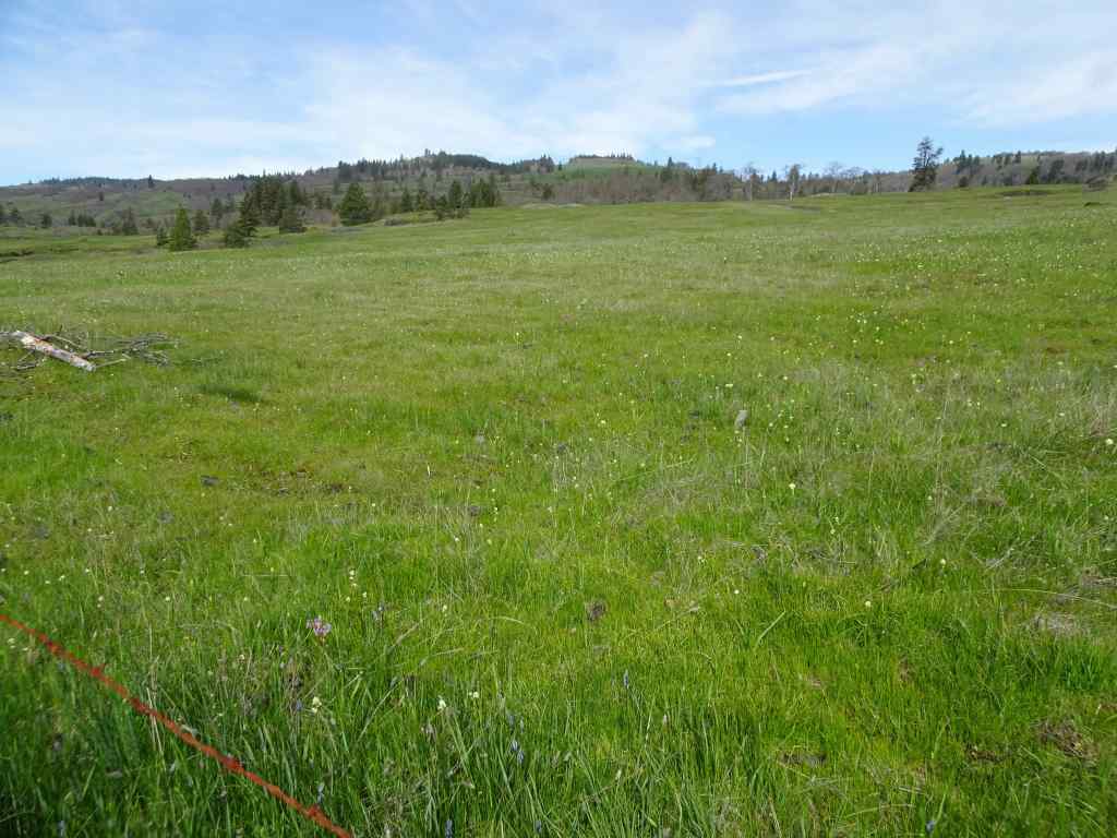
April 23 – Camassia Nature Preserve, West Linn, OR
A one mile loop trail through a natural area near Highway 205 and the Willamette River – somehow preserved from surrounding housing and industrial development.
Walking boardwalks through the green forest, with fringe cup and ferns.A few blue-eyed Marys that always remind me of my sister.Open meadows of camas and rosy plectritisCamas meadows and mossy rocks.Another meadow.Cell tower osprey – the bird can see the Willamette River near Oregon City from their perch.CamasCamas, rosy plectritis and buttercupsTrillium and violets in the forest on the return trail.
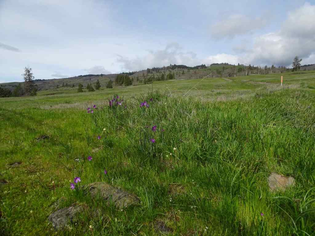
April 25 – Round Lake Lily Fields, Camas, WA
Another short, easy walk in a suburban area where large slopes of camas lilies are not far from housing developments.
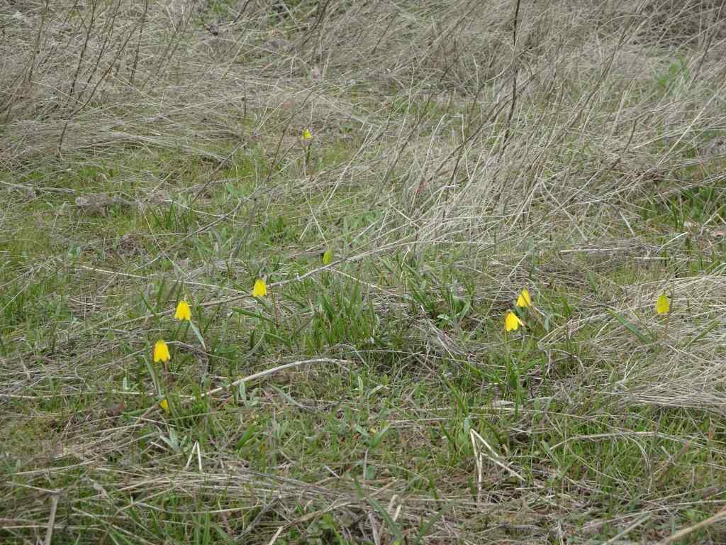
The lower trail near Round Lake…Several paths wind through open slopes of camas lilies.Camas lilyContinuing upwardMossy rocks and camas liliesNear the top of the hillA few glacier lilies still blooming at the very top of the trail.
April 29 – Weldon Wagon Road, WA
The wind continued strong and steady all week in the Gorge. We chose this hike, in part because it has fabulous displays of balsam root along a smooth trail, but also because it is a bit protected from the relentless blasting wind in the main Columbia River corridor.
Oak woodlands along the lower trailBastard toadflax – my first time seeing this small white cluster flower.Purple lupine and white manroot along the upper forest trail, just before the opening to…the wide view across the balsamroot filled slopes.We took a side trail up the ridge with a view to Mt Adams to the north for our lunch stop.Back on the main trail, balsam root all the way…And big headed clover,BalsamrootThe upper trail is wooded, with blue flowers of Pacific hound’s tongue and yellow violets in the understory.Returning down the way we came. Pale pink phlox among the yellow balsamroot.Our descending trail back down through the flowering slopes.
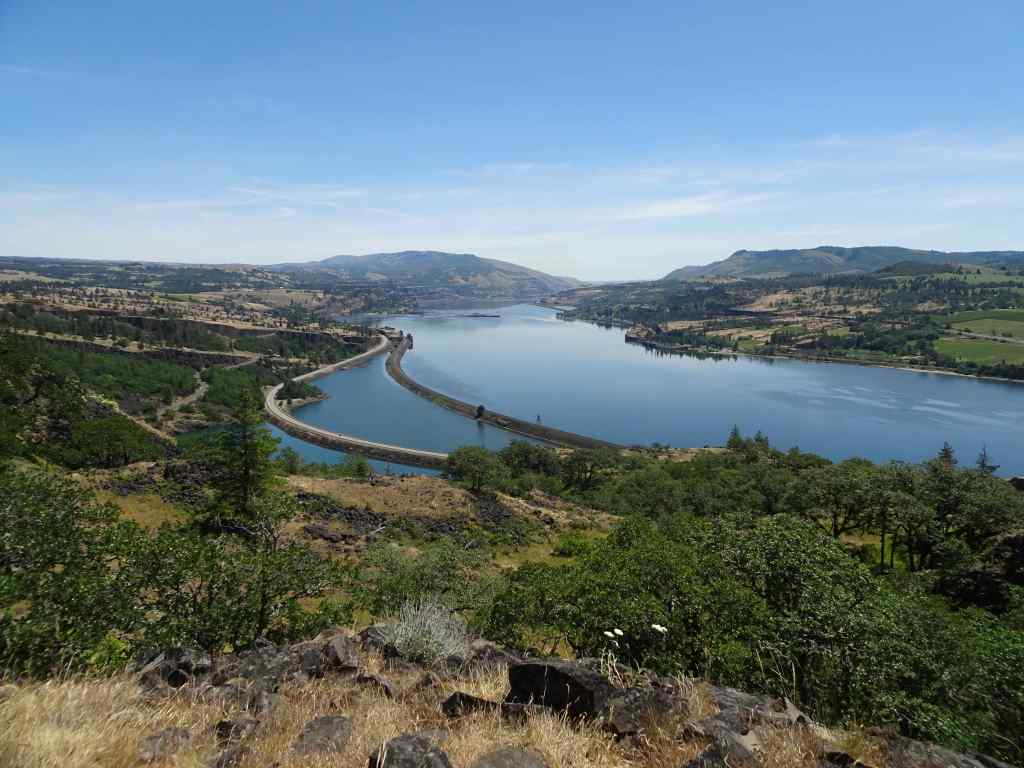
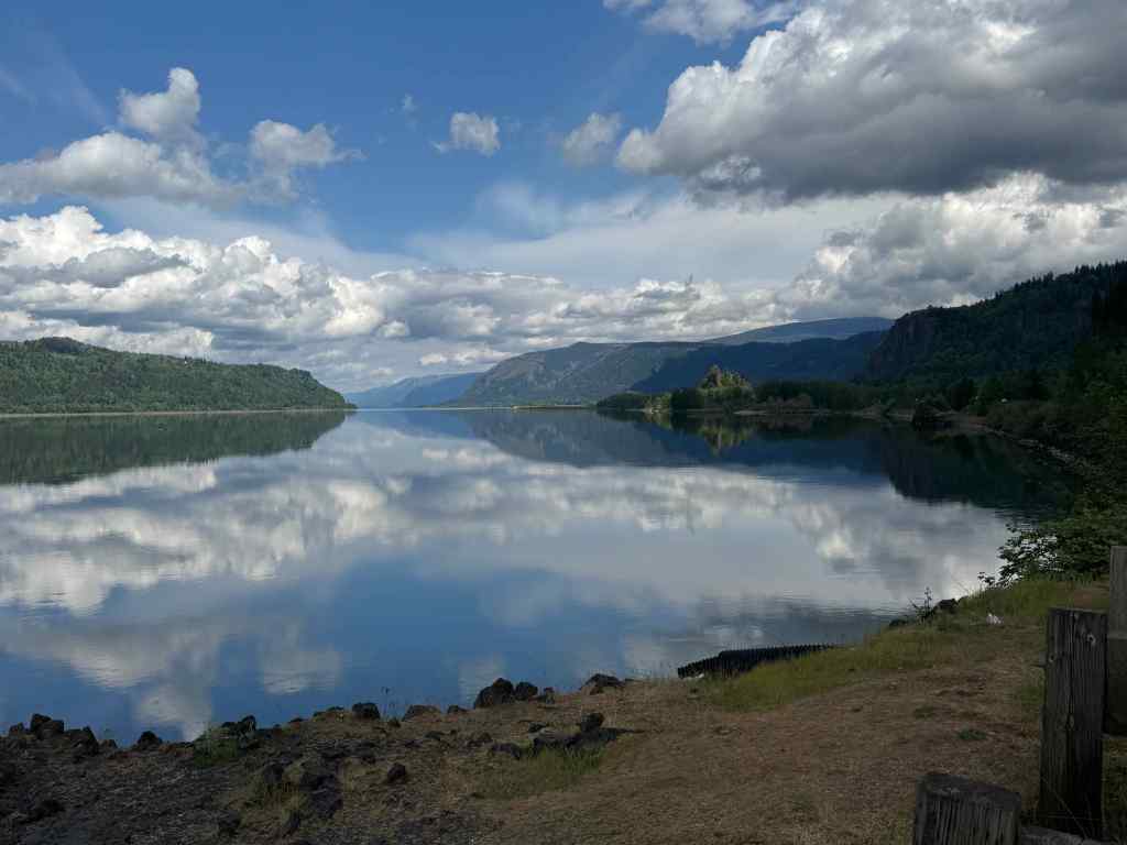
On the drive home, we stopped at the overlook on Highway 84 just below Corbett, where the perfectly calm air allowed a river mirror to form – we don’t see that very often on our gorge excursions.
Eastward, up river, Crown Point/Vista House on the right skyline.Westward toward WashougalPanorama viewHistorical Marker at the viewpoint
Thus, we enjoyed another month of wildflower hikes, with more to come in May.
We enjoyed three wildflower hikes in the eastern Columbia River Gorge in March, all trails we have been to many times in different seasons. I love tracking the phases of wildflower bloom each time we go.
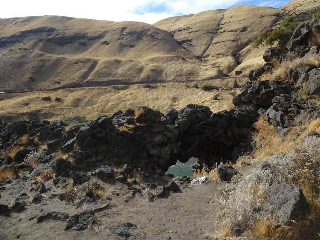
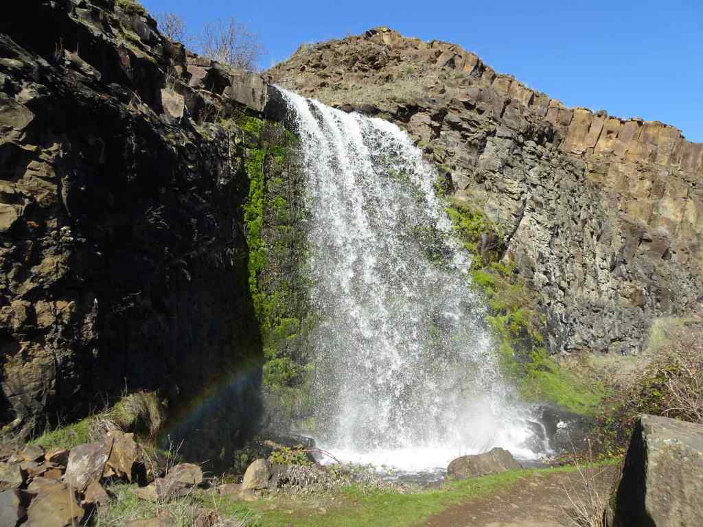
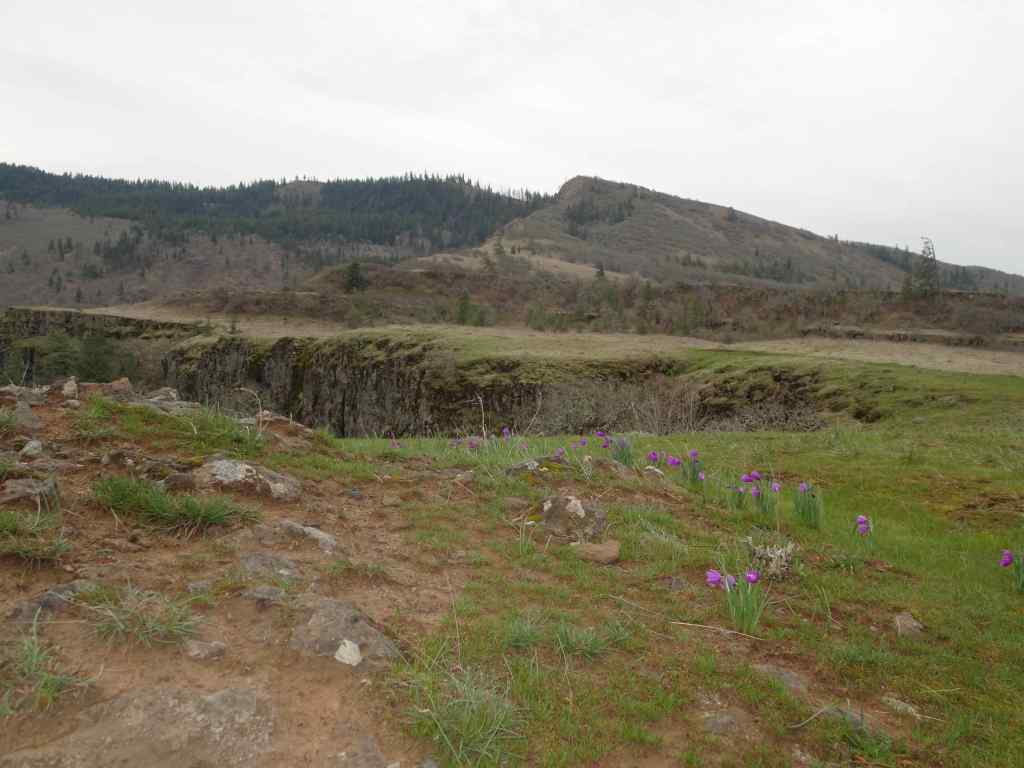
March 3 – Catherine Creek and Lower Labyrinth, WA
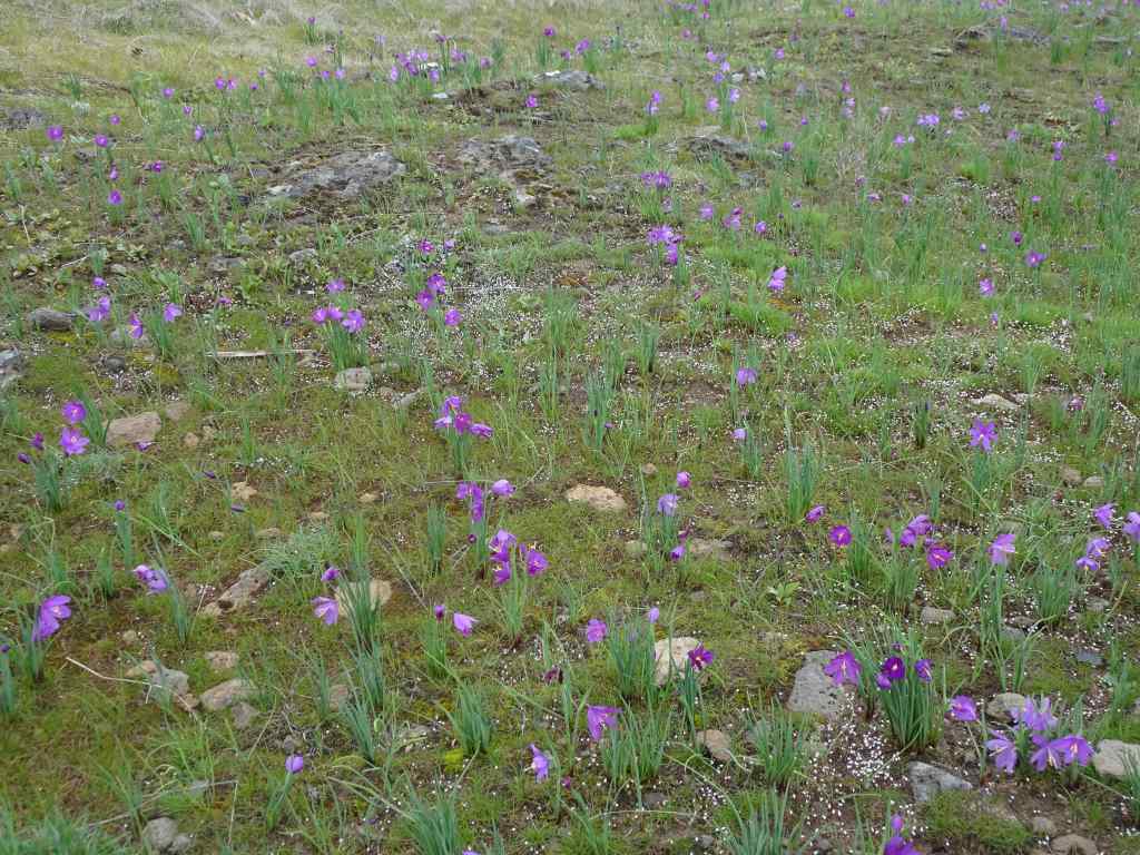
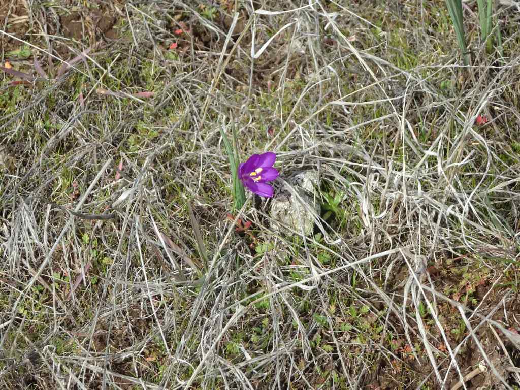
Early March is grass widow season at the lower elevations of the Catherine Creek and Labyrinth trail systems. My camera doesn’t do them justice, but the swaths of purple grass widows are so very pretty!
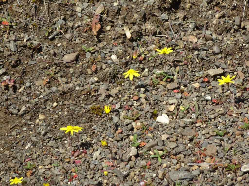
Fields of purple grass widows carpeted the lower meadows along the ADA Trail at Catherine Creek.Grass widowsLooking eastward…Early yellow parsleys in the woodland.More grass widows on the rocky outcrops.There was nothing blooming at the slightly higher elevation fairy ponds, so we went to the nearby Labyrinth/Old Highway 8 Trail to see what was happening there.The Lower Labyrinth Falls along Old Hwy 8 was full.The Upper Labyrinth Falls was also full, but there were no flowers up here.The flowers were concentrated in the lower elevation areas…Grass widows, gold stars, pink woodland stars.
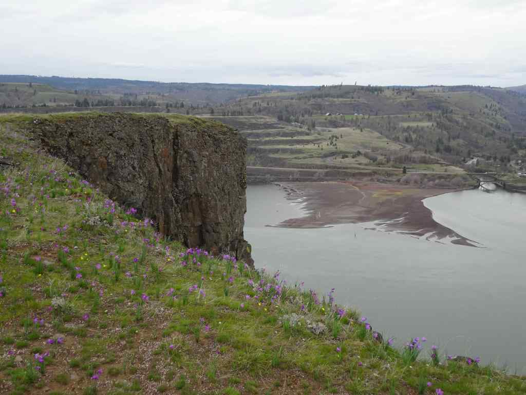
March 11 – Rowena Crest, OR
The next week, on the Oregon side of the river, we saw more swaths of purple grass widows along Rowena Crest – both in the lower part of the Tom McCall Trail, and the Rowena Crest Trail.
We started by walking toward Tom McCall Point, where grass widows filled the meadows.Grass widows and tiny white spring whitlow grass bloomsWe walked through the oak tree lined Parsley Alley, and saw purple Columbia Desert Parsley beginning to bloom.Columbia Desert ParsleyLooking east toward Lyle Cherry Orchard and the Rowena curvesYellow bells popping up in places.
We went back down, and walked all the way to the end of the Rowena Plateau Trail.
Grass widow meadows along Rowena Plateau TrailYellow parsleyWhite salt and pepper parsleyGold Stars in the meadows at the west end of the trail
Reflections in the ponds along the way provided some abstraction distractions…
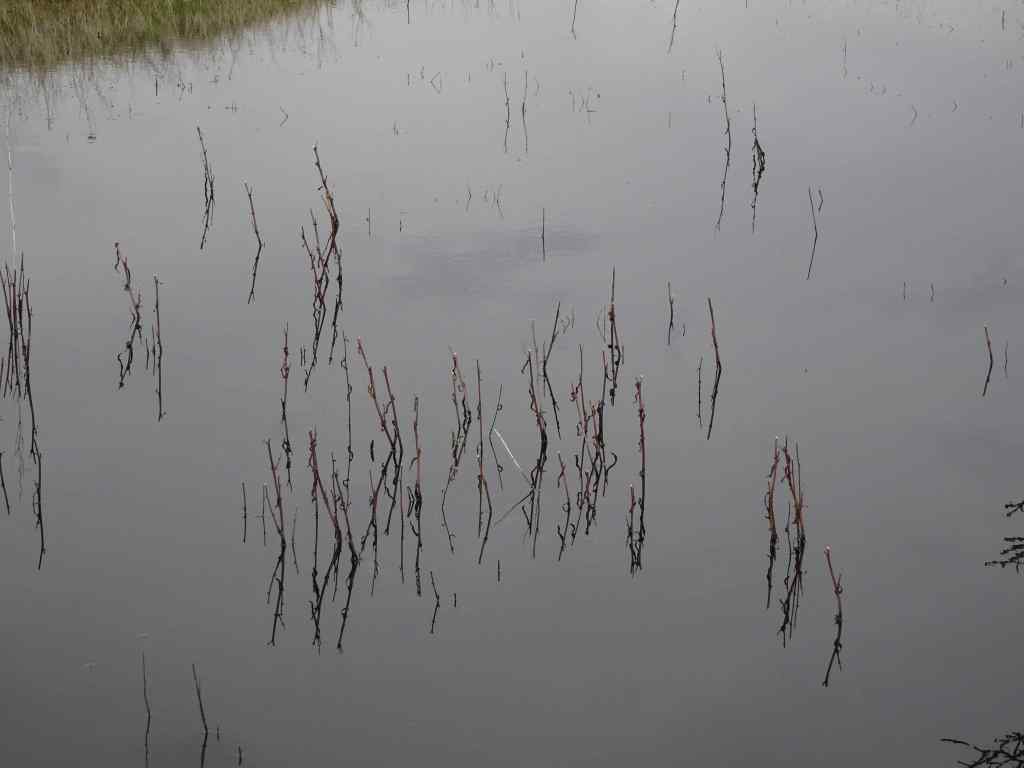
Pondwith ripplesZooming inCloserand closerand back out.Another pond.
We walked back along a side trail near the cliff edges – so many flowers!
Looking toward Lyle, WA.And back toward Tom McCall Point.
March 18 – Rowland Wall/Stringbean Loop, WA
By mid-March in the Catherine Creek area, grass widows were joined by other flowers – saxifrage, gold stars, yellow bells, more of the parsleys, and the first balsam roots.
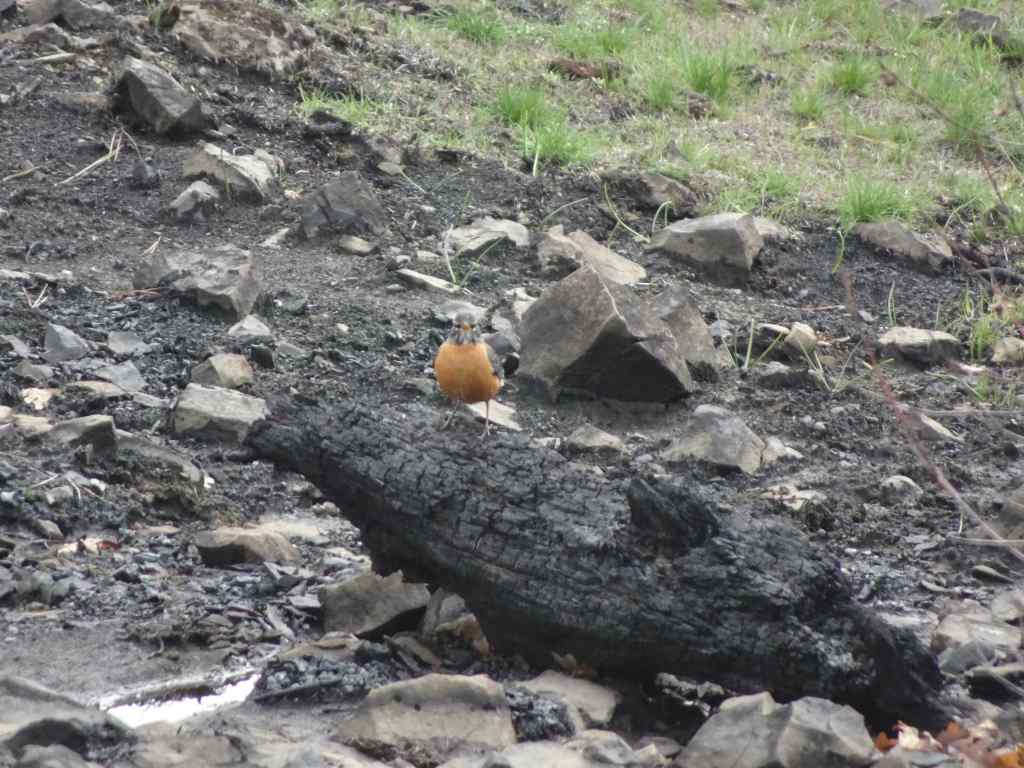
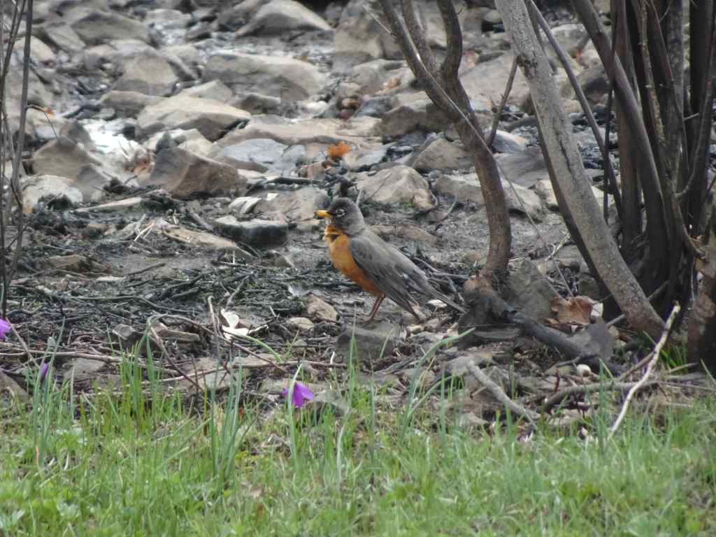
At the trailhead, white saxifrage were speckling the meadows along with grass widows.Gold stars becoming abundant in the rocky areas overlooking the arch.Plenty of grass widows, looking toward the orchards of Mosier.The burn areas from last fall’s Top Of The World Fire are prominent around the trees, but the slopes have turned green.There were many robins hopping along today. We watched these two playing in some puddles while we ate our lunch.RobinWe continued uphill on the burned, but now green, slope of Sunflower Hill.Two robins in the top of the oak tree.Looking east from our high point. We dropped down over Rowland Wall, then decided to walk the inside-out switchbacks of the String Bean Trail. We didn’t find many flowers in the woodlands.Looking back toward Rowland Wall, and the Needle.We crossed the lava flows, then went back up over the wall at the lower trail.We saw the first of the balsam roots blooming along the wayRowland Wall scree slope and NeedlePlenty of yellow parsleys blooming along these west-facing slopes,And pockets of yellow bells.Grass widows and gold stars.
It was a beautiful day, and I am looking forward to the next phase of wildflower bloom in the eastern gorge!
Preview of Coming Attractions –
Driving home westward on Interstate 84, we passed under the base of Mitchell Point. The tunnel on the old highway was destroyed when I-84 was built, but has recently been reconstructed and reopened as part of the bike path through the gorge. I grabbed a photo as we passed – and we hope to walk there sometime soon. The views are supposed to be amazing!
Mitchell Point Tunnel, above the highway on the left.
The shortest month seemed very long. I went from skiing the neighborhood snow to admiring the early spring blooms. I knit, quilted, and read as productive activities to counter the political upheaval. We honored the boycots. I made progress on the recycle/repair/upcycle four-year home improvement project. And we went on two hikes.
Crafting/Home Improvement:
Another pair of socks completedHat for the Guild service projectI started sewing these quilt blocks togetherBack hall carpet installed, almost the last step in that project.
Reading – I read nine books last month, many by or about women: writers, artists, a river guide, a Supreme Court Justice. After watching the Bob Dylan movie last month (A Complete Unknown), I was very interested to read Suze Rotolo’s side of the story. She was a politically active artist. She made a lasting impression on Dylan and his music, but she wanted to pursue her own artistic and life goals, not be just another string on his guitar, his ‘chick’, who would wait for him while he did whatever, wherever in the world. I really admire her for that. There are many great, less celebrated women out there, and I plan to read more of their stories. Meanwhile, I have been listening to the early Bob Dylan music – it fits the mood of this time in the world.
March 2025 Books
The neighborhood:
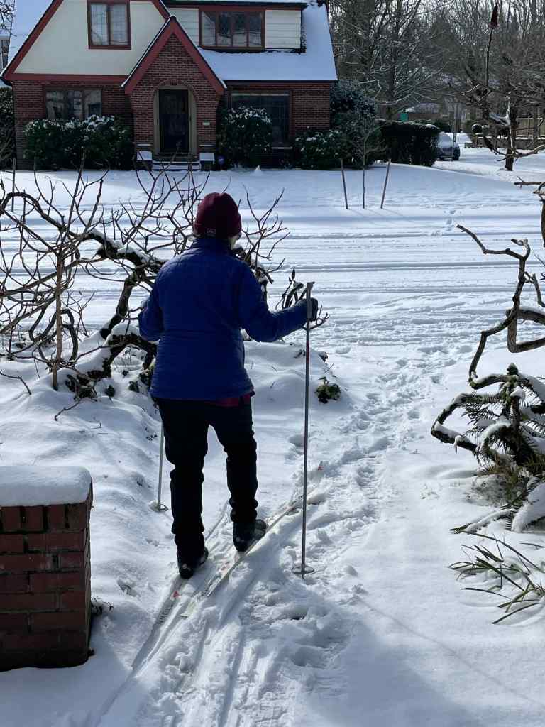
February 14th – I always love a chance to get out my 35 year old cross country skis, and kick-glide for a couple of miles down the quiet, flat streets of Irvington. The snow was perfect this day! And almost completely gone the next day.
Skiing out the front doorJust enough snow…Sunny and calmNice flat streetsJapanese Maple
Meanwhile, in Philadelphia, our son and his fiancee were attending the Super Bowl Victory Parade! Wearing hats that I knit for them last year.
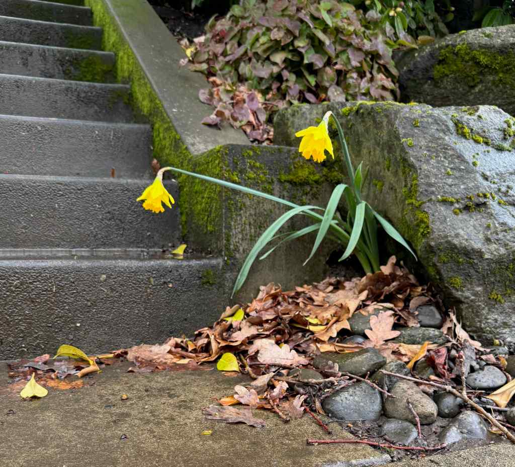
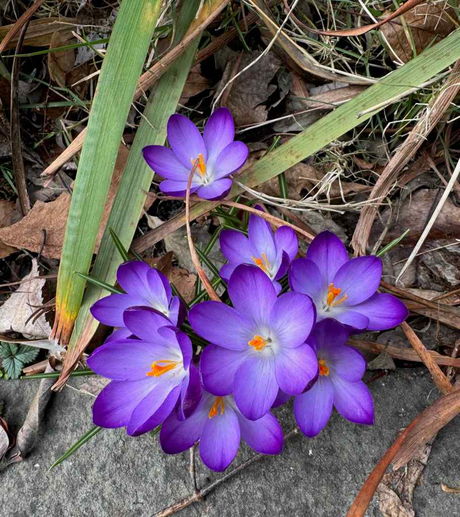
Around town – flowers and rainbows…
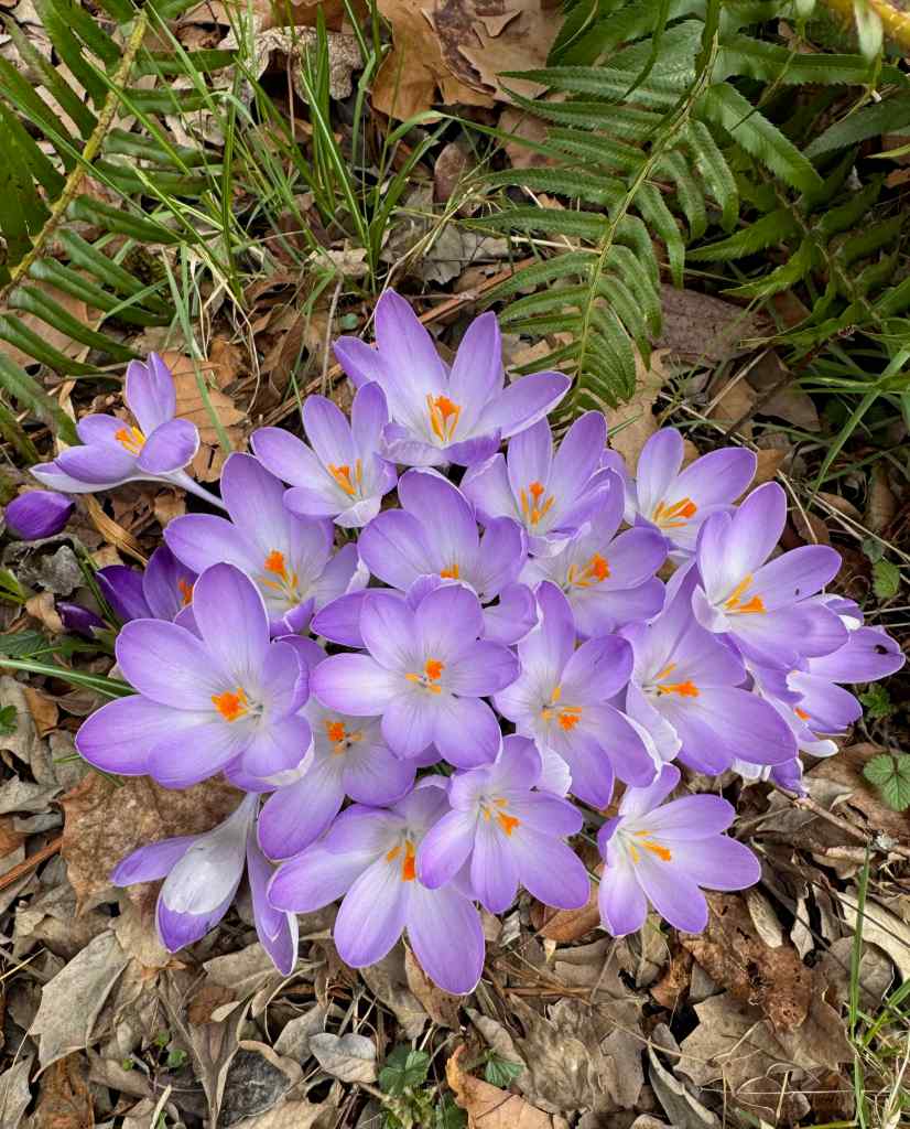
Yellow crocus are earlyDaffodilsPurple crocusLavender crocusWindflowersRainbow seen while driving north on I-5 in Portland
Hiking –
We hiked out in the eastern Columbia River Gorge twice in February –
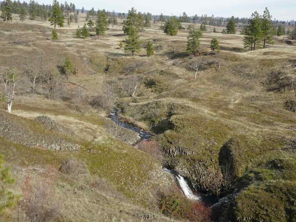
February 20th – Crawford Oaks, WA – We hiked about 5 miles on the Lower Vista Loop, past the full Eight Mile Creek Falls, and around the lower plateau. We saw very few early flowers and just a bit too much wind that day.
February 27th – Memaloose Hills, OR – A beautiful, perfectly calm day. We could see the blue heron rookery on yonder cliff top and a few flowers. It was an easy, enjoyable 3.5 mile hike with dear friends.
Eastward view from the Memaloose OverlookView to the north, with a peek at Mt AdamsWestward view, heron rookery circled in redFuzzy zoomed-in heron rookeryTrail up the south approach to Chatfield HillView to Mt Adams from the topA few grass widows up thereColumbia Desert ParsleySpring Whitlow grassLunch at the top, and a view to Mt Hood (photo credit to my husband).
Meanwhile, the news is worse every day – we are doing what we can, and trying to hold on to the glimmers and small victories. The daily reports of the shredding of the constitution by anti-empathic billionaires is trying every nerve, but I try to stay positive…
I went on a few hikes, knit a little, read quite a few books, and embarked on what I have decided is my personal four year project.
New Years Day was the last day of Hannukkah. We had a small gathering, with latkes.
Menorah and latkes
Neighborhood walks – the low sun position intensified shadows and sky…
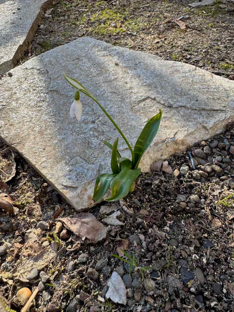
Shadows in windowsShadows on wallsShadows on sidewalksLow light lit treesIndoor and outdoor lighting and shadowsThe first snow drop of winter
Hikes
Early in the month, we spent five days on the sunny southern Oregon Coast (see previous post), where it was cold, but not windy! We took several long beach and headland walks. More locally, we hiked in the eastern Columbia RIver Gorge a few times:
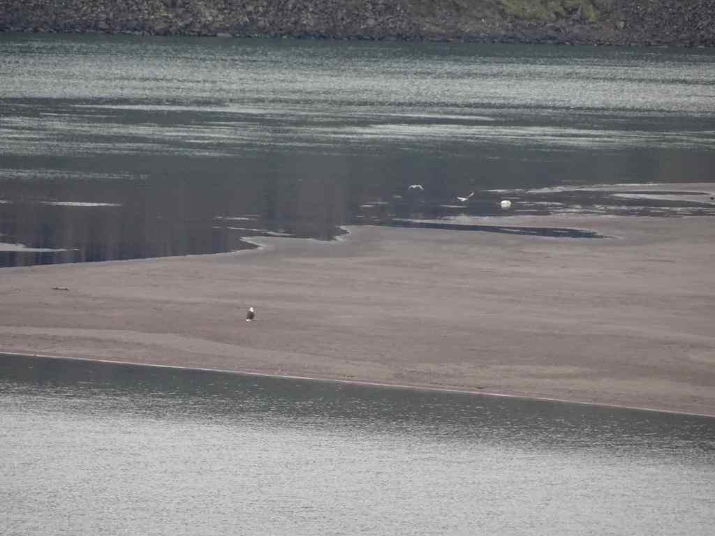
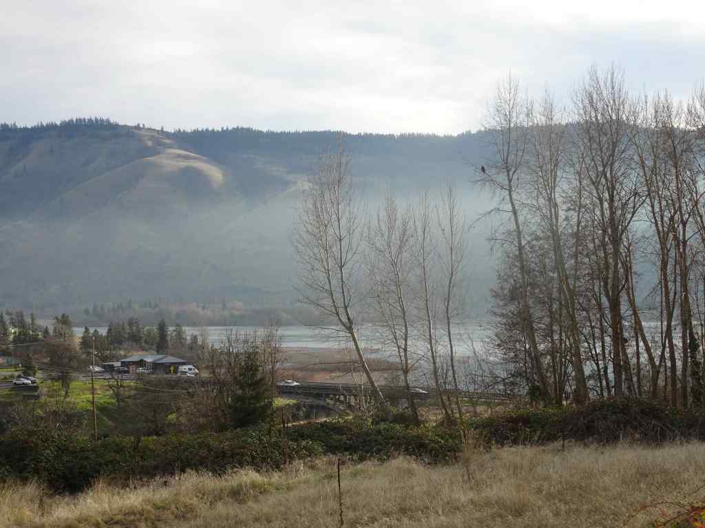
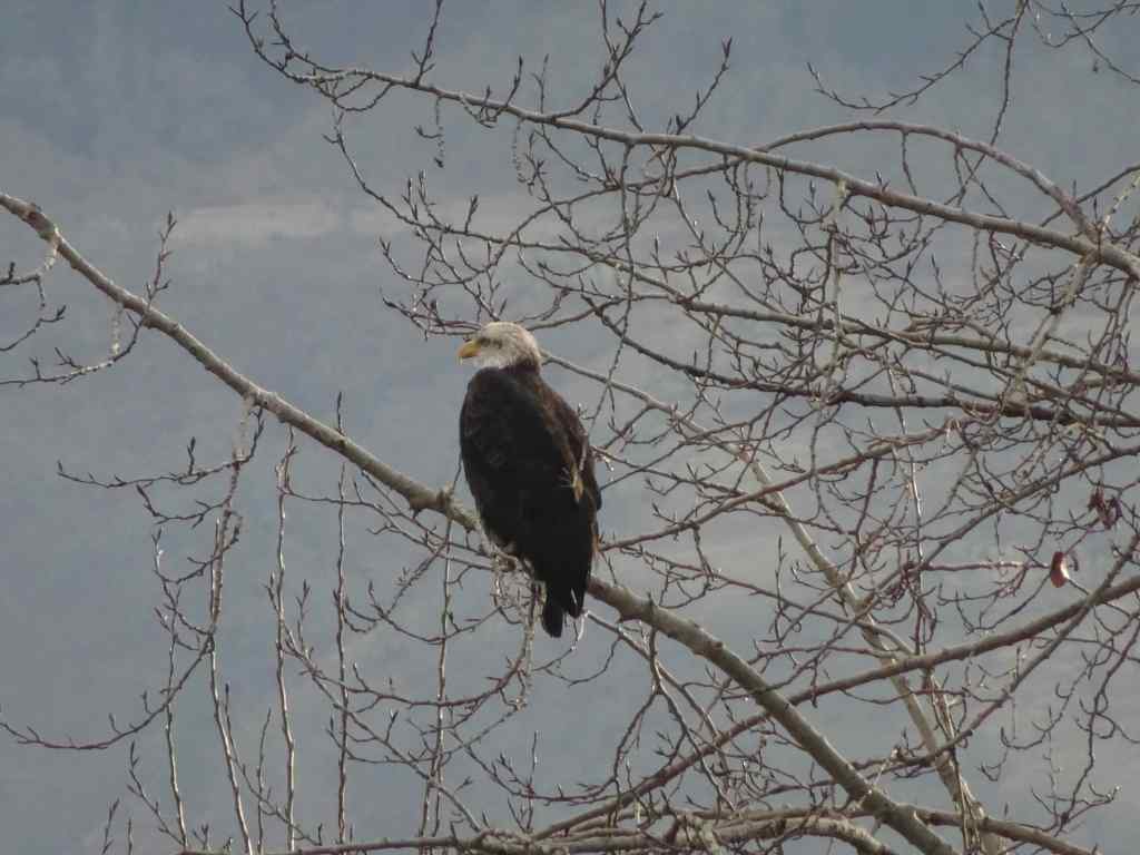
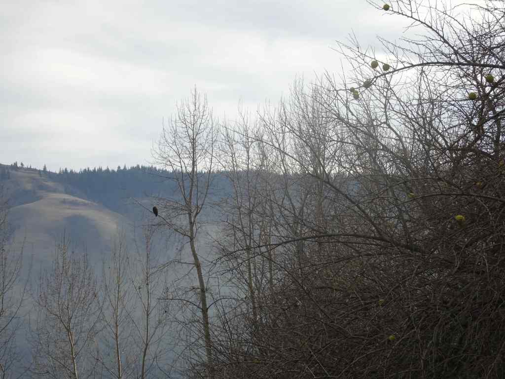
January 13 – Klickitat River Bald Eagles and Lyle Cherry Orchard Trail, Washington – Our annual trek to the bald eagle nesting area on the Klickitat River began with disappointment this year. We saw no eagles along the river in the morning, other than one down on the delta just as we were moving along.
Seagulls and salmon in the Balfour-Klickitat Lake, no eagles in the trees.Osage oranges scattered on the slopeOne bald eagle on the Klickitat River Delta
We then took a short hike along the lower benches of basalt at the Lyle Cherry Orchard site. It was a beautiful day out there, calm and cold! We saw a pair of eagles flying along the cliff face. We also saw a hawk on sitting a rock, then devouring prey that it pounced upon as we watched. Circle of life…
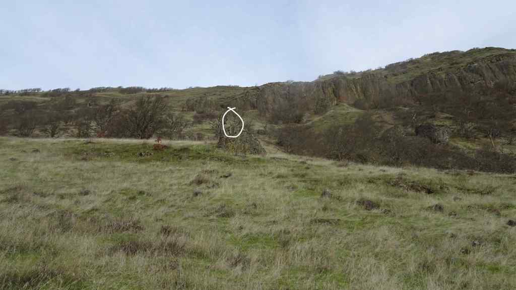
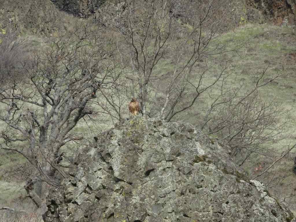
Hiking up through oak woodlandOak treeLooking down on the Convict RoadEastward viewLunch view toward Lyle and the Klickitat River DeltaOne of the eagles flying along the rim rockOn the return hike, my husband spotted a hawk perched on a rock.Closer viewHawk in the grass, after finishing their meal
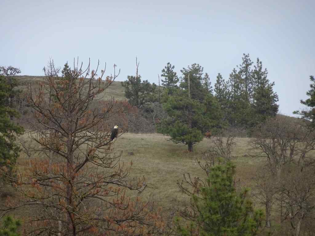
We stopped back at the Klickitat River later in the afternoon, and were rewarded with seeing about a dozen bald eagles – a few perched in the trees, and others flying up the canyon, past us and farther up river, beyond our view, seemingly heading home after their day’s outing.
The bright white of an eagle head, across the lakeCloser viewEagles perched in a snagEagle, with the sunlit Oregon slopes beyond the riverCloser viewAnd another angle, with Osage oranges still clinging to some of the trees.
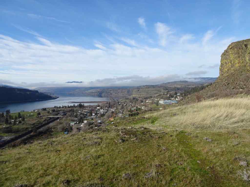
January 22 – Wind Mountain, Washington – a short, sharp hike. I hadn’t been up this one in a while, and was looking for a test for my hip bursitis rehab, after about four months of steady focused exercises. This trail goes up about 1000 feet in a mile, leading to the top of this conical mountain at a bend in the Columbia River.
Reference photo – May 2013. View of Wind Mountain from Dog Mountain. Our trail zigs and zags up the back side of the peak.
It was quite windy up top on the river side, so we didn’t spend much time looking at the river and Oregon view.
Windy westward viewWindy westward view
We found a windbreak on the landward side, so ate our lunch looking at Mt Adams and Dog Mountain – also nice landscapes to admire. It was cold, but a good short hike, and a good work out for my legs. Progress!
Lunch view toward Mt Adams and Dog MountainCloser view of Mt AdamsCloser view of Dog Mountain (where the above reference photo is from), and the river, looking east.
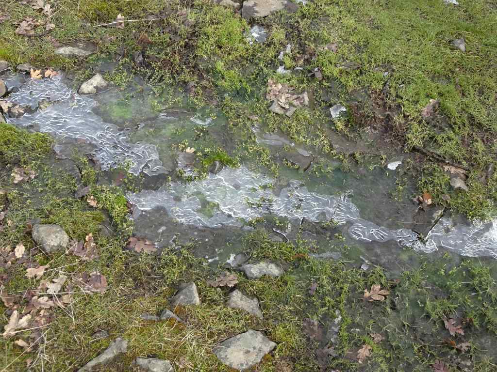
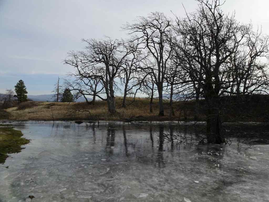
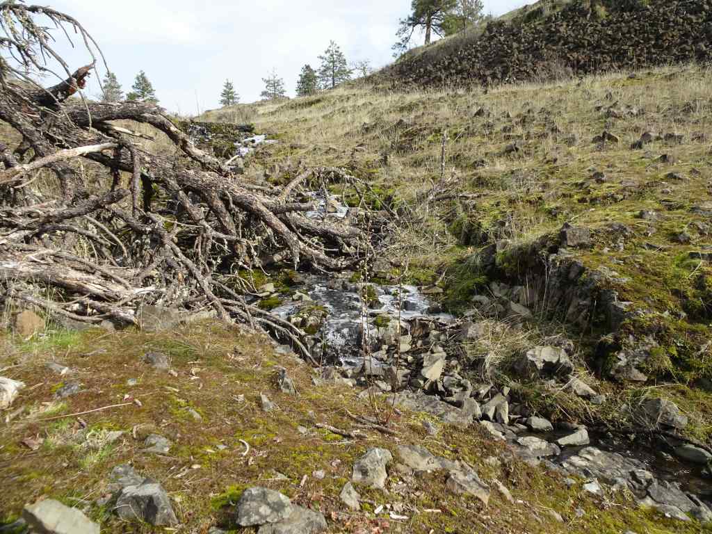
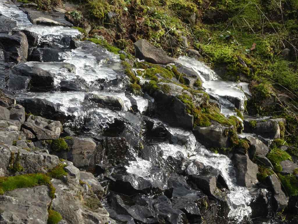
January 30 – Catherine Creek – Rumors of a few blooming grass widows drew us out east in the gorge, on what will probably be the last dry hiking day for the next week or so. We did not find any blooms while wandering several of the lower elevation trails. We visited several vernal ponds that were frozen, and saw foliage of blooms to come…just not yet.
Catherine Creek Trailhead on a cold day in JanuaryMt Hood across the riverBitterroot and grass widow foliageFrozen pond on the lower trailCatherine Creek FallsIce along the upper trailFrozen fairy pondsIceWider viewThe archAnother frozen waterfallwith iciclesFrosted moss and leavesTrail for the day
Knitting
Unfortunately, I overdid the knitting action on a pair of socks – right around the time I needed knitting the most to keep my hands busy while my brain was exploding with the national news. I reactivated an overuse/arthritis knitting injury in my right thumb joint. Blah! I wore a brace and knit not at all for two weeks. I am now allowing myself a few rows per day, and it really helps! I’m trying not to overdo it again. Here are the guilty socks, in progress. But I don’t blame them.
Wanaka SocksBlue gradient socks
Less Knitting = More reading…
I finished all these books in January.
Four Year Project
Sometime after the disastrous election outcome last fall I decided I would need a four year project, something I can do in my own home, when the outside world is too much to take (more than sitting on the roof.) It is time to edit, sort, rehome, recycle, and organize the lifetime of belongings we have accumulated during the 33 years we have lived in this house. Three children have grown up and moved out and left behind many things they ‘might want someday’ but don’t have room for yet. I had a career as a geologist before I settled into family life, and I still have boxes of rocks, maps and books (that apparently nobody wants because it is all digital now). Photos and slides, both professional and personal; quilting fabrics and textile art materials for my creative life; personal writing and memorabilia. We have already made some progress during recent renovation work. We recycled all the old paint, thinned out our shelved books in the rooms where we got new carpet, and delivered usable items to new homes. We gave the unplayed banjo to a local music school, and have recycled many magazines that we were shelving for no good reason. A little action every day will make a big difference in four years, and be much more productive than doom scrolling. I plan to find a means of more outward action/resistance, in addition to donations we make to human rights and environmental organizations. And I will knit more hats (thumb permitting) for the guild service project.
Right now it is difficult to think this new year will be a good year, given the chaos at the national level. I call to mind a passage from the novel, Dune, by Frank Herbert, which I first read in the 70’s, as a teenager. Potential future leader Paul was given a test to prove he was human. There was a good chance he might not be, and would not be made leader. The fictional character passed the test. But I can’t believe the current ‘leadership’ ever would – there has been no sign of human empathy, only selfishness and cruelty. Yet we will resist in the ways we can, and hope that our actions in our own lives will contribute to persistence of human rights beyond the next four years…
Instagram memes I collected in January expressing gratitude, encouragement, and hope:
Honoring Dr Martin Luther King, Jr.I will miss these humans.Reminder to be supportive…More words of encouragement…Keep trying…Music might help…