Grassy Knoll 6/17/2017 (#33)
Bear siting on the approach road
This lovely trail is not heavily used, possibly because the trailhead is a very slow 10 miles on a potholed road (6808) that is on a ledge above a steep drop down to Bear Creek. We saw a bear on the road within the first mile after the end of pavement. We drove around a bend, and there ahead was a large shaggy deep brown bear who looked back at us then hustled down the road around the next bend, away from us. By the time we made our way to that spot in the road we could not see any sign of the bear. There were steep, heavily forested cliffs above and below the road, but I have seen a bear run up a similarly steep mountainside in Yellowstone, so I have no doubt the bear could have gone either way. This was the first time I have seen a bear in the Pacific Northwest. I have seen them previously in Yosemite and Yellowstone.
Wildflower Hike
The trail begins by traversing a grassy slope that is full of wildflowers – buckwheat, lupine, paintbrush, penstemon, groundsel, bluehead gillia, and lots of mariposa lilies.

Trailhead meadow

Penstemon and lupine

Drymocallis

Groundsel

Buckwheat

Stonecrop

Paintbrush and lupine

Blue head gillia and Mariposa lily

Balsamroot
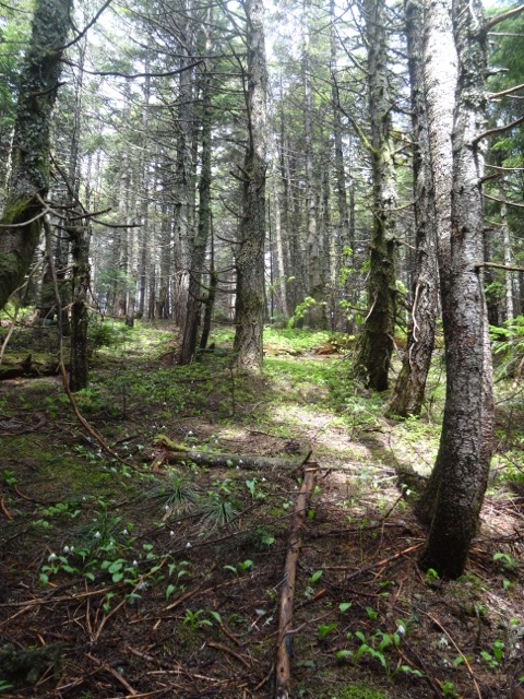
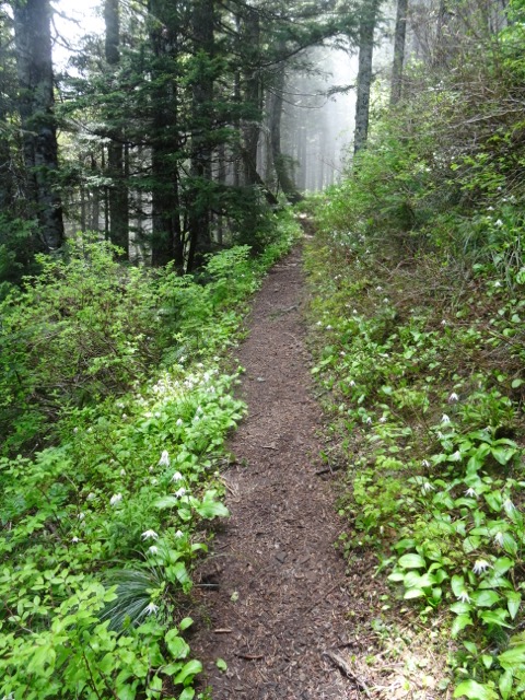
The next mile or so is very steep uphill through the shady woods. Dan compared the trail to the steep part of Dog Mountain. Forest flowers abound, especially windflower and Solomon seals.

Starry Solomon seal

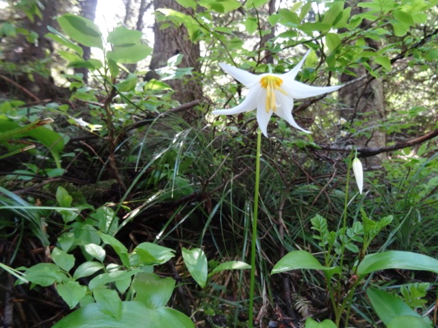
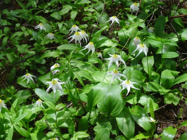
Bead lily

Devil’s club

Coral root
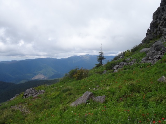
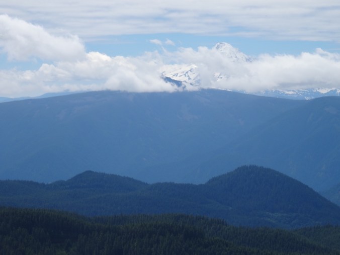
The trail breaks out onto an east facing rocky view point with abundant bright pink cliff penstemon and views across Big Lava Flow to Mt. Adams and Little Huckleberry Mountain.


Back into the forest and along the ridge top, there are views to Mt. Hood to the south, and more varied wildflowers in the dappled light.

Mt. HoodBeargrass

Fringe cup

Vine maple
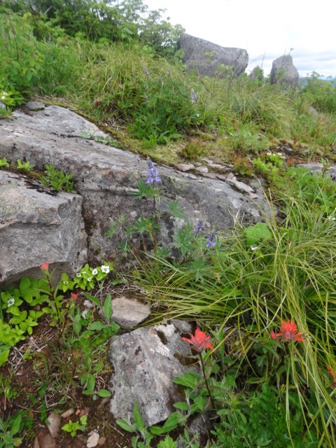
The trail passes a mossy outcrop with lots of white onion flower, penstemon and phlox. Last year this area was covered with Mariposa lilies and other kinds of onions.
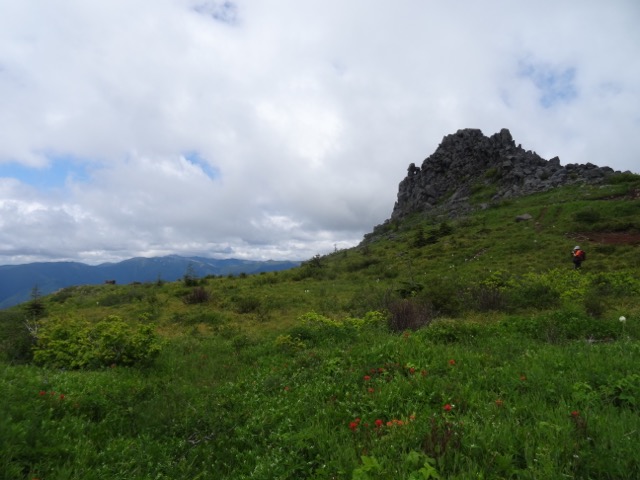
Eventually, there is a view ahead to Grassy Knoll.
The trail switchbacks through a glorious meadow with abundant flowers, and increasing views of Mt. Hood to the south, and Mt. Adams to the east. At the top are the remains of a fire lookout.

Mt. Hood, Dog and Wind Mts. in the foreground

Mt. Hood and the lookout footings
Mt. Hood behind Mt. Defiance
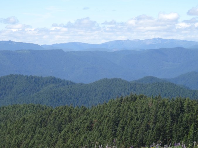
To the west – Three Corner Rock is the point on the left, and Silverstar Mountain the double peak on the right of the skyline
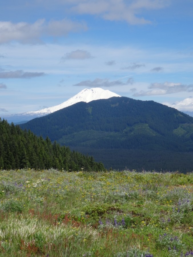
Mt. Adams and Little Huckleberry Mountain
We continued up the trail for about a mile, through more forest and two more wildflower meadows. We saw more flowers we hadn’t seen yet.

Meadow rue

Paintbrush

Buckwheat and chickweed

Trillium

Kittentails
The uppermost meadow was covered in yellow glacier lilies and small pink western spring beauty. Looking back from the high meadow we had another view of Mt. Hood before heading down the trail for the day.

Glacier lily and western spring beauty
We first hiked this trail last year about the same time in June, but on a rainy and overcast day, so we were glad to see the views this time. Another difference is that last year was a low snow year so wildflowers were all much earlier, and the suite that we saw included later season bloomers, such as Clarkia and a lot more blooms from the onion family. Other than the Clarkia, we saw almost all the same flowers, plus a few early season extras in the upper meadows above Grassy Knoll, which we did not hike to last year. Our total for this hike was 63 different wildflowers that I could identify, the highest total for this year. We hope to go to both Saddle and Silverstar Mountains next week, where we may see even more different flowers. This hike was about 6 miles and 1500 feet elevation.
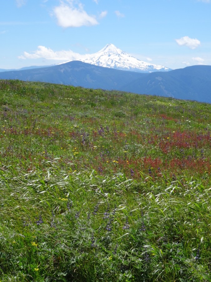
Mt Hood from Grassy Knoll
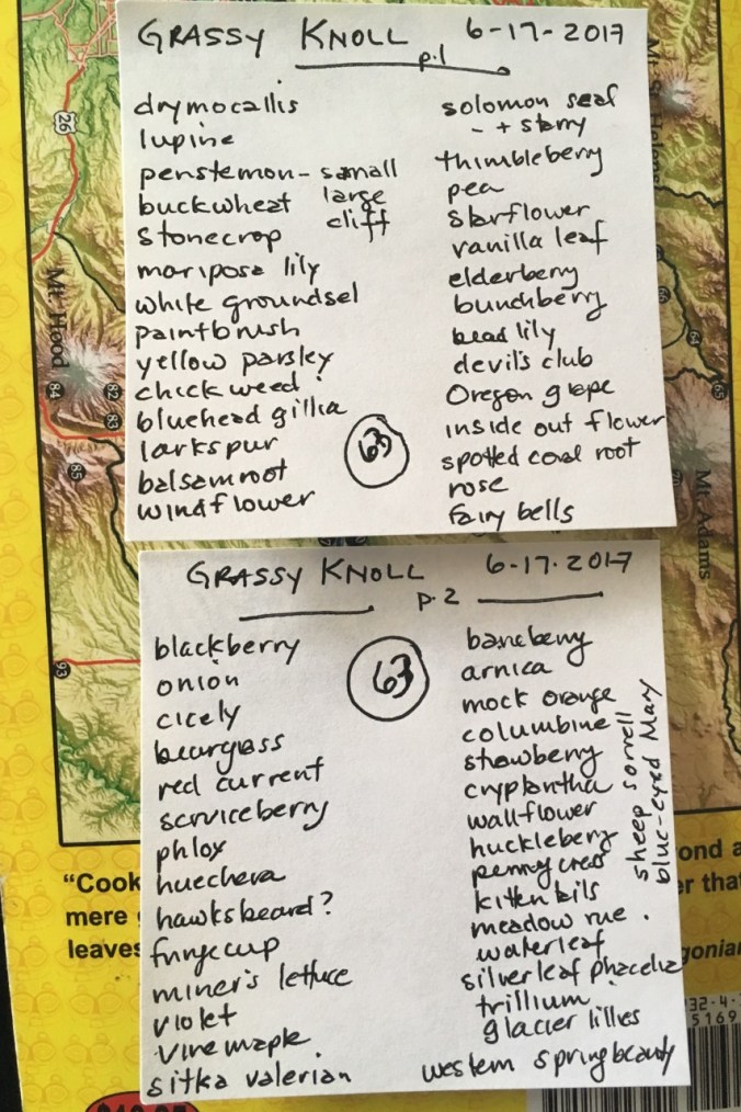
Flower list
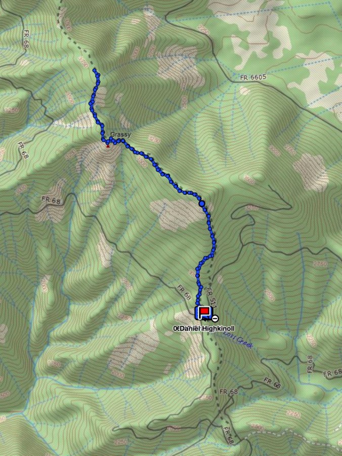
GPS track
Yarn Projects Finished
I retaught myself how to crochet, and made 6 #Hearts4PDX for the yarnbombing event planned for June 26th, in honor of the Hollywood Transit Center attack victims. I appreciated the opportunity to do something positive in response to this event.
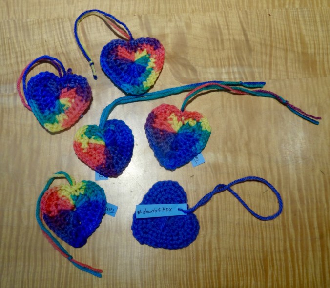
#Hearts4PDX
I finished knitting a pair of socks from the pattern Ludwig by Stephanie van der Linden. These have been my “on the go” knitting for a few months.
")
")


")