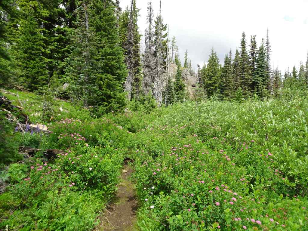
I went on only three hikes in February. We had some down time while my husband recovered from a sudden illness. He is well now. The later walks were in easy, recovery mode.
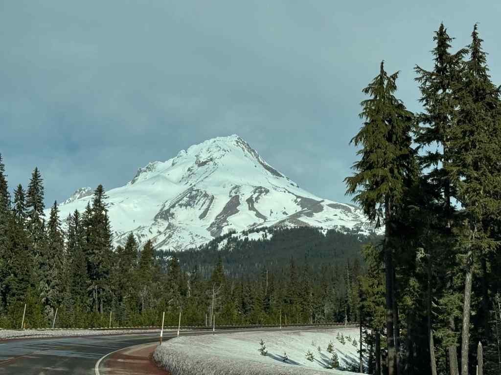
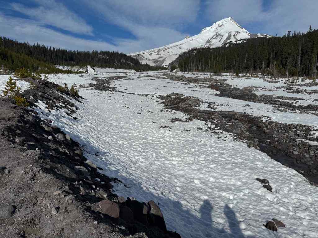
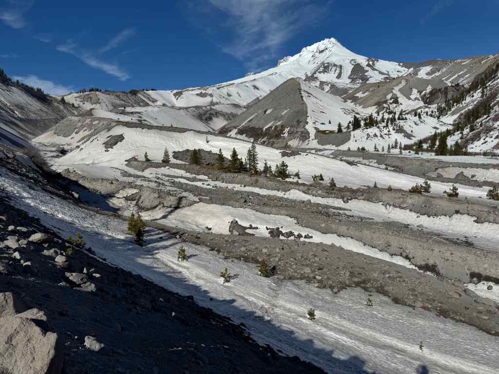
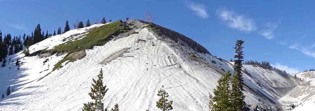
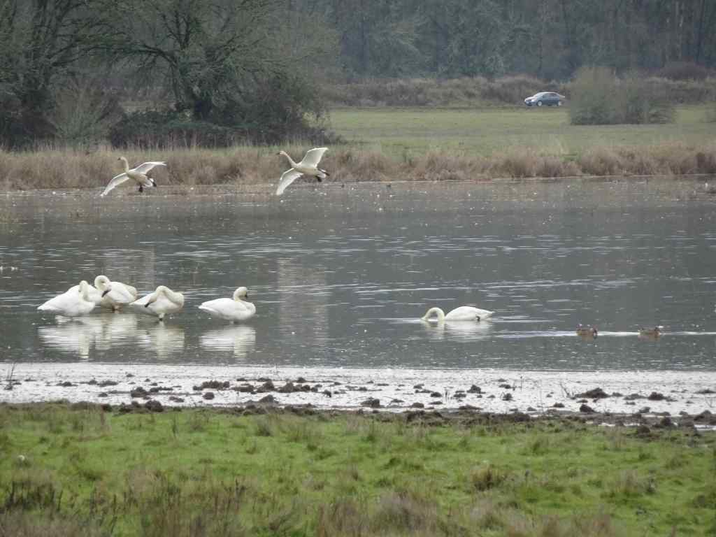
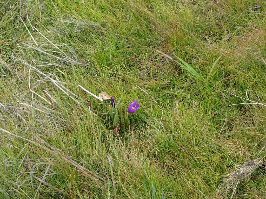
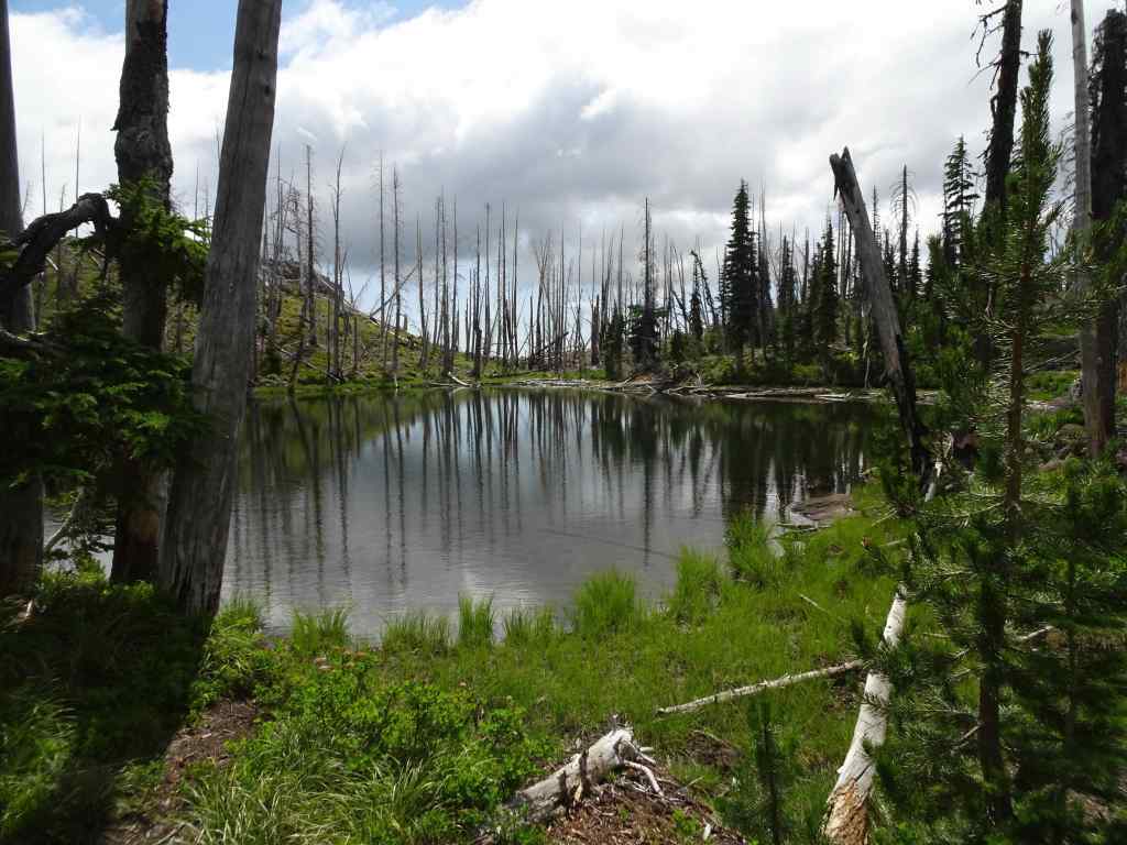
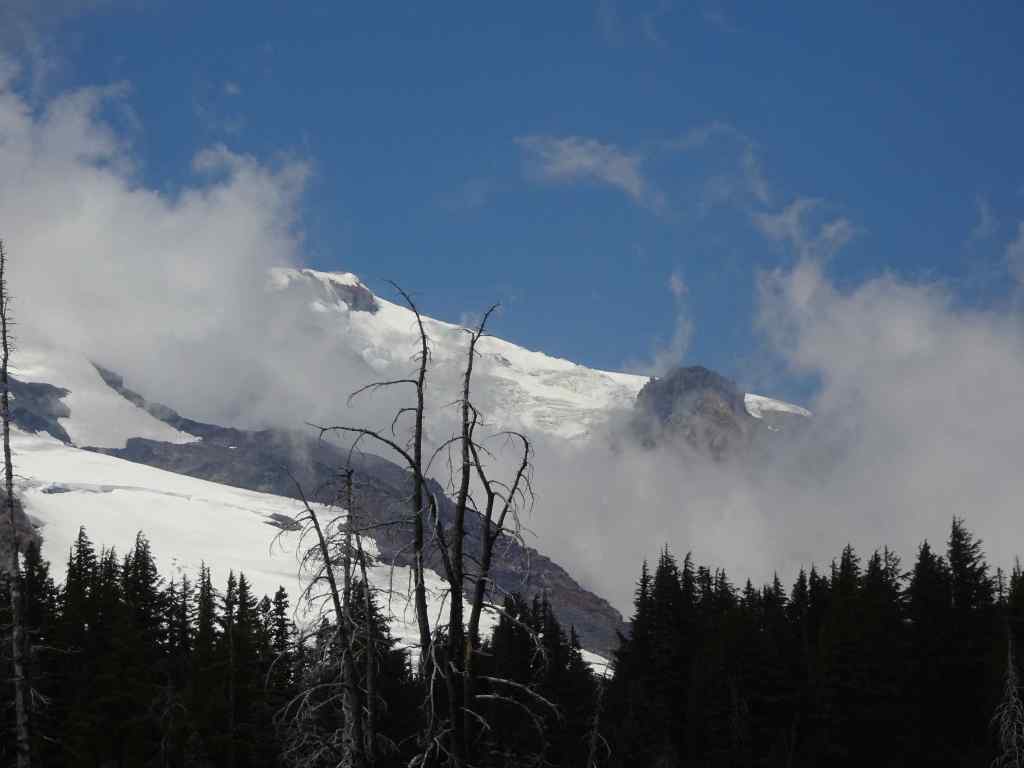
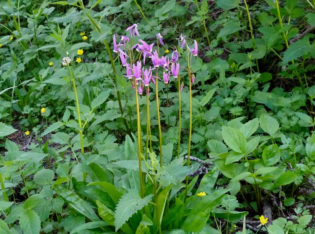
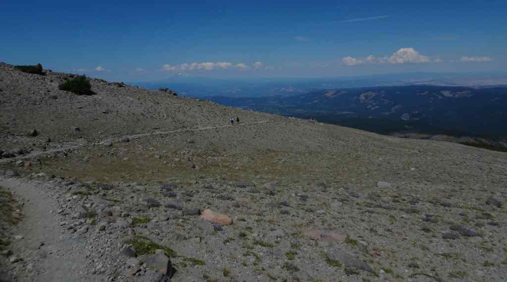
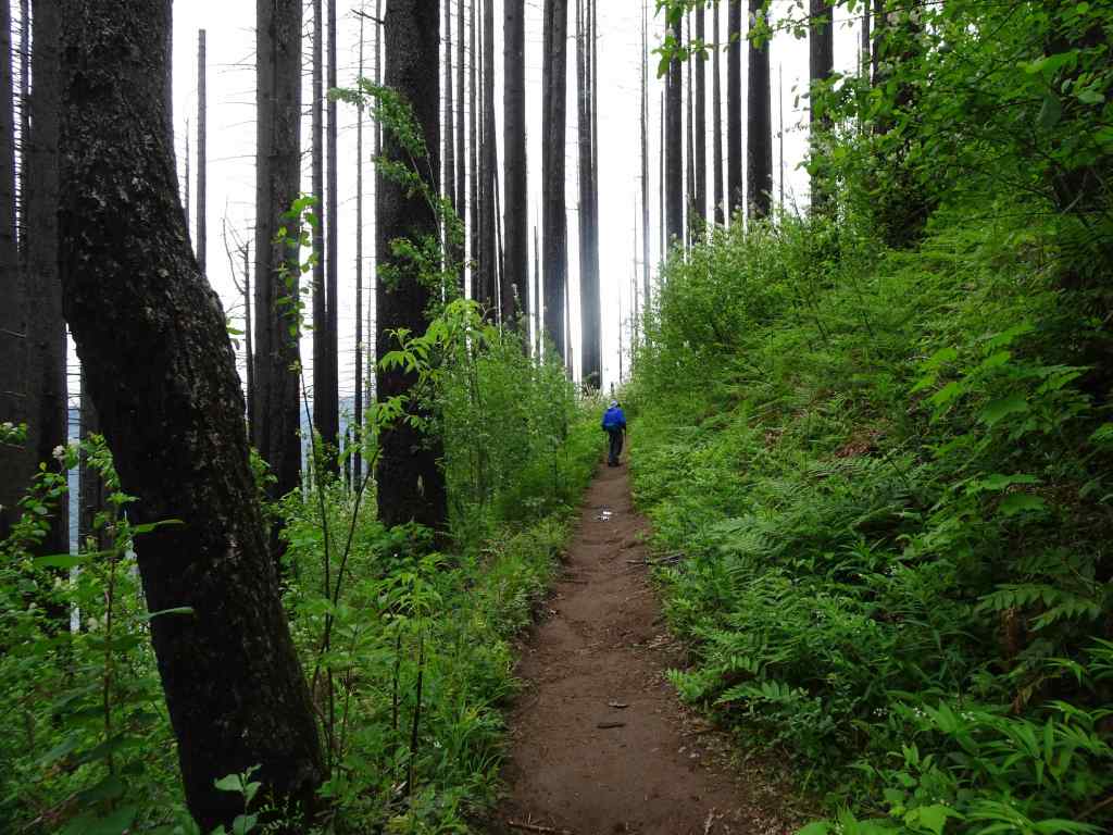
2/5 – White River snow hike, Mt Hood, Oregon
With snow levels still very low, we were able to hike this out-and-back trail, a long time favorite, with just micro spikes on our boots. There was a small amount of post-holing, but it was mostly fine.
Mt Hood from the HighwayHiking uphill along the White River moraine – lots of exposed earth.Our usual lunch spot, about a mile and a half up river, near the Timberline Trail crossing.Boy Scout Ridge, which we sometimes avoid due to avalanche danger, has exposed plants on the surface today.Glamour shot of the top of Mt Hood.
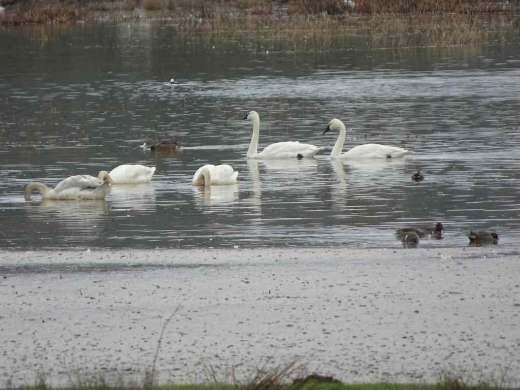
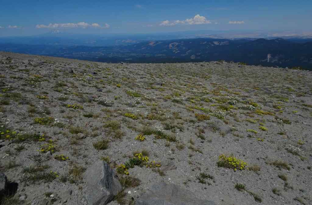
Luckily we had more snow by the middle of the month. There is more snow at this location now than there was in the beginning of February.
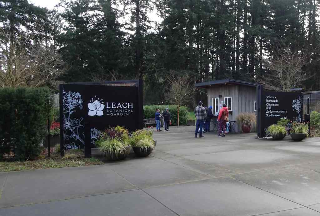
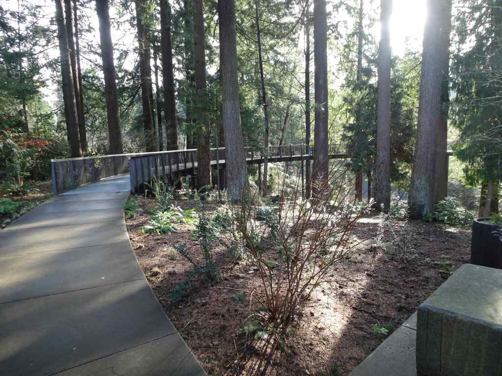
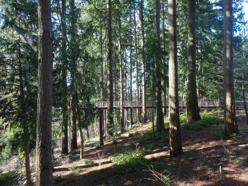
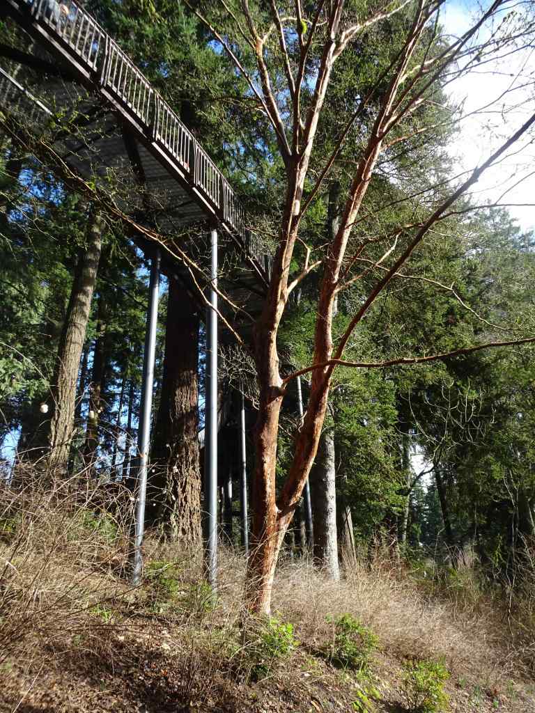
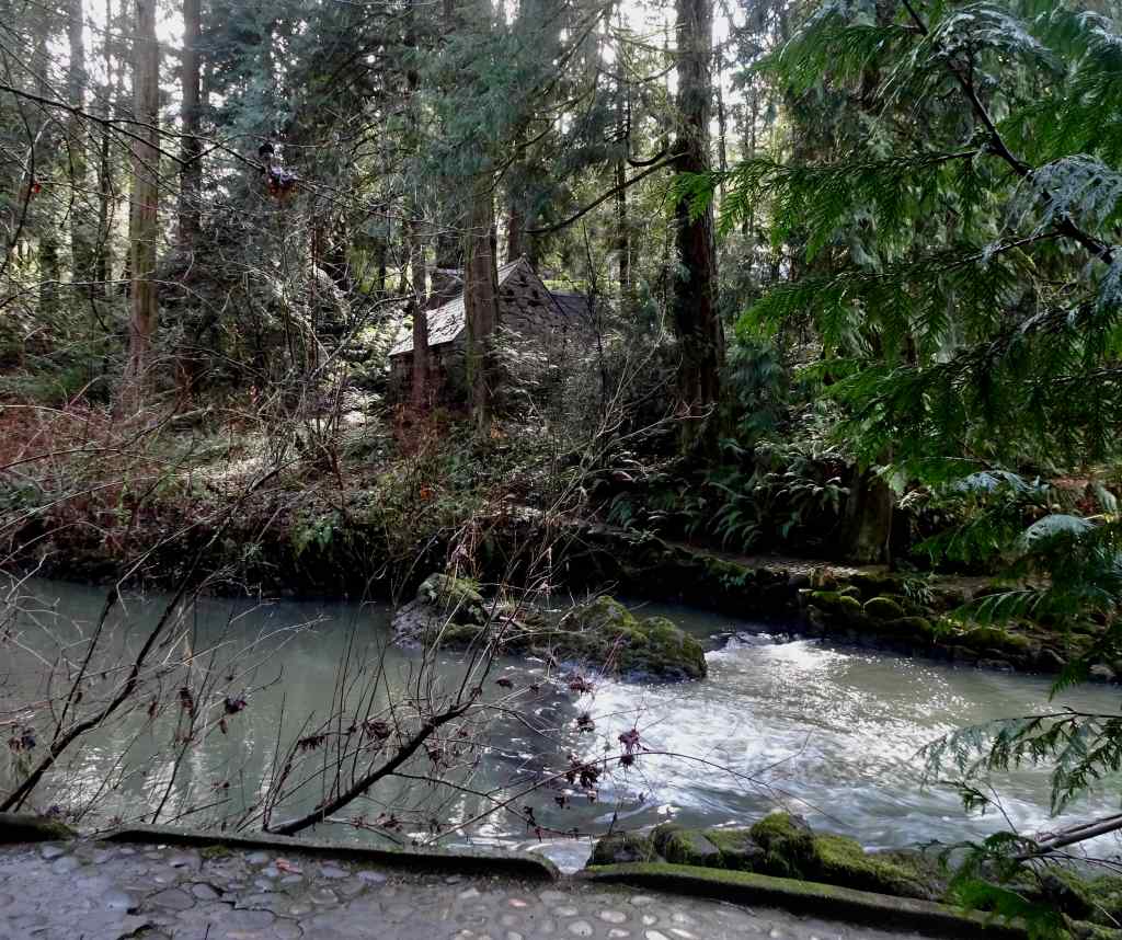
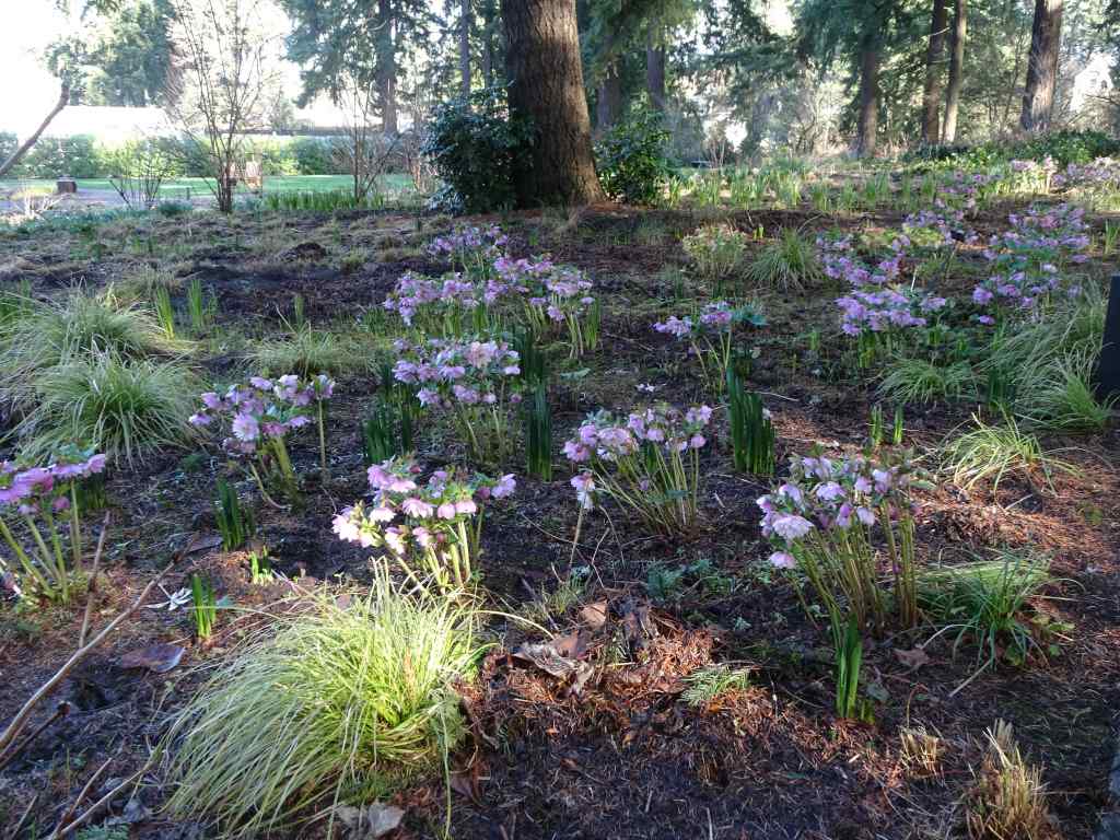
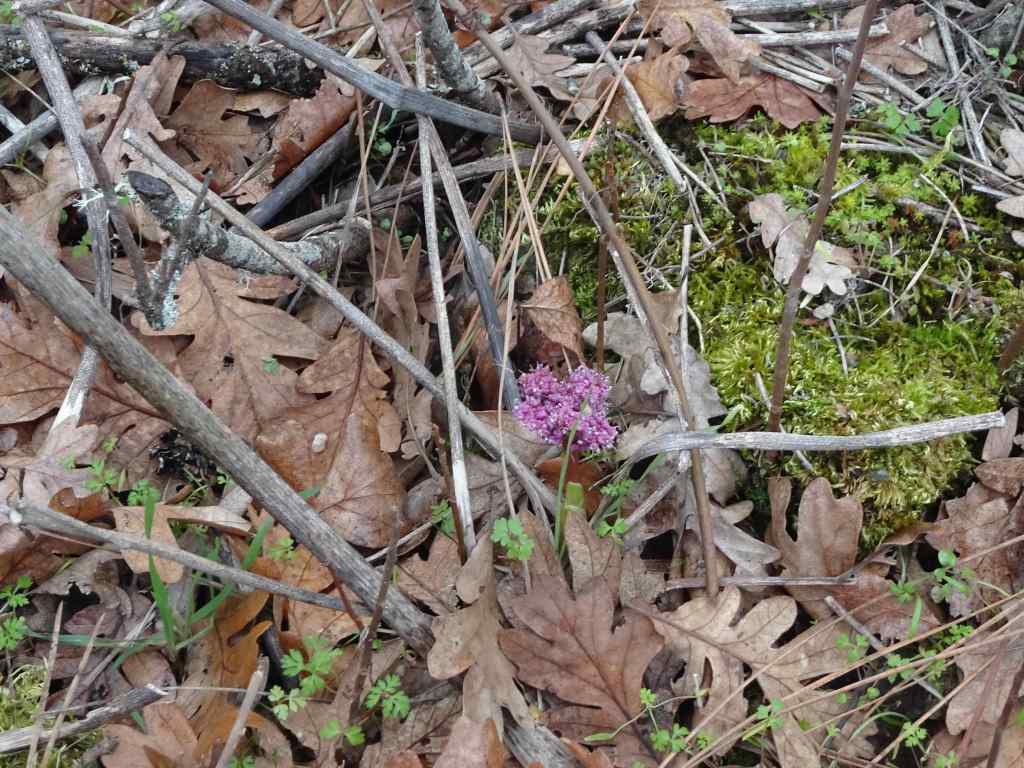
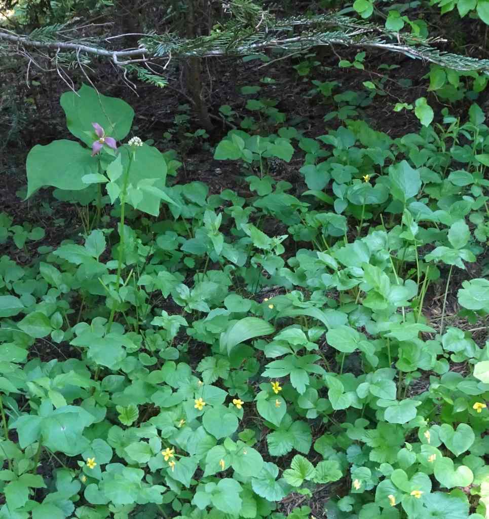
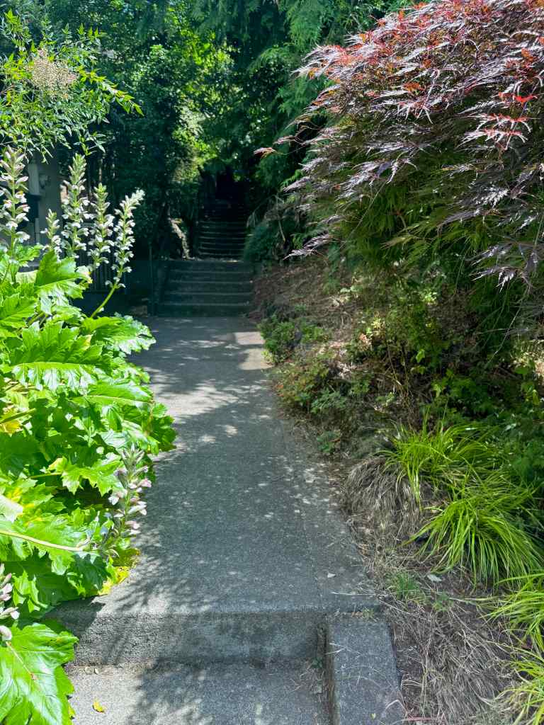
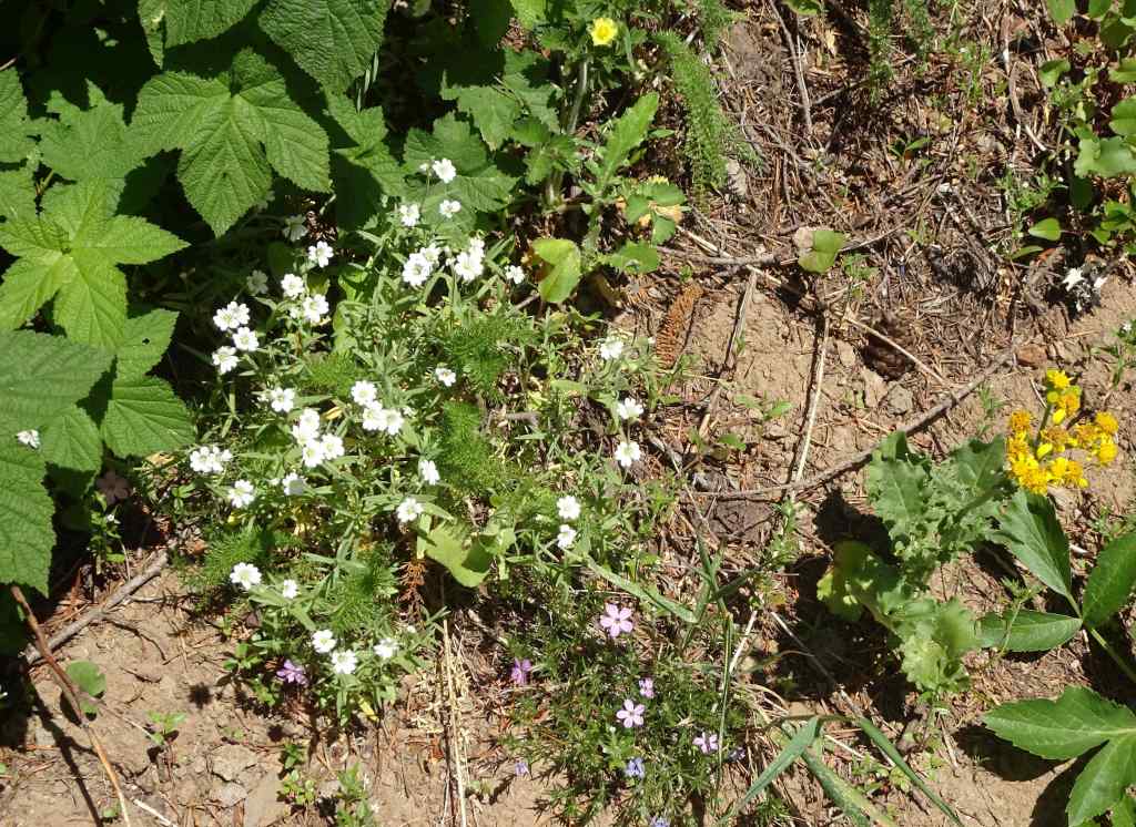
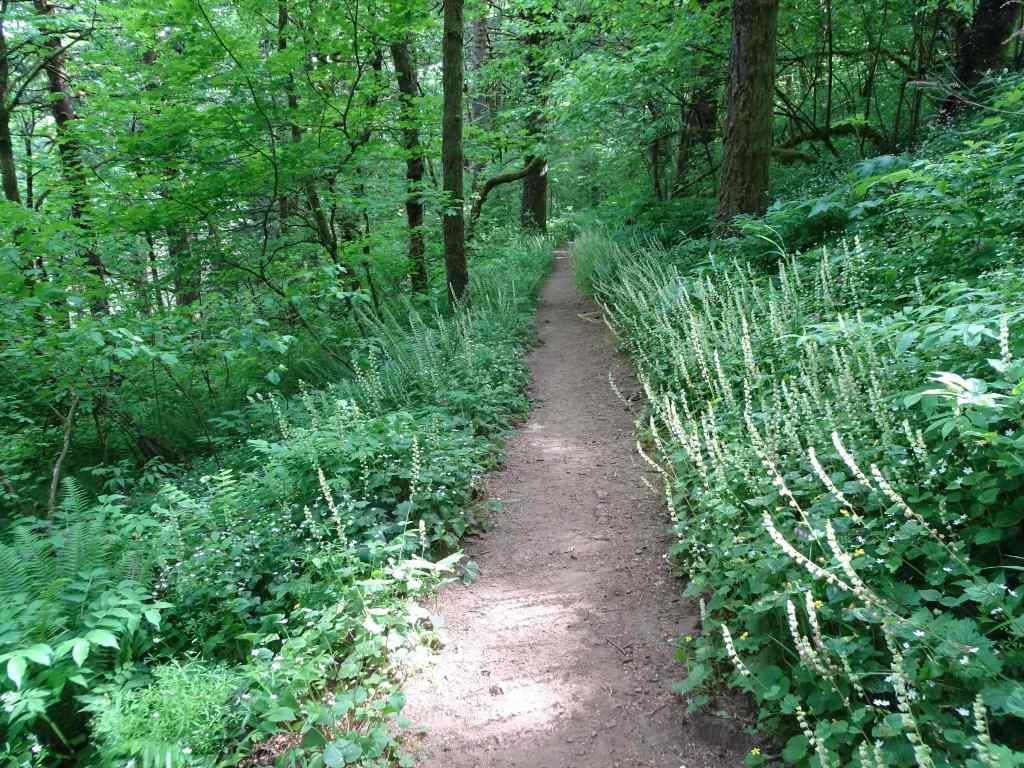
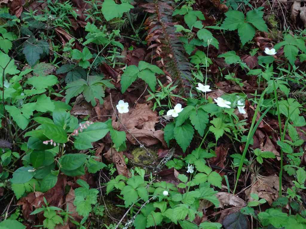
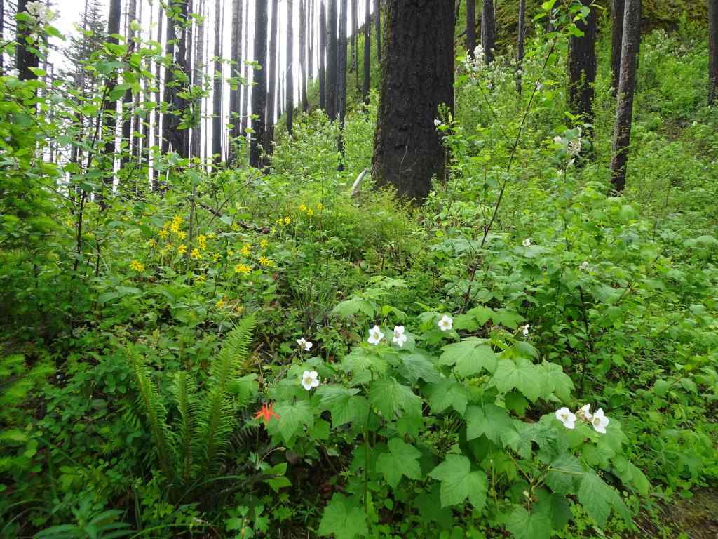
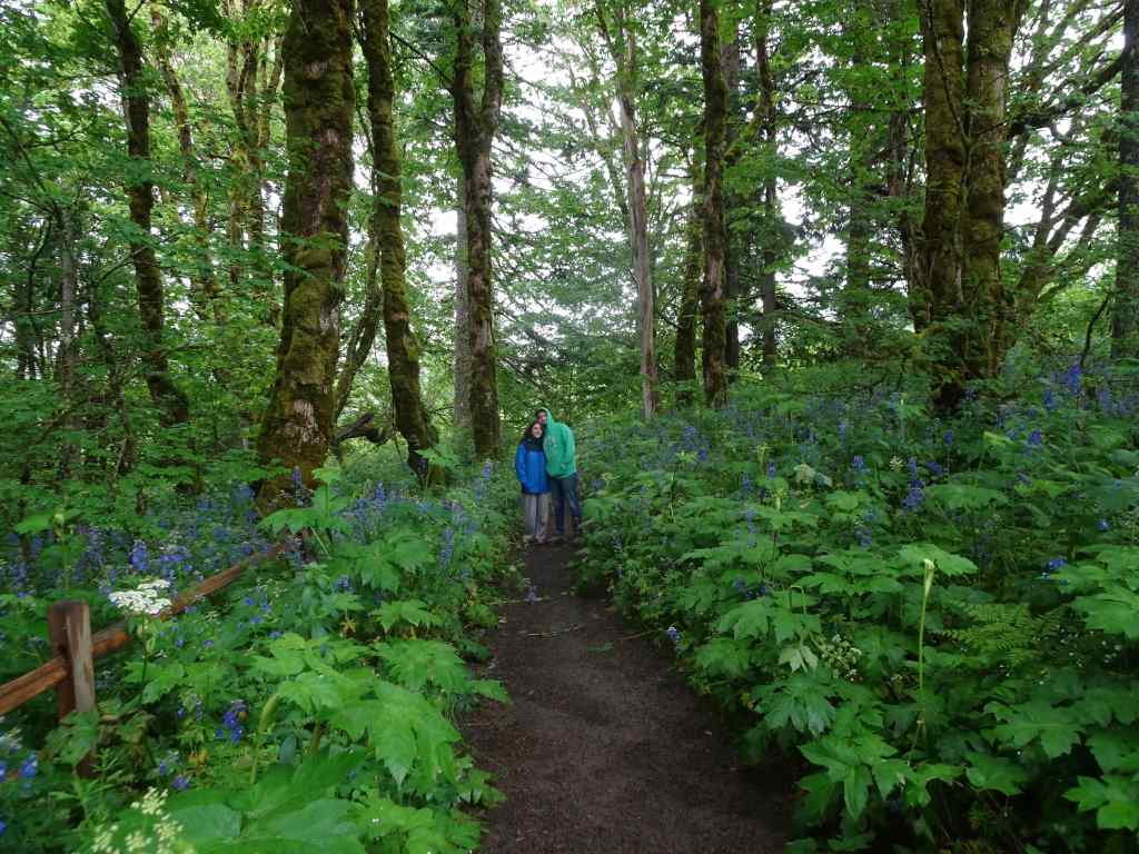
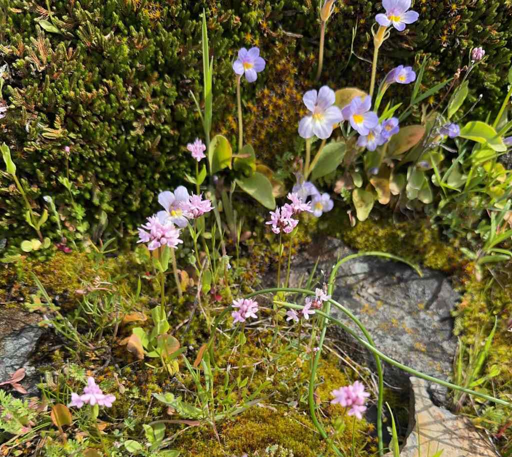
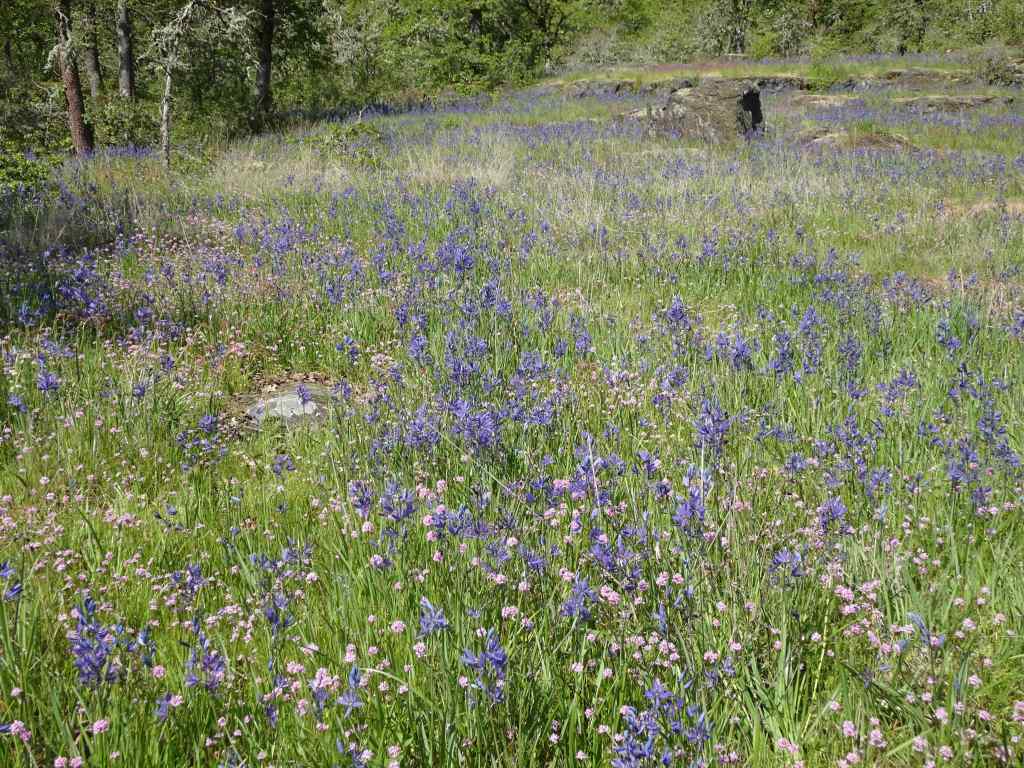
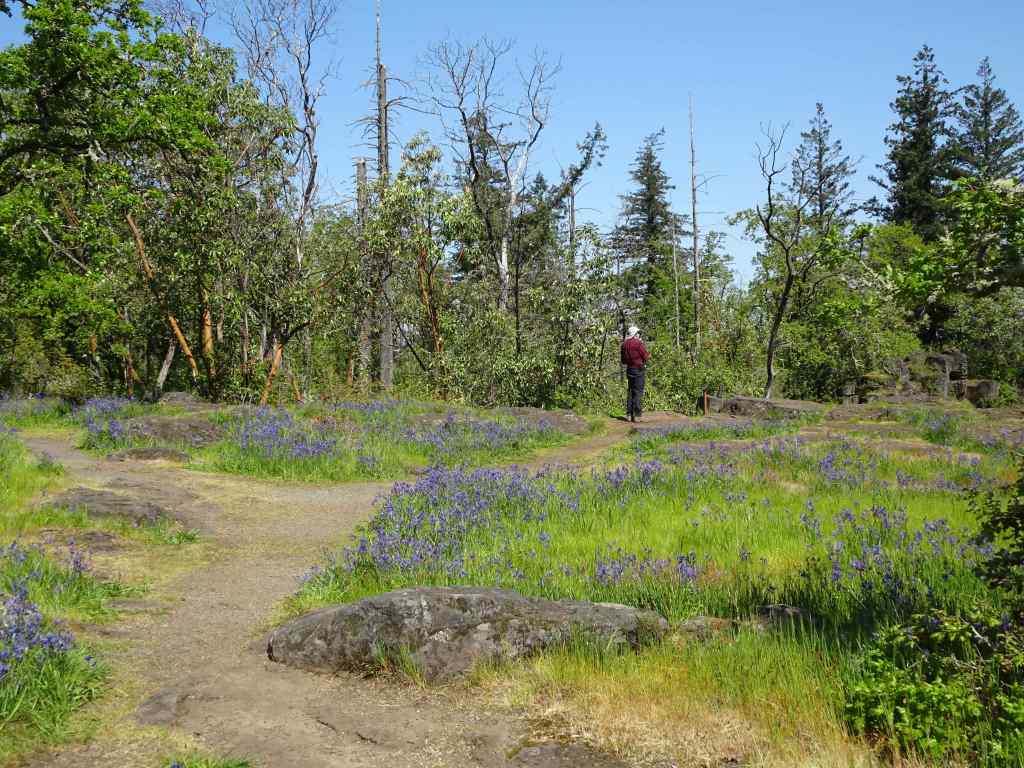
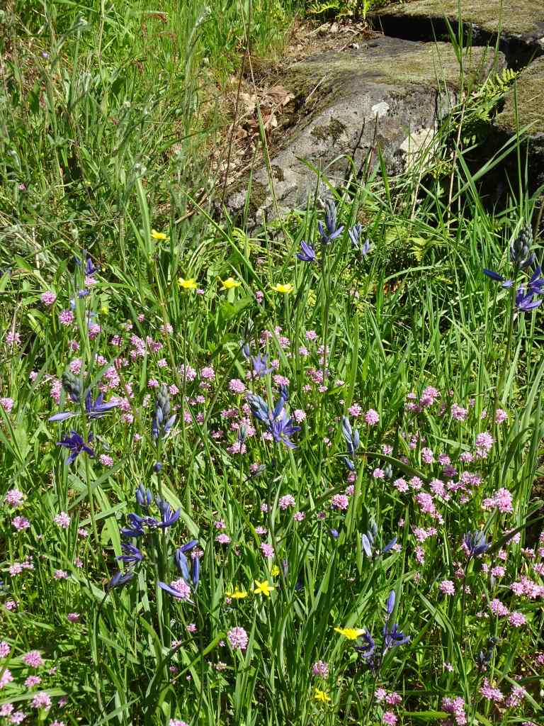
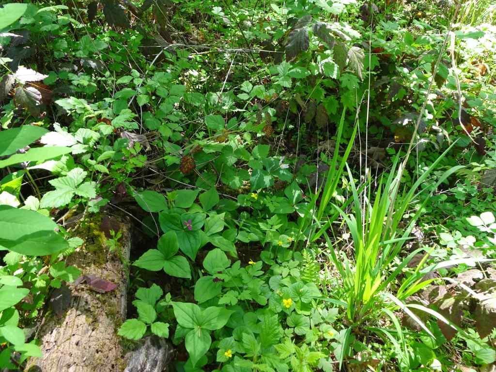
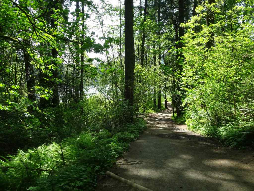
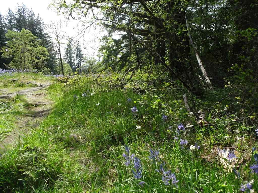
2/15 – Leach Botanical Garden, Portland
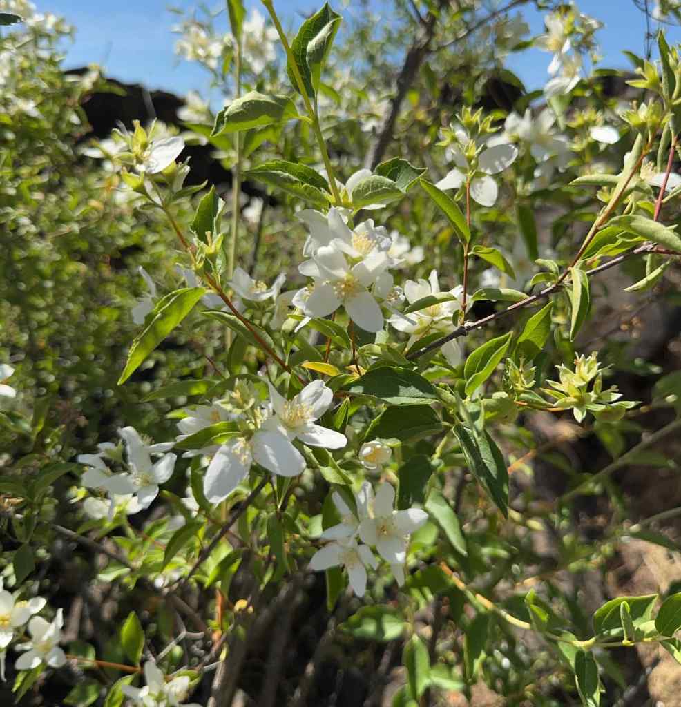
This public garden was gifted to the city of Portland by the estate of John and Lilla Leach. We hadn’t been in many years, but I remember taking my children here when they were young, and walking the stony paths between the plants. There was a bit of a Secret Garden feel to the park. I was aware that there had been a huge remodel and accessibility initiative. There is now a lovely Aerial Walkway that floats through the woodland. Today was our first time to try it. We walked less than a mile in total, as we had a time constraint, and also, my husband was still in recovery mode. Spring flowers were popping in a few beds, with more to come. I hope to return later in the spring to see more flowers.
Entry to Leach GardenAerial walkwayFloating through the forestSome trails pass below the walkway.Trails continue down to Johnson Creek, and to the original stone cottage across the creek.
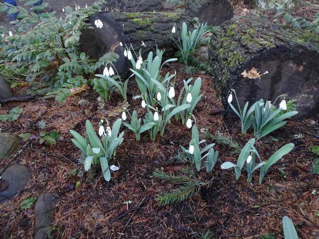
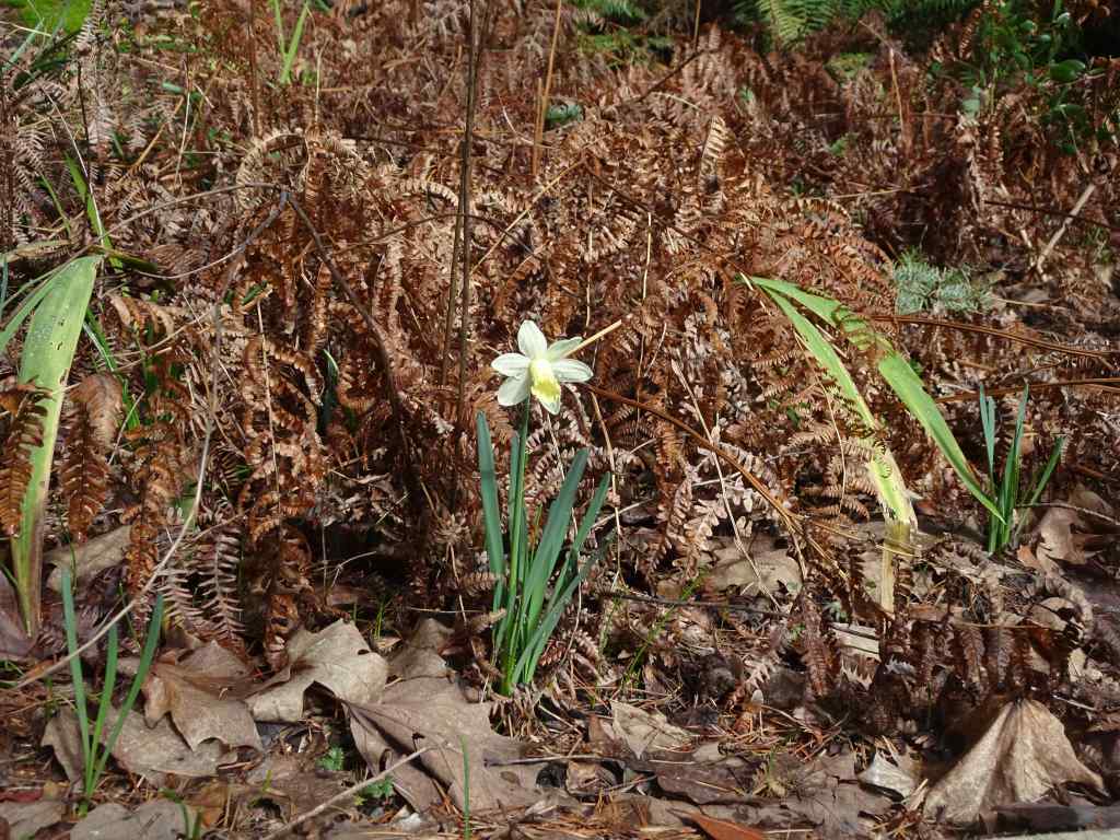
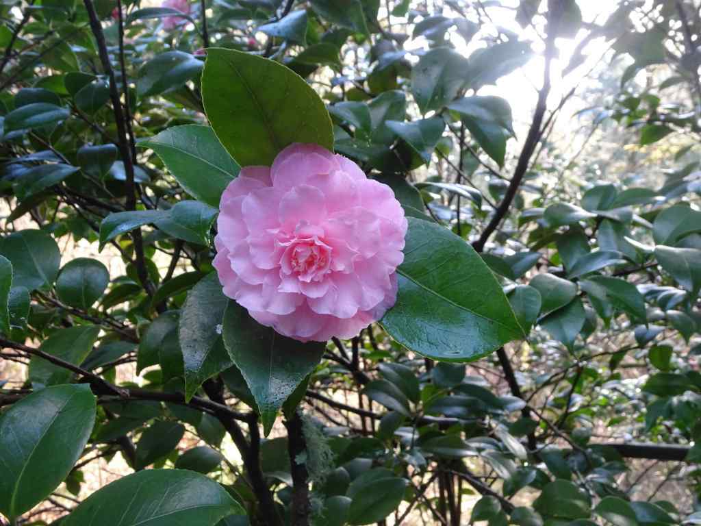
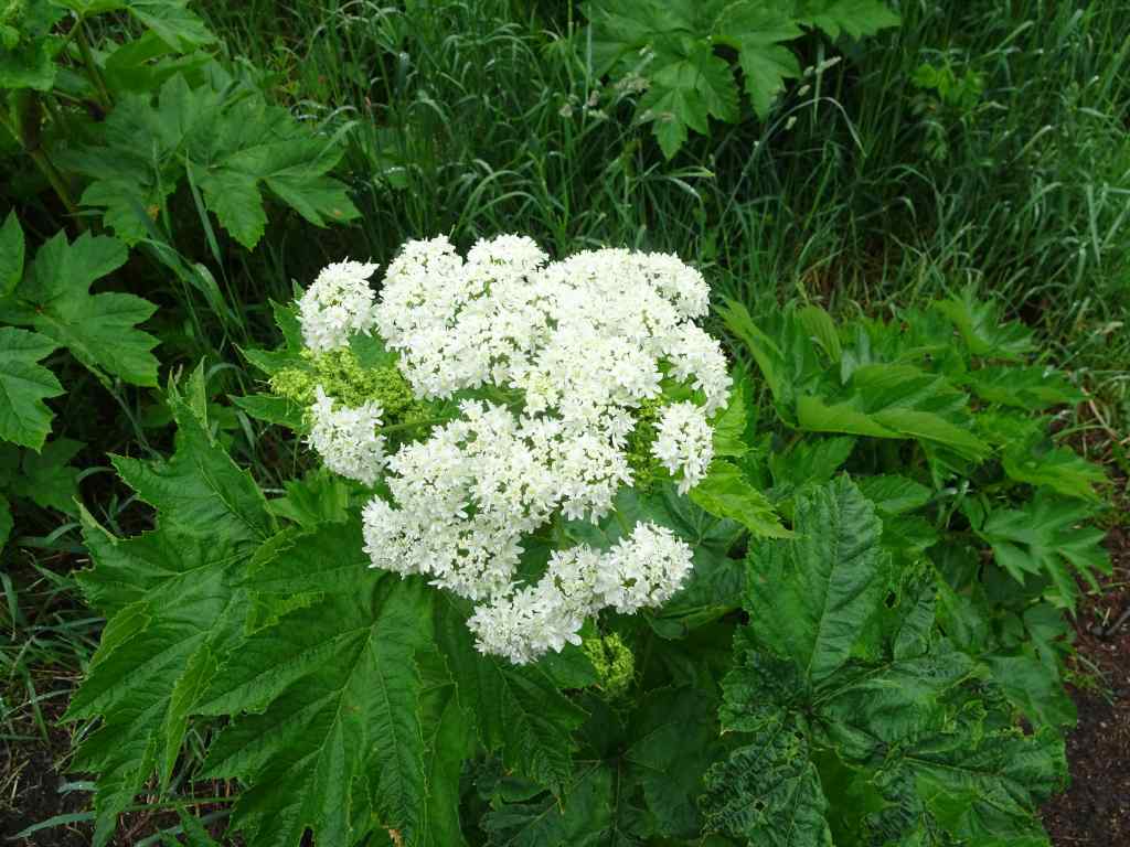
Some flowers in bloom today…
SnowdropsNarcissusCamelliaHellebores
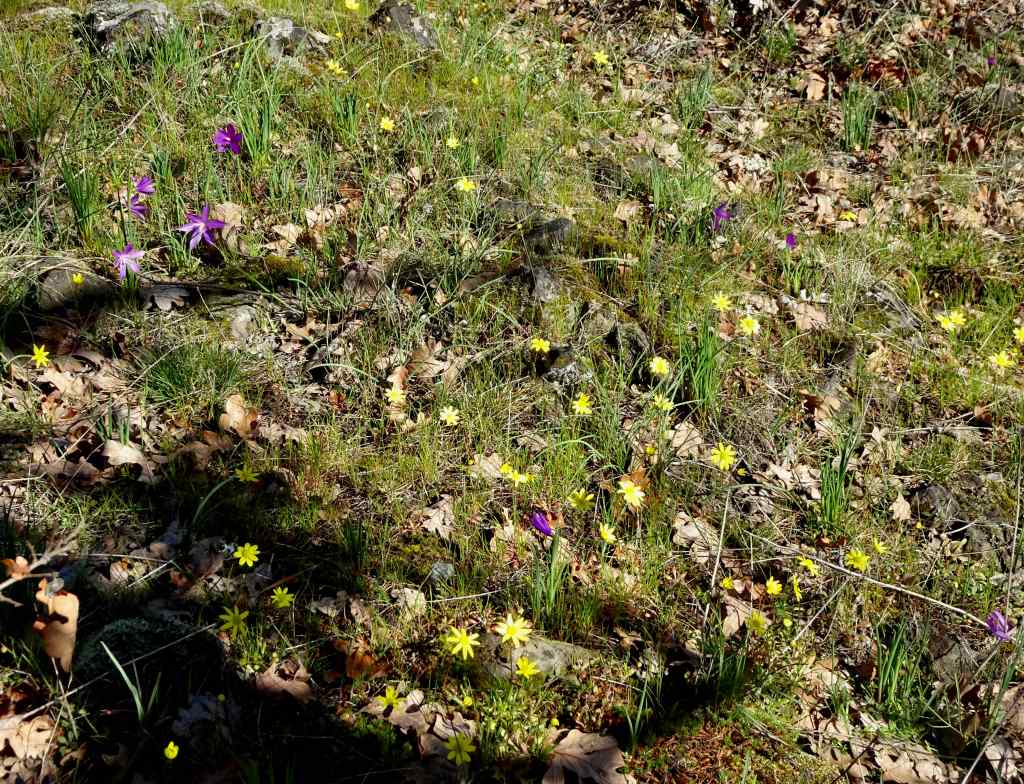
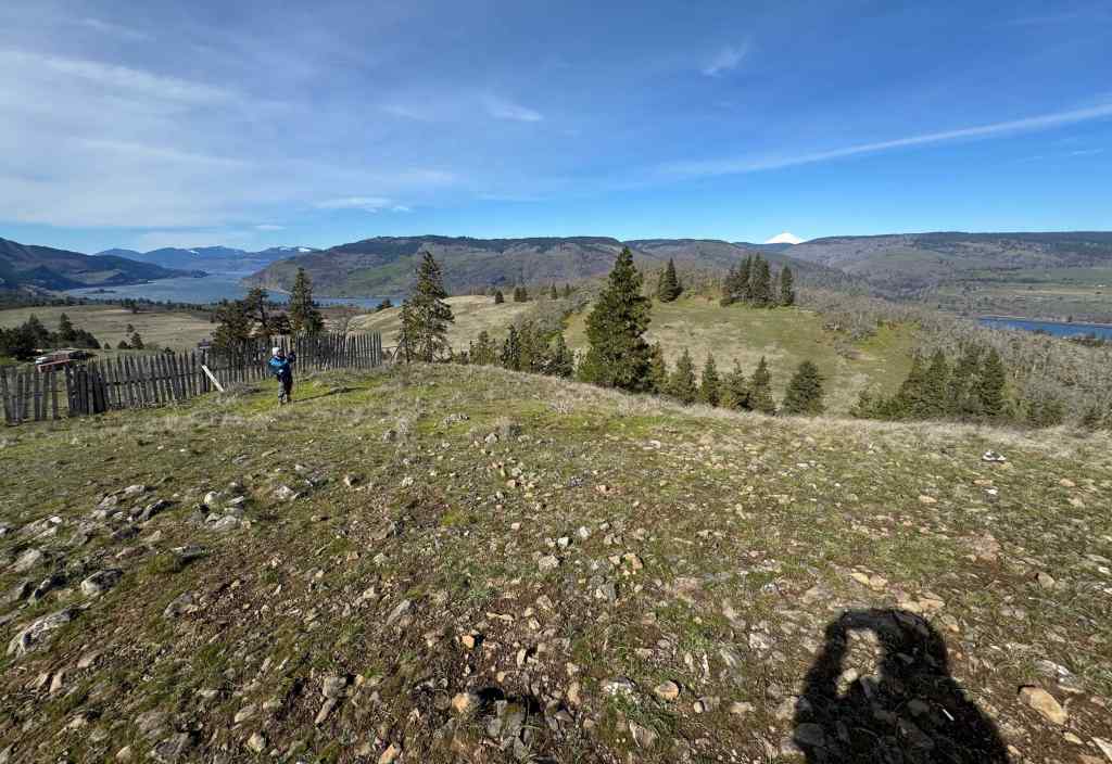
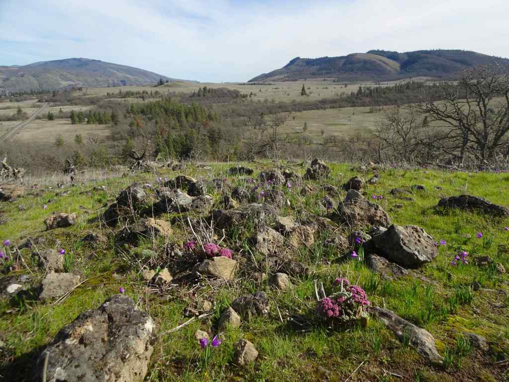
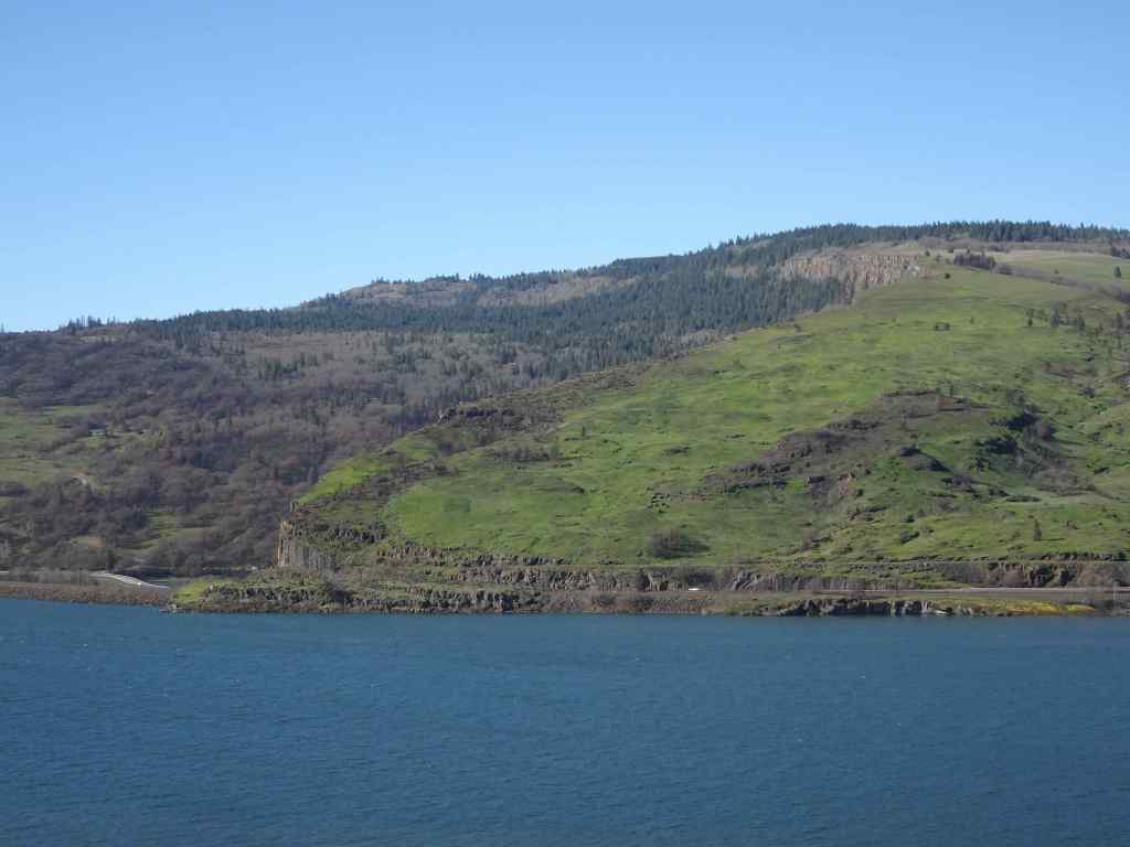
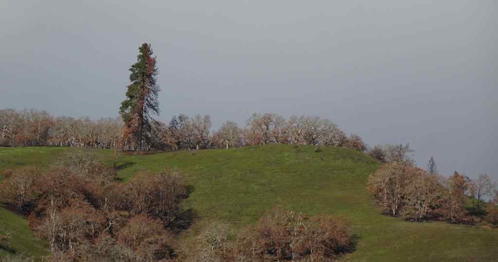
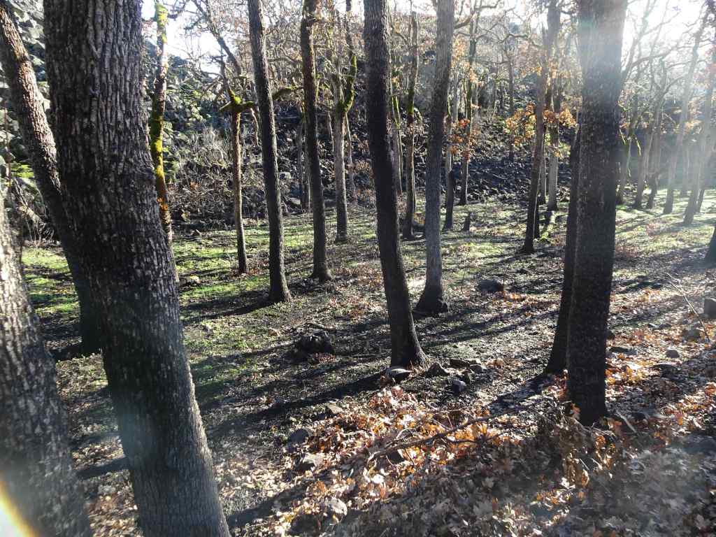
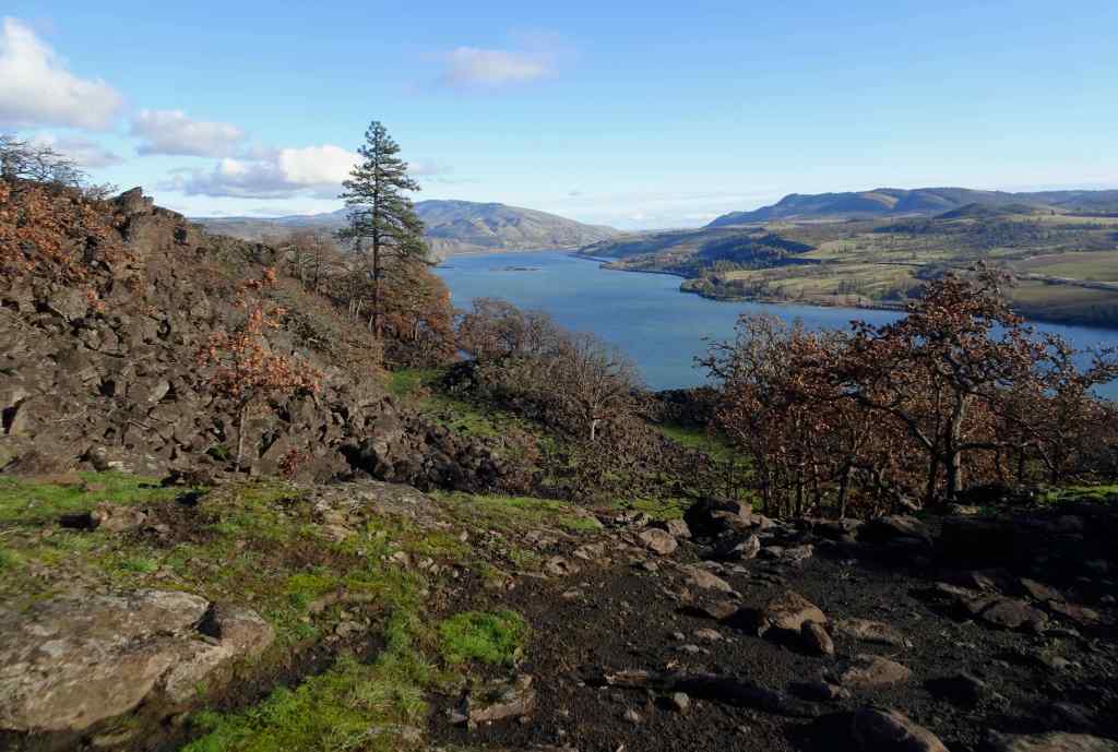
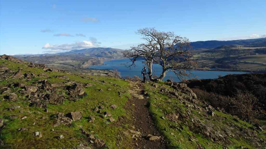
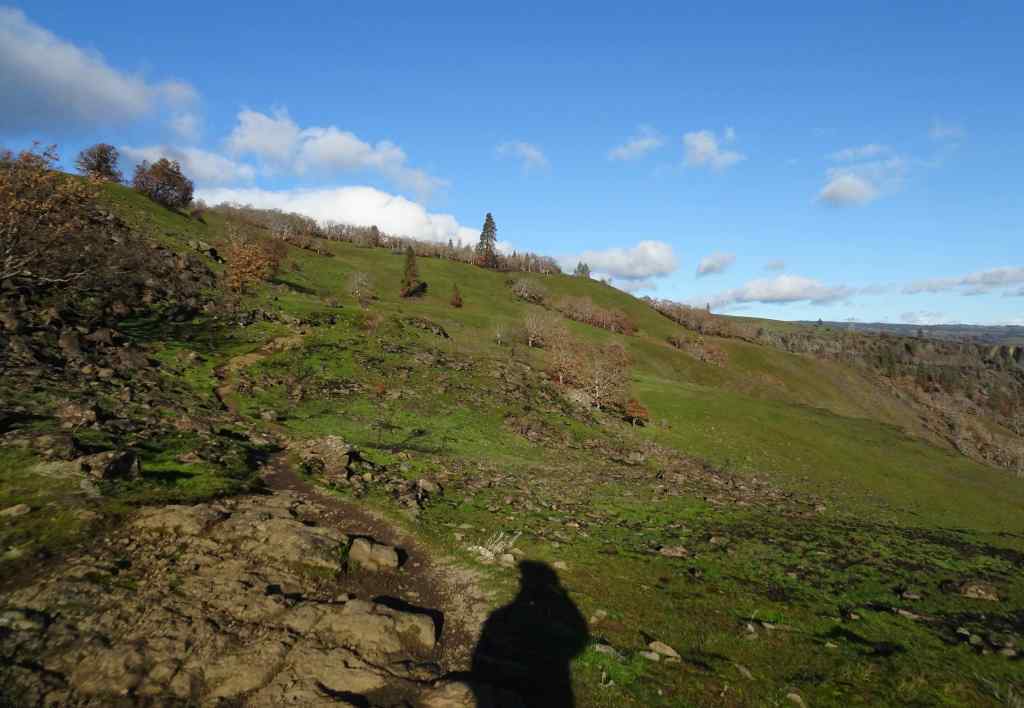
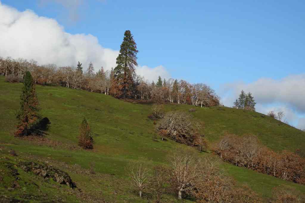
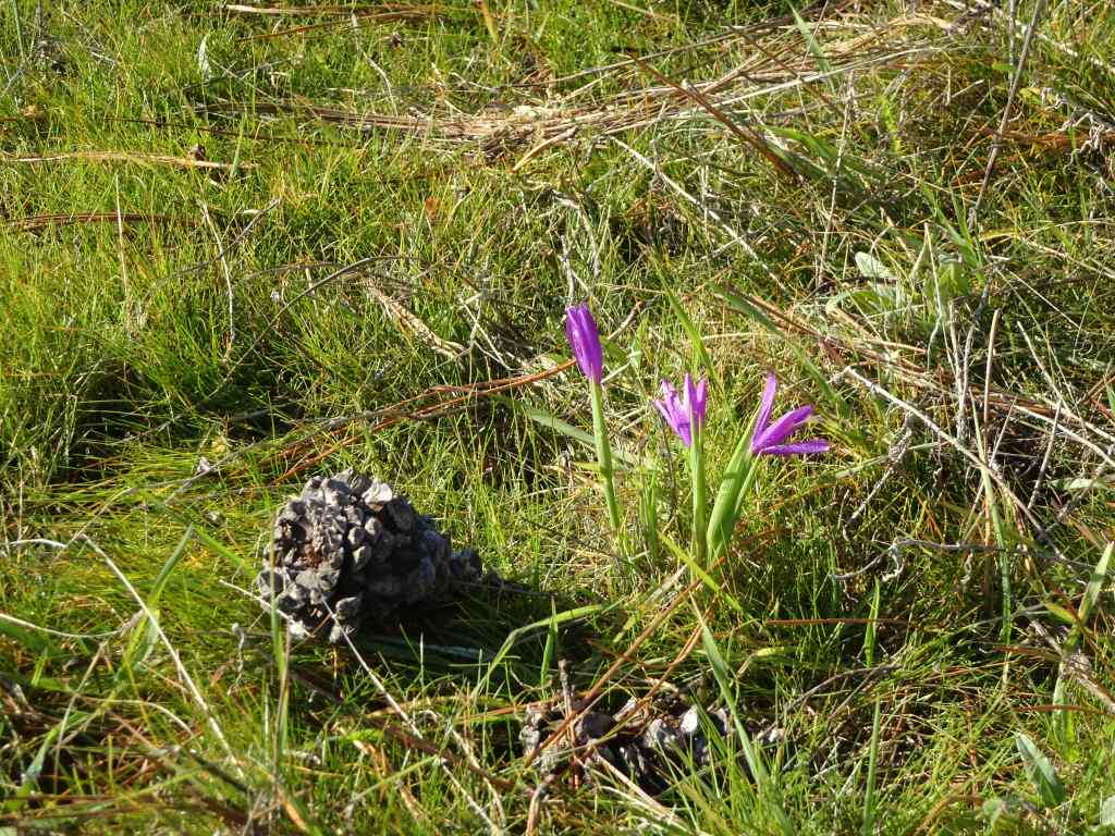
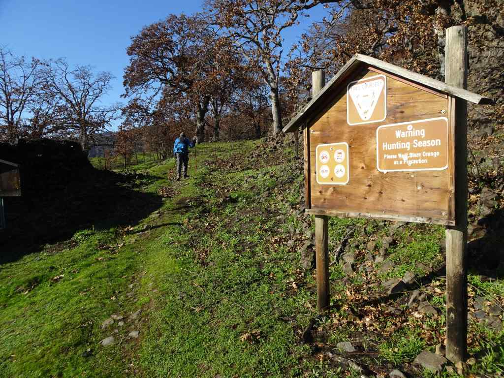
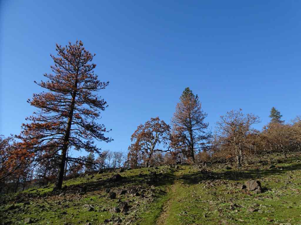
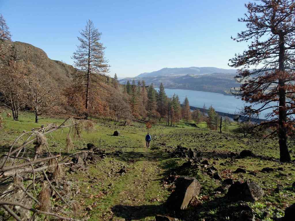
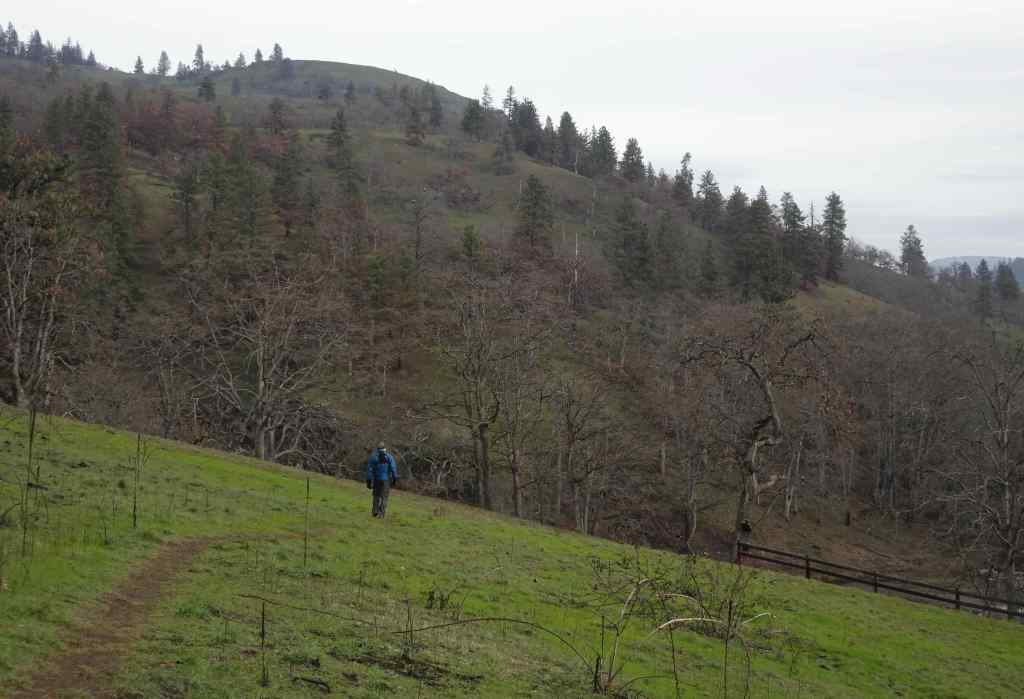
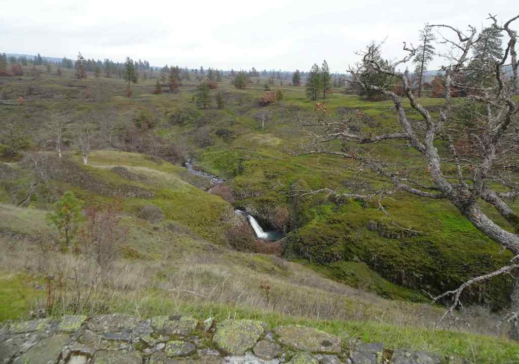
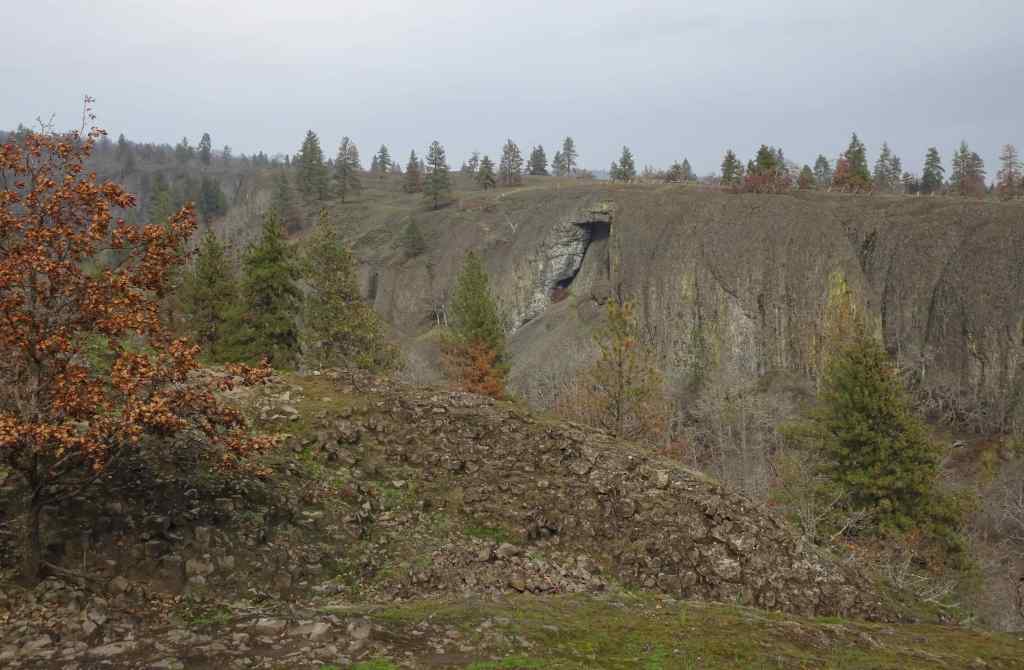
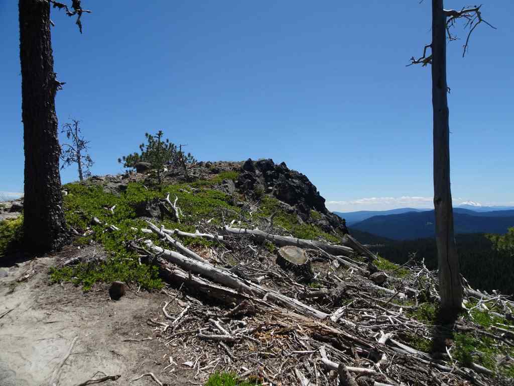
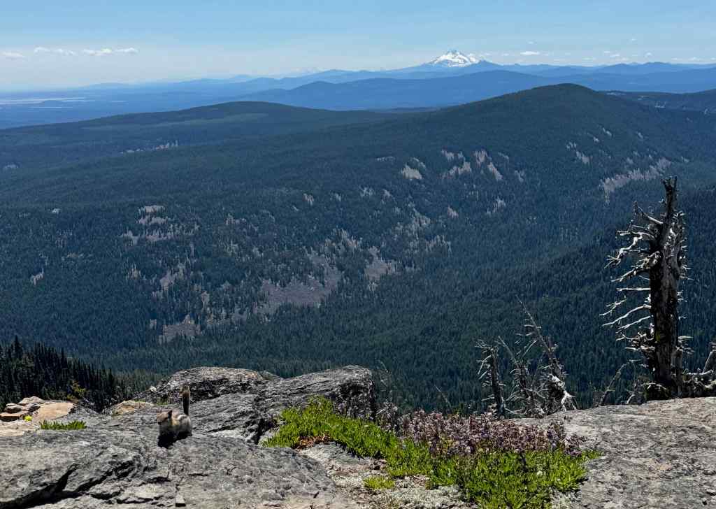
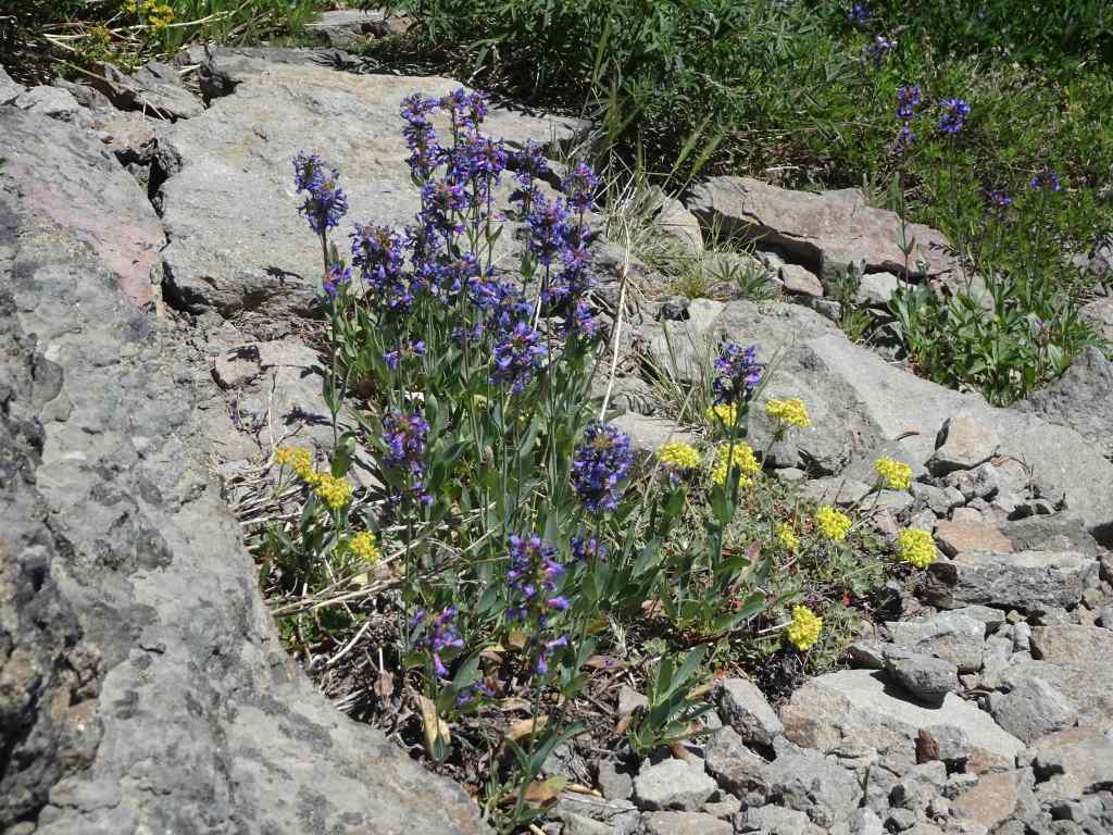
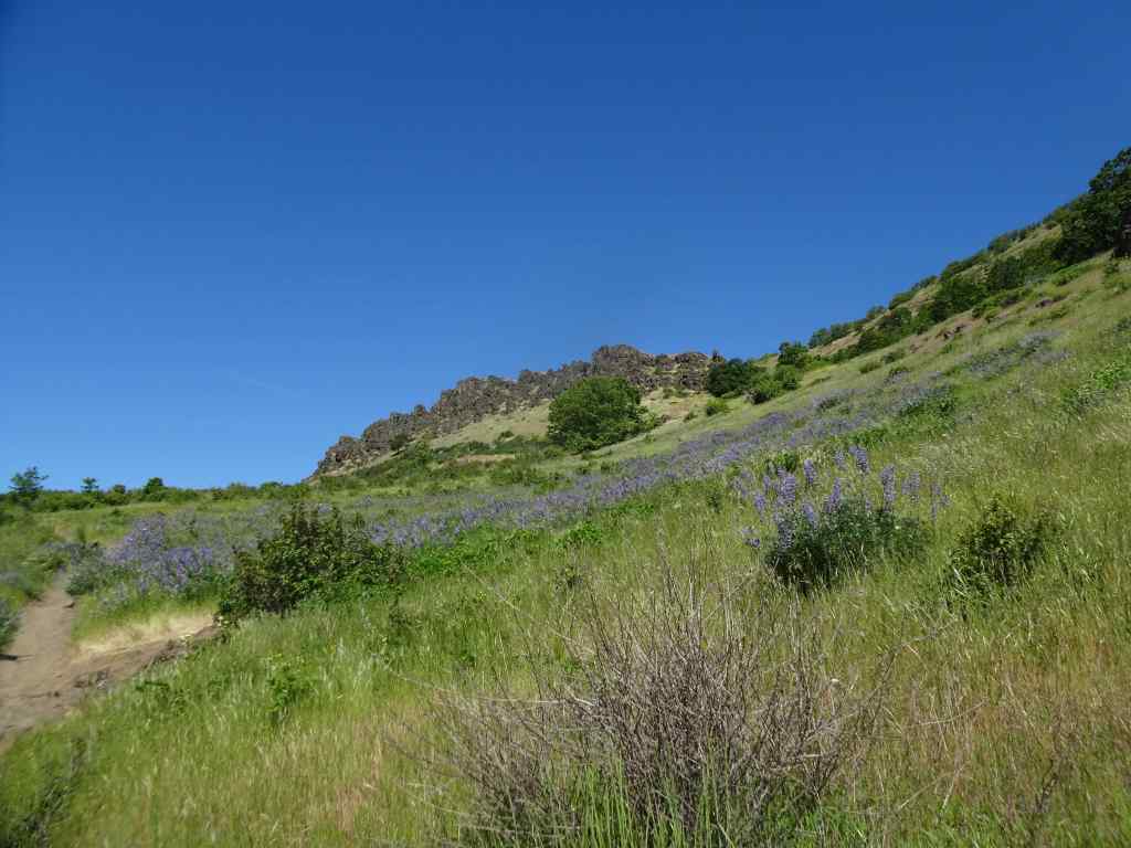
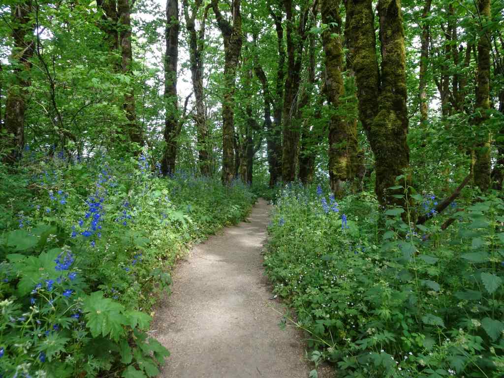
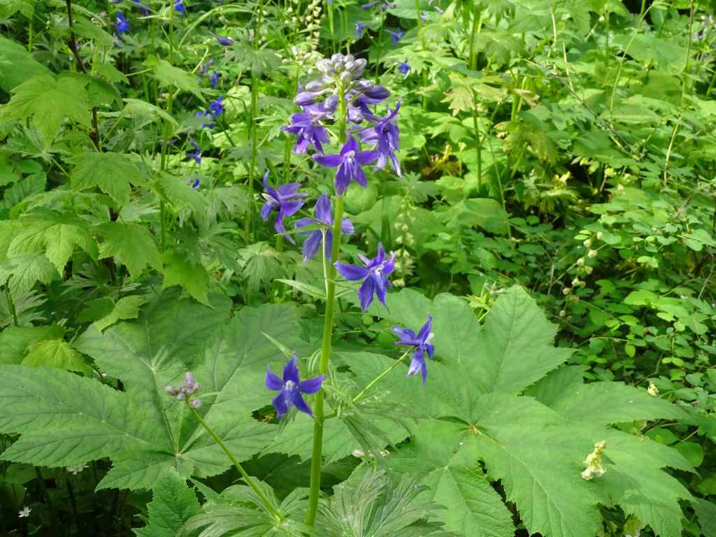
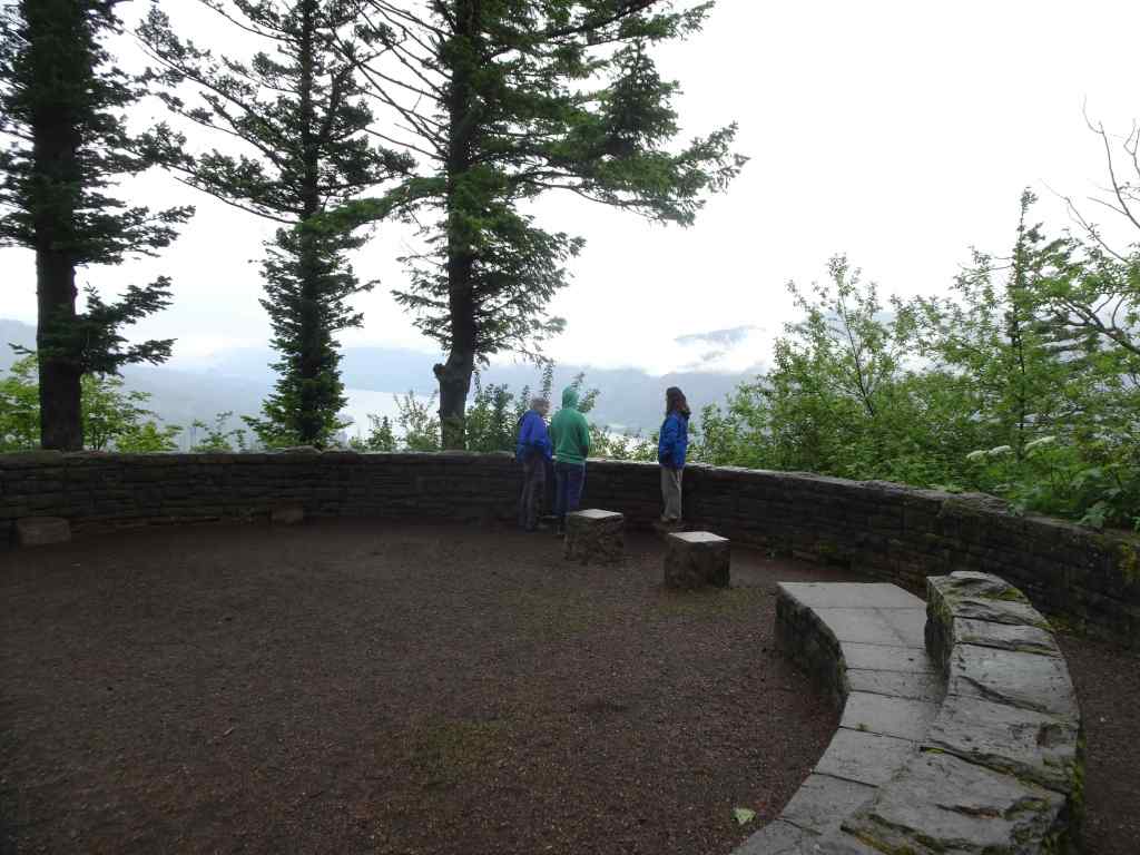
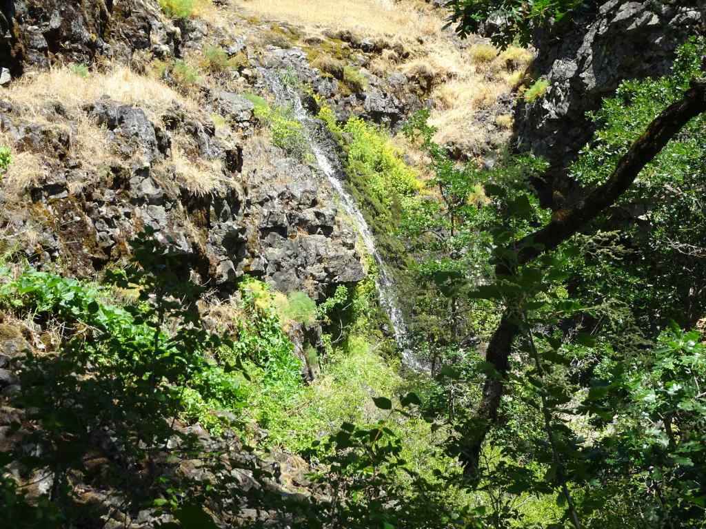
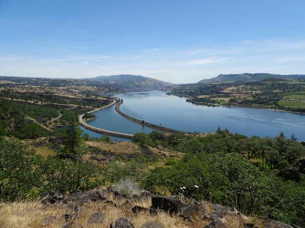
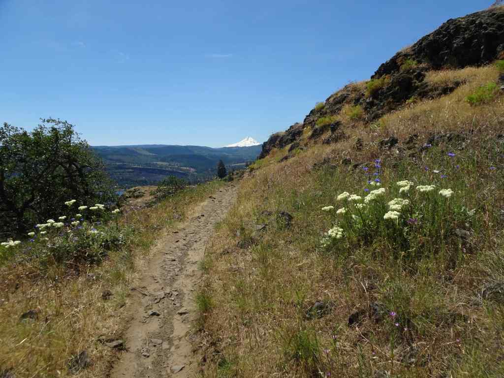
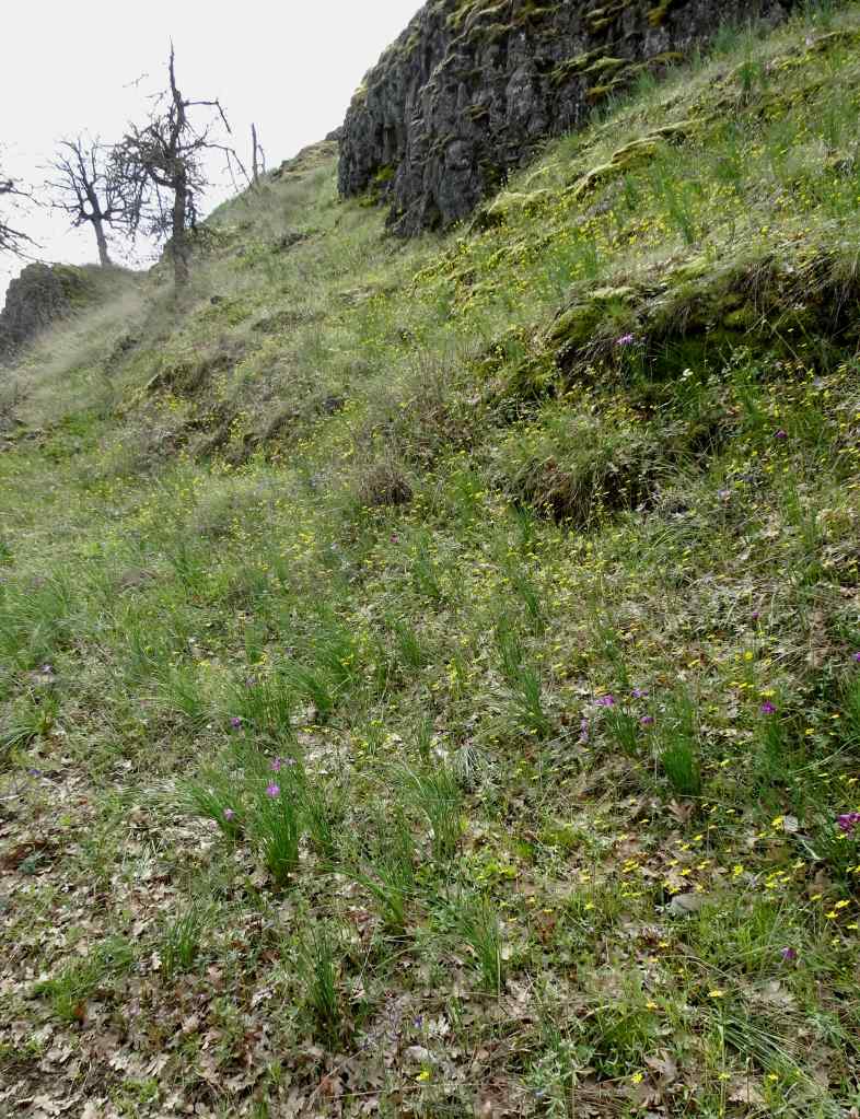
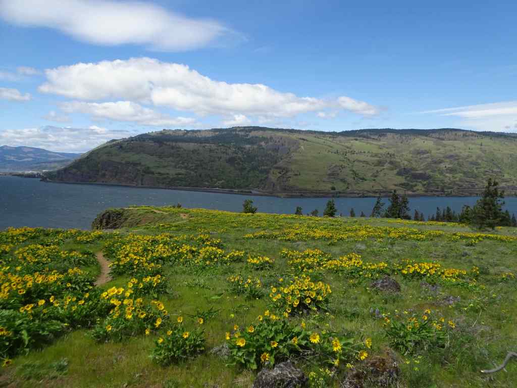
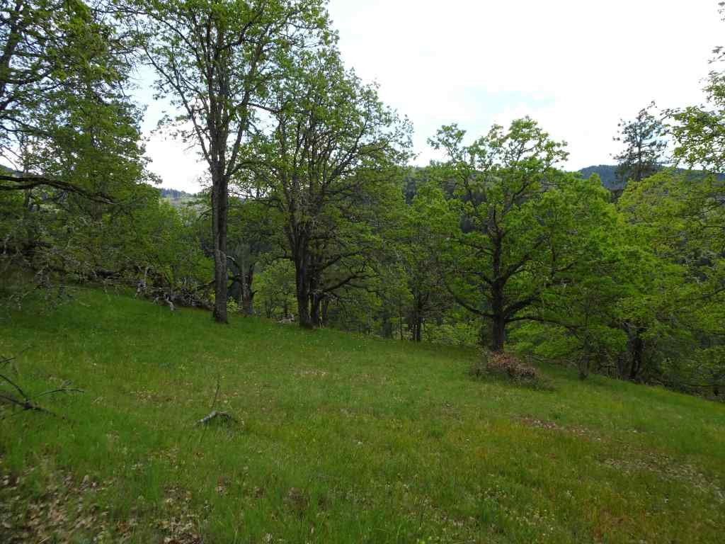
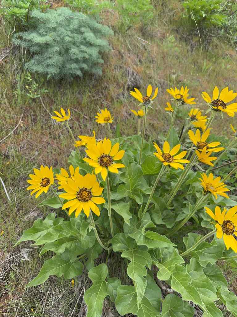
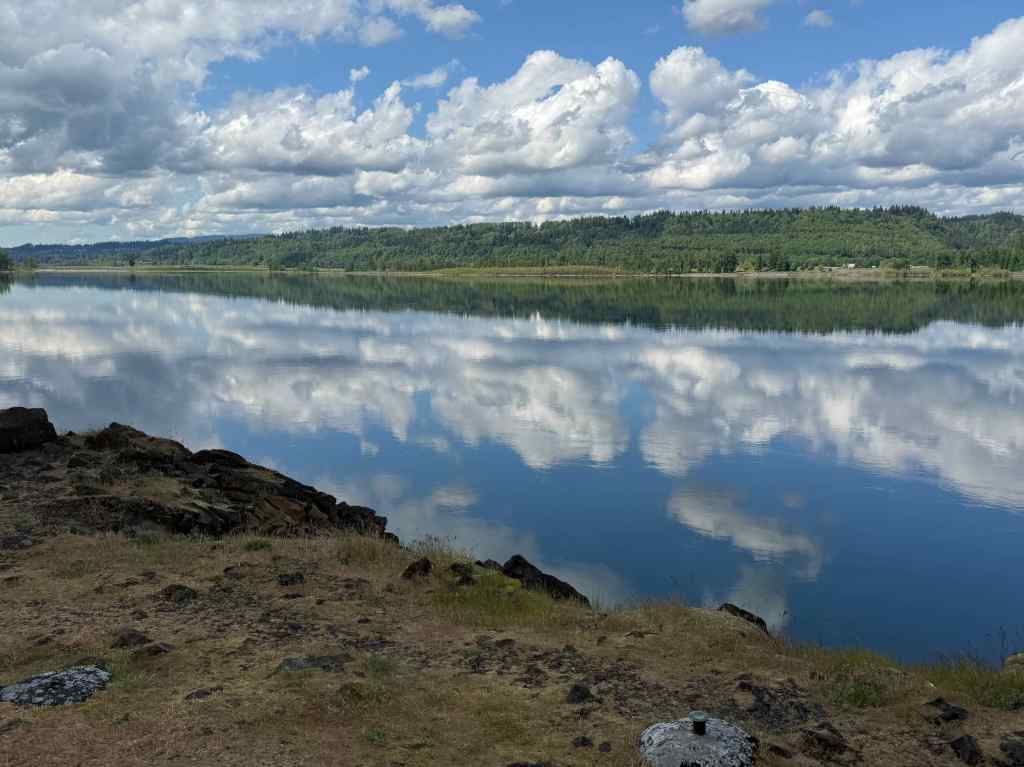
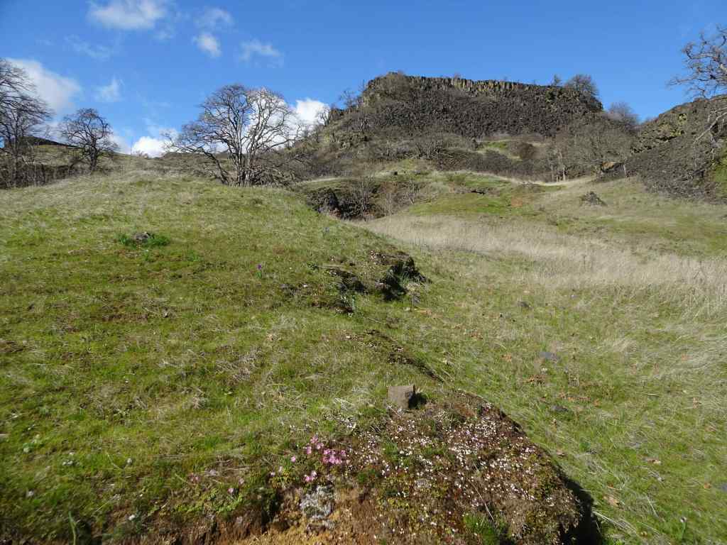
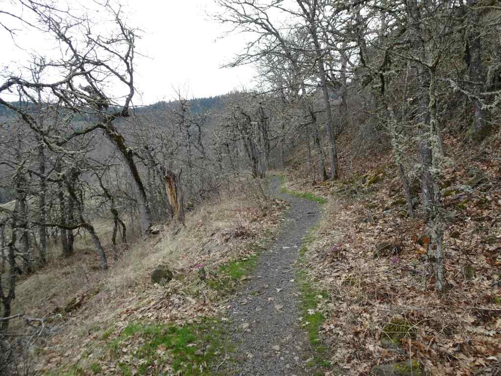
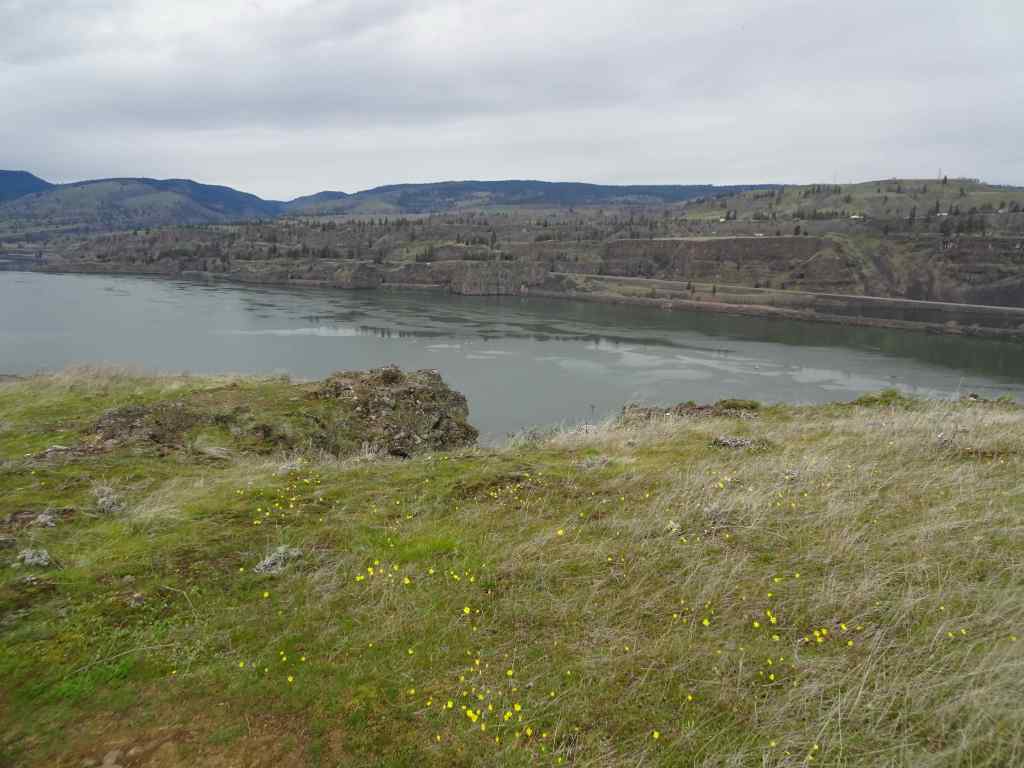
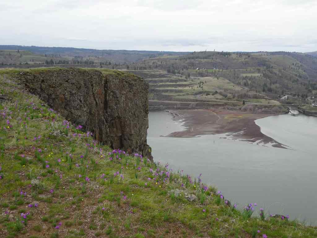
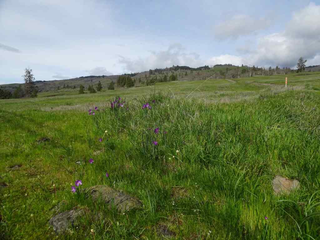
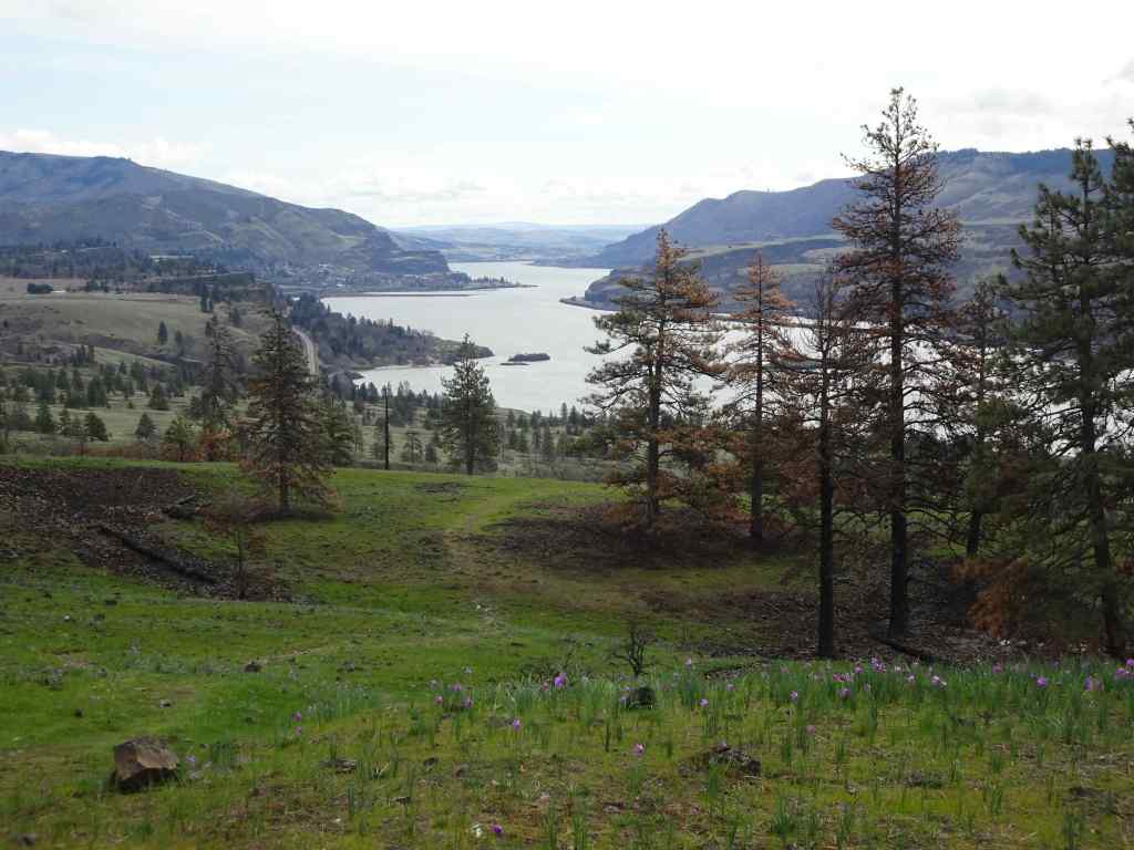
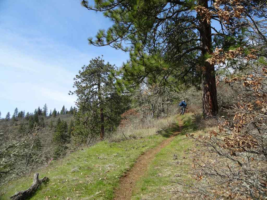
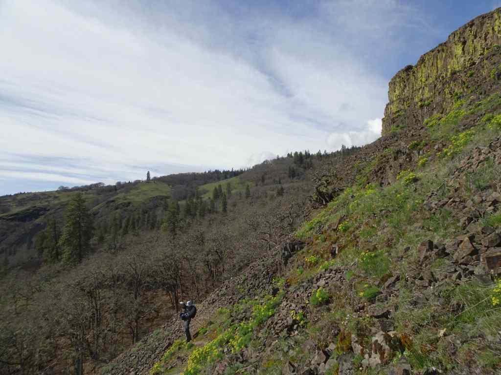
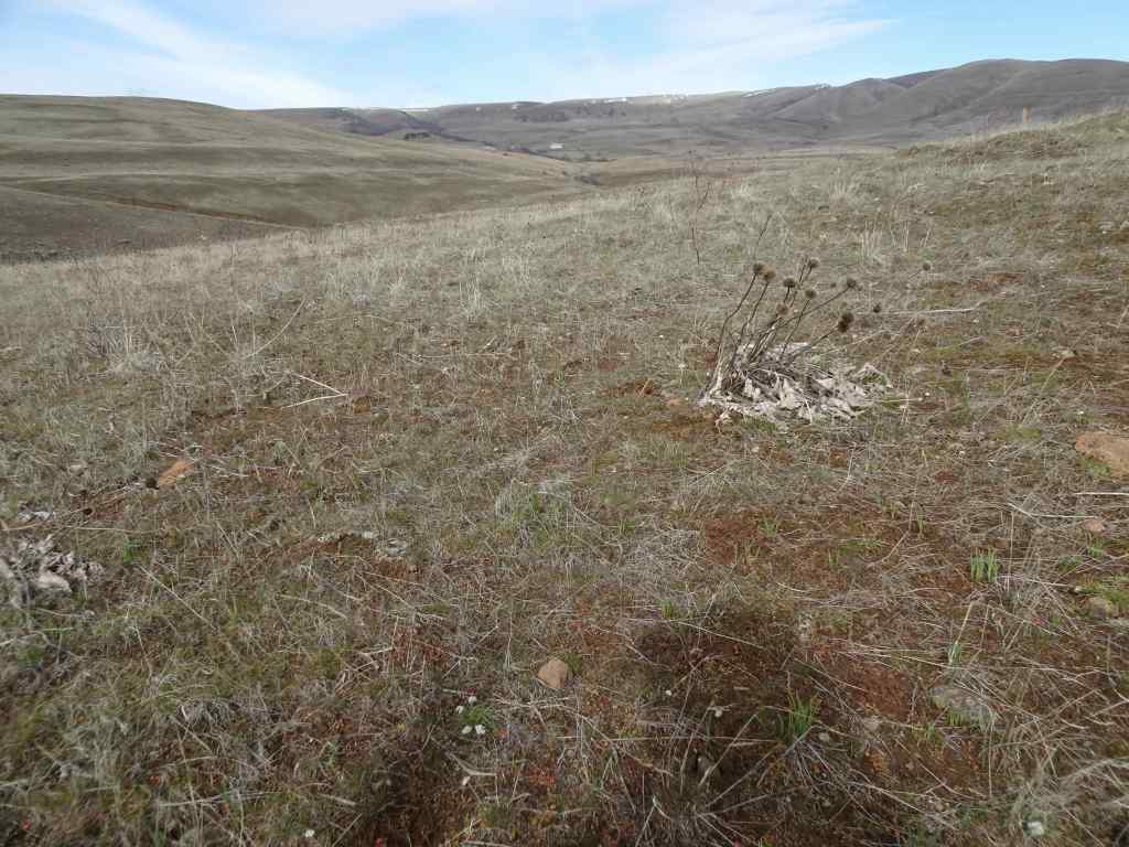
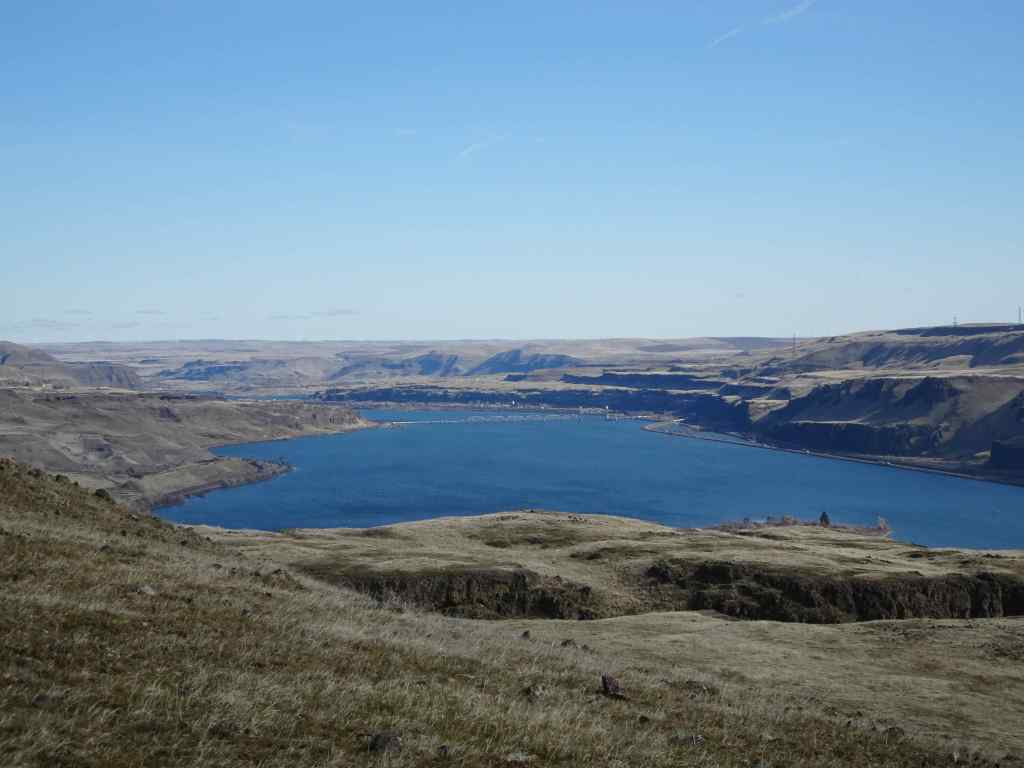
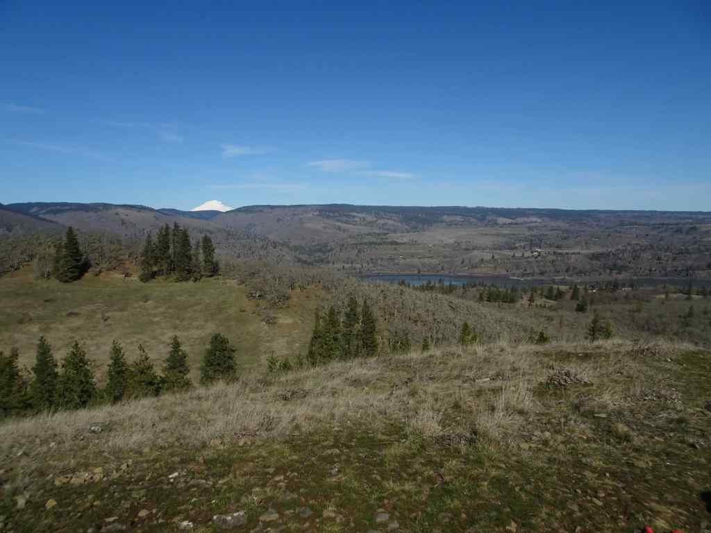
2/26 – Memaloose Hills, Oregon
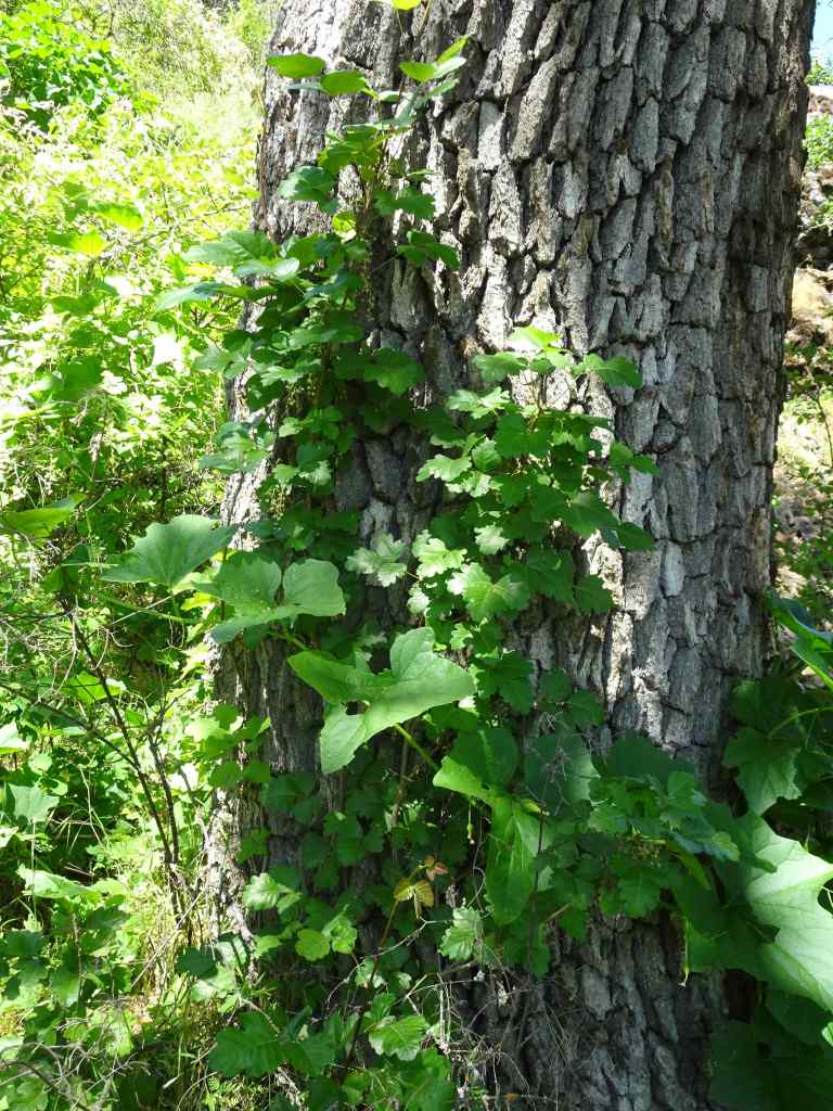
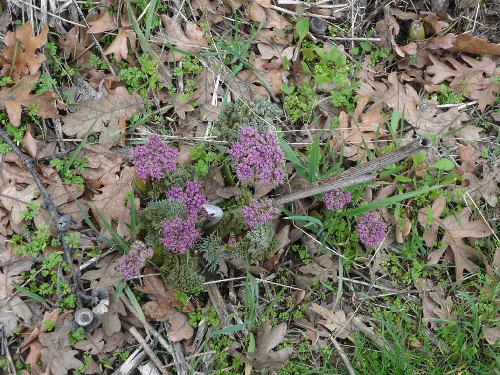
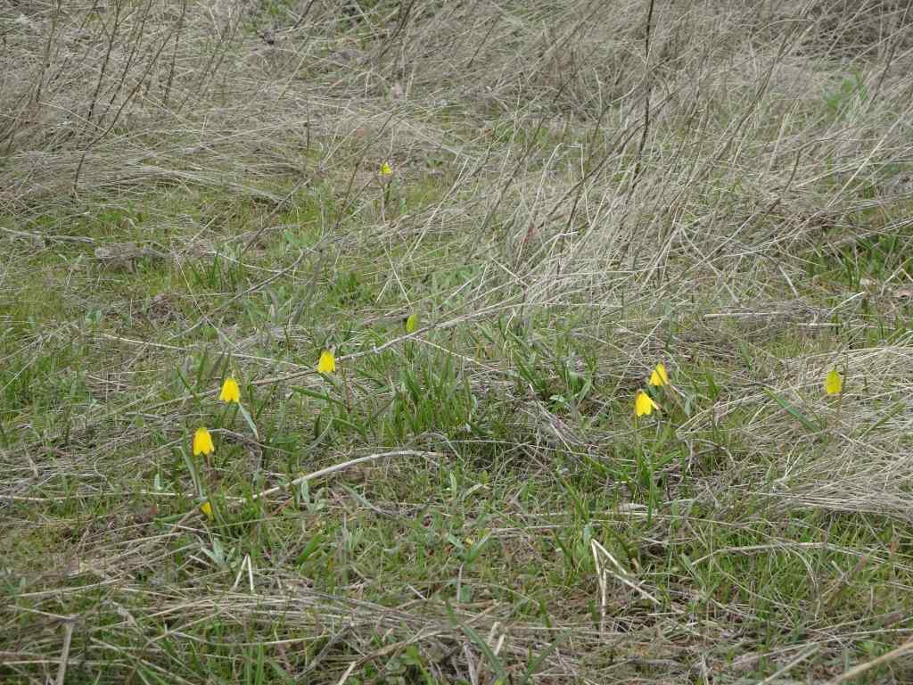
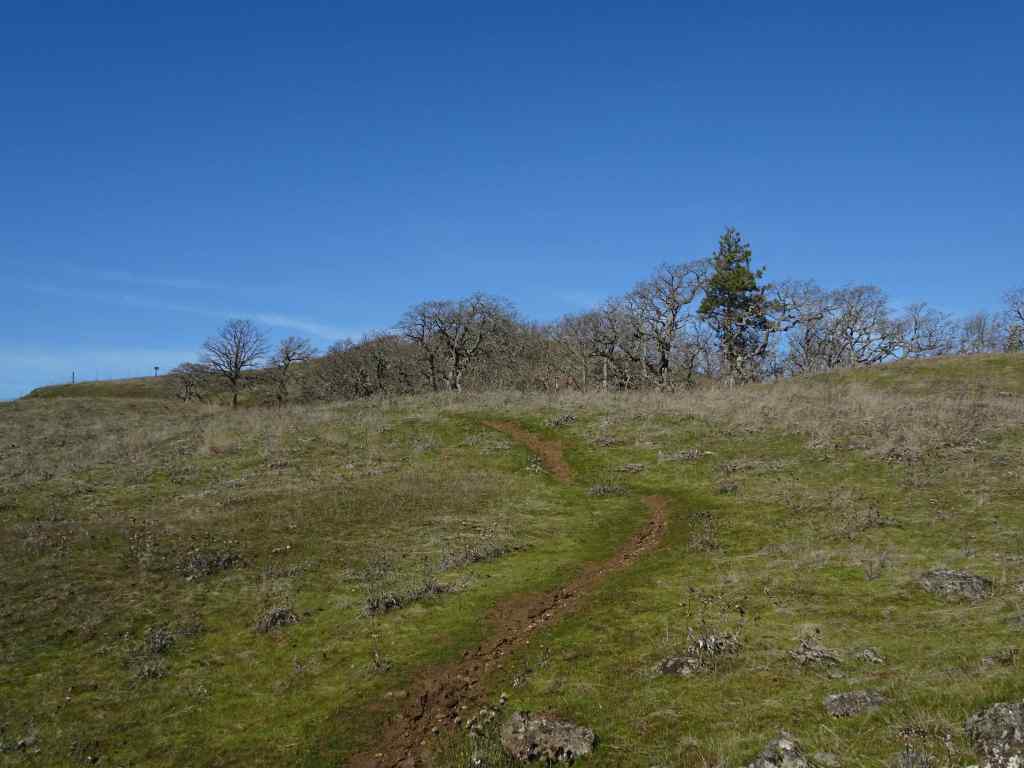
A windy day in the gorge. Most of this trail is protected from the strongest blasts, and it is a good conditioning hike (3 miles, 550 feet), as we work on our stamina…
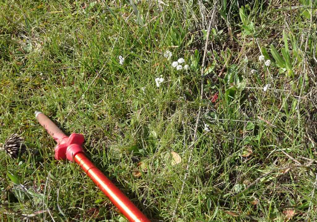
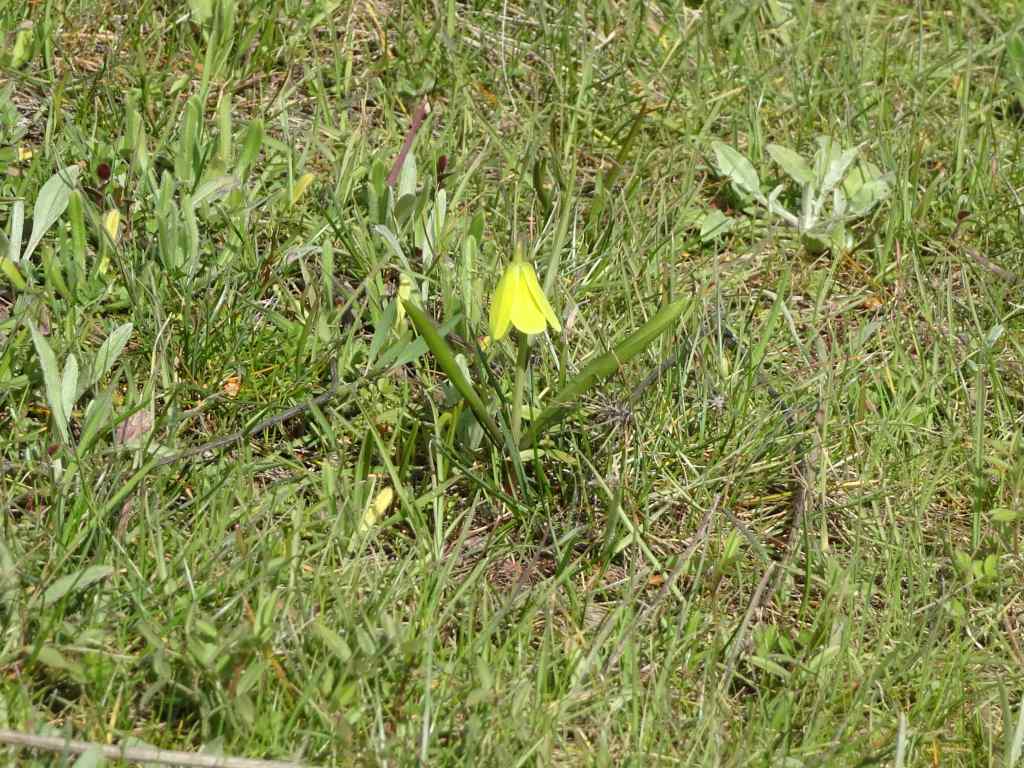
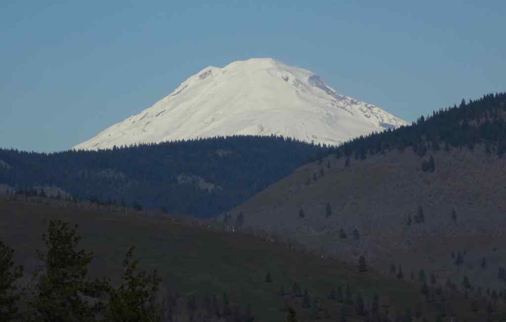
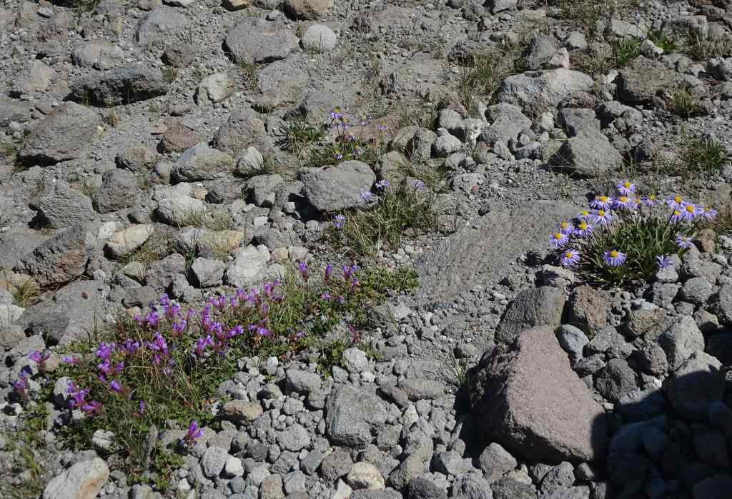
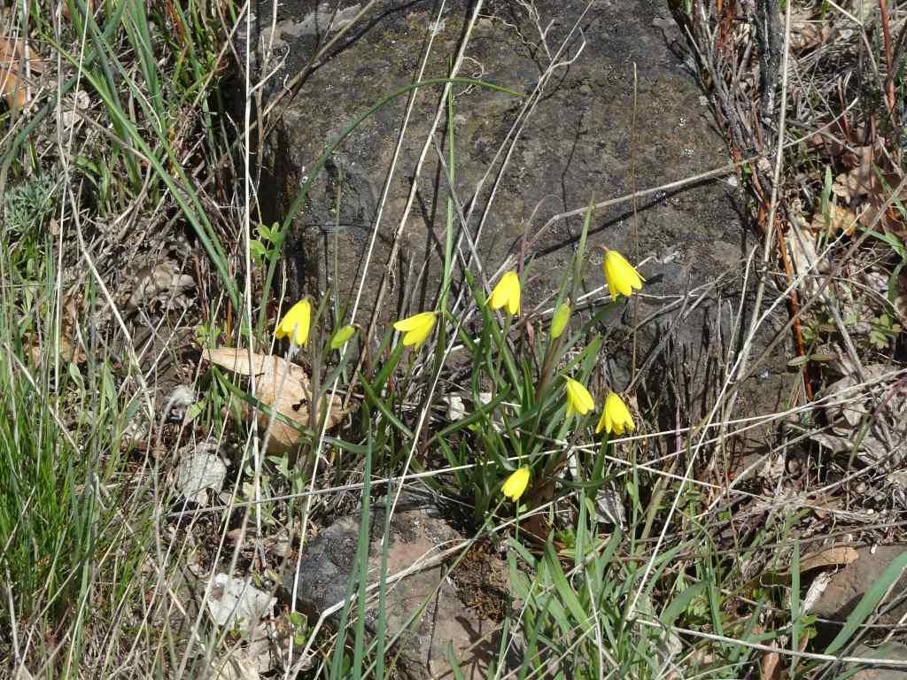
Trailhead view across the Columbia RiverGold stars and grass widows on the upward slopesGrass widowSalt and pepper parsleyYellow bellView of the gorge and Mt Adams from the top of Chatfield HillMt Adams
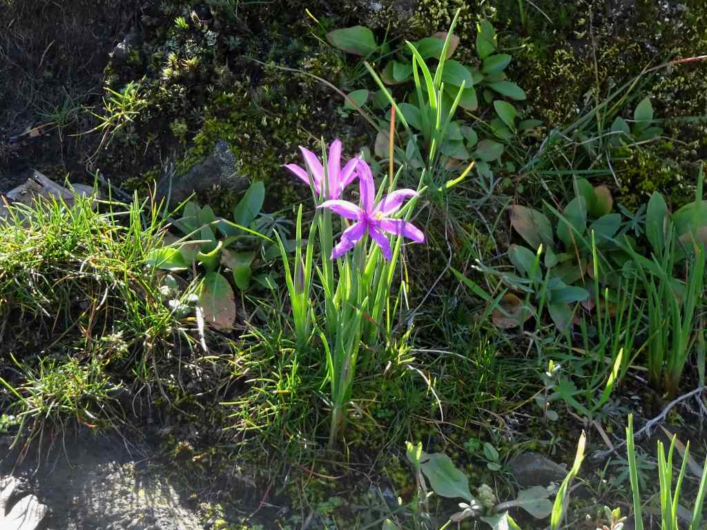
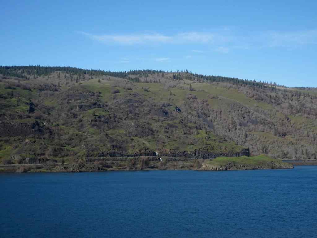
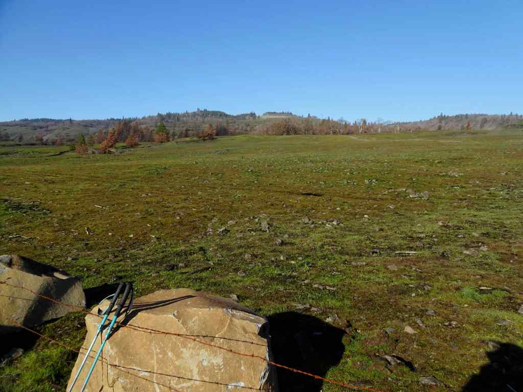
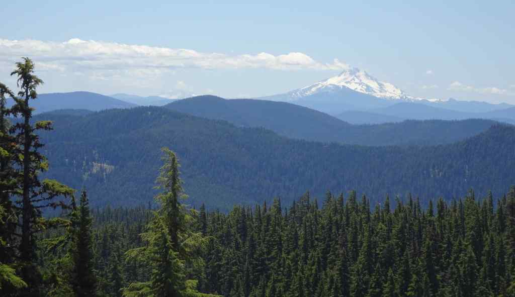
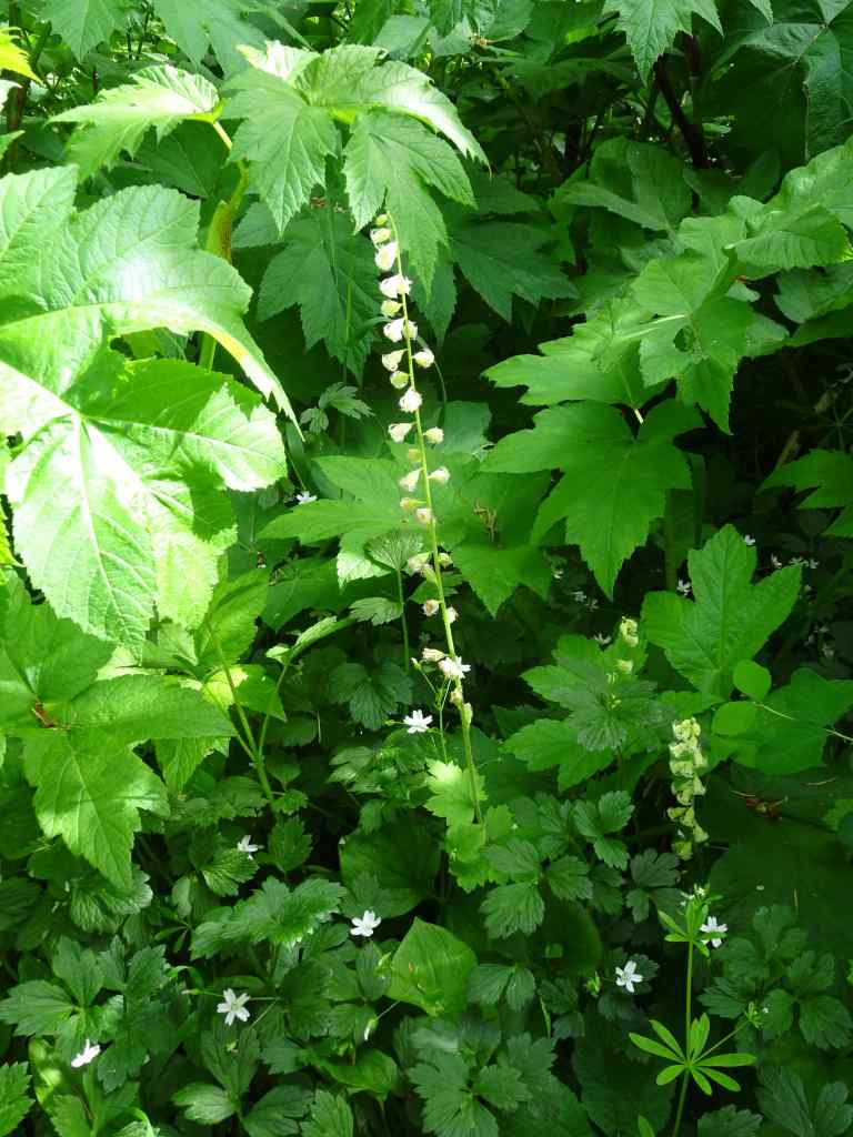
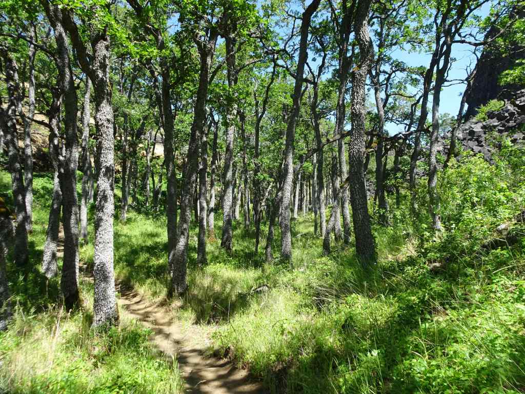
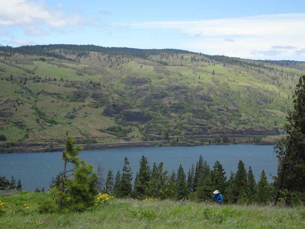
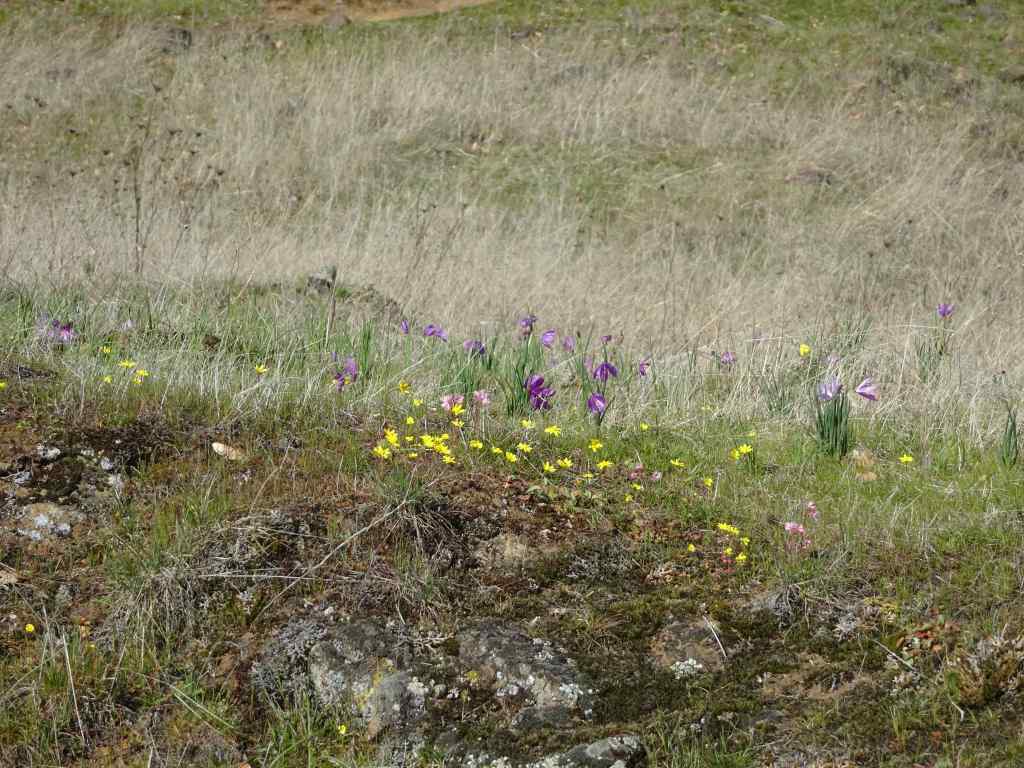
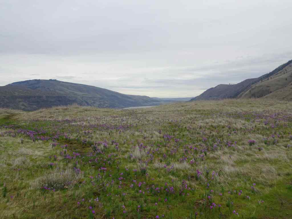
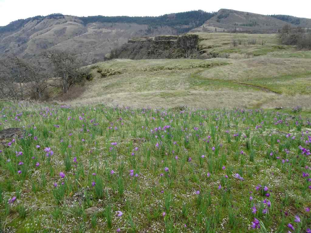
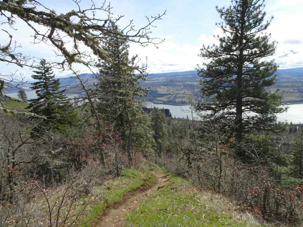
We continued the loop that circles over the top of Marsh Hill…
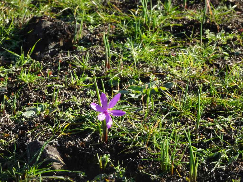
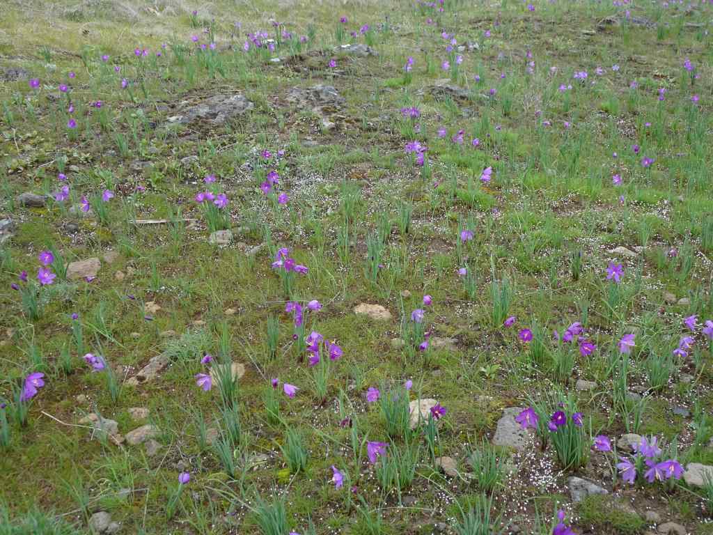
Nearing the top of Marsh HillView eastward from the top of Marsh Hill toward Tom McCall Point, with Columbia Desert parsley and grass widows among the rocks.Swales of grass widows just beginning to bloom.Grass widows
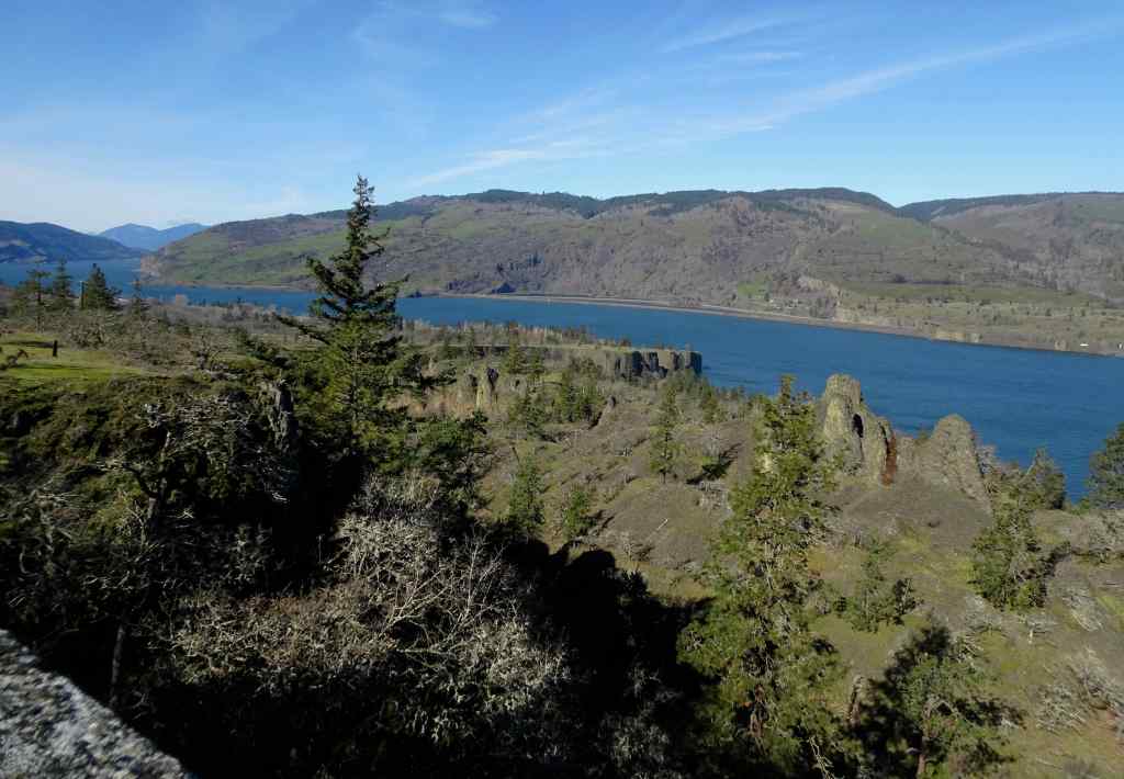
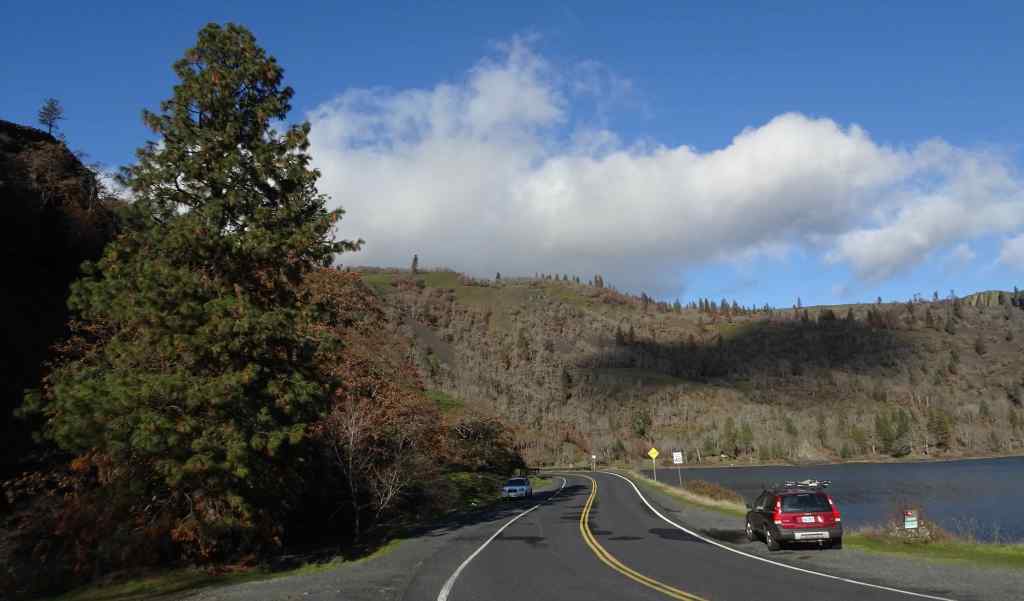
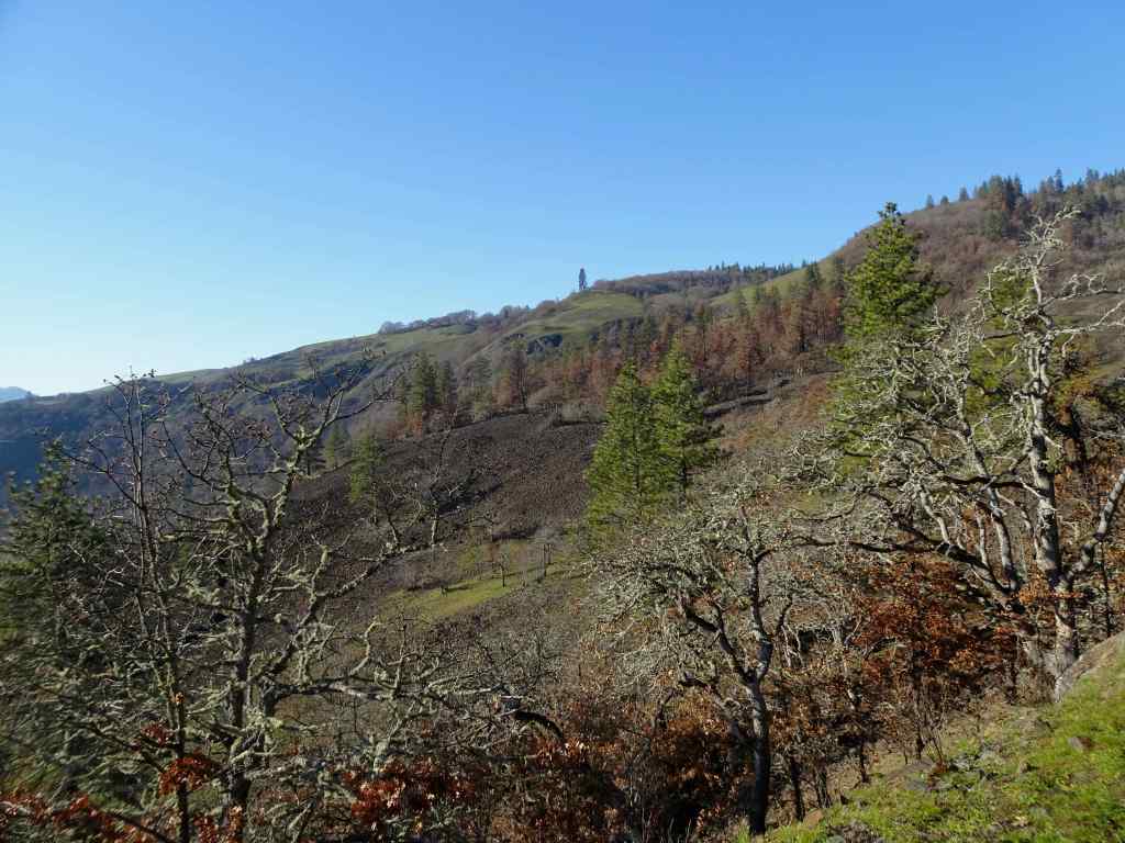
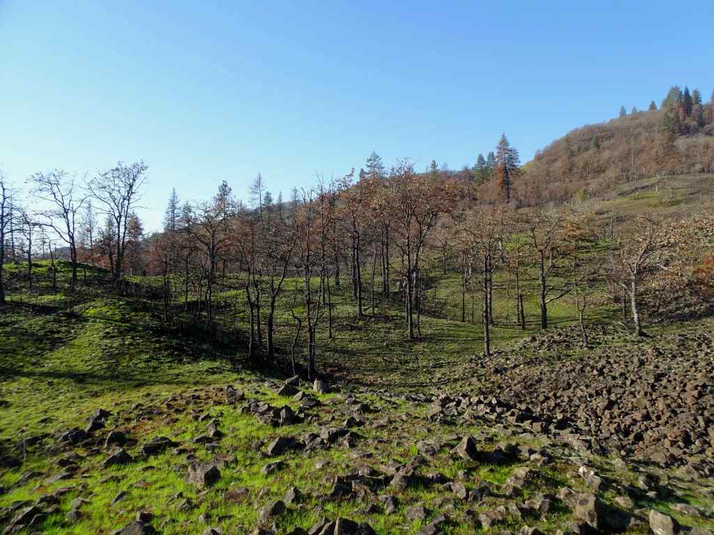
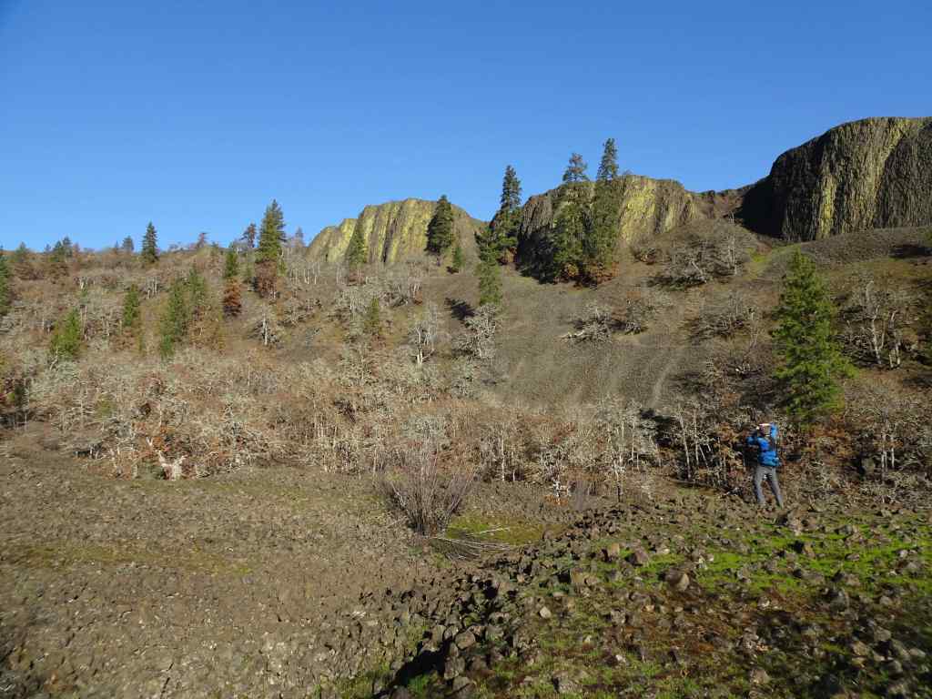
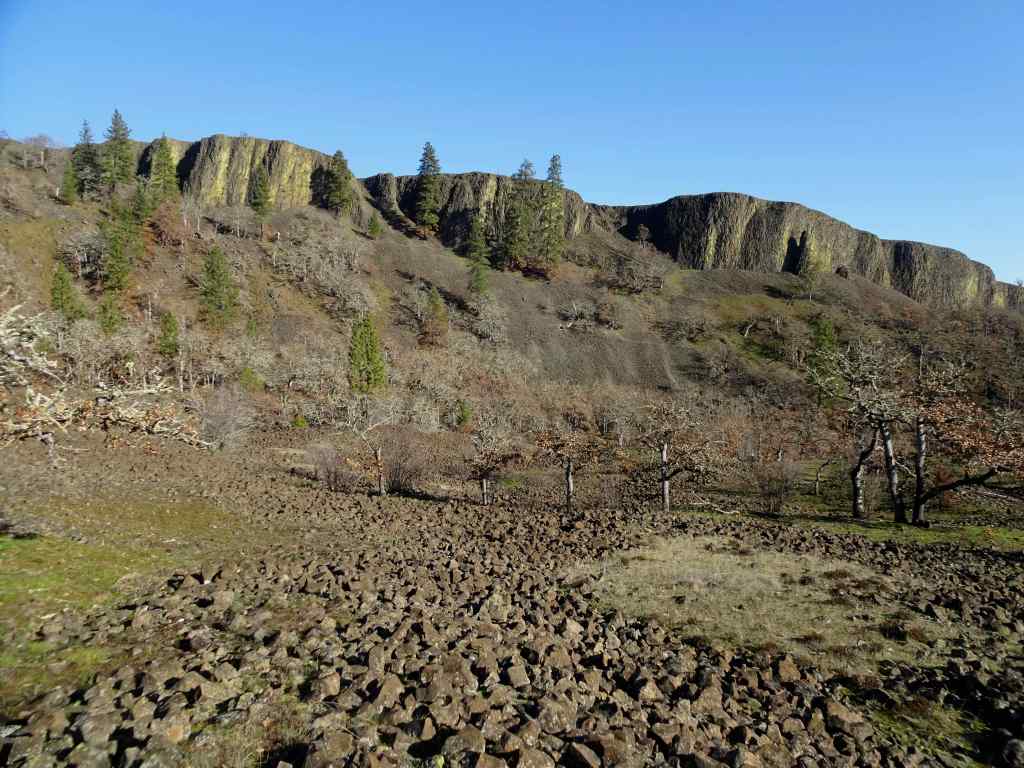
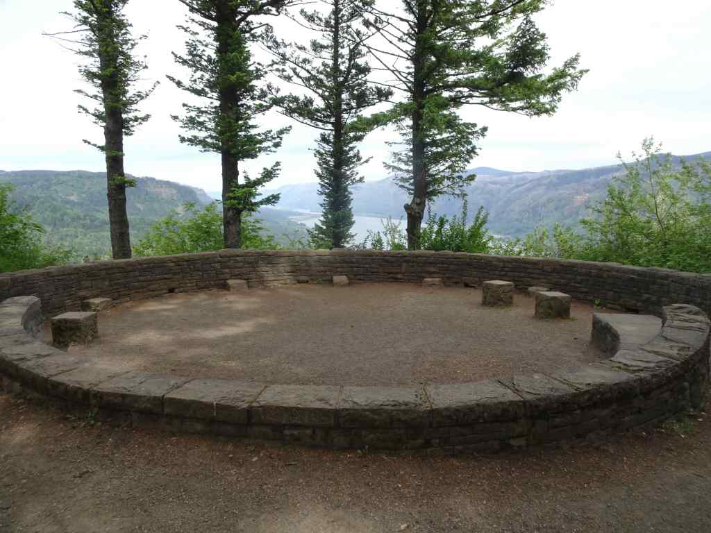
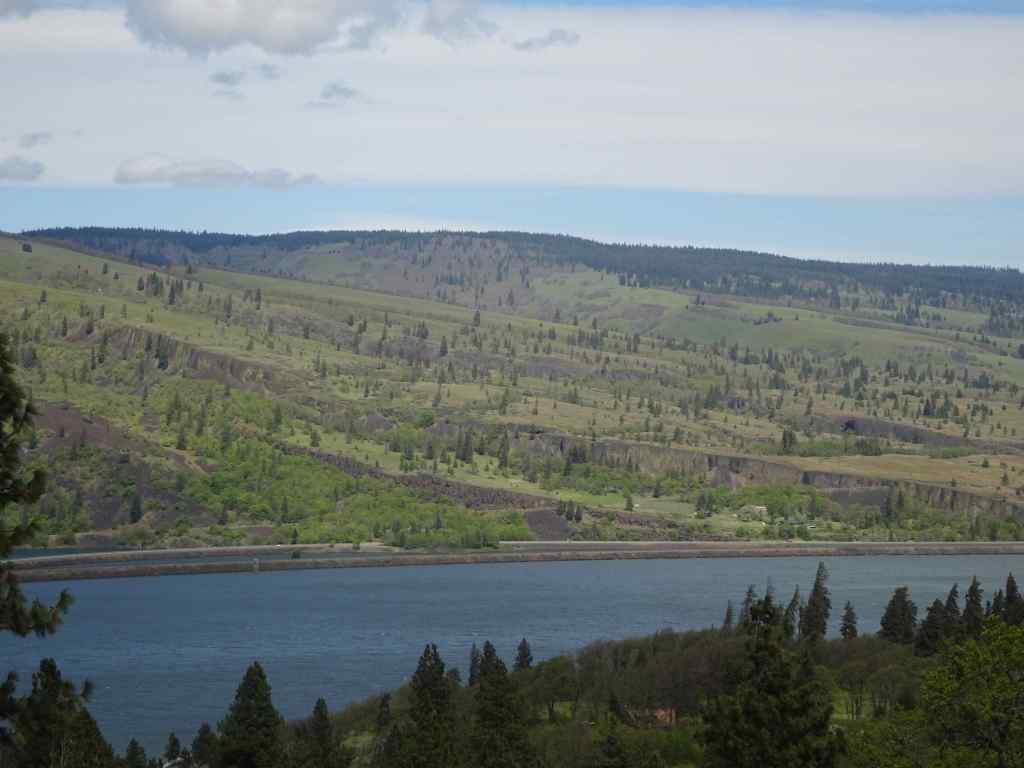
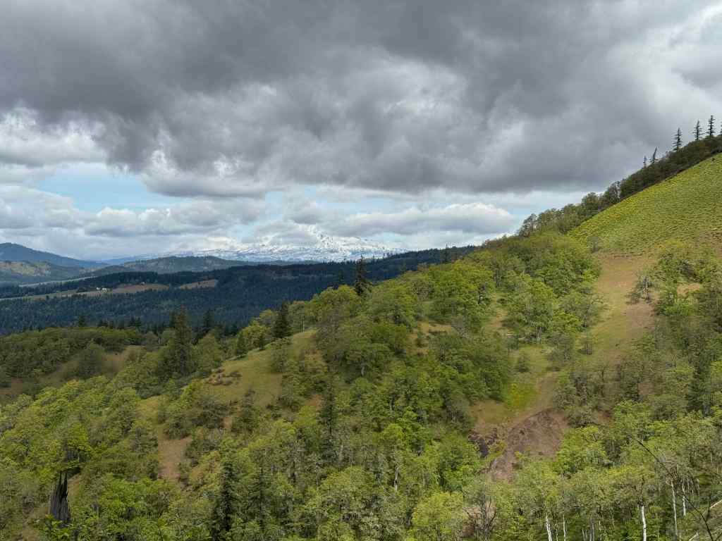
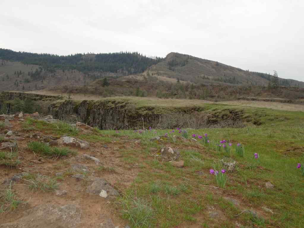
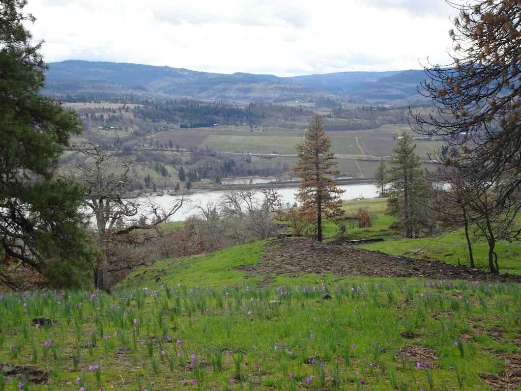
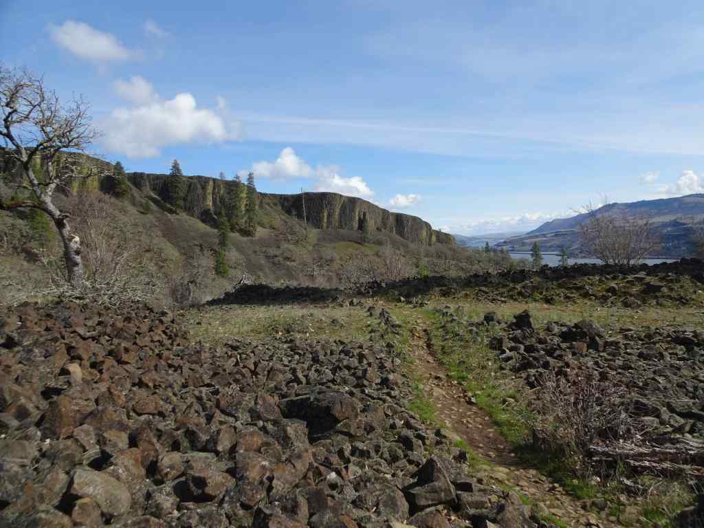
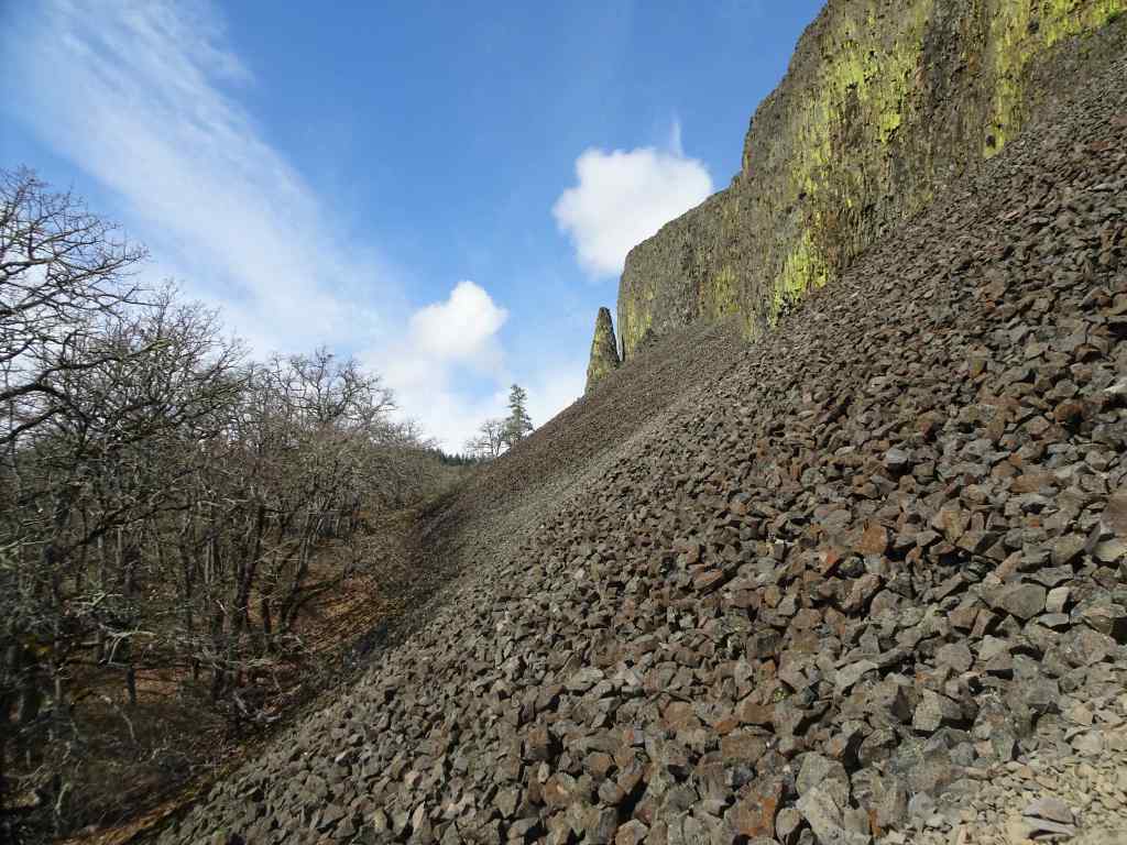
On the drive back toward Mosier, we stopped for a view to the north, to look at the greening slopes of the Coyote Wall and Catherine Creek areas, all burned last summer by the Burdoin Fire.
Coyote Wall, Little MauiThe Labyrinth
The good news is that, despite all the chaos in the political world, the flowers of spring are blooming again this year in the Columbia River Gorge!
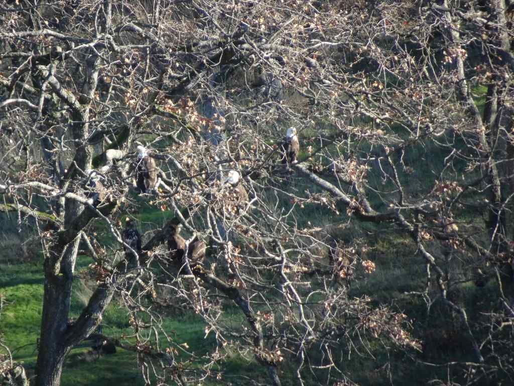
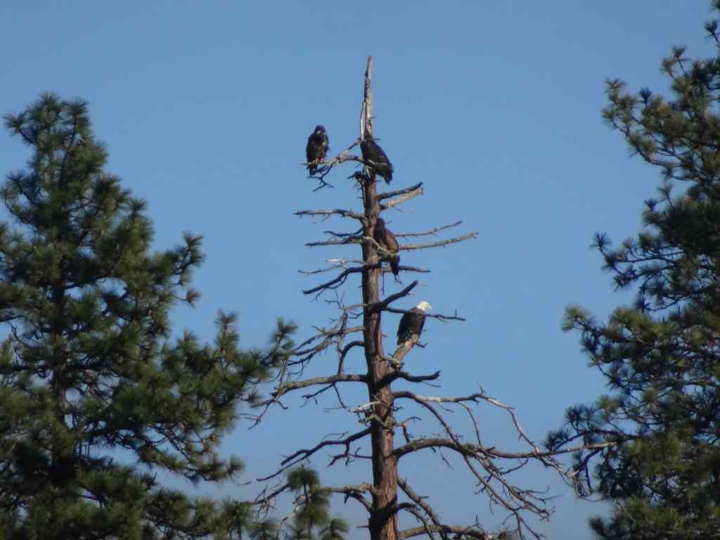
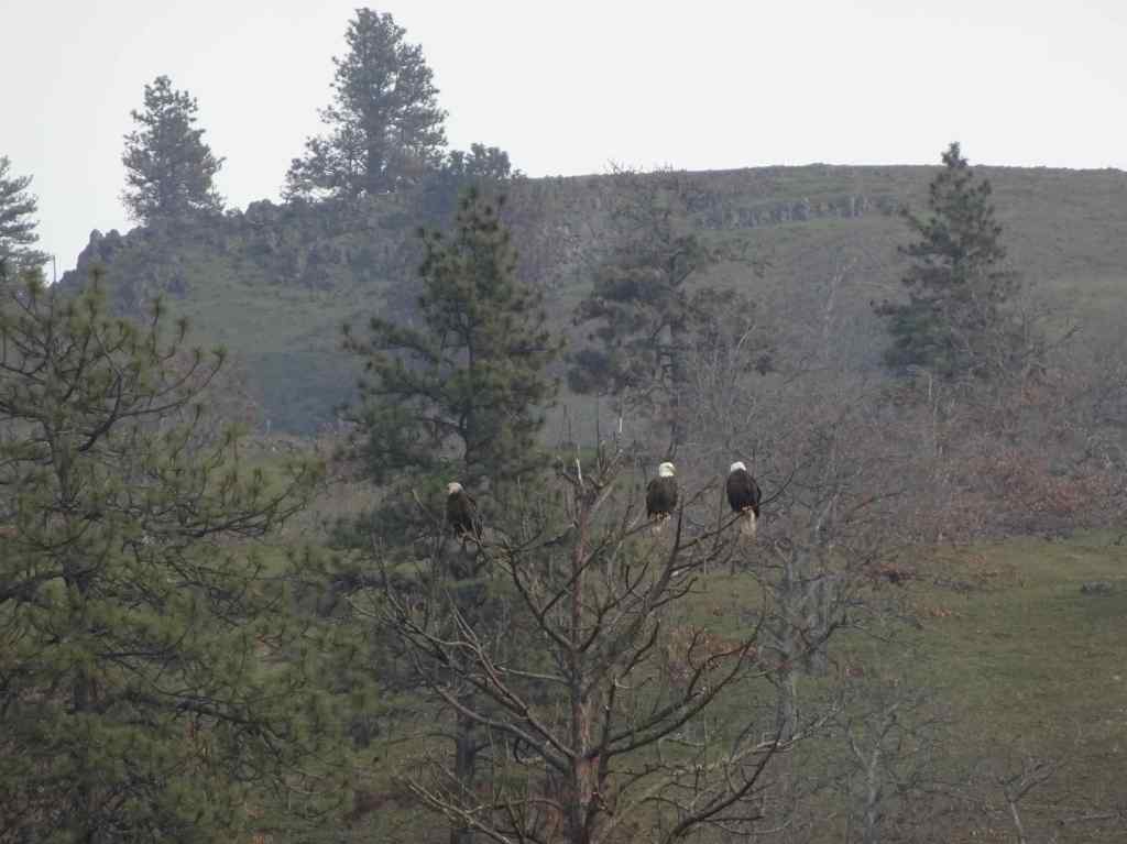
1/5 – Balfour/Klickitat Eagles, and Labyrinth Trail, WA
Our annual visit to this eagle nesting area near Lyle, Washington…
Osage oranges on the trail to the eagle overlook,Lagoon with salmon, ducks, and eagles hiding in the trees. We saw about 20 while watching for a half hour.EaglesEaglesZooming in on the snag in the distance – more eagles.
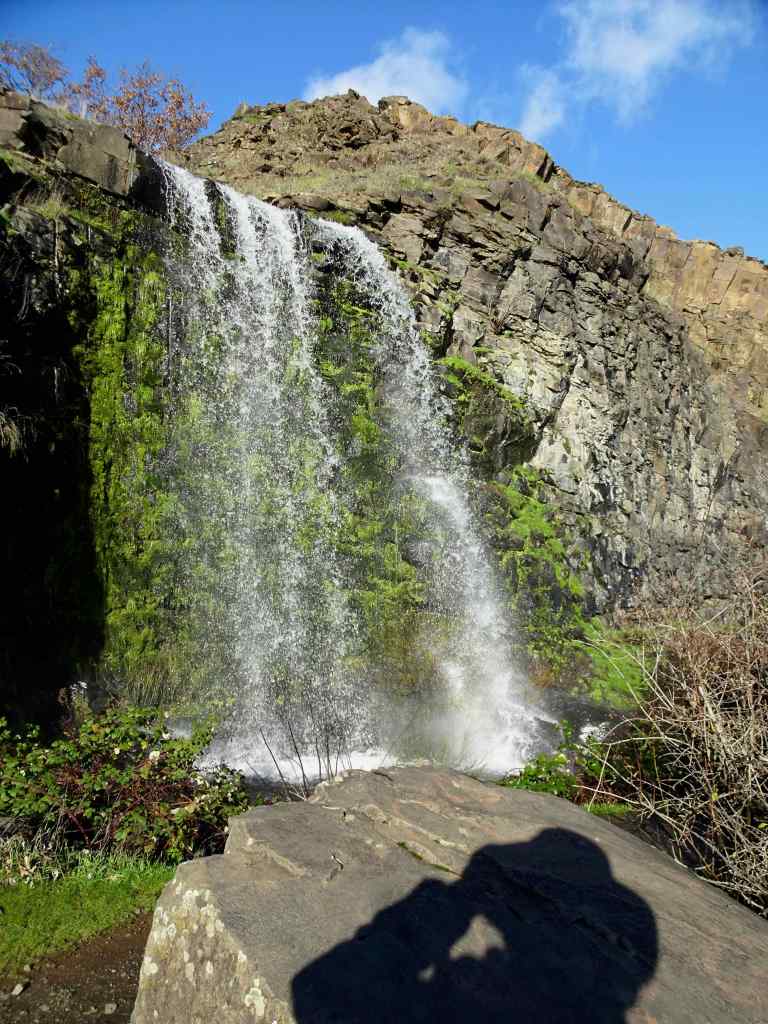
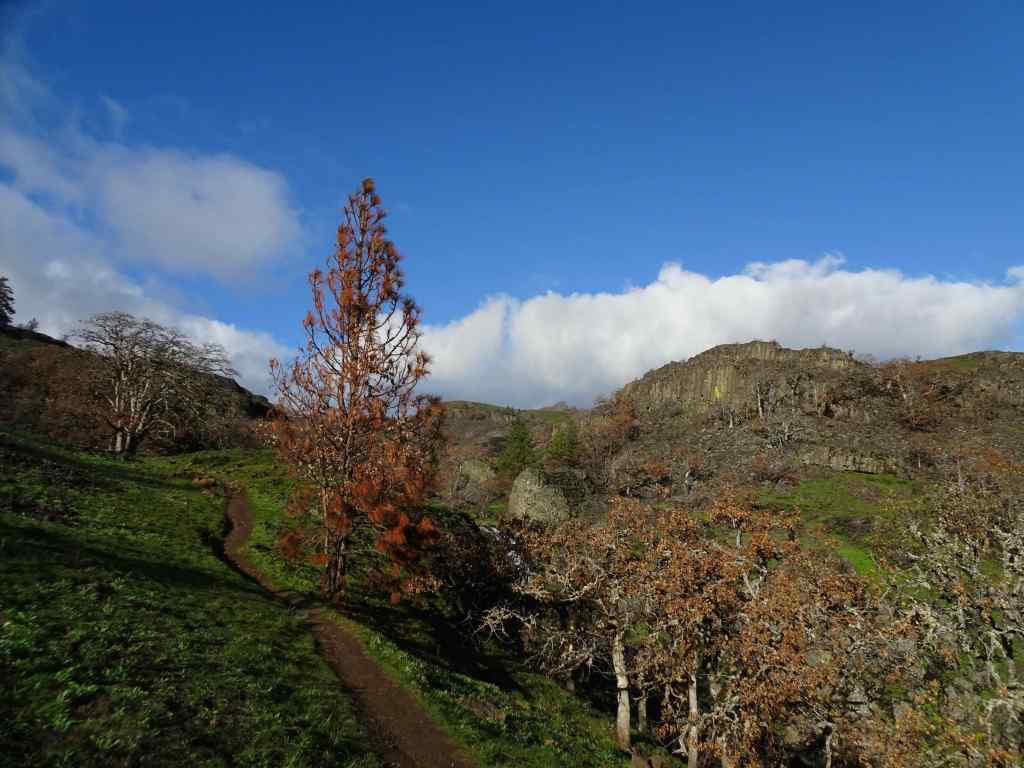
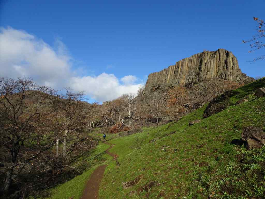
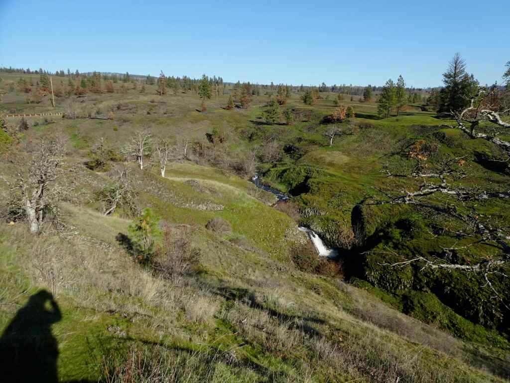
Next we went to the Labyrinth Trail, our first time here since the fires last summer…
Looking up to the guide Ponderosa Pine tree above the Rowland Lake Trailhead.Zooming in, I can see it is partially burned.The waterfall – quite full this time of year.Hiking upward through the mosaic burn…The burned areas are sprouting new grass.My favorite oak grove is scarred, but trees are still standing.View upriver from our lunch ledge.The ridgeline oak tree is intact.We didn’t get all the way to the guide tree on this day, but zooming in, I can see it is less burned on the west side.
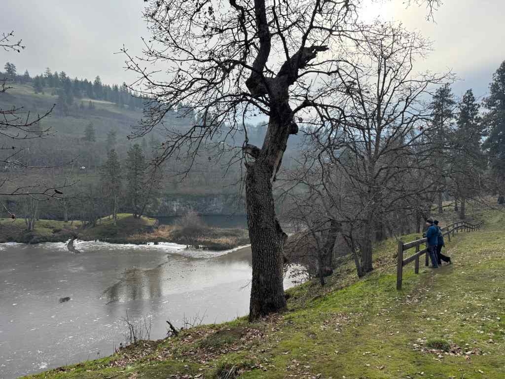
1/14 – Catherine Creek and Rowland Basin, WA
Another rainy day in Portland, but nice and sunny in the eastern Columbia River Gorge…
First we walked the lower loop at Catherine Creek, looking for the first grass widows, which we had seen reports of…
Trailhead. The burned slope here is turning green.We found a few clumps of early grass widows along the ADA trail south of the road. This area did not burn.Catherine Creek waterfall viewpoint.
Next, we walked up the trail that starts at the base of Rowland Wall, and walked about a mile up into Rowland Basin, having never started our hike from this point before, just to see what we would see.
TrailheadUphill, again, plenty of burned landscape, all in recovery mode…And we can see the guide tree from here.Another zoom in on my favorite ponderosa.All the usual undergrowth is gone under the oak treesLooking back eastward toward Rowland WallWe found a few clumps of grass widows out hereAnother view of Rowland Basin, before we start back.Hiking back down.
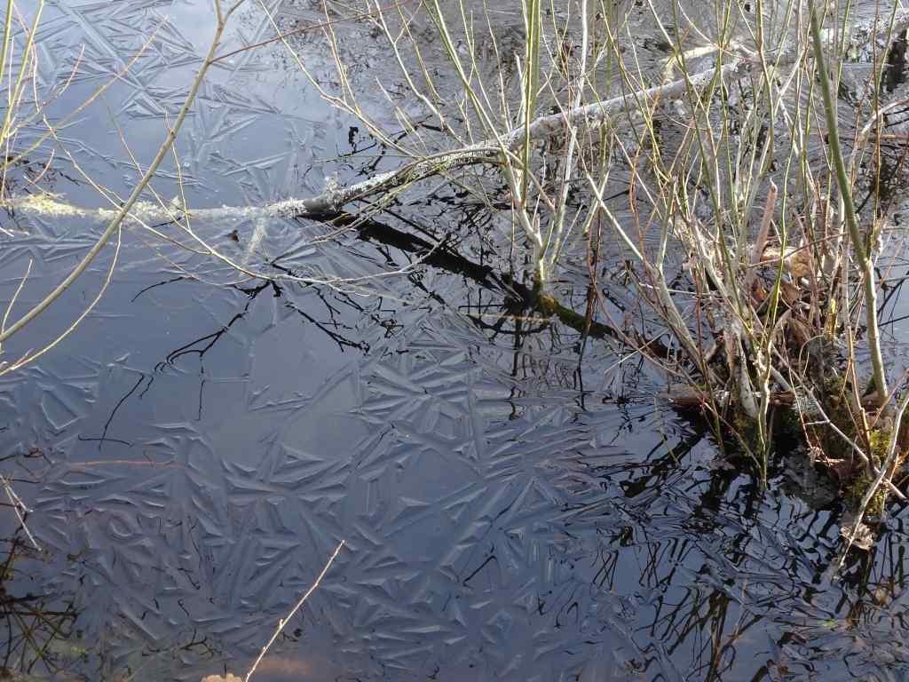
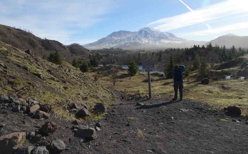
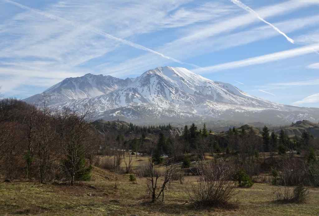
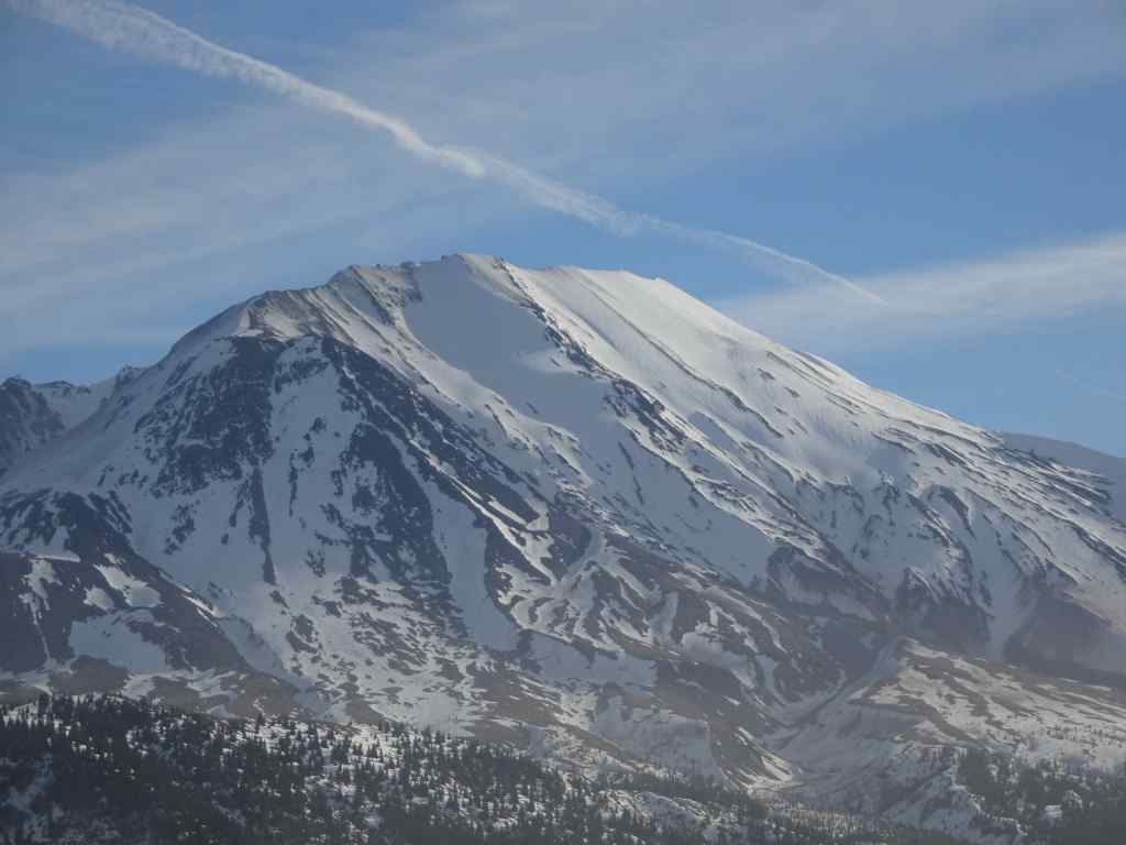
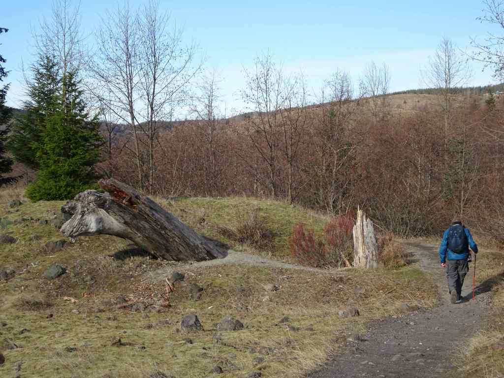
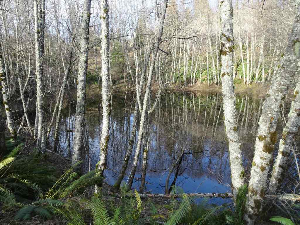
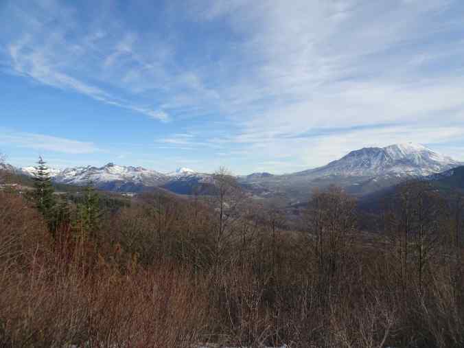
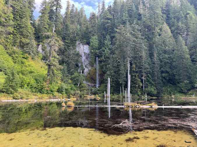
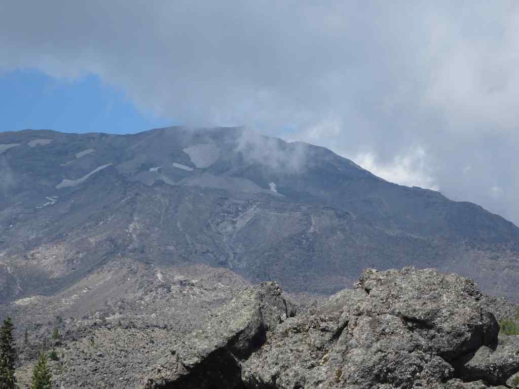
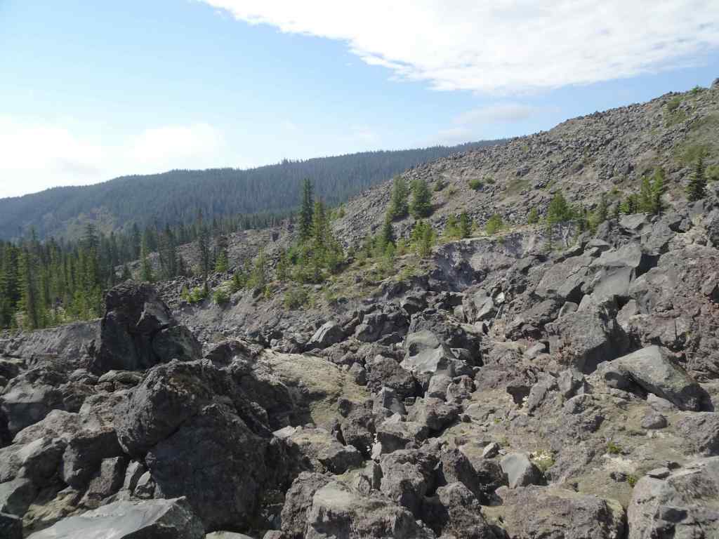
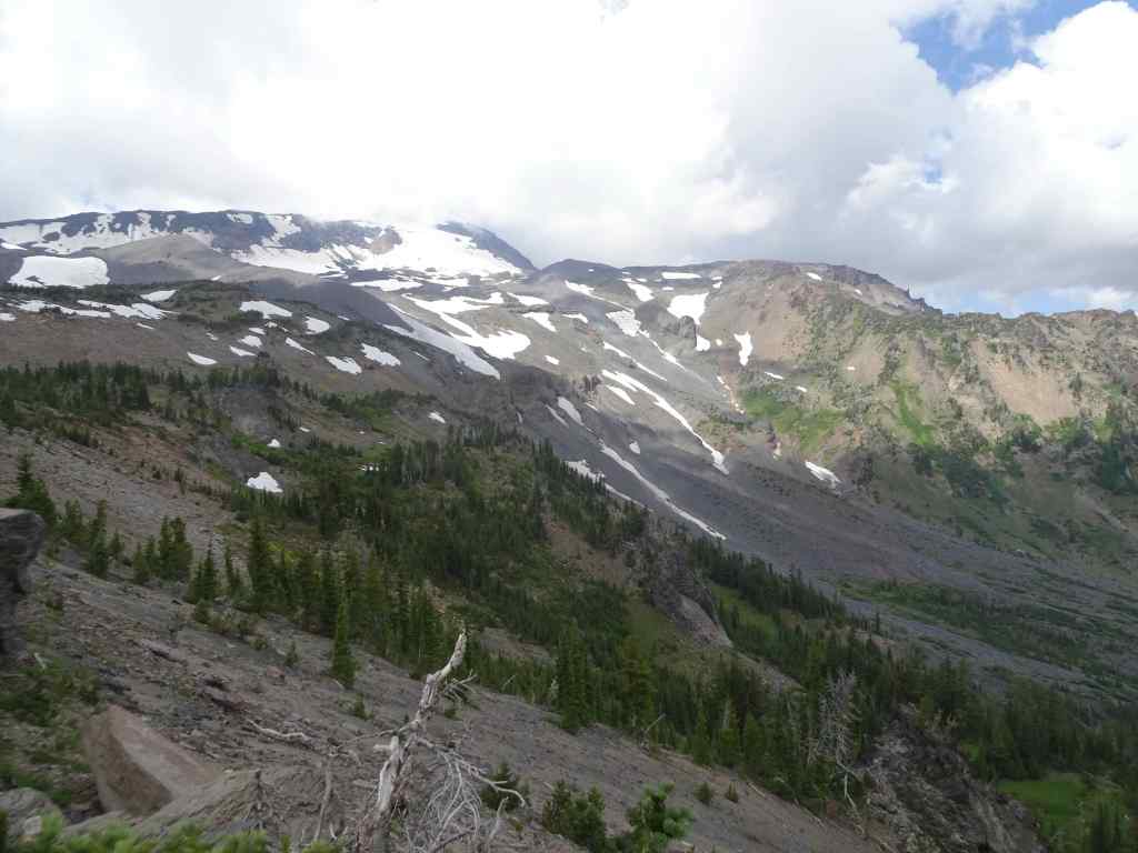
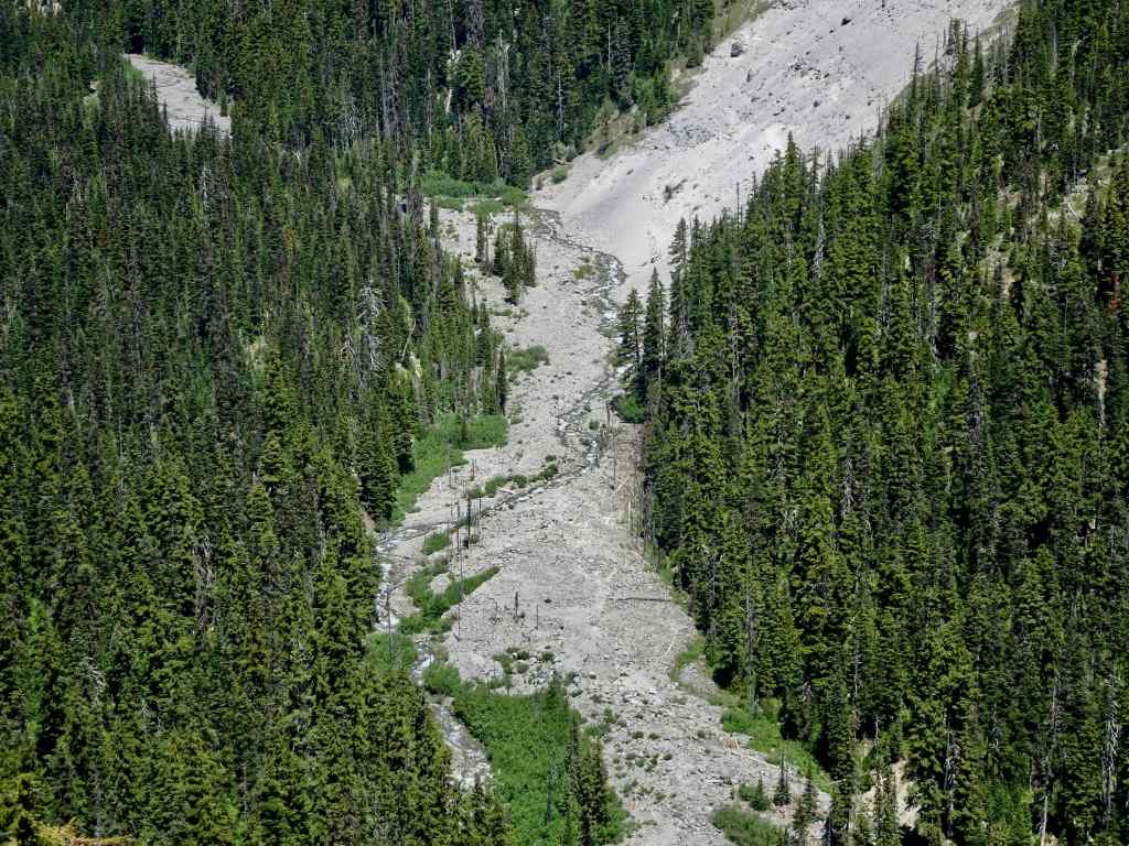
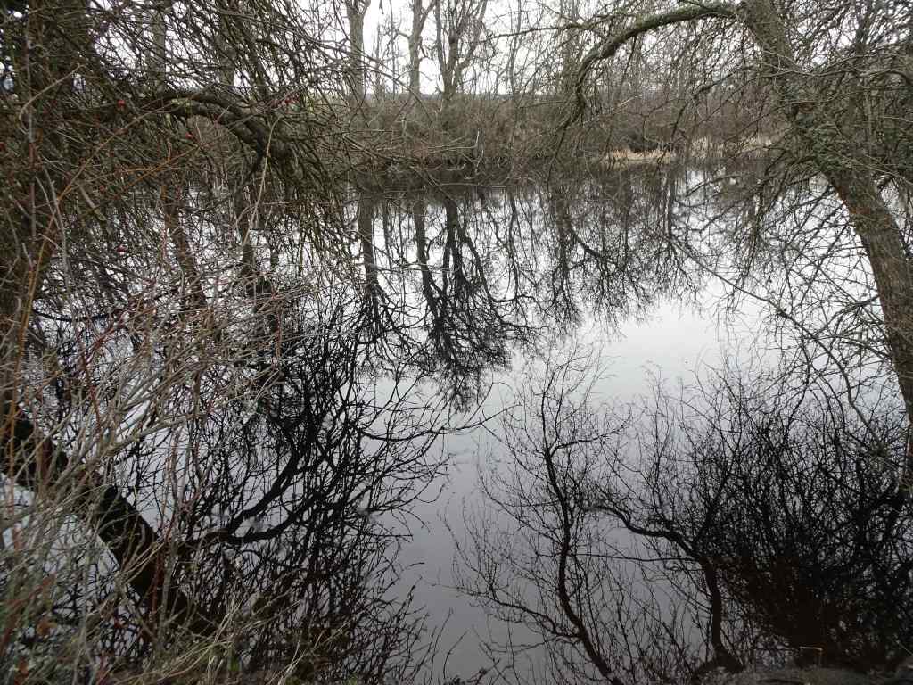
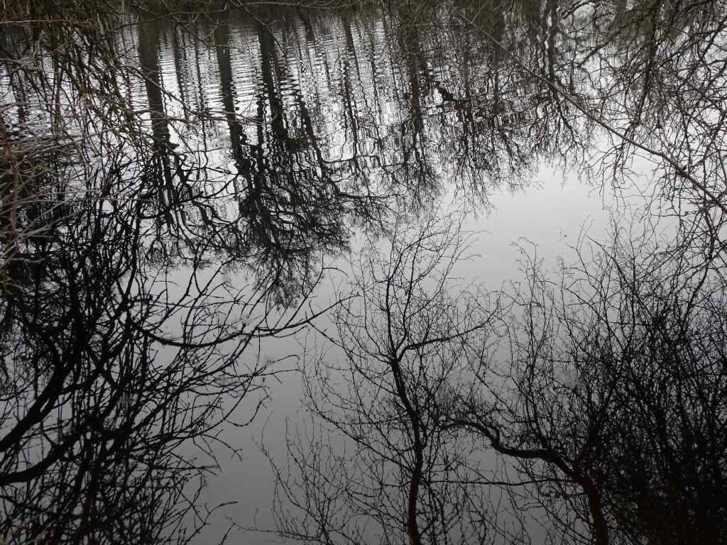
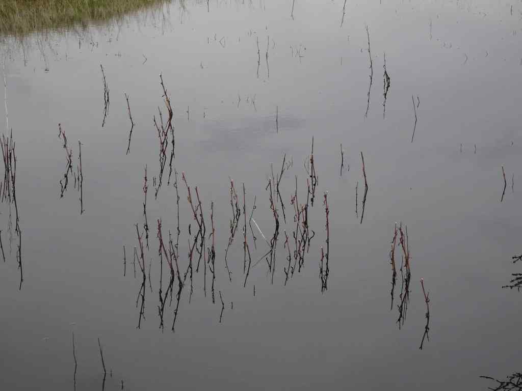
1/20 – Hummocks and Boundary Trails, Mt St Helens, WA
And now for something different – It had been a low snow January, so we drove up to Mt St Helens to try the Hummocks and Boundary Trails. As long as we stayed among the hummocks, we could enjoy the day. There was a cold wind blowing along the Boundary Trail, so we only walked a short way up…but we had great views, and a real change of scenery from the Columbia River Gorge.
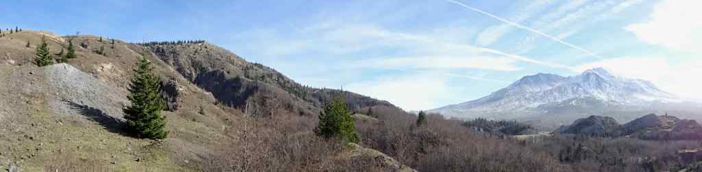
Mt St Helens, as seen from I-5 as we drove north.Snow in the parking lot. The trail was mostly clear. The trail winds around through hills of volcanic debris that were completely barren after the eruption in 1980. Forty five years later, the hummocks are covered with vegetation and there are many lakes and ponds throughout this landscape.On this day the lakes were partially frozen.I was fascinated by geometric patterns in the ice, apparently caused by differential melting due to plant shadows.More ice patternsSnow patches along the trail.Groves of alder trees have filled in much of the landscape.Alder treesToutle River Overlook – this downstream landscape is unstable and constantly changing.Another pond with tree reflections.Tree reflectionsJunction with the Boundary Trail, toward Johnston Ridge…into the wind we go.The trail switchbacks up onto the ridge on the left, toward Johnston Observatory, with great views of the northwest side of Mt St Helens.View from our turnaround point…the wind was getting stronger the further east we went.Closer view of the summit on this side.The return loop passes by this inverted tree, still buried where it landed in May, 1980.And one more reflective pond picture…
We stopped for a last look from the Elk Rock viewpoint on Hwy 504 on our drive home.
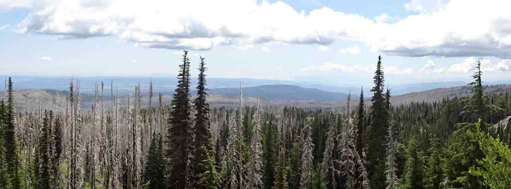
Panorama of the Mt Margaret backcountry, Mt Adams, and Mt St Helens.
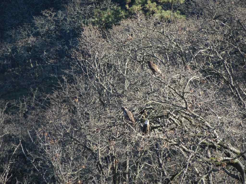
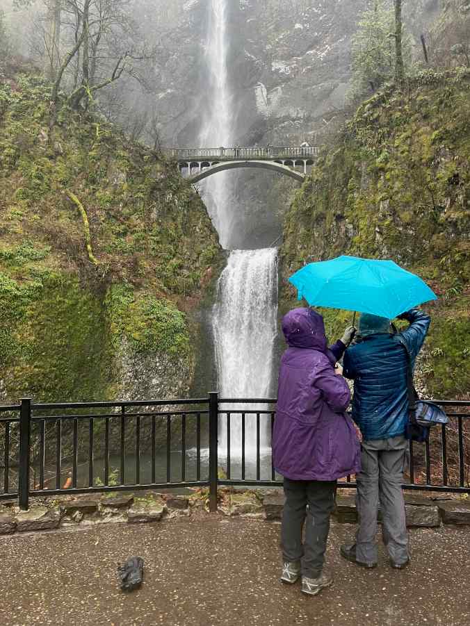
1/28 – Eagles and Catherine Creek, WA, again; with a side of Multnomah Falls, OR
My sister was visiting, and interested in an easy hike, so we took her back to a couple of our favorite places in the Columbia River Gorge.
We could see a few bright white spots in the trees as we approached the overlook at the Balfour/Klickitat Reserve.Three bald eagles. We saw about a dozen this day.The pond is icier than it was earlier in the month.
Next we walked the lower ADA Trail at Catherine Creek, and found just a few of the early flowers.
Catherine Creek ADA trailGrass widowBudding Columbia Desert ParsleyWaterfall OverlookWe walked up to the fairy ponds, now frozen around the trunks of slightly burned oak trees,and looked over to the Arch.
And finally, we drove back through the rainy Gorge, and made a quick stop at Multnomah Falls.
Multnomah Falls
I am gald to be back out on the trails, though I have some work to do to regain my stamina!
In September we visited an art festival, and went on two hikes in the mountains, and one at the beach. I took my usual neighborhood walks, read a few books, and made very little notable progress on my ongoing knitting projects. At the end of the month, we flew to the east coast to visit family there (next post).
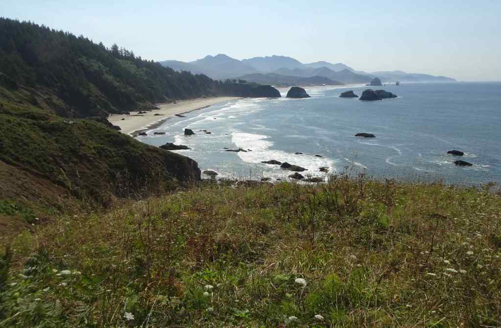
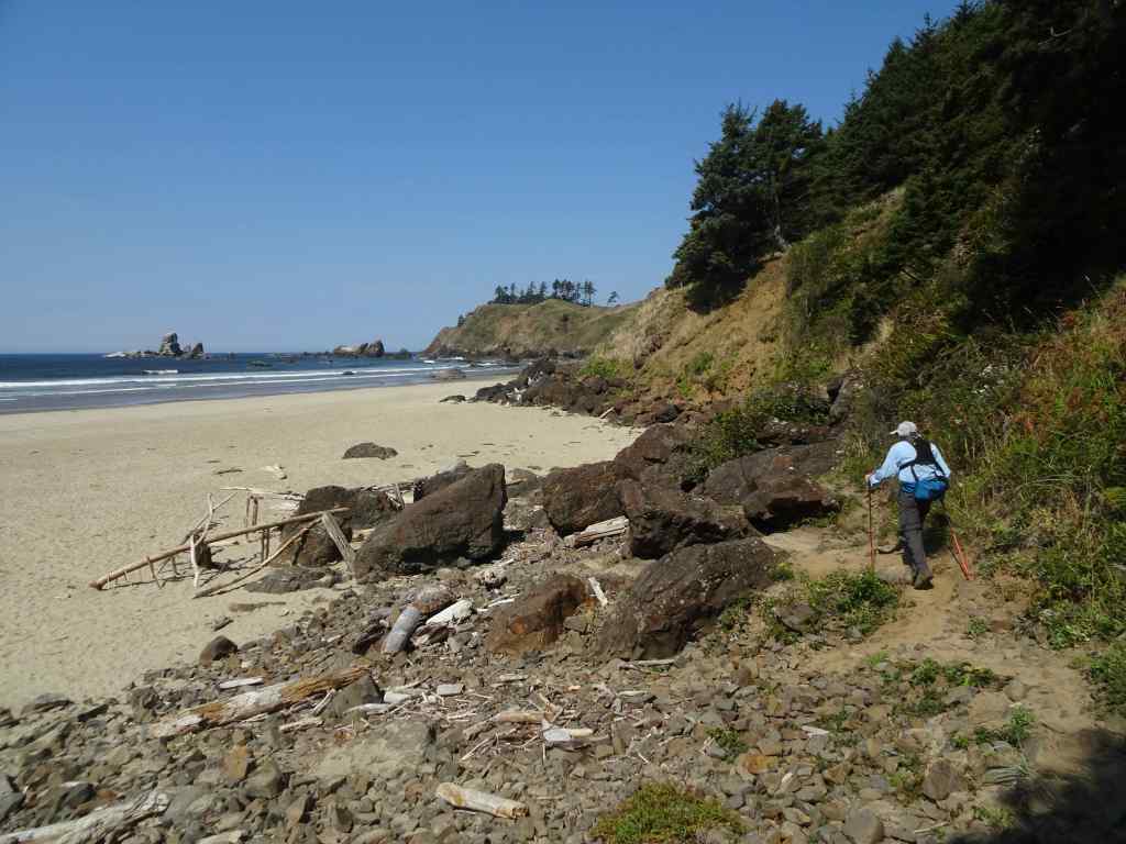
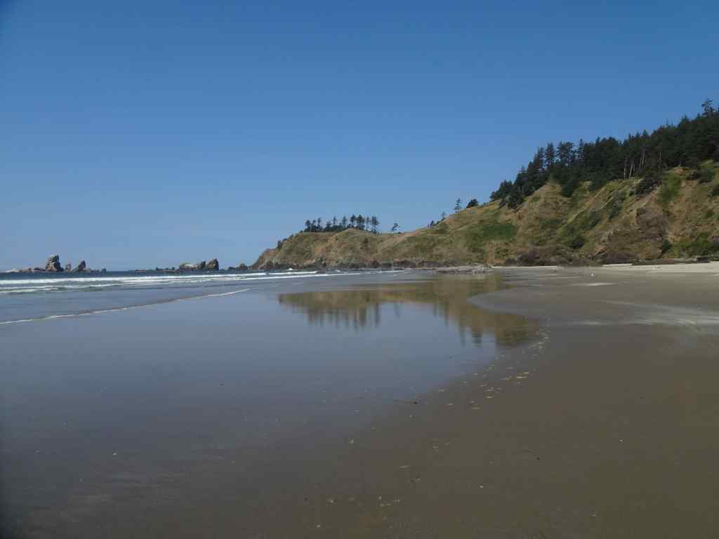
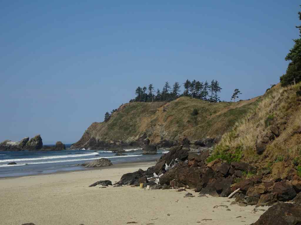
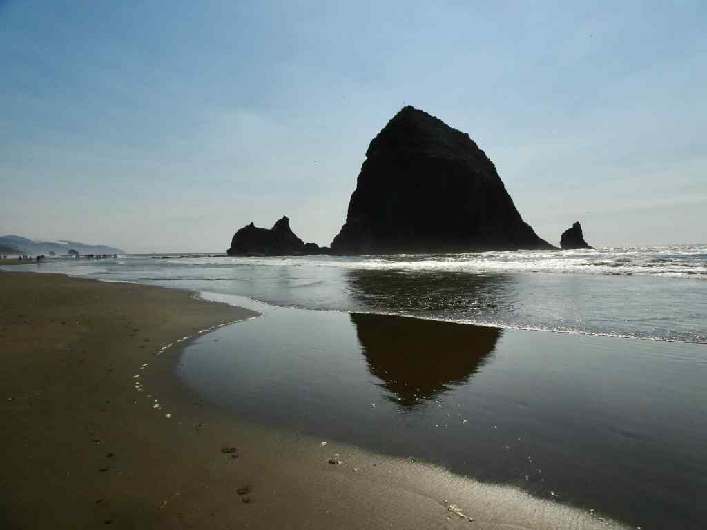
A hot day in Portland. We drove to the coast for a short hike to Crescent Beach in Ecola State Park, then went to Cannon Beach to walk near Haystack Rock at low tide.
View to Crescent Beach and Cannon Beach from Ecola Point.Trail through the forest, about 3 miles round trip.Descending to Crescent Beach, looking south.Looking north.We walked down the beach and found a spot to eat lunch.Zooming in on Ecola Point, where we began our hike. We hiked back up after lunch.South view along Crescent Beach.
After an ice cream break in Cannon Beach, we walked toward Haystack Rock. It wasn’t a particularly low low tide today. My husband took a much longer walk, while I found a good perch right in front of the Needles, and watched several pods of pelicans fly north along the breaker zone.
Walking toward Haystack Rock.View from my perch in the sand.Zooming in on The Needles, with pelican.Pelicans.
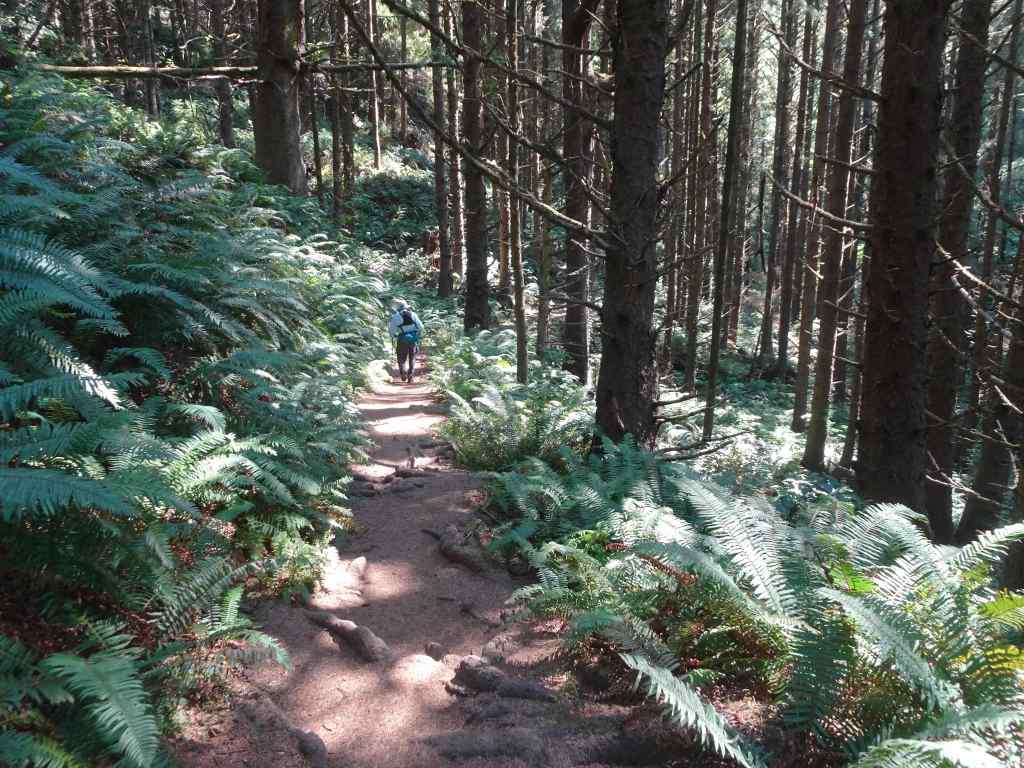
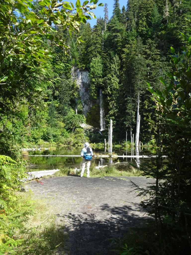
9/10 – June Lake, Mt St Helens, WA
Another hot day. Another relatively easy hike, first to June Lake, then up onto some of the lava flows (Worm Flows) on the south side of the mountain (4 miles, 800 feet).
Trail to June Lake through the forest.
Some of the late wildflowers along the way:
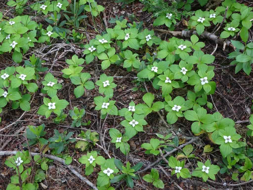
PenstemonFireweed and Pearly everlastingBunchberry
June lake is calm, reflecting the waterfall coming out of the lava flow above.
June Lake
Then we went up a fairly steep trail, and onto the Loowit Trail, and the lava flows:
Up the Worm Flows…Vine Maples beginning to turn orange.A few flowers along the rocky trail.A glimpse of the top of Mt St Helens beyond the clouds.We went just high enough to get the full mountain view.Zooming in on a glacier near the summit ridge.The trail not taken ahead – our knees and balance had enough for the day.
We descended, with another stop at the beautifully reflective June Lake…
June LakeJune Lake
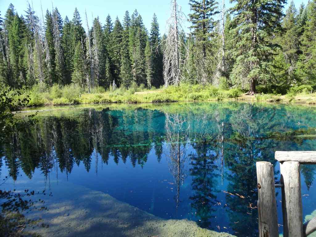
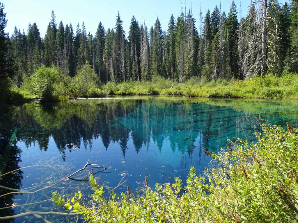
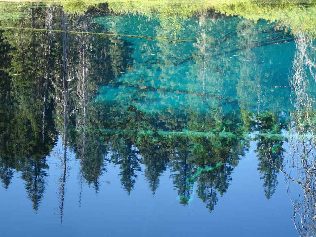
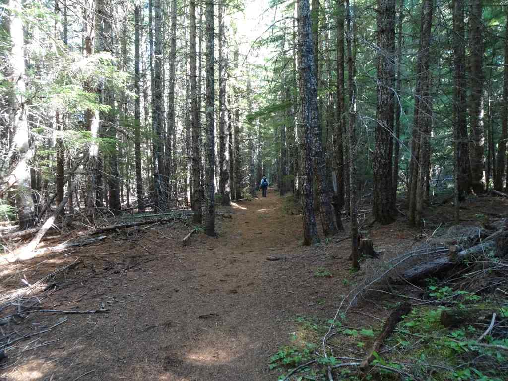
9/16 – Little Crater Lake, Mt Hood, OR
And yet another hot day! Another easy hike, first to Little Crater Lake, then to the eastern edge of Timothy Lake along the Pacific Crest Trail (3.5 miles, 50 feet).
This small artesian spring-fed lake is always a treat, with its deep turquoise color, reflections and transparency. An indulgent photo stop.
Little Crater LakeReflectionsTransparencyGlowing imagesUpside down treesSubmerged branches
We walked to the eastern edge of Timothy Lake, then retraced our steps.
Timothy LakePacific Crest Trail – nice and shady on a hot day.Passing by Little Crater Lake again.
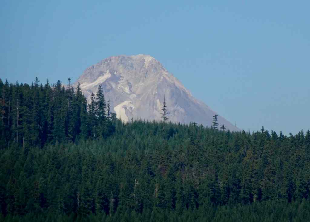
We were told we could see Mt Hood from the Timothy Lake Dam, so we drove around the lake to see the view – it was just a glimpse over a ridge.
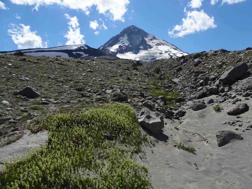
Timothy Lake, Mt Hood in the distance.Zoom in to Mt Hood – almost snow free!
Neighborhood walks
Flowers and landscape elements I noticed in September:
LantanaSunflowersArbutus
I haven’t done much quilting lately, so I composed a concrete quilt from some of my favorite sidewalk cracks.
September books
September books
I finished six books in September. The most inspiring was the biography of Robert Louis and Fanny Stevenson – A Wilder Shore, by Camille Peri. They were a very unusual couple for their time. He chose writing instead of the family business of lighthouse engineering. She grew up in rural Indiana, spent time with her first husband in the mining camps of Nevada, then in bohemian San Francisco, before going to France with her children to study art. They traveled all over the world, by horse carriage, train and ship, eventually settling in Samoa. It seems amazing to me that they were so widely travelled, and that she lived her own style, ignoring much of the expected behavior of a proper Victorian lady. I was inspired to reread my childhood copy of his poem, The Land of Counterpane, from A Child’s Garden of Verses, with illustration by Garth Williams – this is one of the definitive visual memories from my childhood – the quilt, and the imaginary play it inspired.
From The Tall Book of Make Believe
Also in Portland…
Things started to heat up. Deliberate misinformation reported a ‘war zone’ throughout the city. The only actual activity is near the Federal ICE facility in southwest Portland, where the true spirit of Portland is on display in peaceful protests that defend free speech and due process. I am writing this in October, when things have gotten crazier but in September, we were just getting ready for threatened invasion! I’m sure I will be adding something about the frogs next month.
Wall art in my neighborhood.Screen shot of local fiber arts.
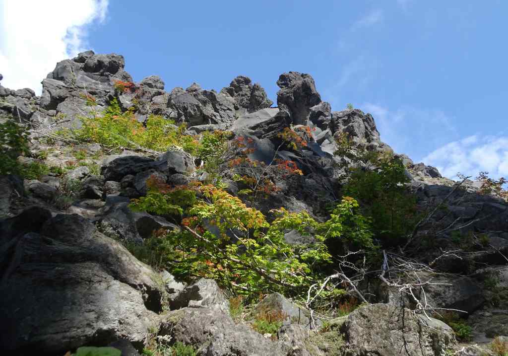
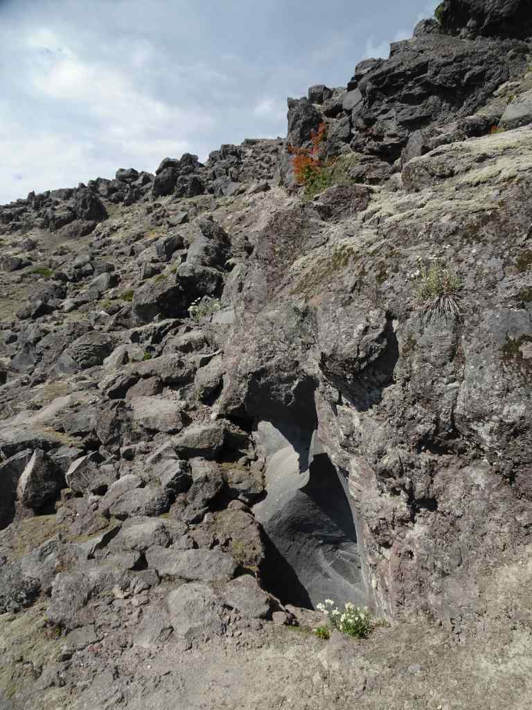
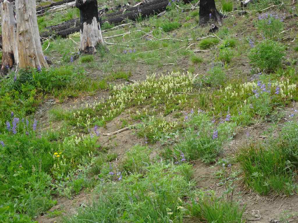
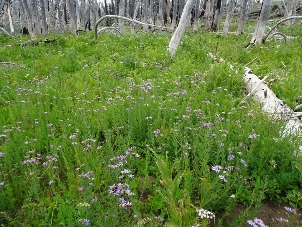
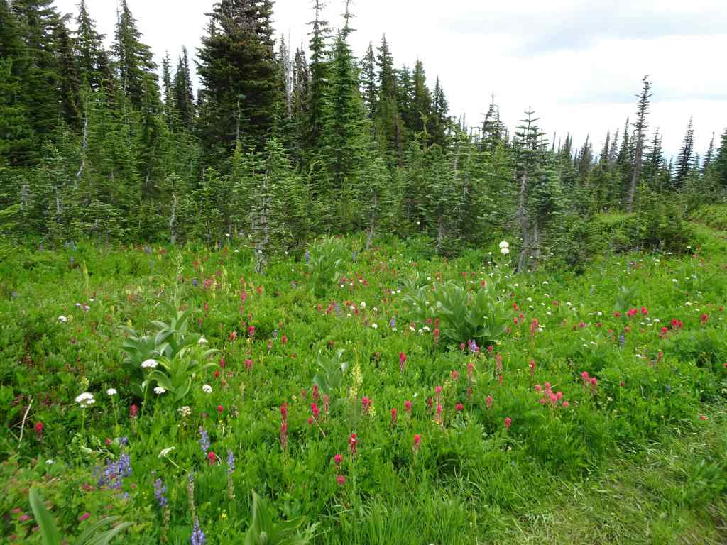
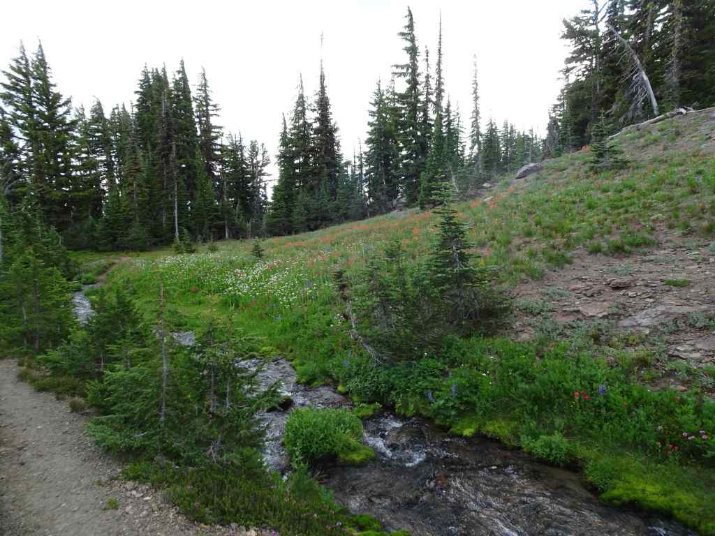
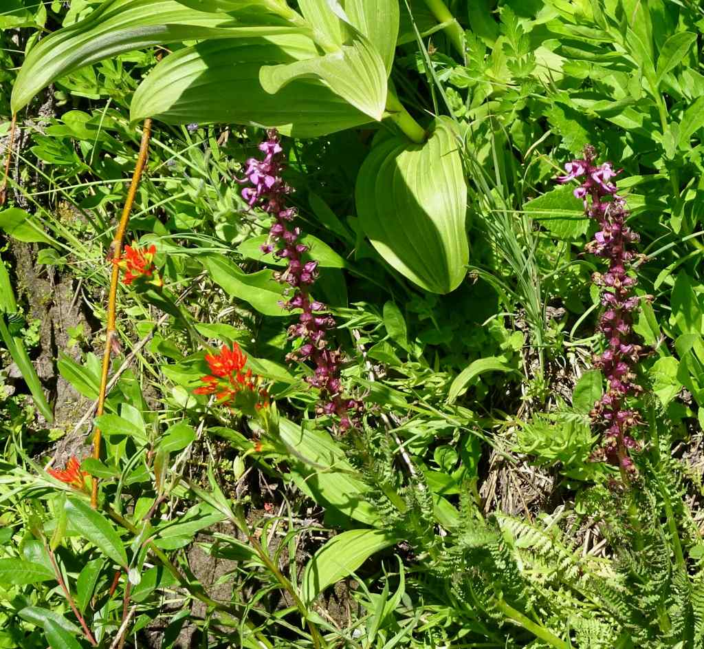
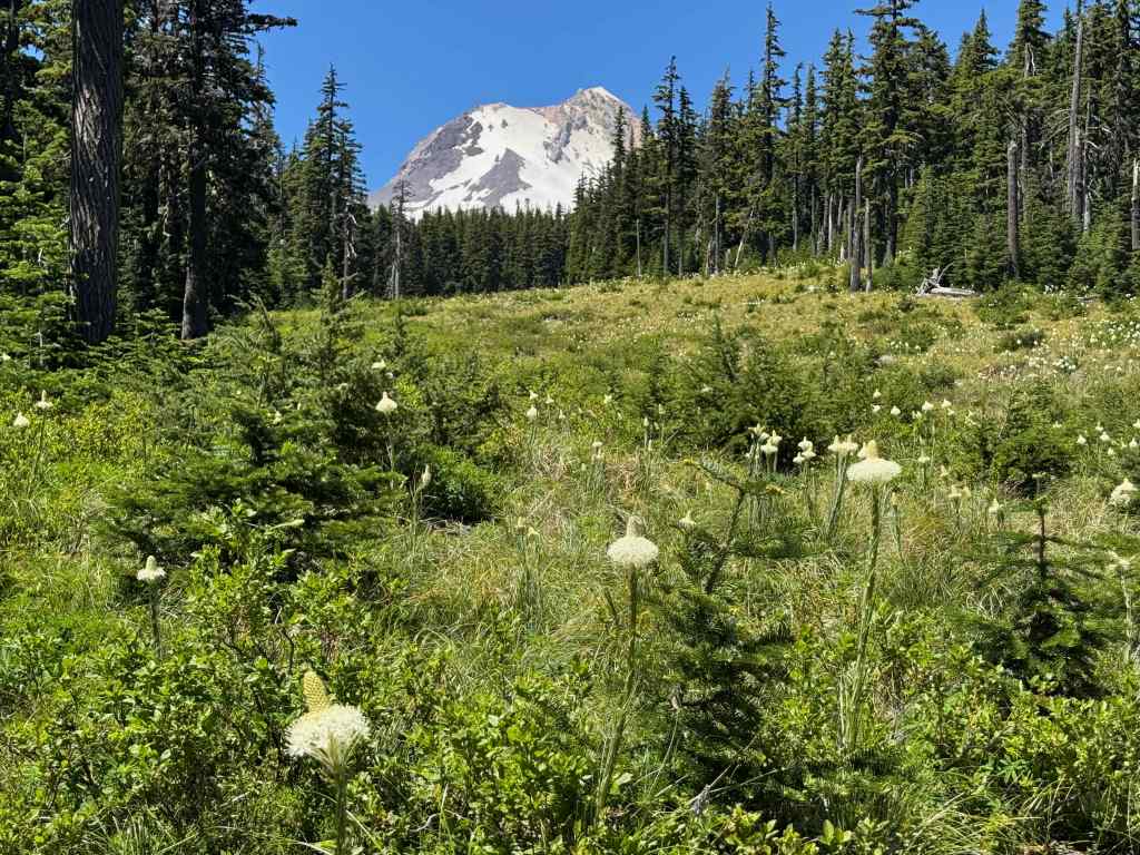
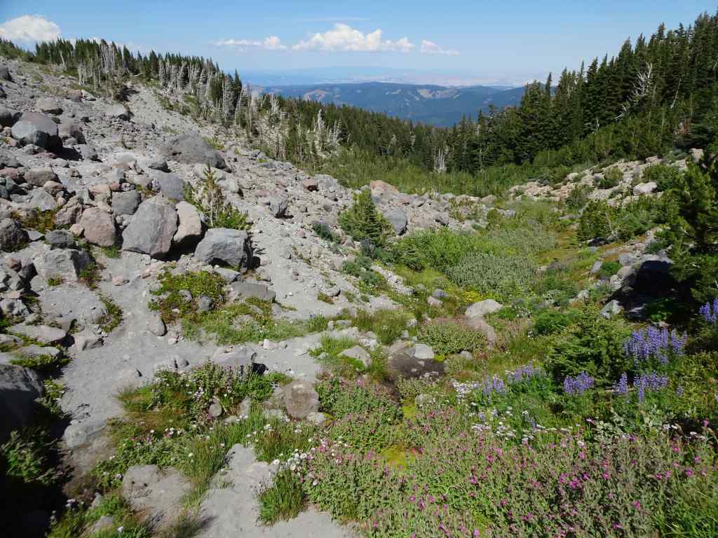
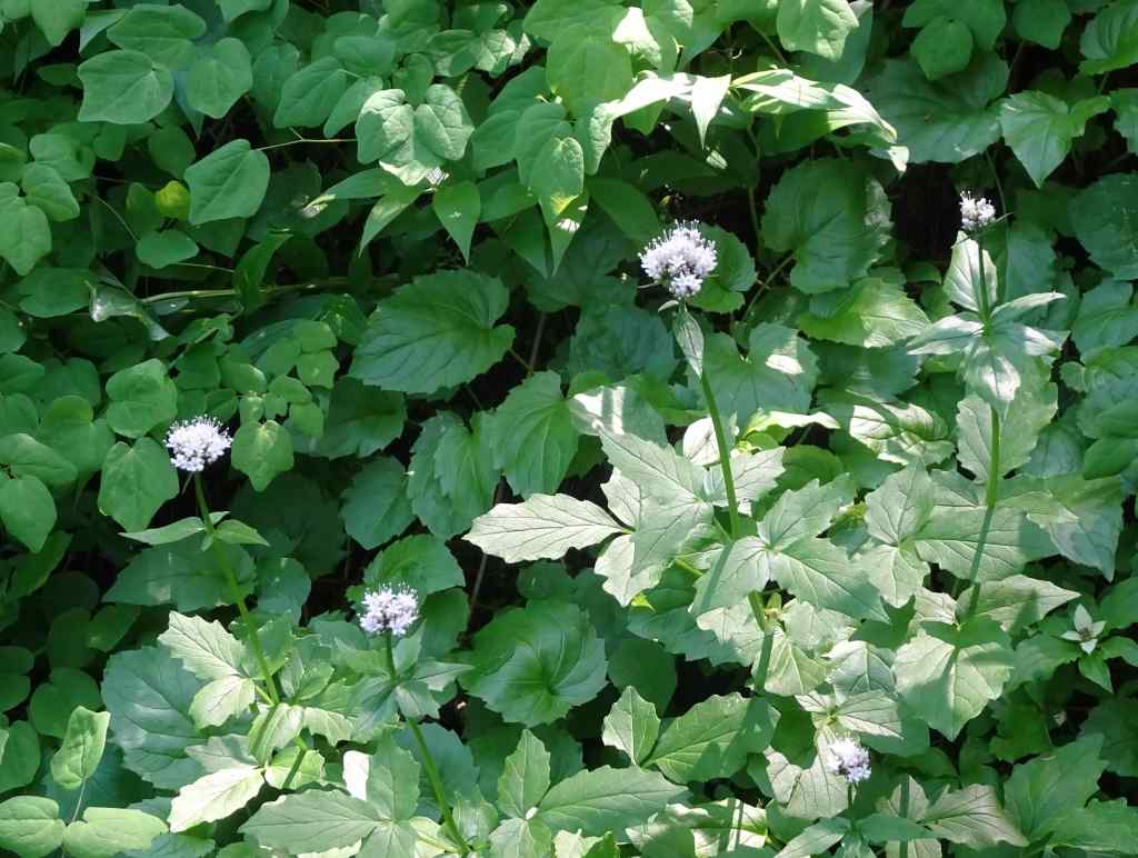
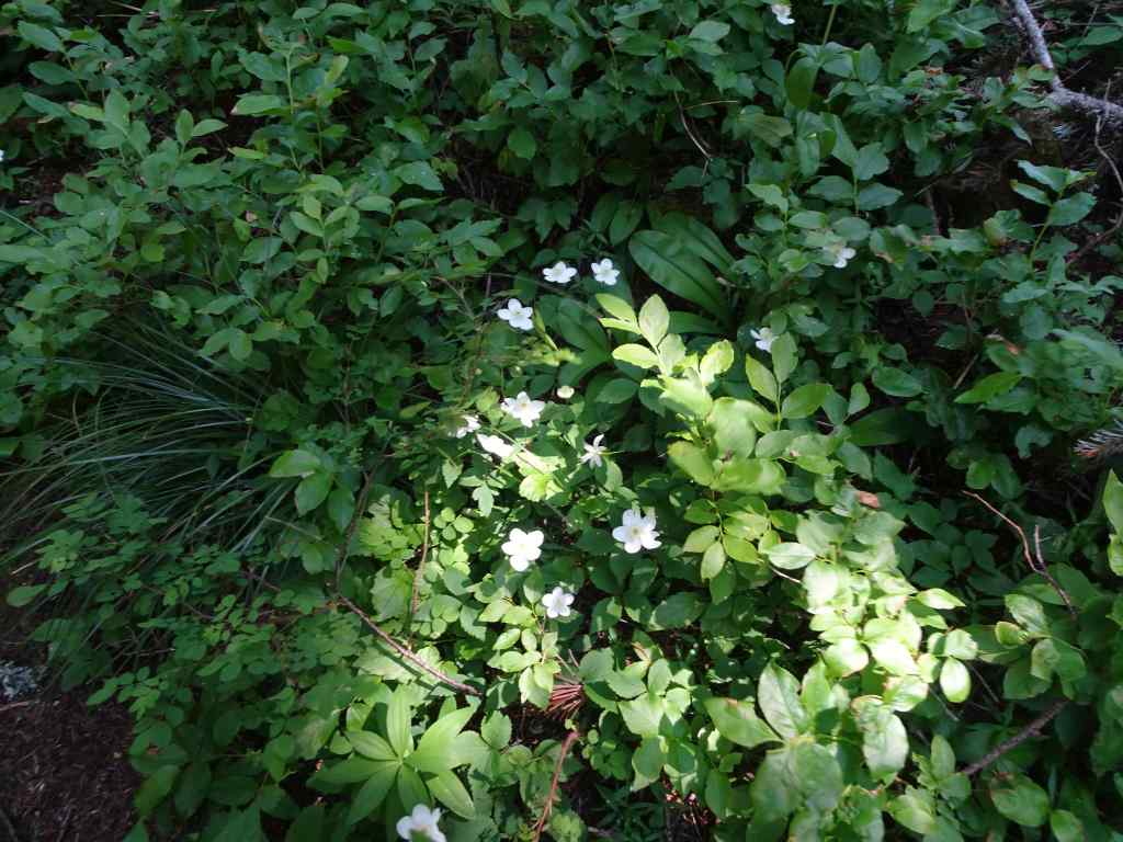
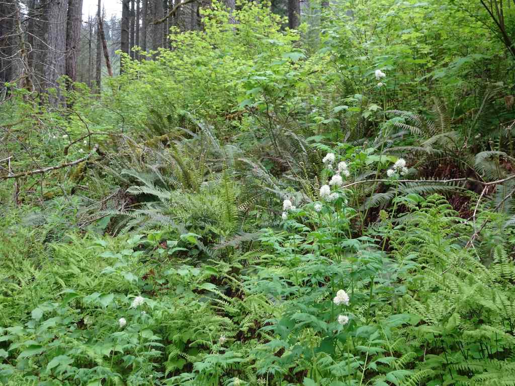
We hiked again where we have hiked before, through the lush wildflower meadows on the southern slopes of Mt Adams, on the Yakama Nation Tract D. We started at Bird Lake, and went counterclockwise uphill to the Hell Roaring Viewpoint of Mt Adams, then down along the Round the Mountain Trail and back to the lake (~5.5 miles, 1000 feet). We saw wildflowers, waterfalls, and some views through the burned forest, on a day when we only had fleeting glimpses of the mountain itself. The wildflower meadows were ‘beyond category’ today, and I took a lot of pictures!
Lower trail, from Bird Lake to Bluff Lake:
Bird Lake. Mountain not out, but pretty reflections in the lake.Partridgefoot and lupine on the lower trail.Asters under the burned trees.A frog in one of the stream crossings.Monkeyflower, lupine, lovageFireweed and false hellebore.Heather and magenta paintbrush.Bluff Lake
Next, continuing uphill to the Round the Mountain Trail:
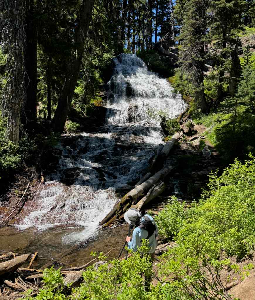
BuckwheatMagenta paintbrush, lovage and lupineSpireaMossy waterfallUp the cliffs, with mariposa liliesMore meadowsBrilliant bouquets all along the trail…Staircase Falls, just below the Round the Mountain Trail.
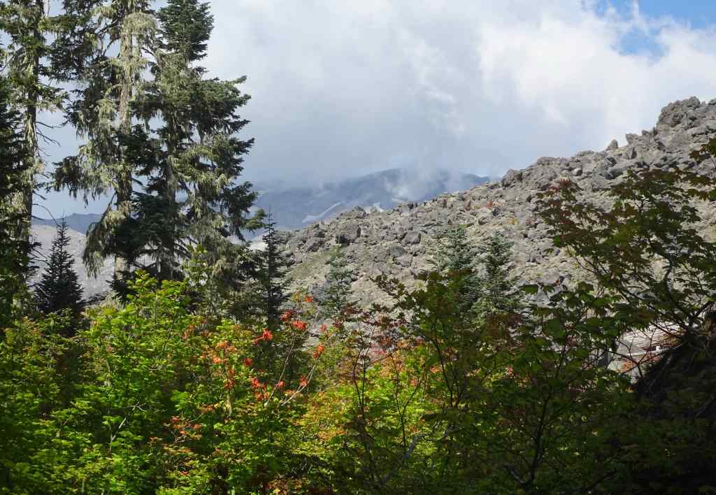
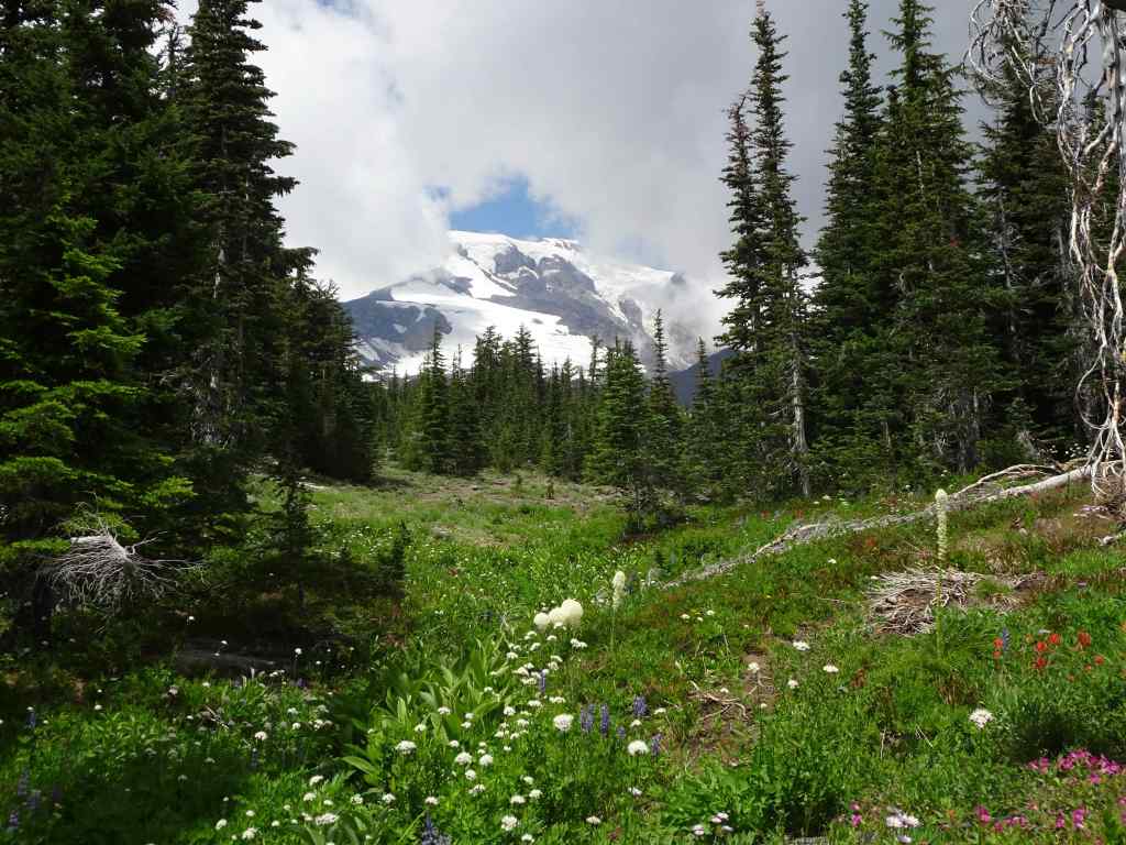
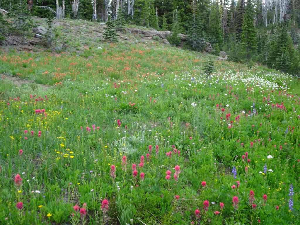
And continuing above the Round the Mountain Trail, on the Trail of Flowers, we finally had a glimpse of Mt Adams from under the clouds.
Mt Adams, with cloud cover.Closer viewBracted lousewort, with more magenta paintbrush and lupineA watchful treePhloxA brief view of the summit of Mt Adams.Orange paintbrush, yellow ‘daisies’ of some sort, and white sitka valerian.And another view of Mt Adams as we hiked up to the next rock ledge.
The ledge along the upper Trail of Flowers Loop provides a view to the landscape to the south.
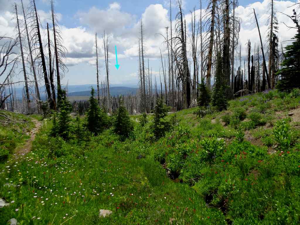
Looking south toward Oregon – blue arrow pointing to the smoke plume from the Burdoin Fire.Closer view of the Burdoin Fire smoke plume.And a wider view across the southern flanks of Mt Adams, and its ghostly forest, burned several times in the past twenty years.
We continued upward through more meadows to the Hellroaring Viewpoint…
Mt Adams on view from the upward trailSandwort and mariposa liliesHellroaring Viewpoint – top of the mountain back under the clouds.Mazama Glacier Hellroaring Falls
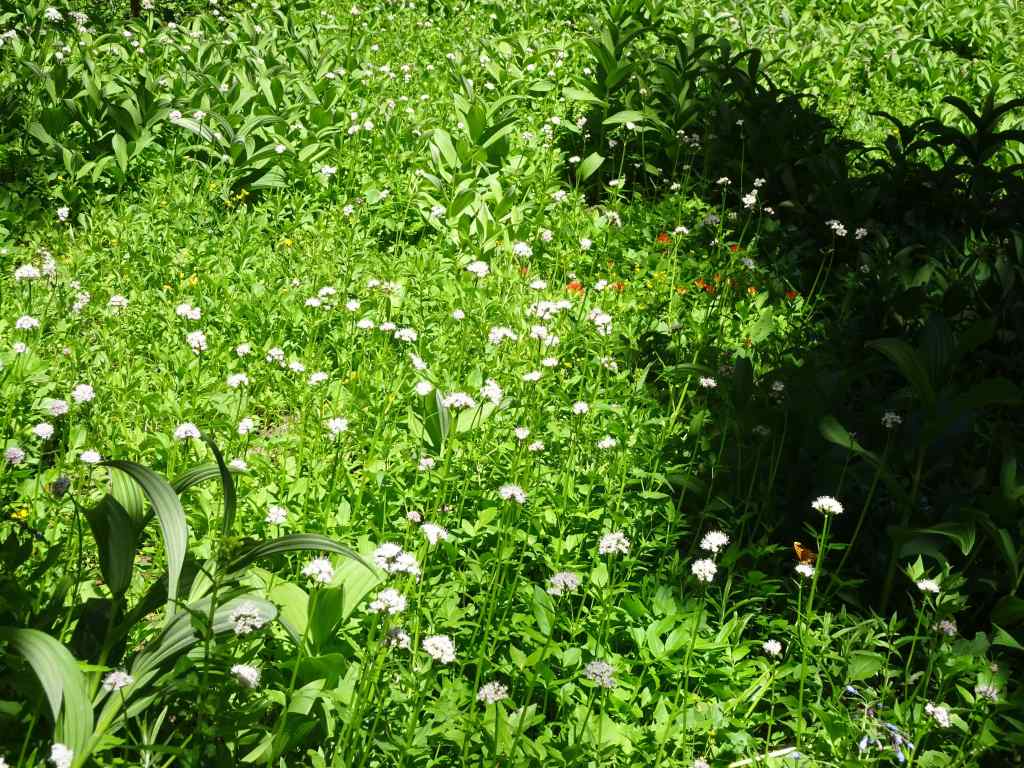
We retraced the trail back to the Trail of Flowers, then down to the Round the Mountain Trail, and continued westward through numerous meadows divided by small creeks that are all branches of Bird Creek.
Every kind of flower in these meadowsEasy walking,Another brief glimpse of Mt AdamsAnd more meadowsAll the flowers!A pondAnd more meadows! Next we crossed a slight rise, and then descended to our start point, by going down the Crooked Creek drainage…More meadows on the downward trail…This slope along Crooked Creek was so colorful!More color!Approaching Crooked Creek FallsCrooked Creek Falls
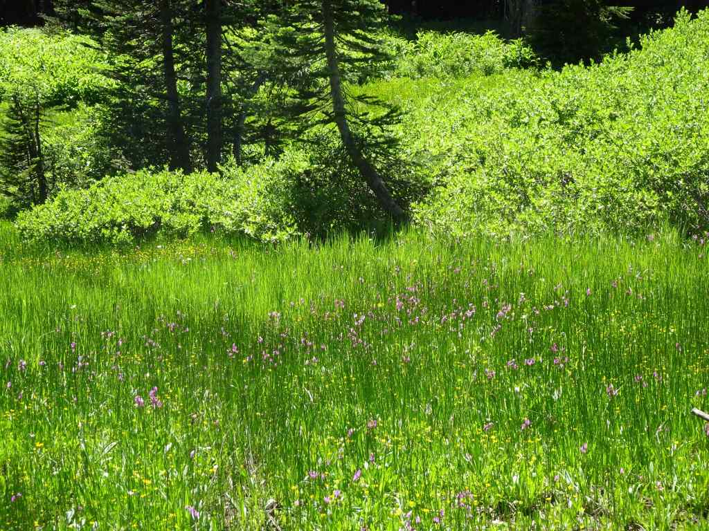
The slopes below Crooked Creek Falls are heavily burned, but the creeks are still colorful with flowers…
Monkey flower, lupine, Sitka valerian, paintbrush
And back to Bird Lake…
Back to Bird Lake, partial view of Mt Adams this afternoon.Meanwhile, dark clouds formed a backdrop for these glowing ghost treesAnd a last view of Mt Adams from the gravel road down.
It was a “wildflower bathing” day on the slopes of Mount Adams!
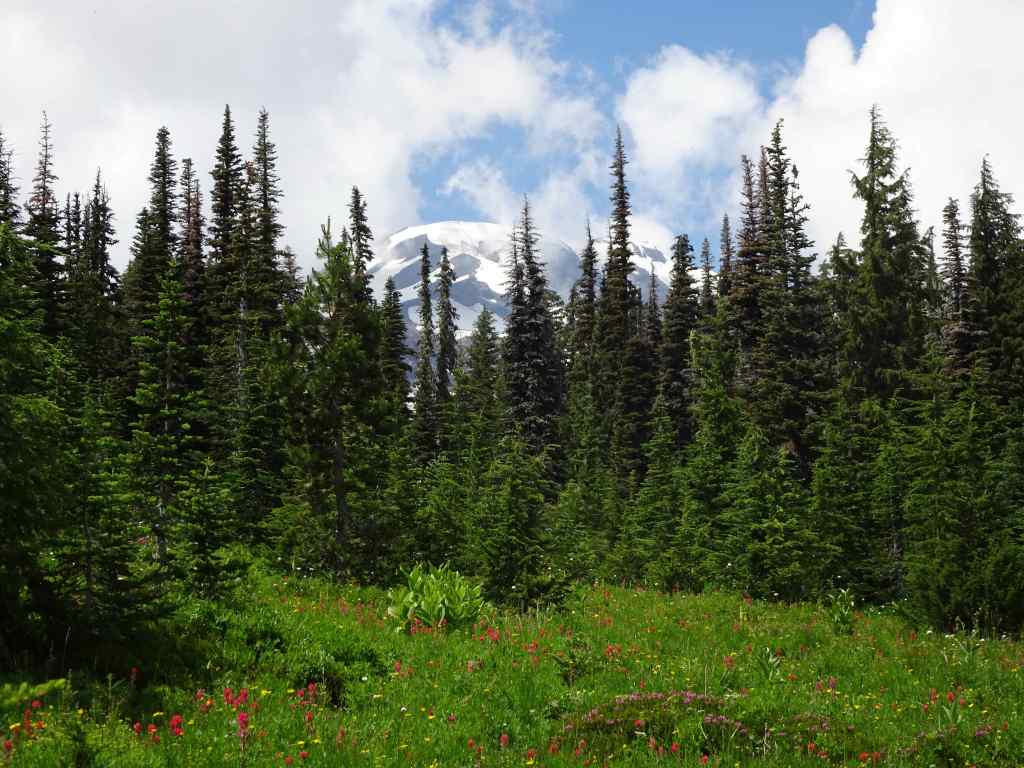
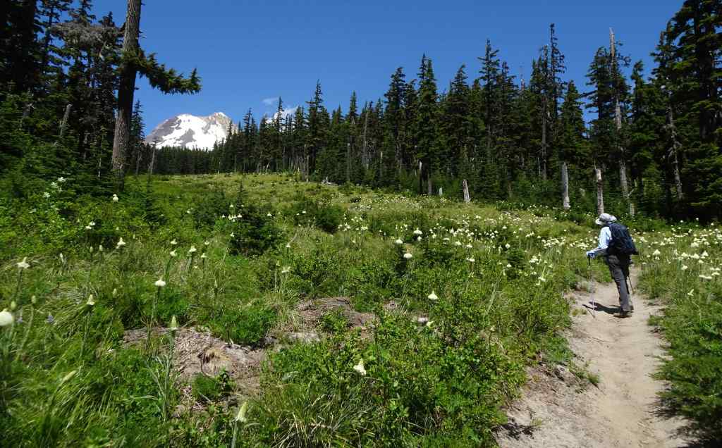
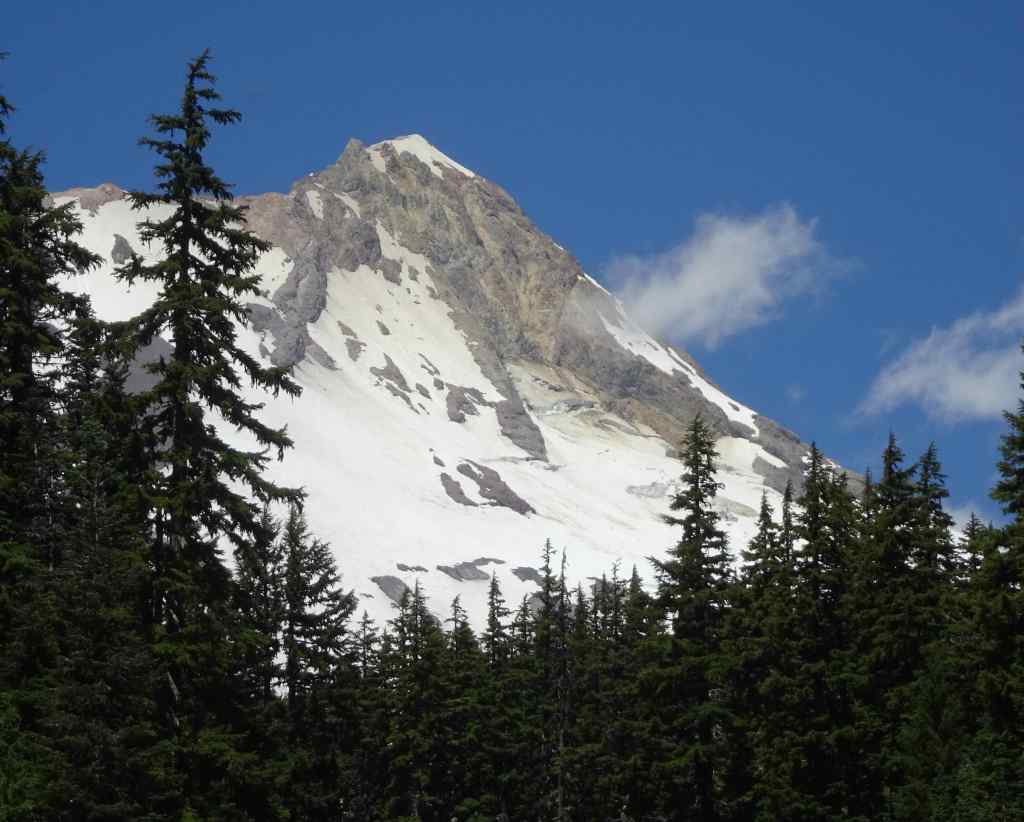
Of our five hikes in July, three were on or near Mt Hood.
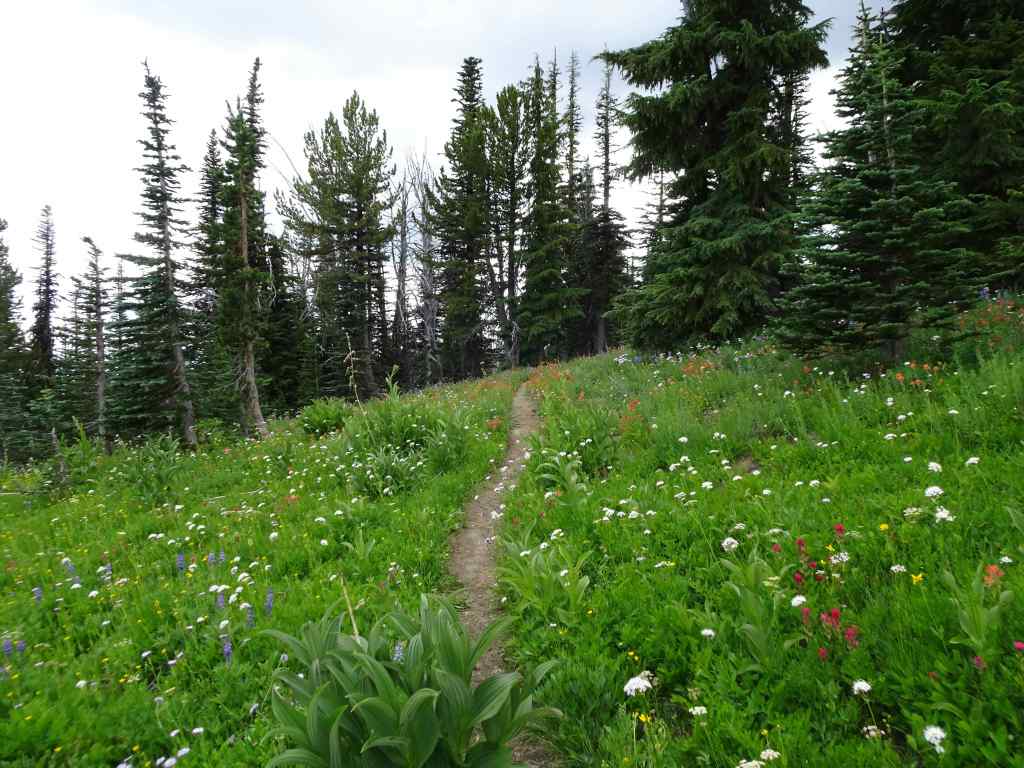
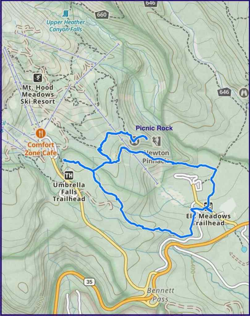
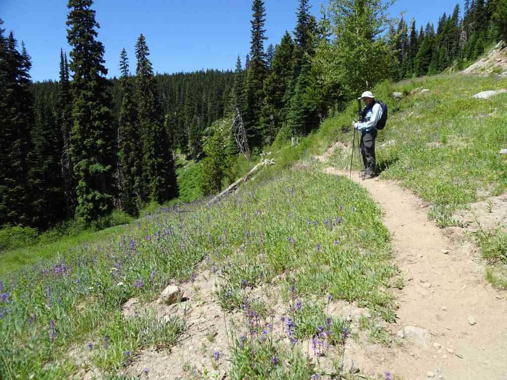
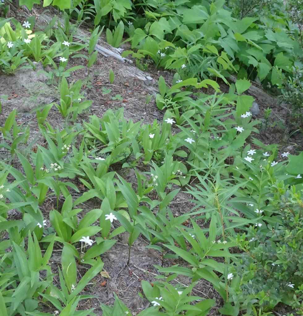
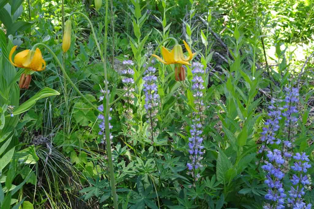
7/3 – Picnic Rock and Umbrella Falls
This hike begins at the Elk Meadows trailhead. We walked uphill along flower-filled ski runs of Mt Hood Meadows, and across to the knob called Picnic Rock. We visited Umbrella Falls, then circled downhill through flower-filled forest to complete the loop.
Trail map, about 6 miles, 1000 feet elevation.
Flowers along the uphill trail…
Uphill meadows – penstemon and lupineWashington liliesBead lilies and Solomon sealLupine and tiger liliesMarsh marigoldTrillium and violetsPaintbrush and Elephant’s head
This was a blooming bear grass year in the ski run slopes, with a view of Mt Hood
Bear grass, Mt HoodMt Hood close up.
At Picnic Rock we had great views…
Ascending Picnic Rock – Mt Jefferson off to the right.Closer look at Mt Jefferson and more Cascade Peaks to the south.Looking east toward Bluegrass Ridge (burned in 2006), above Elk Meadows.West toward Mt Hood and Clark Creek.Clark Creek.Stonecrop on Picnic Rock.Penstemon clinging to the face of Picnic Rock.
We passed back through the bear grass meadows on our way to Umbrella Falls.
Bear grass meadows and Mt Hood.Umbrella Falls
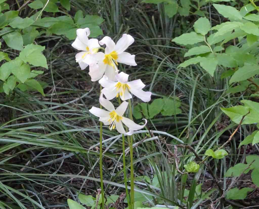
On the downhill trail, we passed through meadows full of sitka valerian, and swampy areas full of shooting stars and buttercups. Once in the forest, the Oregon anemones were sparkling up in abundance.
This was only my second time doing this hike, but it has become a favorite! Especially at this particular time in the bloom season. I hope to be back to explore some of the other trails in the Mt Hood Meadows area.
7/10 – Lookout Mountain
The next week, we hiked the short, sweet (3 miles, 550 feet) loop to Lookout Mountain from High Prairie trailhead. We have done this one many times, and it never gets old! The lower part of the trail crosses a couple of large meadows.
Shooting stars, buttercups and bistort at the High Prairie Trailhead.Subalpine fleabaneElephant’s head, buttercups and astersAnd a view to Mt Adams.
Eventually, we ascended to the ridge where views opened up…
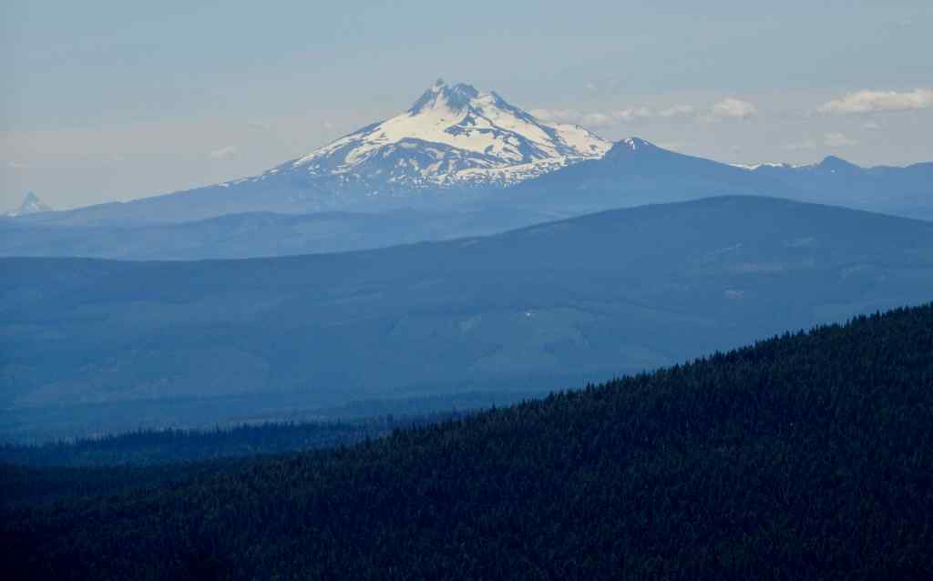
Mt Hood ahead, with paintbrush, scarlet gillia, and lupine.Full view of the mountainClose up of the southern flank, where we were hiking last week near Mt Hood Meadows.The summitCooper Spur, and the Eliot Glacier, near where we will hike at the end of the month.A last snow bank on the approach trail.Mt Hood from the top of Lookout Mountain.Mt Jefferson and the other Cascade Mountains to the south, with ground squirrel.Mt Jefferson and Mt Washington
Lots of wildflowers to look at here, as well…
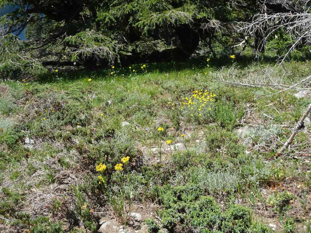
The summit slope has tufts of wildflowers.Sulphurous buckwheat, transitioning from red-orange to yellow.Penstemon and buckwheatDusty maidenAnd a rock wren
More views on the return trail…
The iconic volcanic spire, with Mt Hood beyond,And back through the lower meadows.
The main challenge for this hike is the slow bumpy road up to the 6000 foot trailhead.
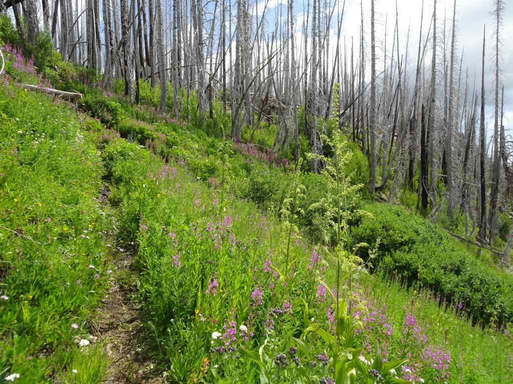
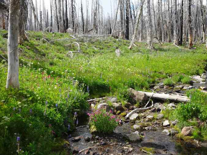
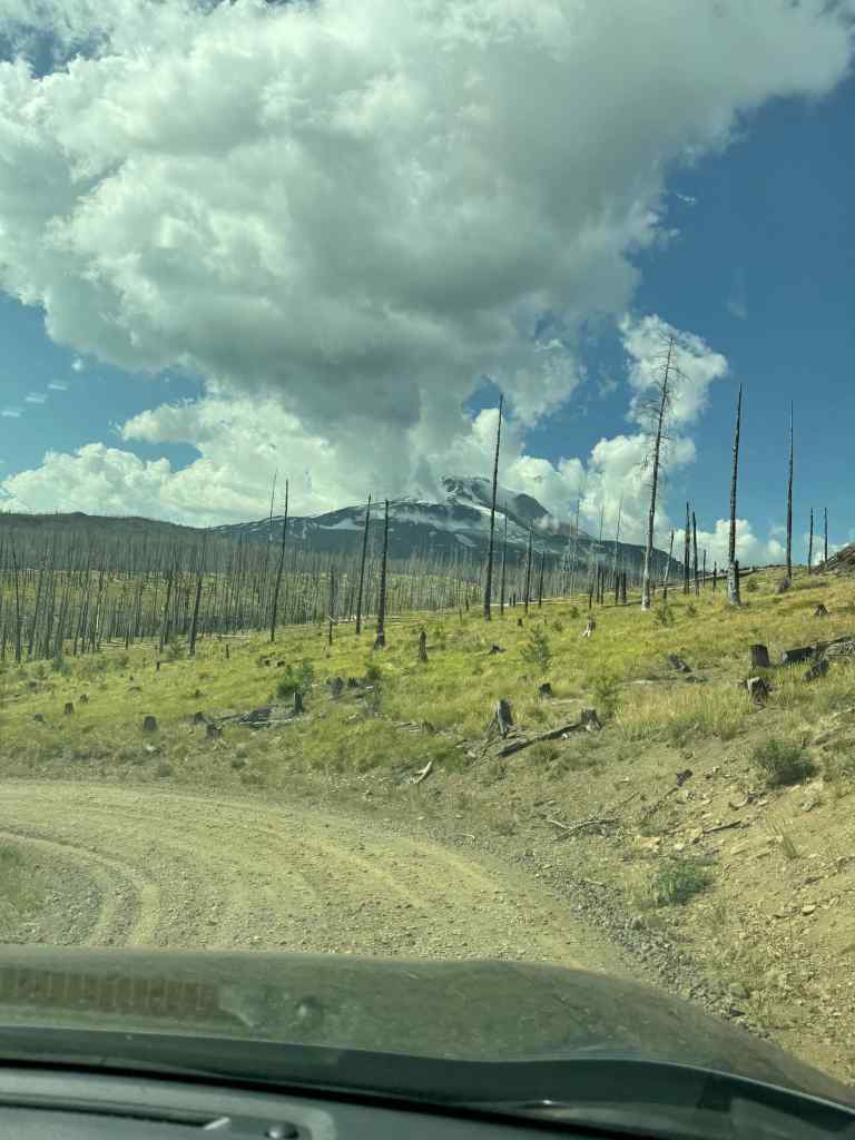
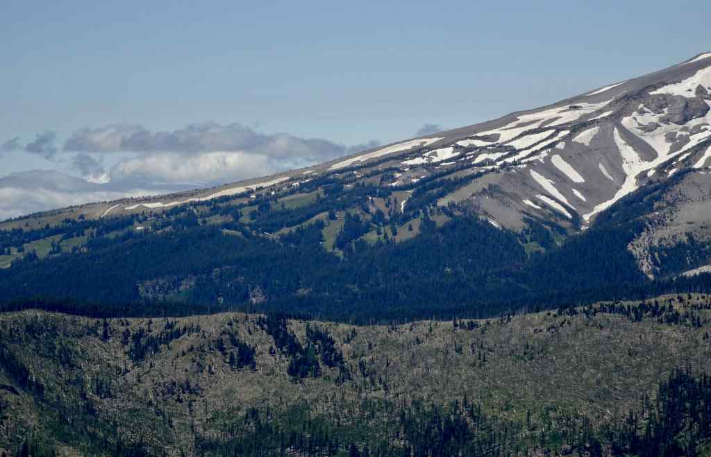
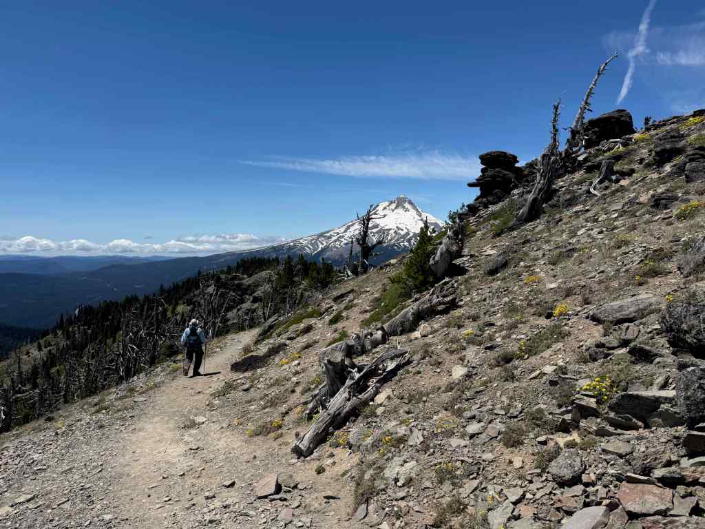
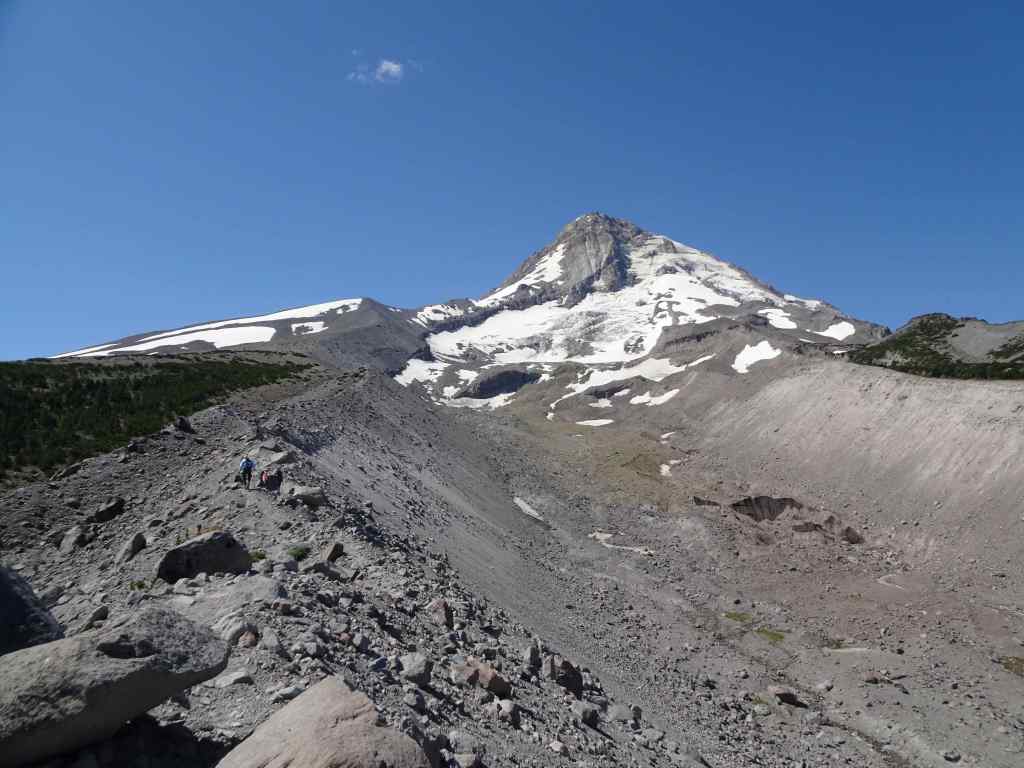
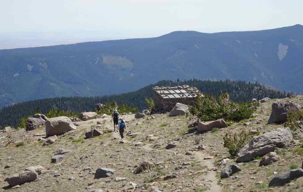
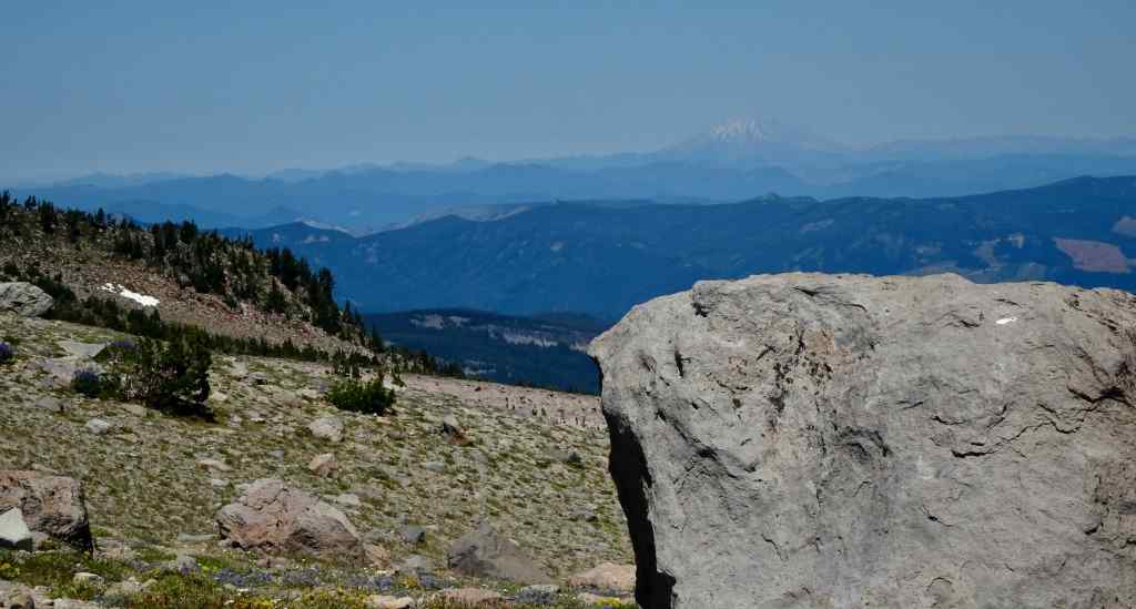
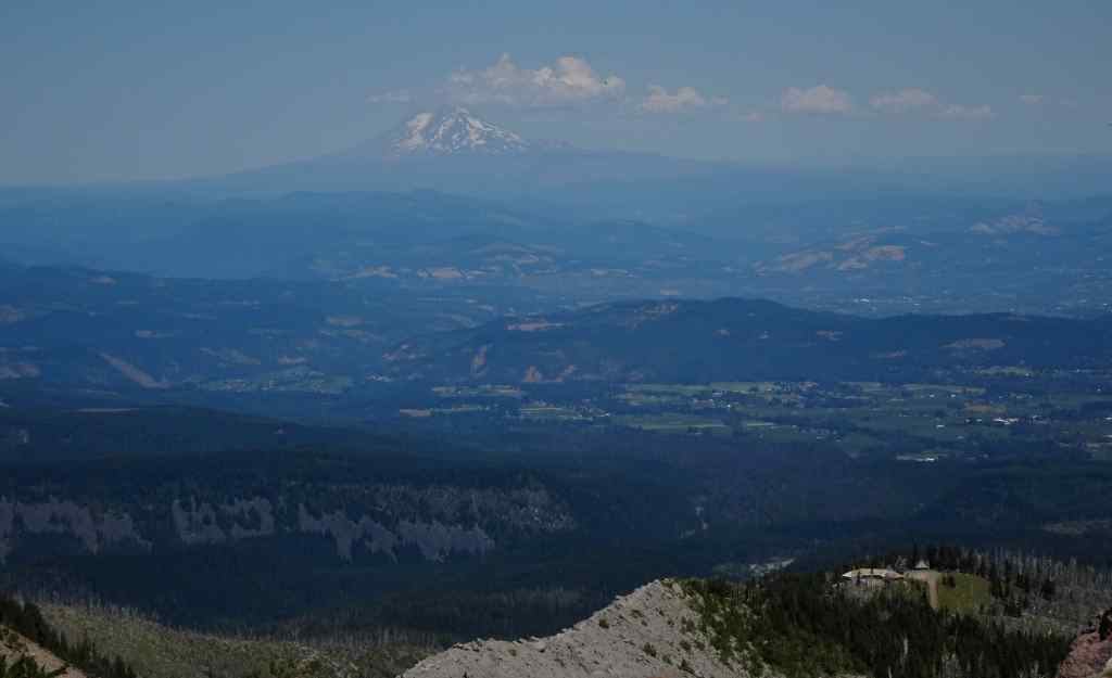
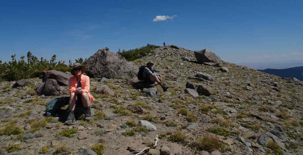
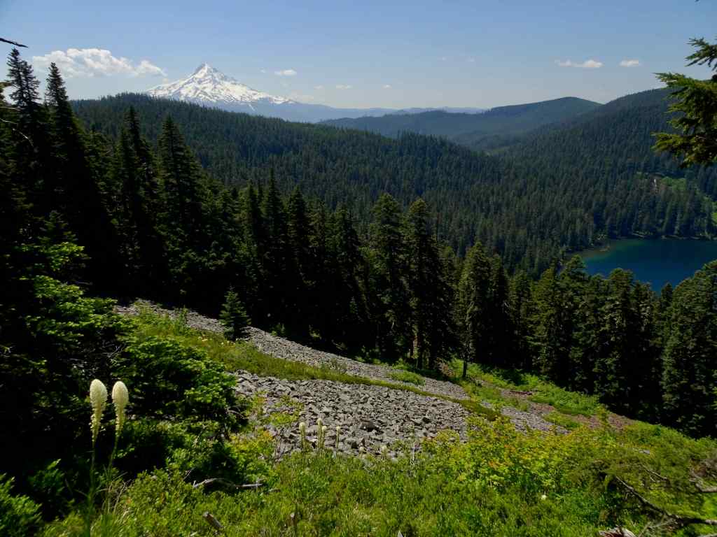
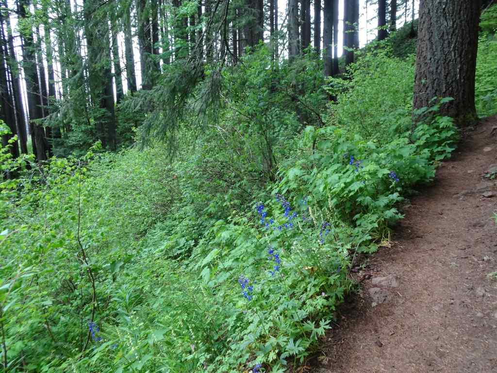
7/10 – Cloud Cap Shelter and Timberline Trail High Point via the East Eliot Moraine.
This long favorite hike also begins with a long bumpy drive up gravel switchbacks, and through a burned ghost forest. From the Cloud Cap Saddle Campground we hiked about up along the crest of the East Eliot Moraine to the Cloud Cap Shelter for lunch. Then we continued south along the Timberline Trail, the high point, about 7300′, for a total of about 5 miles, 1500 feet.
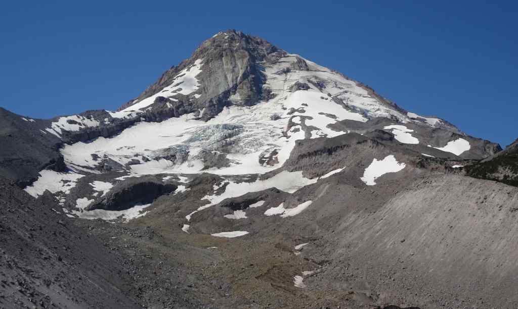
From the crest of East Eliot Moraine, our trail goes up hill toward the Eliot Glacier.Eliot Glacier Glacier close upCrevasses
We crossed south toward the Cloud Cap Shelter for our lunch break.
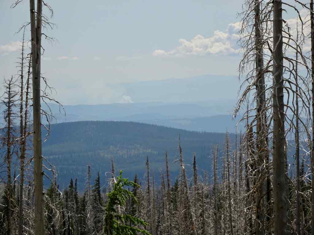
Approaching the Cloud Cap Shelter.Lunch view of Mt St Helens through the haze.Also, Mt Adams to the north, beyond the Hood River Valley; and Cloud Cap Inn, near our trailhead, on lower near right.Cloud Cap Shelter; Cooper Spur and Mt Hood beyond.
After enjoying a good rest rest in the shade at the shelter, as it was a hot day, and I was having trouble with the uphillness of it all, we decided to continue on to the trail high point.
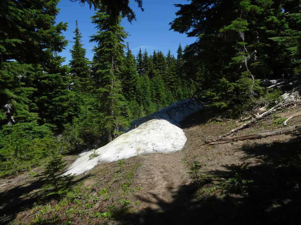
We crossed a few snow banks in the shaded wrinkles of the mountain.Timberline Trail High Point.
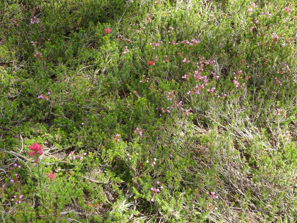
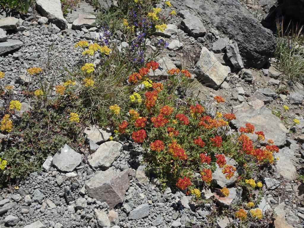
Then we retraced our steps, back along the seemingly barren slopes, with lots of subalpine flowers blooming amid the rocks.
Our trail carved out of the edge of the sky.Tufts of yarrow and buckwheat on the slopes.Yarrow and lupineA last look back at the snow banksPussypawsPenstemon and astersPartridgefoot and Mt Hood.
As we walked the Timberline Trail beneath the Eliot Moraine, I spotted the giant teetering boulder that I have noticed in previous years. It’s still there…
Teetering boulder on the edge of the Eliot MoraineTeetering boulderLewis monkey flowers, asters, and lupine in Tilly Jane Creek, almost back to the trailhead.
Another enjoyable day on Mt Hood. I was really out of shape this year – life circumstances have interrupted my spring hike season. This hike, which I have done easily before, was hard! I hope I will be in better shape for the next time!
Next..
Our other July hikes were on Mt Adams, and at the Oregon Coast – to be reported in the next posts.
Having been out of town for two weeks in southern Utah where it was too hot to walk outside or exercise, and I was otherwise engaged in helping a family member with a health care situation; Having returned, exhausted, and happy to be in my own home quietly for a couple of days; Having successfully taken a couple of slow neighborhood walks in the flatlands…
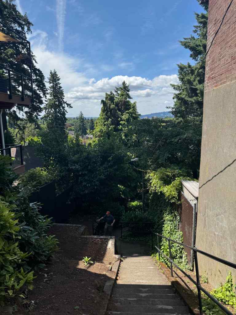
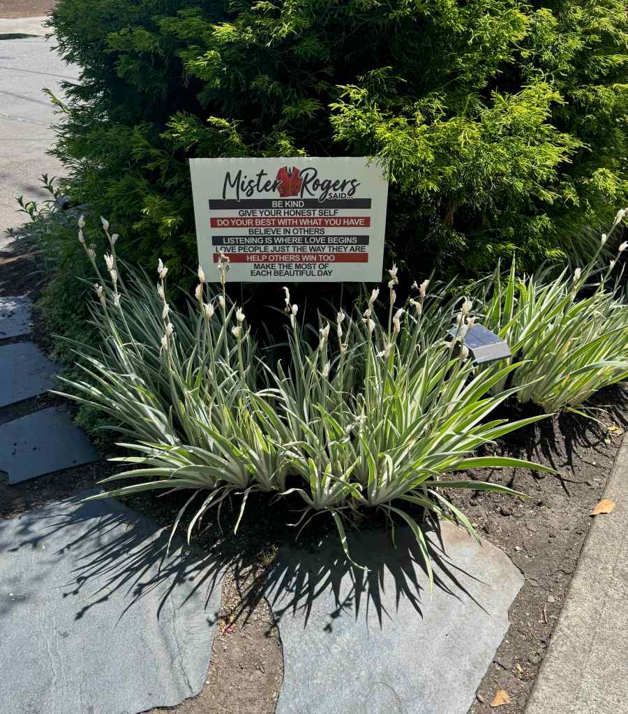
Today I felt I had the energy to walk up to Alameda Ridge and do a few stair repeats. Success! And once again, I am charmed by my neighborhood where I am so lucky to live. Front yards are in bloom and colorful; and today it is only in the mid60s; how lovely to be able to walk outside without being dried and desiccated by the sun. I lived seven years in Tucson, I know dry heat; I knew my survival strategies then. The two weeks of abrupt immersion in the heat and aridity in Utah were exhausting; but now I am recovering. Soon I will be walking in mountains again.
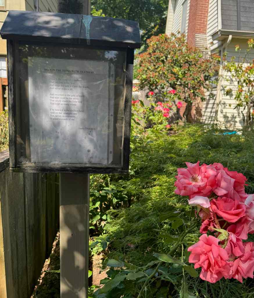
Today I walked my way up the hill, and noticed all the whimsy throughout my neighborhood. It is part of the keep Portland weird vibe. Little doors on trees, little houses under bushes, interesting little signs painted on the sidewalk stair cases of Alameda. Little free libraries throughout my neighborhood.
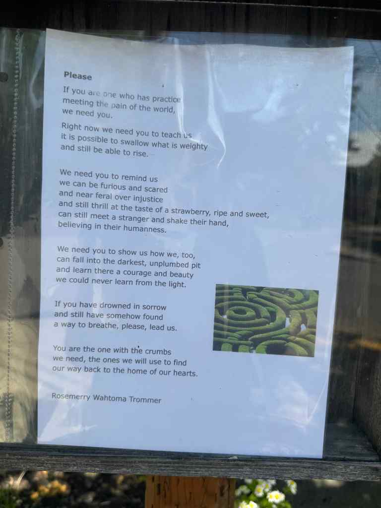
I also looked at each poetry post – today there was Emily Dickinson‘s, ‘Hope is a thing with feathers’, on one signpost. My favorite poetry post, the one I never miss if I am up in that neighborhood, had a very hopeful, expressive poem today for these terrible times we are living in, with the authoritarian effort to crush anything progressive, kind, diverse, multicultural, and human in our country.
Also up on the ridge today, there is that one house with a flagpole – today they were flying three flags, the Pride flag, the Juneteenth flag, which I had never seen before, and the Ukrainian flag.
How positive those signs are to me just wandering my way through the neighborhood on a beautiful early summer day with flowers blooming everywhere. Birdfeeders and gnome doors and buckets of water on offer for the dogs; signs and flags and symbols of inclusion and acceptance and community. Our quiet mostly white, mostly financially stable neighborhood is not in the firing line of ICE raids, but I have seen my neighbors going to the demonstrations and standing in the space to support the resistance.
I did a few stairway repeats on the ridge today – and now I am ready for our next hike of the week in the mountains.
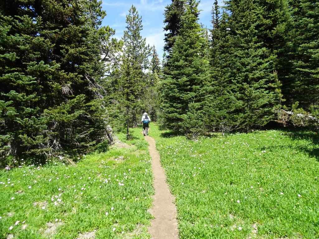
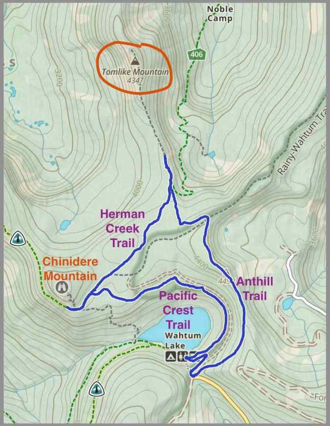
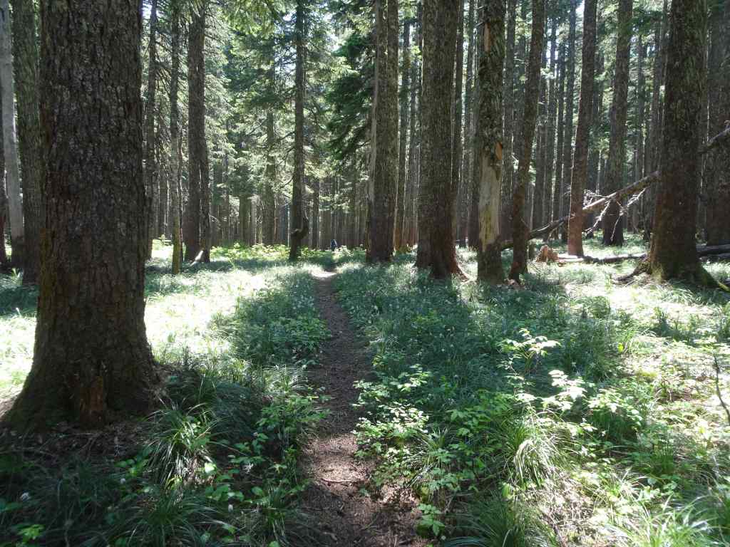
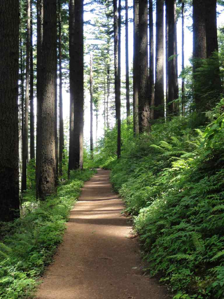
June 24, 2025 – Anthill, Herman Creek and Pacific Crest Trails near Wahtum Lake, Oregon
We usually hike to Chinidere Mountain from this trailhead near Wahtum Lake, but I was curious to try the Anthill Trail toward Tomlike Mountain, which is another rocky peak in the area.
Trail map – about 6 miles and 800 feet elevation gain.
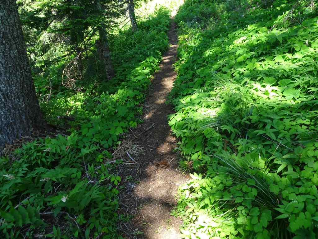
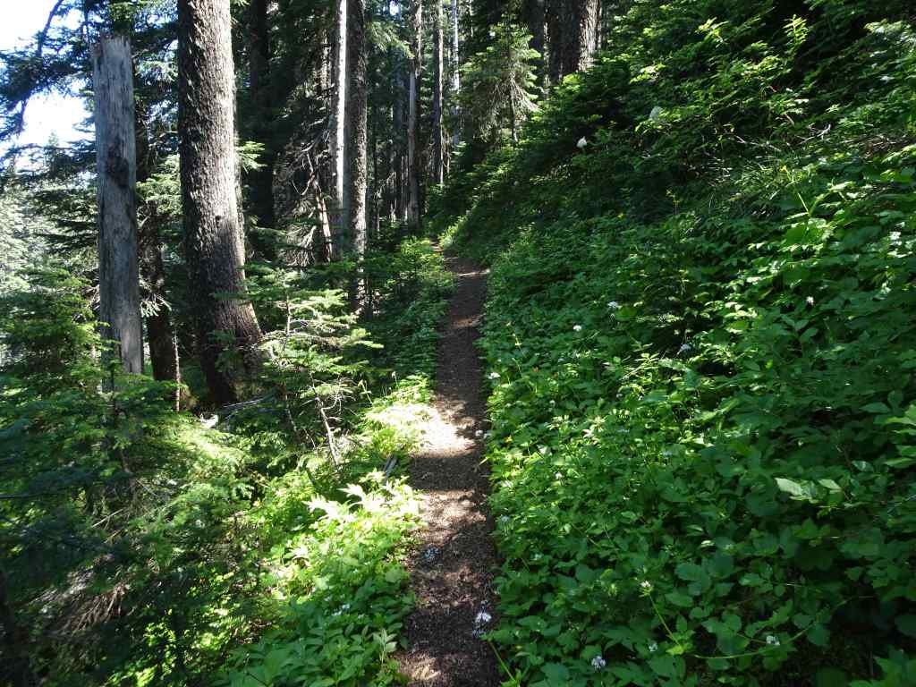
The Anthill Trail begins above the parking area, and continues upward at a gentle gradient along the ridge above the lake. It is beautifully shaded, and on this June day, all the white flowers of the forest floor were sparkling up at us. This is a new addition to my list of favorite trails.
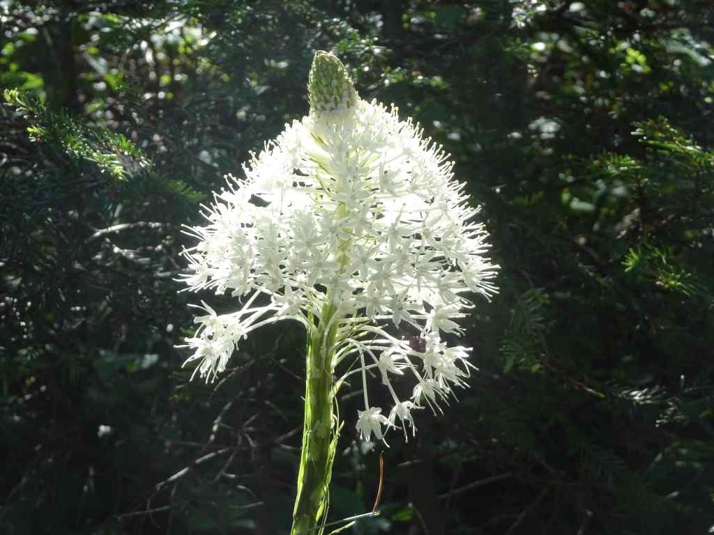
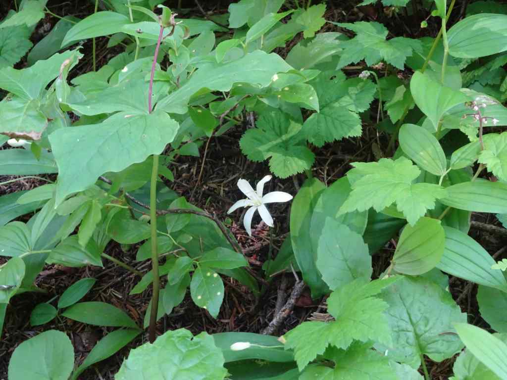
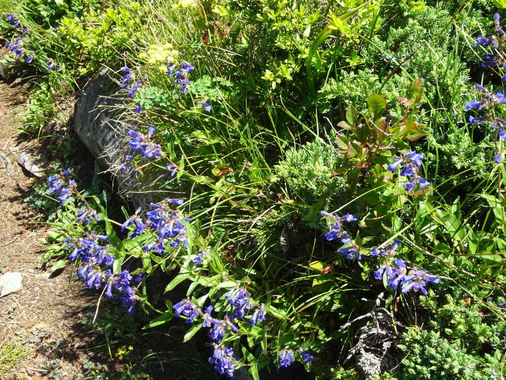
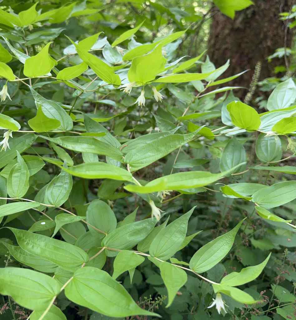
Beargrass along the trail as we start uphill.Green forest floor with so many flowers the entire way. Lots of vanilla leaf in this section.BunchberryStarry solomon sealBleeding heartAvalanche liliesBeargrassRosy twisted stalkContinuing shaded trail with prolific Sitka valerianQueen cup lilies just beginning to openSitka ValerianWindflowers
Near the ridge crest, a rocky view opened up, back to Mt Hood and Wahtum Lake.
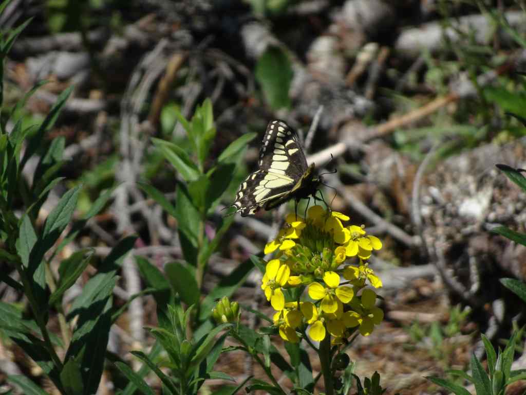
View to Mt Hood and Wahtum Lake, with beargrassYellow flowers on the sunny open slope – arnica, groundsel, Oregon sunshine and wallflowersSwallowtail butterfly on a wallflower
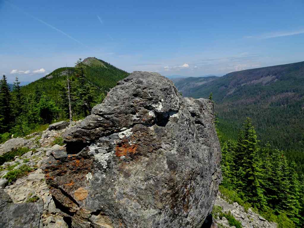
We continued along the Anthill Trail, to the spur that ascends Tomlike Mountain. This is a less well maintained trail, a little rockier. After eating lunch at a rocky viewpoint and admiring the view, we decided begin our return hike. It was another rocky mile to the top – I wasn’t quite ready for that today.
Rocky outcrop, and view to the top of Tomlike Mountain.Glimpse of Mt Adams to the northPenstemon on Tomlike Ridge
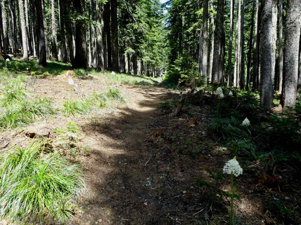
We decided to walk along the Herman Creek Trail toward Chinidere Mountain before returning to the trailhead. We walked through shady forest for least a half mile of blooming avalanche lilies, as far as one could see, across the forest floor. And a few beargrass as well.
Avalanche liliesAs far as the eye can seeShady forest with liliesAnd beargrass
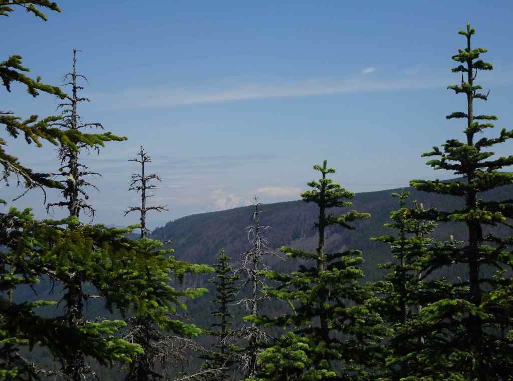
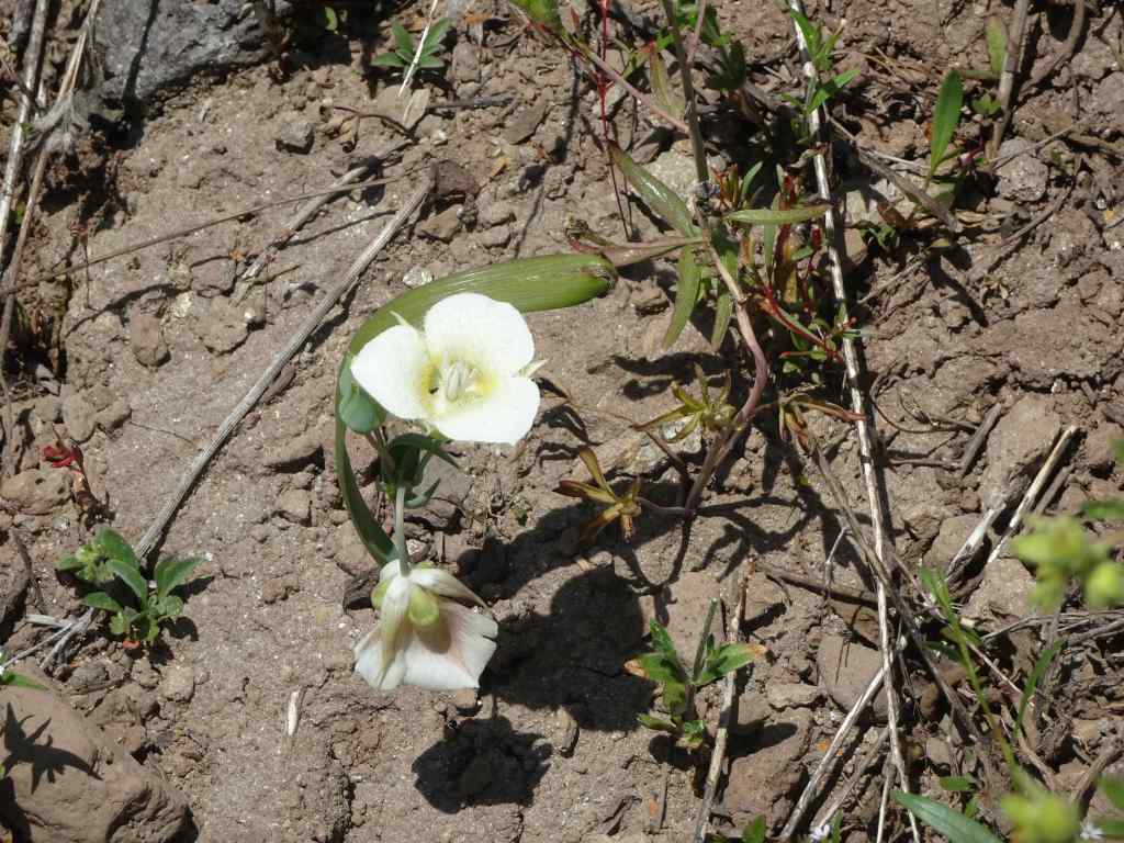
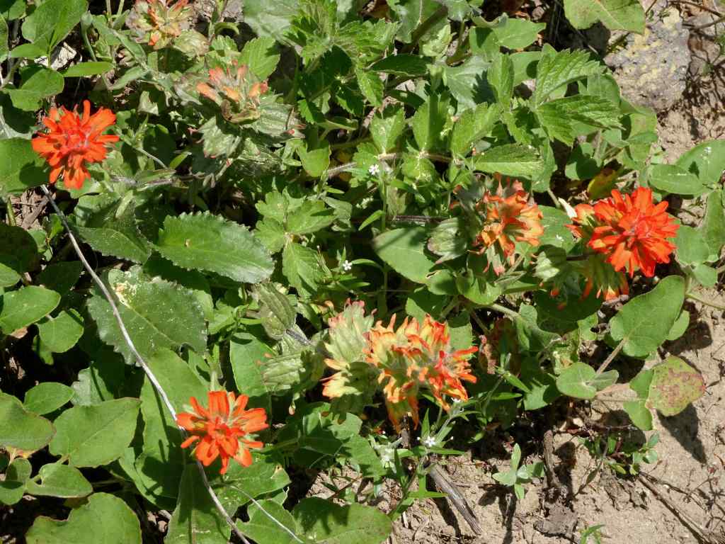
My husband took the side trail to the top of Chinidere Mountain, while I continued a very short distance along the Pacific Crest Trail to the rocky open slope below Chinidere’s cliff side. From here I could see many of the sunny blooming cliff flowers above me, and a view back to Mt Hood the other way. Then I rested in the shade near the trail junction – it was beautiful and quiet in the forest!
Looking up at the cliff side of Chinidere MountainMariposa lilyPaintbrushBuckwheat and columbineChickweed and phloxMt Hood
We completed our circuit by descending along the Pacific Crest Trail above the lake.
Bunchberry and coral root were prolific along our return trail.
This had been a thoroughly enjoyable hike. We had seen some of the wildflowers blooms at their best, though there are more to come. It was lovely to be back in the woods!
We went on five hikes in May, all in the Columbia River Gorge, following the wildflower bloom…
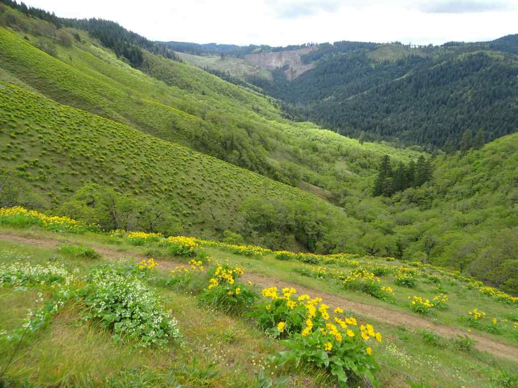
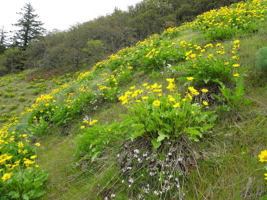
May 6 – Lyle Cherry Orchard, WA
Warm and a bit windy today – we got a chance to see the waning balsam root – everyone’s favorite!
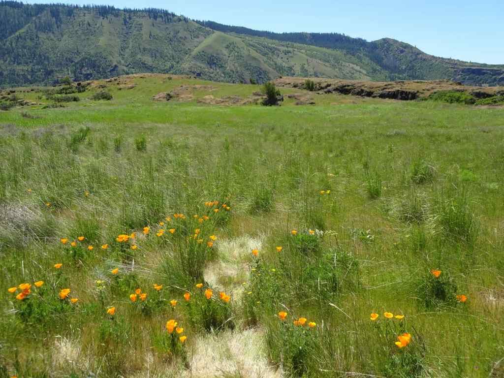
Purple ookow blooming on the Convict Road.Ookow and the seedpods of Columbia desert parsleySwales of lupine on the middle plateauThe last of the yellow balsam rootA poppy patch.
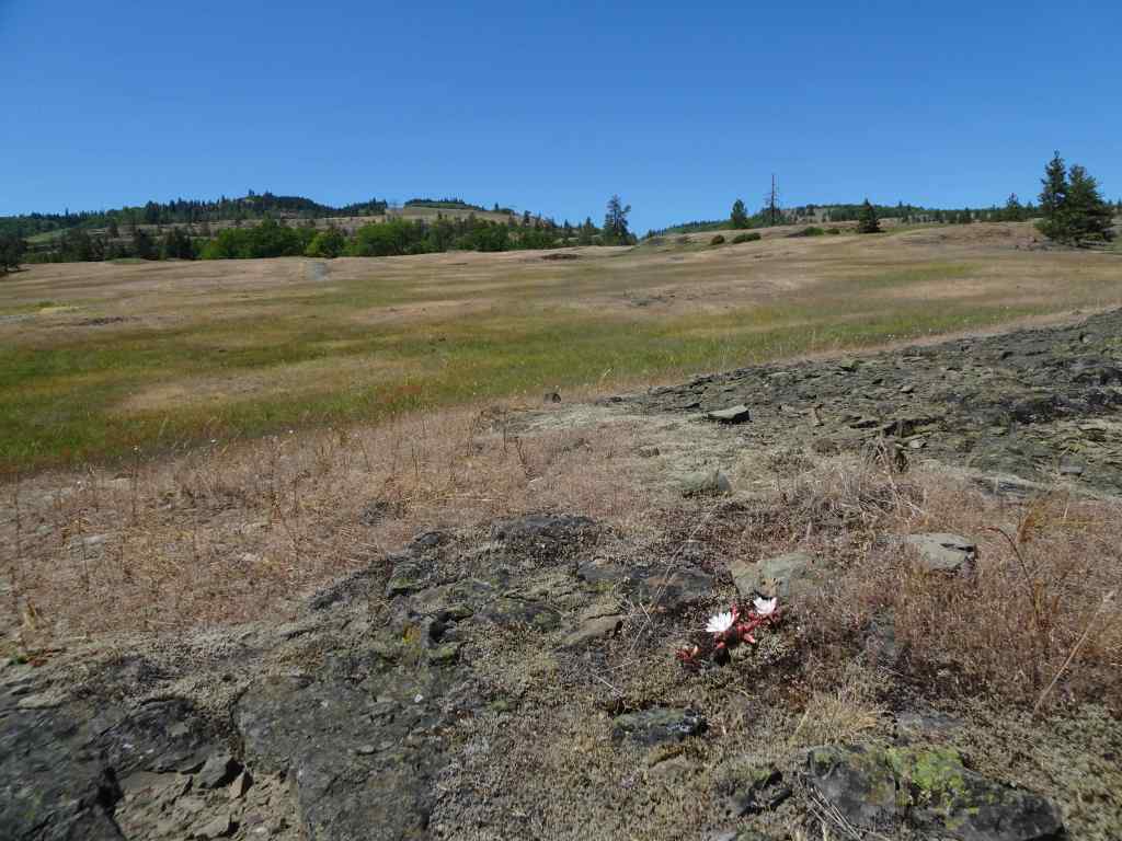
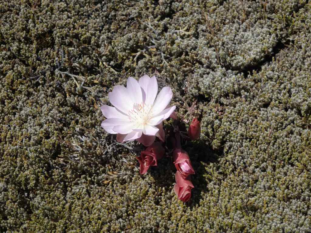
On our drive home, we stopped briefly at the Catherine Creek Trailhead so I could get a peek at the bitterroot that blooms there – probably my only chance this season.
And there it was, on the rocky outcrop just above the parking lot.Lewisia rediviva, bitterroot – one of my all time favorites!
May 10 – Cape Horn, WA
Tall larkspur season at Cape Horn – it is always a treat to walk on the neatly groomed trails here. Today we started at Strunk Road, and walked to one of the lower overlooks – less than two miles, but with rain in the forecast for the next few days, we took our opportunity.
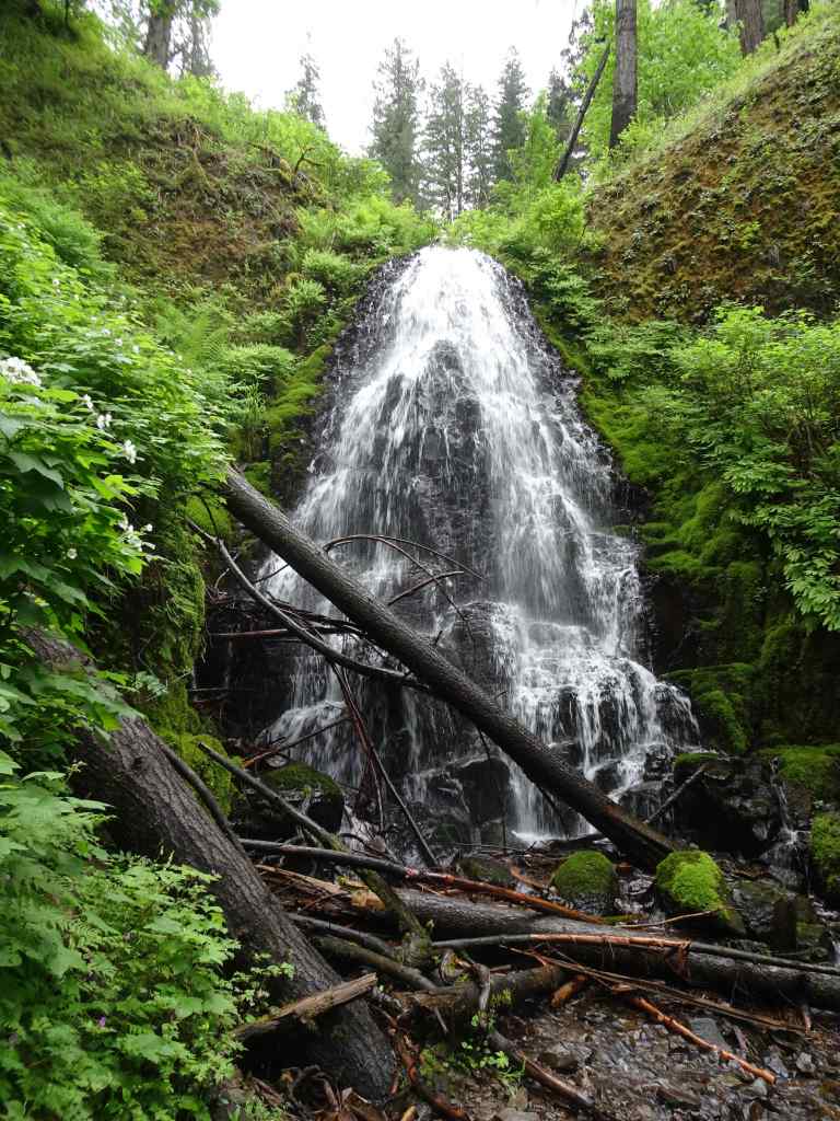
Tall larkspur along the pathCloser viewWhite fringe cup and candy flower also prolific today.Nancy Russell Overlook – we stop to look at the view and say, “Thank you!” to Nancy Russell for her conservation work.Up river view toward Beacon Rock.Continuing downward, the purple path continues…And the fringe cup…A few other flowers tucked in – Hooker’s fairy bells,Fern leaf biscuitroot,and vanilla leaf.
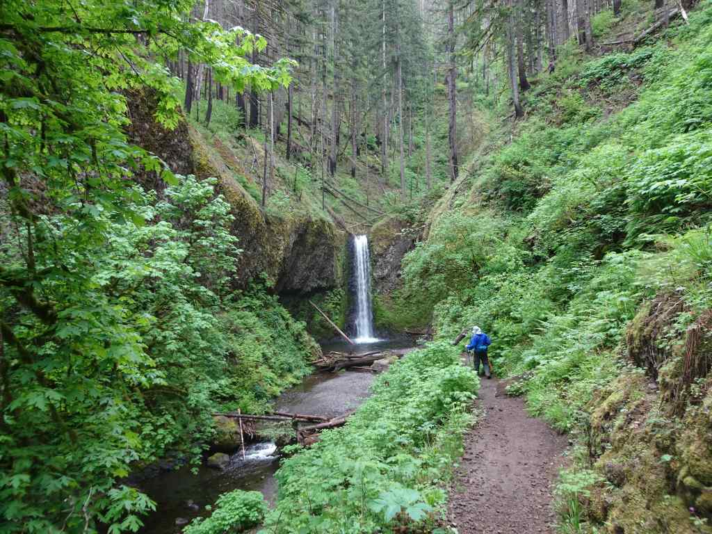
May 13 – Wahkeena-Multnomah Loop, OR
Back again to this five mile long, 1500 foot loop.
We began at Multnomah Falls, and started west along the old highway toward Wahkeena Falls.After passing Wahkeena Falls, the trail ascends up many wildflower-filled switchbacks,to Lemmon’s Viewpoint, overlooking the Columbia River.Continuing up Wahkeena Creek, past Fairy Falls,passing more wildflowers along the way. Columbia windflowers, and salalBaneberryA few fading trilliumLarkspur and fringe cup
After a lunch break at the trail junction, we walked eastward toward Multnomah Creek. This part of the trail has always felt rather magical to me – mostly flat, through a forest of tall firs. The undergrowth has changed a bit since the 2017 fire, but it is still one of my favorite places.
2013 Lookback – Magical trail before the fire.May 2025, Lots of redstem ceanothus filling the forest floor under the burned trees.Still very pretty, and with a view to the river…More wildflowers along the trail as it descends into Multnomah Creek – thimbleberry, columbine, arnica.CorydalisWiesendanger FallsHoneysuckle and inside out flowerBack to the trailhead at the bottom of Multnomah Falls.
May 22 – Cape Horn, WA, again
We wanted to take our son and his fiancee for a hike – though they didn’t bring proper shoes, and it was a bit rainy. We settled for going back to the tall larkspur-lined path from Strunk Road to the Nancy Russell Overlook at Cape Horn. It was less than two weeks since our previous visit, the tall larkspur were even more profuse, and the cow parsley were starting to spread their umbrella heads. Lovely, even with a bit of our Oregon sunshine misting us.
Previous week, May 10, with older hiking gentleman.Same path, May 22nd, with cow parsley and a cute young couple.Misty view from the overlook.Cow parsley
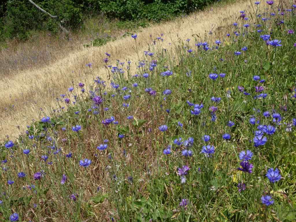
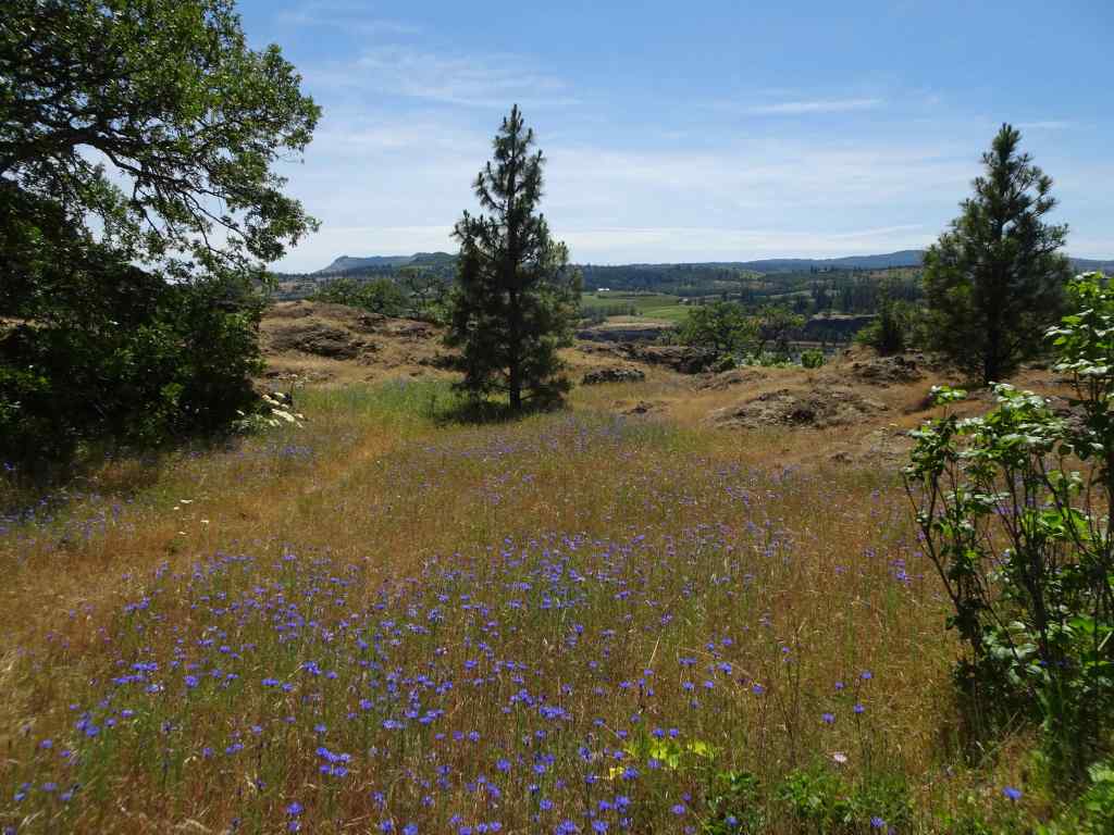
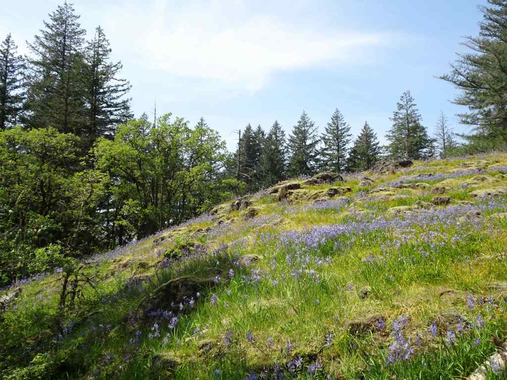
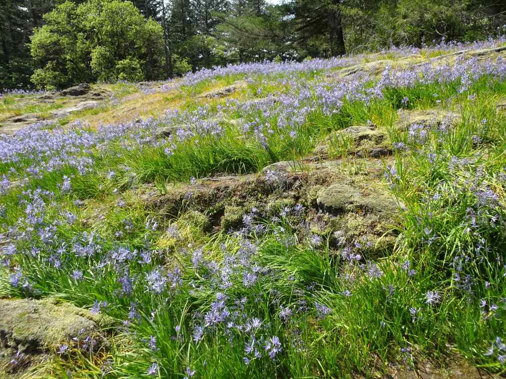
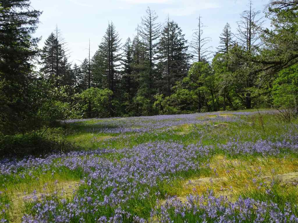
May 27 – The Labyrinth, WA
The Labyrinth was one of the first trails we ever hiked in the eastern gorge, and we have returned many times. The path winds through piles of columnar basalt that provide some protection from the wind, and the views are great! Wildflowers change throughout the bloom season. Today was the first time I have seen this particular suite of flowers – blue and purple bachelor buttons and ookow; white buckwheat, yarrow, and mock orange; pink clarkia and onions; all accompanied by a full gauntlet of poison oak.
The first surprise – abundant wildflowers surrounding the Lower Labyrinth Waterfall on the old highway approach trail – mock orange, bachelor button, ookow, buckwheat, and monkeyflowersMore mock orange, poppies and buckwheat, the Columbia River, and Mt Hood.Mock orange
Starting up the trail along Labyrinth Creek –
Buckwheat, golden grass with late season flowers. YarrowOokow, and bachelor buttons. The bachelor buttons are considered disturbed, but they do add a pretty color to the late season wildflower suite.Winecup clarkiaSwales of flowers in the drying grass
Continuing up along Labyrinth Creek –
Monkey flowers surrounding the upper waterfallHomage to the poison oak gauntlet that we carefully walked through today.Colorful slopes beneath one of the volcanic buttes.My favorite oak grove, with a lush poison oak understory.
Lunch views, with mule deer…
Westward, mule deer on the next ridgeMule deerEastward – Columbia River shimmeringHooker’s onions
It was getting warm, and I was losing my uphill motivation, but I wanted to go a little higher, to the rocky bluff where bitterroot blooms.
Mt Hood and buckwheatAs I expected, the bitterroot is shriveled up – I’ll have to wait until next year.Looking farther uphill, toward the slopes that lead to Coyote Wall – green grass turning to gold.Another look at Mt Hood, then we begin the return hike…I didn’t notice these White Brodiaea on the way up.Ceanothus blooming in the oak groveAnd past the waterfall again on our return to the trailhead.
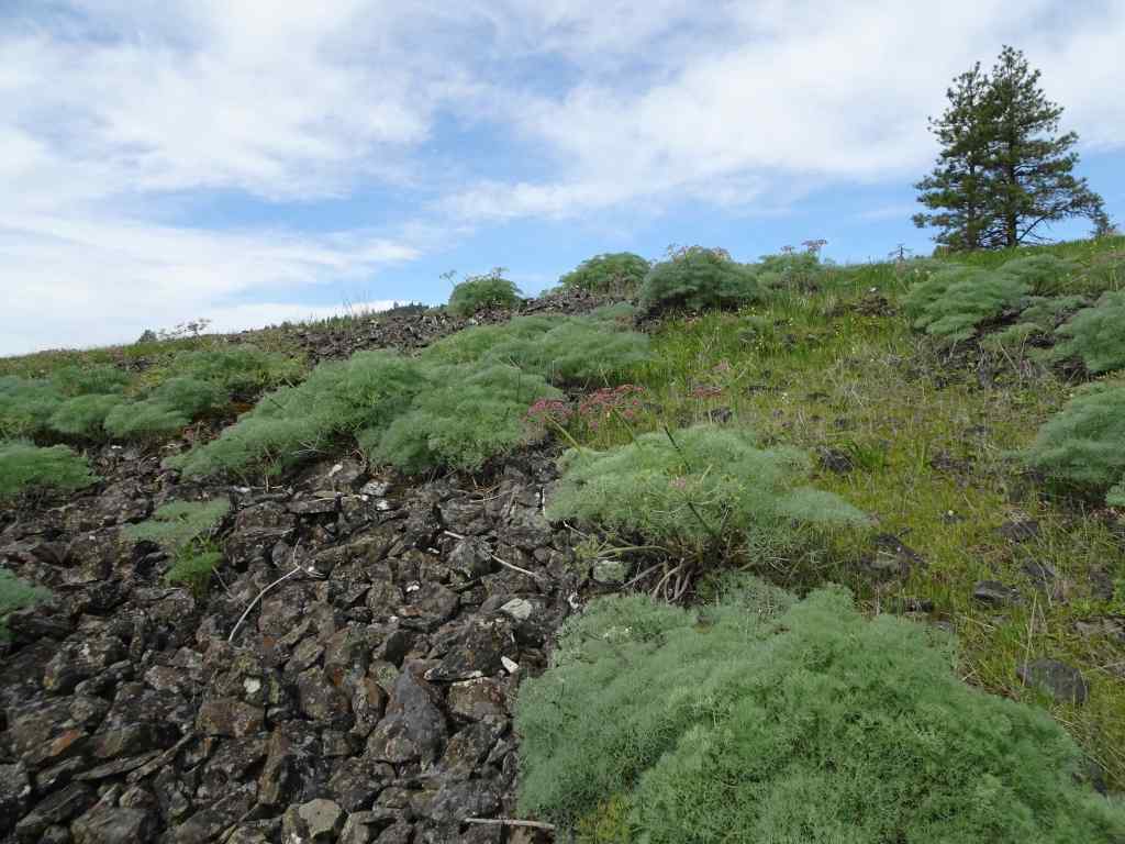
It was beautiful day in the Labyrinth. But it is getting too hot for me in the eastern gorge – we may not be back until fall! I am going to southern Utah in June, where it is already very HOT, to help a family member. I may not hike much in the next month, but there will be red rocks and possibly some dinosaur tracks…
We went on one hike on April 1st, before my husband’s neck surgery on April 4th. After a couple of weeks of rest, we found some shorter, easier hikes in the last half of April, following the wildflower bloom, but keeping activity level within medical guidelines.
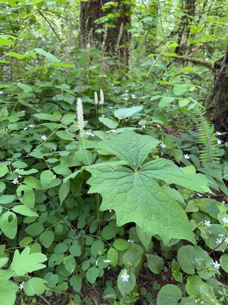
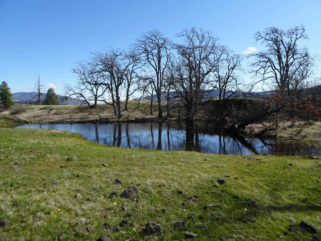
April 1 – Catherine Creek: Lower Tracy Hill – Arch Loop, WA
One of our usual trails. It was lovely to see the next phase of bloom in the meadows here.
View from the trailhead: the meadows are full of white saxifrage, also purple shooting stars, and a few camas beginning to bloom.Looking south toward Mt Hood, the orchards of Mosier are glowing as the leaves unfurl.Along the trail – rosy plectritus and purple broomrape.Pockets of camas liliesSaxifrage and shooting starsColumbia desert parsleyPonderosas reflected in a vernal pool, and yellow desert parsley.Our trail passed above the ent who guards the slope…He’s still standing.On our return trail, we passed below the Arch, with eagles soaring above.Some early bloomers were hanging on in this cliff shadow – gold stars and grass widows.A few larkspur were just starting to bloom among them.
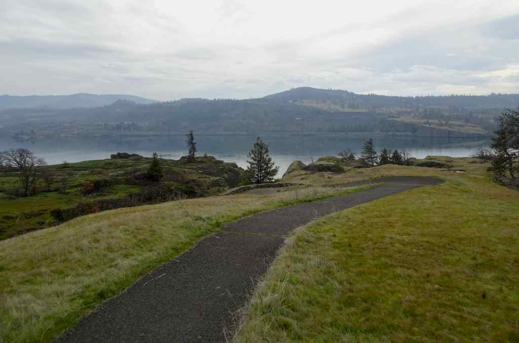
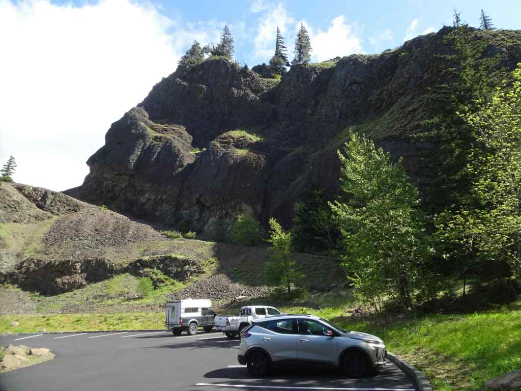
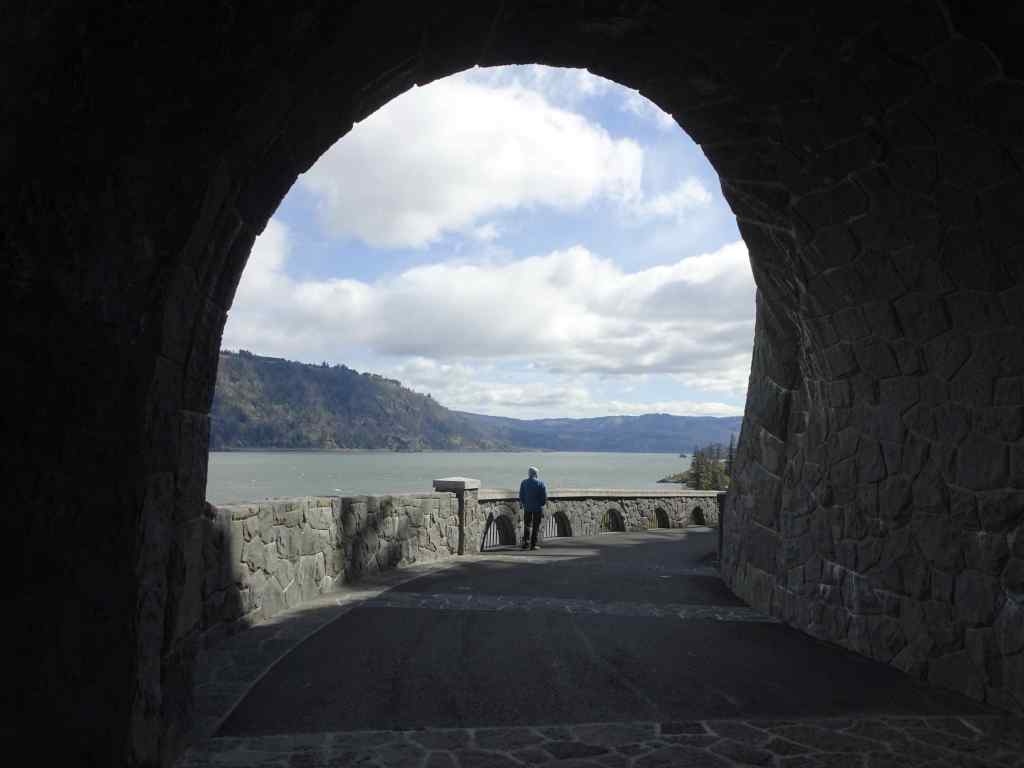
April 21 – Mitchell Point Tunnel and Mosier Plateau, OR
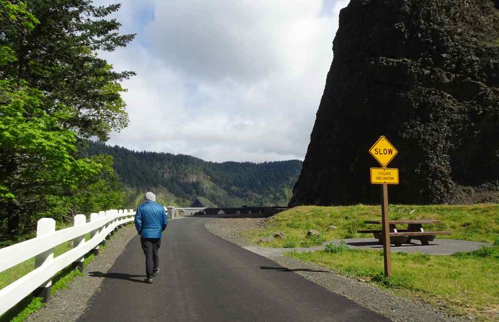
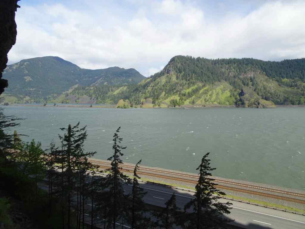
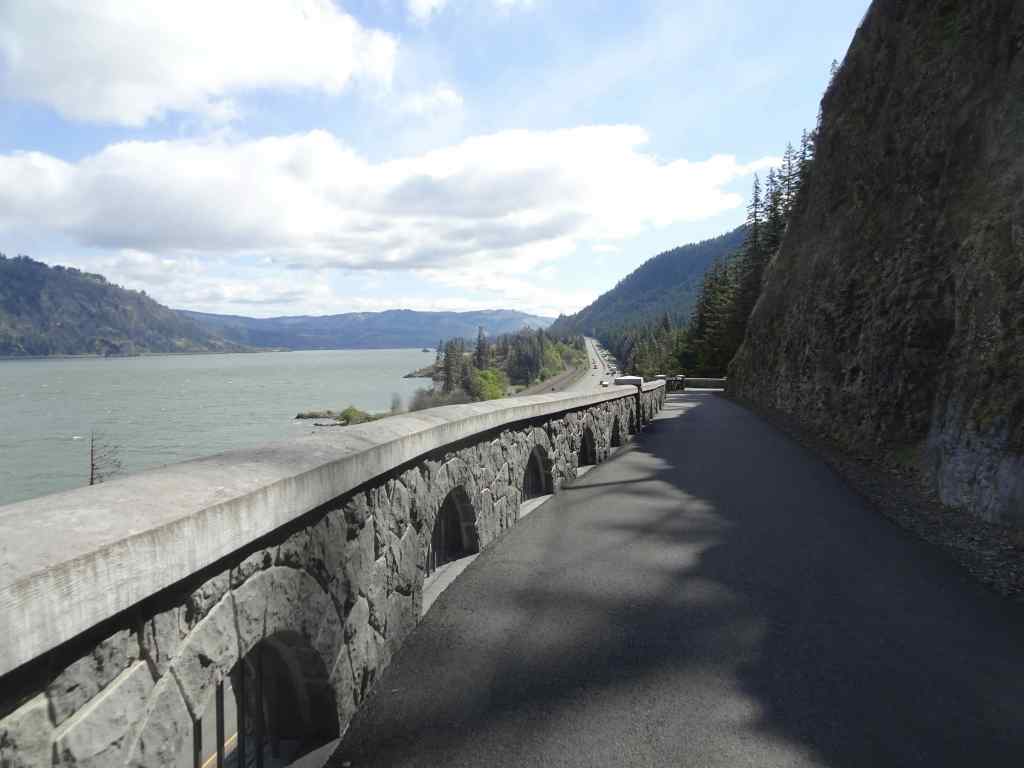
Last month I mentioned seeing the nearly completed Mitchell Point Tunnel from the highway as we drove by. The tunnel is now open. We stopped on our way to Mosier Plateau to see the views from the tunnel.
Mitchell Point from the parking lot. The new pedestrian and bicycle tunnel replaces the original automobile tunnel on the Old Columbia River Highway that was destroyed when Interstate 84 was built. The tunnel passes around the north side and through Mitchell Point.Western tunnel entranceWestern view from the western tunnel entrance on a windy day.There are five or six viewing windows in the 600 foot long tunnel.View through one of the windows.Another window view.Eastern tunnel opening.View from the eastern opening toward the highway and the eastern gorge.Back through the tunnel.The western entry patio was comfortably sheltered from the wind today.We walked a short way up the Mitchell Point Trail, which has been closed during tunnel construction. There were lots of wildflowers blooming in the woods. The trail becomes quite steep and rocky, and not suited for a surgical recovery hiker, so we didn’t go very far.
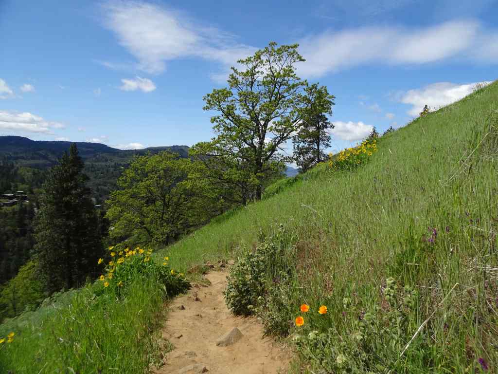
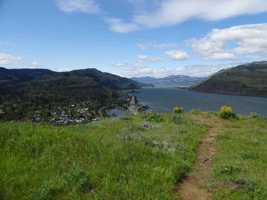
We drove on to Mosier Plateau, where the lower part of the hike is protected from the wind. Eventually, the trail emerges onto the open bench above the river, where the blooms and views were beautiful, but the wind too strong to want to walk the full length of the plateau.
Passing Mosier Creek Falls on the lower trail.Heading uphill within Mosier Creek drainage, well protected from the wind.Looking up along the trail,Northward, toward the river – clumps of bright yellow balsam root bloom becoming more abundant.BalsamrootWith a few poppiesOn the windy plateau, looking west down the Columbia River and toward Mosier.Northern view, looking directly at Coyote Wall in WashingtonA perfect view of the black basalt outcrops of the labyrinth, where I can pick out a couple of my favorite trees.And farther east toward Rowland Wall, Catherine Creek, and her famous Arch.
April 23 – Camassia Nature Preserve, West Linn, OR
A one mile loop trail through a natural area near Highway 205 and the Willamette River – somehow preserved from surrounding housing and industrial development.
Walking boardwalks through the green forest, with fringe cup and ferns.A few blue-eyed Marys that always remind me of my sister.Open meadows of camas and rosy plectritisCamas meadows and mossy rocks.Another meadow.Cell tower osprey – the bird can see the Willamette River near Oregon City from their perch.CamasCamas, rosy plectritis and buttercupsTrillium and violets in the forest on the return trail.
April 25 – Round Lake Lily Fields, Camas, WA
Another short, easy walk in a suburban area where large slopes of camas lilies are not far from housing developments.
The lower trail near Round Lake…Several paths wind through open slopes of camas lilies.Camas lilyContinuing upwardMossy rocks and camas liliesNear the top of the hillA few glacier lilies still blooming at the very top of the trail.
April 29 – Weldon Wagon Road, WA
The wind continued strong and steady all week in the Gorge. We chose this hike, in part because it has fabulous displays of balsam root along a smooth trail, but also because it is a bit protected from the relentless blasting wind in the main Columbia River corridor.
Oak woodlands along the lower trailBastard toadflax – my first time seeing this small white cluster flower.Purple lupine and white manroot along the upper forest trail, just before the opening to…the wide view across the balsamroot filled slopes.We took a side trail up the ridge with a view to Mt Adams to the north for our lunch stop.Back on the main trail, balsam root all the way…And big headed clover,BalsamrootThe upper trail is wooded, with blue flowers of Pacific hound’s tongue and yellow violets in the understory.Returning down the way we came. Pale pink phlox among the yellow balsamroot.Our descending trail back down through the flowering slopes.
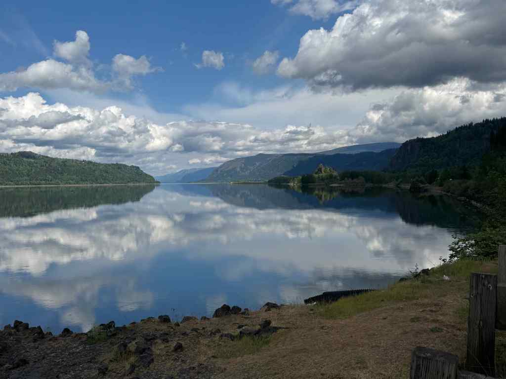
On the drive home, we stopped at the overlook on Highway 84 just below Corbett, where the perfectly calm air allowed a river mirror to form – we don’t see that very often on our gorge excursions.
Eastward, up river, Crown Point/Vista House on the right skyline.Westward toward WashougalPanorama viewHistorical Marker at the viewpoint
Thus, we enjoyed another month of wildflower hikes, with more to come in May.
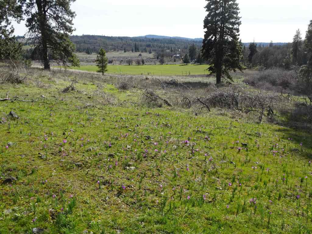
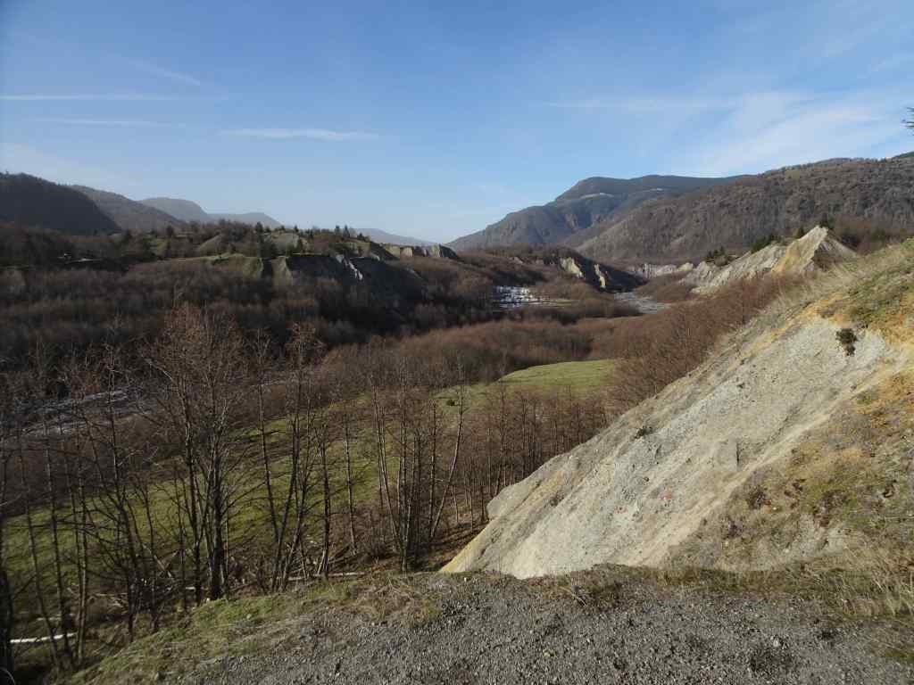
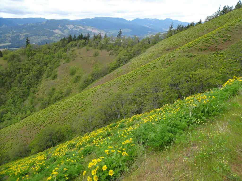
We enjoyed three wildflower hikes in the eastern Columbia River Gorge in March, all trails we have been to many times in different seasons. I love tracking the phases of wildflower bloom each time we go.
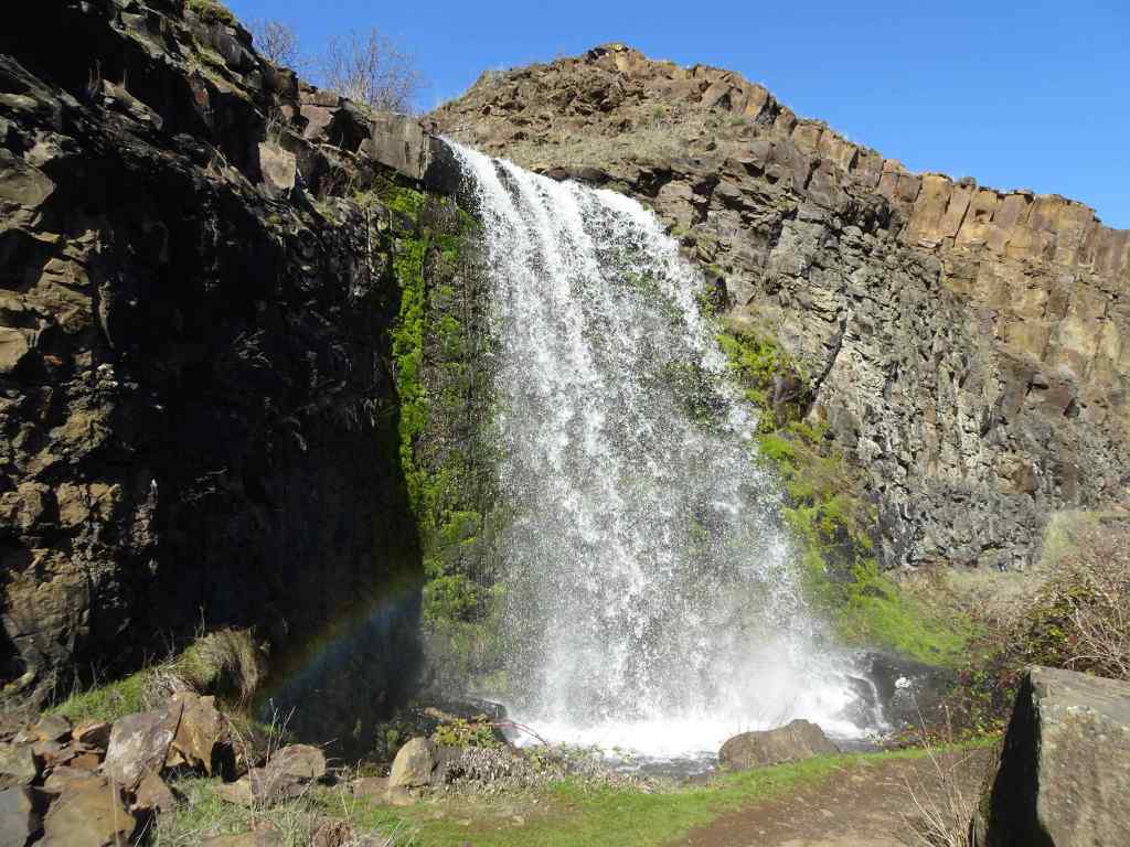
March 3 – Catherine Creek and Lower Labyrinth, WA
Early March is grass widow season at the lower elevations of the Catherine Creek and Labyrinth trail systems. My camera doesn’t do them justice, but the swaths of purple grass widows are so very pretty!
Fields of purple grass widows carpeted the lower meadows along the ADA Trail at Catherine Creek.Grass widowsLooking eastward…Early yellow parsleys in the woodland.More grass widows on the rocky outcrops.There was nothing blooming at the slightly higher elevation fairy ponds, so we went to the nearby Labyrinth/Old Highway 8 Trail to see what was happening there.The Lower Labyrinth Falls along Old Hwy 8 was full.The Upper Labyrinth Falls was also full, but there were no flowers up here.The flowers were concentrated in the lower elevation areas…Grass widows, gold stars, pink woodland stars.
March 11 – Rowena Crest, OR
The next week, on the Oregon side of the river, we saw more swaths of purple grass widows along Rowena Crest – both in the lower part of the Tom McCall Trail, and the Rowena Crest Trail.
We started by walking toward Tom McCall Point, where grass widows filled the meadows.Grass widows and tiny white spring whitlow grass bloomsWe walked through the oak tree lined Parsley Alley, and saw purple Columbia Desert Parsley beginning to bloom.Columbia Desert ParsleyLooking east toward Lyle Cherry Orchard and the Rowena curvesYellow bells popping up in places.
We went back down, and walked all the way to the end of the Rowena Plateau Trail.
Grass widow meadows along Rowena Plateau TrailYellow parsleyWhite salt and pepper parsleyGold Stars in the meadows at the west end of the trail
Reflections in the ponds along the way provided some abstraction distractions…
Pondwith ripplesZooming inCloserand closerand back out.Another pond.
We walked back along a side trail near the cliff edges – so many flowers!
Looking toward Lyle, WA.And back toward Tom McCall Point.
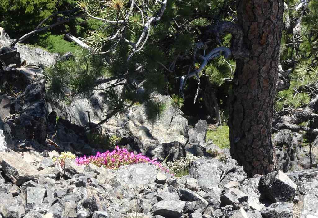
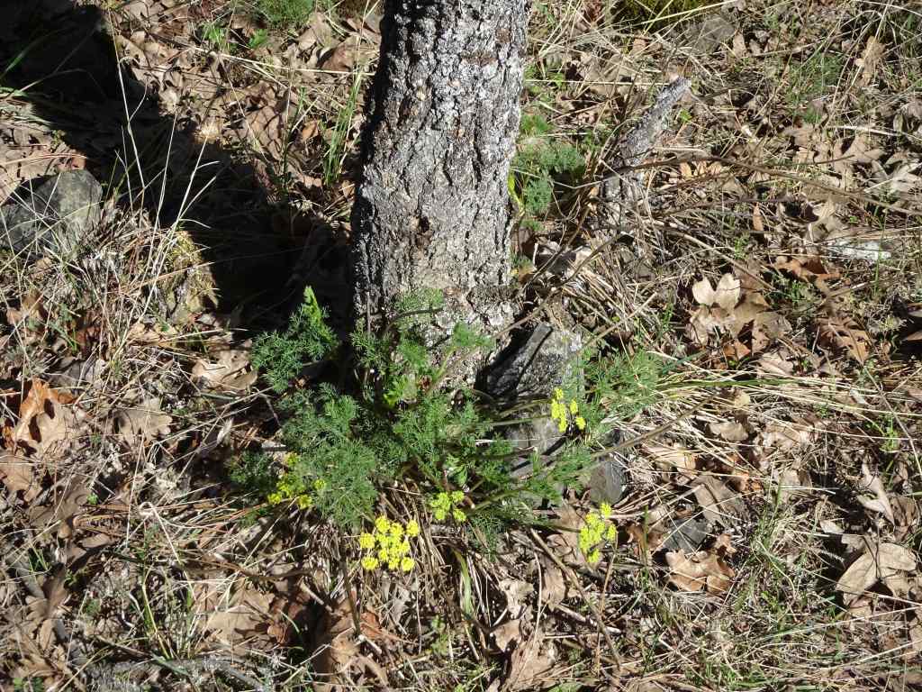
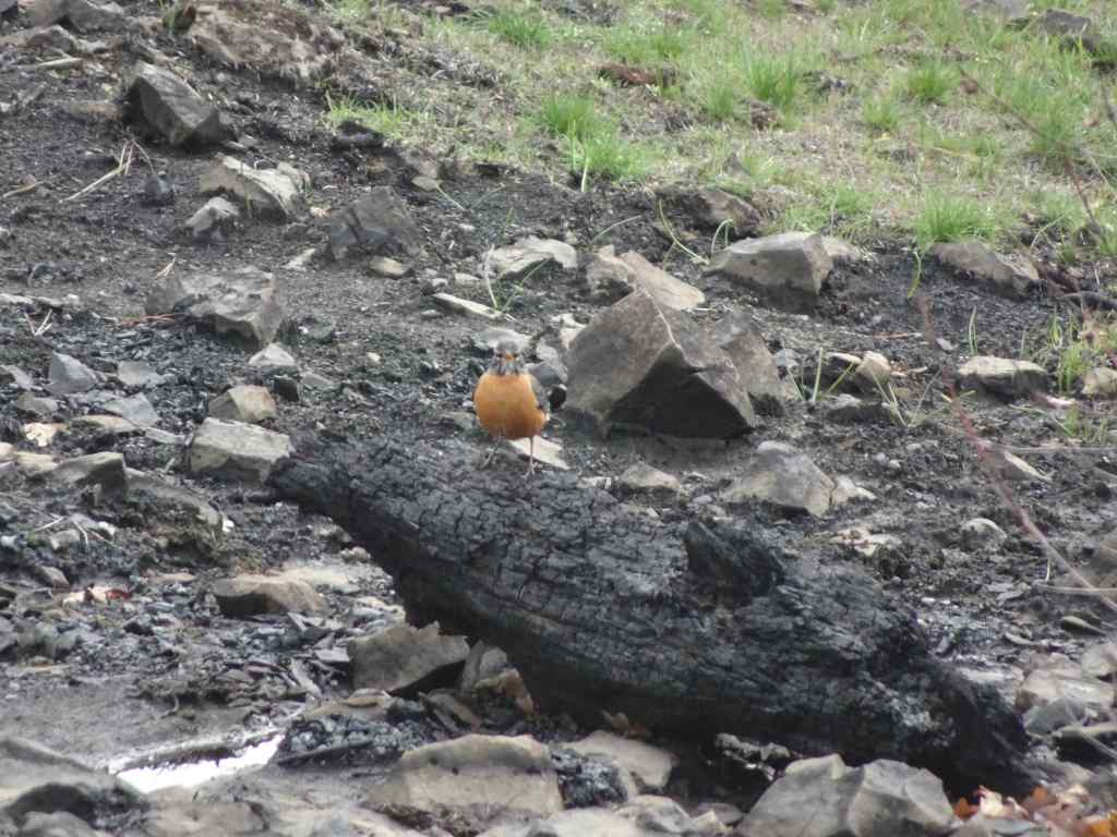
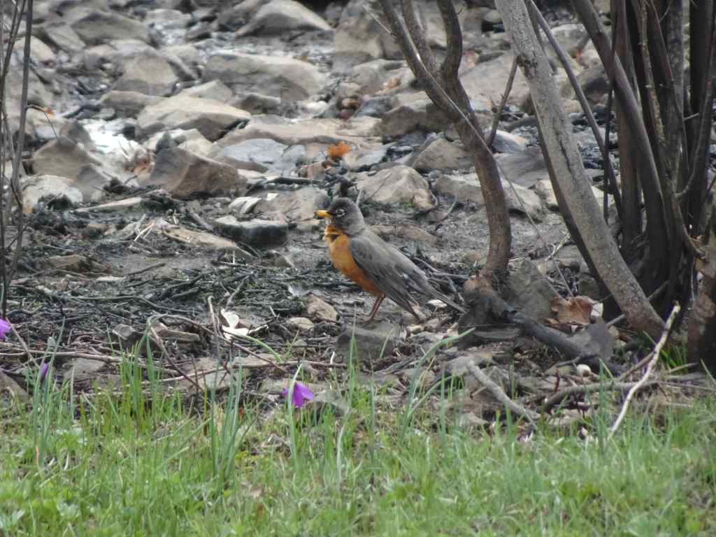
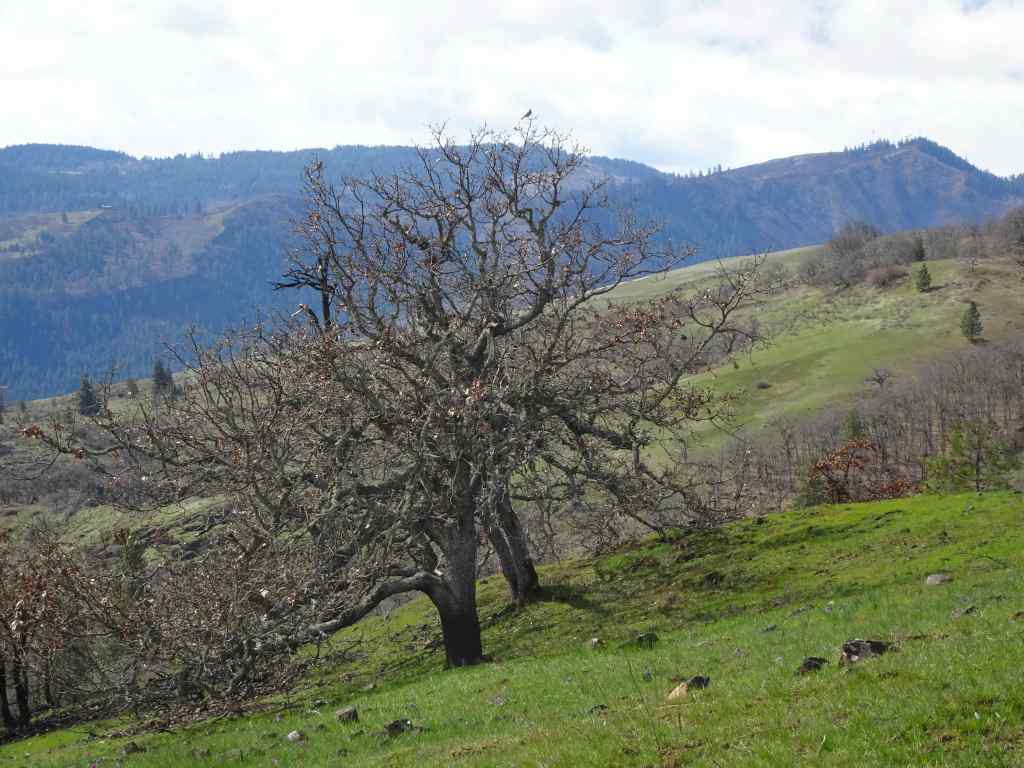
March 18 – Rowland Wall/Stringbean Loop, WA
By mid-March in the Catherine Creek area, grass widows were joined by other flowers – saxifrage, gold stars, yellow bells, more of the parsleys, and the first balsam roots.
At the trailhead, white saxifrage were speckling the meadows along with grass widows.Gold stars becoming abundant in the rocky areas overlooking the arch.Plenty of grass widows, looking toward the orchards of Mosier.The burn areas from last fall’s Top Of The World Fire are prominent around the trees, but the slopes have turned green.There were many robins hopping along today. We watched these two playing in some puddles while we ate our lunch.RobinWe continued uphill on the burned, but now green, slope of Sunflower Hill.Two robins in the top of the oak tree.Looking east from our high point. We dropped down over Rowland Wall, then decided to walk the inside-out switchbacks of the String Bean Trail. We didn’t find many flowers in the woodlands.Looking back toward Rowland Wall, and the Needle.We crossed the lava flows, then went back up over the wall at the lower trail.We saw the first of the balsam roots blooming along the wayRowland Wall scree slope and NeedlePlenty of yellow parsleys blooming along these west-facing slopes,And pockets of yellow bells.Grass widows and gold stars.
It was a beautiful day, and I am looking forward to the next phase of wildflower bloom in the eastern gorge!
Preview of Coming Attractions –
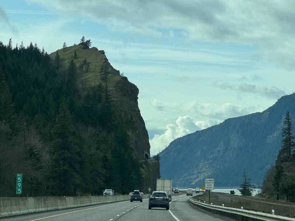
Driving home westward on Interstate 84, we passed under the base of Mitchell Point. The tunnel on the old highway was destroyed when I-84 was built, but has recently been reconstructed and reopened as part of the bike path through the gorge. I grabbed a photo as we passed – and we hope to walk there sometime soon. The views are supposed to be amazing!
Mitchell Point Tunnel, above the highway on the left.
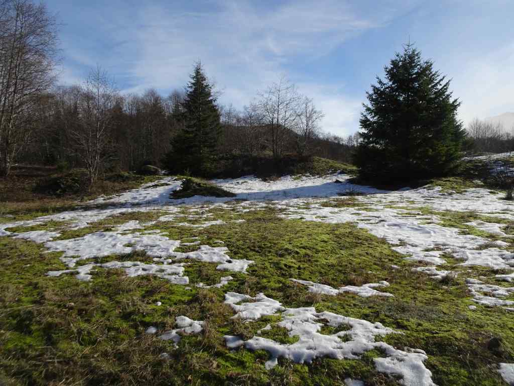
The shortest month seemed very long. I went from skiing the neighborhood snow to admiring the early spring blooms. I knit, quilted, and read as productive activities to counter the political upheaval. We honored the boycots. I made progress on the recycle/repair/upcycle four-year home improvement project. And we went on two hikes.
Crafting/Home Improvement:
Another pair of socks completedHat for the Guild service projectI started sewing these quilt blocks togetherBack hall carpet installed, almost the last step in that project.
Reading – I read nine books last month, many by or about women: writers, artists, a river guide, a Supreme Court Justice. After watching the Bob Dylan movie last month (A Complete Unknown), I was very interested to read Suze Rotolo’s side of the story. She was a politically active artist. She made a lasting impression on Dylan and his music, but she wanted to pursue her own artistic and life goals, not be just another string on his guitar, his ‘chick’, who would wait for him while he did whatever, wherever in the world. I really admire her for that. There are many great, less celebrated women out there, and I plan to read more of their stories. Meanwhile, I have been listening to the early Bob Dylan music – it fits the mood of this time in the world.
March 2025 Books
The neighborhood:
February 14th – I always love a chance to get out my 35 year old cross country skis, and kick-glide for a couple of miles down the quiet, flat streets of Irvington. The snow was perfect this day! And almost completely gone the next day.
Skiing out the front doorJust enough snow…Sunny and calmNice flat streetsJapanese Maple
Meanwhile, in Philadelphia, our son and his fiancee were attending the Super Bowl Victory Parade! Wearing hats that I knit for them last year.
Around town – flowers and rainbows…
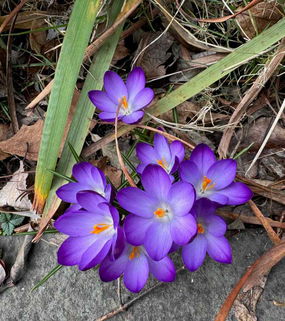
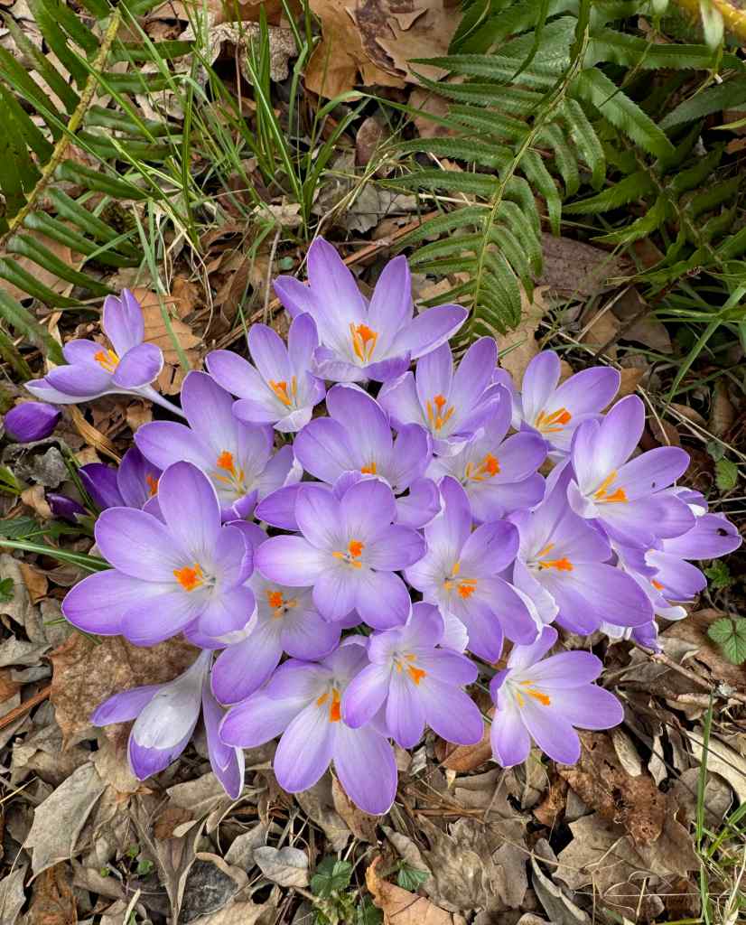
Yellow crocus are earlyDaffodilsPurple crocusLavender crocusWindflowersRainbow seen while driving north on I-5 in Portland
Hiking –
We hiked out in the eastern Columbia River Gorge twice in February –
February 20th – Crawford Oaks, WA – We hiked about 5 miles on the Lower Vista Loop, past the full Eight Mile Creek Falls, and around the lower plateau. We saw very few early flowers and just a bit too much wind that day.
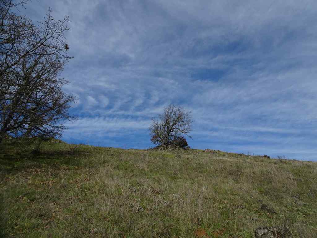
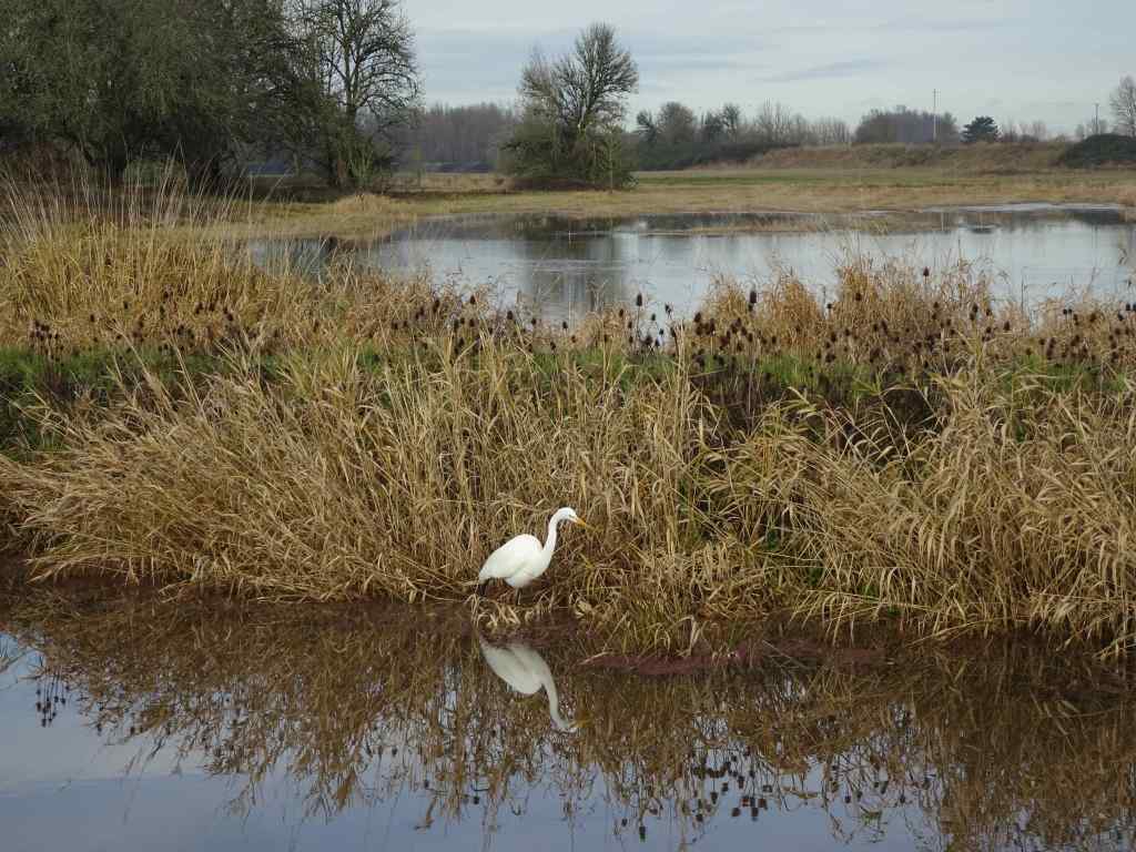
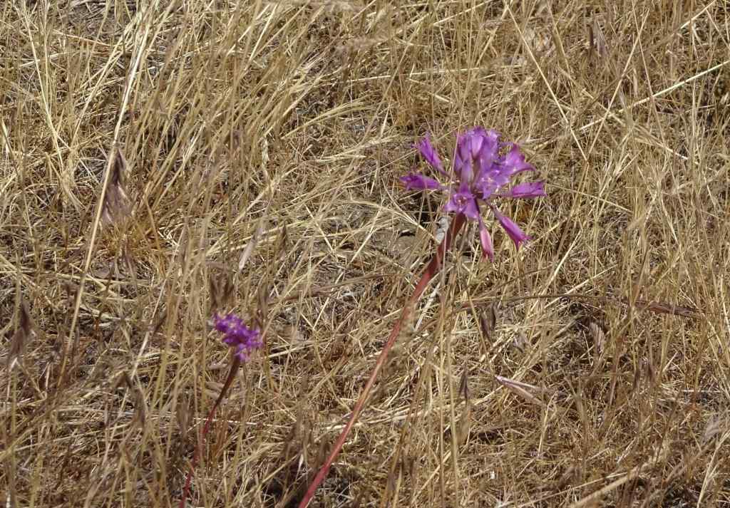
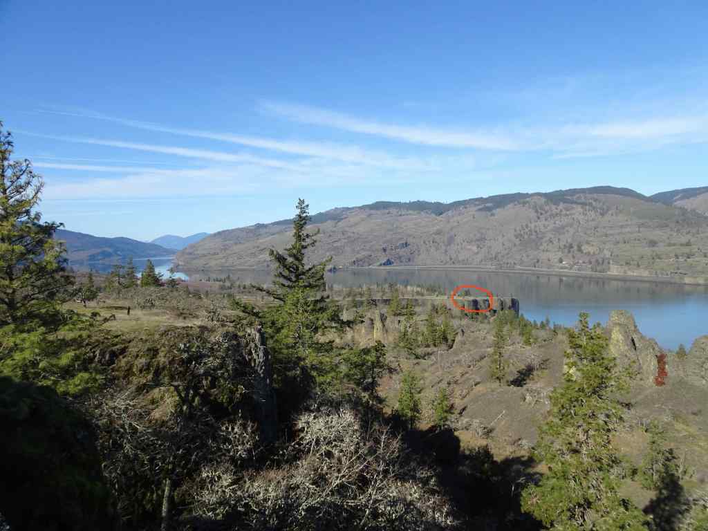
February 27th – Memaloose Hills, OR – A beautiful, perfectly calm day. We could see the blue heron rookery on yonder cliff top and a few flowers. It was an easy, enjoyable 3.5 mile hike with dear friends.
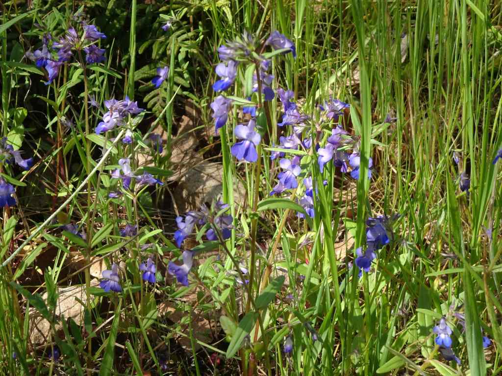
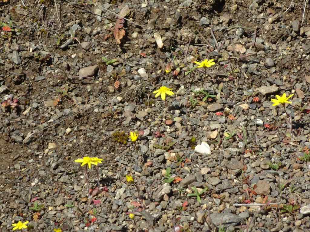
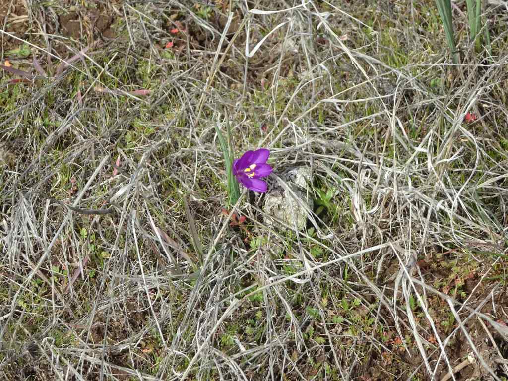
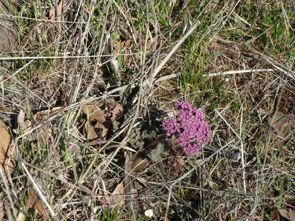
Eastward view from the Memaloose OverlookView to the north, with a peek at Mt AdamsWestward view, heron rookery circled in redFuzzy zoomed-in heron rookeryTrail up the south approach to Chatfield HillView to Mt Adams from the topA few grass widows up thereColumbia Desert ParsleySpring Whitlow grassLunch at the top, and a view to Mt Hood (photo credit to my husband).
Meanwhile, the news is worse every day – we are doing what we can, and trying to hold on to the glimmers and small victories. The daily reports of the shredding of the constitution by anti-empathic billionaires is trying every nerve, but I try to stay positive…