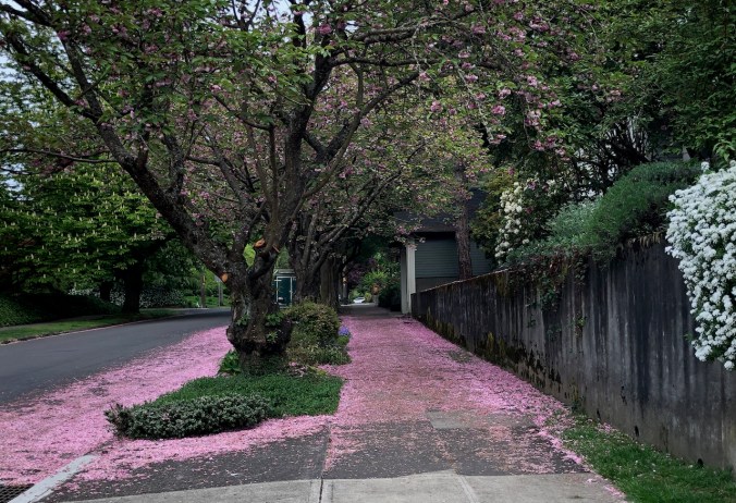
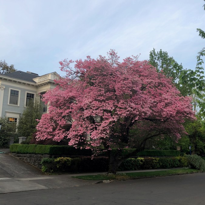
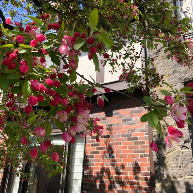
Continuing my neighborhood walks: After the cherry blossoms, the pink snow,
We go from pink trees
to pink sidewalks in a week’s time.
And find them all through the neighborhood.
Dogwood trees and other flowers bloom,
Dogwood
rhododendron
fothergilla
lewisia
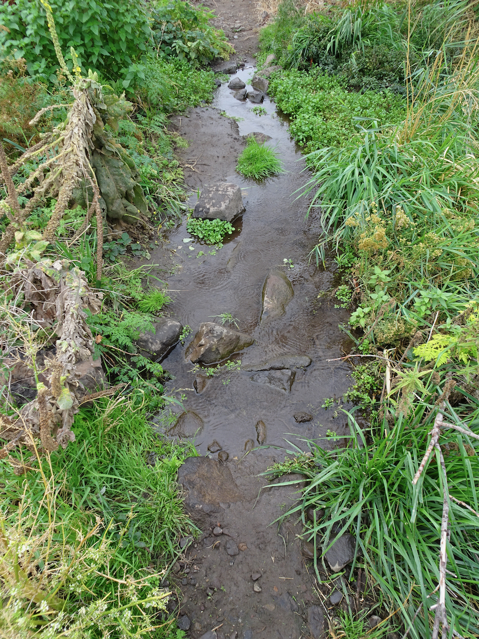
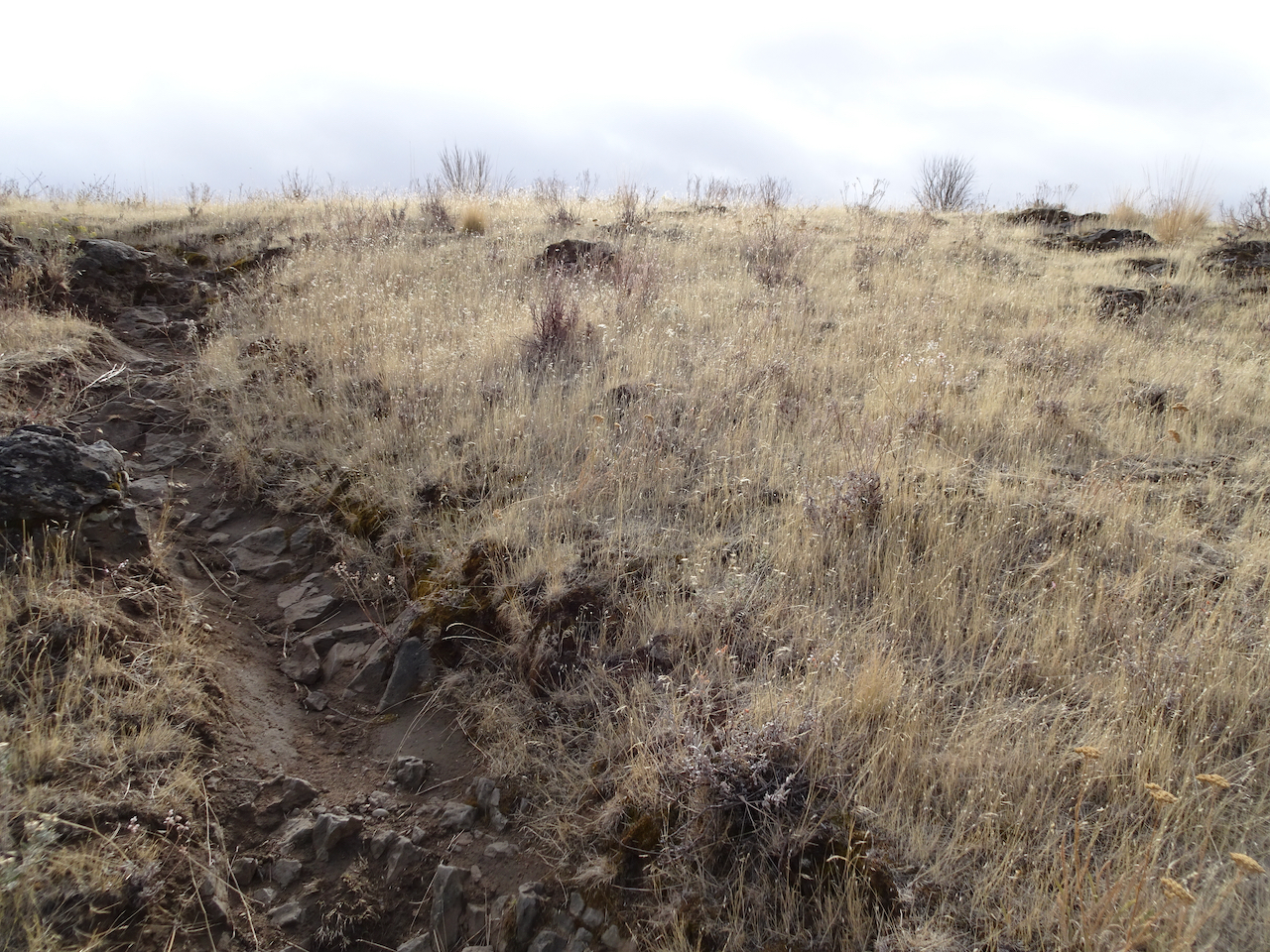
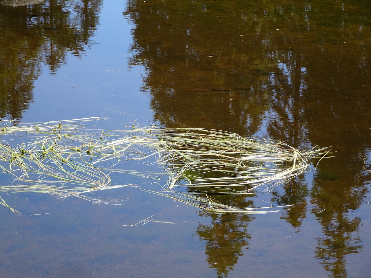
Interestingly cracked concrete catches my eye…
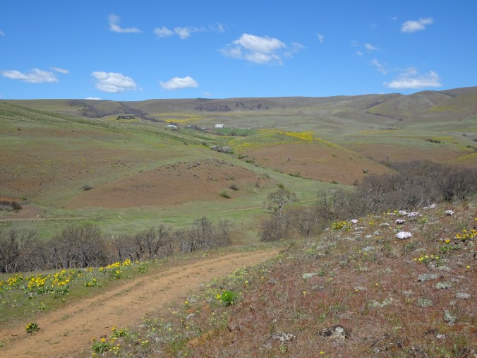
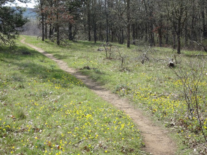
We went on two more hikes with amazing wildflowers:
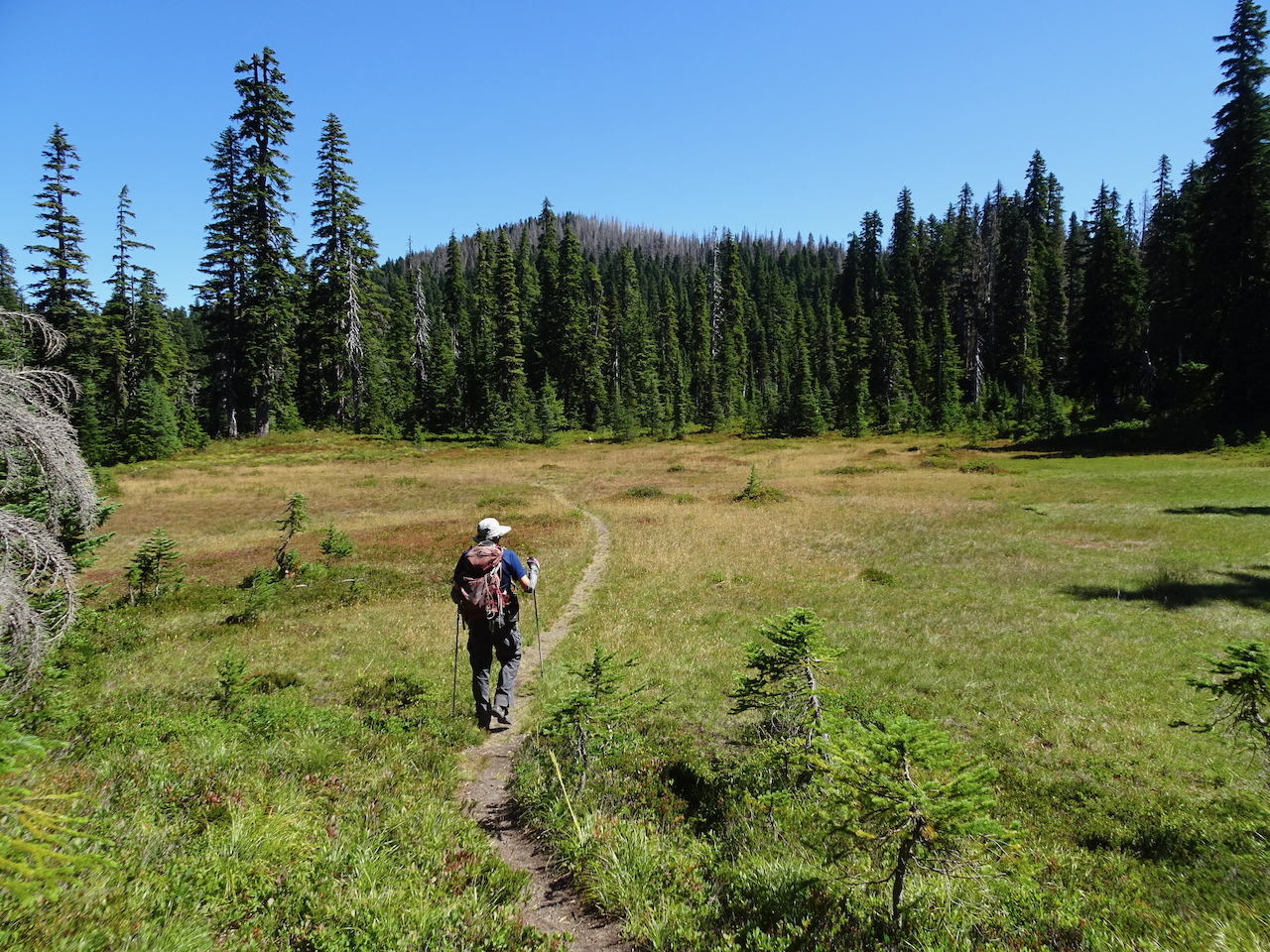
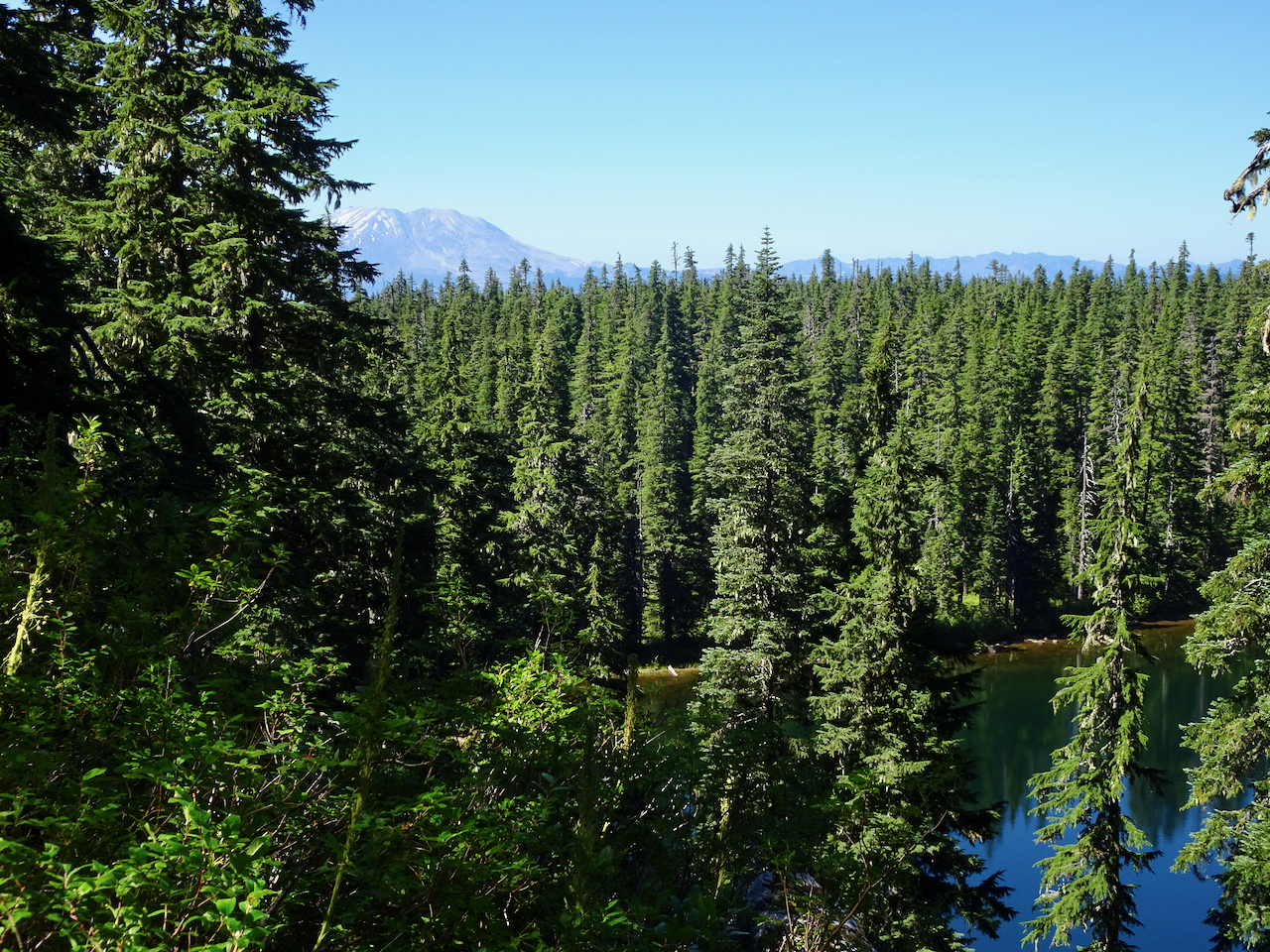
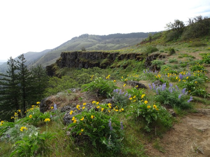
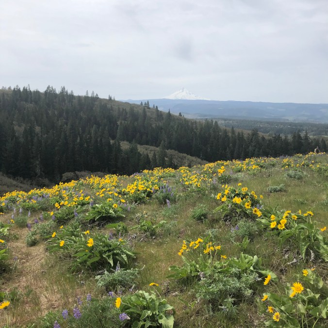
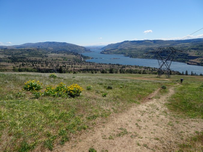
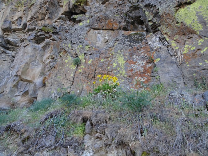
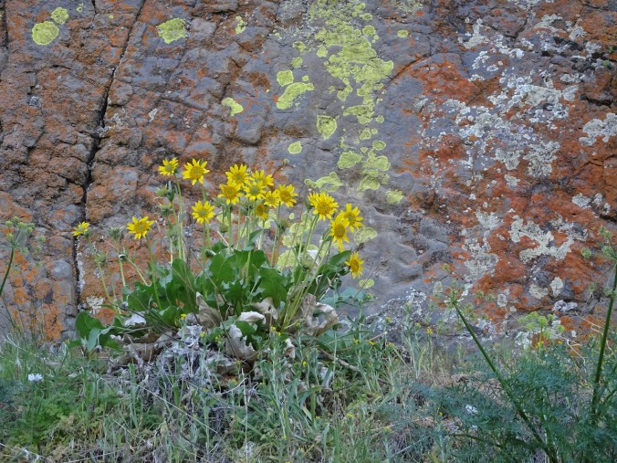
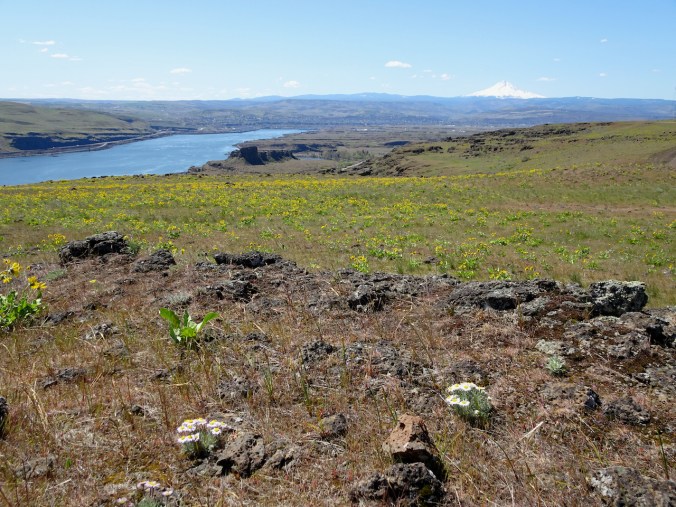
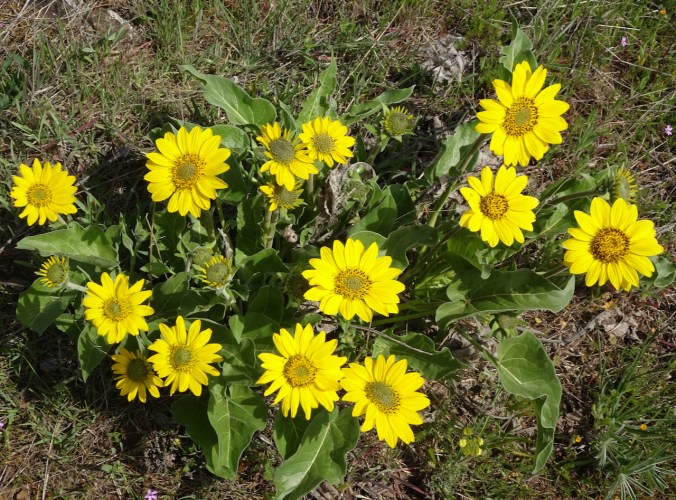
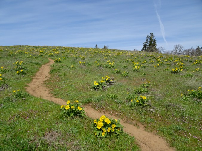
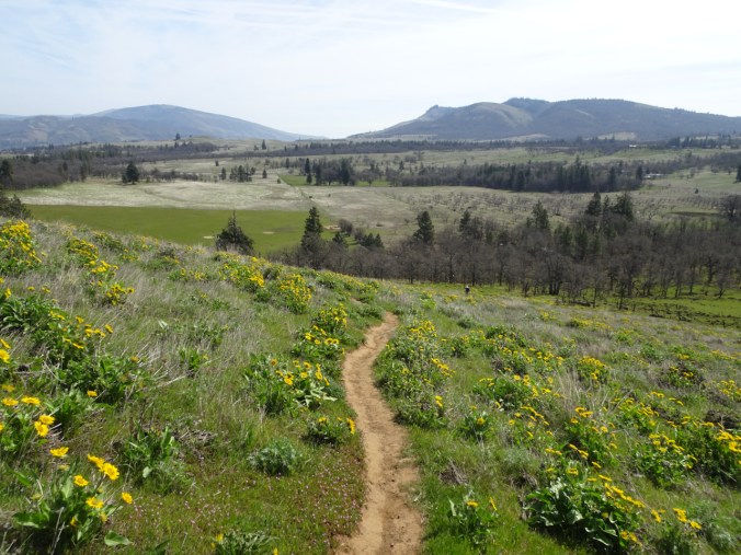
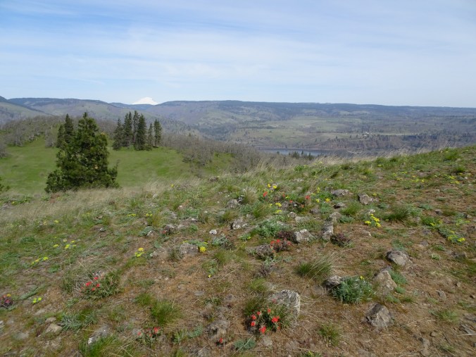
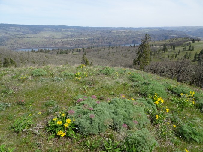
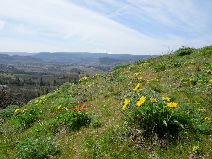
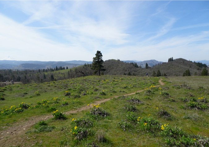
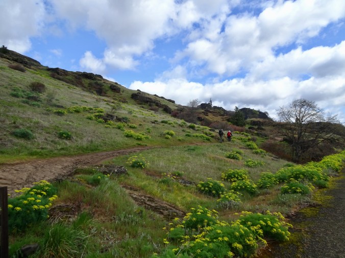
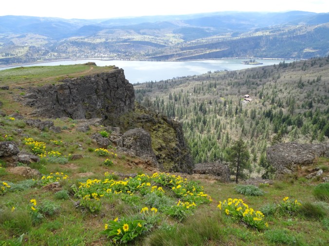
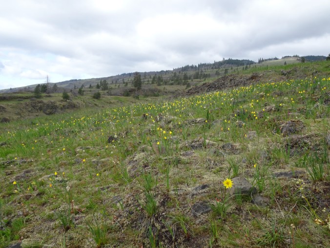
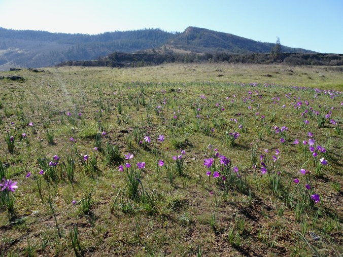
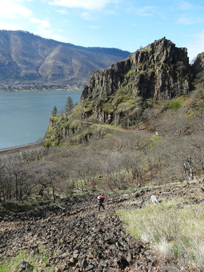
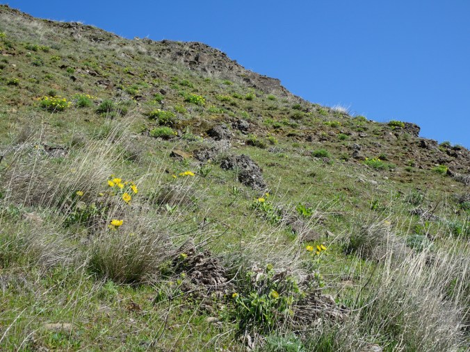
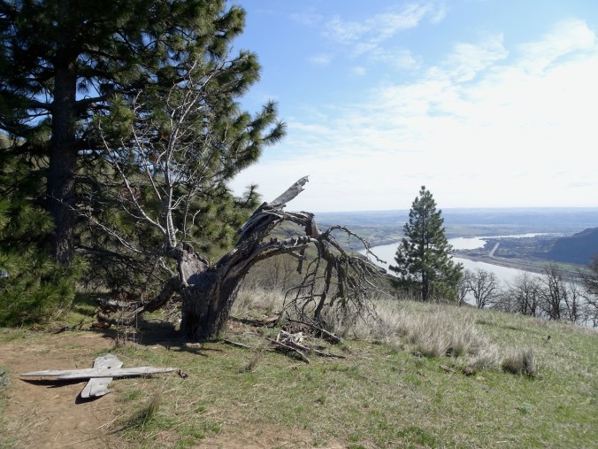
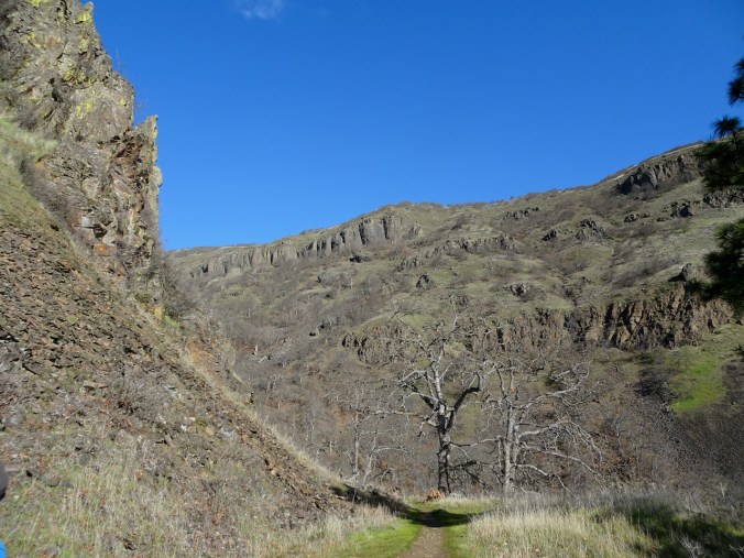
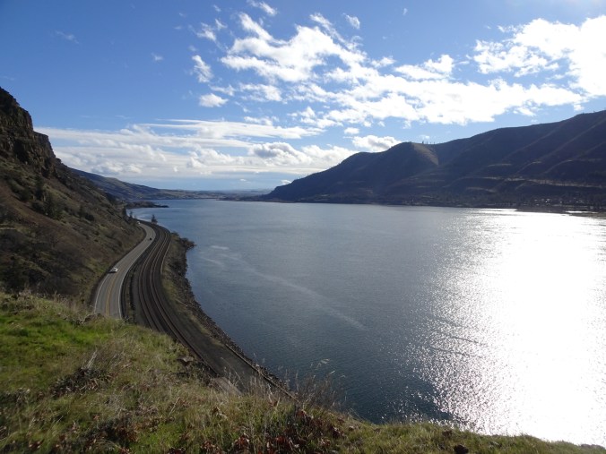
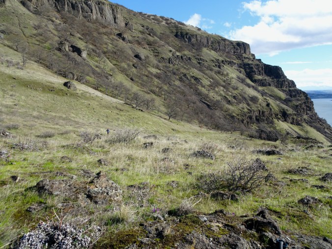
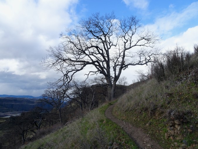
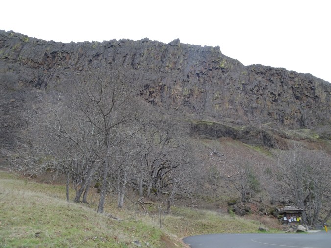
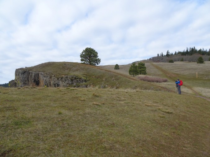
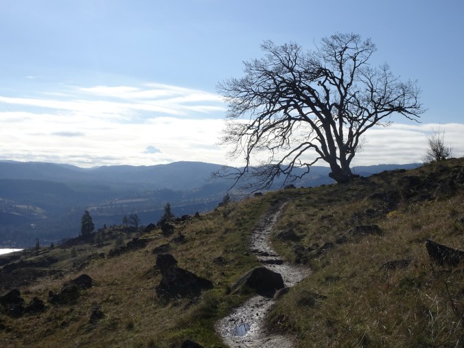
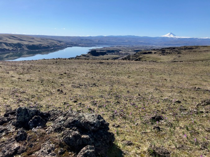
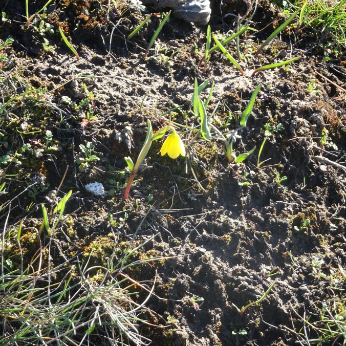
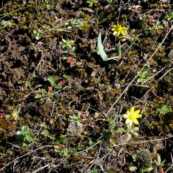
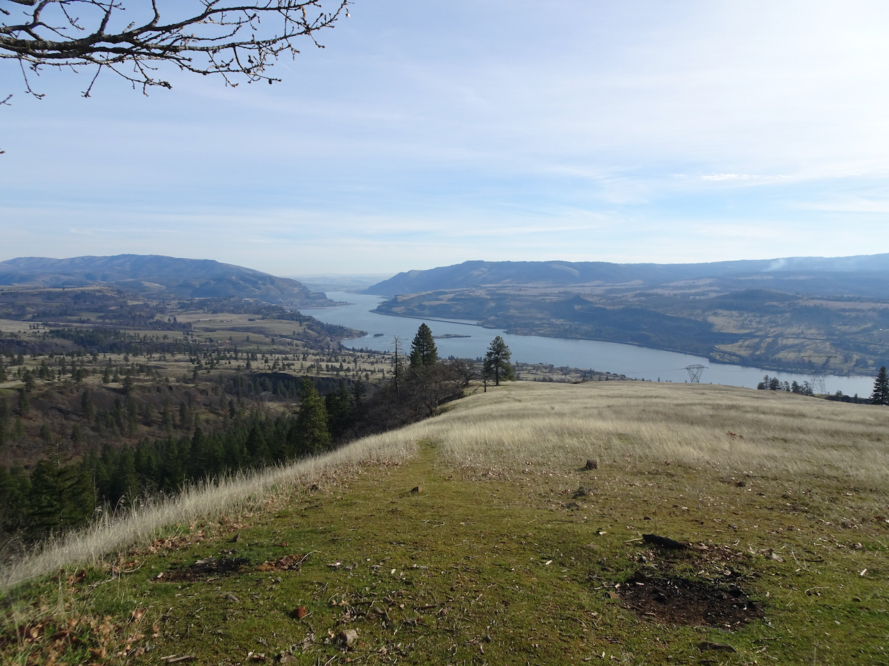
Tom McCall Trail, OR, April 23
When we hiked here on March 11th, the slopes were covered with purple grass widows. Today, the balsamroot is the star!
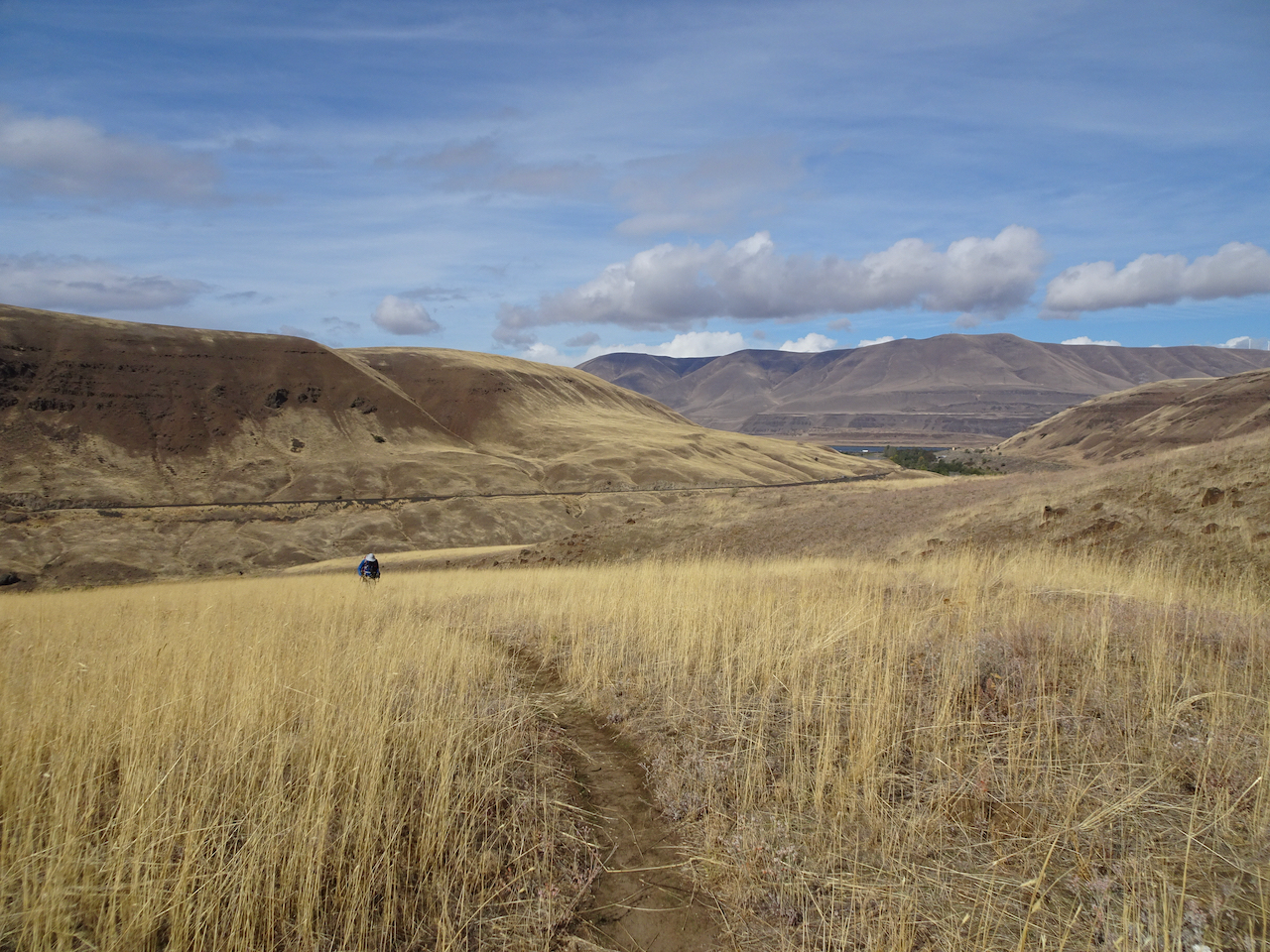
Starting up the trail with friends.
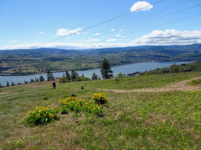
Lower cliffs, balsamroot and lupine in full bloom!
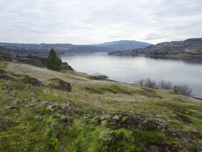
Eastward view.
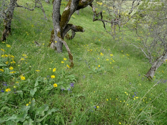
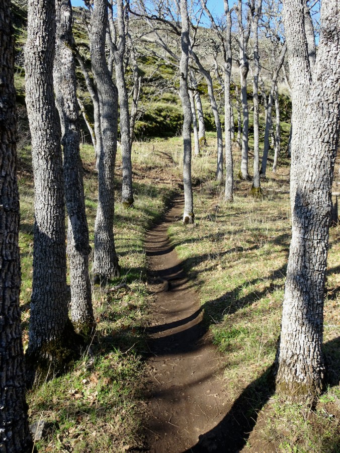
Every blade abloom under the oak trees.
Open slopes of balsamroot and Mt Adams.
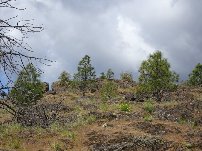
Continuing up.
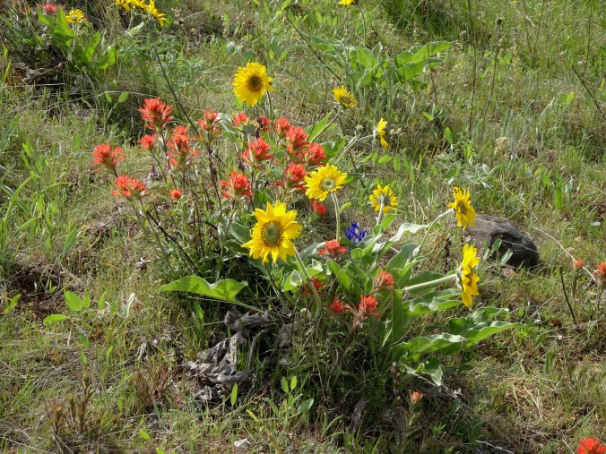
Paintbrush in bloom on the upper slopes.
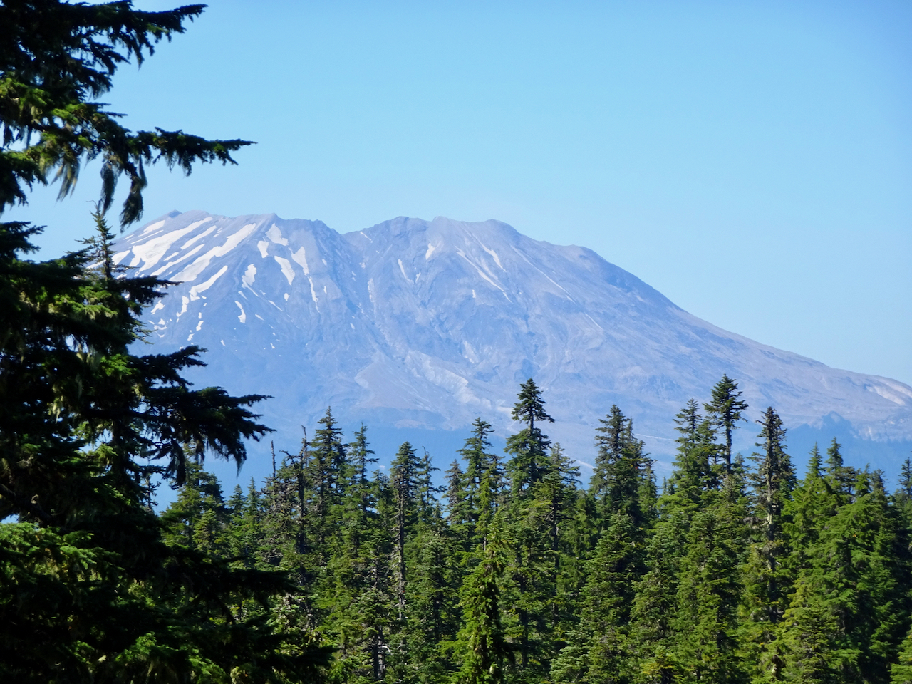
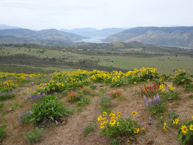
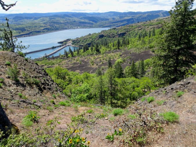
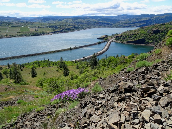
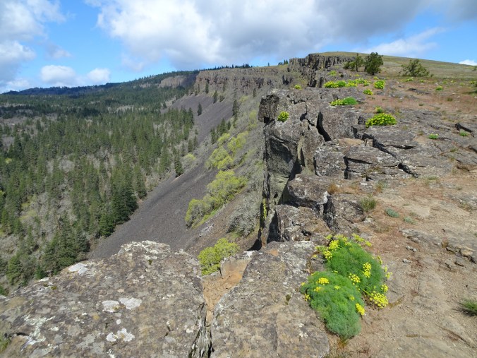
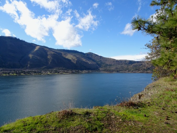
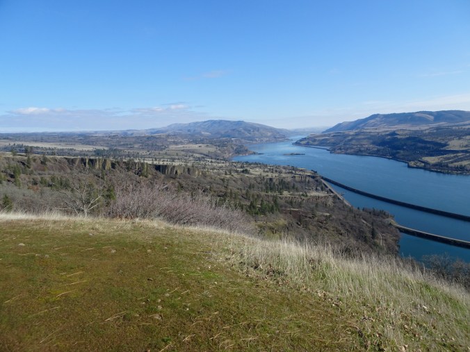
Views from the top:
West to Mt Hood.
North to Mt Adams.
Northeast, to the Cherry Orchard.
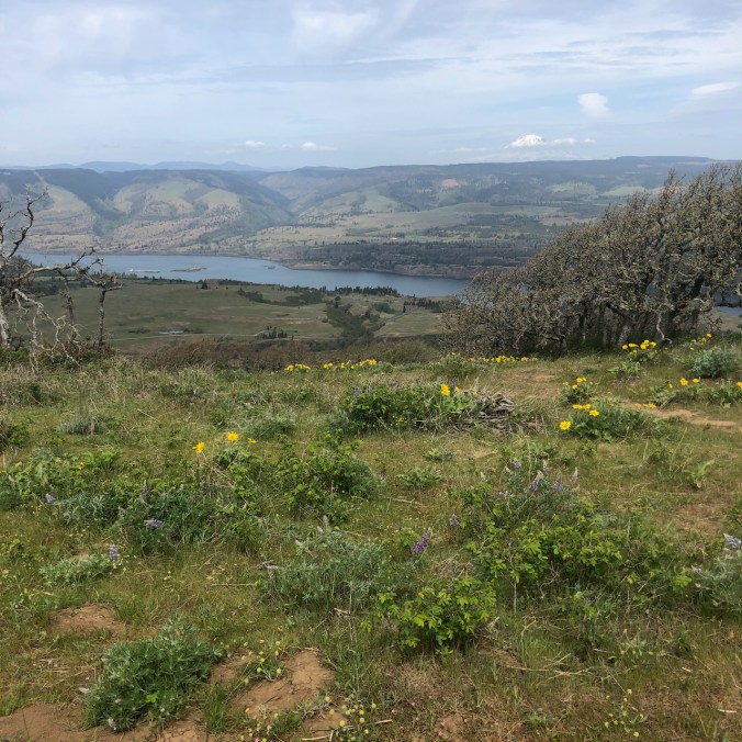
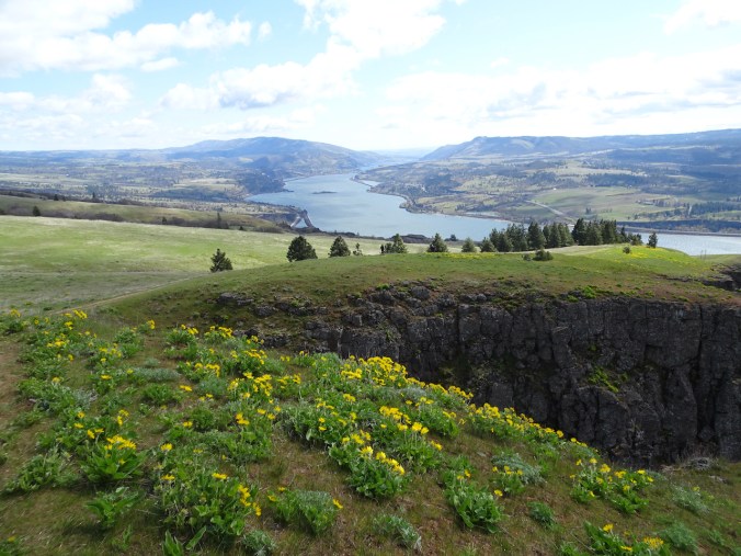
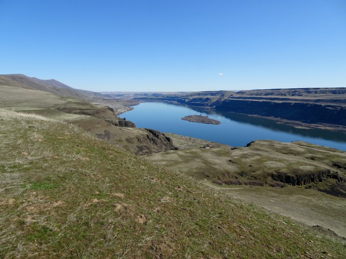
More views on the hike down:
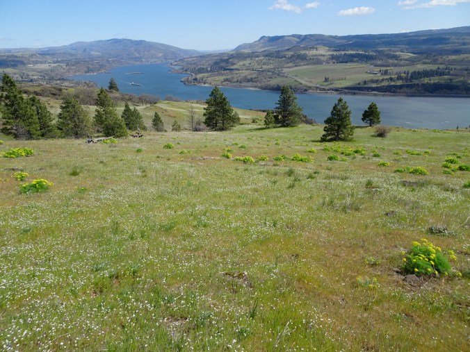
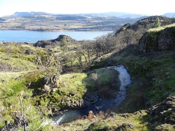
Rowena Plateau.
Paintbrush! and the Memaloose Hills, with their yellow backs.
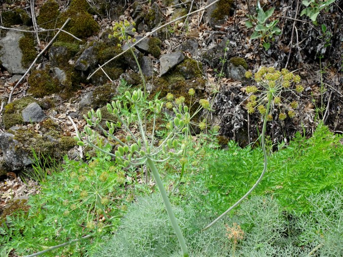
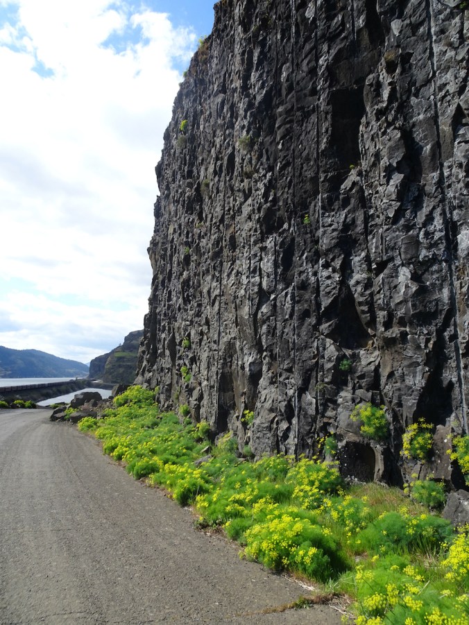
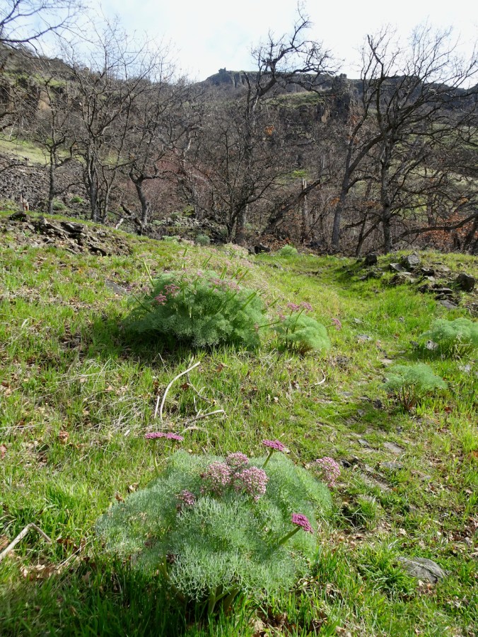
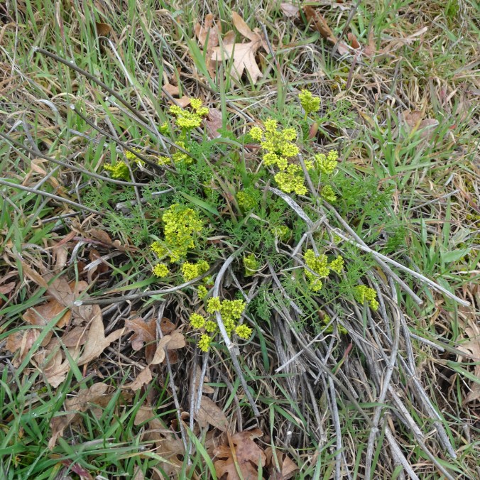
Parsley Alley….
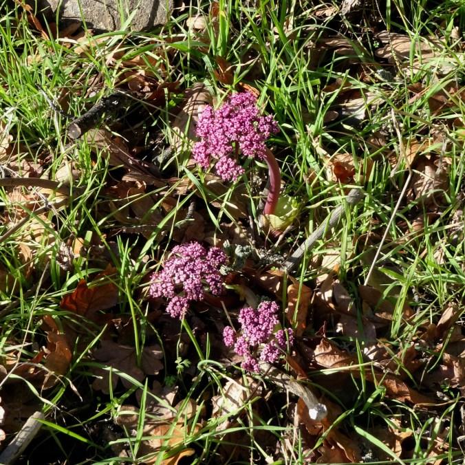
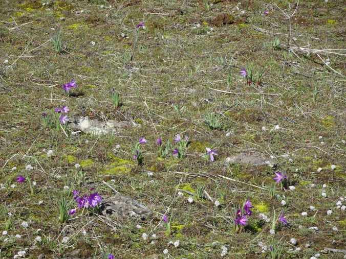
And a few more flowers, for the day.
Chocolate lily and some of that sneaky poison oak creeping in.
Oaks toothwort
Miner’s lettuce
Waterleaf
Orobanche
Baby stars
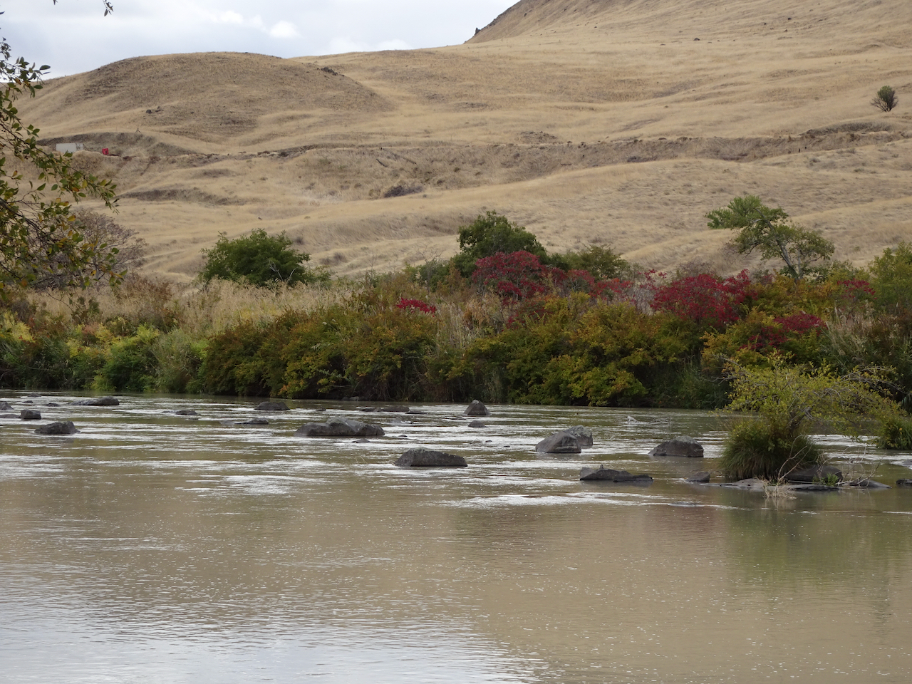
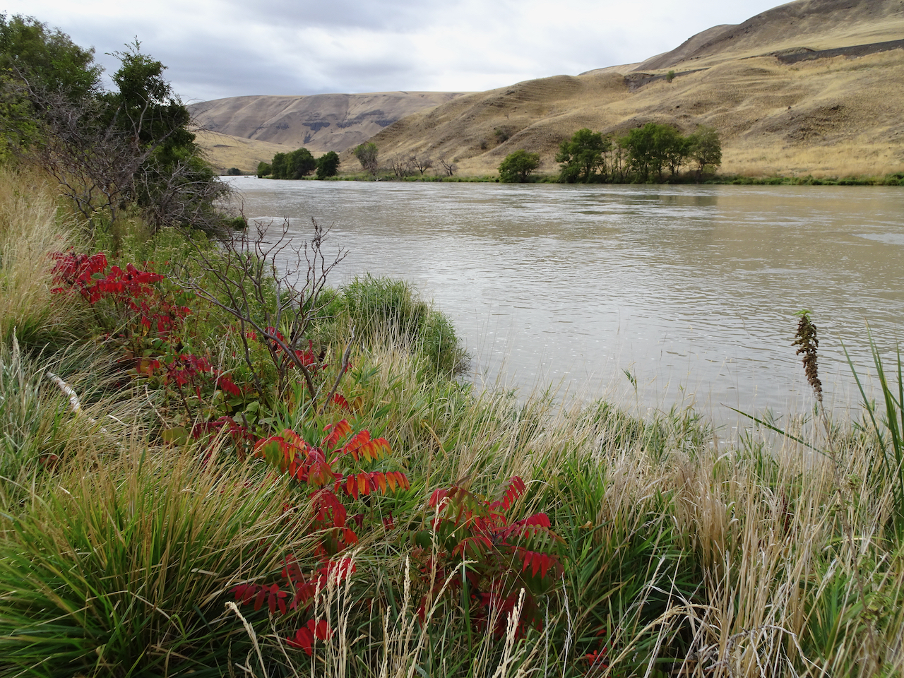
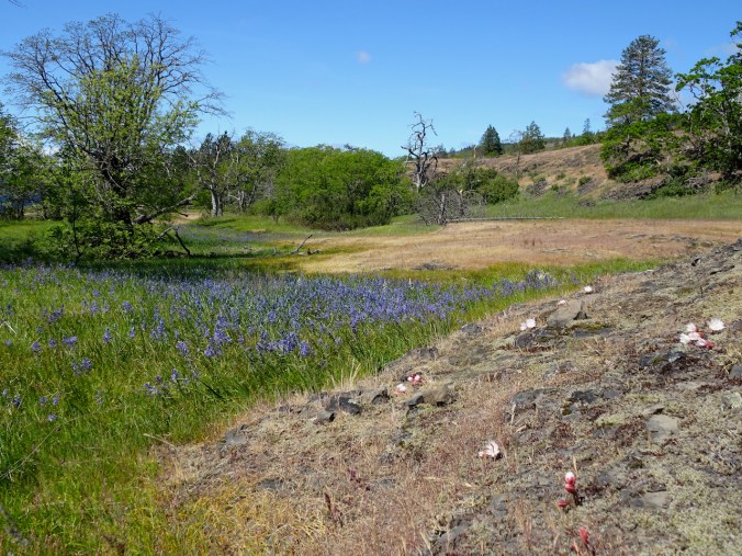
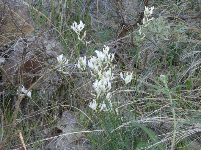
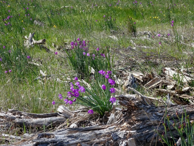
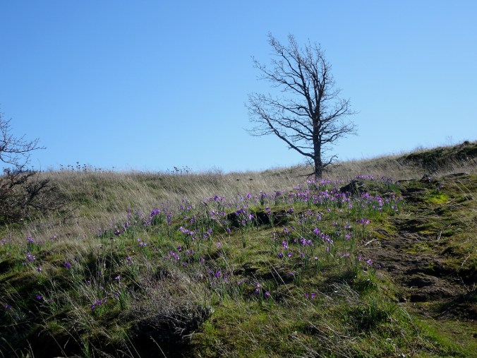
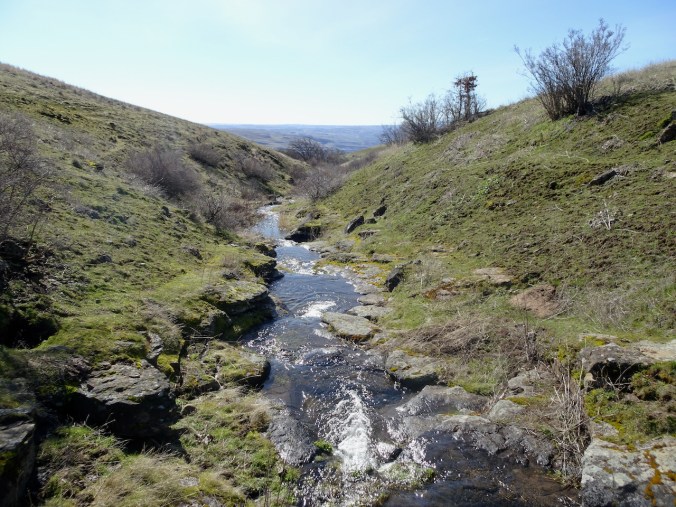
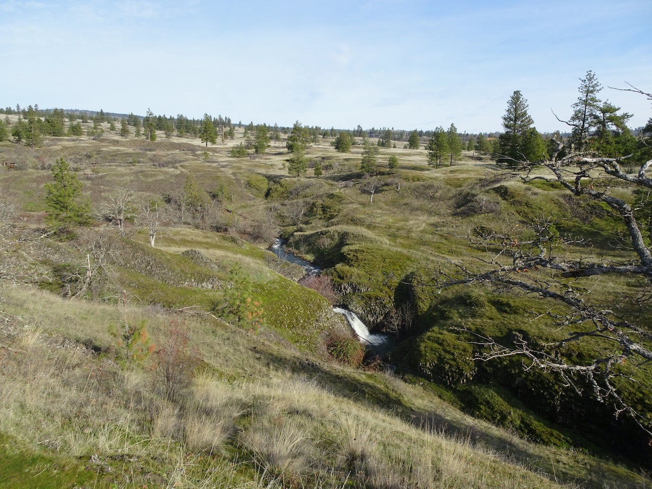
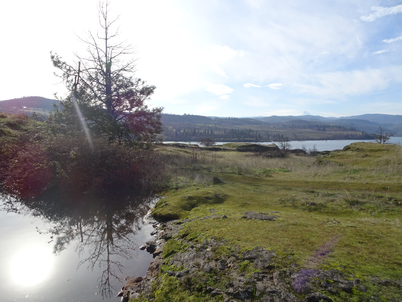
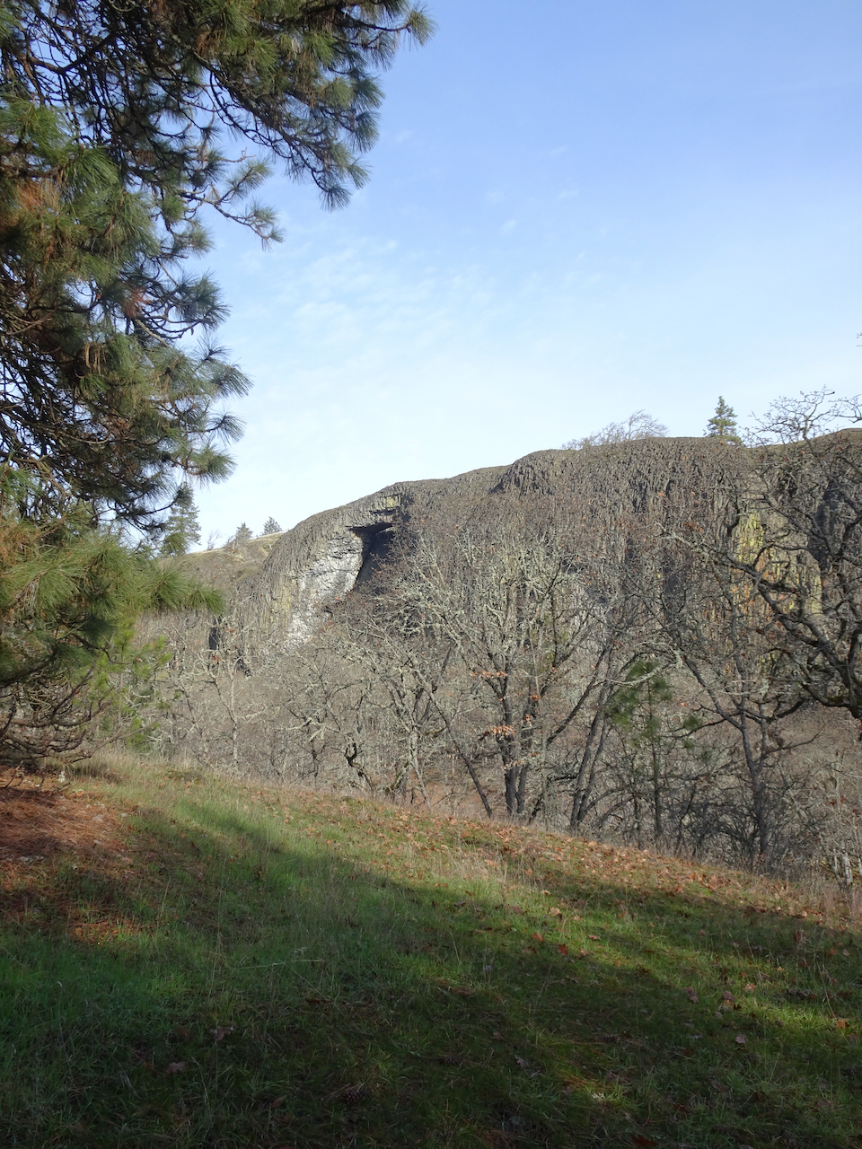
Bitterroot Trail, Catherine Creek, WA April 26
Aptly lived up to its name – the earlier blooming flowers have faded, but the bitterroot is just getting started today!
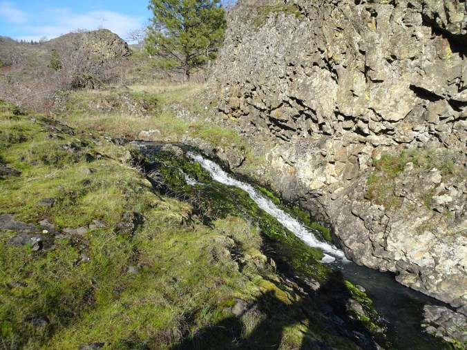
We began near the fairy ponds – now filled with camas lilies; the adjacent rock outcrops hosting glorious bitterroot flowers.
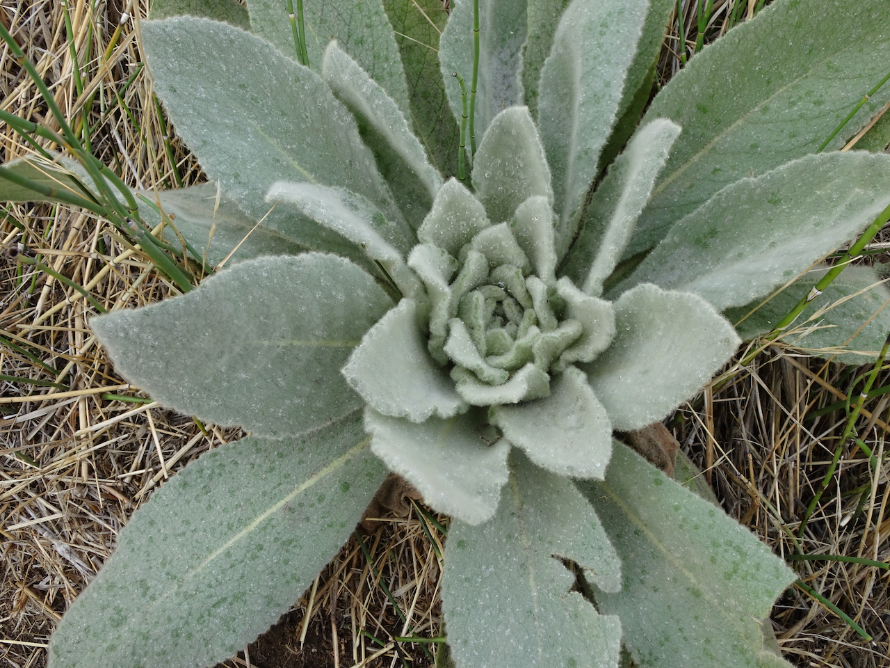
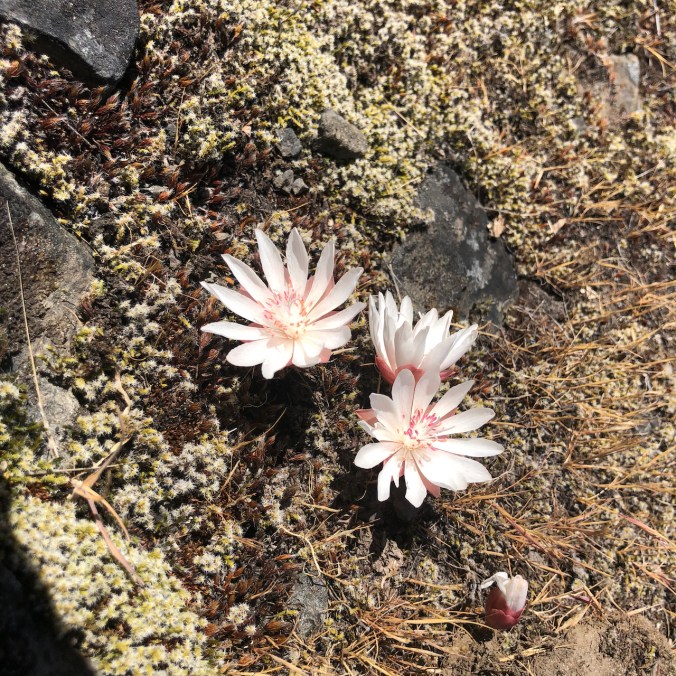
Lewisia rediviva
Sprinkled across the basalt; bicolored cluster lilies speckle the meadow beyond.
We wind our way up the slope:
Eastward.
Camas lilies and shooting stars.
Death camas and purple camas lilies
Turn left at the balsamroot, while admiring the windswept views east,
and west…
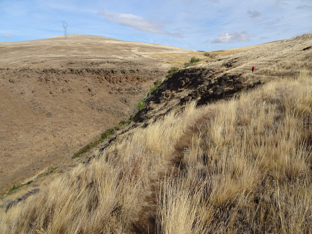
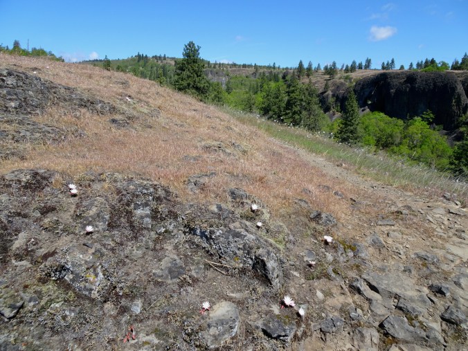
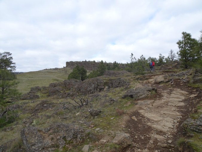
We drop down the Rowland Wall trail,
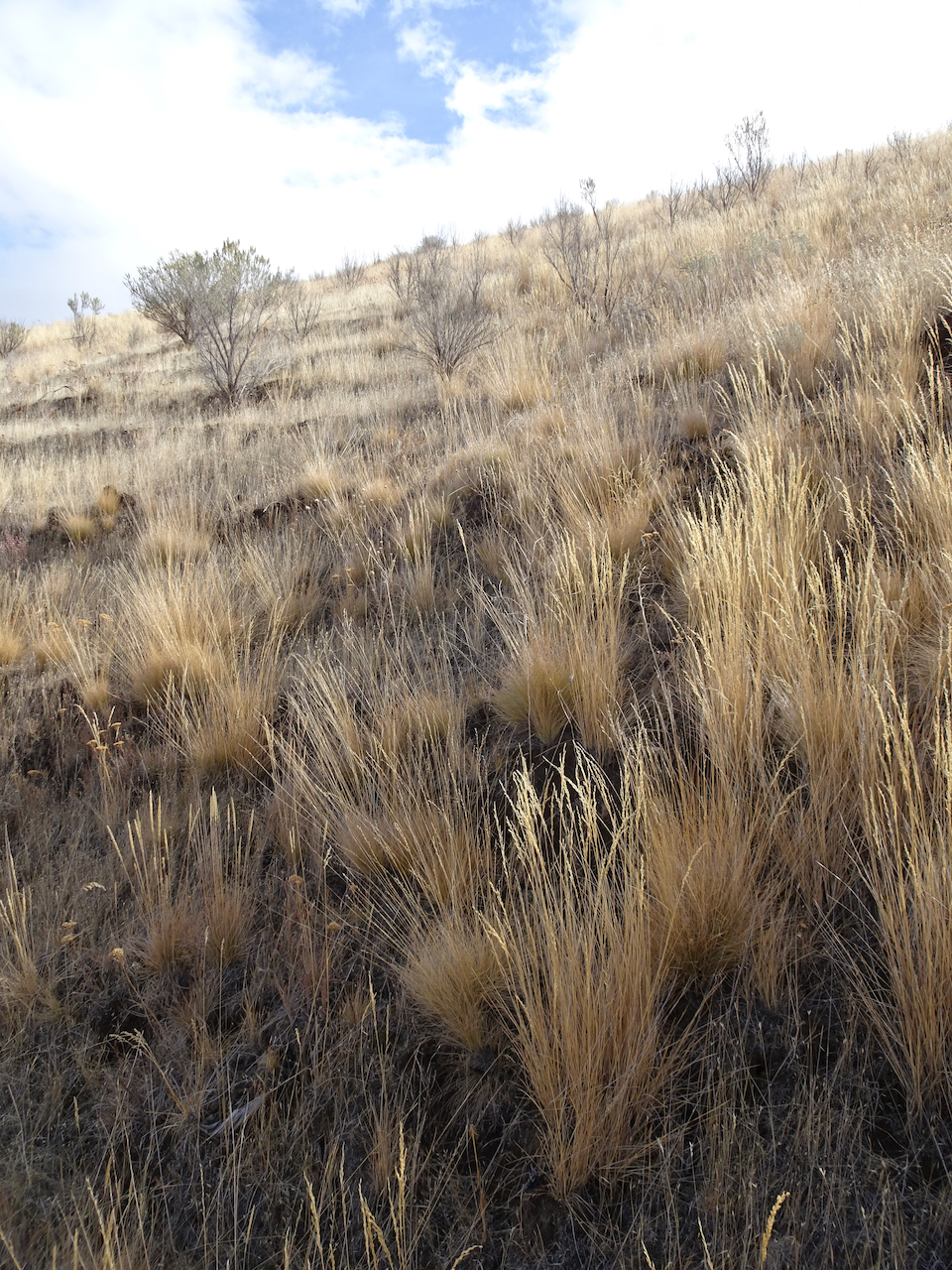
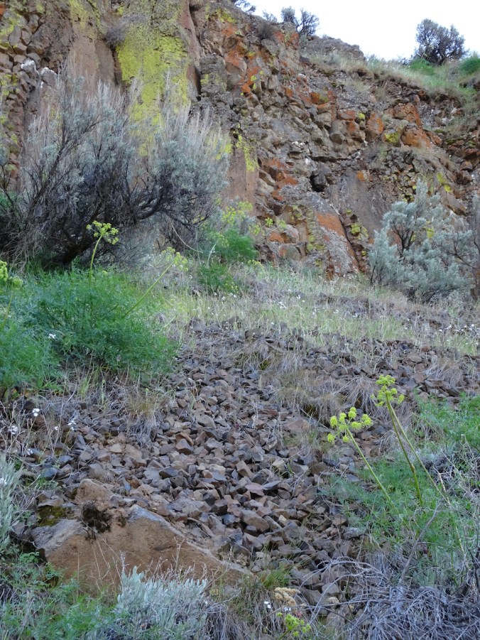
One of the largest clusters of bitterroot buds I have seen…
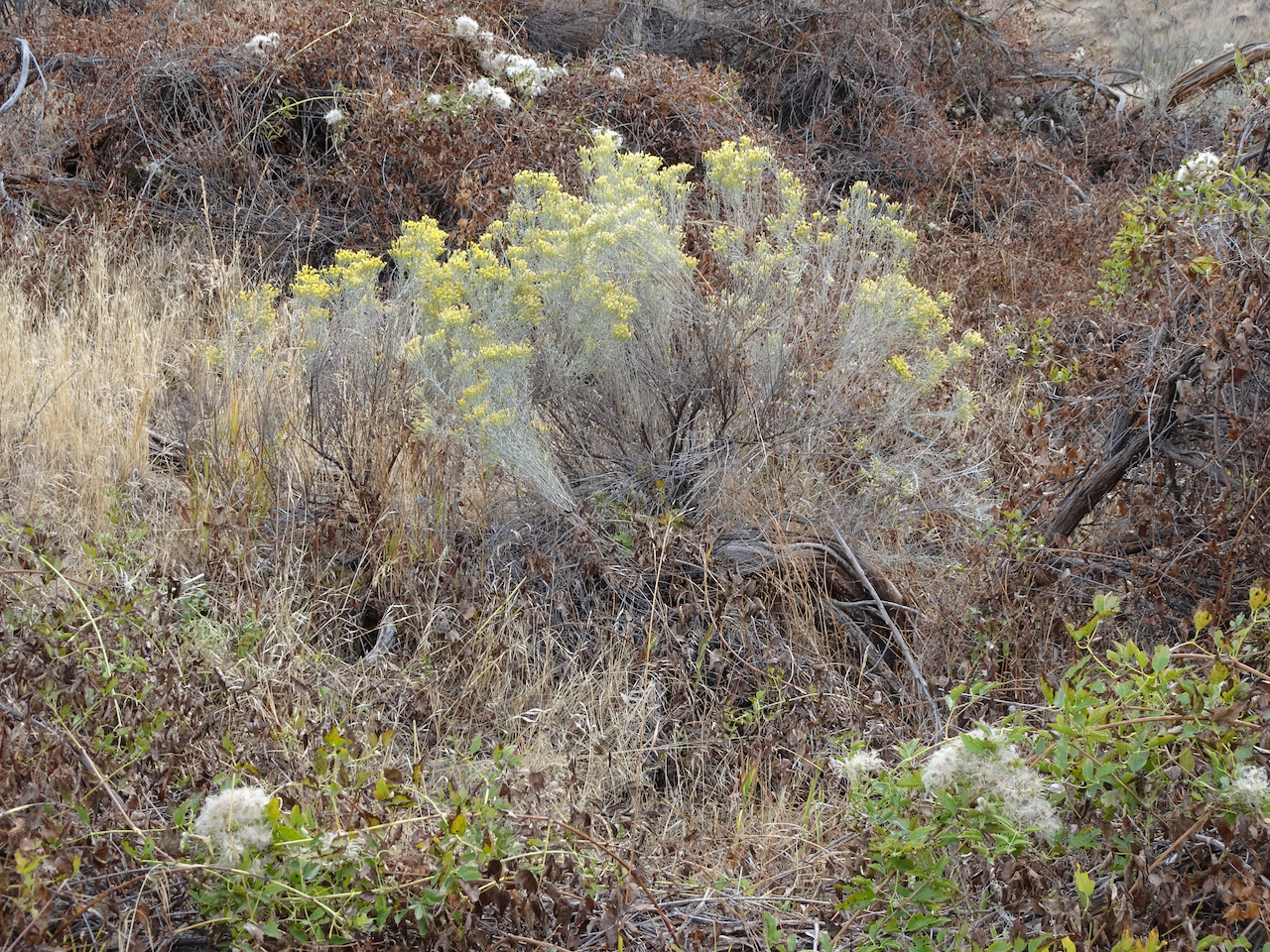
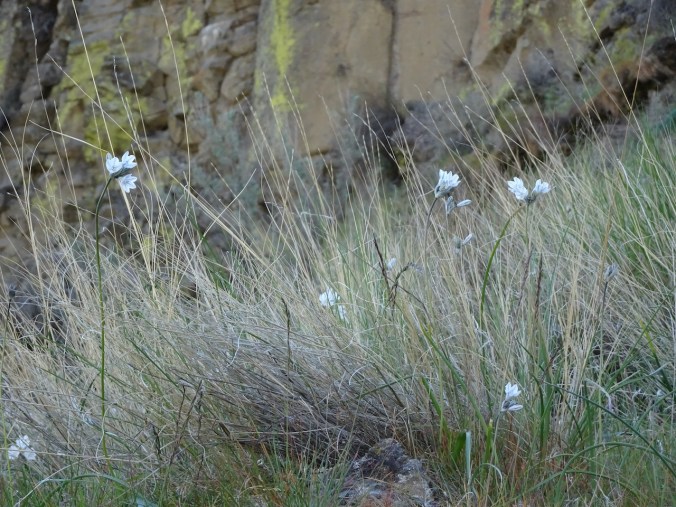
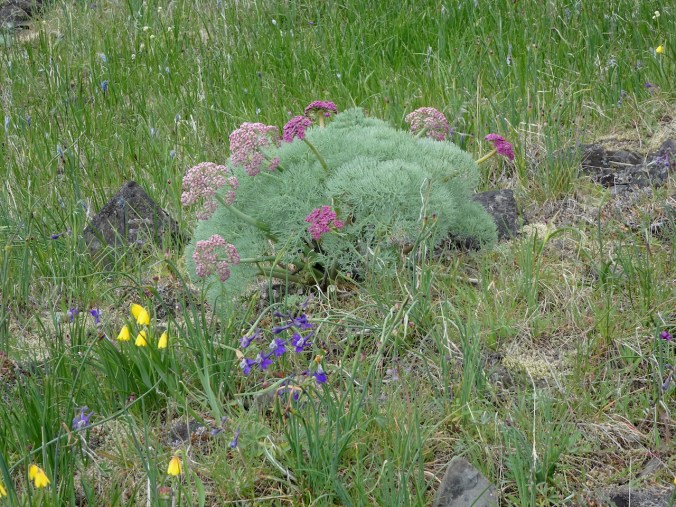
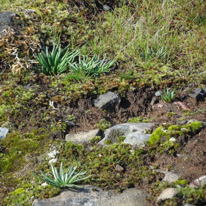
buckwheat
A giant clump of cliff penstomen surprised us!
More bitterroot scattered across the rocky surface along our return trail.
This is their time to rise up!
Meanwhile…
We finally had a chance to see the heritage American Chestnut Tree in the Sellwood neighborhood. It dwarves the house, and there is an enormous stump of another chestnut tree behind it.
Rare American Chestnut, Sellwood, Oregon
Leaves just budding out.
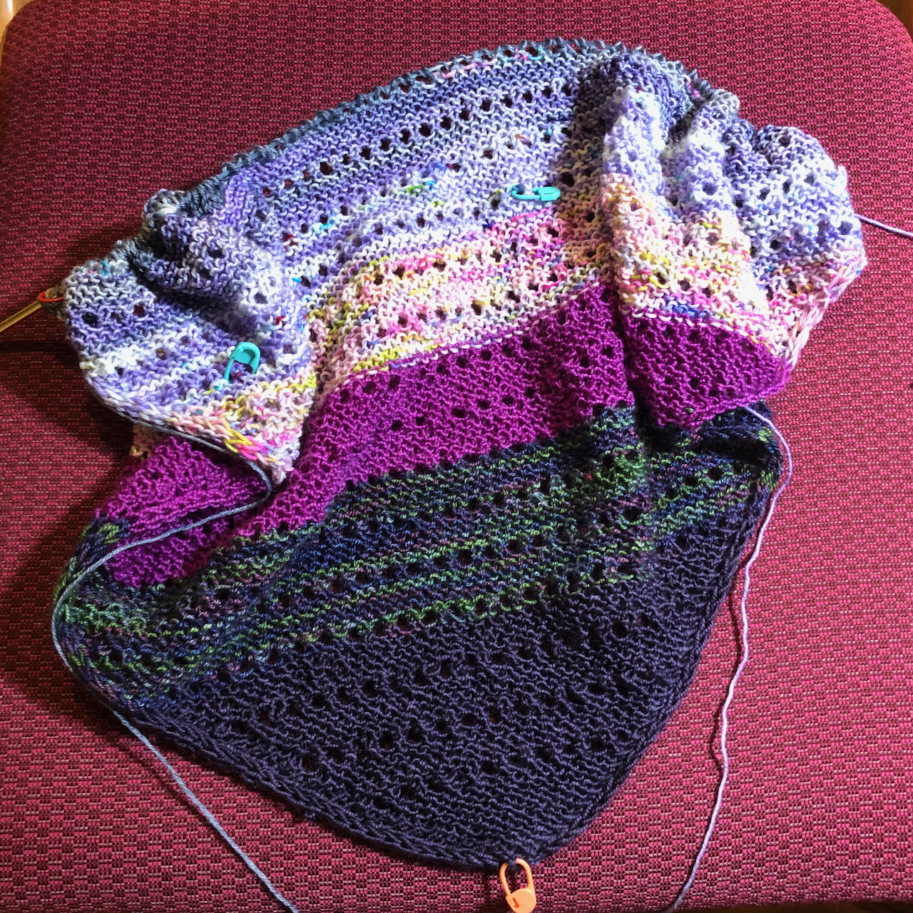
Knitting
I finished a Scrappy Marl Hat for the guild project,
started another hat, and restarted my bamboo cardigan.
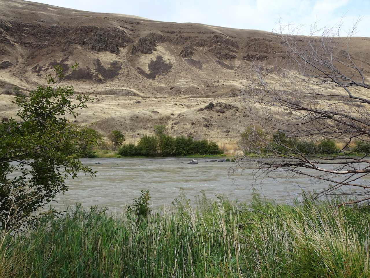
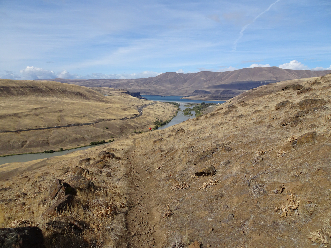
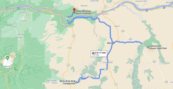
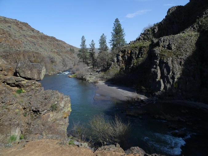
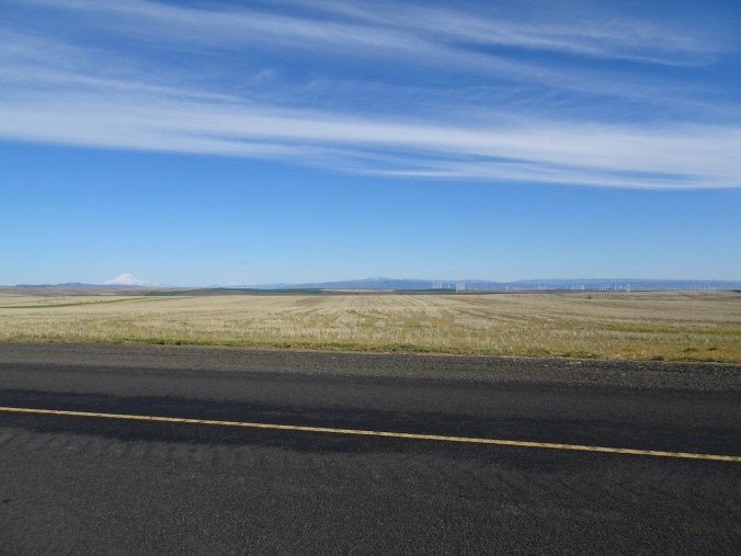
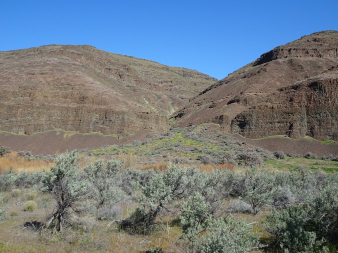
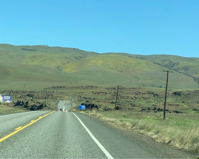
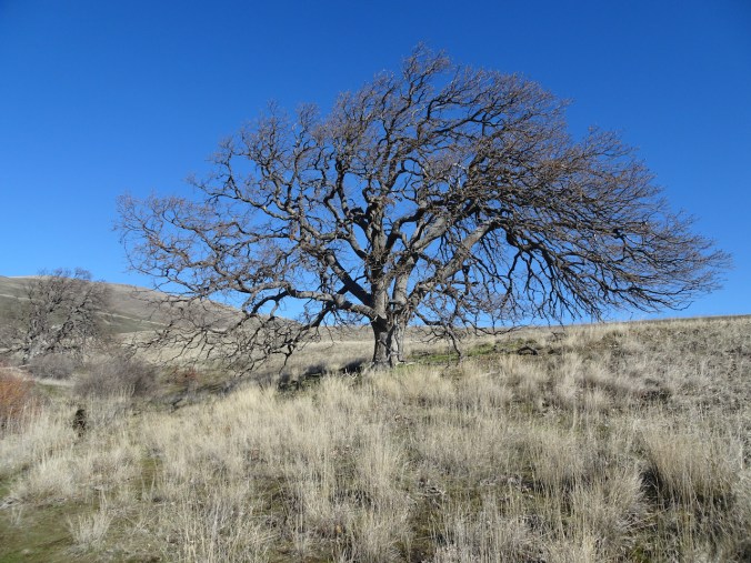
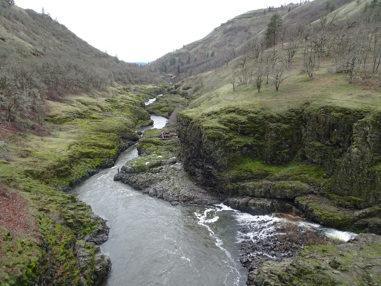
We spent a few days hiking east of the Cascade crest and the rain. We stayed in a small hotel in the small town of Moro, and explored two Oregon State Parks for the first time, then visited the Columbia Hills in Washington on our way home.
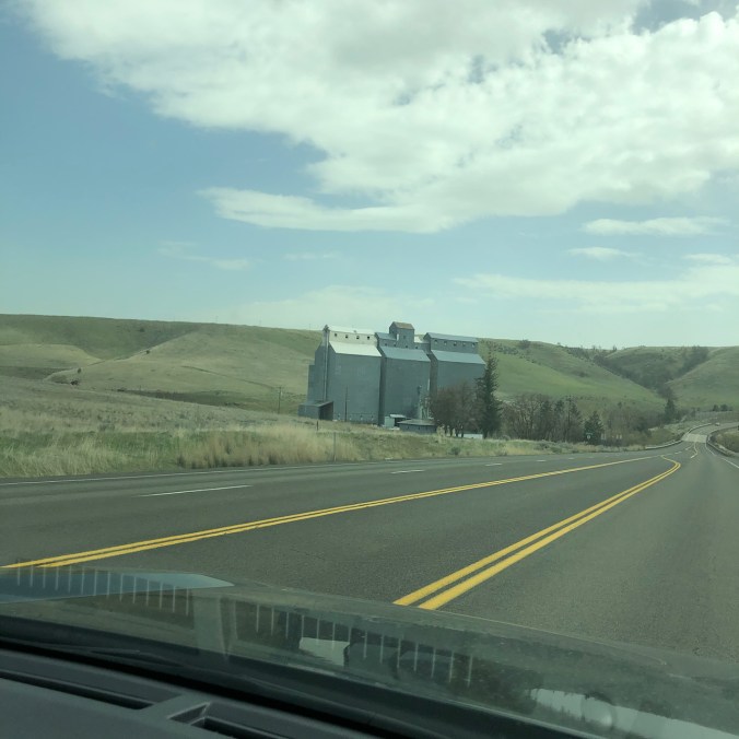
Driving south of the Columbia River to White River Falls State Park – low hills and agricultural buildings our new scenery.
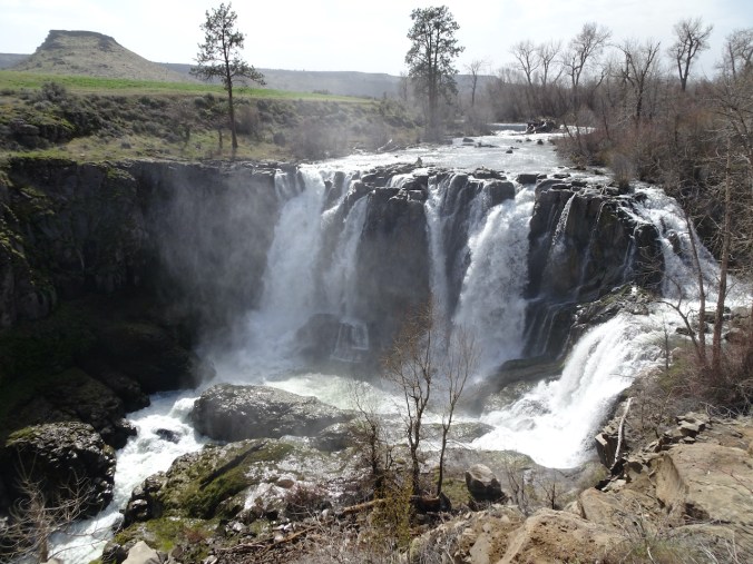
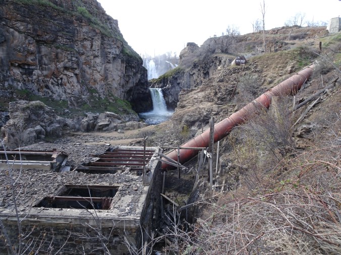
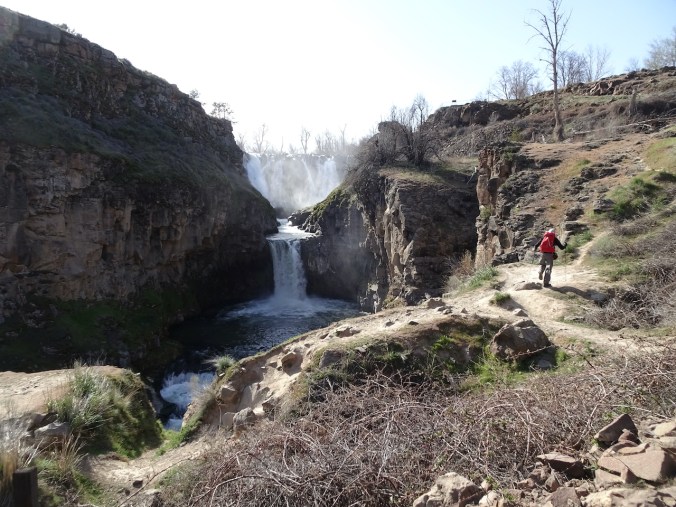
April 13th, White River Falls State Park, Oregon
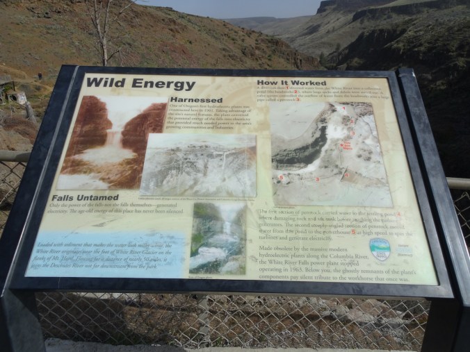
We admired the White River Falls from the overlook, then walked downstream to see the lower tiers of the falls. We were about 2 miles upstream from the confluence with the Deschutes River, and about 50 miles from the source, the White River Glacier on Mt Hood, near a favorite winter snowshoe location. Here, the White River tumbles over cliffs, past the ruins of a hydropower plant that was abandoned in 1963, when a giant dam on the nearby Columbia River was built.
White River Falls
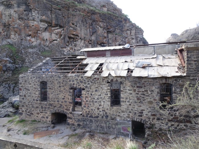
Abandoned power plant.
This is a beautiful falls, though the surrounds are a bit of a wasteland – cement and disconnected pipes, wire grids, a broken building with roof gaps, graffiti, tumble weeds and leaves blown in, plants growing out of the cracks, moss in the crevices.
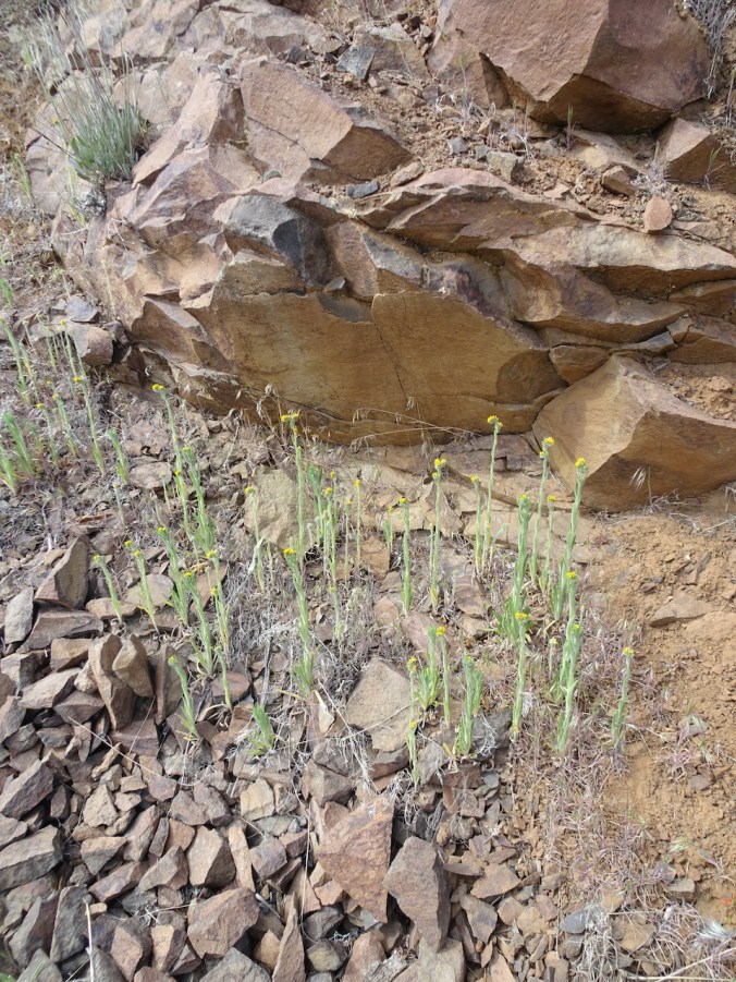
Bright yellow balsamroot and parsley were blooming around the canyon, and gold fiddle neck striped the edges of the rocky path.
Balsamroot, parsley
fiddleneck
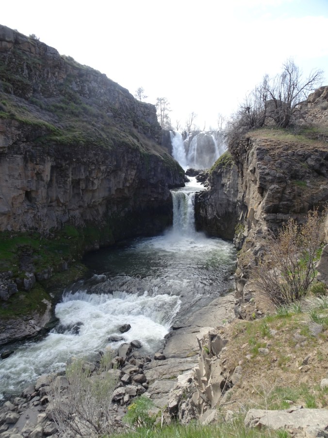
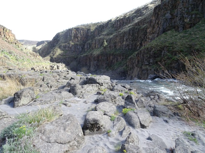
Down by the river we had a bit of a wind shelter. Quiet today, but in summer people come to swim. We walked a ways down stream to see the third tier of the falls, the smoothed rocky shelves with potholes, now exposed, and smooth, sandy banks.
Sandy beach above the lower falls.
Lower falls; upper falls visible to the upper right.
Downstream along the White River.
We walked back up to the rim, past the ruins of the powerhouse and almost post-apocalyptic scenery.
Return hike.
More of the ruins of the old power plant.
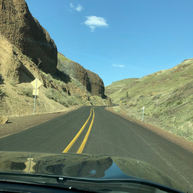
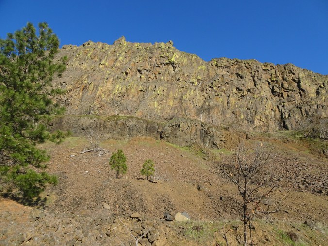
From White River Falls, we drove east across the Deschutes River on our way to Moro, along a long, smoothly curved road on the Warm Springs Reservation. Balsamrooot blooms were sprinkled on cliffs above the canyon.
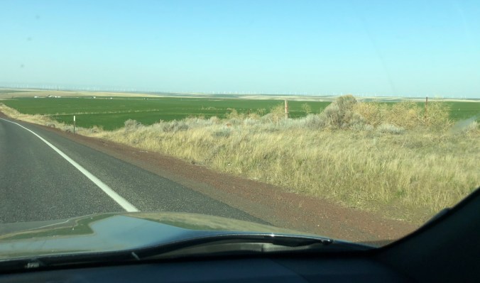
We passed sagebrush uplands and cultivated green fields, a 360 degree horizon punctuated by white windmills gleaming in the afternoon light.
Many white wind turbines on the horizon.
April 14th, Cottonwood Canyon State Park, Oregon
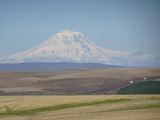
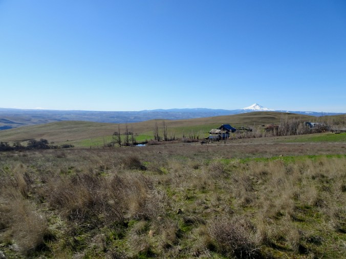
We drove across the uplands between the John Day and Deschutes Rivers on a beautiful clear blue morning. Mt Hood, Mt Adams and Mt Rainier were on the horizon, and more windmills.
Mt Hood
Mt Adams and Mt Rainier
Mt Adams, windmills
Mt Rainier and the Goat Rocks, windmills
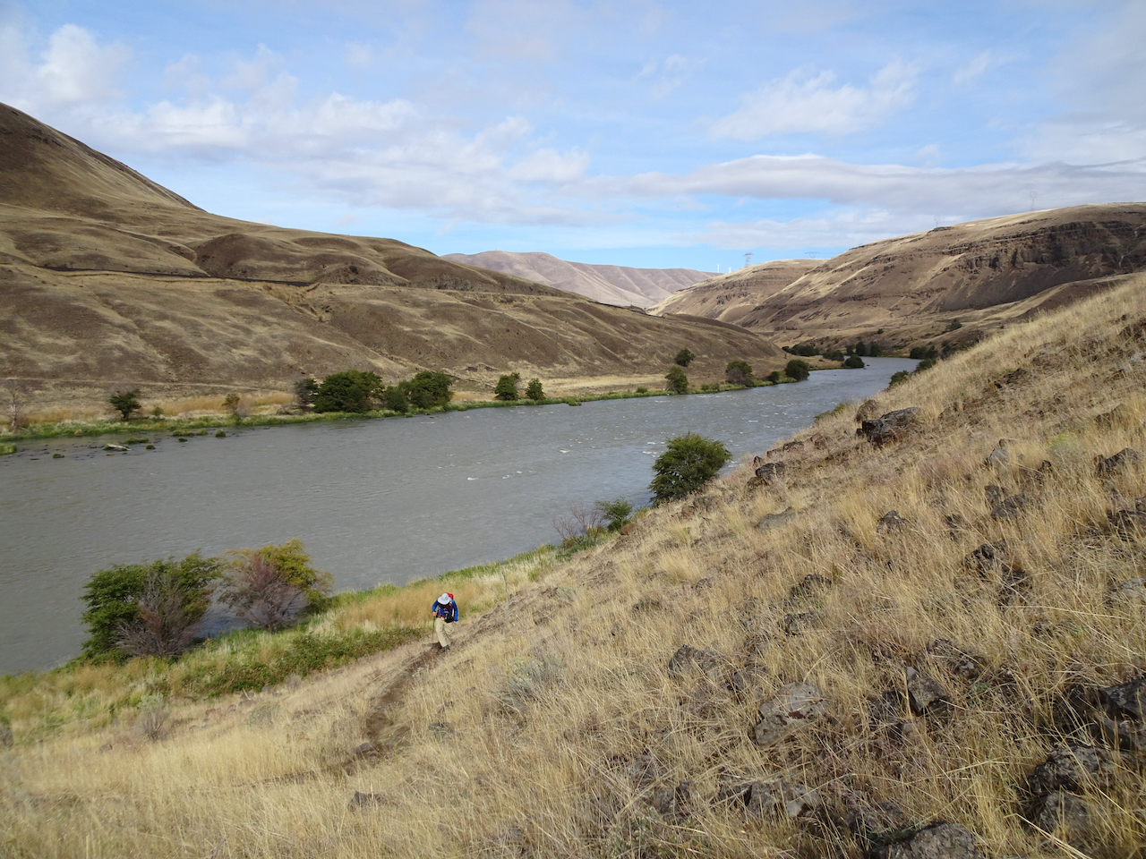
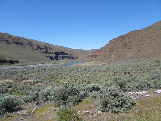
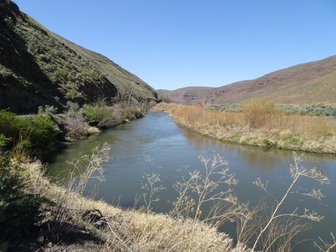
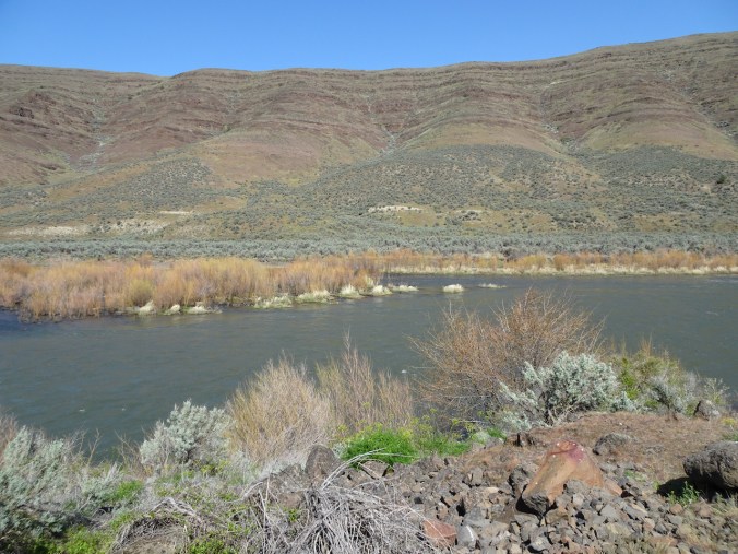
The Lost Coral Trail in Cottonwood Canyon State Park is 9.6 miles out and back. The trail follows an old road along the John Day River, sometimes beneath river-cut cliffs, sometimes across the point bars, as the wide blue river sweeps down stream.
Trailhead
Under the cliffs
Balsamroot above
Bicolored cluster lilies
Desert parsley and lichen
Balsamroot and parsley
milk vetch
Cottonwood Canyon campground across the river.
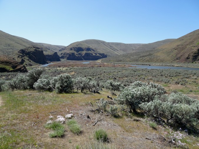
Continuing along the river, the slopes were speckled with wildflowers; willows on the bars and a few trees were beginning to leaf out.
Flowering alluvial fan across the river.
Cliffs and reflections, serviceberry in bloom.
Sagebrush
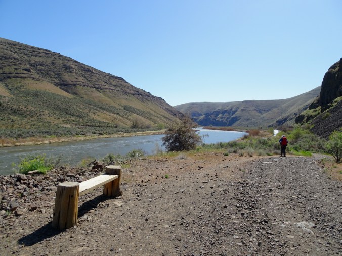
A welcome bench for rest and contemplation.
Lovely desert colors in the rocks, river, plantlife.
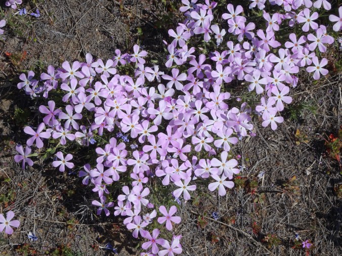
At our turnaround point, we found a phlox-covered slope and beautiful views of the river. We saw three equestrians – our only other people on the trail today.
Three equestrians in our downstream lunch view
Upstream lunch view.
phlox
We retraced our steps upstream after lunch, admiring the views along the river in the changing light.
Walking upstream.
Many colors along the river.
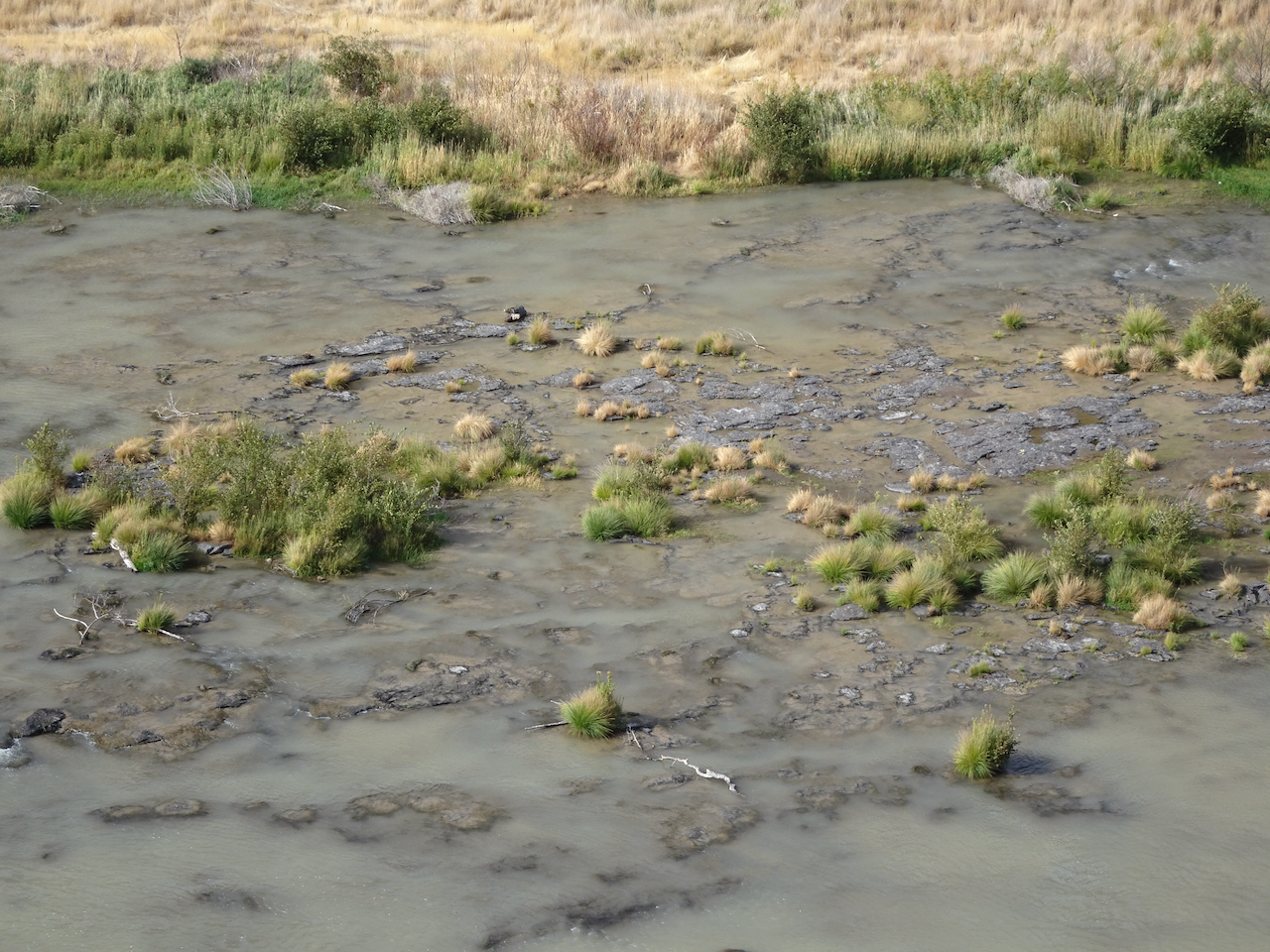
Grassy tufts in the river.
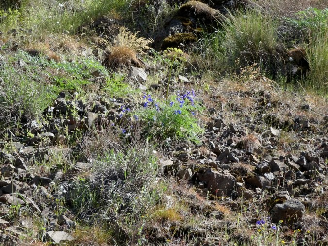
Larkspur
Back under the cliffs near the trailhead.
Parsley
I don’t know if I still love the desert as much as I used to. The rocky, prickly, isolation of it has caught up with my age. Dust and wind, and there must be snakes around somewhere …I just don’t know…
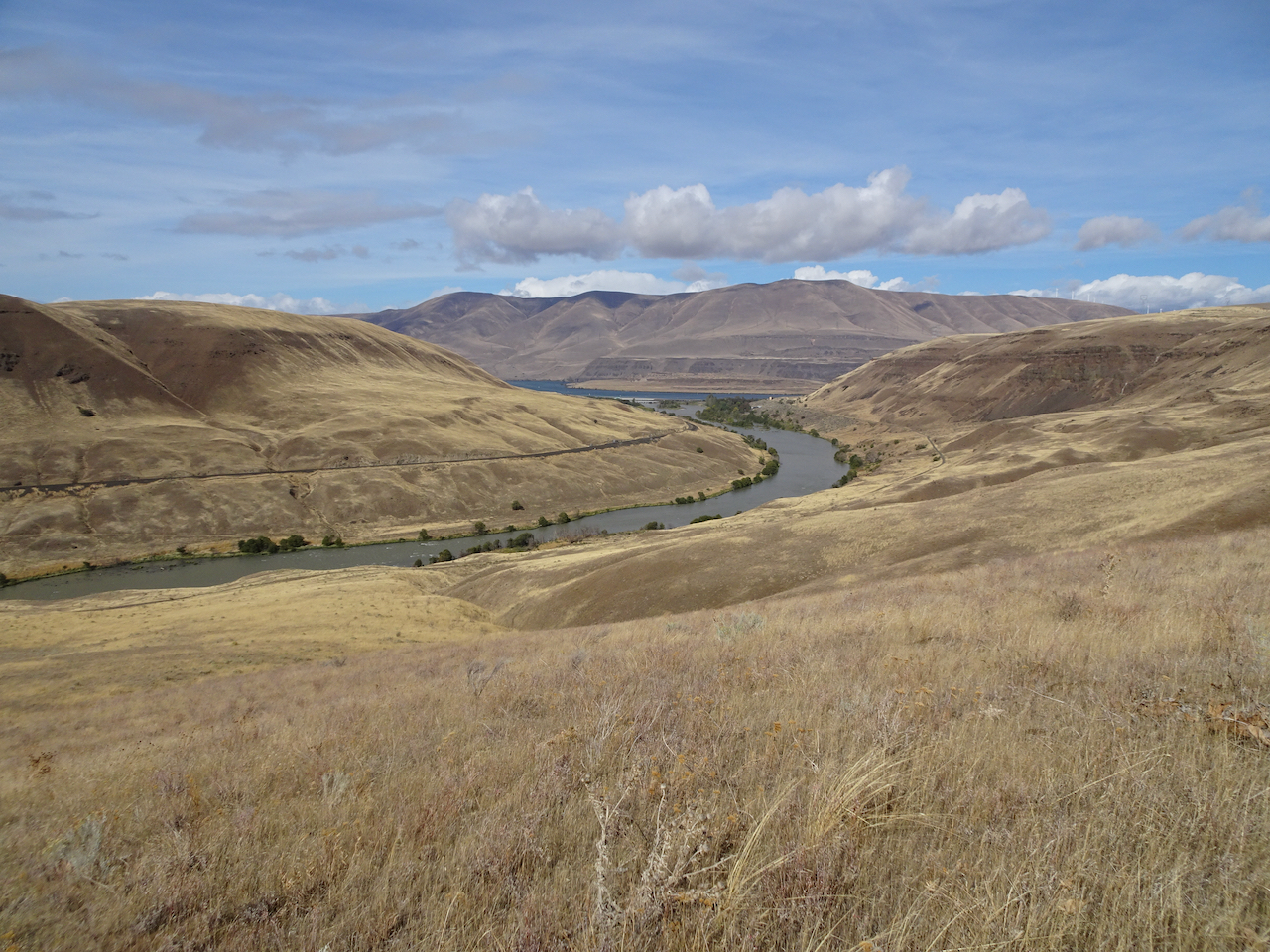
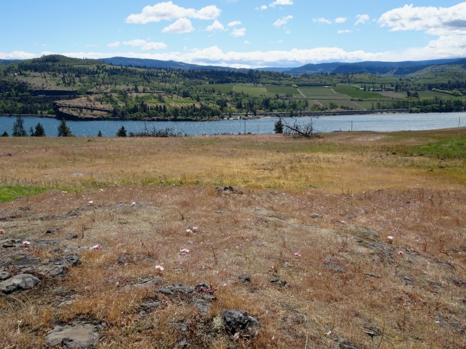
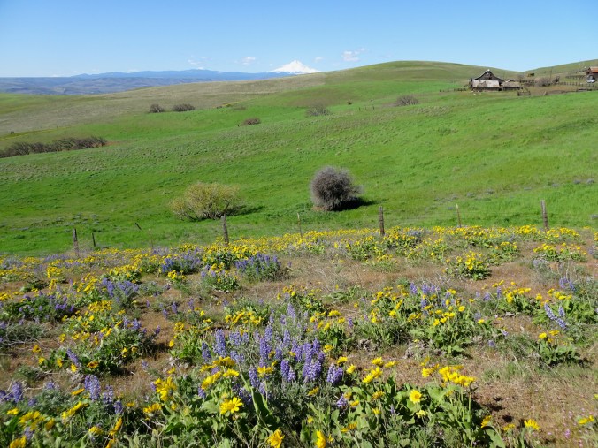
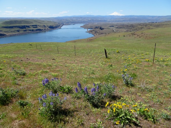
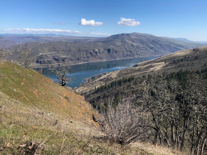
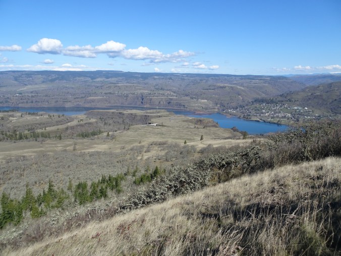
April 15th, Dalles Mountain Ranch, Columbia Hills State Park, WA
We drove back across the windmilled uplands, in view of the three mountains on the skyline, all the while watching the painted slopes of the cliffs and hills on the north side of the Columbia River. Distinct patches of yellow, white, and purple across the green and brown indicate the slopes are blooming with the wildflowers that we are going to see.
Looking at the Columbia Hills in Washington from Oregon.
We hiked the Ranch Loop clockwise from the Dalles Mountain Ranch Trailhead – we have been here before, most recently in February, when only the early flowers were on view. Today there were so many flowers out – gold balsamroot, purple lupine, pale pink phlox, and always the yellow parsley and pink filagree creating a pastel underglaze on almost every slope.
Mt Hood and ranch buildings from near the trailhead.
The “one tree”, still no leaves, with a flowery background
Balsamroot all the way down to the Columbia River.
Lower east-most view.
Lupine and western view from the high point on the lower trail.
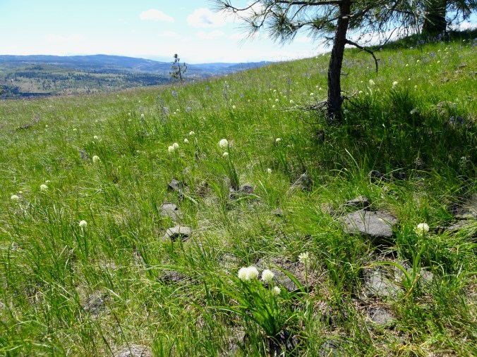
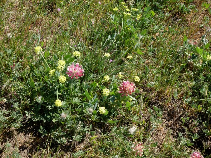
Large head clover
Fleabane
Lunch view – in February this area was covered in purple grass widows.
Back up Eight Mile Creek to the ranch.
We finally spotted the old car that is so often photographed among the flowers at the ranch.
We enjoyed this hiking trip, a chance to get out of town and enjoy the spring flowers at a couple of new locations.
The crabapple tree in our front yard finally bloomed during the second week of April. This tree was in full bloom the day we moved into our house in mid March almost 30 years ago.
April 9th
April 11th
April 15th
Other garden blooms:
tulips fully open
phlox
checker lily
And some cupcakes for a friend’s birthday:
Hikes:
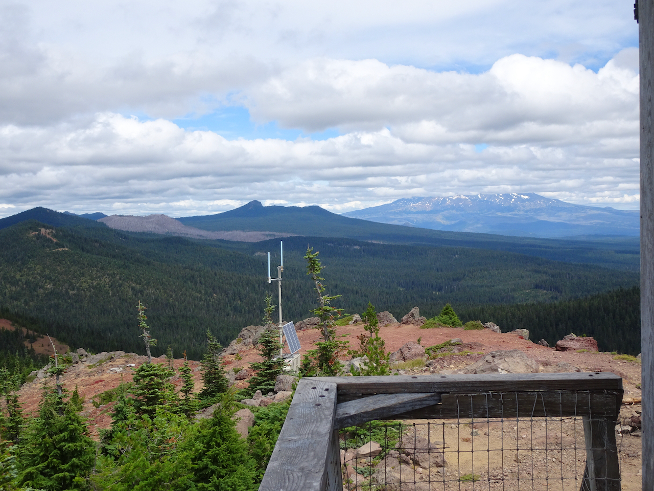
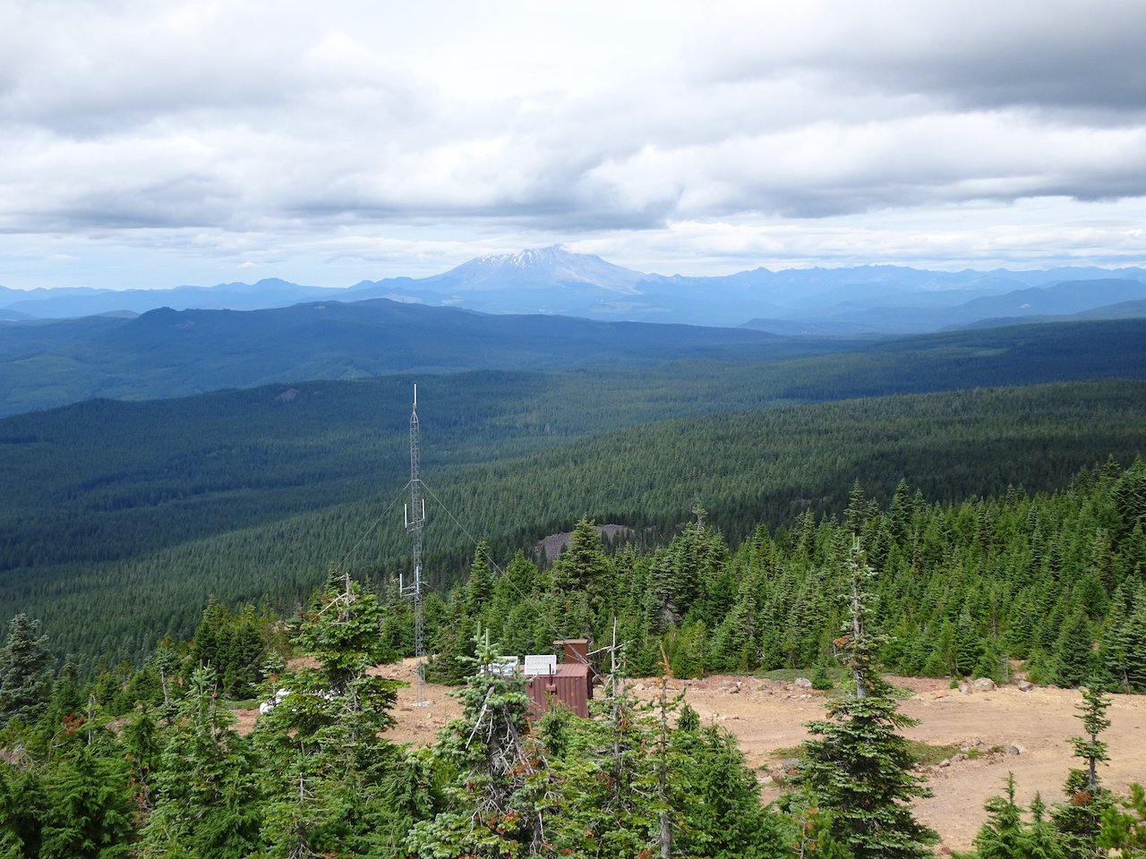
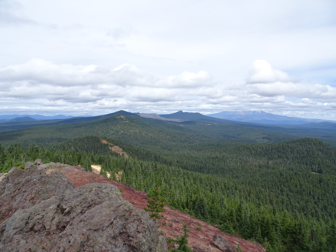
April 2nd, Memaloose Hills, OR –
Begin at the Memaloose Overlook…
Today’s star is balsamroot!
Buttercup carpet in the woods.
Balsamroot all the way up Chatfield Hill.
Looking back.
North view from the top – Mt Adams, paintbrush, yellow parsley.
Columbia River, Columbia Desert parsley, balsamroot
Mt Hood to the west.
Willows and bees near the spring on the return hike.
Popcorn flowers on Marsh Hill.
View from Marsh Hill back to the Memaloose Hills.
More wildflowers:
Blue eyed Mary and slender phlox
Glacier lilies and buttercups
Larkspur and balsamroot
Shooting stars.
April 8, Coyote Wall, WA – Our first hike with friends in more than a year! We are all fully vaccinated!
Starting up The Old Ranch Road.
Service berry in bloom on the Little Moab Cliffs.
The edge of the Coyote Wall, yellow parsley.
And balsamroot, eastward view.
Southward view.
And we are going higher!
Upper cliff edge view.
A nice meadow near Atwood Road, as we loop eastward before hiking down.
A day when every blade of grass seems to have a bloom!
So many flowers!
Desert parsley along Old Hwy 14 cliff, return hike.
And more flowers:
Parsley and cluster lilies
Tomcat clover
Pucoon
Great hounds tongue
Wooly vetch
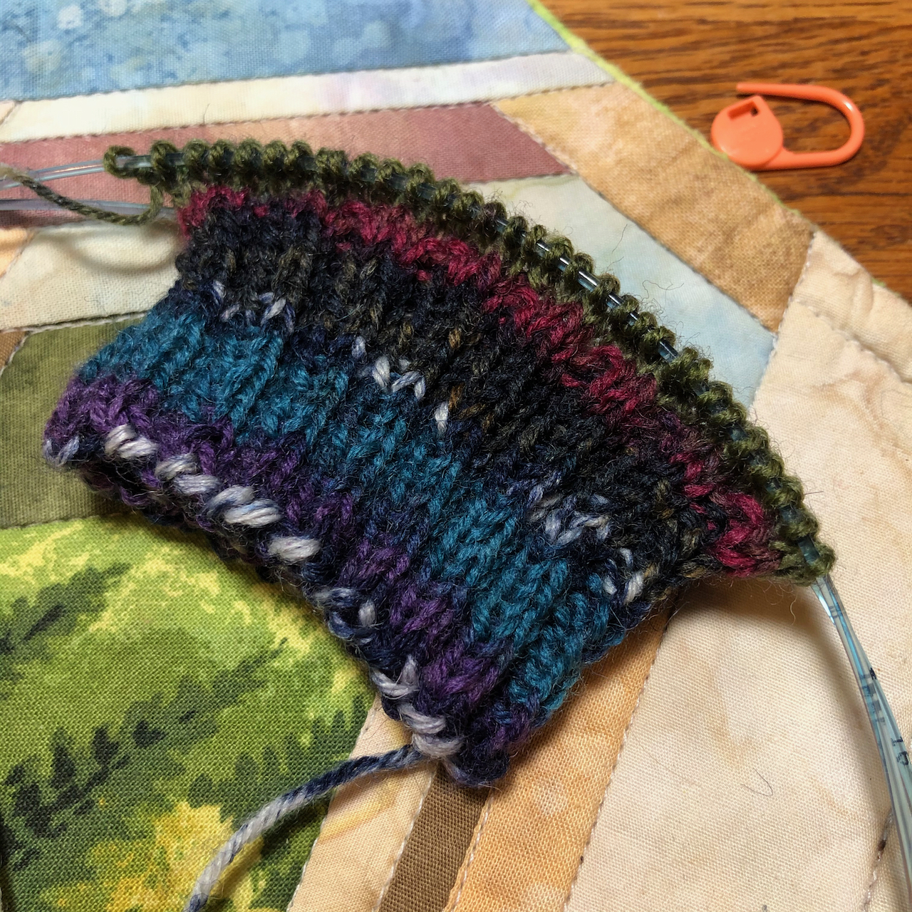
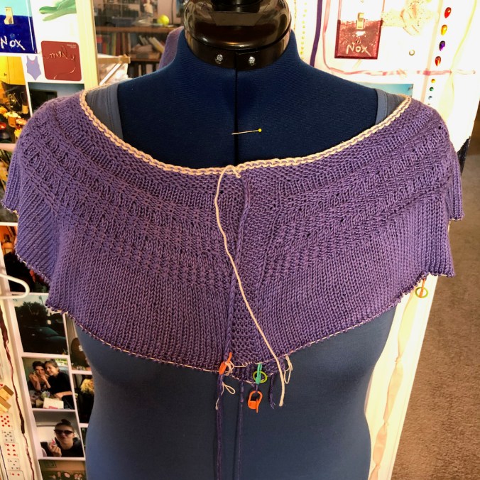
Knitting
Some progress on two projects:
I finished the yoke on this bamboo cardigan, and it is way too big, despite careful swatching, so this one is in time out for a while.
A mystery project for a gift…
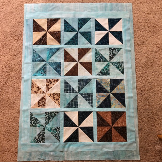
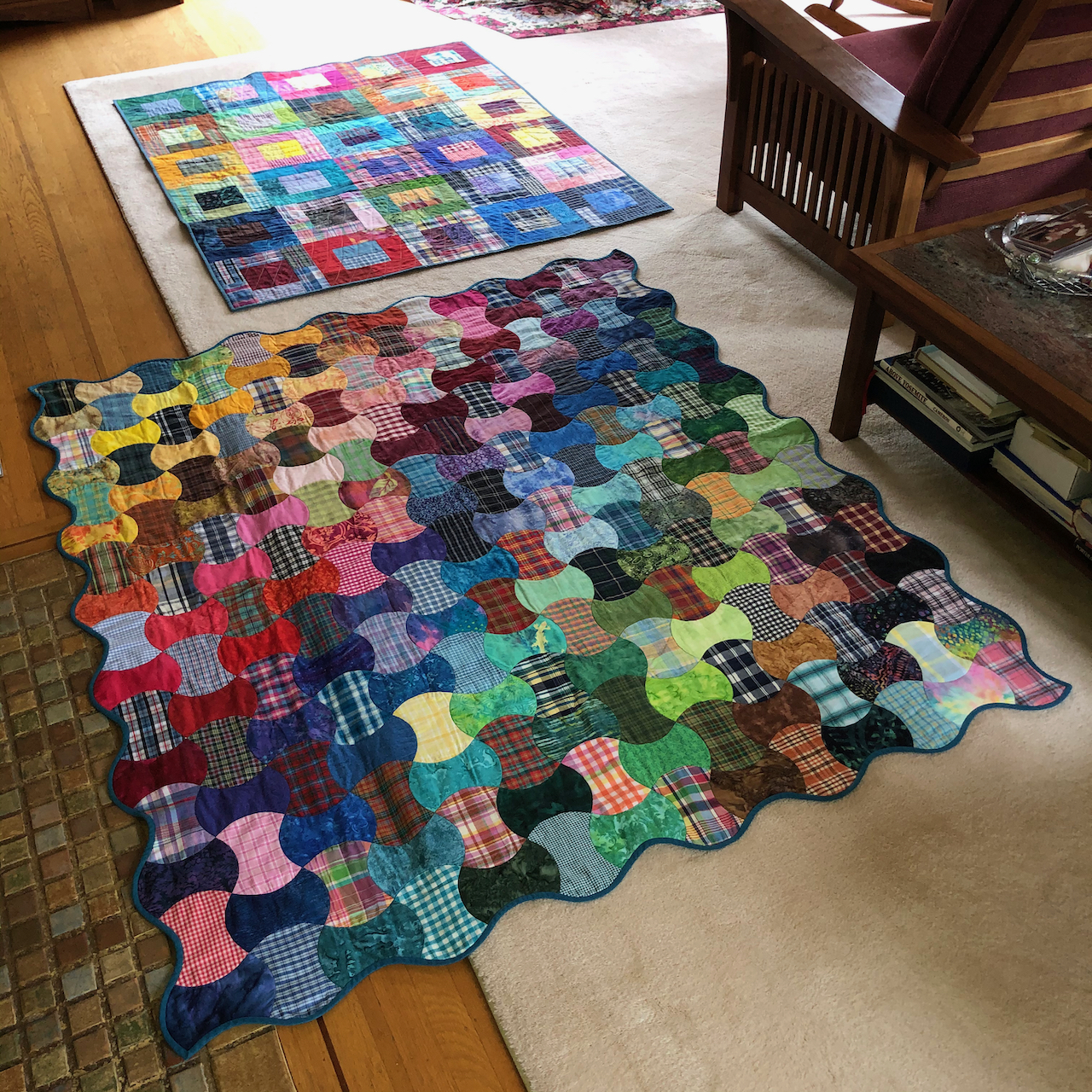
Quilting
I am starting a baby quilt for a new family member!
Tulips and cherry blossoms, three more hikes, a new knit along, a careful cross country trip, and our neighborhood loses our star author, as we continue into our second year of pandemia.
The neighborhood in bloom –
anemones
tulips
forsythia
garden wall on Klickitat St.
cherry trees
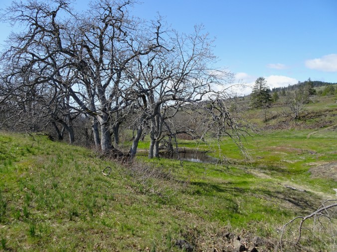
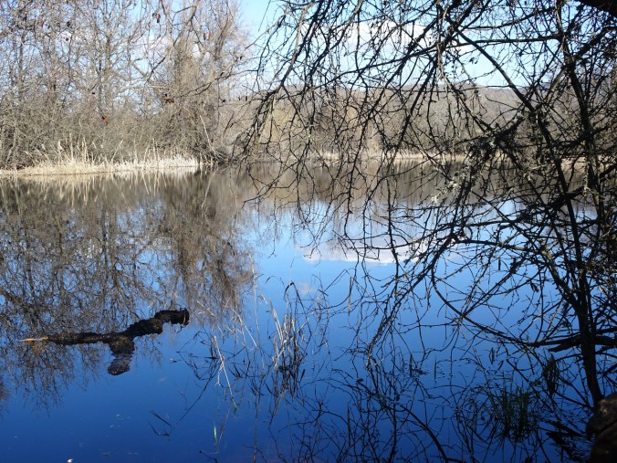
Catherine Creek East
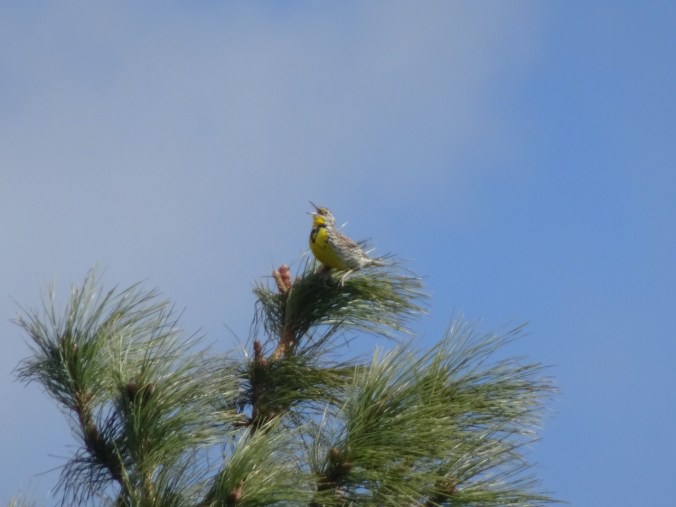
March 26th – A beautiful day – we roamed on the eastward loop to see the latest of early spring flowers sprinkled on the grassy slopes.
White death camas and saxifrage all the way up…
Yellow agerosis and yellow bells
The first of the purple camas,
the last of the grass widows.
Monkey flowers, rosy plectritis and orobanche
Shooting stars and saxifrage
Larkspur, and purple Columbia desert parsley
Yellow parsley and Mt Hood!
Meadow lark
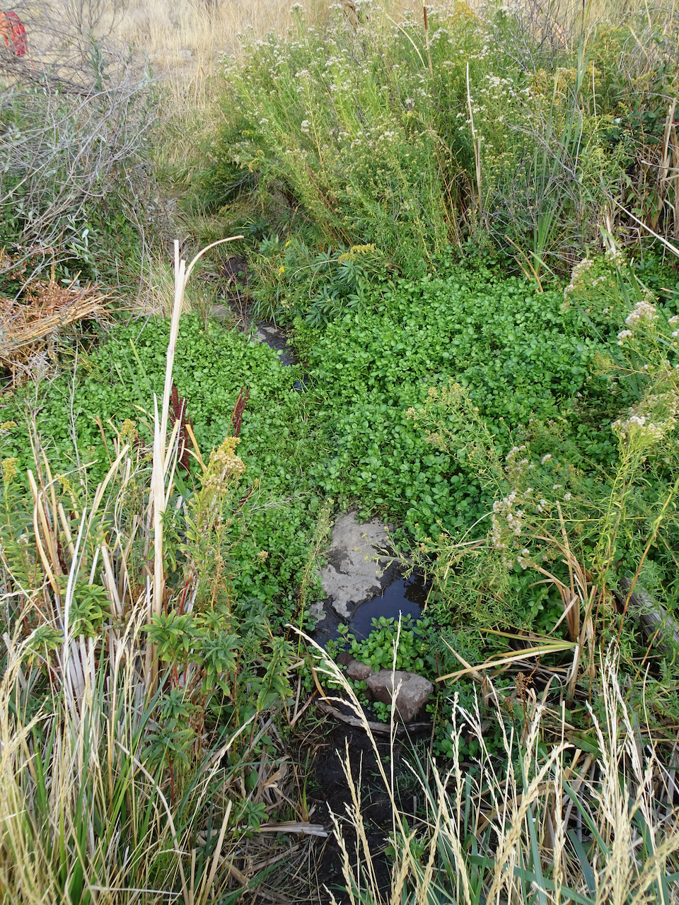
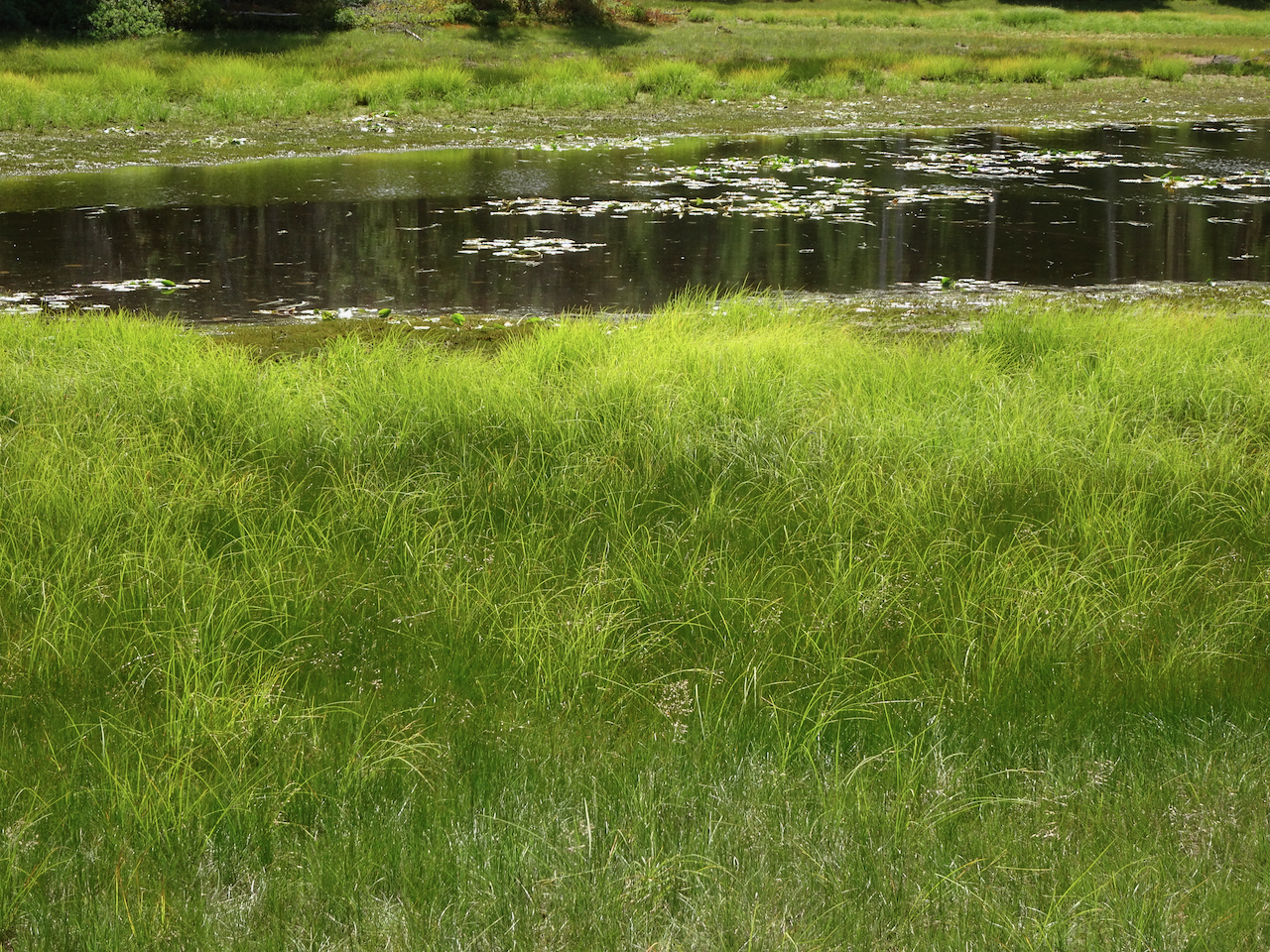
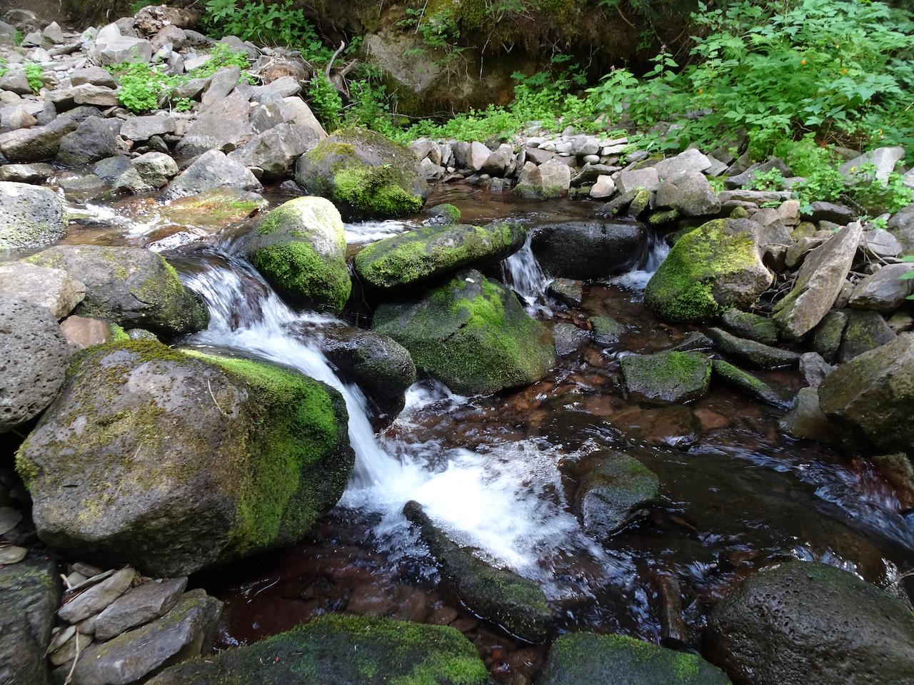
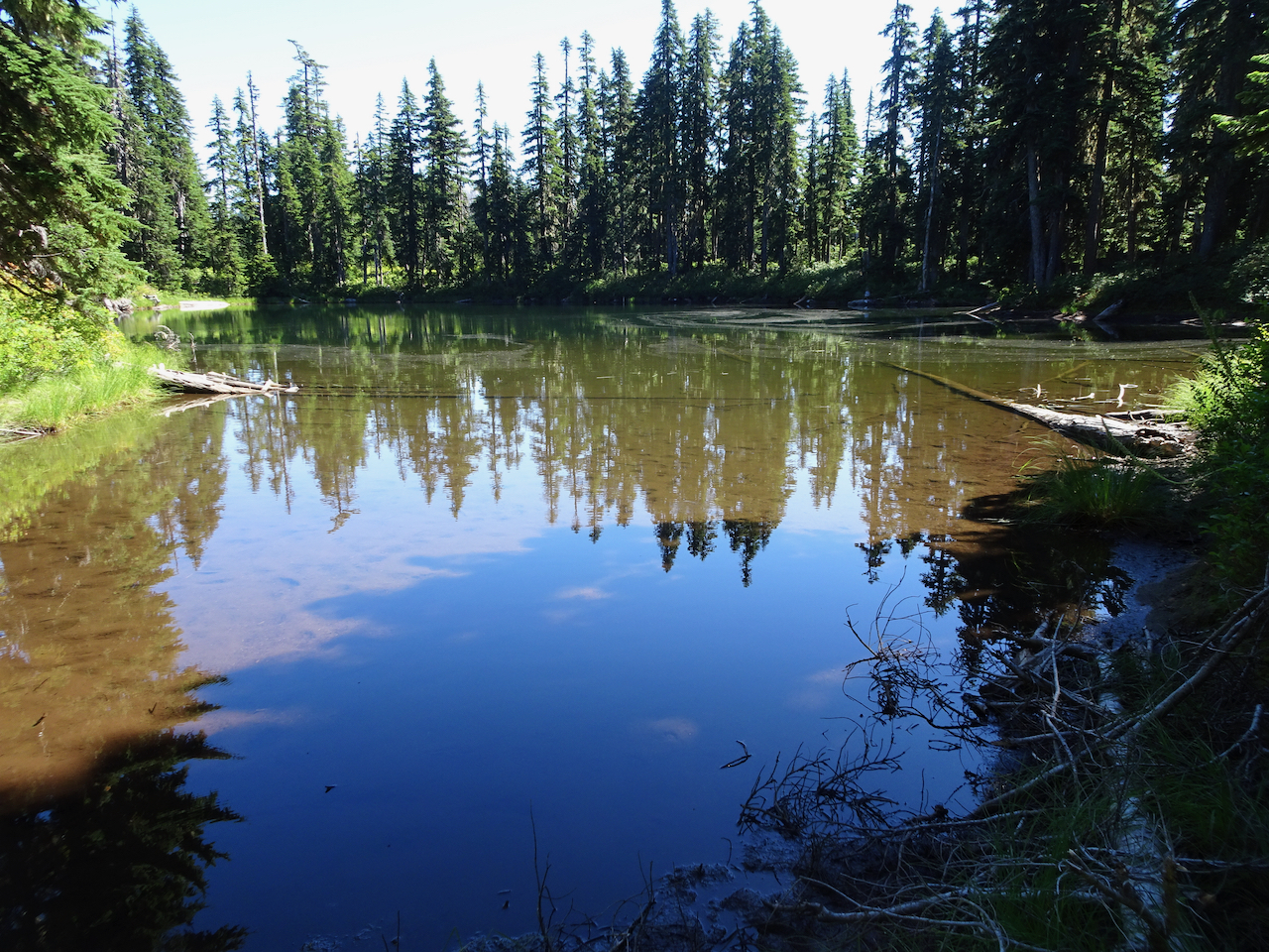
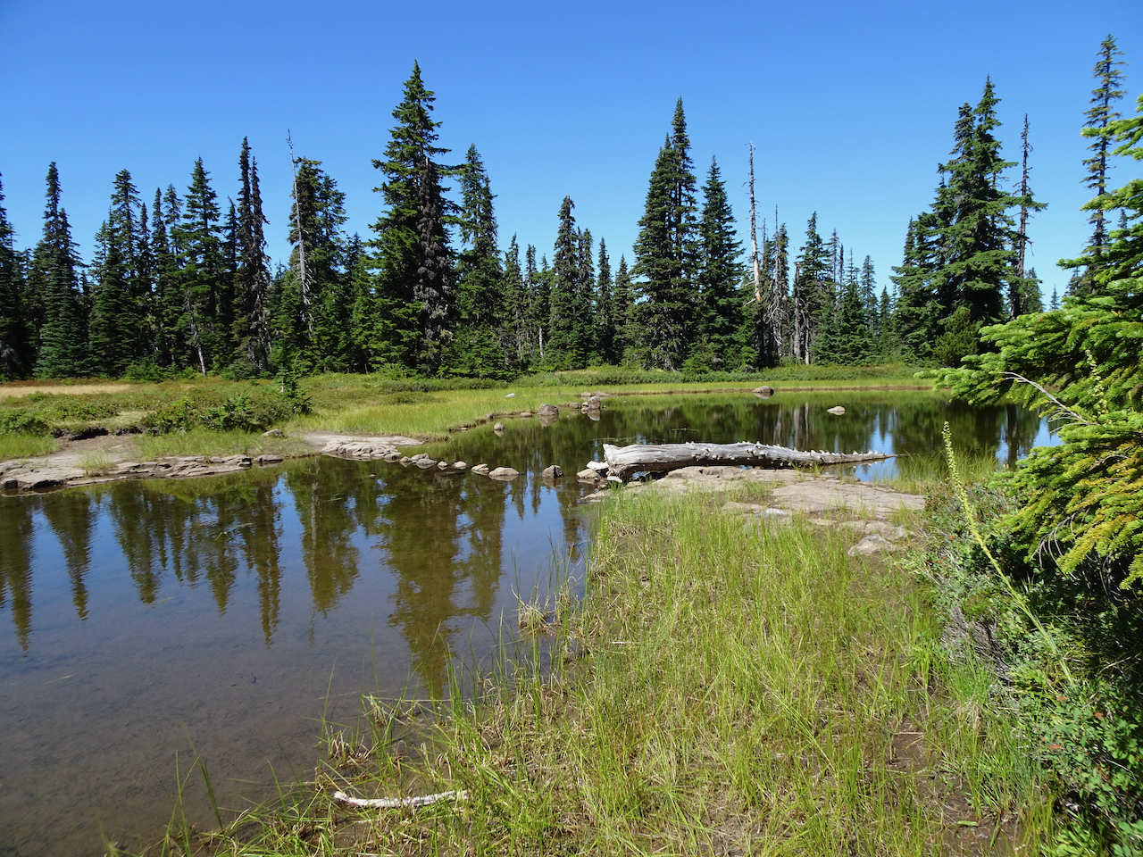
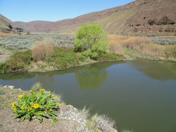
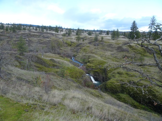
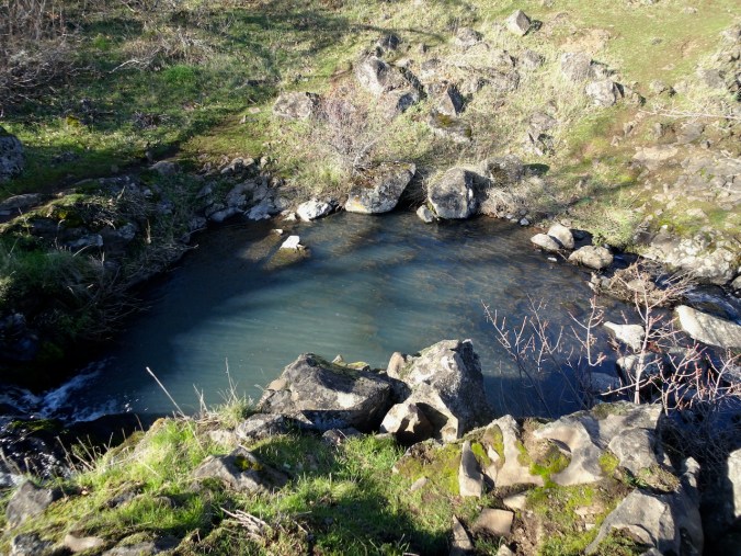
Fairy ponds
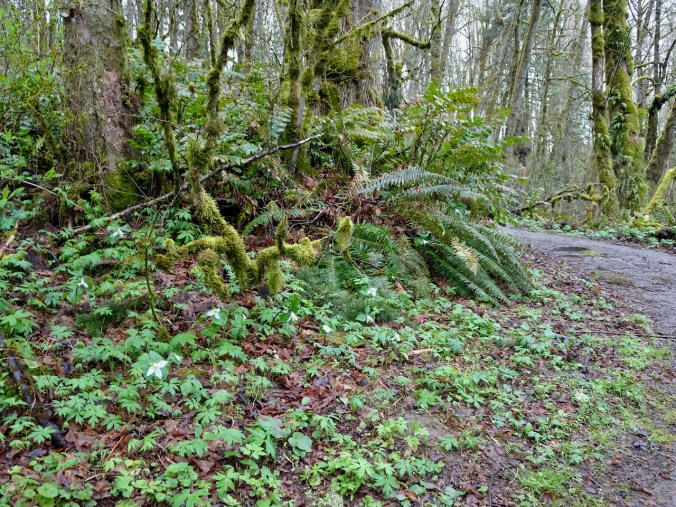
Wildwood Trail, milepost ~ 10 to 14
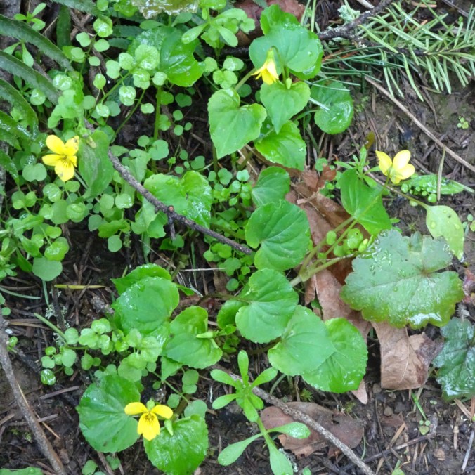
March 29th – A slightly rainy day, trilliums lining the trail on our loop. I have now completed about 20 miles of the 30 mile trail during the pandemic.
Wildwood trail on a damp day.
Trillium blooming all along the trail.
Trillium
Violets
Salmonberry
Coltsfoot
Return along Leif Erikson Drive
Sky breaking out!
Cooper Mountain
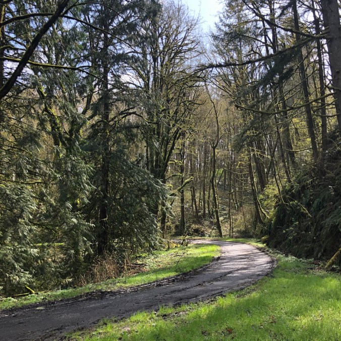
March 30th – We took a quick loop around this mountain on the edge of suburbia, being reclaimed/preserved so that all doesn’t become concrete, while our son was at an appointment nearby. A few early spring flowers on view.
Iris
Indian plum
Oregon grape
Looking down the slope from the trailhead.
Knitting
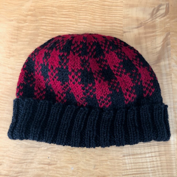
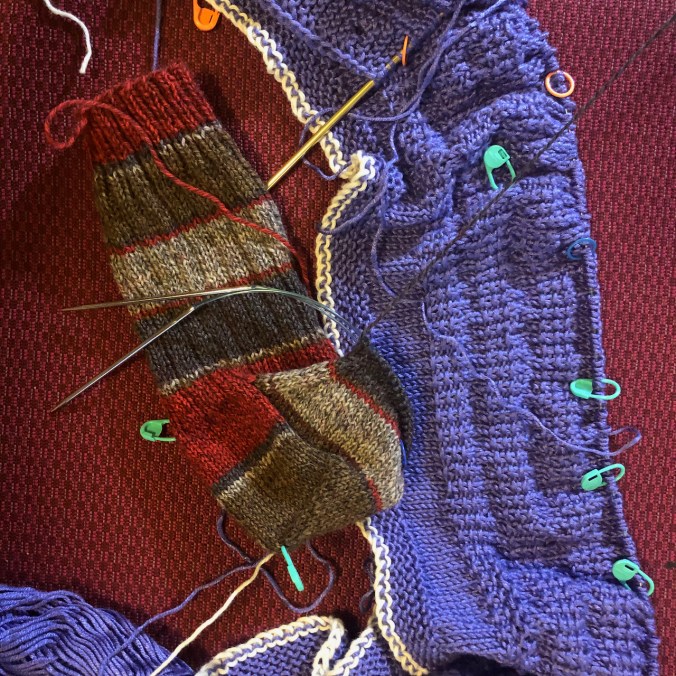
I finished another hat, and continue to knit on the socks and cardigan.
Plaid hat – a test knit for a friend.
Sock and cardigan, in process.
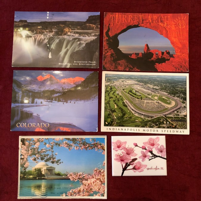
Son’s trip to DC:
Travel is fraught in these Covid times, yet we needed to transfer one of our cars to our daughter on the east coast. Our temporarily unemployed son volunteered, so in the midst of the pandemic, he bubbled himself across country. With all appropriate masking and testing, he delivered the car. Then he flew back, and after more bubbling and testing, successfully completed his adventure Covid free.
Postcards from the road
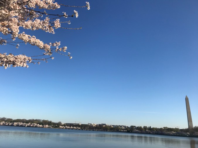
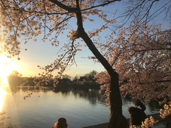
Cherry blossoms on the National Mall
More cherry blossoms, tidal basin.
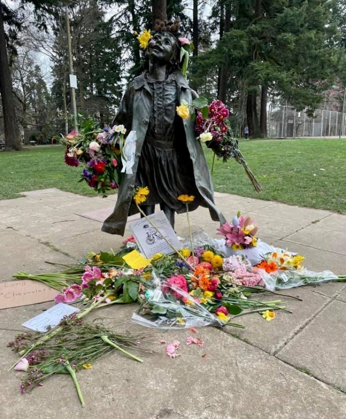
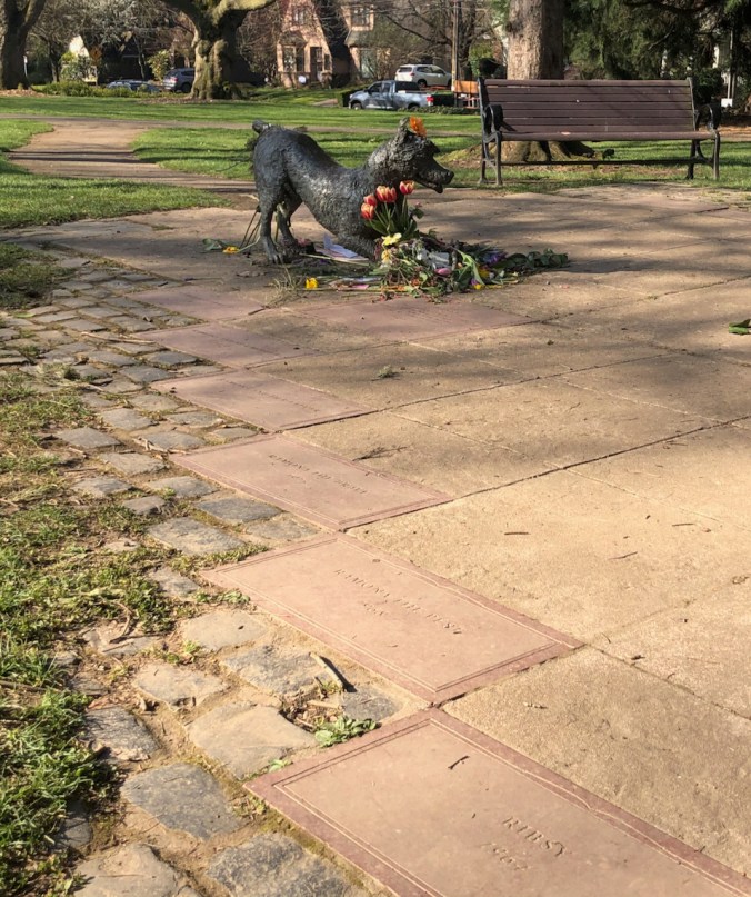
Beverly Cleary
We live in Ramona’s neighborhood, the same neighborhood in Portland, Oregon, where the acclaimed children’s author went to school and roamed Grant Park and Klickitat Street. Beverly Cleary died last week, a few weeks short of her 105th birthday. Though she spent most of her adult life in California, our neighborhood honors her legacy. Libraries and schools bear her name. We have a walking tour of the neighborhood to see her world. I remember getting my middle school aged son to read the books to his three year old sister while I was making dinner, and he never objected – he looked forward to it. “Is it time to read to Emily yet?” I especially enjoyed her two memoirs, recognizing many of the scenes from her childhood as replayed in her novels. I heard her say in an interview that she identified most with Ellen Tebbits. She got to live a good long life, and in our neighborhood we have her “ordinary” fictional children cast in bronze in the sculpture garden in the park, which doubles as a splash pad in the summer. Last week there were flowers in the sculpture garden in tribute to her memory.
We are sliding into spring around here. Flowers are blooming, with a few warm days between the rainy stretches. We were vaccinated at just about the one year anniversary of the pandemic, and I am grateful! I feel the hope of spring, yet I know we still have so far to go until everyone can say that. And then my daughter reminds me of our privilege in the world. I know. I can only live where I am, but I do know.
Knitting, reading, hiking, on we go, fuzzy days mushing into each other. Planning the weekly grocery list. Creating with my hands, my brain, I take notes. I try to find the distinguishing features of each day, and celebrate the positivity and the beauty. That is most of what I do, and will do, and am lucky to do. So….
Hiking
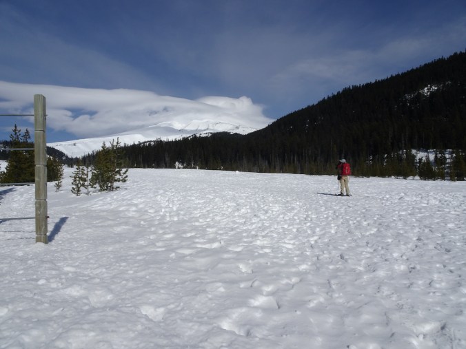
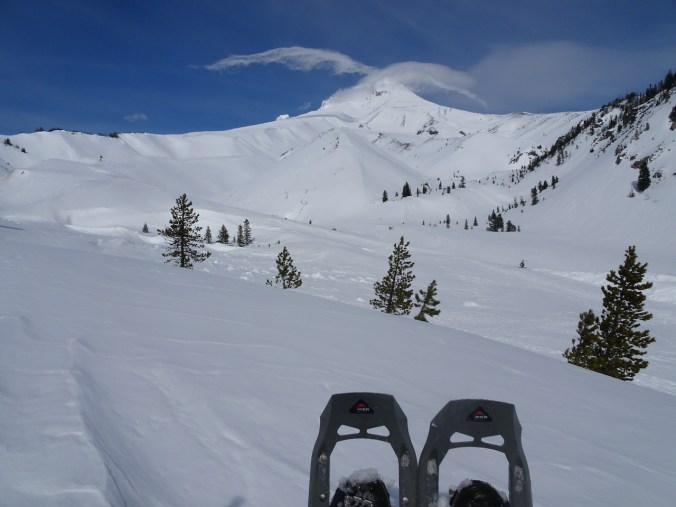
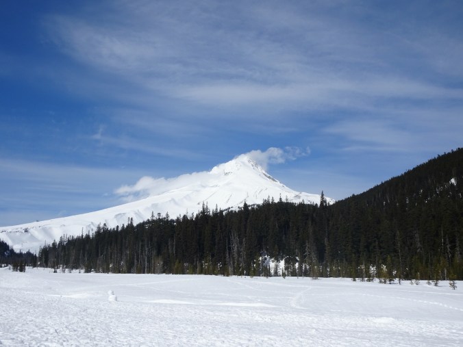
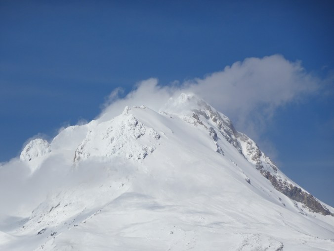
1) We snowshoed up White River on Mt Hood on March 2nd – clouds swathing the peak much of the day, but in a most artistic way.
Mt Hood in clouds, near the Sno-Park.
Lunch view, near the Timberline Trail crossing.
The snow on nearby Boy Scout Ridge looked unstable, so we kept our distance!
Return trip…
Last views – we can almost see the entire peak.
2) On March 11th we hiked Tom McCall Point and around Rowena Crest, east of Hood River in Oregon, to see the fields of grass widows.
Thousands of grass widows on the plateau below Tom McCall Point.
Grass widows
More grass widows…
Columbia River reflecting the Cherry Orchard cliffs in Washington.
Parsley alley
Mt Adams and Rowena Plateau, from near the top of Tom McCall Point.
Tiny flowers of spring whitlow grass.
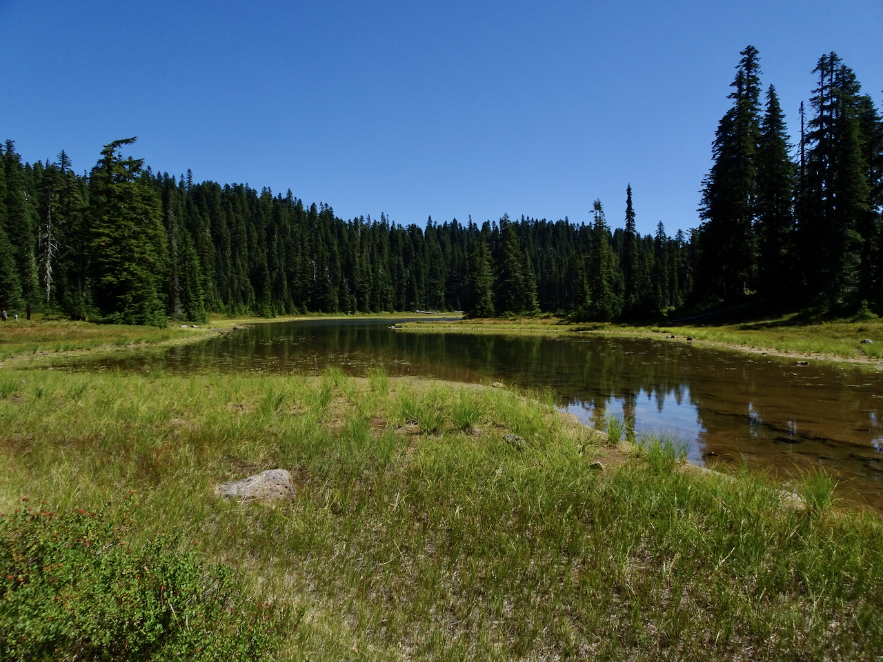
Then we walked around Rowena Crest, closer to the river:
East view from Rowena Crest cliffs – kettle lakes in the foreground.
Westerly view.
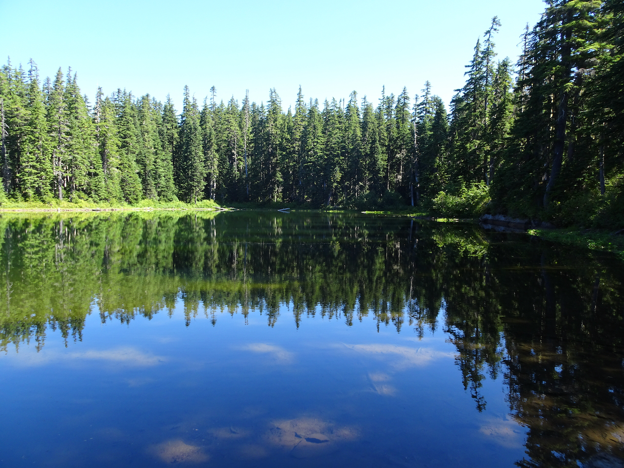
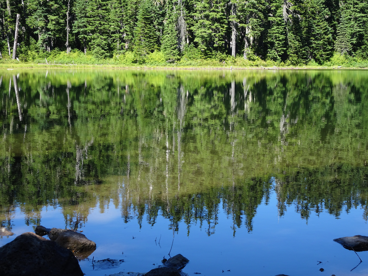
One of the lakes on Rowena Crest.
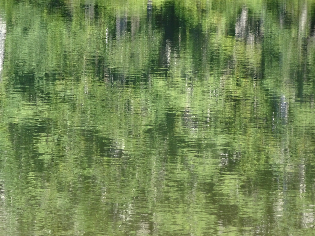
Abstractions in the lake reflections…
And more grass widows!
3) The next week, on March 16th, we went out across the river to Lyle Cherry Orchard again. No squalls this time – a perfect hiking day, and the first of the bright yellow balsam root blooms were opening as we hiked.
Hiking up above the Convict Road.
Columbia Desert Parsley in full bloom.
Balsam root opening on the upper slopes.
Lots of flowers showing for the first time this spring:
shooting stars
balsam root
death camas
ballhead waterleaf
popcorn flower
fiddle neck
blue-eyed Mary
gold bells and buttercups
Stunning views from the cherry orchard:
Eastward, one of the remaining cherry trees.
Westward, balsamroot
4) We also walked a fast loop through Tryon Creek Park, on March 17th, where the very first of the trillium were opening, a little later than last year.
Tryon Creek
First trillium of spring
Around Portland
My neighborhood is also blooming.
cherry trees
star magnolia
The mountain is out, from the Markham Bridge.
goodbye to the Subaru
“Emily’s house”
windows
hyacinth
dove
windflowers
star magnolia
Knitting
I finished knitting a pair of socks for me and another hat and a cowl for the guild charity project, and cast on new socks and a cardigan.
New yarn, Rose City Virtual Yarn Crawl!
Marled Alaska Cowl
Bankhead hat
New socks for me
Patons Kroy socks
Em Dash cardigan
And…
I hold the more difficult challenges to the outside world in my heart. This week it is yet another uniquely American gun violence episode in Georgia, another hate crime, anti-woman, anti-Asian. I know in my heart it is all true, and part of the work we all have to do – bring out all the biases into the light of day and see how they harm so many. I am listening and learning more each day, and it all rings true, and saddens me. I pledge to myself to be as much of an ally as I can recognize. Listen and learn. Validate. Search for the commonalities and not the otherness. From my place on the privilege spectrum. That is most of what I do, and will do, and am lucky to do. And before I can publish this – yet another mass shooting at a grocery store in Colorado.
As a youngster with all the idealism of youth, I envisioned a giant magnet circling the world sucking away all the implements of violence, all the guns and weapons of war. On days like today with a heavy heart and a less idealistic world view, still I sigh and wish it could be true.
And back to the trailhead beneath the wall. A successful day!
Dalles Mountain Ranch – Vista Loop – Feb. 24
After two weeks of snow and ice storms, we were finally able to find a blue sky day at Columbia Hills State Park, an hour and a half east of Portland. A beautiful day, edged by snow on the skyline. Take a peek here if you want to see this trail in full spring bloom!
View south and west from Dalles Mountain Ranch trailhead – Mt Hood in Oregon, far across the Columbia River. We are heading downhill toward the river.
Looking back to the ranch as we hike down Eight Mile Creek.
Creek crossing.
Our lunch stop along the Missoula Floods scoured lower bench. Mt Hood, Columbia River, The Dalles and Horsethief Butte. Lots of purple grass widows in the foreground.
January 20, 2021 – So far 2021 has not brought much change to our daily life, but the relief of having a new president casts a hopeful light on our future! We celebrated our 36th wedding anniversary this month, with homemade Indian food and leftover Christmas chocolate. We continue in pandemic lockdown mode, staying home unless doing essential shopping, going on neighborhood walks, or weekly out of neighborhood hikes. Vaccines are seeping into the community, mostly to health care professionals and long term care facilities. My husband has temporarily unretired and will be helping with vaccinations. Thus he was able to celebrate inauguration day doubly, as he got his first dose today.
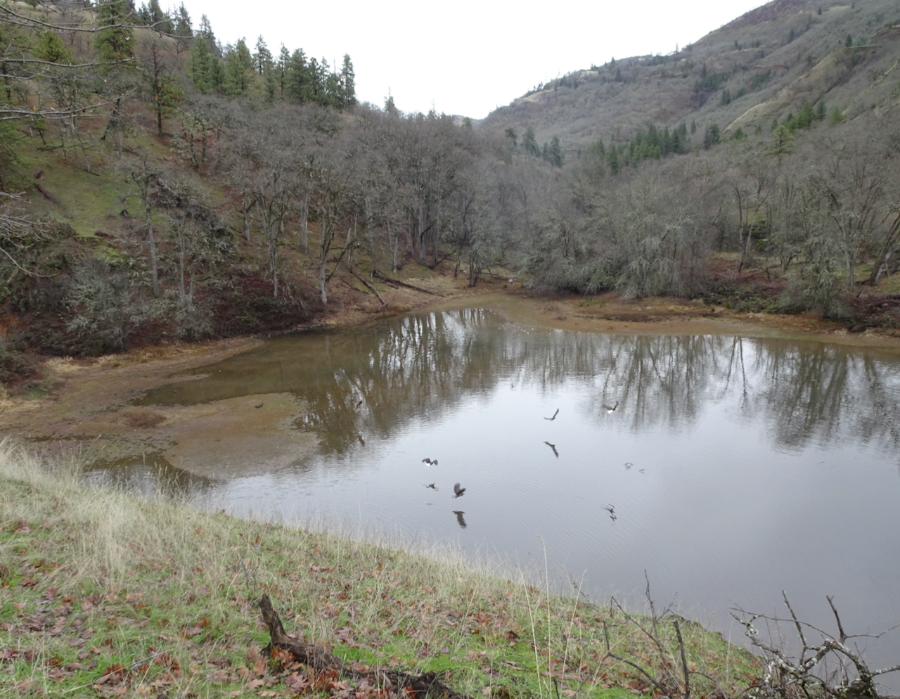
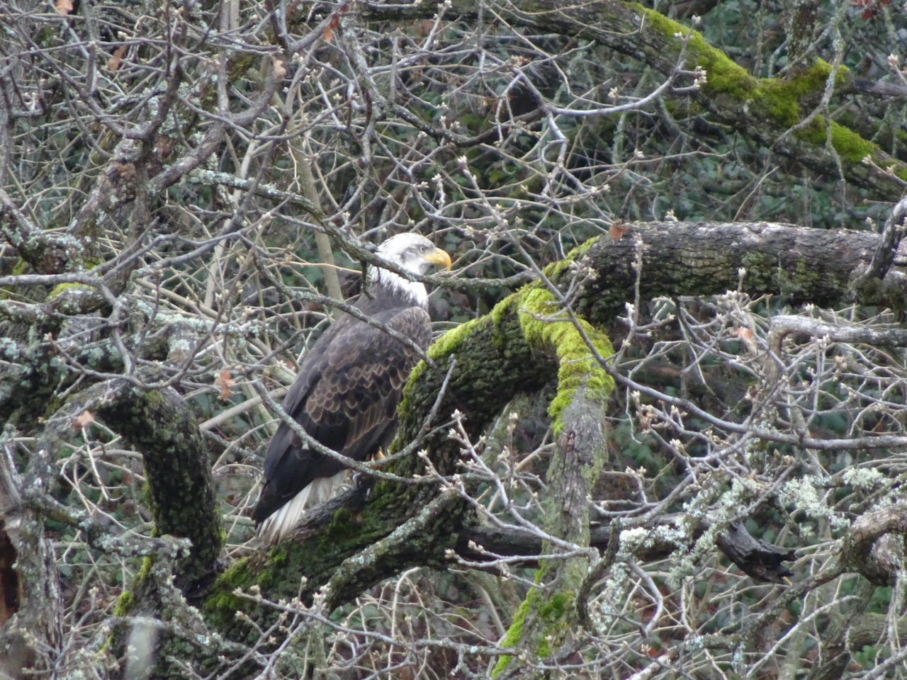
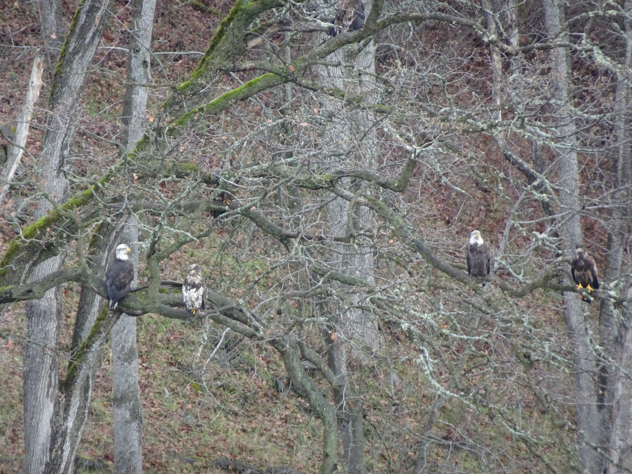
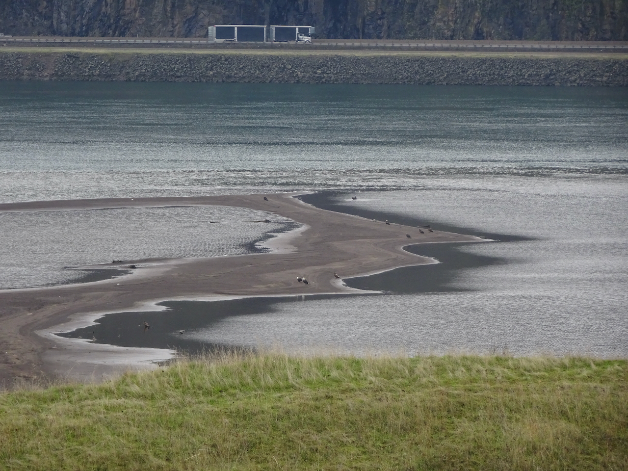
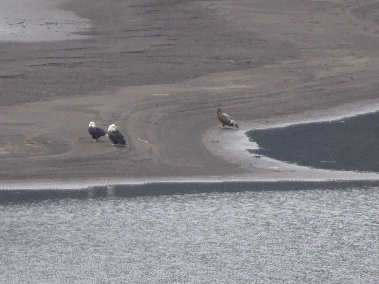
Hiking: We have been on three hiking adventures so far. The first, on January 7th, was our annual trek to see the bald eagle nesting area along the Klickitat River near Lyle, Washington. We saw at least thirty birds, many of them juveniles that still have brown plumage.
Bald eagles flying across the Balfour-Klickitat pond.
One eagle stayed perched in a tree nearby.
Closer view.
Many more eagles in the trees across the pond.
Zooming in, even more eagles can be seen disguised in the foliage.
Another dozen eagles were out on the sand bar where the Klickitat River flows into the Columbia River.
Two adults, one juvenile bald eagle on the sand bar.
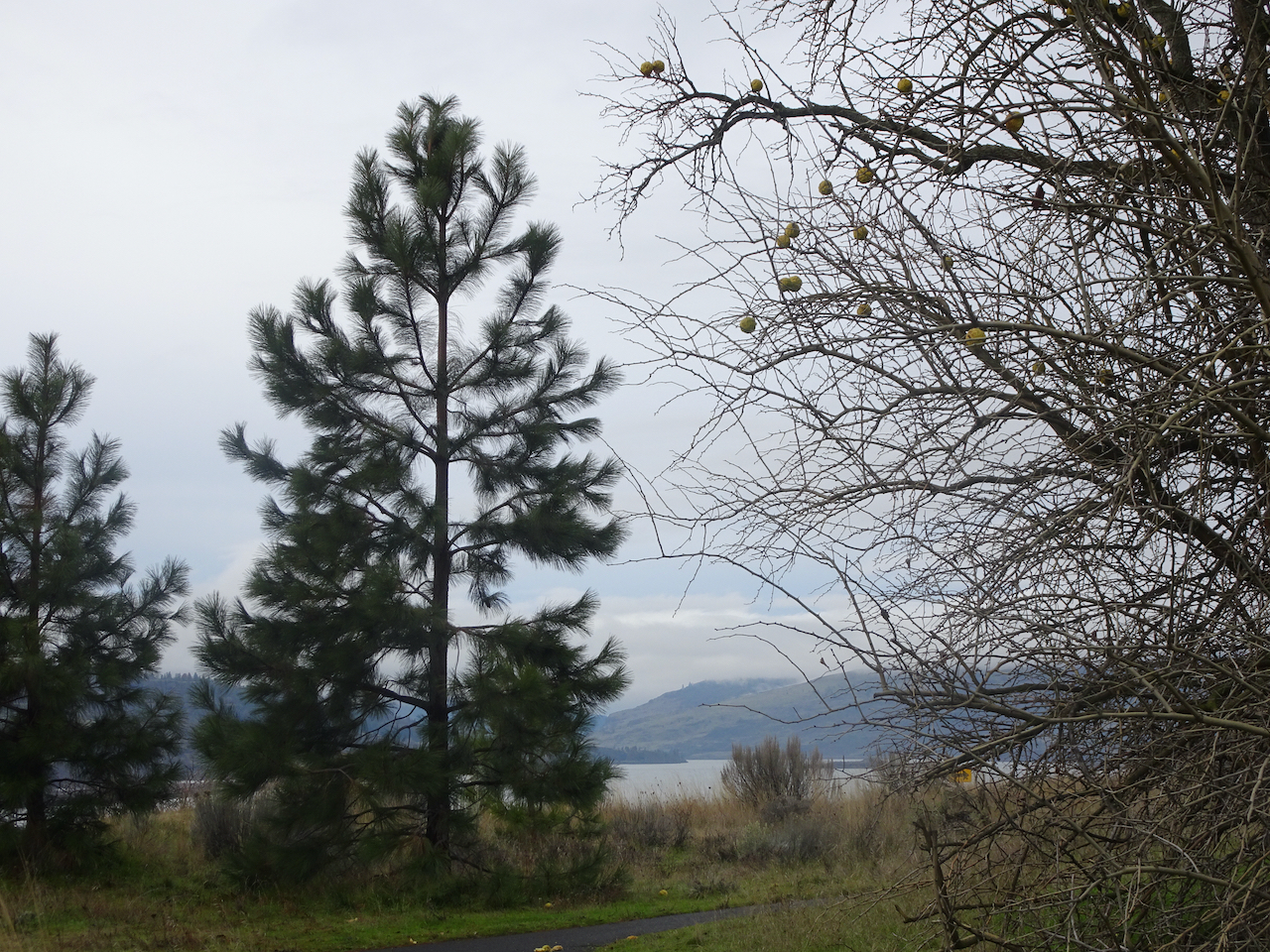
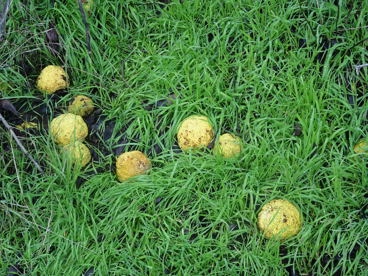
Osage oranges along the trail here.
They are a curious fruit.
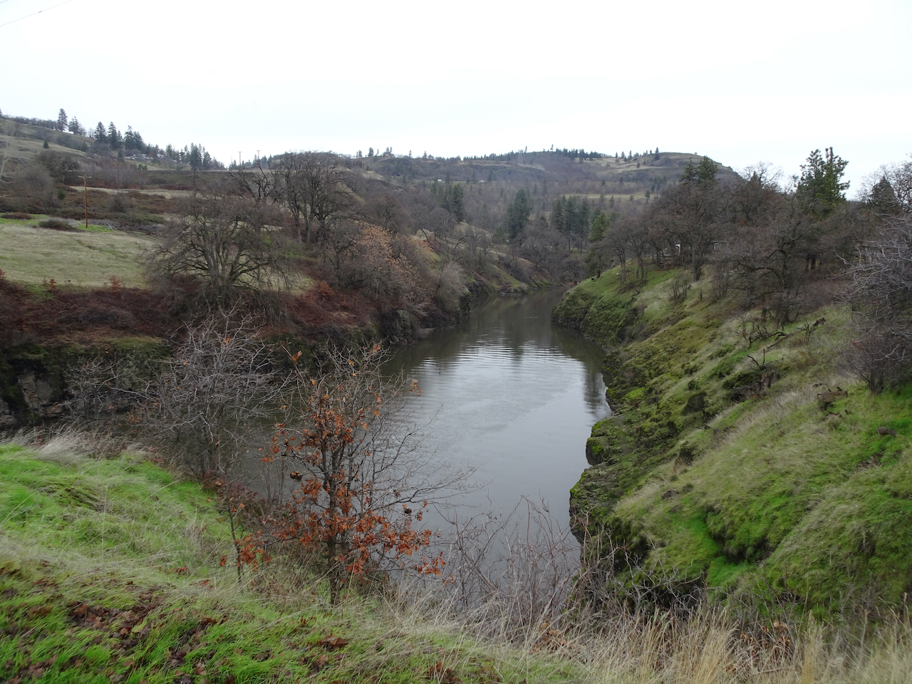
We walked a couple of miles along the Klickitat River trail.
Downy woodpeckers were in the bushes nearby.
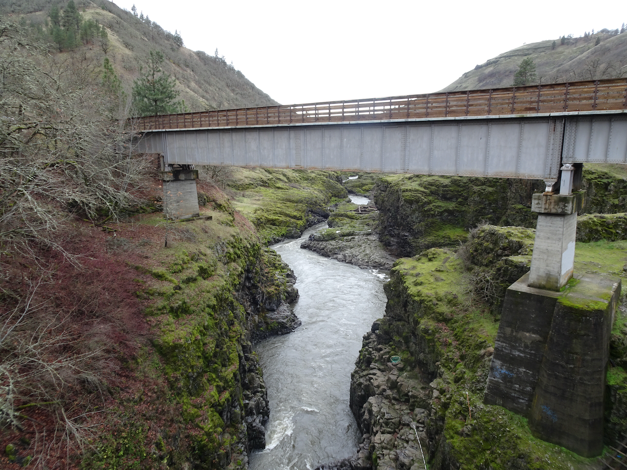
This is a converted rail trail with a nice even tread.
We turned around at the Fisher Hill Trestle.
View down the Klickitat River from the trestle.
A side stream cascading into the Klickitat River.
On our return walk we saw a congregation of a couple of dozen eagles circling overhead.
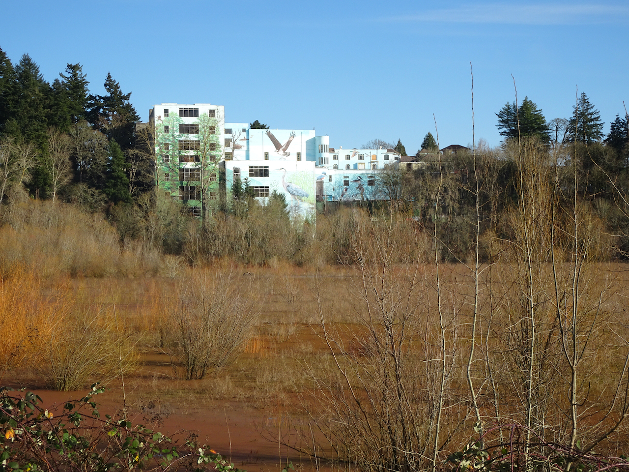
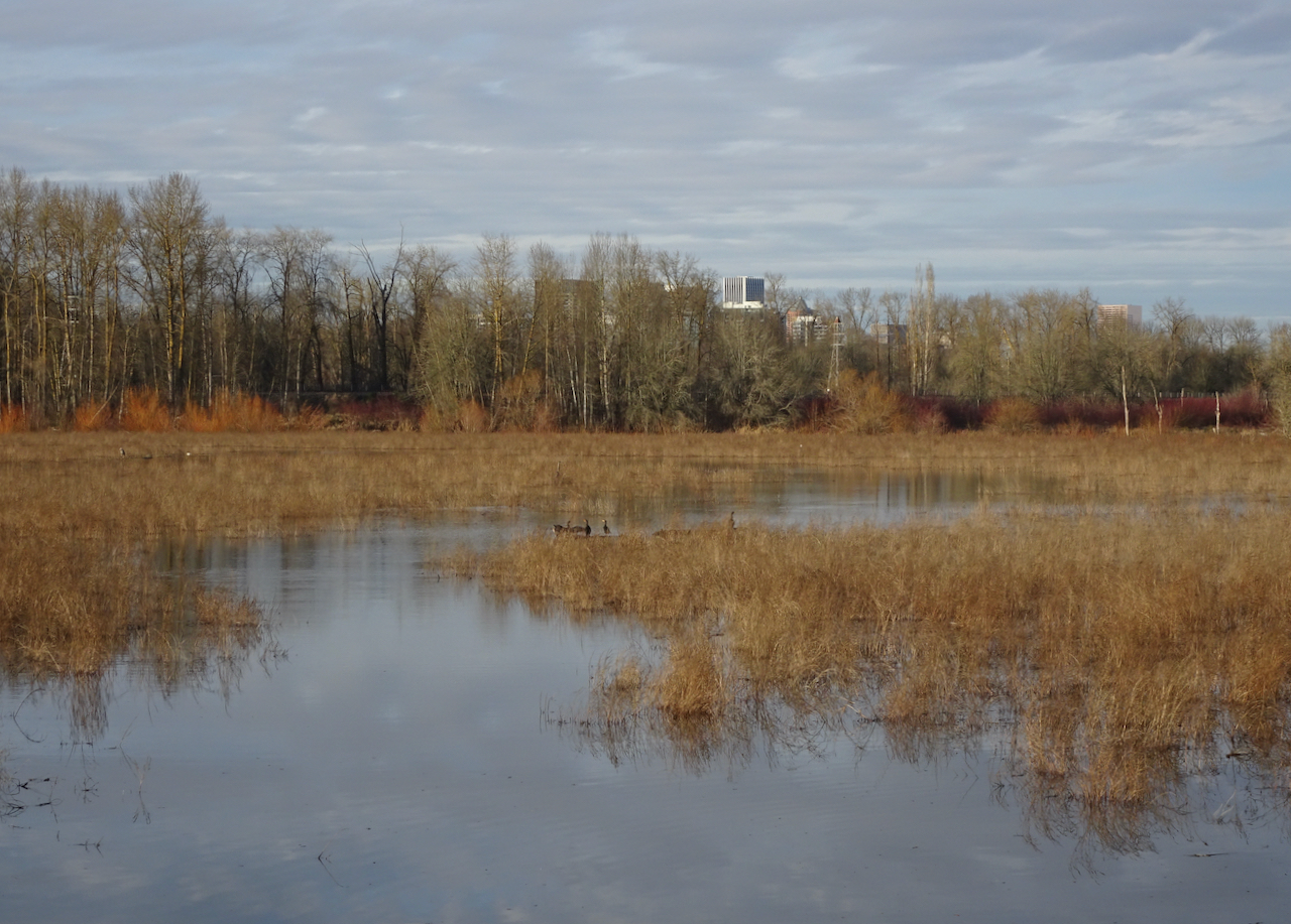
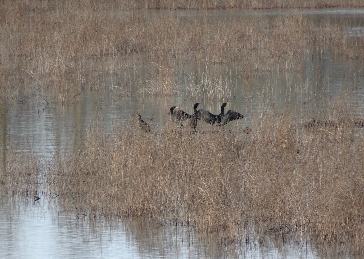
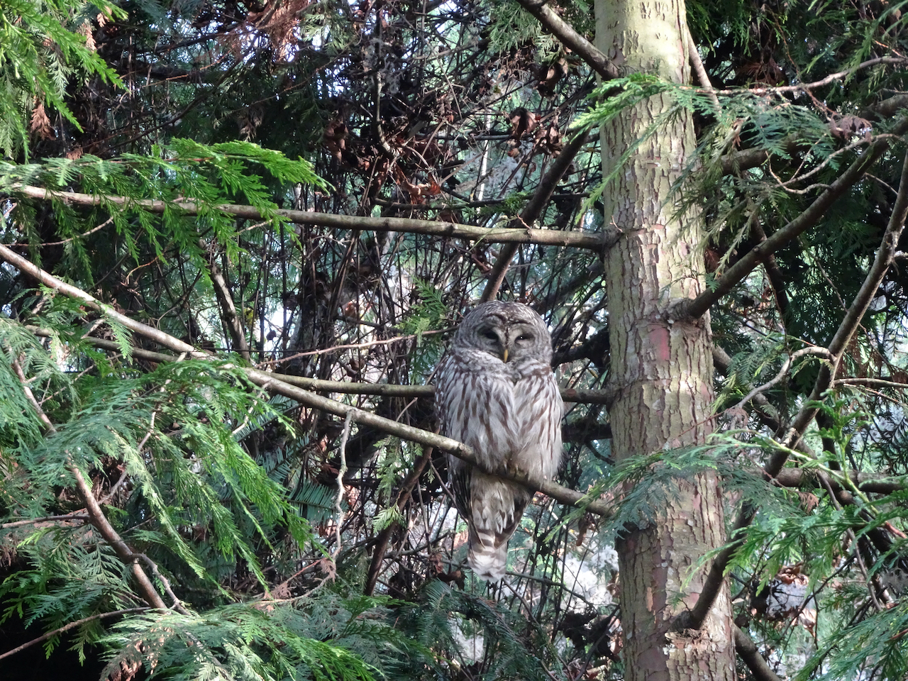
On January 14th, we walked around Oaks Bottom Wildlife Refuge in Southeast Portland. The blue sky was reflected beautifully in the water, and we saw cormorants, herons, and a barred owl near the trailhead.
Blue sky.
Reflections in the marsh.
Winter foliage.
Muraled Mausoleum across the marsh.
Oaks Park on winter/Covid hiatus.
Cormorants and herons, Downtown Portland.
Cormorants.
Barred owl.
Back out at Catherine Creek, near Lyle, Washington, on January 19th, we found the first grass widow of spring, then hiked a long loop up Atwood Road, across the top of Sunflower Hill, then down the Desert Parsley Trail back to Rowland Wall, thus completing some of the gaps in our map there. It was a beautiful day – chilly, but conducive to hiking up hill at a steady pace to see the eastern gorge spread below magnificently.
First grass widow of spring!
Catherine Creek waterfall set in the winter landscape.
Mt Hood to the west.
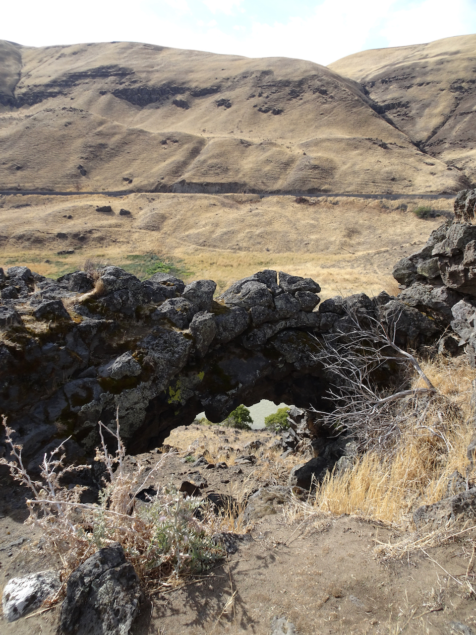
The arch from Atwood Road.
An old stove near Atwood Road.
Lunch view from the top of Sunflower Hill.
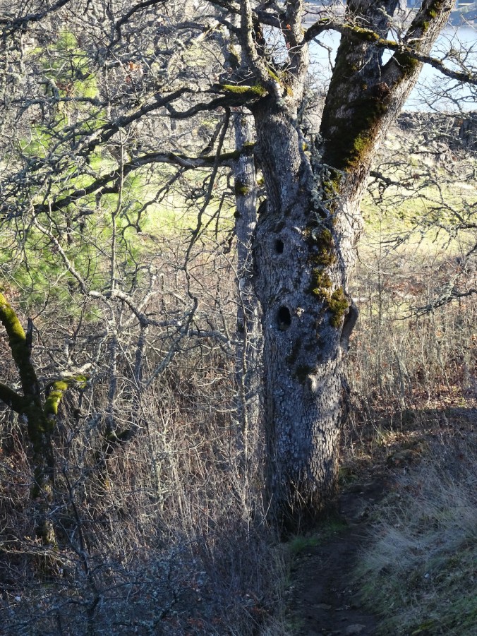
Oak tree, Mt Hood, noonday sun.
Looking up at our guide Ponderosa from The Desert Parsley Trail.
Knitting: So far this year I have finished knitting a sweater and a gnome, I’ve started a blanket and a new pair of socks:
Farallon Cardigan
Here We Gnome Again
Habitation Throw, using my “advent” yarns exchanged with my knitting group
Artists Garden Socks
Quilting: I finished my Plaid Rectangles Charm Quilt, a companion piece to my Plaid Applecore Charm quilt.
Plaid Rectangles Charm Quilt
Companion quilts.
A New Day! After a long, satisfying hike yesterday, I got up way too early (for me) to watch the inauguration celebration. I felt some trepidation, due to the recent insurrection. I am very relieved to report that all proceeded beautifully. The participants were diverse, eloquent, hopeful, forward looking! I cried as I witnessed the swearing in of our first female vice president! The singing, the president’s speech, and the prayers were relevant, meaningful, beautifully delivered. I adored the young poet laureate, Amanda Gorman, and the firefighter who signed as well as spoke the Pledge of Allegiance. The outgoing vice president was gracious in the transition. The colorful wool coats of the ladies brightened a blue sky day, when the Capitol, unfortunately, had to be surrounded by military lockdown, as the previous occupant never really conceded to his violent, deluded followers. I am disappointed that my daughter, sitting in her apartment about a mile away from the proceedings, could not witness the day. She assured me they remained safely within, while the din of helicopters continued above. Perhaps, going forward, the domestic terrorists will withdraw and think about the bill of goods they were sold, the lies told, the violence fomented by a greedy, disappointed narcissist who was only ever out for personal profit and aggrandizement, with no concern for the common good, no interest in public service. Good riddance! Meanwhile, executive orders and initiatives are already putting to right some of the damage, and asserting to the world that we want to participate in finding solutions for global problems.
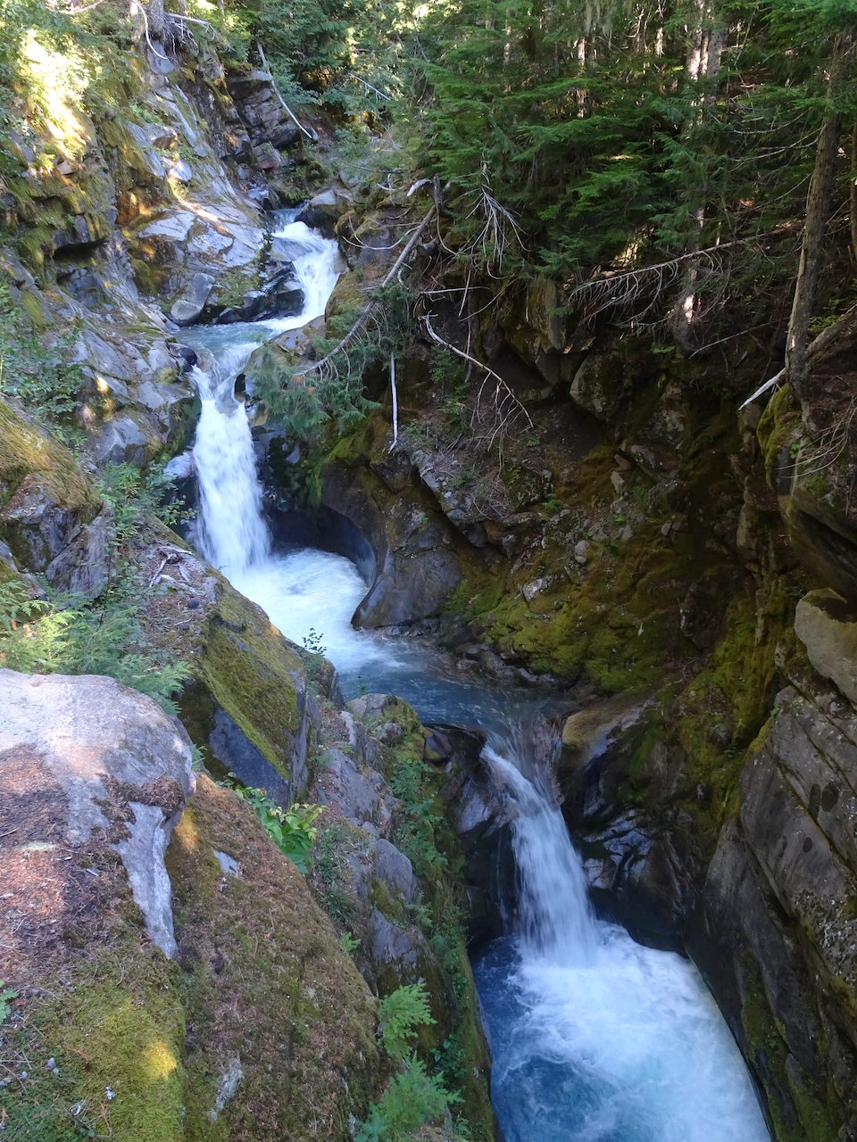
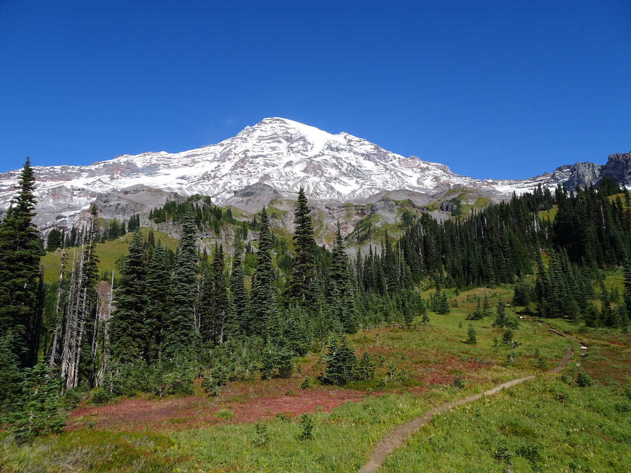
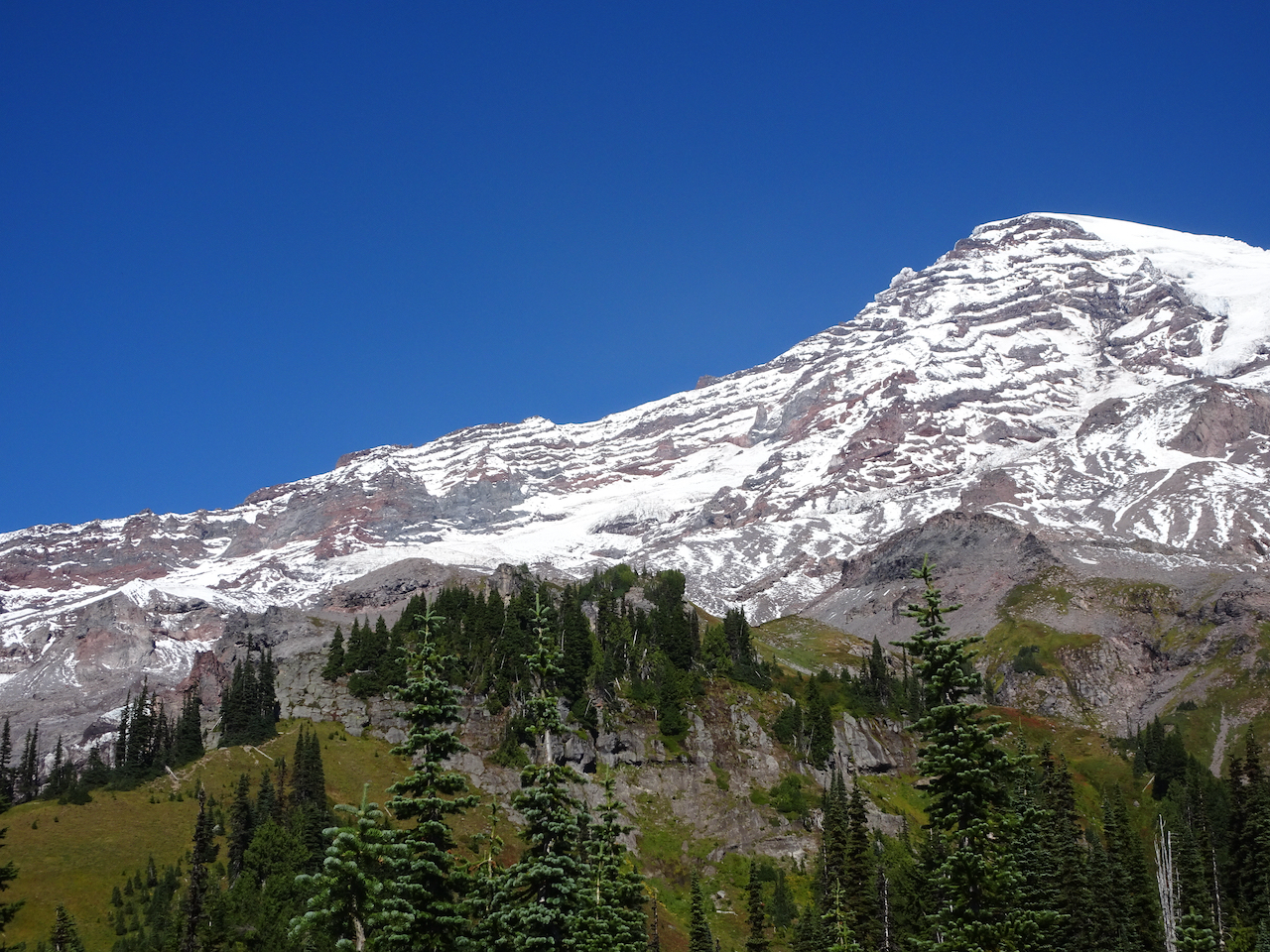
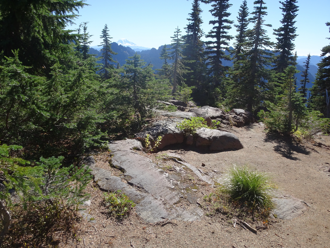
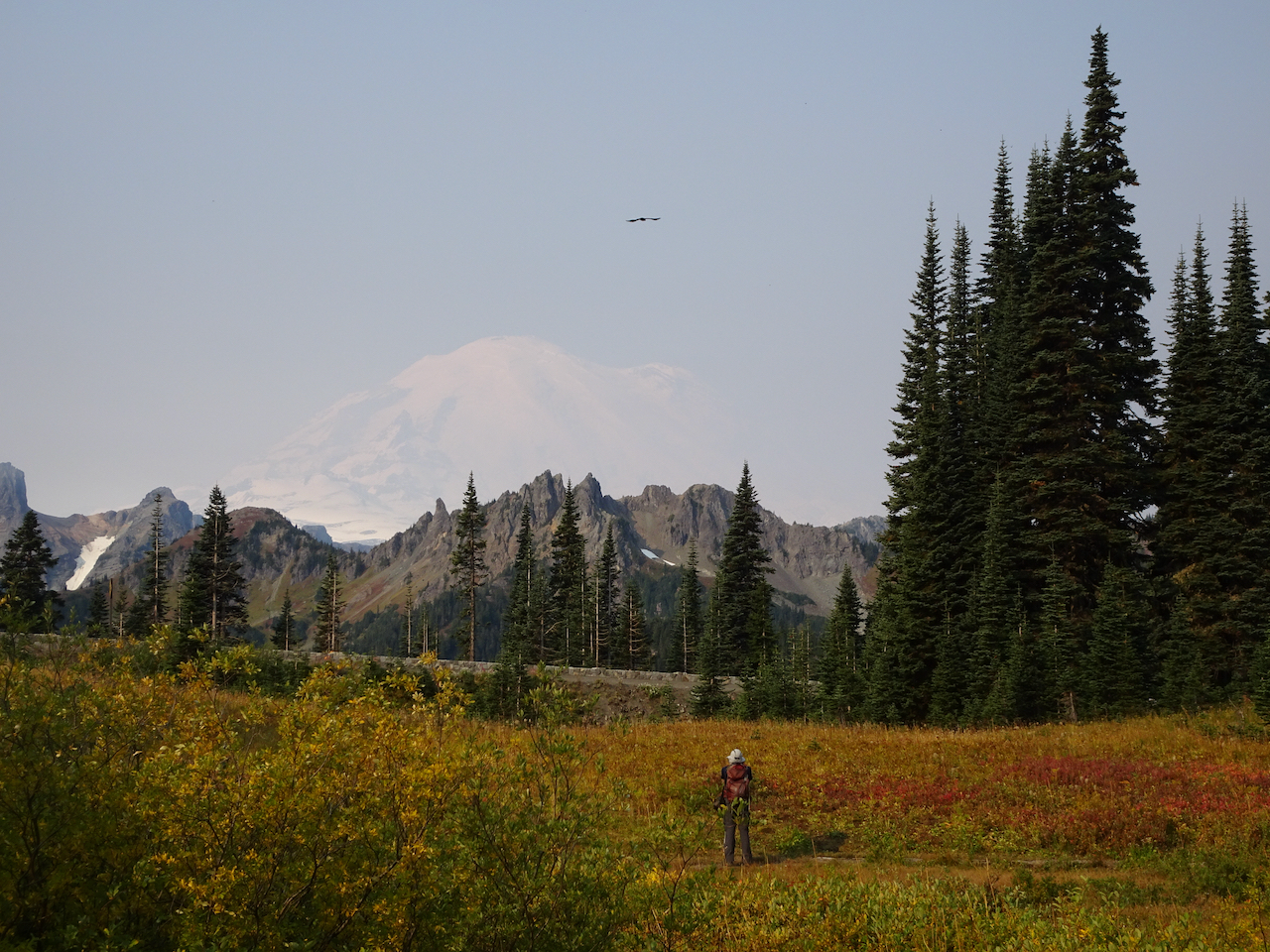
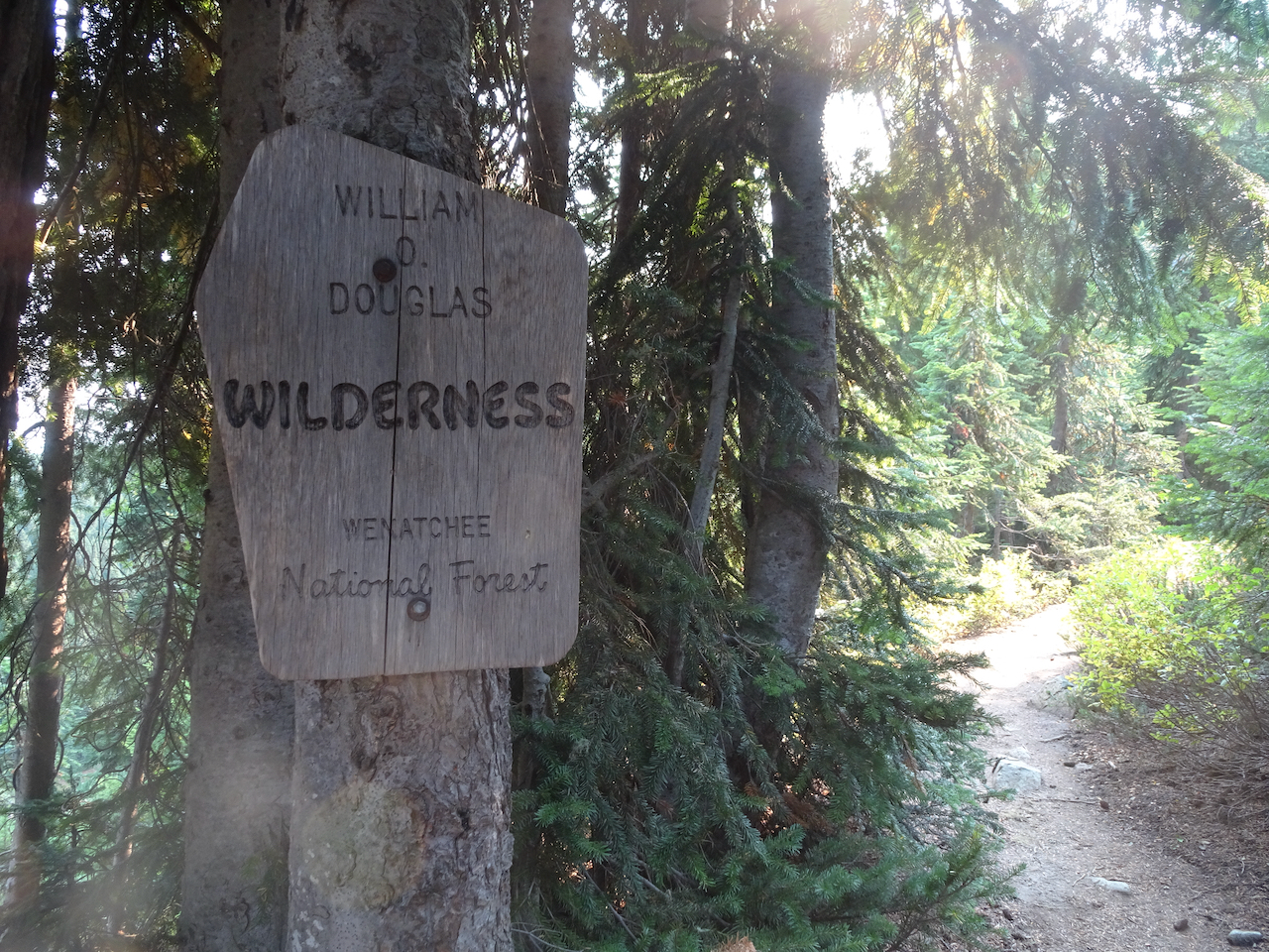
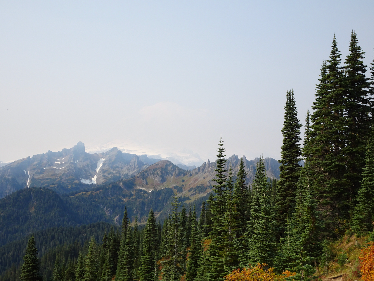
-on a midweek getaway, to a self-contained cabin in Packwood, Washington, with our own food, following all Covid-19 precautions. We have seen the stunning wildflower displays of summer a few times, and had long been wanting to see the the mountain in fall colors.
Mount Rainier area hikes.
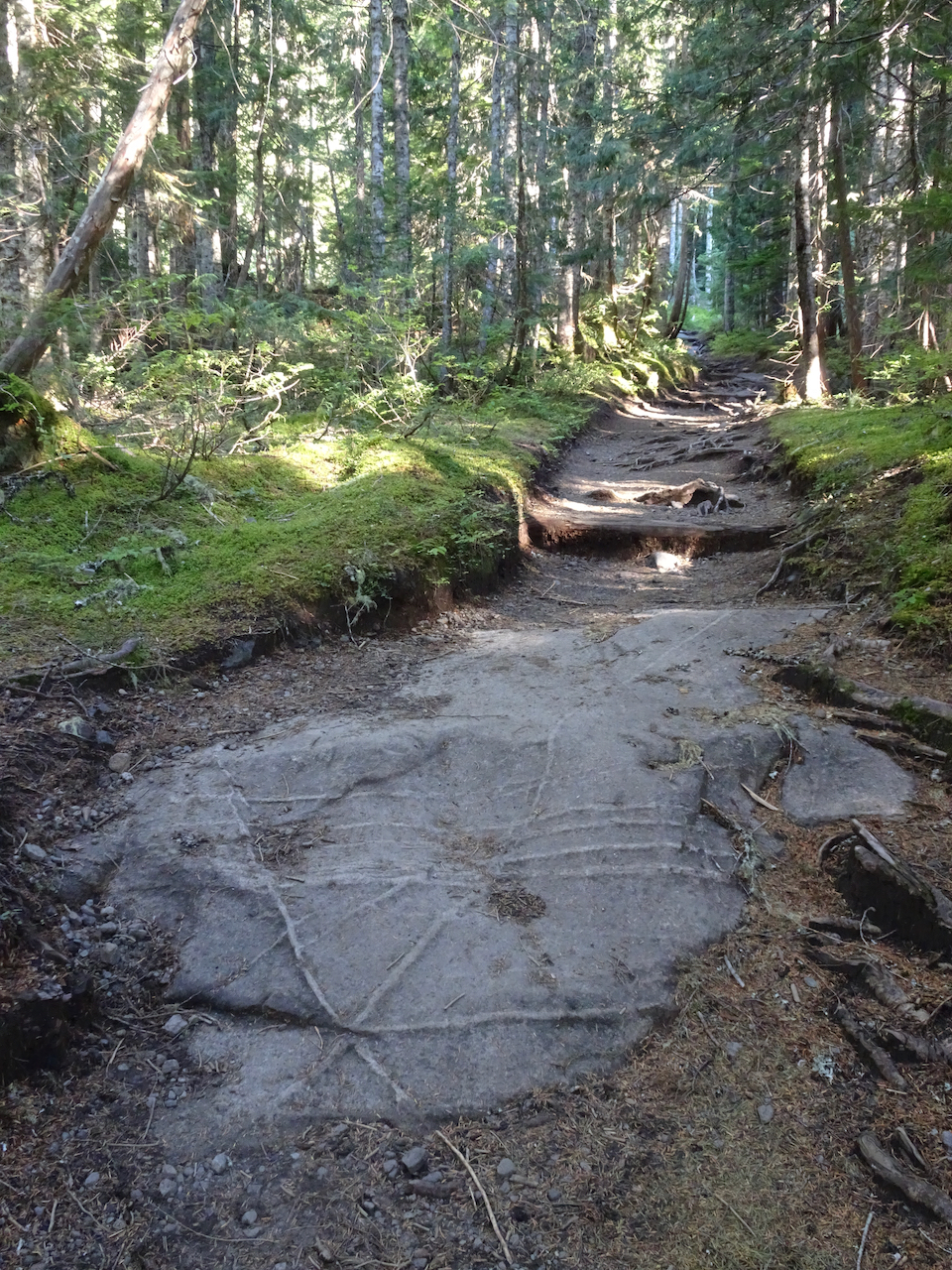
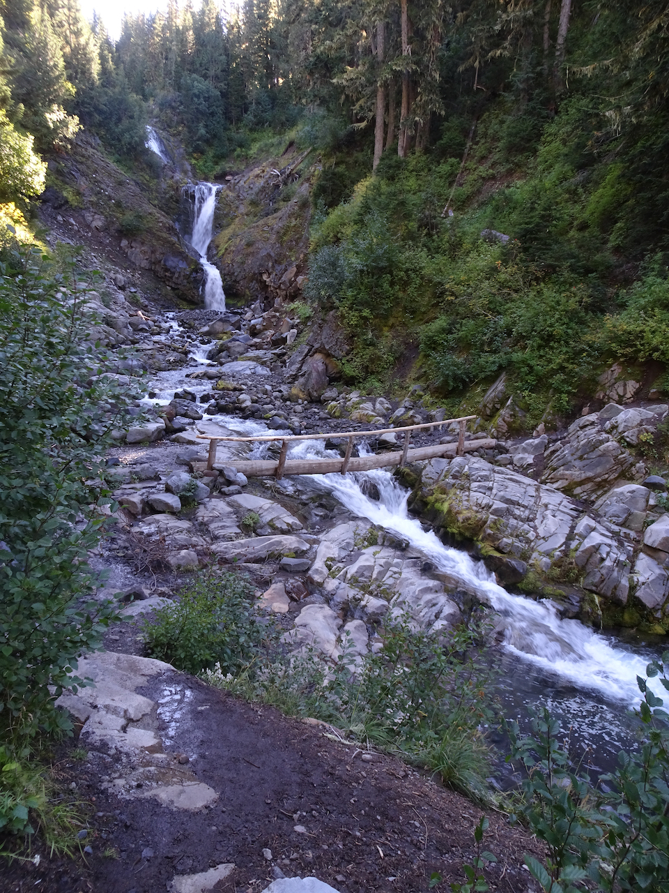
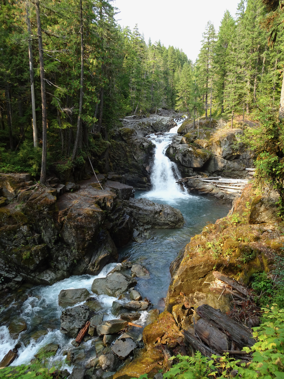
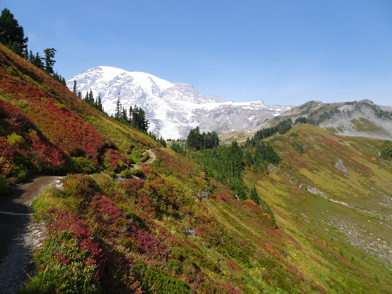
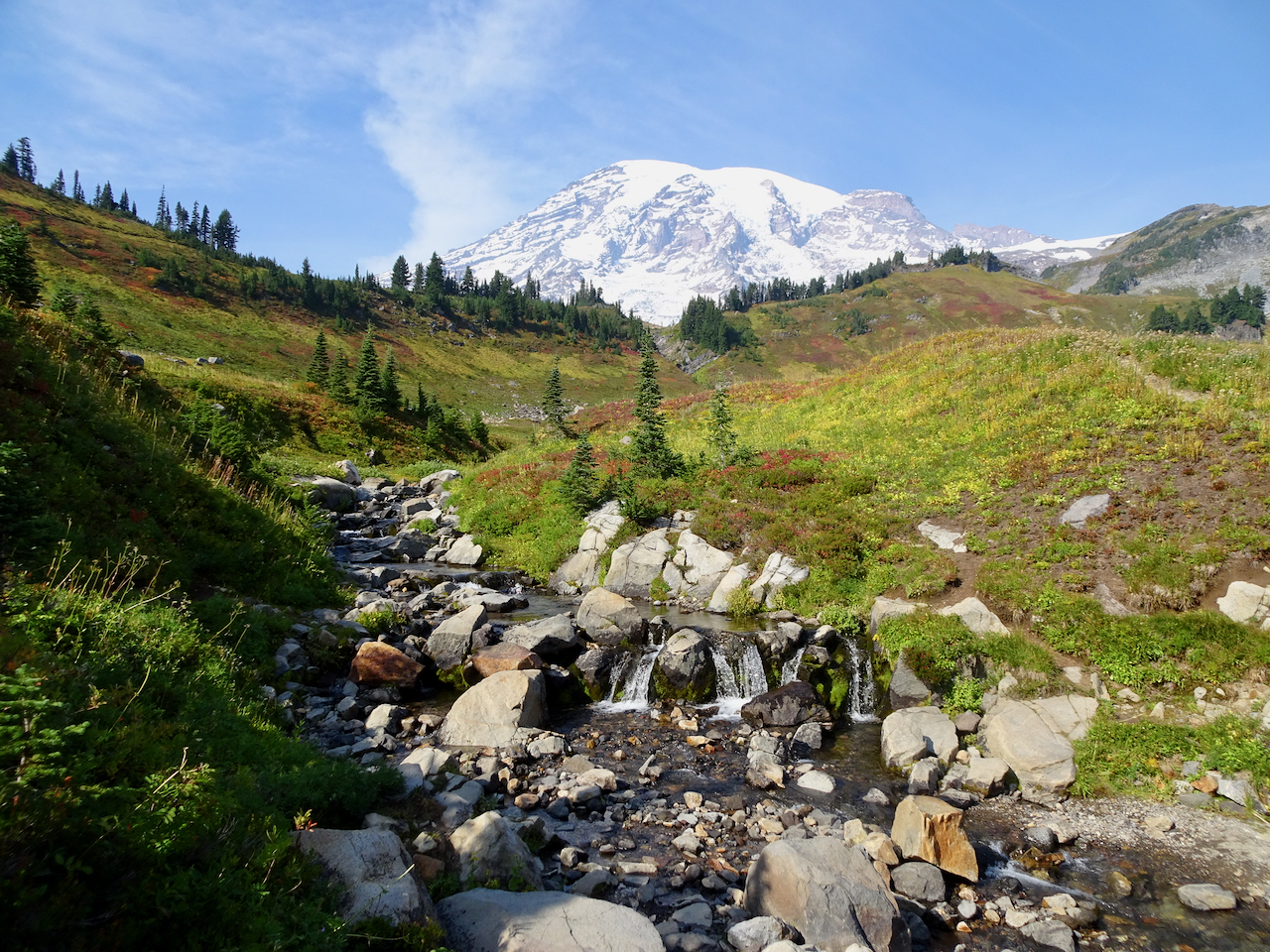
September 29, 2020 – Comet Falls/Van Trump Park
This trail, west of the Nisqually River and Paradise, follows Van Trump Creek all the way up to the stunning Comet Falls, then farther up the slopes to magnificent views of Mt Rainier from Van Trump park. (P.B. Van Trump was one of the first to stand on the summit of the mountain, in 1870). A very challenging and satisfying hike (7 miles, 2500 feet).
Smaller falls near the trailhead.
Trail through the woods.
I first thought this was our waterfall, then continued over the next ridge:
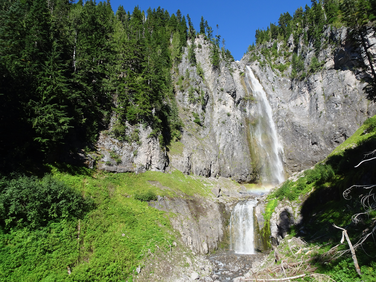
Comet Falls! About 400 feet, counting smaller tiers above and below the main falls. Snow bank on lower right.
With rainbows in the mist!
Our trail continues up, with better views of Comet Falls.
The trail continued upward steeply, into Van Trump Park.
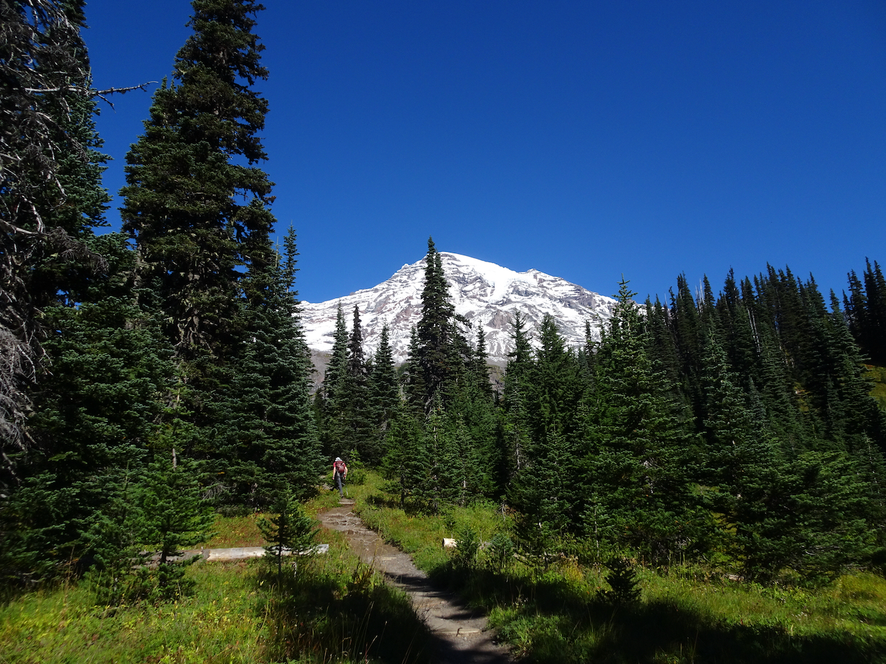
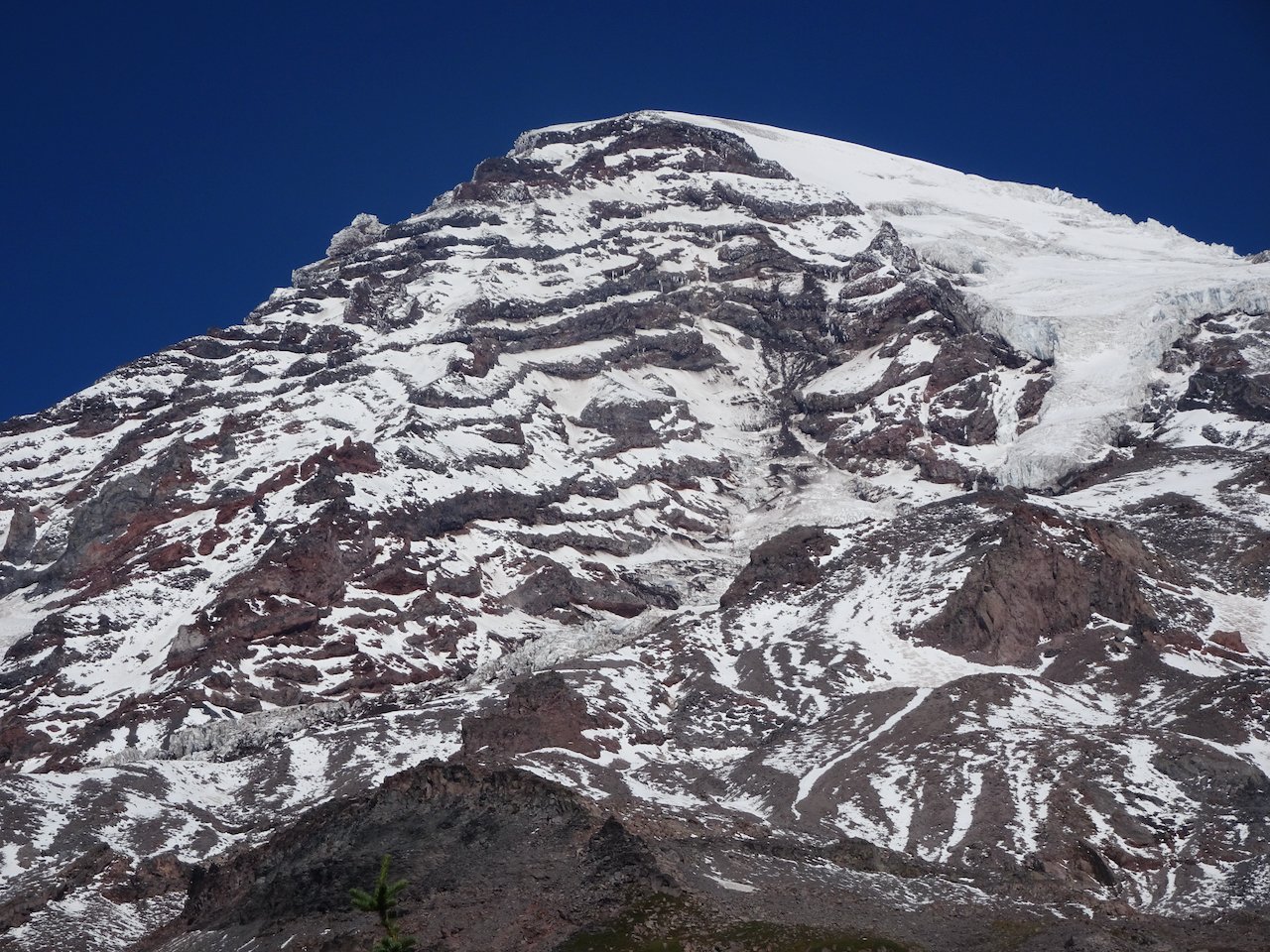
Above the waterfall, the mountain came into view.
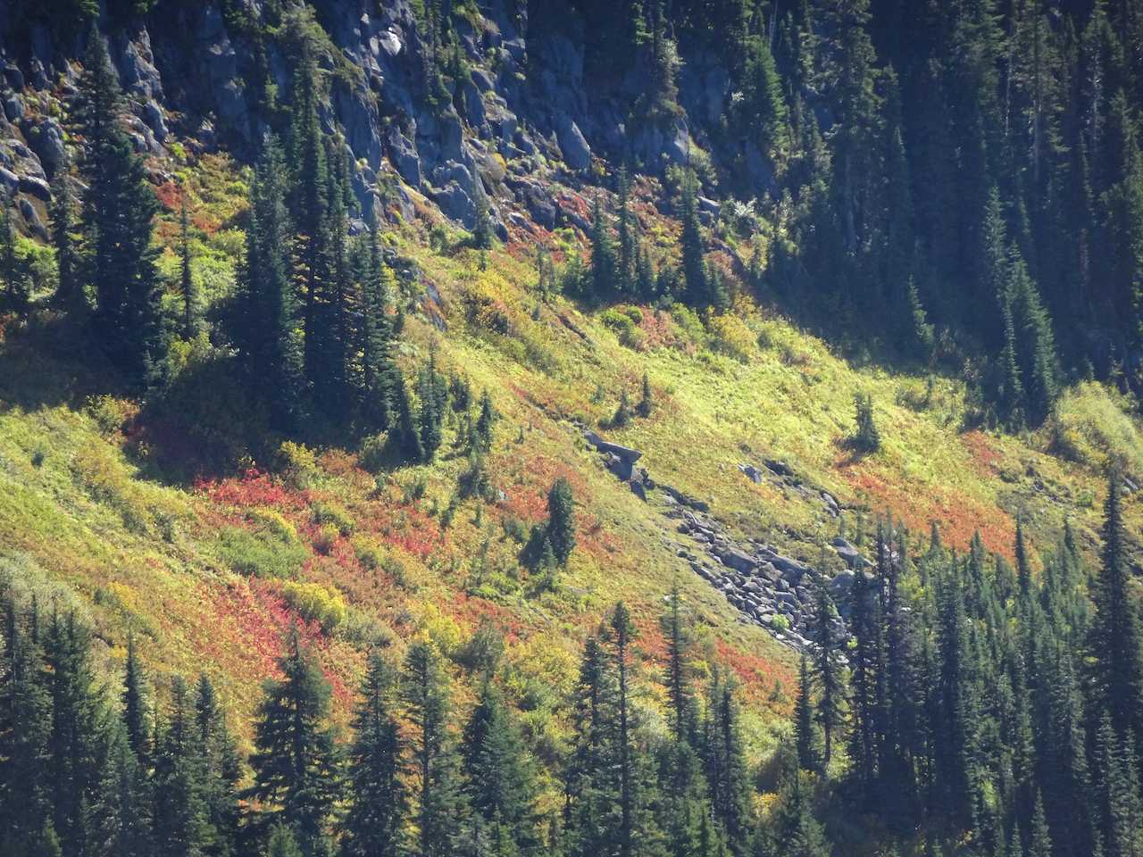
Fall foliage on the slopes of Van Trump Park, glowing red!
Mount Rainier from our lunch stop in Van Trump Park.
Views of the glaciers from a new angle:
The trail down seemed steeper than the trail going up; that might just be my knees talking.
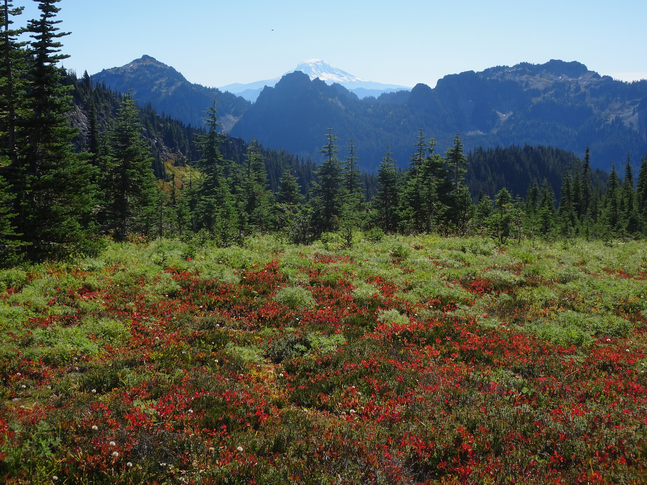
Mt Adams on view beyond the Tatoosh Range.
Glacial striations/polish and Mt Adams.
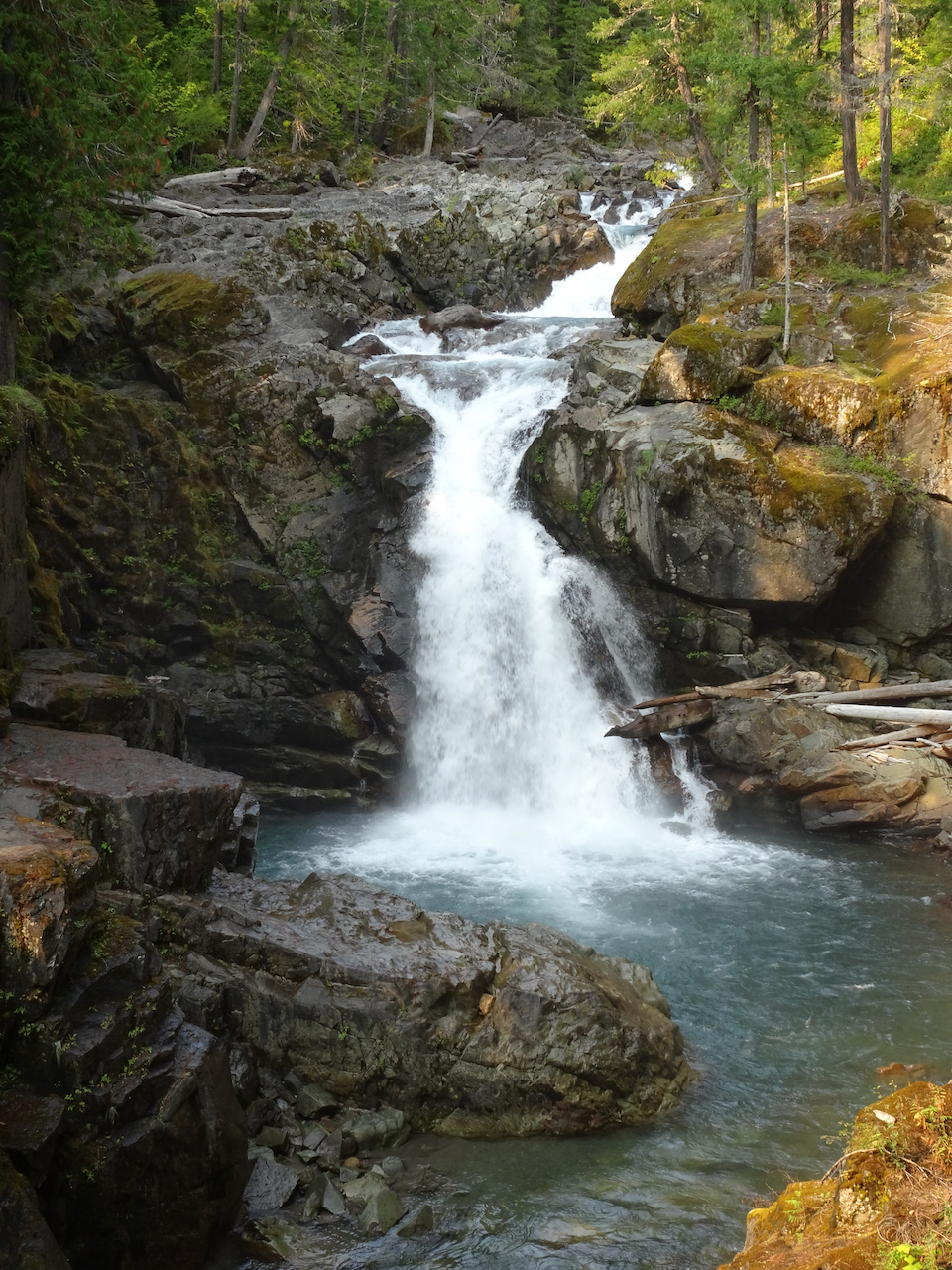
Uppermost tier of Comet Falls.
A particularly steep trail section.
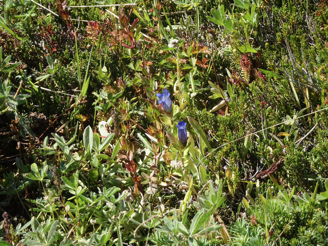
A few late gentians in the upper meadows.
Vine maples just beginning to turn red.
We stopped at a couple of roadside viewpoints on our way out of the park.
Highway bridge over the Nisqually River canyon.
Nisqually River downstream.
We could not resist stopping to see the mirror image in Reflection Lakes.
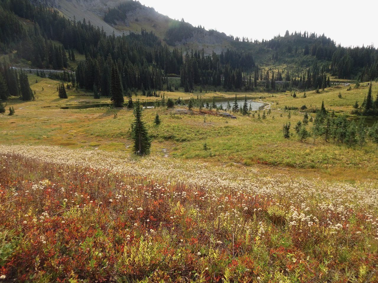
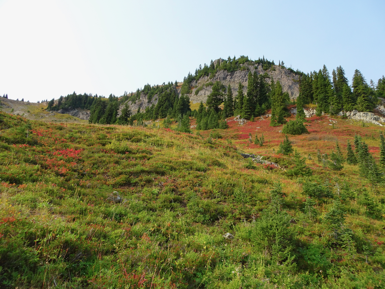
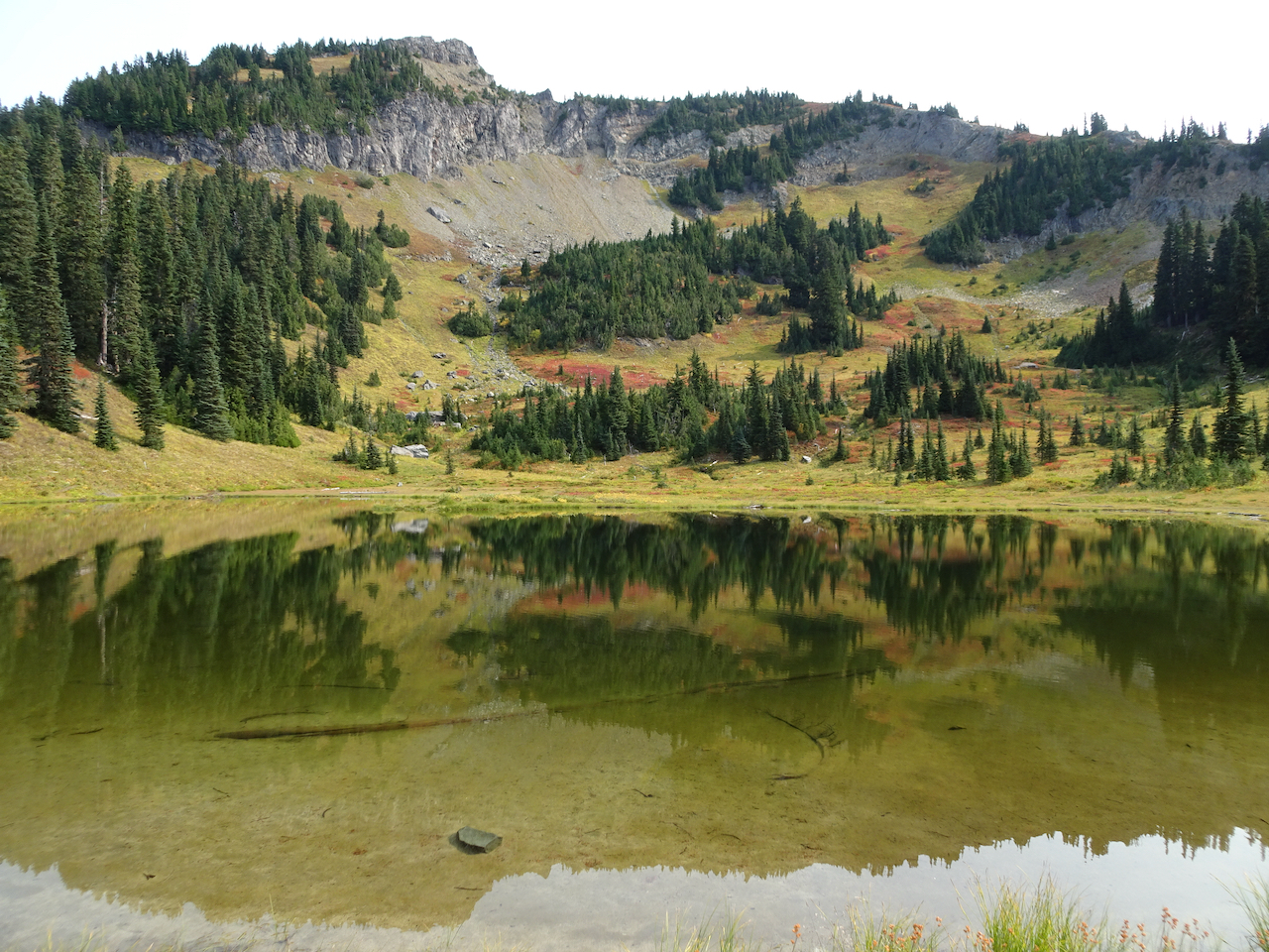
September 30 – Naches Peak/Tipsoo Lake Loop, smoke haze at Sunrise, Silver Falls.
We hiked this loop trail (4 miles, 600 feet), with our views increasingly shrouded in haze. Wildfire smoke began drifting diffusely in, creating a grayish white sky that was so startlingly blue yesterday.
We were almost alone as we walked around Tipsoo Lake, admiring the beautiful reflections in its mirror-like surface.
Tipsoo Lake
Yakima Peak
Mt Rainier, slightly obscured by haze.
Mt Rainier reflected in Tipsoo Lake.
Yakima Peak – our trail rising along its base.
Pasque flower seed head
Meadow of huckleberry and aster seed heads.
Then we hiked the loop around Naches Peak – following the Pacific Crest Trail.
Crossing Hwy 410.
Hwy 410, headed down the canyon, to the east.
A new wilderness area for us!
Trail up over the shoulder of Naches Peak.
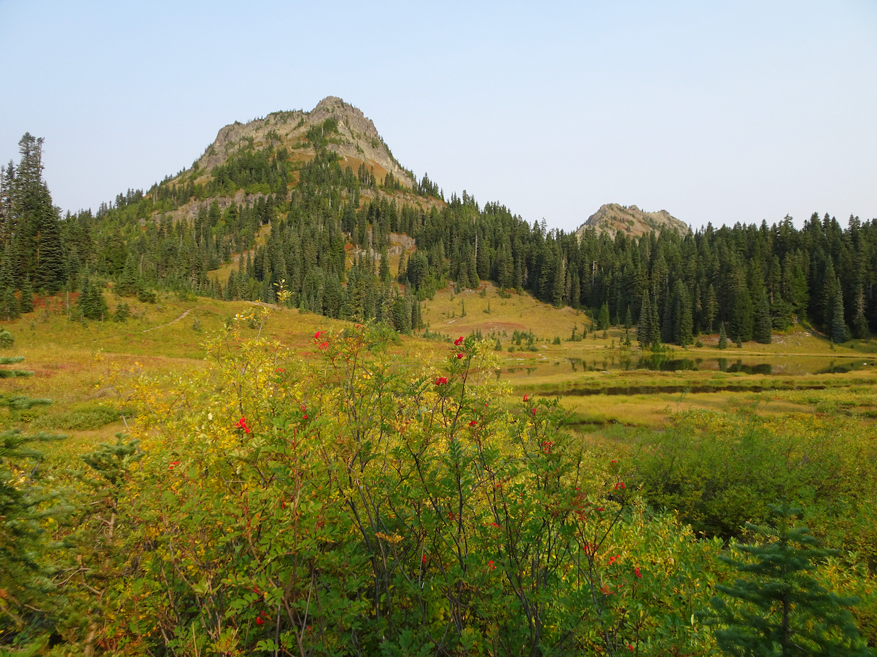
Naches Peak.
Looking back.
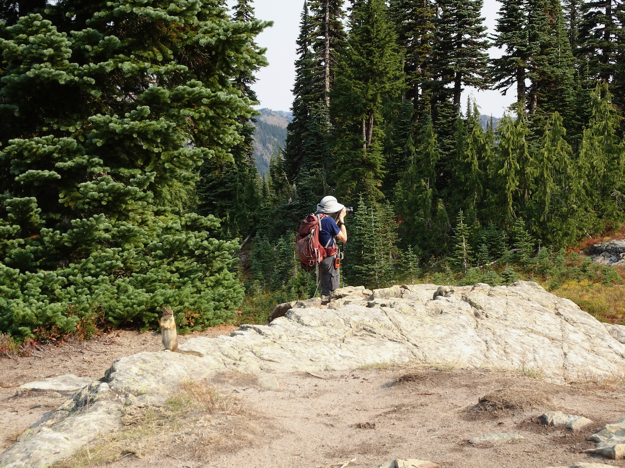
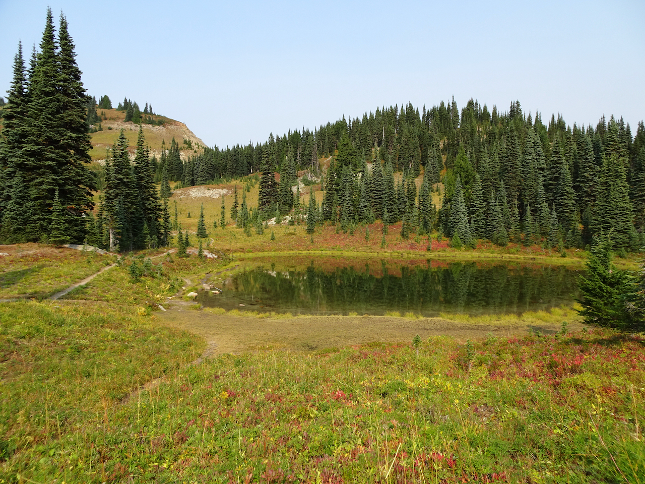
We passed a small lake with a friendly chipmunk.
Once over the shoulder of Naches Peak, we could see the Dewey Lakes to the southeast as the smoke haze increased.
One of the Dewey Lakes.
The trail circles back west, with stunning views of Mt Rainier when there is no haze, as it passes more small lakes.
Mt Rainier is ahead through the haze.
One of the trailside lakes.
More beautiful meadows!
Mt Rainier disappearing before our eyes!
We stopped to admire Upper Tipsoo Lake near the trailhead before finishing the hike.
Upper Tipsoo Lake.
After lunch we drove up to Sunrise, elevation 6400 feet, but the smoke haze obscured views, so we didn’t stay.
Dotted Blue line shows Mt Rainier skyline behind the smoke haze.
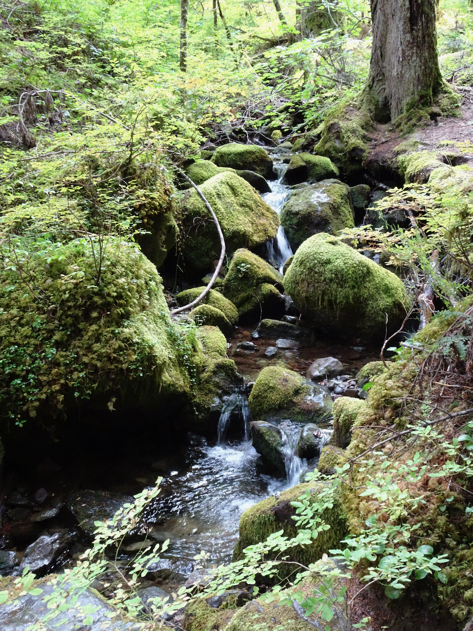
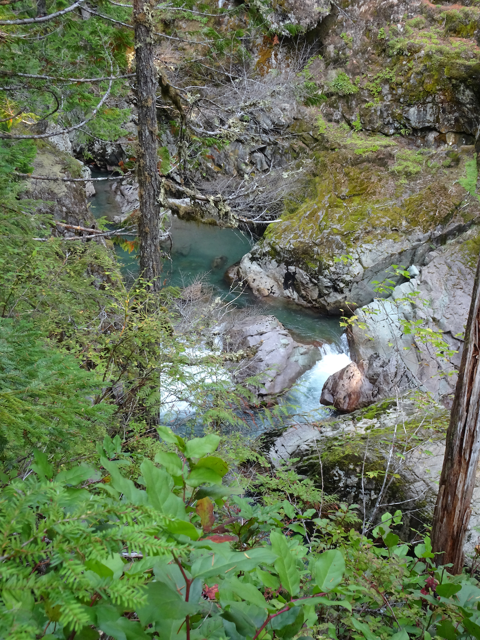
Instead we hiked to Silver Falls, on the Ohanapecosh River, through old and mossy forest, to see clear turquoise waters, and bright falling waters cutting through a slick rock gorge. All in all a lovely ‘recovery’ day from yesterday – the hikes being not so steep. We hope the smoke will blow out for tomorrow.
Small fairy falls in the mossy old growth forest.
Looking down on the blue waters in Ohanapecosh gorge.
Overlook at the top of Silver Falls.
Downstream view of the Ohanapecosh River below the bridge.
Silver Falls.
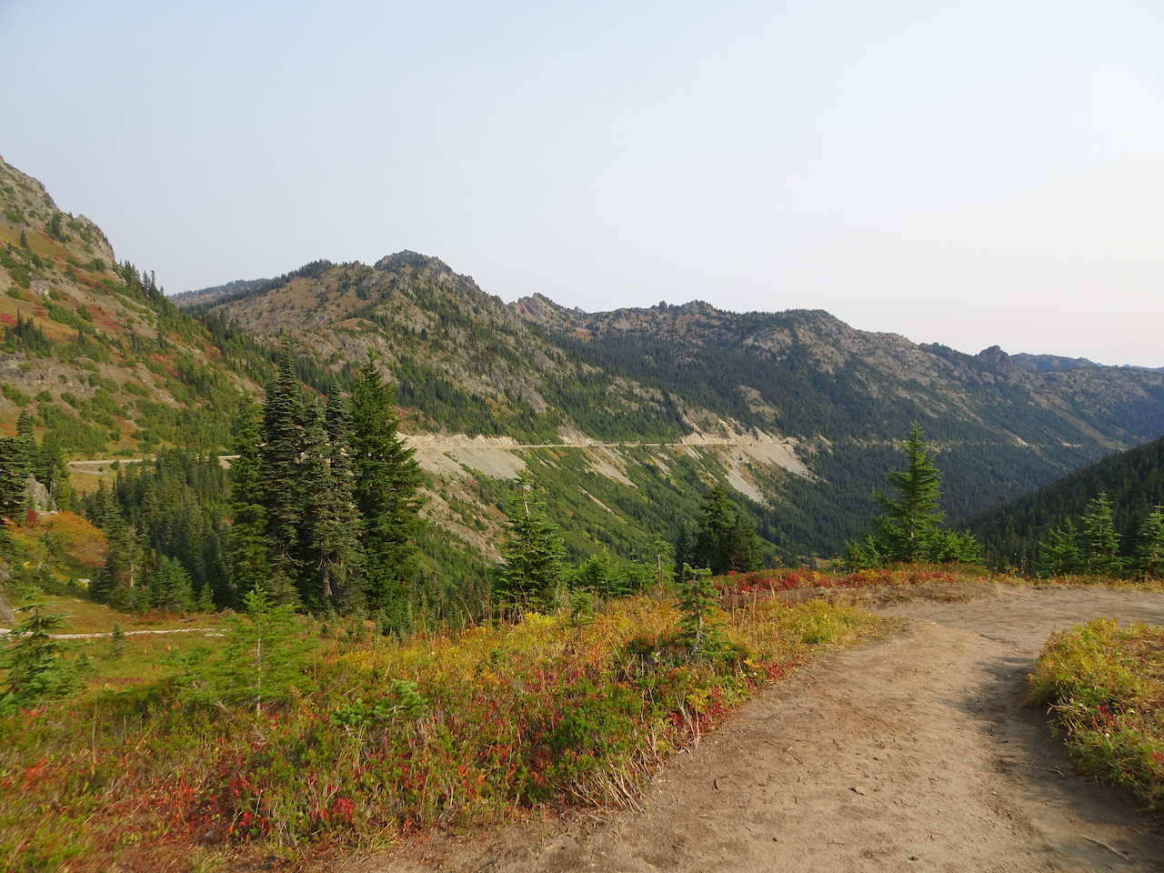
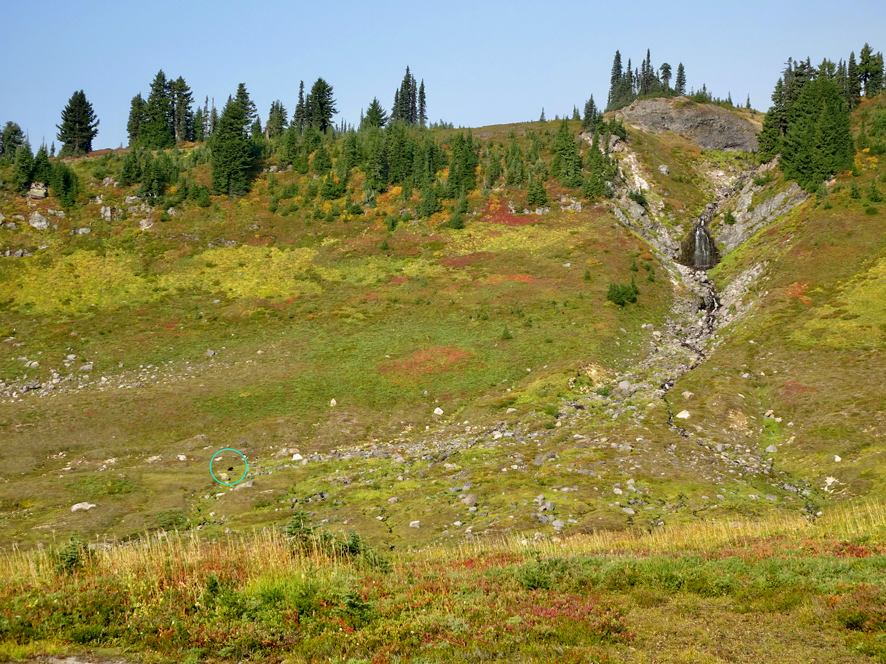
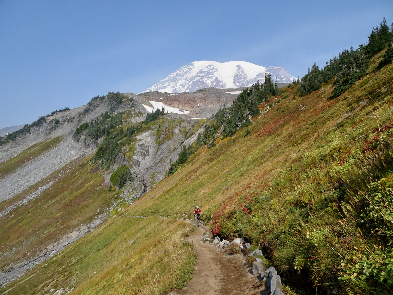
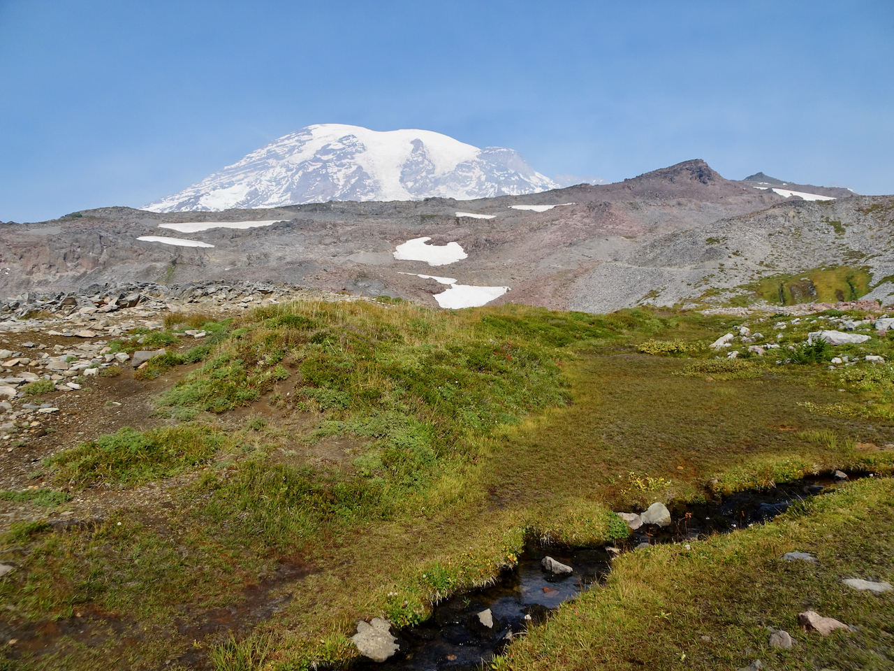
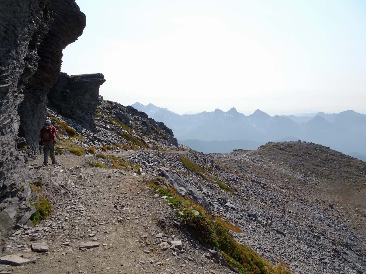
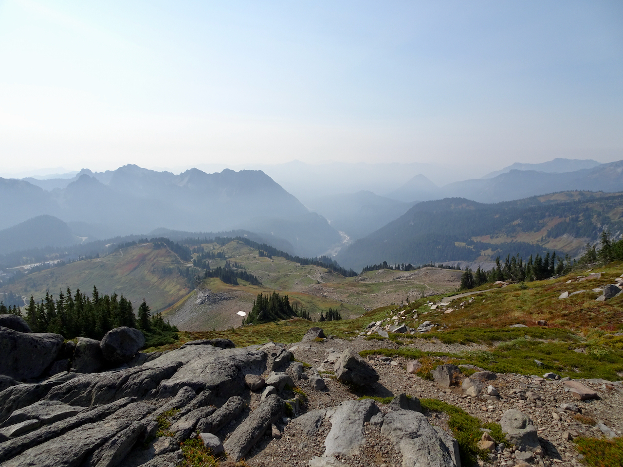
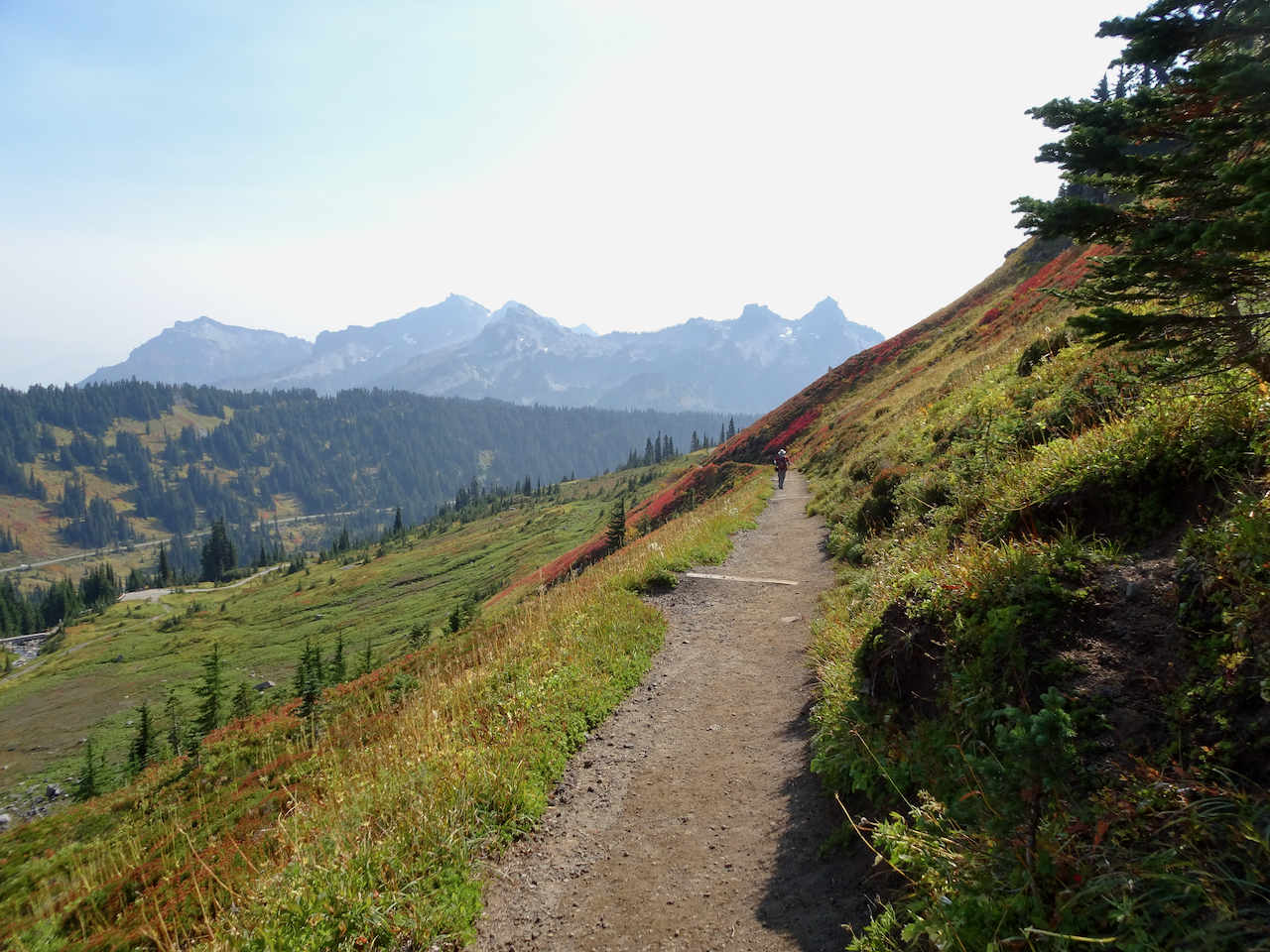
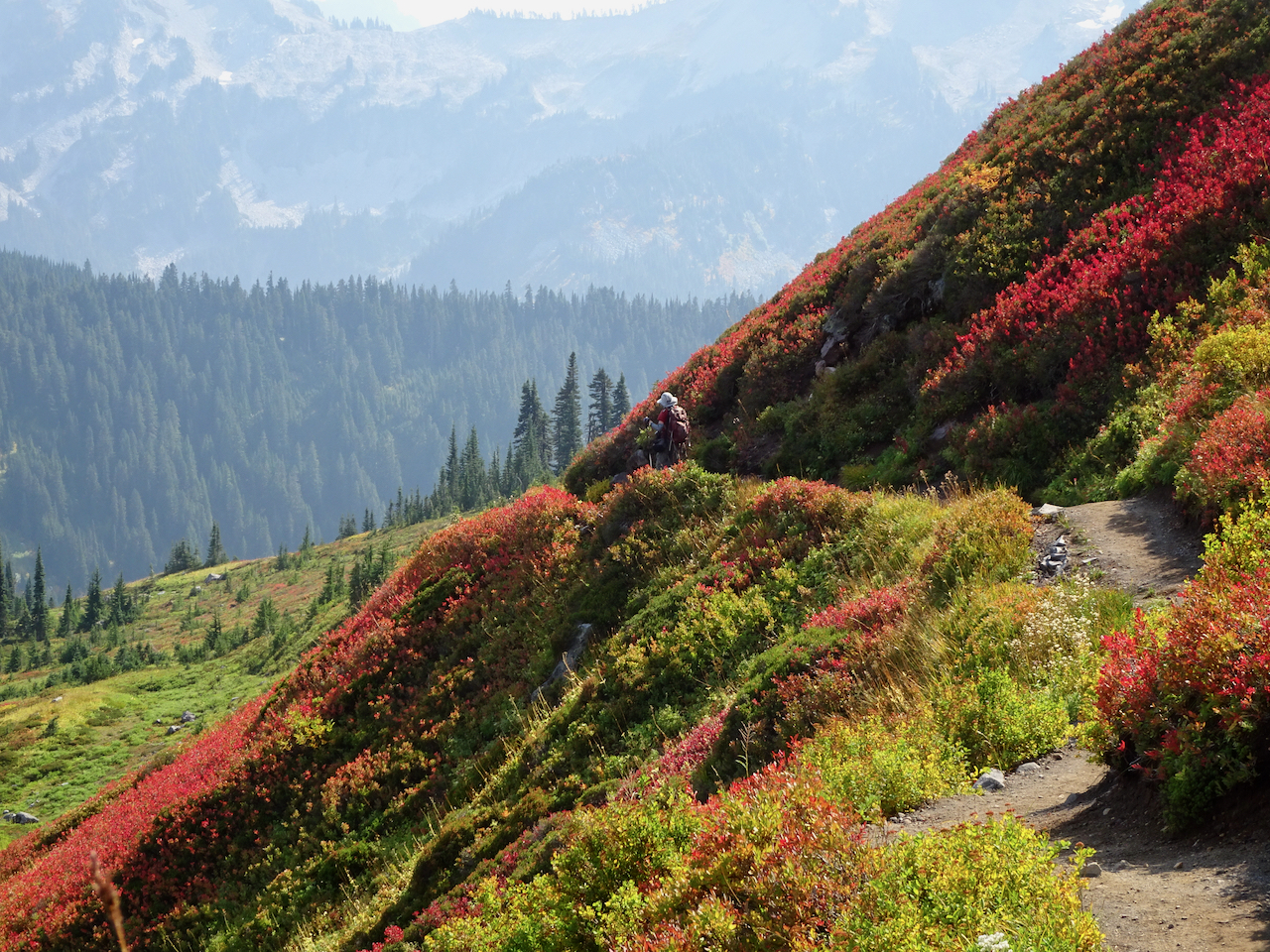
October 1 – Paradise, Golden Gate Trail, Panorama Point
The mountain was ‘out’ behind a thin veil of translucent haze! Smoke would gather throughout the day below us to the south on the flanks of the Tatoosh Range.
View from the parking lot at Paradise.
Iconic gateway to the trail system.
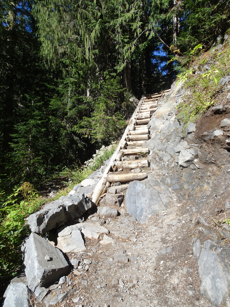
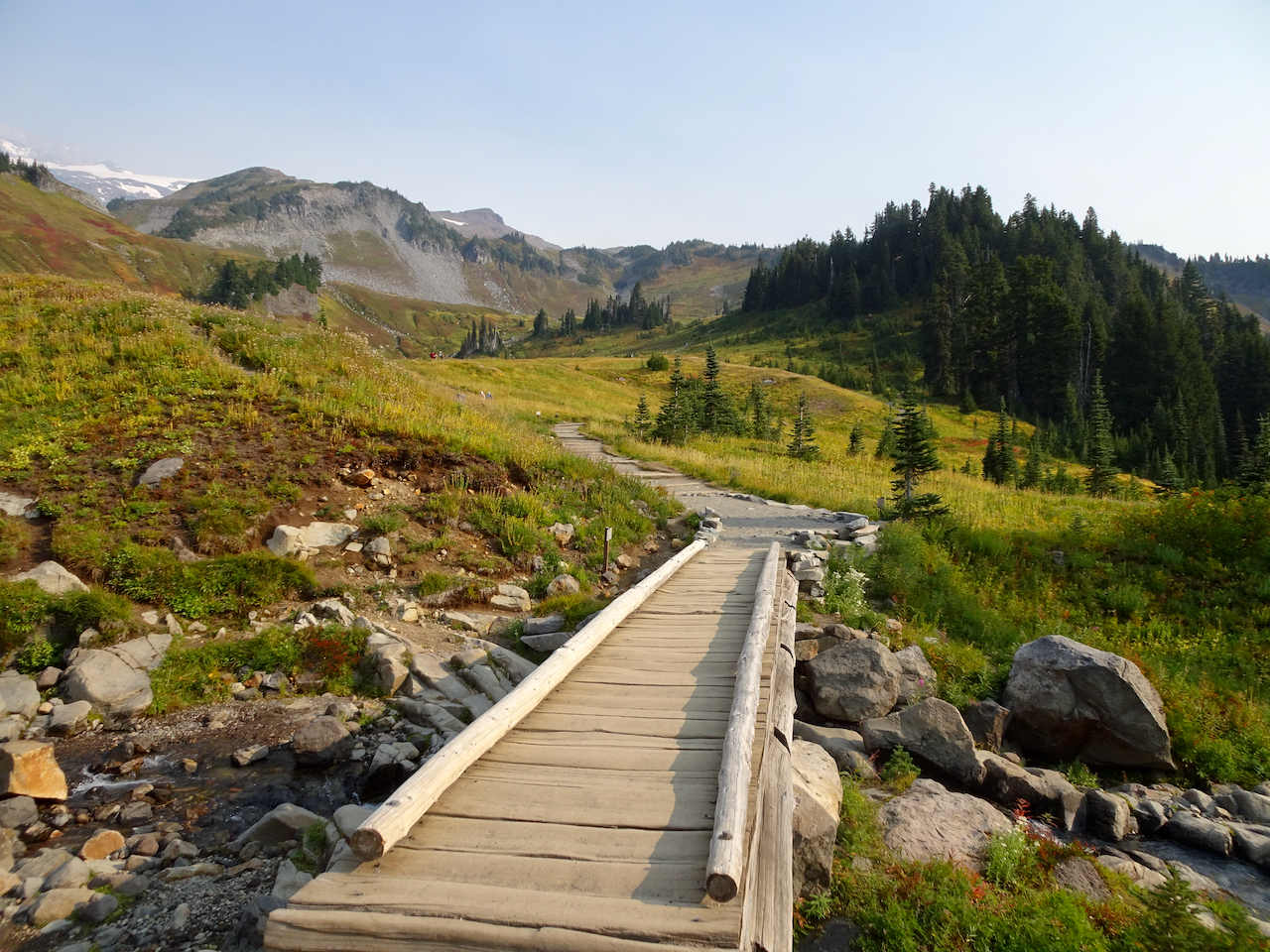
We hiked across Paradise Valley, and up the Golden Gate switchbacks and granite steps, to the High Skyline Trail that circles the valley (6 miles, 1700 feet).
Looking up toward the red huckleberry foliage on Alta Vista, which would be our return trail in the afternoon.
Looking toward the Skyline trail on the east side of Paradise Valley.
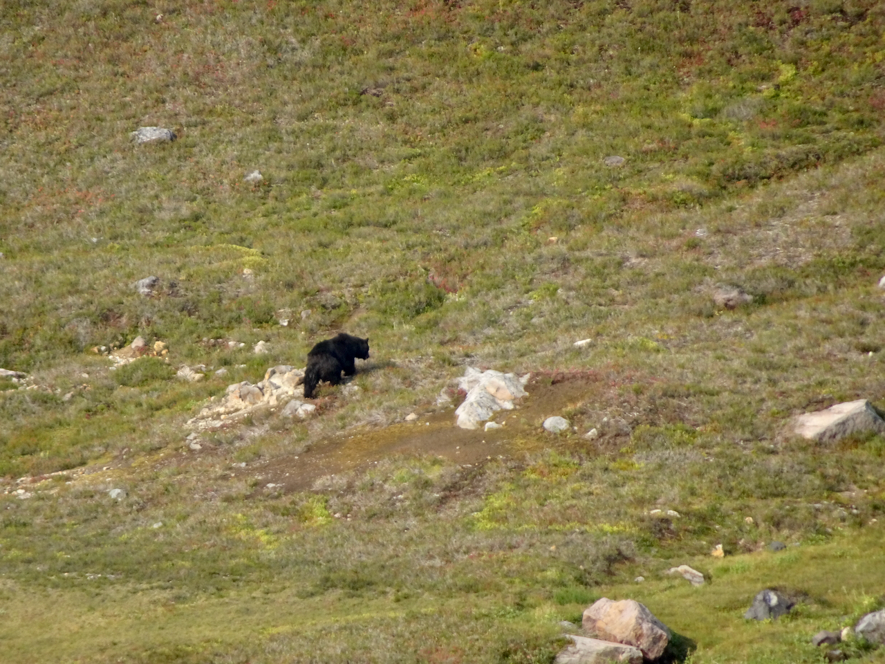
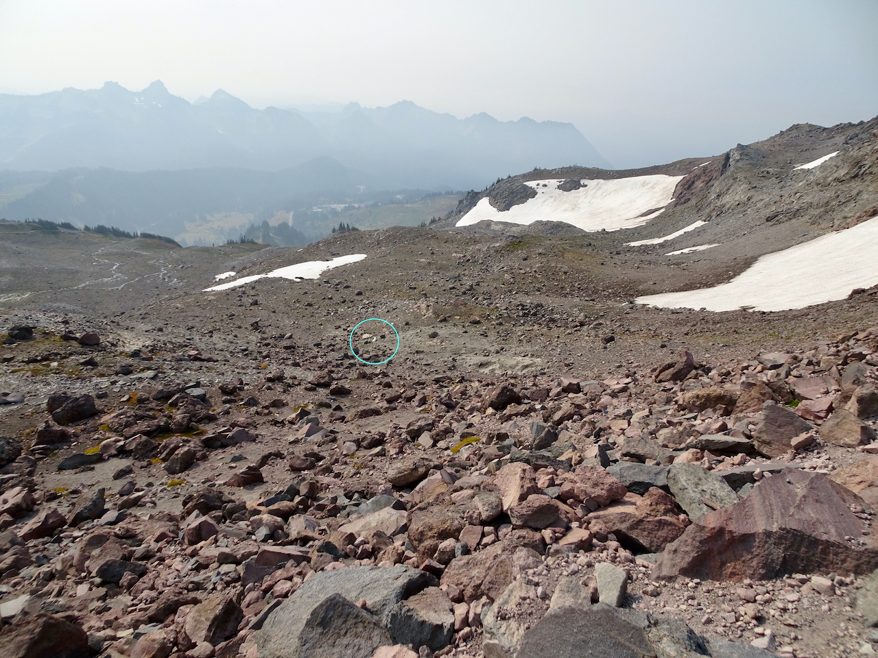
We saw a black bear foraging in the meadows below, and at least eight marmots foraging and nest building on our way up.
While looking across at the waterfall,
I noticed a moving black spot in the valley below.
Black bear.
Marmots along the trail.
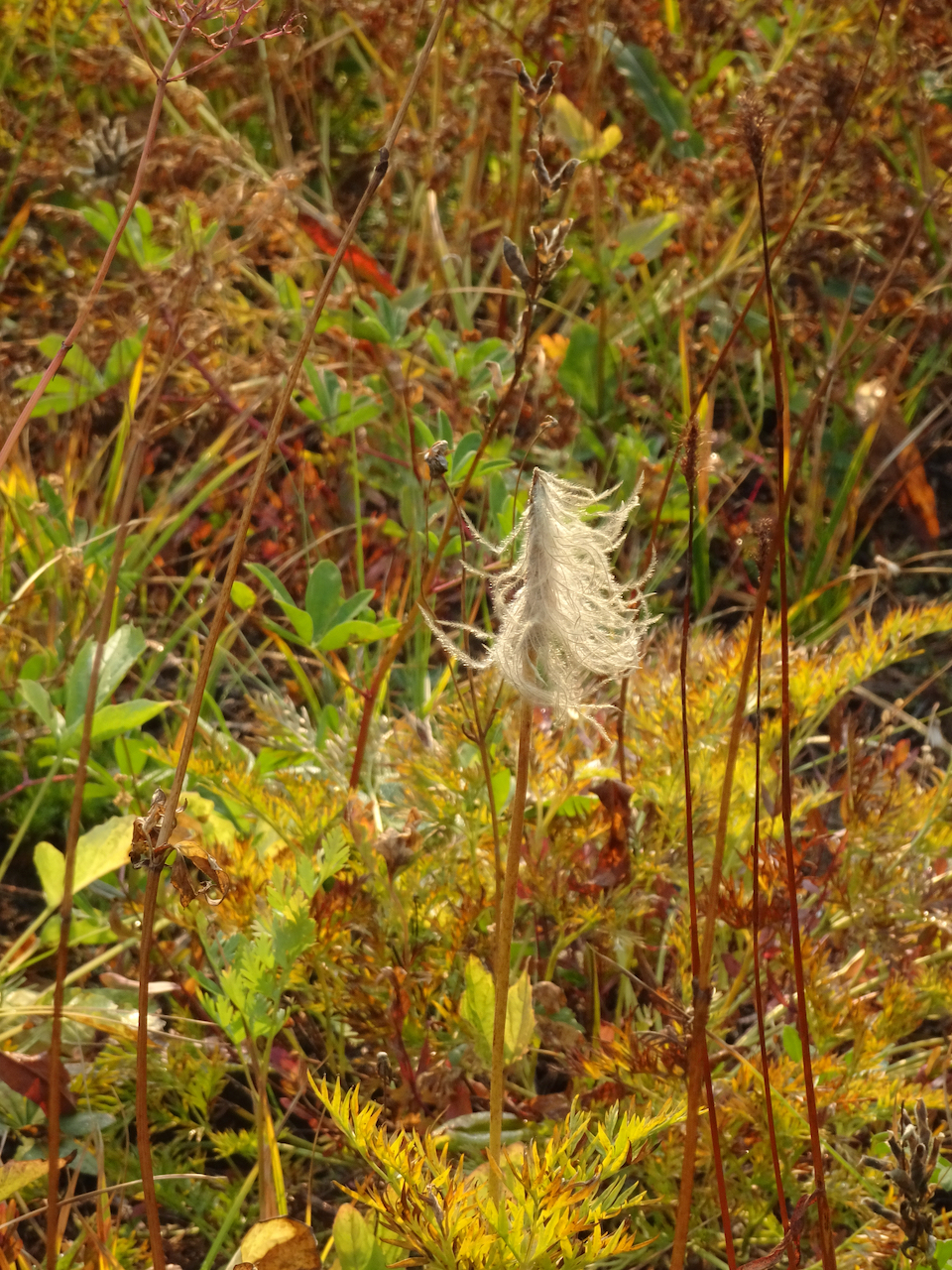
The slopes were still green, and full of fading wildflowers with a few remaining blooms.
Switchbacks of the Golden Gate Trail ahead.
Up the last switchback to the Skyline Ridge.
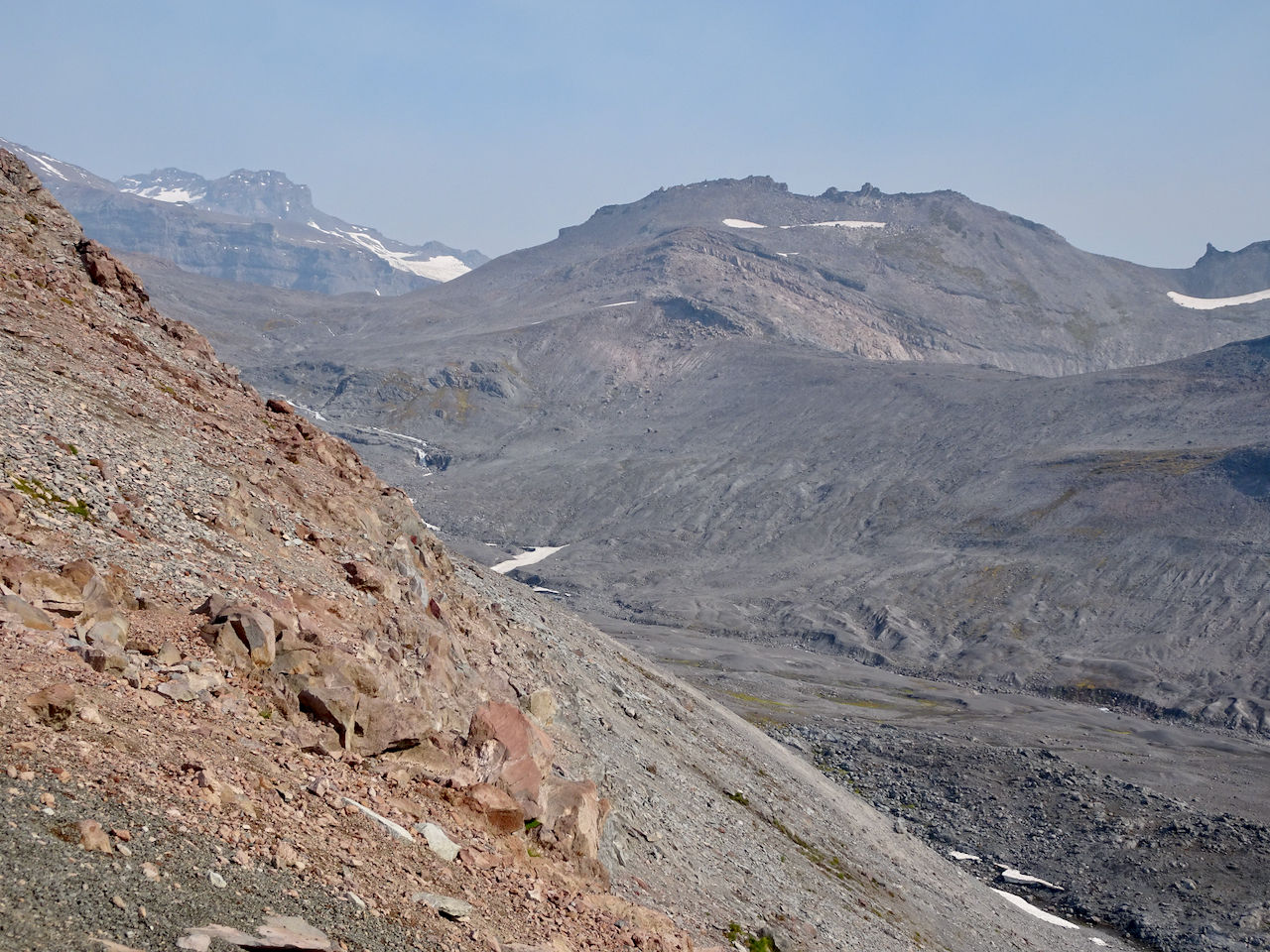
Once to the ridge, stark, glaciated landscape dominated.
High Skyline Trail
A glimpse over the ridge to the east to the next glaciated valley.
Our destination is around the cirque and above the snowfield – there are tiny humans on that ridge.
Rocky trail.
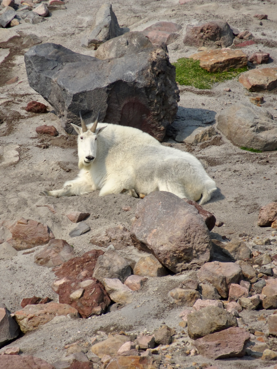
A mountain goat was resting near one of the snow fields in the cirque.
This is the closest we would get to the mountain goat (to the right of the snow field).
Mountain goat, zoom lens.
Looking down on the mountain goat after we climbed higher.
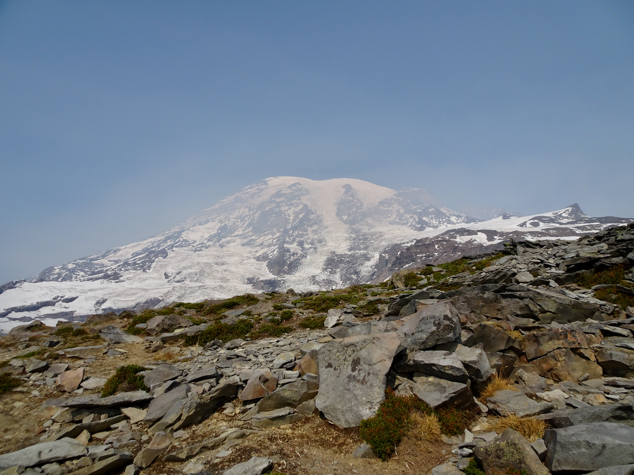
Over the rocky top above Panorama Point, near Pebble Creek, we sat on the rocks and ate our lunch with a full mountain view: 7000 feet of vertical relief, glaciers and sculpted rocks. We heard an occasional boom as something up there, heeding gravity, fell.
Lunch view.
Chipmunk on the rock.
Glacier close-ups.
We made our way back down the steep granite steps, past Panorama Point and more glacier views.
Heading down to Panorama Point.
Panorama Point, with views in all directions:
East, where we have been.
South, toward our starting point, and the smoky Tatoosh Range.
West, to our downward trail and the Nisqually Valley.
Continuing down…
Rocky steps to Glacier View.
We saw one late pasque flower in the meadow.
The bear was still roaming in the valley below.
We crossed through the brilliant red huckleberry foliage on the flank of Alta Vista.
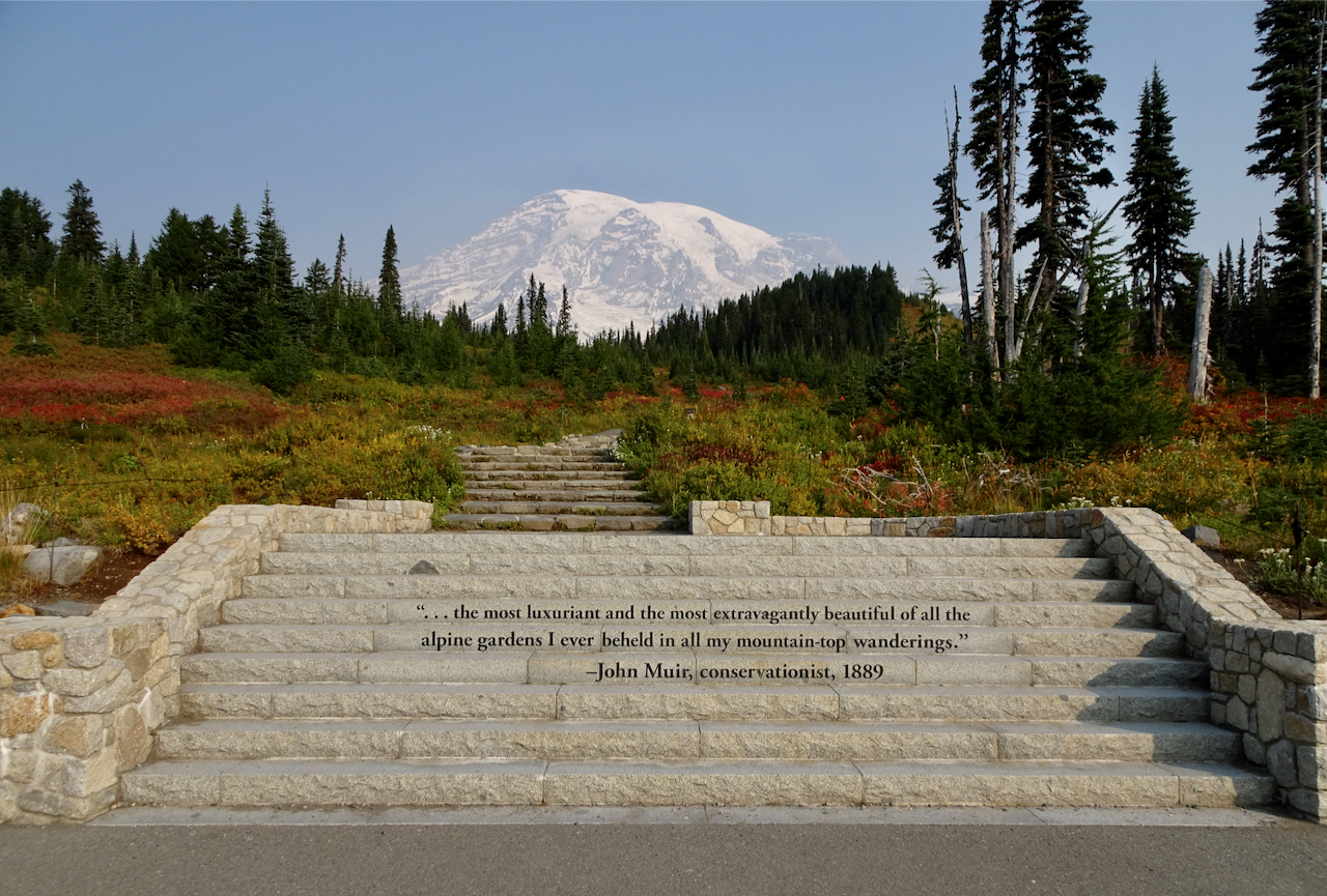
After a last stop at Edith Creek and Myrtle Falls, I was done walking for a while. My legs were tired, my cup full! I have to agree with the sentiment carved in the steps at the trailhead. This is one of the most beautiful places I have been. I feel so lucky to have seen it in the fall!
Myrtle Falls
Edith Creek
This hungry deer near the trailhead paid no attention to the people taking his photo!
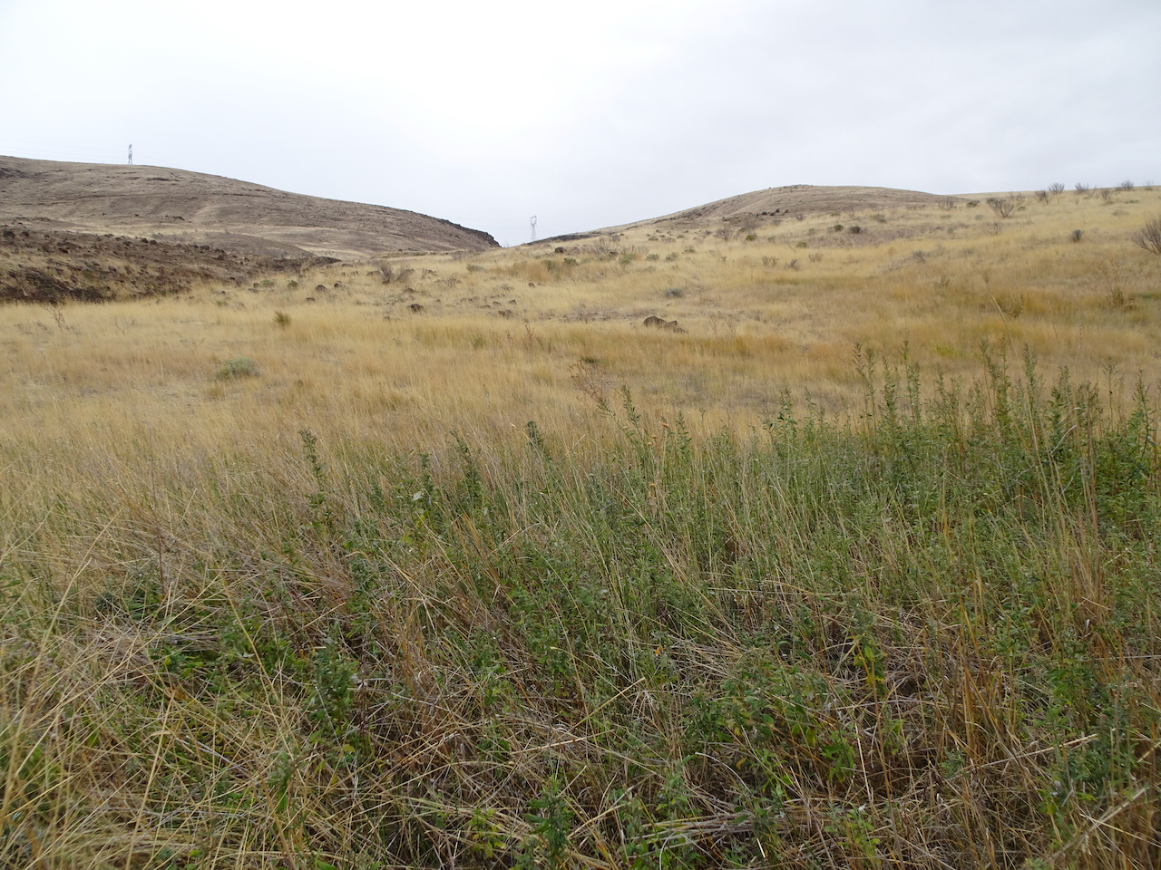
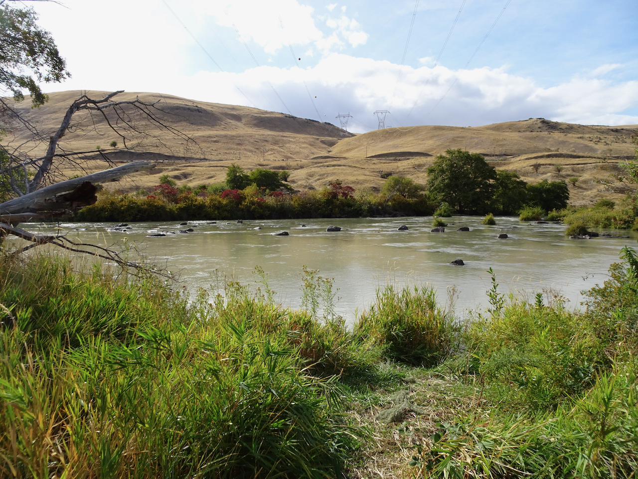
Deschutes River trail, a smattering of rain, it feels like walking through a purifying mist, and there’s no Covid out here.
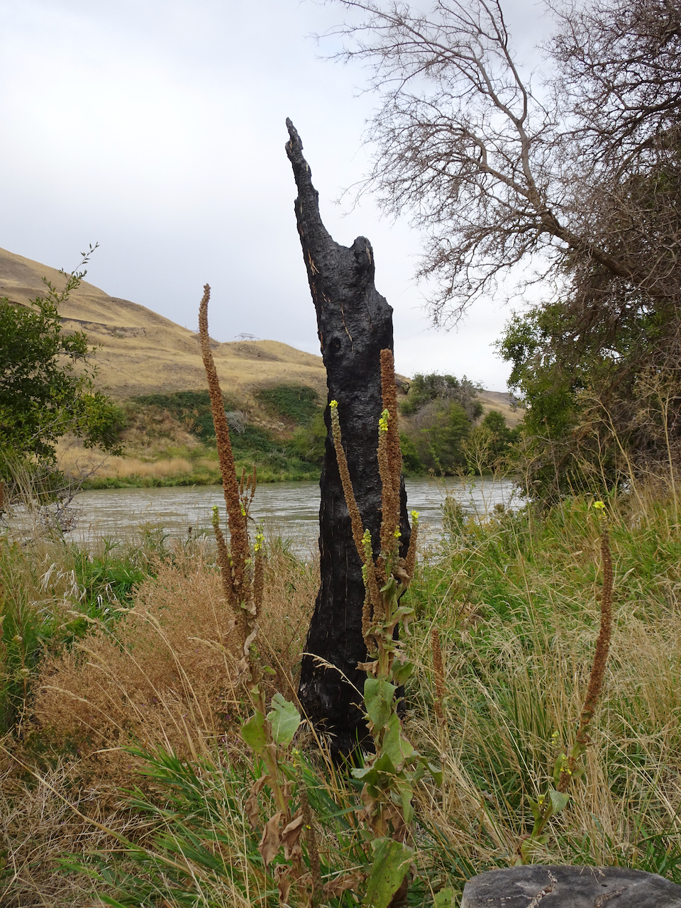
Deschutes River
Rabbit brush
Sumac along the trail
Sumac
Raindrops on leaves
Raindrops in the creek
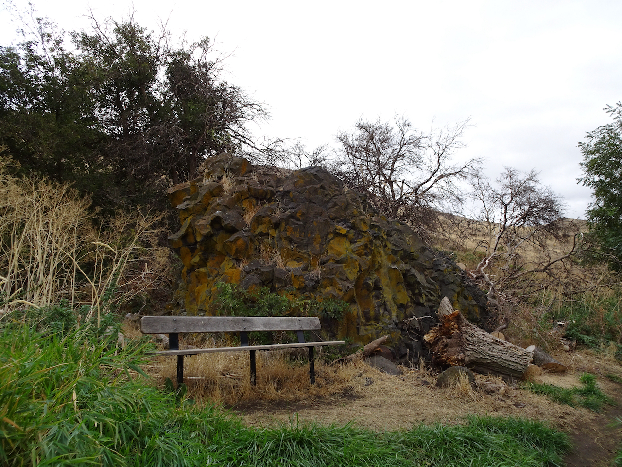
A place to rest
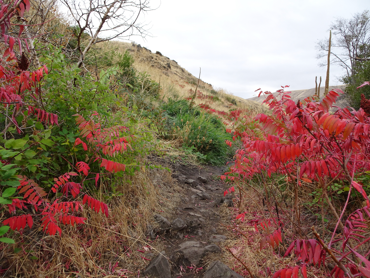
Burned tree from 2017 fire
Golden grasses
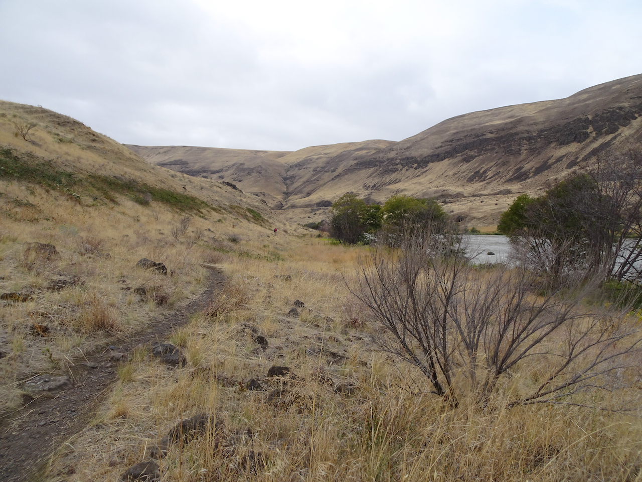
I could be wrong, we have passed a few hikers, anglers, a hydrologist; there are boats on the river, workers on the railroad across the river, campgrounds and powerlines nearby.
Looking uphill to the east.
Our trail continues south, upstream.
Columbia Hills to the north.
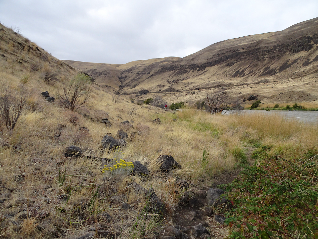
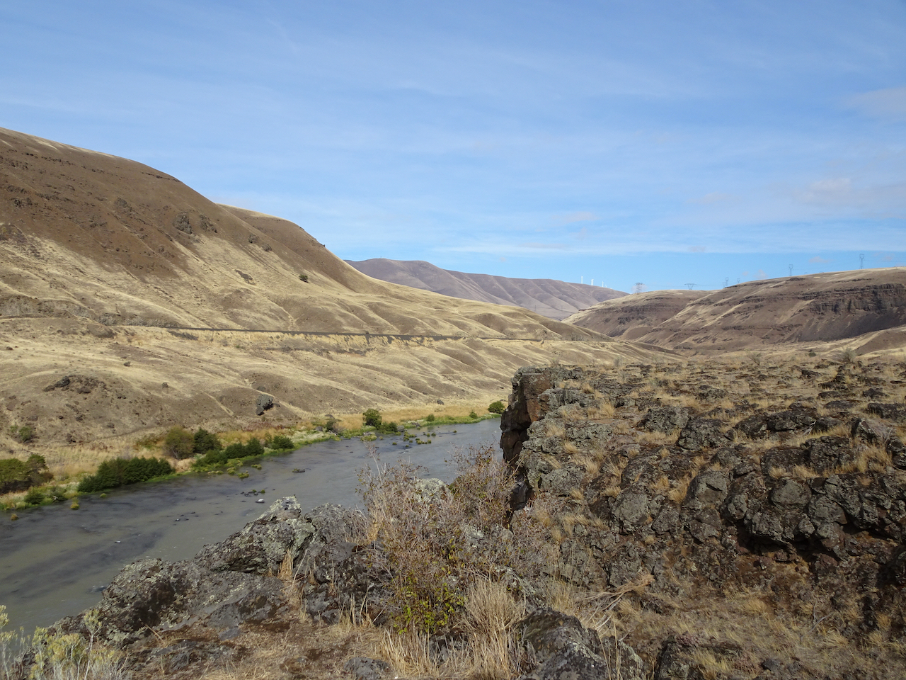
Rocky cliffs
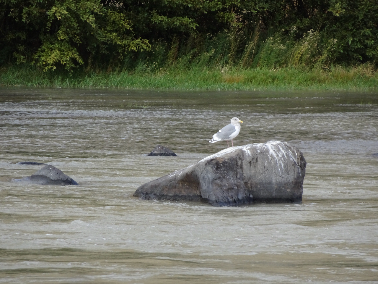
Seagull in the river
Maybe because in this low desert landscape, with golden light on the black cliffs and the dry grass of late summer, I feel like I can really breathe out here; the scent of the high desert, and a smattering of rain only enhancing the sense of free fresh air.
Climbing up the cliffs..
Golden grasses
Lunch view north.
Looking down at the river from our lunch stop.
Looking down to the river through the rock arch.
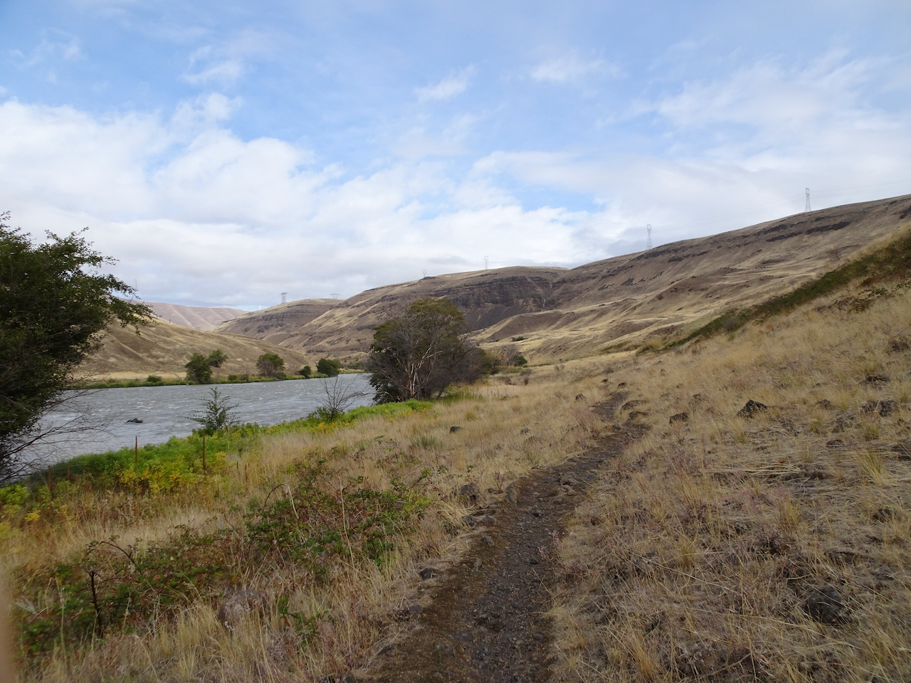
Up on the hill now after lunch, golden and desolate views of the rivers, views of the black volcanic rocks that used to enclose cascading waters of Celilo Falls, cascading waters that used to have salmon leaping up them every year, salmon leaping up into the nets of the Celilo people, before the dam.
Ascending the hills.
Closer view of the Deschutes/Columbia Confluence
Windmills on the hills, power transmission lines to the dam, cell towers, highways, train tracks, campgrounds, and yet I feel alone on this golden hillside.
Golden grasses
Dried balsam root will bloom bright gold in spring.
Approaching the upper Ferry Springs crossing.
Ferry Springs
I feel alone even though the powerlines are buzzing above us, the powerlines are transmitting the thoughts and bytes of millions, and yet I feel blessedly alone.
Its all downhill now to the trailhead.
Dry waterfall and power lines humming above.
Back down to river level, with power lines.
I’m not really alone of course – hiking with Dan, in a respite from the city; the desert is a place of wide open freedom – harsh, spiky, dry, rocky, steep, prickly; hidden hazards beyond each cliff, under every rock, yet wide open above, on an autumn day, I am lucky to be here, to be breathing freely.
blanket flower
horsetail
thistle
snow buckwheat
sumac
preying mantis
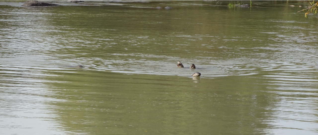
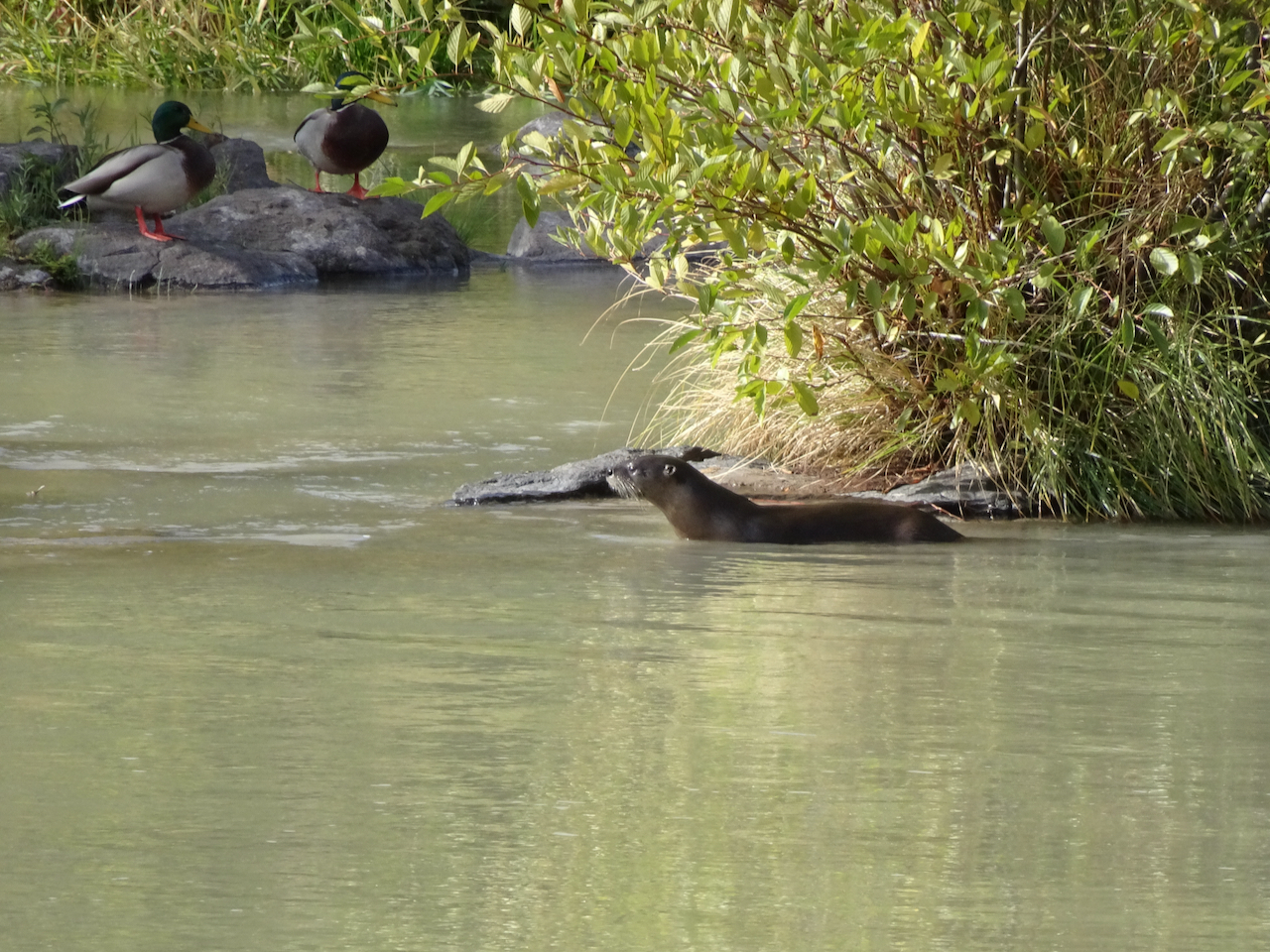
Bonus content: More River otters! There were six otters playing in the river near the trailhead –
River otters
River otters and ducks
Celilo Falls, Salmon fishing, before the dam:
“Courtesy of the U.S. National Library of Medicine”
We took two hikes in Indian Heaven Wilderness, a beautiful patch of the Gifford Pinchot National Forest between Mt Adams and Mt St Helens in southern Washington. A few small volcanic peaks rise above the rolling forested landscape that is also spotted with dozens of lakes, and covered with ripe huckleberry bushes in August.
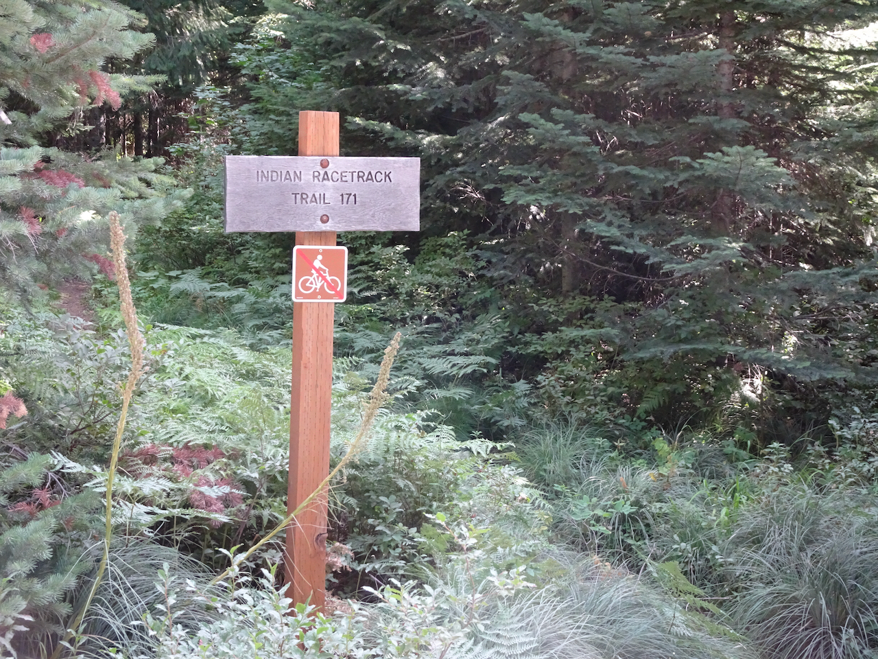
August 20, 2020 – Indian Racetrack Lake and Red Mountain
Trailhead into the forest
Racetrack Lake – the only lake on this hike
Looking Across Racetrack Meadow to Red Mountain
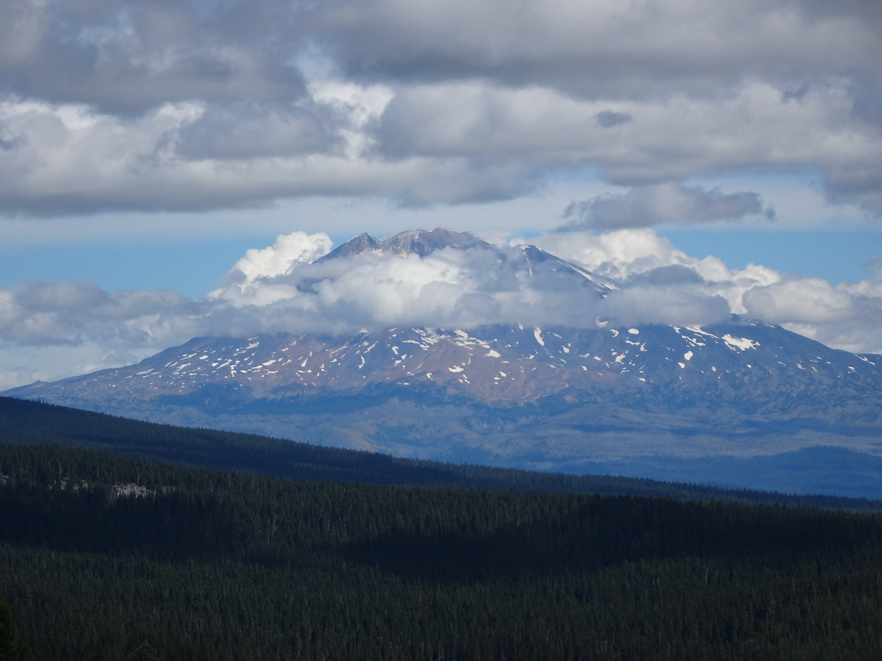
View of Mt Adams on the way up to Red Mountain
Closer view of Mt Adams,
And closer.
Nearing the top of Red Mountain
Views from the top:
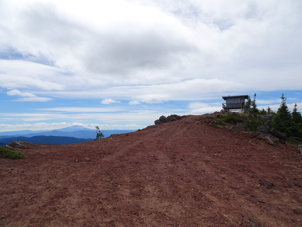
Mt Hood beyond Red Mountain Lookout
We climbed up to the viewing platform on the lookout.
Some other hikers pointed out a bear cub down on the other side of the mountain, eating huckleberries.
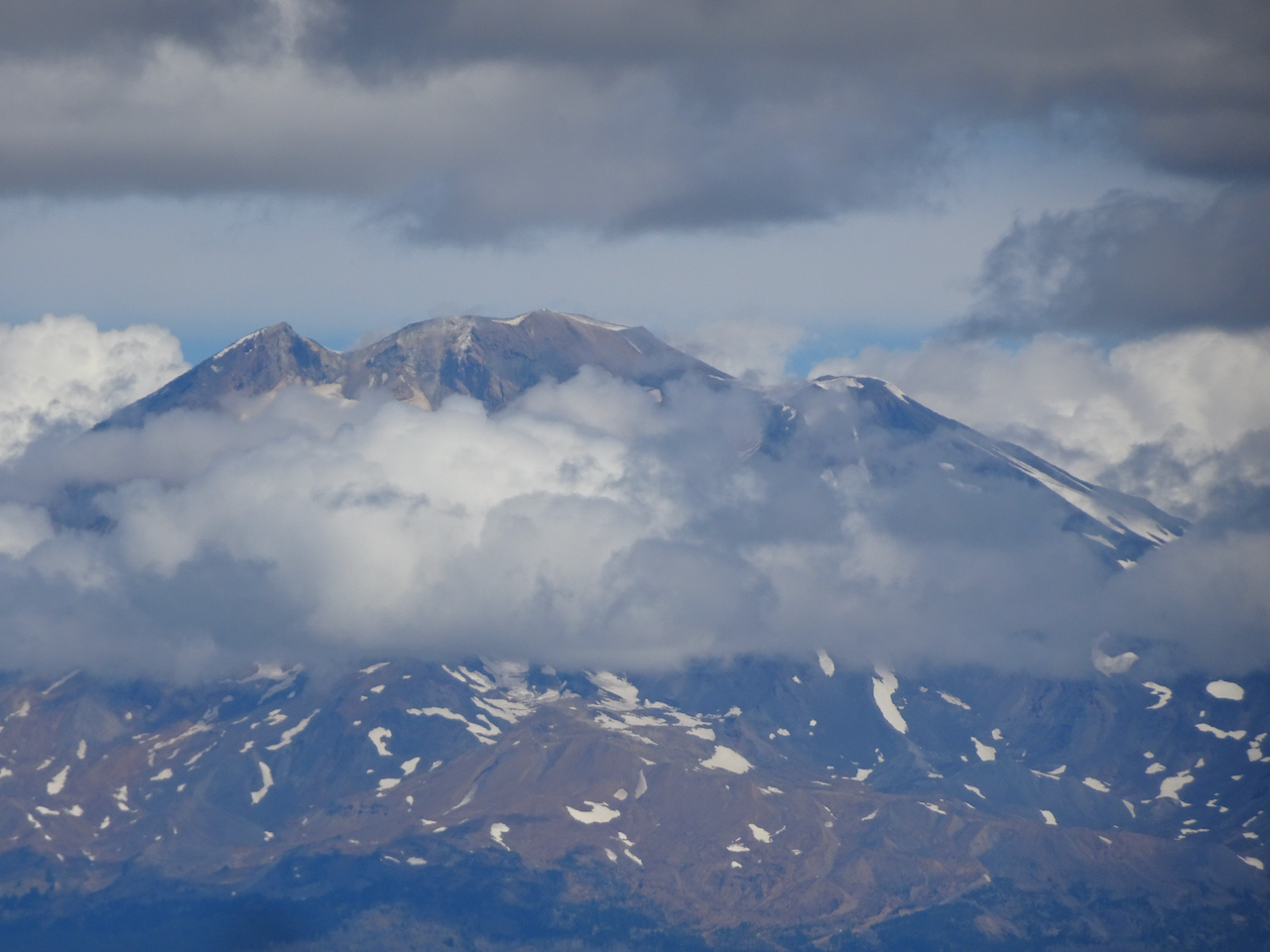
Looking back east at Mt Adams – clouds now covering the top
Mt St Helens to the north
And starting down again, we can see our trail dropping into the woods, and beyond we see the spine of Indian Heaven Wilderness: Berry Mountain, Gifford Peak, burned East Crater, and Lemei Rock.
Some details along the trail:
ripe huckleberries
aster
pyrola
red knotweed
Lily pads and grass, Racetrack Lake
Falls Creek
Hike #57, 6.8 miles, 1500 feet
August 28, 2020 – Thomas Lake trailhead to Junction Lake
The other ten lakes were seen on this hike.
Once again we enter the forested wilderness…
Thomas Lake
Heather Lake
Dee Lake
Eunice Lake
Nuha Lake
Rock Lakes
Unnamed lake beyond Rock Lakes
View of burnt East Crater from the Old Cascade Crest trail segment
A glimpse of Mt St Helens as we cross the shoulder of East Crater
Unnamed lake near the trail junction
Junction Lake, our turnaround point
Some details along the trail:
Reflections in the lakes…
Huckleberry bushes turning red
Mountain ash berries
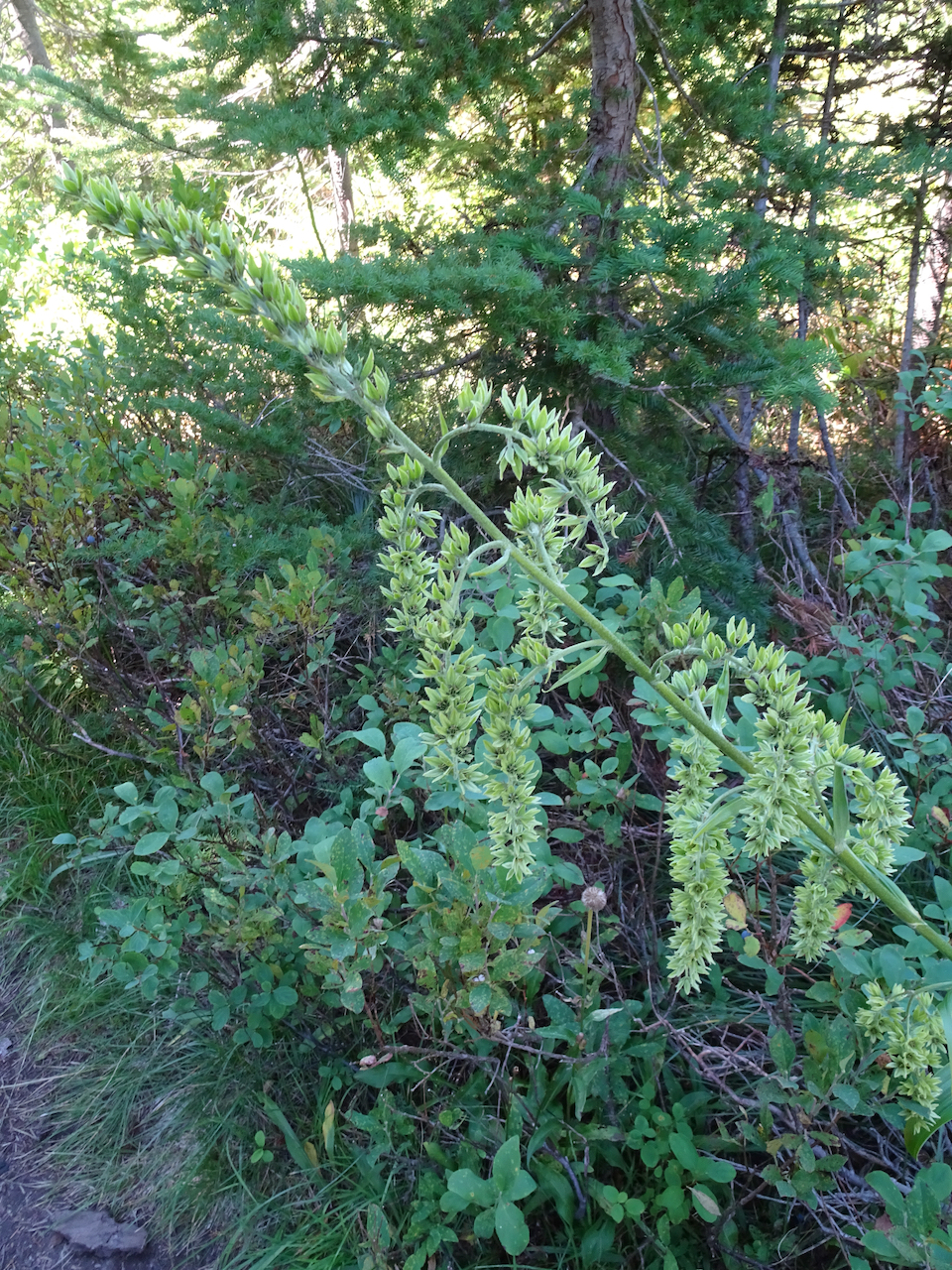
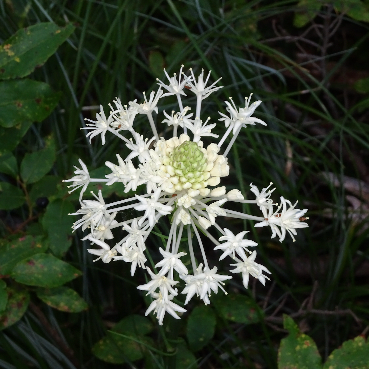
Hellebore
Most likely the last beargrass bloom of summer
And another view of Mt St Helens above Eunice Lake on the descent.
Hike #58, 6.8 miles, 630 feet.
Meanwhile, we are floating along through more days of pandemia – some days we see no one at all, only virtual connections to the outside world. Our neighbors leave us tomatoes. We leave them apples and plums and wave across the rose bushes. Downtown is still burning up with civil unrest while I go on placidly through the days of late summer, of pandemia, of this administration… I virtually hold my breath, knock on wood, pray, cast spells, wish for a begin to a return to ‘normalcy’; hope for a late summer without a local fire season, hope for a scientifically tested efficacious vaccine, and hope for a fair election that will allow us to emerge from impending climate change, covid and facism. And I knit…
Knitting –
I cast on a hat and some socks…
Rafa by Joji Locatelli, Malabrigo Arroyo, Blue green
Sock, Berroco Sox yarn
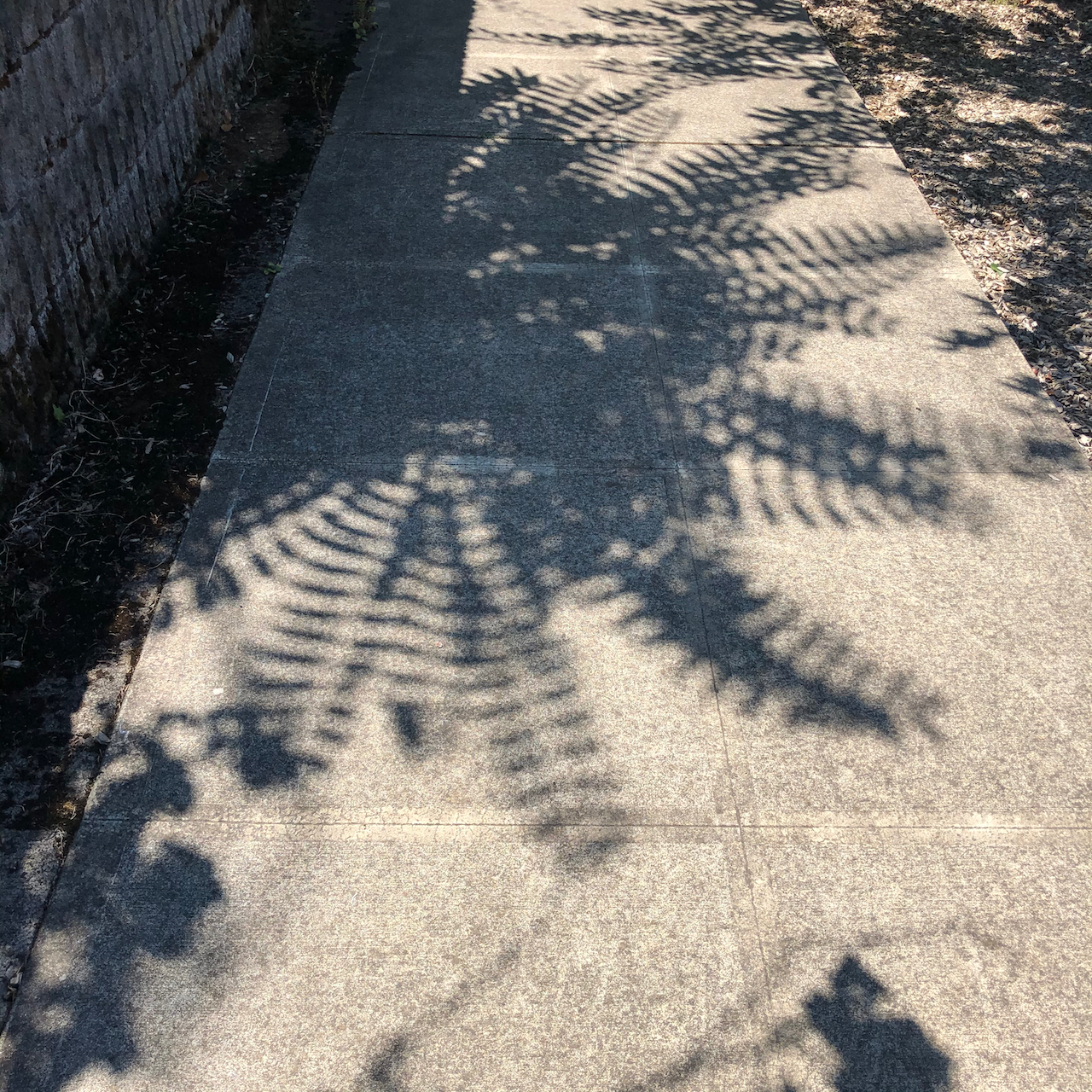
Neighborhood sights:
fern shadows
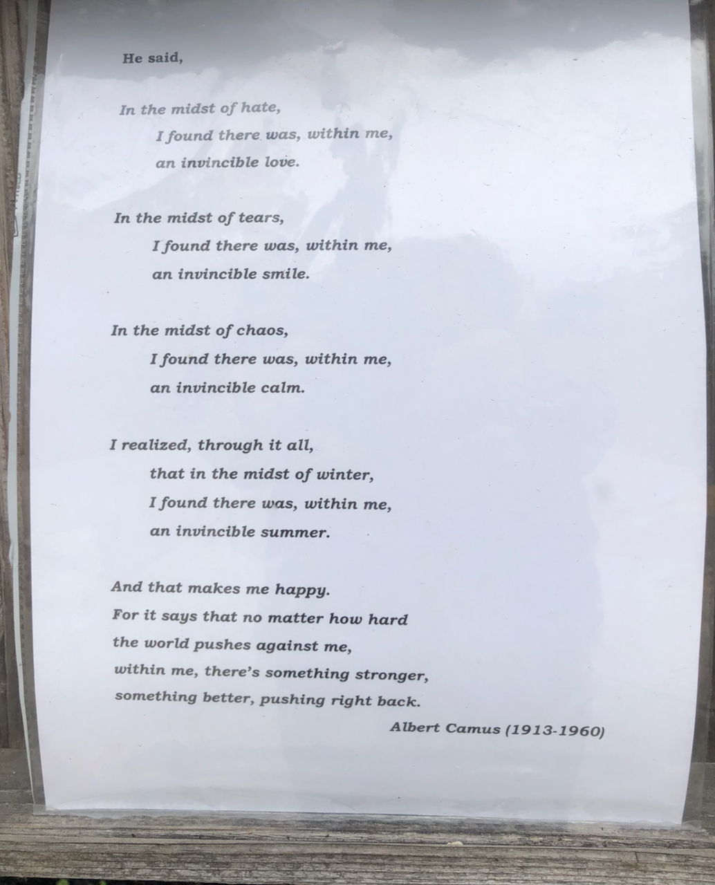
Poetry Post
yard sign
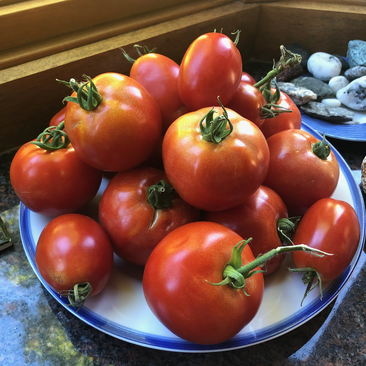
neighborly tomatoes
And nationally…
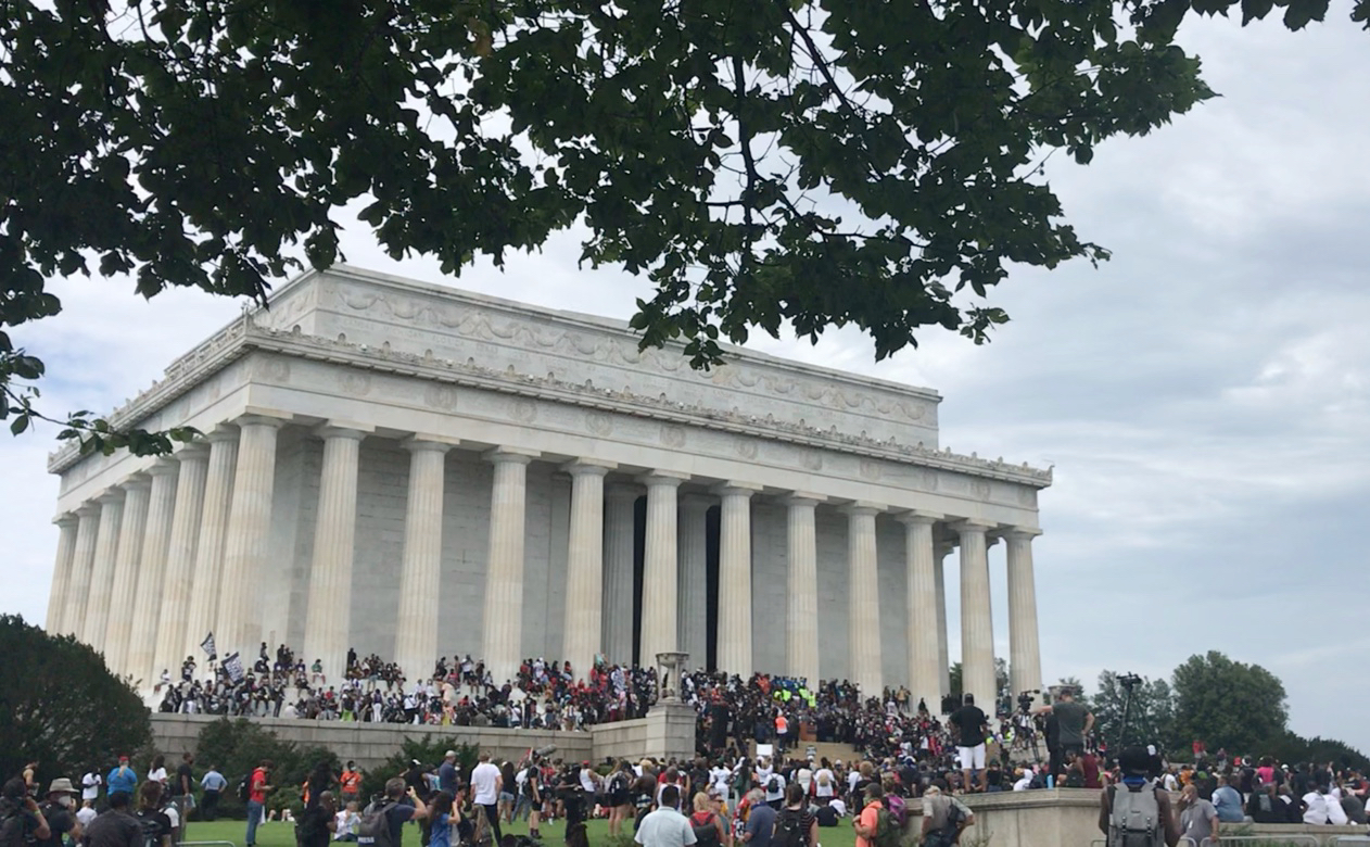
My daughter attended the 57th March on Washington,
The march
Lincoln Memorial
The Mall
-and this artwork crossed my social media feed:
I am still struggling a bit with the new WordPress format….


 Deschutes River trail, a smattering of rain, it feels like walking through a purifying mist, and there’s no Covid out here.