23. Visiting the Midwest

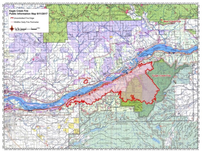
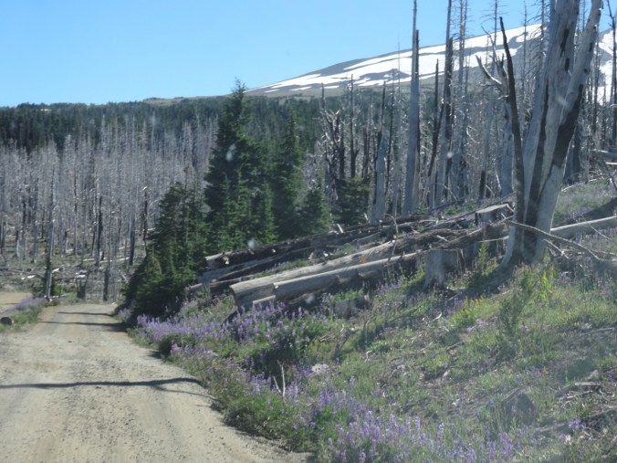
As I write this I get an Eagle Creek Fire update:  Rain has finally slowed the fire, and operations are turning to cleanup and recovery.

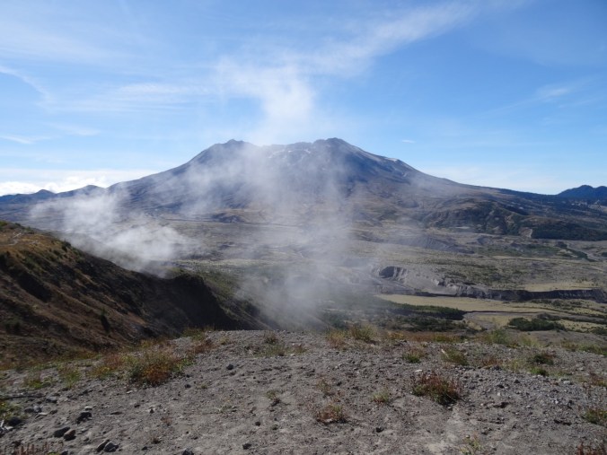
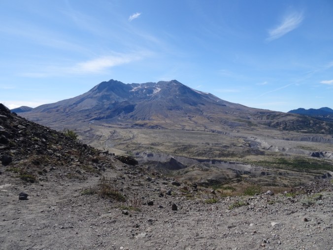
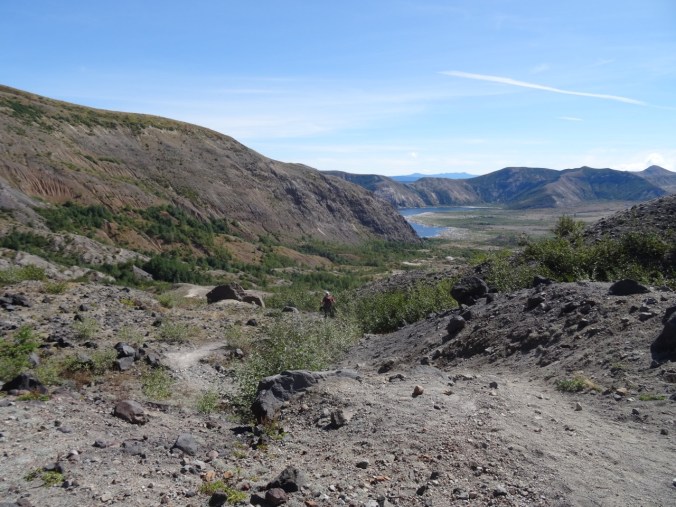
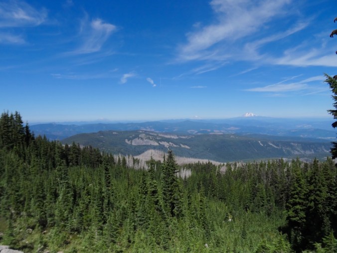
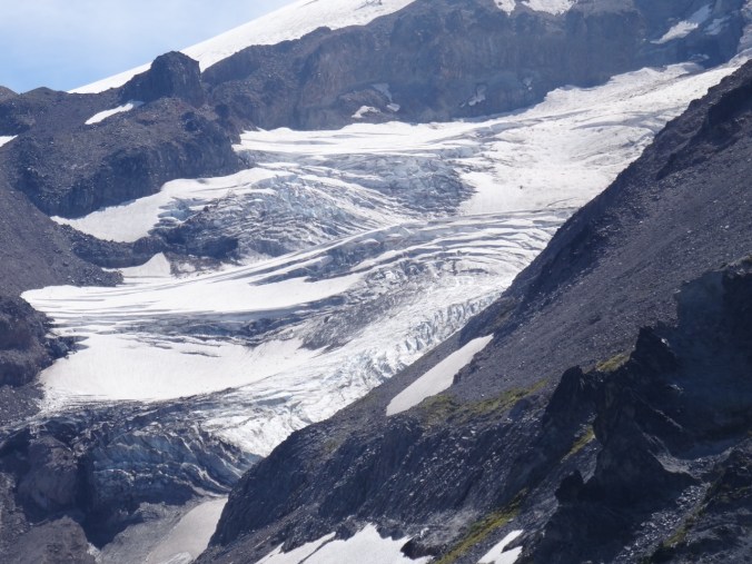
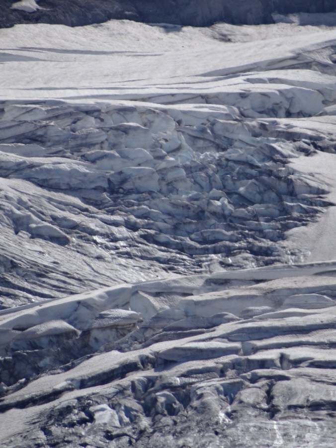
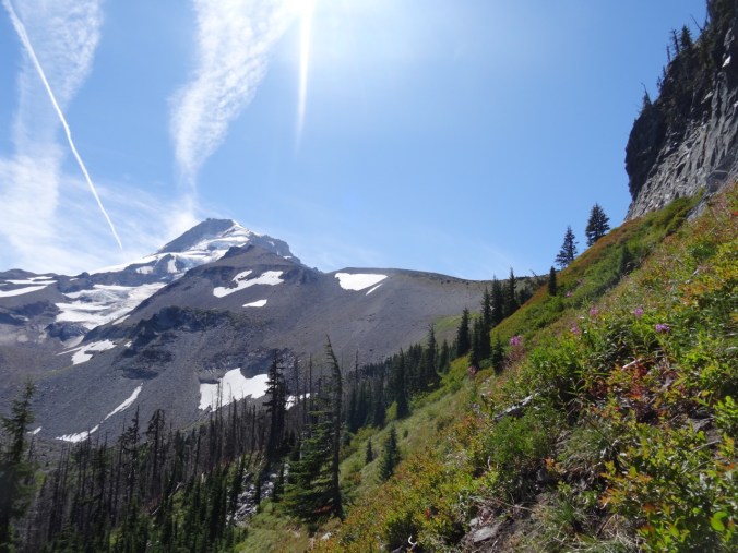
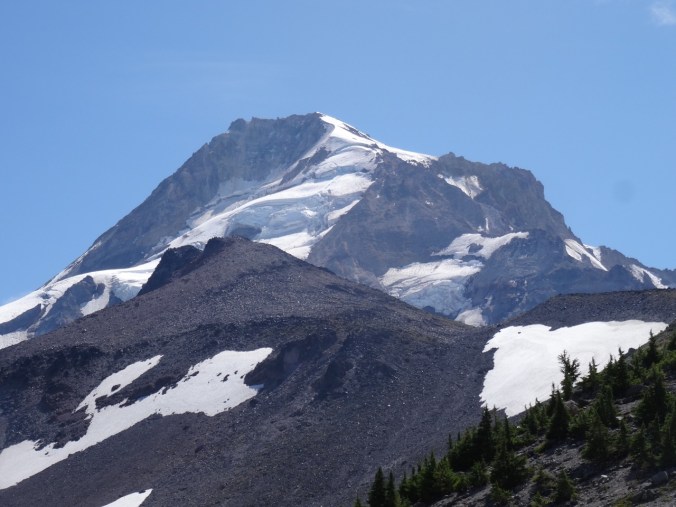
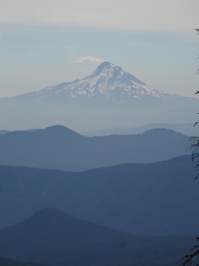
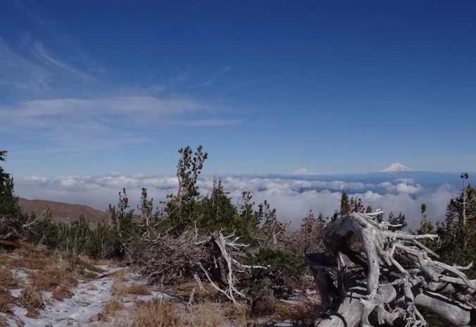
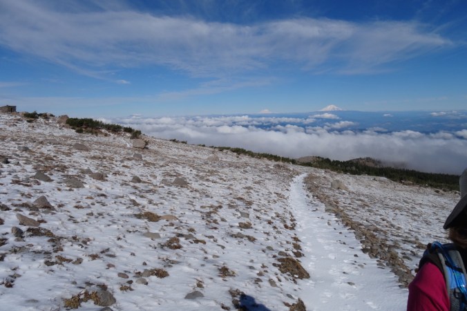
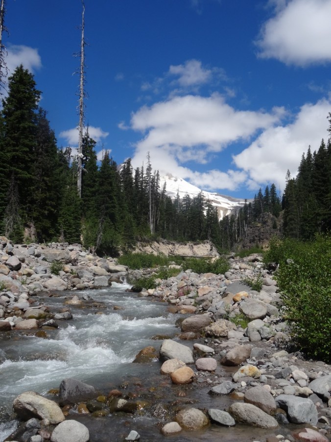
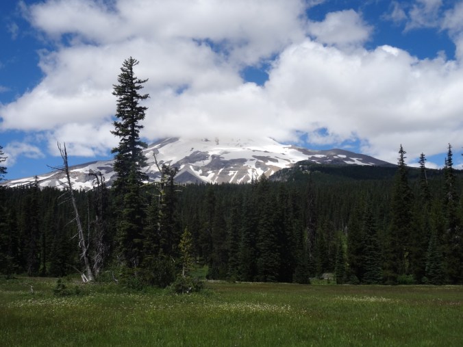
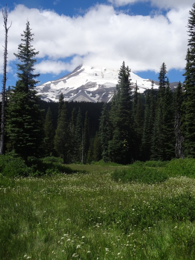
We flew to Ohio, passing over the south side of Mt Hood – smoke not impeding our view today to Mt Adams and Rainier beyond.

DSC07967

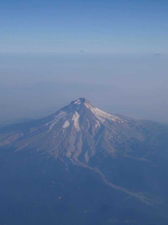
Mt Hood, Mt Rainier and Mt Adams

Ohio

Oberlin College

We visited our daughter at Oberlin College in Ohio. I had previously only had a brief peak at the campus the day we moved her into her dorm two years ago.  She and her roommate are now in a two bedroom apartment and enjoying the non-dorm lifestyle. We walked all around campus, seeing the various buildings and rooms where she spends her time. She introduced us to friends that seemed to appear around every corner.  I enjoyed the quiet, but intensely busy vibe on this early-term late summer weekend.  We got coffee from The Local, ate delicious dinners at The Feve and Indian Garden, and joined her for a student prepared lunch at her dining coop.

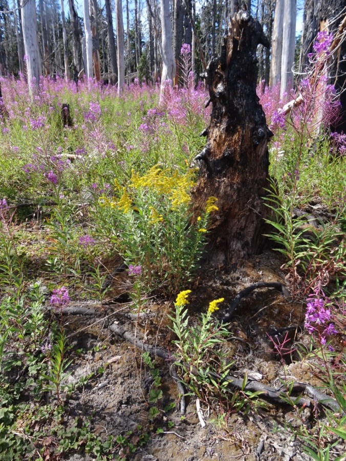
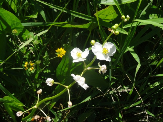
Brandywine Falls, Cuyahoga National Park, Ohio   Sept. 17, 2017  (#46)

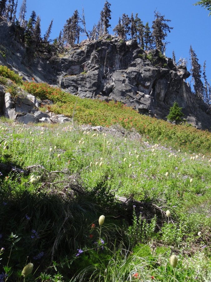
She also wanted to go for a hike.  We chose a 4 mile hike about an hour from campus, the Stanford/Brandywine Falls trail. It was a beautiful sunny day though the humidity was much greater than we are used to in the Pacific Northwest. There was enough shade in the woodlands to stay comfortable, a few summer flowers struggled along, and fall colors were beginning to pop.


Chicago

We then flew to Chicago to visit to our son. Beautiful weather continued on Monday as we enjoyed the Architectural Boat Tour.

Windows and reflections:

After lunch we rented Divvy bikes and rode four miles along Lakeshore Drive trail from Millenium Park back to Lakeview where we were joined by long time friends for dinner.

DSC08332

The Bean, i.e. Cloud Gate, in Millenium Park

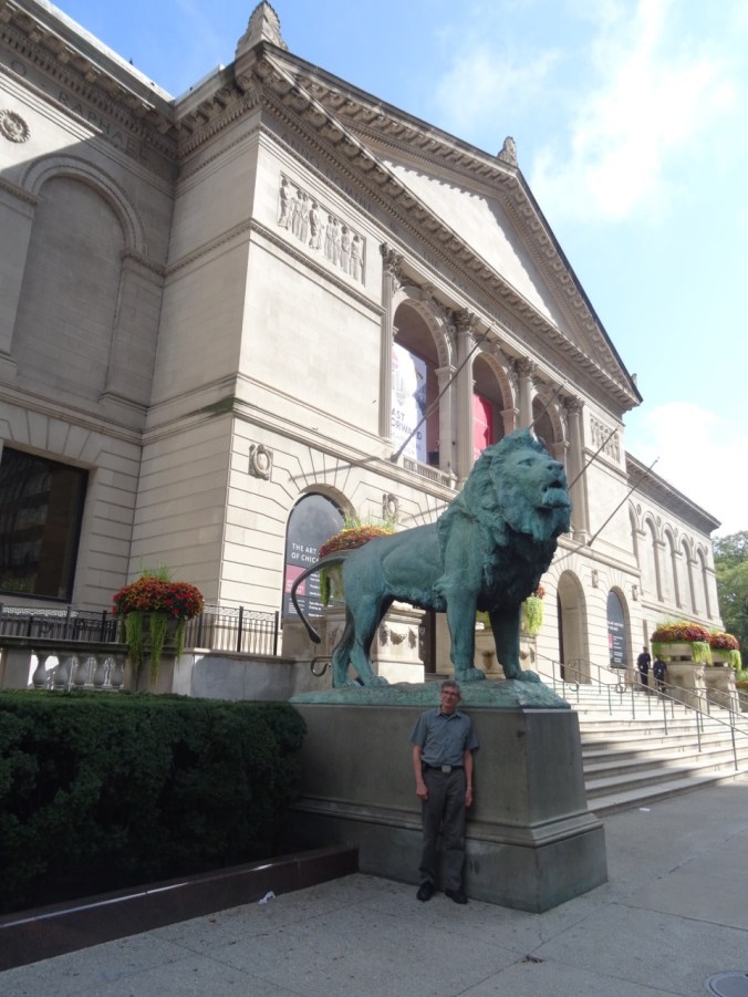
The next day we visited the Chicago Art Institute.

DSC08357

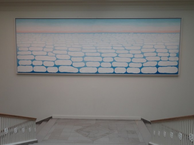
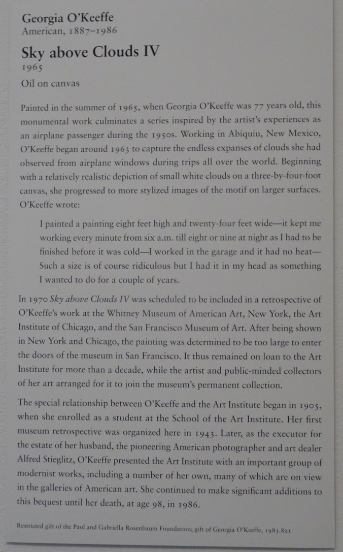
We spent most of our time in the Impressionism and Modern American galleries. My favorite piece was by Georgia O’Keefe, a 24 foot long painting that filled a stairwell:

DSC08426DSC08428

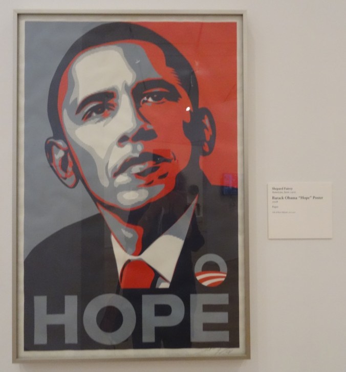
This also caught my eye:

DSC08430

We walked around some of the parks near the Art Institute.

After dinner we went to see Hamilton!

This was my first visit to Chicago, and only lasted two days, but I enjoyed my time, and can see why my son likes living there.
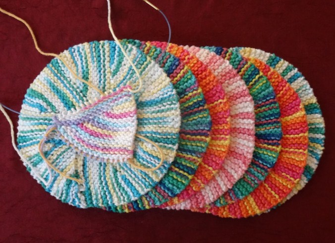
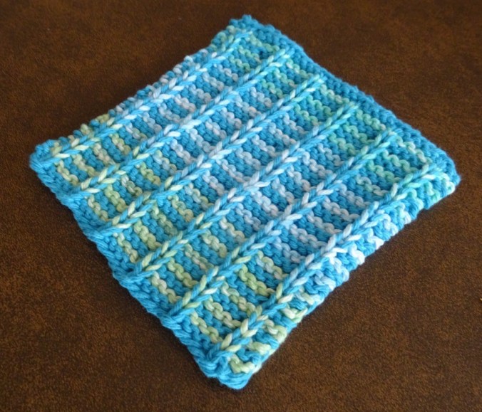
Knitting update:

DSC07915

11 dishcloths

22. Mt St Helens Boundary Trail

Eagle Creek fire update as of  9/11/17:  34000 acres, 7% contained.

21640885_123414854982697_7881458328682540061_o

USFS Incident Map

Boundary Trail toward Harry’s Ridge     9/10/2017    (#45)

The skies are alternating blue and cloudy today. Unsure of any firesafe place east of us, we opted to drive north to Johnston Ridge, Mt St Helens National Monument.  Clouds that were floating at mountain level when we arrived late morning evaporated during the day.

DSC07837DSC07842

DSC07848

Mt St Helens

We hiked the Boundary Trail toward Harry’s Ridge.

DSC07855

Coldwater Peak, north of the Boundary Trail

The trail that used to go along a steep, cliffy slope to the grand viewpoint at Devil’s Elbow is now closed.  The new alternate route cuts over the ridge, and has a view to Spirit Lake from the pass at the top of the cutoff. We stopped there for lunch.

DSC07851

Lunch stop at the top of the new cut off trail, with view to Spirit Lake

I decided it was too hot to continue, so hiked slowly back to the observatory.  Dan went on to Harry’s Ridge then met me back at the observatory later.  I had the chance to watch the excellent 16 minute film that simulates the eruption and illustrates the forces of nature during the 1980 eruption.

DSC07861

View while hiking back toward Johnston Observatory

DSC07871

Looking east from the observatory toward Mt Adams

DSC07872

Mt Adams

There are straggling summer flowers in bloom – lupine of both large and dwarf varieties, penstemon, paintbrush, yarrow, an abundant yellow composite, and equally abundant white pearly everlasting gilding the slopes, and standing out strongly in contrast to the early reds of fall.

We stopped at Coldwater Lake to walk the boardwalk trail that illustrates the Birth of the Lake. It was peaceful and beautiful there, with excellent views of Minnie Peak and Mt St. Helens. It is pleasant to walk through shady foliage after spending time in the blast zone. My total mileage for the day was about 5 miles/800 feet.

LOOKBACK:

Boundary Trail to Harry’s Ridge – we have hiked this trail in several seasons, with different views of the mountain:

DSC05594

June 2016

DSC07868

September 2017

DSC05602

Inner crater dome close up    June 2016

DSC07849

September 2017

Coldwater Lake:

In March of 2015, a low snow year, we walked the 12 mile loop around Coldwater Lake.  The foliage was mostly dormant and brown.  We had views of the mountain, walked by the abandoned logging machinery destroyed by the blast, got some closer views of Minnie Peak.

DSC03346

March 2015   Minnie Peak and old logging machinery on Coldwater Ridge

DSC03371

March 2015    Minnie Peak


DSC03460

March 2015

DSC07882

September 2017 Mt St Helens and Coldwater Lake

In Spring of 2017 we were in the area hiking the Hummocks trail, and we visited the Science and Learning Center, which gave us a snowy view of the boardwalk that we walked on today.

DSC01570

February 2017   Looking down on Coldwater Lake


19. Vista Ridge again, Fireweed this time

Vista Ridge, Mt. Hood, Oregon   8/25/2017   (#43)

Looking for another trip to subalpine elevations, we walked up the Vista Ridge trail on the north side of Mt. Hood, as we had in late June.  This time, instead of millions of avalanche lilies, we were treated to the late summer swath of pink fireweed through the burn zone, with readily picked huckleberries along the way.  We could see the dried seedheads of the earlier lilies.  Other blooming plants in the burn zone were pearly everlasting and goldenrod, and plenty of Sitka Mountain Ash with ripening clusters of red berries provided additional color.

DSC07387

Fireweed and pearly everlasting understory in the burn zone

DSC07388

Mt Hood from the switchback viewpoint

DSC07399

Dried avalanche lily seedheads

DSC07402

Golden rod and fireweed

We reached the timberline trail, and rested in a shaded pocket at the edge of Wy’East basin, as lovely an alpine meadow as one could hope for – though the flowers are fading in the open areas. We continued walking east toward Elk Cove, hopping over the small strands of Clear Branch Creek that trickle down through Wy’east basin. Pink monkey flower, yellow groundsel, purple aster and lupine, and magenta paintbrush were the main riparian blooms.

We admired the view of the three Washington peaks from various angles, and turned the corner toward Elk Cove, with the rocky cliff of Barrett Spur to our right, and the looming peak of Mt Hood and its glistening Coe Glacier to the south.

DSC07435

Mts St Helens, Rainier and Adams

DSC07446

Turning the corner of Barrett Spur toward Elk Cove, with Mt Hood looming above

DSC07449

Close ups of the Coe Glacier

DSC07451DSC07450DSC07453DSC07452

We continued about half way down to Elk Cove, far enough to see the hanging meadow of pasque flowers, and the long drawn out ridge of Barrett Spur. That was our turn around point for the day.

DSC07462

Mt Hood and Barrett Spur

DSC07469

Pasque flower seed heads

Heading back toward Wy’East basin, we located the trail that leads up to Dollar Lake.  It is really more of a puddle.

DSC07470

Dollar Lake

DSC07475

Barret Spur and Mt Hood from the ridge above Dollar Lake

Back on the Timberline Trail, we meandered up the side trail to the upper part of WyEast basin to take in the slightly wider view of the horizon to the north.

From there, we retraced our steps back down the Vista Ridge trail, admiring the intense coral/red violet color of the fireweed, and greeting my favorite ghost trees on the way down.

Our total for the day was 9 miles/ 1500 feet.

Screen Shot 2017-08-27 at 9.13.37 PM

GPS track

LOOKBACK:

I perused my photos from our previous hikes up Vista Ridge.  Our trip in August of  2014 had more blooming flowers in the upper meadows.

DSC09148

August 5, 2014

DSC00463

March 29, 2015

DSC07517

August 25, 2017

The photo from August of 2013, taken only two years after the 2011 Dollar Creek Fire, shows a mostly blackened environment.  The contrast with the with the avalanche lily / fireweed lined trail of this year is striking, and shows how fast the vegetation is restarting. I didn’t get a picture of the abundant low huckleberry bushes along some parts of the trail – I was too busy eating the ripe berries.

Knitting and other home front activity:

18. Late Summer on Mt Adams, Stagman Ridge Trail

Stagman Ridge, Mt. Adams, Washington      8/20/2017     (#42)

DSC07271

Looking for a hike that avoided wildfire smoke and eclipse traffic, we headed to the west side of Mt. Adams, north of Trout Lake, WA.  This was our first time hiking this trail. We like to hike in Bird Creek Meadows this time of year, but that area is closed due to the massive Cougar Creek Fire of 2015. The area around Stagman Ridge was also recently burned, by the Cascade Creek Fire of 2012. The trail traverses through burned forest, with occasional forays into unburned terrain. The silver lining is mountain views through the ghost trees.

DSC07121DSC07155

In many burned places the underlayer is green, topped by a pink swath of fireweed. Pearly everlasting and golden rod are abundant at lower elevations.

Higher up, the last of the asters, lupine and licorice root were hanging on in shady areas.

The open meadow at about mile 3 was green but past bloom – most likely thanks to the intense two week heat wave of early August.  I would like to return when this meadow is in full bloom – with the open view of Mt Adams to the east – it is a lovely spot.

DSC07189DSC07190DSC07192

DSC07193

Glacier close up

We continued on past the meadow to the Graveyard trail junction, then crossed the small creek and headed west toward Lookingglass Lake. Riparian flowers lined the creek crossings.

We decided the crossing of Cascade Creek looked difficult so we turned back after a rest at the water with great views of the mountain.

DSC07235DSC07238DSC07242DSC07247

On the way down, we noticed the distance views of Mt St Helens, Mt Hood and west toward Indian Heaven.

DSC07264

DSC07265

Mt St Helens

DSC07311

DSC07310

Mt Hood

DSC07318

There were plenty of huckleberries for the picking.  Berries, flower seedheads and tints of red foliage in the huckleberry and vine maple foreshadow the coming of fall.

A few other items of interest along the way:

DSC07278

lichen and roots

DSC07166

ghost tree

DSC07115

My first time seeing pine drops

Our hike was approximately 9 miles with 1500 feet elevation gain, and the flower count was 34, with 5 berries.

Mementos from my Peruvian travelers:

DSC07058

Knitting:

DSC07023

two more tortillas for the collection

And of course, the Eclipse, which I watched at 99% in my front yard:


16. Visiting in Eugene; Hiking in Silver Falls State Park


Family time in Eugene, Oregon

A sister visiting from California created an opportunity for us to spend part of the week in Eugene visiting other family members while my husband and daughter are off on an adventure to Machu Picchu, Peru.  We found a house to rent for a few days near the University,

and were able to spend some lovely down time relaxing, celebrating my birthday, and trying to stay cool in the unreasonable hot temperatures and smoky hazy air that have settled in the Willamette Valley for an overlong period this year. There was lots of color around town and at the Saturday Market,

the UO Art Museum,

and a couple of family yards that were blooming with lovely flowers.

Silver Falls State Park  8/6/2017 (#40)

We drove home via Silver Falls State Park, arriving about 4 pm and unrealistically hoping for slightly cooler temperatures.  We completed the short loop (about 3 miles and 300 feet) around the Upper and Lower South Falls.

It was a little hot for hiking, and the water levels were low enough that we were not at all misted when we passed behind the falls on the trail, another hope that was dashed.  This contrasts markedly with the last time I was there in February, when we had to practically run those trail segments to avoid being soaked.  Still, my sister enjoyed the scenery and the greenery, as she lives in a completely different landscape.

Lookback photos:  February and August, 2017

Upper South Falls:

Upper South Falls from the footbridge:

Behind Upper South Falls:

Lower South Falls:

Another view of Lower South Falls:

A bit of Knitting:

DSC06820

Genius Wash Cloth

Meanwhile, in Peru,

Dan and Emily made it over 15000′ Salcantay Pass!

20645124_1757106297650699_7607631488945806124_o

15. Cloud Cap/Cooper Spur/ Timberline Trail, Mt Hood, Oregon 7/28/2017

Timberline Trail High Point from Cloud Cap  7/28/2017  (#39)

We drove up the dusty switchbacks of Cloud Cap Road, through the burned forest from the 2008 and 2011 fires.  Lupine, goldenrod, penstemon, aster and paintbrush lined the road, and the views to the Cascade peaks to the north appeared as we gained elevation.

DSC06816

Lupine lined road to Cloud Cap through the burned forest

The trail head is at 5600 feet, and we began our hike in the forest.  We soon rounded a bend to clear views of the mountain, and of our trail heading up through loose moraine and across a stream.  Abundant wildflowers lined the trail despite the dry dusty nature of the substrate.

After crossing the drainage, we continued up and soon emerged above timberline on a rocky alpine slope with local patches of snow.  We saw stunning views to the peak of Mt. Hood and it’s eastside glaciers, and to the Washington Cascade peaks of Mt St Helens, Mt Rainier and Mt Adams.

We continued gently up and down on the Timberline Trail, around ridges and across snowfields. We could see the peak, and the Cooper Spur moraine and ridgeline made distinctive by a huge boulder called tie in rock.  We hiked that ridge to the base of the glacier a few years ago, and we could see a few antlike people hiking along the ridgeline today.  We opted to stay along the timberline trail to its topographic high point, about 7300 feet.  We traversed along the ridge adjacent to this point to a lunch spot with 360 degree panoramic views, including views to the south of Gnarl Ridge, Lamberson Butte, and much further to the south, the silhouettes of Mt Jefferson and Black Butte that were somewhat obscured by wildfire smoke in that direction.  To the north, the view was still clear to Mt. Adams and Mt Rainier.


Though the landscape looks barren from a distance there were abundant flowers along the trail, some of them short or dwarf varieties.


I love to look at the shapes and textures of the glaciers:

These suncups in a melting snowfield on the trail created an otherworldly landscape.

DSC06754DSC06751


We stopped to look at the stone Cooper Spur shelter, and get a better look at the upper part of the Eliot Glacier.


Our round trip hike for the day was about 6 miles and 1650 feet.

Lookback: We completed this same hike in October of 2015 with friends.  At that time there was an early winter dusting of snow, creating a frosted white landscape.  The clarity and blueness of the sky was remarkable that day, despite the patchy clouds, with Cascade peaks both north and south easily seen.

The three Washington peaks to the north from timberline:

DSC06789

July 2017

Version 2

October 2015

and from above timberline, with the Cloud cap shelter on the left:

Version 2 (1)

July 2017

DSC08293

October 2015

Mt. Hood from the Timberline trail high point lunch spot; Cooper Spur/Tie-In Rock on the right:

DSC06700

July 2017

DSC08338

October 2015

Looking down Tilly Jane Creek from the trail crossing:

DSC06630

July 2017

DSC08280

October 2015

Craft Update:

I made a key basket for my son, and added one and a half knitted tortillas to my collection:

14. Lupine at Elk Meadows, and a bit of Knitting, 7/22/2017

Elk Meadows, Mt. Hood   7/22/17  (#38)

This hike includes a lovely walk through the woods,

DSC06422

Lupine near the trailhead, with the tip of Mt. Hood in the trees.

DSC06418

Trailhead

a slightly harrowing crossing of Newton Creek,

DSC06444

Mt. Hood and Newton Creek

seven switchbacks up to the ridge top through woods and a hanging garden,

and a gentle descent to blooming Elk Meadows with views to the east side of Mt. Hood.

DSC06496

So many flowers in the meadows!

We circumnavigated the perimeter of the meadow through lupine carpeted forest.

DSC06515

Lupine in the woods

DSC06529

Mt. Hood

DSC06538

A million asters!

DSC06547

More lupine and asters

DSC06551

Bugbane and lupine

DSC06553

Another mountain view

We returned back down down the hanging meadow switchbacks, back over the rushing Newton Creek on tippy logs, and a quiet amble back to the trailhead.

It is about 5 miles to the meadow and back, and another 2 miles around the perimeter and exploring the meadow area, for a total of 7 miles/1200 feet.


Lookback: We have hiked Elk Meadows before, with different views each time.  I found photos from August 2013, where yellow flowers were prominent in the meadows, and once again, the top of the mountain was capped with clouds.  We hiked with microspikes to the meadow in March of 2015, an especially low snow year, and had a crystal clear view of the mountain across pristine white meadows.

DSC06839

August 2013

DSC03238

March, 2015

DSC06497

July, 2017

Knitting

Progress on a few knitting projects:

13. Latourell Falls and Sherrard Point, 7/14/2017

Latourell Falls and Sherrard Point  7/14/2017  (#37)

Health issues and visitors slowed down my hiking this past couple of weeks, but we ventured out again to the Oregon side of the Columbia River Gorge, with our visiting son, to an easy waterfall hike and an iconic viewpoint.

 Latourell Falls

Latourell Falls is one of the westernmost waterfalls in waterfall alley of the Columbia River Gorge.  The lower falls is easily seen from the old highway; the short trail down to its base was crowded on this beautiful Friday afternoon in July.  We chose to hike the easy 2.4 mile loop (500′) which took us to views of both upper and lower falls, and an overlook of the Washington side of the gorge.  Most of the usual forest flowers were past, or dusty remnants, with the exception of hedge nettle along the lower part of the trail in pleasing tall swaths, and  bright yellow arnica at the upper falls.

Sherrard Point

We then backtracked along the old highway to Larch Mountain Road, and drove the 13 winding miles through forest lined intermittently with orange tiger lilies, purple foxglove, white cow parsnip and yellow wooly weed. Sherrard Point, the view point at the top of Larch Mountain is a short (0.3 miles) walk up a wooded path that was  lined with many forest flowers.  At the top, the cream puff cascade peaks were all floating in the distance, Mt. St. Helens, Mt. Rainier, and Mt. Adams to the North, Mt. Hood directly to the south, and Mt. Jefferson a bit farther south in the haze.


12. Ridgefield Wildlife Refuge

Kiwa Trail   7/4/2017  (#36)

We celebrated 4th of July with a midday stroll along the Kiwa Trail at Ridgefield National Wildlife Refuge, Washington. The  one and a half mile loop trail crosses through treed areas, open fields and wetlands.

Birders love this trail – we were surrounded by much birdsong and glimpsed a few, including redwing blackbird sentinels.  The trail is closed during winter nesting season, and I can easily imagine the fields full of swans and geese. Today was warm and dry with only a few clouds, so not much wildlife viewing.  We appreciated the vistas, the quiet,  the ambient sounds, and the splash of color from the midsummer wildflowers.

Sounds:

  • bullfrog – a deep bass mooing,
  • birds – higher pitched tweets, warbles, pips and chirps,
  • train – periodic horn blast and thrum of wheels on rails,
  • breeze in trees – intermittent light percussive ruffling,
  • country band – occaisional wafts from the Ridgefield 4th of July celebration, less than a mile away as the crow flies,

Critters: tree frog, turtle, butterfly, redwing blackbird, other birds.

I noticed wapato plants with acute triangular leaves and three petaled white flowers growing in one of the wetlands.  The bright green leaves reflect the sunlight in an array of pointed spaceships, ready for takeoff, and also shadowed transparency with interesting intersecting shapes in the bright sunlight.

The wapato blooms are  bright white with three petals.

DSC06265

Other blooming wildflowers/weeds were mostly dry season holdovers – many noted for growing in disturbed areas.  The refuge is a reclaimed pastureland, after all.

Preserving time by catching shadows behind leaves and light on grass, on water, and on a butterfly in a freeze frame photo.

11. Avalanche Lilies and Haunted Trees of Vista Ridge

Vista Ridge Hike   6/30/2017   (#35)

The Vista Ridge trail, trailhead at 4500′, is one of my favorite ways to hike to the summer alpine meadows along the Timberline Trail on the north side of Mt. Hood.  The area suffered a large forest fire in 2011, so much of the lower part of the trail is through a burned forest.  Each year the undergrowth in the burn zone has increased, and there are many huckleberry bushes now filling in the ashy ground, but there is little shade in the scorched forest.  We see glimpses of the stark white peak of Mt. Hood through the screen of burned trees, and each year we notice more fallen trees.  Usually we wait to hike until the snow has melted out up to the Timberline Trail at about 6000′, and we have noticed  abundant lily seed heads lining the trail through the burn zone.  We have also seen the social media posts about the incredible avalanche lily display that follows the snowline up the mountain. We have previously seen swathes of lilies in the upper trail area, but this year we went early enough to see the lower trail in full bloom.  With the heavy snowpack this year, it may be a while before the Timberline trail is snow free.

DSC06074

Dan hiking toward Mt. Hood in the lower lily fields, flowers fading to pink.

There were millions of lilies along the trail and throughout the forest floor. The lilies in the first patches we encountered were fading and turning pink, petals tips curling up. But soon enough we were surrounded by fresh blooming flowers with crisp white points and yellow centers. They were beautiful and amazing and the pictures speak for themselves.  It was lovely to be able to walk through them.  We hiked to about 5300′, where snow obscured the trail and the lily plants in the patches of snow free ground had not yet bloomed.

Meanwhile, we were walking among  the ghosts of a forest past – trees reduced to spiky trunks, sloughed black bark, chalky curled branches and ashen soil.   Trees with haunted sad faces, gaping mouths, and twisted empty eye sockets occasionally loomed above, watching us walk by. The contrast between blue sky and bare trees creates a starkly beautiful if tragic setting.

Two photos from previous year’s hikes show one of the tree faces that I couldn’t find this year, so it must have fallen.  The August 2014 photo shows abundant lily seed heads.  In March of 2015, a low snow year, I saw the same face with a snowy ground.

Returning down the trail, Mt. Adams seems to float  on the skyline, reminding me of Carl Sandburg’s Village of Cream Puffs.

There were only a few other wildflowers blooming on this day, including some seen along the road to the trailhead.  Our hiking mileage for the day was 4.2/800 feet.