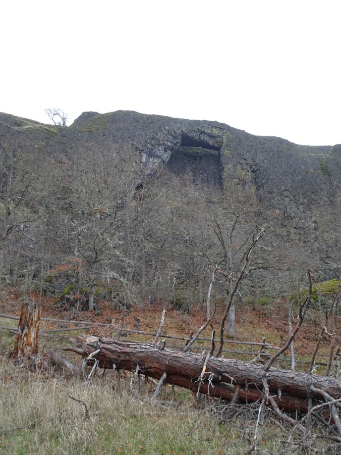
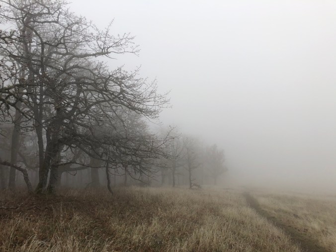
The fog never lifted, and was sometimes frozen, as we hiked past the Catherine Creek Arch, all the way up Tracy Hill, and then down again. (Hike #72, 5 miles, 1100 feet)
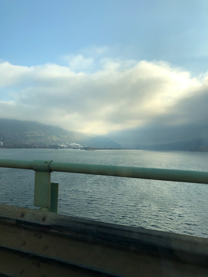
Looking toward our destination from the Hood River Bridge.
Passing the Arch on the way up,
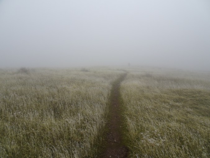
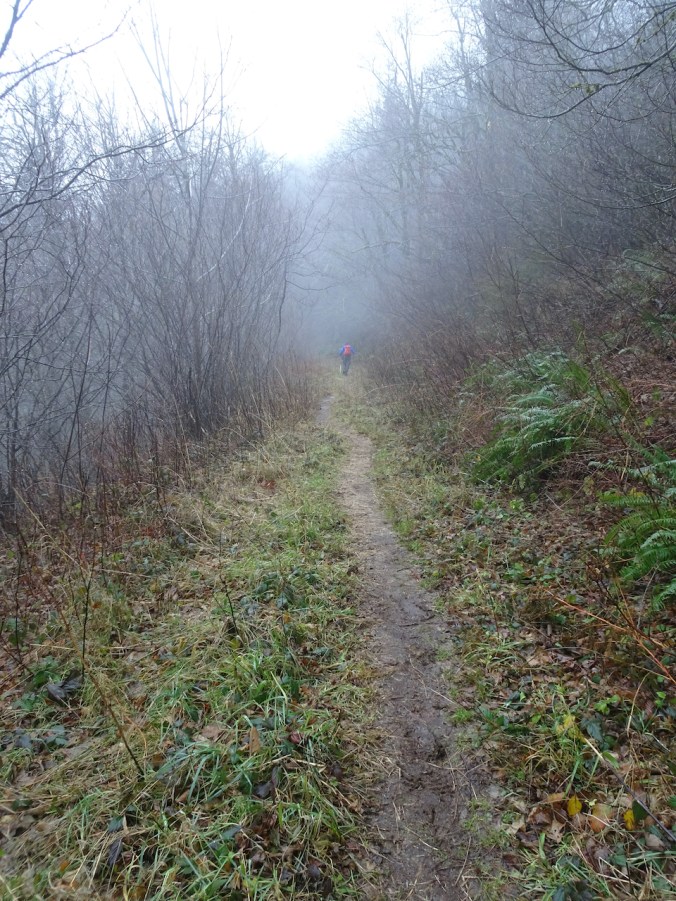
and into the fog.
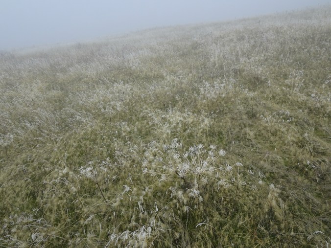
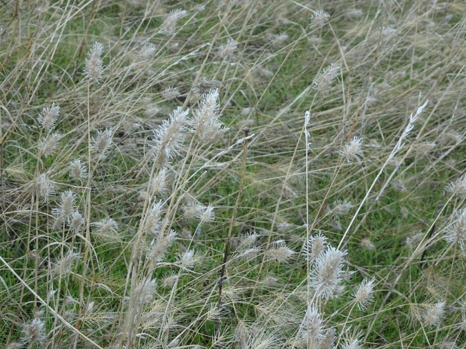
The frozen grasses and seed heads are pretty.
Lunch stop with no view, near the top of Tracy Hill.
On our way down – eventually below the fog again.
Frozen vernal pond.
Hiking above the Arch on the return.
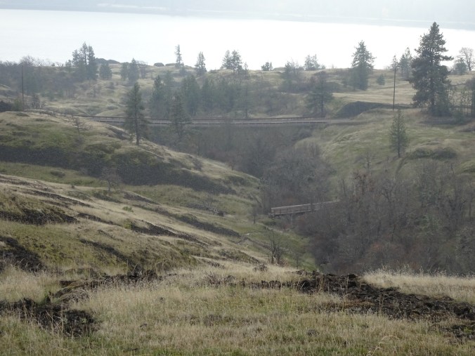
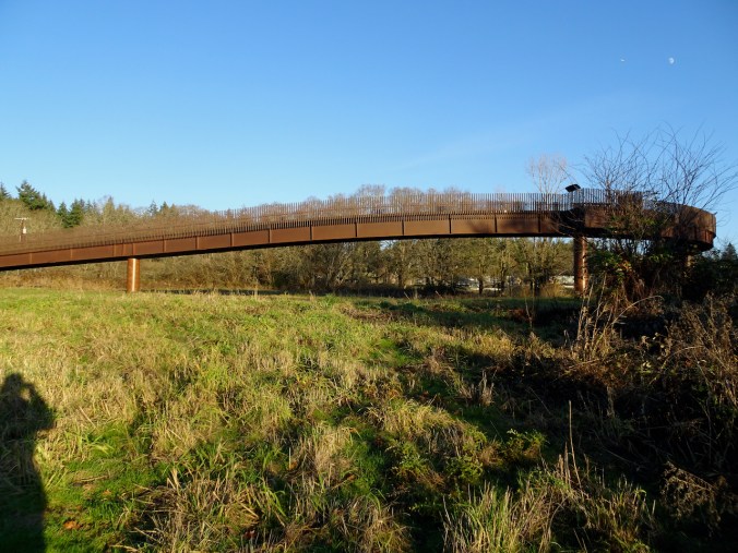
Our first time crossing the new trail bridge over Catherine Creek – we used to walk back along the highway.
We always see something new here – this time, frozen grasses and a new trail bridge.
Wednesday, December 9th, Hardy Ridge and Nancy Russell Overlook, WA
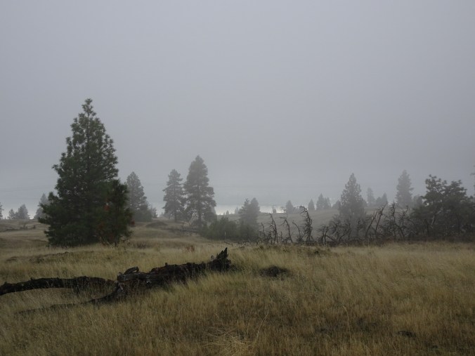
The rain was supposed to stop midmorning but didn’t, so we turned back about half way. We stopped for a quick view from Nancy Russell Overlook on the way home. (Hike #73, 6.2 miles, 1200 feet)
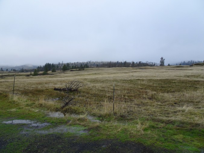
Soggy trail to Hardy Ridge.
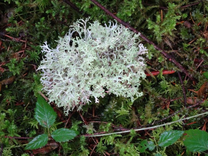
Soggy lichen
Nancy Russell Overlook
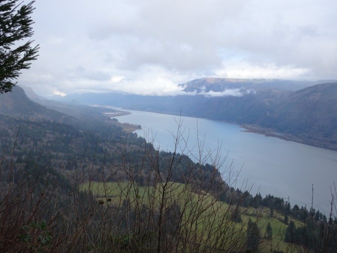
Columbia River Gorge, looking east.
Puddles in the trail.
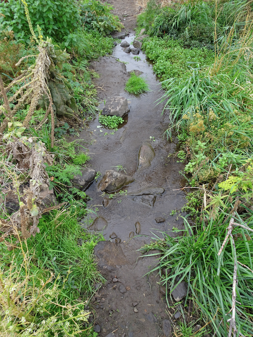
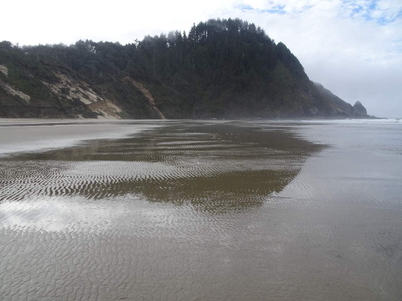
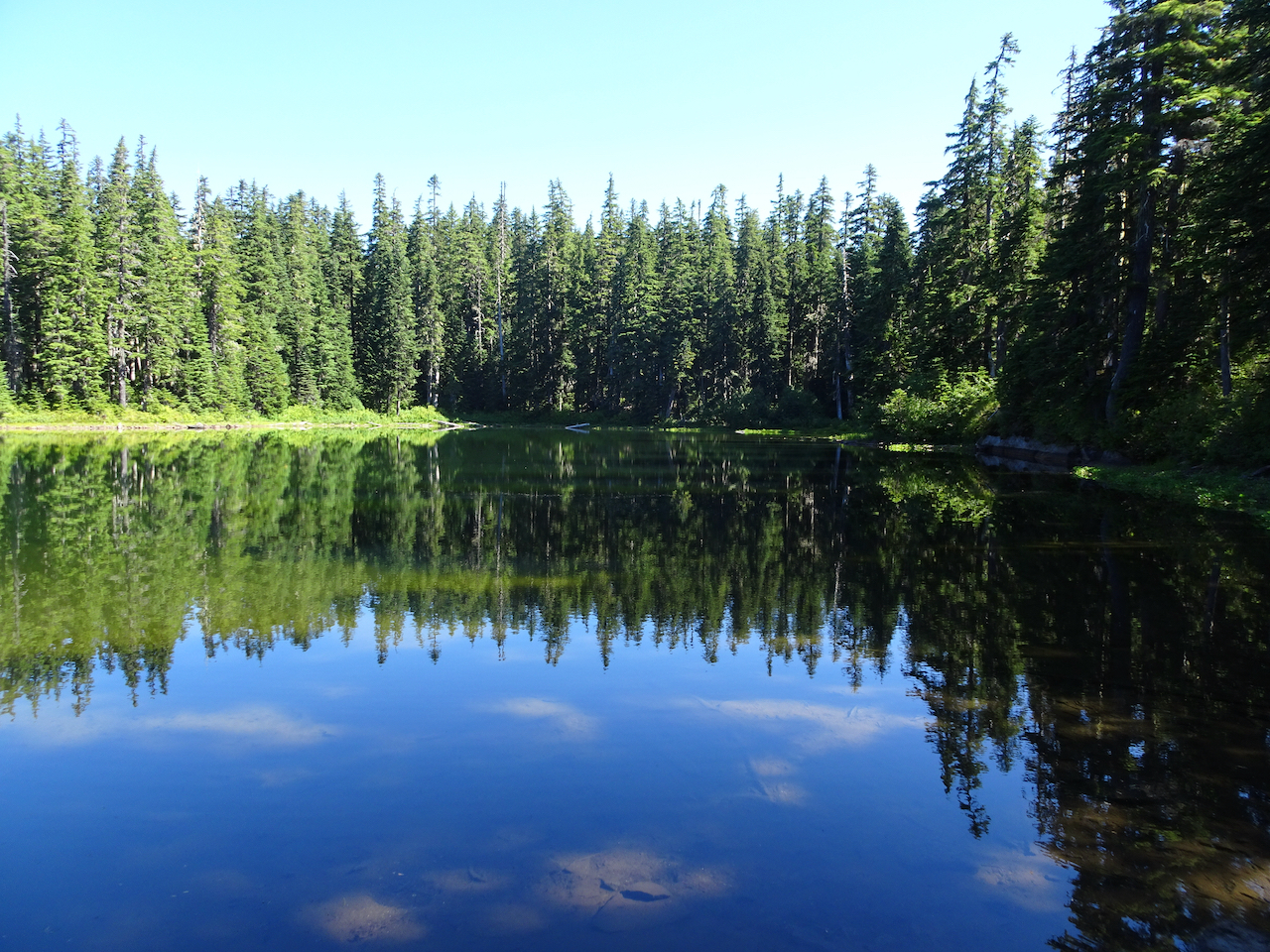
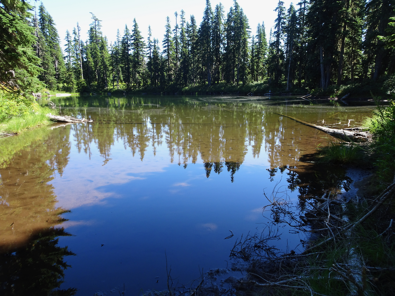
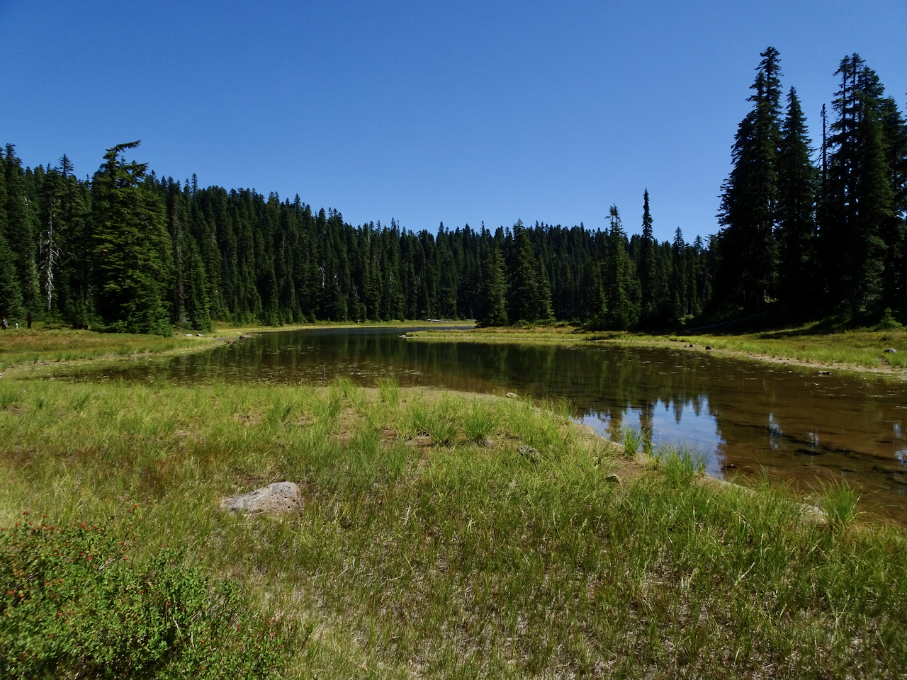
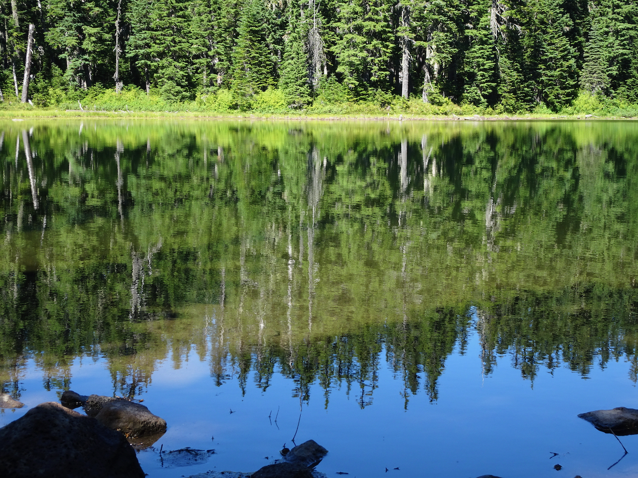
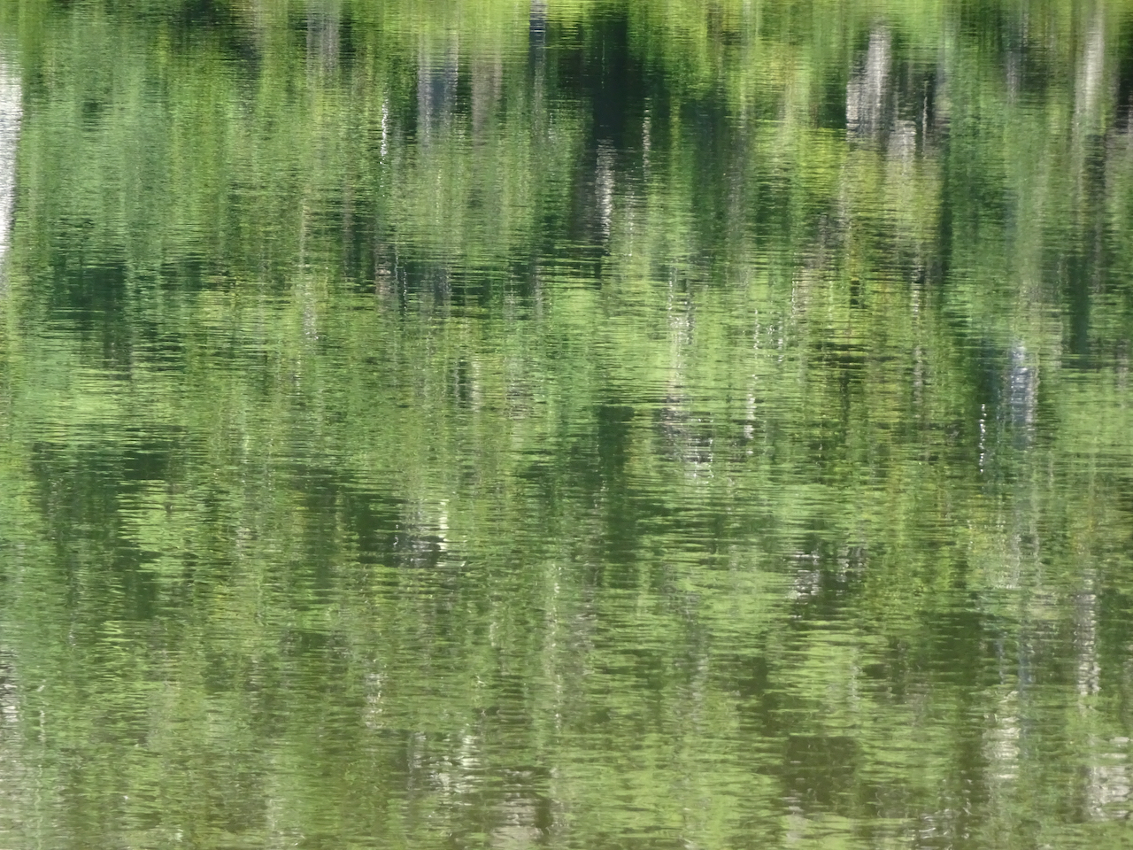
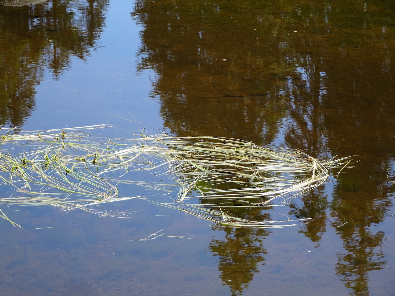
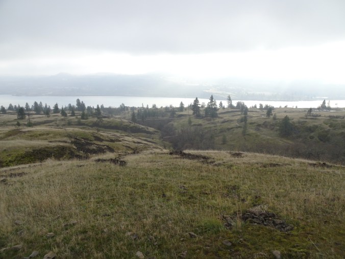
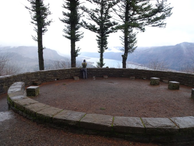
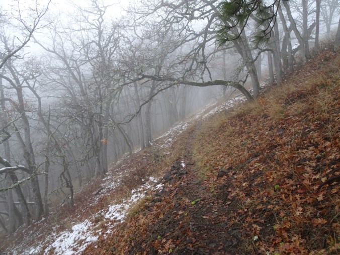
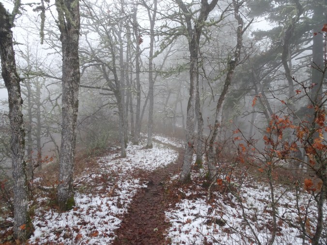
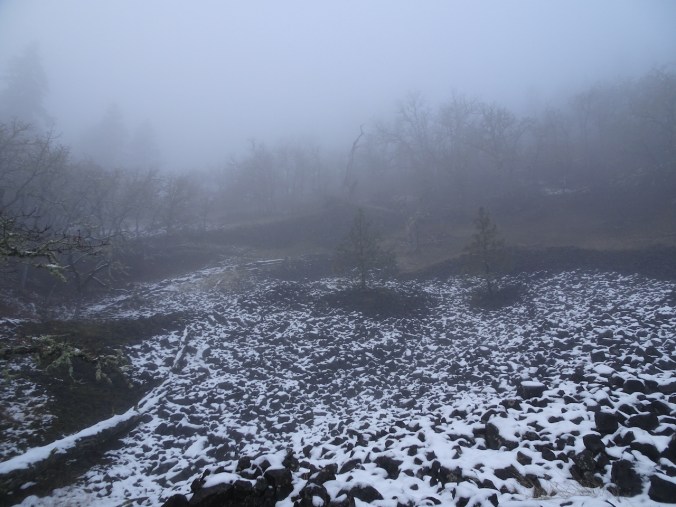
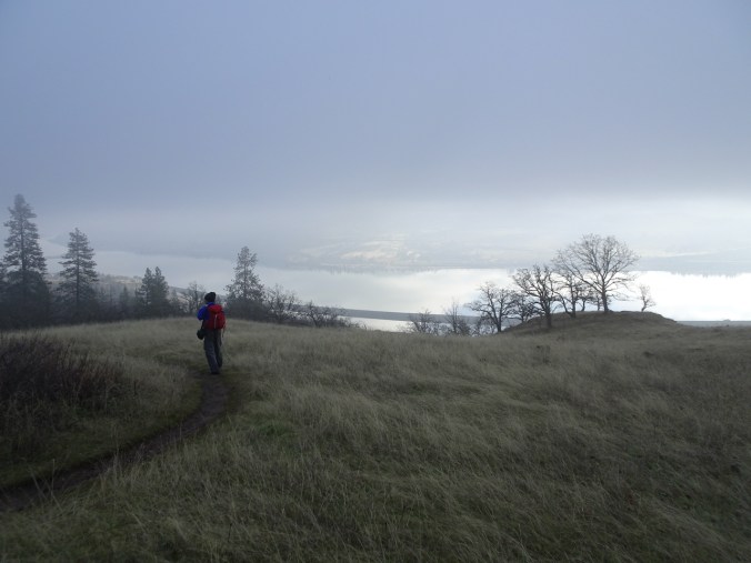
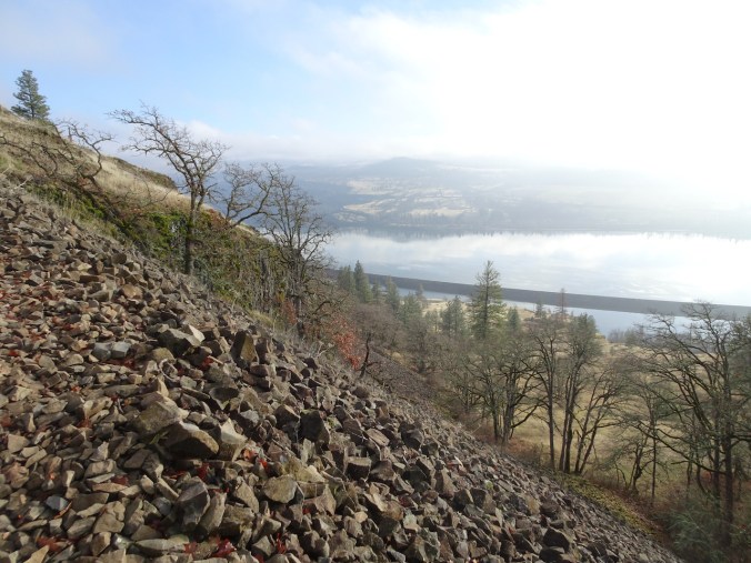
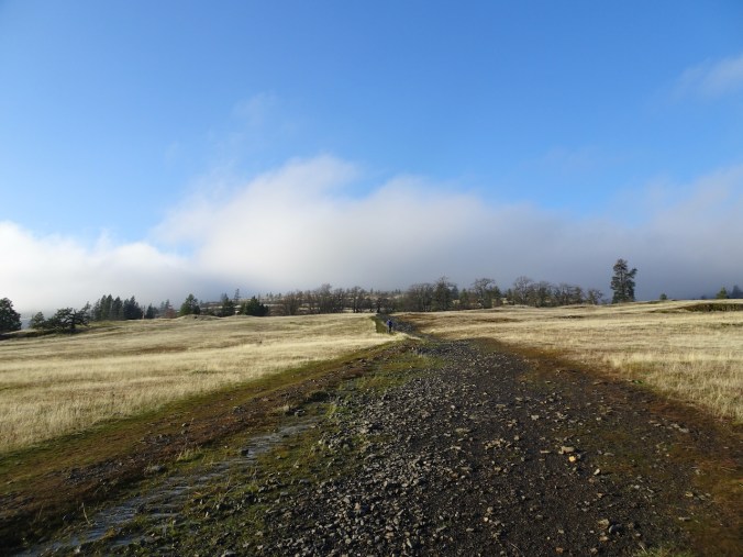
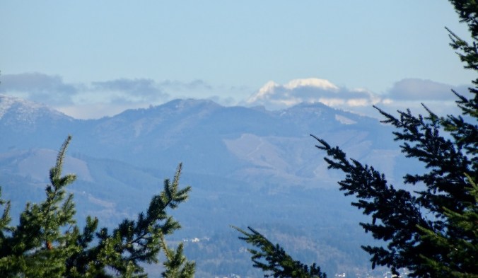
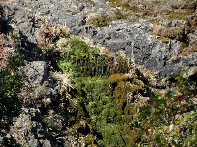
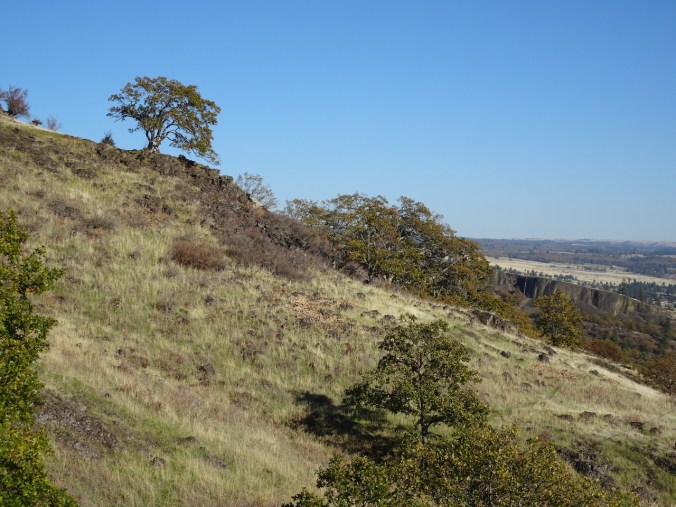
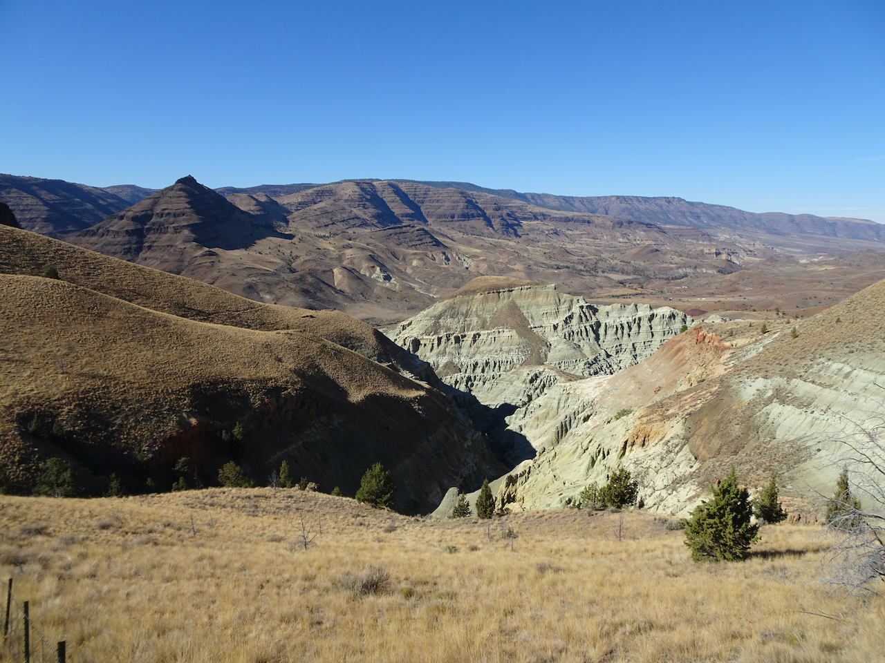
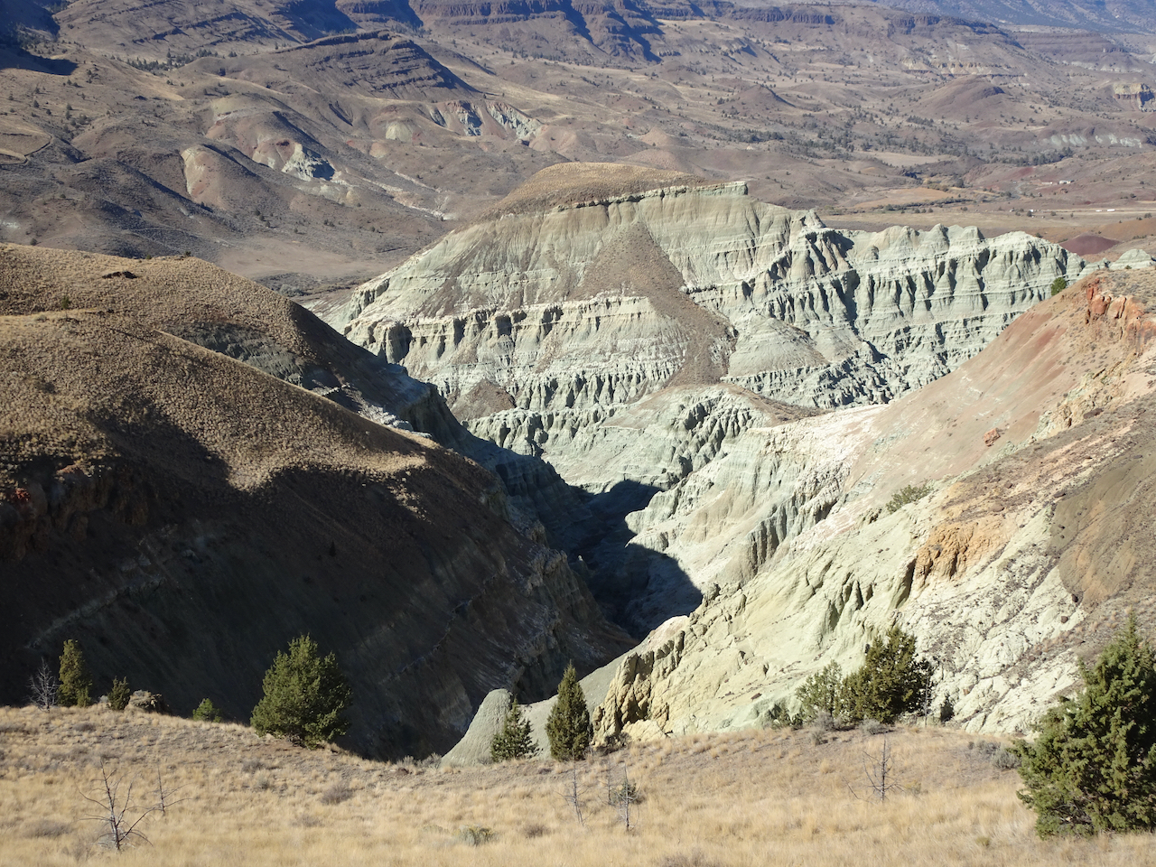
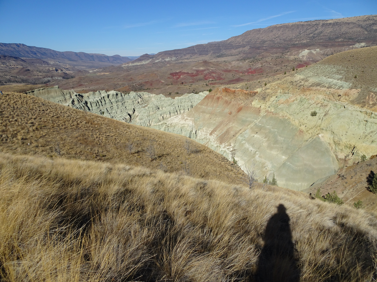
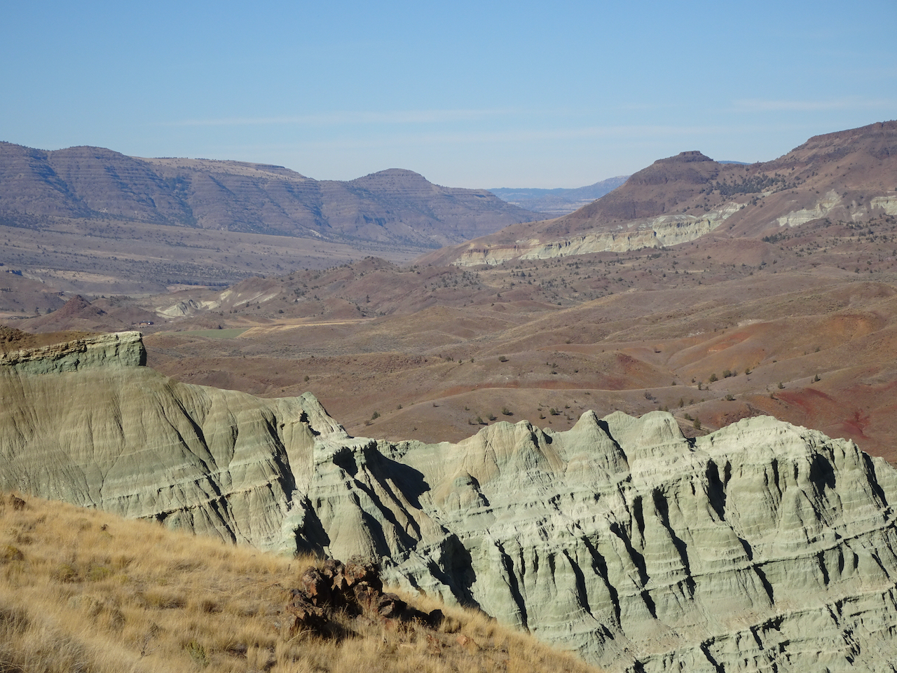
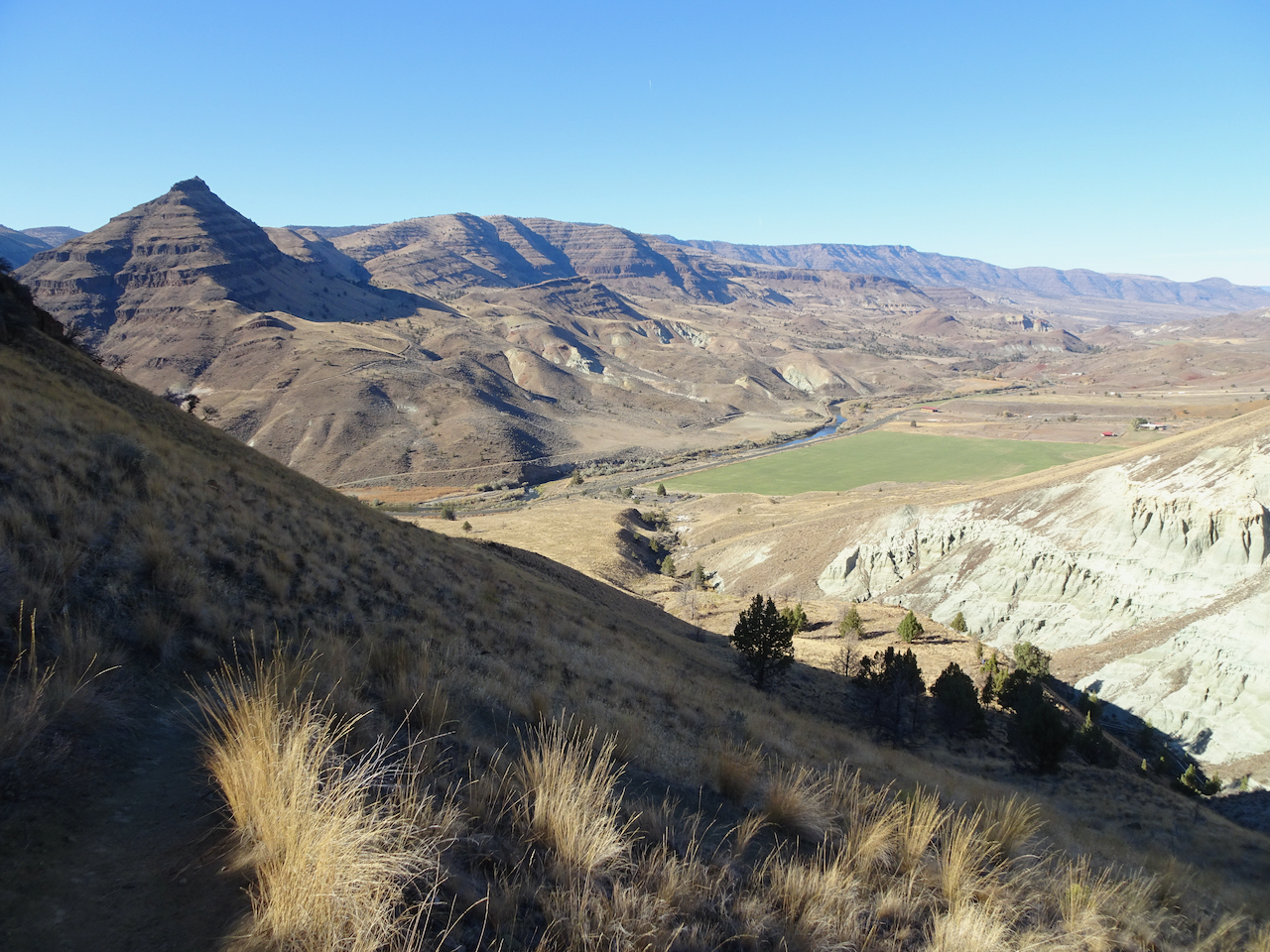
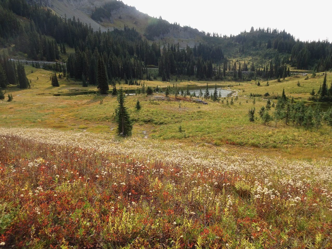
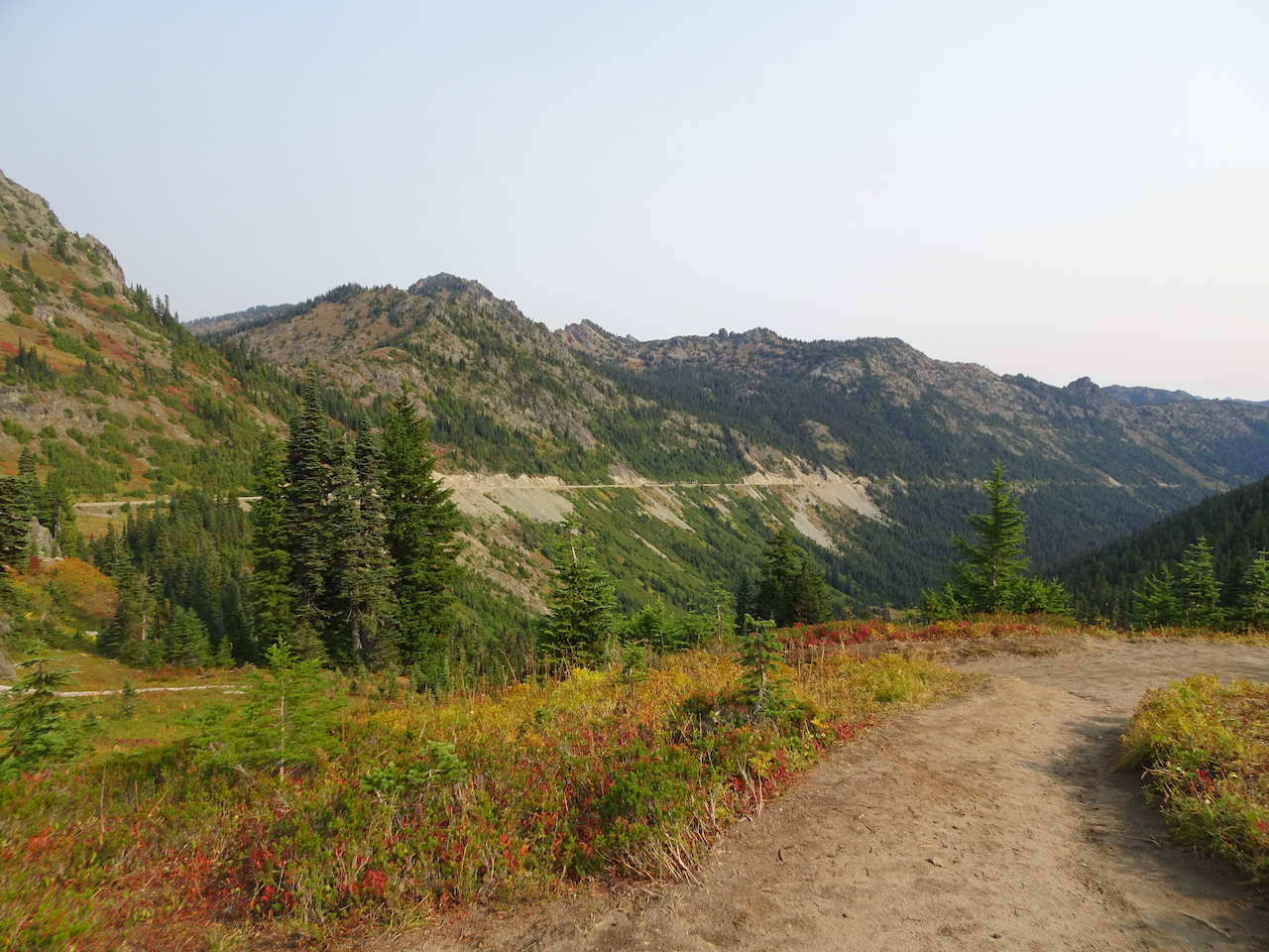
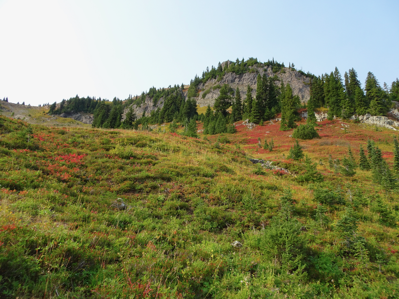
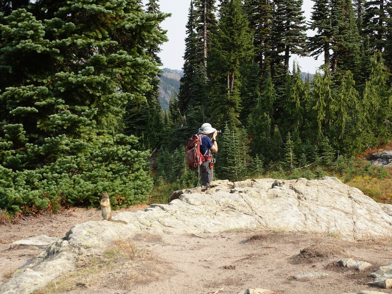
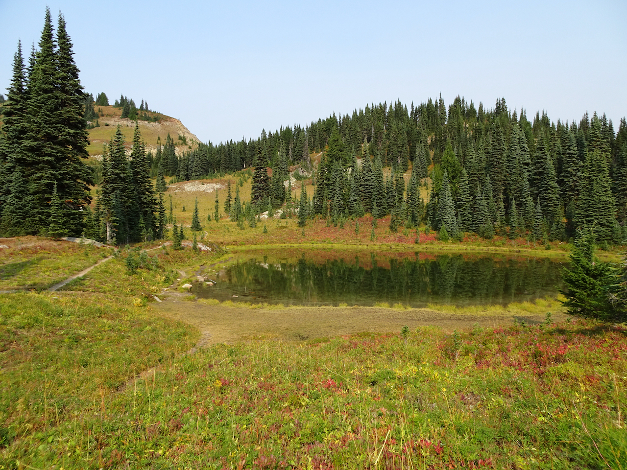
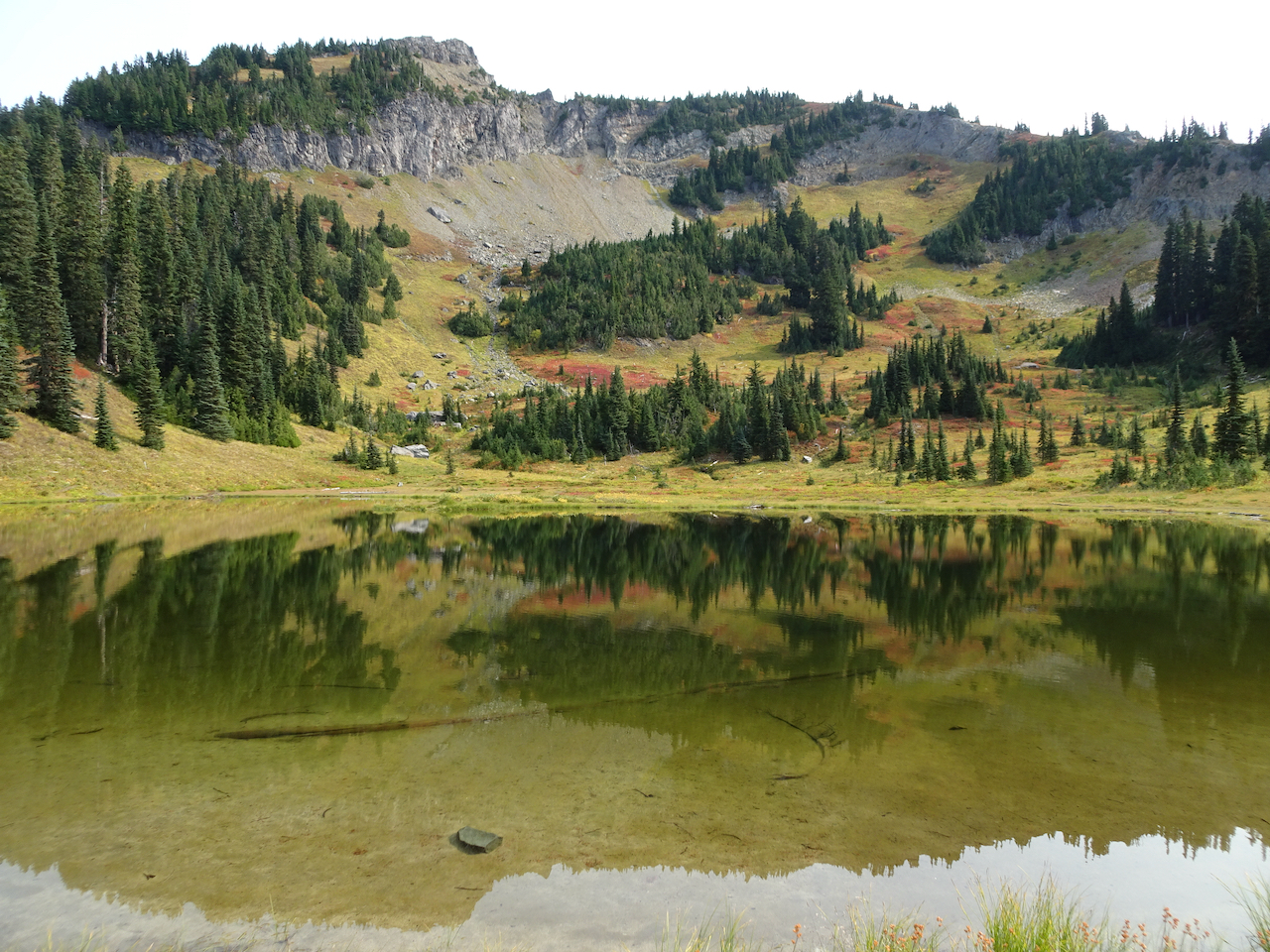
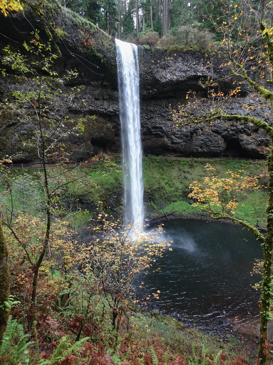
Monday, December 14th, Catherine Creek, WA
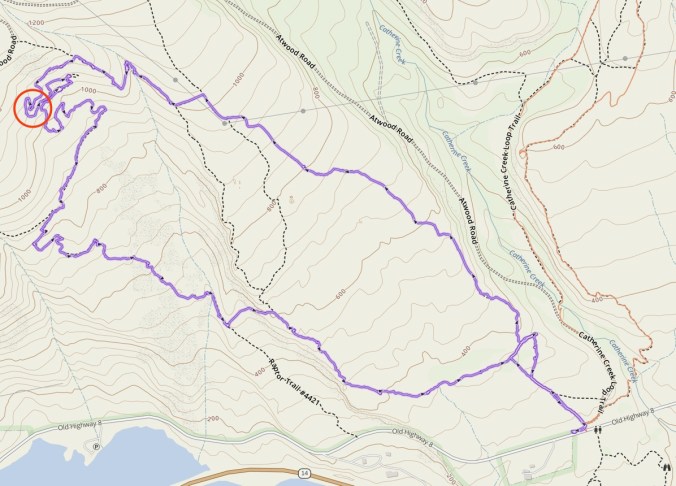
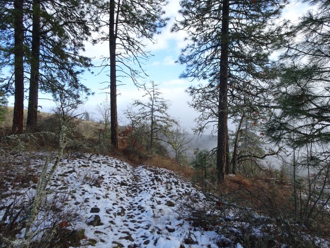
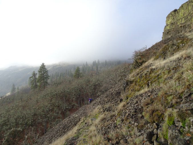
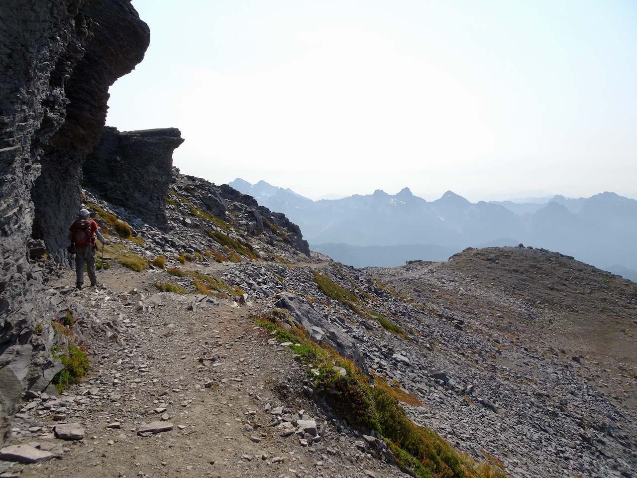
We finally found the path through the inside out switchbacks on the Shoestring Trail beneath Rowland Wall, as we hiked through fog, snow, and then a surreal landscape between fog and sun. (Hike #74, 4 miles, 850 feet)
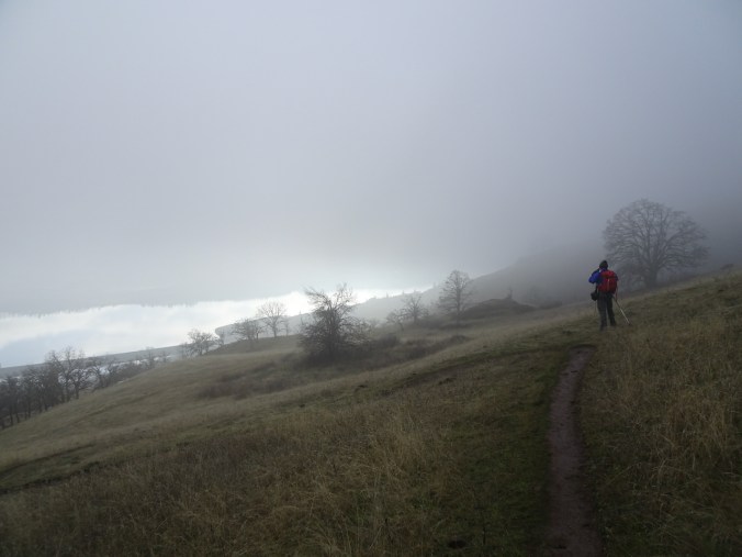
Fog ahead – we began with hopes that the fog would lift.
Looking to the east – it is sunny out there.
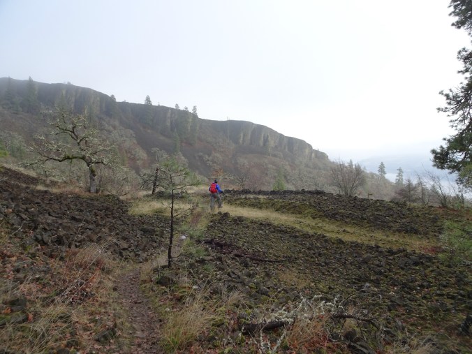
By the time we reached the pylons, we were in the fog.
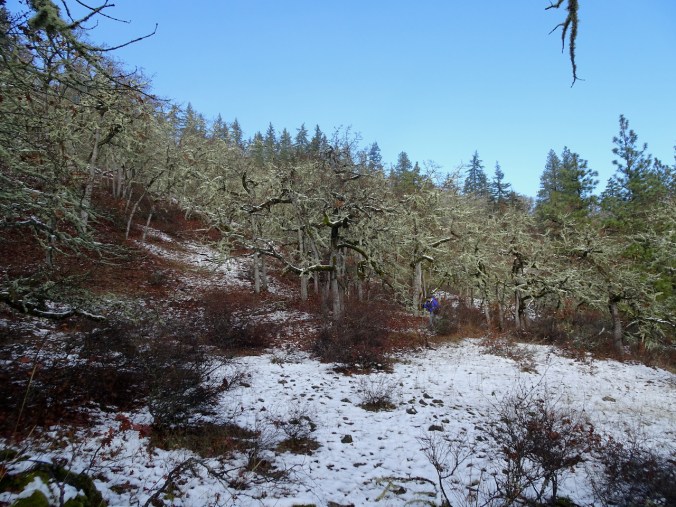
When we dropped over Rowland Wall, we were walking through oak groves with patchy snow along our trail.
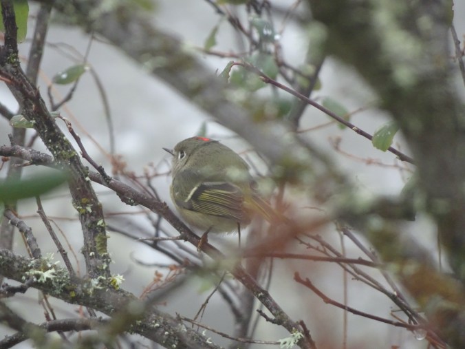
I saw a ruby crowned kinglet in the bushes.
The snow helped define the place in the path where we have lost the trail on previous occasions. Also, by hiking down instead of up, I thought we could make the connection, and we did!
Our GPS track for the day: the red circle is the place of the inside out switchbacks, developed by mountain bikers, where we have lost the trail in the past.
After lunch, we continued down, and looked behind us to see blue sky!
Continuing down toward Rowland Wall, below the fog.
We emerged out onto the grassy slopes, fog above, sun somewhere shining on the Columbia River.
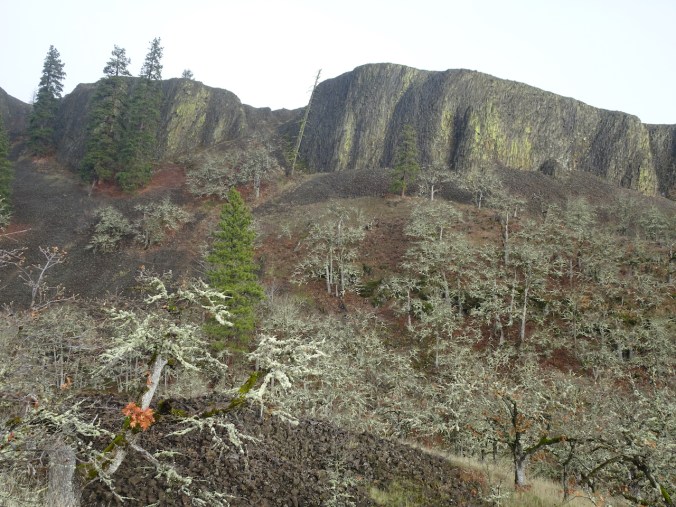
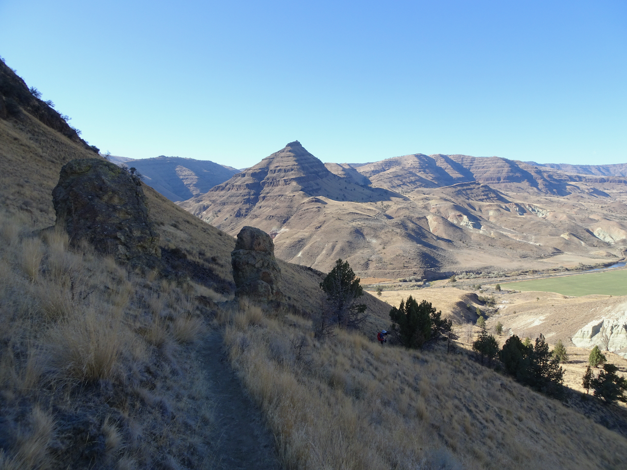
Heading toward Rowland Wall.
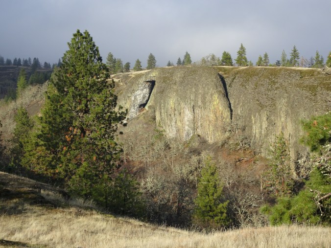
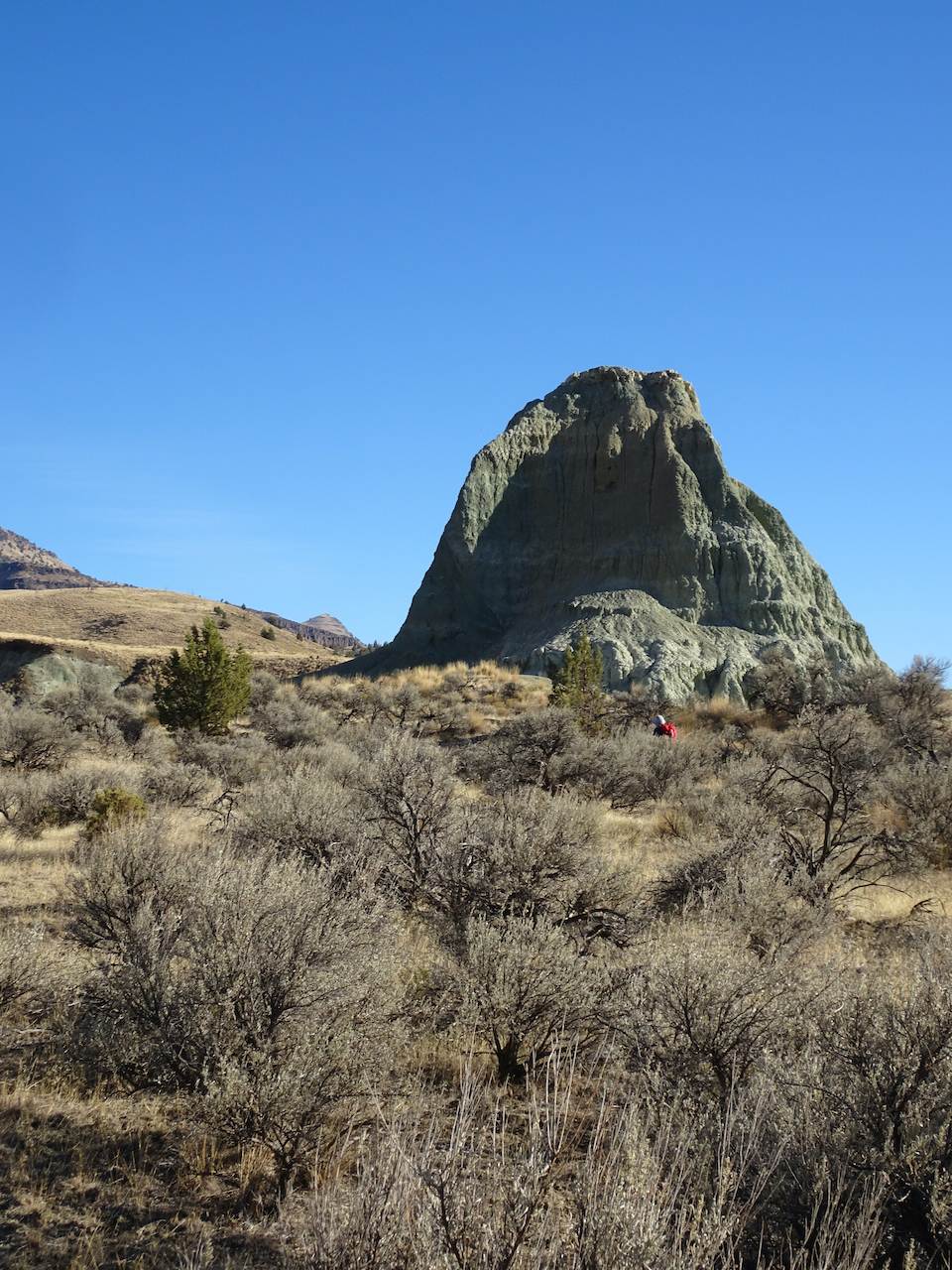
The leaning tree and the Pinnacle.
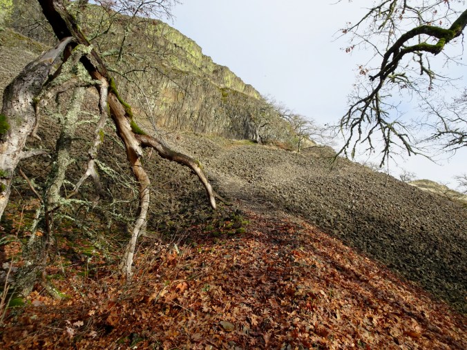
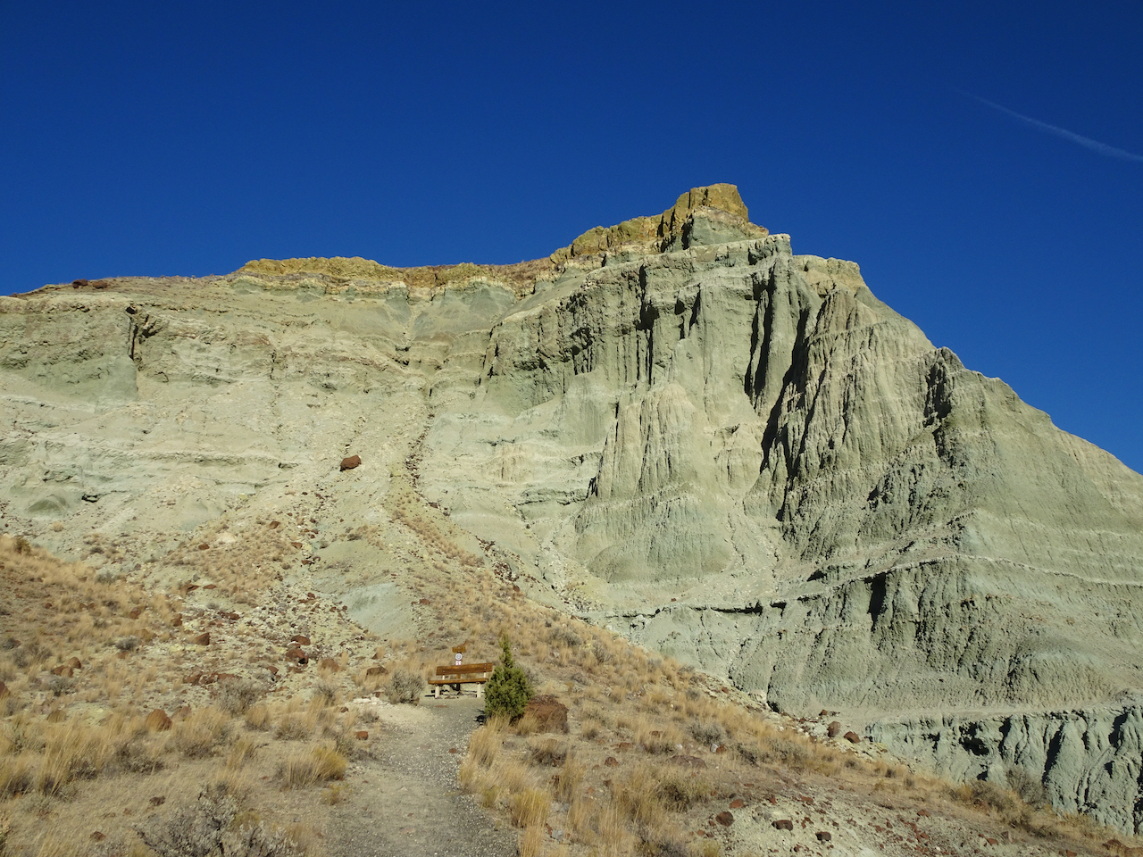
Our path back up the wall.
Once above Rowland Wall, we could see more blue sky to the east.
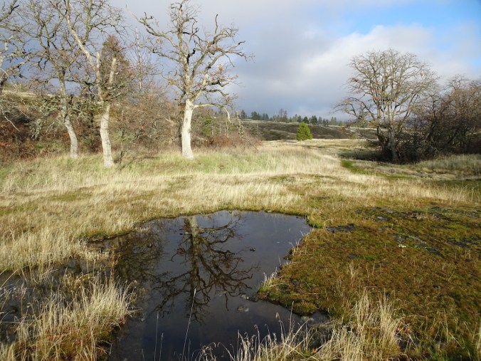
Vernal pool near the trail head.
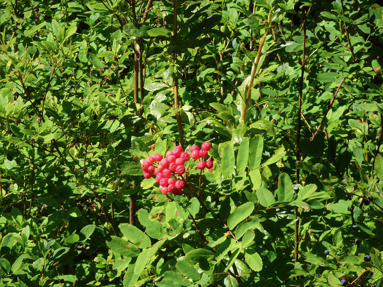
Catherine Creek Arch in the low sun.
Foliage of the bitterroot flowers of April!
Looking back up to where we have been.
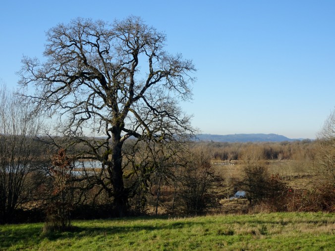
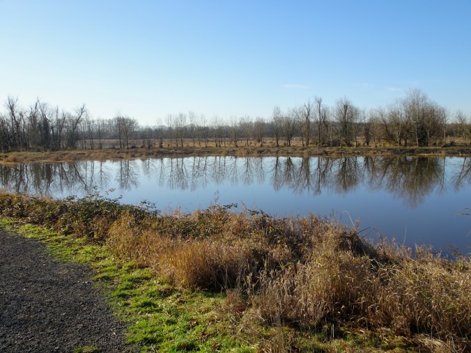
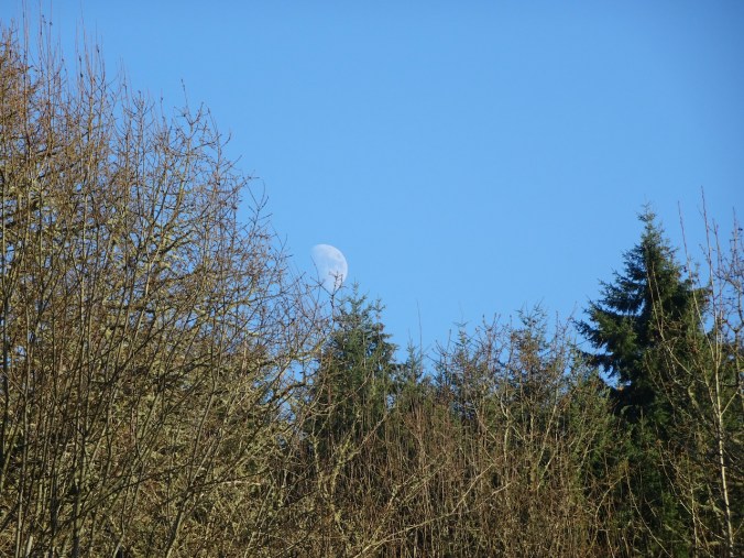
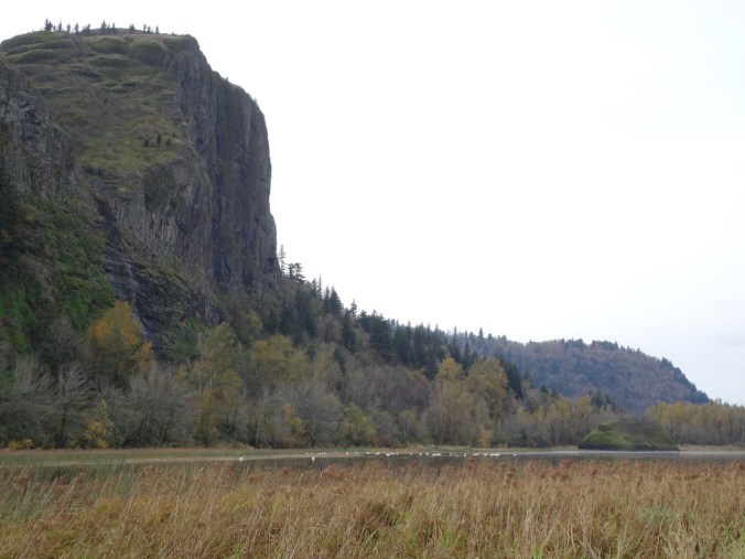
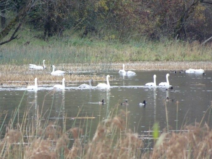
Wednesday, December 23rd, Ridgefield Wildlife Refuge, WA
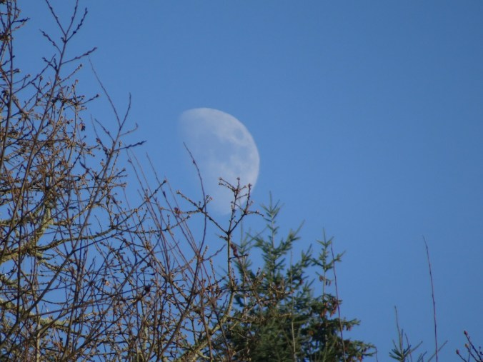
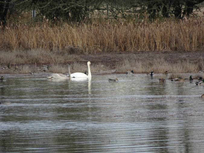
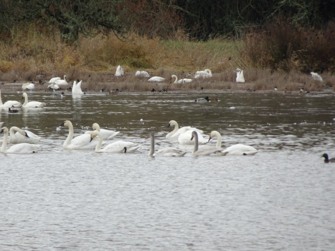
Swans from a distance, and an excellent view of moonrise. (Hike #75, 2.7 miles, 100 feet)
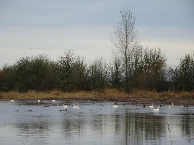
The best view of the swans in Carty Lake was from the entry bridge.
Upside down trees out in their full glory.
Moon rising…
Moon, photobombed by airplane, as we approach the bridge at the end of our hike.
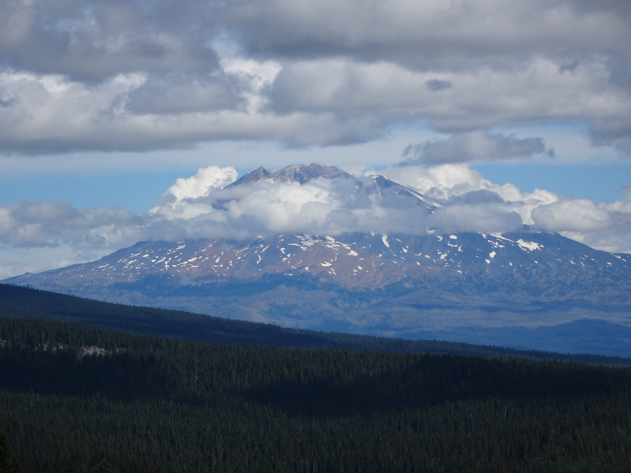
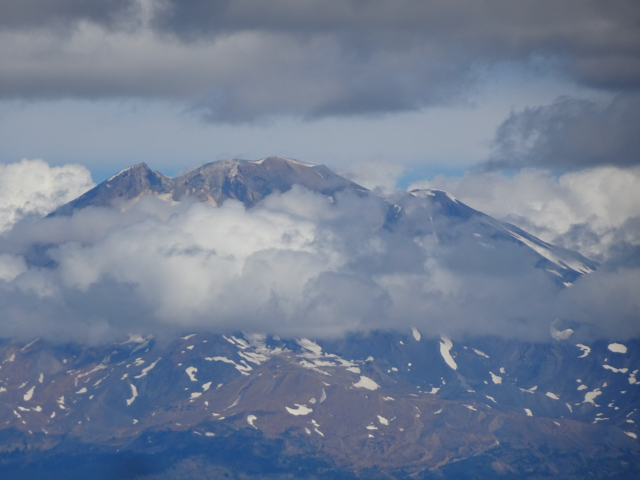
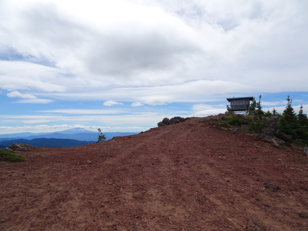
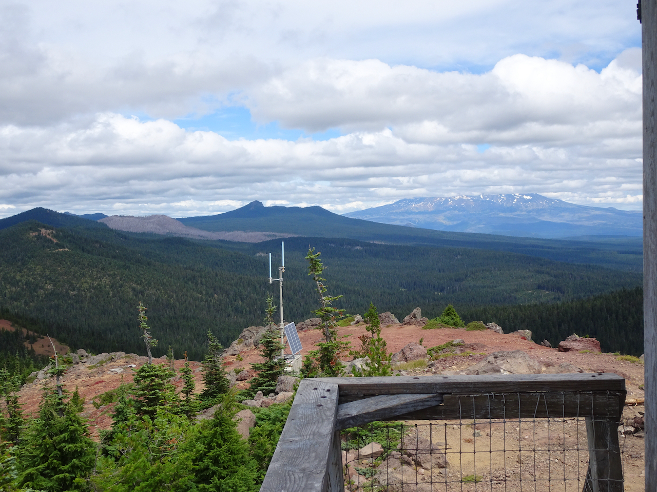
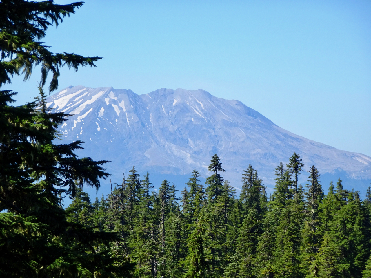
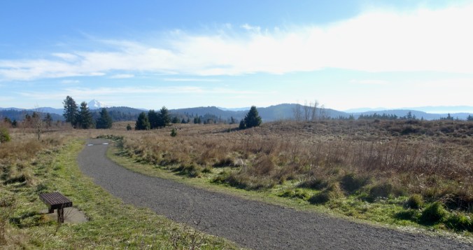
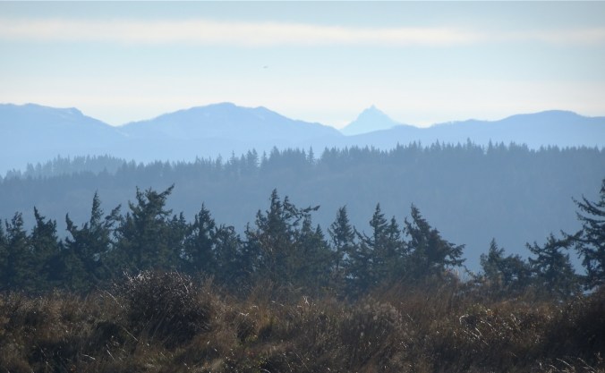
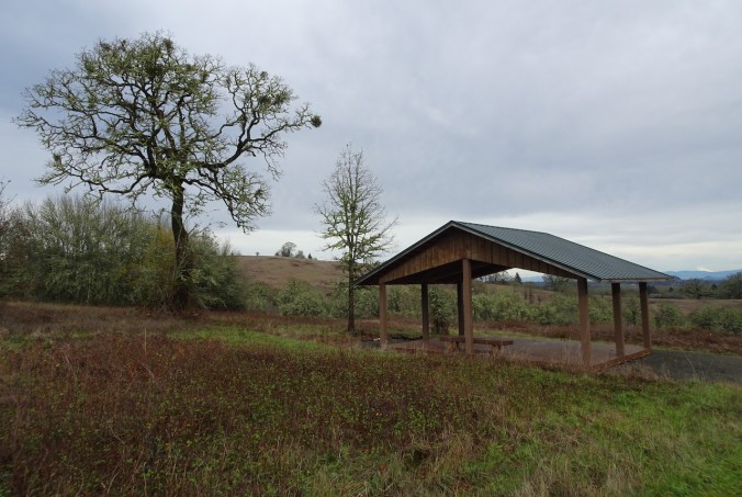
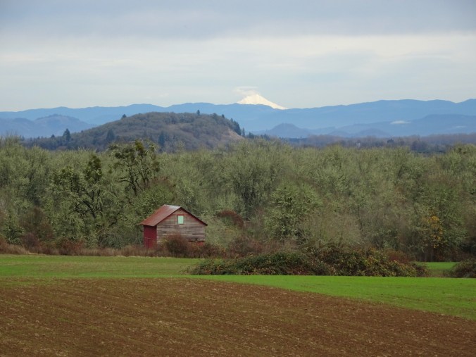
Monday, December 28th, 2020, Powell Butte, Portland, OR
Cold and windy, with clear views of the surrounding Cascade Mountains. (Hike #76, 4.3 miles, 500 feet)
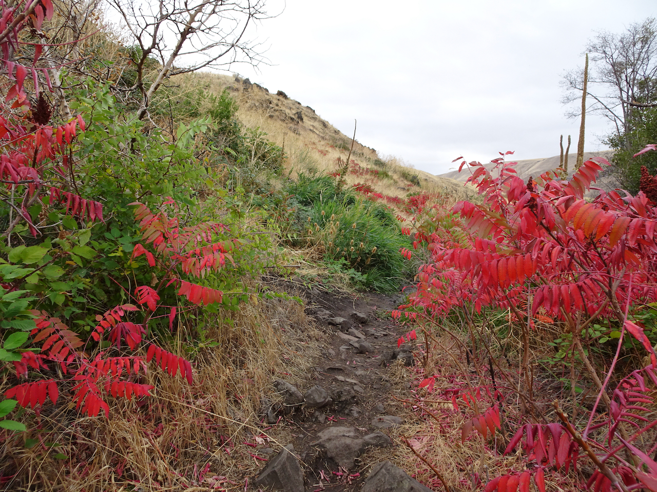
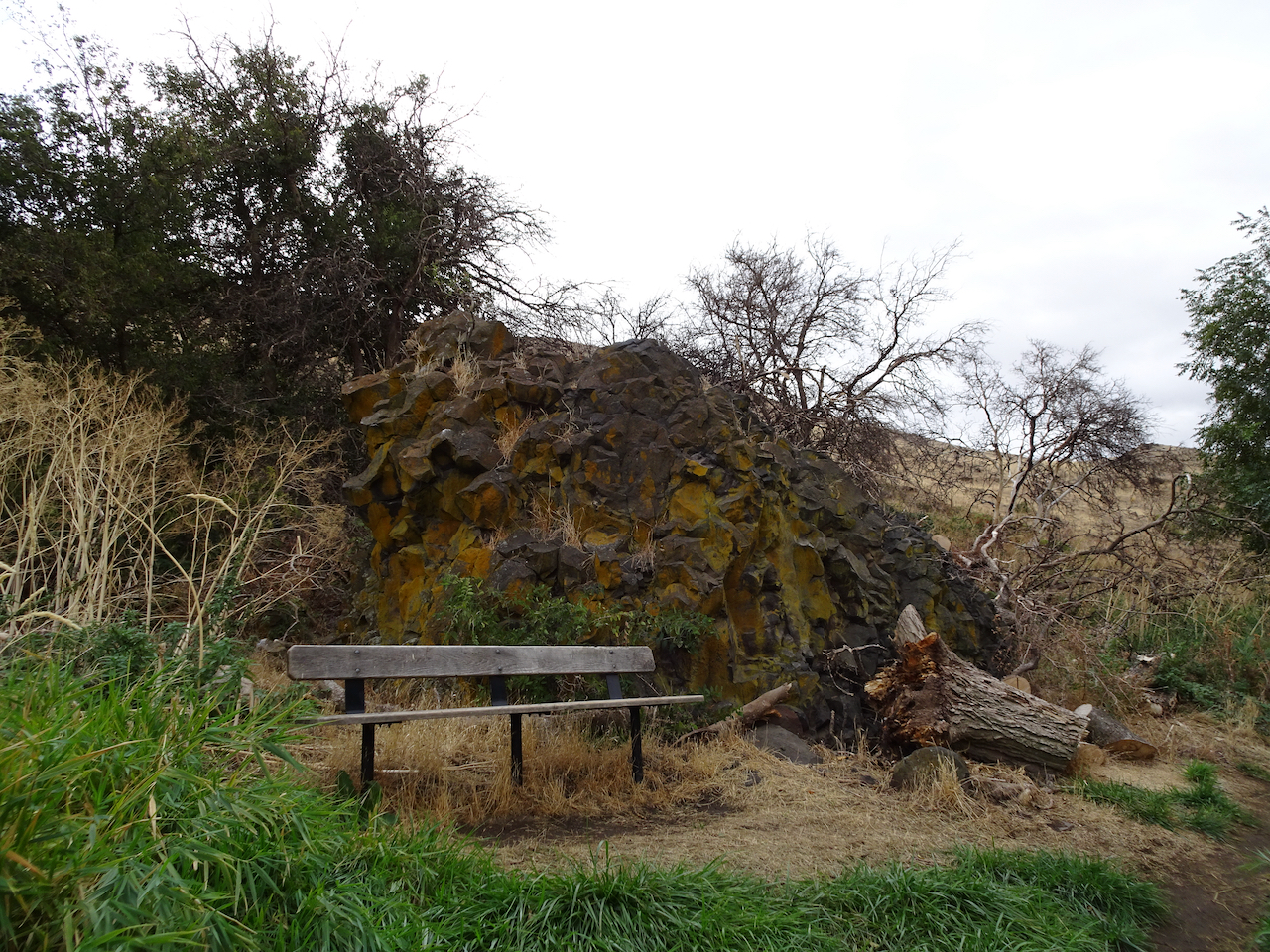
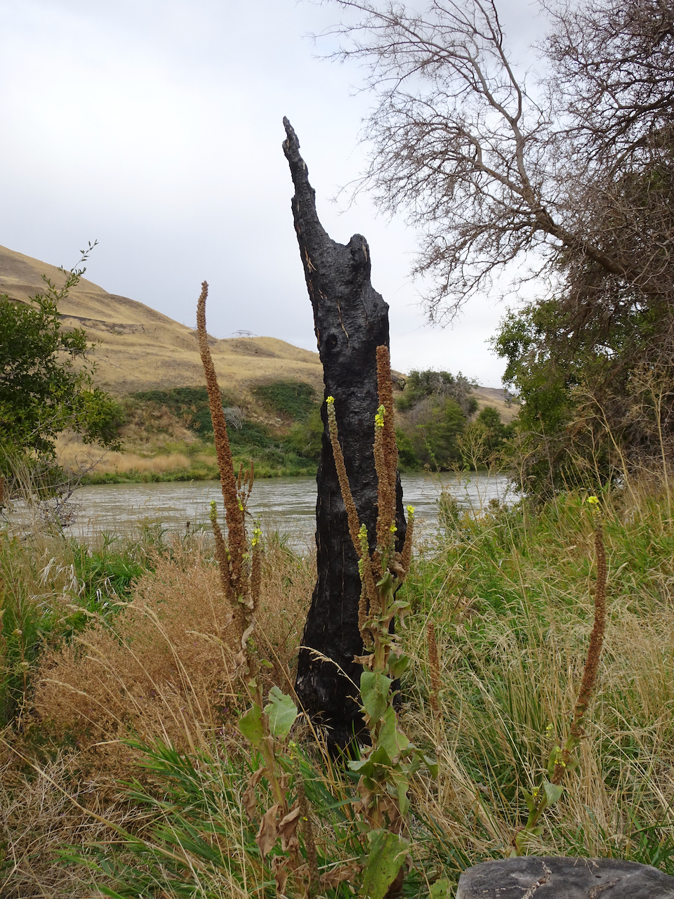
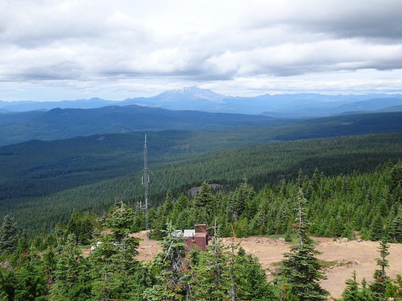
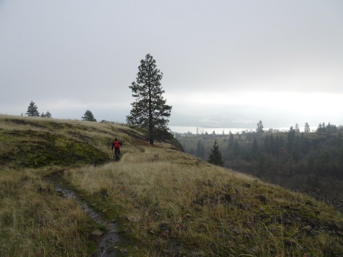
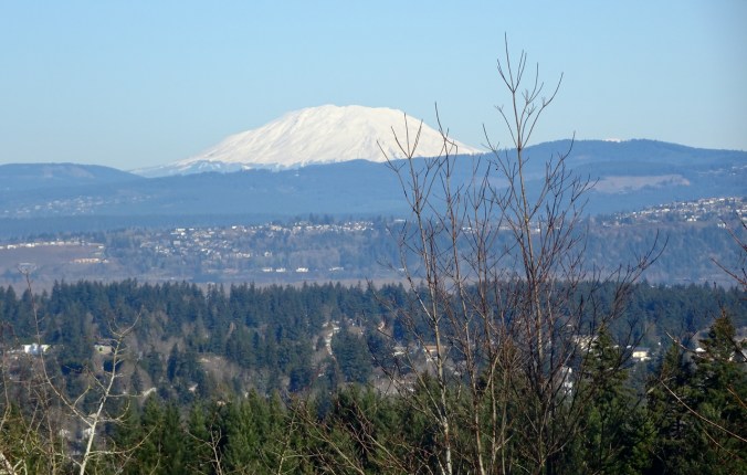
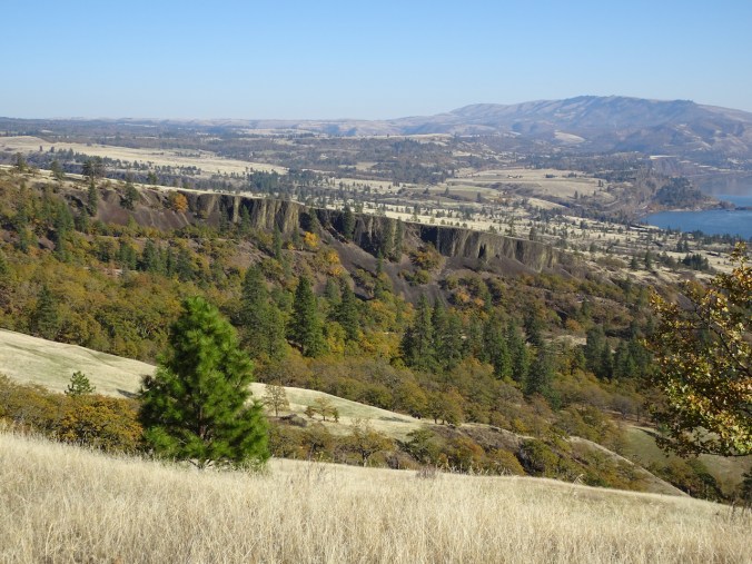
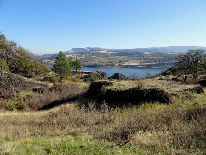
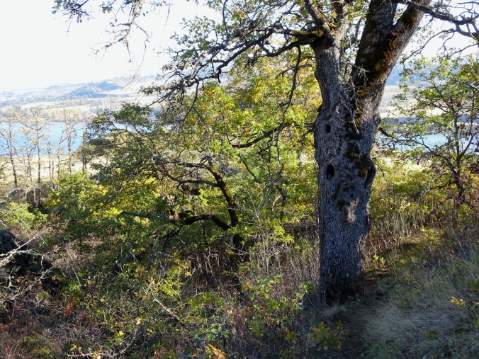
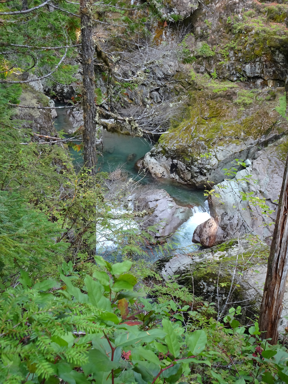
My favorite, often visited, eastern Gorge trail on a windless day with beautiful low autumn light. (Hike #69 for 2020, 4.4 miles, 1000 feet)
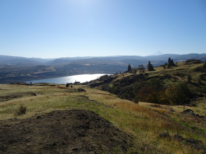
Trailhead, Rowland Lake, perfectly calm and reflective. Our destination is the tall Ponderosa Pine, left of center.
The Old Hwy 8 waterfall is completely dry.
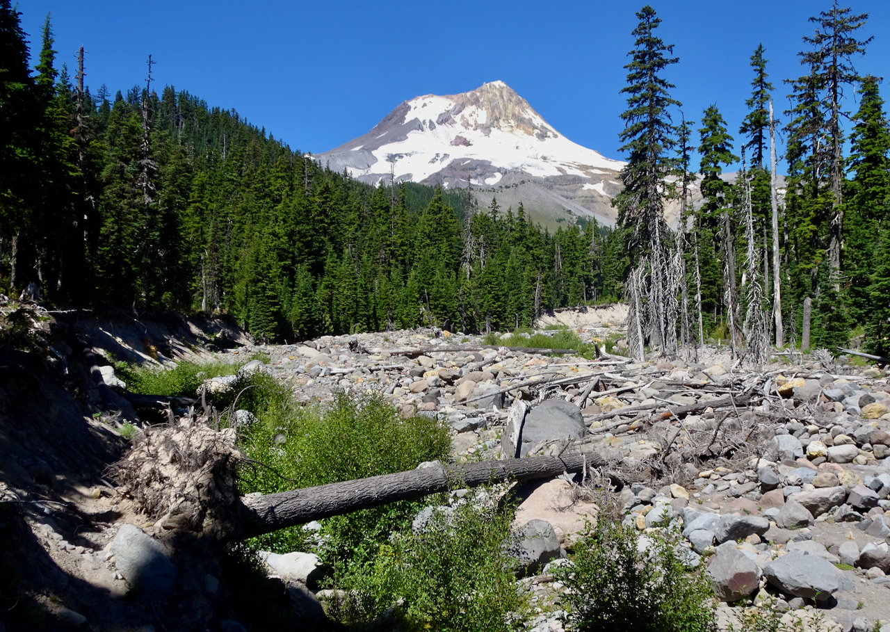
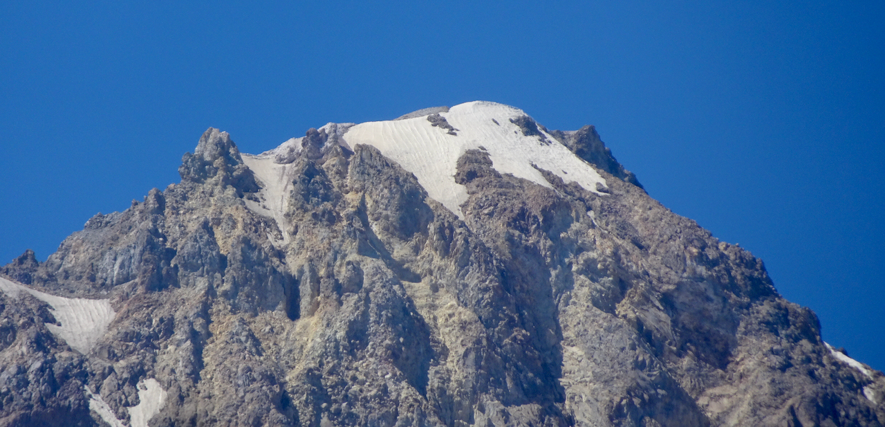
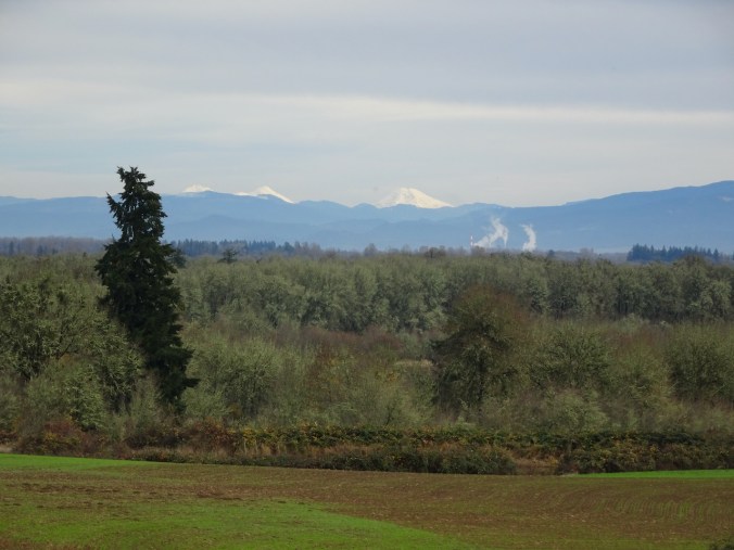
Mt Hood on view to the west across the Columbia River.
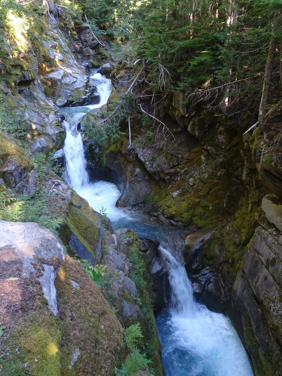
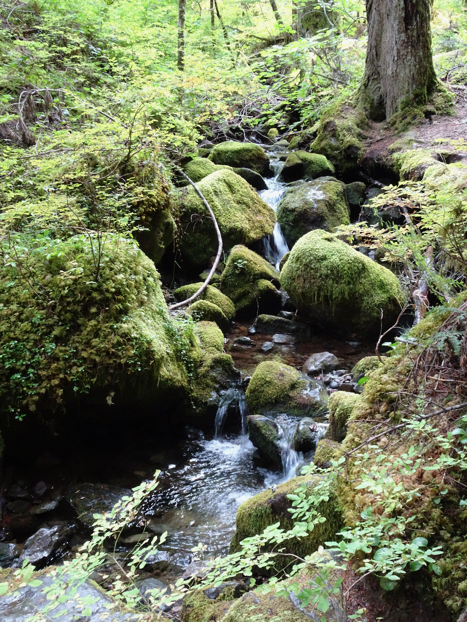
The labyrinth waterfall is almost dry…
A few drips in the mossy wall,
and some still pools below in the streambed.
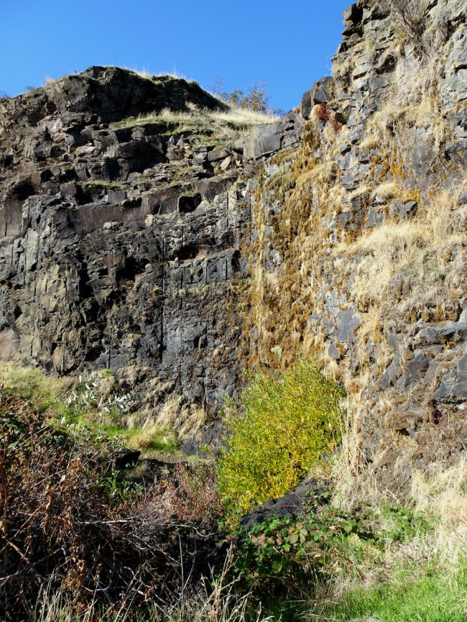
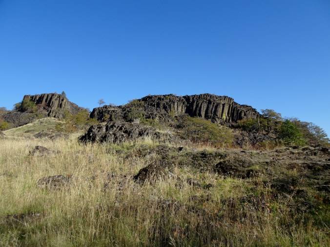
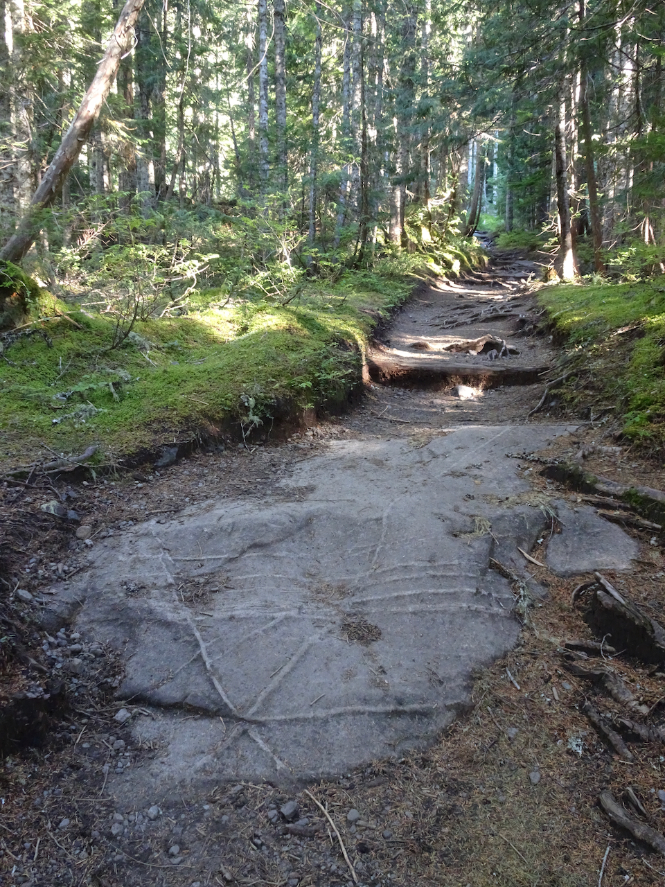
We wind around columnar basalts surrounded by golden grass,
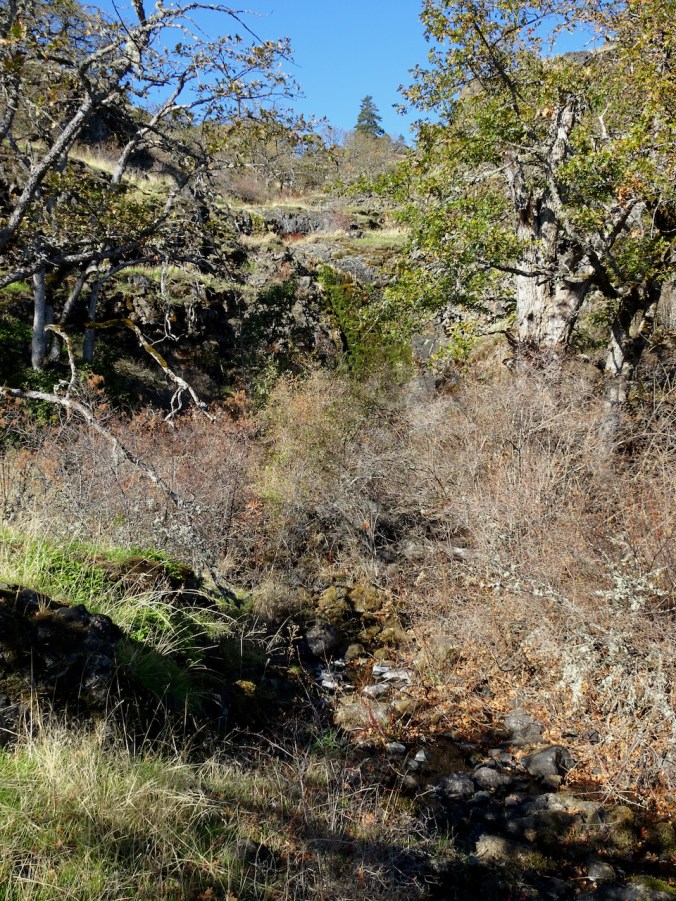
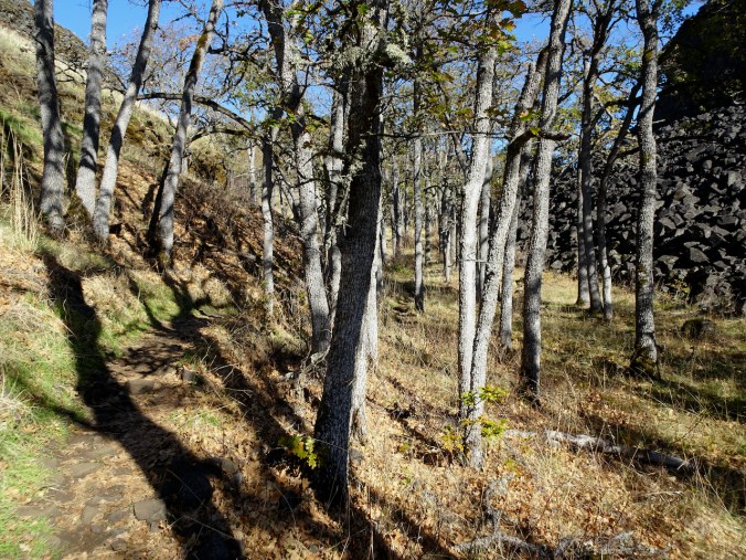
Through the oak grove.
Mt Hood still on view in the glare, as the sun moves west
We pass a favorite trailside oak tree,
Almost to our destination Ponderosa…
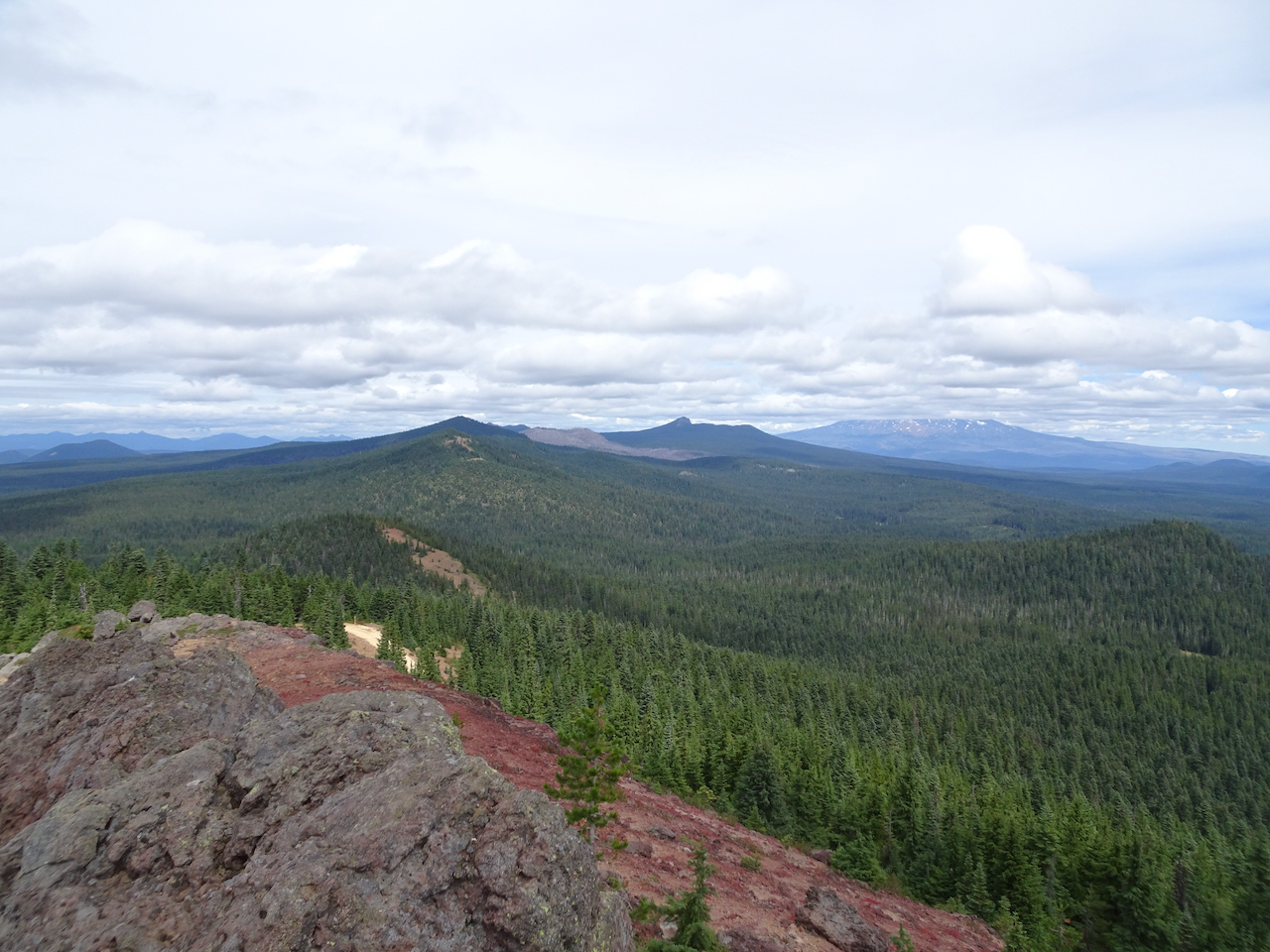
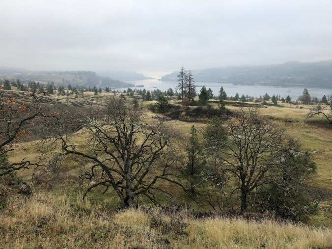
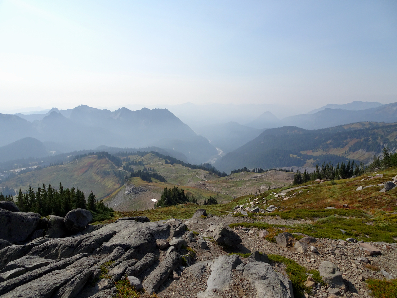
The eastern Gorge beyond
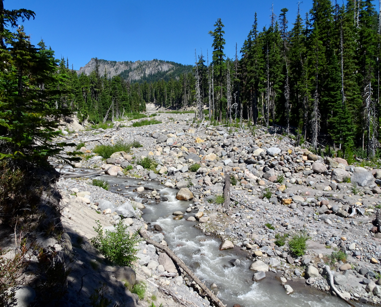
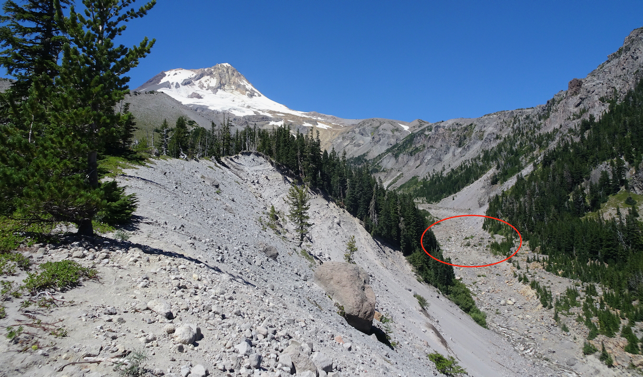
Rowland Wall and the Catherine Creek area slopes.
Zoom in on Lyle and Memaloose Island
Tom McCall Point and the orchards of Mosier on the descent.
The haunted oak tree bids us farewell.
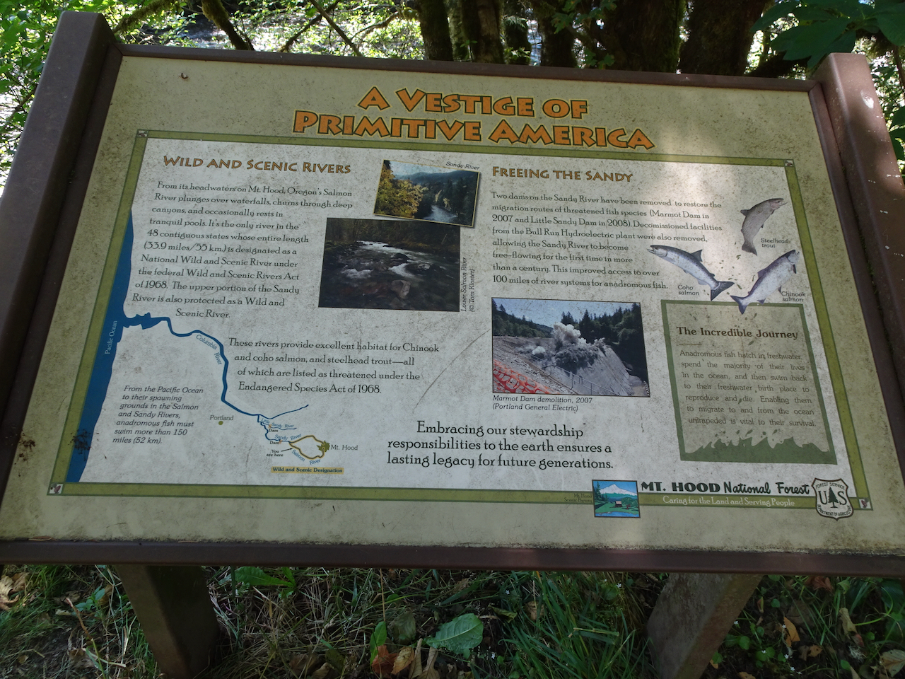
Monday November 9th, Dry Creek Falls
We spotted the winter swans in Mirror Lake at the base of Crown Point as we made our way through The Gorge to Cascade Locks.
Dry Creek Falls, which we have hiked many times, is one of the closest waterfall hikes, most of the trails still being closed since the 2017 fire. Today we walked through falling Big Leaf Maple leaves lighting up the partially burned forest. (Hike #70, 4.9 miles, 1050 feet)
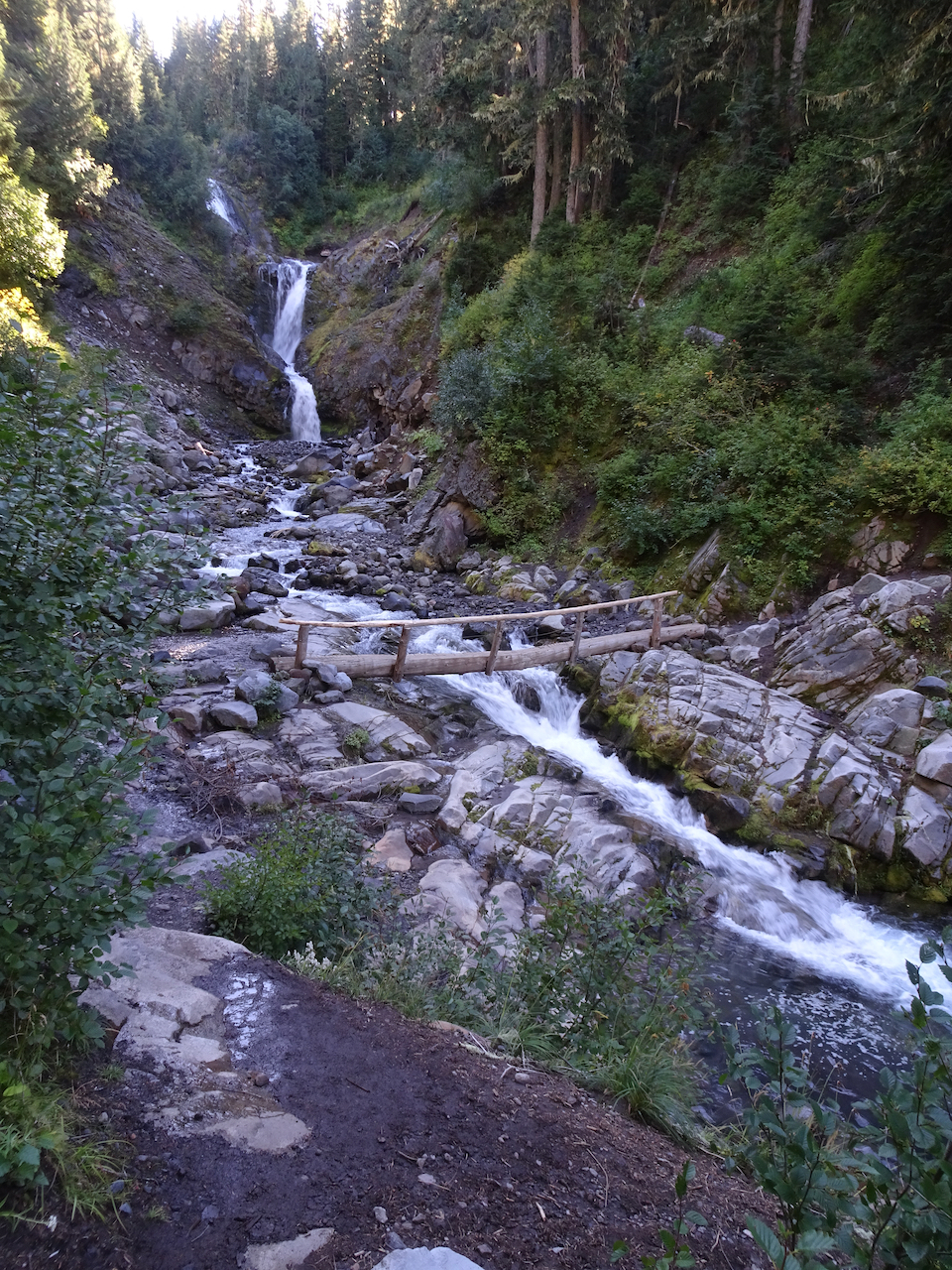
Bridge over Dry Creek on the Pacific Crest Trail.
Dry Creek Falls
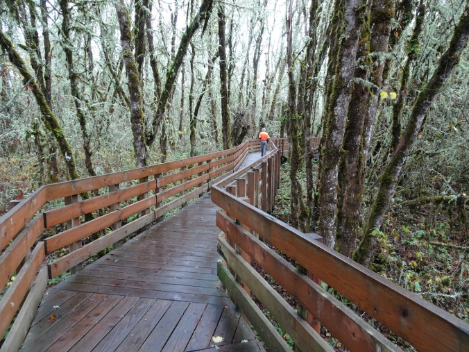
Monday, November 16th, Finley Wildlife Refuge
Our first visit to this refuge, on a day when the Willamette Valley to the south was the only partly dry place within a two hour drive from home. Recovered farm land is a winter sanctuary for migratory birds. (Hike #71, 2.5 miles, 150 feet)
Our first stop, the Prairie Overlook:
Miles of Willamette Valley grasslands.
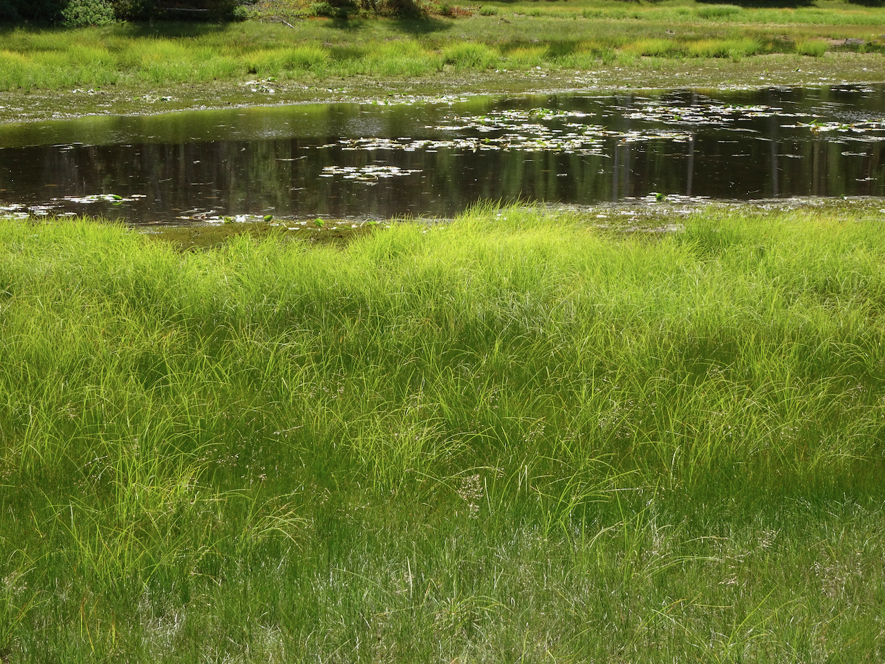
From there, we walked the Homer Campbell Boardwalk through a wetter terrain.
Canadian Geese near the trailhead
The boardwalk…
Marshy forests
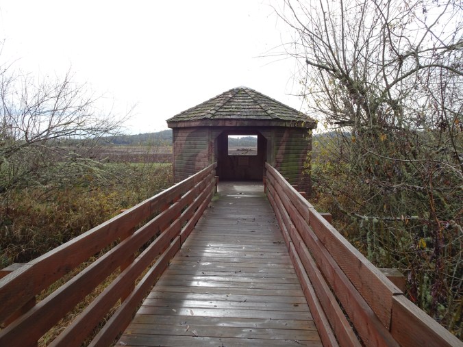
A bird blind at the end of the winter trail.
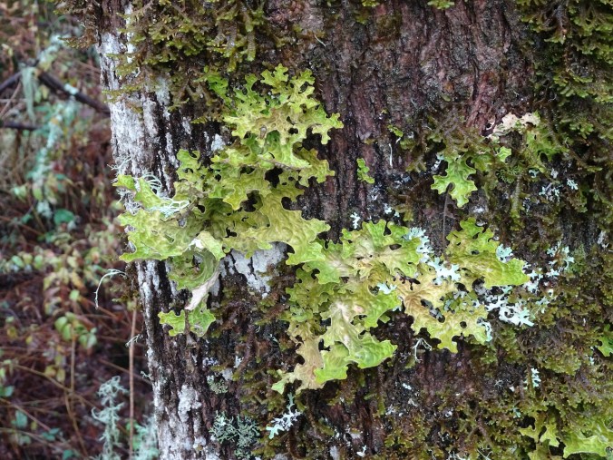
Back through the mossy and lichen covered trees.
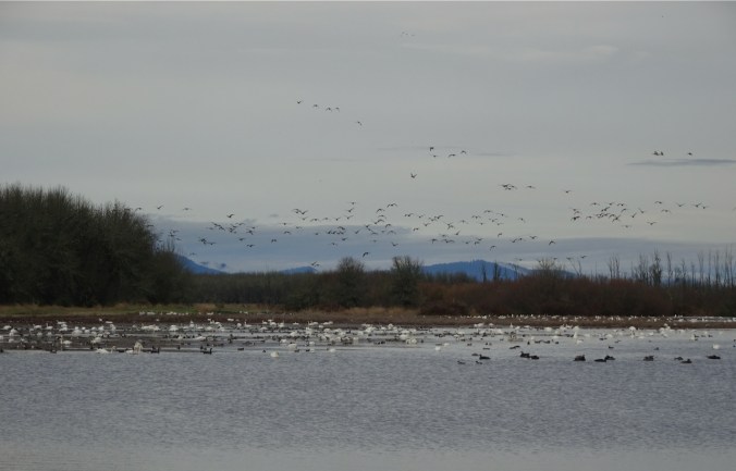
Another hiker told us we would see swans in the McFadden Marsh, so we headed there for our lunch stop.
Swans, geese and other water fowl.
The weather had cleared a bit, so we hiked the Woodpecker Loop trail to stretch our legs a bit more.
Along the Woodpecker Loop trail.
High point – a shelter, and view of some of the high Cascade Mountain peaks to the east.
As we began our drive home, we found the best view of the Cascades was from a road pullout above some of the historic farm buildings.
Mt Jefferson
North, Middle and South Sisters.
We enjoyed our day at Finley Wildlife Refuge – anything to get out of the house for a few hours and walk in nature. I would like to visit in other seasons, but we usually have destinations closer to home…
Another socially distant/Covid careful trip. We stayed three nights in Prineville, and had two days to explore the Painted Hills and Sheep Rock units of the National Monument. Indoor exhibits were closed, trails were available for walking.
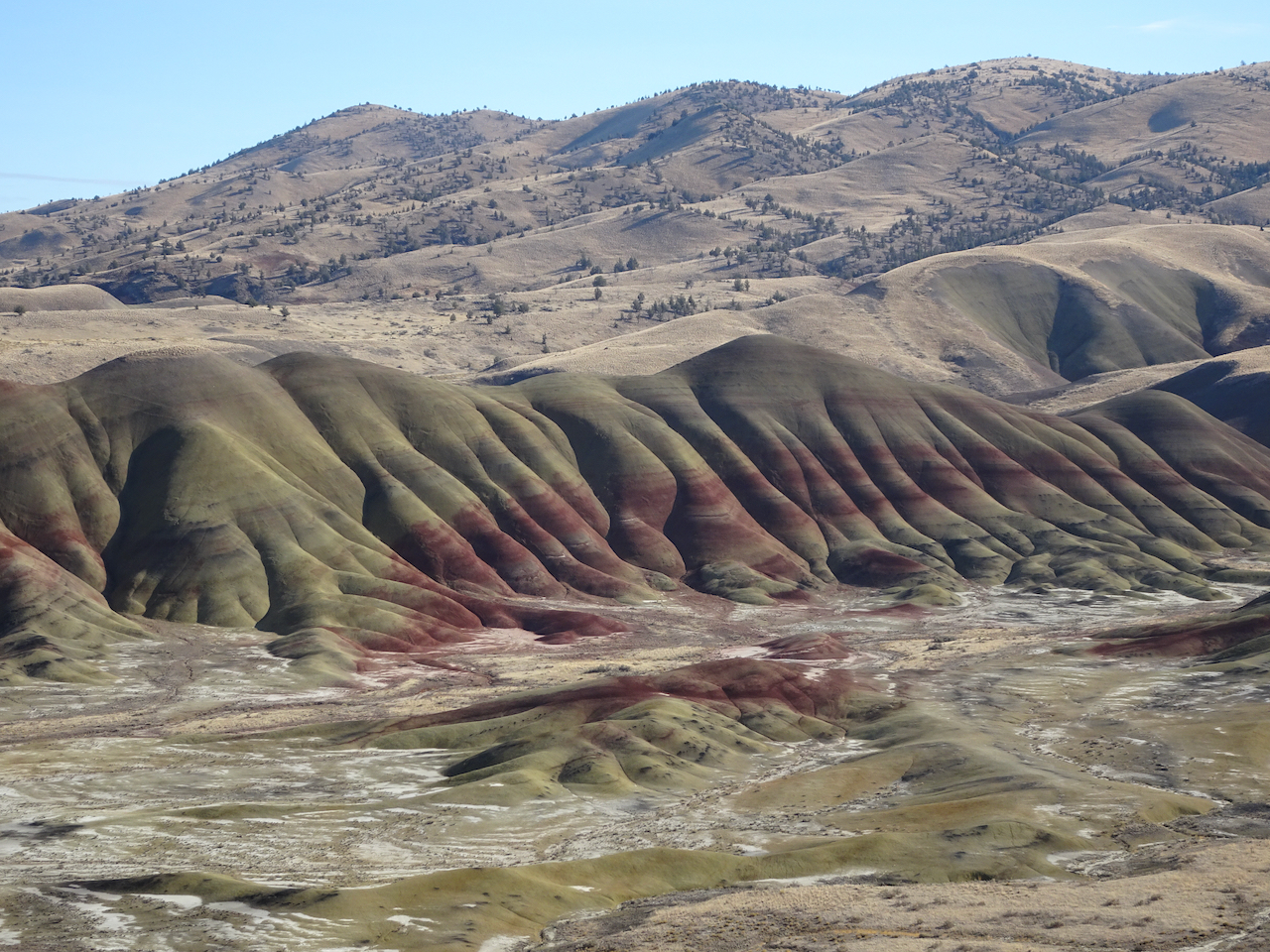
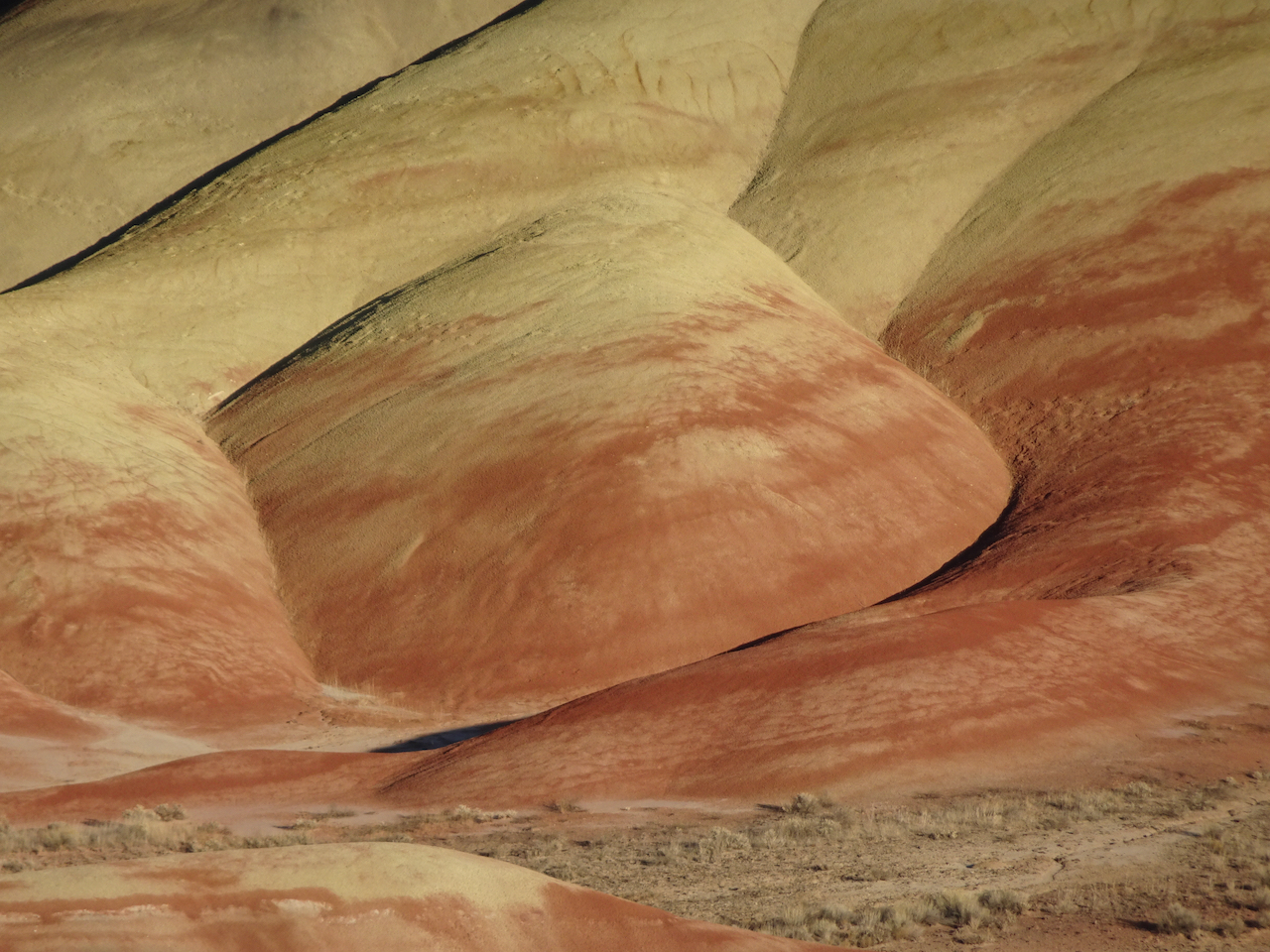
Painted Hills 10/27/2020
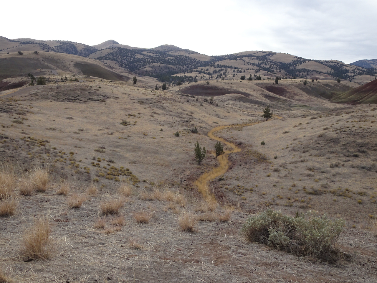
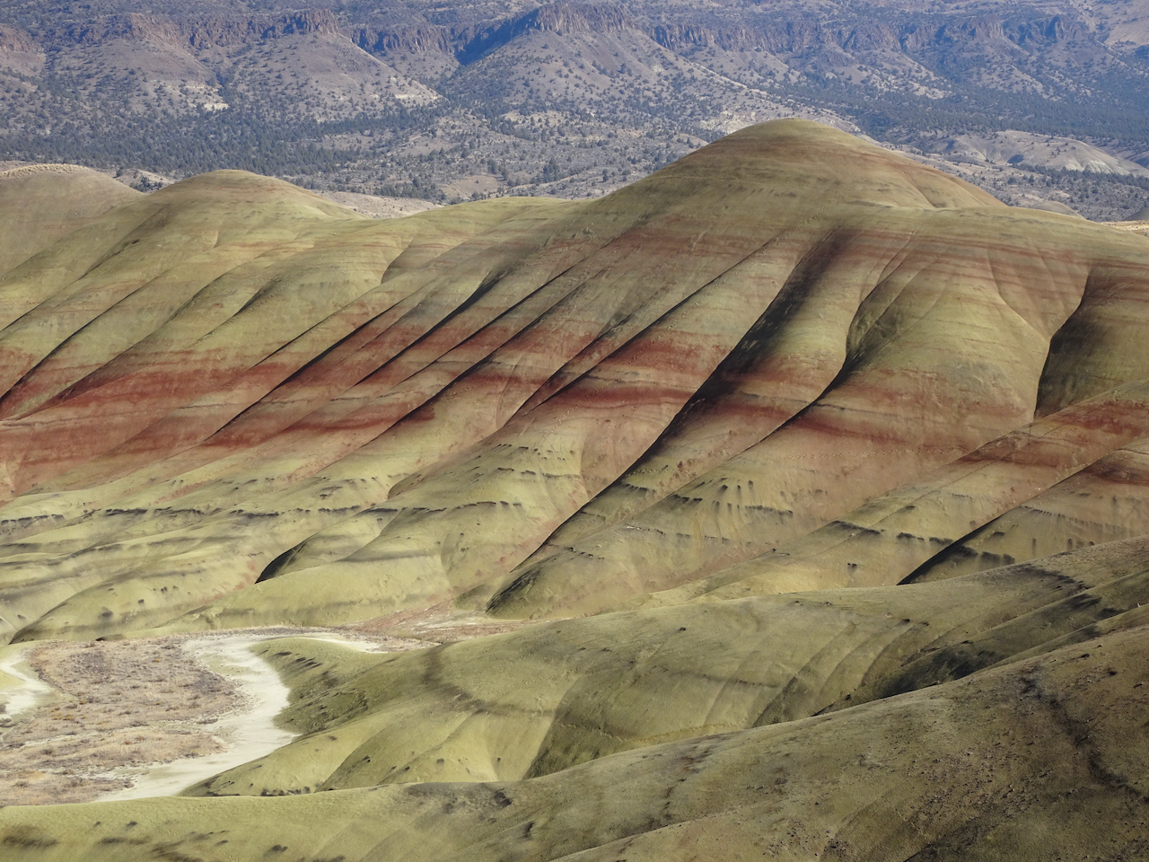
We walked five different short trails, each highlighting an aspect of the ancient lake beds that are exposed now as brilliantly colored and striped landforms. It was bitter cold out in the morning – well below freezing, but warmed up during the day.
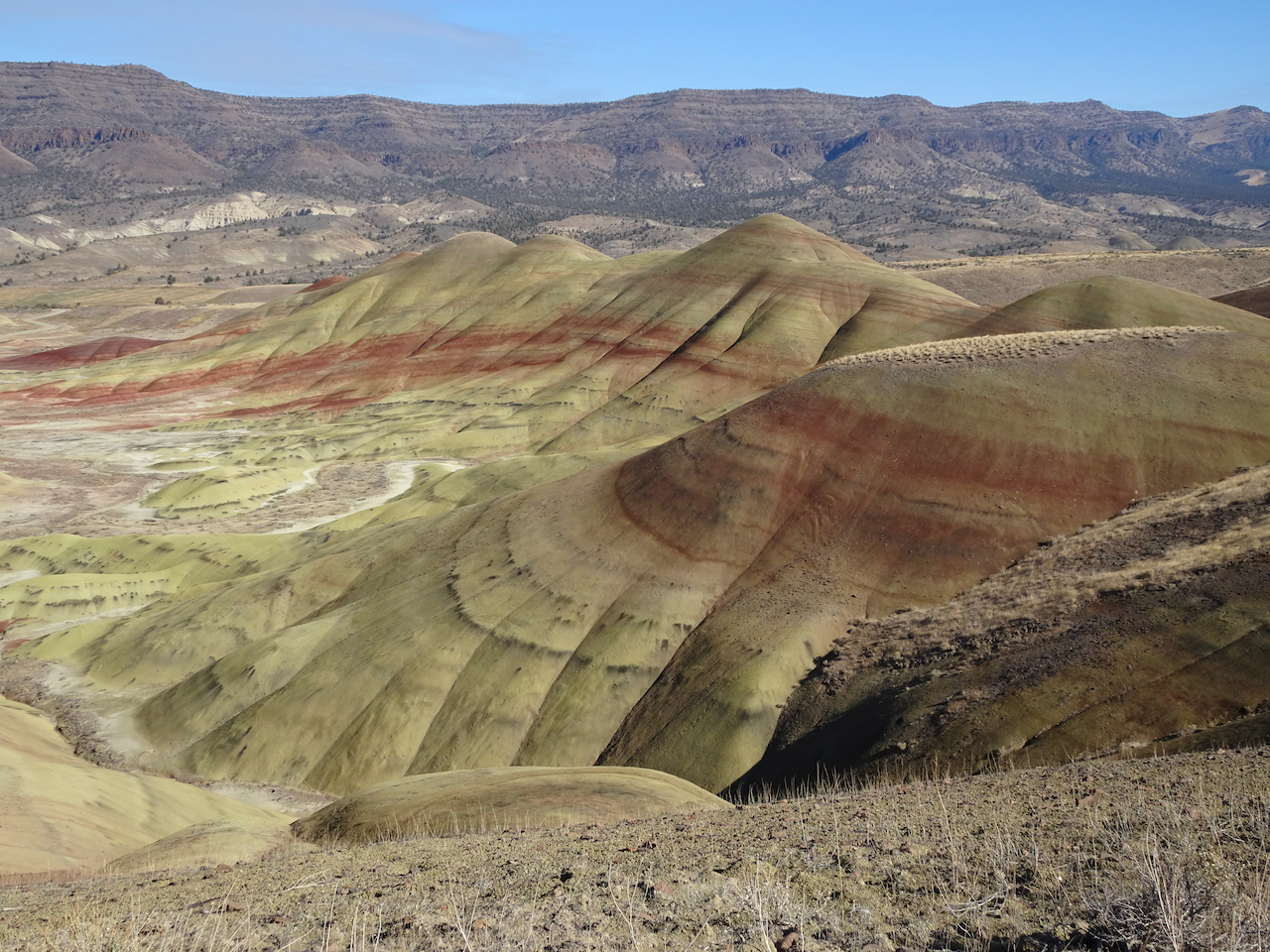
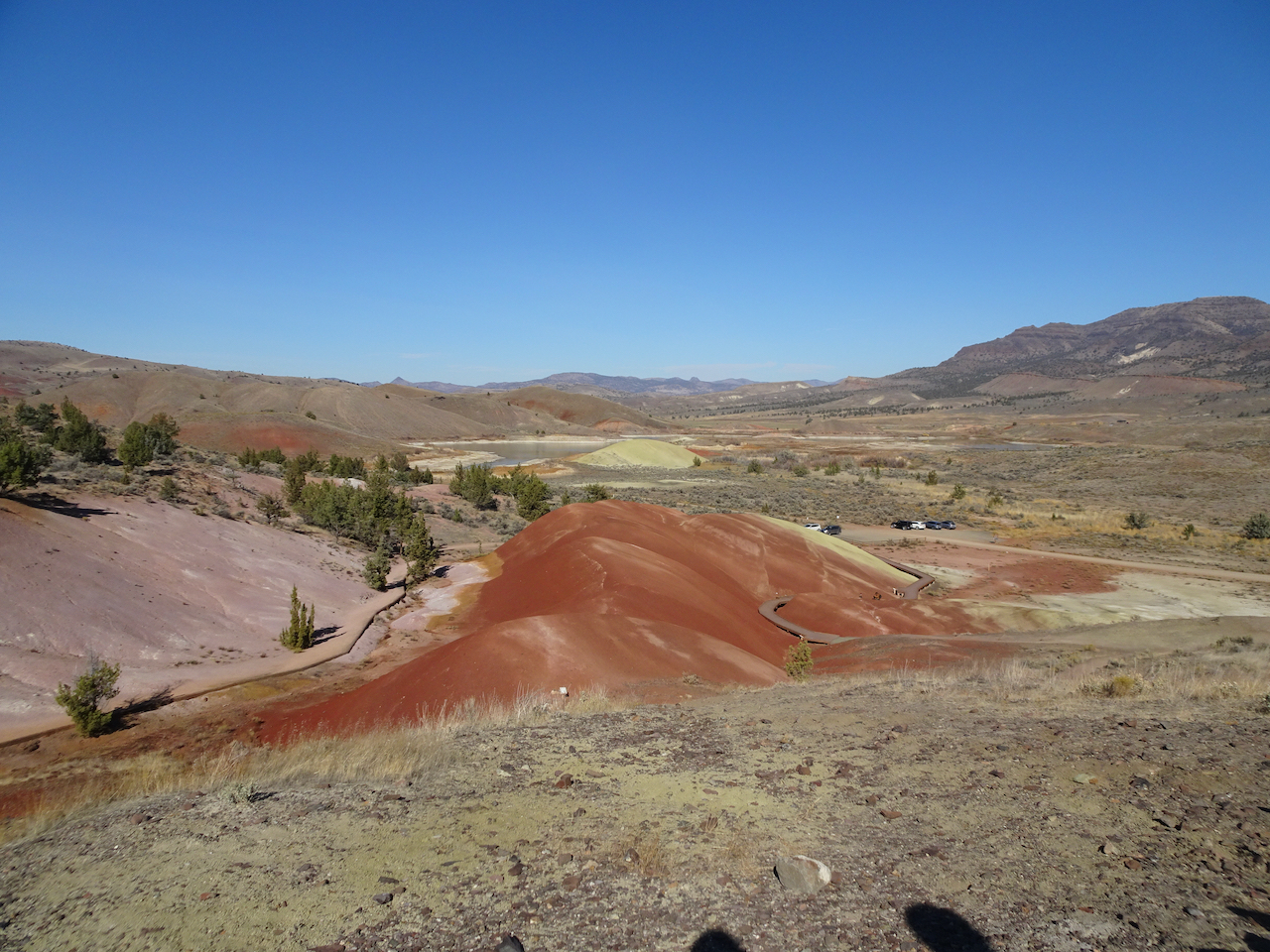
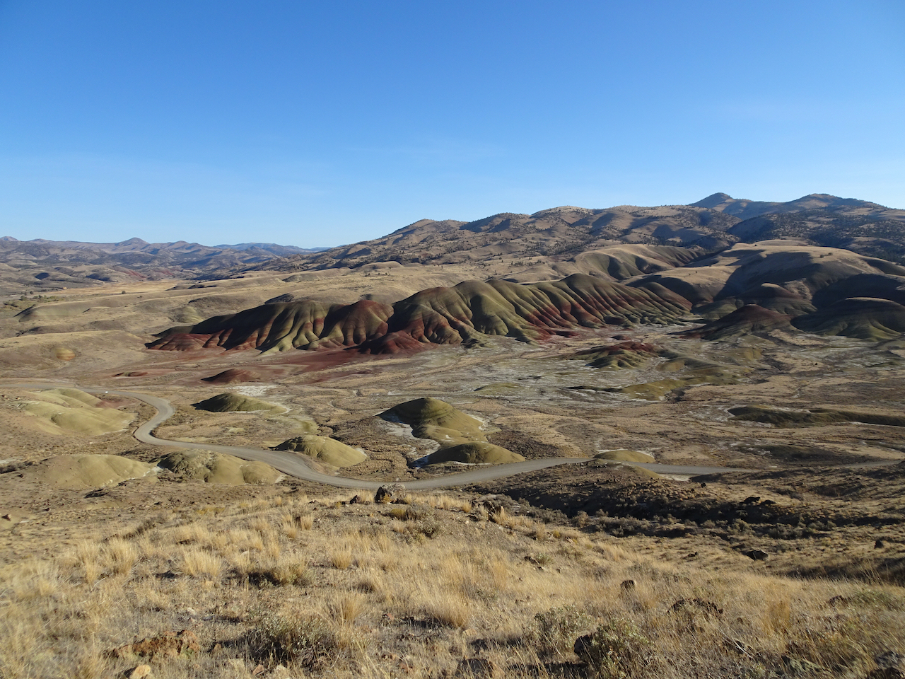
Painted Hills Overlook – The main overlook has an amazing view of the Painted Hills. We walked to the upper overlook for more views.
Main overlook.
River of grass on the nearby hills.
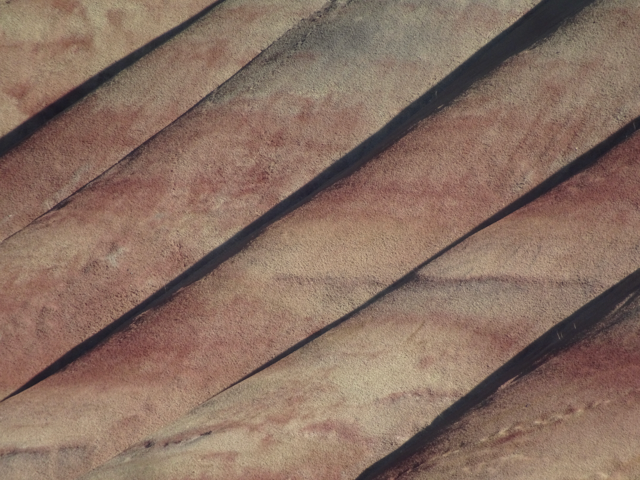
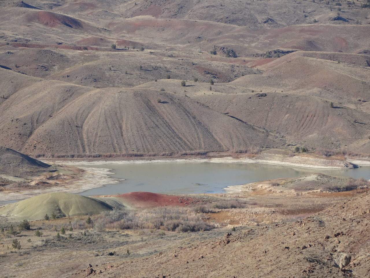
Zooming in from the upper overlook:
Upper overlook
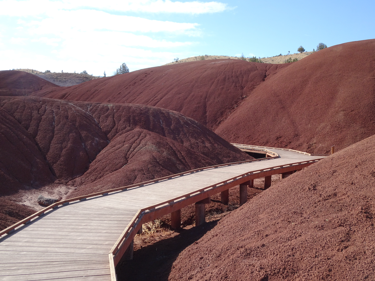
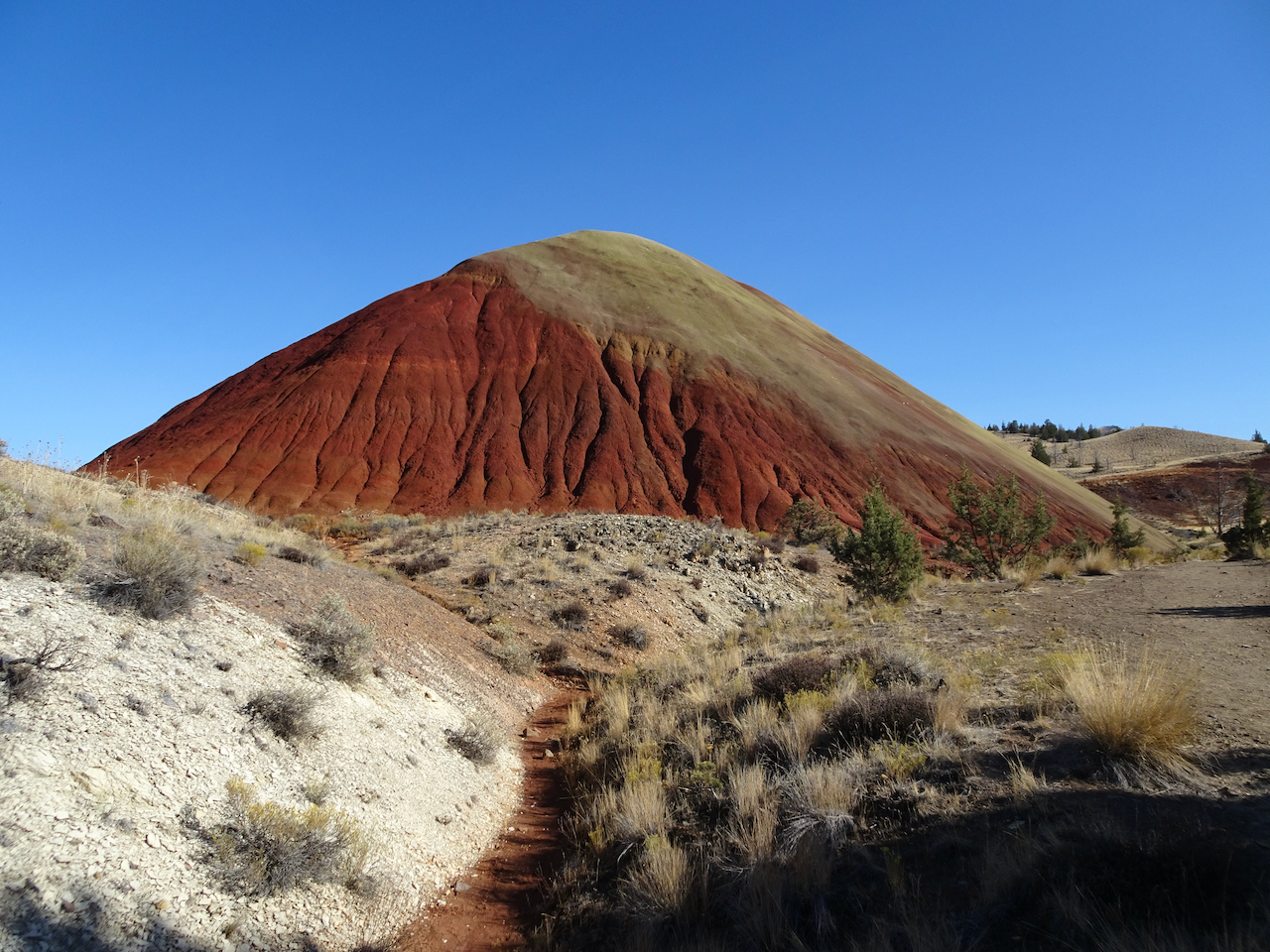
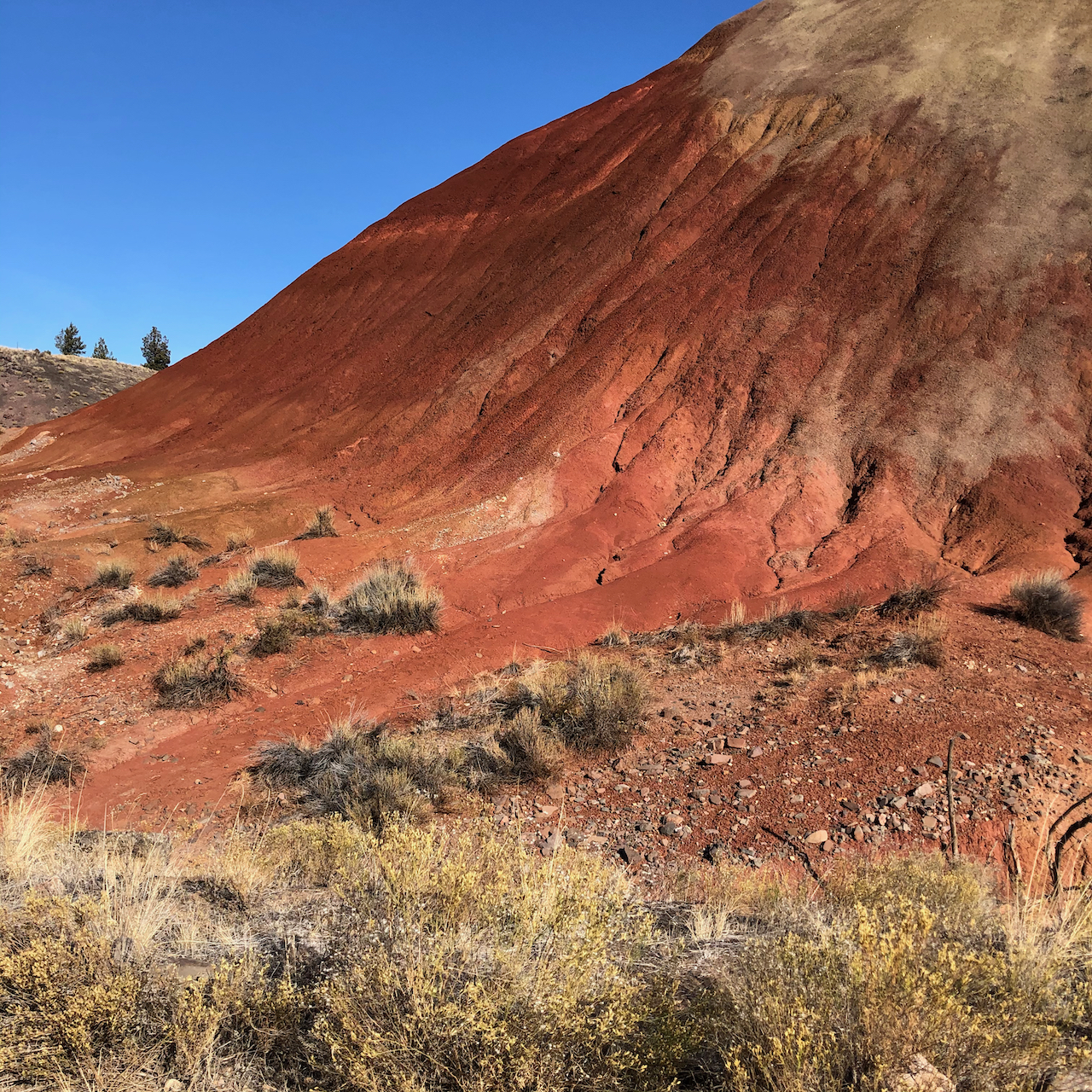
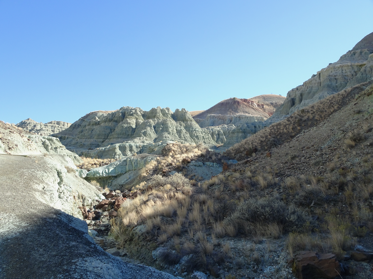
Painted Cove Trail – We next walked the short loop through the red hills near the John Day River.
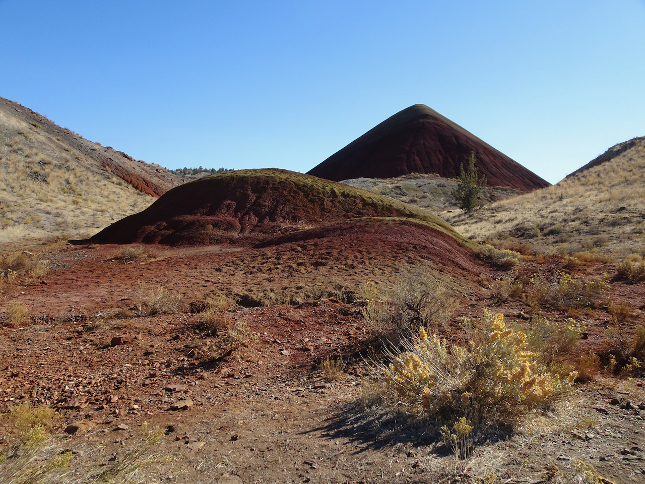
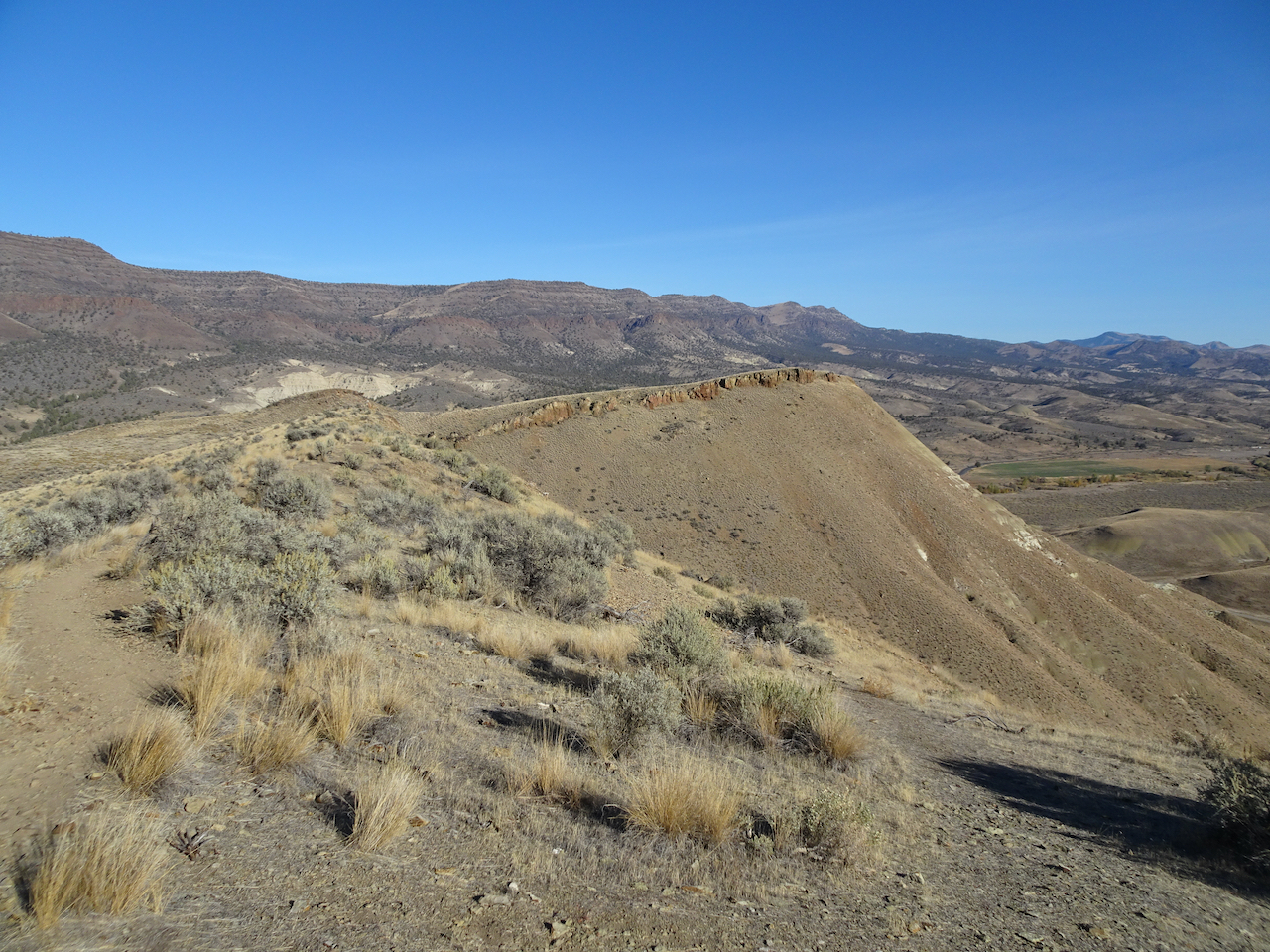
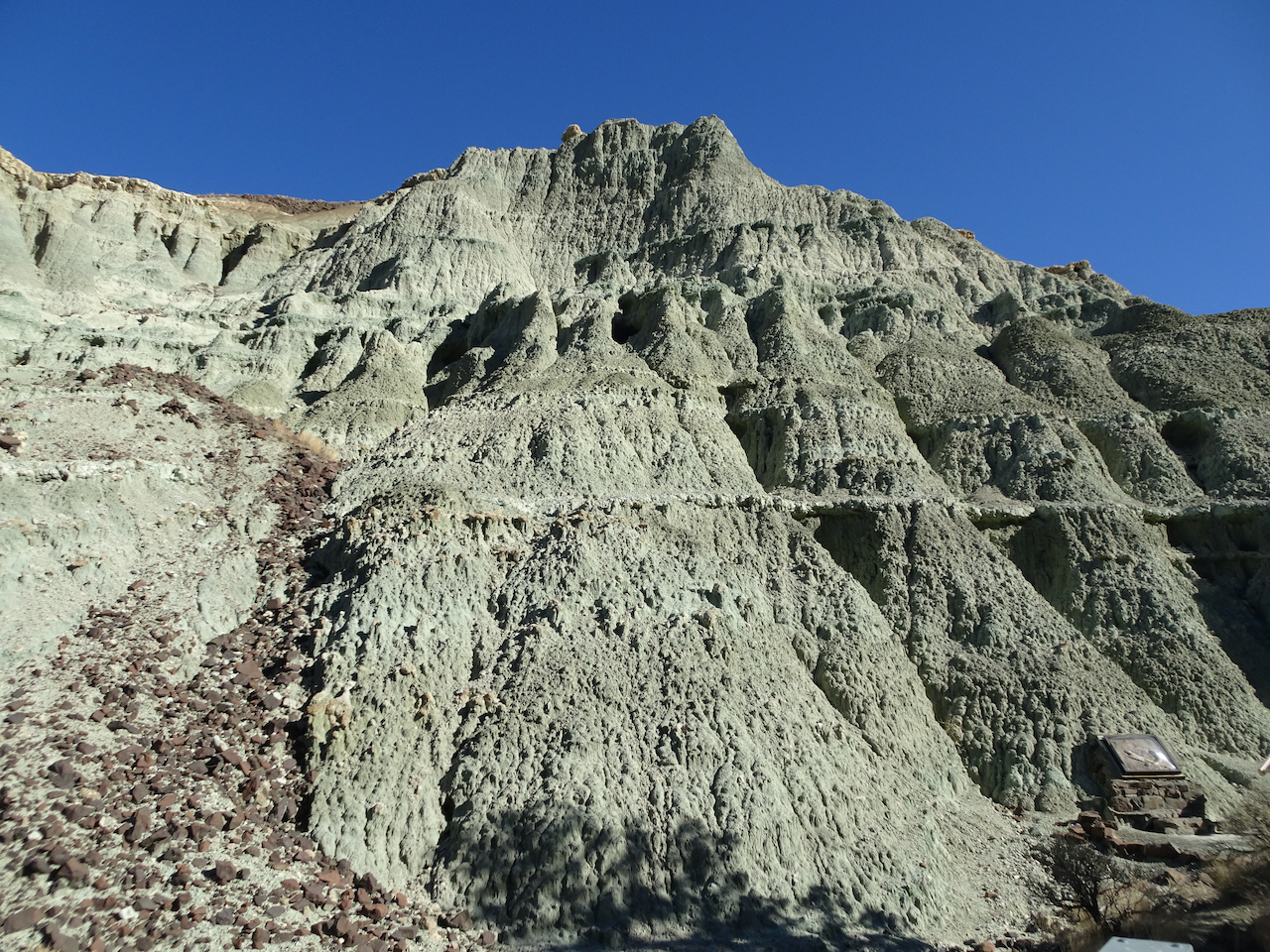
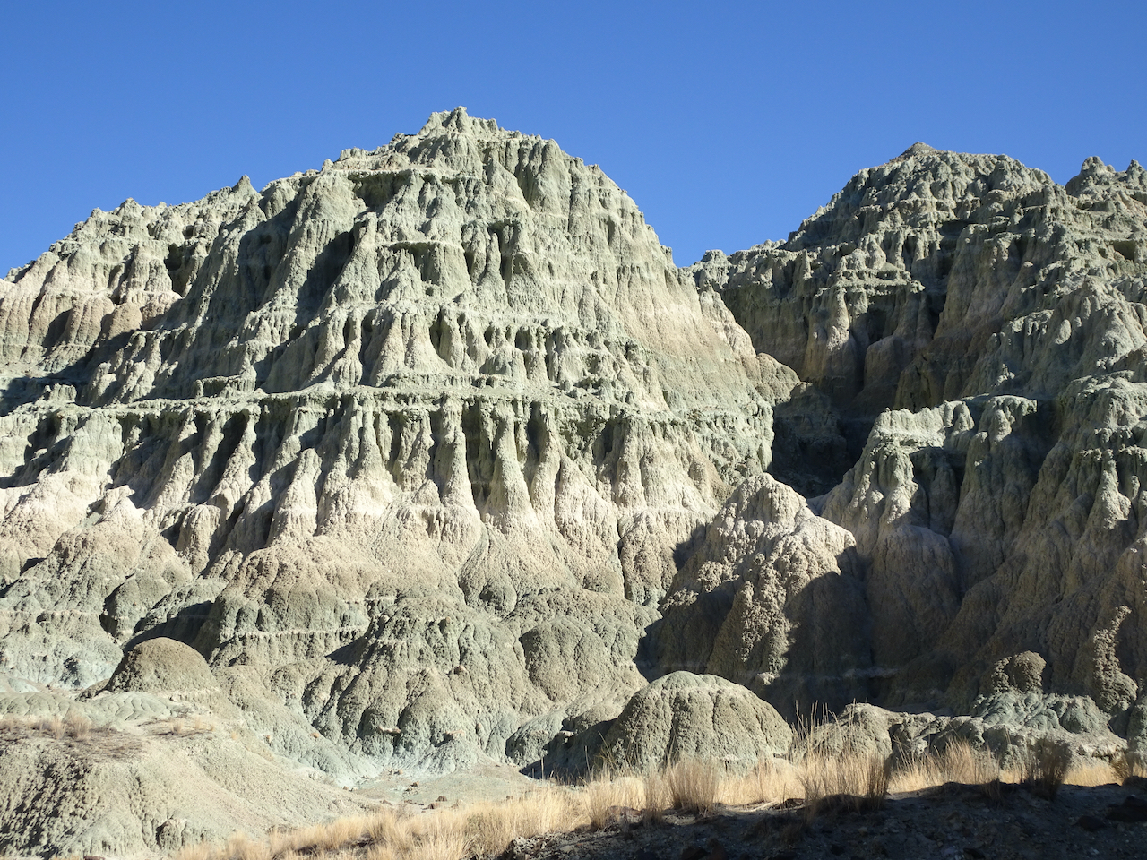
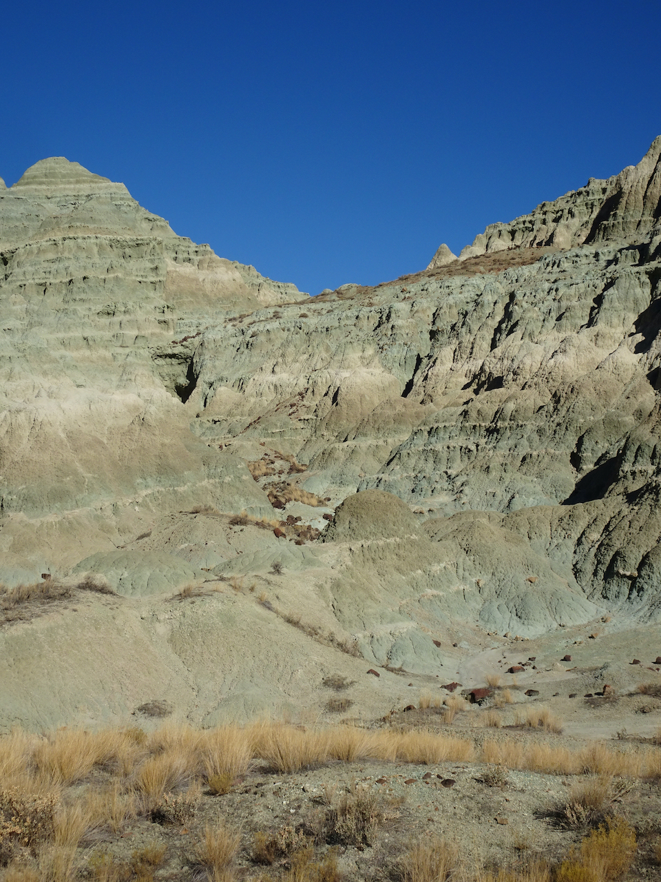
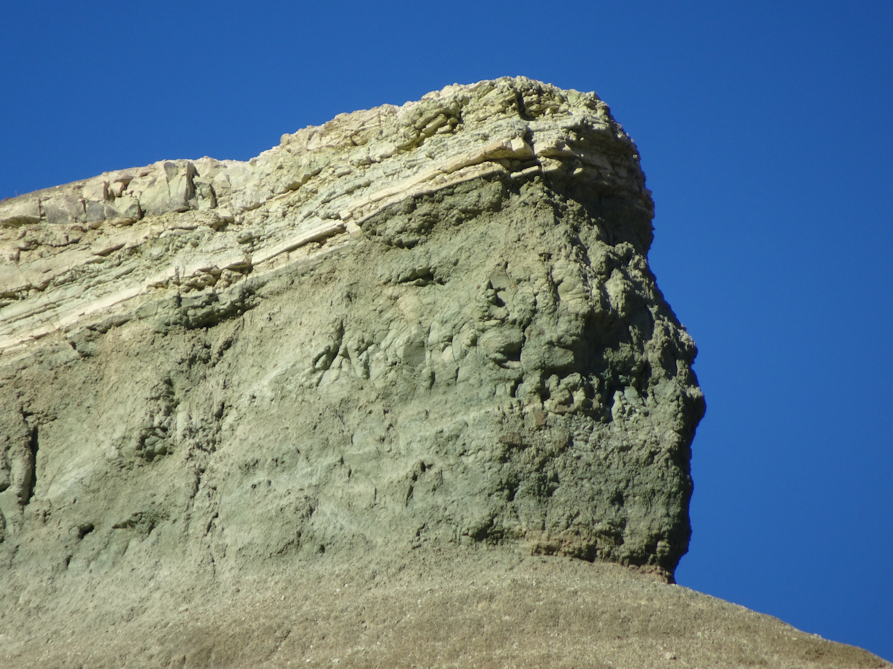
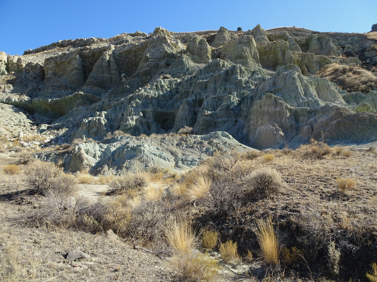
Red Scar Trail – Another short trail that leads past brilliantly colored badlands.
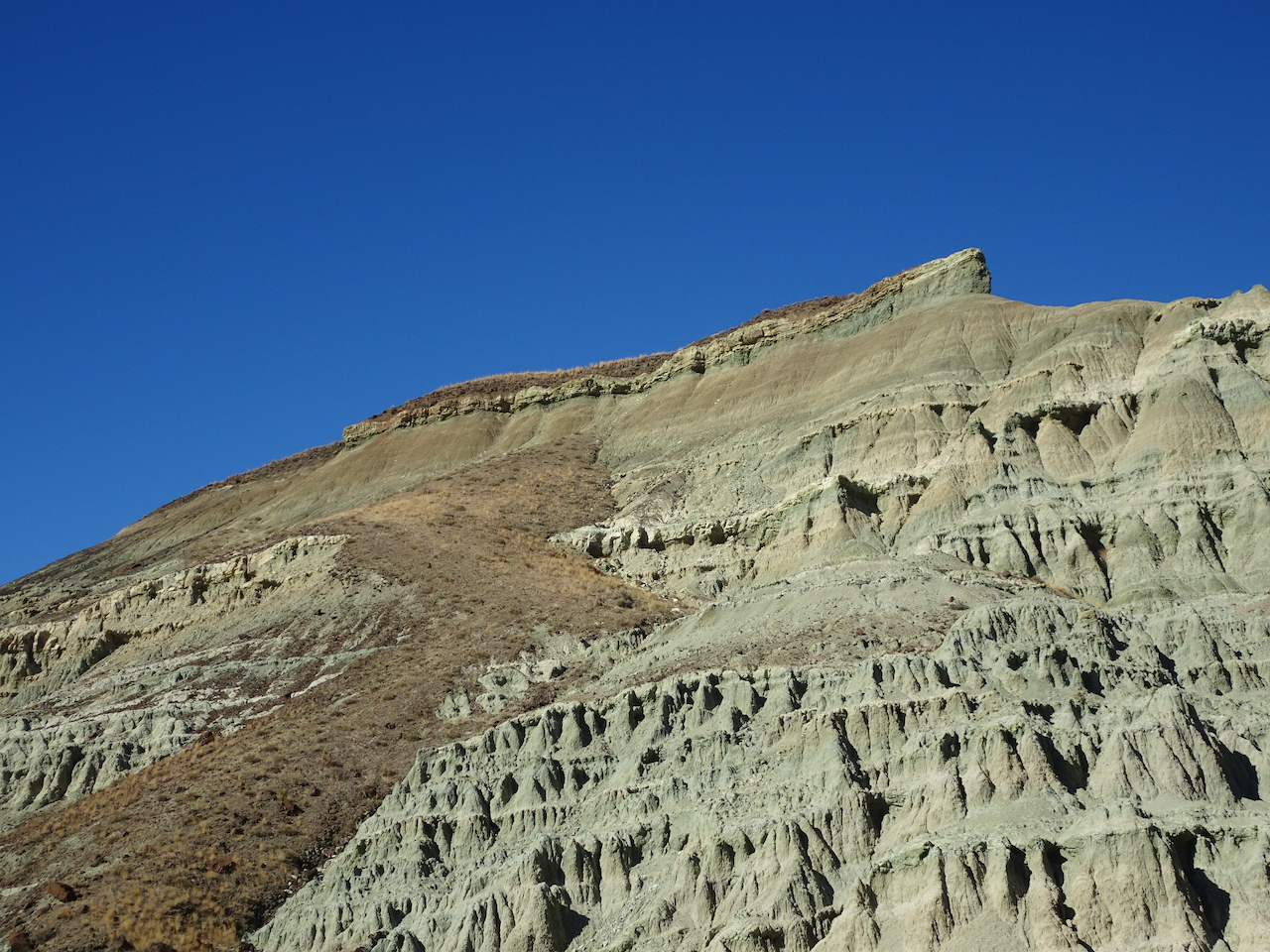
Red Scar Knoll and Red Hill
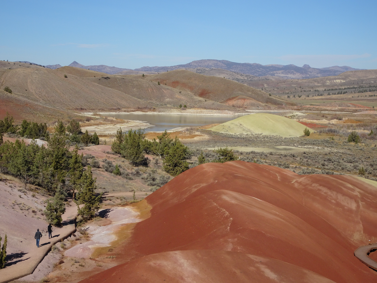
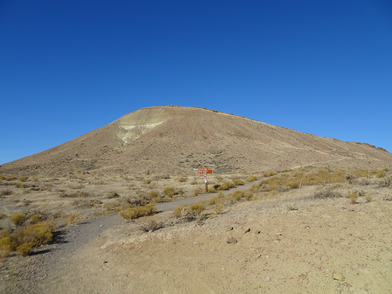
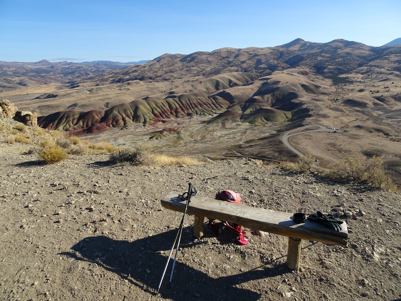
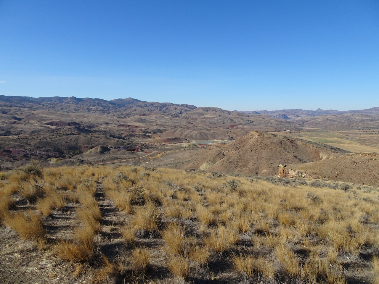
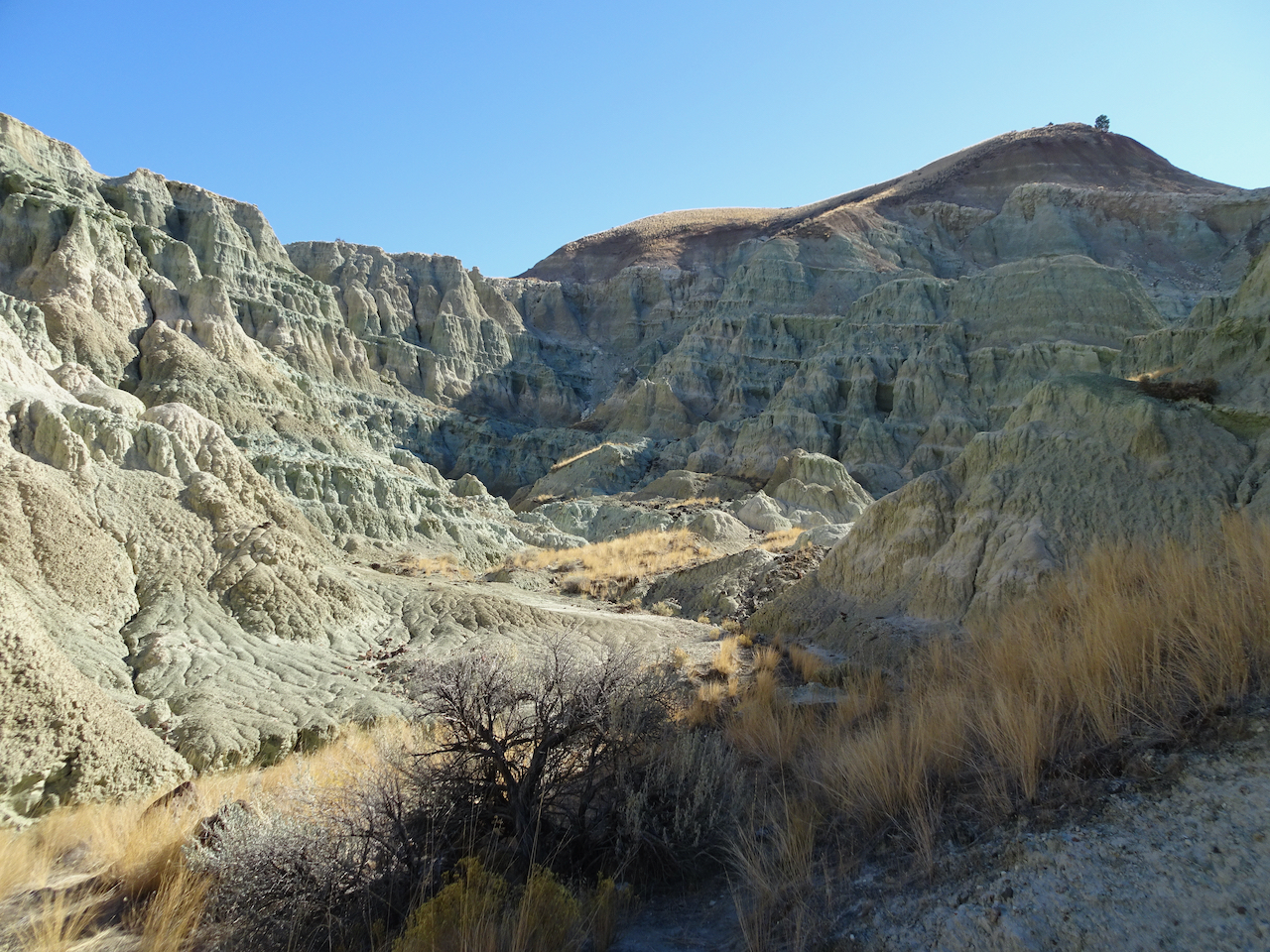
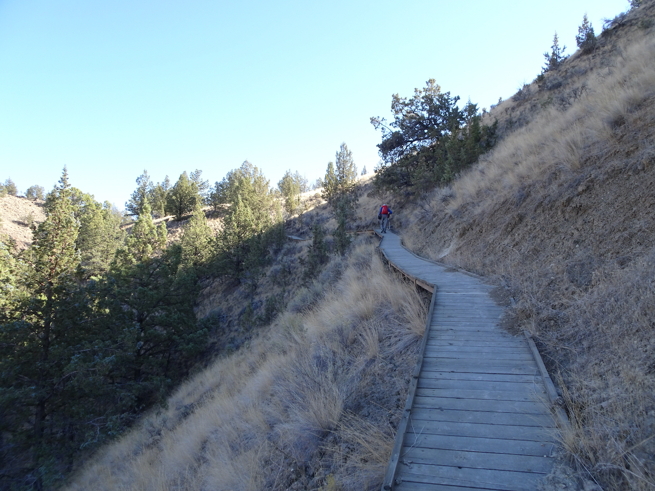
Carroll Rim Trail – Our longest trail for the day (1.6 miles/400 feet) was a walk up to the Carroll Rim. As we hiked up, we could look down on the Painted Hills. From the top, we could see views in every direction.
Carrol Rim
Looking down from the trail.
View from the end of the trail.
View to the east
View to the northwest, Painted Cove area.
Close up of Painted Cove
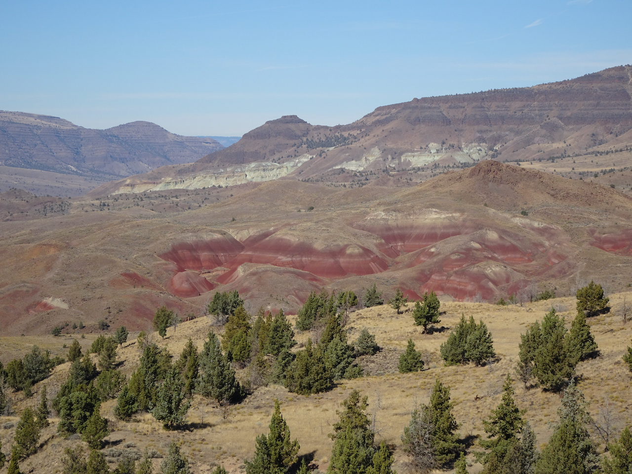
View to the Painted Hills on the way down.
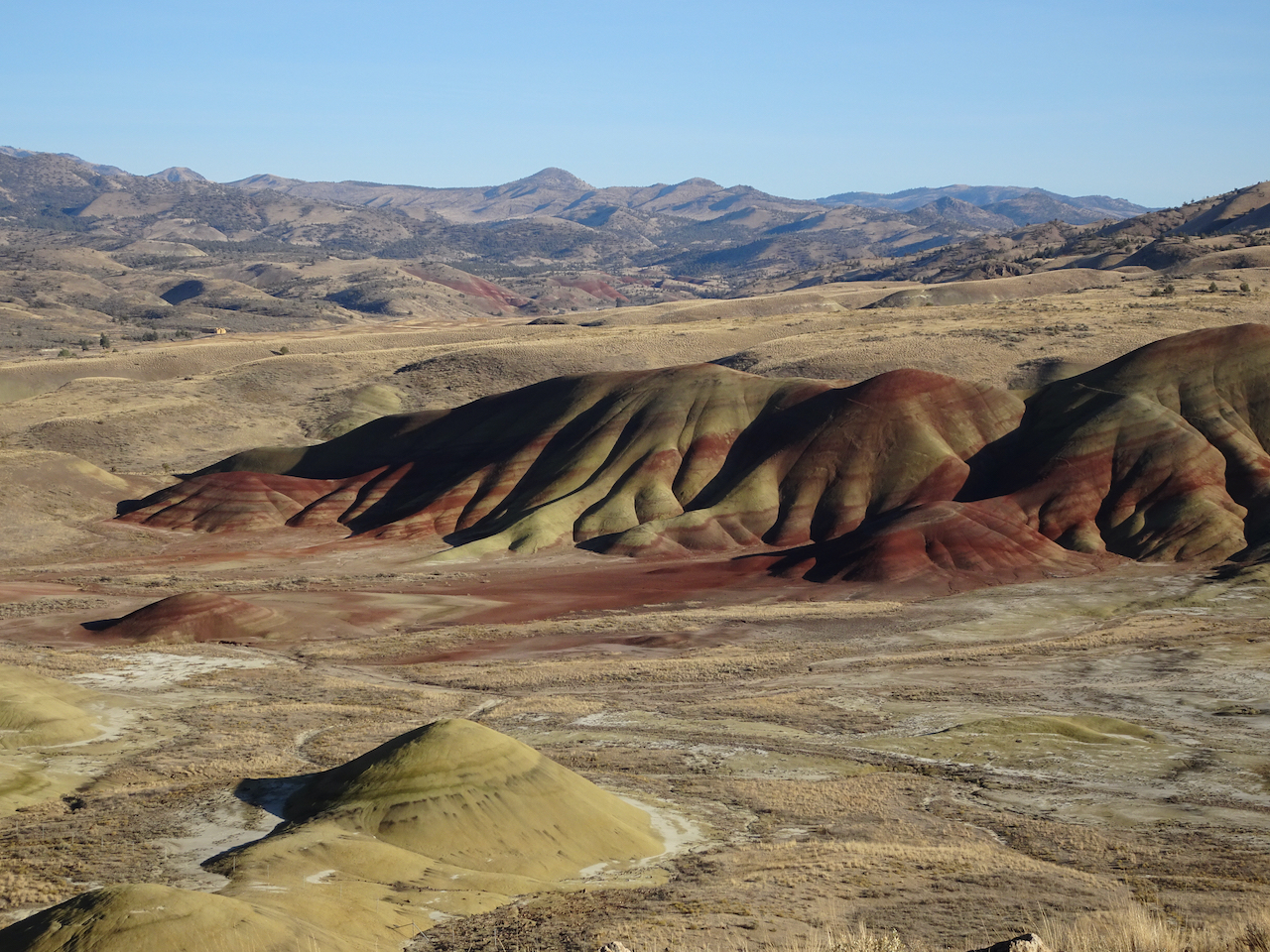
Back to the Painted Hills Overlook – for another look as the low western light added a glow to the Painted Hills.
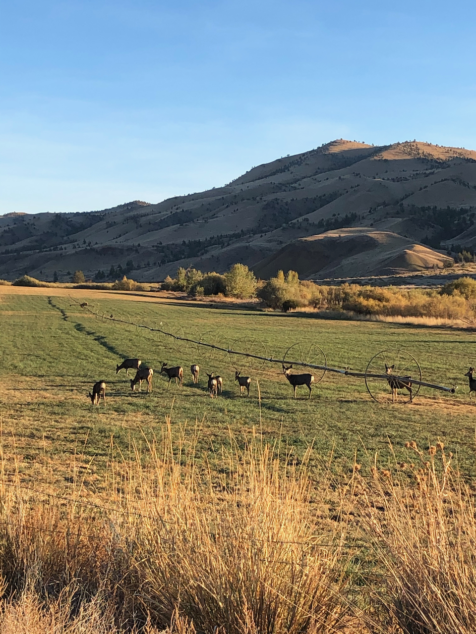
On our drive back to Prineville, we saw a herd of deer, and a view of the Central Cascades.
Deer near Painted Hills.
Mt Bachelor, Broken Top and the Three Sisters on the horizon.
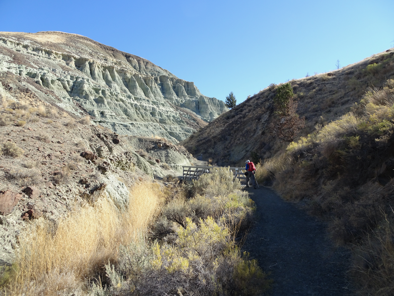
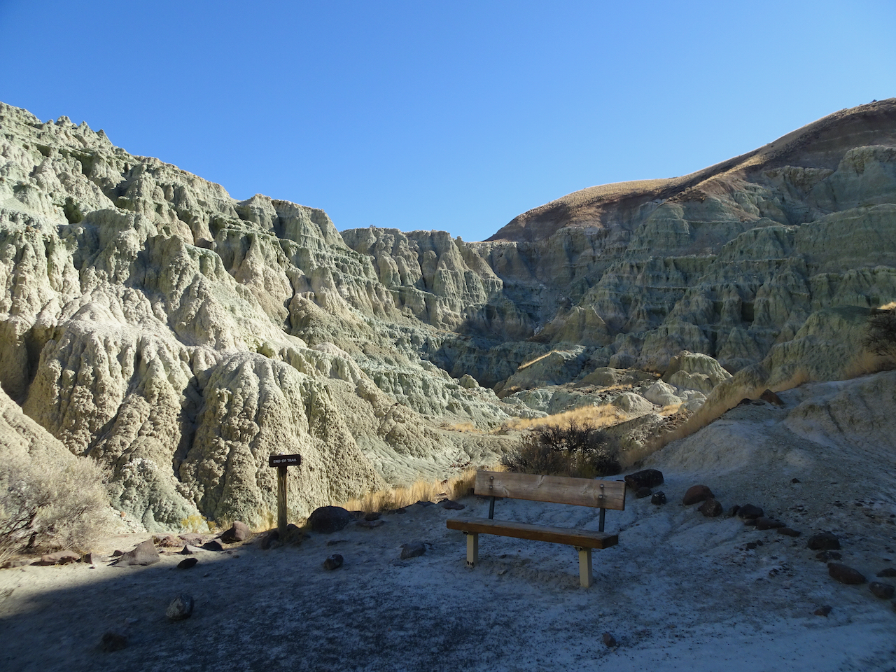
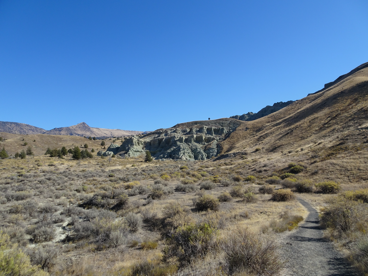
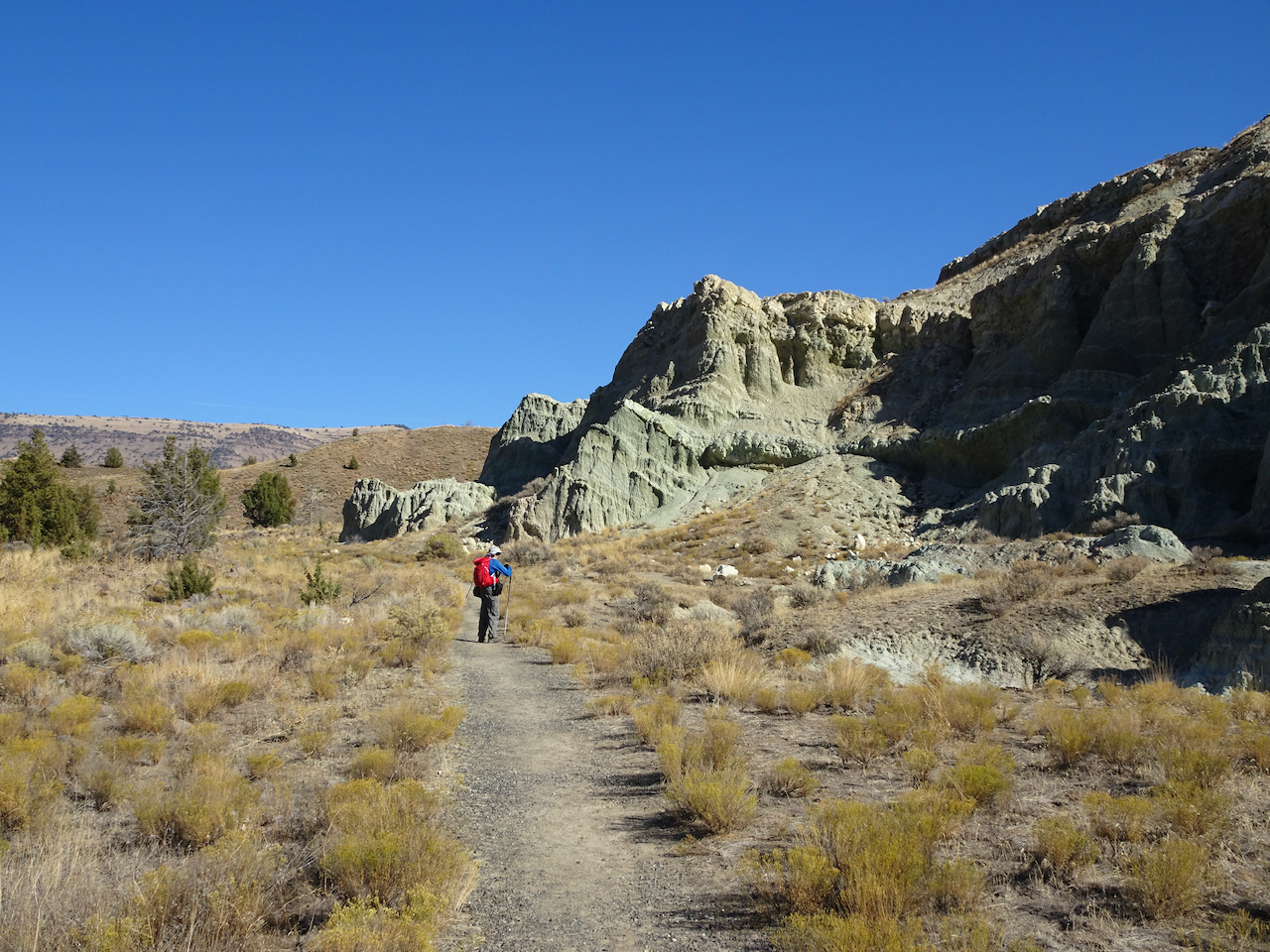
Sheep Rock Unit – Blue Basin – 10/28/2020
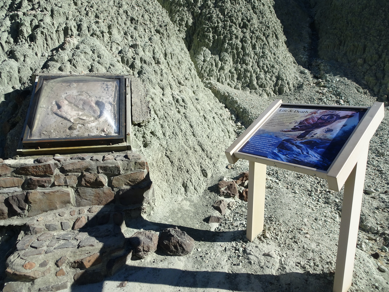
We first walked the Island in Time Trail in the heart of Blue Basin.
Entering Blue Basin – one of many bridges on this trail.
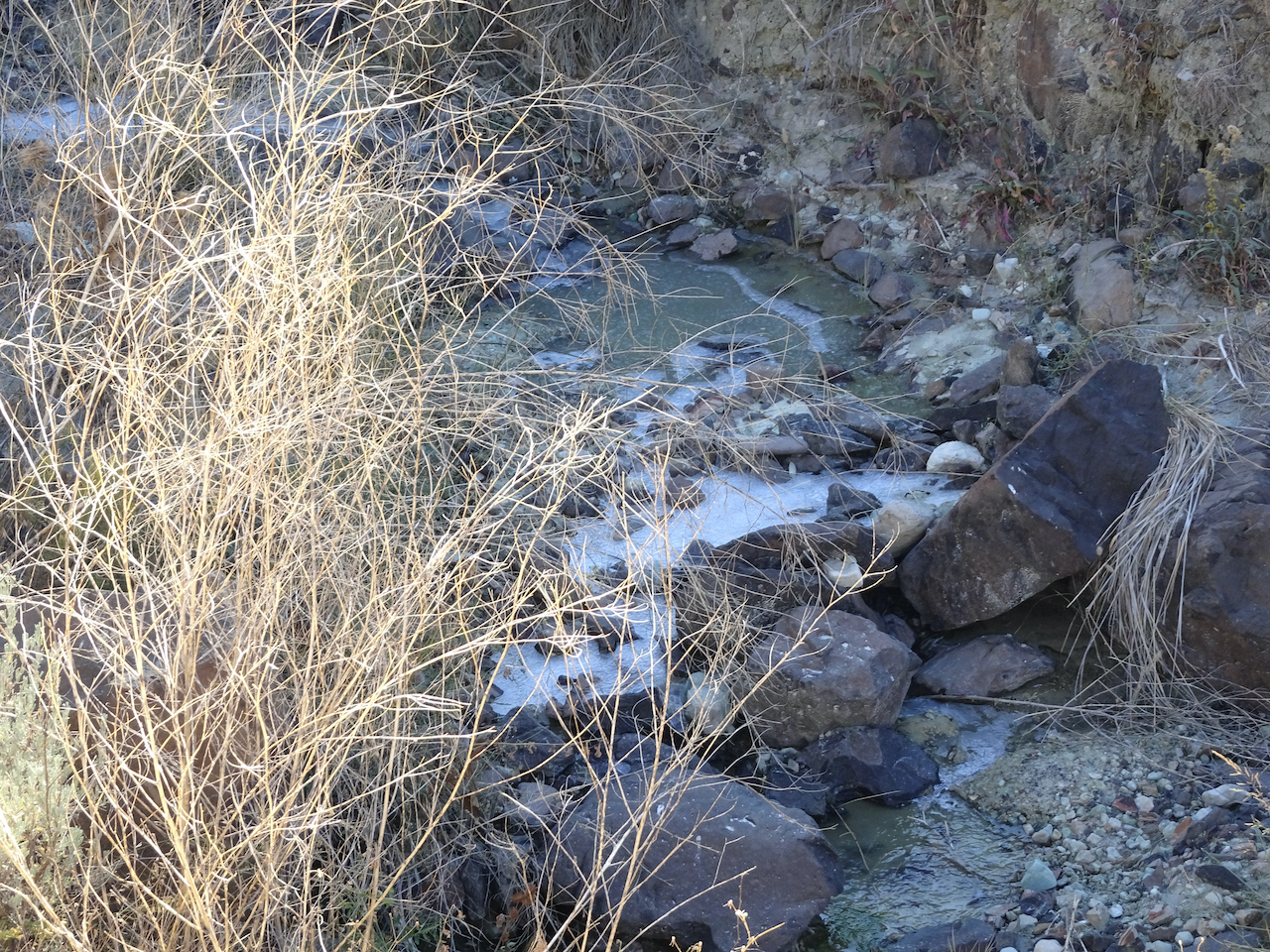
Ice in the creek – last time we were here there was bluish water in the creek.
Blue-green volcanic ash claystones.
One of many fossil displays along the trail.
We would be hiking on the surrounding hills later in the day.
Bench at the end of the trail.
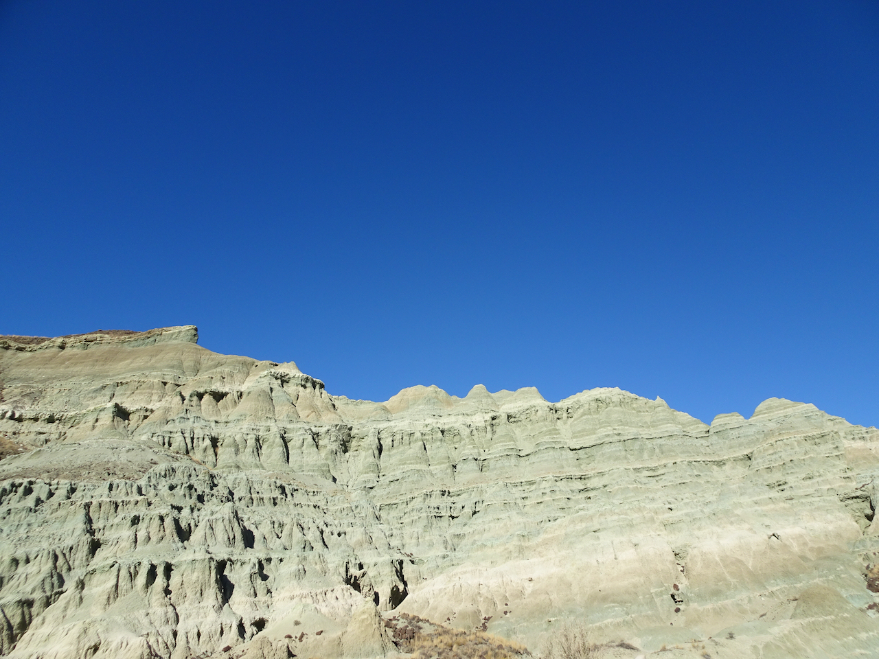
This beautifully eroded skyline was a prominent feature.
Zooming in on the prow…
We spotted this little bird on our way out.
After lunch, we hiked the longer Blue Basin OverlookTrail (3.25 miles/ 600 feet) around the encircling mountains.
North of Blue Basin, the trail passes more blue badlands formations.
Continuing up hill…
Boardwalk over mudstone
Views to the north
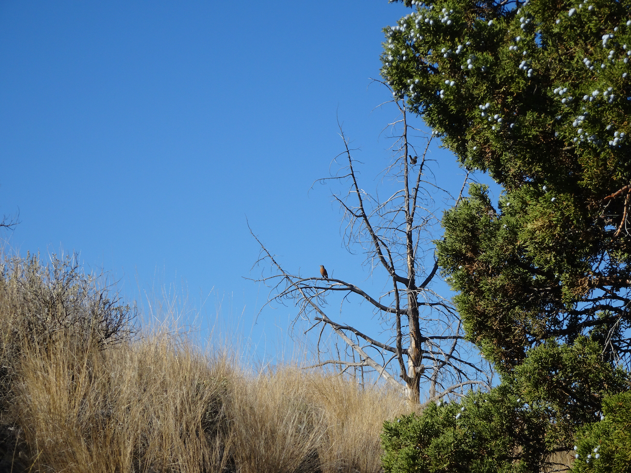
Robins and juniper berries.
Eventually we reached the viewpoint over Blue Basin –
The trail circles around to the south, above the basin, giving views of the same beautifully eroded skyline I noticed earlier.
Eventually, we descended to the trailhead.
John Day River Valley.
We also took a short hike on the Story in Stone Trail, located just a few miles north in the Foree unit. We saw similar landforms there.
We thoroughly enjoyed our visit to this remote area. We were lucky with sunny, if cold, weather. The trails were mostly empty, an important Covid consideration. Lots of fresh air and a good change of pace from our sheltering at home routines.
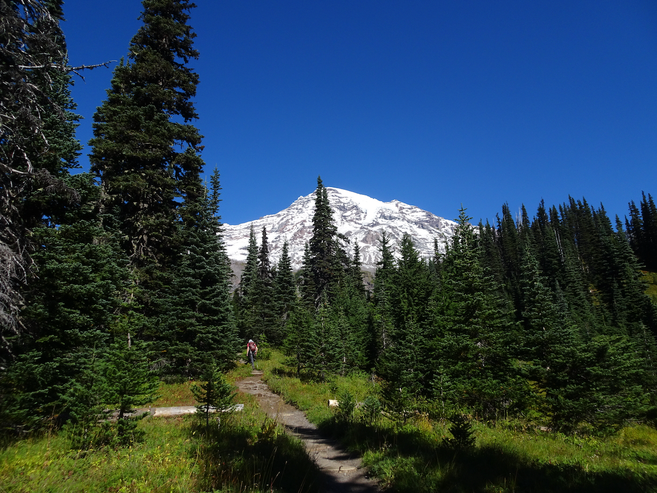
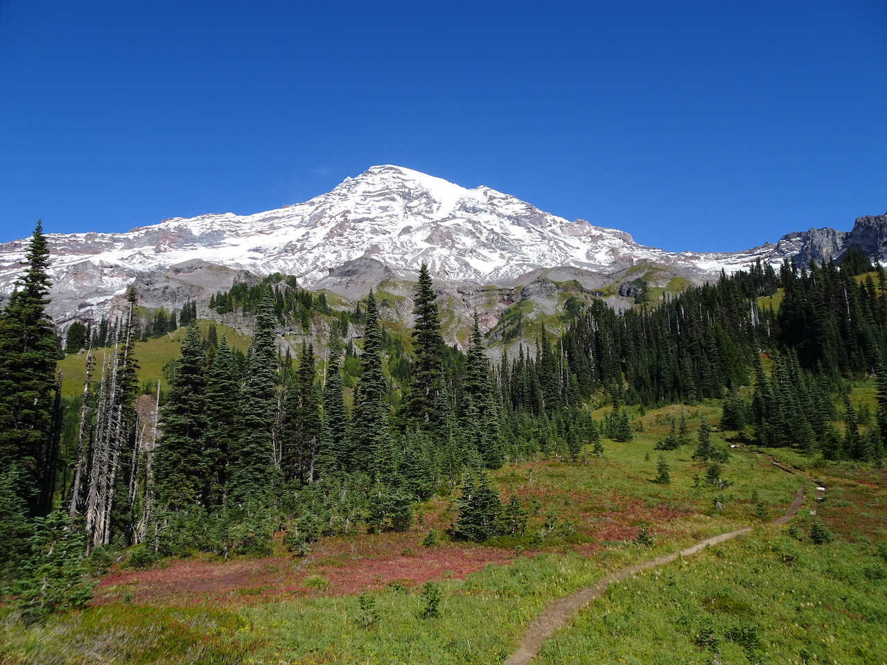
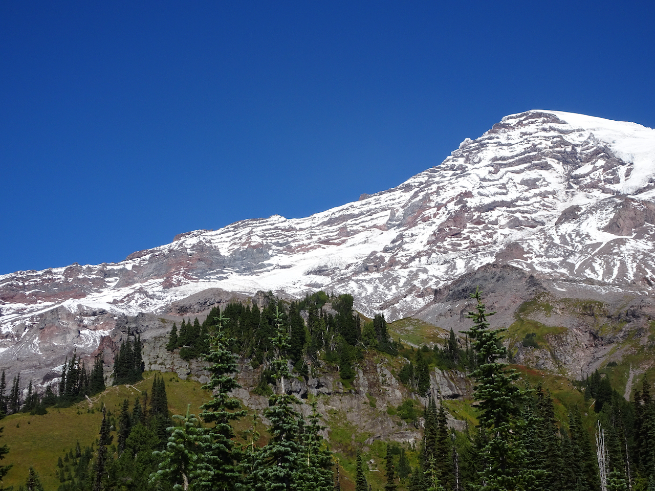
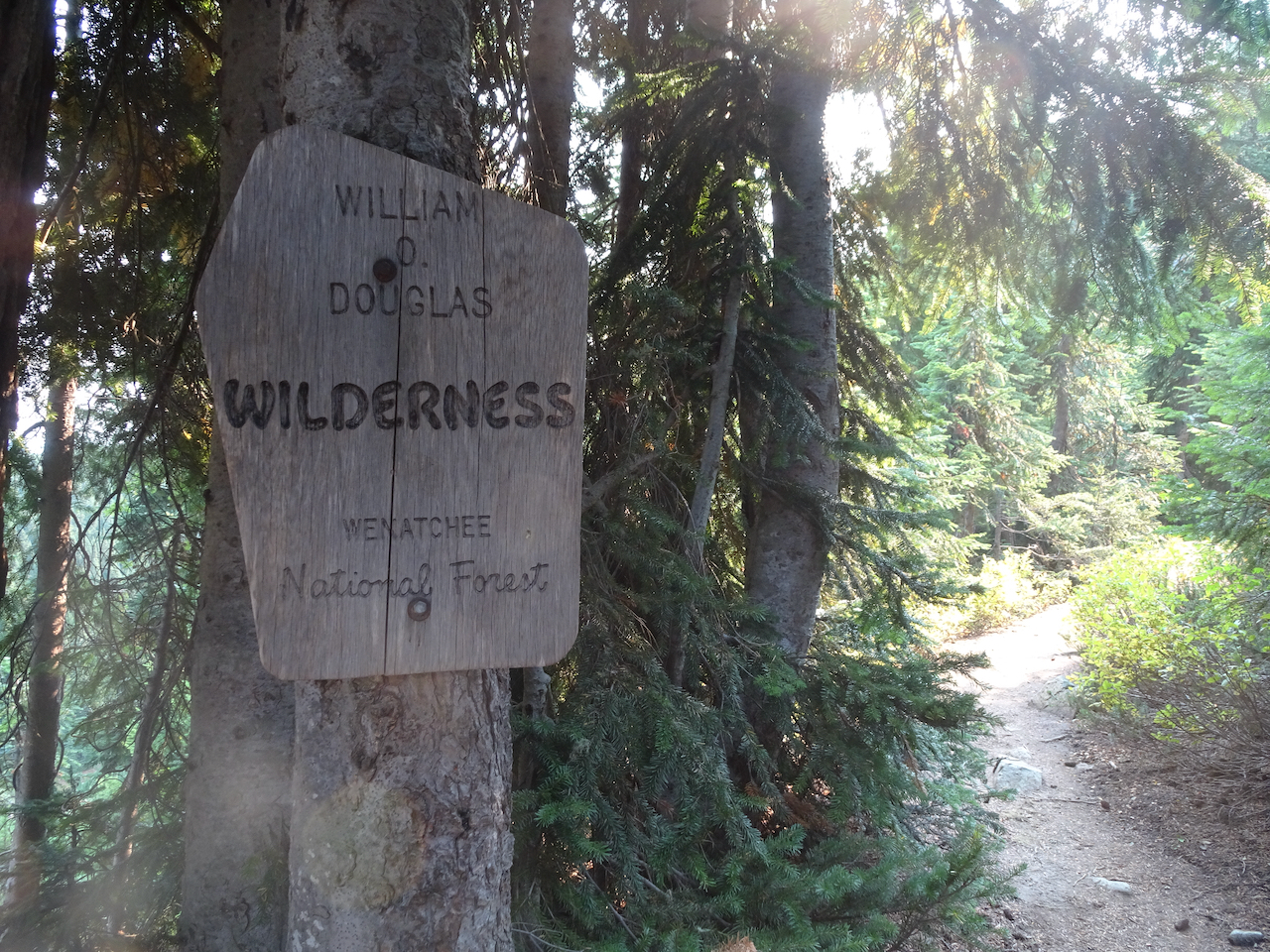
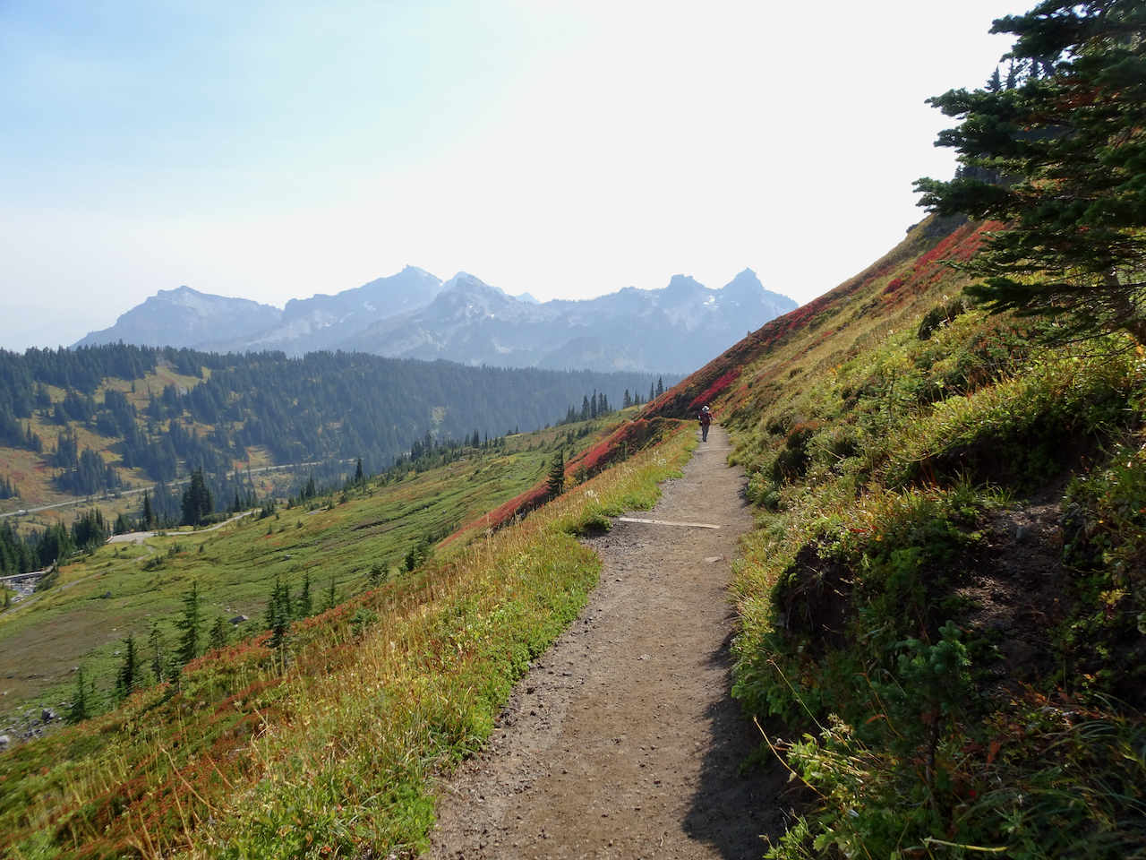
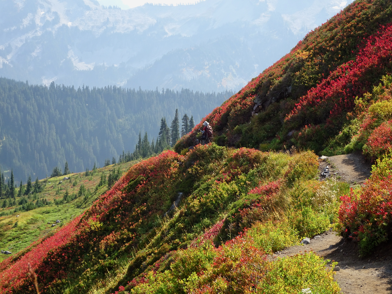
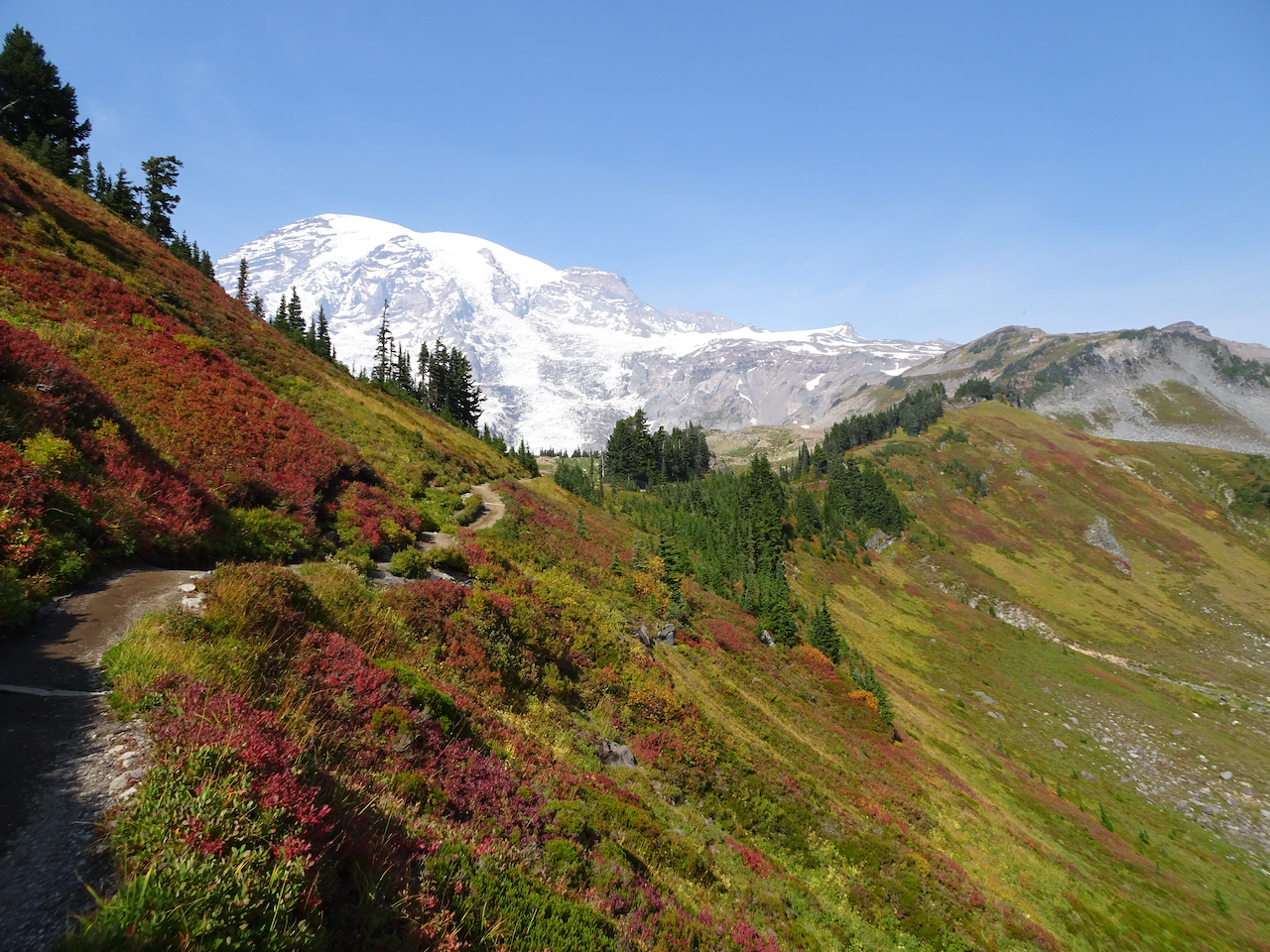
-on a midweek getaway, to a self-contained cabin in Packwood, Washington, with our own food, following all Covid-19 precautions. We have seen the stunning wildflower displays of summer a few times, and had long been wanting to see the the mountain in fall colors.
Mount Rainier area hikes.
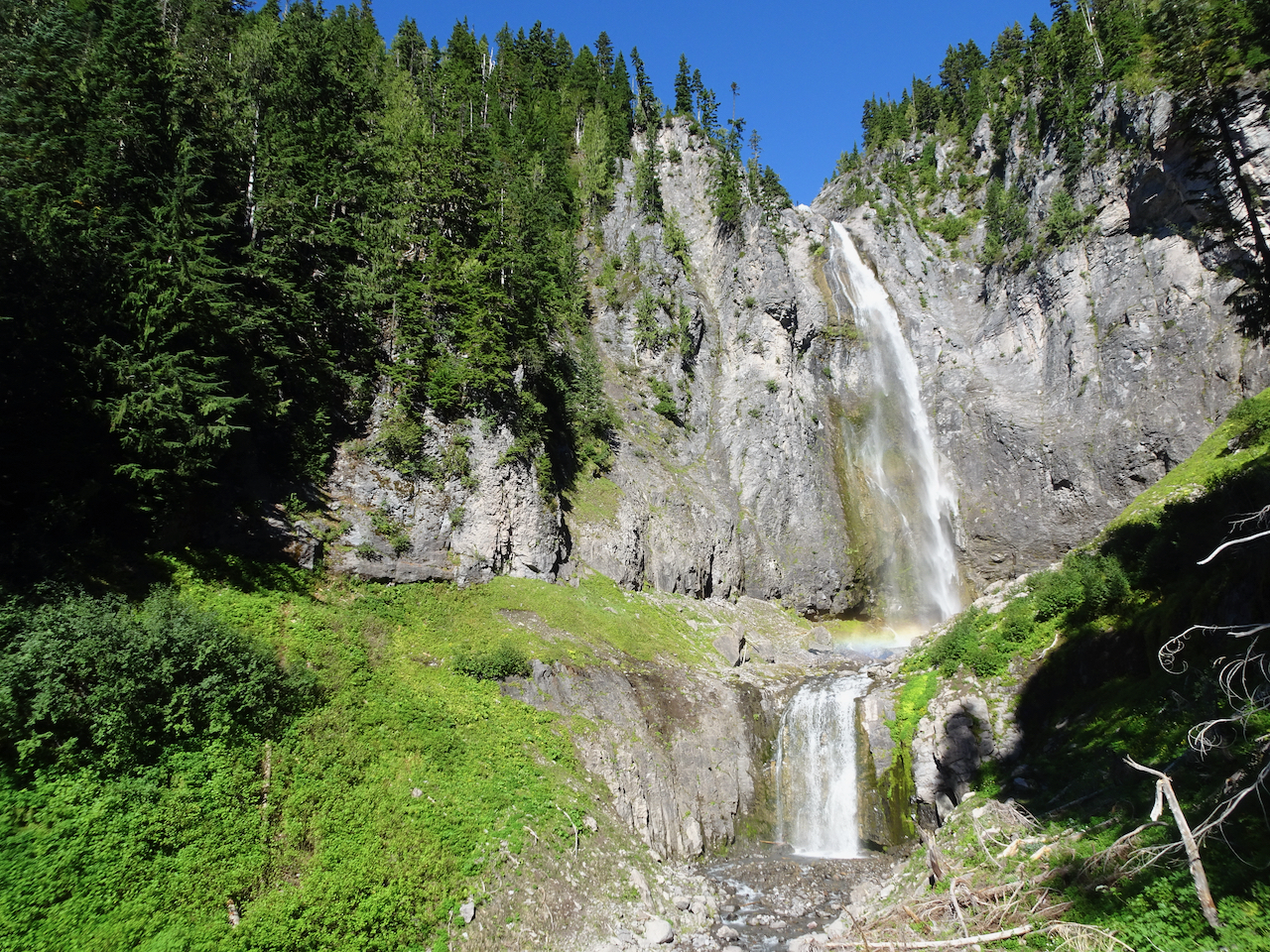
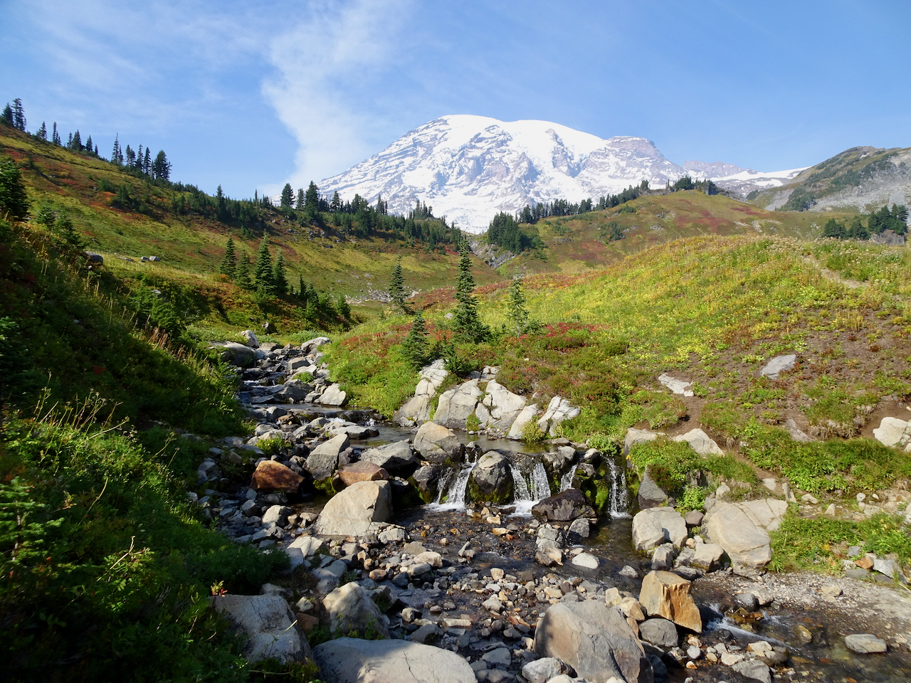
September 29, 2020 – Comet Falls/Van Trump Park
This trail, west of the Nisqually River and Paradise, follows Van Trump Creek all the way up to the stunning Comet Falls, then farther up the slopes to magnificent views of Mt Rainier from Van Trump park. (P.B. Van Trump was one of the first to stand on the summit of the mountain, in 1870). A very challenging and satisfying hike (7 miles, 2500 feet).
Smaller falls near the trailhead.
Trail through the woods.
I first thought this was our waterfall, then continued over the next ridge:
Comet Falls! About 400 feet, counting smaller tiers above and below the main falls. Snow bank on lower right.
With rainbows in the mist!
Our trail continues up, with better views of Comet Falls.
The trail continued upward steeply, into Van Trump Park.
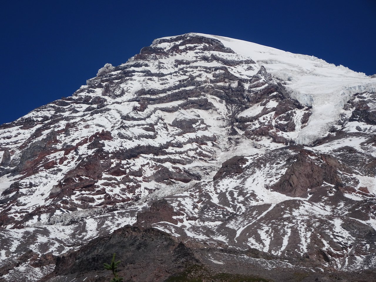
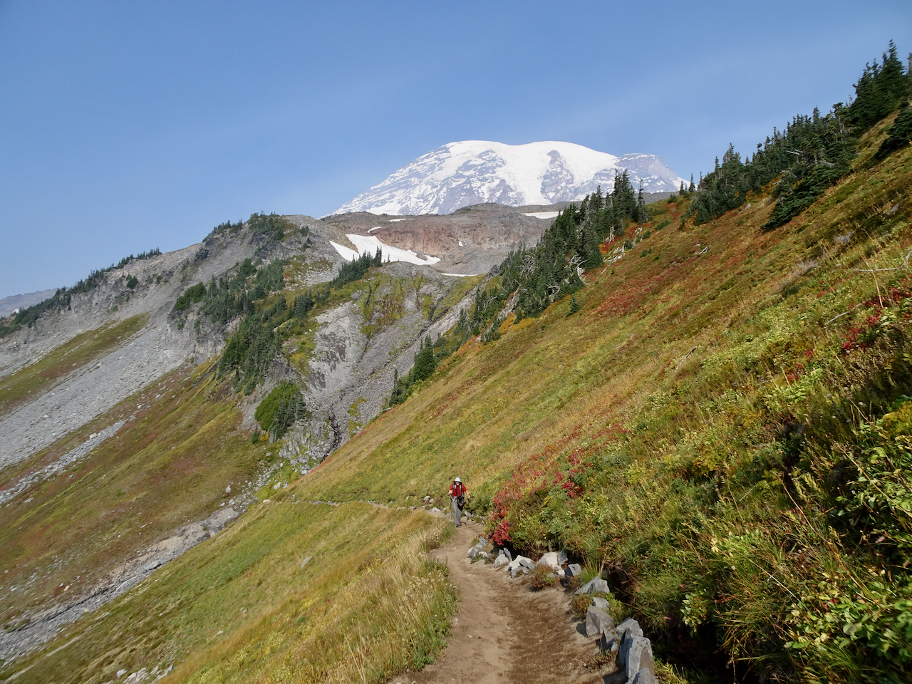
Above the waterfall, the mountain came into view.
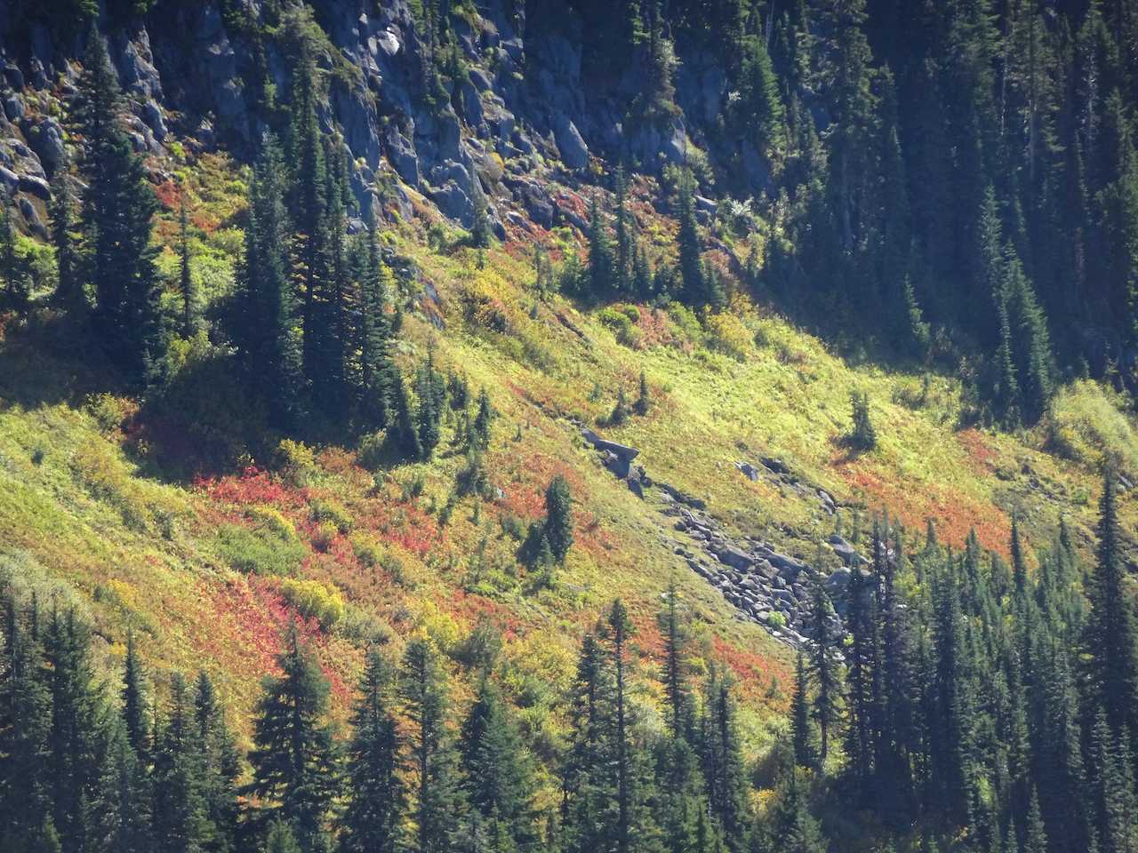
Fall foliage on the slopes of Van Trump Park, glowing red!
Mount Rainier from our lunch stop in Van Trump Park.
Views of the glaciers from a new angle:
The trail down seemed steeper than the trail going up; that might just be my knees talking.
Mt Adams on view beyond the Tatoosh Range.
Glacial striations/polish and Mt Adams.
Uppermost tier of Comet Falls.
A particularly steep trail section.
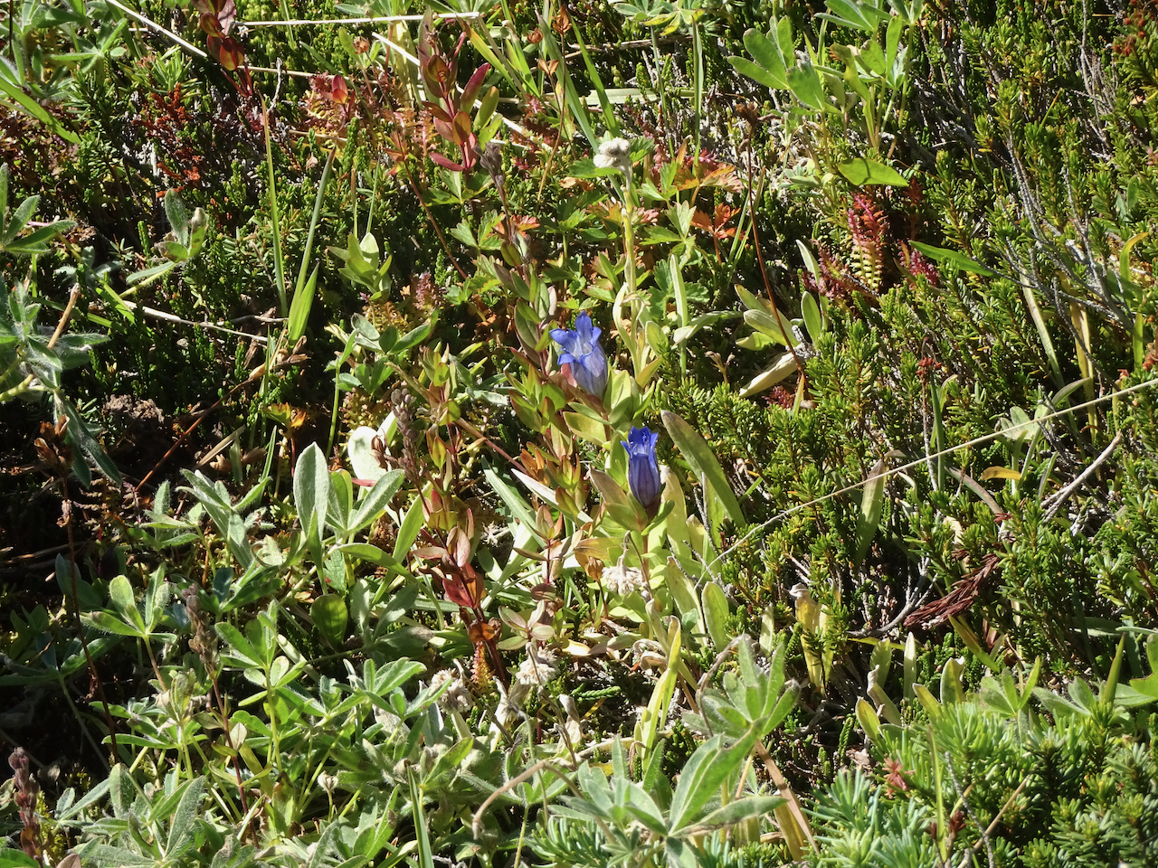
A few late gentians in the upper meadows.
Vine maples just beginning to turn red.
We stopped at a couple of roadside viewpoints on our way out of the park.
Highway bridge over the Nisqually River canyon.
Nisqually River downstream.
We could not resist stopping to see the mirror image in Reflection Lakes.
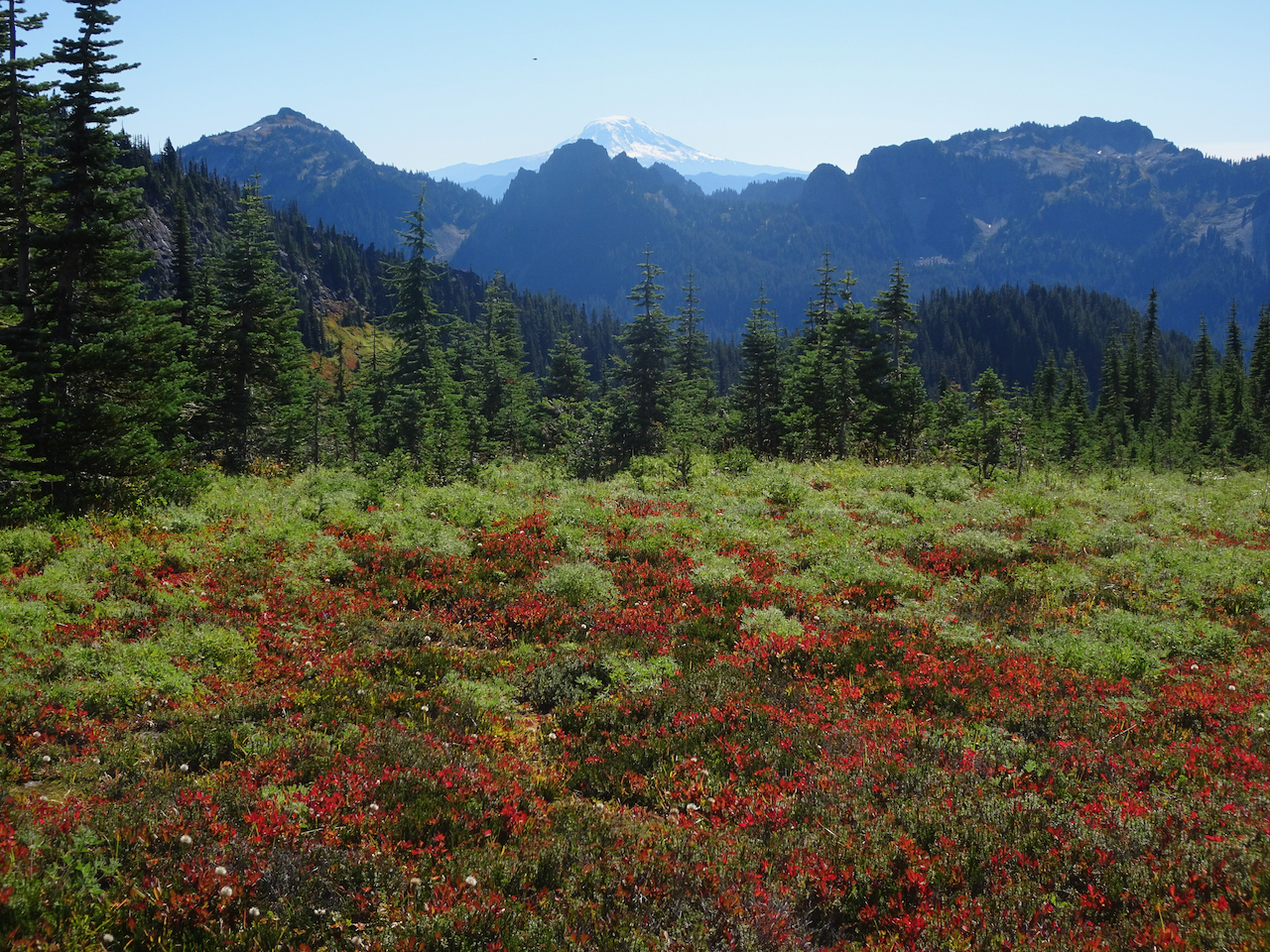
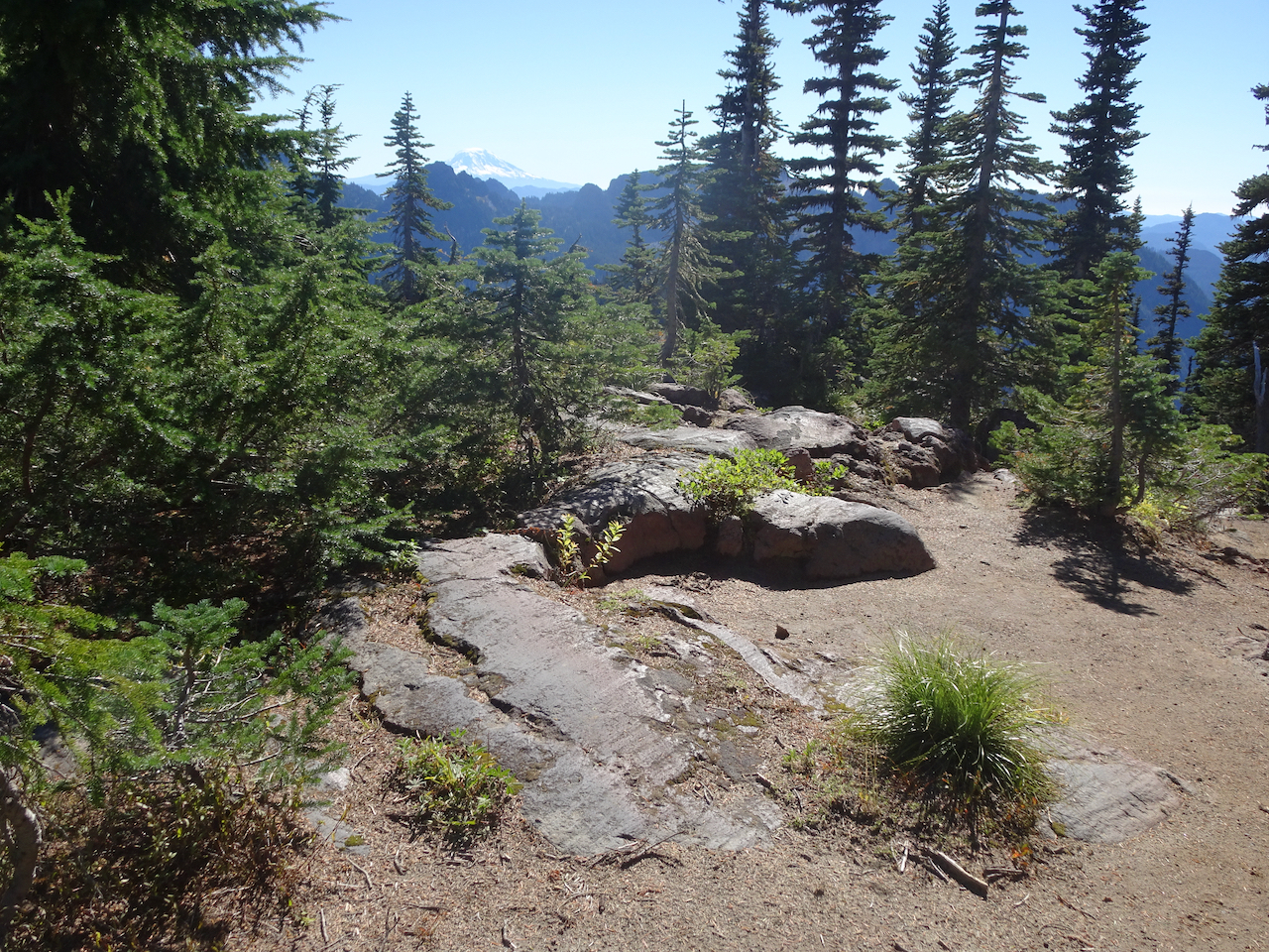
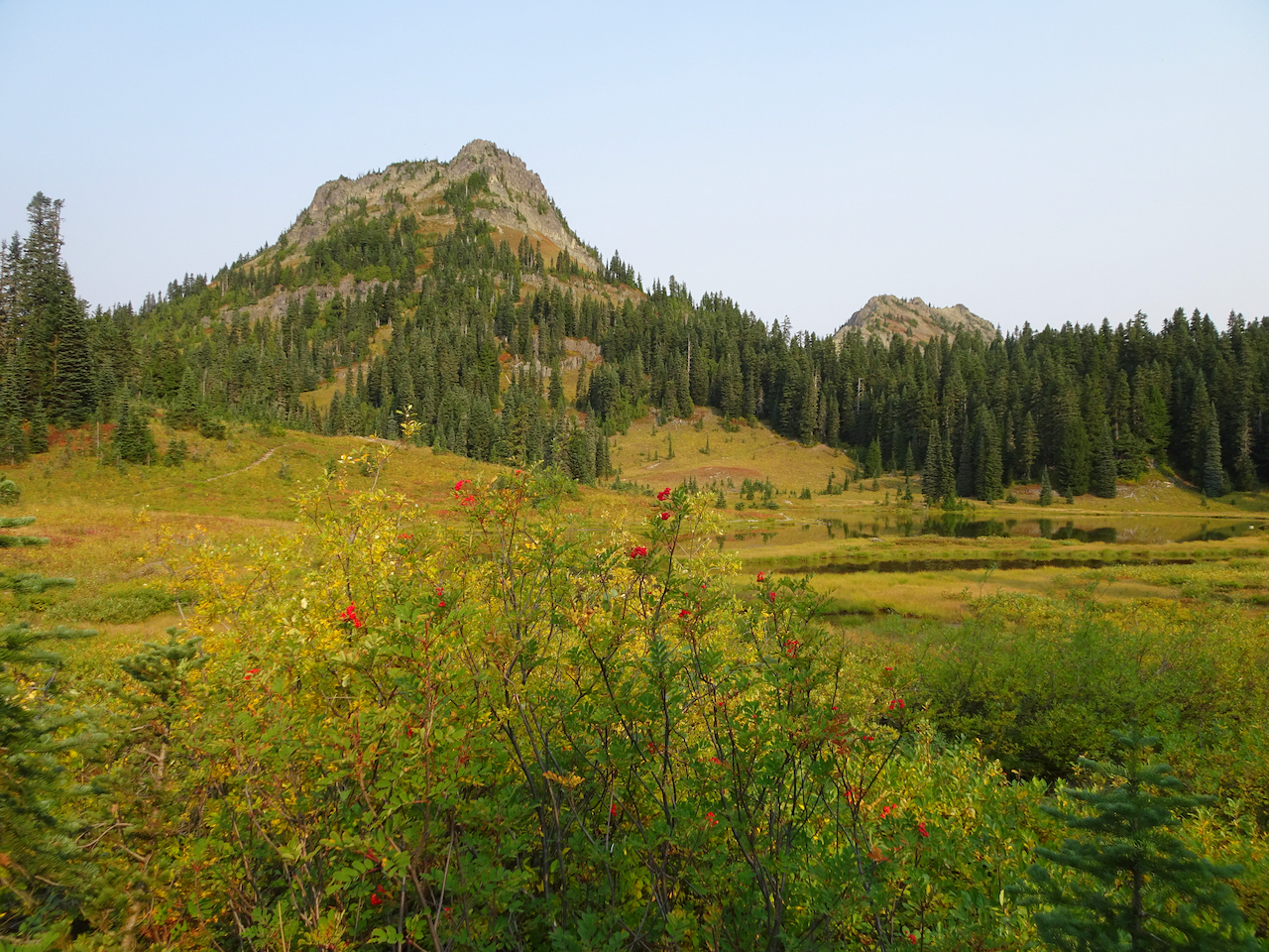
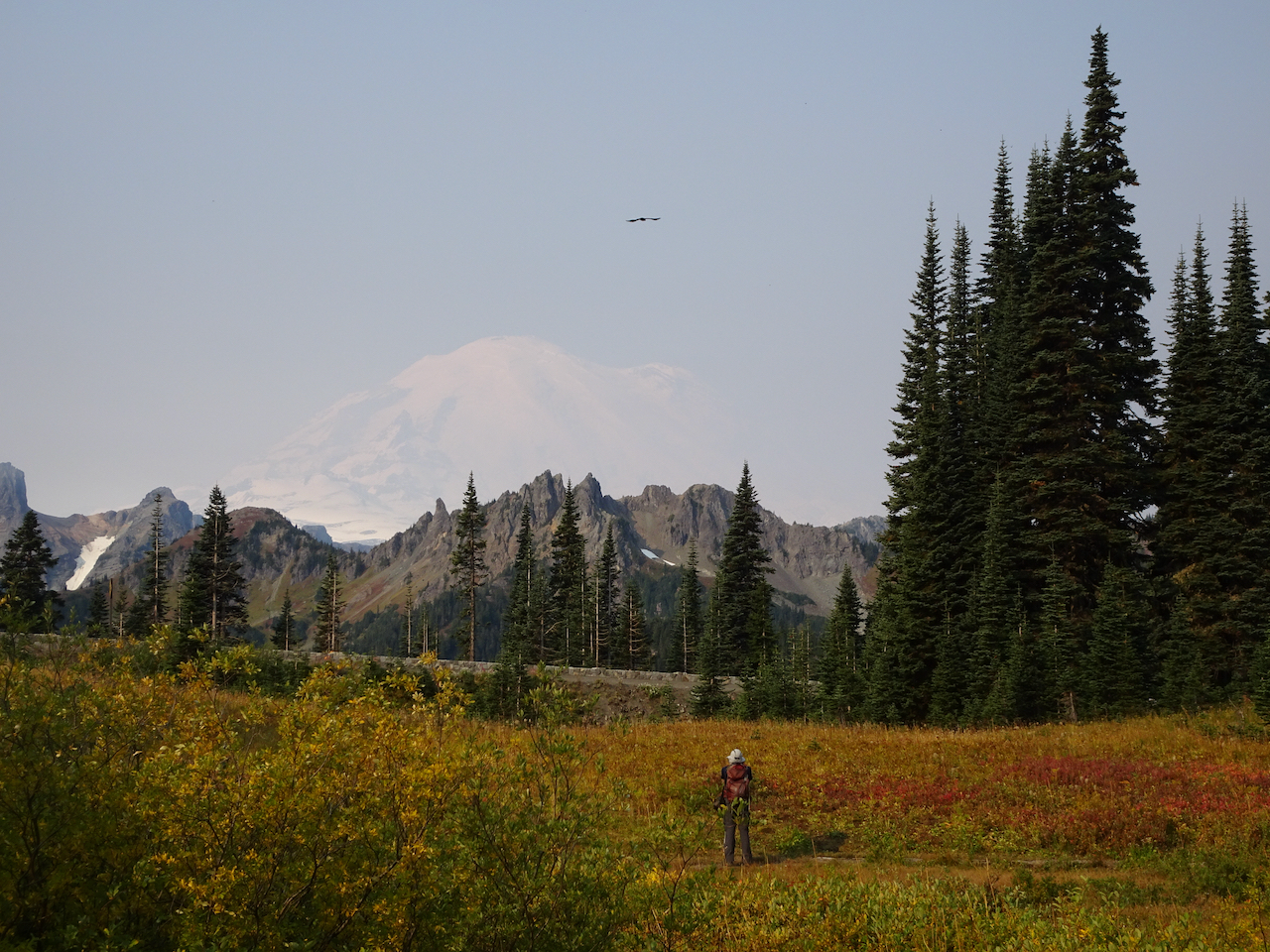
September 30 – Naches Peak/Tipsoo Lake Loop, smoke haze at Sunrise, Silver Falls.
We hiked this loop trail (4 miles, 600 feet), with our views increasingly shrouded in haze. Wildfire smoke began drifting diffusely in, creating a grayish white sky that was so startlingly blue yesterday.
We were almost alone as we walked around Tipsoo Lake, admiring the beautiful reflections in its mirror-like surface.
Tipsoo Lake
Yakima Peak
Mt Rainier, slightly obscured by haze.
Mt Rainier reflected in Tipsoo Lake.
Yakima Peak – our trail rising along its base.
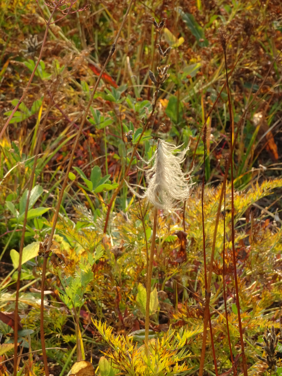
Pasque flower seed head
Meadow of huckleberry and aster seed heads.
Then we hiked the loop around Naches Peak – following the Pacific Crest Trail.
Crossing Hwy 410.
Hwy 410, headed down the canyon, to the east.
A new wilderness area for us!
Trail up over the shoulder of Naches Peak.
Naches Peak.
Looking back.
We passed a small lake with a friendly chipmunk.
Once over the shoulder of Naches Peak, we could see the Dewey Lakes to the southeast as the smoke haze increased.
One of the Dewey Lakes.
The trail circles back west, with stunning views of Mt Rainier when there is no haze, as it passes more small lakes.
Mt Rainier is ahead through the haze.
One of the trailside lakes.
More beautiful meadows!
Mt Rainier disappearing before our eyes!
We stopped to admire Upper Tipsoo Lake near the trailhead before finishing the hike.
Upper Tipsoo Lake.
After lunch we drove up to Sunrise, elevation 6400 feet, but the smoke haze obscured views, so we didn’t stay.
Dotted Blue line shows Mt Rainier skyline behind the smoke haze.
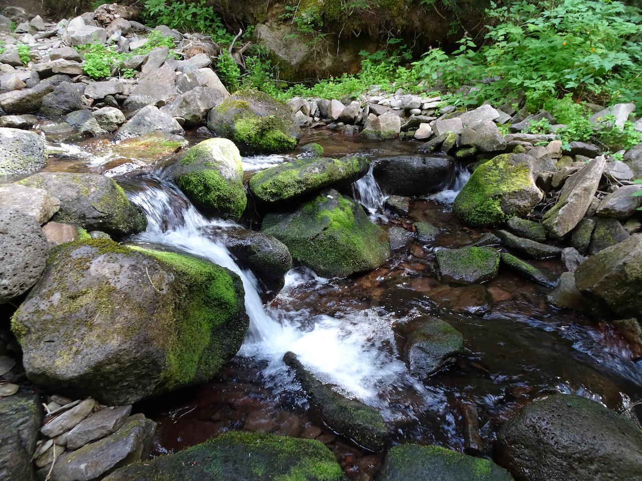
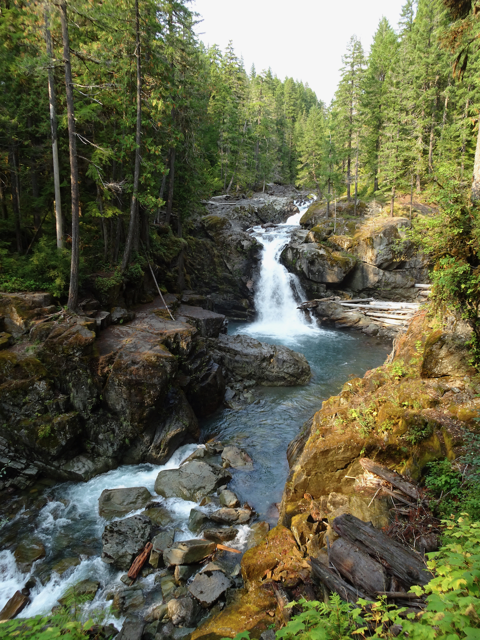
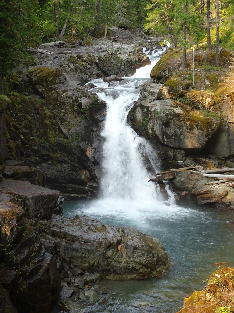
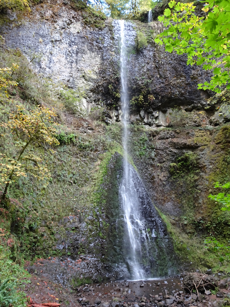
Instead we hiked to Silver Falls, on the Ohanapecosh River, through old and mossy forest, to see clear turquoise waters, and bright falling waters cutting through a slick rock gorge. All in all a lovely ‘recovery’ day from yesterday – the hikes being not so steep. We hope the smoke will blow out for tomorrow.
Small fairy falls in the mossy old growth forest.
Looking down on the blue waters in Ohanapecosh gorge.
Overlook at the top of Silver Falls.
Downstream view of the Ohanapecosh River below the bridge.
Silver Falls.
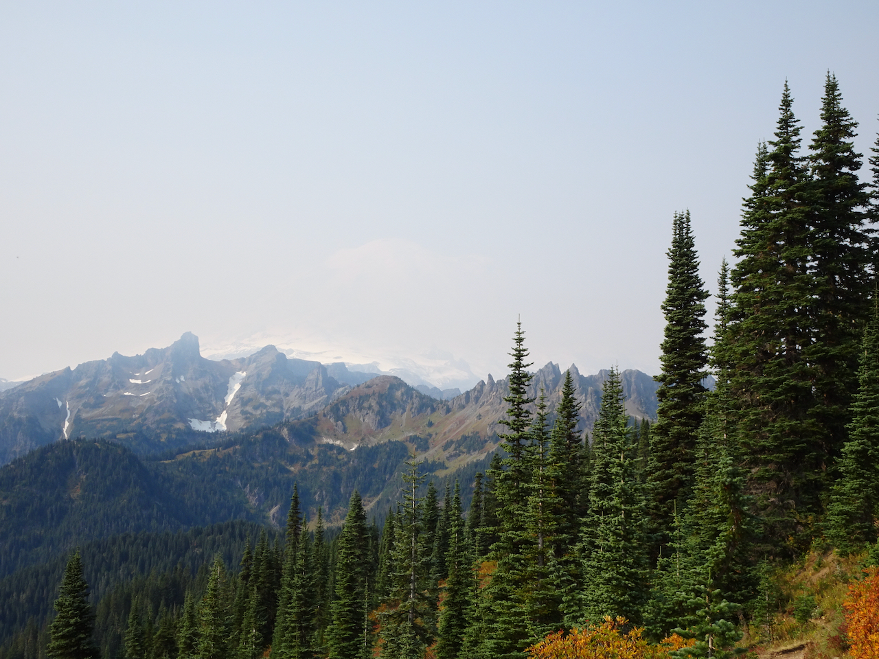
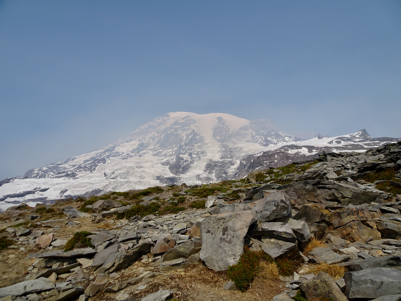
October 1 – Paradise, Golden Gate Trail, Panorama Point
The mountain was ‘out’ behind a thin veil of translucent haze! Smoke would gather throughout the day below us to the south on the flanks of the Tatoosh Range.
View from the parking lot at Paradise.
Iconic gateway to the trail system.
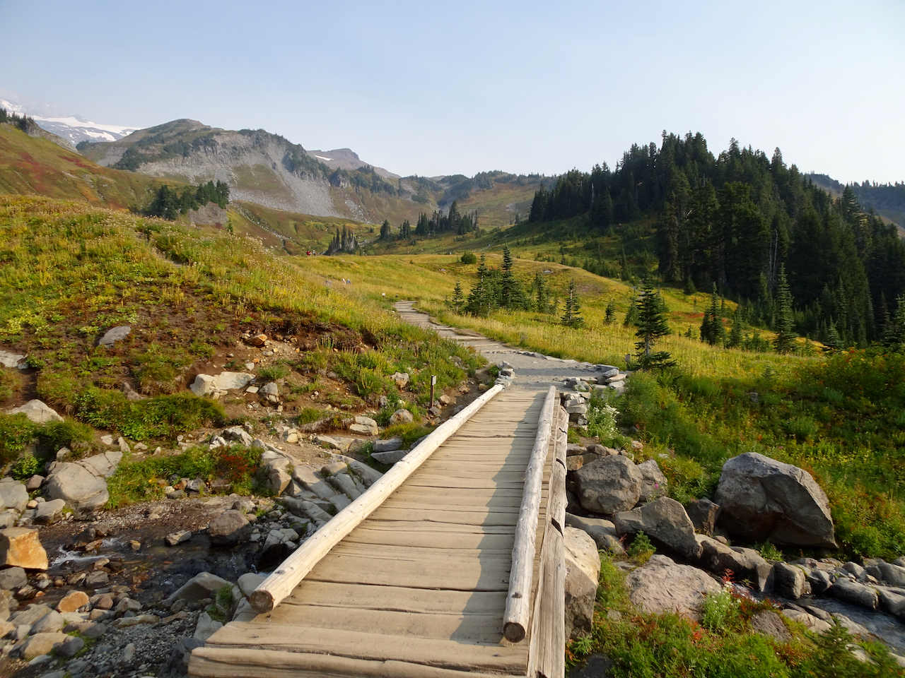
We hiked across Paradise Valley, and up the Golden Gate switchbacks and granite steps, to the High Skyline Trail that circles the valley (6 miles, 1700 feet).
Looking up toward the red huckleberry foliage on Alta Vista, which would be our return trail in the afternoon.
Looking toward the Skyline trail on the east side of Paradise Valley.
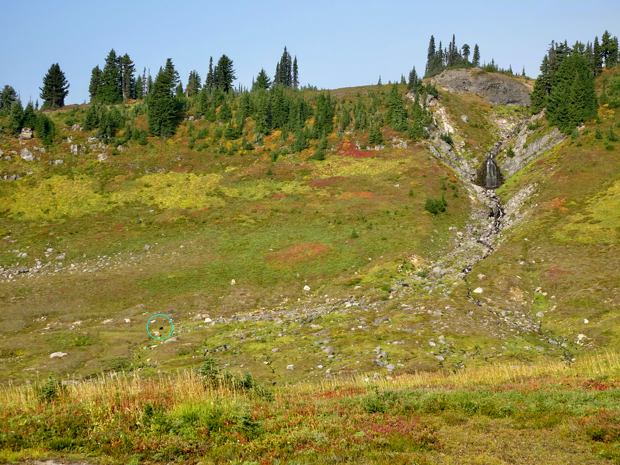
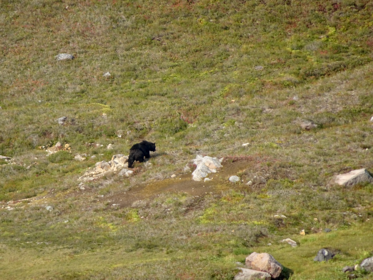
We saw a black bear foraging in the meadows below, and at least eight marmots foraging and nest building on our way up.
While looking across at the waterfall,
I noticed a moving black spot in the valley below.
Black bear.
Marmots along the trail.
The slopes were still green, and full of fading wildflowers with a few remaining blooms.
Switchbacks of the Golden Gate Trail ahead.
Up the last switchback to the Skyline Ridge.
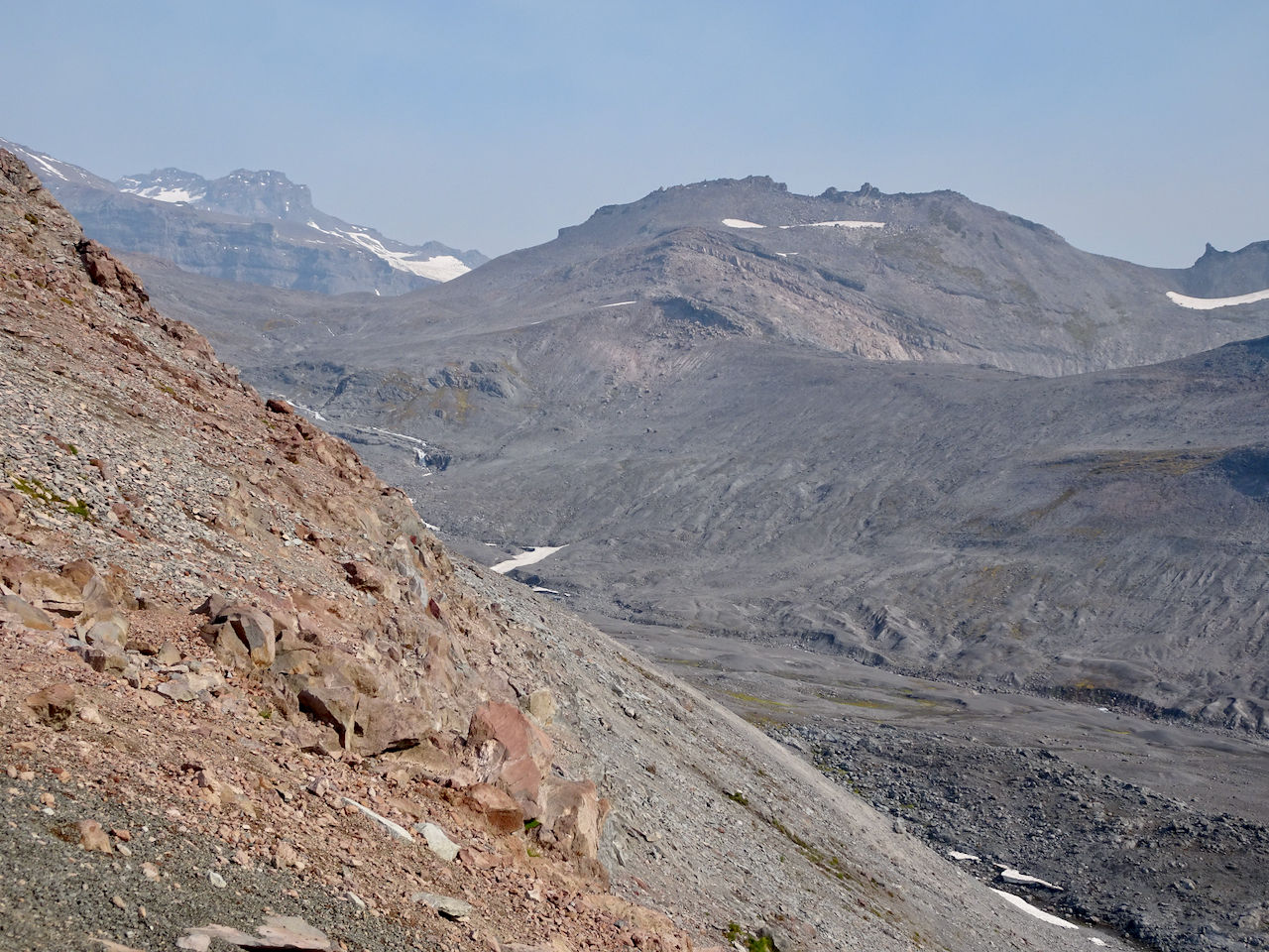
Once to the ridge, stark, glaciated landscape dominated.
High Skyline Trail
A glimpse over the ridge to the east to the next glaciated valley.
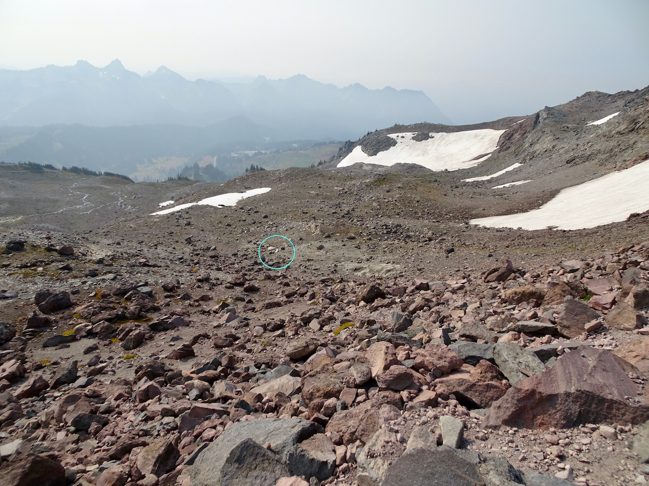
Our destination is around the cirque and above the snowfield – there are tiny humans on that ridge.
Rocky trail.
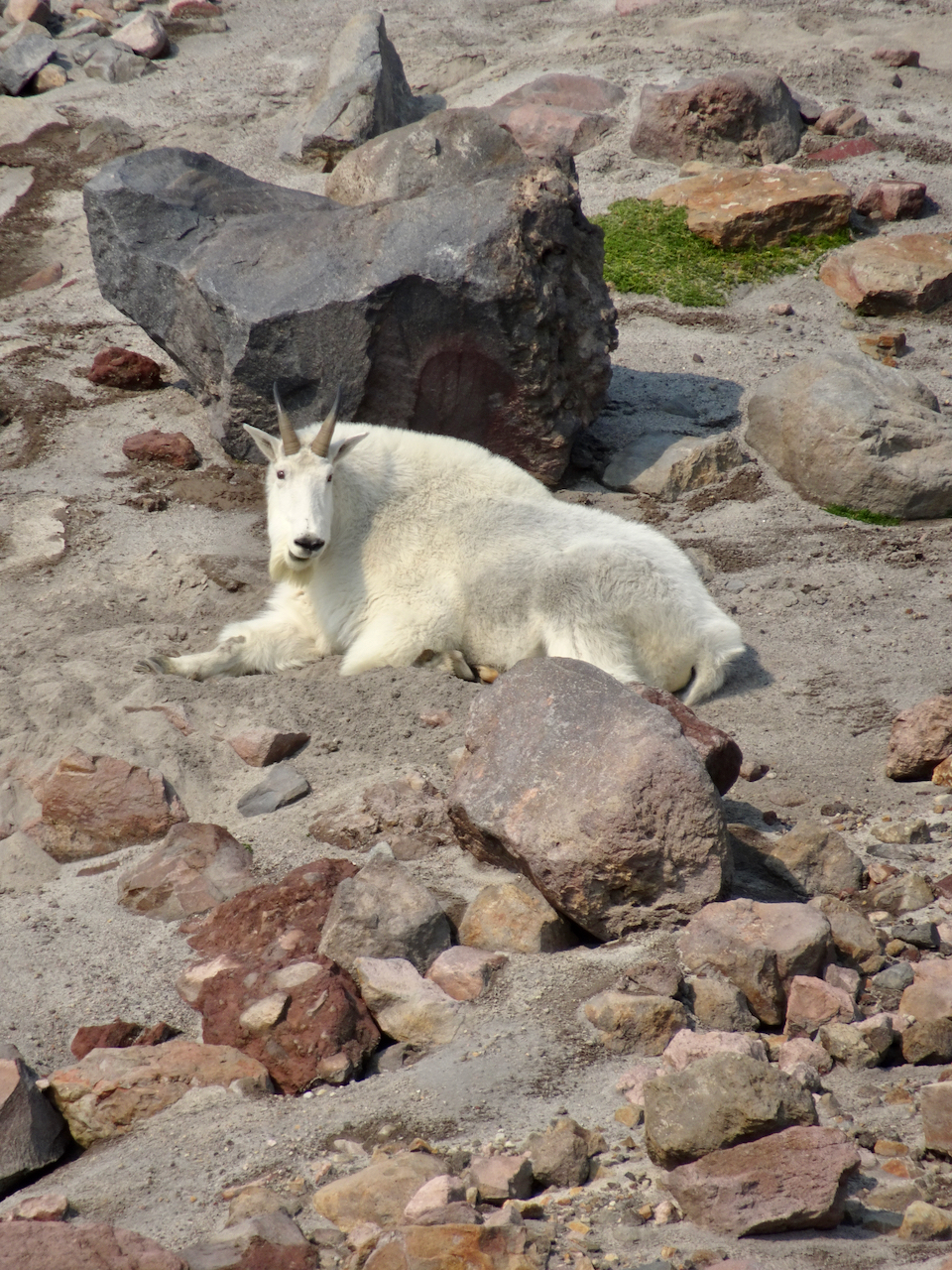
A mountain goat was resting near one of the snow fields in the cirque.
This is the closest we would get to the mountain goat (to the right of the snow field).
Mountain goat, zoom lens.
Looking down on the mountain goat after we climbed higher.
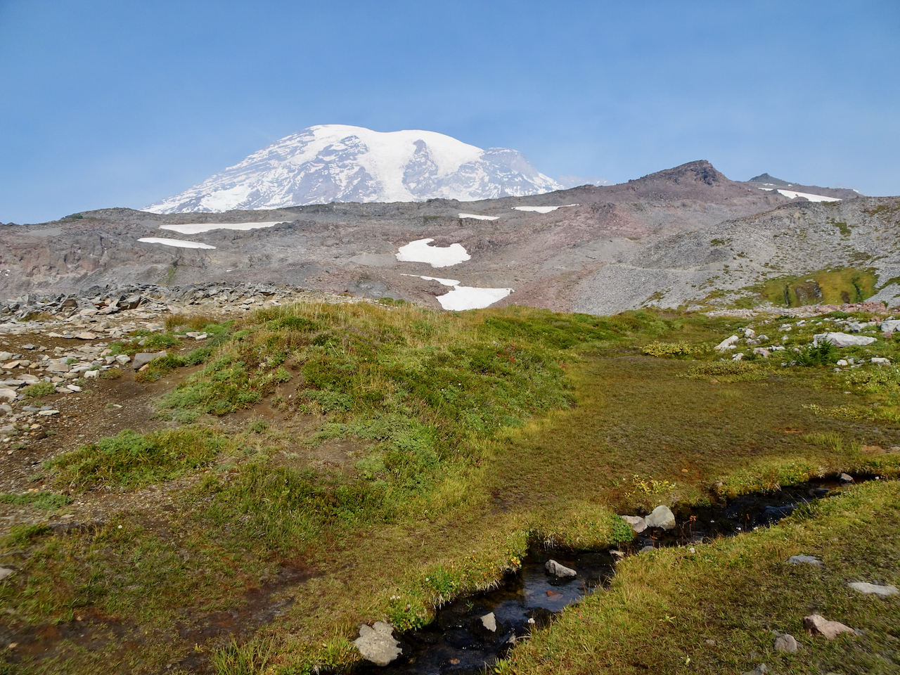
Over the rocky top above Panorama Point, near Pebble Creek, we sat on the rocks and ate our lunch with a full mountain view: 7000 feet of vertical relief, glaciers and sculpted rocks. We heard an occasional boom as something up there, heeding gravity, fell.
Lunch view.
Chipmunk on the rock.
Glacier close-ups.
We made our way back down the steep granite steps, past Panorama Point and more glacier views.
Heading down to Panorama Point.
Panorama Point, with views in all directions:
East, where we have been.
South, toward our starting point, and the smoky Tatoosh Range.
West, to our downward trail and the Nisqually Valley.
Continuing down…
Rocky steps to Glacier View.
We saw one late pasque flower in the meadow.
The bear was still roaming in the valley below.
We crossed through the brilliant red huckleberry foliage on the flank of Alta Vista.
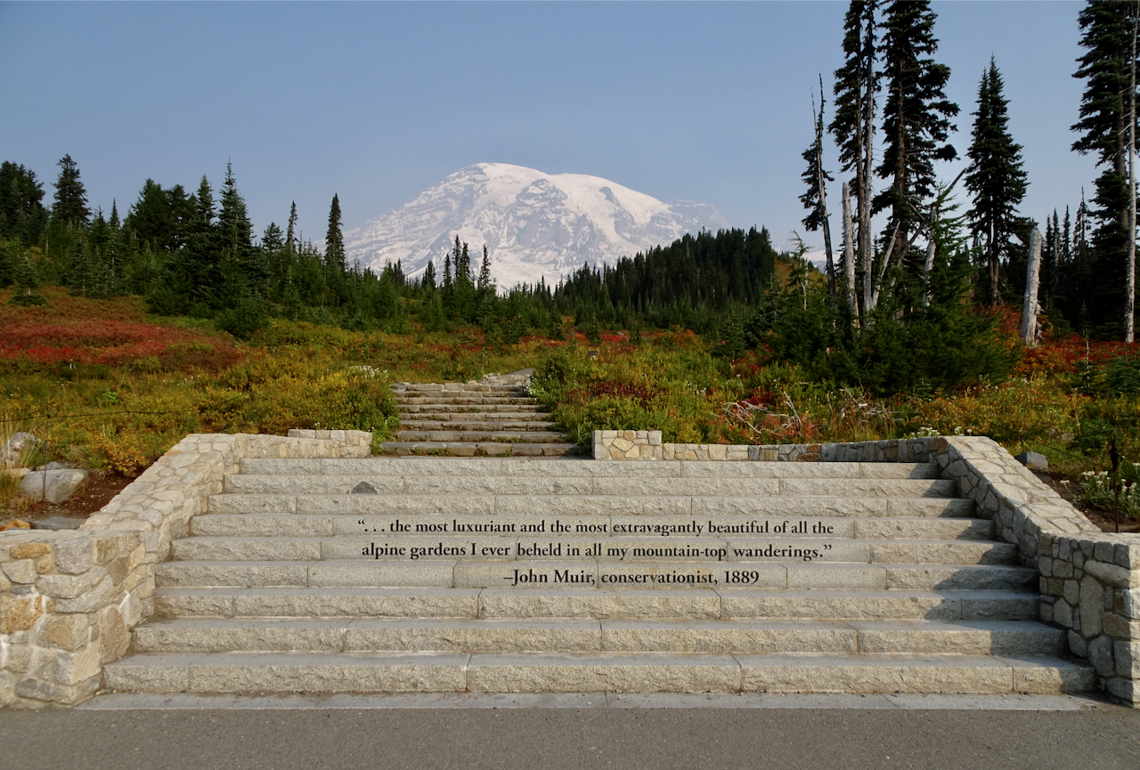
After a last stop at Edith Creek and Myrtle Falls, I was done walking for a while. My legs were tired, my cup full! I have to agree with the sentiment carved in the steps at the trailhead. This is one of the most beautiful places I have been. I feel so lucky to have seen it in the fall!
Myrtle Falls
Edith Creek
This hungry deer near the trailhead paid no attention to the people taking his photo!
Rio Calina Cowl – getting longer, and I might just make it into a long scarf instead of a cowl.
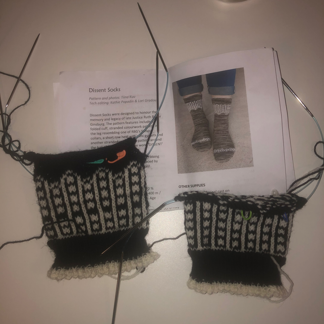
Dissent Socks, in honor of Ruth Bader Ginsberg – I’ve finished the ankles – on to the heels!
Walks around the neighborhood,
New signs, whimsy, architectural elements:
Mural
Gnome and spaceman
Rain chain and shadow
New sign
Window critters
New signs
Eave pig
Garden gate
Winding stairs with turret
Fall colors evolving…
I have been hunting witches and other Halloween displays, to be shared in a later post.
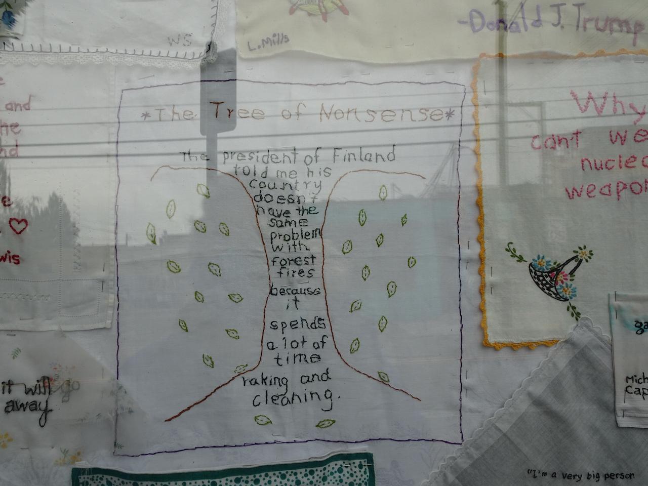
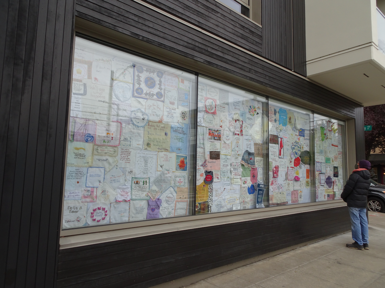
Portland Textile Month, Tiny Pricks Art Installation
We visited the exhibition window to see the stitchery, made by artists who embroider a quote onto a vintage textile as a form of protest. It is not how I want to spend my crafting time – but I was glad to get a chance to see a small sampling of the thousands of pieces that have been contributed to this crowd-sourced artwork.
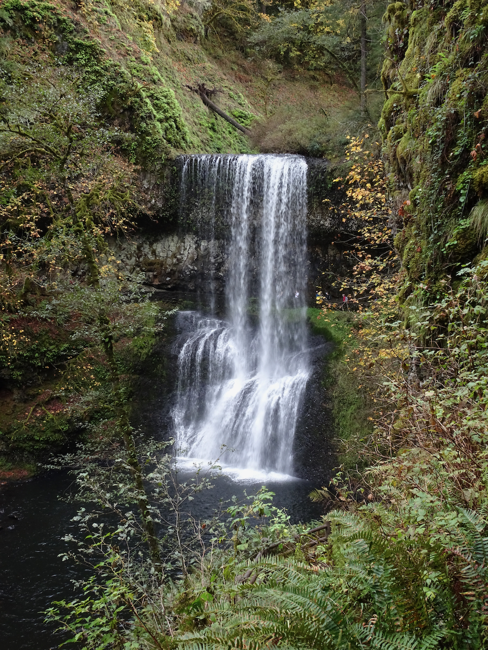
Silver Falls State Park
October 19th – We hiked the 5 mile waterfall loop. It was hard to relax and enjoy the scenery – there were a fair number unmasked, seemingly Covid-protocol-oblivious hikers. We cut our day shorter than usual. The waterfalls are always beautiful, and the light streaming through the yellow big leaf maples enchanting.
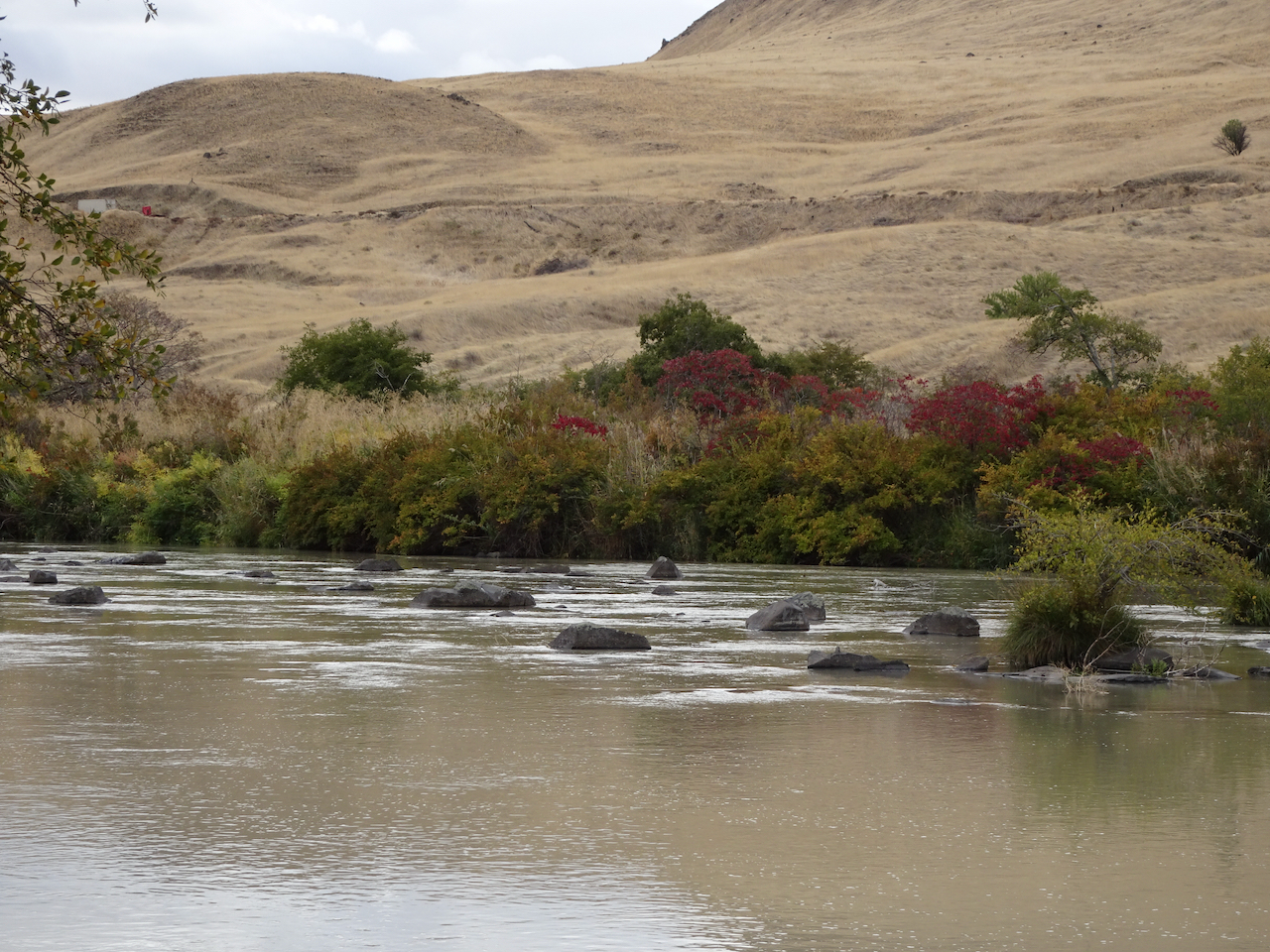
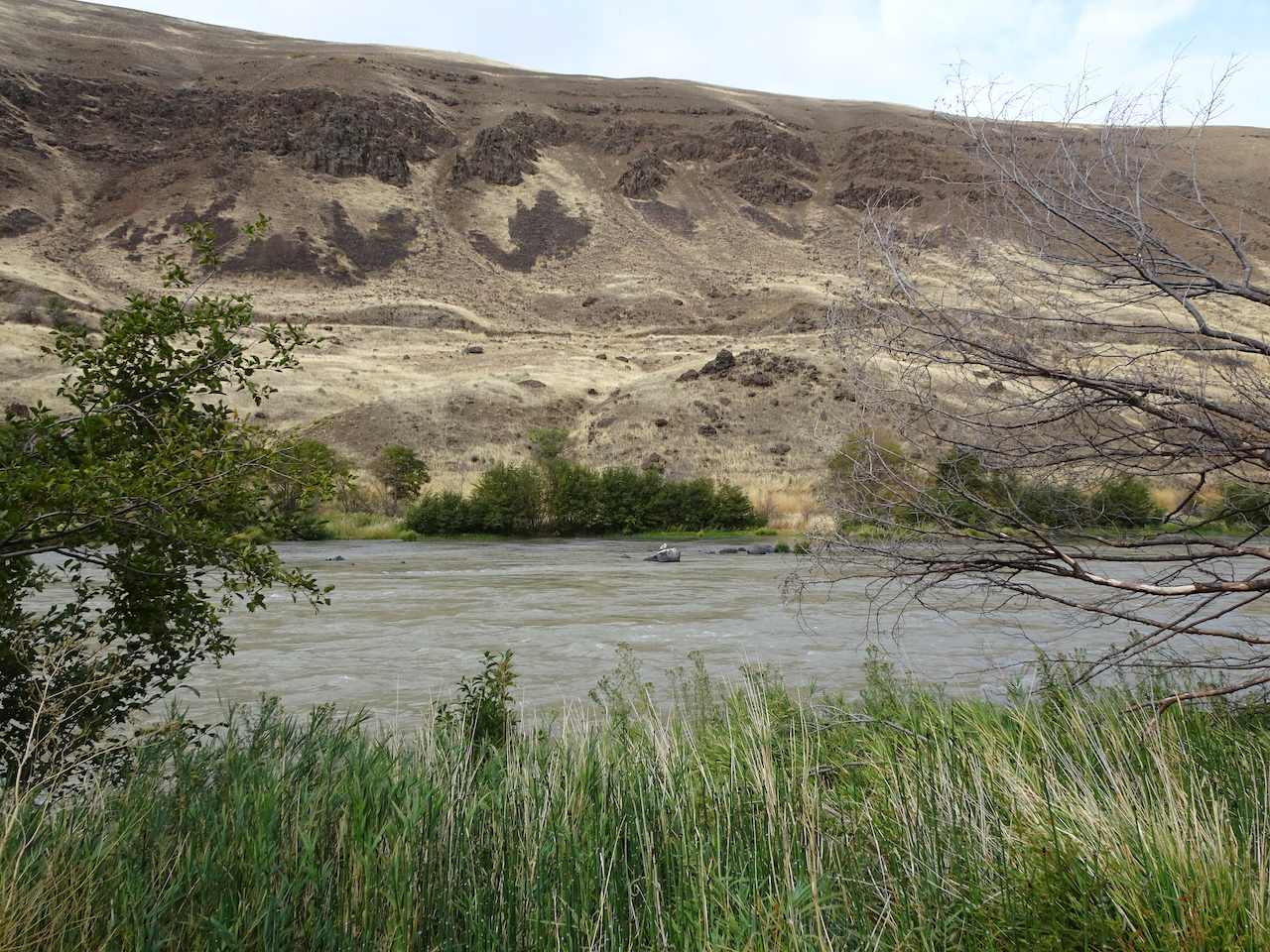
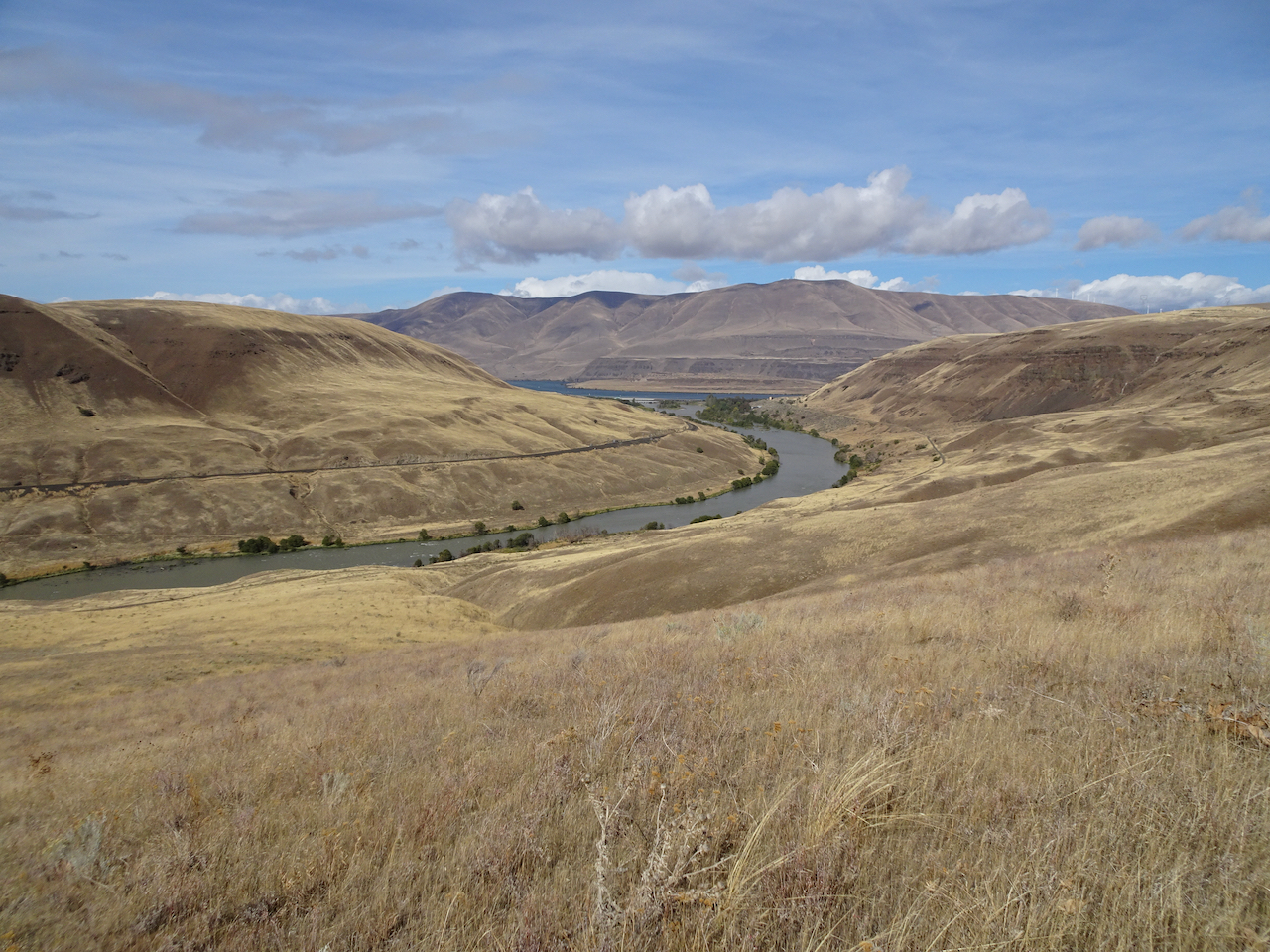
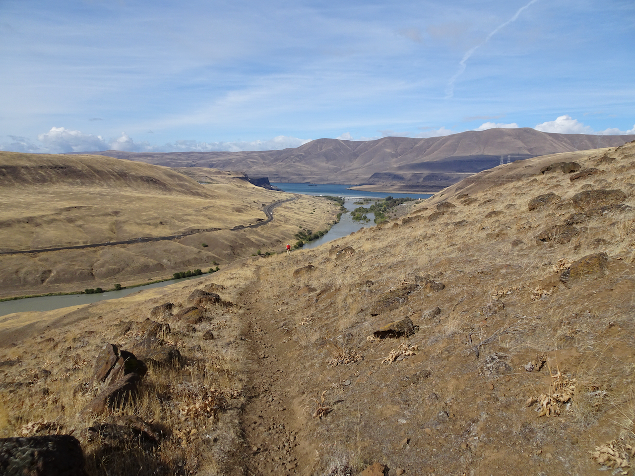
Deschutes River trail, a smattering of rain, it feels like walking through a purifying mist, and there’s no Covid out here.
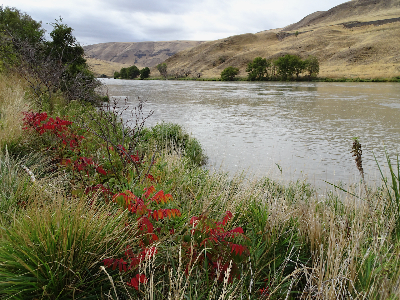
Deschutes River
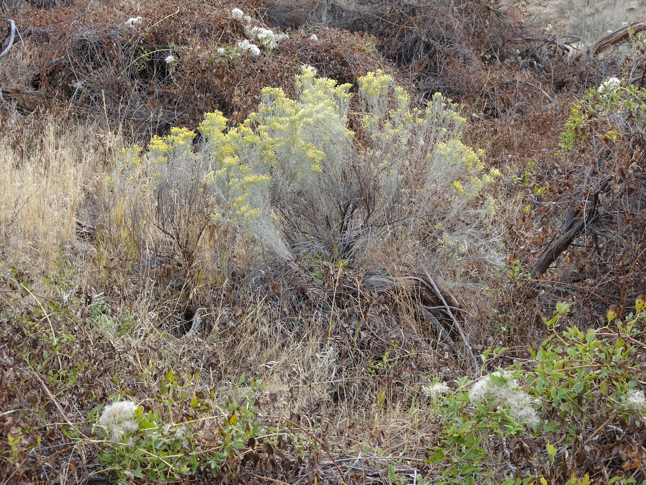
Rabbit brush
Sumac along the trail
Sumac
Raindrops on leaves
Raindrops in the creek
A place to rest
Burned tree from 2017 fire
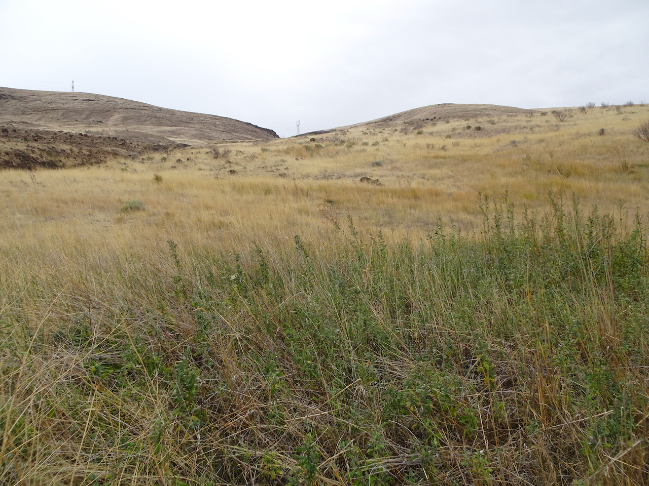
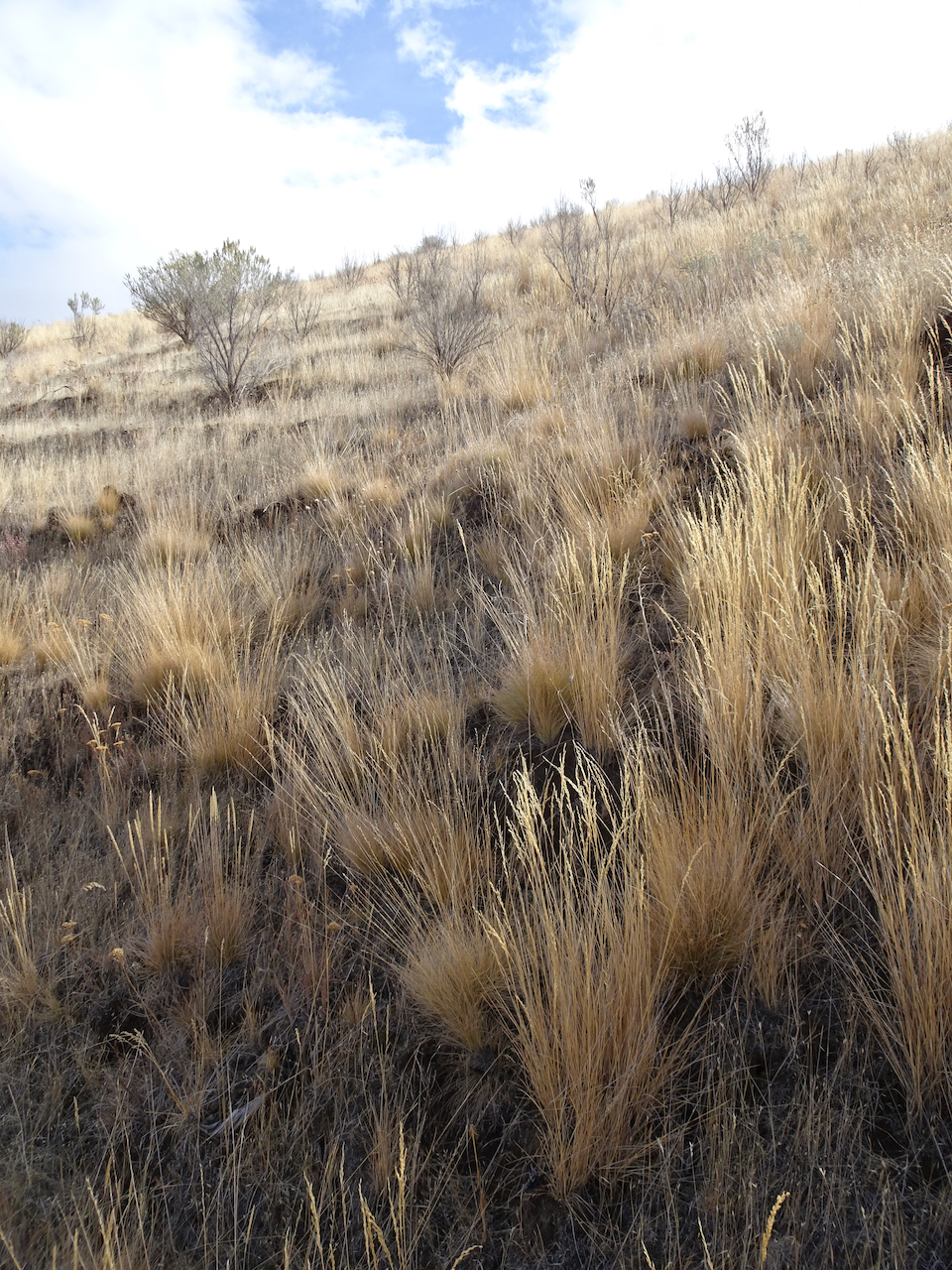
Golden grasses
I could be wrong, we have passed a few hikers, anglers, a hydrologist; there are boats on the river, workers on the railroad across the river, campgrounds and powerlines nearby.
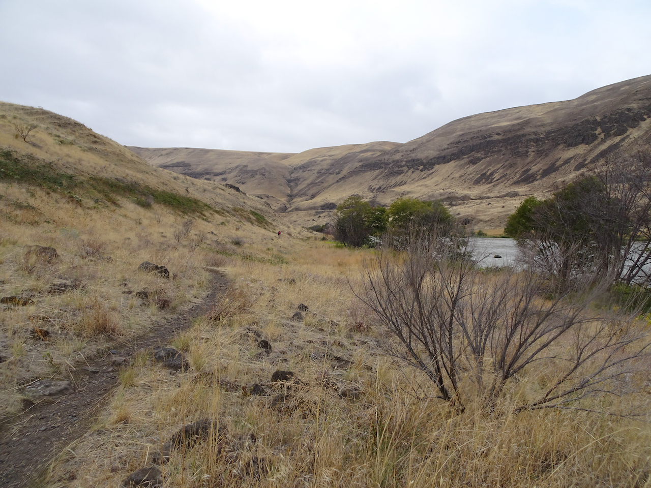
Looking uphill to the east.
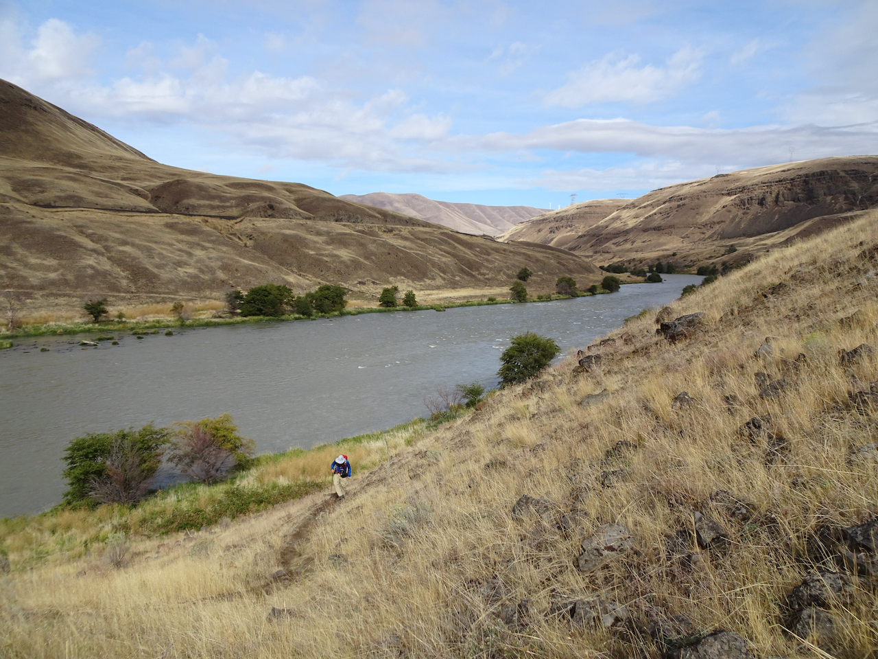
Our trail continues south, upstream.
Columbia Hills to the north.
Rocky cliffs
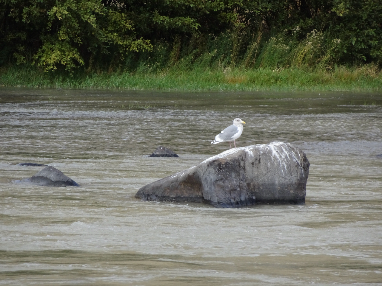
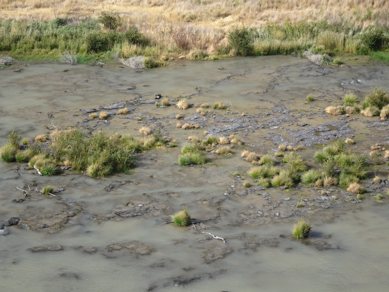
Seagull in the river
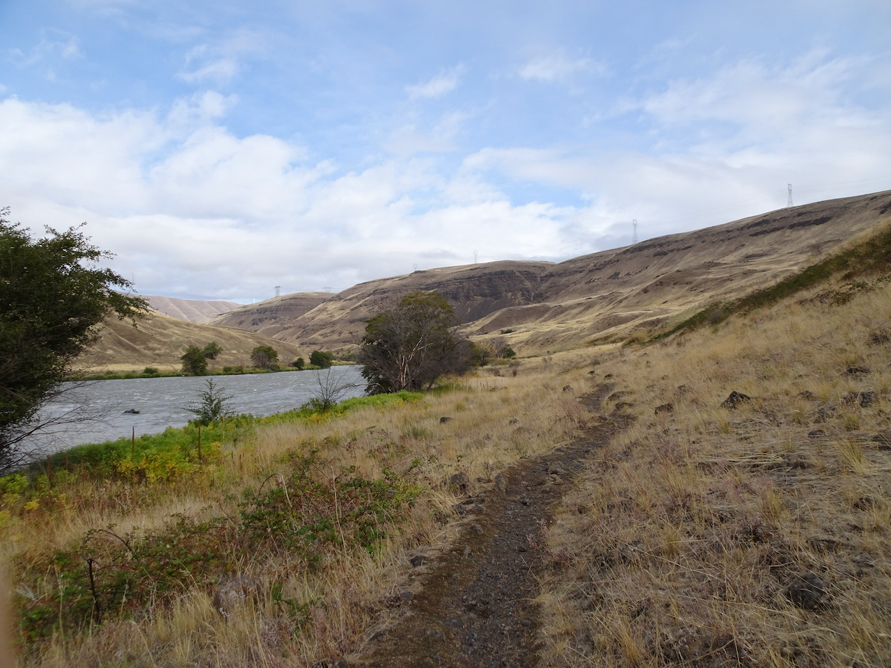
Maybe because in this low desert landscape, with golden light on the black cliffs and the dry grass of late summer, I feel like I can really breathe out here; the scent of the high desert, and a smattering of rain only enhancing the sense of free fresh air.
Climbing up the cliffs..
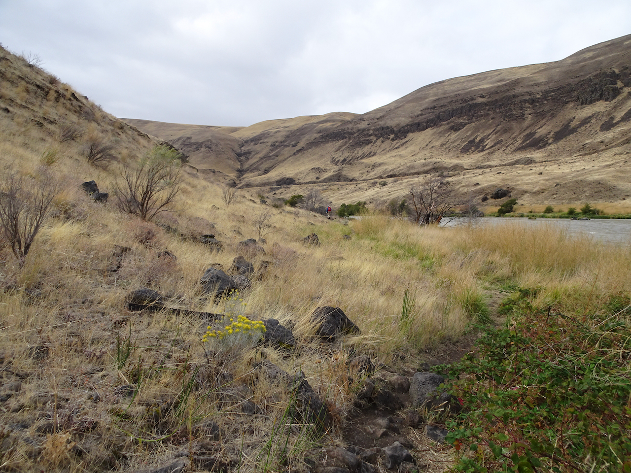
Golden grasses
Lunch view north.
Looking down at the river from our lunch stop.
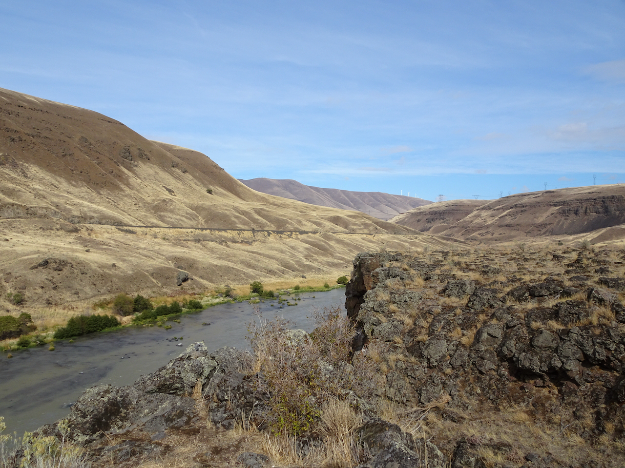
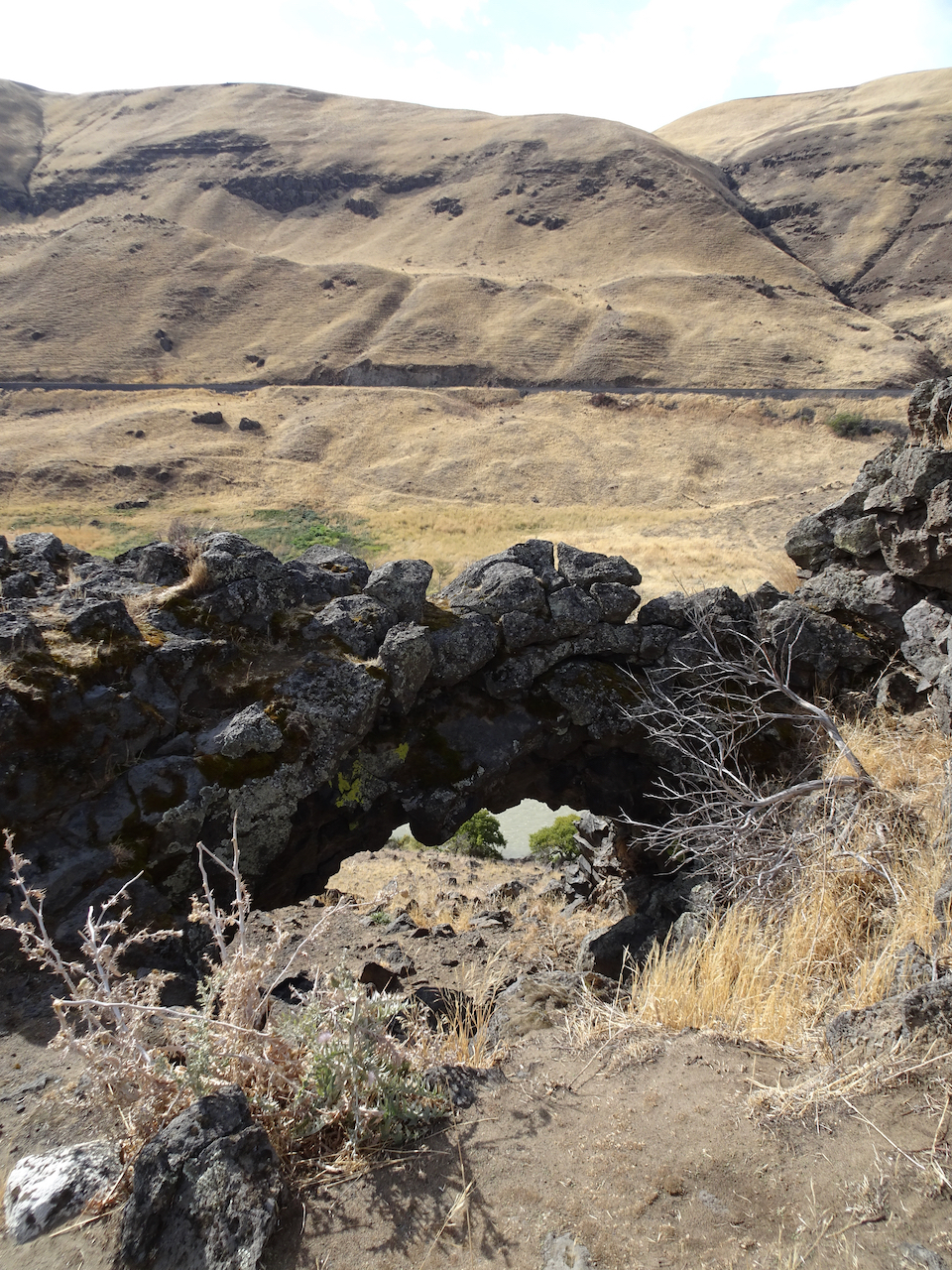
Looking down to the river through the rock arch.
Up on the hill now after lunch, golden and desolate views of the rivers, views of the black volcanic rocks that used to enclose cascading waters of Celilo Falls, cascading waters that used to have salmon leaping up them every year, salmon leaping up into the nets of the Celilo people, before the dam.
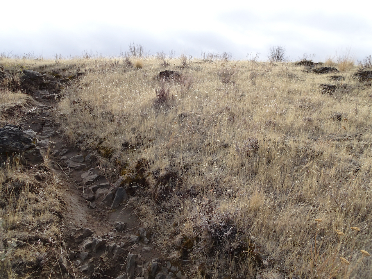
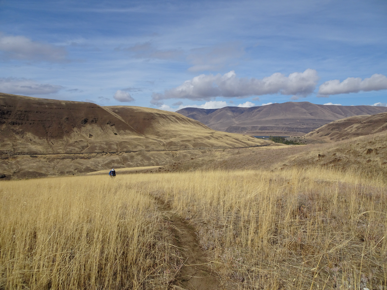
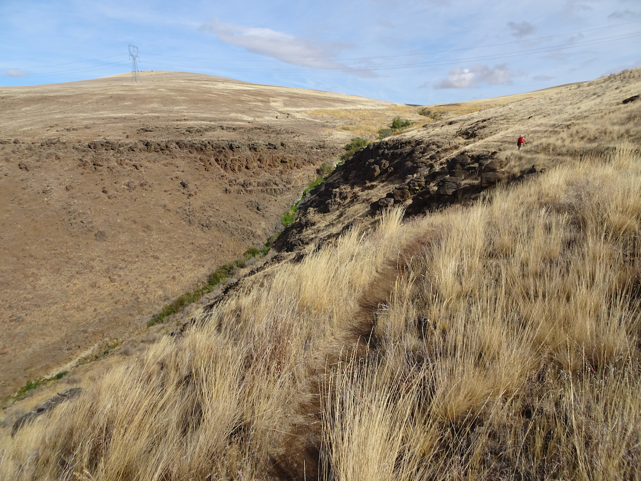
Ascending the hills.
Closer view of the Deschutes/Columbia Confluence
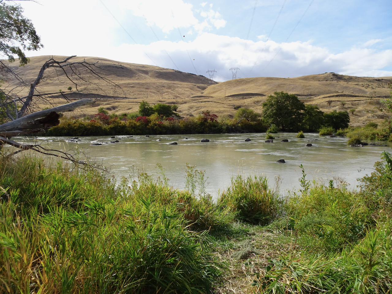
Windmills on the hills, power transmission lines to the dam, cell towers, highways, train tracks, campgrounds, and yet I feel alone on this golden hillside.
Golden grasses
Dried balsam root will bloom bright gold in spring.
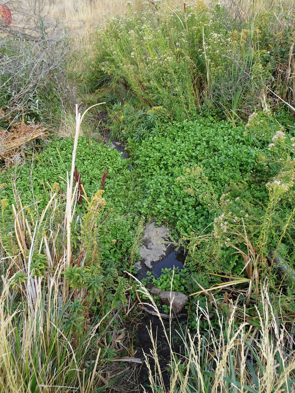
Approaching the upper Ferry Springs crossing.
Ferry Springs
I feel alone even though the powerlines are buzzing above us, the powerlines are transmitting the thoughts and bytes of millions, and yet I feel blessedly alone.
Its all downhill now to the trailhead.
Dry waterfall and power lines humming above.
Back down to river level, with power lines.
I’m not really alone of course – hiking with Dan, in a respite from the city; the desert is a place of wide open freedom – harsh, spiky, dry, rocky, steep, prickly; hidden hazards beyond each cliff, under every rock, yet wide open above, on an autumn day, I am lucky to be here, to be breathing freely.
blanket flower
horsetail
thistle
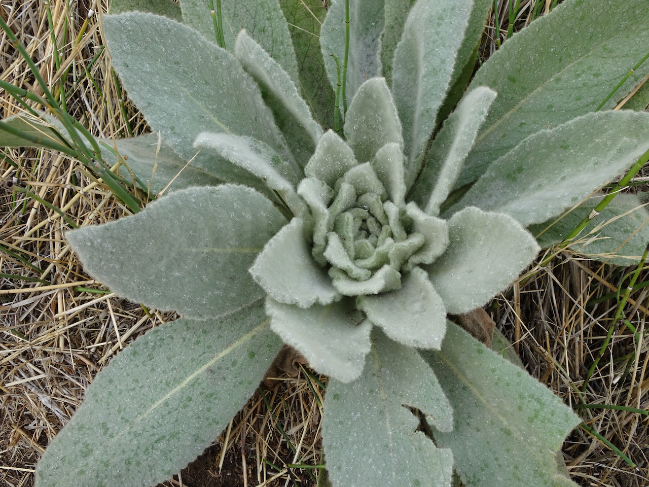
snow buckwheat
sumac
preying mantis
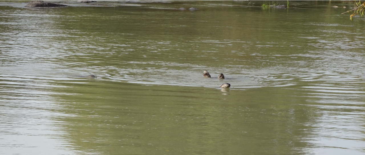
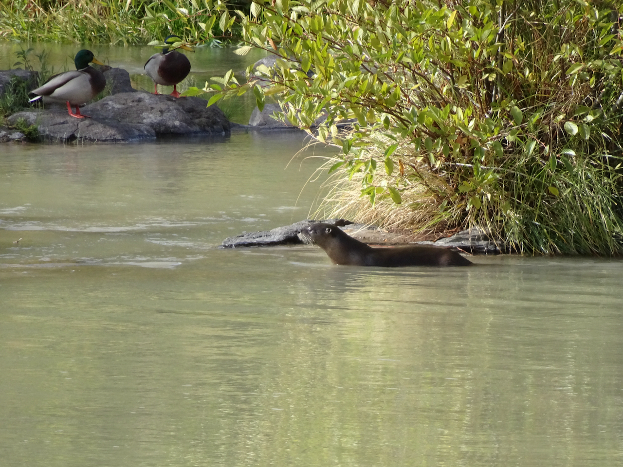
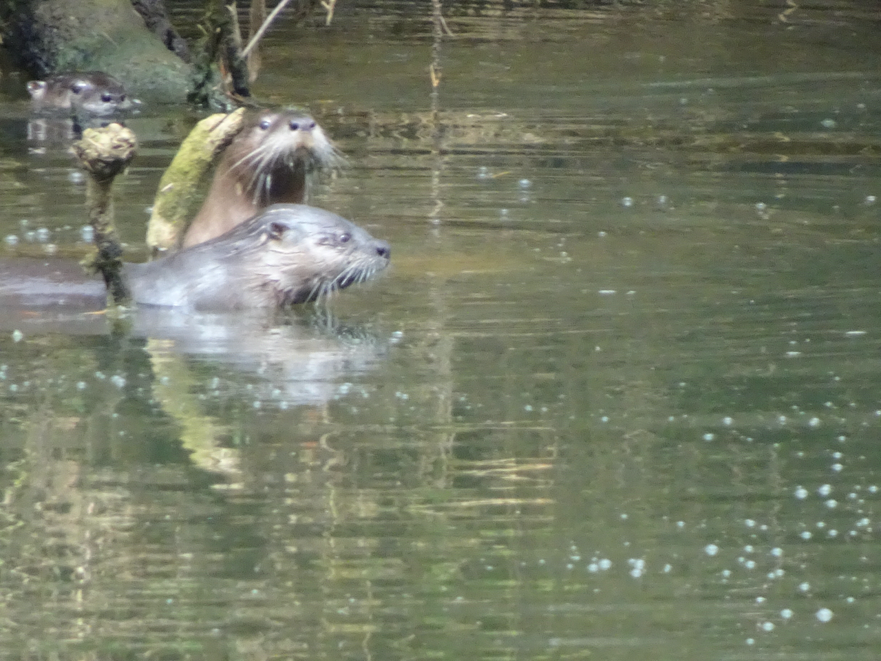
Bonus content: More River otters! There were six otters playing in the river near the trailhead –
River otters
River otters and ducks
Celilo Falls, Salmon fishing, before the dam:
“Courtesy of the U.S. National Library of Medicine”
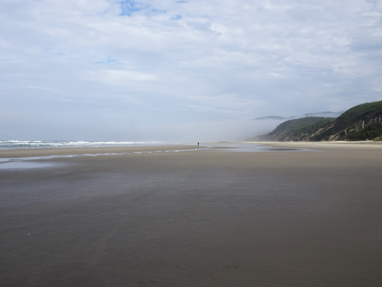
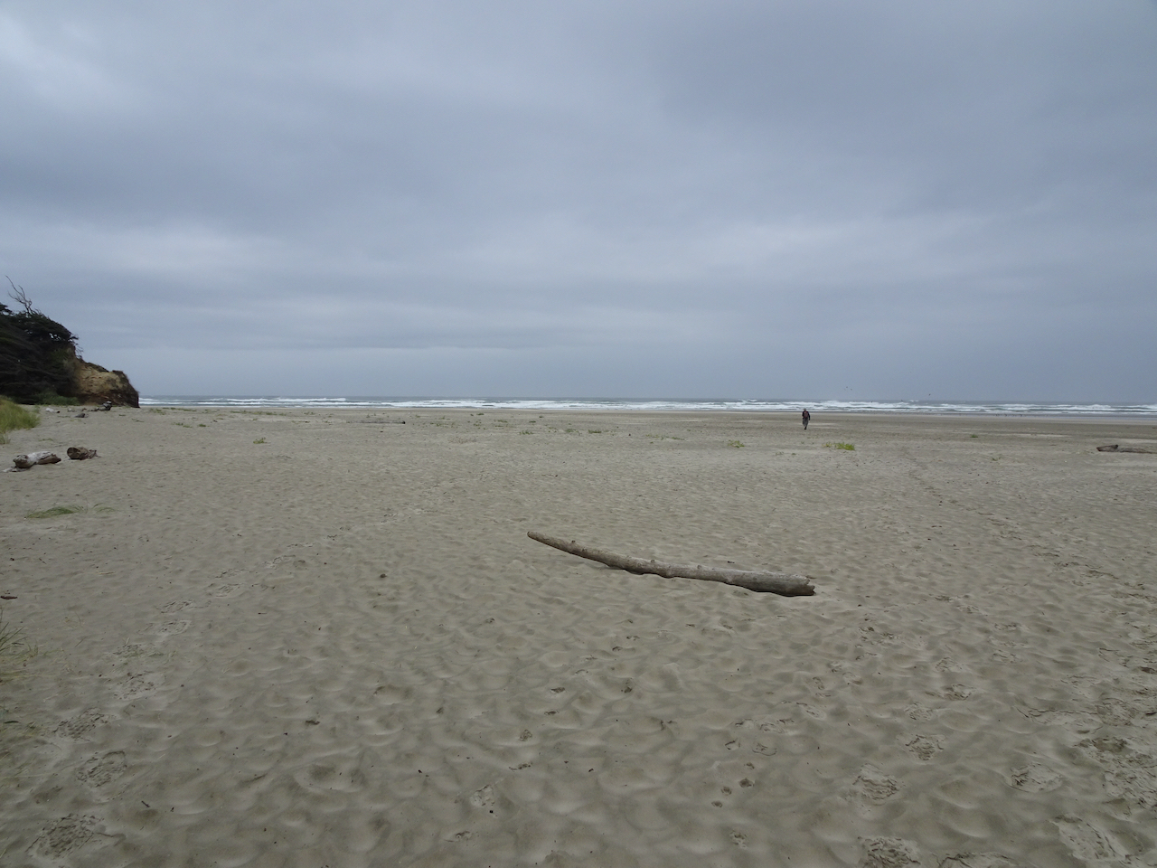
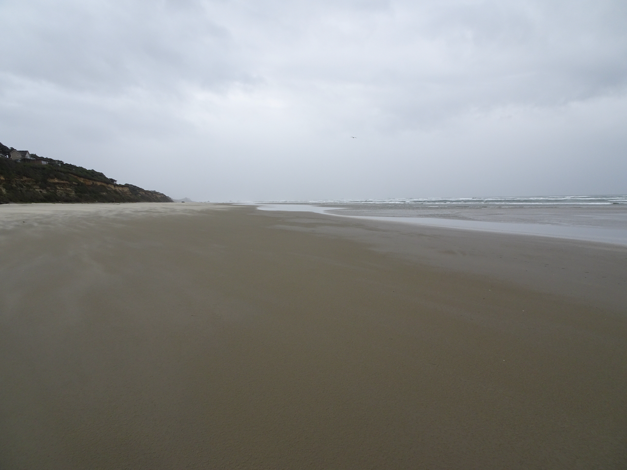
We were able to reschedule our planned trip to the central Oregon Coast until after the wildfire smoke cleared out. We stayed in a hotel, brought our own food, and walked on the beaches and trails, following all the covid-safety protocols. Many of the parks and trails along the coast were closed due to the recent windstorms and wildfire smoke event, or due to Covid precautions. But all of the beaches were open for walking.
Central Oregon Coast, and places we walked on our trip.
Sunday, September 20th
Yachats, Oregon
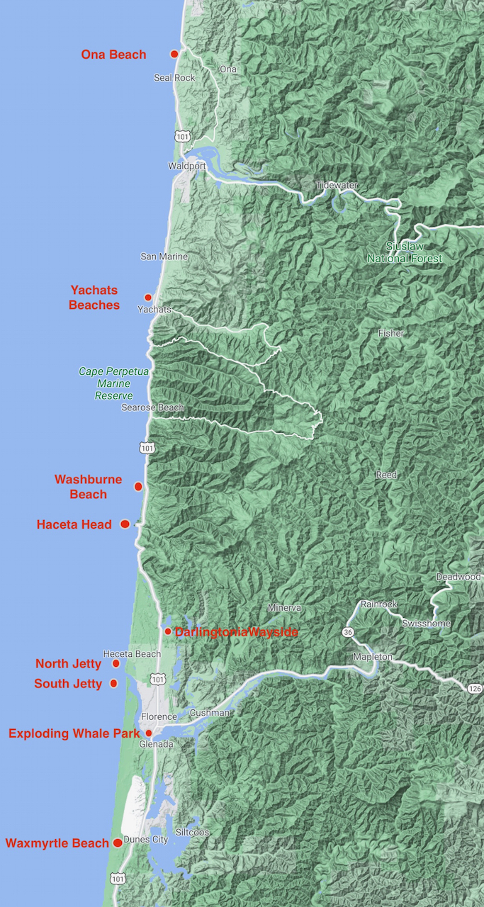
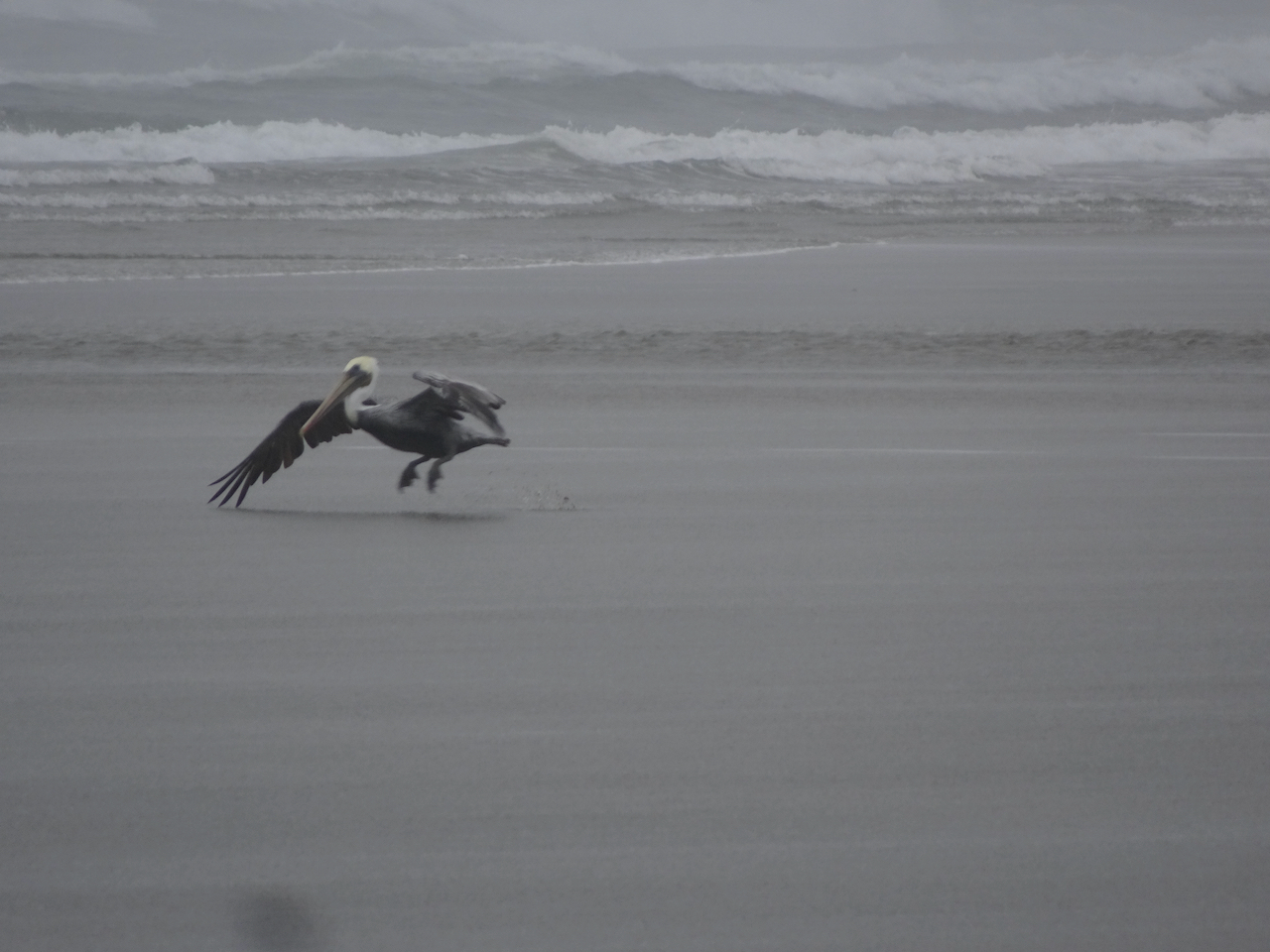
We arrived in Yachats in the evening, in time to walk along the rocky outcrops near our hotel as the tide was receding, and watch a lovely sunset, with pelicans and gulls.
Yachats sunset
Pelican
Yachats sunset
Pelican peleton
Monday, September 21st –
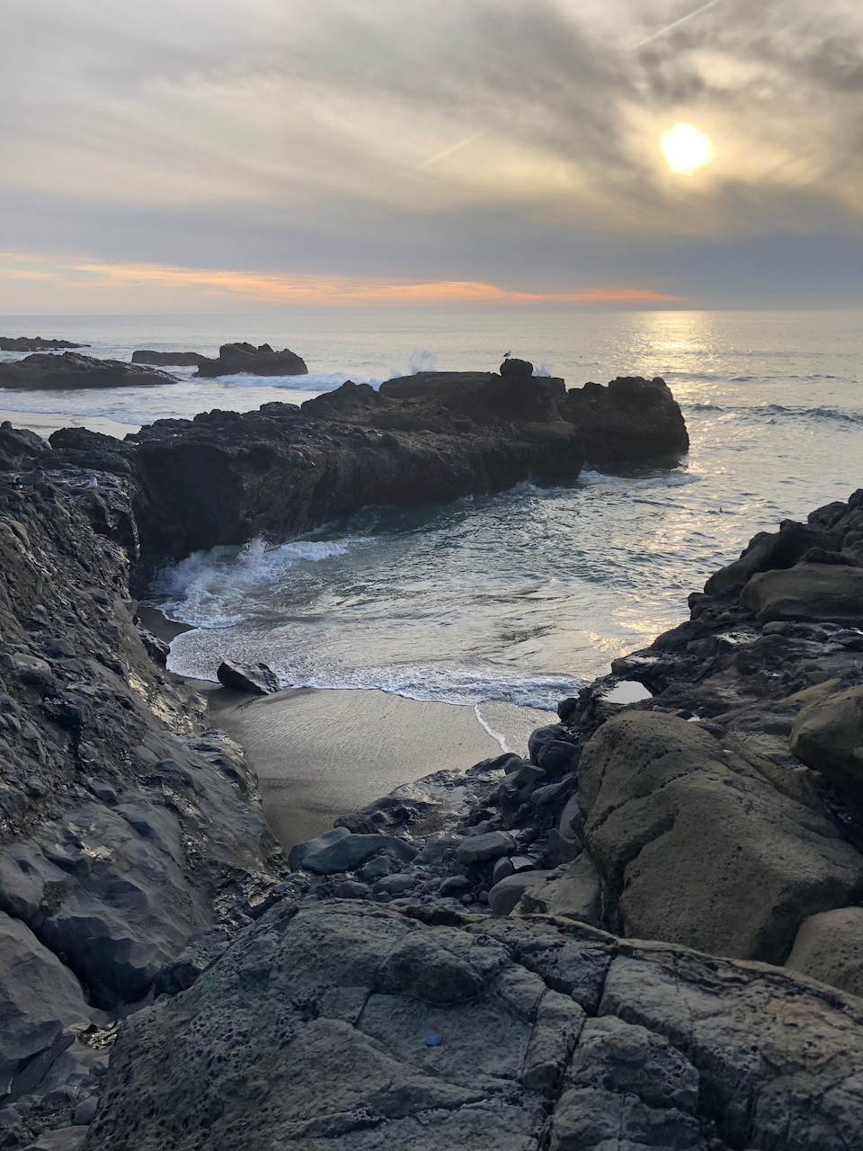
Washburne to Hobbit Beach at low tide – A lovely three mile walk toward Haceta Head.
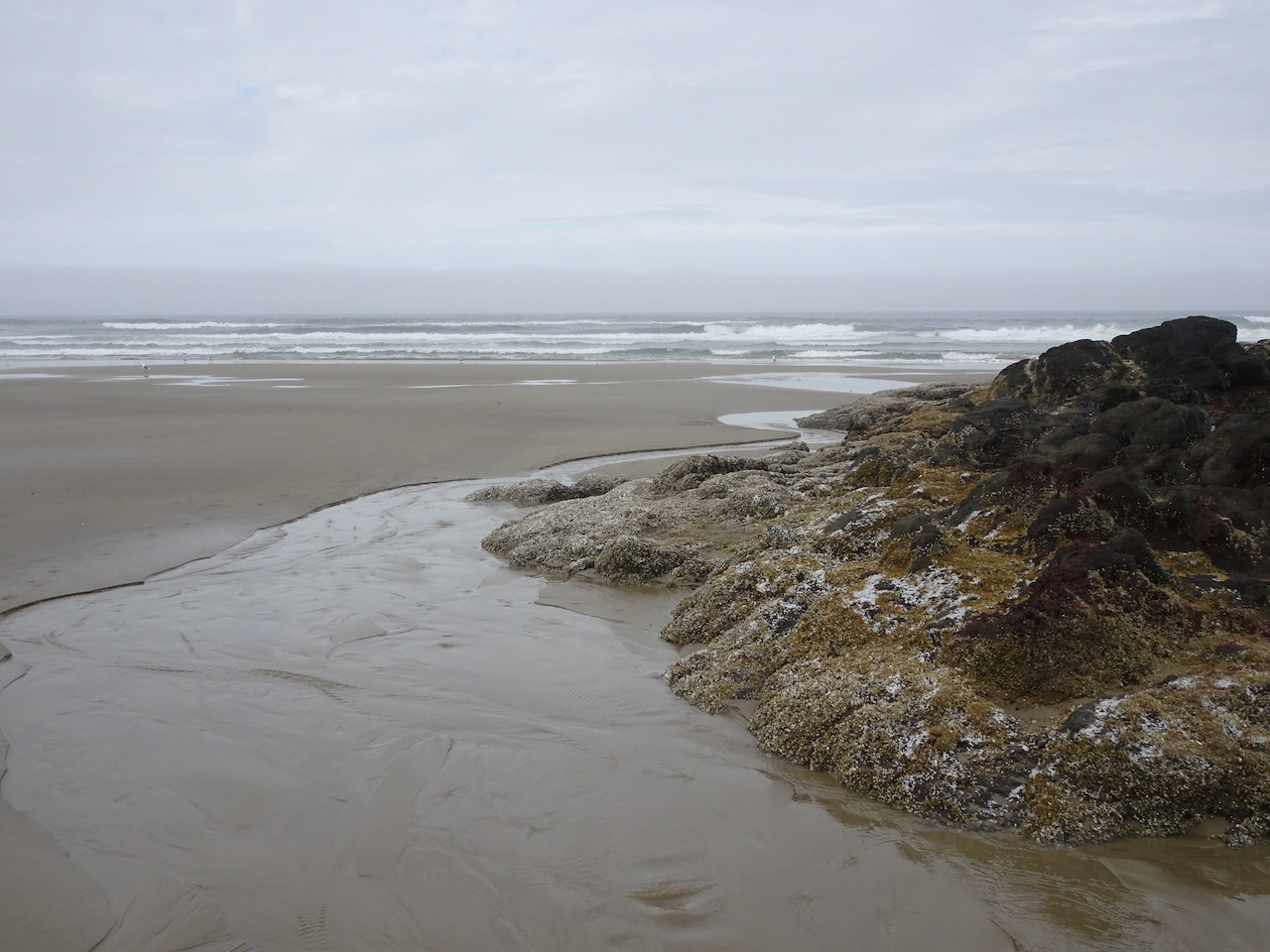
Tidal pools and sand bars on the beach as we walk south toward Haceta Head.
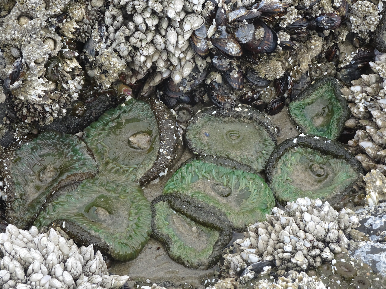
Rocky outcrop with tide pools.
Sea anemones, barnacles, and mussels.
Blue sky, blue sand.
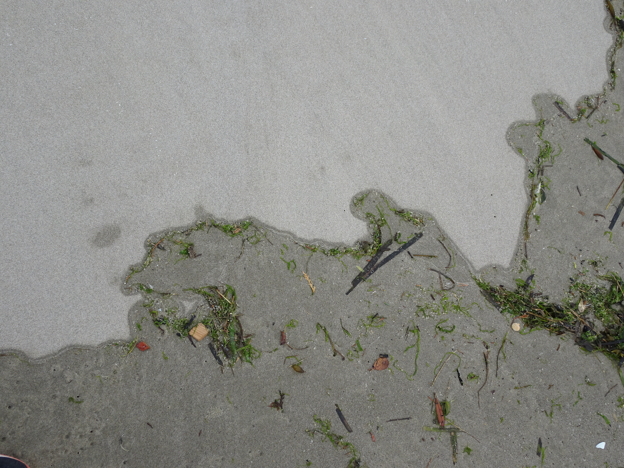
Ripples.
Return walk north.
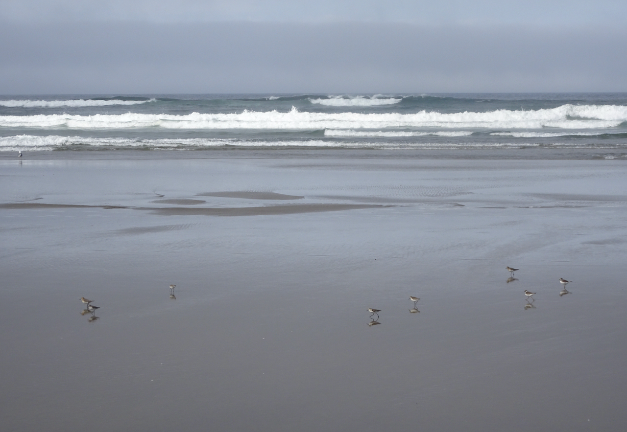
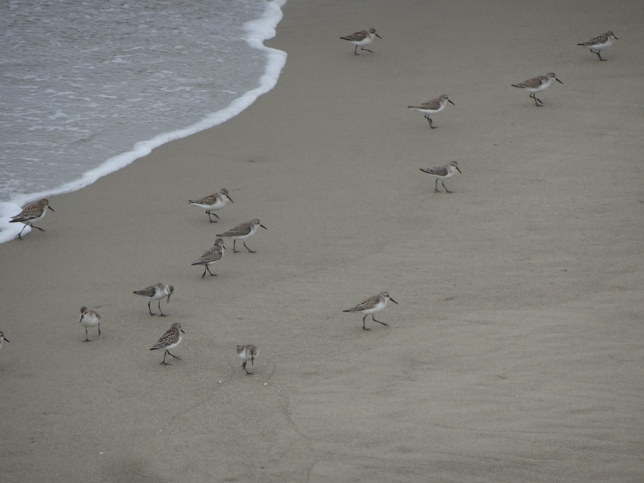
A skittering of sand plovers.
Sand plovers, doubled.
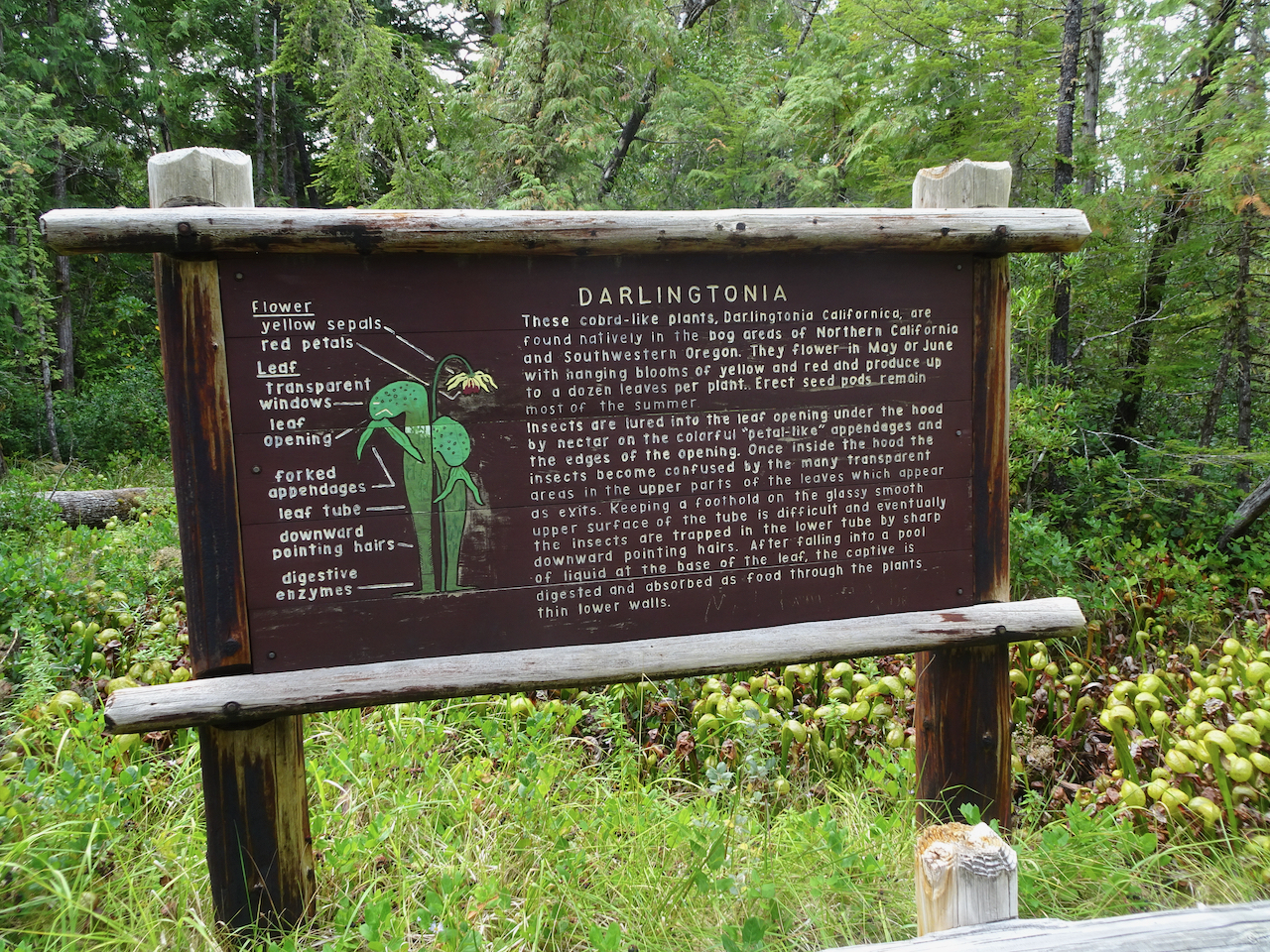
Darlingtonia Wayside
After our beach walk we continued south along the coast looking for more adventures. Our next stop was to see a swath of carnivorous plants.
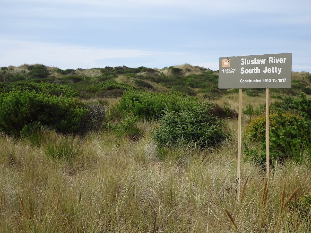
North Jetty
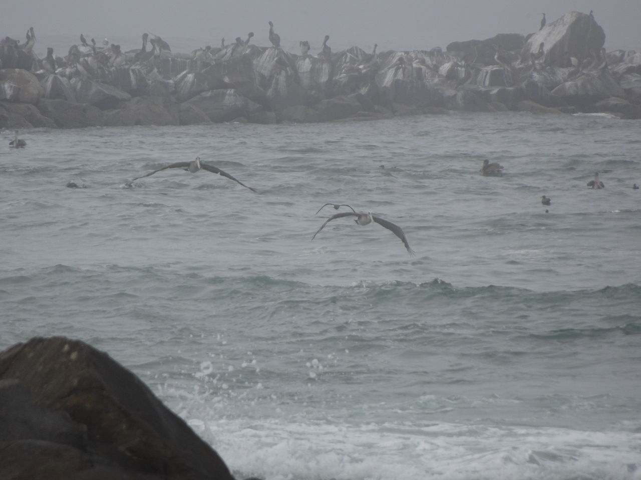
We followed the north side of the Siuslaw River to it’s mouth and took a walk along the North Jetty, where we again saw pelicans and plovers.
Entry to the North Jetty.
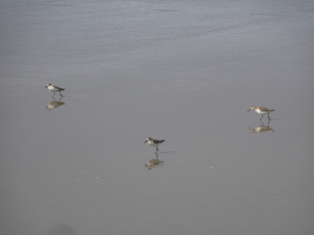
Walking seaward on the North Jetty – those shadows in the distance are birds!
Another skittering of sand plovers! It makes me so happy just to watch them!
Plovers.
Pelicans and other sea birds far out on the jetty.
Pelican in flight!
I spotted one seal nearby.
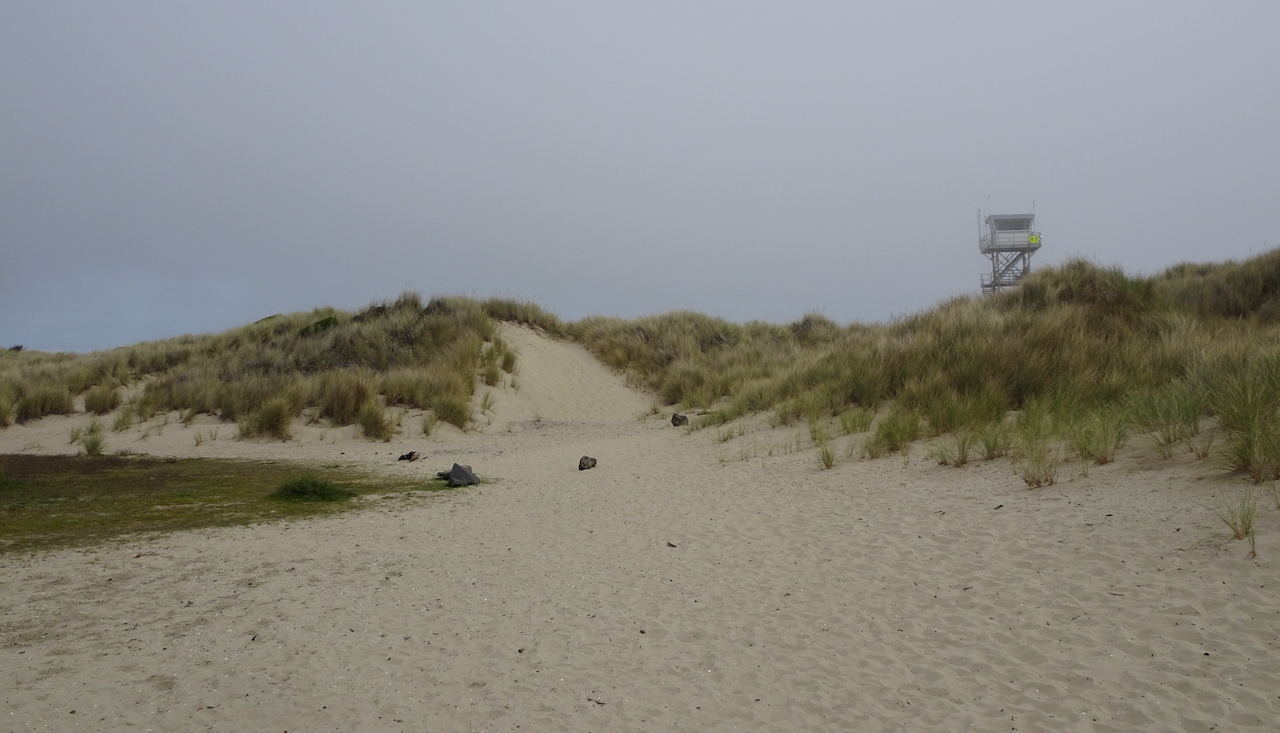
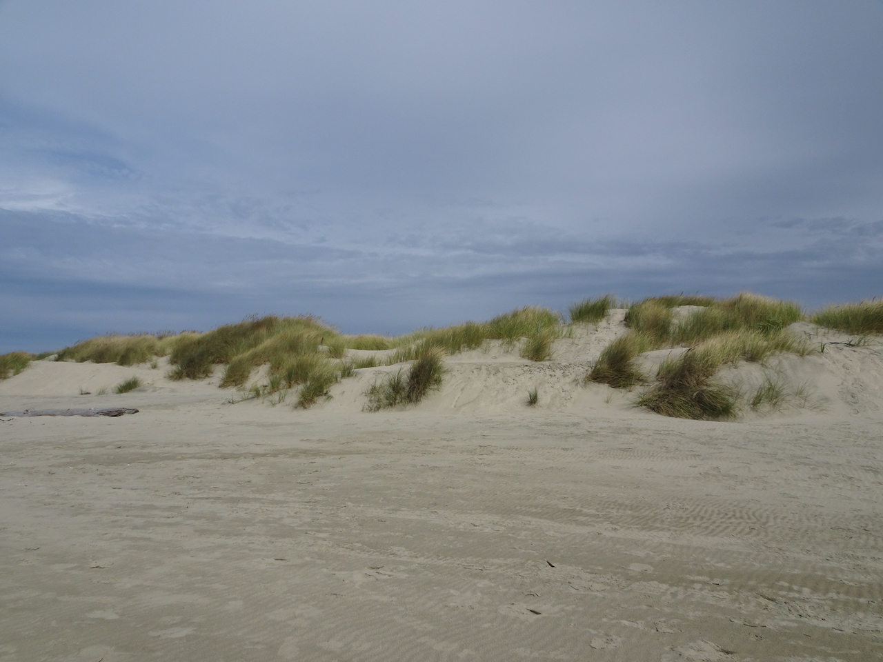
The dunes and lifeguard tower near the North Jetty entrance.
A line of rocks in the estuary make perfect perches for the seabirds.
Pelicans and gulls on their perches.
Exploding Whale park
As we drove back toward Florence, this park caught our attention. It is named for the infamous attempt to dispose of a washed up dead whale with dynamite, on a nearby beach, about 50 years ago.
Local citizens voted for the park name.
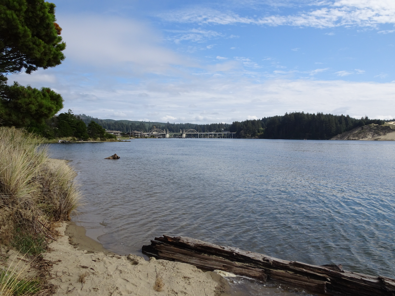
A short walk here reveals nice views of the highway bridge, and the dunes to the south.
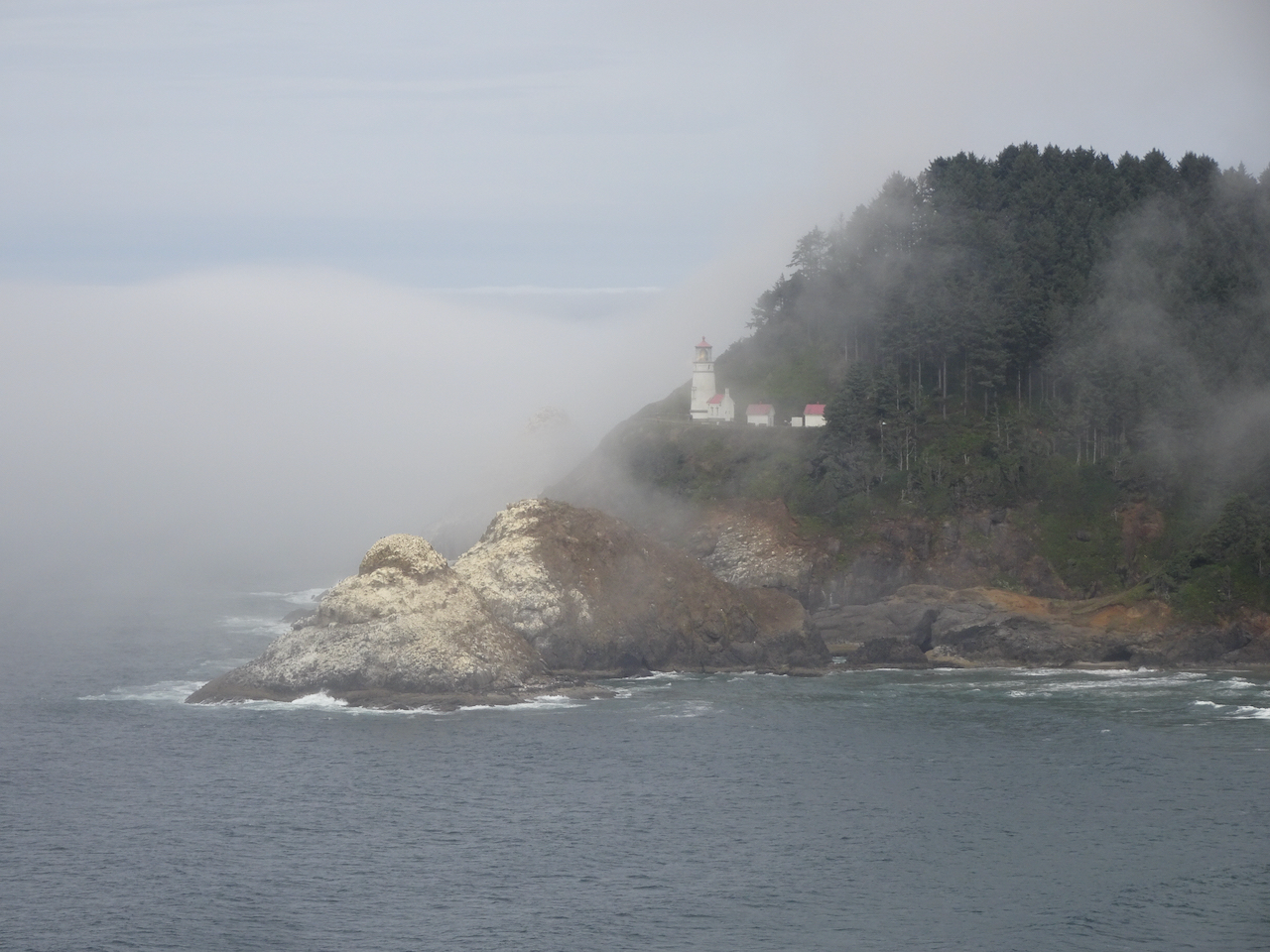
Haceta Light House
We stopped briefly south of Haceta Head in the early afternoon to see the lighthouse through the fog. On our return trip north in later in the day, the view was much clearer.
Haceta Head Lighthouse from the beach, through the fog.
Lighthouse from the highway viewpoint, early afternoon.
Lighthouse from the highway viewpoint, late afternoon.
Monday, September 22nd
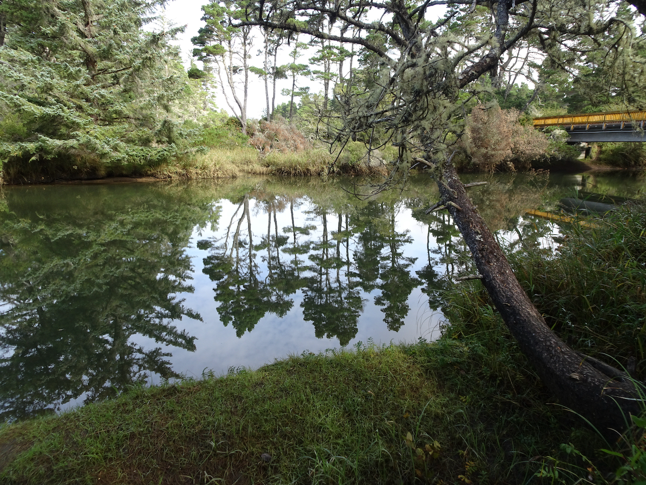
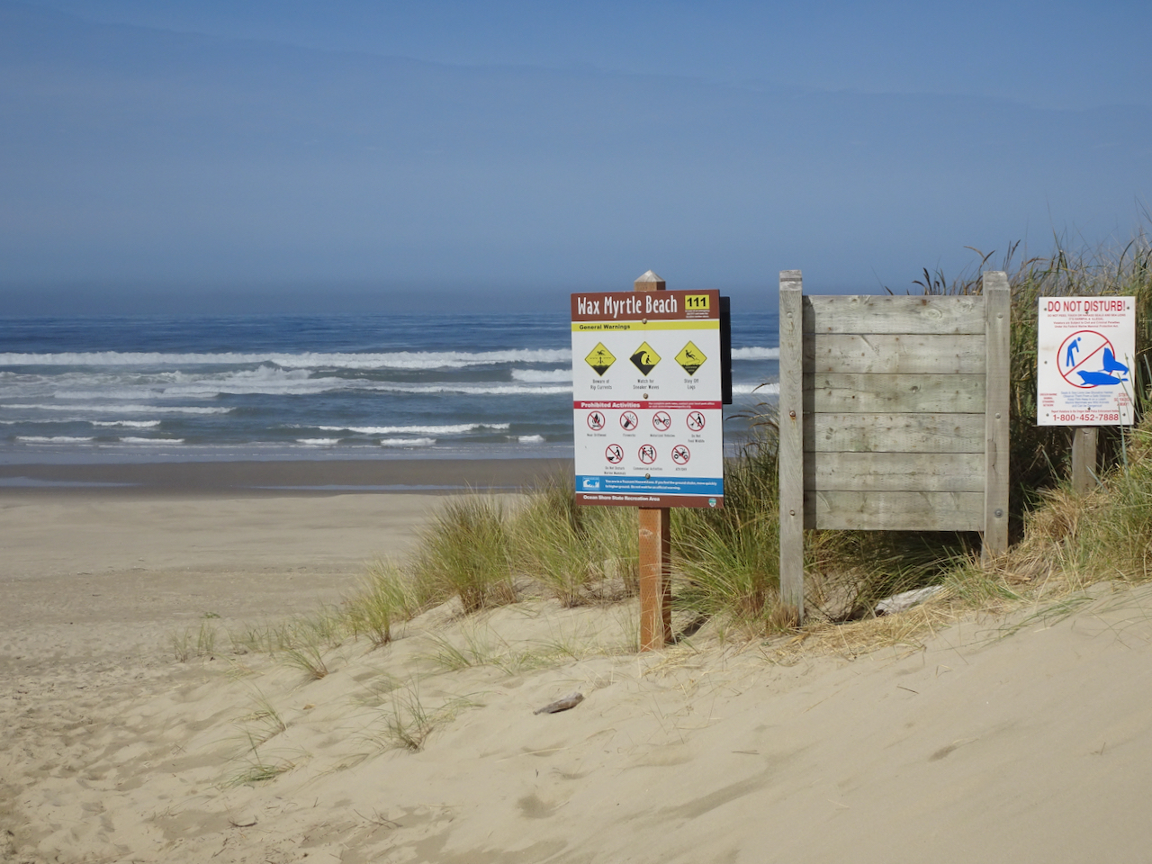
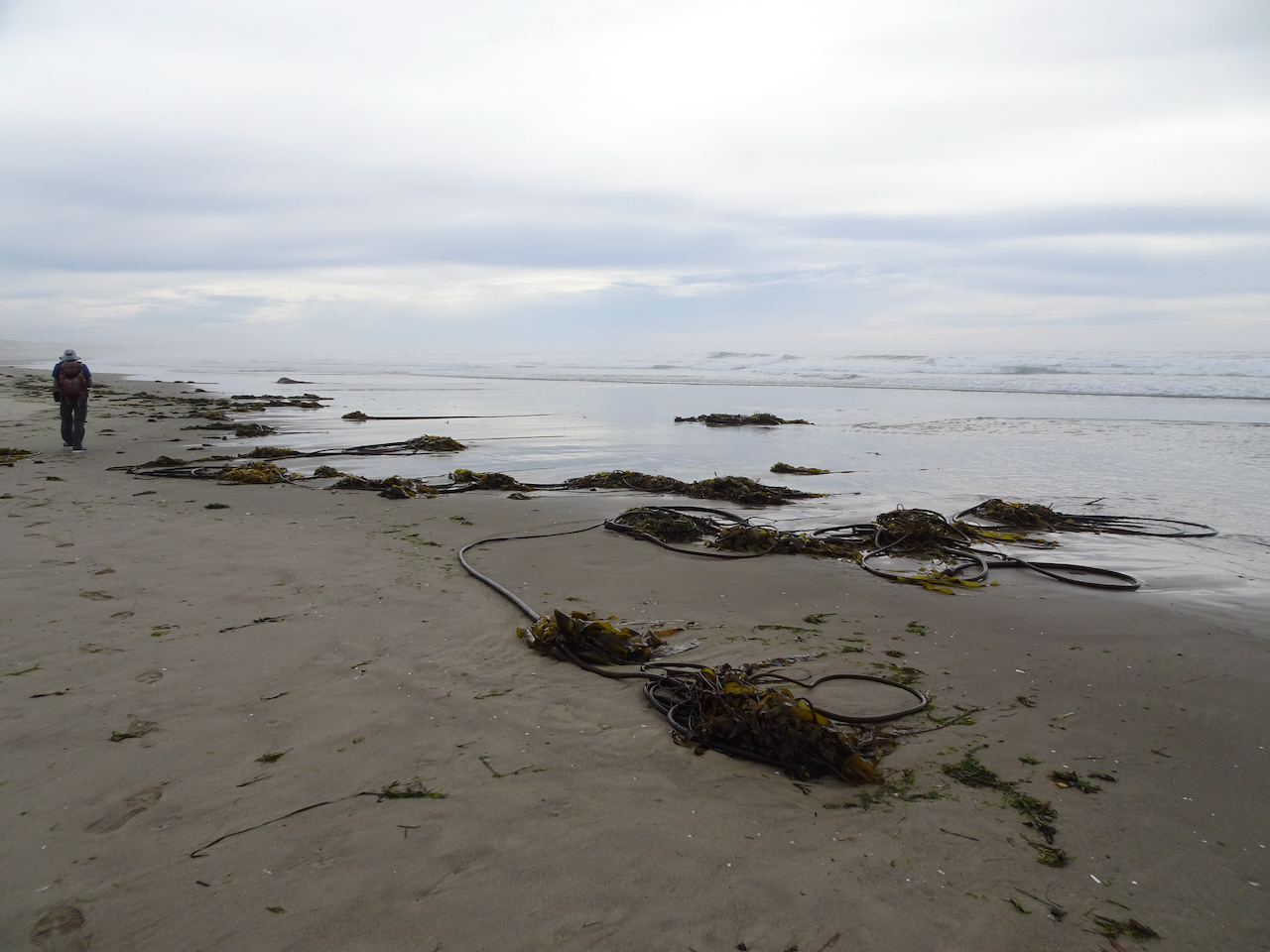
Wax Myrtle Trail and Lagoon Trail, Siltcoos River
Campgrounds in this area were closed, and the trails were particularly empty on this beautiful September day.
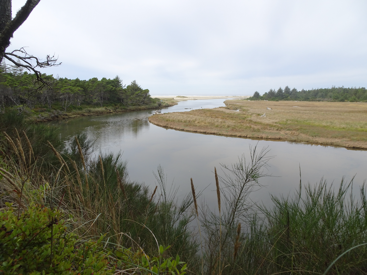
The walk to Wax Myrtle Beach follows the Siltcoos River.
We spotted a heron in the estuary as we got closer to the beach.
Heron.
We followed the Siltcoos River to the sea.
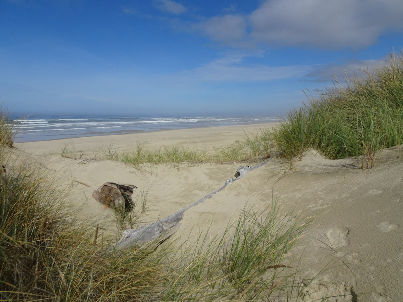
A line of sand dunes border Wax Myrtle Beach.
Dunes and beach.
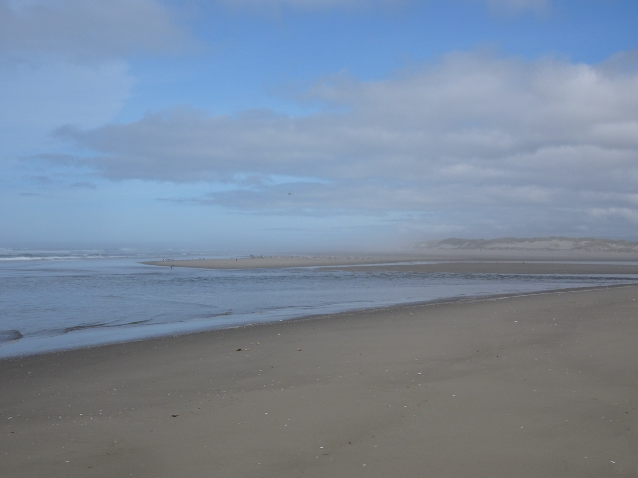
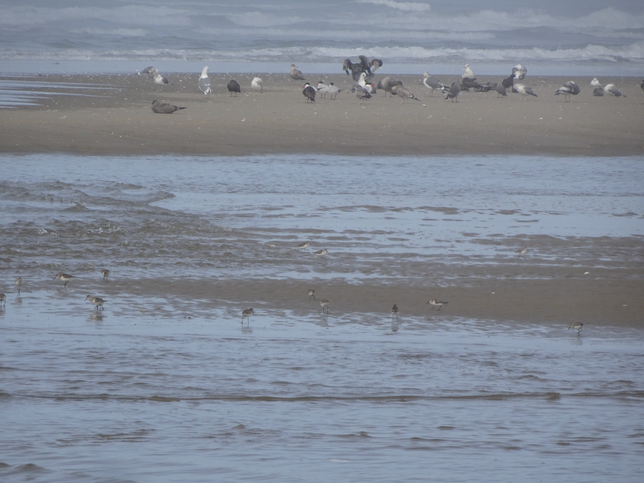
We walked north to the mouth of the Siltcoos River, where birds were out on the low tide sandbars.
Pelican.
More plovers in the foreground!
As we walked back upriver on our return hike, another hiker pointed out three river otters who were swimming upstream and eating fish along the way. We followed along with them until they disappeared upriver. This is my first time seeing them in the wild!
All three otters in this photo – the third one in the upper left corner. They are very fast and hard to photograph!
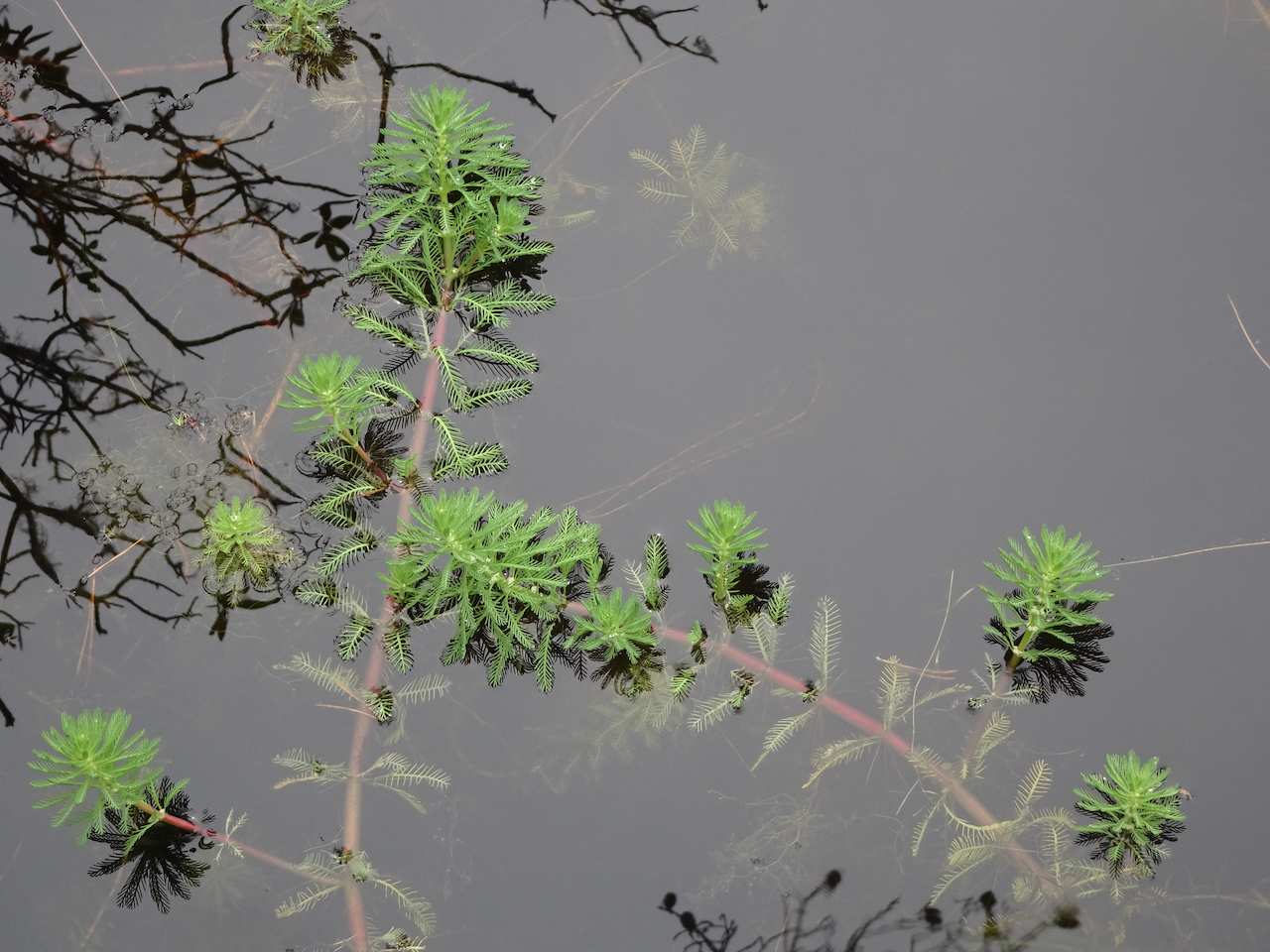
We walked partway around the nearby lagoon, where these beautiful plants floated on the surface.
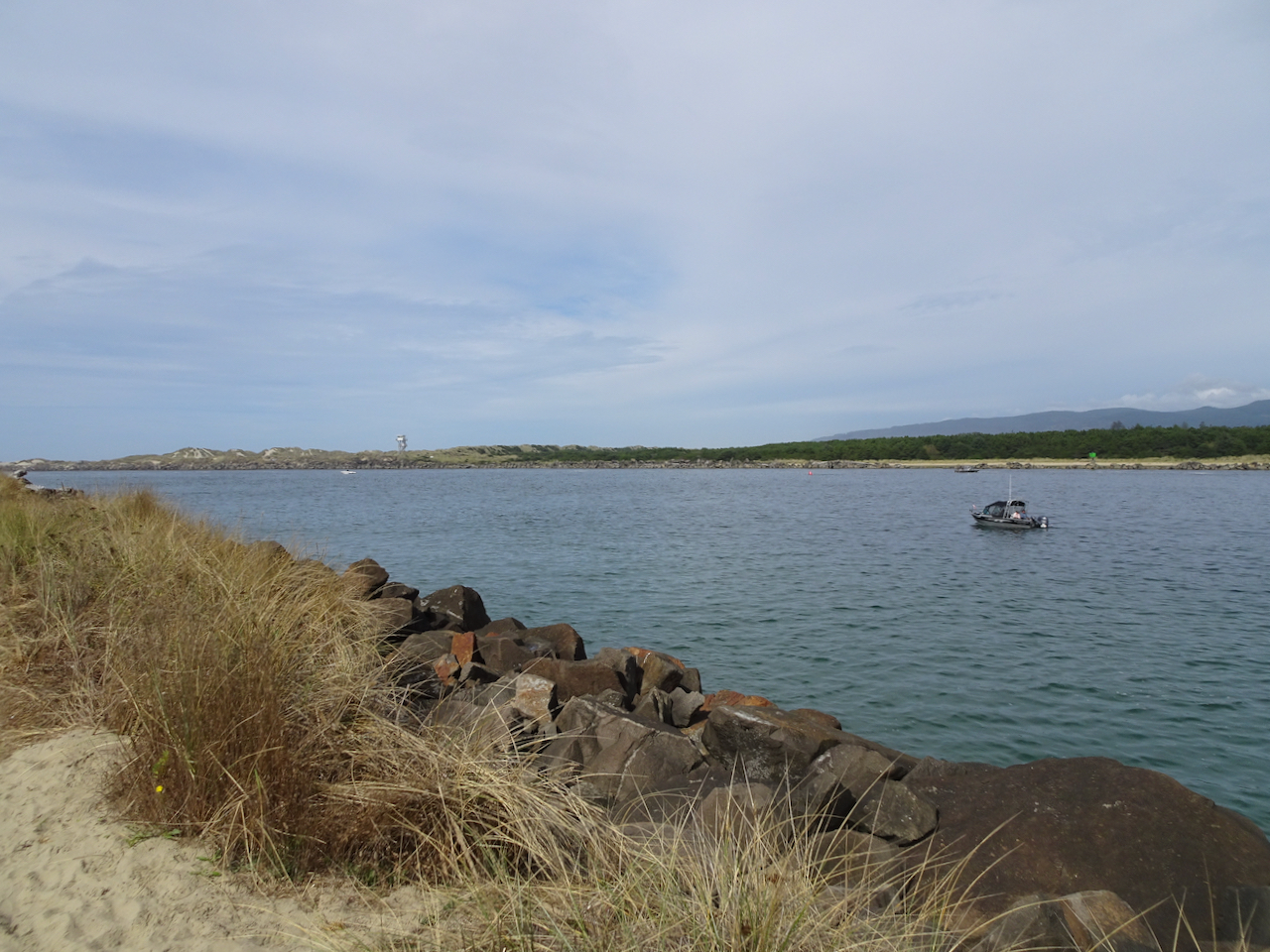
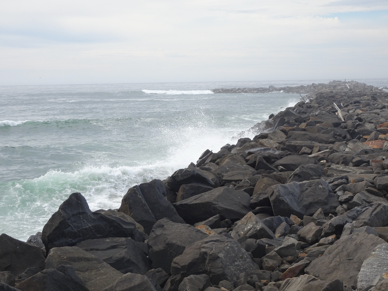
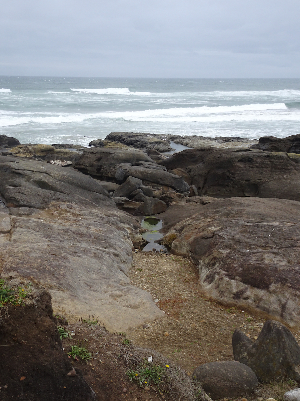
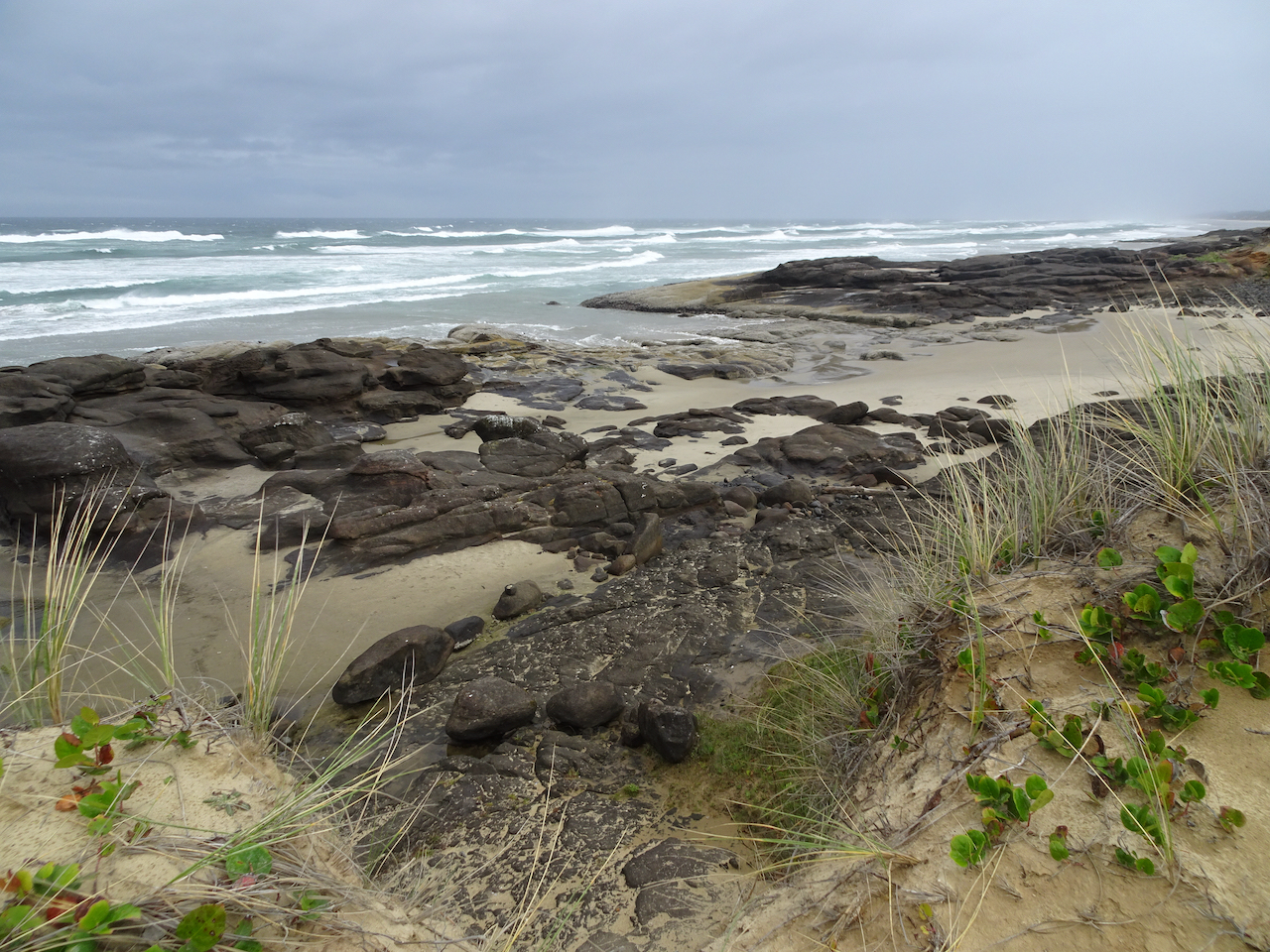
South Jetty, Siuslaw River
We drove back north toward Florence, and decided to drive out to the South Jetty of the Siuslaw River, just across from where we had walked on the North Jetty the previous day. There were plenty of people out there, also plenty of room to walk on beaches and in the dunes.
Looking seaward between the jetties. The North Jetty lifeguard tower is on the horizon.
Waves crashing against the South Jetty. Not as many pelicans on the outer jetty.
South Jetty beach from South Jetty.
Seaweed on South Jetty beach.
Swash zone.
Looking south.
Sand dunes to the east all along the beach for miles.
Sunset in Yachats
We had a lovely colorful sky outside our hotel.
Wednesday, September 23rd Yachats
We woke up to wind, and predictions of a storm coming in. We walked a short way on the beach in the wind before heading north toward home.
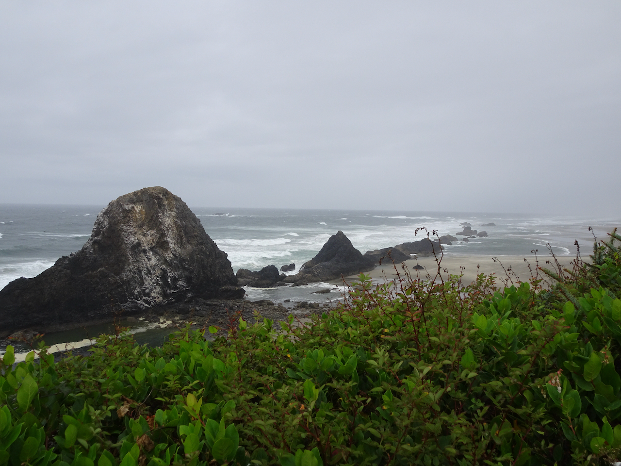
Seal Rock and Ona Beach
On our drive north, we stopped to look at the Seal Rocks, in the wind.
Seal Rocks to the south.
Seal Rocks to the north.
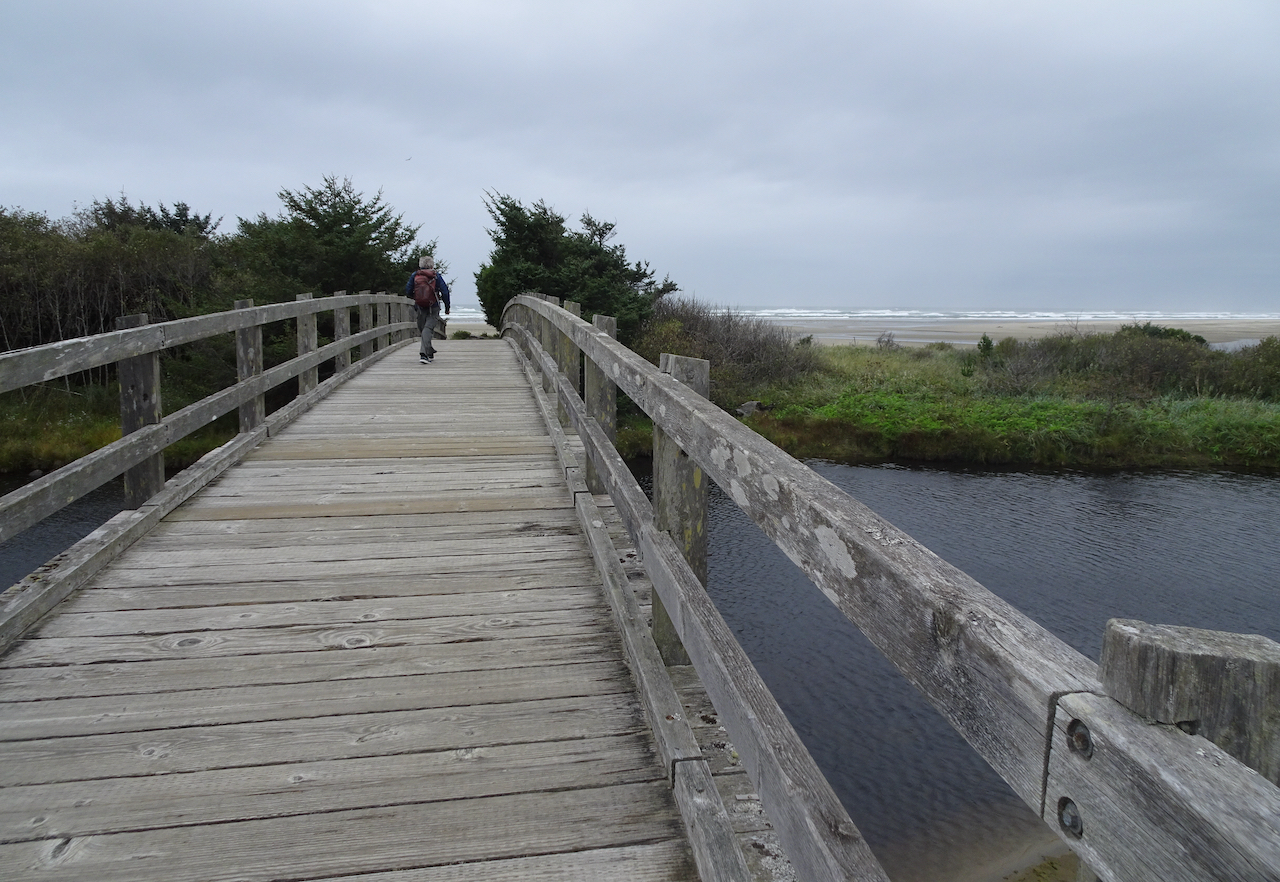
We stopped at Ona Beach, just to the north of Seal Rocks, and walked out to the beach.
Crossing Beaver Creek on our way to the beach.
Beaver Creek estuary
Squirrel getting ready for winter.
Ona Beach.
Windblown sand across the tidal flats.
Sand ripples, birds on the low tide bars.
These might be our last pelican sightings for the year.
Ona Beach, looking south toward Seal Rocks. Too windy to explore today – we will have to come back another time.
Rain started as we headed back to the car. I felt so refreshed from our few days in the fresh air and wide open spaces of the Oregon coast, and thankful that I could be there during this difficult year of pandemic, climate and political crises.
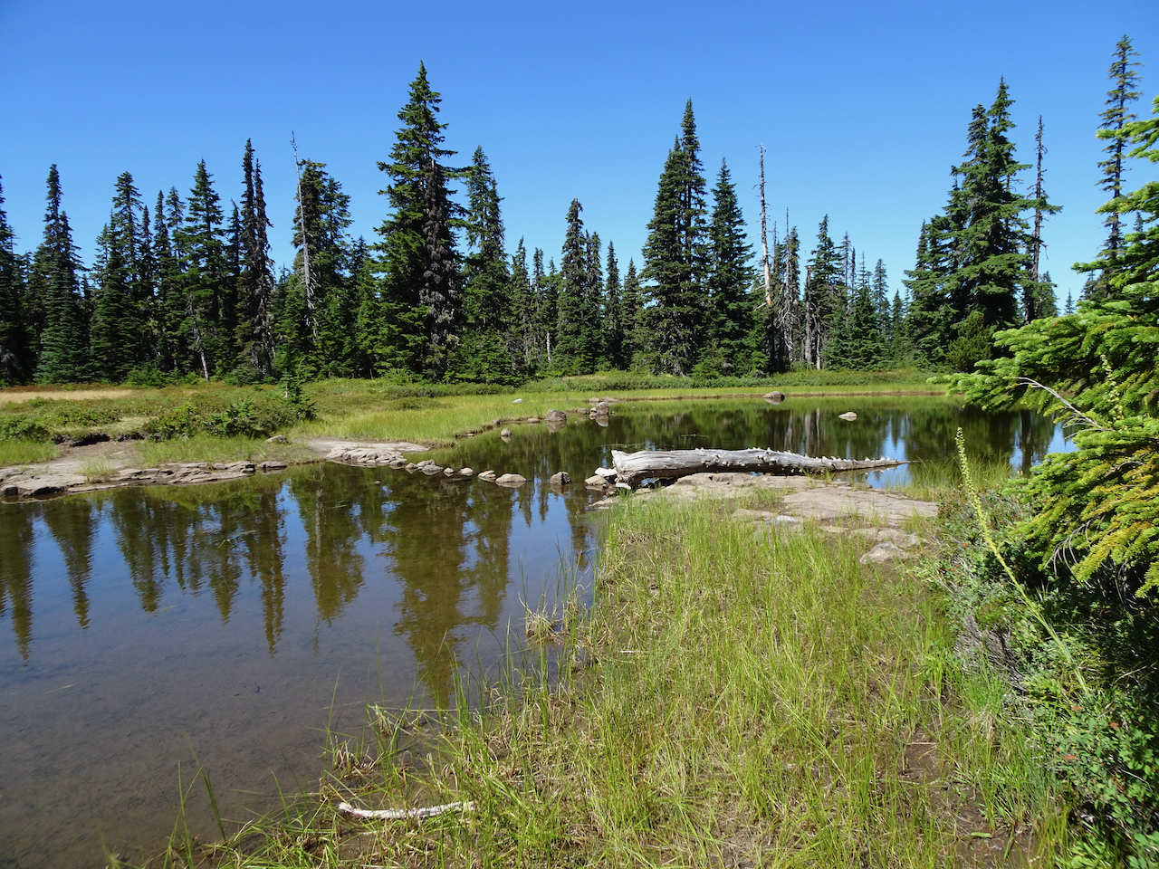
We took two hikes in Indian Heaven Wilderness, a beautiful patch of the Gifford Pinchot National Forest between Mt Adams and Mt St Helens in southern Washington. A few small volcanic peaks rise above the rolling forested landscape that is also spotted with dozens of lakes, and covered with ripe huckleberry bushes in August.
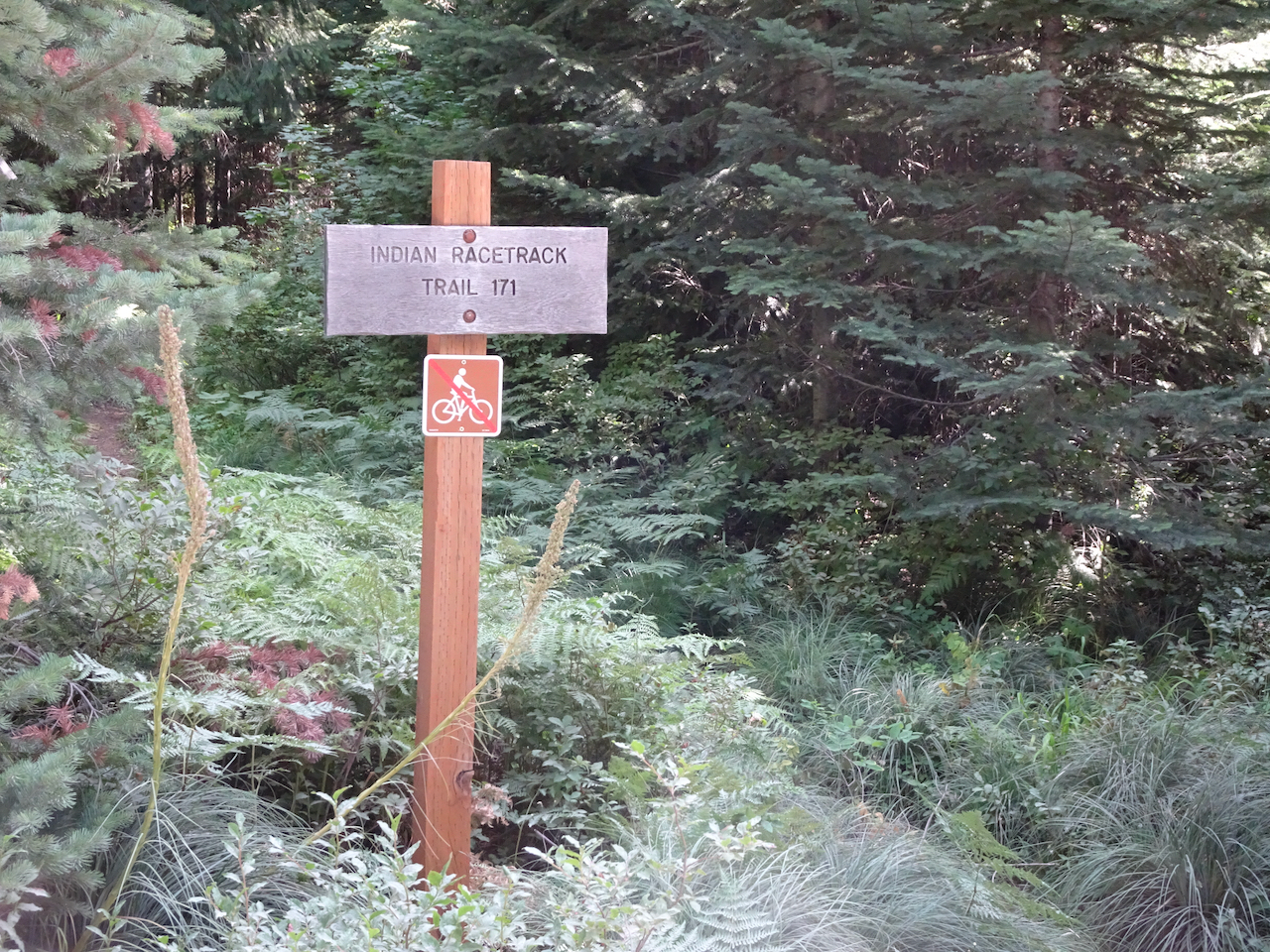
August 20, 2020 – Indian Racetrack Lake and Red Mountain
Trailhead into the forest
Racetrack Lake – the only lake on this hike
Looking Across Racetrack Meadow to Red Mountain
View of Mt Adams on the way up to Red Mountain
Closer view of Mt Adams,
And closer.
Nearing the top of Red Mountain
Views from the top:
Mt Hood beyond Red Mountain Lookout
We climbed up to the viewing platform on the lookout.
Some other hikers pointed out a bear cub down on the other side of the mountain, eating huckleberries.
Looking back east at Mt Adams – clouds now covering the top
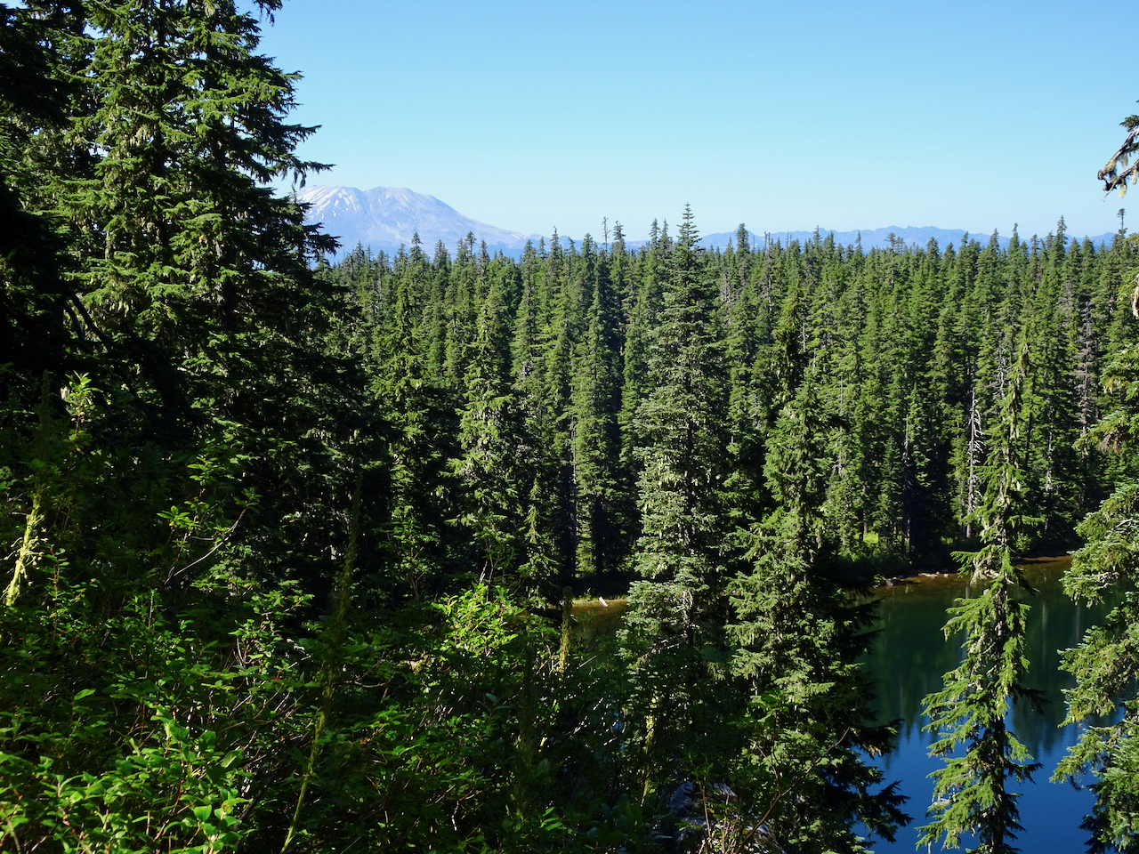
Mt St Helens to the north
And starting down again, we can see our trail dropping into the woods, and beyond we see the spine of Indian Heaven Wilderness: Berry Mountain, Gifford Peak, burned East Crater, and Lemei Rock.
Some details along the trail:
ripe huckleberries
aster
pyrola
red knotweed
Lily pads and grass, Racetrack Lake
Falls Creek
Hike #57, 6.8 miles, 1500 feet
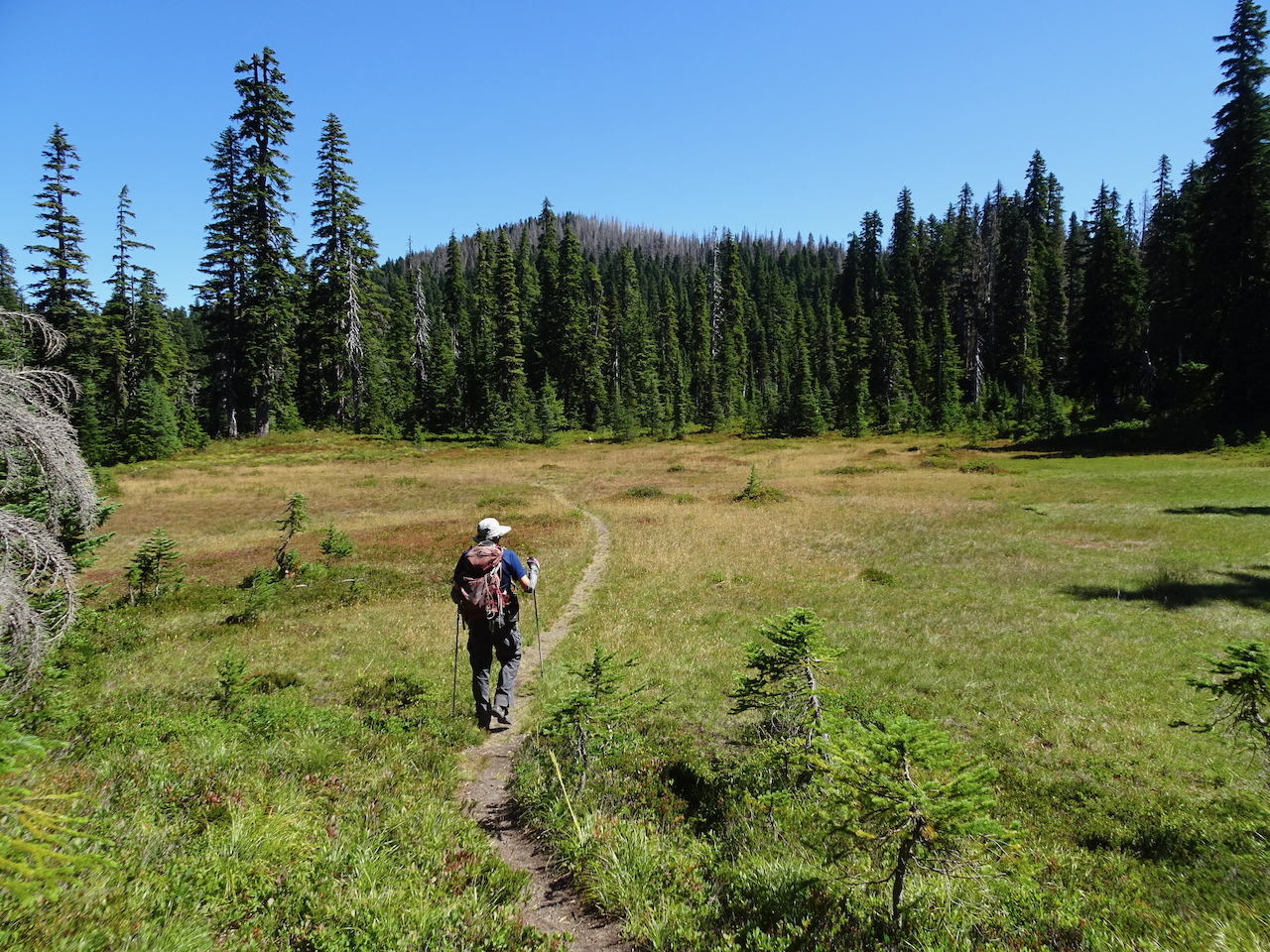
August 28, 2020 – Thomas Lake trailhead to Junction Lake
The other ten lakes were seen on this hike.
Once again we enter the forested wilderness…
Thomas Lake
Heather Lake
Dee Lake
Eunice Lake
Nuha Lake
Rock Lakes
Unnamed lake beyond Rock Lakes
View of burnt East Crater from the Old Cascade Crest trail segment
A glimpse of Mt St Helens as we cross the shoulder of East Crater
Unnamed lake near the trail junction
Junction Lake, our turnaround point
Some details along the trail:
Reflections in the lakes…
Huckleberry bushes turning red
Mountain ash berries
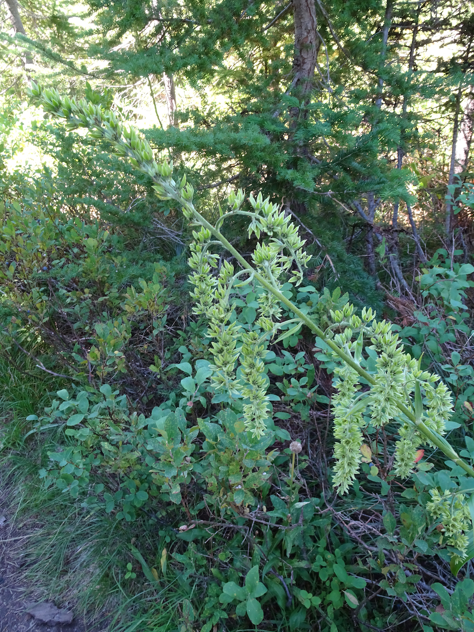
Hellebore
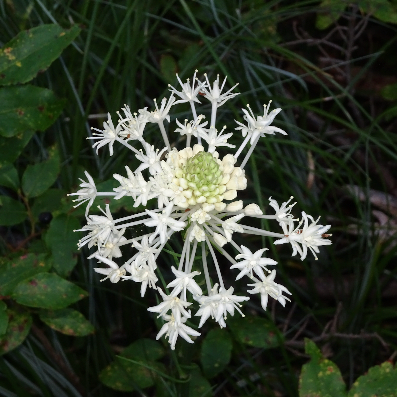
Most likely the last beargrass bloom of summer
And another view of Mt St Helens above Eunice Lake on the descent.
Hike #58, 6.8 miles, 630 feet.
Meanwhile, we are floating along through more days of pandemia – some days we see no one at all, only virtual connections to the outside world. Our neighbors leave us tomatoes. We leave them apples and plums and wave across the rose bushes. Downtown is still burning up with civil unrest while I go on placidly through the days of late summer, of pandemia, of this administration… I virtually hold my breath, knock on wood, pray, cast spells, wish for a begin to a return to ‘normalcy’; hope for a late summer without a local fire season, hope for a scientifically tested efficacious vaccine, and hope for a fair election that will allow us to emerge from impending climate change, covid and facism. And I knit…
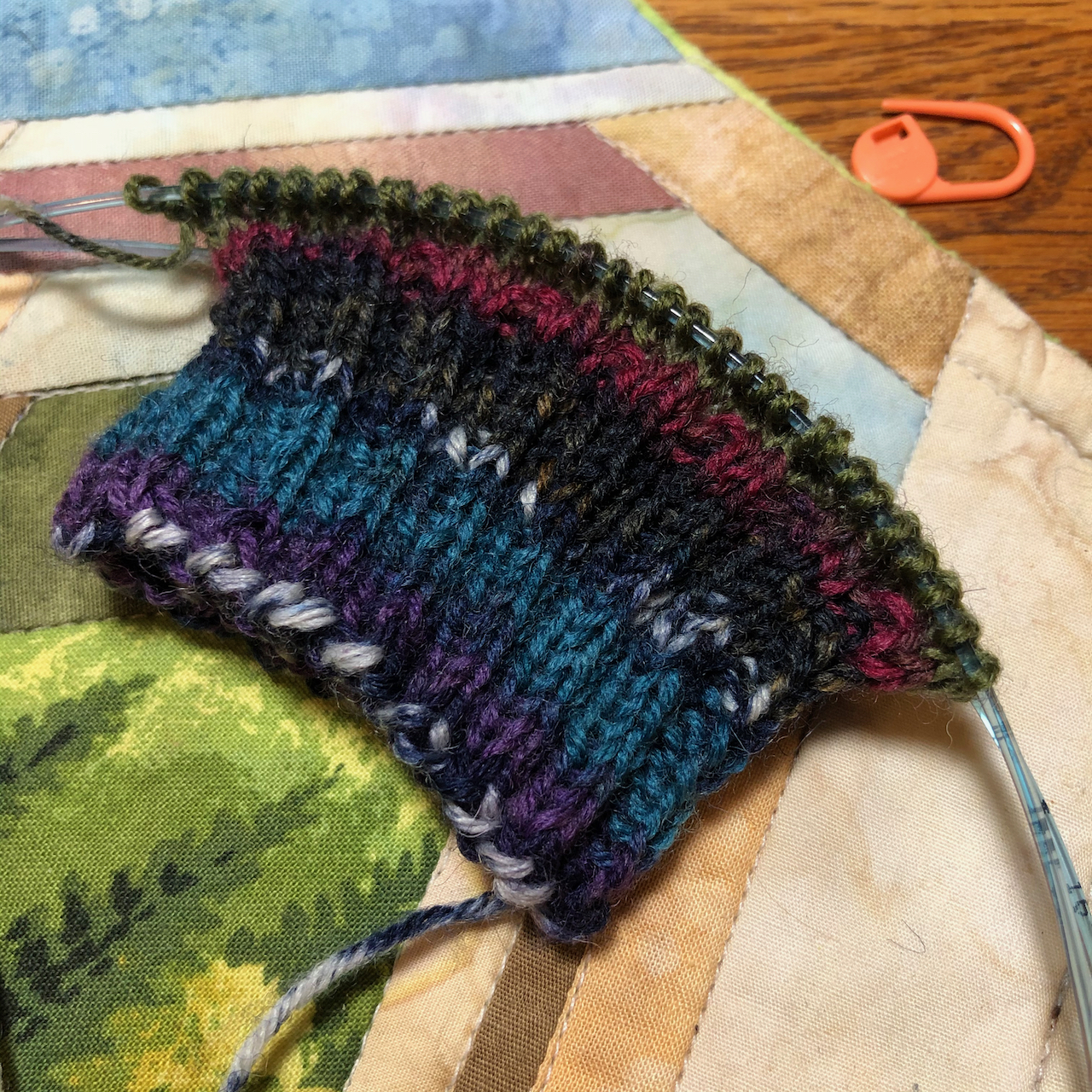
Knitting –
I cast on a hat and some socks…
Rafa by Joji Locatelli, Malabrigo Arroyo, Blue green
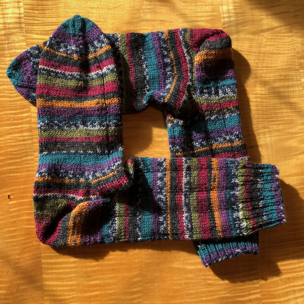
Sock, Berroco Sox yarn
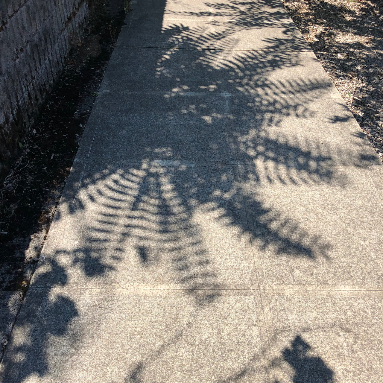
Neighborhood sights:
fern shadows
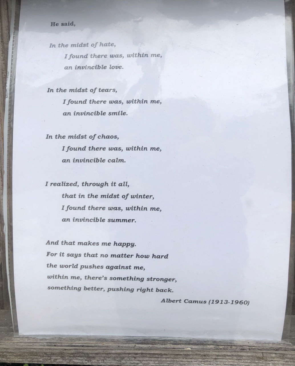
Poetry Post
yard sign
neighborly tomatoes
And nationally…
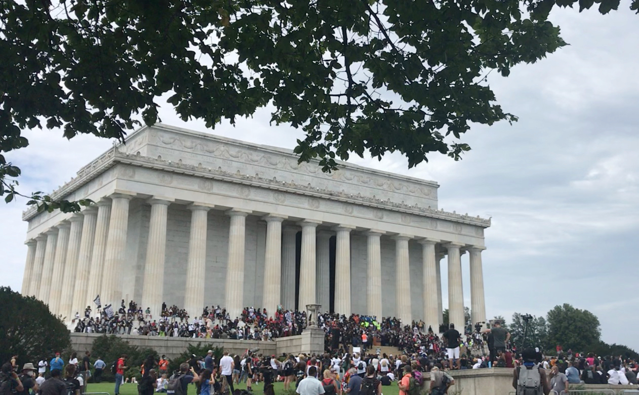
My daughter attended the 57th March on Washington,
The march
Lincoln Memorial
The Mall
-and this artwork crossed my social media feed:
I am still struggling a bit with the new WordPress format….
8/17/2020 – I’ve had a birthday, which we celebrated with a hike and a socially distanced takeout Thai dinner with our two sons. Despite the palpable pandemic/political chaos tension in the world I have much to be grateful for. Although I am missing having our usual summer get togethers with extended family, so is everyone in the world right now. I am especially grateful that we saw almost every relation last year, between two weddings and a graduation trip to the east coast. My latest acromegaly lab tests all look good, and, we are eating homegrown tomatoes and basil almost every day.
Birthday cake, flowers from my daughter,and a few lovely presents.
I have been knitting, knitting, knitting away on a few projects, fingers keeping the anxiety away.
Rio Calina Cowl, by Cat Bordhi, in Malabrigo Rios.
My cotton dishcloth pile is growing!
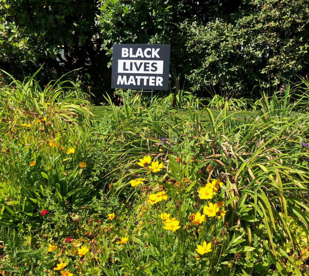
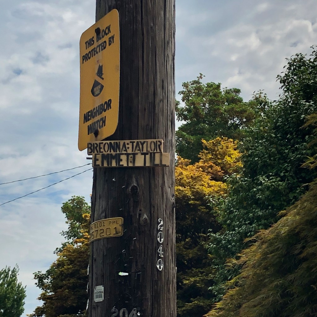
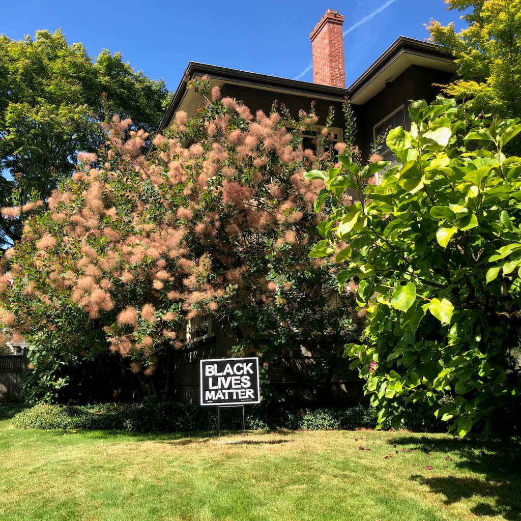
My neighborhood walks continue to reveal signs of encouragement and solidarity.
Tethered unicorn
Fairy house
Poetry post
Also in the neighborhood, late summer flowers, shadow play, interesting architectural elements, and tinges of the autumn ahead….
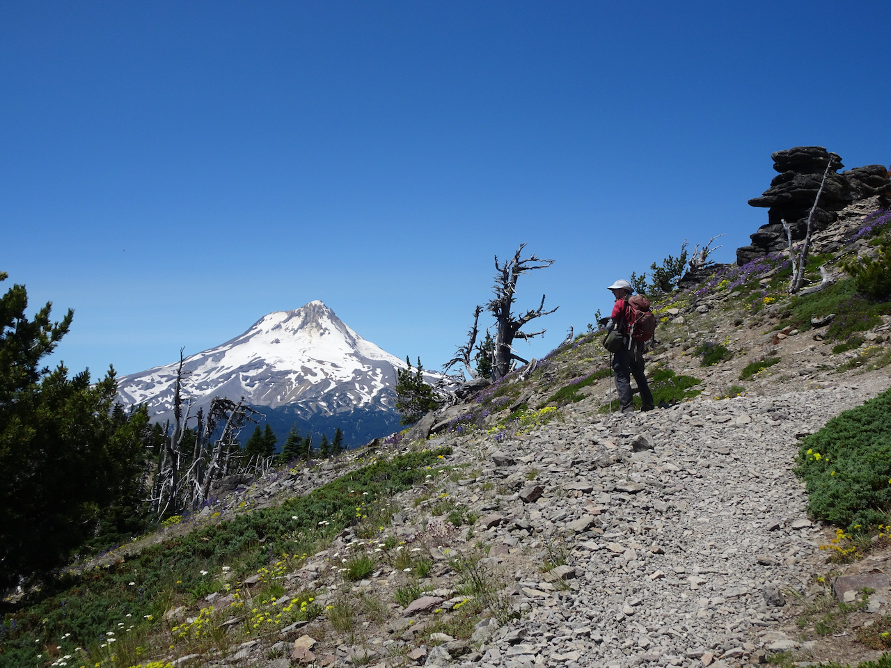
Two hikes on opposite sides of Mt Hood –
Burnt Lake August 5, 2020
My birthday hike on the west side of Mt Hood was mostly through shady forest, on a hot day, with a few stream crossings, and late season flowers. The other time we hiked here the mountain was under a cloud, so today we were very glad to see the beautiful reflections of Mt Hood in the lake. Hike #55, 8.5 miles, 1500 feet.
The shady forest
Tree scorched in the early 1900’s.
Mt Hood, Burnt Lake
Mountain close up
Reflection
Notable flowers and plants:
pinesap
rattlesnake plantain
fireweed
devil’s club
yellow pond lily
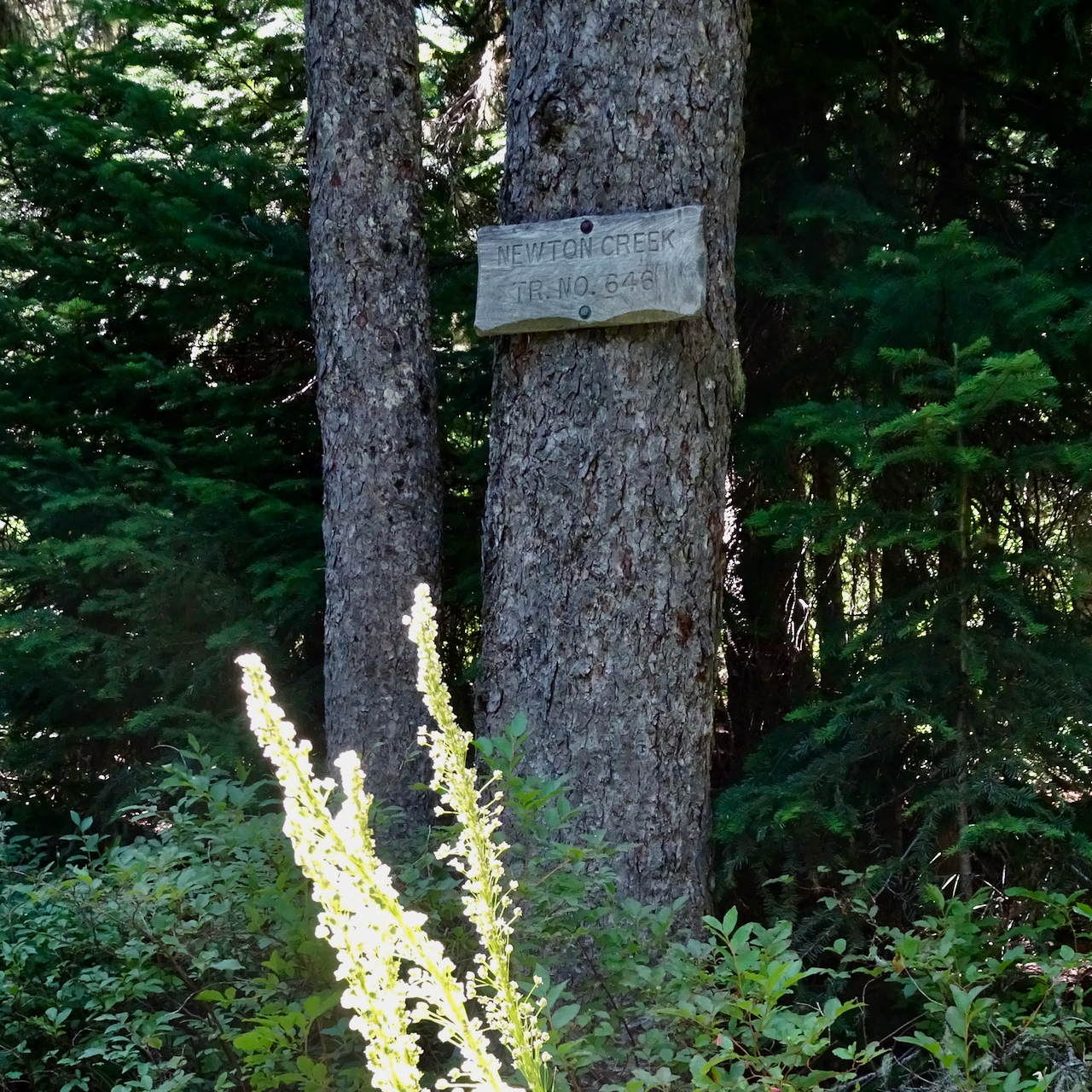
Newton Creek to Timberline Trail, August 10, 2020
We started from the Elk Meadows trailhead, then walked uphill along the Newton Creek Trail, stopping for lunch near the Timberline Trail junction where we enjoyed lovely views of Mt Hood and Gnarl Ridge. We then walked south on the Timberline Trail toward Mt Hood Meadows for a short distance before turning back. Hike #56, 7.7 miles, 1600 feet.
Moon over Clark Creek
Newton Creek trail
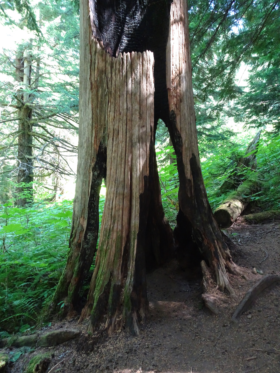
Ghost tree in the forest
Gnarl Ridge beyond Newton Creek
Upstream
Downstream, fireweed
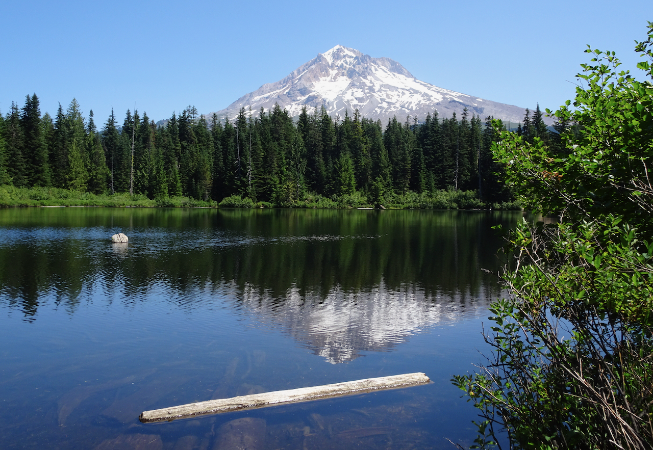
Mt Hood ahead
Lunch view of Gnarl Ridge
Gnarl Ridge closeup
We saw a few tiny hikers crossing Newton Creek on the Timberline Trail.
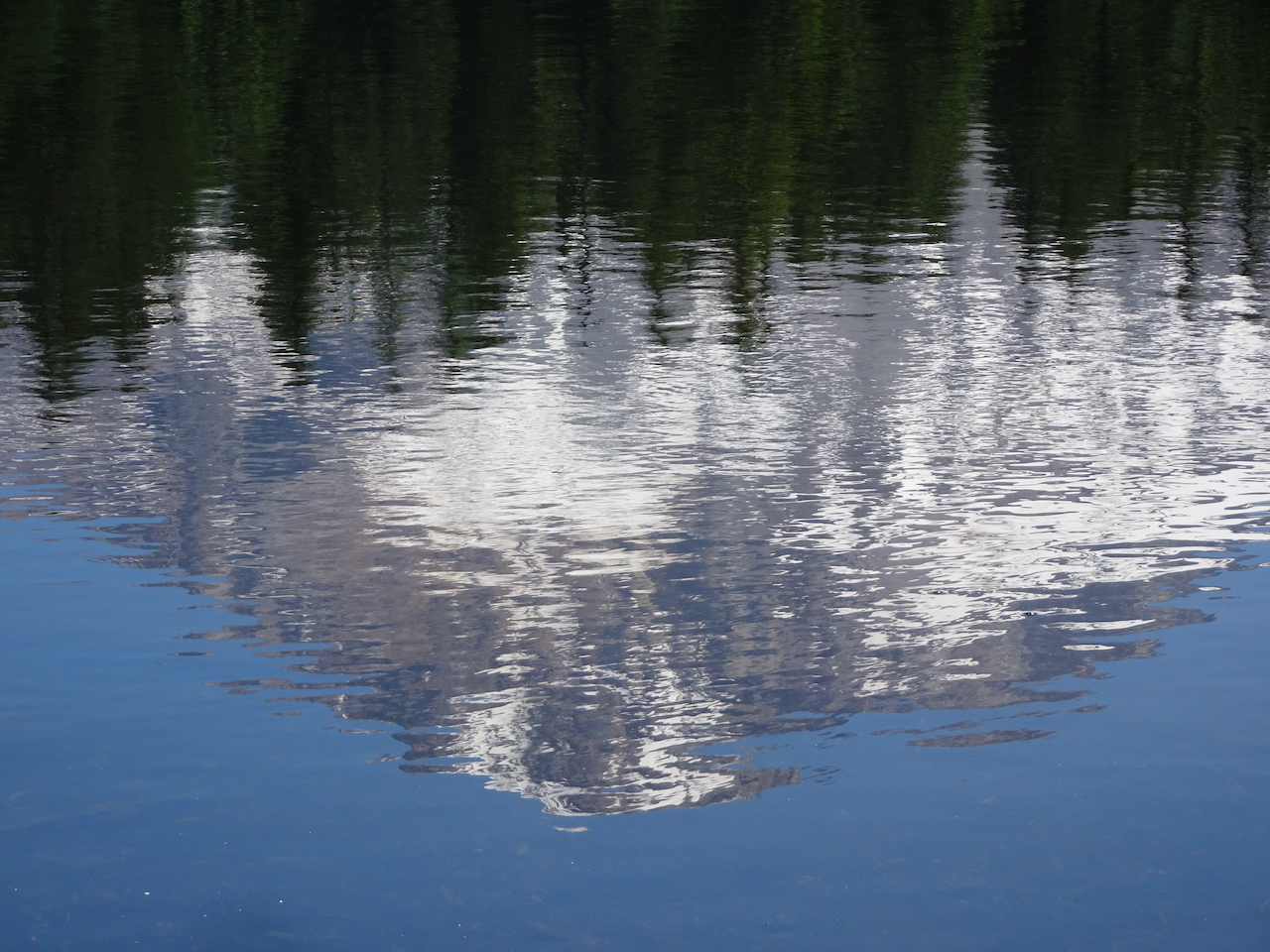
Glacier closeup
The peak
Backside of pea gravel ridge, which we walked along as far as the descent into Clark Creek.
Return hike down Newton Creek.
Editing note – This is my first post with the New WordPress Editor, so there are lots of formatting inconsistencies. Not loving it, but I suppose I will get used to it as I continue hurling forward into the future, keeping my synapses sharp by constant novelty….
I have been distracted from posting by current events. All I have been able to think about is how my community has been attacked by our own government. Federal gestapo-like forces have invaded Portland’s mostly peaceful Black Lives Matter protests and demonstrations, and created a war zone in the four downtown blocks around the federal building. Click-bait and spot news entertainment have focused on the four square blocks of federally-incited violence that occurs after most demonstrators have gone home. The leadership void in DC is trying to distract from inept pandemic management and interrupt local progress toward ending white supremacy. The ‘stormtroopers’ sent by a failed president are causing the violence. Today there is an announcement of an agreement to withdraw the troops. Our state and city have serious antiracist/police reform legislation proposals underway. I am cautiously optimistic.
I am speaking from a condition of white, middle class privilege. I myself have not been downtown, although I know people who have. I am of an age and health situation that I think the best thing I can do to help is to stay home, not contribute to spreading Covid-19. I stay aware of what is going on, donate money, and hope that the trifecta of political, economic, and public health crises our country is experiencing will begin to resolve after November elections.
I honor the Black Lives Matter protesters. I appreciate the wall of moms, the dads with leaf (teargas) blowers, the wall of vets, the volunteer medics, street cleaners, and cooks, all the folks who have put themselves on the line to keep the conversation about systemic racism and police reform going.
Meanwhile, in my neighborhood…
The quiet and calm in my neighborhood are uninterrupted. I see signs of support and blooming flowers on my walks.
masked statue
We have been eating sungold tomatoes and basil from our garden, and we’ve celebrated another family birthday.
Berries from the Farmer’s Market
Blueberry muffins
Another birthday cake
Black cherry tomatoes
I seem to be obsessed with knitting dishcloths and have also cast on a new sweater.
We have been out hiking in the past two weeks to places we have been before.
Lookout Mountain, July 22, 2020
Wildflower meadows and views of nine Cascade volcanoes, from Mt Rainier to Broken Top. Hike #53, 3.5 miles, 650 feet.
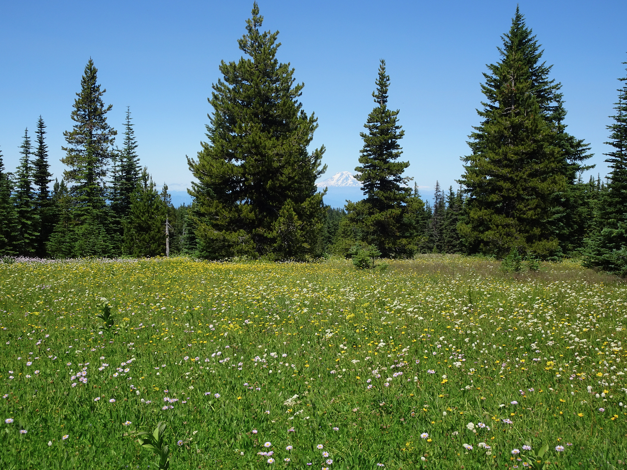
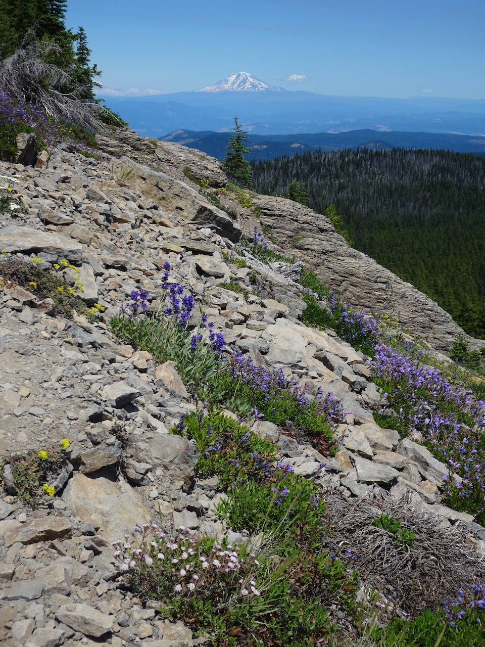
Mt Adams beyond the wildflower meadows of High Prairie.
Mt Hood from the volcanic spire overlook.
Glacier close up.
Mt Adams from the summit approach trail.
Mt Hood from the summit approach trail.
Washington Cascades from the summit.
Oregon Cascades from the summit.
Notable wildflowers:
heather
Douglas dustymaiden and penstemon
penstemon and scarlet gillia
orange agerosis
shooting stars
penstemon and aster
lousewort
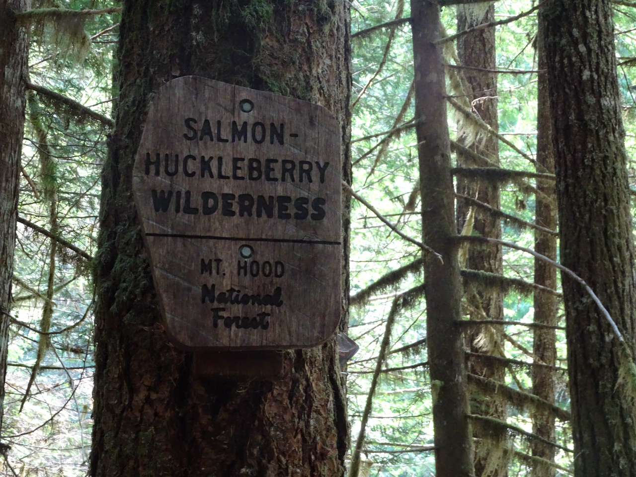
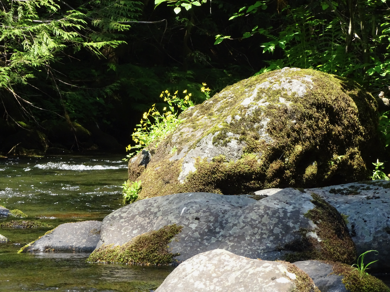
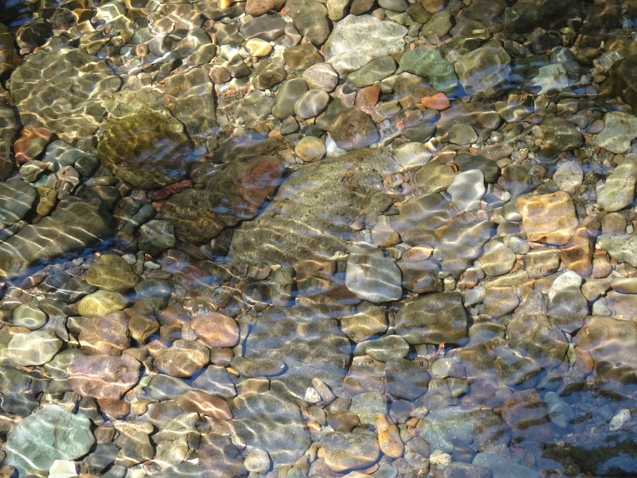
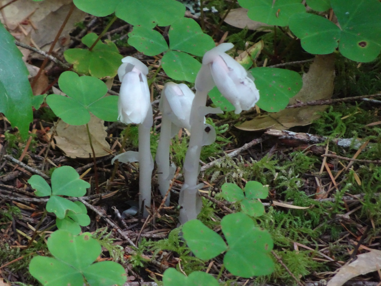
Salmon River, July 28, 2020
A mostly shaded trail on a hot day along the Wild and Scenic Salmon River through old growth forest on the slopes of Mt Hood. Hike #54, 4.5 miles, 300 feet.


 Dry Creek Falls, which we have hiked
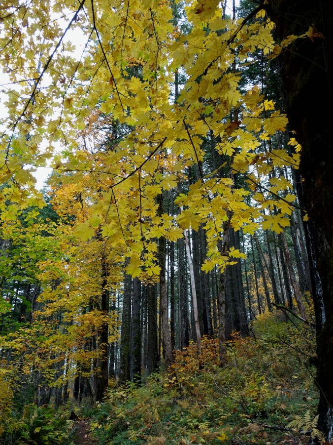


 Deschutes River trail, a smattering of rain, it feels like walking through a purifying mist, and there’s no Covid out here.