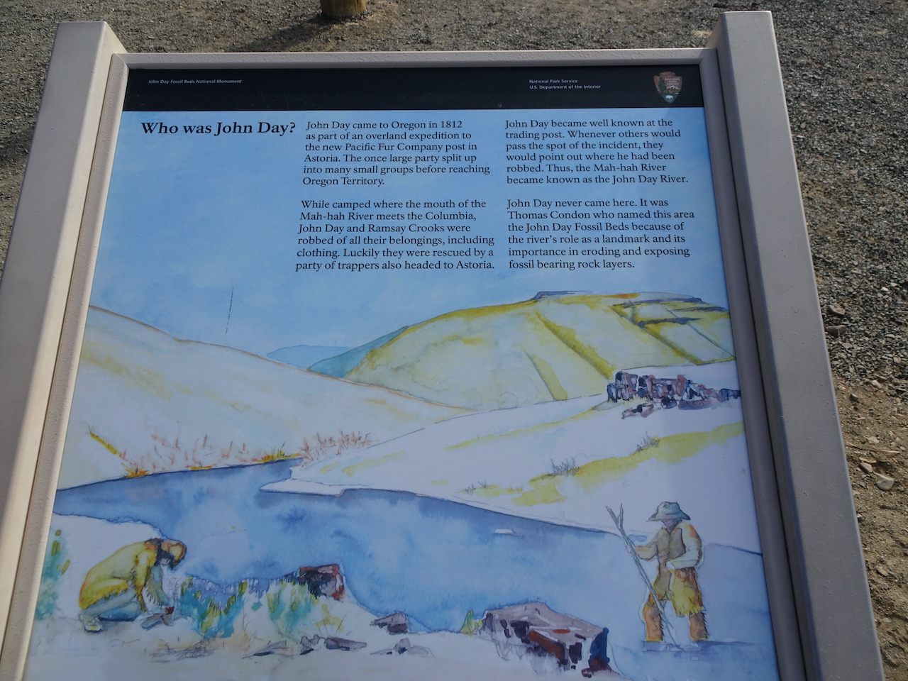
Another socially distant/Covid careful trip. We stayed three nights in Prineville, and had two days to explore the Painted Hills and Sheep Rock units of the National Monument. Indoor exhibits were closed, trails were available for walking.
Painted Hills 10/27/2020
We walked five different short trails, each highlighting an aspect of the ancient lake beds that are exposed now as brilliantly colored and striped landforms. It was bitter cold out in the morning – well below freezing, but warmed up during the day.
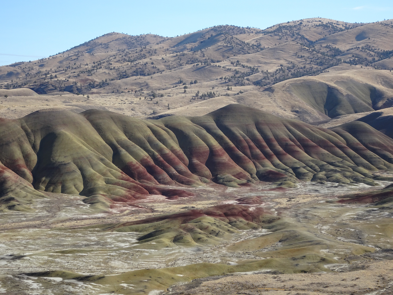
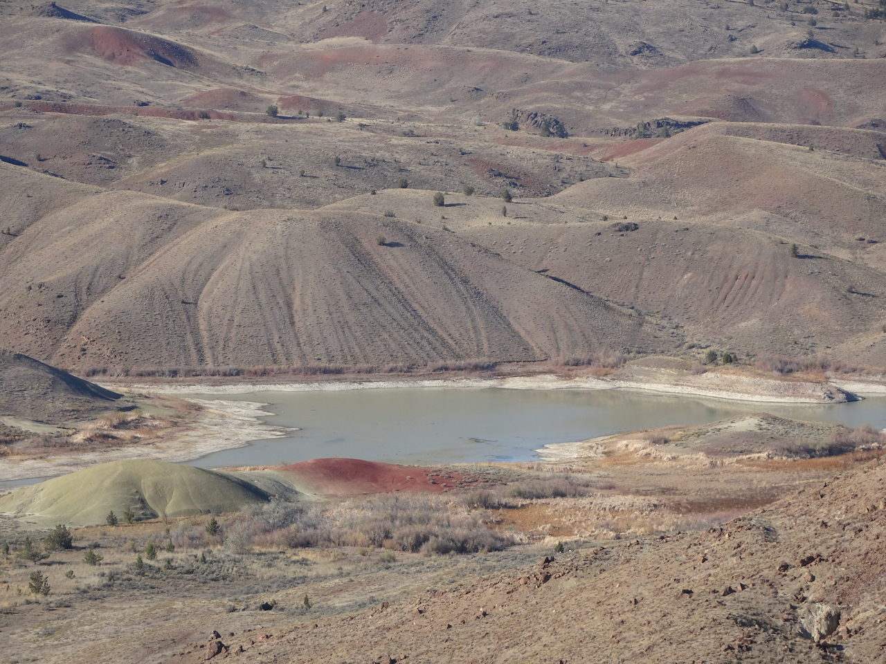
Painted Hills Overlook – The main overlook has an amazing view of the Painted Hills. We walked to the upper overlook for more views.

Main overlook.
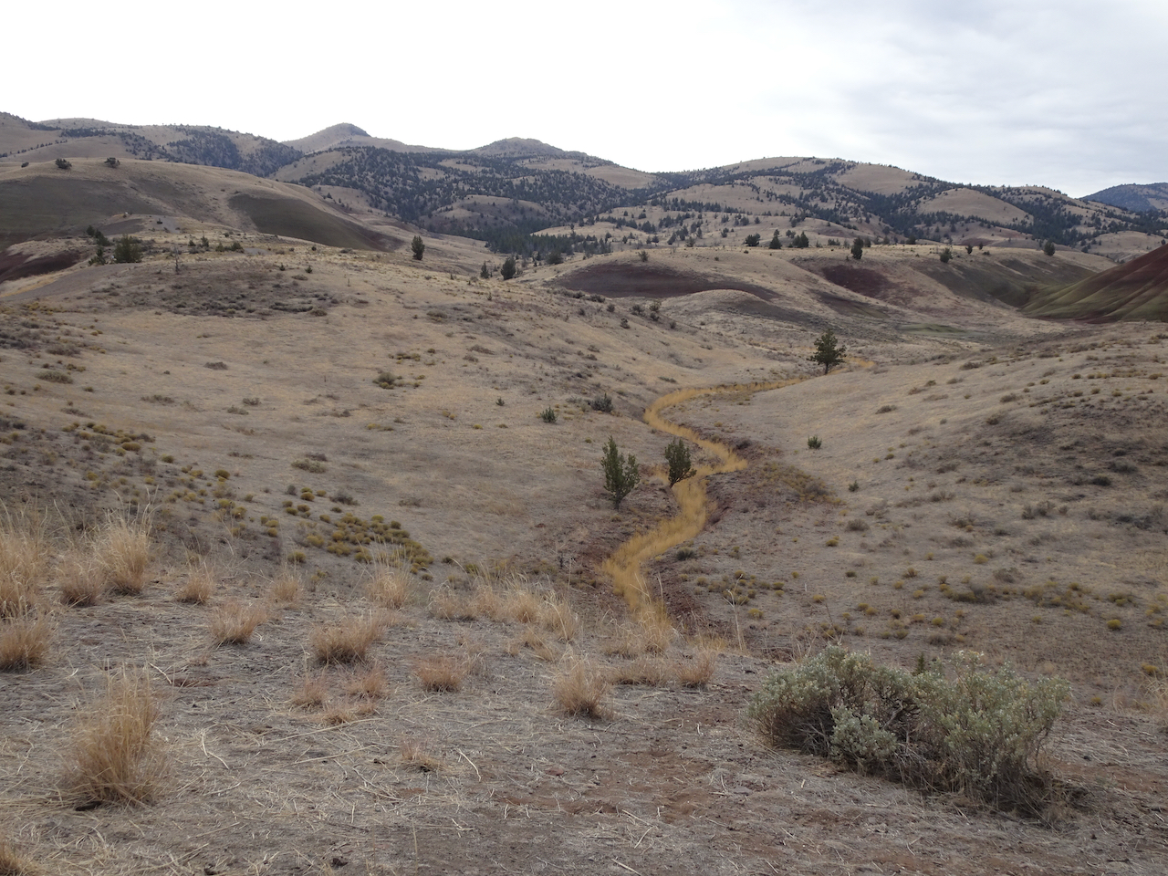
River of grass on the nearby hills.

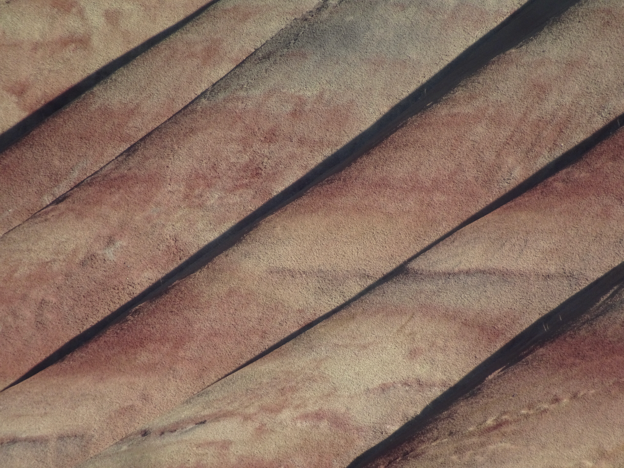
Zooming in from the upper overlook:

Upper overlook
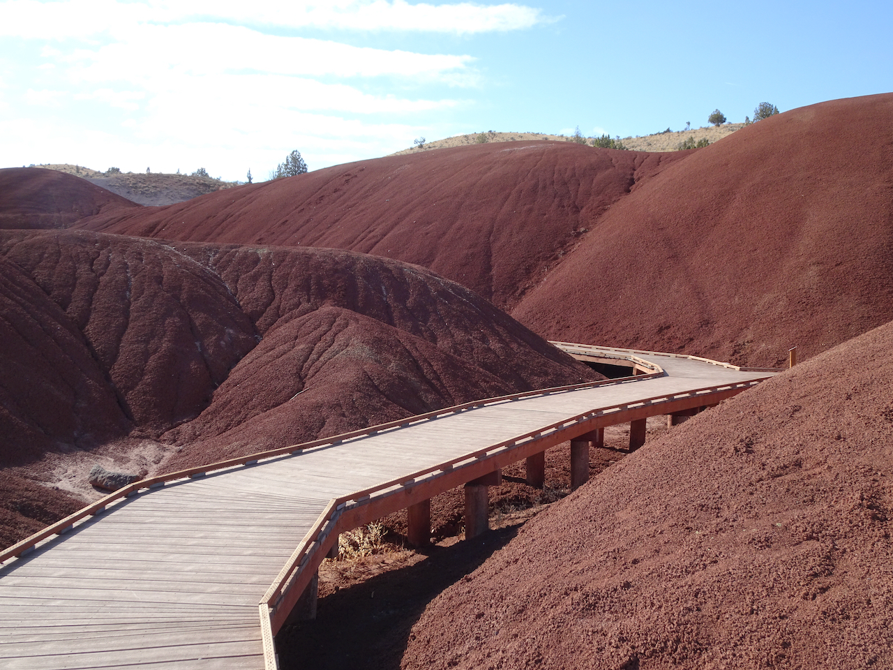
Painted Cove Trail – We next walked the short loop through the red hills near the John Day River.


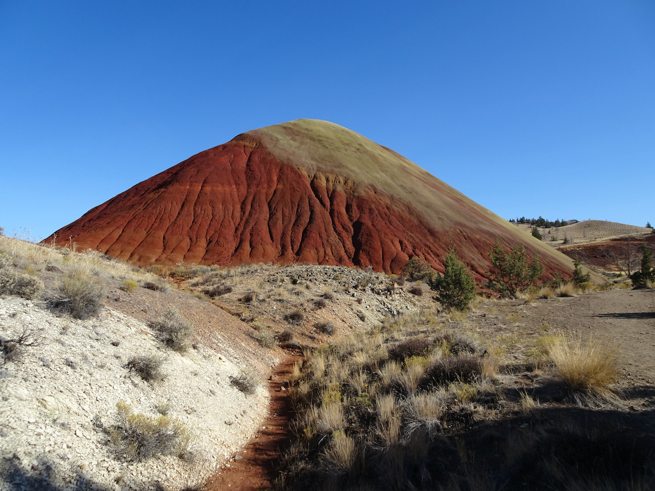
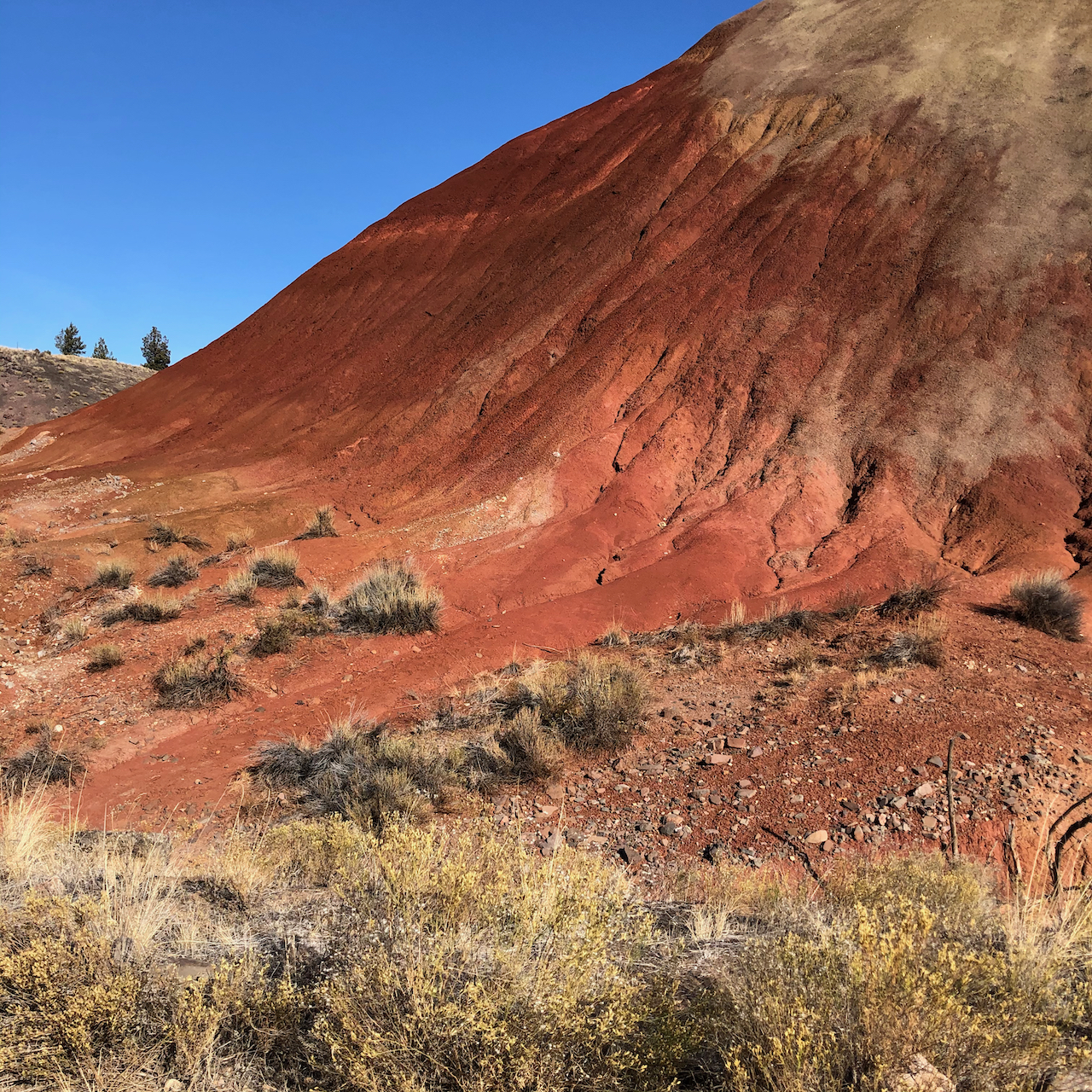
Red Scar Trail – Another short trail that leads past brilliantly colored badlands.

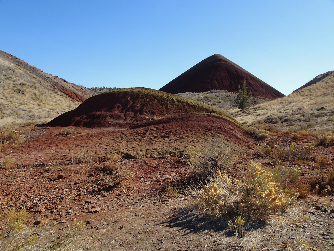
Red Scar Knoll and Red Hill

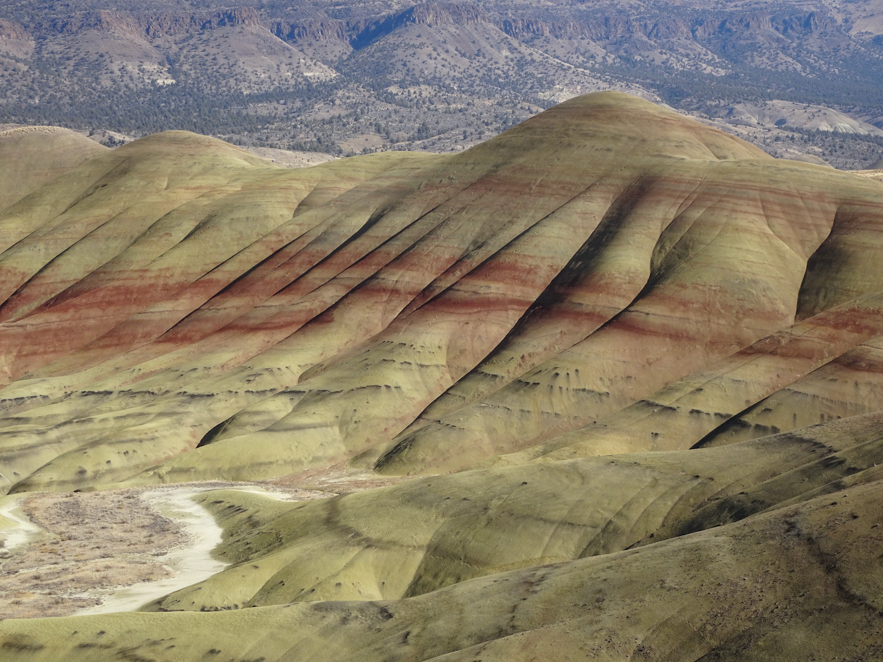
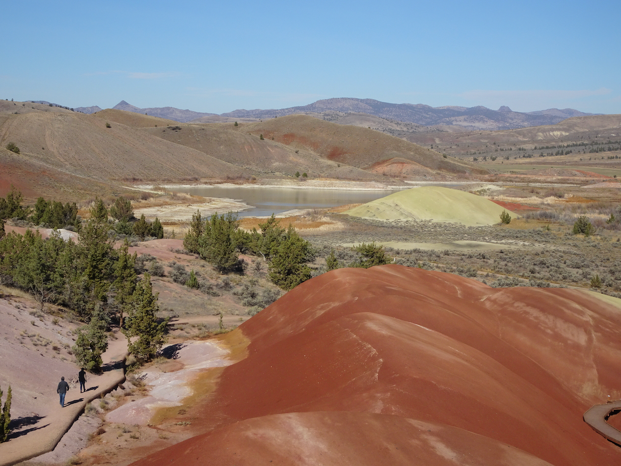
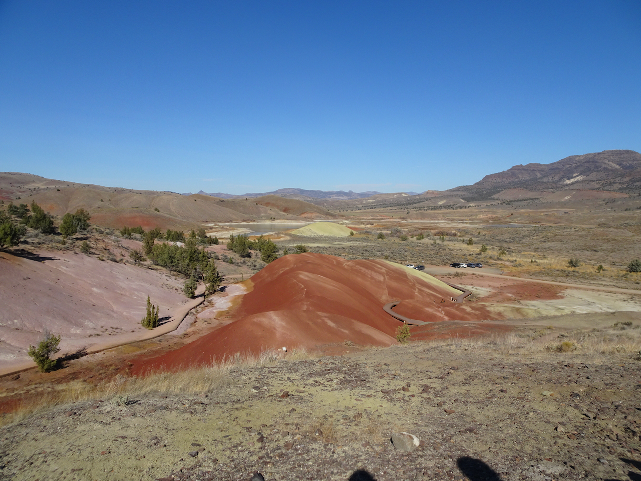
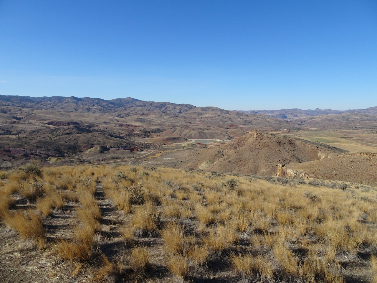
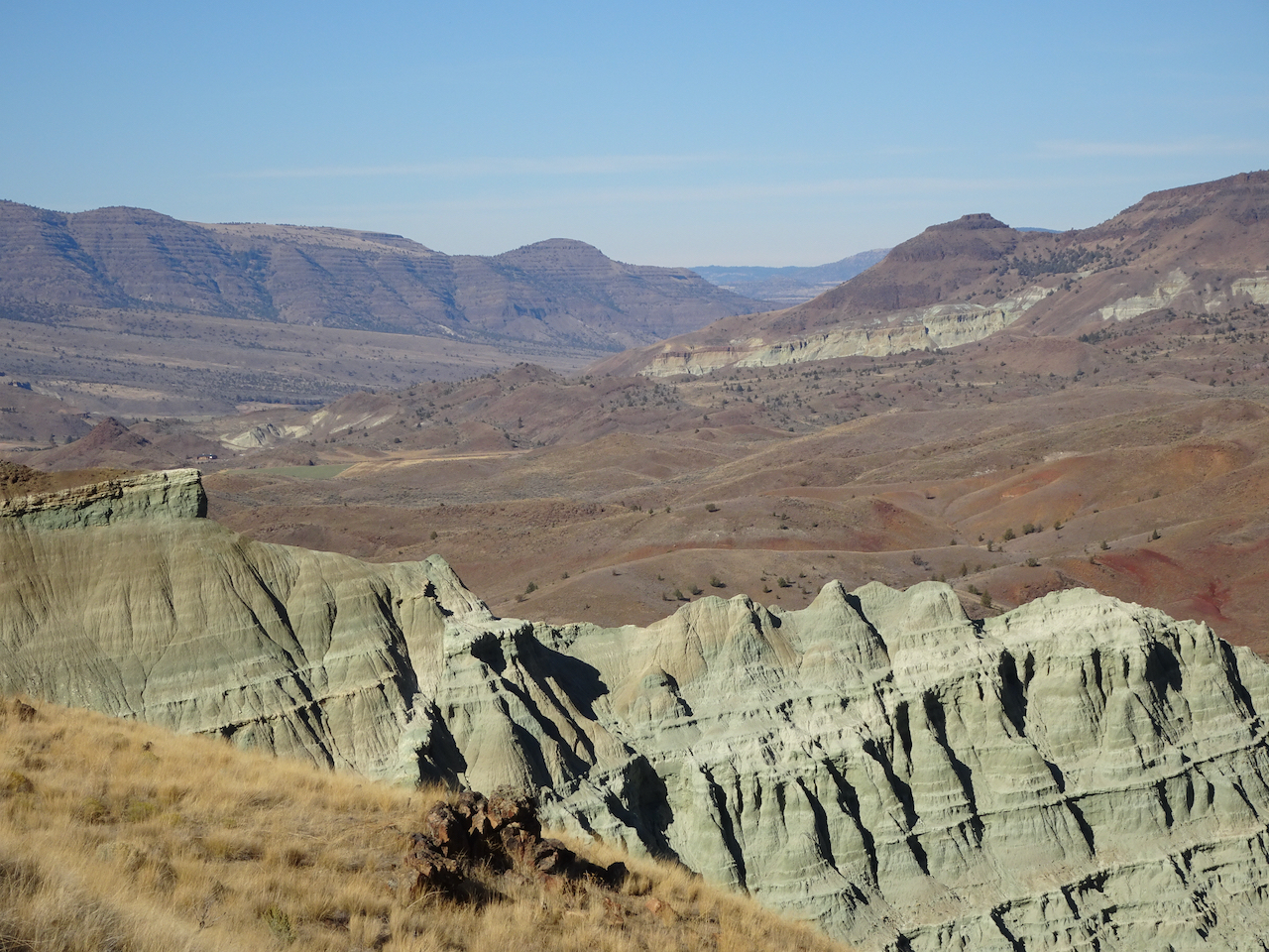
Carroll Rim Trail – Our longest trail for the day (1.6 miles/400 feet) was a walk up to the Carroll Rim. As we hiked up, we could look down on the Painted Hills. From the top, we could see views in every direction.
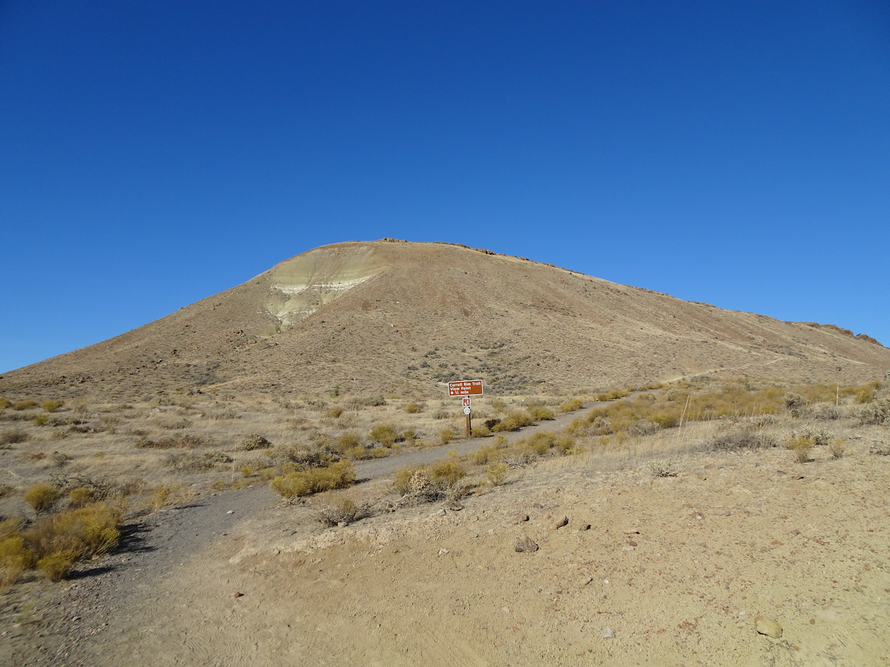
Carrol Rim
Looking down from the trail.
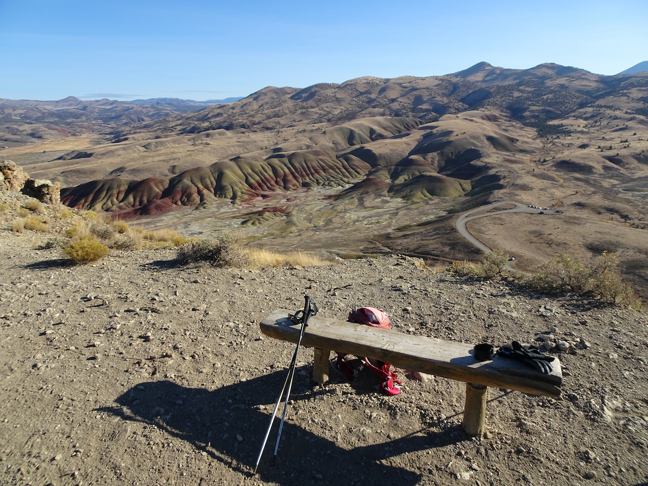
View from the end of the trail.
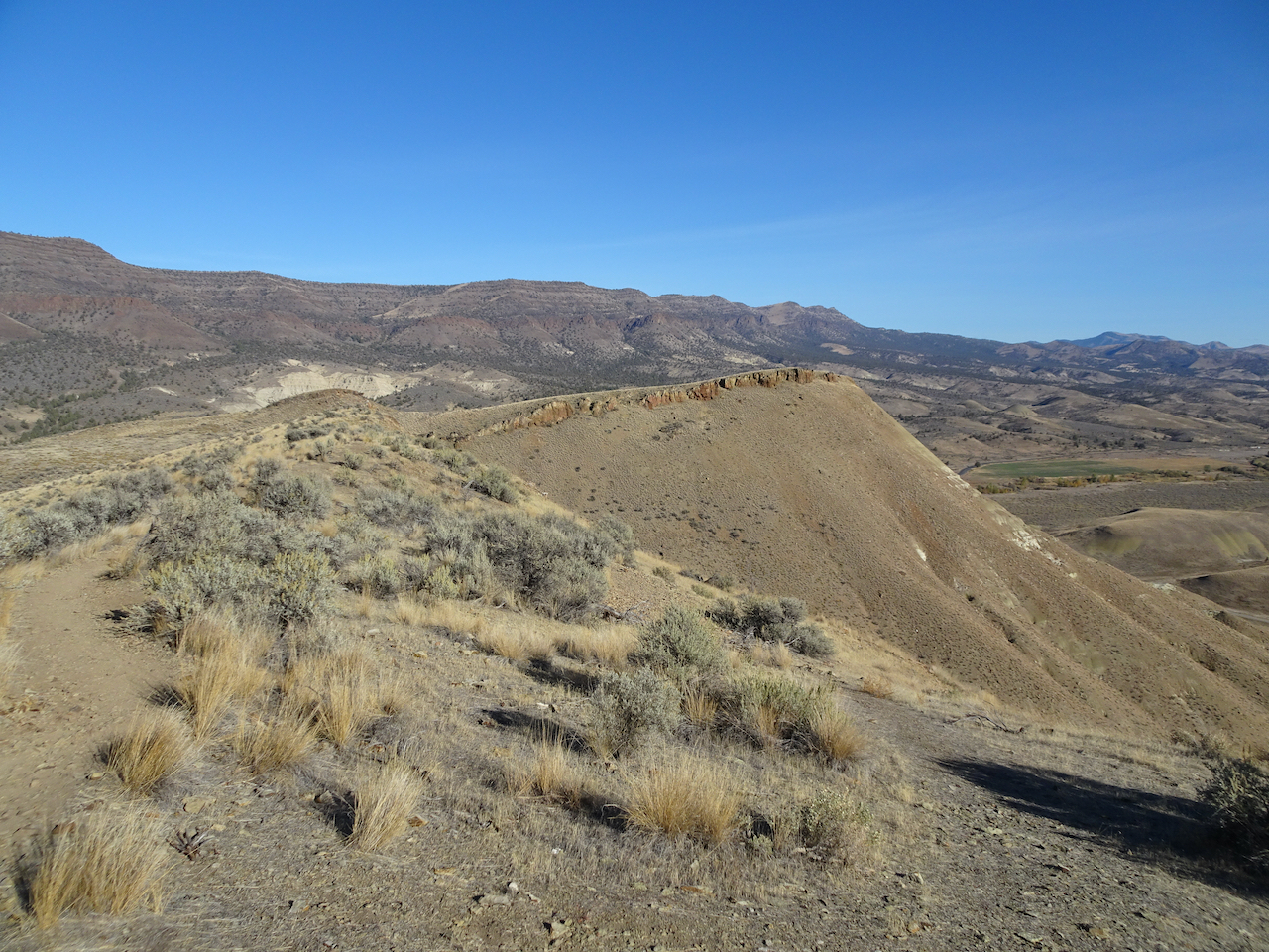
View to the east
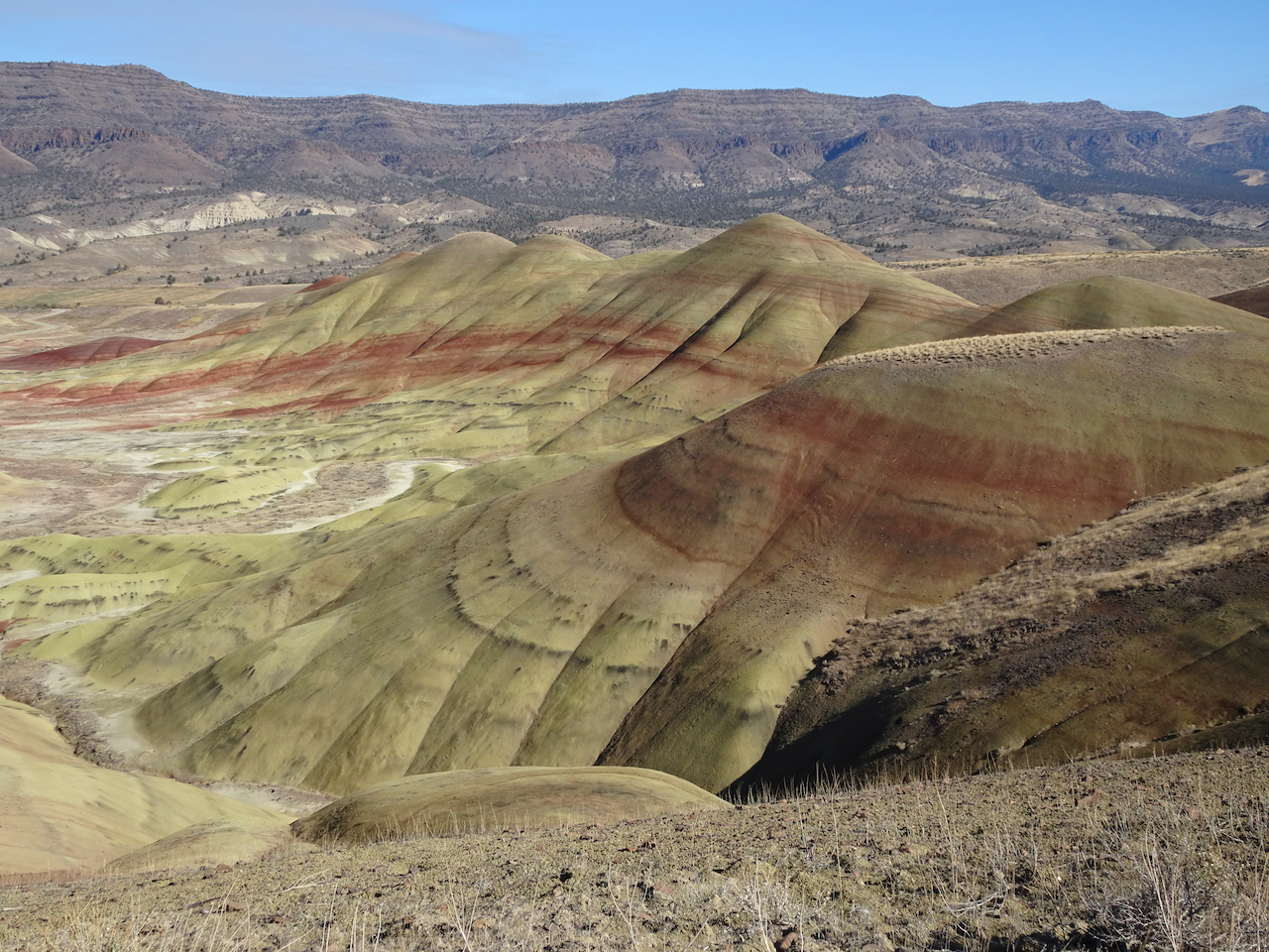
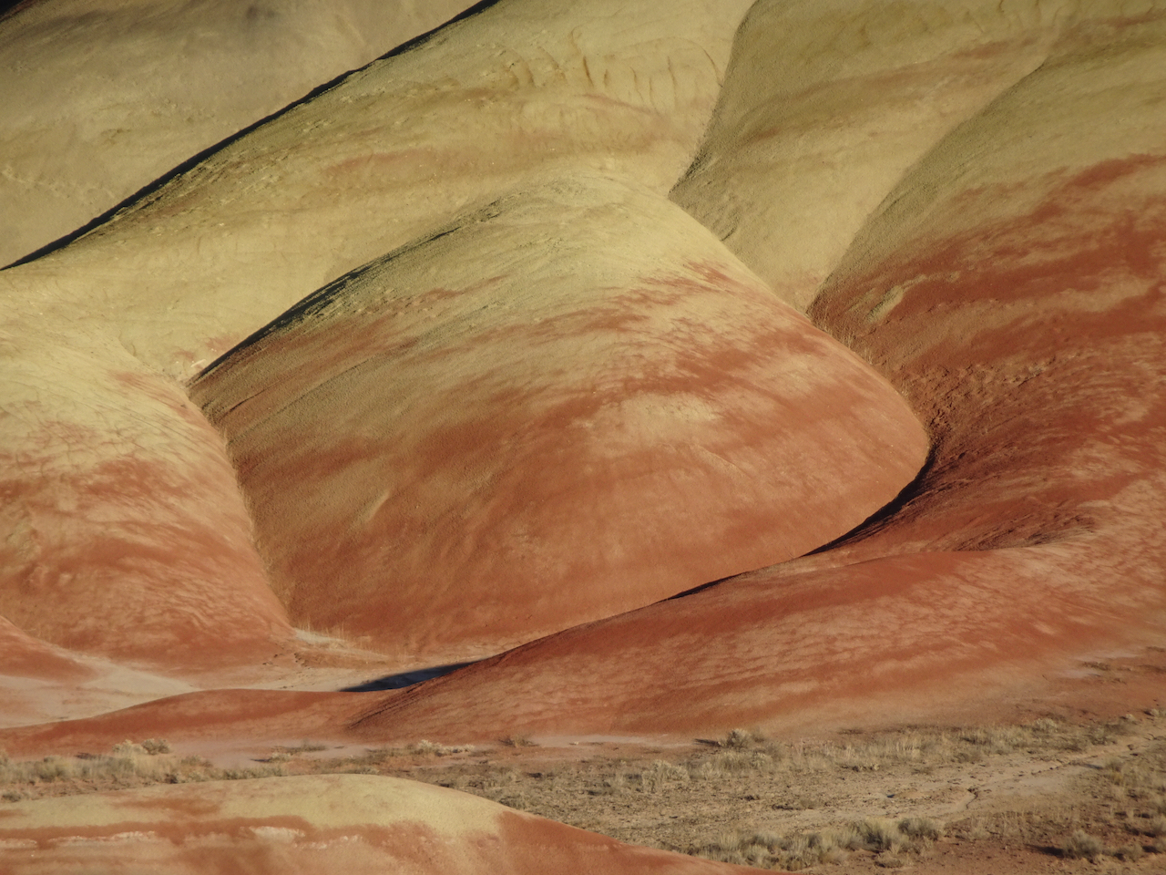
View to the northwest, Painted Cove area.
Close up of Painted Cove
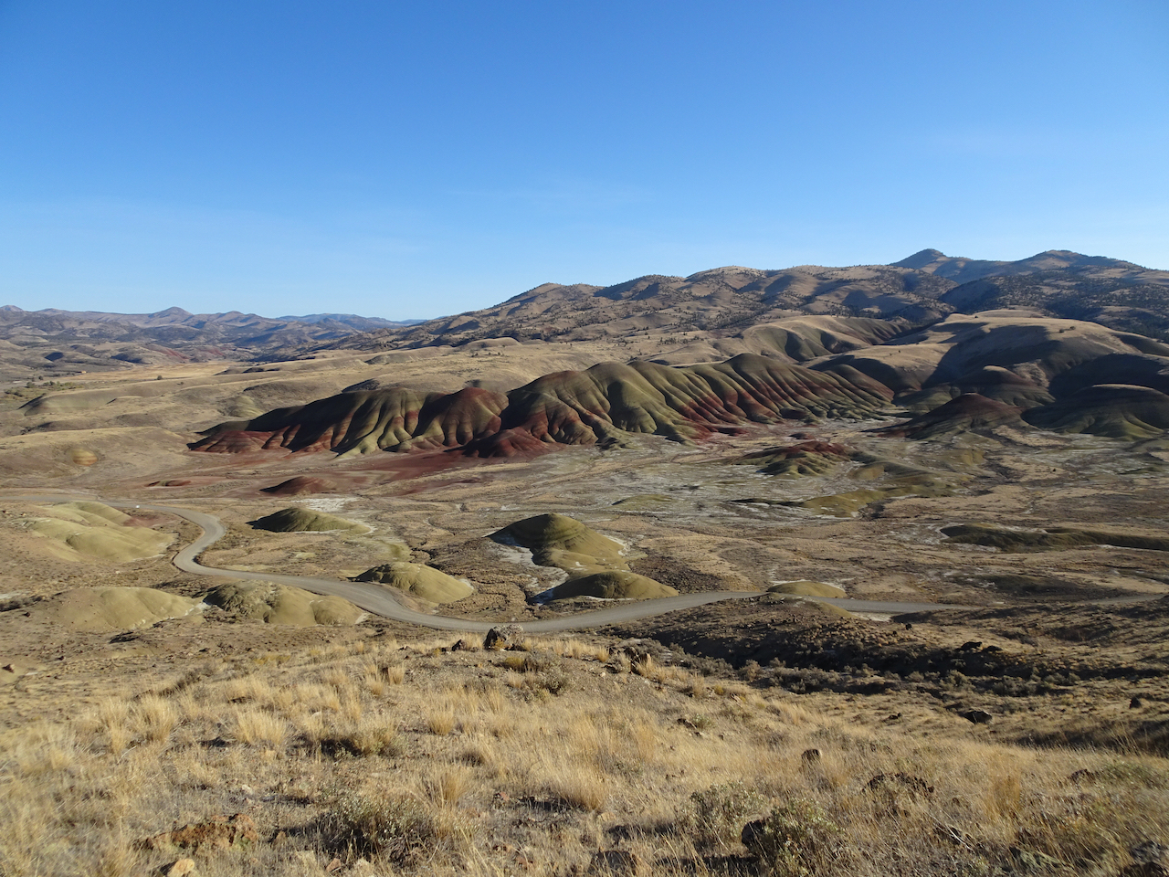
View to the Painted Hills on the way down.
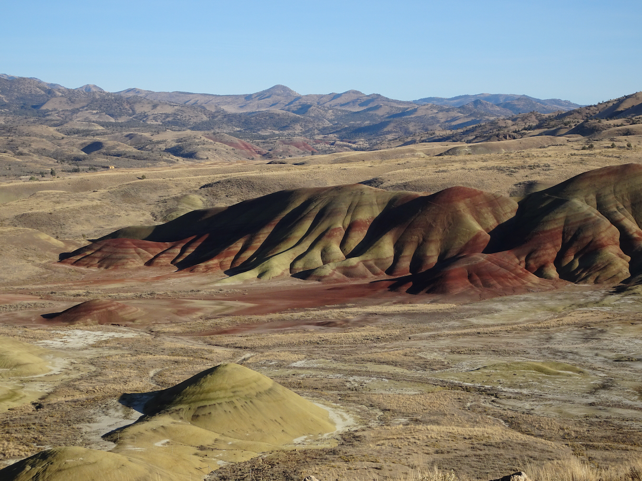
Back to the Painted Hills Overlook – for another look as the low western light added a glow to the Painted Hills.

On our drive back to Prineville, we saw a herd of deer, and a view of the Central Cascades.
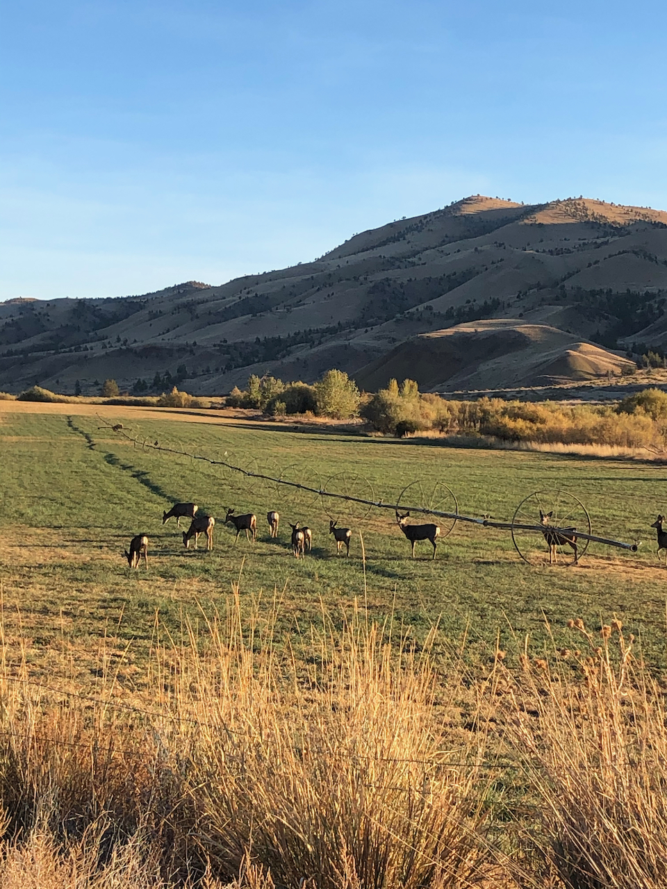
Deer near Painted Hills.

Mt Bachelor, Broken Top and the Three Sisters on the horizon.
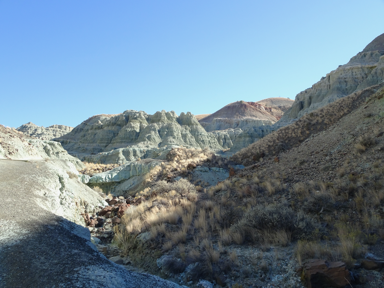
Sheep Rock Unit – Blue Basin – 10/28/2020
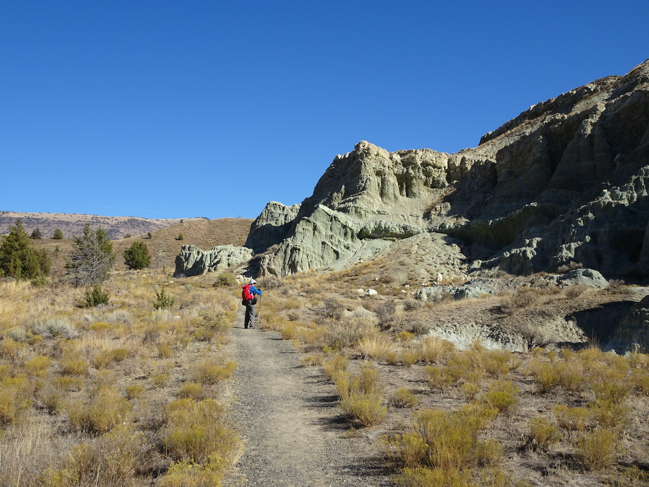
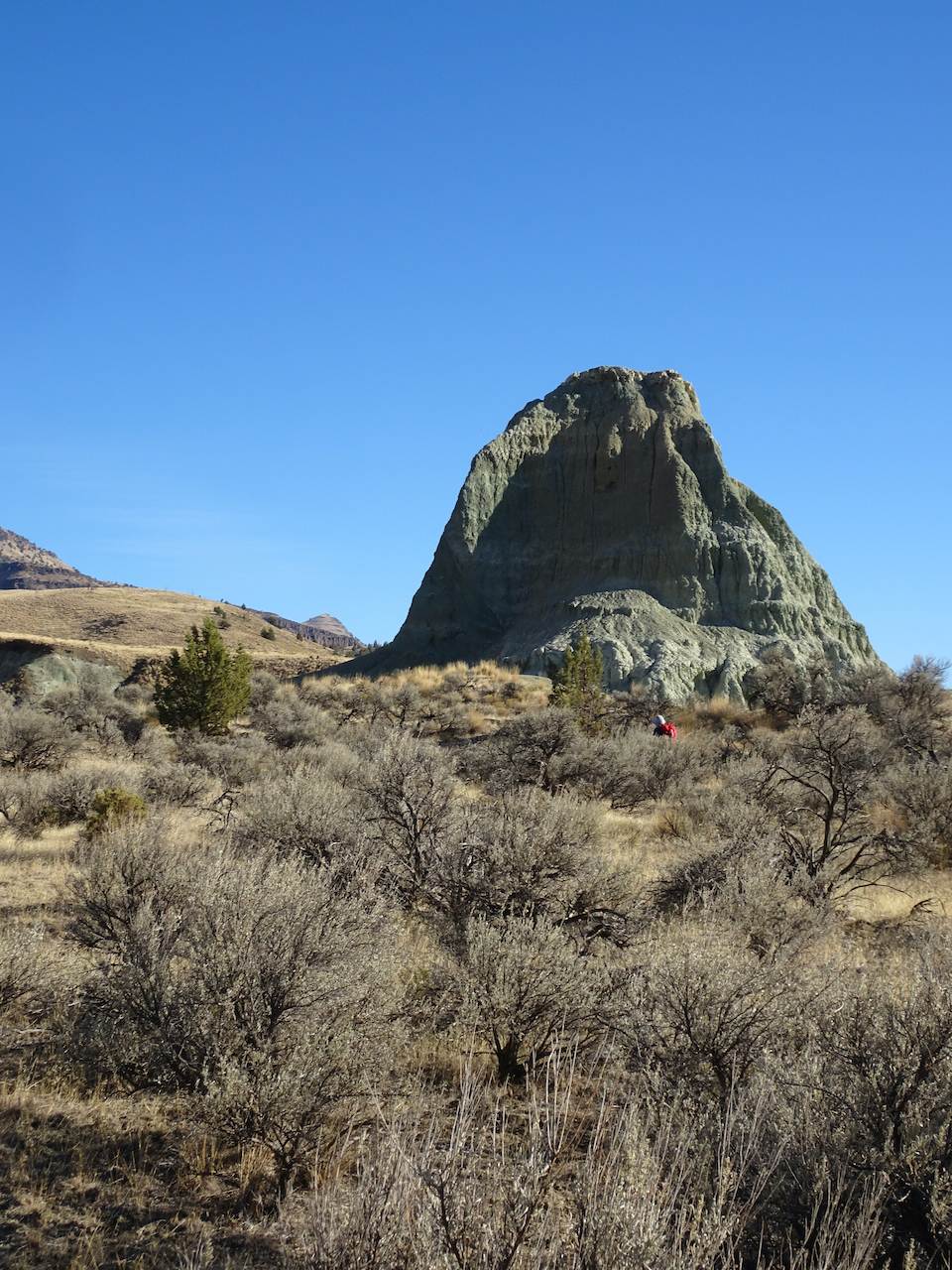
We first walked the Island in Time Trail in the heart of Blue Basin.
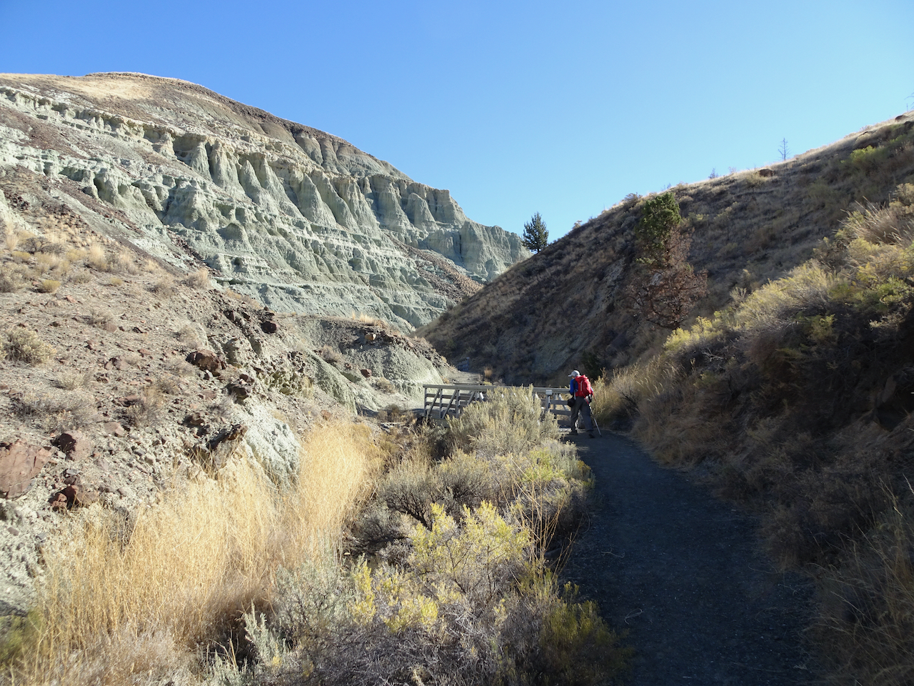
Entering Blue Basin – one of many bridges on this trail.
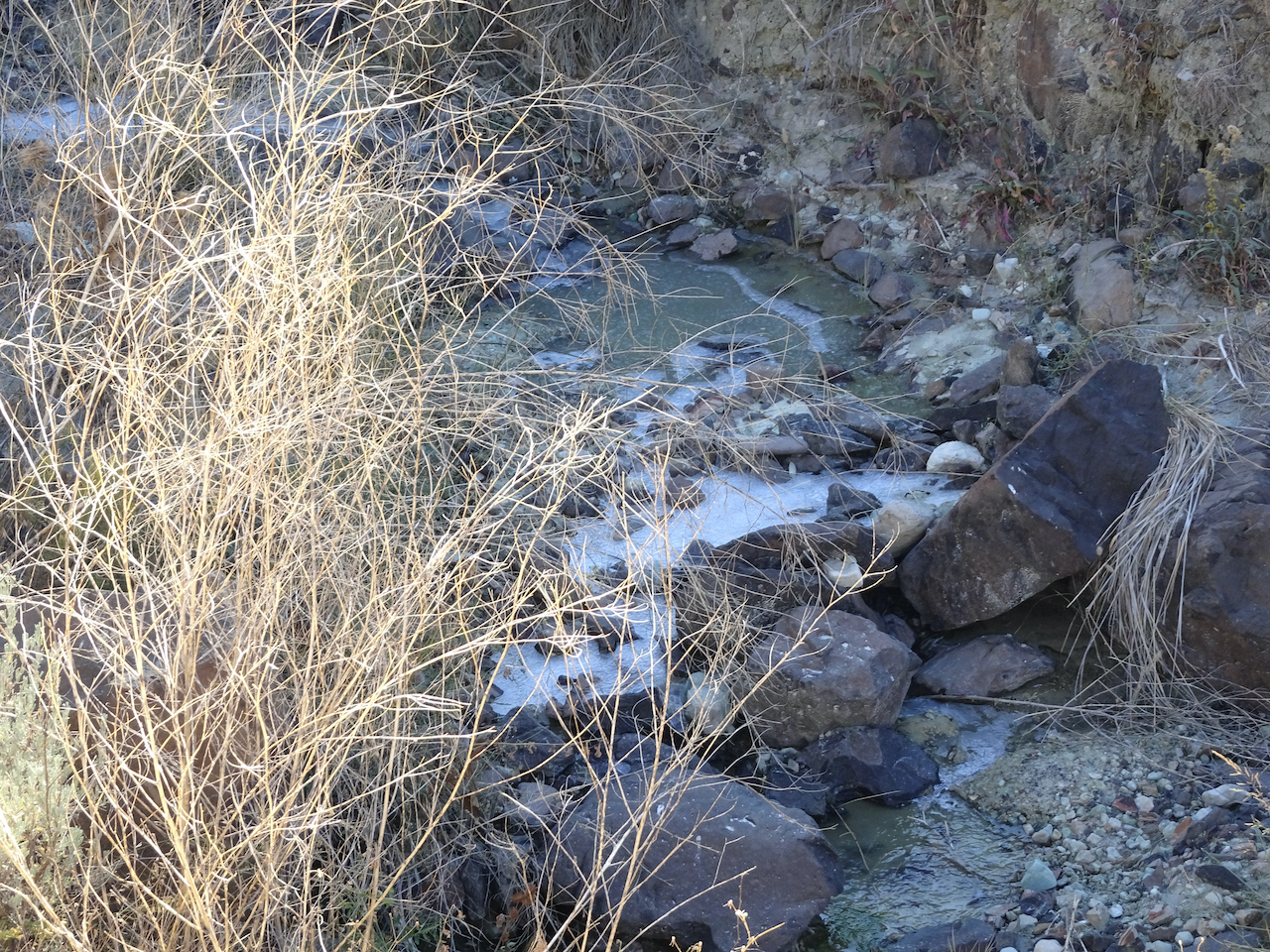
Ice in the creek – last time we were here there was bluish water in the creek.
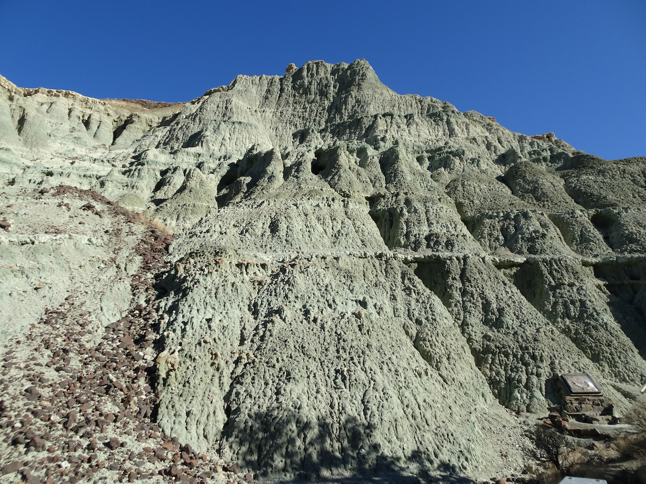
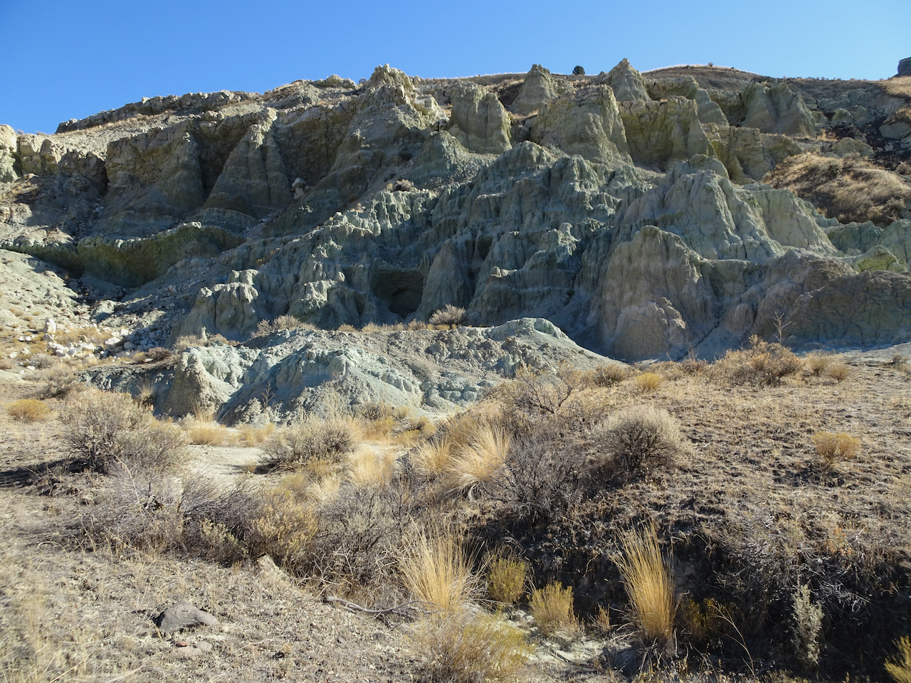
Blue-green volcanic ash claystones.
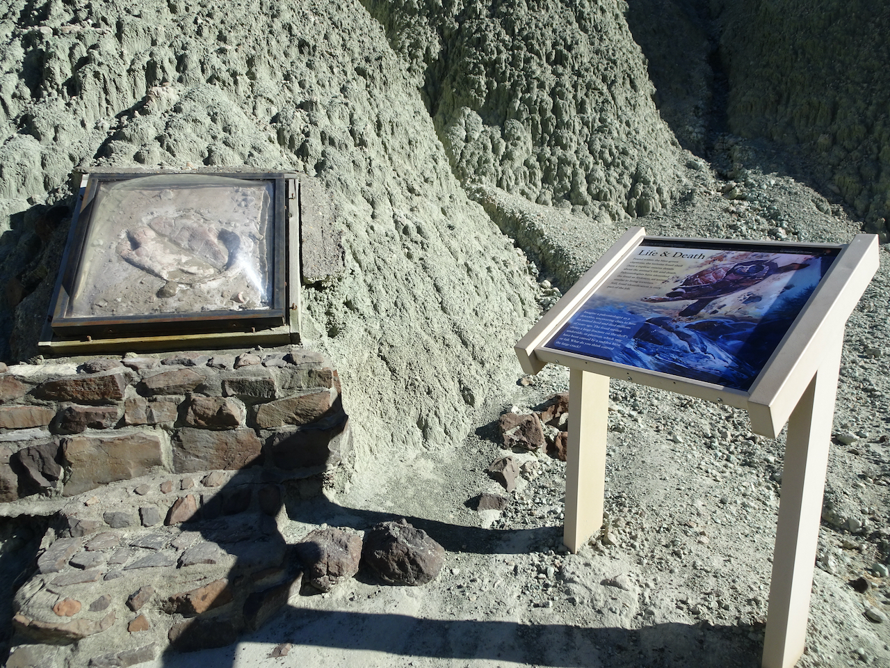
One of many fossil displays along the trail.
We would be hiking on the surrounding hills later in the day.
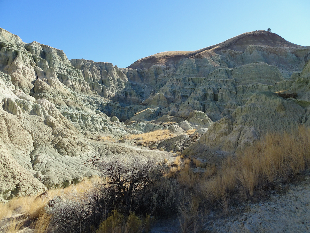
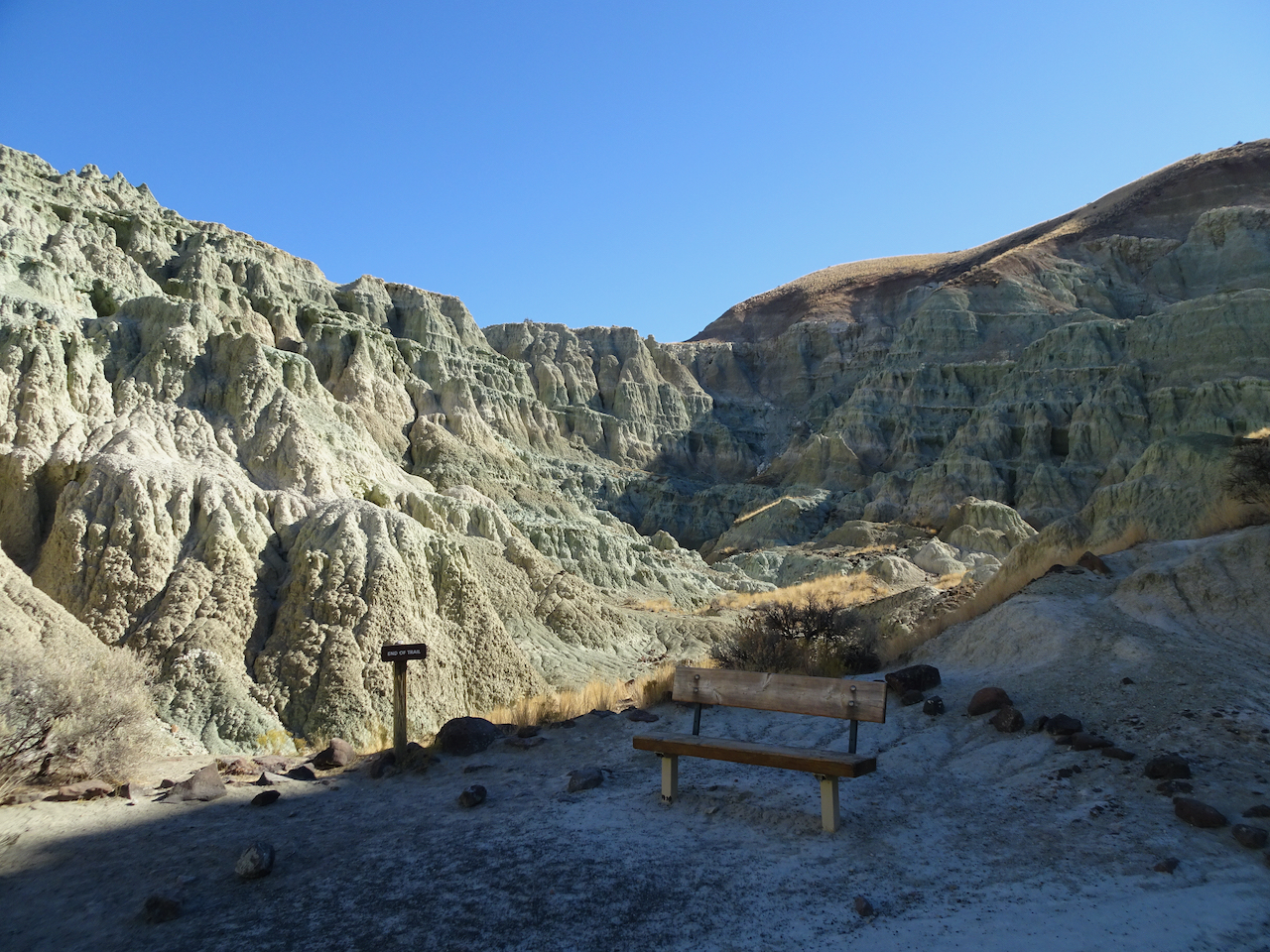
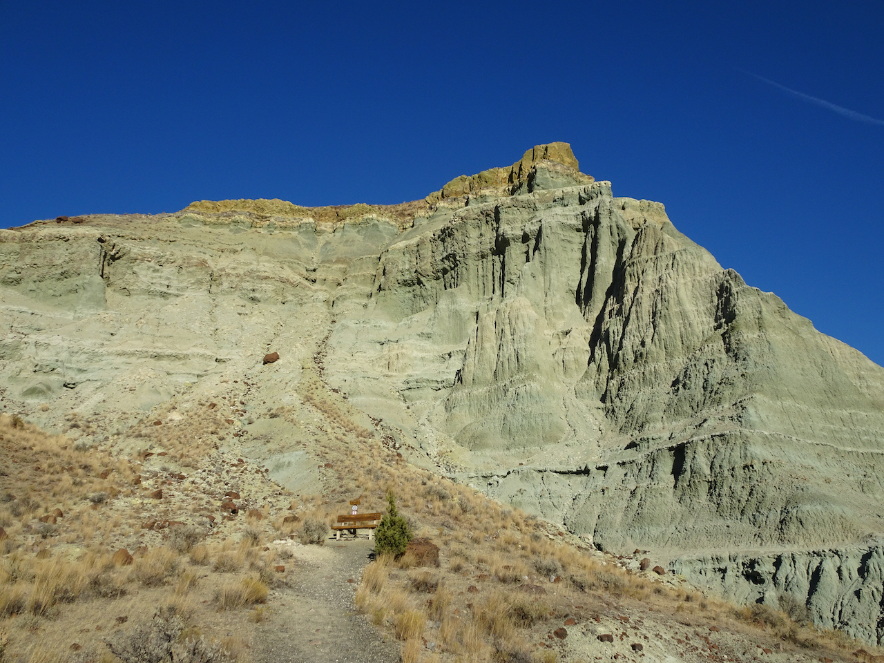
Bench at the end of the trail.
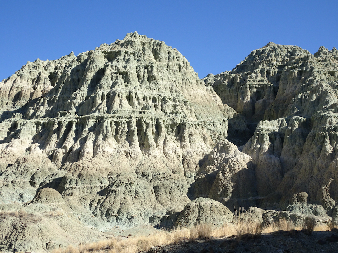
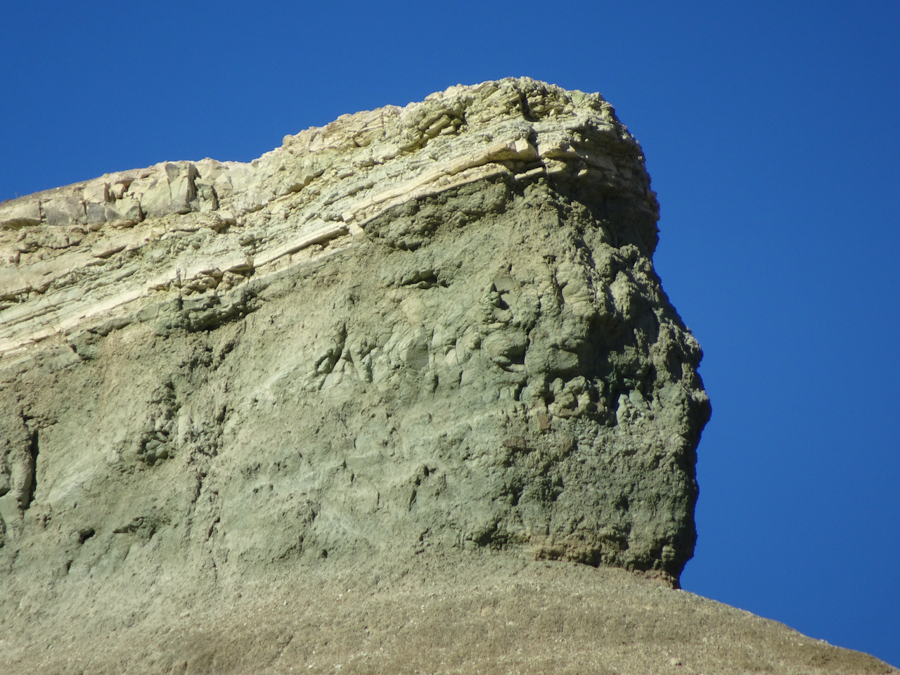
This beautifully eroded skyline was a prominent feature.
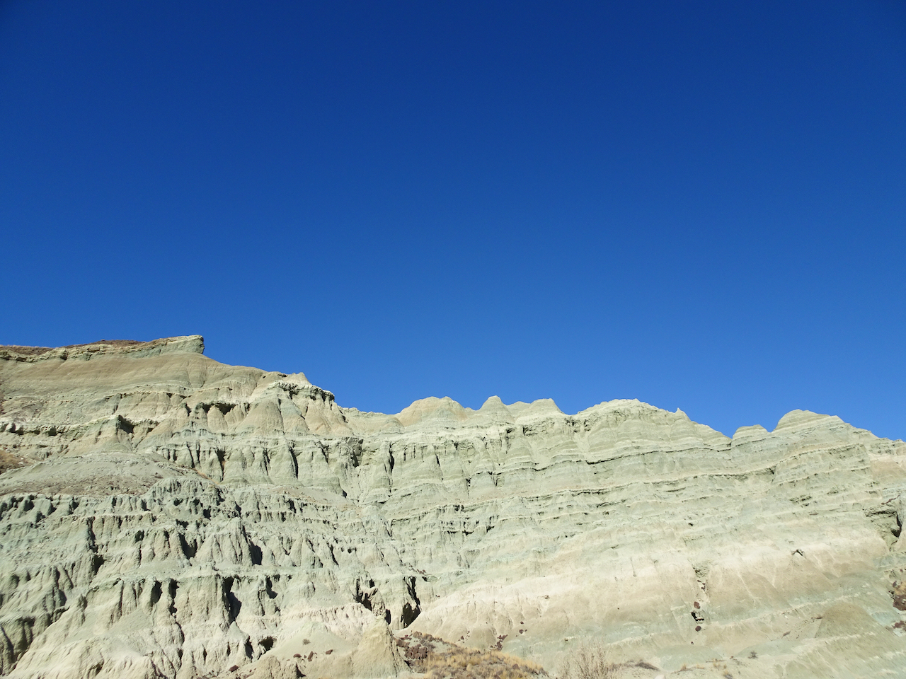
Zooming in on the prow…

We spotted this little bird on our way out.

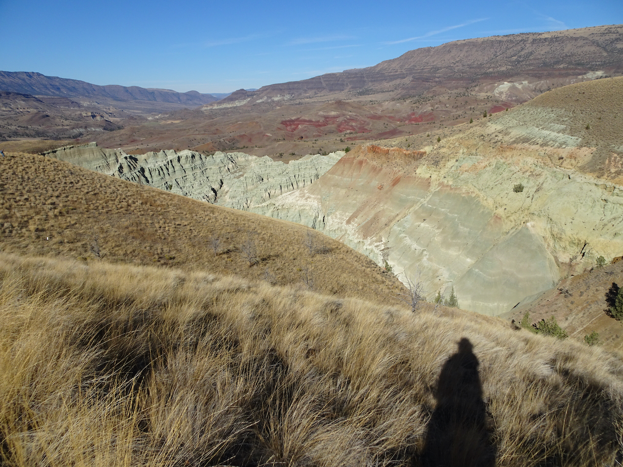
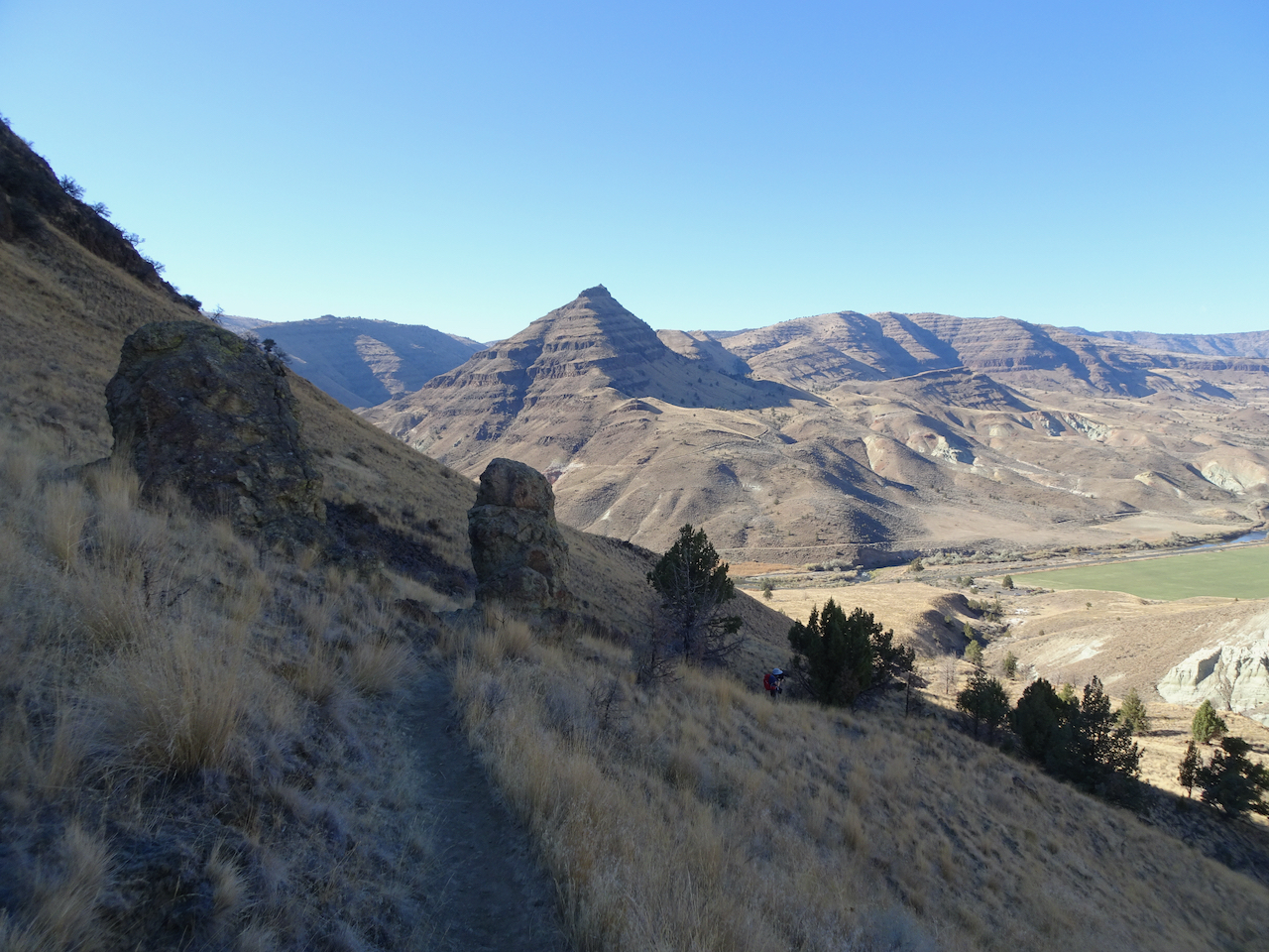
After lunch, we hiked the longer Blue Basin Overlook Trail (3.25 miles/ 600 feet) around the encircling mountains.
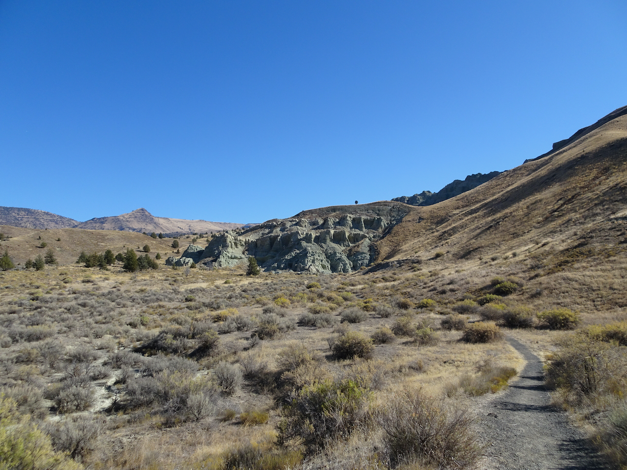
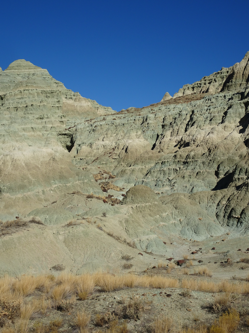
North of Blue Basin, the trail passes more blue badlands formations.
Continuing up hill…
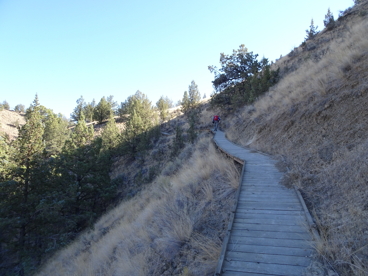
Boardwalk over mudstone
Views to the north
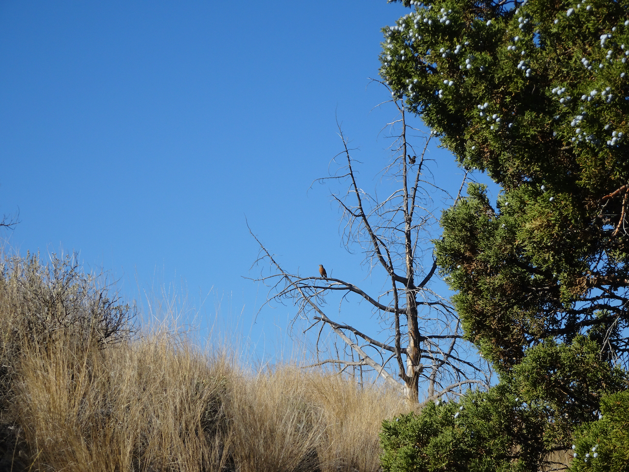
Robins and juniper berries.
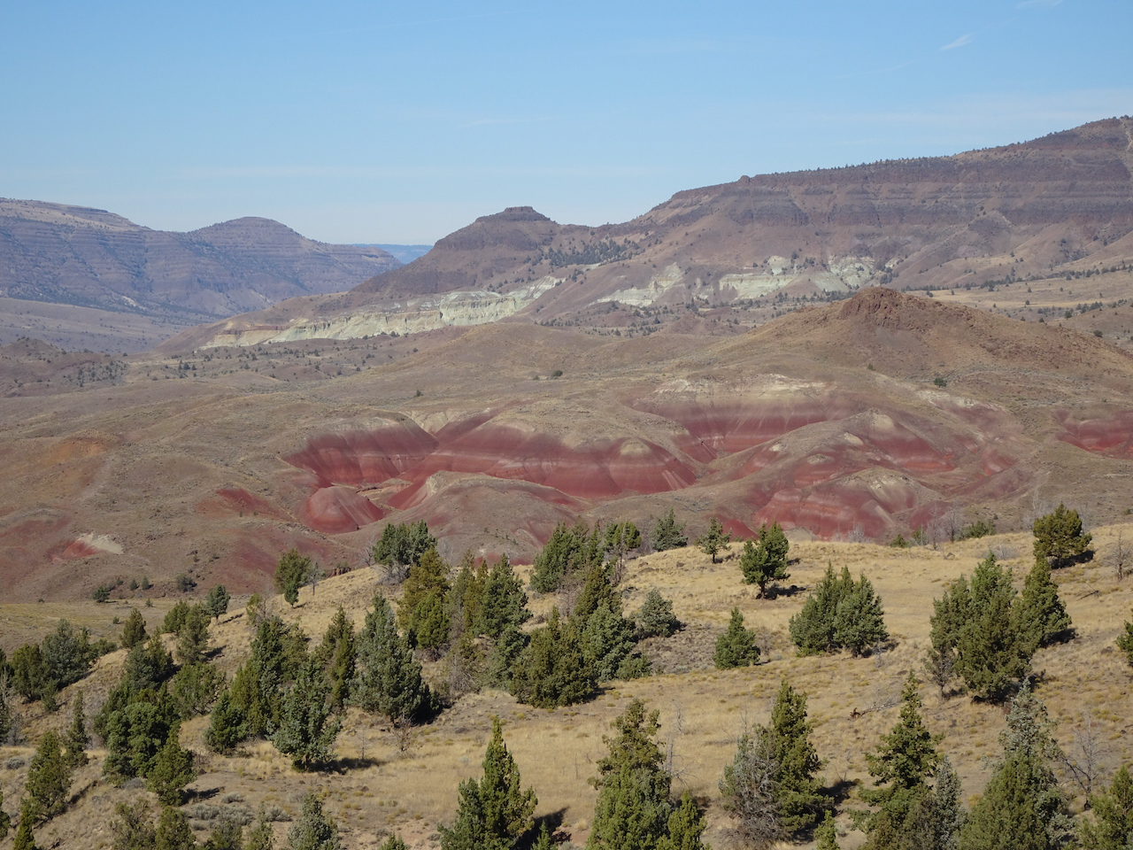
Eventually we reached the viewpoint over Blue Basin –
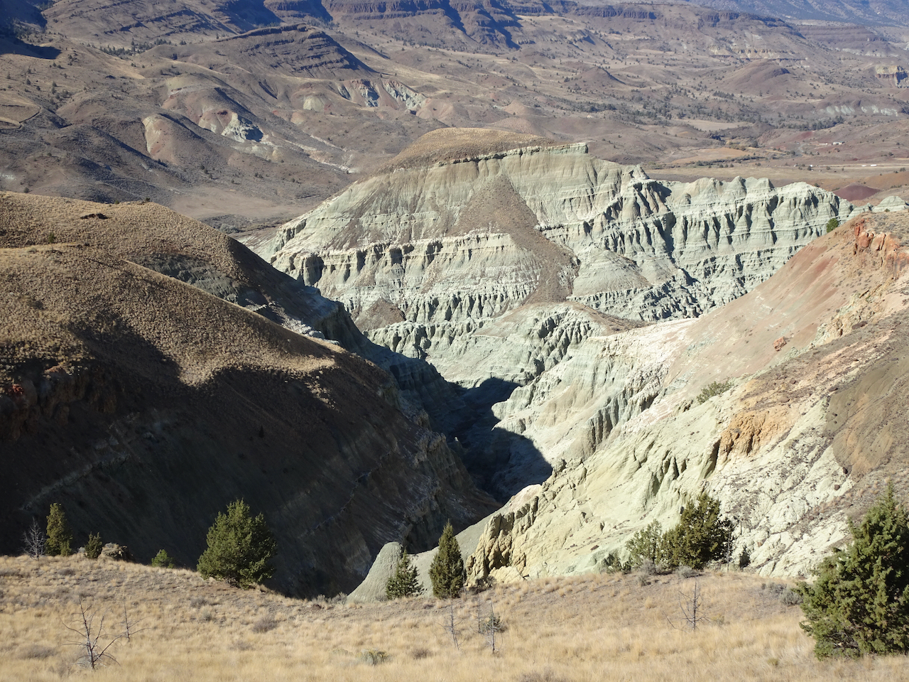
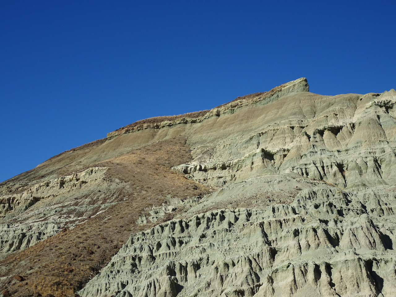
The trail circles around to the south, above the basin, giving views of the same beautifully eroded skyline I noticed earlier.

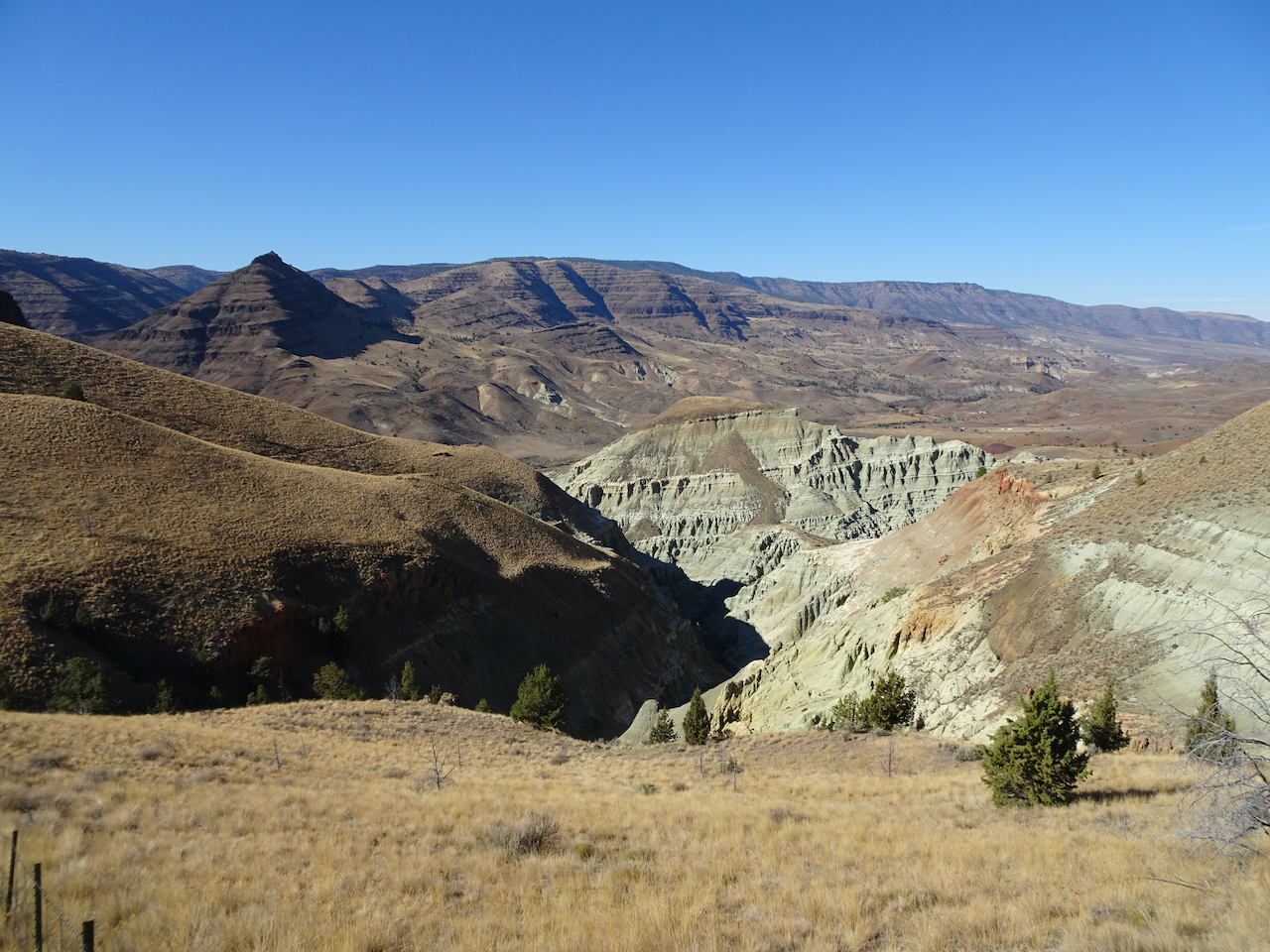
Eventually, we descended to the trailhead.
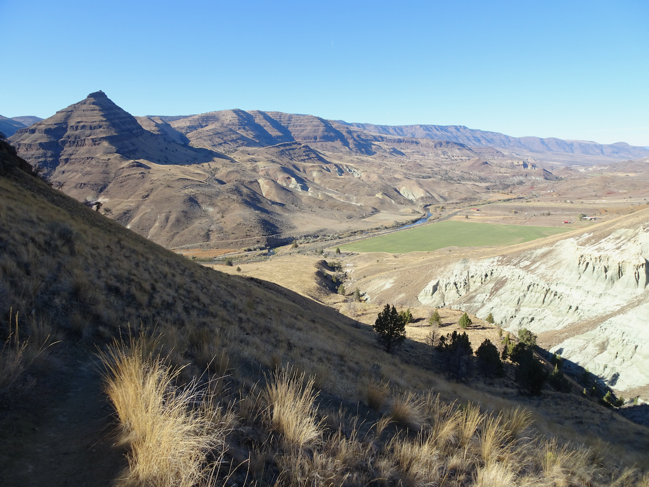
John Day River Valley.
We also took a short hike on the Story in Stone Trail, located just a few miles north in the Foree unit. We saw similar landforms there.
We thoroughly enjoyed our visit to this remote area. We were lucky with sunny, if cold, weather. The trails were mostly empty, an important Covid consideration. Lots of fresh air and a good change of pace from our sheltering at home routines.

I think that cute little bird with the stripped tail is a Rock Wren, not an uncommon species in the rocky reaches east of the Cascades. You got a good photo of a bird that likes to hop in and out of focus! 🙂
LikeLike
Thanks! I was thinking possibly wren. I’ve become pretty good at wildflower id, but I am quite the novice with birds. This was the best of four fuzzy pictures.
LikeLike
Such unique landscape. Beautiful! 🙂
LikeLike
Pingback: 2020 Review / 2021Preview | Margaret Quilts
Such superb photos. Thanks you for posting them for us to see.
LikeLike