Return to Angel’s Rest (18-53)

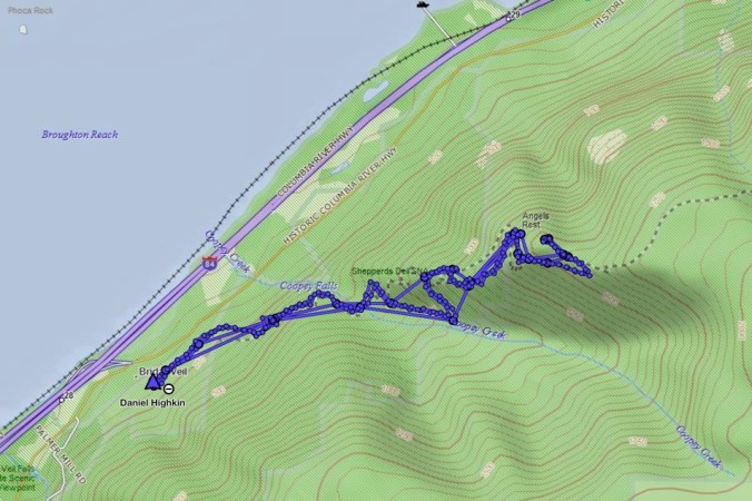
Angel’s Rest Trail, Oregon   November 24, 2018

A few trails in the Columbia River Gorge that have been closed since the September 2017 Eagle Creek Fire were reopened for the first time this past weekend. We went to Angel’s Rest on Saturday morning, along with hundreds of other local hikers. It was with care, scrutiny, appreciation, and gratitude that we made our way up 1500 feet to the iconic views over the gorge. The trail was in great shape, thanks to the many trail keepers who have worked on recovery.
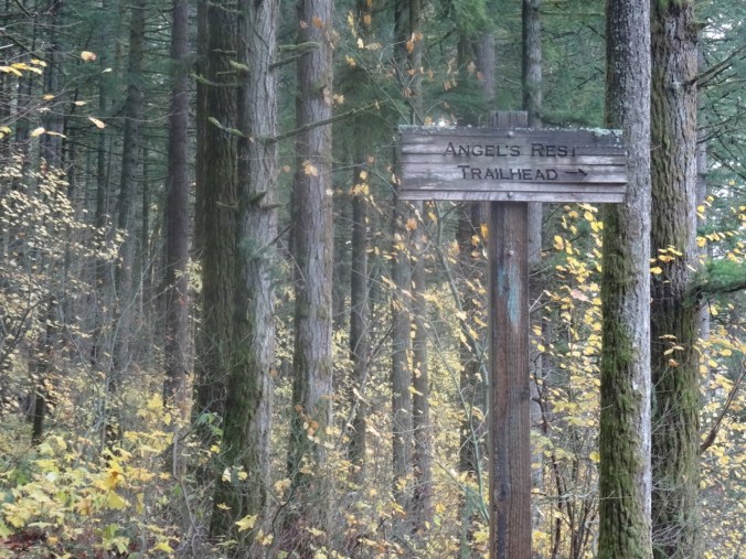
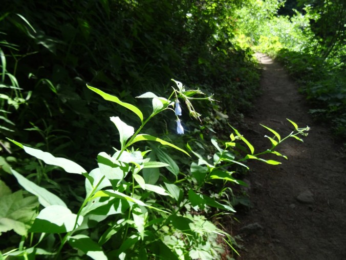
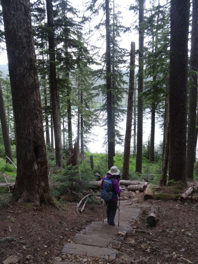
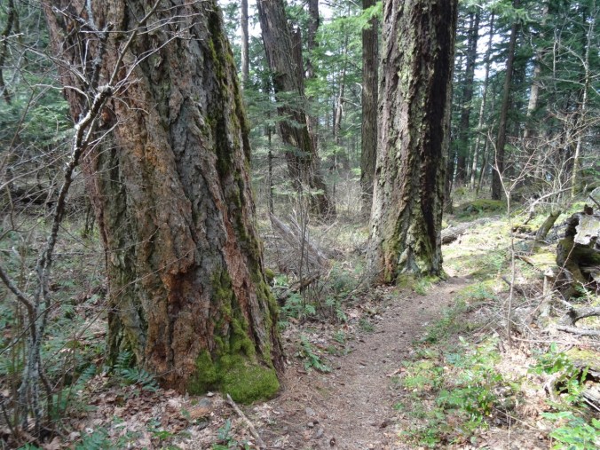
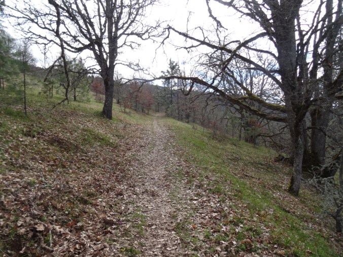
DSC00428

Into the woods

DSC00312

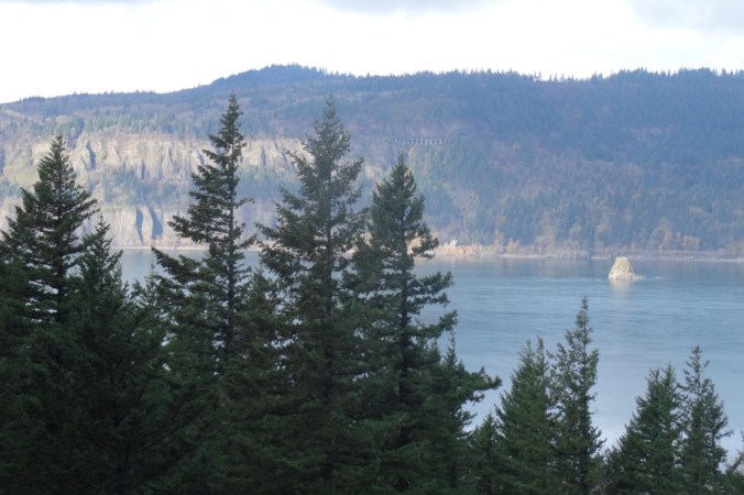
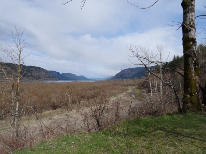
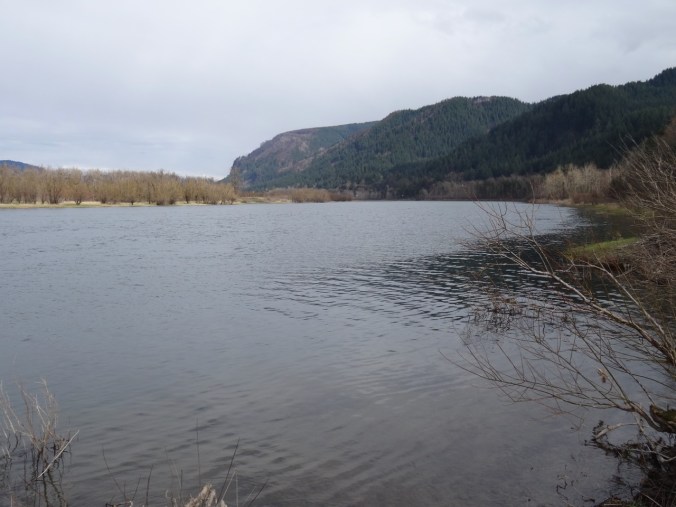
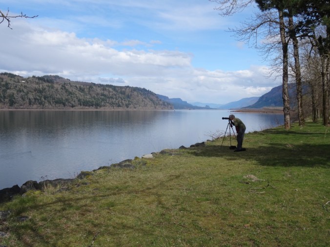
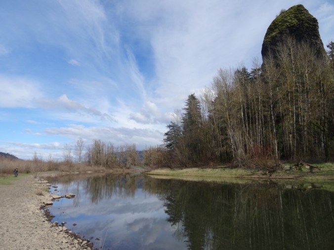
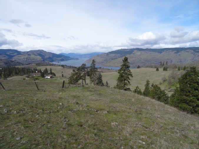
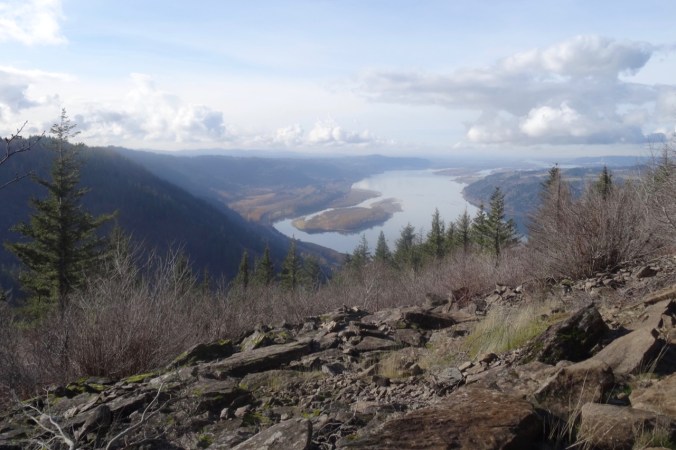
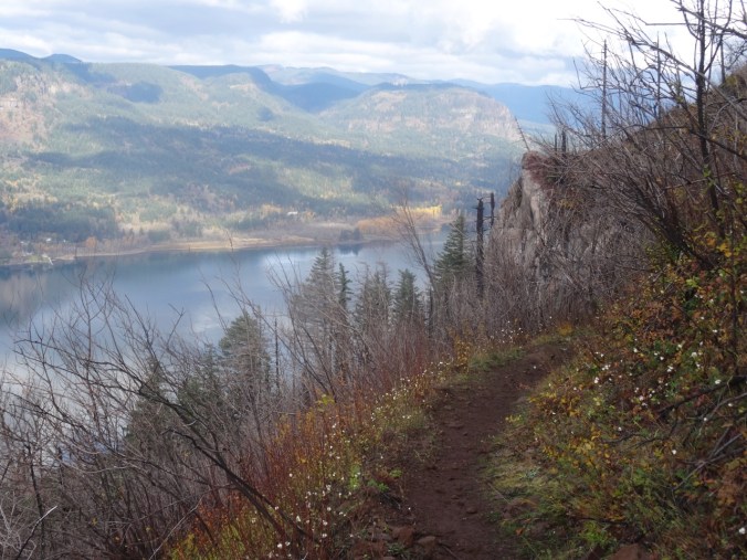
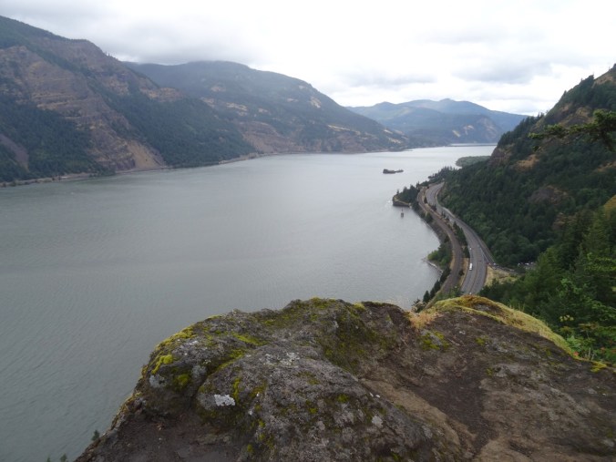
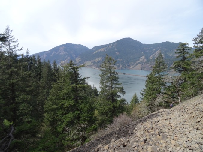
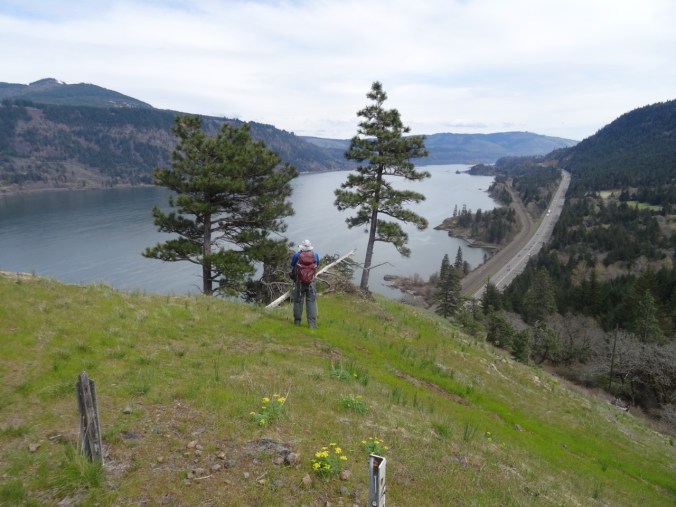
Views of Cape Horn, the Columbia River and Phoca Rock emerge on the lower trail.
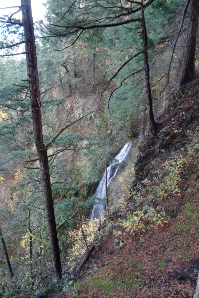
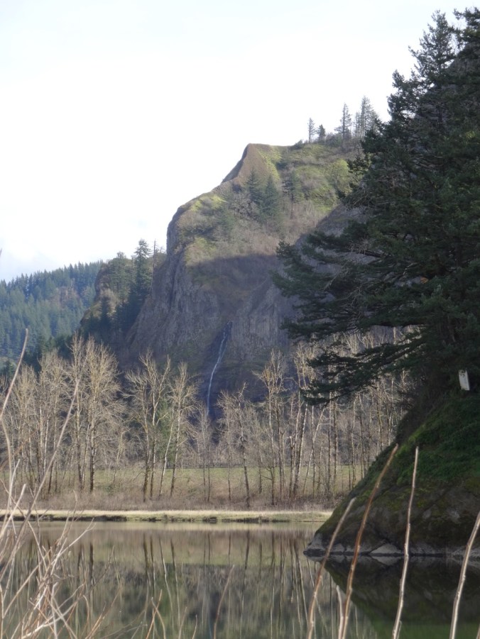
DSC00315

Coopey Falls

DSC00330

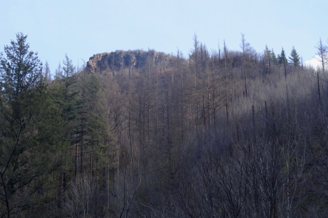
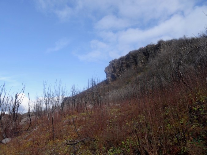
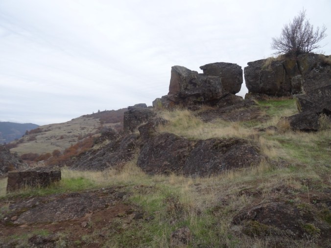
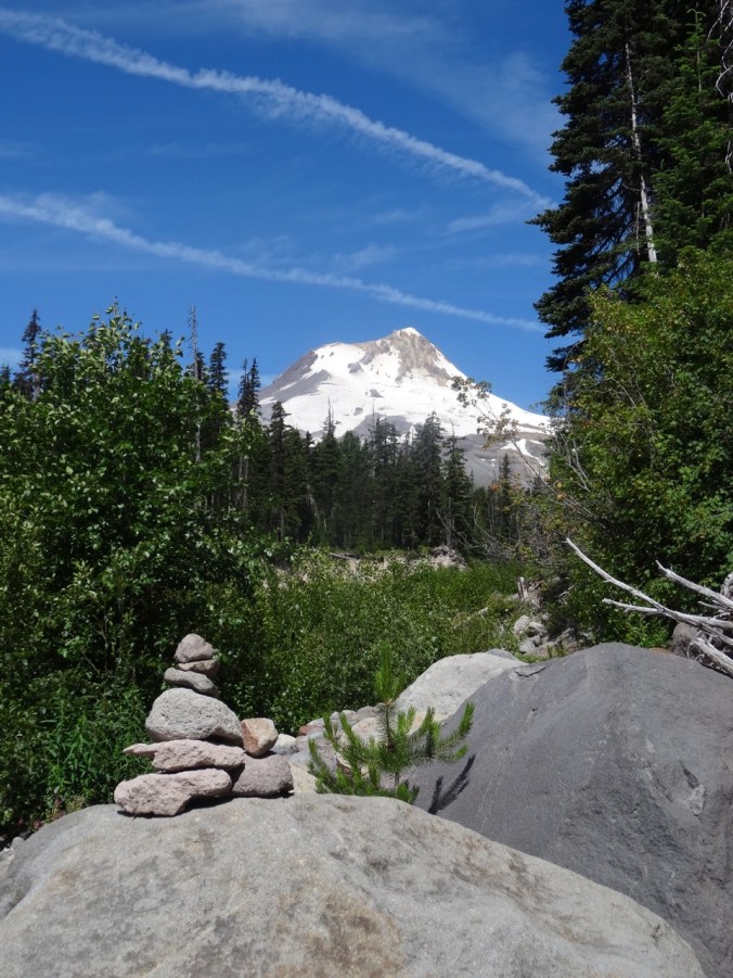
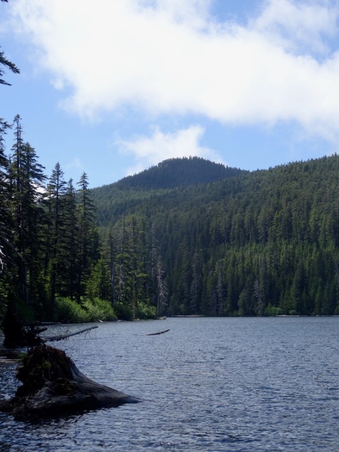
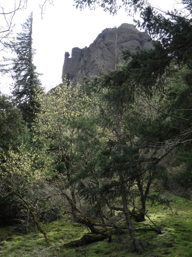
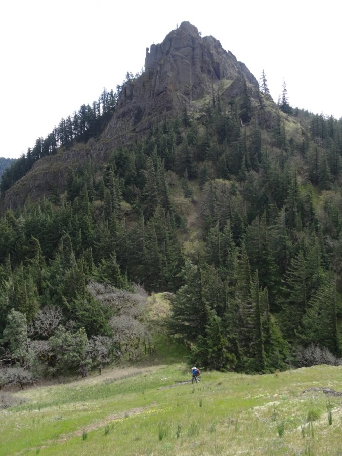
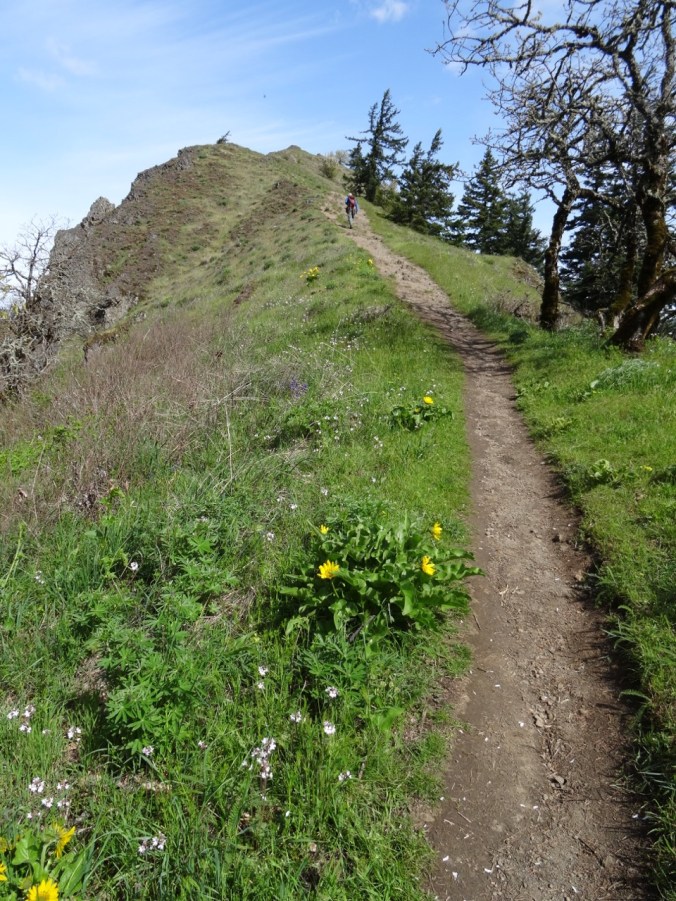
Angel’s Rest – our destination.

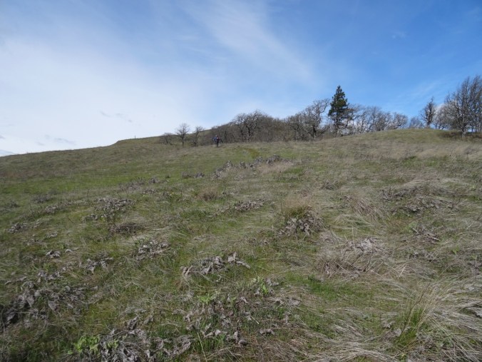
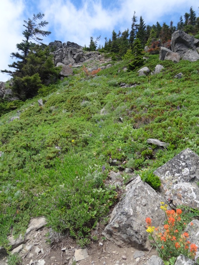
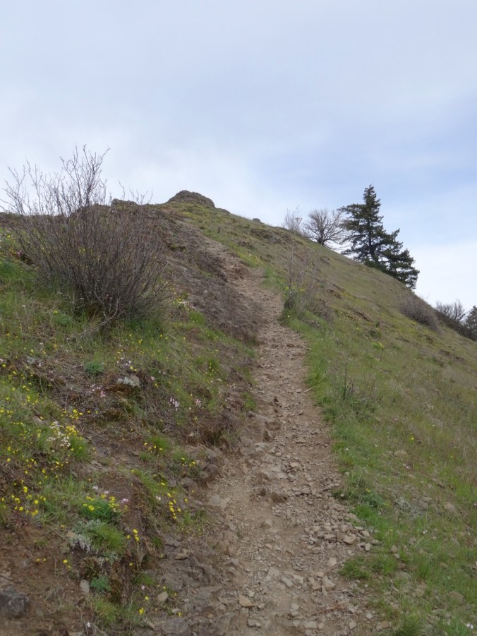
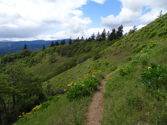
The trail begins to switchback up the front of Angel’s Rest.

DSC00339

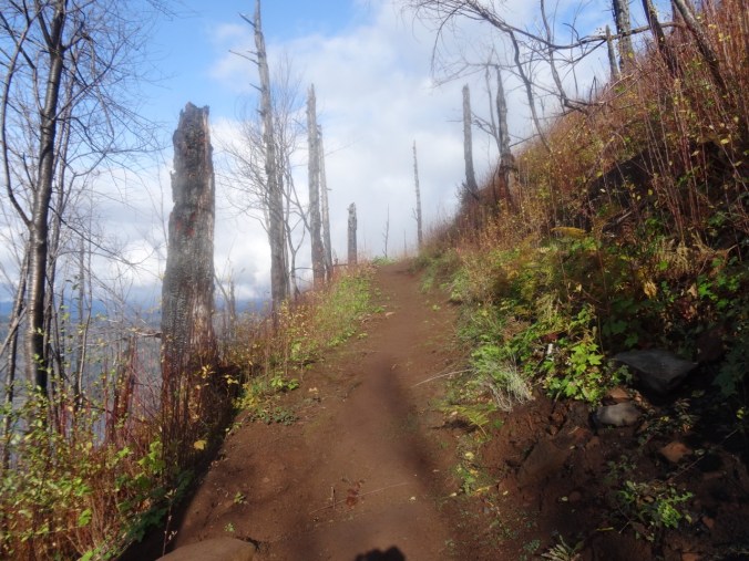
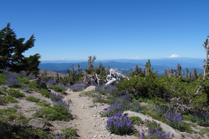
Burned tree trunks and open views line the trail.

DSC00347

First view west toward the trailhead.

DSC00349

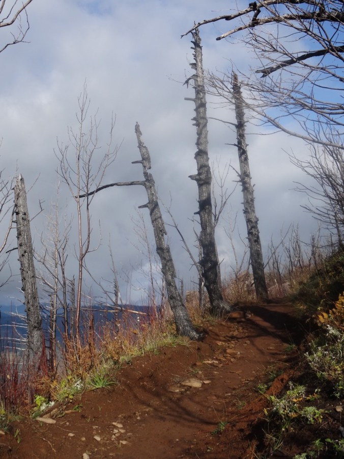
Well repaired trail surface next to blackened trees.

DSC00351

Blackened stump.

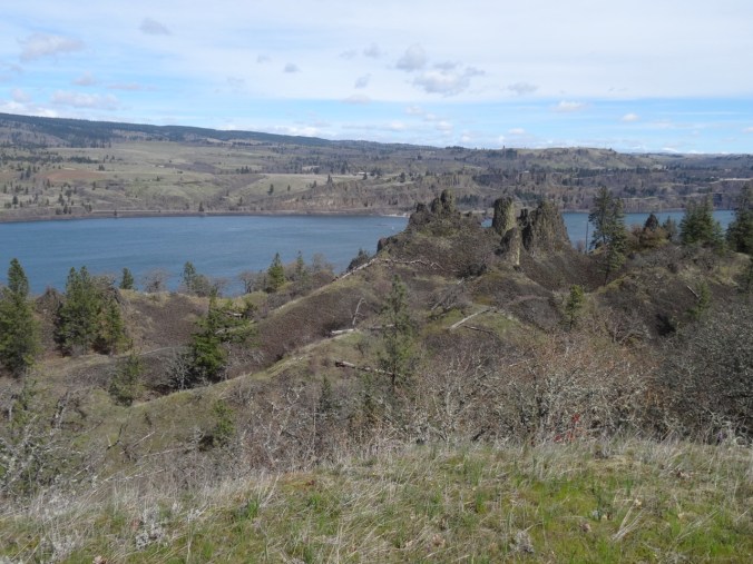
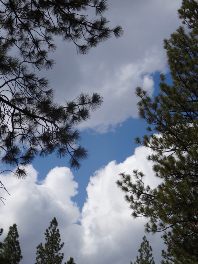
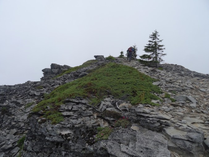
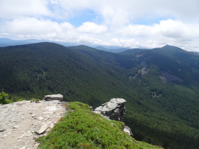
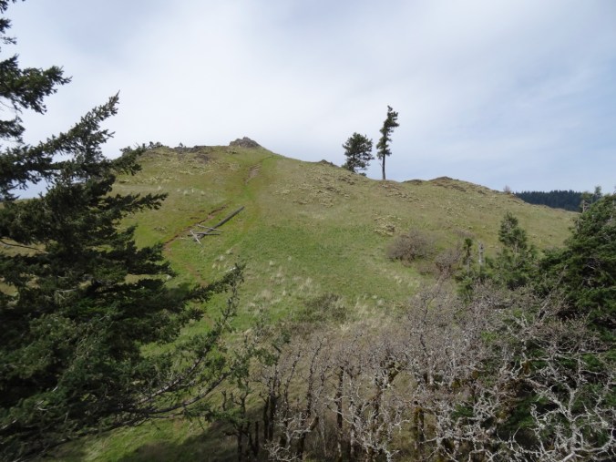
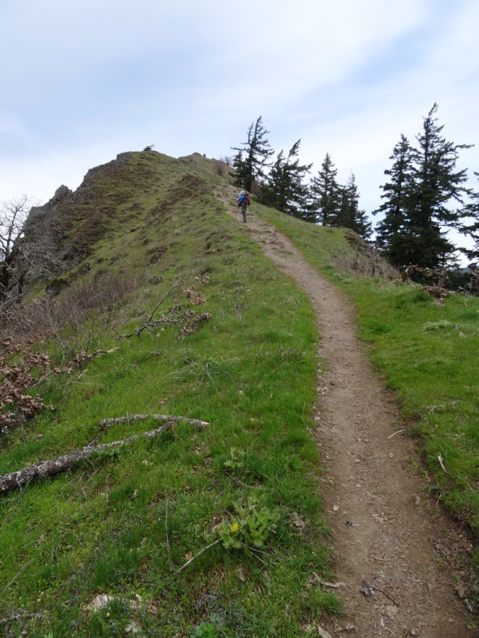
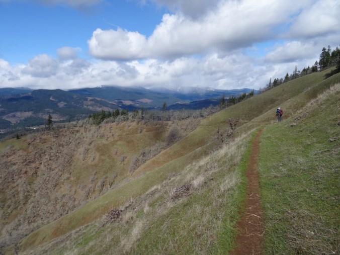
Nearing the top, the views unfold:

DSC00361

To the west, from near the top.

DSC00370

The Hilary Step of Angel’s Rest – leads to the ridge crest. Sometimes there is a line of hikers waiting to go up or down.

DSC00411

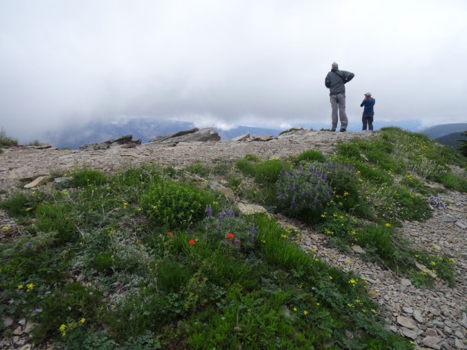
From the top, looking toward the overlook where many rest.

DSC00380

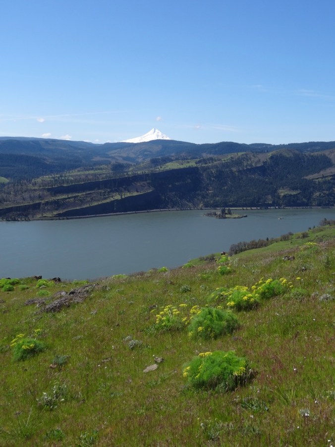
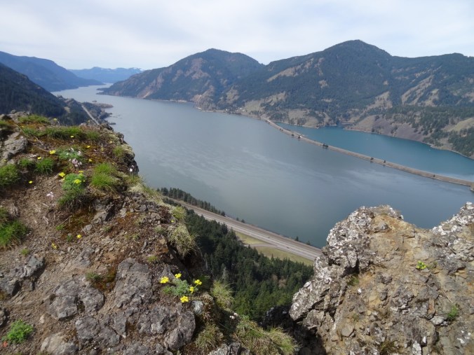
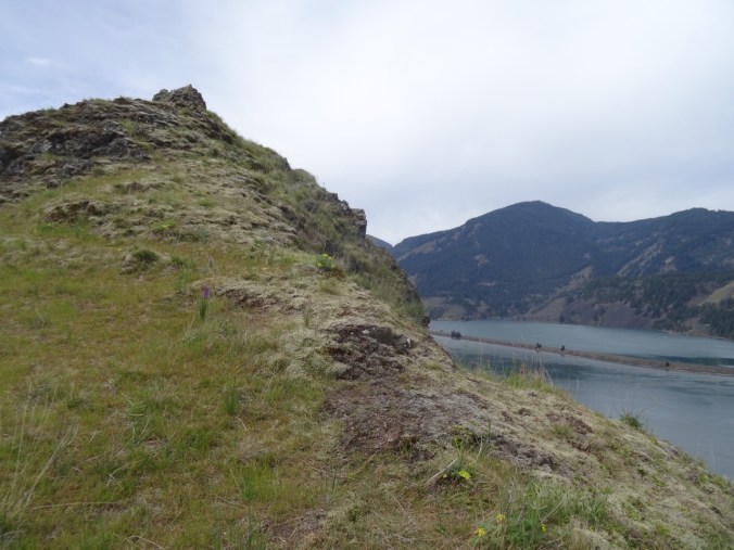
Open view west – toward Portland, Cape Horn in Washington and Phoca Rock.

DSC00387

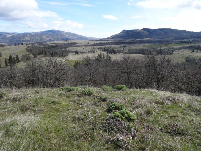
Open view east – toward Hamilton Mountain in Washington.

We wandered around on top for a while, admiring the view from various perspectives, and found a place to eat lunch.

DSC00394

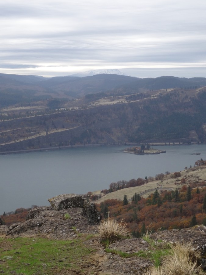
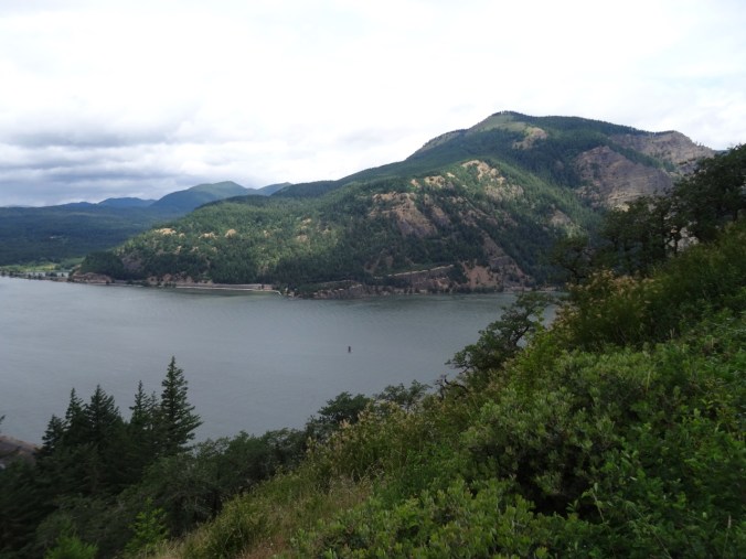
Closer view of Cape Horn in Washington.

DSC00395

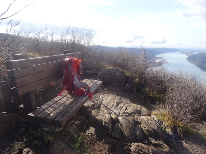
The bench is still there.

DSC00397

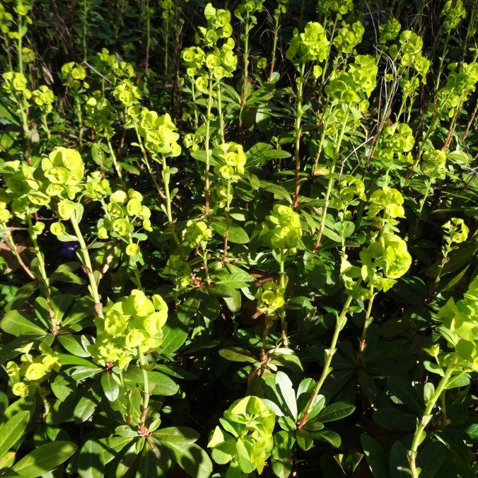
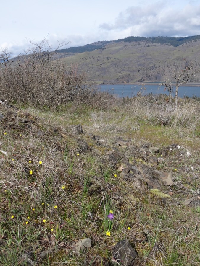
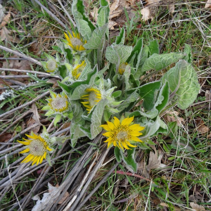
We saw a single blooming white yarrow near our lunch stop.
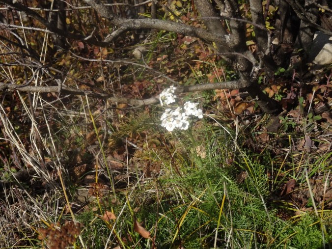
DSC00396

Yarrow

We headed down, stopping for a few more views along the way.

DSC00404

Looking back toward the top, where the first views are seen.

DSC00407

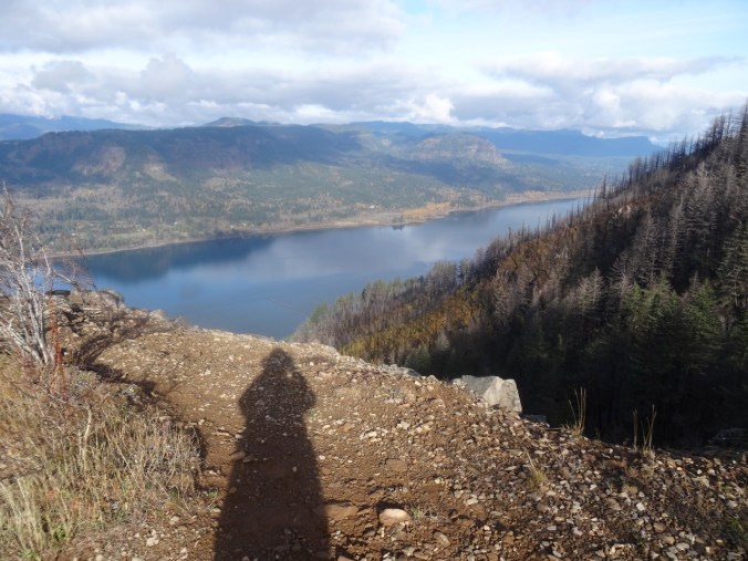
My shadow in the low November light.

DSC00413

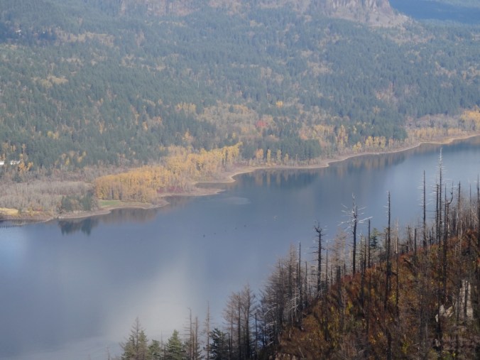
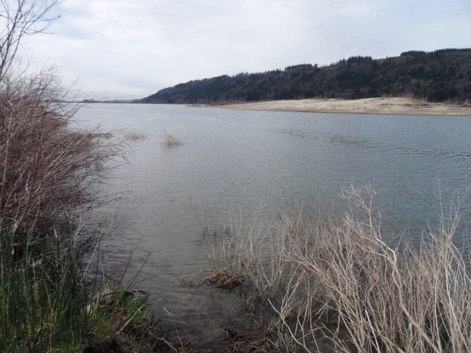
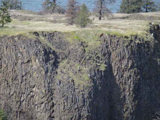
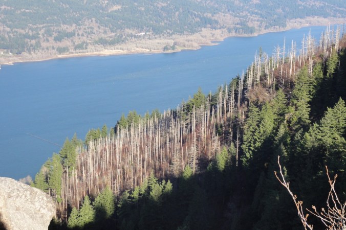
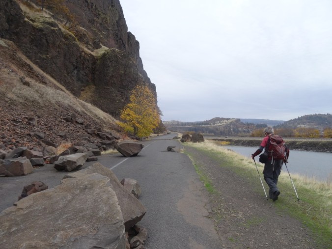
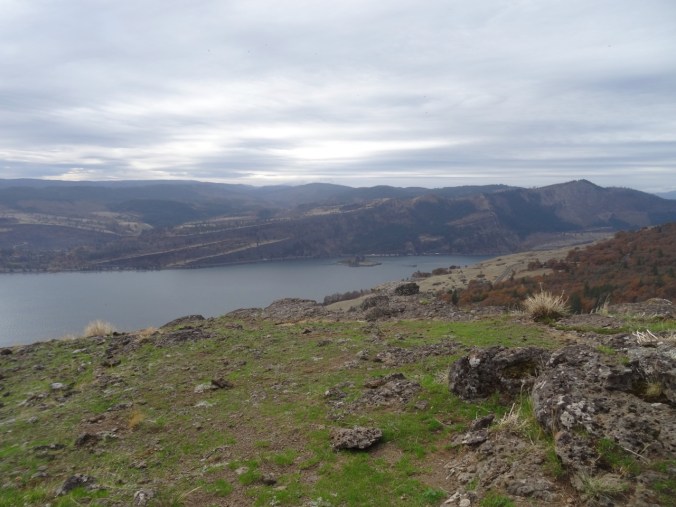
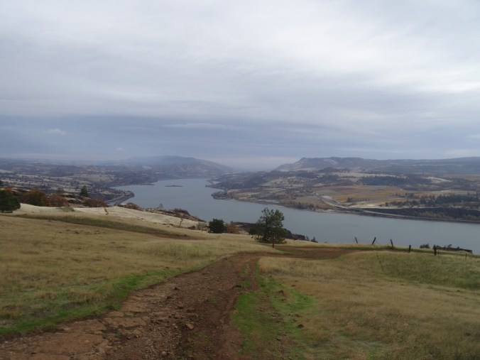
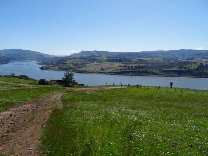
My favorite sculpted shoreline of the Columbia River.

DSC00415

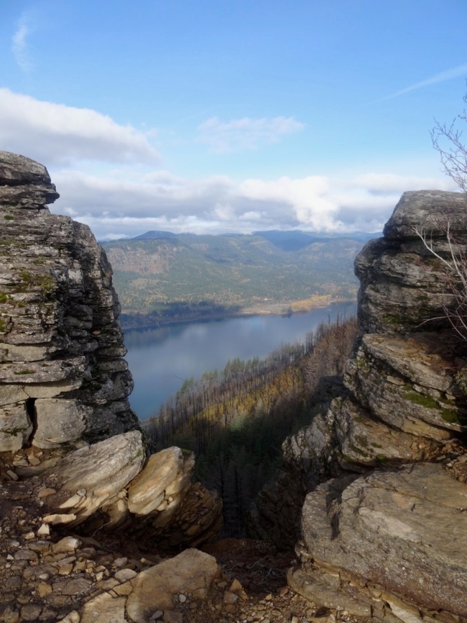
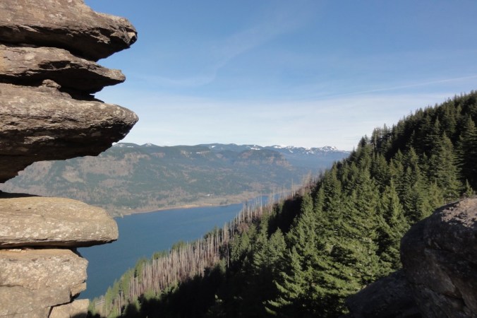
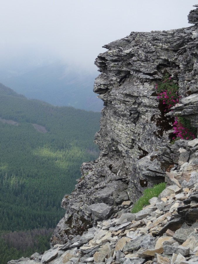
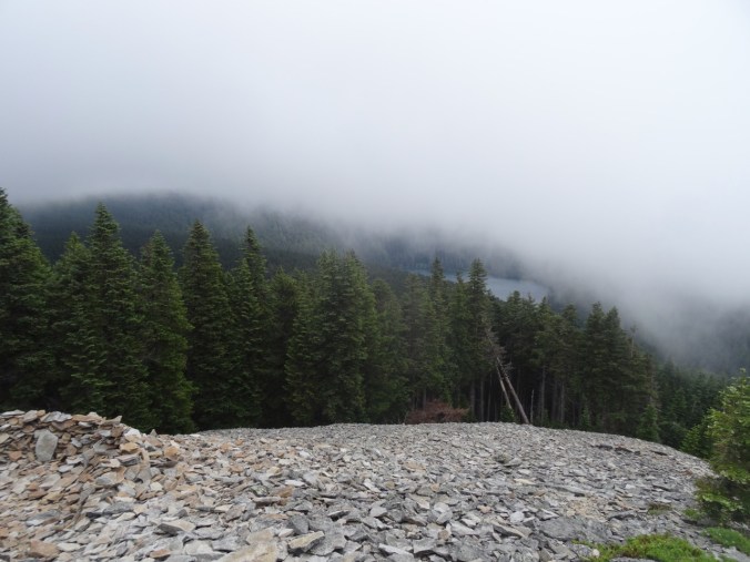
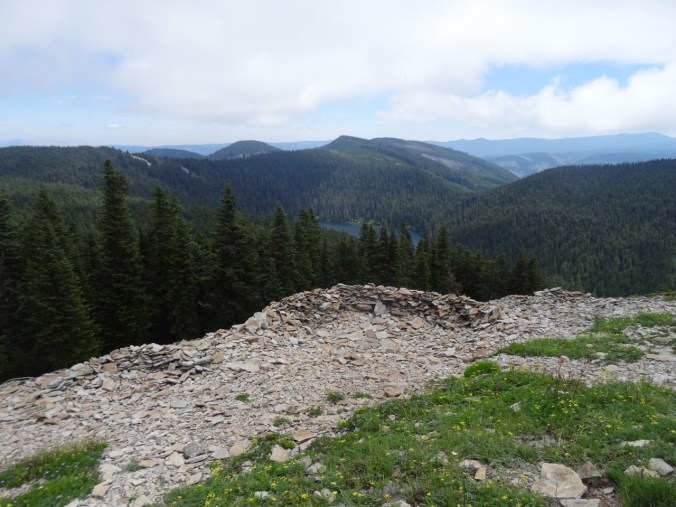
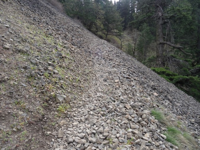
View through the rock piles.
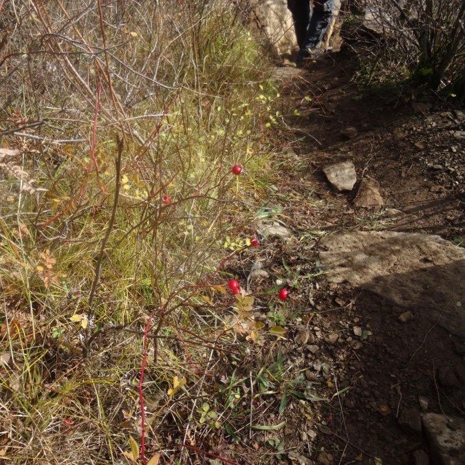
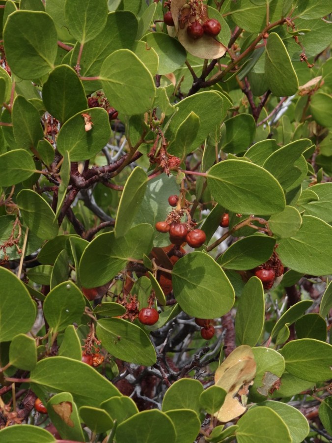
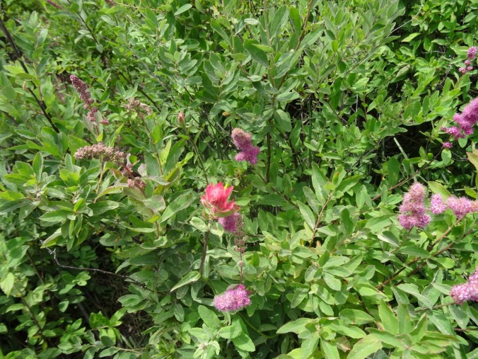
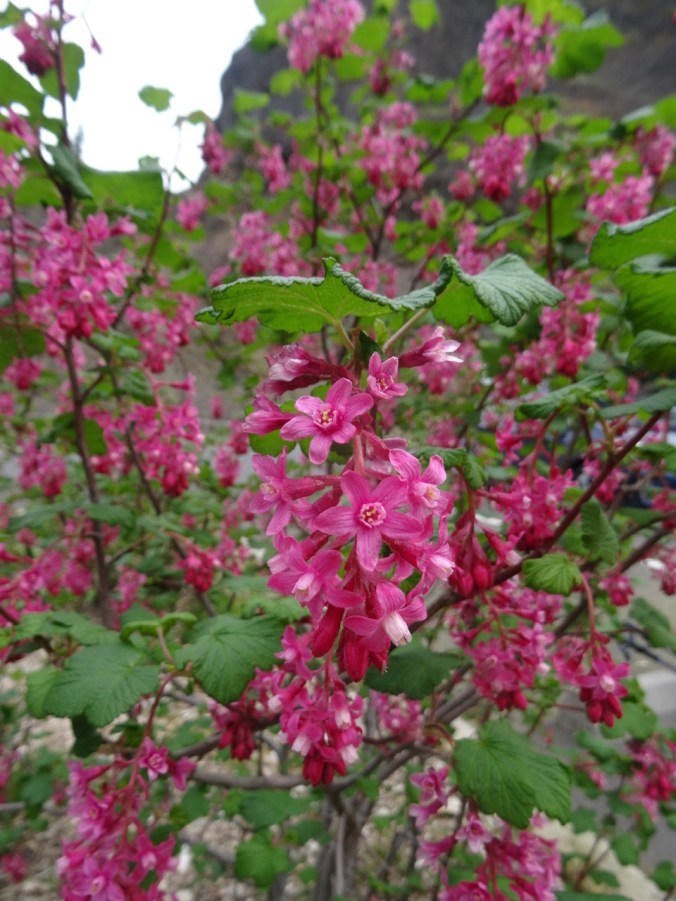
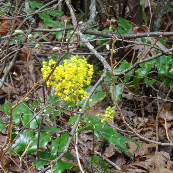
DSC00416

Seasonal berries

DSC00417

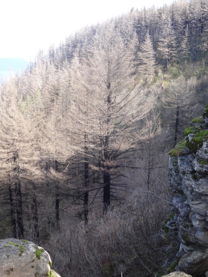
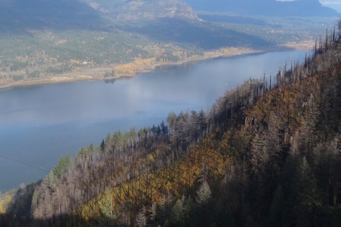
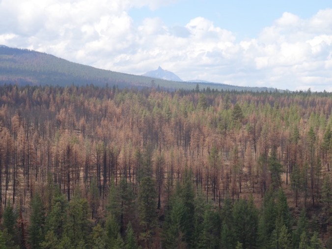
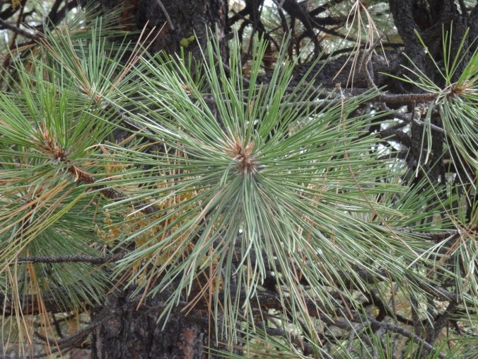
Trees that are burned, dying, no longer evergreen.

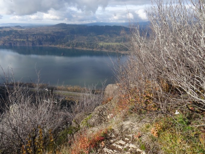
Looking back as we hiked down:

DSC00420

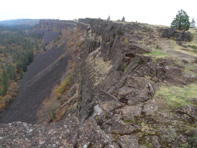
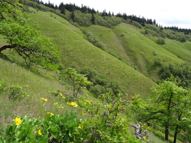
Where we were – and much more visible with all the undergrowth burned away.

DSC00422

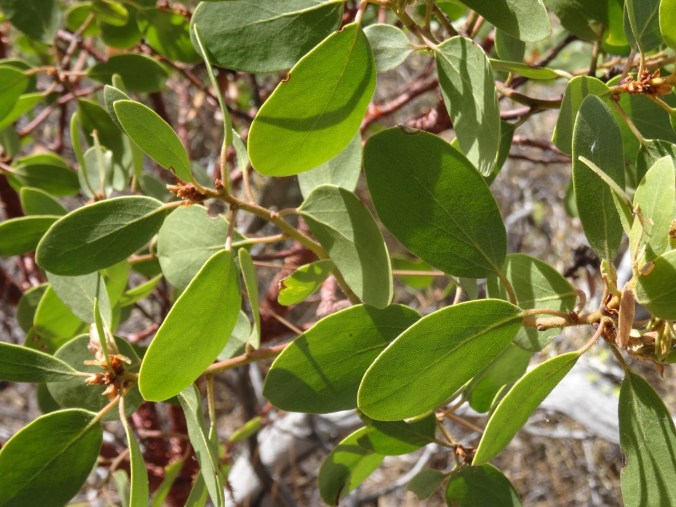
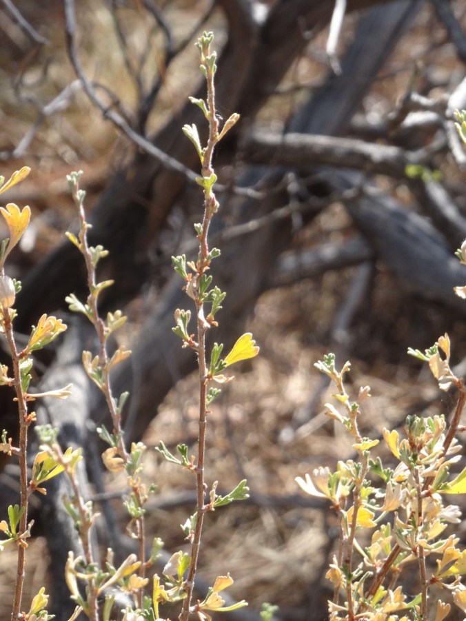
White berries lined this part of the trail – not sure what they are – possible snowberries, or the dreaded poison oak.

Image 11-28-18 at 1.18 PM

Golden Hike of the year, #62, 5.2 miles, 1500 feet.

Look back:

I found a couple of comparison photos from previous hikes – this one in January of 2013:

DSC00623

January 2013 – the white tree trunks are left from a fire in 1991.

DSC00368

November 2018 – the white trunks are blackened, and the green trees are now dying.

A closer view:

DSC00628

January 2013

DSC00400

November 2018

An image taken in 2017 from Cape Horn looking over to today’s hike to Angel’s Rest.

Version 2

Angel’s Rest, October 2017, From Cape Horn, WA.

Pumpkin Pie

A lovely Thanksgiving dinner with a small gathering of family and friends.

56455561396__6DC3EE2D-A9BB-4FCC-907B-ADFF24C3AD45

Knitting

Another round cloth. Some new sock and hat yarn acquired from my LYS on Black Friday.

DSC00434IMG_1726

Jane Austen House Cross Stitch

I have been rather obsessively cross stitching in the evenings.
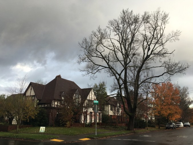
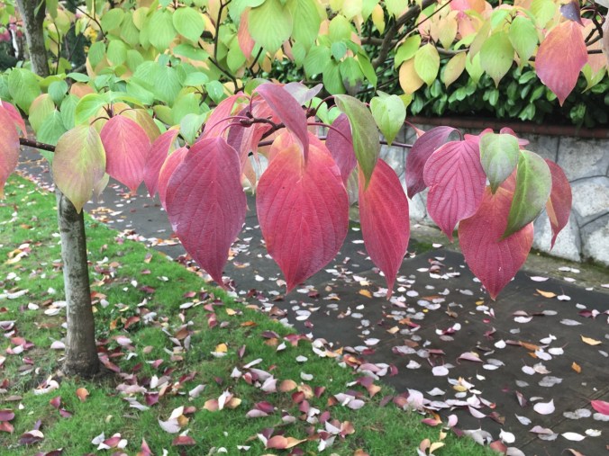
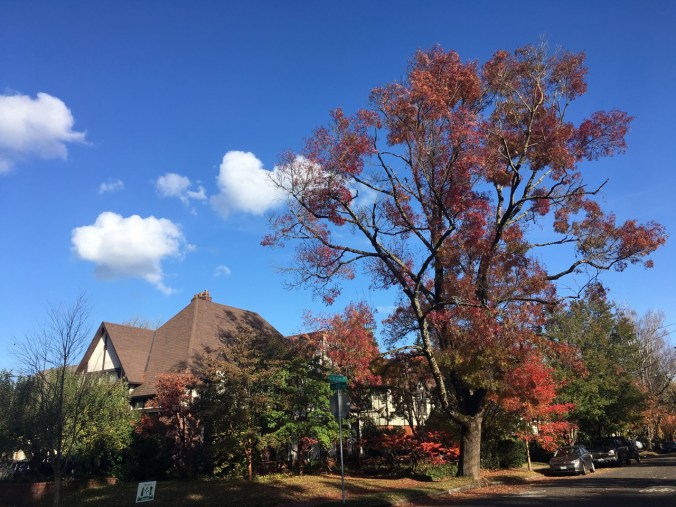
DSC00438

Neighborhood

Leaves fully gone from the flame ash tree.

IMG_1724

Other Adventures

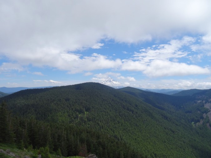
It has been about a year since I was diagnosed with a pituitary tumor. I had another trip through the MRI this week to evaluate the tumor surgery site, accompanied by a Joni Mitchell soundtrack in my head this time. Fortunately, all appears well. And I could see all three mountains from the OHSU tram view patio.

IMG_1709

Mt St Helens on the left; the top of Mt Adams just right of center on the horizon. Tillikum Bridge over the Willamette River on the right.

IMG_1710

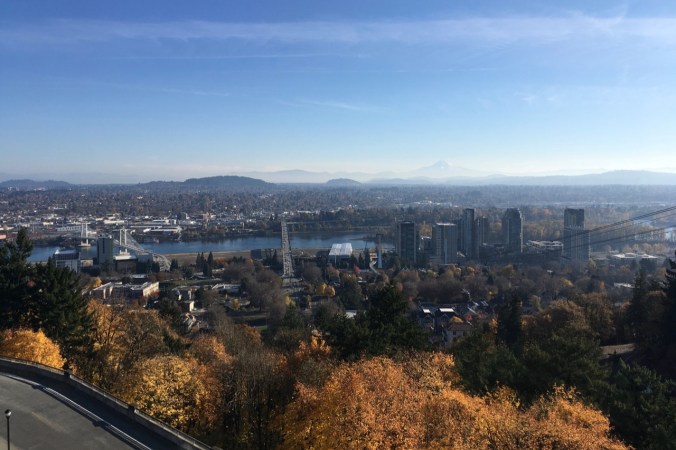
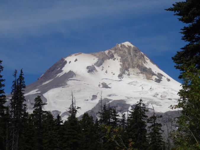
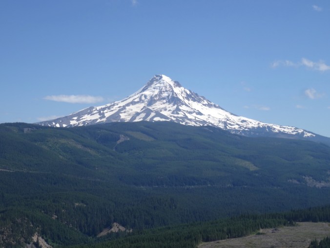
Tillikum Bridge on the left; Mt Hood on the horizon – looking east from the OHSU tram patio.

Coyote Wall, WA (18-49)

As we drove toward Hood River to cross the bridge to the Washington side of the gorge, we noticed fire burning high on the slopes above White Salmon. We realized it must be a controlled/slash burn, not a wildfire, thankfully.

DSC00119

Little Moab and Old Ranch Road Trails, November 3, 2018 (#60)

We walked up Coyote Wall about half way on an overcast day.

DSC00123

Walking along Old Highway 8 to the trail up Coyote Wall.

DSC00129

First view to the east – a different perspective on the fruit orchards east of Mosier from our Catherine Creek hike last week.

DSC00130

Approaching one of the viewpoints over Coyote Wall on the Little Moab Trail.

DSC00138DSC00139

DSC00160

Looking over the wall and up. The sky is a bit smoky from the fire above White Salmon, just over the hill.

DSC00163

We begin to see the shoulders of Mt Hood under clouds to the south.

DSC00166

Junction of Little Moab and Old Ranch Road trails. We are headed up.

IMG_1672

Lunchtime view to the east

DSC00178

Lunchtime view to the south

DSC00176

Lunchtime view up Coyote Wall

We decided to head down, as the wind was picking up and blowing more smoke toward us. 4.3 miles, 1000 feet for the day.

DSC00202

Looking back up to where we had been on Coyote Wall from the trail head.

Lookback:

Comparing fall and spring views:

DSC00193

View to the east, October 2018

DSC03347

April 2017

DSC00186

View toward Mt Hood, October 2018

DSC03354

April 2017

Knitting

I am blocking the Ivy Cardigan, and I finished another round dishcloth.

DSC00210IMG_1688

Neighborhood

The fall colors have been a pleasure to walk through – my camera can’t quite catch them and yet I try.

IMG_1644IMG_1649IMG_1666IMG_1671

Late Summer Adventures Part 3 – Three Sisters, Oregon (18-40)

Rest Day    9-14-2018   Whychus River Overlook

DSC08927

I slowly walked the easy one mile loop (#51) and contemplated distant views of mountains and close up views of the high desert forest. My legs were not up for much more today. Dan hiked down to the river and wandered there for a bit.

DSC08864

Nearly flat trail through the Ponderosa forest

DSC08878

Looking down to Whychus Creek

DSC08879

Middle and North Sisters

DSC08885

Mt Washington, Pole Creek Fire forest

DSC08869

Rabbit brush

DSC08863

Manzanita

DSC08903

Manzanita bark

DSC08895

Manzanita leaves

DSC08916

“Little apples”

DSC08893

Ponderosa

DSC08919

Sage

DSC08913

Sky

DSC08929

Whychus Creek recovery team logo


Back in town I visited The Stitchin’ Post, a wonderful quilt store.

DSC08931

Window display

DSC08930

Window display

DSC09131

I bought a small package of Australian-themed fabric.

On a related note, we enjoyed having a Double Wedding Ring quilt on the bed in our lodge room.

DSC09122

Tam McArthur Rim    9-15-2018     (#52)

This trail provides another entrance point to the Three Sisters Wilderness, from the east toward Tam McArthur Rim along a ridge that leads toward Broken Top. We had hiked this trail in September two years ago on a clear day. Today we watched clouds cover the peaks, lifting occasionally for views. By the time we reached the top, a bitter wind was beginning to blow and the cloud cover was increasing. We didn’t stay long.

DSC08941

Tam McArthur Rim and Three Creek Lake as seen from the trail

DSC08962

Broken Top appears as we cross the upper plain

DSC08968

Almost to the top, with Little Three Creek Lake below

DSC08972

Middle and North Sisters from the End of Trail overlook

DSC08973

Broken Top and South Sister from the overlook

DSC08984

Closer view of the glaciers on Middle and North Sister

DSC08986

All three Sisters, with clouds

DSC09008

North view beyond Tam McArthur overlook. Pole Creek fire burn zone in the foreground; Black Butte beyond.

DSC08955

Late blooming lupine

DSC09022

Neon lichen

Lookback to our hike in September of 2016 to compare the views:

DSC08977

Middle and North Sisters, September 2018

DSC09364

In September 2016, on a clear day

We hiked about 5.5 miles/ 1200 feet today.

Screen Shot 2018-09-21 at 4.31.19 PM

Back to Dee Wright/Mckenzie Pass at sunset

We took our last opportunity this year to spend a little time at the lava lands of Mckenzie Pass – and one of my favorite places in the world. Despite the cold wind we wanted to see the sunset. The Sisters were still covered in clouds, but as the lowering sun streamed in from under the western clouds, Black Crater lit up a bright, ethereal red orange that seemed magical. To the west, the streaky clouds glowed pink and gold.

DSC09045

Lenticular cloud over Mt Washington

DSC09046

Black Crater at 7:01 pm

DSC09057

Black Crater at 7:04 pm

DSC09055

Clouds continue to hide North and Middle Sisters

DSC09499

What North and Middle Sisters look like – from September 2016

DSC09100

Sunset colors to the west

A fitting end to our late summer adventures – back to Portland tomorrow.


Cloud Cap and Timberline Trail, Mt Hood, Oregon (18-37)

Eliot East Moraine and Timberline Trail High Point     8/31/18       (Hike#46)

We have hiked here a few times. This is our first time taking the Eliot East Moraine trail along the crest of the moraine.

DSC07843DSC07679

Once up the steep sandy ascent to the crest of the moraine, there is a fabulous view to the Eliot Glacier, and the glacial valley below, the entire way to the Cloud Cap Shelter.

DSC07690

Mt Hood and the Eliot Glacier

DSC07683

DSC07695

Looking east to the high desert

I enjoy zooming in on the textures, crevasses, and steep edges of the Eliot Glacier and the rocky exposed top of Mt Hood in late summer.

DSC07700DSC07702DSC07717DSC07718

The moraine trail joins the Timberline Trail near Cloud Cap Shelter:

DSC07729

Approaching Cloud Cap Shelter.

DSC07734

Cloud Cap Shelter; Cooper Spur and Mt Hood beyond.

After visiting the Cloud Cap Shelter we continued south on the Timberline trail, up and down the wrinkles of the mountains’ flank, to the 7300’ high point of the trail. Clouds intermittently floated across the top of Mt Hood. We could see the faraway peaks of Mt Adams, Rainier and Jefferson above the blanket of clouds in the distance.

DSC07759DSC07763DSC07778

DSC07784

The only snowfield we crossed this year.

DSC07794

North view to Mts Rainier and Adams

DSC07795

South view to Mt Jefferson, Lamberson Butte and the Timberline Trail continuing south.

By the time we retraced our steps north, the clouds had diminished.

DSC07824

Cloud Cap Shelter again.

DSC07826

The high desert beyond the clouds

We saw a marmot on the Eliot Moraine, and a blue bird on the Timberline Trail.

DSC07710

marmot

DSC07812

blue bird on the rock, Mt Adams beyond

DSC07814

Not many flowers.

The rusty, red and yellow fall hues are beginning to color the vegetation on the rocky alpine slopes.

Screen Shot 2018-08-31 at 10.33.42 PM

6 miles, 1600 feet.

Lookback:

I like to review my photos from previous hikes to compare conditions. There was a lot more snow during our hike a month earlier last year.

DSC07810

Mt Hood from Timberline trail, August 31, 2018

DSC06734

Mt Hood from Timberline trail, July 28, 2017

And a lot more flowers, and a better view of the distant mountains last year.

DSC07831

August 31, 2018

DSC06789

July 28, 2017 – lupine, Mt St Helens, Rainier and Adams

CRAFTING

I cast on another round washcloth, and I have been swatching the Song yarn, trying decide what to make with it.

IMG_0943

We walked through the Art In The Pearl street fair on Labor Day and admired the beautiful artwork. This piece, by artist Kathy Ross, I found especially inspiring.

Kathy Ross, Art In The Pearl, 9/18

Kathy Ross, artist, Art in the Pearl, Portland, Oregon, September 2018


Elk and Summit Meadows, Mt Hood, Oregon, and ‘Tour de Craft’ (18-29)

Elk Meadows trail  7/13/18 (Hike #41)

We started this hike on a hot day. The shade of the forest didn’t really take the edge off and my “condition” has been affecting me this week.

DSC06636

By the time we started up the eight long switchbacks, about a mile and a half into the hike, I realized I was never going to make it to the top of the hill. We decided to turn back. I had been hoping to see bog orchids and gentians, but I did see the mountain blue bells for the first time this year.

DSC06621

Lots of other flowers along the way:

Meanwhile, we braved the log crossing on the Newton Creek twice.

DSC06635

Here is a “real” cairn doing a cairn’s job – marking the trail to the log crossing.

DSC06619

Zooming in on Mt Hood’s Newton/Clark Glacier:

DSC06633

Today we only went 3.2 miles, 500 feet. Last year we made it all the way to Elk Meadows and saw all the flowers.

Summit Meadows

We stopped and poked around in this meadow off the Trillium Lake road on our way home. We have skied or snowshoed this road a few times,

DSC09931

November 2017

and always wondered what the meadows would look like in summer.

DSC06640

I think we are late for the bigger bloom, as the paintbrush were faded, but the pink spirea along the road were lovely.

DSC06664

Paintbrush

DSC06665

Aster

DSC06666

Spirea

I zoomed in on Mt Hood for a closeup view of the ski area above Timberline Lodge.

DSC06649DSC06655DSC06660DSC06659DSC06661

Tour de Craft

I have only dabbled in spinning, so can’t really participate in the Tour de Fleece, but I do love to watch the Tour de France – for the views of France, and the drama and the stunning athletic effort that goes into these races. We DVR the coverage, then watch/fast forward through in the evening while I knit or quilt.

I have made a lot of progress on my Welcome quilt – I was planning to whip it together quickly, but I keep getting new design ideas….but that is the point for me – to play with the fabrics till I am satisfied and have learned something new by trying something new. Fun.

DSC06614DSC06667

And I finished the first Cornwall sock and cast on the second.

DSC06669

Garden

IMG_0735

Some quilting! and Chinidere Mtn hike (18-26)

Quilting!

I started the Pinwheel Baby Quilt I am making for an expected family member.

Chinidere Mountain    6/22/2018     (Hike#38)

This trail starts at Wahtum Lake, on the upper end of the Eagle Creek fire zone. The area has been off limits since last September, but this particular trail recently reopened to public use. Connecting trails down Eagle Creek are still closed.

Screen Shot 2018-06-22 at 10.35.35 PM

6 miles/1200 feet

The trail immediately descends down 250 steps to Wahtum Lake.

DSC06321

From the shore we can just see the rocky promontory that we are hiking to – Chinidere Mountain.

DSC06420

(Photo taken on the return trip after the fog had lifted)

We continued on the Pacific Crest Trail around the east side of the lake, through an area with several hanging gardens and lots of flowers.  The Chinidere cutoff at about 2.5 miles switchbacks up the side of this rocky promontory that stands above the forest. When we arrived, the top was still covered in fog and a cold wind swept the spine of the mountain.

DSC06355

Approaching the top

DSC06357

Cliff penstemon

DSC06359

Summit

DSC06362

Flowers, fog, wind

DSC06368

Mt Hood beyond the clouds

Just 10 feet away we could sit comfortably in the windless sunshine and enjoy our lunch, hoping for the clouds on Mt Hood to lift.

DSC06360

Wahtum Lake from the summit

DSC06367

Wahtum Lake after the clouds lifted

Below us to the north, we could see the mosaic burn of the upper part of the Eagle Creek fire.

DSC06364

Brown areas burned by the Eagle Creek Fire

As we headed down the trail we walked out onto the ridge viewpoints to admire the wildflowers growing in the sunny rocky meadows and watched the clouds blow across Mt Hood.

DSC06392

DSC06413

Lots of wildflowers today – lovely.


By the time we drove down the road the mountain was free and clear!

DSC06431

Lookback:

On a clear day we could see all the volcanoes, north and south, from the top of Chinidere Mt.

DSC05757

June 2016 – Mt Hood and Mt Jefferson

DSC03181

June 2015 – Mt St Helens, Mt Rainier and Mt Adams


Starvation Creek again (18-22)

Lower Starvation Loop Hike, June 10, 2018      (hike #36)

We did this hike in early May last year, in the rain, with rainbows, and with early spring flowers. This year it was still a bit rainy, but we managed to hike on a wet weekend when Mt Hood actually received more snow! We saw the late spring flowers – always interesting to see what blooms next. And our daughter, temporarily home from college before heading off for her summer adventures, joined us. I got to practice my uphill in a steep section, but the hike was much shorter than last week. And I don’t think my new treatment regimen gave me any setback at all, so Yay!  (3.2 miles, 800 feet)

Views from the high point:

DSC06137

East – Columbia River and trailhead parking below

DSC06160

North to Dog Mtn

DSC06150

West, Wind Mtn, no rainbows this year

Cabin Creek crossing, a fairy glen:

DSC06111

Photo shoot with Dad:

DSC06152

Wildflower suite:

Wet foliage:

DSC06144

lupine

DSC06113

ferns

Waterfalls:

DSC06175

Lancaster Falls

DSC06182

Hole In The Wall Falls

DSC06187

Cabin Creek Falls

Wildflower Lookback:

DSC04105

May 2017 – monkey flower, rosy plectritis, blue eyed Mary and shooting stars in the meadow

DSC06166

June 2018 – dry meadow

CRAFTING

I finished cross stitching the Elgol scene, and removed the guidelines.

DSC06189

Next I will decide how to frame it. And get started on one of two new cross stitch projects waiting in the wings.

DSC06194DSC06199

I find the focused attention of counted cross stitching soothing these days. I also ordered fabric to make a baby quilt for our niece.

Spring Flowers, Mitchell Point, Oregon (18-13)

Mitchell Point trail          3/31/2018                       (#13)

Mitchell Point is a steep promontory east of the burn area and west of Hood River on the Oregon side of the Columbia RIver Gorge. It has been closed since the fire last fall, but has recently reopened. We took this short, steep hike (3 miles/1300 feet) to both upper and lower points.   Oaks toothwort, Oregon grape and red currant were blooming along the lower trail.

DSC02175

View of Mitchell Point from the trailhead


DSC02066

red currant

DSC02069

Oregon grape

After crossing the rocky scree slope I found one trillium, my first of the season, in the upper wooded trail on the way up.  

DSC02077

Hounds tongue and glacier lilies were blooming in the upper saddle and power line corridor.


DSC02081

hounds tongue

DSC02084

glacier lilies

At the top we enjoyed the steep hillside meadows full of gold stars, grass widows, prairie stars, yellow and white parsleys, slender phlox, blue eyed Mary, popcorn flower, filaree, and saxifrages.

DSC02132

yellow parsley, prairie stars,

DSC02126

grass widows, yellow bells, salt and pepper

DSC02124

lots of gold stars

DSC02096

phlox, blue eyed Mary, grass widows

The upper trail traverses the spine of the ridge, with great views in every direction along the Columbia River. We stopped for lunch on the rocky crest.

DSC02101

Yellow meadows near the top

DSC02122

West view from the top

DSC02112

North view

DSC02116

East view, with saxifrage

On the way down, I found two fairy slipper orchids in the upper wooded trail area where I remembered them being abundant the last time we were here in April of 2015.  

DSC02140

fairy slipper

DSC02135

douglas fir

DSC02146

saxifrages

We crossed the rocky scree field again.

DSC02072

Trail across the scree slope

DSC02144

Looking directly up at Mitchell Point, where we ate lunch

DSC02143

NW view

We then took the spur trail to the lower point, and found another grassy and flowered meadow, and also some blooming larkspur and a good view of where we had been. We missed this trail the last time we were here.

DSC02147

Mitchell Point from the Spur Trail

DSC02151

The grassy slope of lower Mitchell Point

DSC02157

View across the river and meadow flowers

DSC02158

Looking east

DSC02155

Looking back up at Mitchell Point

DSC02163

Closer view of the top

DSC02169

Balsamroot

DSC02166

Tomcat clover

DSC02150

Larkspur, gold stars

Lookback:

In midApril of 2015, the tiny meadow flowers were past bloom, but the balsam root was in full flower. Since one can’t be everywhere at once, it is a joy to see each location in a different season of bloom.

DSC02086

March 2018

DSC00793

April 2015

Easter eggs

IMG_0537

Garden

IMG_0533

Tulips

Weldon Wagon Road (18-12)

Weldon Wagon Road trail     3-25-2018      (#12)

Early flowers were out  along this trail through the oak woodlands and open slopes in southwest Washington above the White Salmon River near Husum. This was my most elevation gained so far as I recover (4.5 miles/1300 foot rise), and I felt good. Progress!

DSC01988

Lower trail through oak woodlands

DSC02008

Views to the open slopes ahead.

DSC02015

A seat with a view at the halfway point

Last spring,  the exposed upper slopes were a bright green and yellow balsam root meadow. Today we saw just one plant blooming along the trail,

DSC02033DSC02012

and otherwise, the meadows and woodlands were still waking up, sprinkled with grass widows, buttercups, a few prairie stars, toothwort, yellow bells, blue eyed Mary, and Columbia Desert Parsley.

DSC02027

Heading down in the afternoon

LOOKBACK: to May 2017 when the balsam root was in bloom-

DSC04306

May 2017

DSC04274

May 2017

Knitting

Another scrappy tortilla washcloth for the 2018 stack:

DSC02038

I reknit the toes of the socks I finished last week so that the stripes would match.

Elgol Cross Stitch update

I have been filling in the foreground with shadows and light – mostly pinks:

Cross stitch depicting the view from Elgol on the Isle of Skye.

Blooming in the garden

DSC01936

Tulips opening

DSC01859

Euphorbia

DSC01862

Shadows on a neighborhood stair


Rooster Rock and Memaloose Hills (18-11)

Rooster Rock      3/15/2018       (#10)

We took a short afternoon to explore the trails at Rooster Rock State Park. To the east, the beach trail gives views of Sand Island and the burned skylines in the gorge.

DSC01408

Looking east toward Sand Island and the beach trail

DSC01380

Sand Island

DSC01401DSC01397DSC01402

DSC01392

Burned Angel’s Rest and trees along the skyline

To the west we hiked to a close view of Rooster Rock. This park is very popular in the summer, but quiet today in the off season. (3 miles).

DSC01419

To the west

DSC01418

To the east

DSC01448

The waterfall above Hidden Lake

DSC01420

A robin

DSC01431

Looking east, Rooster Rock

DSC01444

Reflections

DSC01435

Rooster rock

Memaloose Hills       3/18/2017      (#11)

This is the earliest we have hiked this April-May wildflower eden between Mosier and Rowena in the eastern gorge.

DSC01803

Pinnacles along the lower trail between I-84 and Rt 30

DSC01765

Grass widows, gold stars, and a view across the Columbia River toward the labyrinth.

From the ledge above the lower trail one can look over to a cliff that hosts a great blue heron rookery. We only saw a few birds here today (grey spots), but in a previous year there were countless herons on this cliff.

DSC01804

Look for the grey blobs on the green slope near the top of the cliff

DSC01805

From the Hwy 30 Memaloose viewpoint one can look directly across the river at Catherine Creek in Washington.

DSC01800

It was interesting to see the early season flowers – gold stars, yellow bells, glacier lilies, early buttercups, Columbia desert parsley, and a few others.

We hiked up a nearly barren Chatfield Hill, with extensive views at the top.

DSC01783

Hiking up

DSC01789

View to the west from the top

DSC01788

To the north and east

DSC01790

To the east, Tom McCall Point and Columbia desert parsley

Since the full flower bloom was not out, we returned by the loop through the oak woodlands on the north side of Chatfield Hill. DSC01798

I hope the next time we take this hike it will be in full wildflower glory: a view from today compared with April 2015.

DSC01785

March 2018

DSC00607

April 2015

4 miles/800 feet.

Screen Shot 2018-03-19 at 4.04.07 PM

Quilting

I spent a day photographing 13 of my quilts, and adding labels where omitted. I am getting closer to writing the stories of these quilts, which is why I actually started this blog!

DSC01848

Knitting

I finished the Strong Heel Socks, though I plan to reknit the toe where the knot in the yarn interupted the stripe sequence.

DSC01831 (1)

And in the garden:

DSC01356

Star magnolia

DSC01359