December 10, 2020 – I have been both knitting and quilting away, as the days get shorter, the evenings longer. We usually watch one program in the evenings, and have made our way through the latest seasons of The Crown, The Great British Baking Show (including the holiday edition with the Derry Girls), and The Queen’s Gambit. Some of these require full attention, but the Baking show is pretty relaxed, so I can get a lot of knitting in.
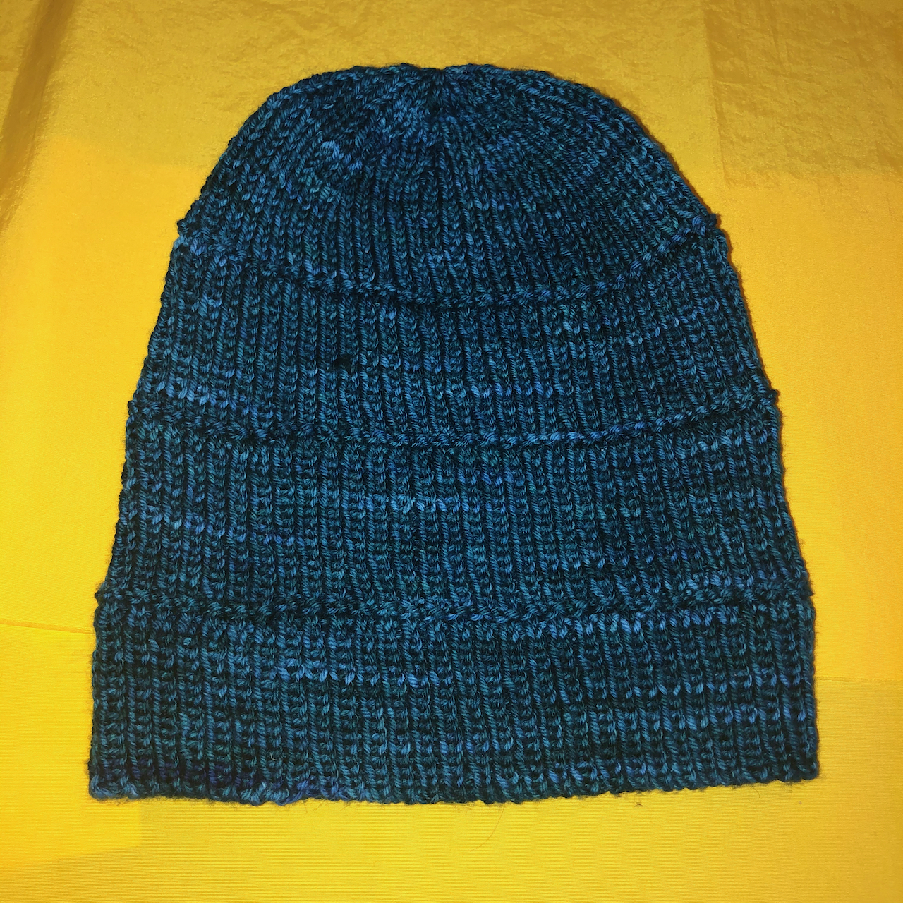
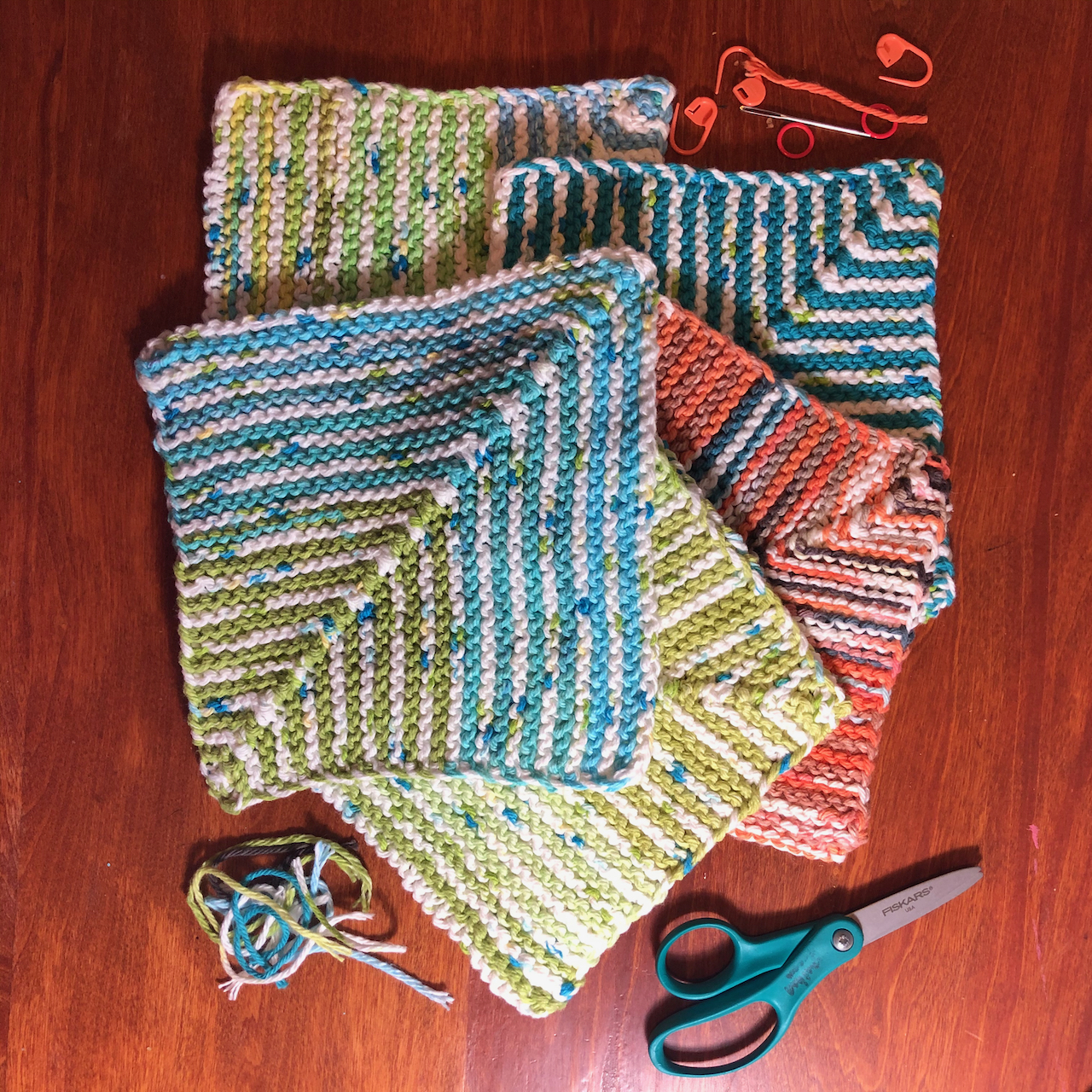
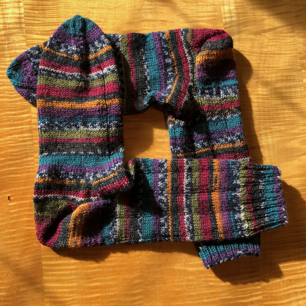
I finished my Dissent Socks and another Ridge Washcloth.
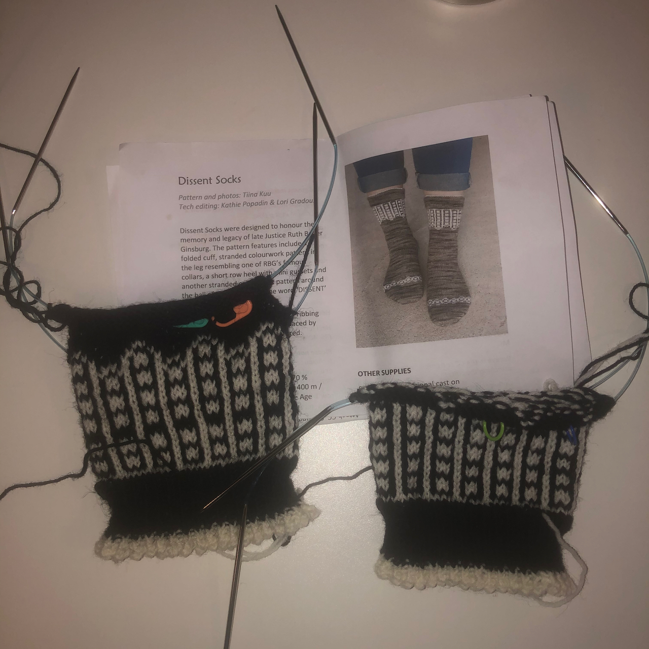
Dissent Socks, pattern by Tiina Kuu
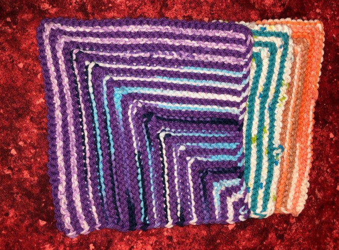
Ridge Washcloth, pattern by Hannah Maier
I joined the AdventureGnome Mystery KnitALong, and am also making one of her earlier released gnome patterns, just a little knitting on these every day.
Adventure Gnome, pattern by Sarah Schira
Here We Gnome Again, pattern by Sarah Schira
I am making good progress on socks and a hat that are holiday gifts.
Rafa’s Hat, pattern by Joji Locatelli; Artists Garden Socks, pattern by Tif Neilan
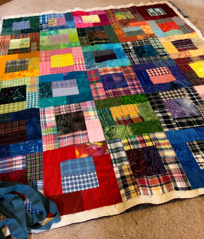
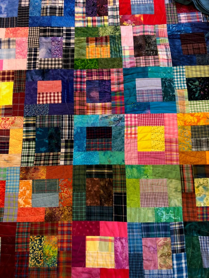
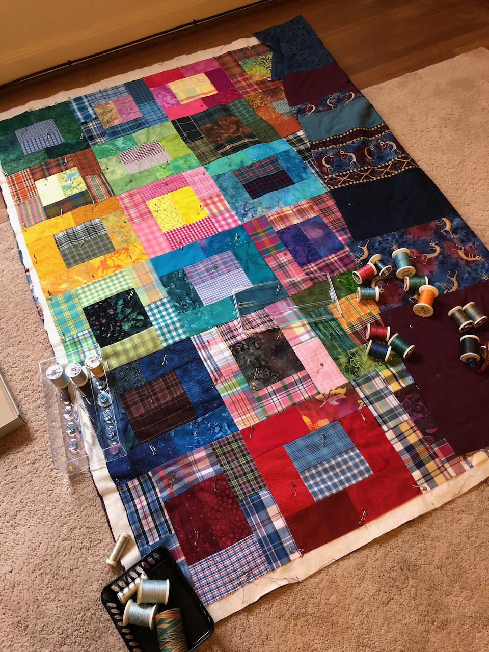
And I finished the quilting on the Plaid Rectangles Charm Quilt. I just need to add the binding.
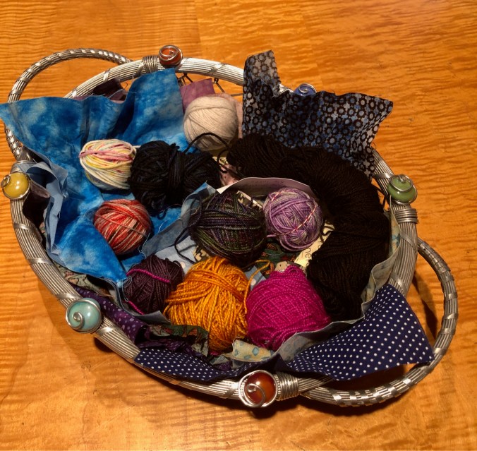
Holiday Cheer – My knitting group, which has become an online knitting group during the pandemic, cleverly set up a holiday exchange, beginning last summer. Three of the 15 members collected twenty 10 gram mini-skeins of leftover fingering weight yarn from each member, and set up what were were promised as a Solstice Surprise, Advent Calendar, Hanukkah Miracles, or Pagan Pockets (to be ecumenical about it). They really outdid themselves, and we have been assured that they had a lot of fun doing it – despite having to collaborate remotely. I was expecting a bag with twenty balls of yarn, but instead was presented with this magnificent gift -bearing banner. Gifts in pockets, and ribbons with tied-on but hidden yarn balls. It has been so much fun to open one every day and see what my surprise is. I believe the plan is to save the banner and fabric squares for reuse in future years – so it is also a wonderful, reusable item. I am so grateful to these knitters, who I get to see twice a week on knit chat meetups, for helping to pass the pandemic time so productively and supportively.
My yarn “Solstice Surprise” banner.
10 days of surprises, so far!
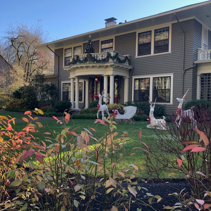
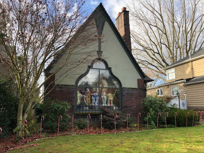
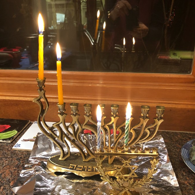
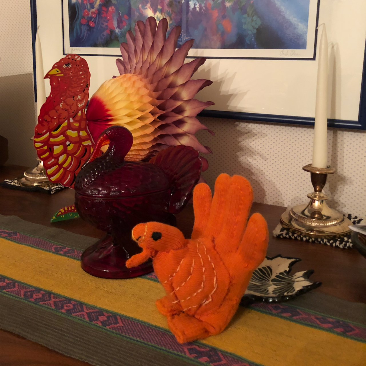
I have noticed lots of cheerful decorations around the neighborhood on my walks. We lit candles for the first night of Hanukkah tonite, joining our son remotely. Our Christmas tree is up and lighted – I have yet to unpack the ornaments – that will be next.
Giant ornaments
Lawn reindeer
Roof reindeer
Star Wars heroes
Porch nutcrackers
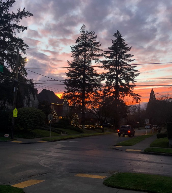
A beautiful sunset –
reflected in the window.
Menorah
Today, the first Covid vaccine was approved – we can begin to hope for the end of the pandemic – that is probably the most uplifting thought of all!
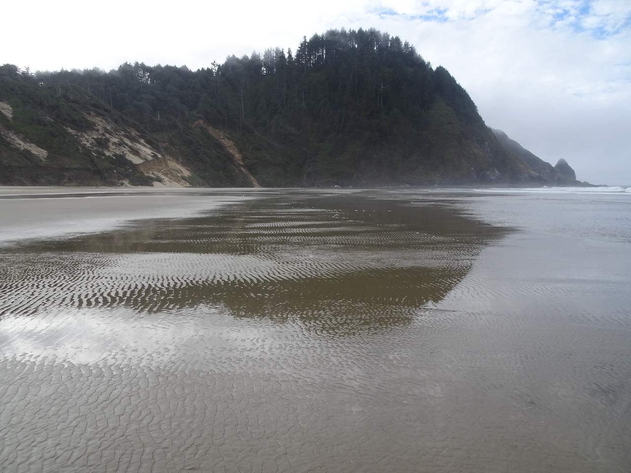
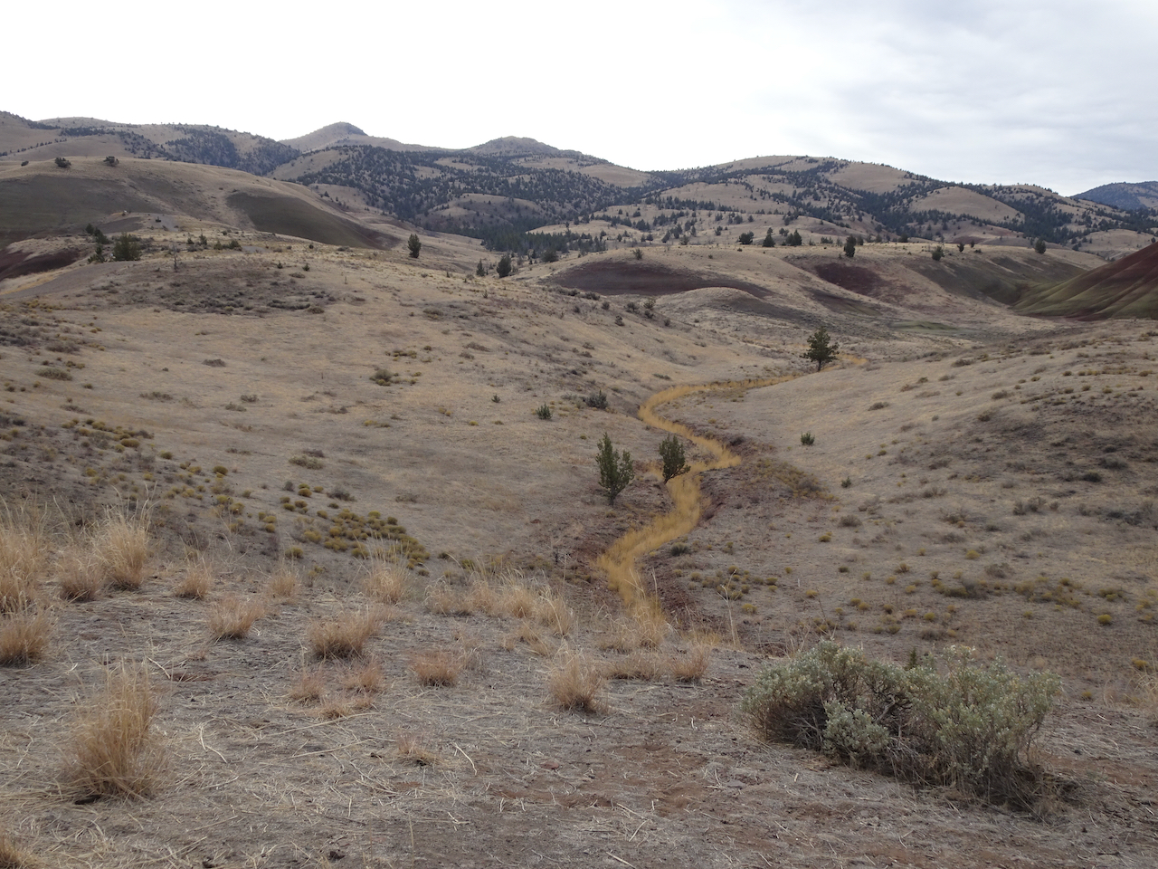
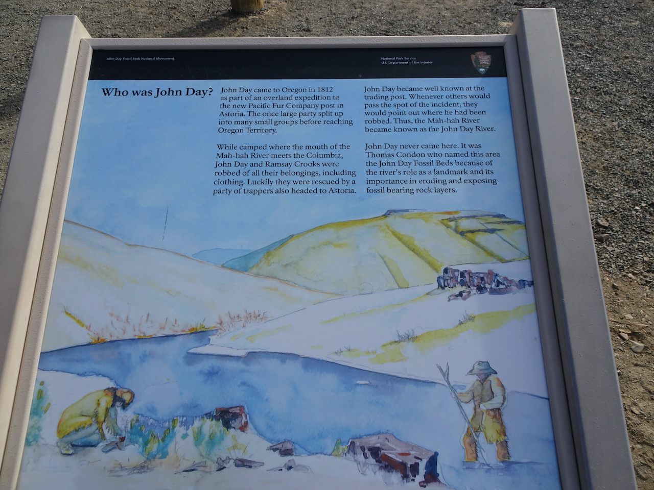
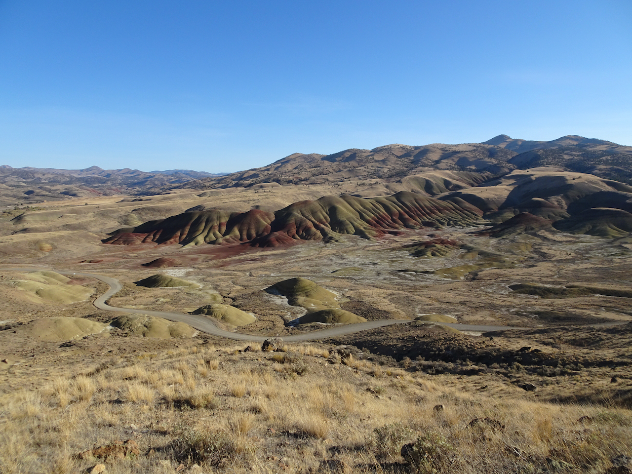
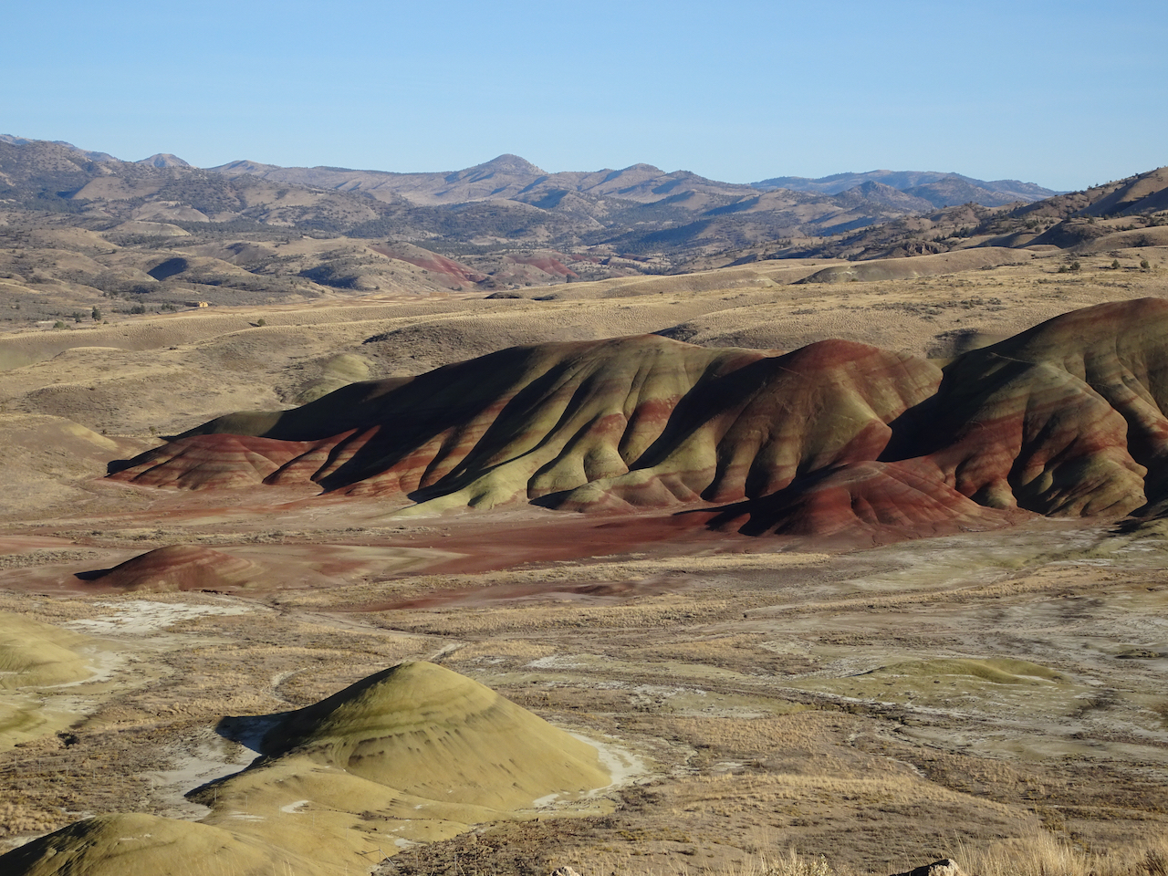
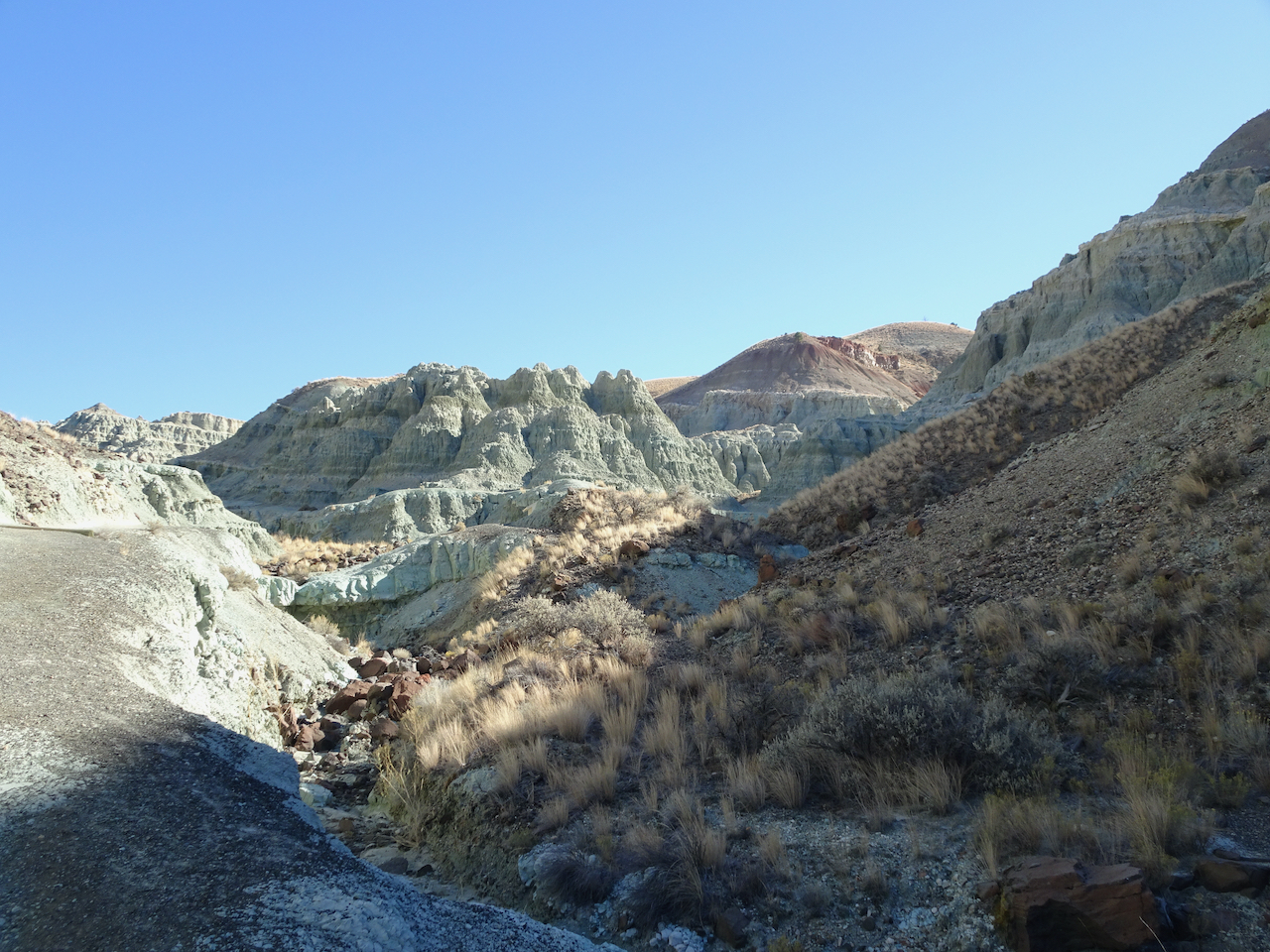
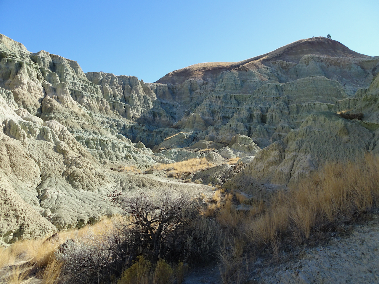
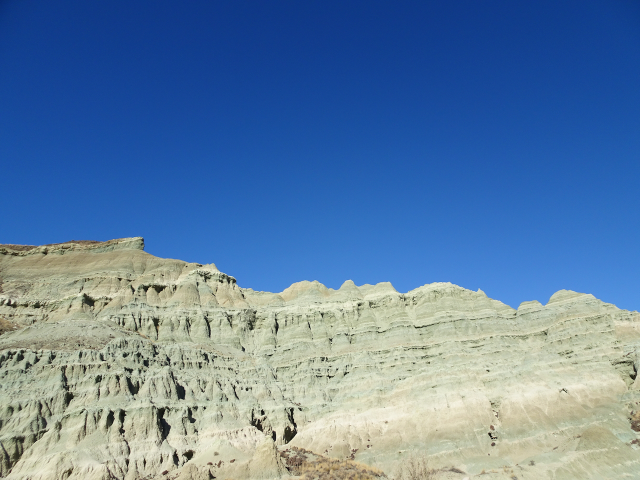
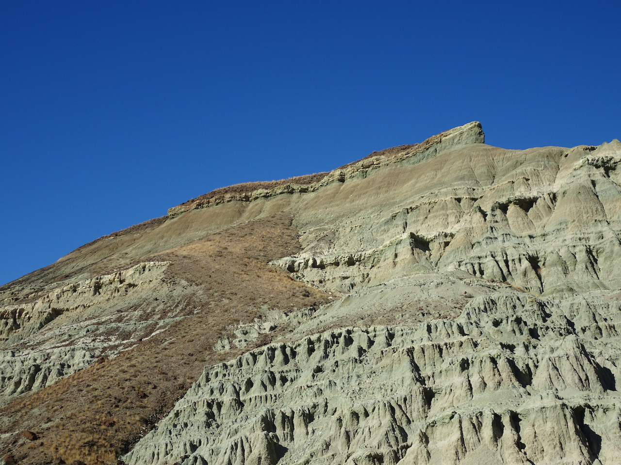
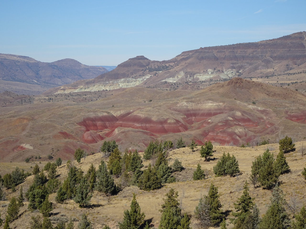
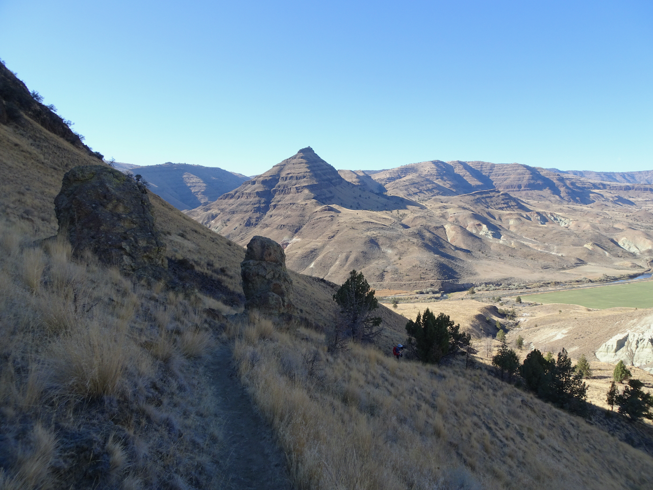
Another socially distant/Covid careful trip. We stayed three nights in Prineville, and had two days to explore the Painted Hills and Sheep Rock units of the National Monument. Indoor exhibits were closed, trails were available for walking.
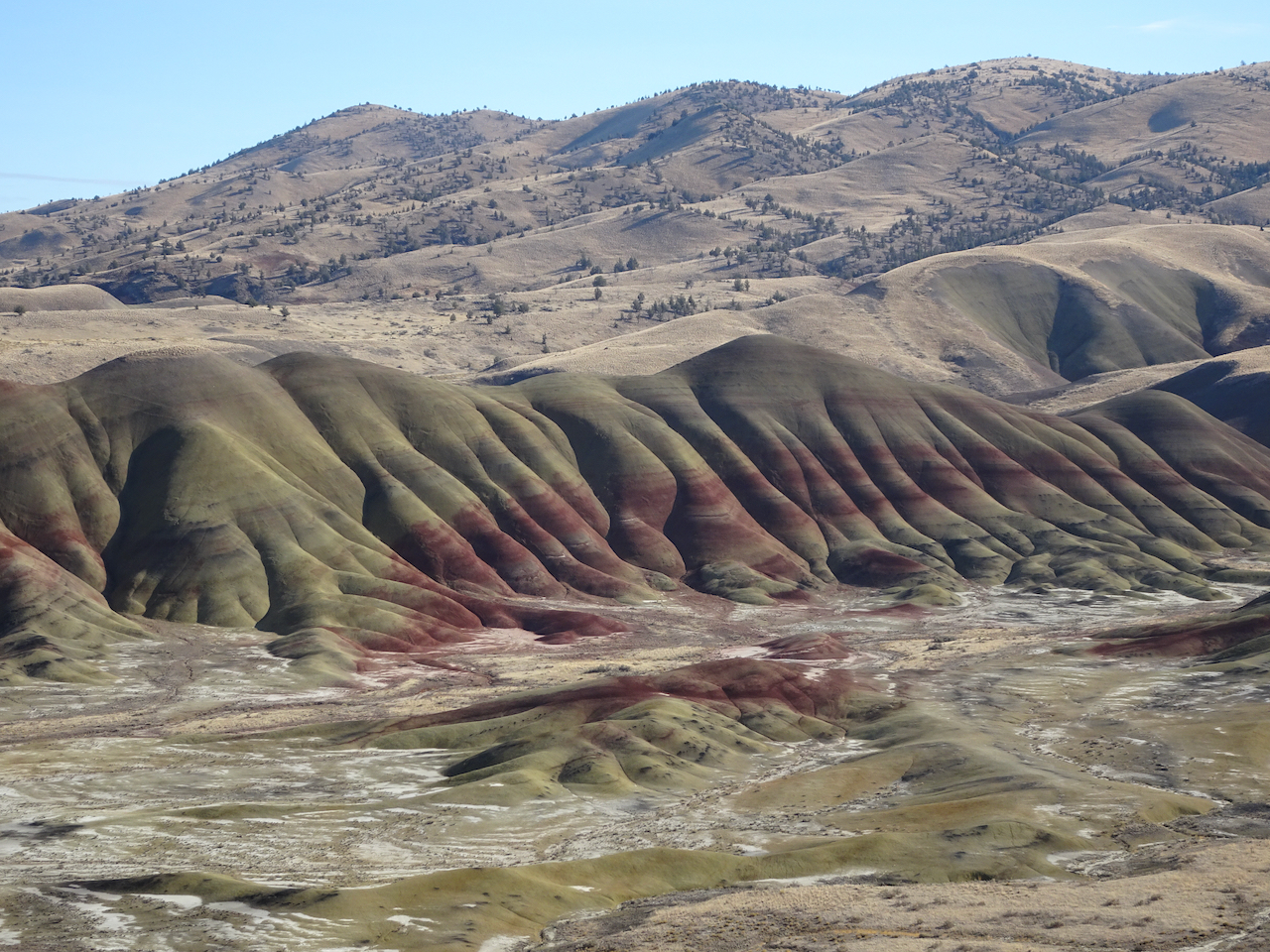
Painted Hills 10/27/2020
We walked five different short trails, each highlighting an aspect of the ancient lake beds that are exposed now as brilliantly colored and striped landforms. It was bitter cold out in the morning – well below freezing, but warmed up during the day.
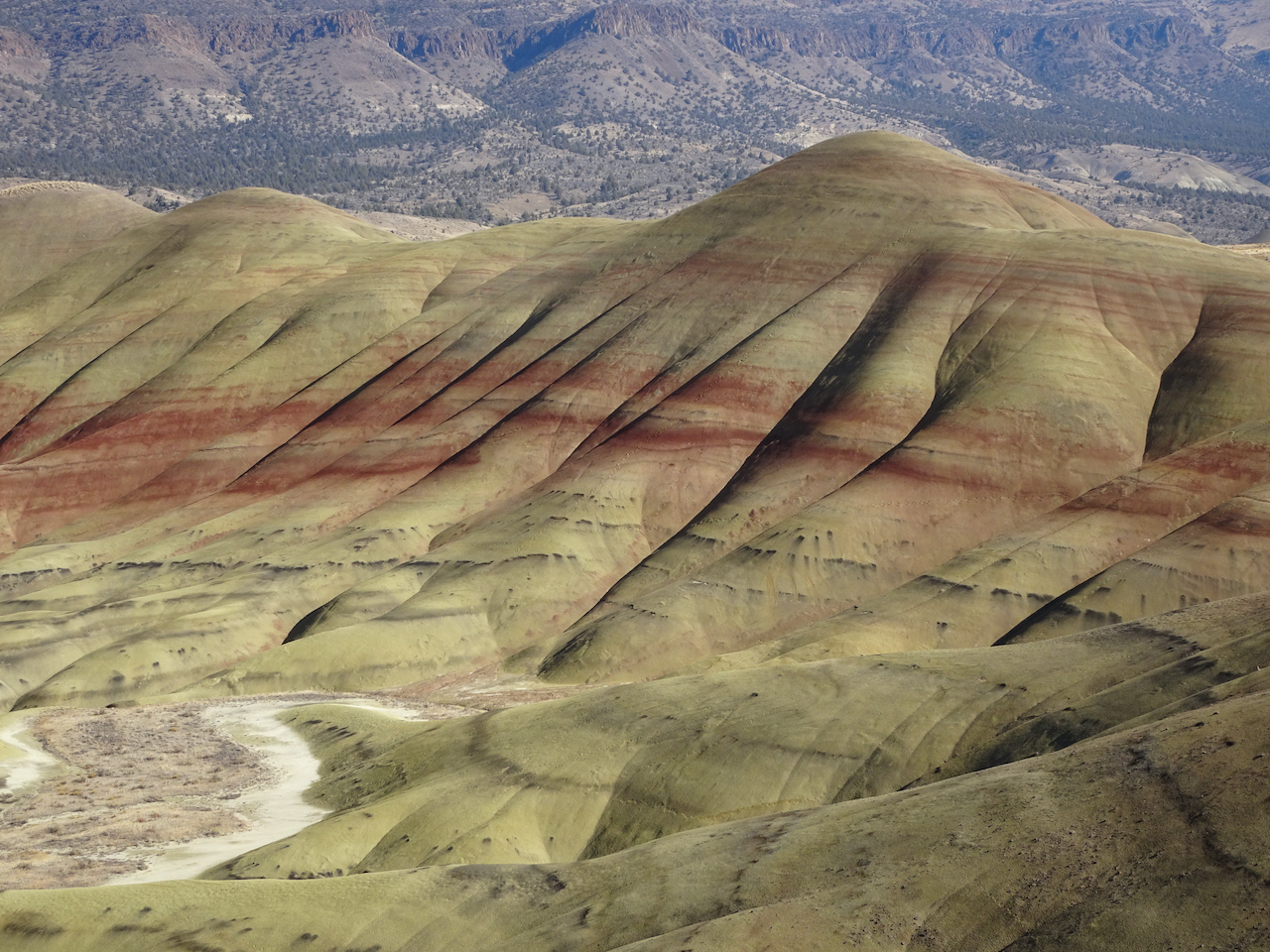
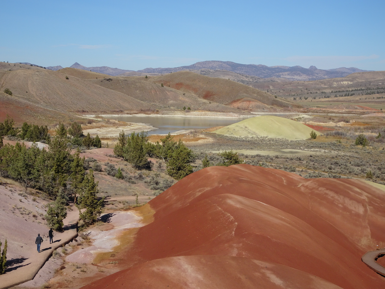
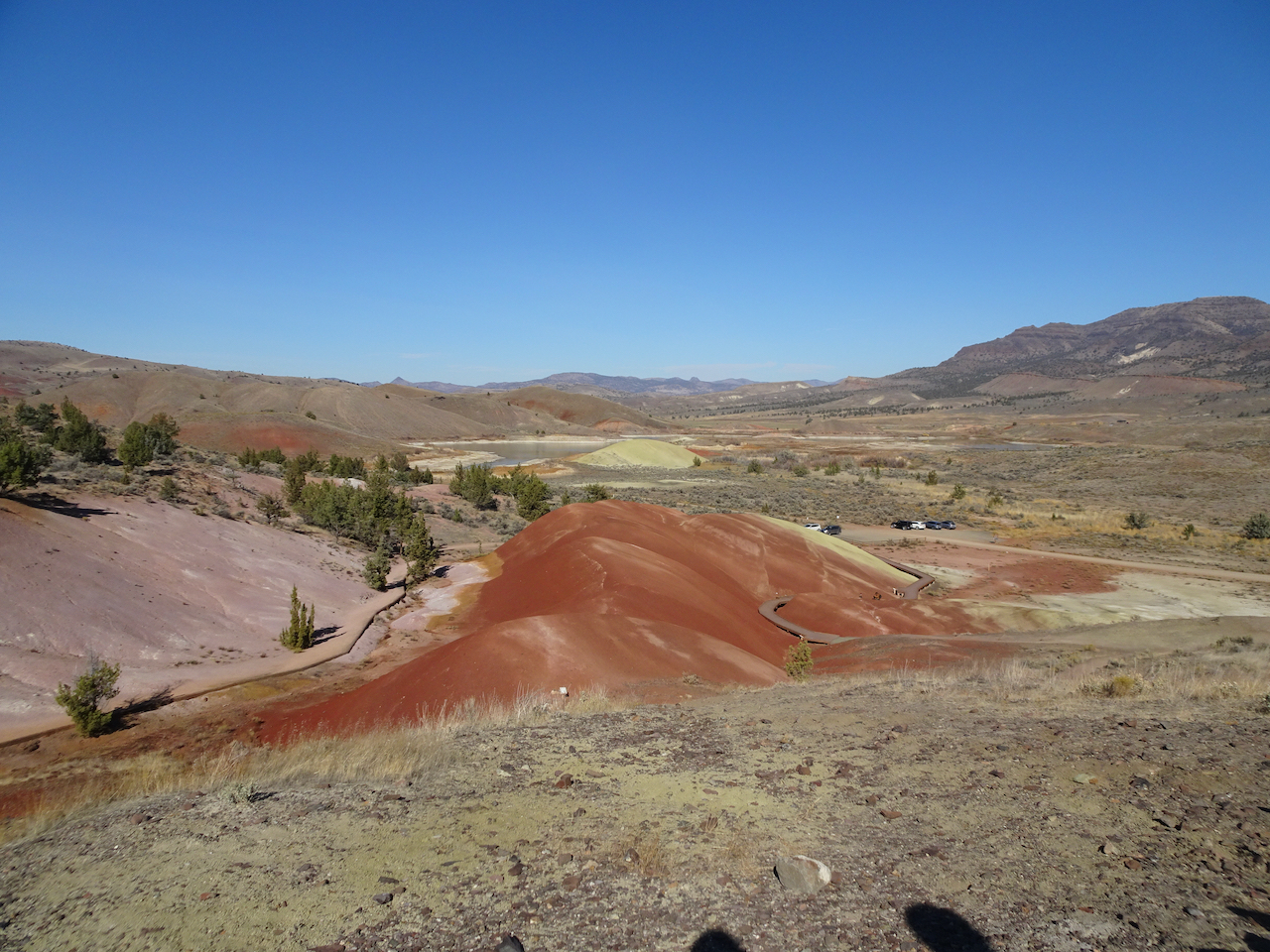
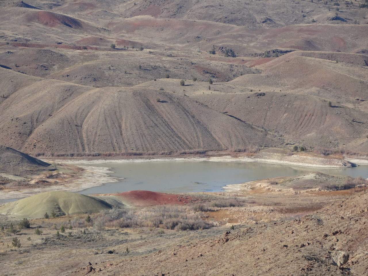
Painted Hills Overlook – The main overlook has an amazing view of the Painted Hills. We walked to the upper overlook for more views.
Main overlook.
River of grass on the nearby hills.
Zooming in from the upper overlook:
Upper overlook
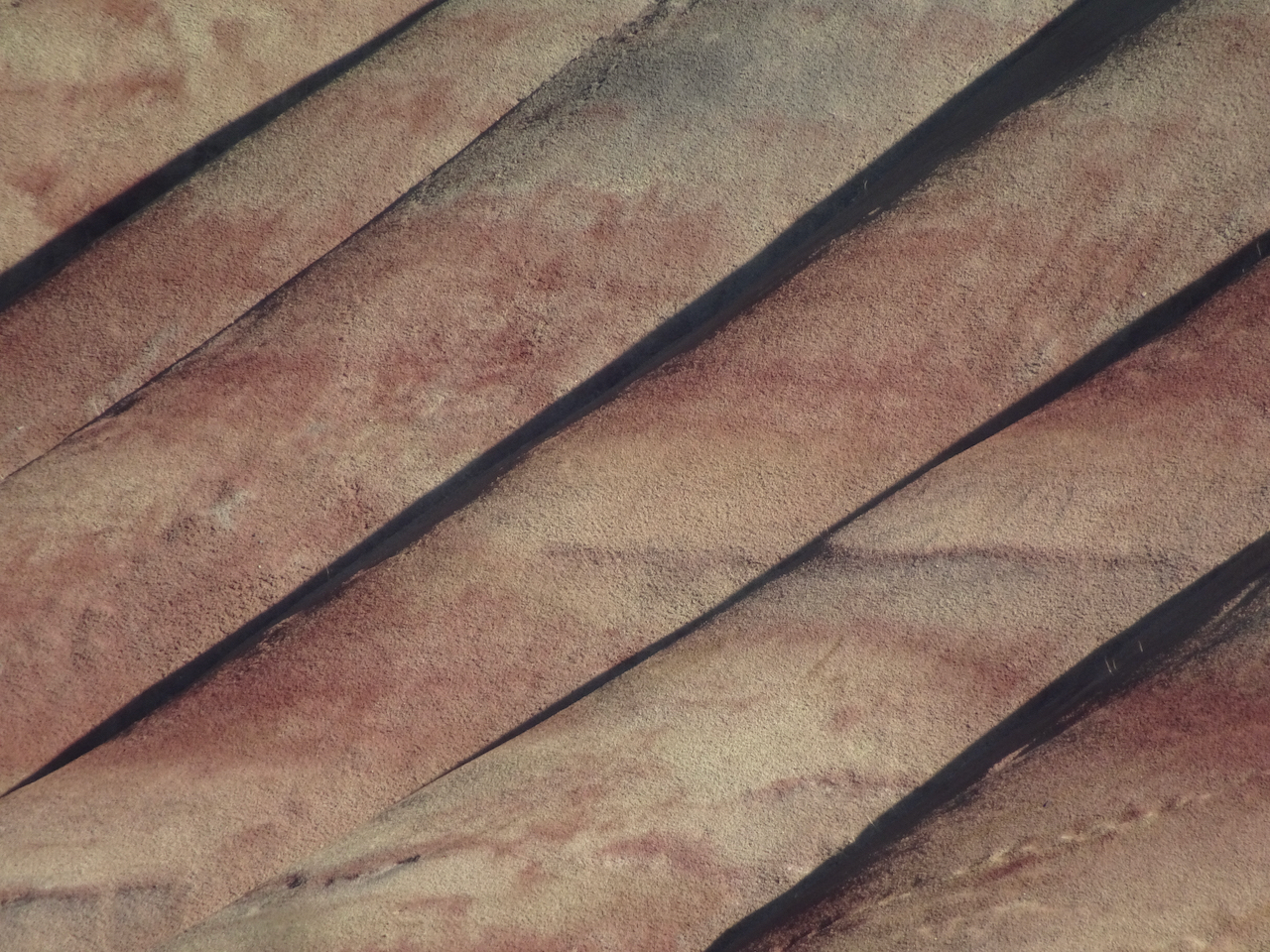
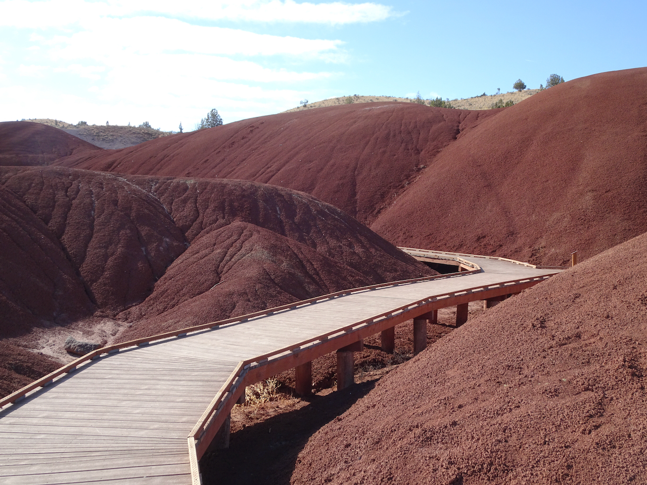
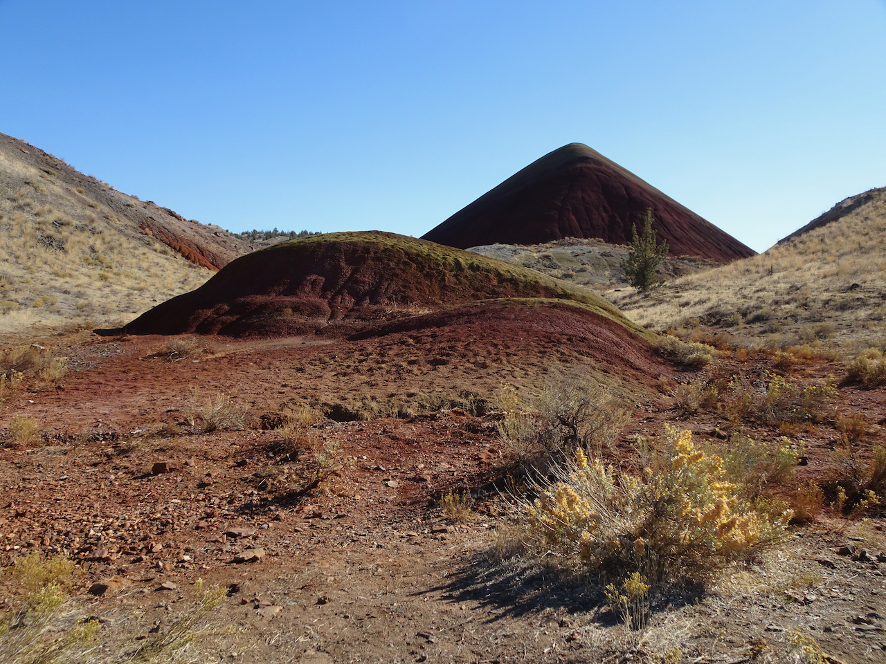
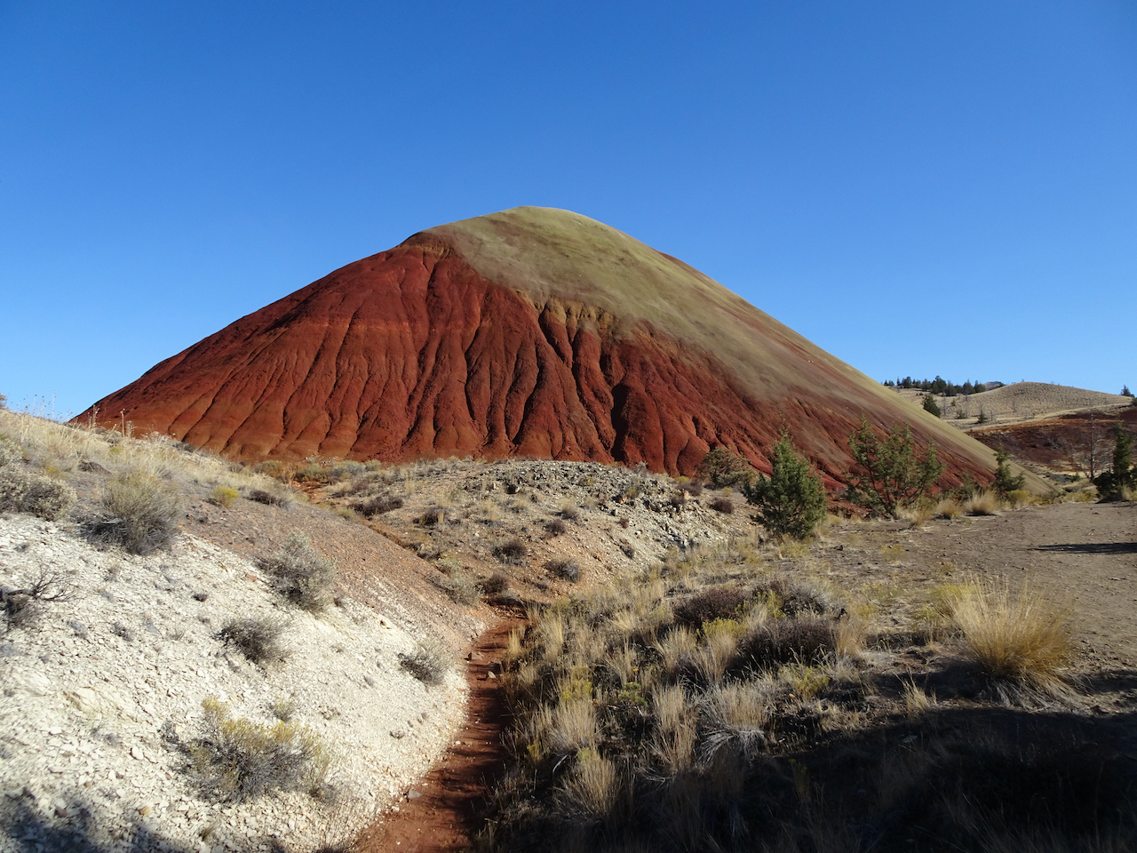
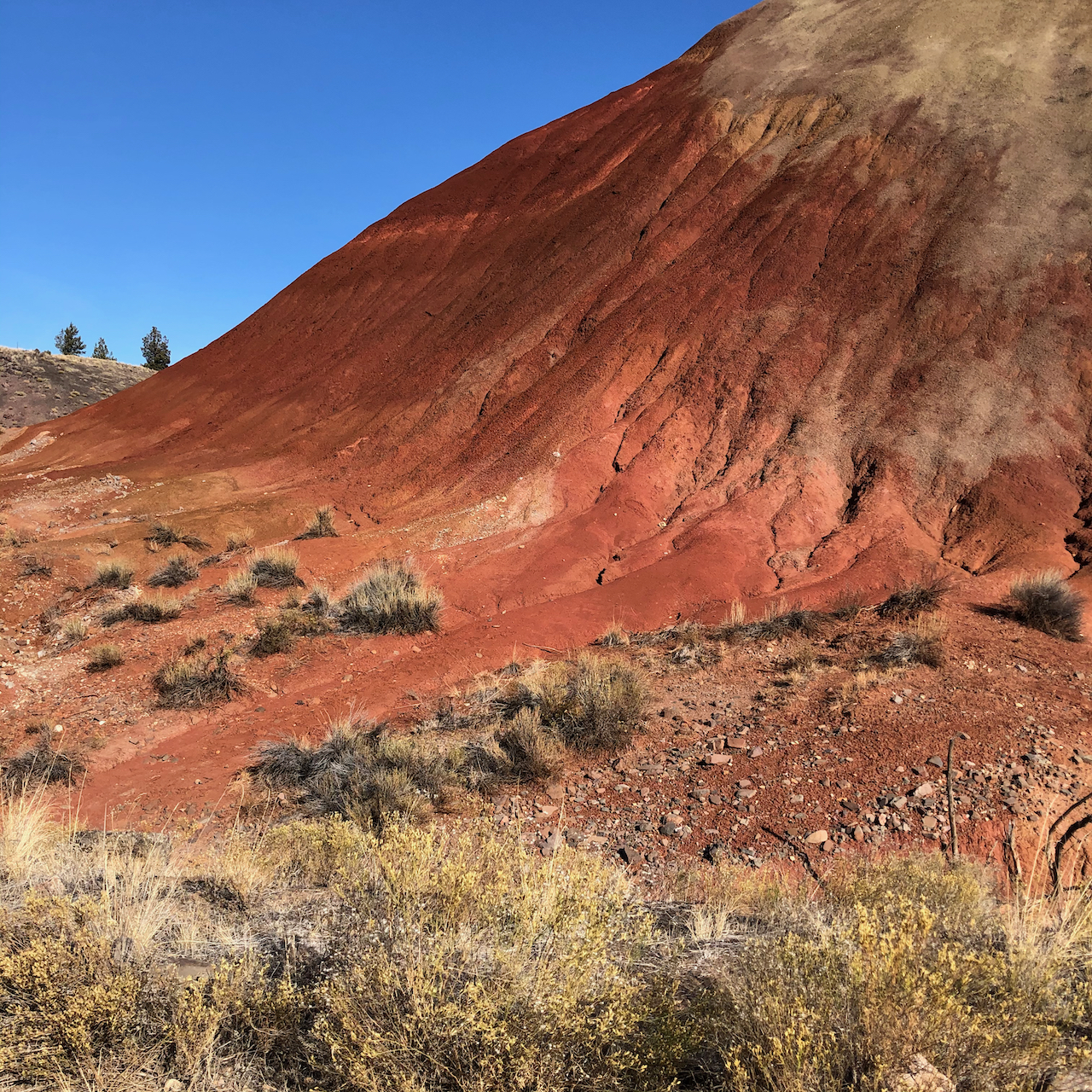
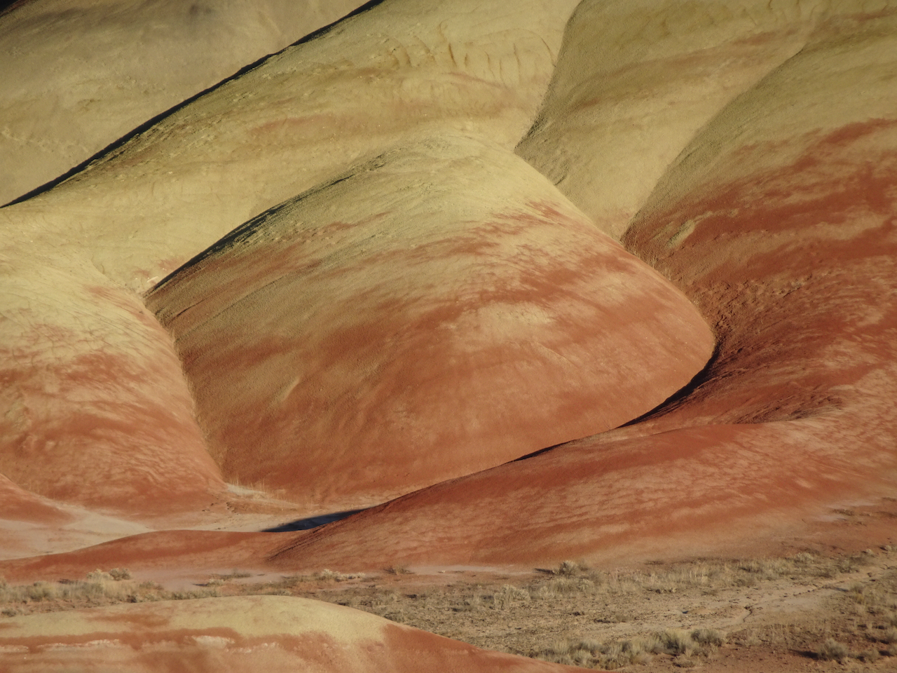
Painted Cove Trail – We next walked the short loop through the red hills near the John Day River.
Red Scar Trail – Another short trail that leads past brilliantly colored badlands.
Red Scar Knoll and Red Hill
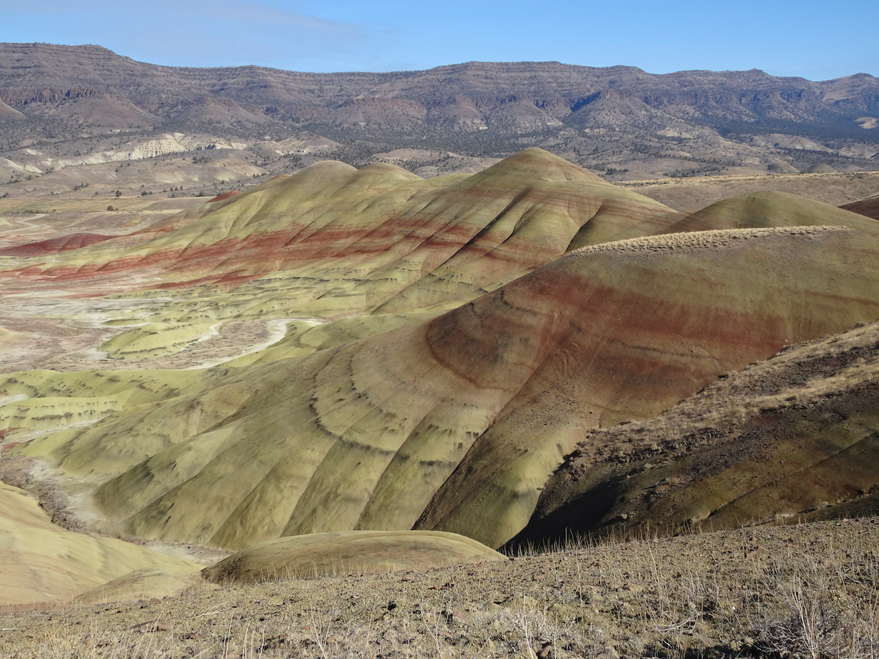
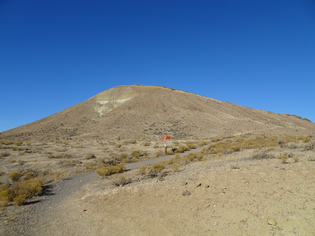
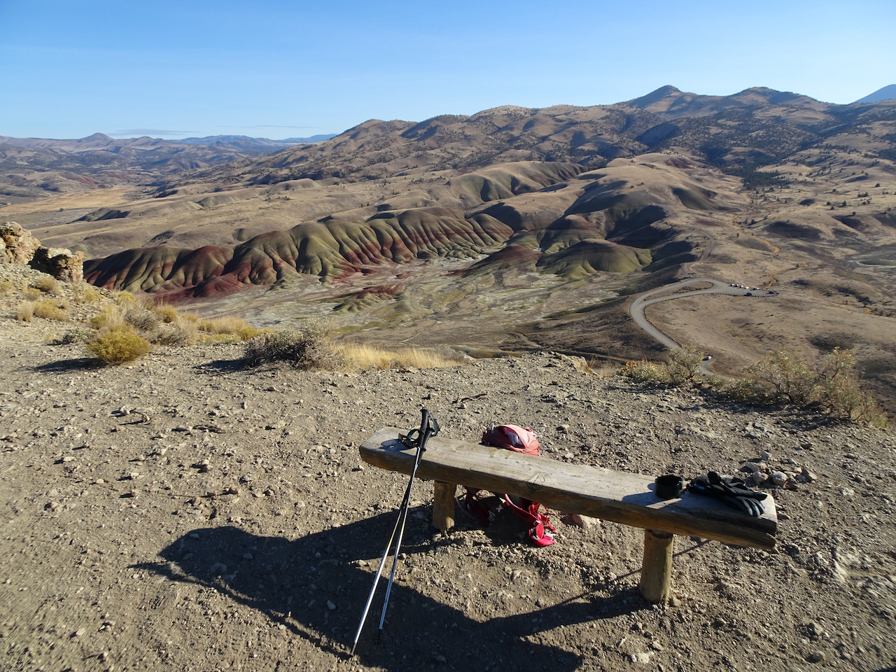
Carroll Rim Trail – Our longest trail for the day (1.6 miles/400 feet) was a walk up to the Carroll Rim. As we hiked up, we could look down on the Painted Hills. From the top, we could see views in every direction.
Carrol Rim
Looking down from the trail.
View from the end of the trail.
View to the east
View to the northwest, Painted Cove area.
Close up of Painted Cove
View to the Painted Hills on the way down.
Back to the Painted Hills Overlook – for another look as the low western light added a glow to the Painted Hills.
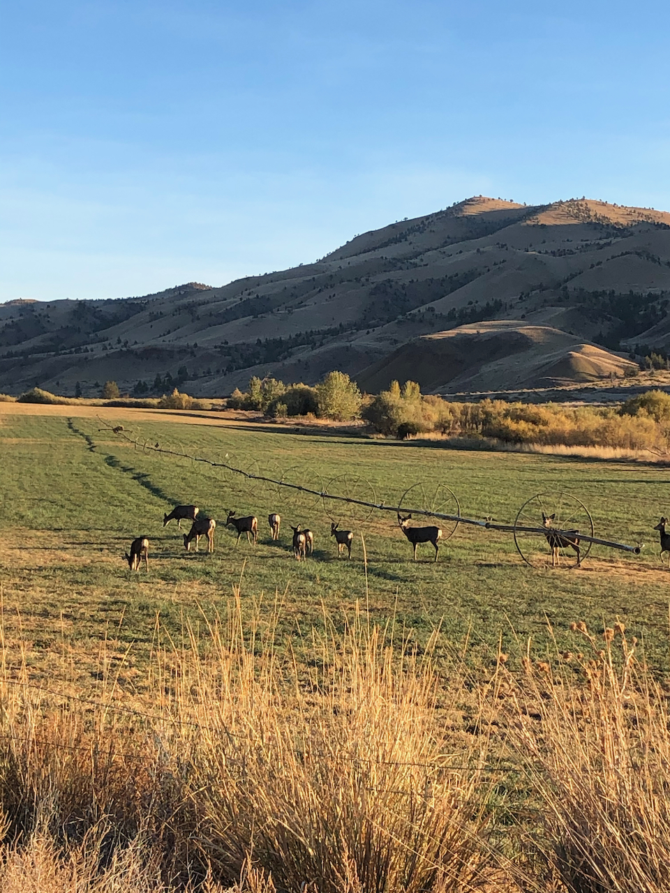
On our drive back to Prineville, we saw a herd of deer, and a view of the Central Cascades.
Deer near Painted Hills.
Mt Bachelor, Broken Top and the Three Sisters on the horizon.
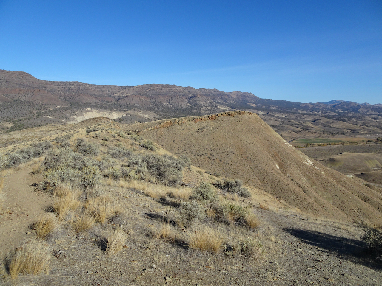
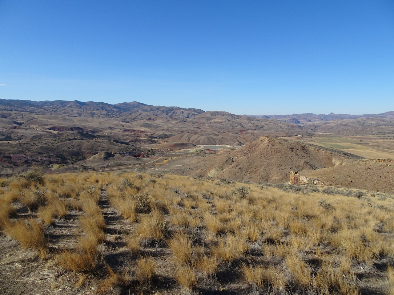
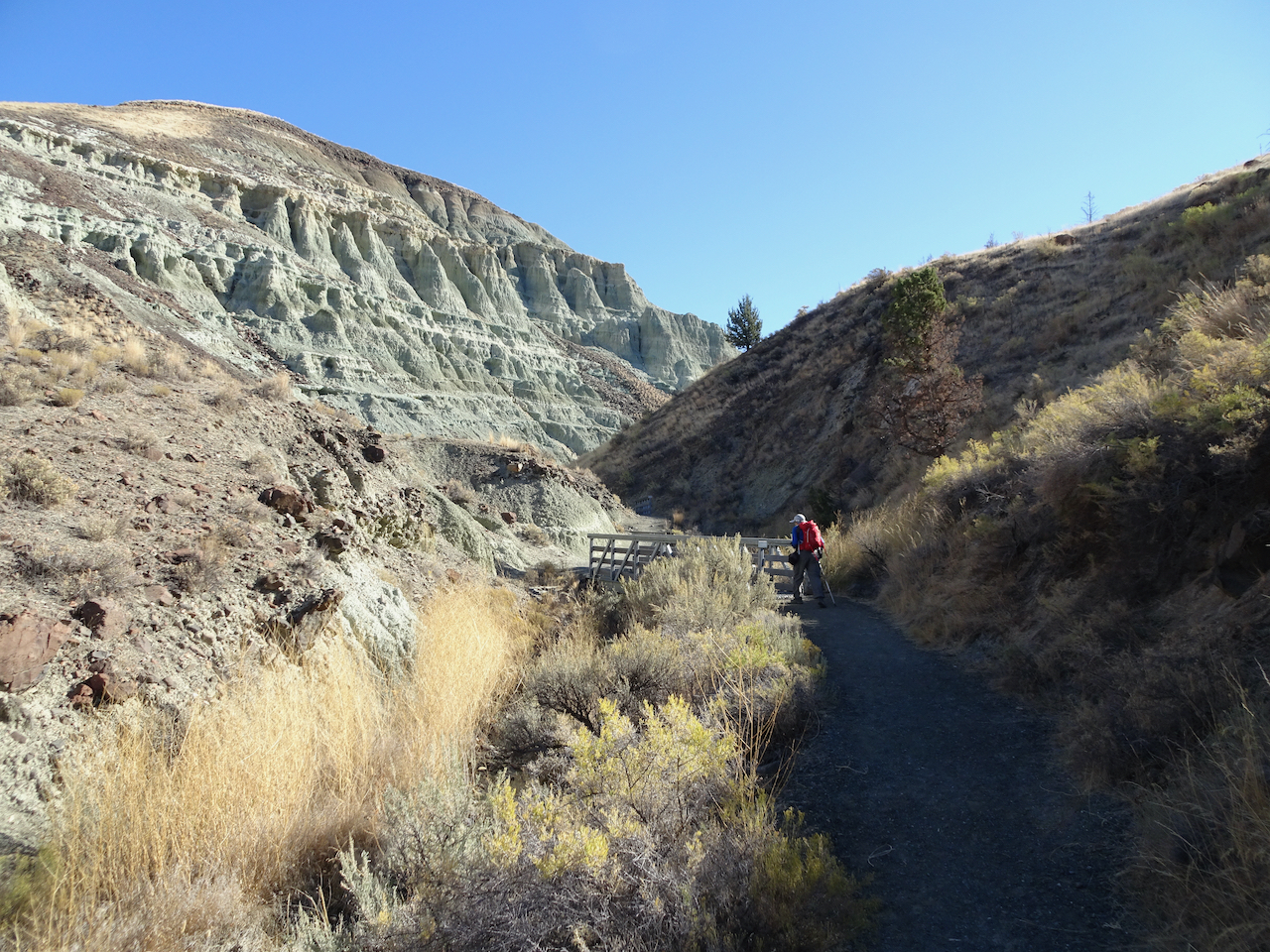
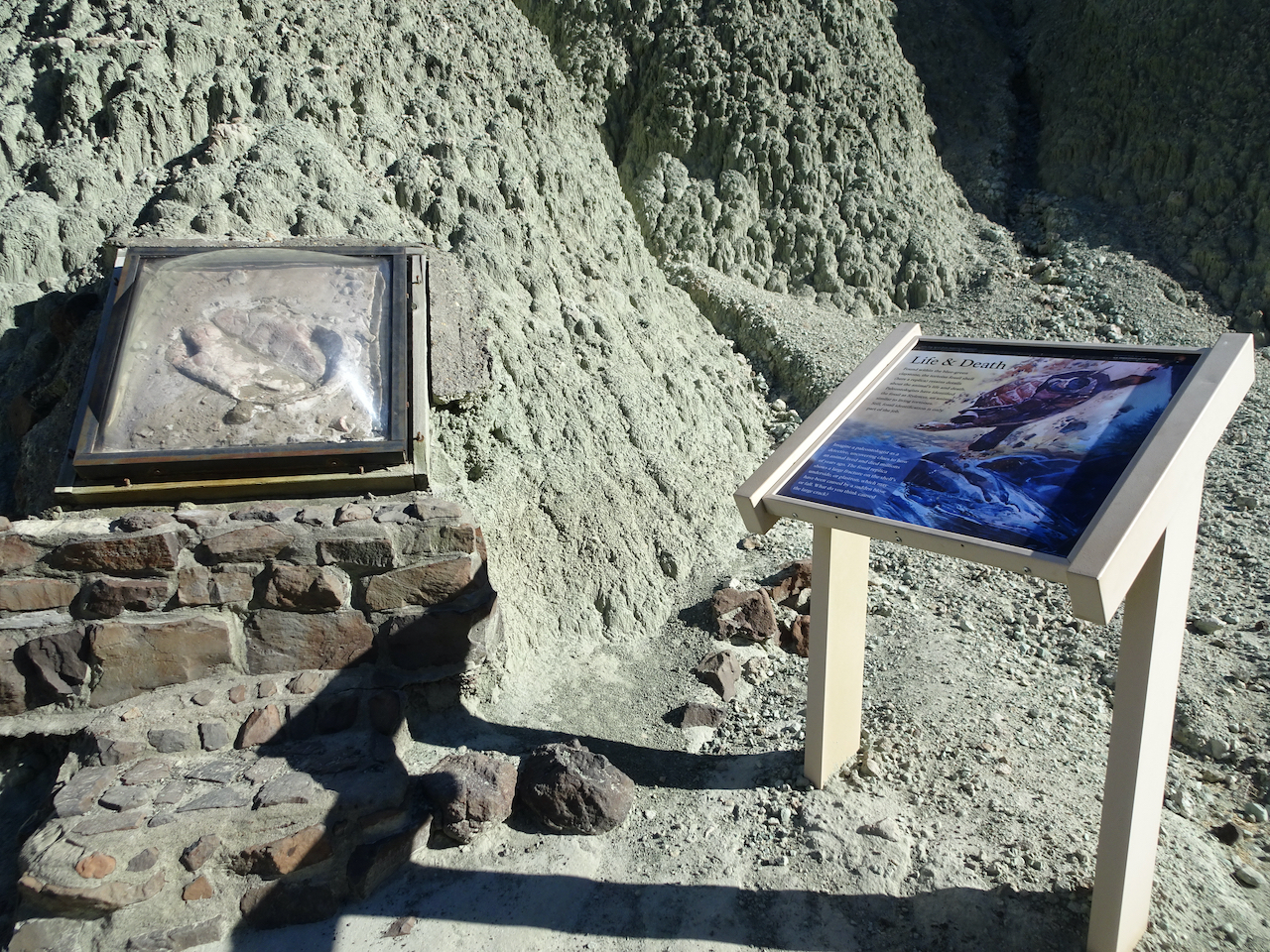
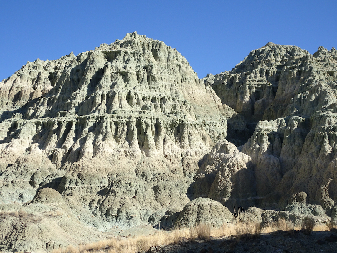
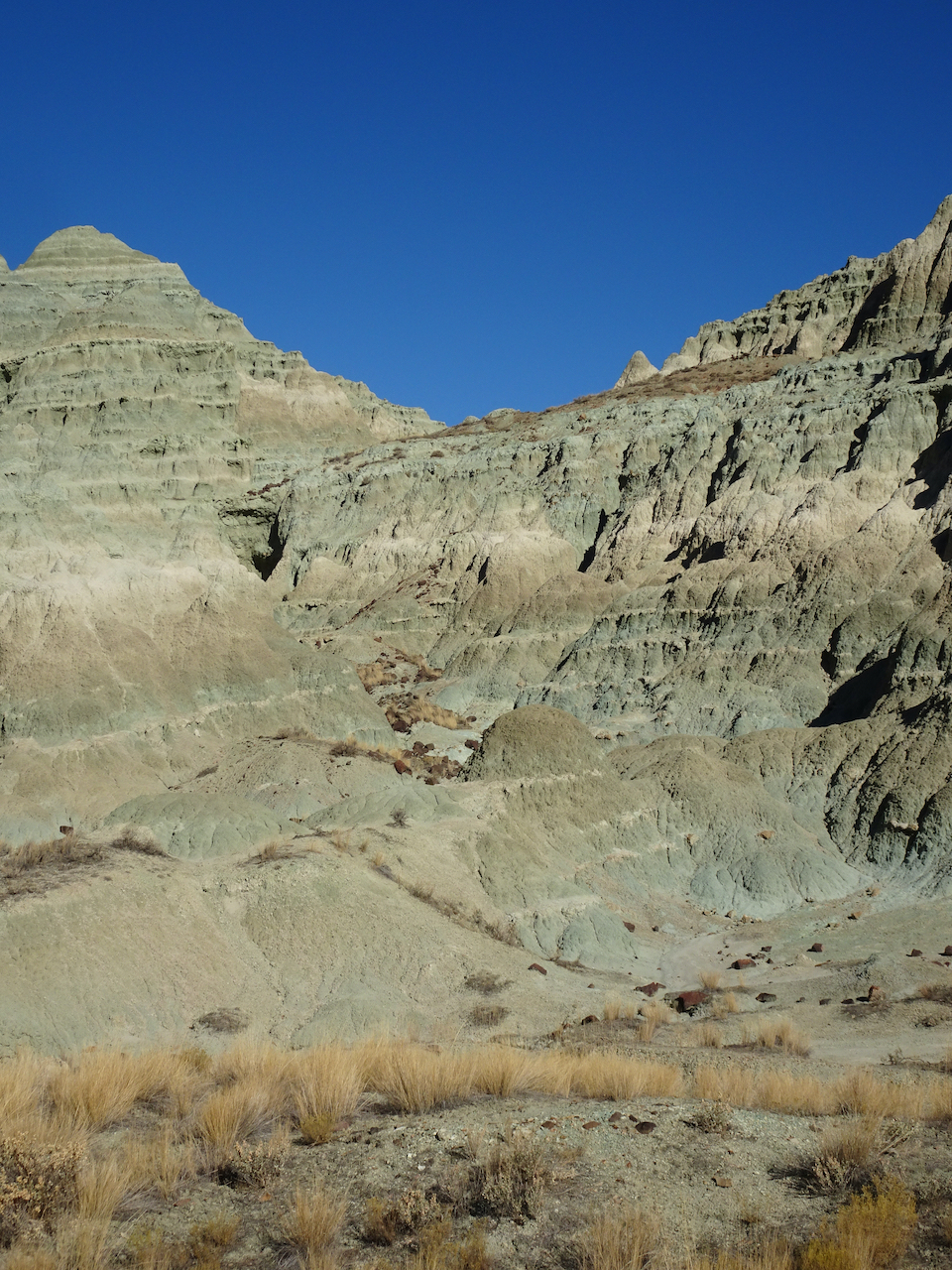
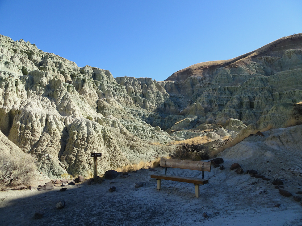
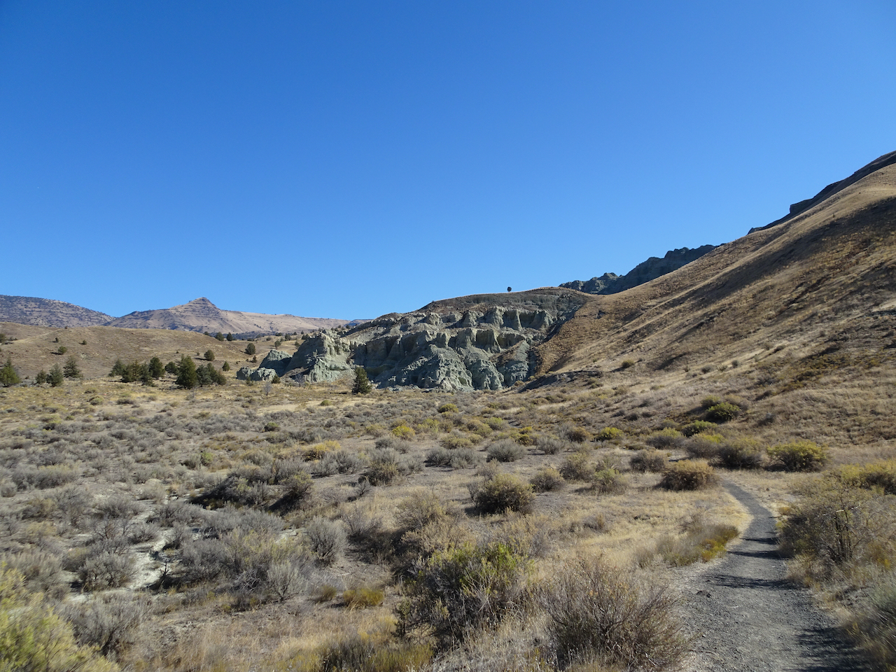
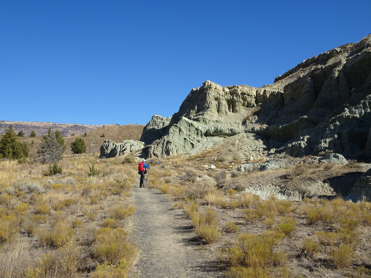
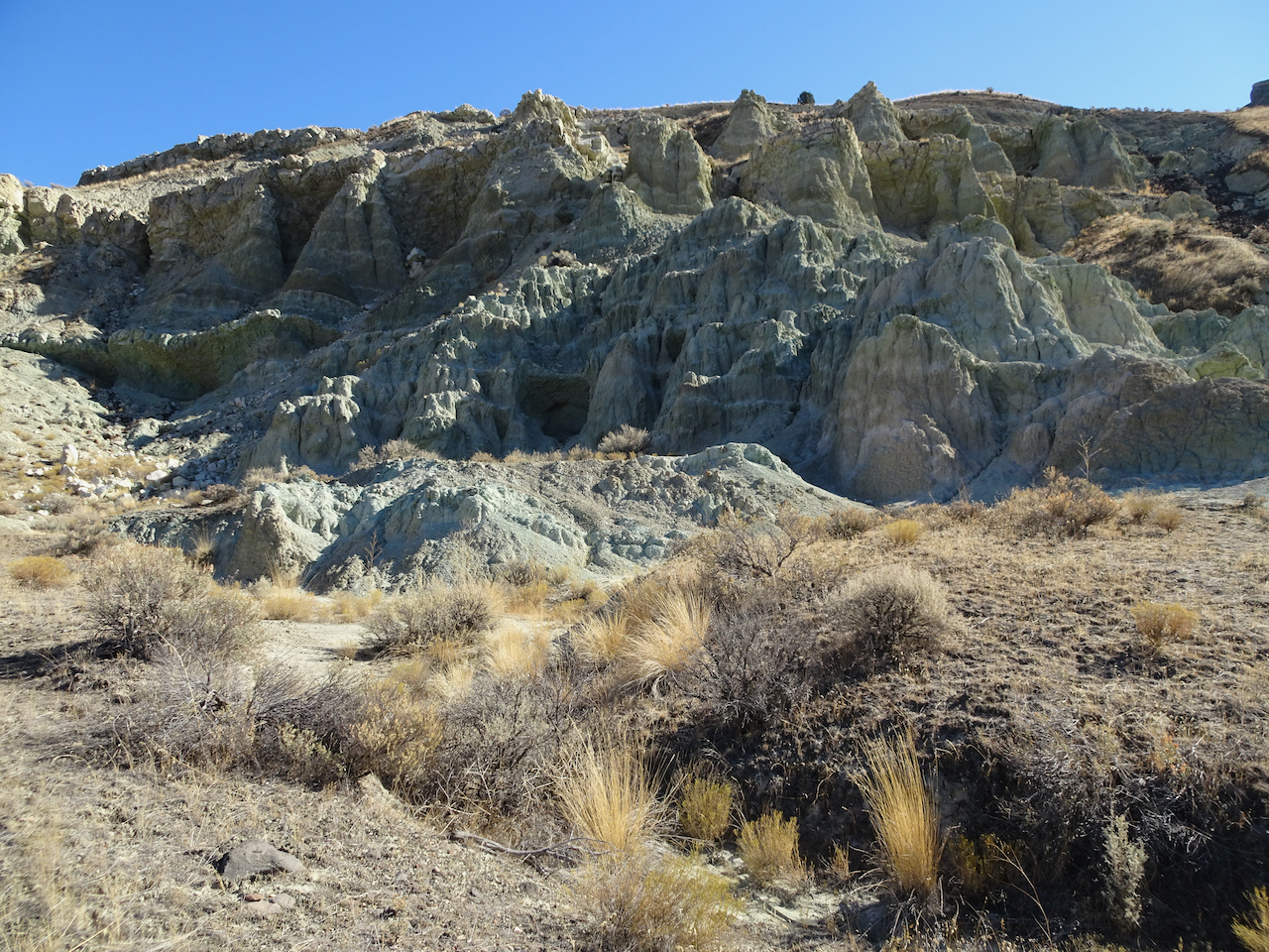
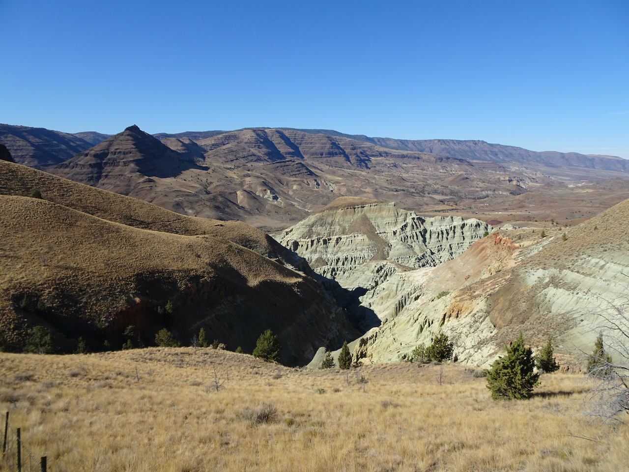
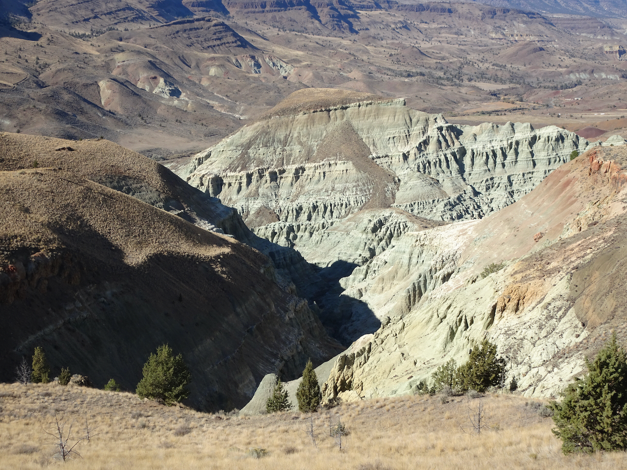
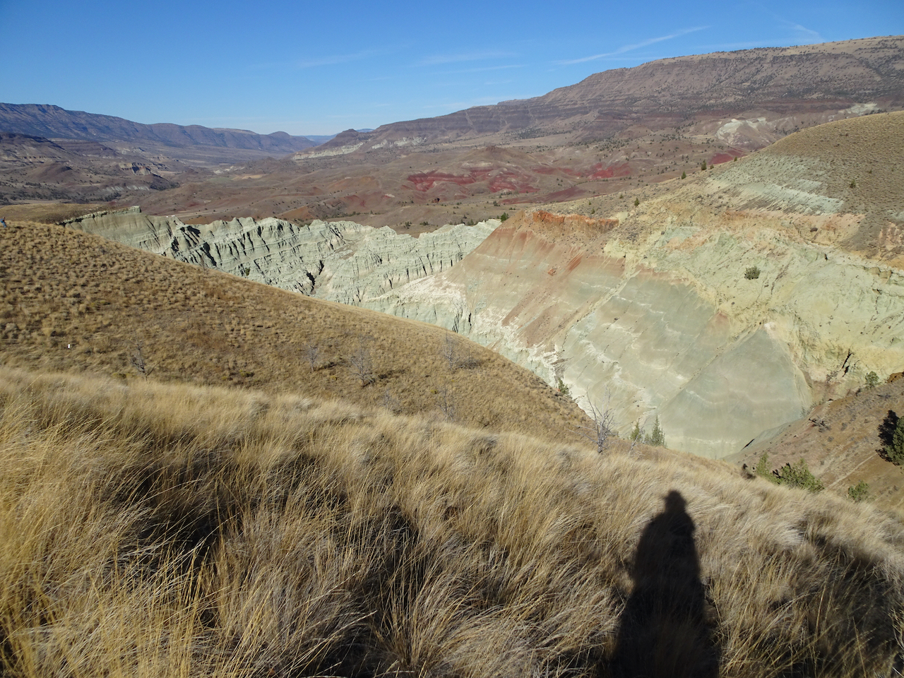
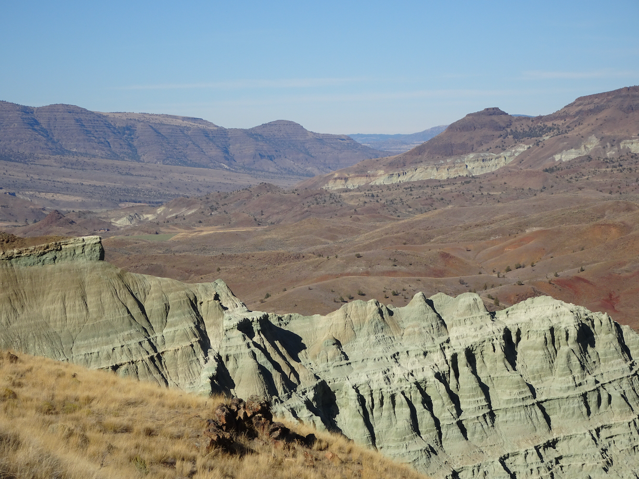
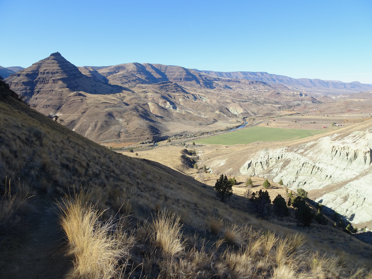
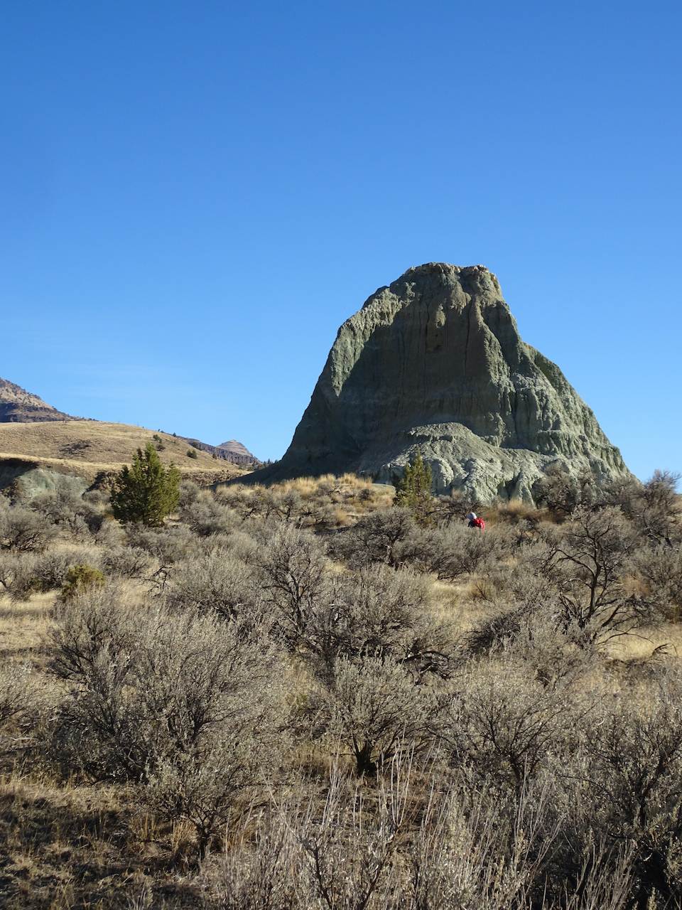
Sheep Rock Unit – Blue Basin – 10/28/2020
We first walked the Island in Time Trail in the heart of Blue Basin.
Entering Blue Basin – one of many bridges on this trail.
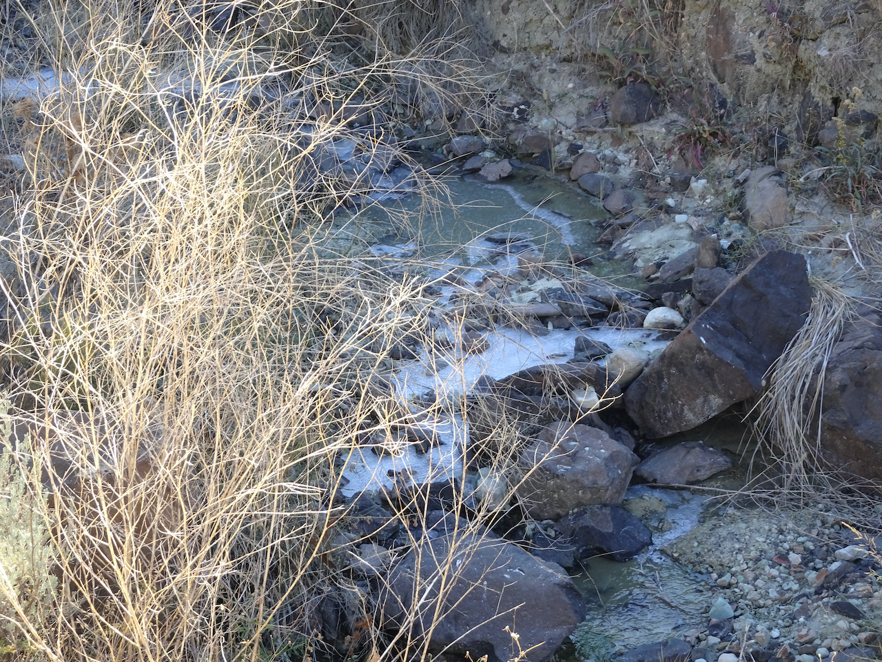
Ice in the creek – last time we were here there was bluish water in the creek.
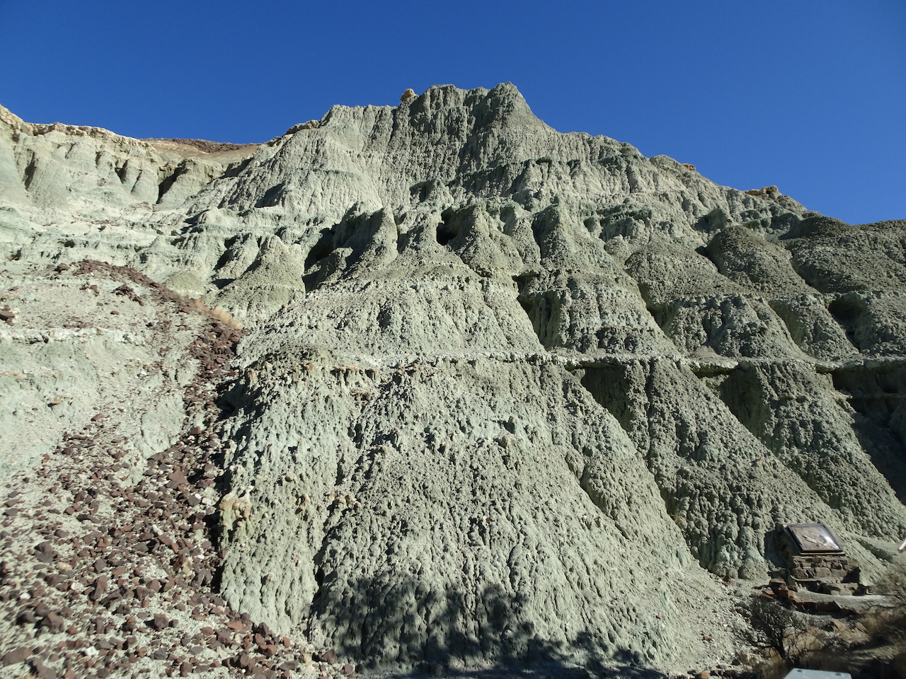
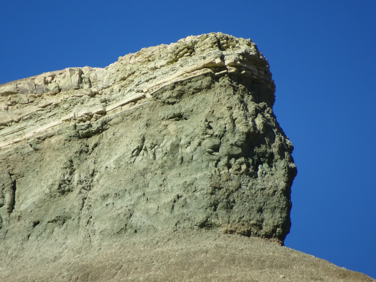
Blue-green volcanic ash claystones.
One of many fossil displays along the trail.
We would be hiking on the surrounding hills later in the day.
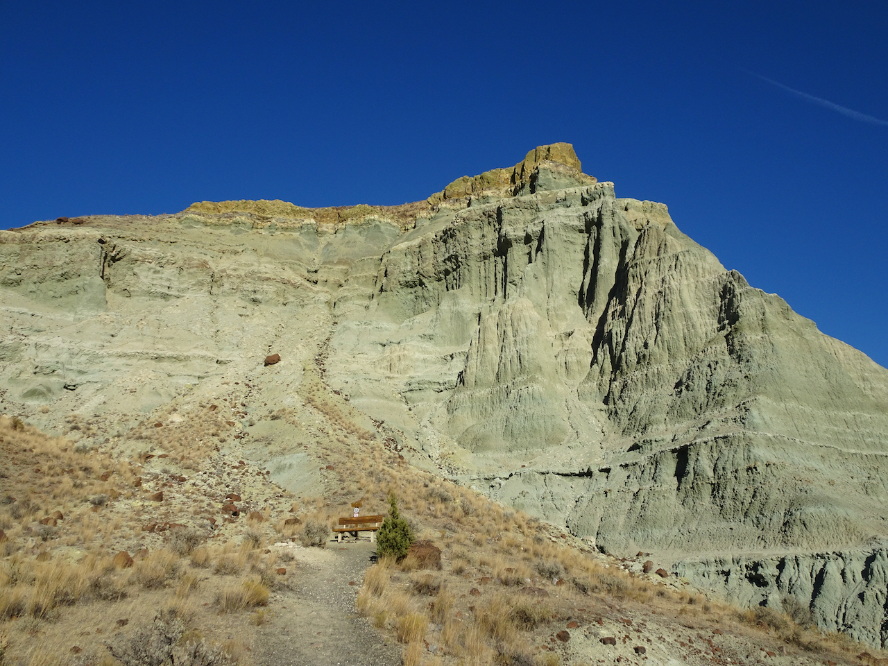
Bench at the end of the trail.
This beautifully eroded skyline was a prominent feature.
Zooming in on the prow…
We spotted this little bird on our way out.
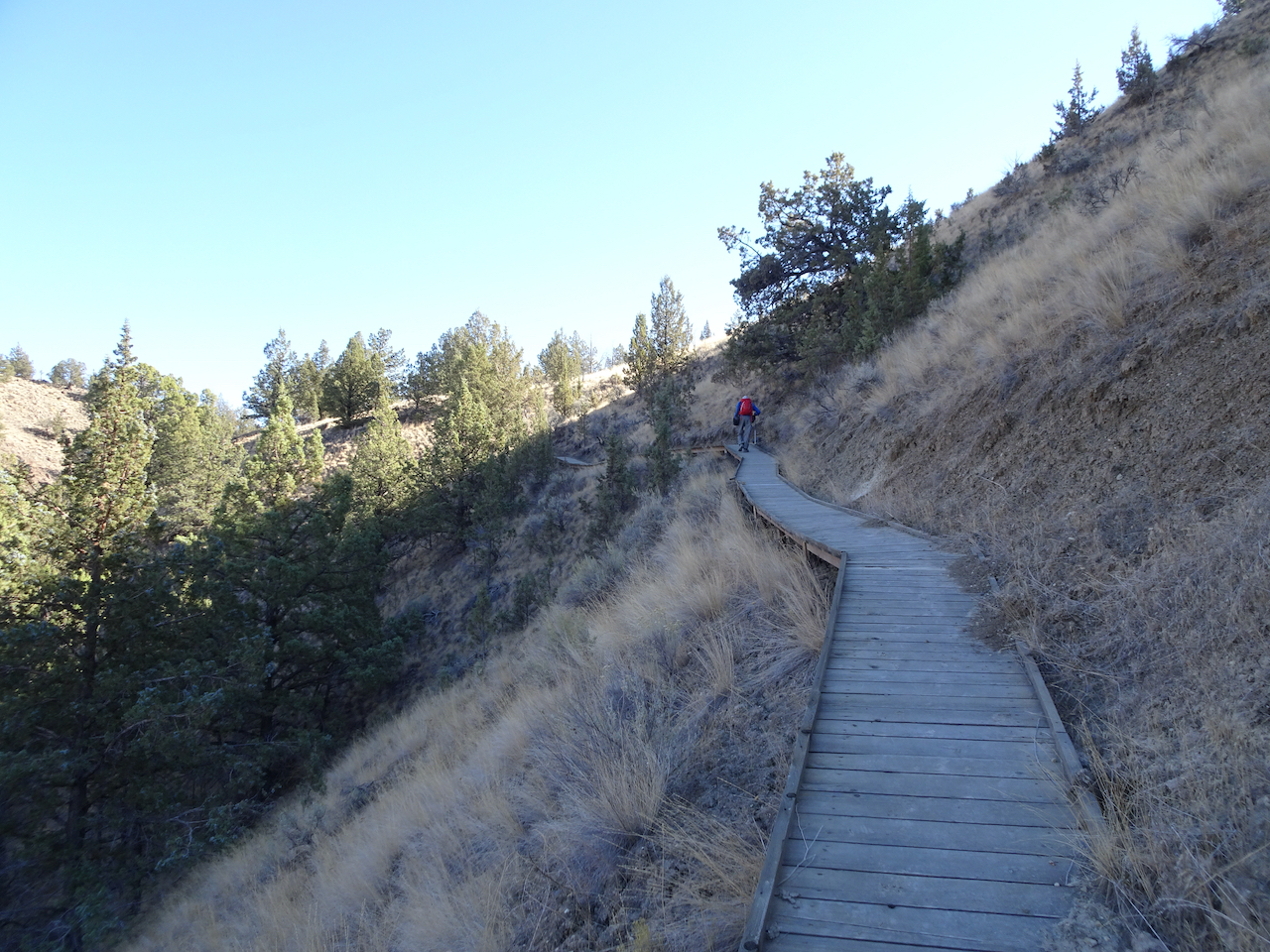
After lunch, we hiked the longer Blue Basin OverlookTrail (3.25 miles/ 600 feet) around the encircling mountains.
North of Blue Basin, the trail passes more blue badlands formations.
Continuing up hill…
Boardwalk over mudstone
Views to the north
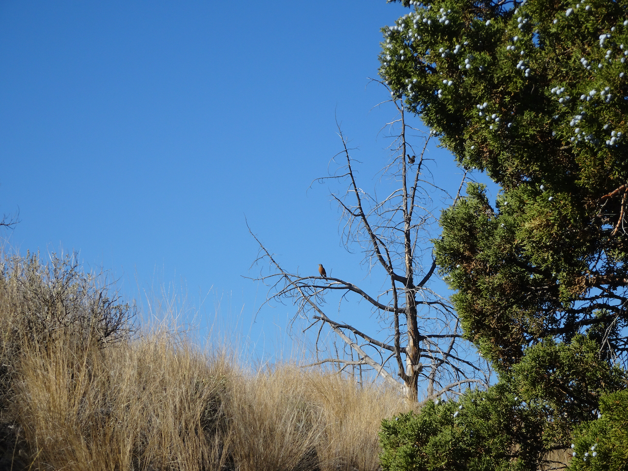
Robins and juniper berries.
Eventually we reached the viewpoint over Blue Basin –
The trail circles around to the south, above the basin, giving views of the same beautifully eroded skyline I noticed earlier.
Eventually, we descended to the trailhead.
John Day River Valley.
We also took a short hike on the Story in Stone Trail, located just a few miles north in the Foree unit. We saw similar landforms there.
We thoroughly enjoyed our visit to this remote area. We were lucky with sunny, if cold, weather. The trails were mostly empty, an important Covid consideration. Lots of fresh air and a good change of pace from our sheltering at home routines.
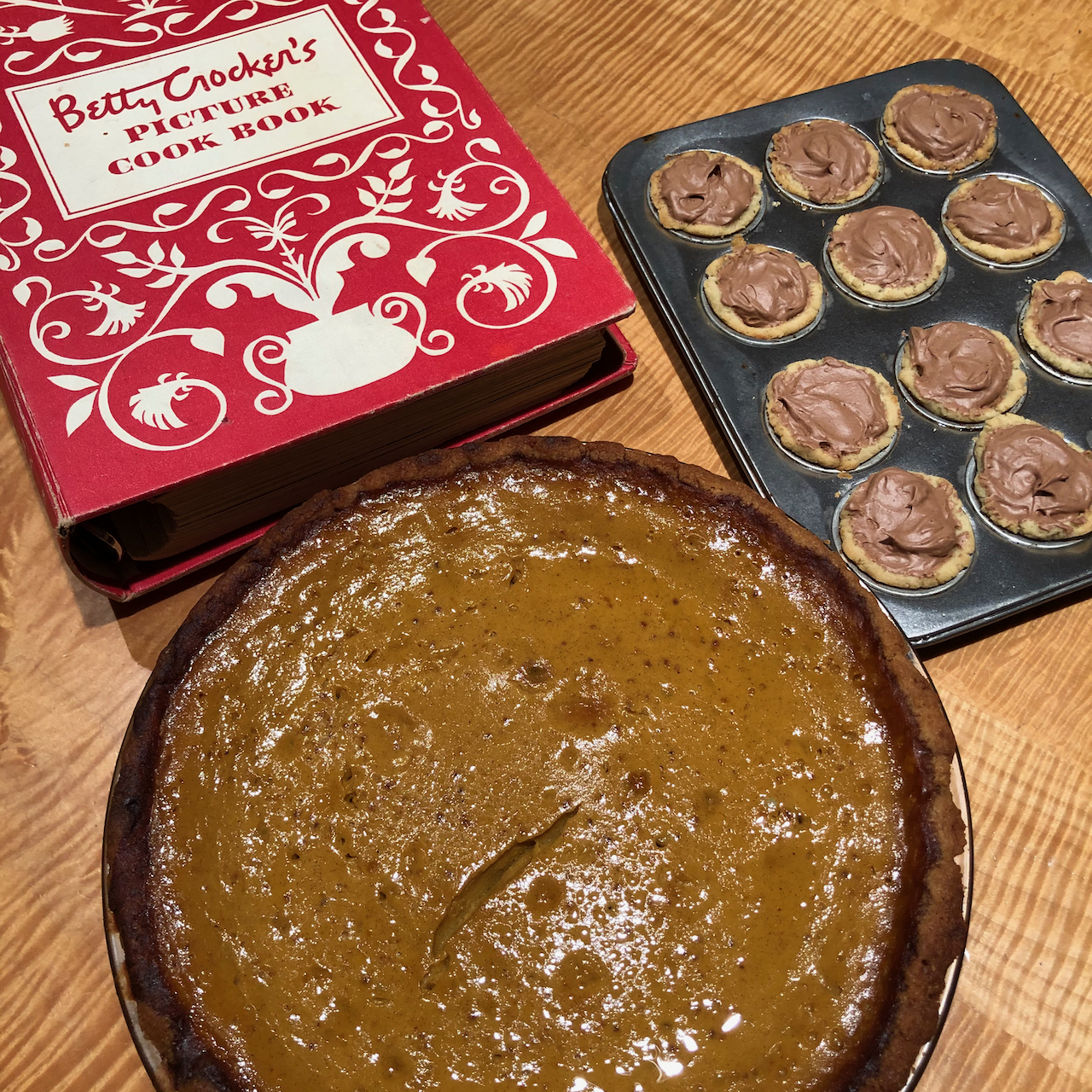
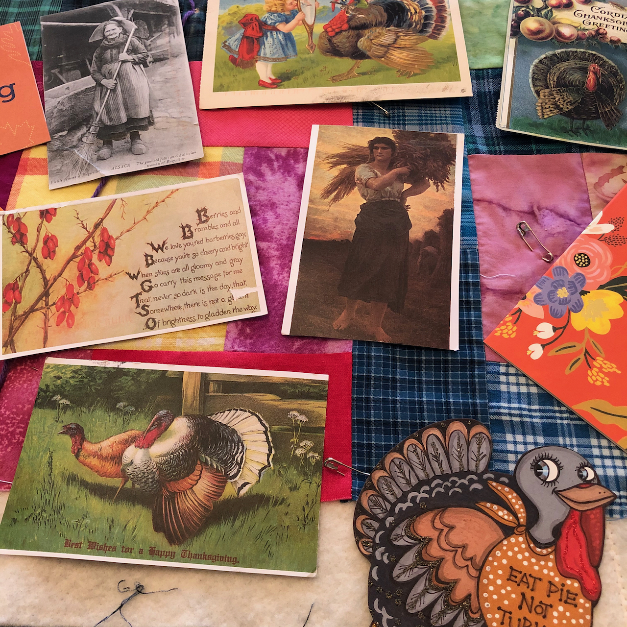
Thanksgiving approaches and once again I am baking three kinds of pie, two kinds of cranberry sauce, and a turkey breast. There will be mashed potatoes and (store bought) gravy, roasted brussels sprouts, and veggie lasagna. For four people. We will be grateful for abundance and eat all the leftovers for days. We will be grateful for all the years we could share the meal with a larger group of family and friends. I will even make just a little bit of whipped cream for the pies, to keep with tradition, this year when we struggle to keep the traditions afloat. We won’t be using the good china, the antique gravy boat, or grandma’s silver. We won’t be lighting candles or lingering over the table. We will be in the backyard, grateful that it is not raining. Grateful that after a negative covid test and continued social distancing, we can set up a separate table for our son to join us, and we can sit together for as long as the weather holds. We will be grateful to have lots of warm clothes, hand knitted socks, scarves and sweaters to keep us warm while we celebrate our first, and hopefully our last, Covid Thanksgiving. November 25, 2020
Pumpkin and chocolate pies ready, apple to be baked tomorrow.
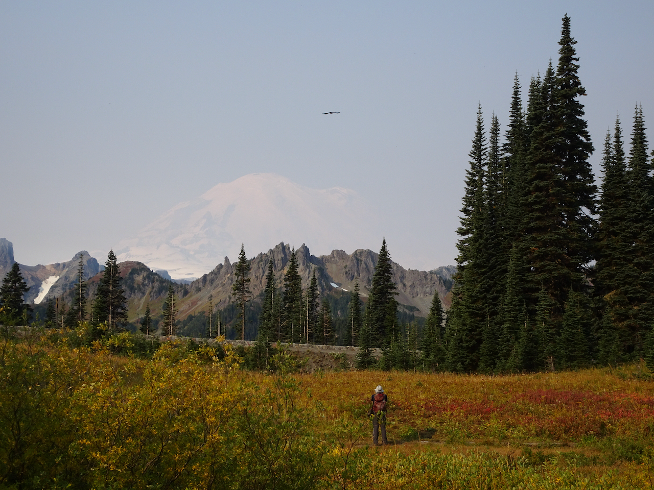
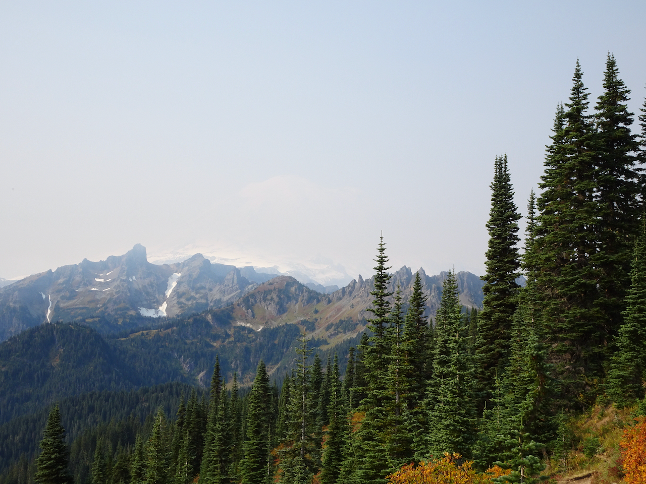
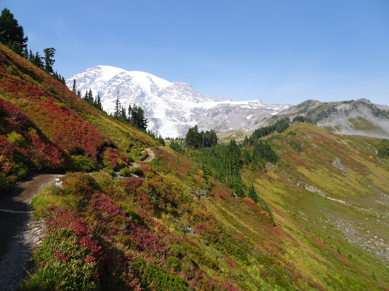
-on a midweek getaway, to a self-contained cabin in Packwood, Washington, with our own food, following all Covid-19 precautions. We have seen the stunning wildflower displays of summer a few times, and had long been wanting to see the the mountain in fall colors.
Mount Rainier area hikes.
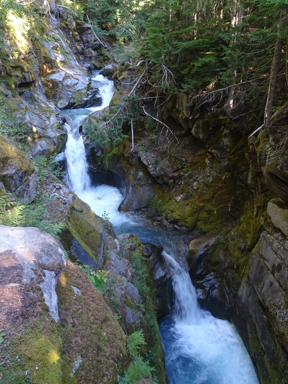
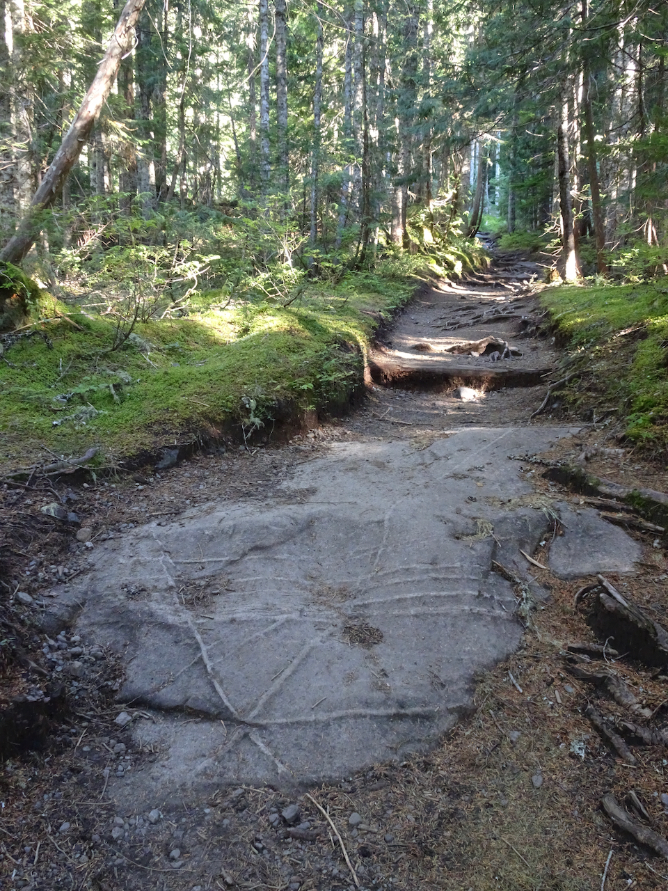
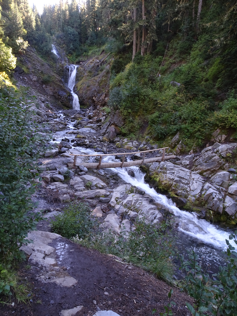
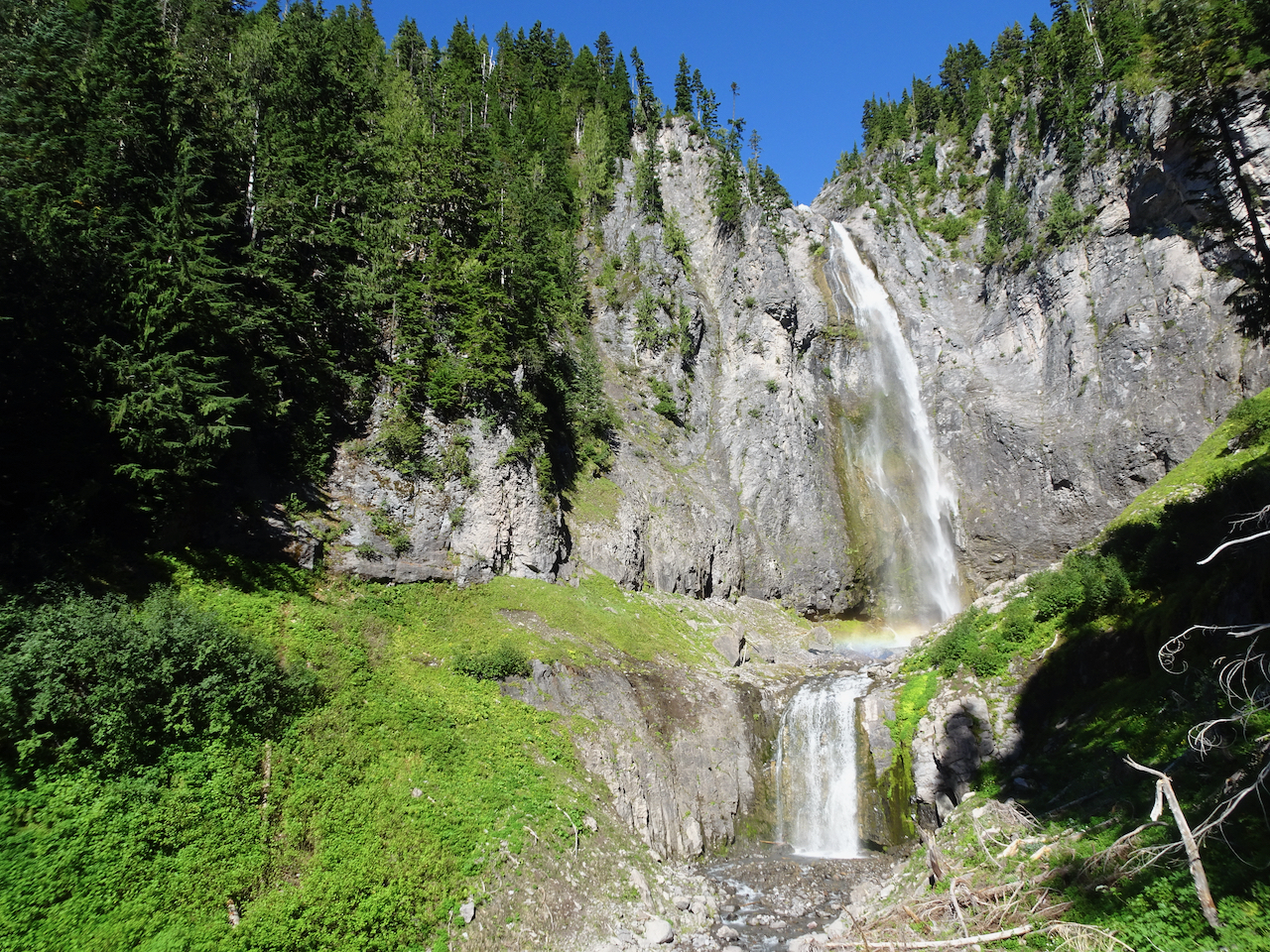
September 29, 2020 – Comet Falls/Van Trump Park
This trail, west of the Nisqually River and Paradise, follows Van Trump Creek all the way up to the stunning Comet Falls, then farther up the slopes to magnificent views of Mt Rainier from Van Trump park. (P.B. Van Trump was one of the first to stand on the summit of the mountain, in 1870). A very challenging and satisfying hike (7 miles, 2500 feet).
Smaller falls near the trailhead.
Trail through the woods.
I first thought this was our waterfall, then continued over the next ridge:
Comet Falls! About 400 feet, counting smaller tiers above and below the main falls. Snow bank on lower right.
With rainbows in the mist!
Our trail continues up, with better views of Comet Falls.
The trail continued upward steeply, into Van Trump Park.
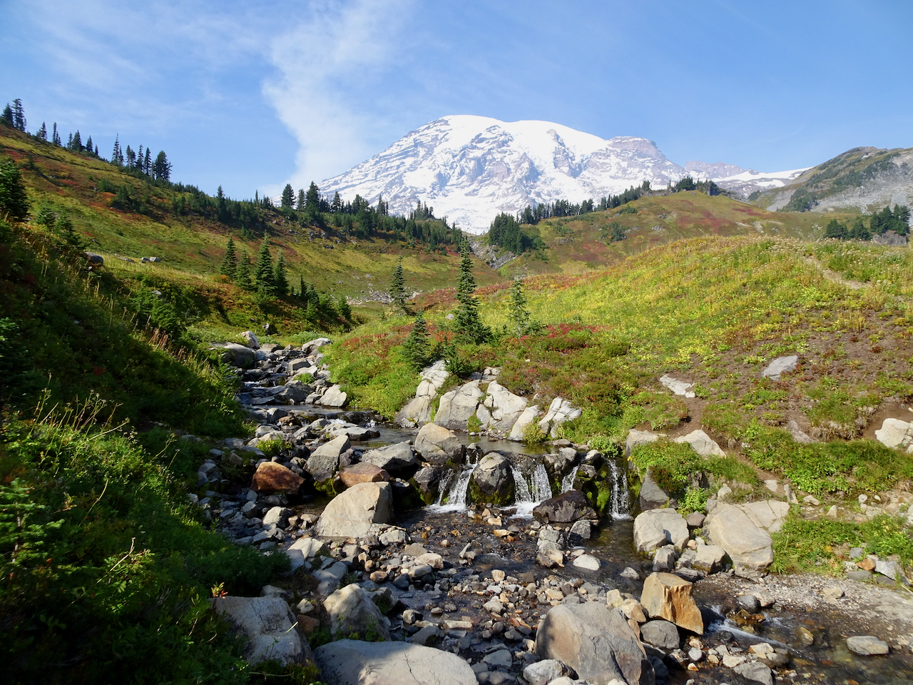
Above the waterfall, the mountain came into view.
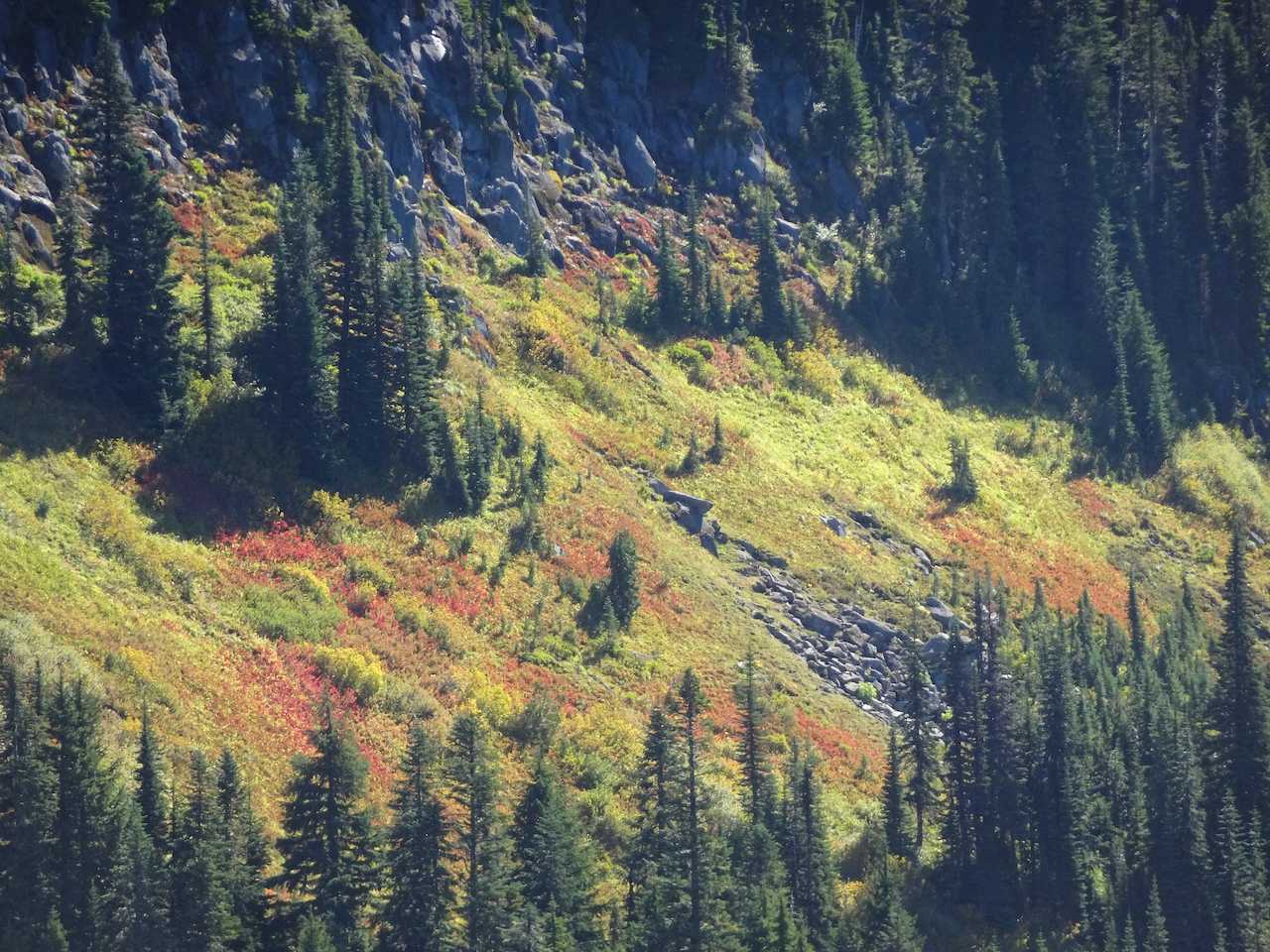
Fall foliage on the slopes of Van Trump Park, glowing red!
Mount Rainier from our lunch stop in Van Trump Park.
Views of the glaciers from a new angle:
The trail down seemed steeper than the trail going up; that might just be my knees talking.
Mt Adams on view beyond the Tatoosh Range.
Glacial striations/polish and Mt Adams.
Uppermost tier of Comet Falls.
A particularly steep trail section.
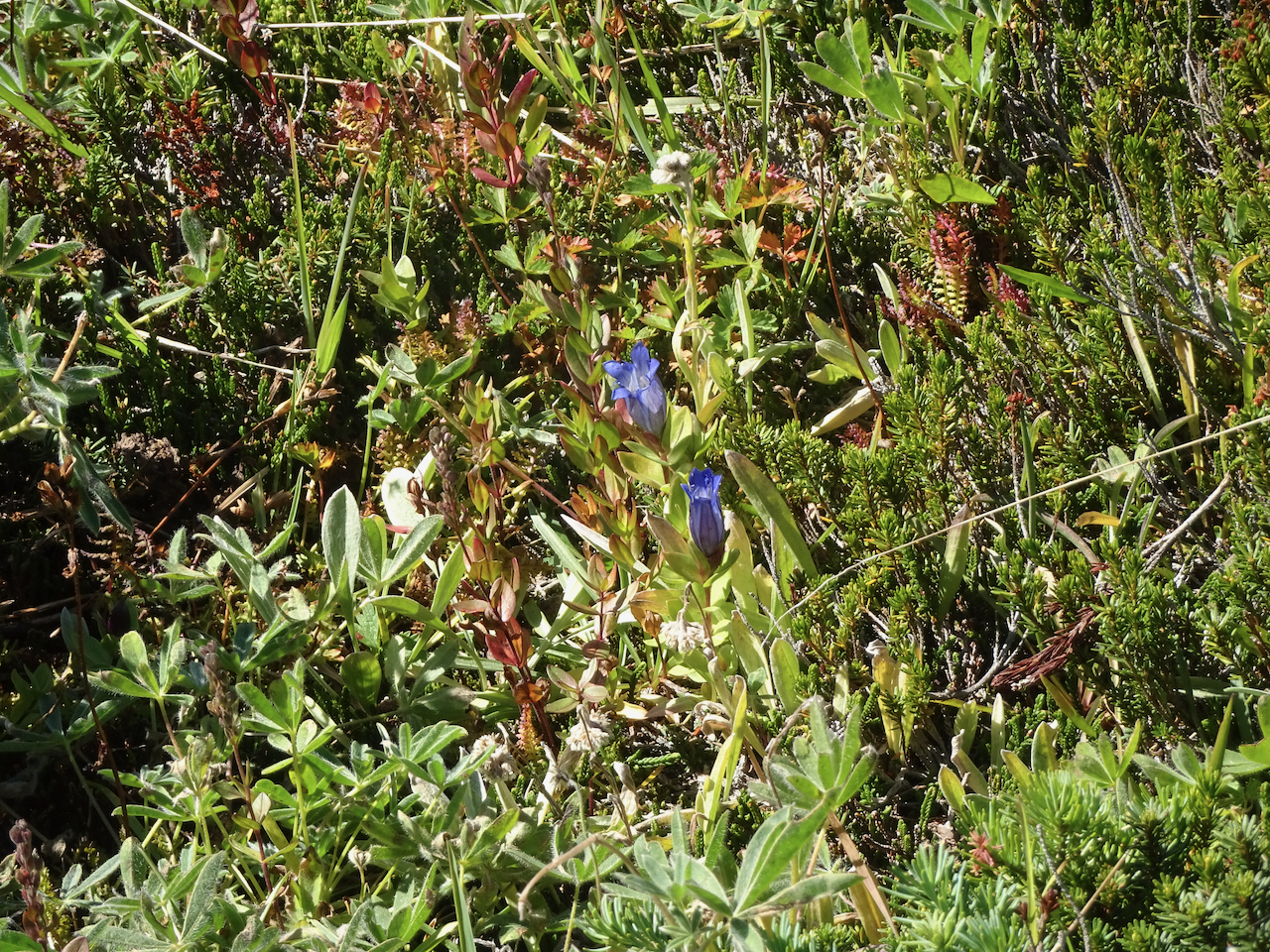
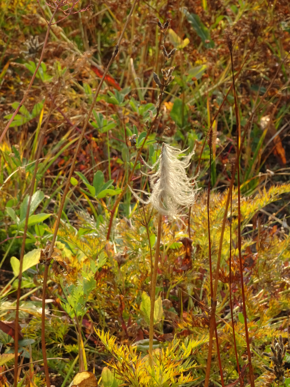
A few late gentians in the upper meadows.
Vine maples just beginning to turn red.
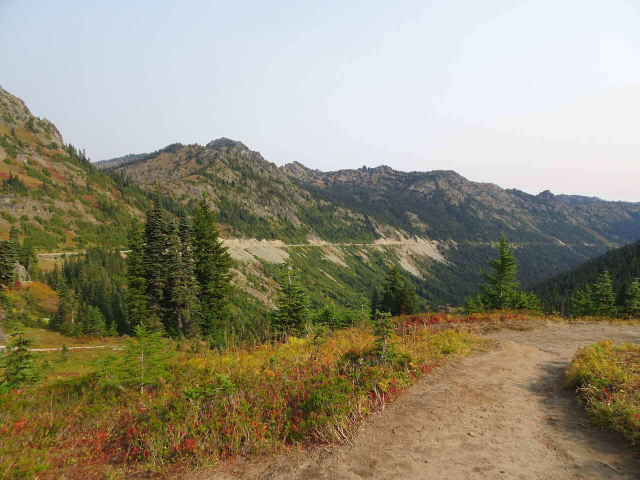
We stopped at a couple of roadside viewpoints on our way out of the park.
Highway bridge over the Nisqually River canyon.
Nisqually River downstream.
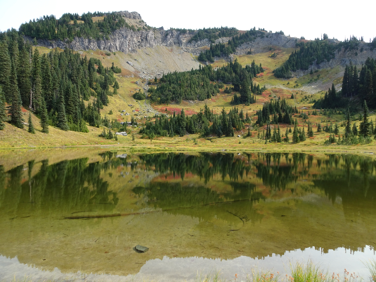
We could not resist stopping to see the mirror image in Reflection Lakes.
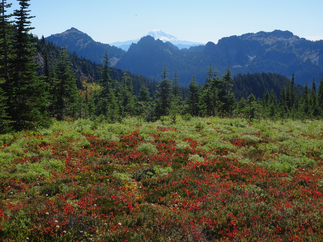
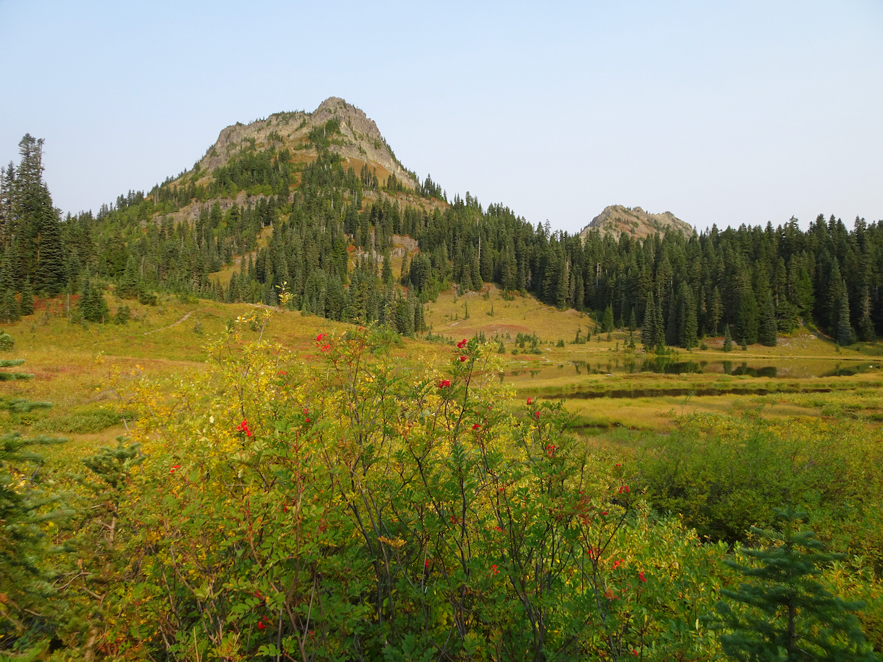
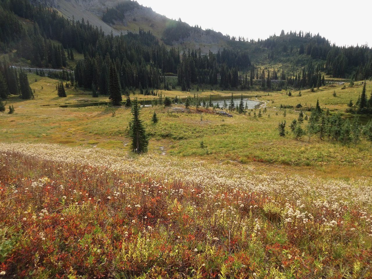
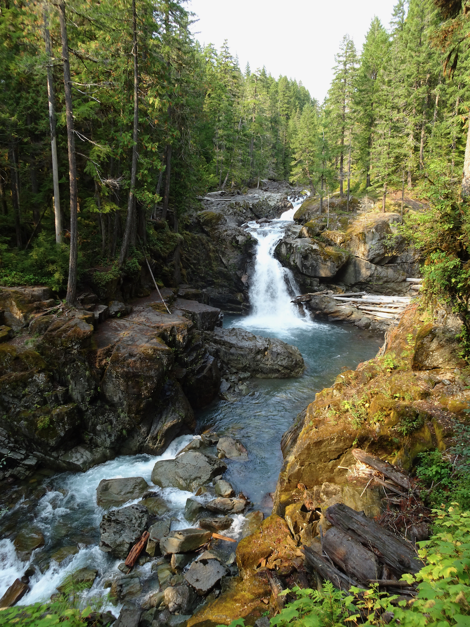
September 30 – Naches Peak/Tipsoo Lake Loop, smoke haze at Sunrise, Silver Falls.
We hiked this loop trail (4 miles, 600 feet), with our views increasingly shrouded in haze. Wildfire smoke began drifting diffusely in, creating a grayish white sky that was so startlingly blue yesterday.
We were almost alone as we walked around Tipsoo Lake, admiring the beautiful reflections in its mirror-like surface.
Tipsoo Lake
Yakima Peak
Mt Rainier, slightly obscured by haze.
Mt Rainier reflected in Tipsoo Lake.
Yakima Peak – our trail rising along its base.
Pasque flower seed head
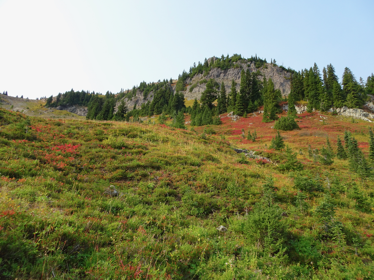
Meadow of huckleberry and aster seed heads.
Then we hiked the loop around Naches Peak – following the Pacific Crest Trail.
Crossing Hwy 410.
Hwy 410, headed down the canyon, to the east.
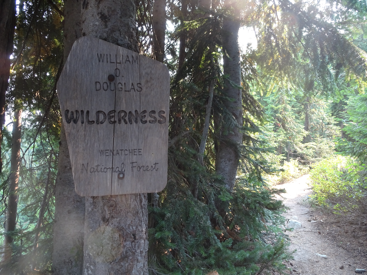
A new wilderness area for us!
Trail up over the shoulder of Naches Peak.
Naches Peak.
Looking back.
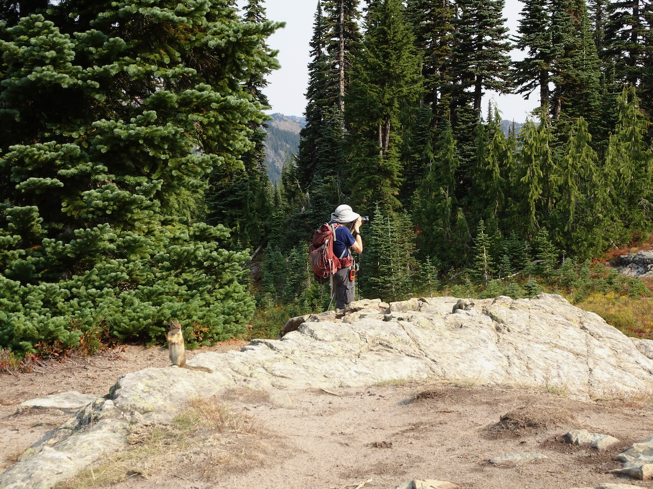
We passed a small lake with a friendly chipmunk.
Once over the shoulder of Naches Peak, we could see the Dewey Lakes to the southeast as the smoke haze increased.
One of the Dewey Lakes.
The trail circles back west, with stunning views of Mt Rainier when there is no haze, as it passes more small lakes.
Mt Rainier is ahead through the haze.
One of the trailside lakes.
More beautiful meadows!
Mt Rainier disappearing before our eyes!
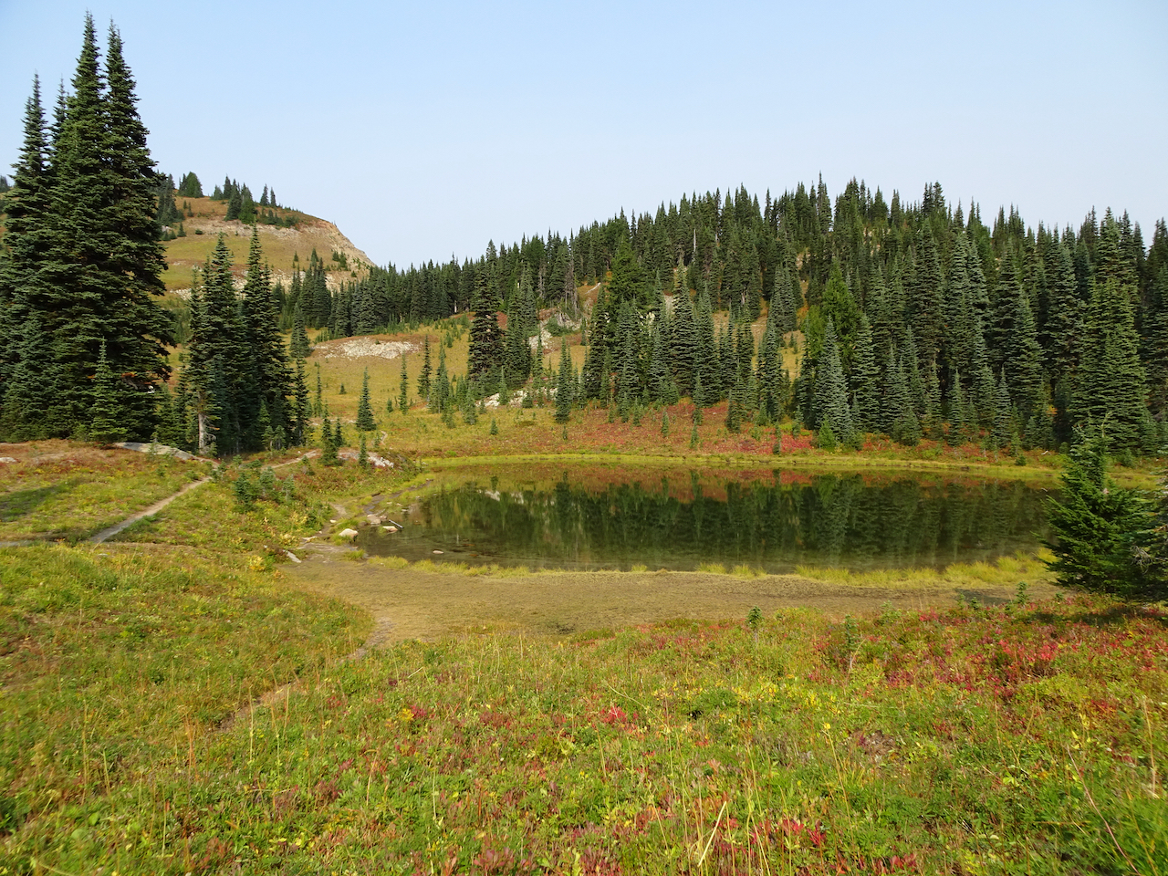
We stopped to admire Upper Tipsoo Lake near the trailhead before finishing the hike.
Upper Tipsoo Lake.
After lunch we drove up to Sunrise, elevation 6400 feet, but the smoke haze obscured views, so we didn’t stay.
Dotted Blue line shows Mt Rainier skyline behind the smoke haze.
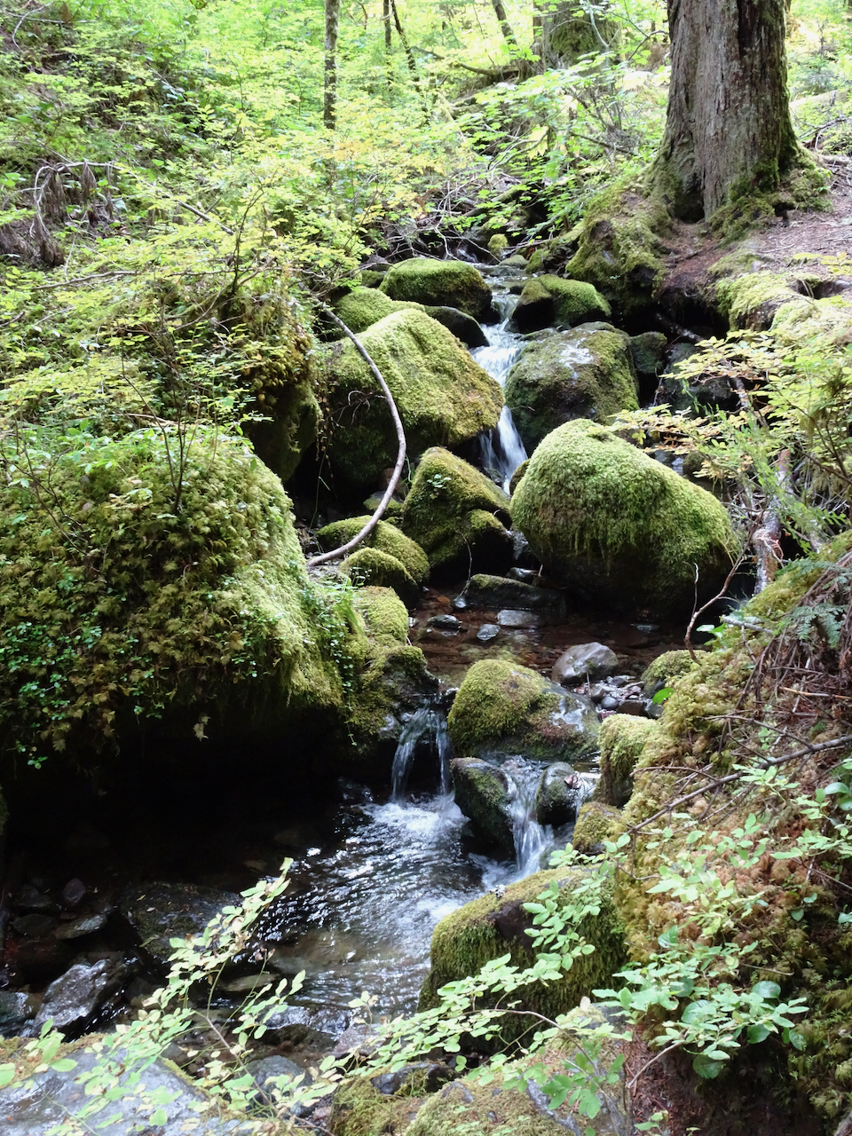
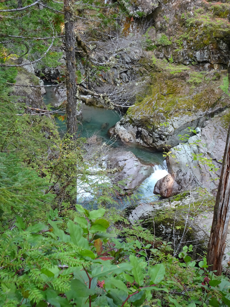
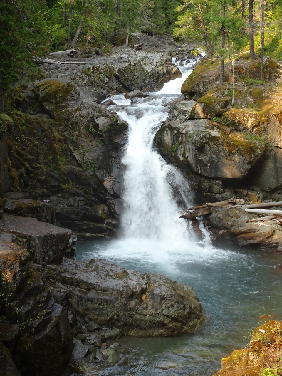
Instead we hiked to Silver Falls, on the Ohanapecosh River, through old and mossy forest, to see clear turquoise waters, and bright falling waters cutting through a slick rock gorge. All in all a lovely ‘recovery’ day from yesterday – the hikes being not so steep. We hope the smoke will blow out for tomorrow.
Small fairy falls in the mossy old growth forest.
Looking down on the blue waters in Ohanapecosh gorge.
Overlook at the top of Silver Falls.
Downstream view of the Ohanapecosh River below the bridge.
Silver Falls.
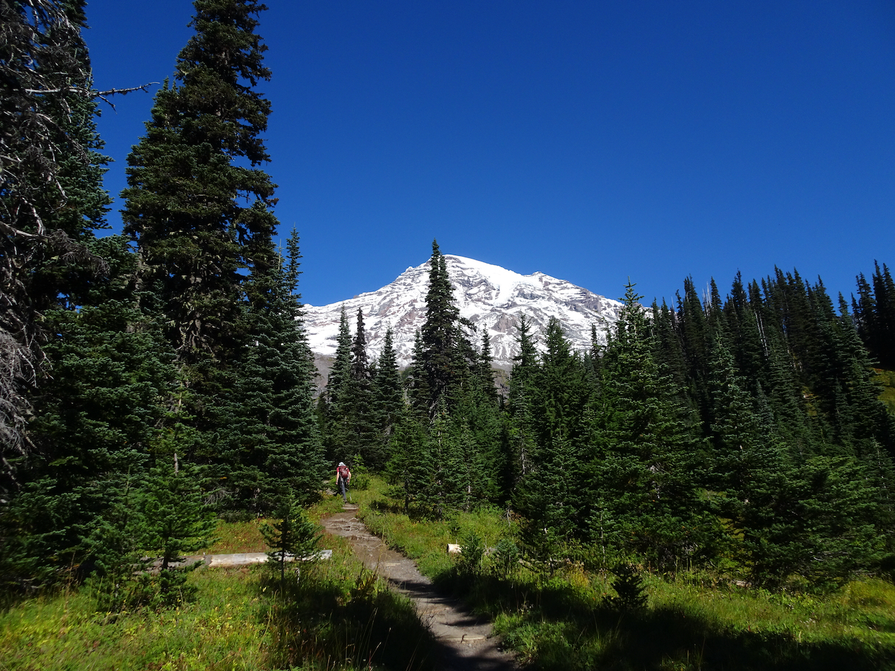
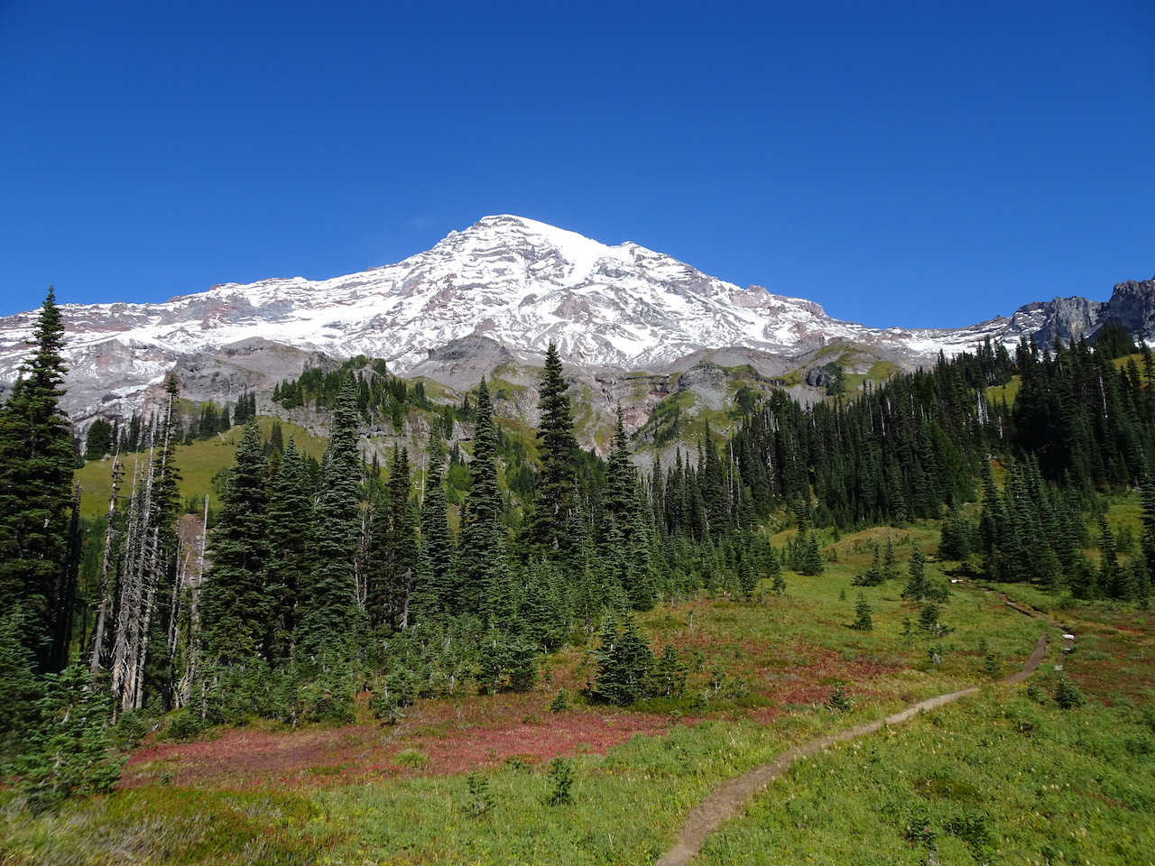
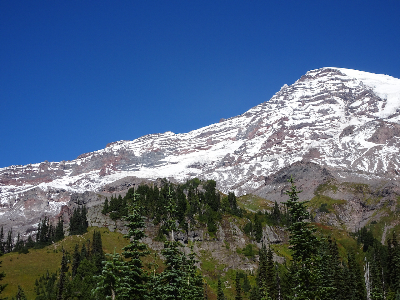
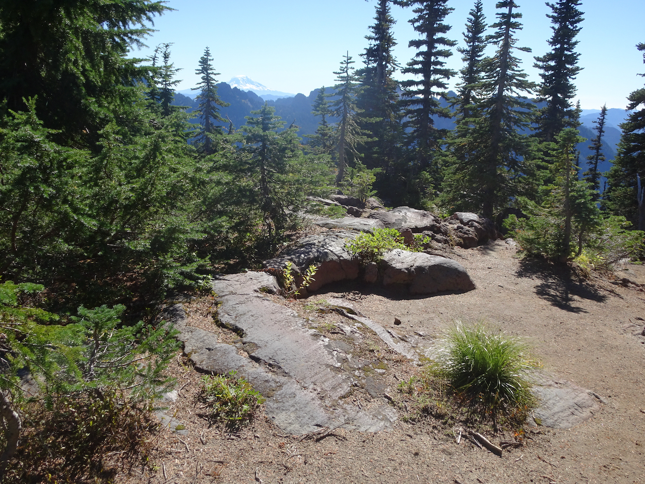
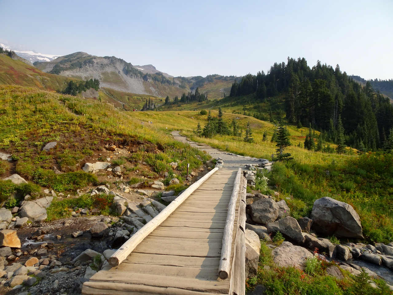
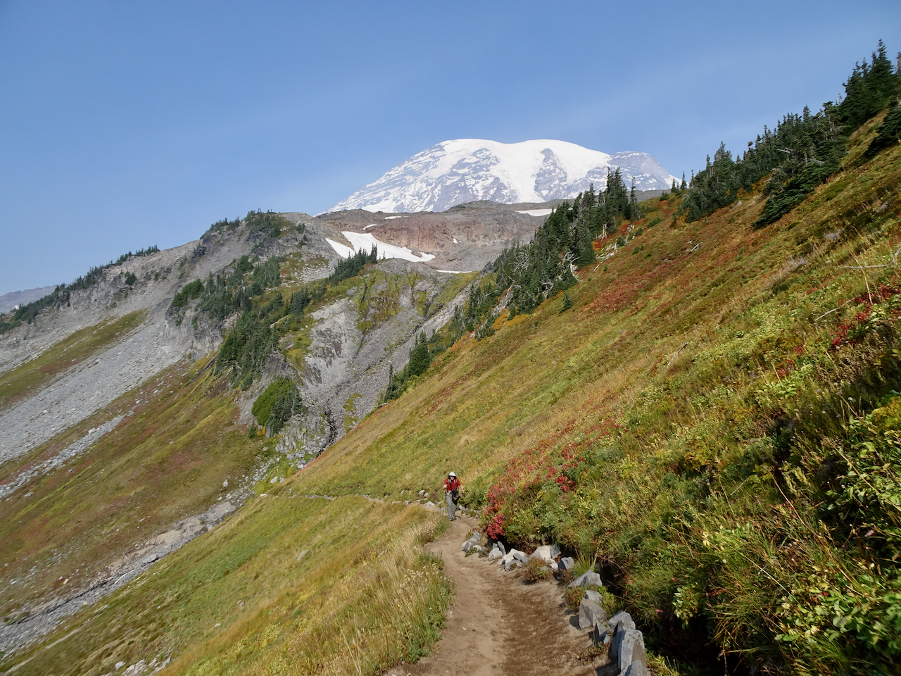
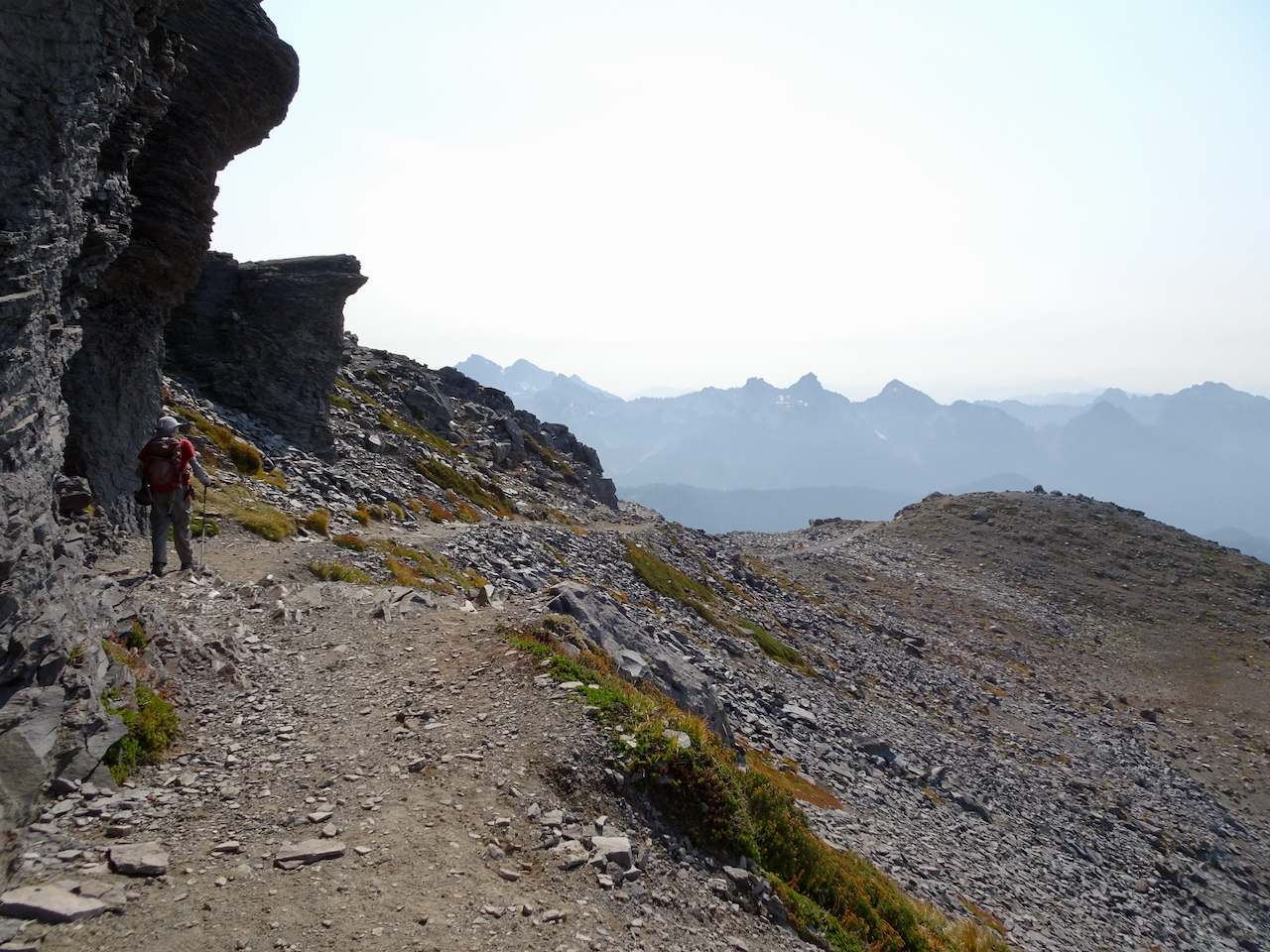
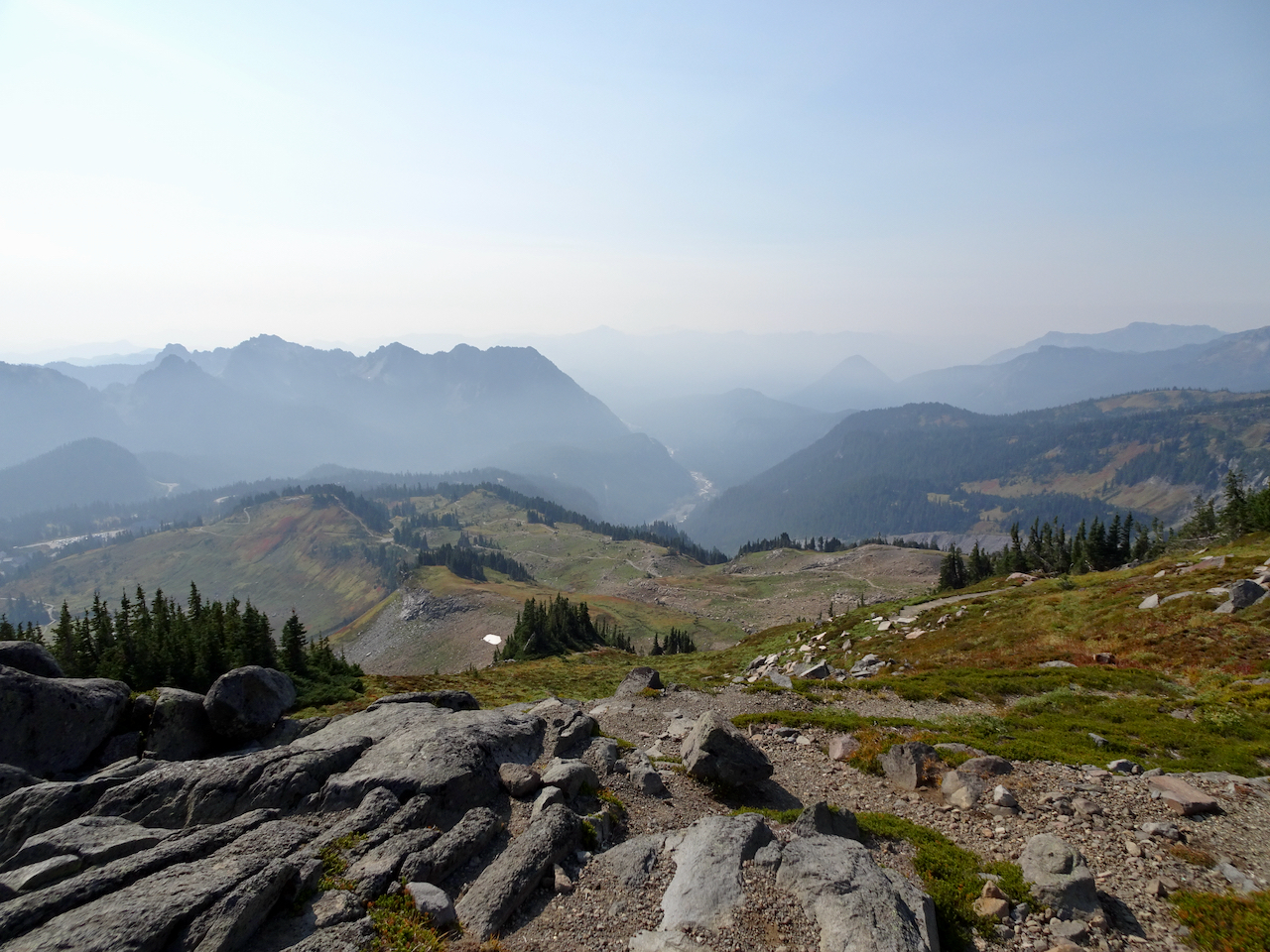
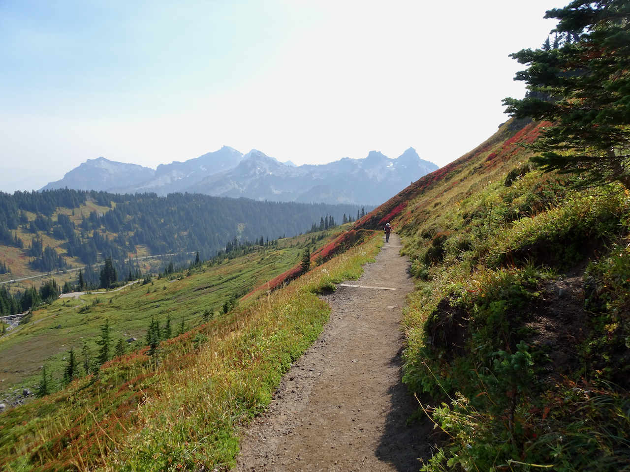
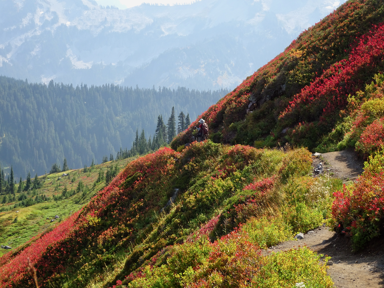
October 1 – Paradise, Golden Gate Trail, Panorama Point
The mountain was ‘out’ behind a thin veil of translucent haze! Smoke would gather throughout the day below us to the south on the flanks of the Tatoosh Range.
View from the parking lot at Paradise.
Iconic gateway to the trail system.
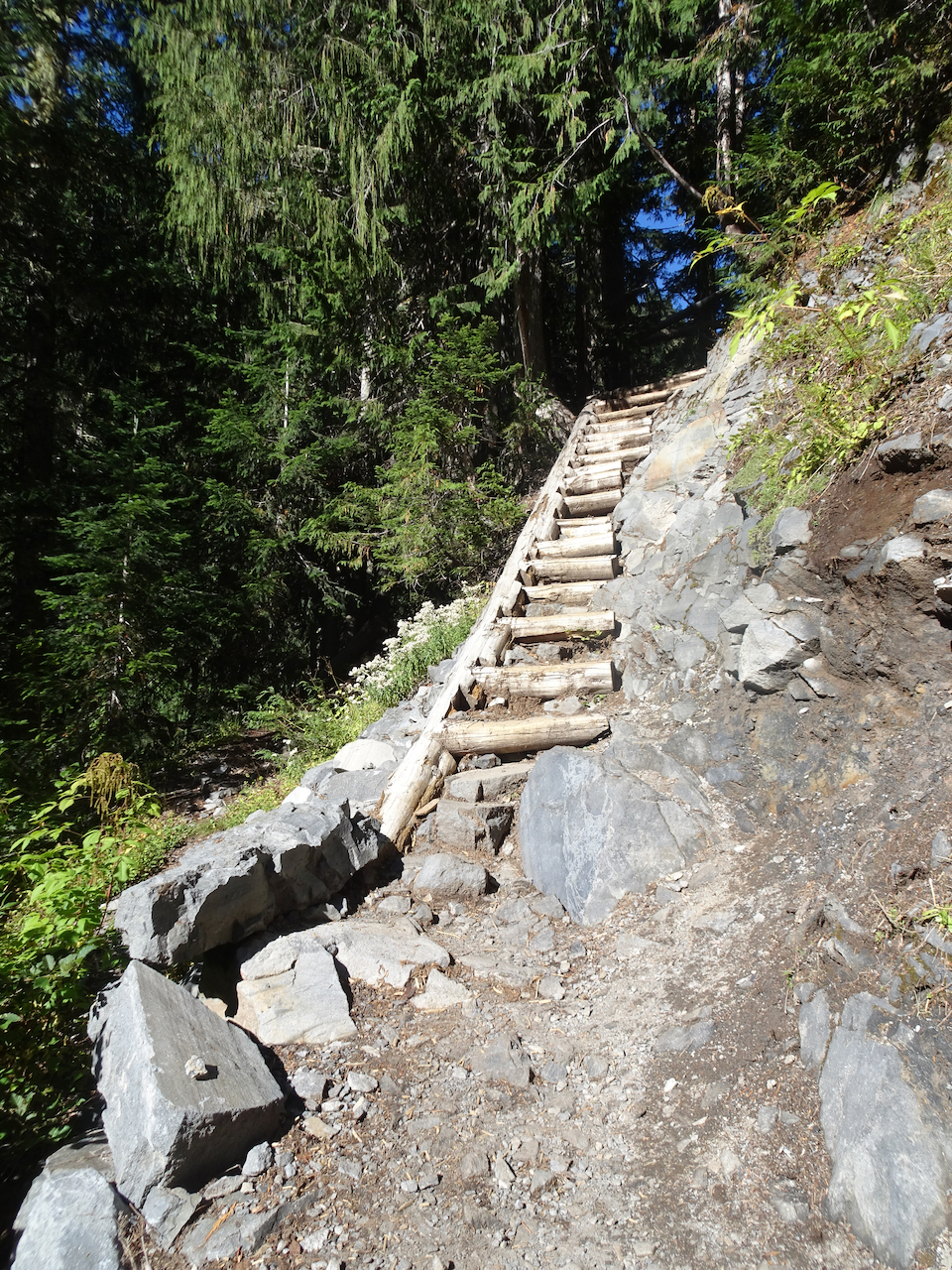
We hiked across Paradise Valley, and up the Golden Gate switchbacks and granite steps, to the High Skyline Trail that circles the valley (6 miles, 1700 feet).
Looking up toward the red huckleberry foliage on Alta Vista, which would be our return trail in the afternoon.
Looking toward the Skyline trail on the east side of Paradise Valley.
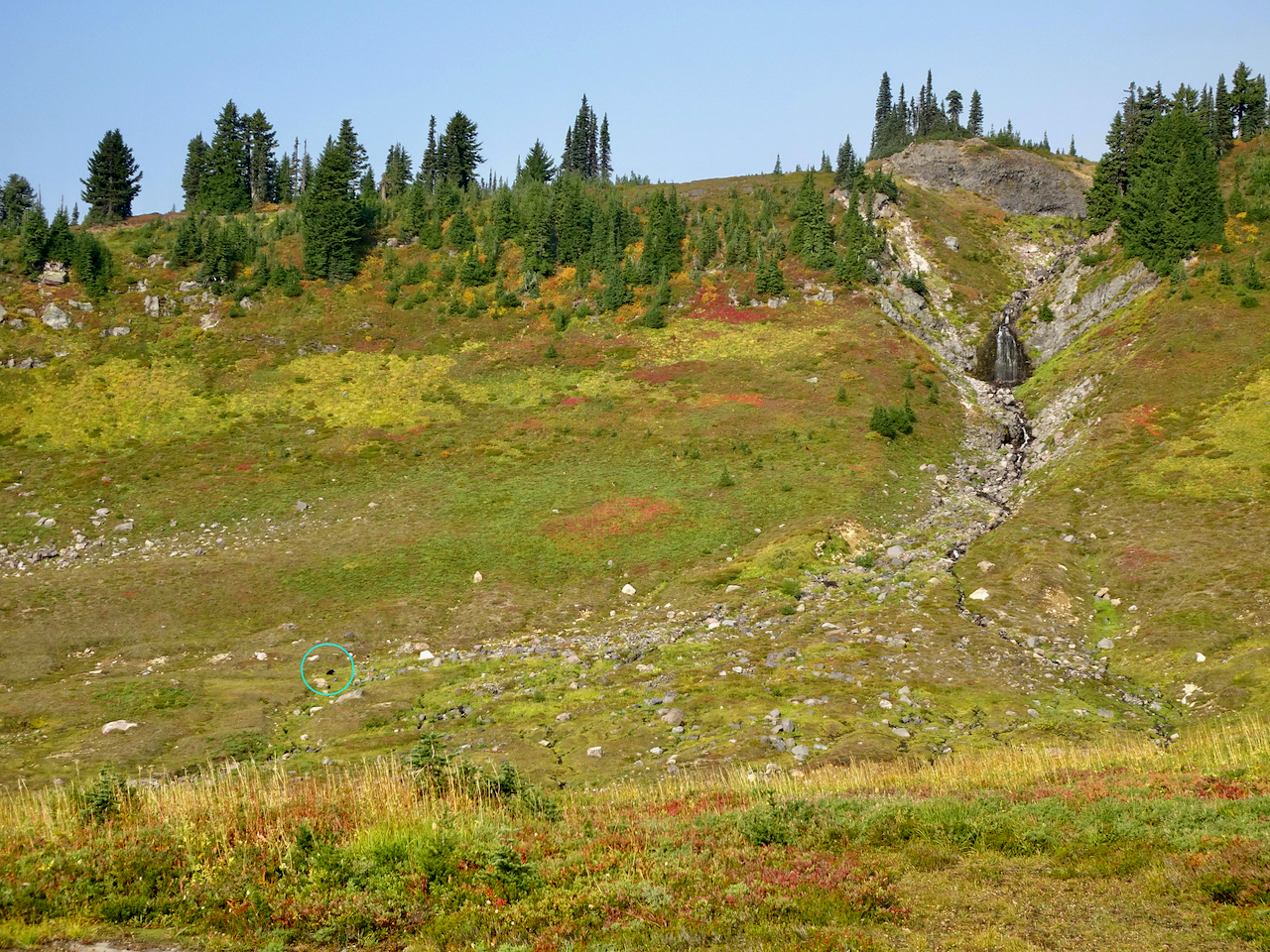
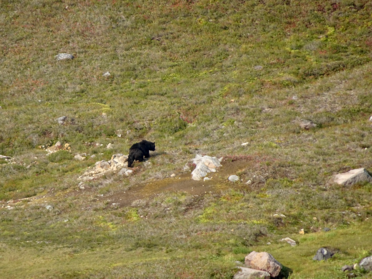
We saw a black bear foraging in the meadows below, and at least eight marmots foraging and nest building on our way up.
While looking across at the waterfall,
I noticed a moving black spot in the valley below.
Black bear.
Marmots along the trail.
The slopes were still green, and full of fading wildflowers with a few remaining blooms.
Switchbacks of the Golden Gate Trail ahead.
Up the last switchback to the Skyline Ridge.
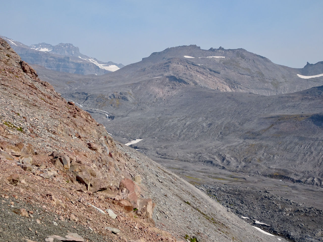
Once to the ridge, stark, glaciated landscape dominated.
High Skyline Trail
A glimpse over the ridge to the east to the next glaciated valley.
Our destination is around the cirque and above the snowfield – there are tiny humans on that ridge.
Rocky trail.
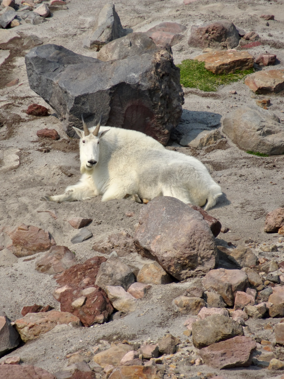
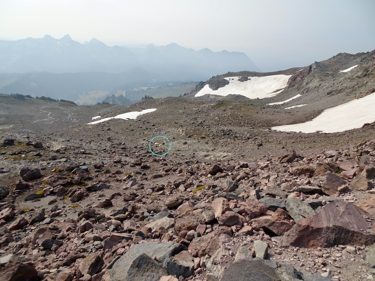
A mountain goat was resting near one of the snow fields in the cirque.
This is the closest we would get to the mountain goat (to the right of the snow field).
Mountain goat, zoom lens.
Looking down on the mountain goat after we climbed higher.
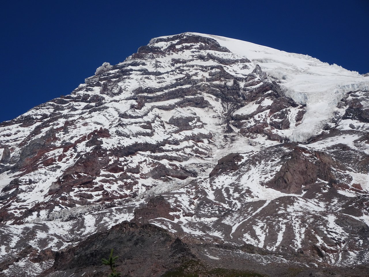
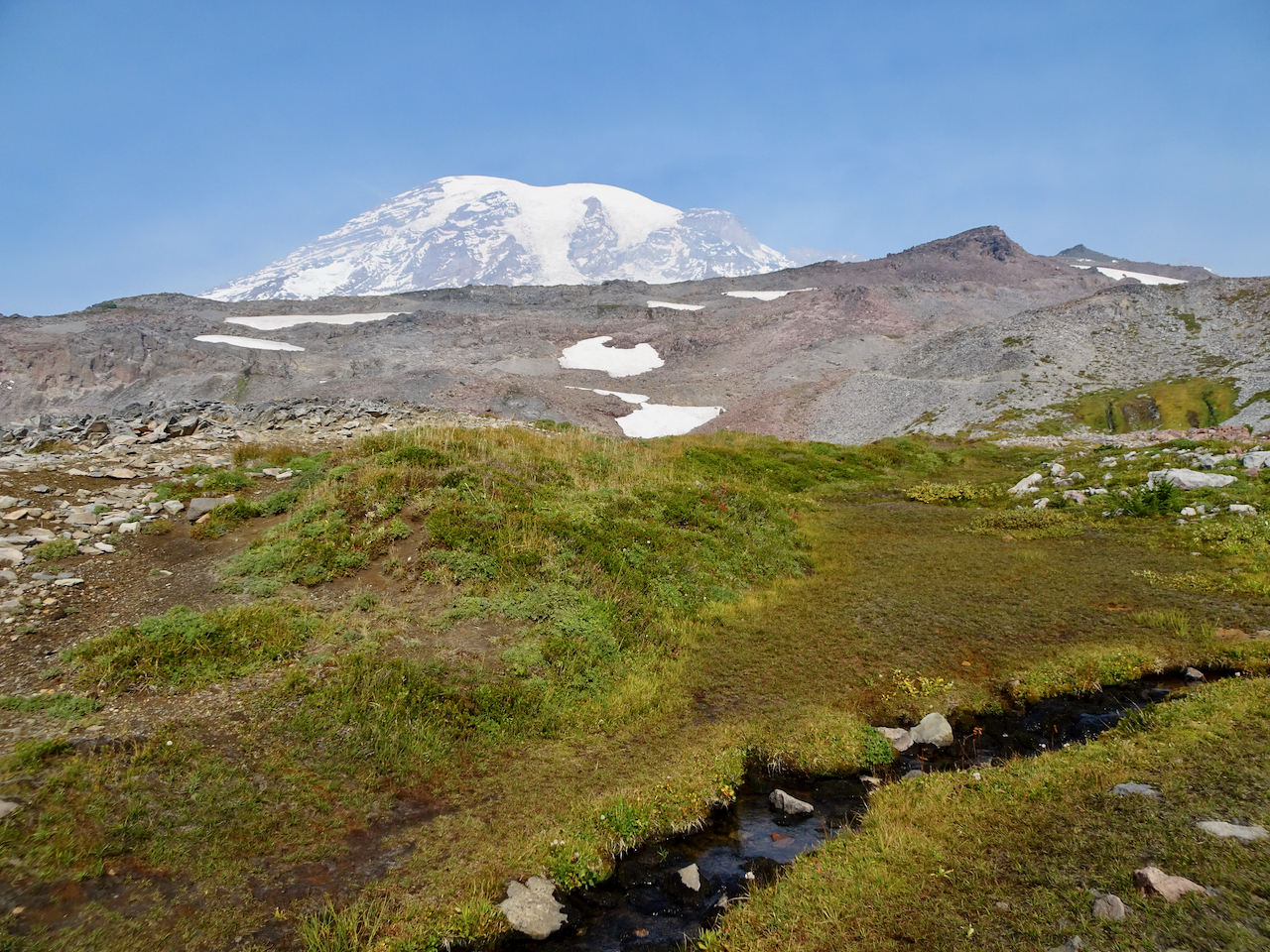
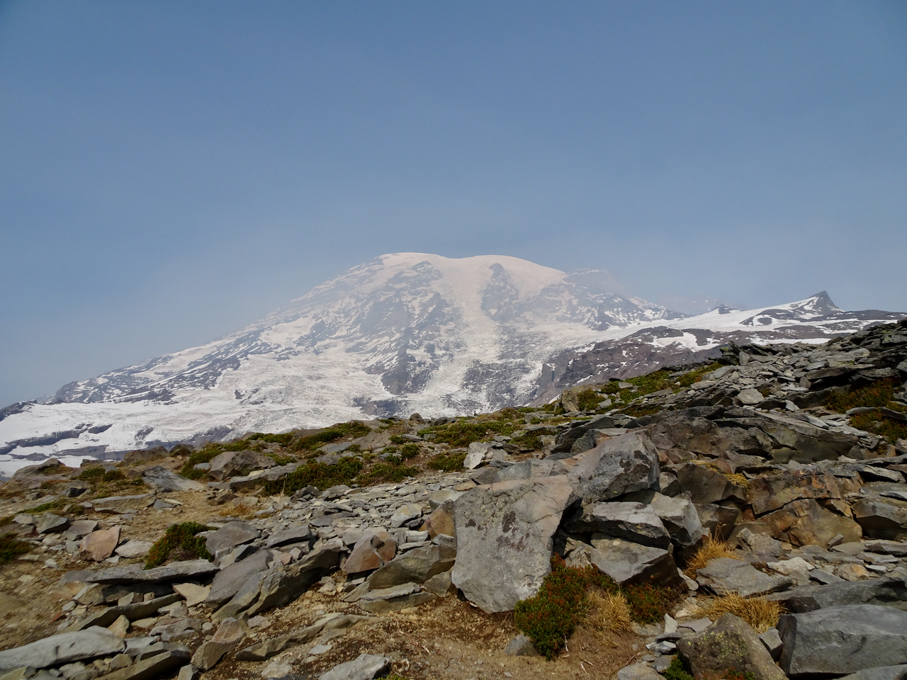
Over the rocky top above Panorama Point, near Pebble Creek, we sat on the rocks and ate our lunch with a full mountain view: 7000 feet of vertical relief, glaciers and sculpted rocks. We heard an occasional boom as something up there, heeding gravity, fell.
Lunch view.
Chipmunk on the rock.
Glacier close-ups.
We made our way back down the steep granite steps, past Panorama Point and more glacier views.
Heading down to Panorama Point.
Panorama Point, with views in all directions:
East, where we have been.
South, toward our starting point, and the smoky Tatoosh Range.
West, to our downward trail and the Nisqually Valley.
Continuing down…
Rocky steps to Glacier View.
We saw one late pasque flower in the meadow.
The bear was still roaming in the valley below.
We crossed through the brilliant red huckleberry foliage on the flank of Alta Vista.
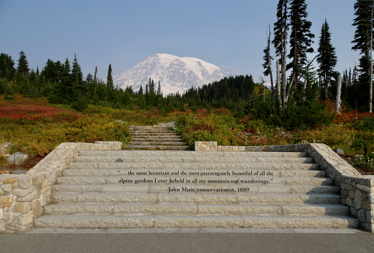
After a last stop at Edith Creek and Myrtle Falls, I was done walking for a while. My legs were tired, my cup full! I have to agree with the sentiment carved in the steps at the trailhead. This is one of the most beautiful places I have been. I feel so lucky to have seen it in the fall!
Myrtle Falls
Edith Creek
This hungry deer near the trailhead paid no attention to the people taking his photo!
November 11th, 2020 – Well yeah!!! Biden and Harris won the election! We will have a new administration in January! Action will be taken on the pandemic, on climate change, on humanitarian treatment of every person, with intelligent, informed, common sense in decision making.
And, our new vice president Kamala Harris represents the breaking of the glass ceiling for so many underrepresented and often abused populations of people! What joy!
Halloween was celebrated in a subdued way.
My neighborhood trees have gone through their beautiful color change cycle. Just today I walked through red, yellow and orange paved sidewalks. Rain is turning leaf piles to mush. The city clean up trucks are coming tomorrow.
Tupelo
For me, now that I know that our current president will be replaced by someone with decency, I can feel my stress levels decreasing. So many events this year involving breath – the coronavirus, the smoke from wildfires, the political morass…I am beginning to breathe more freely again!
Another thing I can do again has to do with my crafting. I love quilting and sewing, but for me it is a different sort of creativity than knitting. And for me, all the stress of the past four years has found its best relief in knitting. I am grateful, and I will keep on knitting. But on Friday night, when my son told me I really did have reason to be optimistic, I got the notion to pull out a languishing quilt top. Quilting is a different creation process to knitting, and not nearly as immediately satisfying as picking up needles and frantically knitting until I calm down a bit. I have already basted the quilt, and am making decisions about thread and pattern, so soon will be stitching.
Plaid Rectangle Charms quilt
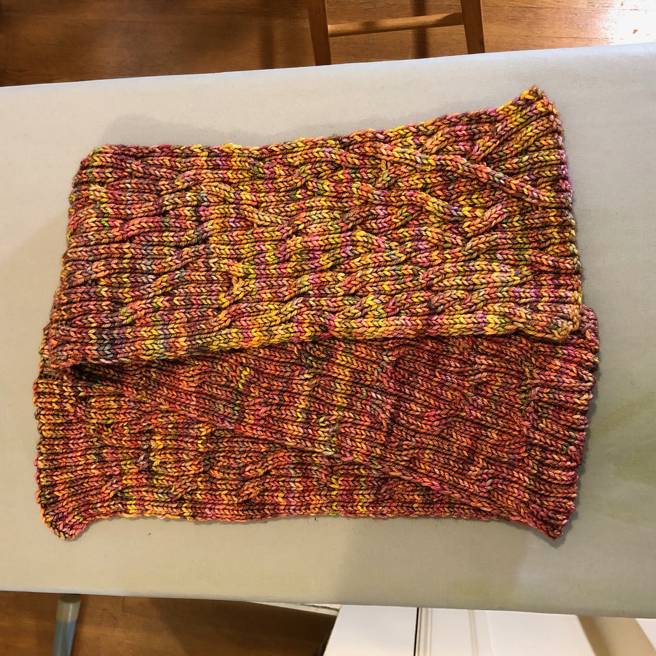
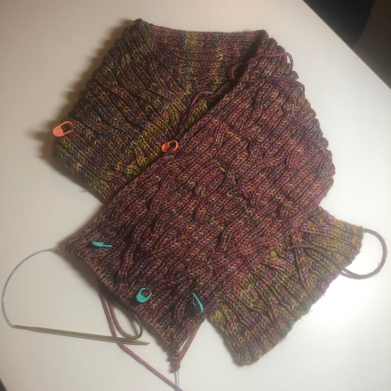
I finished my Rio Calina scarf (Cat Bordhi).
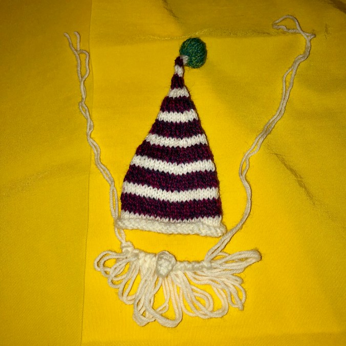
I made a tiny Mochimochi Gnome.
I have no delusions that our national way forward will be easy. Almost half of the nation voted for our country to stay on the same path. I believe that people are allowed to believe whatever they want, but there should be a wall that separates church and state. White supremacy is wrong. I and more than 75 million other Americans, not to mention millions of global citizens, have been holding our breath these four years, knitting frenetically in my case, waiting to be able to breathe again. When all the law suits and the recounts and the lame attempts at coup are done, we will all be inhaling deeply, exhaling freely, back on the path of decency, with many long hills still to climb, but a worst scenario overcome.
Rio Calina Cowl – getting longer, and I might just make it into a long scarf instead of a cowl.
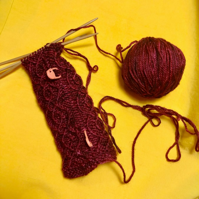
Dissent Socks, in honor of Ruth Bader Ginsberg – I’ve finished the ankles – on to the heels!
Walks around the neighborhood,
New signs, whimsy, architectural elements:
Mural
Gnome and spaceman
Rain chain and shadow
New sign
Window critters
New signs
Eave pig
Garden gate
Winding stairs with turret
Fall colors evolving…
I have been hunting witches and other Halloween displays, to be shared in a later post.
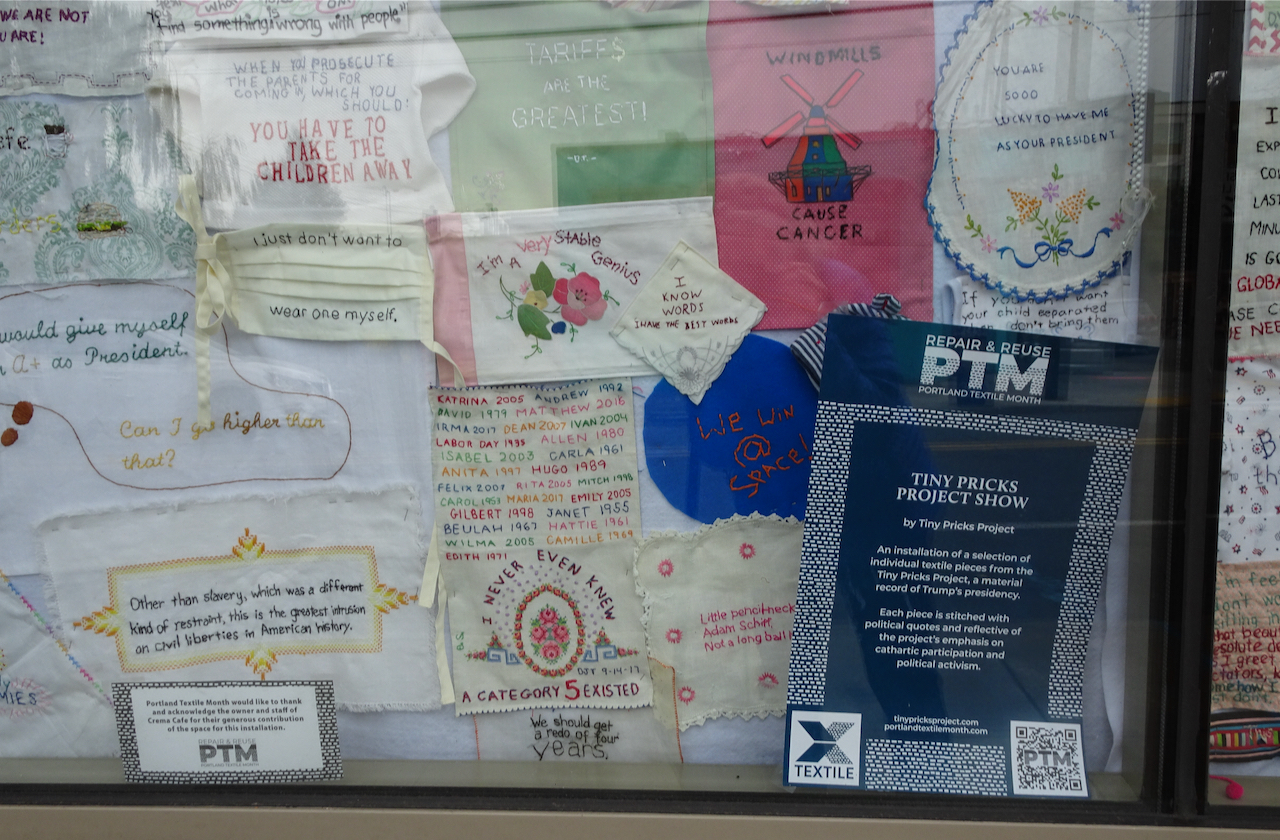
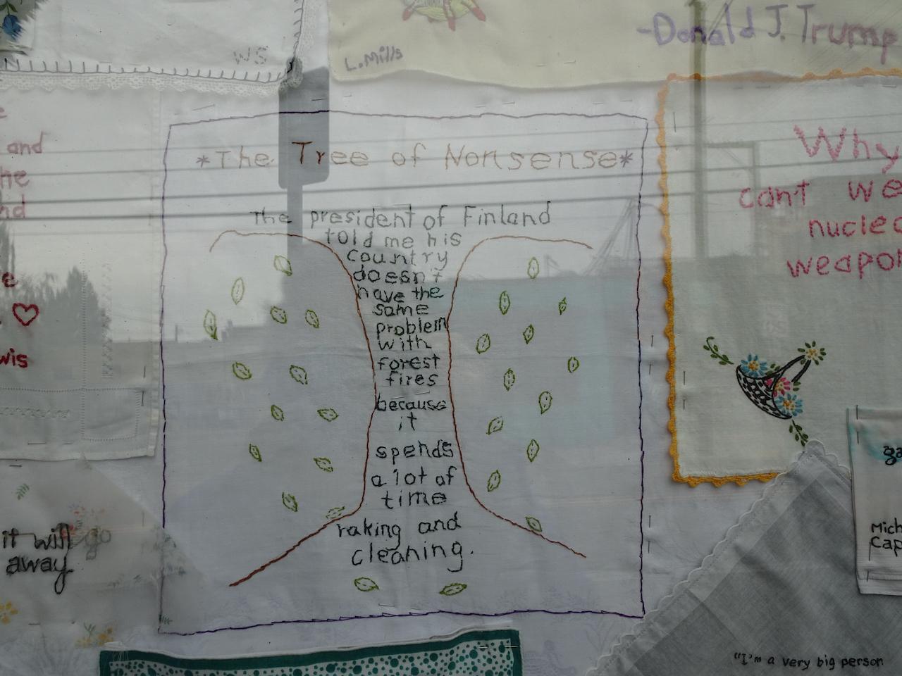
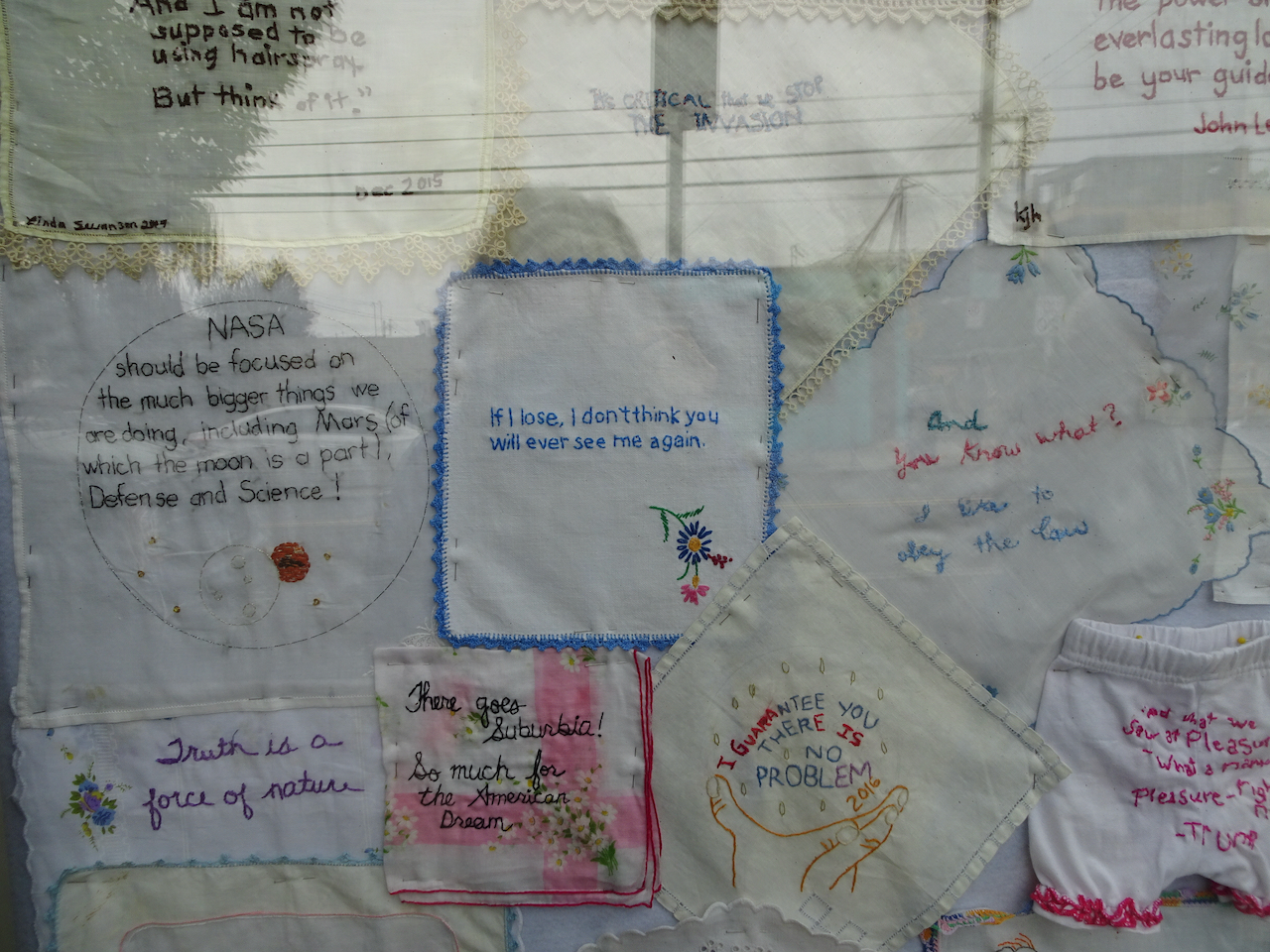
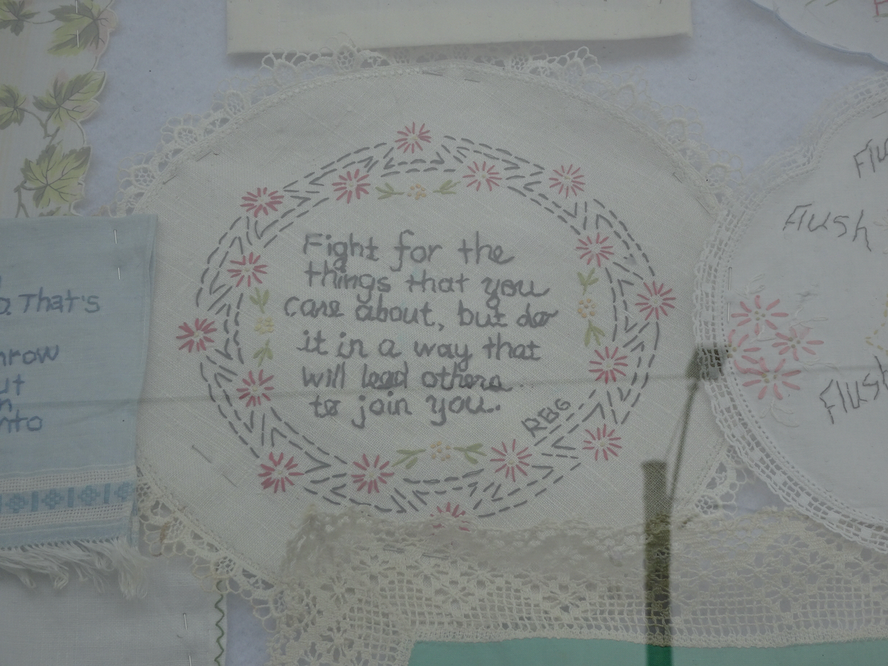
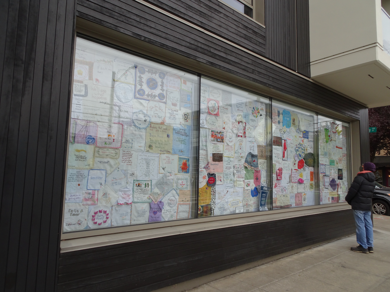
Portland Textile Month, Tiny Pricks Art Installation
We visited the exhibition window to see the stitchery, made by artists who embroider a quote onto a vintage textile as a form of protest. It is not how I want to spend my crafting time – but I was glad to get a chance to see a small sampling of the thousands of pieces that have been contributed to this crowd-sourced artwork.
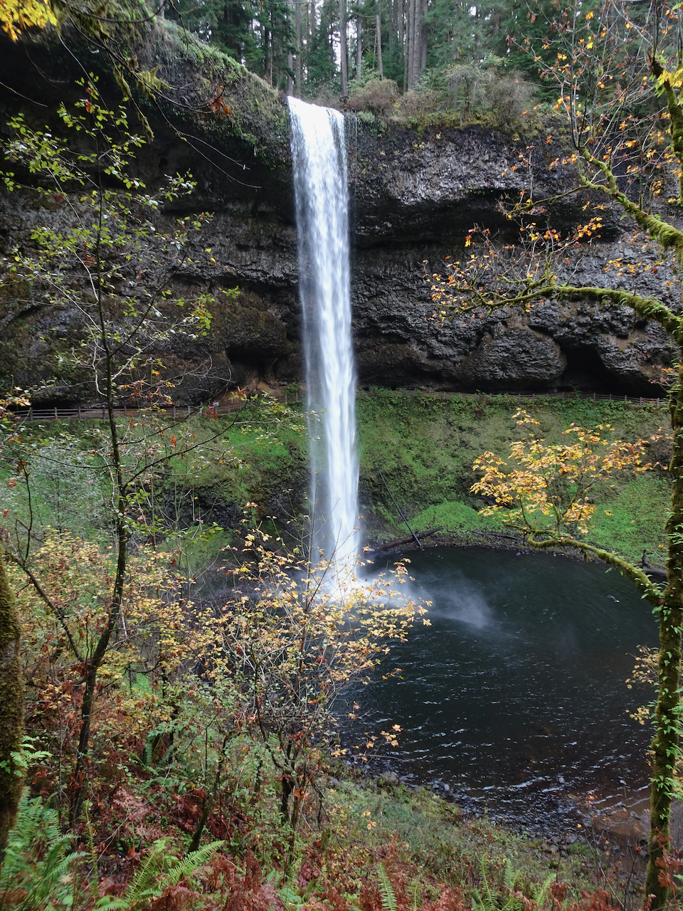
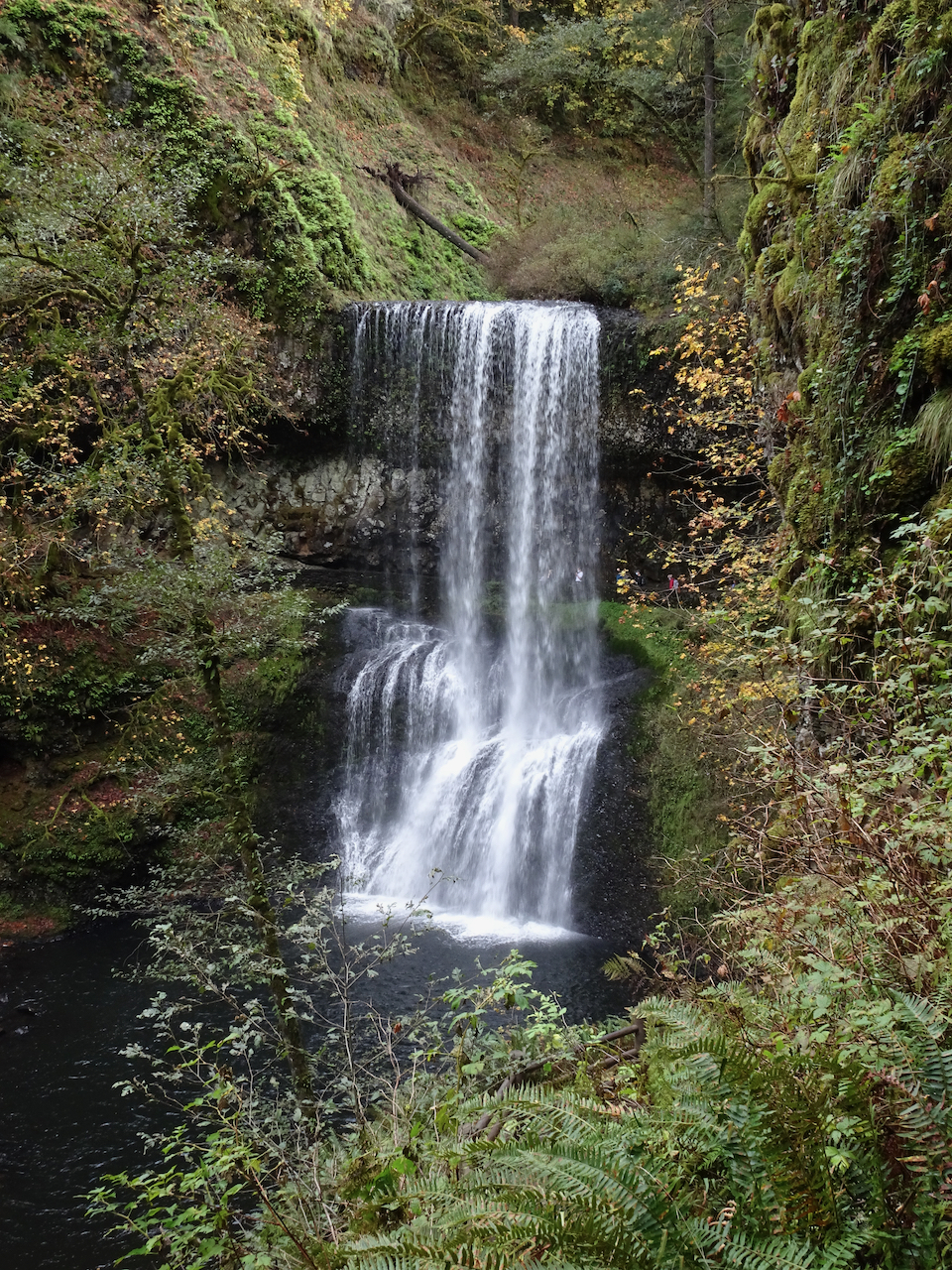
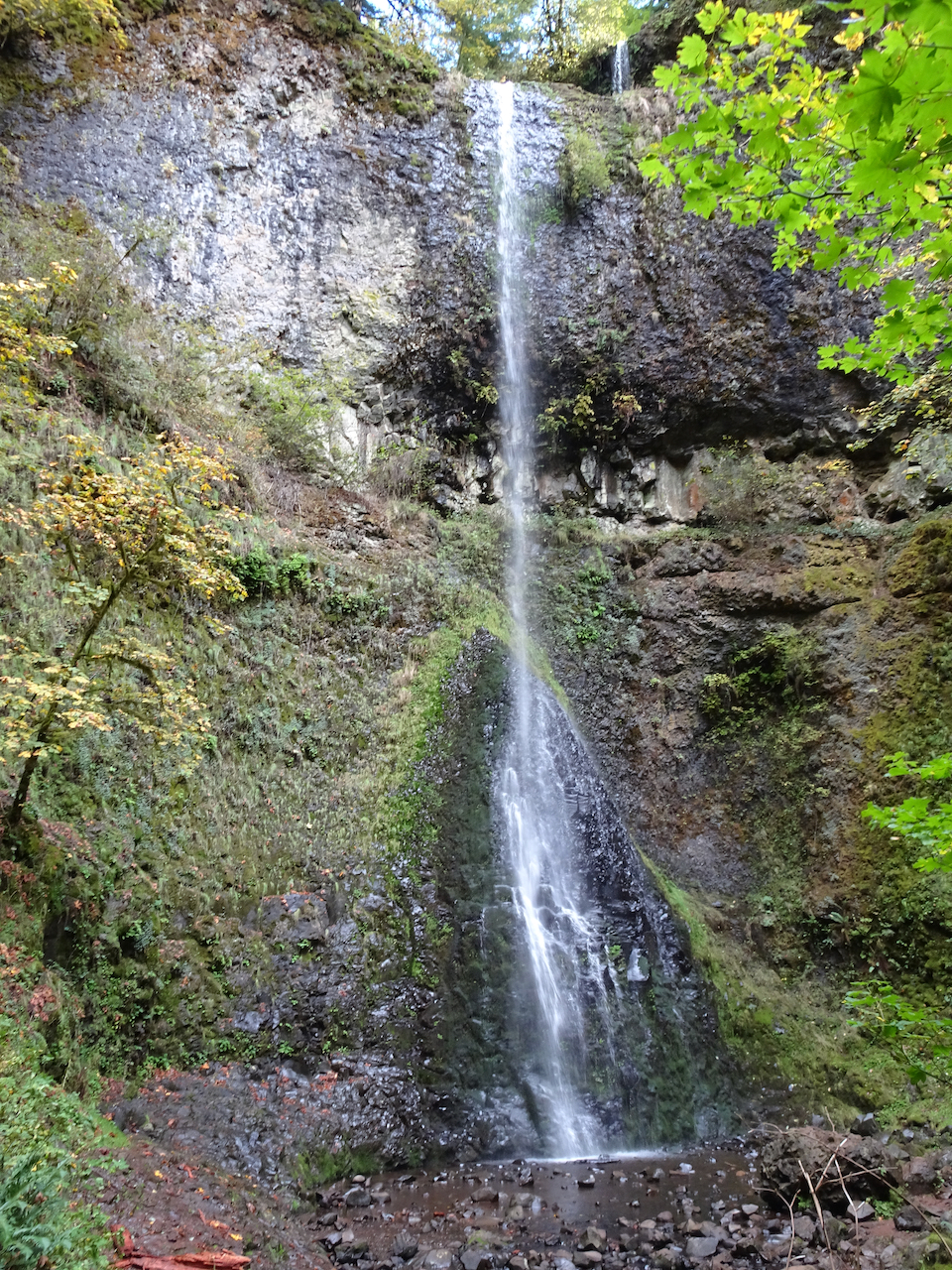
Silver Falls State Park
October 19th – We hiked the 5 mile waterfall loop. It was hard to relax and enjoy the scenery – there were a fair number unmasked, seemingly Covid-protocol-oblivious hikers. We cut our day shorter than usual. The waterfalls are always beautiful, and the light streaming through the yellow big leaf maples enchanting.
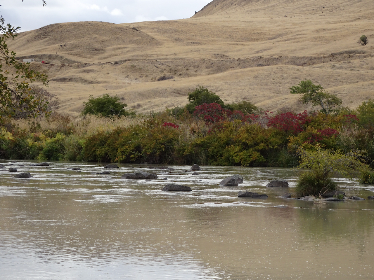
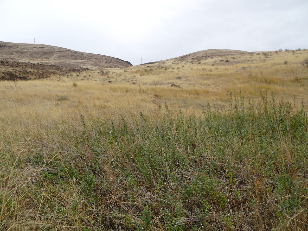
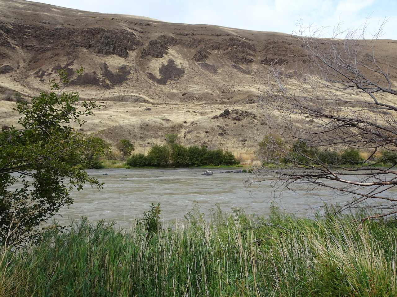
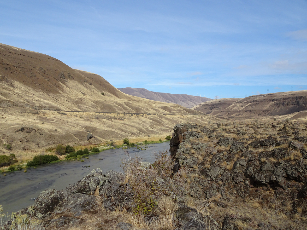
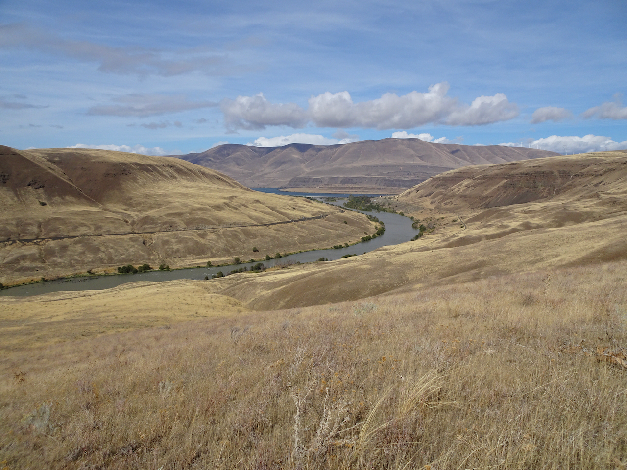
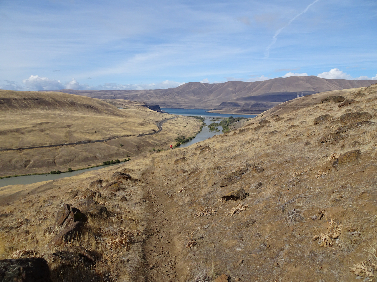
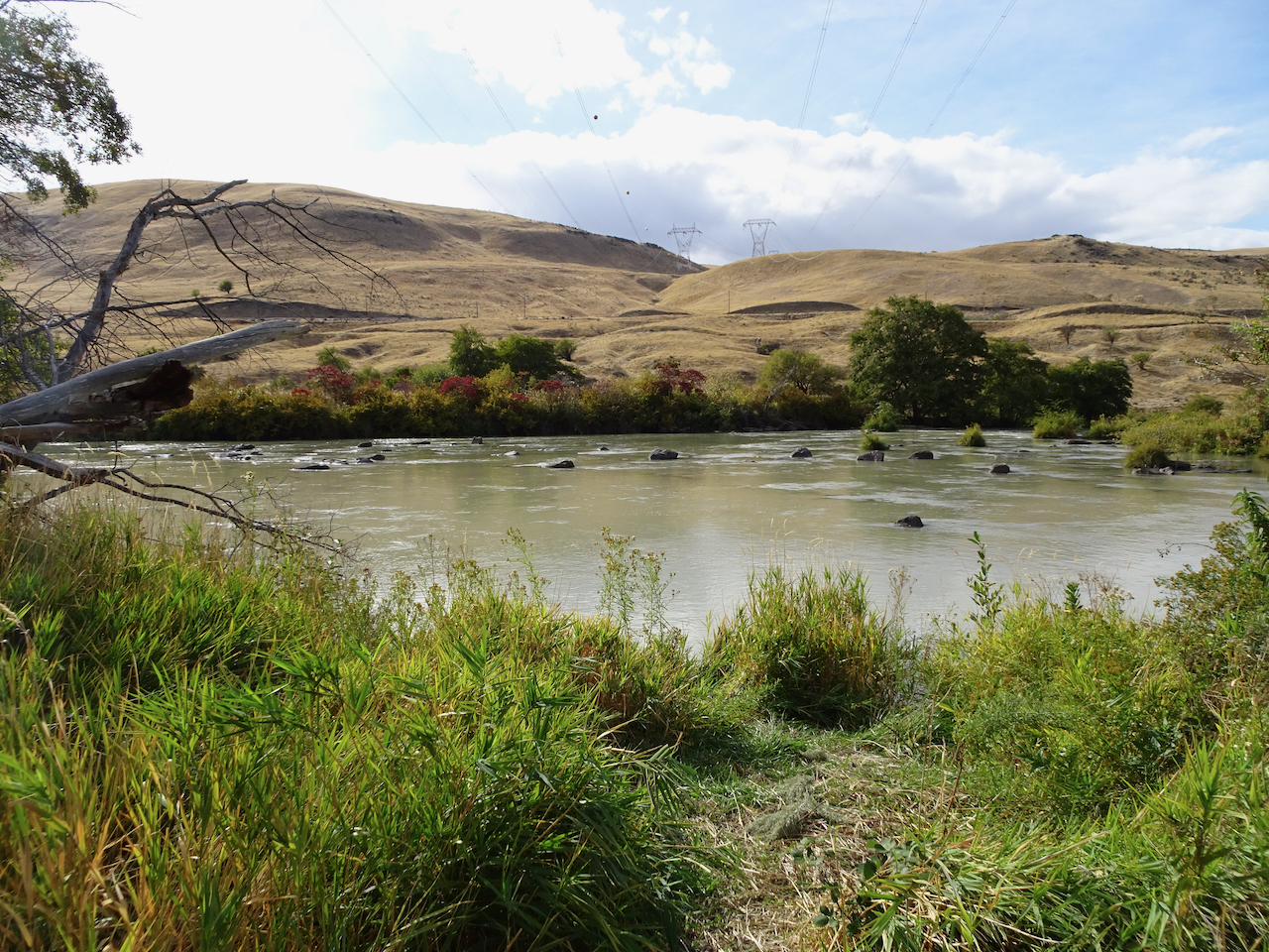
Deschutes River trail, a smattering of rain, it feels like walking through a purifying mist, and there’s no Covid out here.
Deschutes River
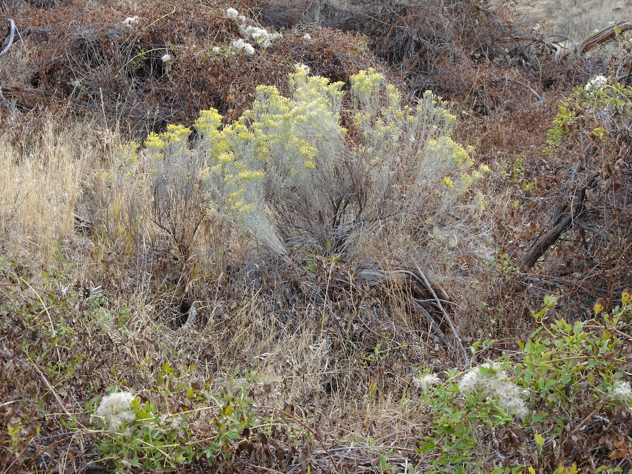
Rabbit brush
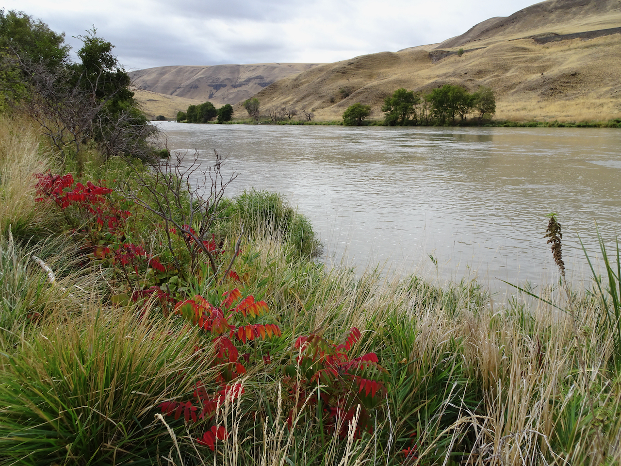
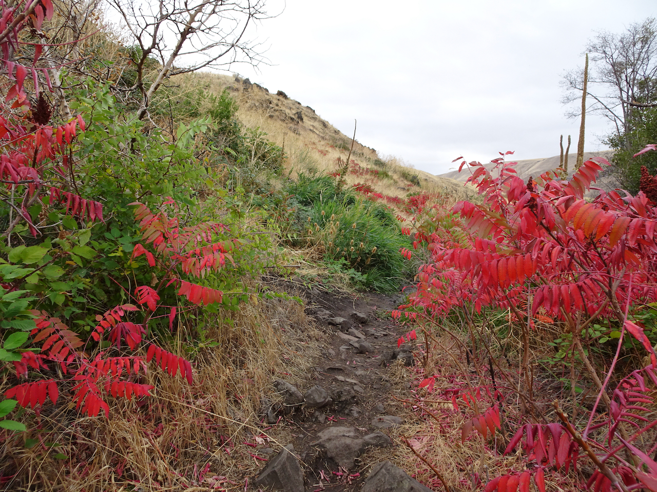
Sumac along the trail
Sumac
Raindrops on leaves
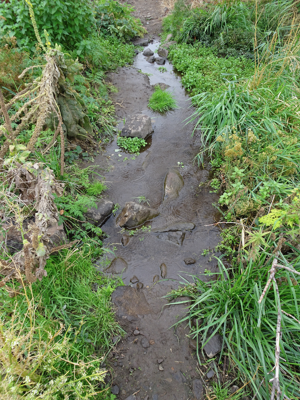
Raindrops in the creek
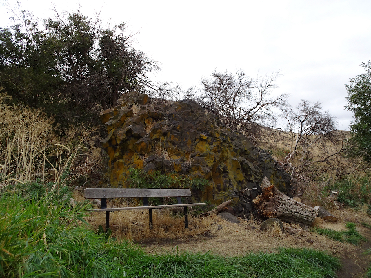
A place to rest
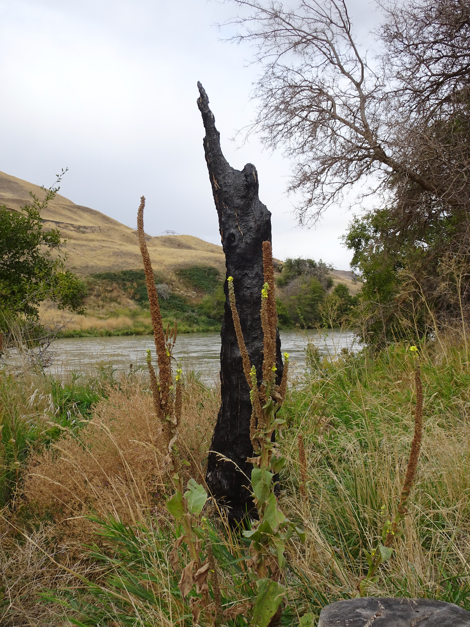
Burned tree from 2017 fire
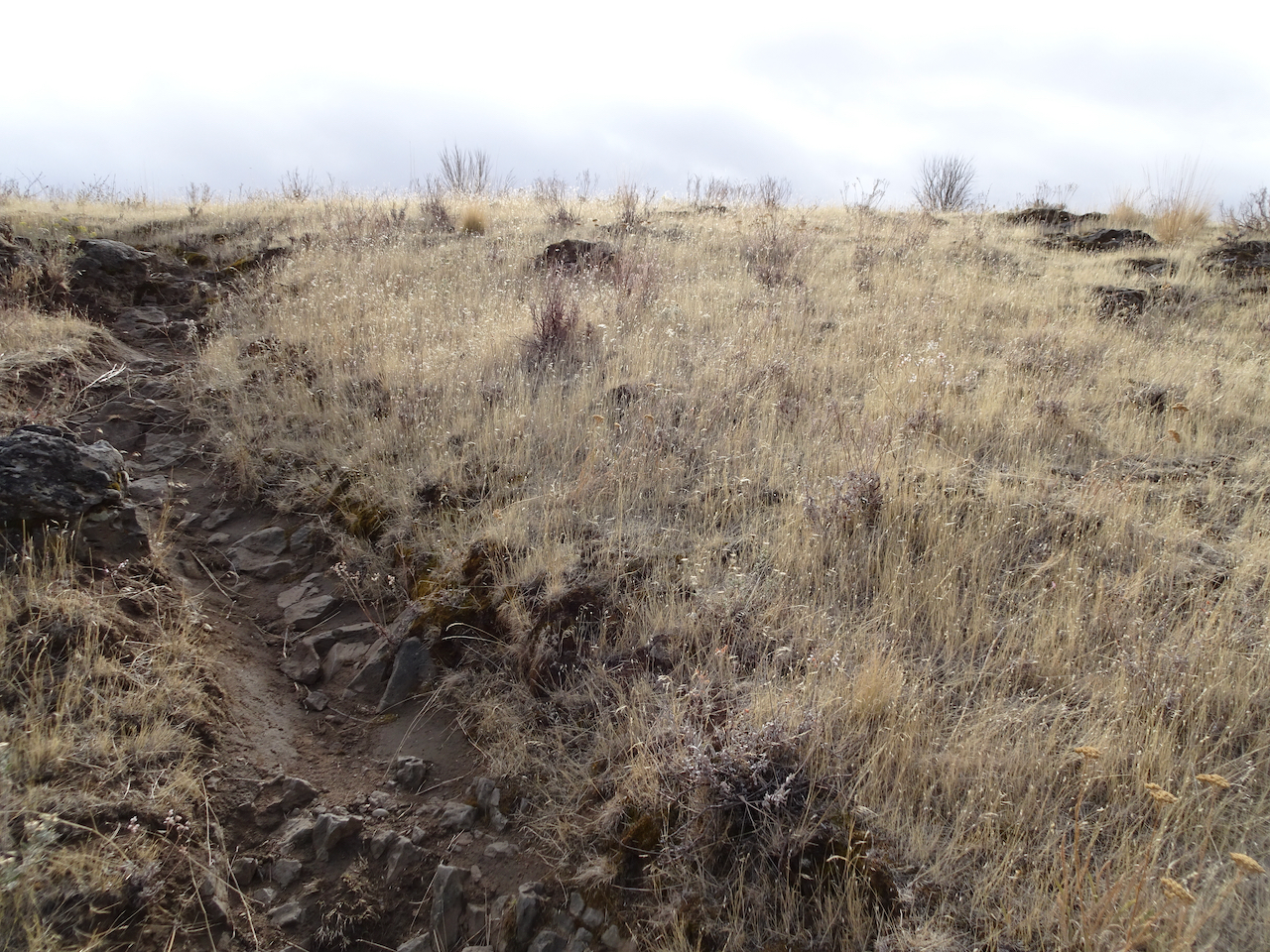
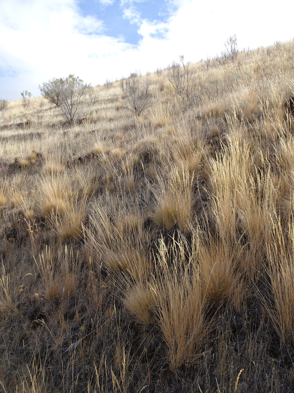
Golden grasses
I could be wrong, we have passed a few hikers, anglers, a hydrologist; there are boats on the river, workers on the railroad across the river, campgrounds and powerlines nearby.
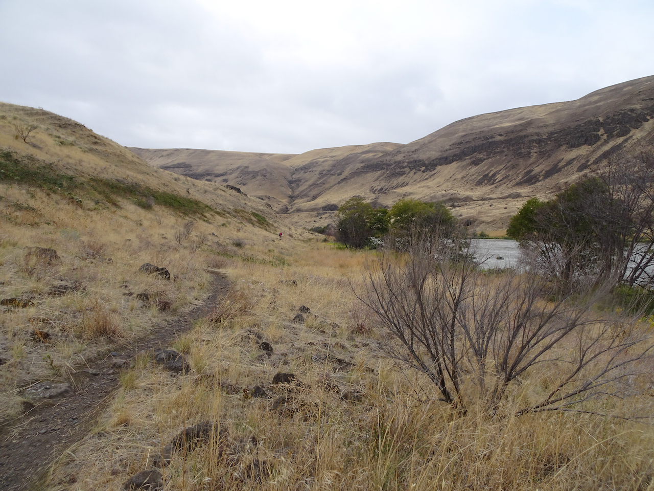
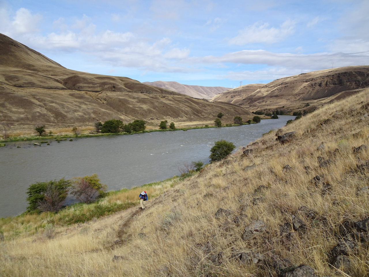
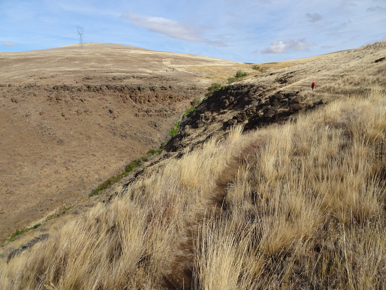
Looking uphill to the east.
Our trail continues south, upstream.
Columbia Hills to the north.
Rocky cliffs
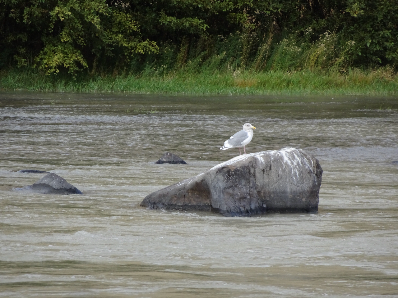
Seagull in the river
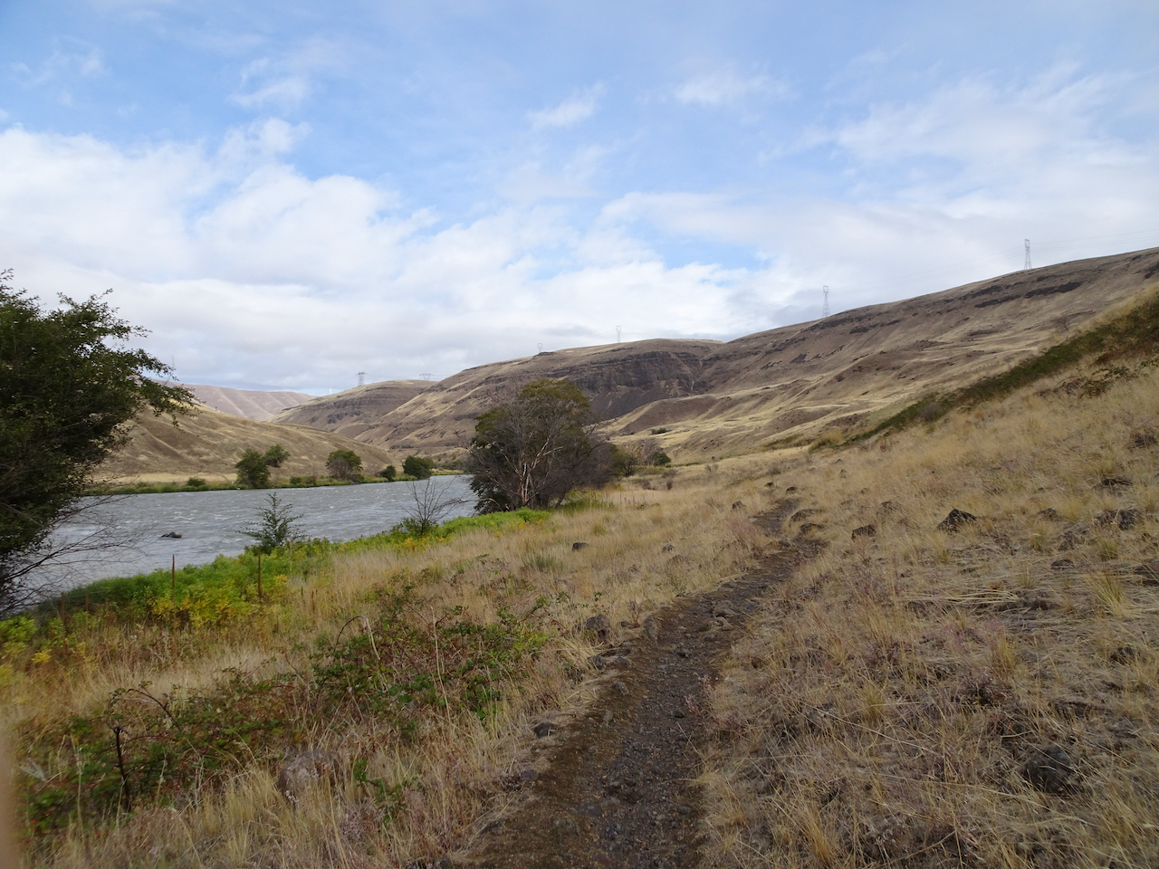
Maybe because in this low desert landscape, with golden light on the black cliffs and the dry grass of late summer, I feel like I can really breathe out here; the scent of the high desert, and a smattering of rain only enhancing the sense of free fresh air.
Climbing up the cliffs..
Golden grasses
Lunch view north.
Looking down at the river from our lunch stop.
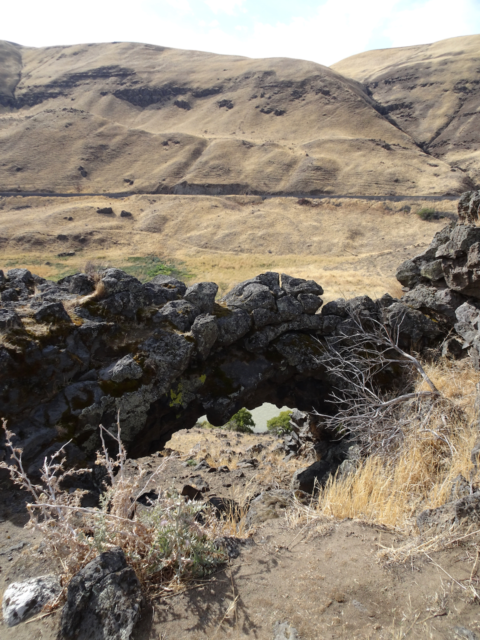
Looking down to the river through the rock arch.
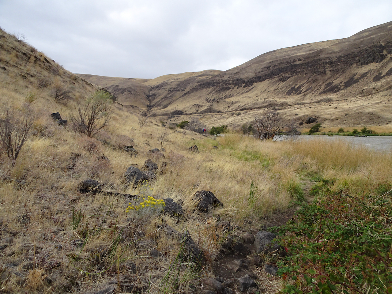
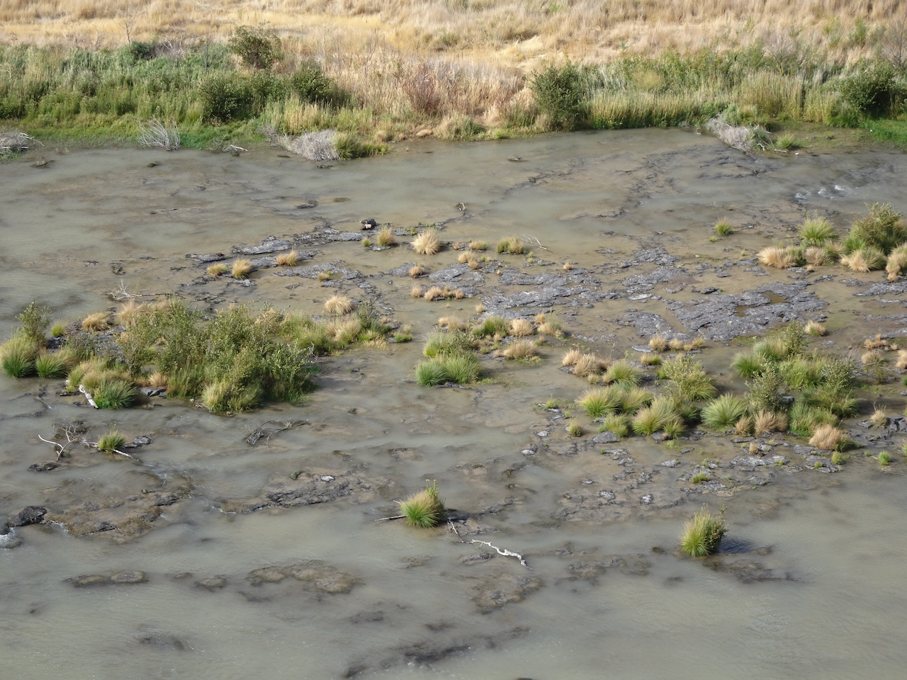
Up on the hill now after lunch, golden and desolate views of the rivers, views of the black volcanic rocks that used to enclose cascading waters of Celilo Falls, cascading waters that used to have salmon leaping up them every year, salmon leaping up into the nets of the Celilo people, before the dam.
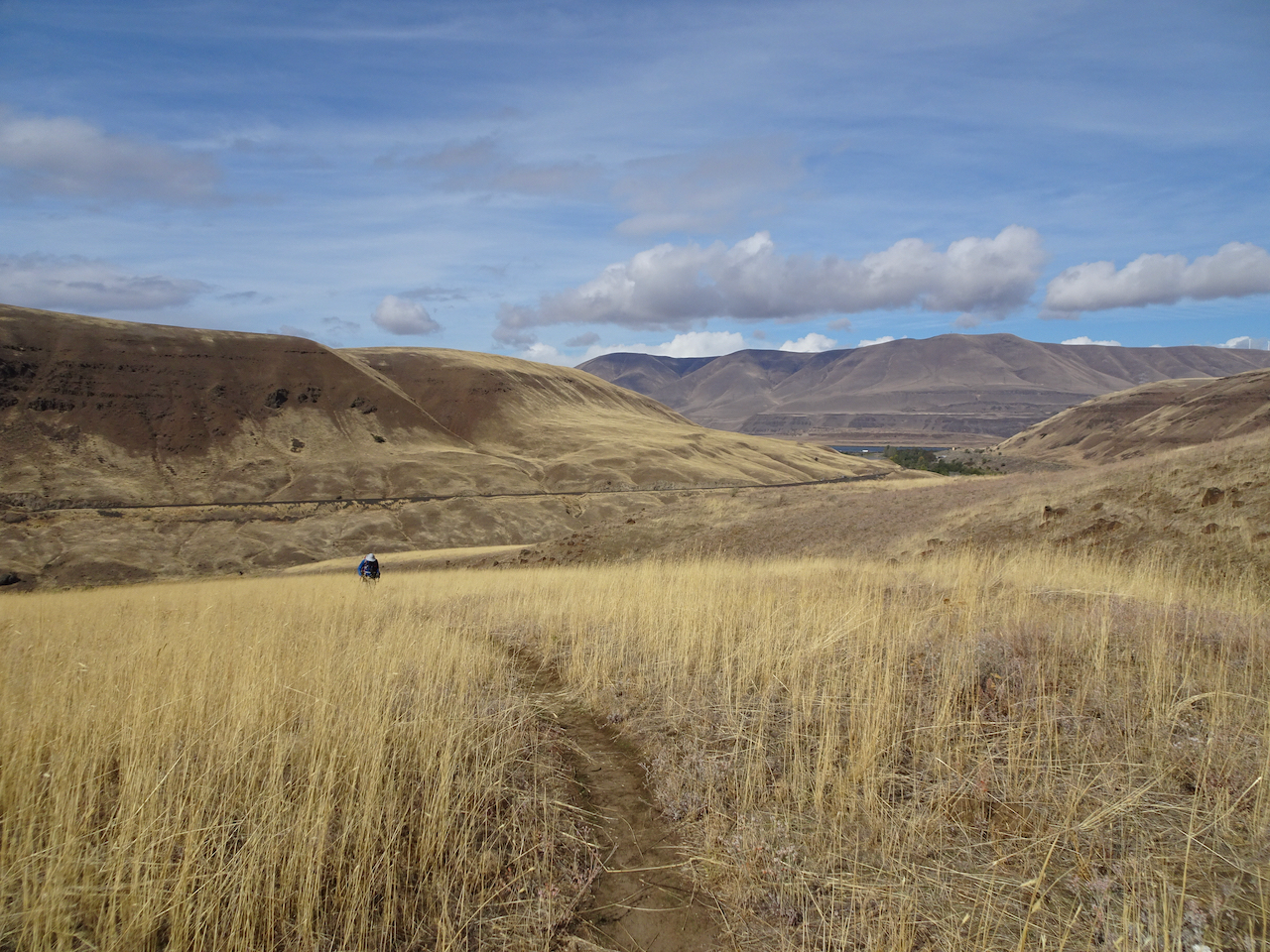
Ascending the hills.
Closer view of the Deschutes/Columbia Confluence
Windmills on the hills, power transmission lines to the dam, cell towers, highways, train tracks, campgrounds, and yet I feel alone on this golden hillside.
Golden grasses
Dried balsam root will bloom bright gold in spring.
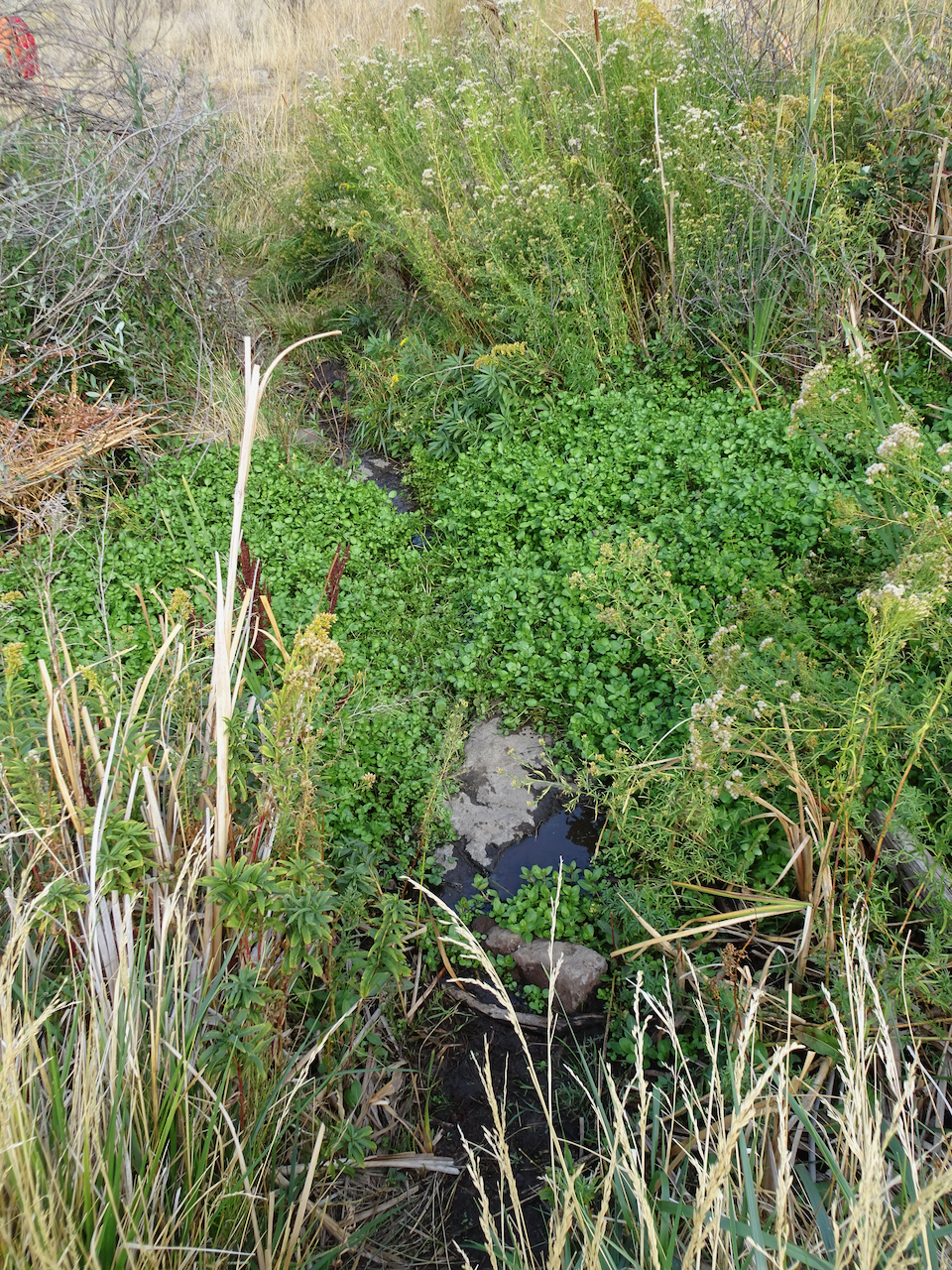
Approaching the upper Ferry Springs crossing.
Ferry Springs
I feel alone even though the powerlines are buzzing above us, the powerlines are transmitting the thoughts and bytes of millions, and yet I feel blessedly alone.
Its all downhill now to the trailhead.
Dry waterfall and power lines humming above.
Back down to river level, with power lines.
I’m not really alone of course – hiking with Dan, in a respite from the city; the desert is a place of wide open freedom – harsh, spiky, dry, rocky, steep, prickly; hidden hazards beyond each cliff, under every rock, yet wide open above, on an autumn day, I am lucky to be here, to be breathing freely.
blanket flower
horsetail
thistle
snow buckwheat
sumac
preying mantis
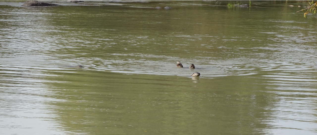
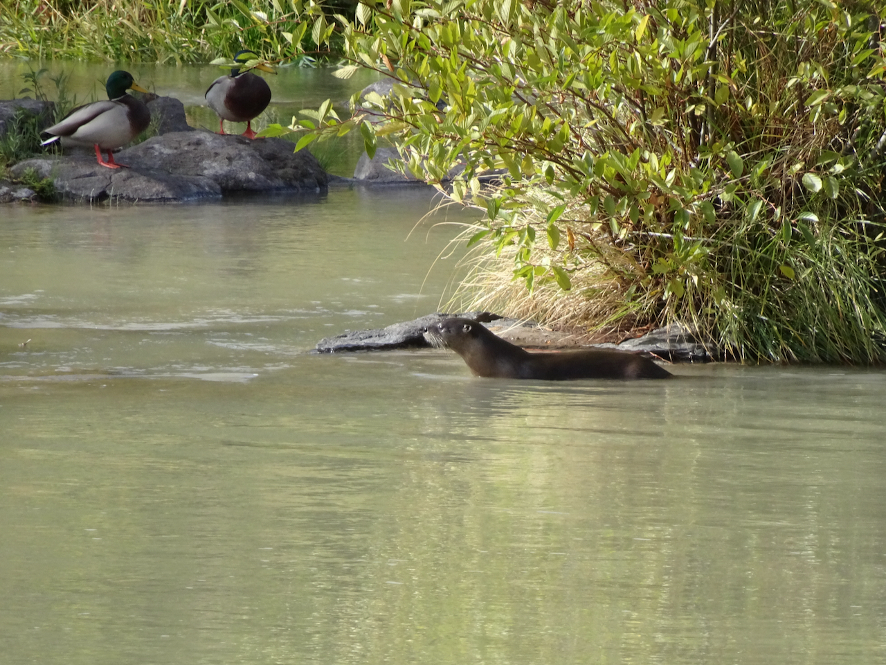
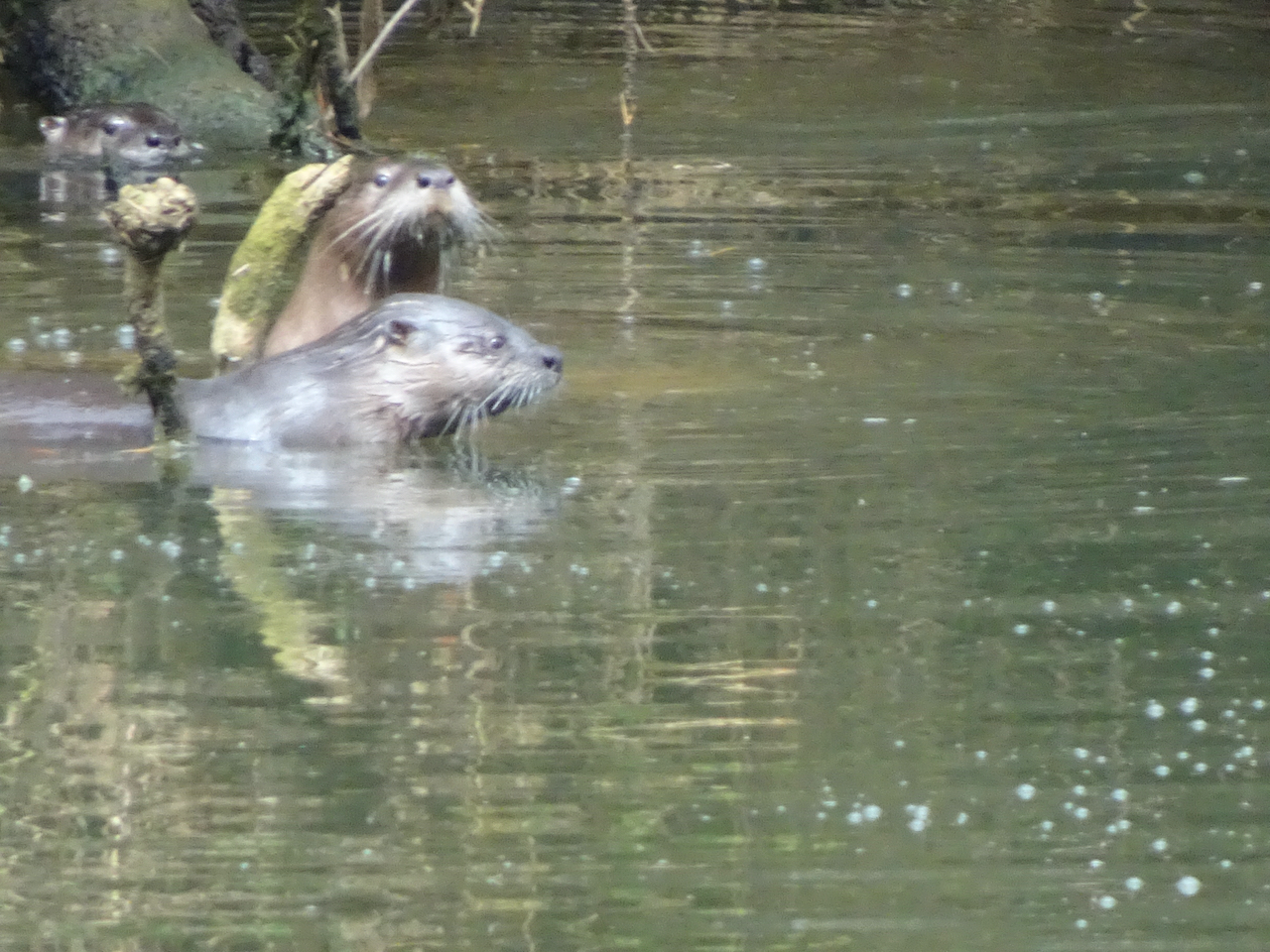
Bonus content: More River otters! There were six otters playing in the river near the trailhead –
River otters
River otters and ducks
Celilo Falls, Salmon fishing, before the dam:
“Courtesy of the U.S. National Library of Medicine”
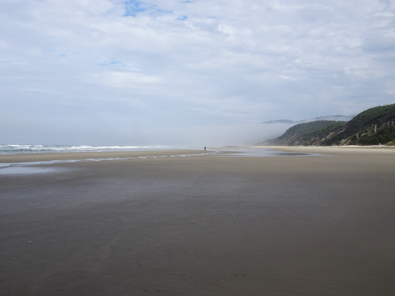
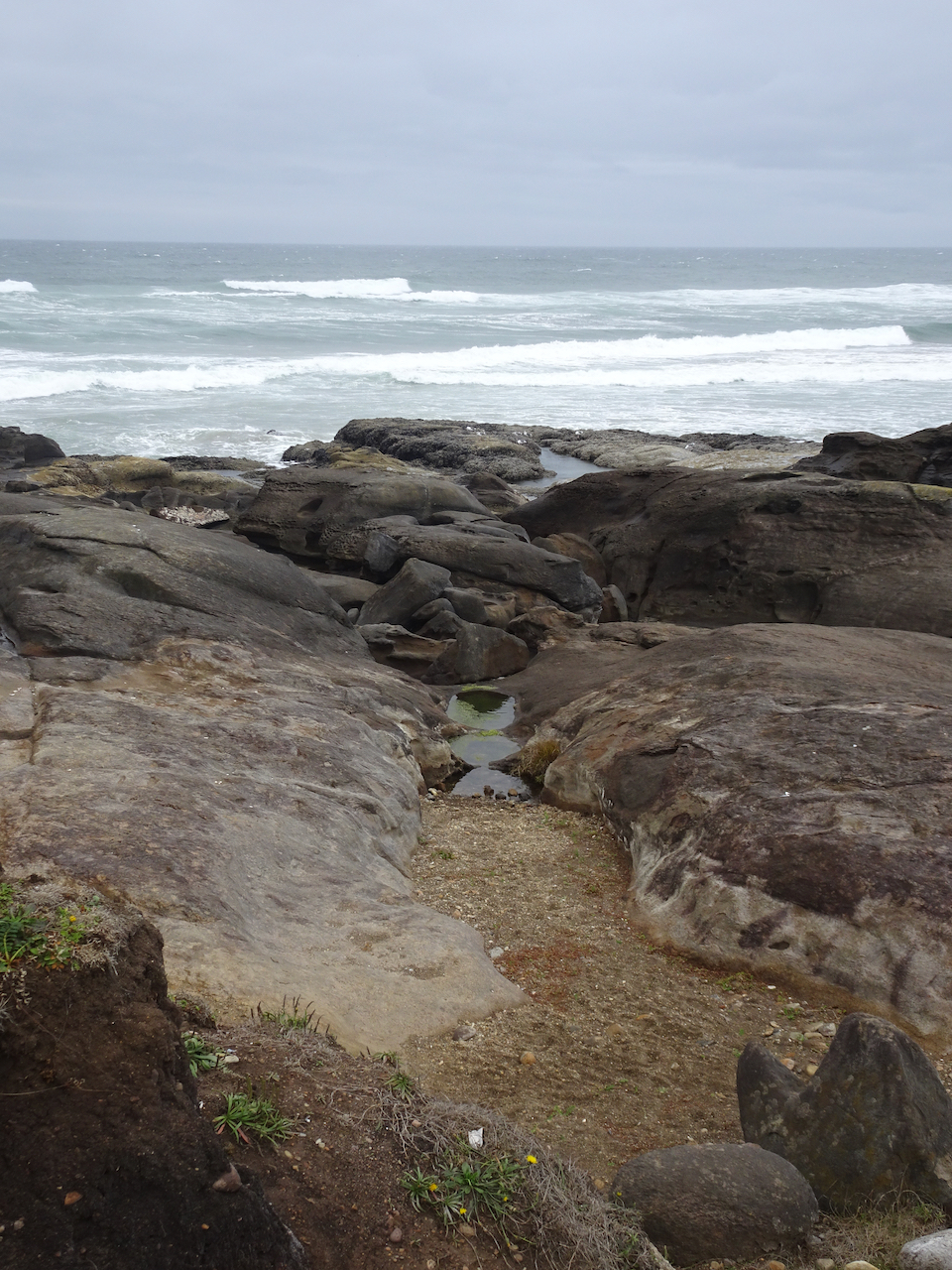
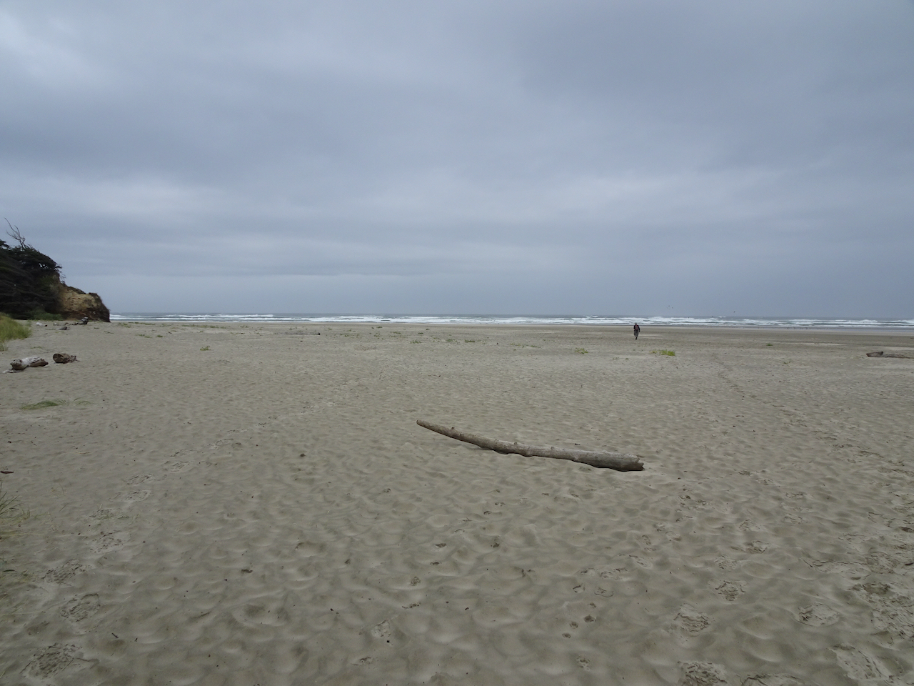
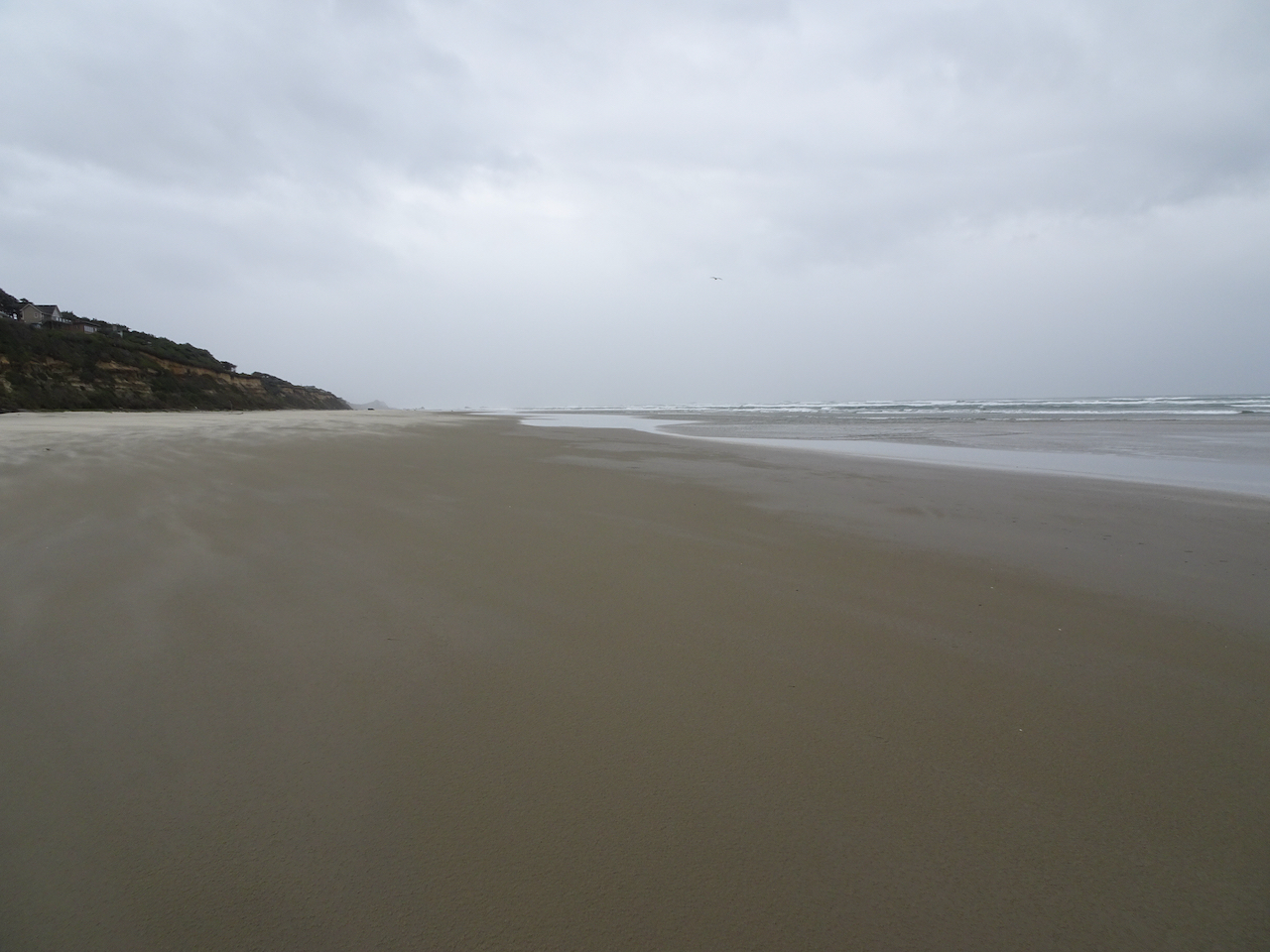
We were able to reschedule our planned trip to the central Oregon Coast until after the wildfire smoke cleared out. We stayed in a hotel, brought our own food, and walked on the beaches and trails, following all the covid-safety protocols. Many of the parks and trails along the coast were closed due to the recent windstorms and wildfire smoke event, or due to Covid precautions. But all of the beaches were open for walking.
Central Oregon Coast, and places we walked on our trip.
Sunday, September 20th
Yachats, Oregon
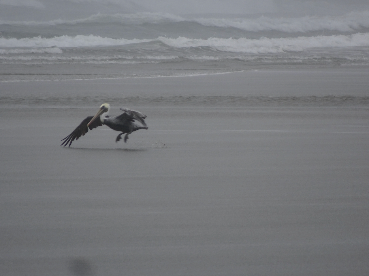
We arrived in Yachats in the evening, in time to walk along the rocky outcrops near our hotel as the tide was receding, and watch a lovely sunset, with pelicans and gulls.
Yachats sunset
Pelican
Yachats sunset
Pelican peleton
Monday, September 21st –
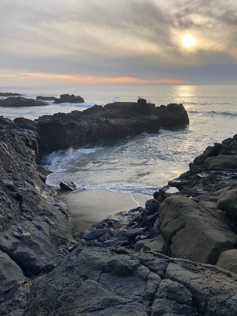
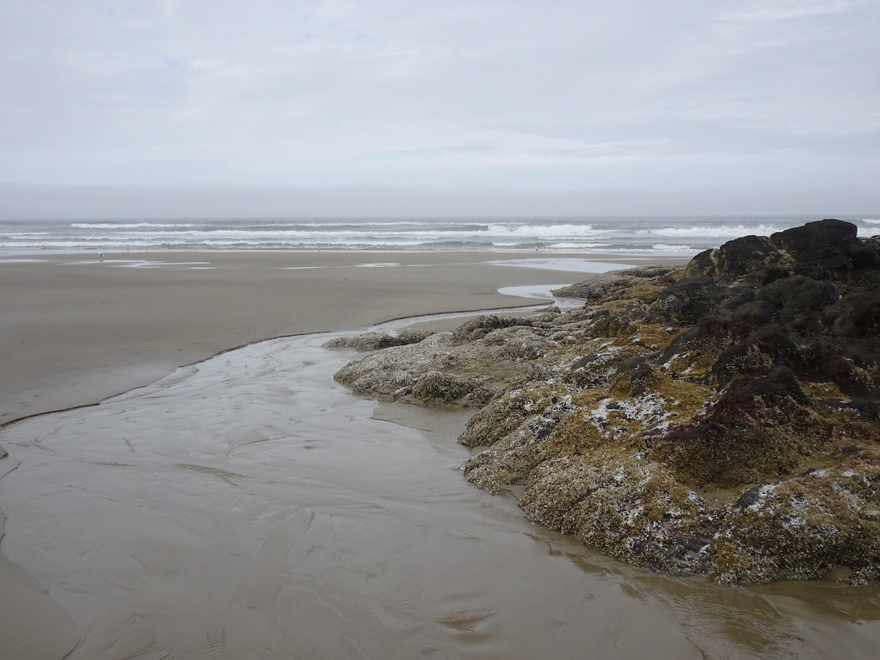
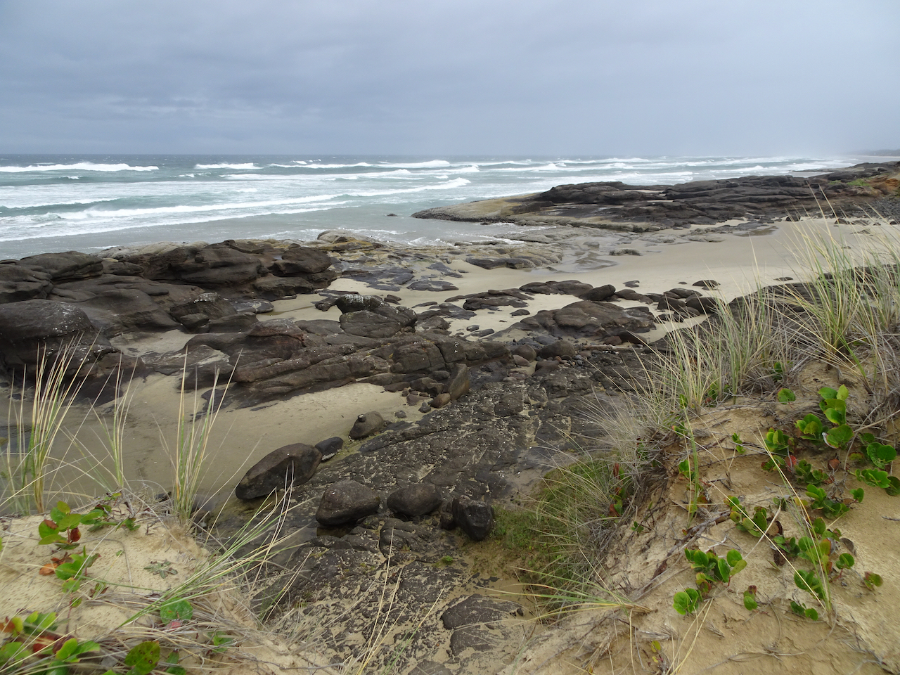
Washburne to Hobbit Beach at low tide – A lovely three mile walk toward Haceta Head.
Tidal pools and sand bars on the beach as we walk south toward Haceta Head.
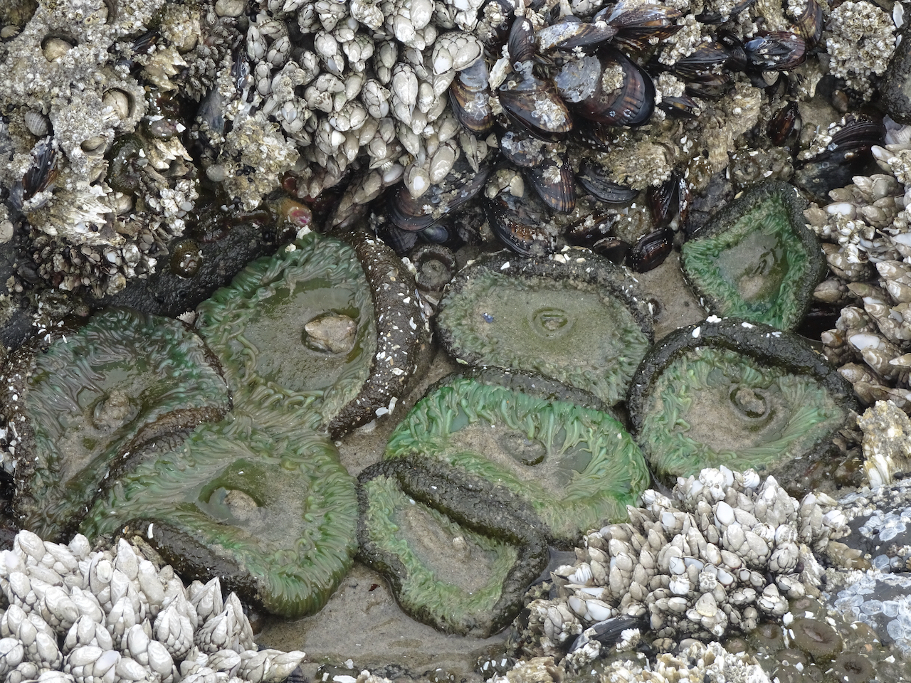
Rocky outcrop with tide pools.
Sea anemones, barnacles, and mussels.
Blue sky, blue sand.
Ripples.
Return walk north.
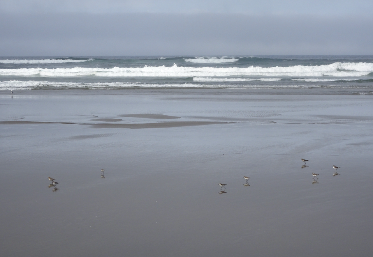
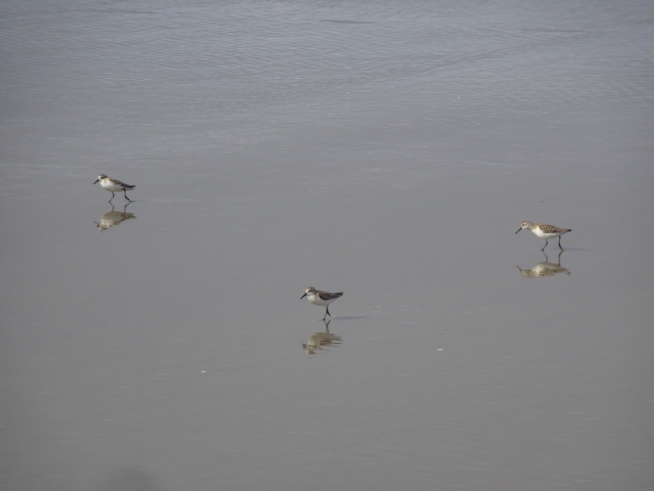
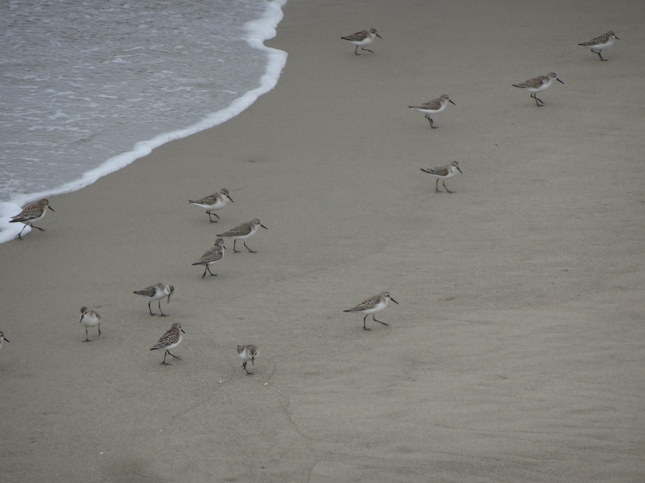
A skittering of sand plovers.
Sand plovers, doubled.
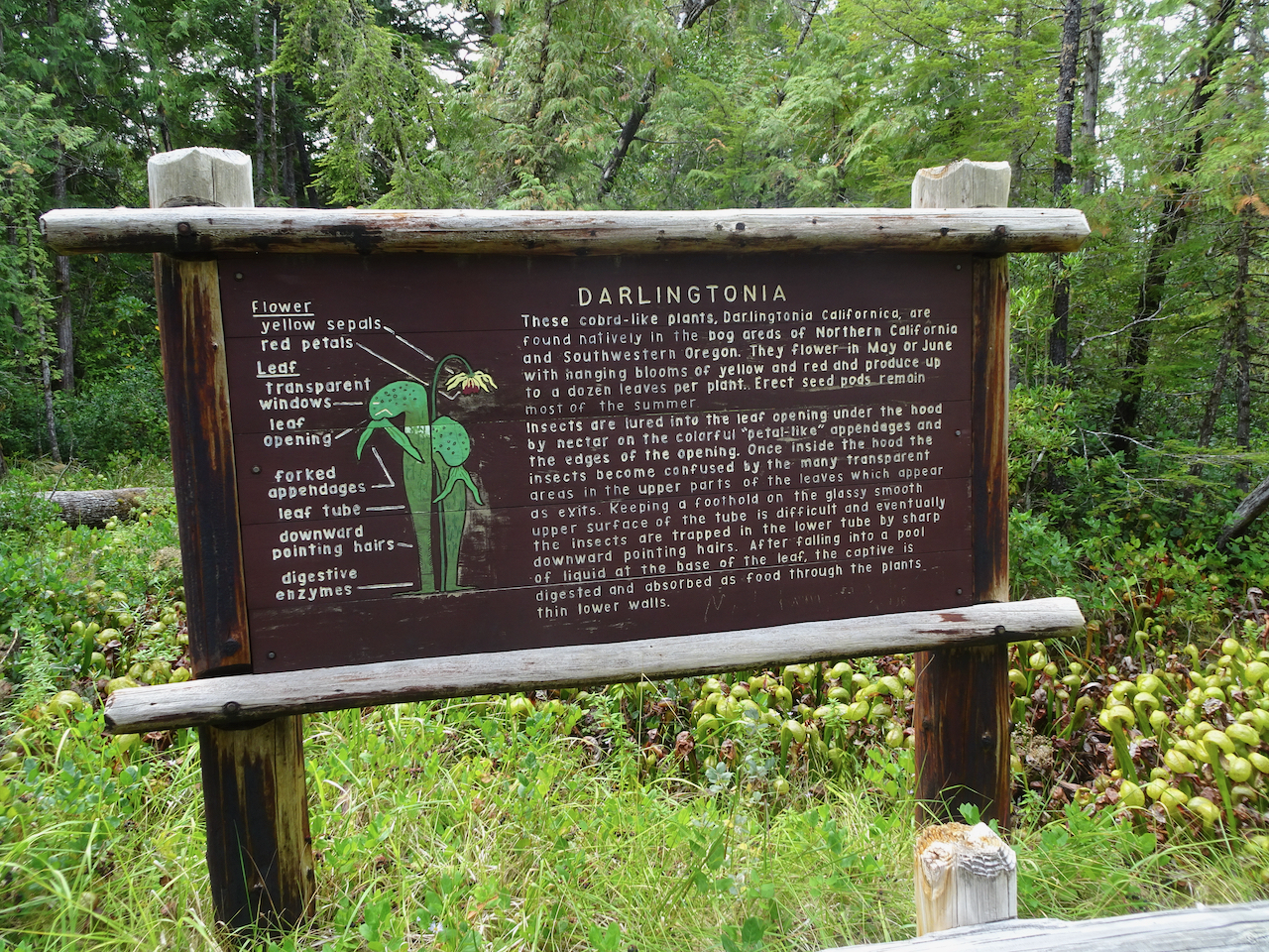
Darlingtonia Wayside
After our beach walk we continued south along the coast looking for more adventures. Our next stop was to see a swath of carnivorous plants.
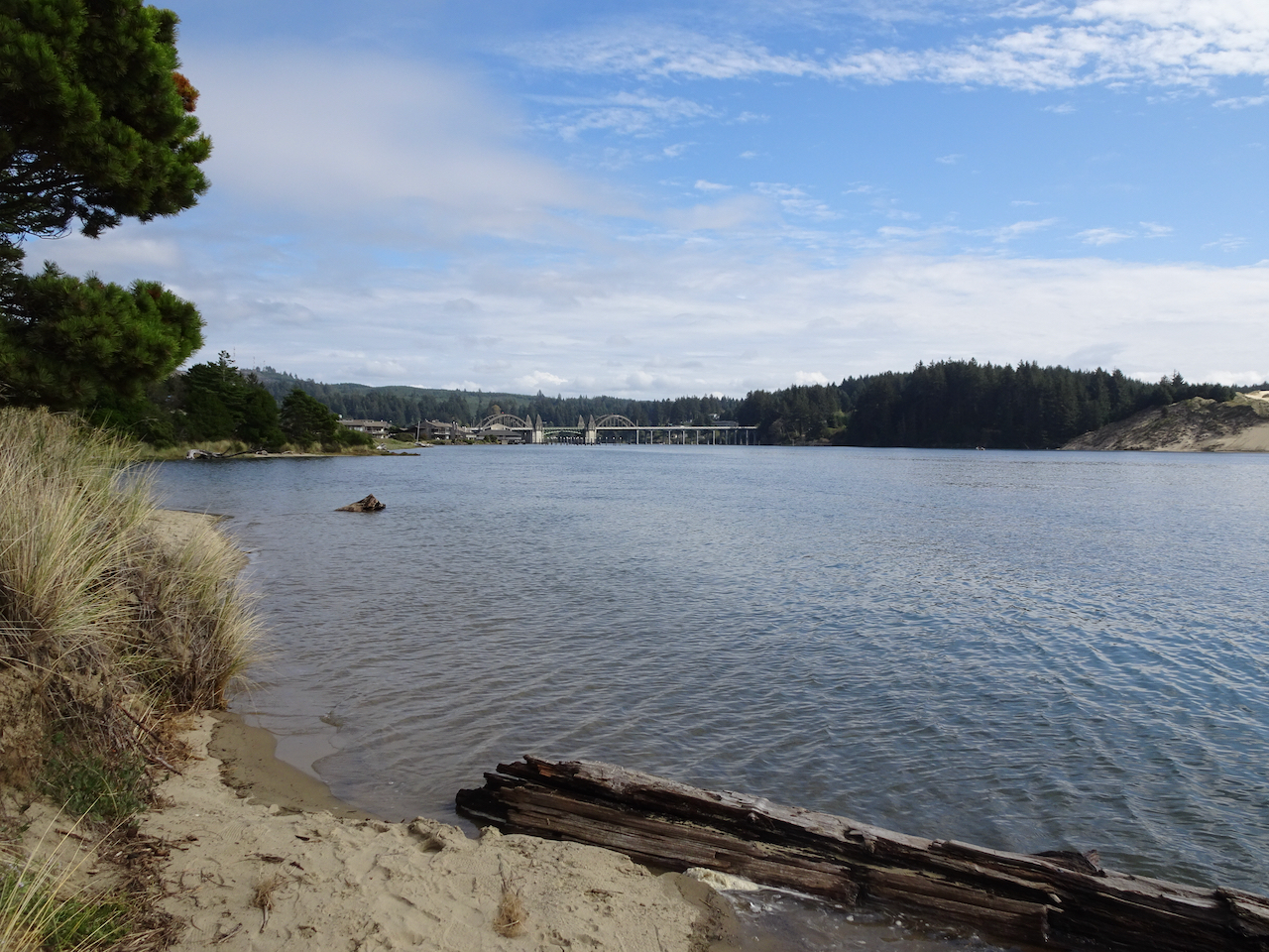
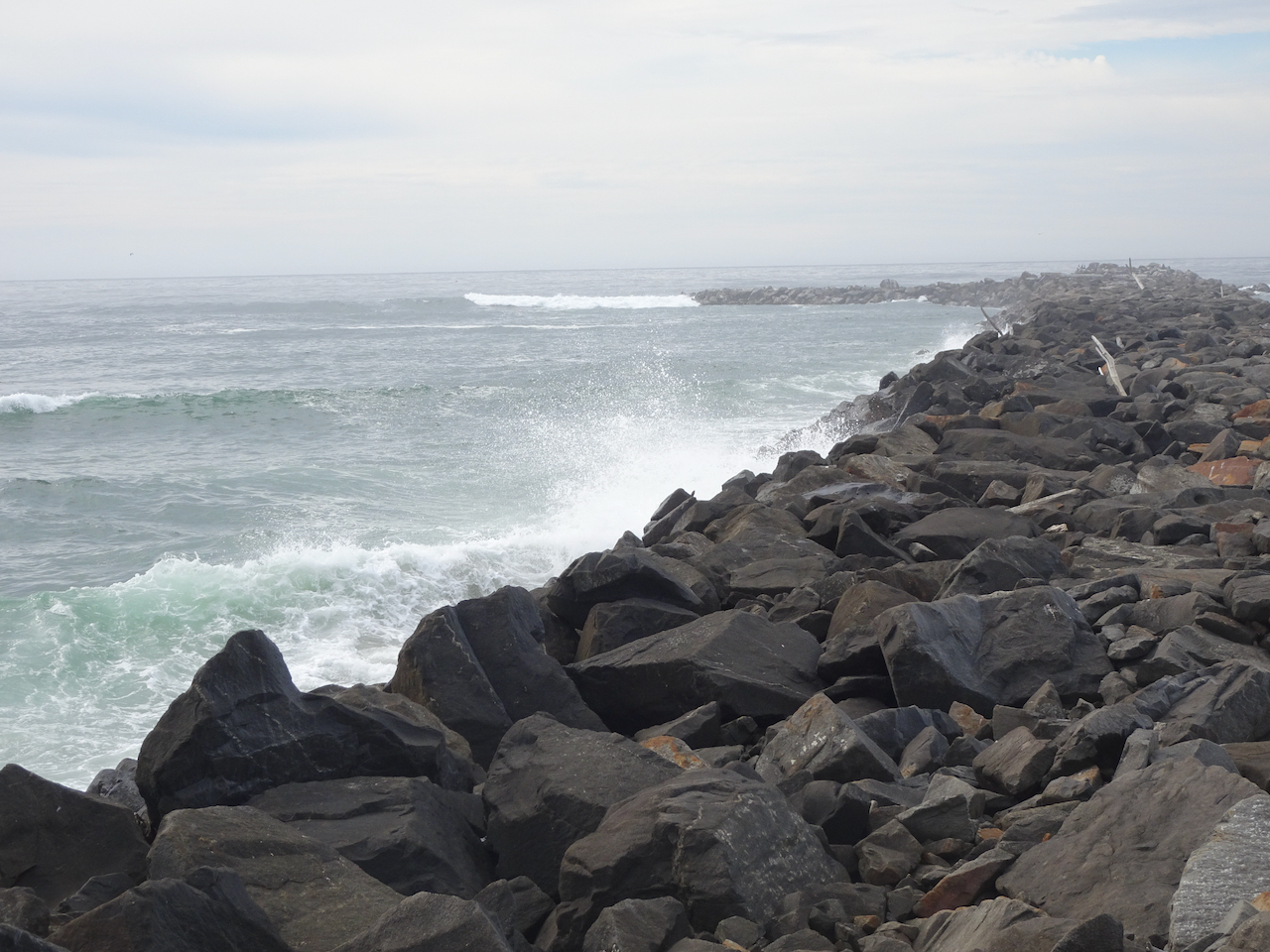
North Jetty
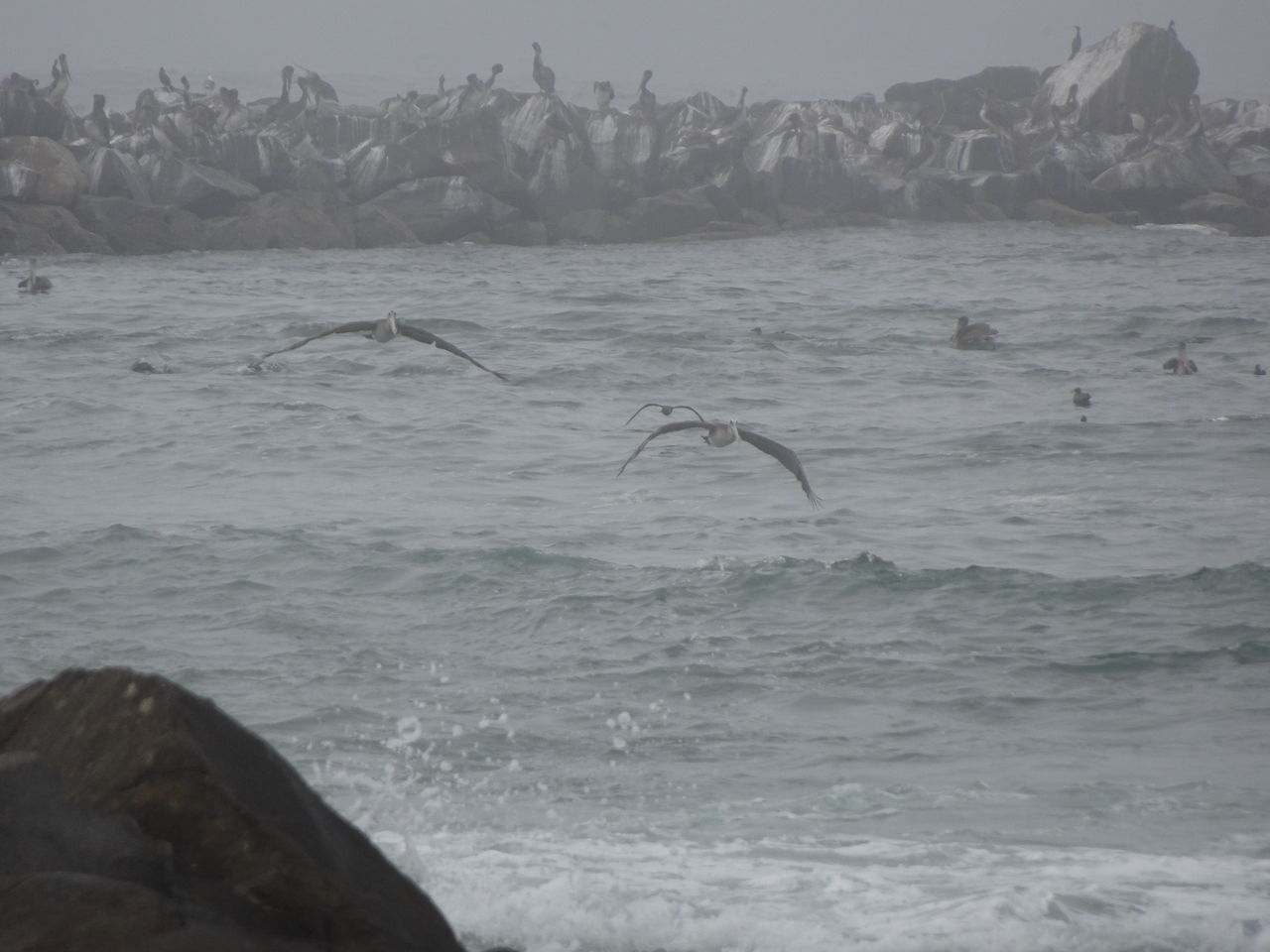
We followed the north side of the Siuslaw River to it’s mouth and took a walk along the North Jetty, where we again saw pelicans and plovers.
Entry to the North Jetty.
Walking seaward on the North Jetty – those shadows in the distance are birds!
Another skittering of sand plovers! It makes me so happy just to watch them!
Plovers.
Pelicans and other sea birds far out on the jetty.
Pelican in flight!
I spotted one seal nearby.
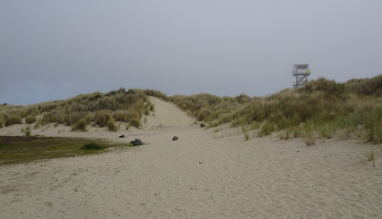
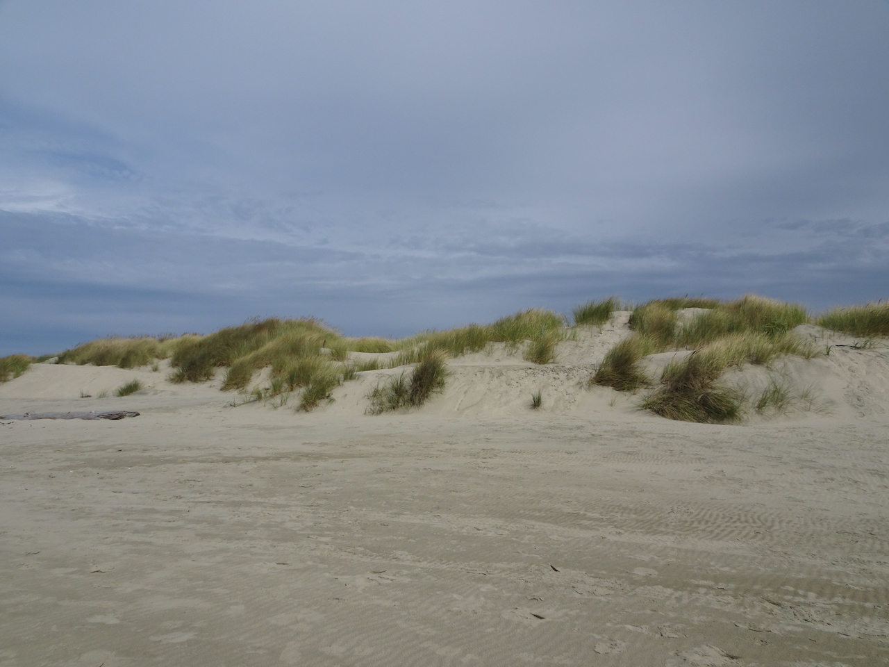
The dunes and lifeguard tower near the North Jetty entrance.
A line of rocks in the estuary make perfect perches for the seabirds.
Pelicans and gulls on their perches.
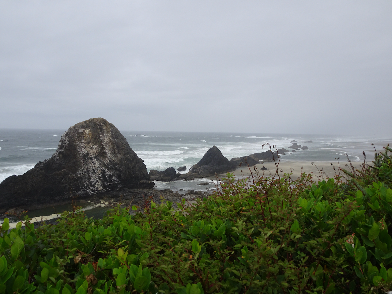
Exploding Whale park
As we drove back toward Florence, this park caught our attention. It is named for the infamous attempt to dispose of a washed up dead whale with dynamite, on a nearby beach, about 50 years ago.
Local citizens voted for the park name.
A short walk here reveals nice views of the highway bridge, and the dunes to the south.
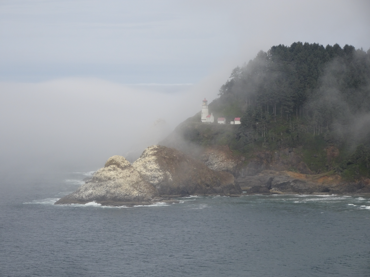
Haceta Light House
We stopped briefly south of Haceta Head in the early afternoon to see the lighthouse through the fog. On our return trip north in later in the day, the view was much clearer.
Haceta Head Lighthouse from the beach, through the fog.
Lighthouse from the highway viewpoint, early afternoon.
Lighthouse from the highway viewpoint, late afternoon.
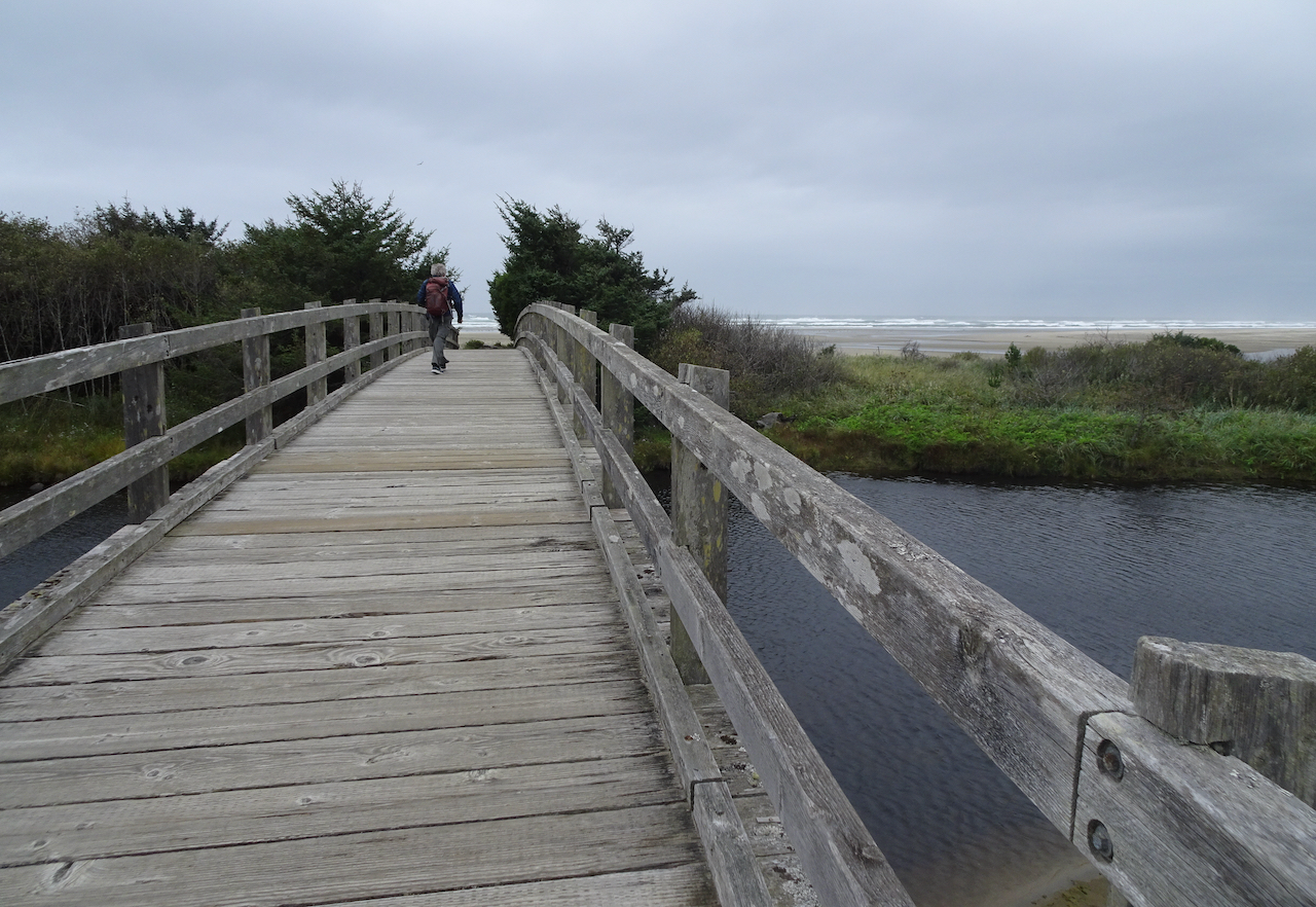
Monday, September 22nd
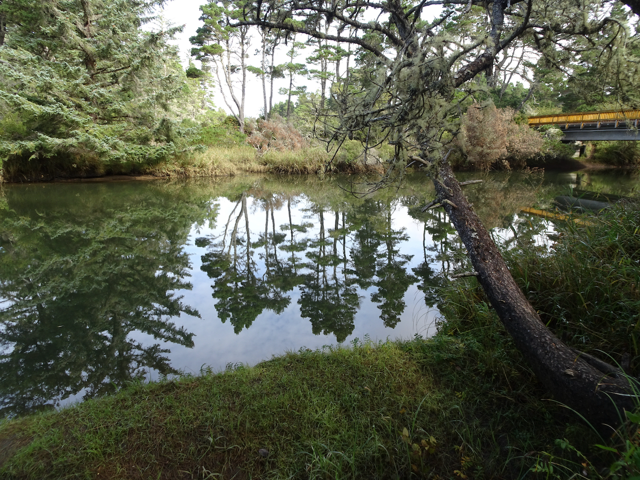
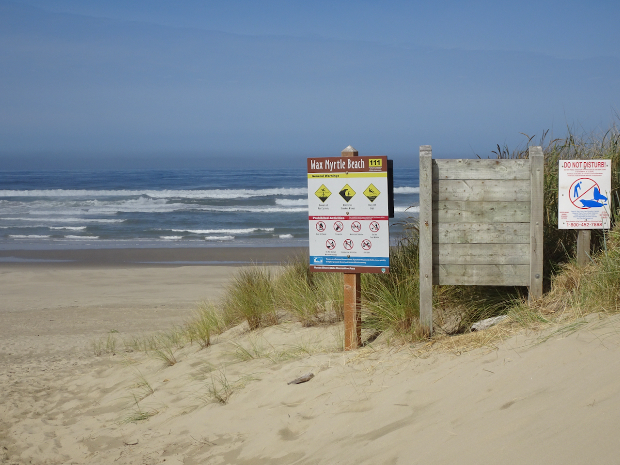
Wax Myrtle Trail and Lagoon Trail, Siltcoos River
Campgrounds in this area were closed, and the trails were particularly empty on this beautiful September day.
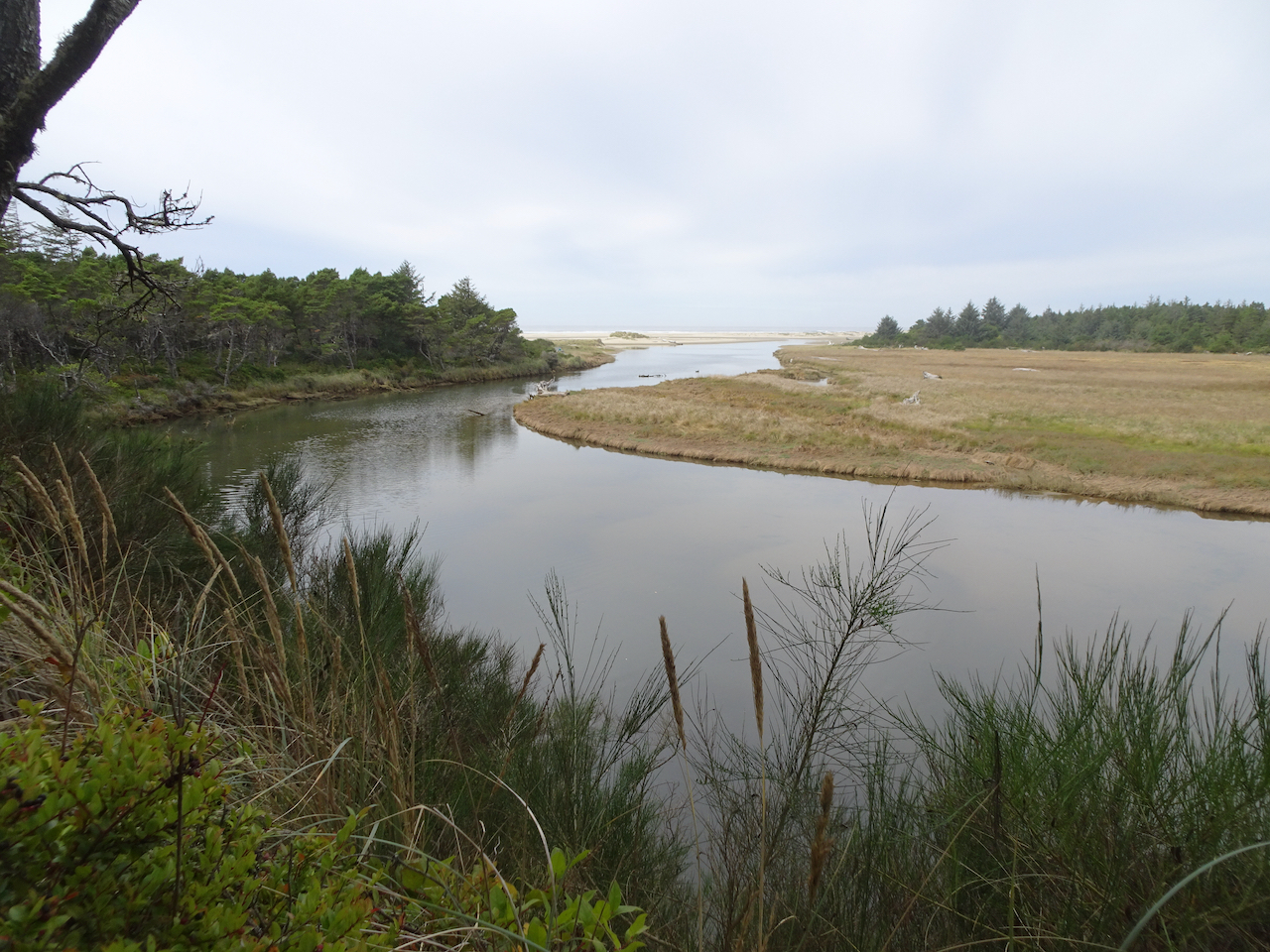
The walk to Wax Myrtle Beach follows the Siltcoos River.
We spotted a heron in the estuary as we got closer to the beach.
Heron.
We followed the Siltcoos River to the sea.
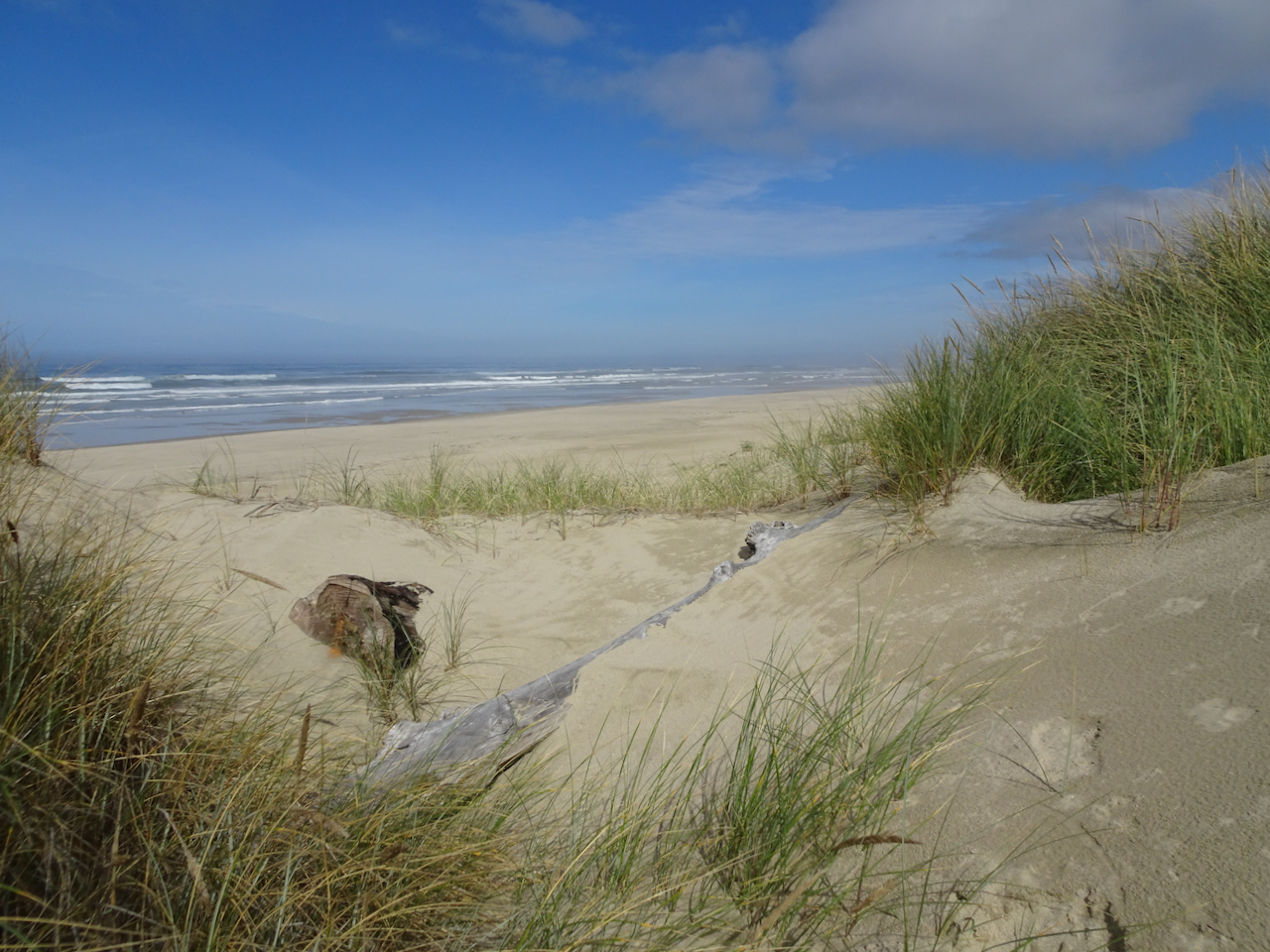
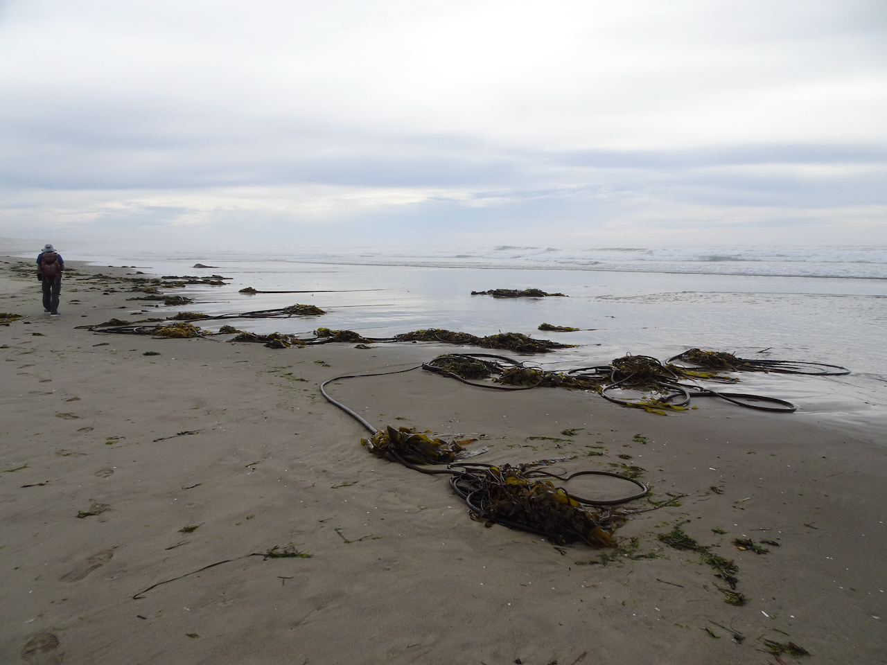
A line of sand dunes border Wax Myrtle Beach.
Dunes and beach.
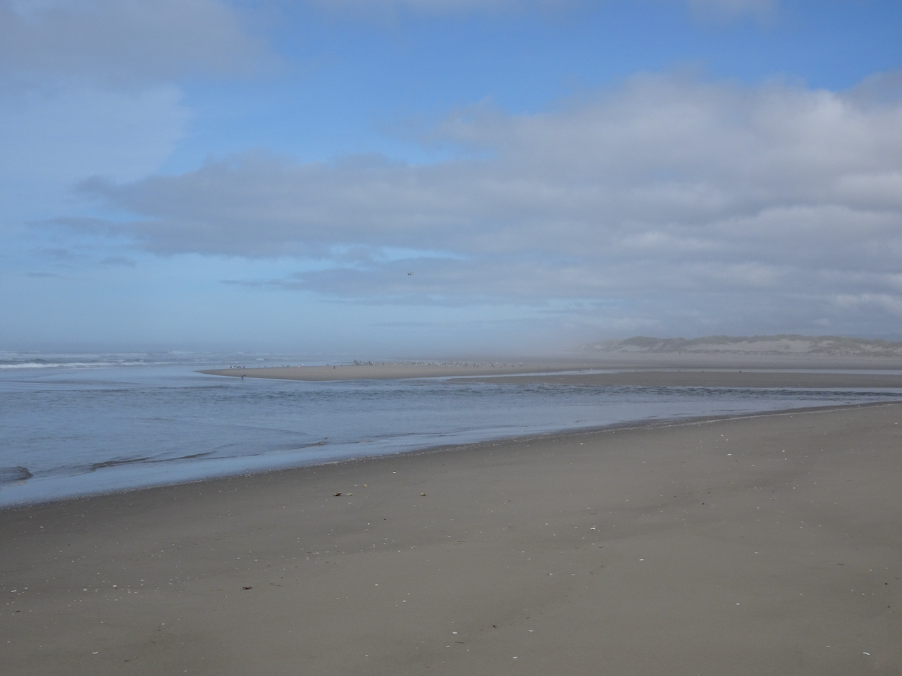
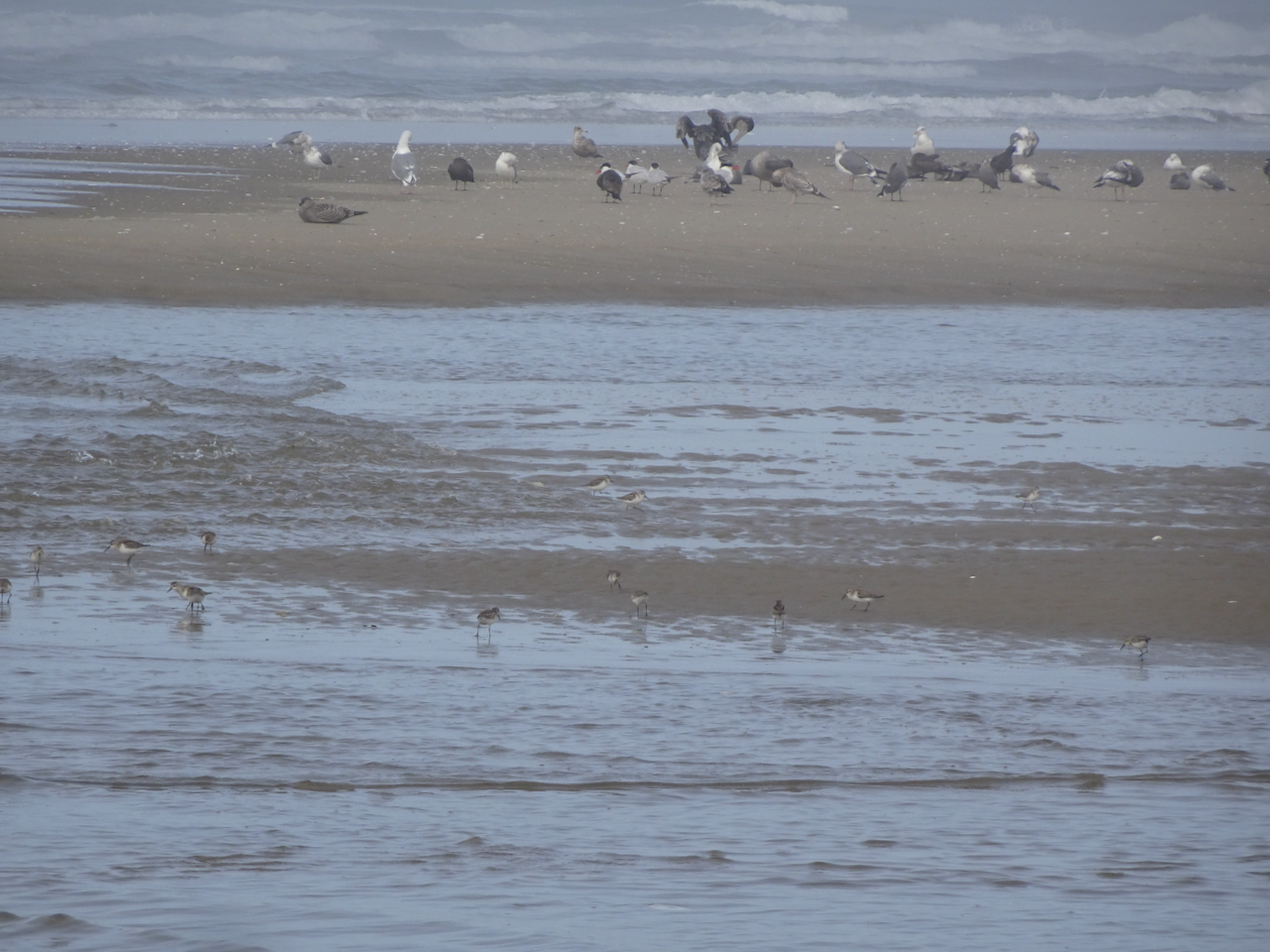
We walked north to the mouth of the Siltcoos River, where birds were out on the low tide sandbars.
Pelican.
More plovers in the foreground!
As we walked back upriver on our return hike, another hiker pointed out three river otters who were swimming upstream and eating fish along the way. We followed along with them until they disappeared upriver. This is my first time seeing them in the wild!
All three otters in this photo – the third one in the upper left corner. They are very fast and hard to photograph!
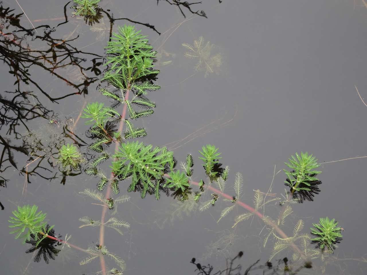
We walked partway around the nearby lagoon, where these beautiful plants floated on the surface.
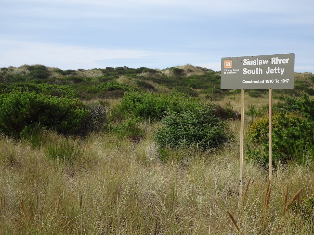
South Jetty, Siuslaw River
We drove back north toward Florence, and decided to drive out to the South Jetty of the Siuslaw River, just across from where we had walked on the North Jetty the previous day. There were plenty of people out there, also plenty of room to walk on beaches and in the dunes.
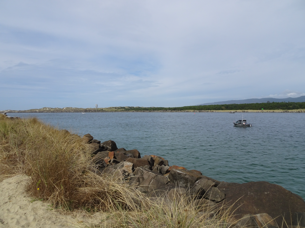
Looking seaward between the jetties. The North Jetty lifeguard tower is on the horizon.
Waves crashing against the South Jetty. Not as many pelicans on the outer jetty.
South Jetty beach from South Jetty.
Seaweed on South Jetty beach.
Swash zone.
Looking south.
Sand dunes to the east all along the beach for miles.
Sunset in Yachats
We had a lovely colorful sky outside our hotel.
Wednesday, September 23rd Yachats
We woke up to wind, and predictions of a storm coming in. We walked a short way on the beach in the wind before heading north toward home.
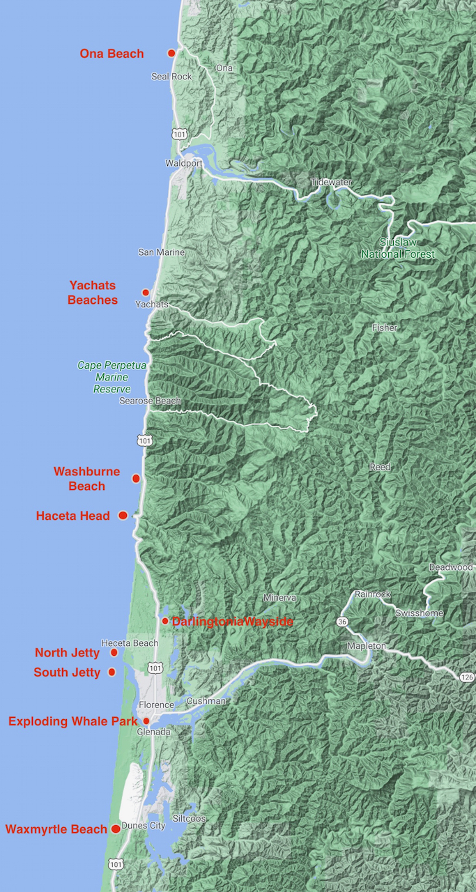
Seal Rock and Ona Beach
On our drive north, we stopped to look at the Seal Rocks, in the wind.
Seal Rocks to the south.
Seal Rocks to the north.
We stopped at Ona Beach, just to the north of Seal Rocks, and walked out to the beach.
Crossing Beaver Creek on our way to the beach.
Beaver Creek estuary
Squirrel getting ready for winter.
Ona Beach.
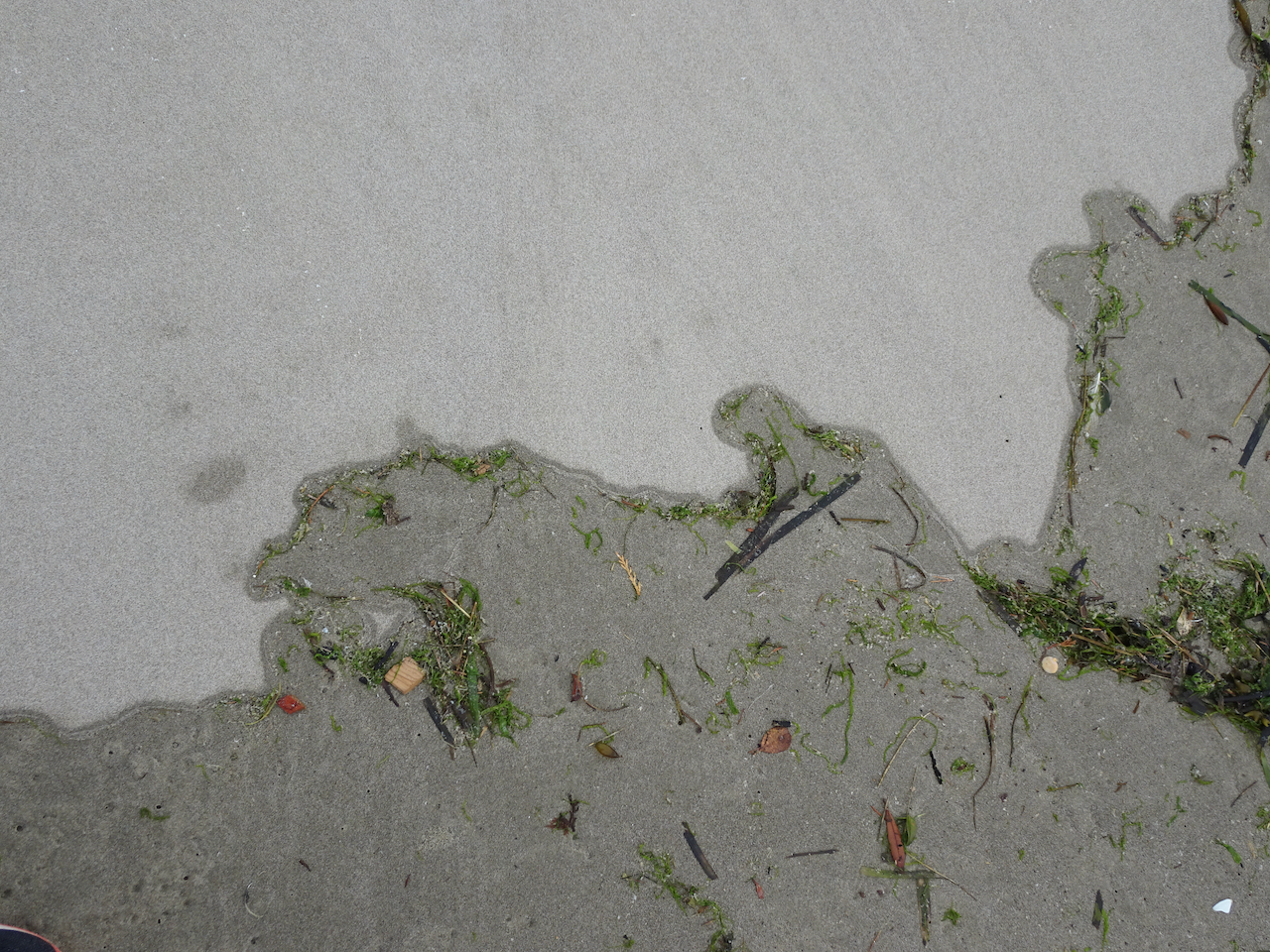
Windblown sand across the tidal flats.
Sand ripples, birds on the low tide bars.
These might be our last pelican sightings for the year.
Ona Beach, looking south toward Seal Rocks. Too windy to explore today – we will have to come back another time.
Rain started as we headed back to the car. I felt so refreshed from our few days in the fresh air and wide open spaces of the Oregon coast, and thankful that I could be there during this difficult year of pandemic, climate and political crises.
Sun out today, white clouds, blue sky, it looks the way it should.
Today we are going to actually do something. Today we are going to the coast.
Today when I woke up I felt so helpless- thinking about the death of Ruth Bader Ginsberg, and all the political turmoil that is part of the way we live now, spiraling down through conspiracy theories of my own regarding the complete fall of our democracy bit by bit throughout this administration, and how it will go on if the election fails again.
And Covid, and wildfires, and the fact that I can’t hug my son, and seeing my daughter is risky…a whirling spiral life of anxiety….and I am priveliged to take a break but cannot really, though I have my home, my town – safe places for the most part, for now…
I woke too early, at 6 am with these thoughts. I opened Facebook and there my friend Helen was posting in the wee hours last night about her own anxiety, her fears. And so many people told her she was not alone, they shared her fears.
I am sitting here in the sun in my kitchen window, watching the post-wildfire-smoke neighborhood come back to life. We donated money to political, food assistance and wildfire relief organizations. We are going to take some long walks on the beach this week, and clear our brains a bit, return refreshed and newly ready to proceed under the most stressful circumstances of this year, do whatever we need to do, whatever comes next. I hope.
September began with a heat wave, too hot for hiking. I went on my usual walks through the neighborhood, noting the late summer flowers and early signs of fall.
Hydrangeas
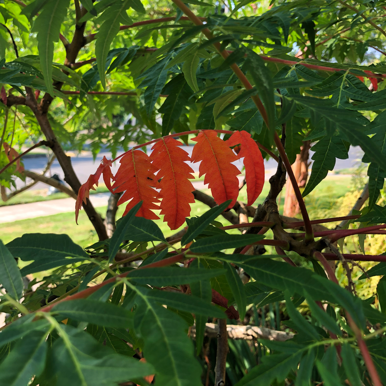
Sumac
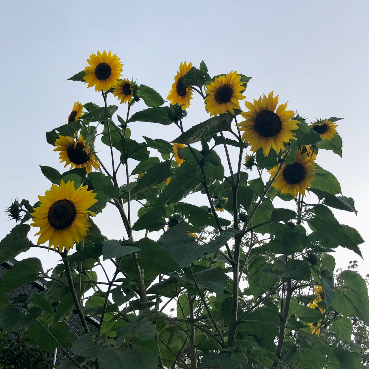
Sunflowers
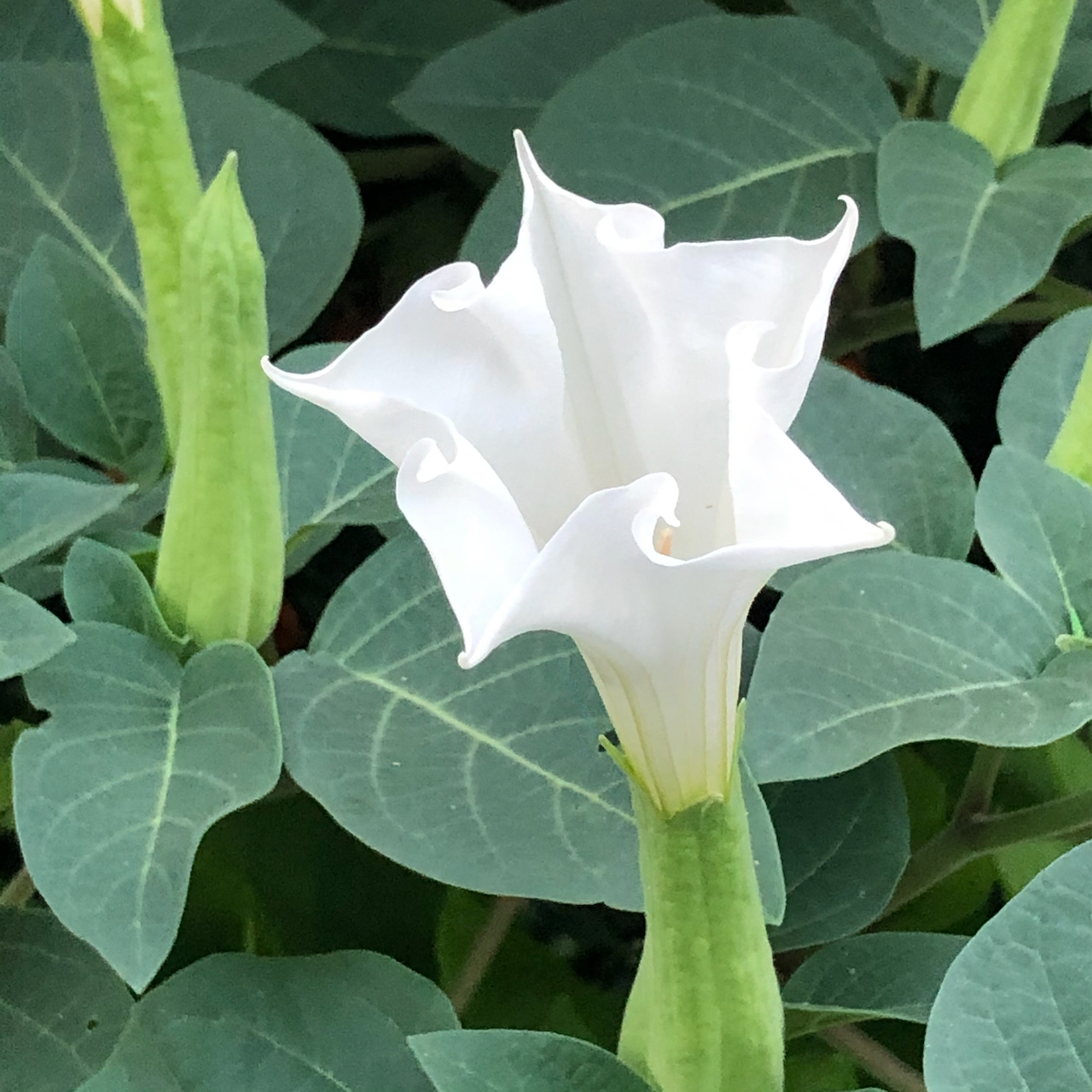
Datura
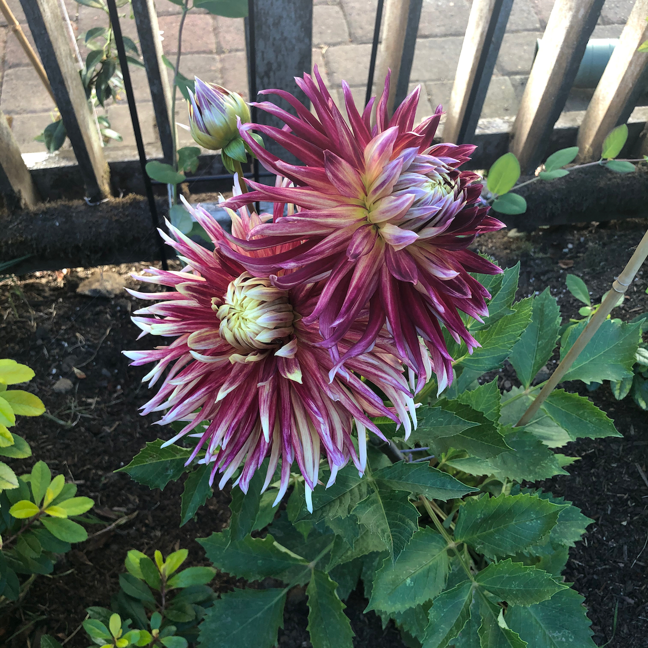
Our first dahlia blooms
And I finished sewing my summer kimono robe.
We were planning some adventures after the Labor Day weekend, when the trails would be quieter. Instead, quite literally, all hell broke loose. In my last post, I expressed my “hope for a late summer without a local fire season.” I could never have predicted the late summer snowstorm in the Rockies that created an ‘unprecedented’ giant windstorm that swept westward across the continent, fanning the flames of wildfires in every combustible forest on the west coast of North America. We were safe at home, watching in horror, as the news kept getting worse.
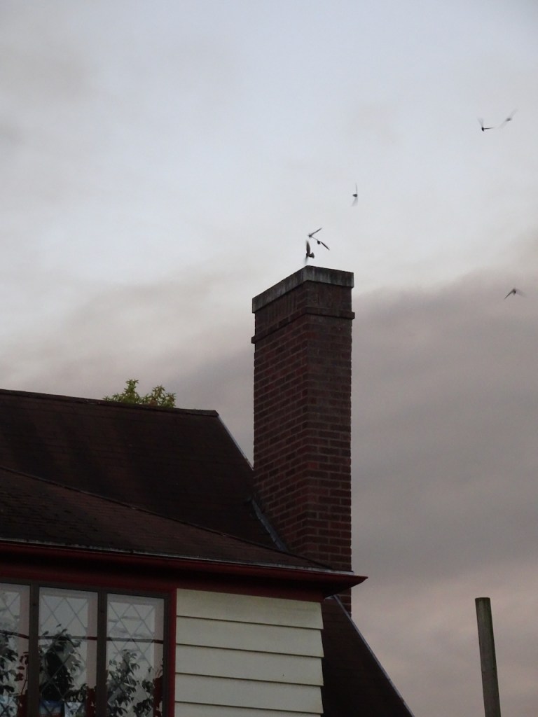
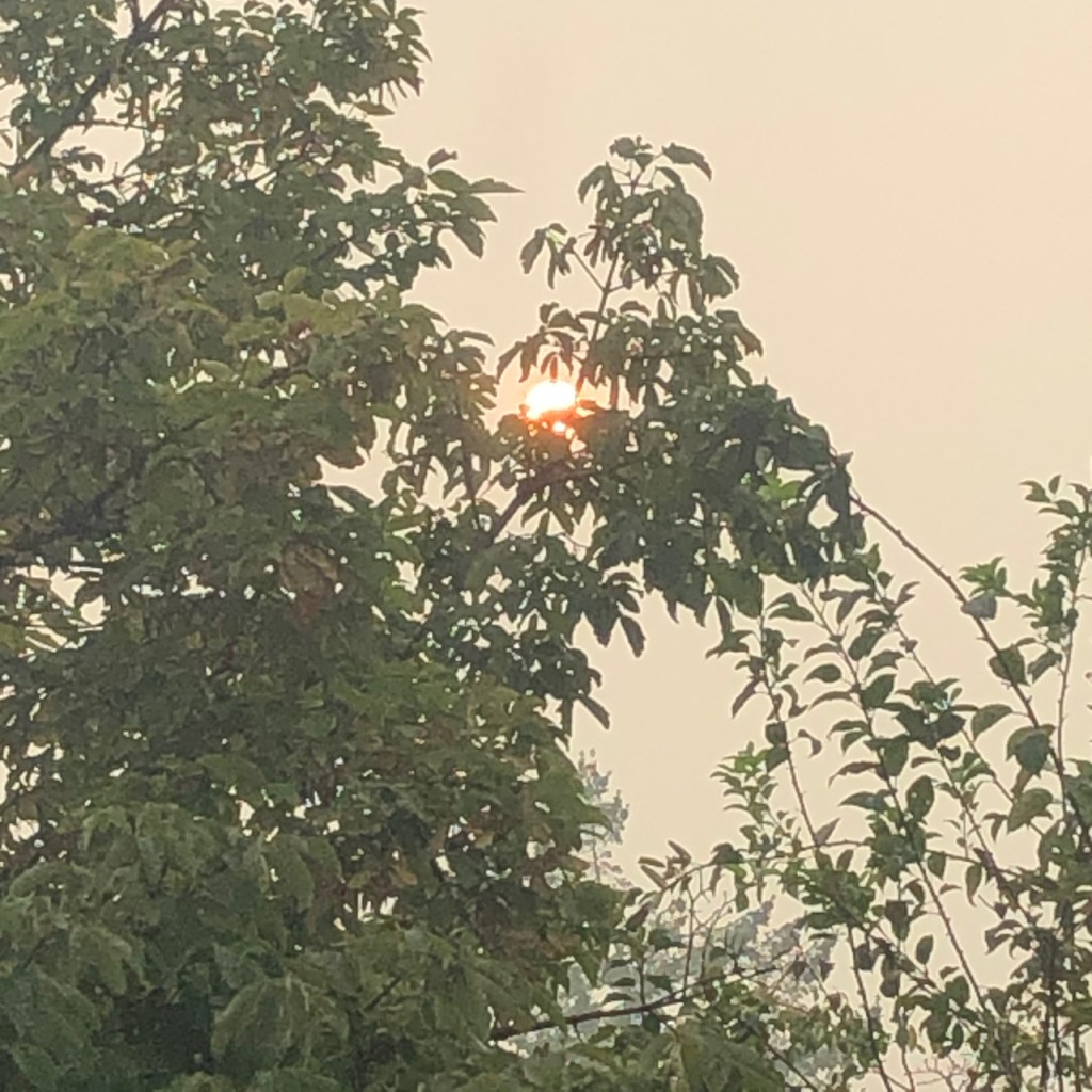
September 8th: Wildfire smoke wafting into our neighborhood as we watched swifts fly down our neighbor’s chimney.
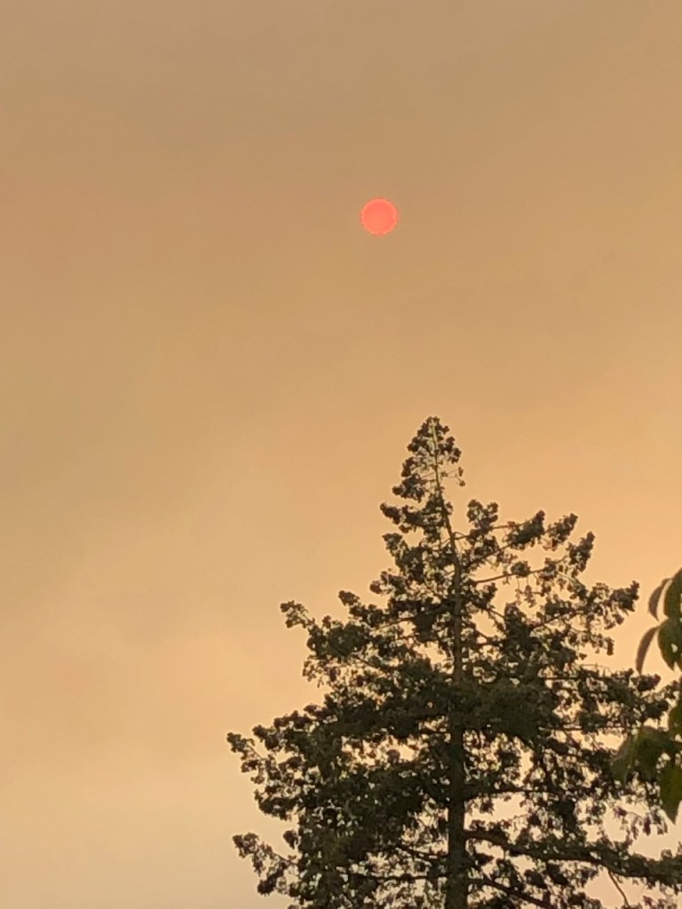
September 9th: Last appearance of the sun for a week.
Sept 9th: Aerial view of the fires and the smoke.
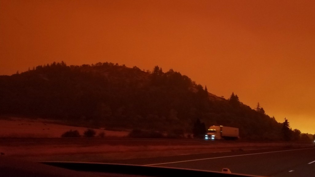
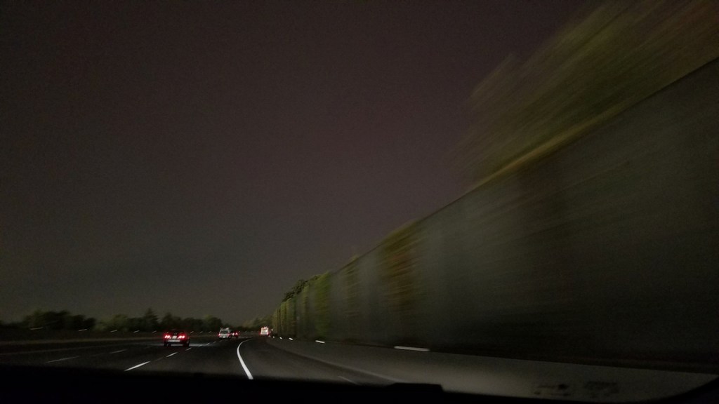
September 10th: My friend sent me two photos of her drive north on Interstate 5 during daylight hours:
Near Eugene.
Near Salem.
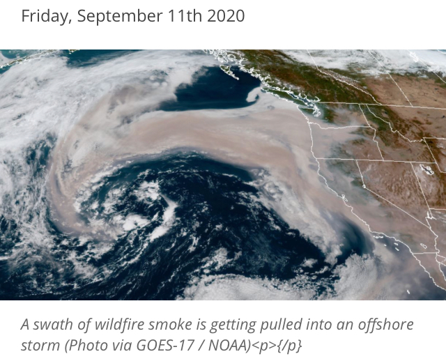
Satellite photos from September 11th show the smoke being pulled far out to sea:
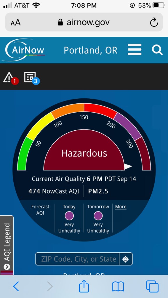
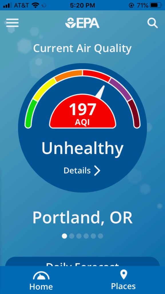
After the winds died down, the heavy smoke settled in, limiting visibility, and making breathing painful. We learned how to use the AirNow app to monitor our air quality, constantly refreshing the page, hoping for better results.
September 14th
September 17th
For six days I did not go out of doors at all – grateful to have a safe home to harbor in, knowing there were so many families evacuated, and many with their homes burned. Many have still not been able to return; meanwhile the firefighters, Red Cross, and all the social support services have stepped up to aid those in need. I have only gone out once, so far, to pick up a prescription and some groceries. Nobody is walking our neighborhood streets – the air has been too bad. Today it finally shows signs of improvement, and we may be able to step out in the next day or two.
September 16th – our first glimpse of the sun in more than a week.
Knitting
Once again, knitting to the rescue. I have had time to finish a few projects:
Rafa Hat for my brother – Malabrigo Arroyo, pattern by Joji Locatelli
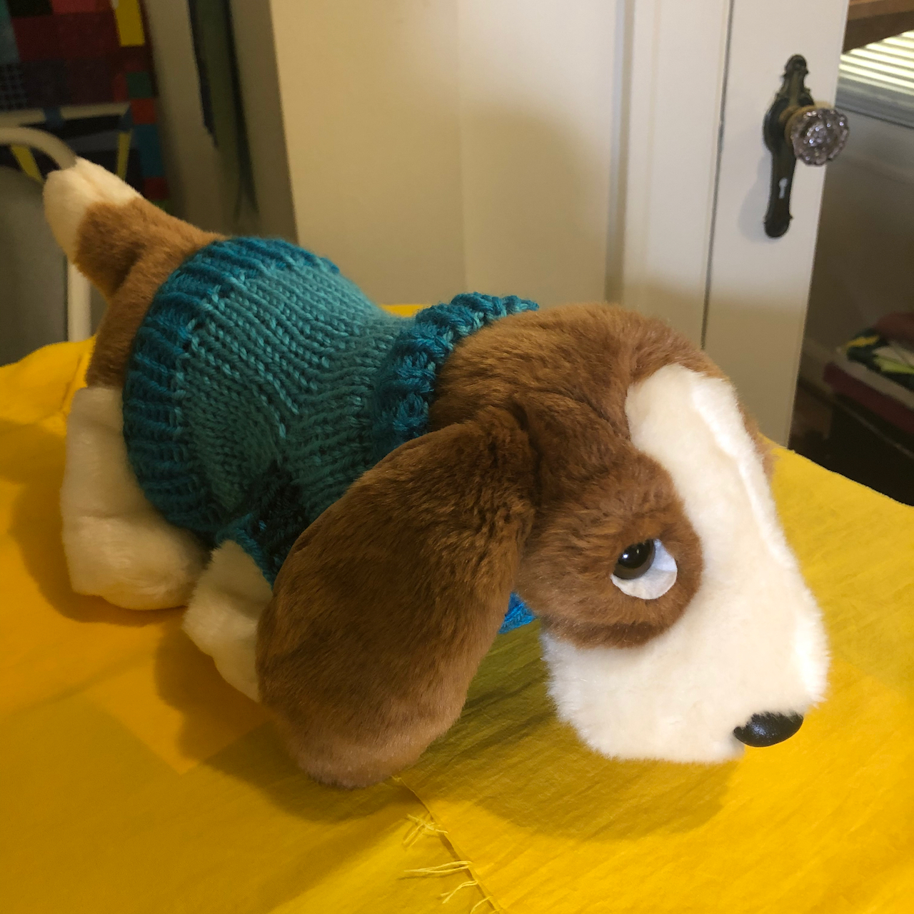
Dog Sweater for a donation toy – Pattern by Jeslane on Ravelry.
Ridge Washcloths, Lily Sugar’n Cream cotton, pattern by Hannah Maier.
And make progress on other projects:
Rio Calina cowl, Malabrigo Rios, pattern by Cat Bordhi
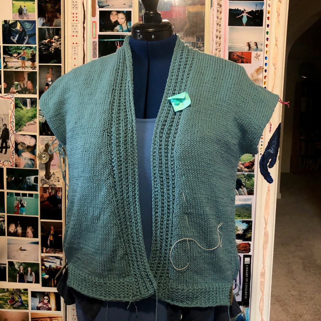
Farallon cardigan, Classic Elite Song yarn, pattern by Elizabeth Doherty.
Awake and say “What time is it? What day is it? What season?” No sun, but not dark, so… daytime…
End of summer in a strange year when all the cues are gone, and now gone again. Most things closed down again. Wildfire smoke blankets our part of the planet. Fall approaches, but is it the fall of our civilization? Or autumn? Invisible viruses still pervade the air. Not quite invisible smoke particles dim our sight, harm our lungs.
A metaphor for the insidious gloom covering our entire nation in an unprecedented election year, the outcome to determine how we will breathe going forward.


 Deschutes River trail, a smattering of rain, it feels like walking through a purifying mist, and there’s no Covid out here.