17. Oswald West/Cape Falcon

Beach Day  7/8/2017 (#41)

Portland has been HOT (95 to 105) and SMOKY from the BC and other Cascade wildfires.  My visiting sister, my son and I decided to head west to the coast for some relief.  Our initial plan was to climb Neahkanie Mountain, an easy hike with great views, but the peak was fogged in.  We opted instead for the five mile round trip hike to Cape Falcon from the Oswald West State Park parking area.  The beach is a popular surfing spot, and the trail took us down to the beach where many were riding the waves and enjoying the 60 degree air temperatures.
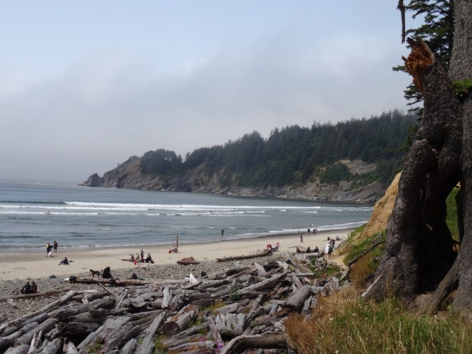
DSC06979

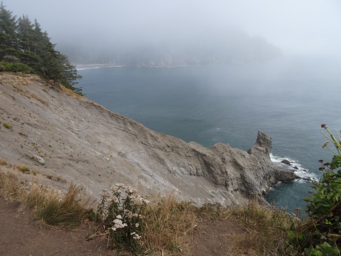
Cape Falcon (our goal) is the far ridge beyond Smuggler Cove
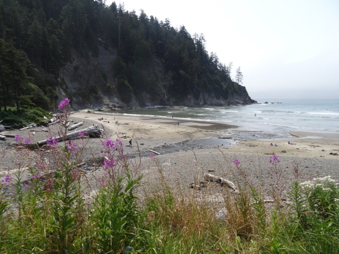
DSC06978

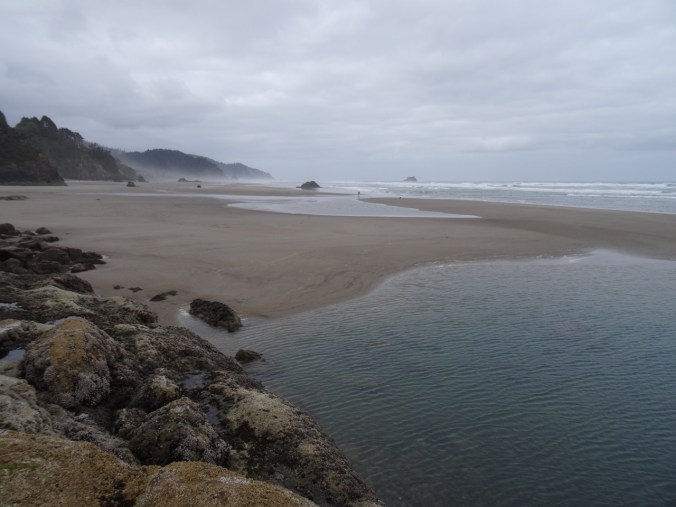
Short Sand Beach

Screen Shot 2017-08-12 at 1.12.58 AM

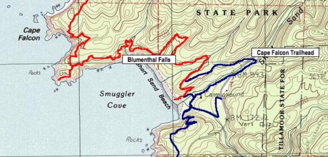
We went from the trailhead to the cape and back via the beach trail

We followed the well worn trail past a small waterfall and out to the Cape where we watched the fog roll in and out, obscuring views and keeping us cool.  We found a shady perch to eat lunch, then hiked back to the trail head, tripping over some of the many exposed roots on the trail – it could use some work, to be perfectly honest, but the cool temperatures and beautiful views make it hard to complain.

DSC06982

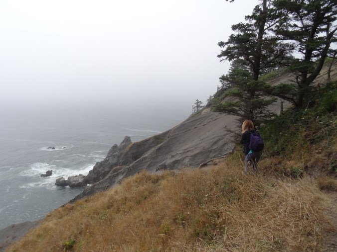
Looking down on Short Sand Beach from the trail
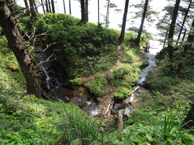
DSC06989

Small waterfall above Blumenthal Falls
DSC06994

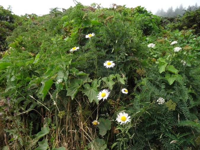
Daisies and hemlock on the Cape

DSC06996

View to south from the Cape

DSC06998

View to north from the cape

DSC07007

Cape Falcon

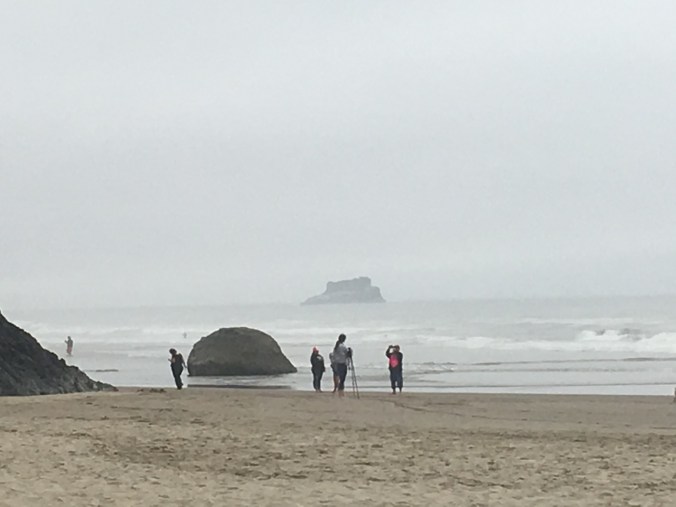
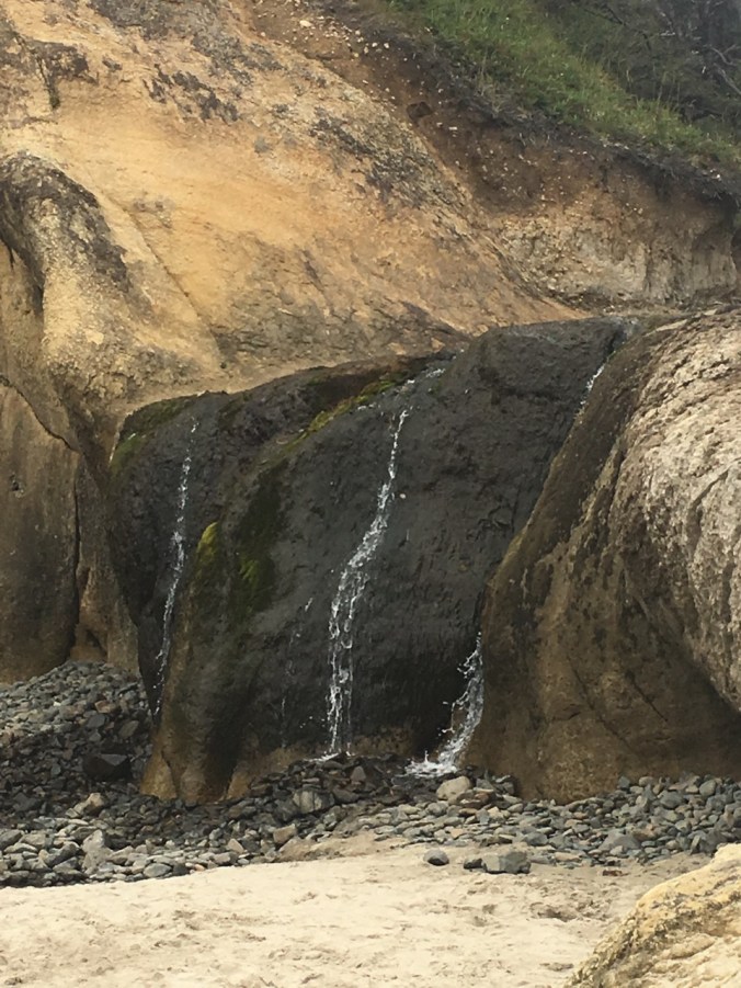
We drove back north on HWY 101, and stopped for a while at Hug Point State Park.  The receding tide was still high, so we could not quite make it on to Hug Point, but we sat for a while in the late afternoon near the waterfall, dipped our toes into the Pacific Ocean and enjoyed the peace, and the cool temperatures. I was able to get one iPhone photo of the waterfall without other beach goers in it.
IMG_1359

Castle Rock from near the Hug Pt Waterfall
IMG_1358

Hug Pt Waterfall

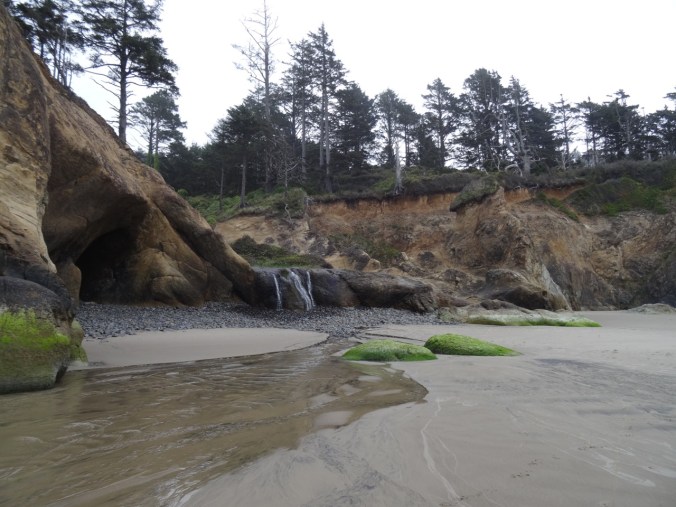
And because I have been really enjoying the LOOKBACK aspect of writing this blog, despite, or maybe because of, the rabbit hole nature of digging through my photos, here are two comparison photos of the Hug Point waterfall, and the view south  toward Castle Rock from Hug Point, taken May 8th, 2016, when we were there for a super low tide.
DSC03877

Hug Point waterfall, May 8, 2016

DSC03842

View south to Castle Rock from Hug Point, May 8, 2016

We stopped in Cannon Beach for a typical post beach day meal at the Pelican Brewery (clam chowder, fish tacos, fish and chips), then returned eastward on Hwy 26, back over the coast range to Portland and home, where the hazy smoky air and hot temperatures absorbed us into their gloom.  Next weekend is predicted to be in the 80s; perhaps the wildfires will calm down and the smoke will dissipate.  One can only hope, as it is rather tedious to complain about the weather.

Meanwhile, back in Portland:

By the weekend, the heat spell finally broke.  I pulled open the living room shades for the first time in two weeks, and there were plums on our plum tree, raindrops on roses, and cherry tomatoes for my birthday eclipse bowl.

And, somewhere in Peru…

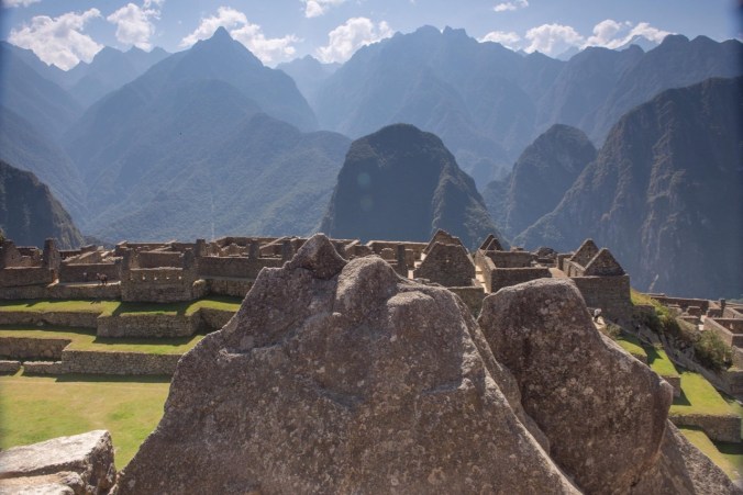
They made it to Machu Picchu!
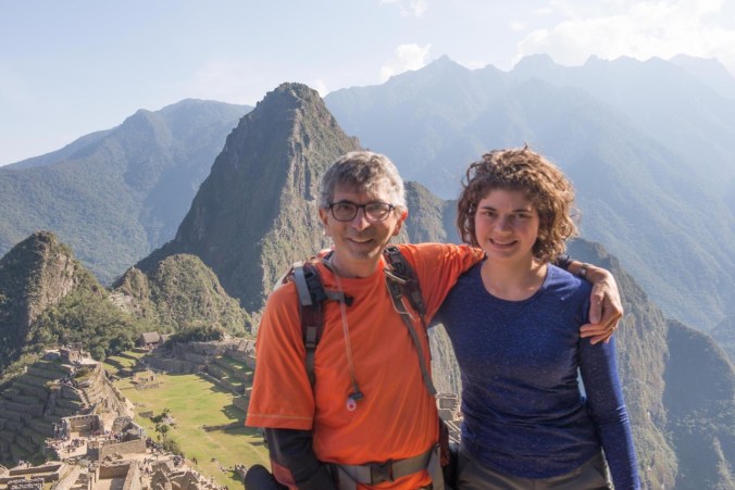
20746127_1761116673916328_298640694633812101_o20861903_1761118093916186_6907003265004647185_o

SaveSave

16. Visiting in Eugene; Hiking in Silver Falls State Park


Family time in Eugene, Oregon

A sister visiting from California created an opportunity for us to spend part of the week in Eugene visiting other family members while my husband and daughter are off on an adventure to Machu Picchu, Peru.  We found a house to rent for a few days near the University,

and were able to spend some lovely down time relaxing, celebrating my birthday, and trying to stay cool in the unreasonable hot temperatures and smoky hazy air that have settled in the Willamette Valley for an overlong period this year. There was lots of color around town and at the Saturday Market,

the UO Art Museum,

and a couple of family yards that were blooming with lovely flowers.

Silver Falls State Park  8/6/2017 (#40)

We drove home via Silver Falls State Park, arriving about 4 pm and unrealistically hoping for slightly cooler temperatures.  We completed the short loop (about 3 miles and 300 feet) around the Upper and Lower South Falls.

It was a little hot for hiking, and the water levels were low enough that we were not at all misted when we passed behind the falls on the trail, another hope that was dashed.  This contrasts markedly with the last time I was there in February, when we had to practically run those trail segments to avoid being soaked.  Still, my sister enjoyed the scenery and the greenery, as she lives in a completely different landscape.

Lookback photos:  February and August, 2017

Upper South Falls:

Upper South Falls from the footbridge:

Behind Upper South Falls:

Lower South Falls:

Another view of Lower South Falls:

A bit of Knitting:

DSC06820

Genius Wash Cloth

Meanwhile, in Peru,

Dan and Emily made it over 15000′ Salcantay Pass!

20645124_1757106297650699_7607631488945806124_o

13. Latourell Falls and Sherrard Point, 7/14/2017

Latourell Falls and Sherrard Point  7/14/2017  (#37)

Health issues and visitors slowed down my hiking this past couple of weeks, but we ventured out again to the Oregon side of the Columbia River Gorge, with our visiting son, to an easy waterfall hike and an iconic viewpoint.

 Latourell Falls

Latourell Falls is one of the westernmost waterfalls in waterfall alley of the Columbia River Gorge.  The lower falls is easily seen from the old highway; the short trail down to its base was crowded on this beautiful Friday afternoon in July.  We chose to hike the easy 2.4 mile loop (500′) which took us to views of both upper and lower falls, and an overlook of the Washington side of the gorge.  Most of the usual forest flowers were past, or dusty remnants, with the exception of hedge nettle along the lower part of the trail in pleasing tall swaths, and  bright yellow arnica at the upper falls.

Sherrard Point

We then backtracked along the old highway to Larch Mountain Road, and drove the 13 winding miles through forest lined intermittently with orange tiger lilies, purple foxglove, white cow parsnip and yellow wooly weed. Sherrard Point, the view point at the top of Larch Mountain is a short (0.3 miles) walk up a wooded path that was  lined with many forest flowers.  At the top, the cream puff cascade peaks were all floating in the distance, Mt. St. Helens, Mt. Rainier, and Mt. Adams to the North, Mt. Hood directly to the south, and Mt. Jefferson a bit farther south in the haze.