15. Cloud Cap/Cooper Spur/ Timberline Trail, Mt Hood, Oregon 7/28/2017

Timberline Trail High Point from Cloud Cap  7/28/2017  (#39)

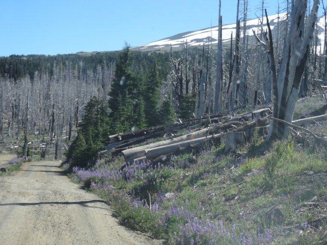
We drove up the dusty switchbacks of Cloud Cap Road, through the burned forest from the 2008 and 2011 fires.  Lupine, goldenrod, penstemon, aster and paintbrush lined the road, and the views to the Cascade peaks to the north appeared as we gained elevation.

DSC06816

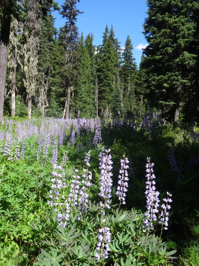
Lupine lined road to Cloud Cap through the burned forest

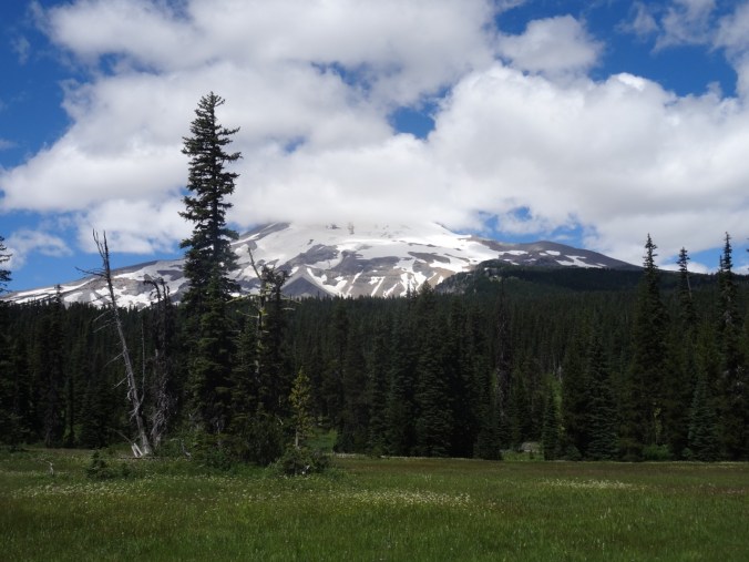
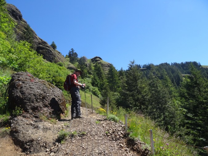
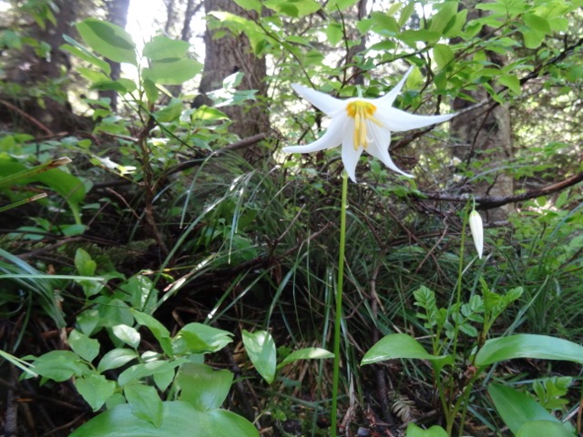
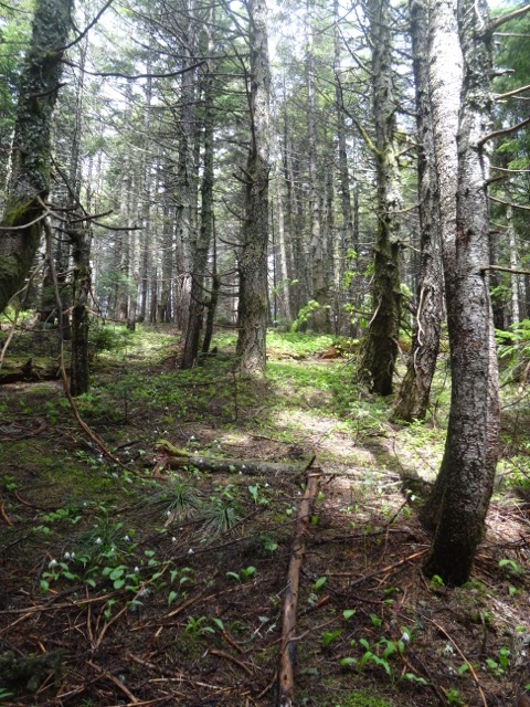
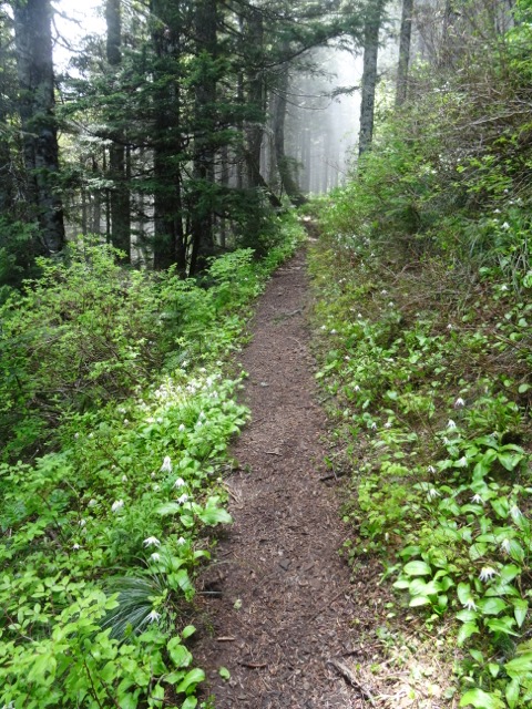
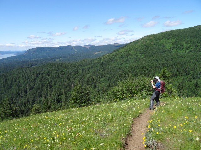
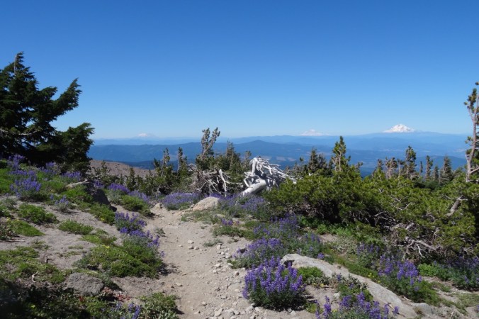
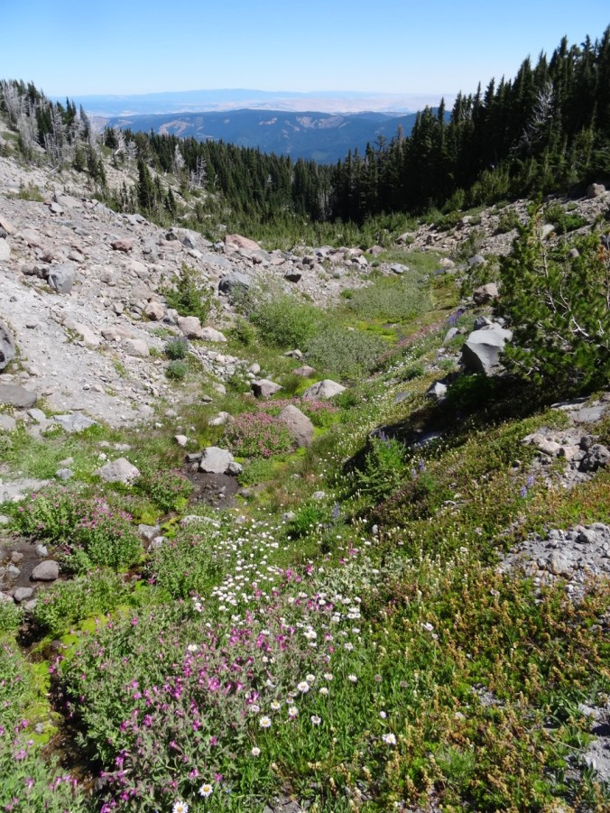
The trail head is at 5600 feet, and we began our hike in the forest.  We soon rounded a bend to clear views of the mountain, and of our trail heading up through loose moraine and across a stream.  Abundant wildflowers lined the trail despite the dry dusty nature of the substrate.

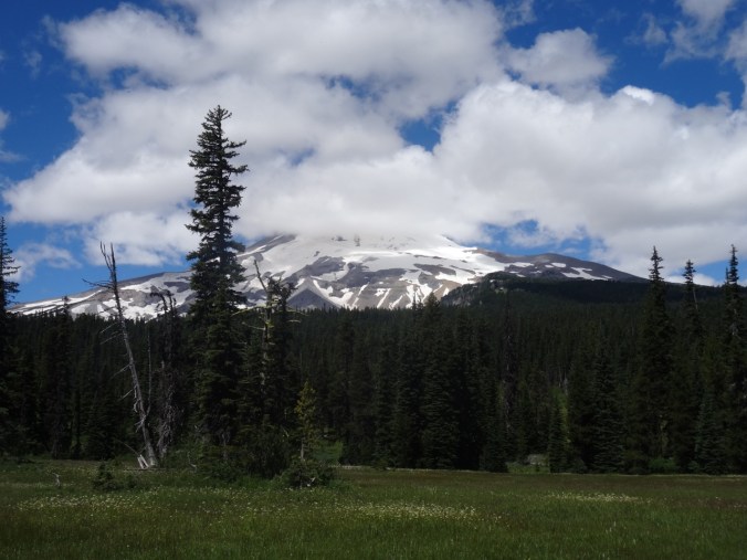
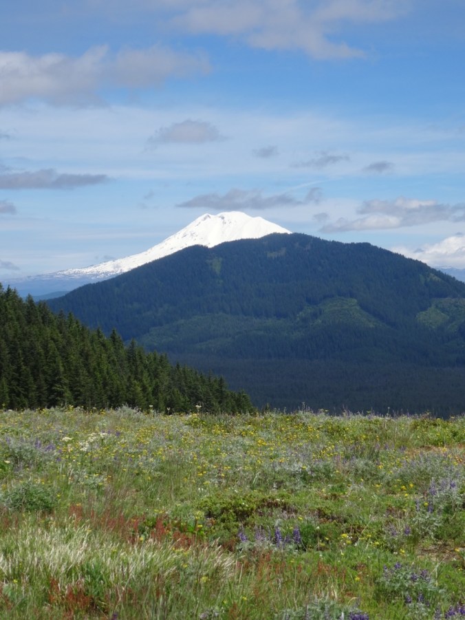
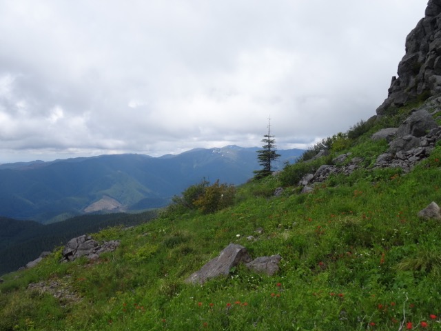
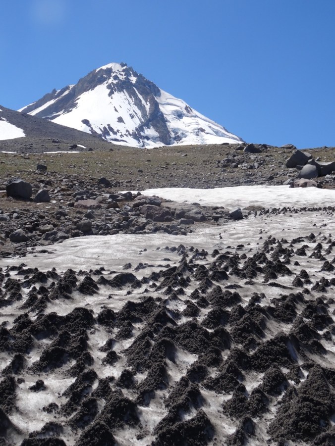
After crossing the drainage, we continued up and soon emerged above timberline on a rocky alpine slope with local patches of snow.  We saw stunning views to the peak of Mt. Hood and it’s eastside glaciers, and to the Washington Cascade peaks of Mt St Helens, Mt Rainier and Mt Adams.

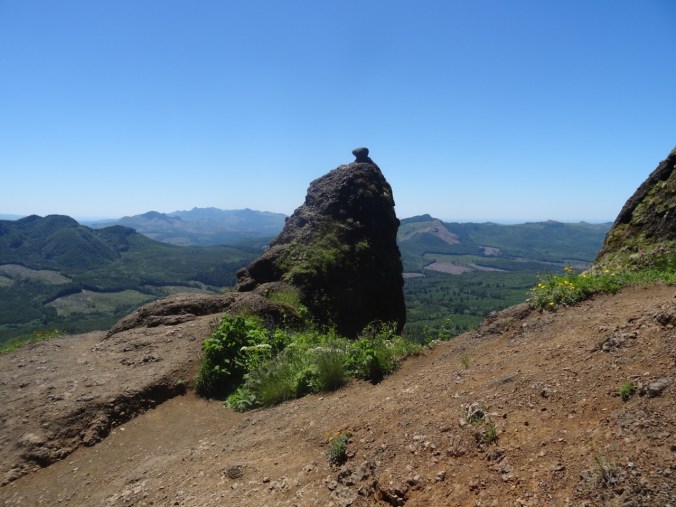
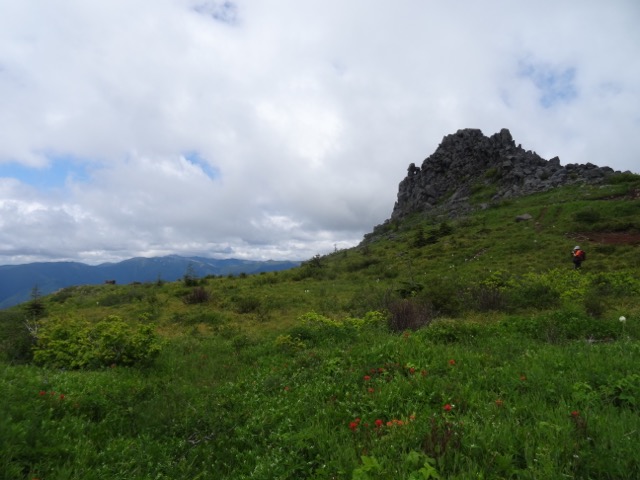
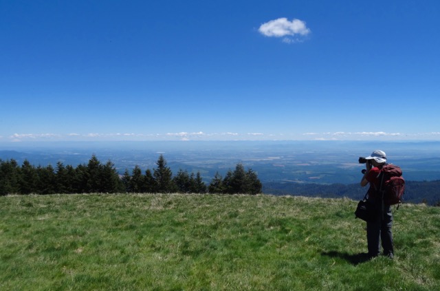
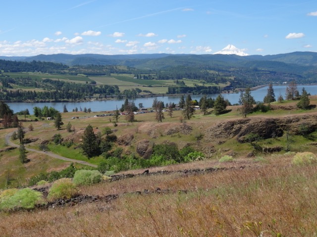
We continued gently up and down on the Timberline Trail, around ridges and across snowfields. We could see the peak, and the Cooper Spur moraine and ridgeline made distinctive by a huge boulder called tie in rock.  We hiked that ridge to the base of the glacier a few years ago, and we could see a few antlike people hiking along the ridgeline today.  We opted to stay along the timberline trail to its topographic high point, about 7300 feet.  We traversed along the ridge adjacent to this point to a lunch spot with 360 degree panoramic views, including views to the south of Gnarl Ridge, Lamberson Butte, and much further to the south, the silhouettes of Mt Jefferson and Black Butte that were somewhat obscured by wildfire smoke in that direction.  To the north, the view was still clear to Mt. Adams and Mt Rainier.


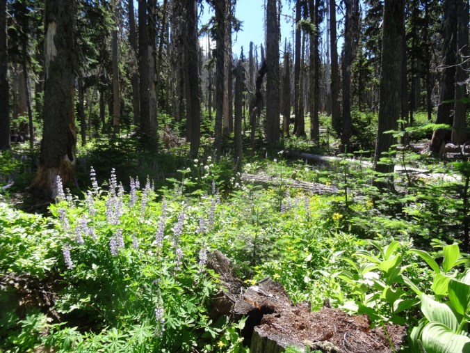
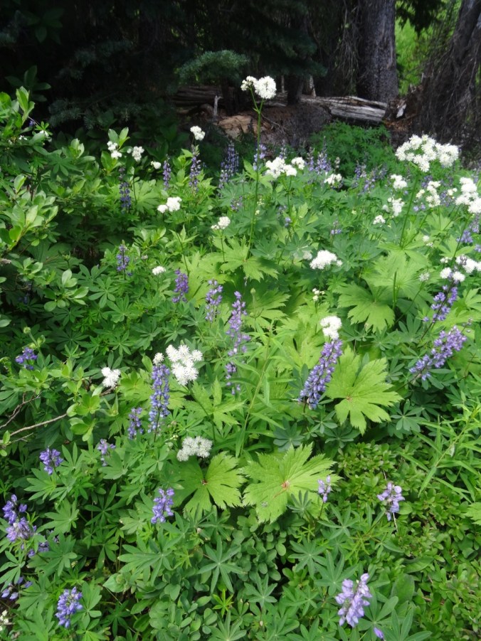
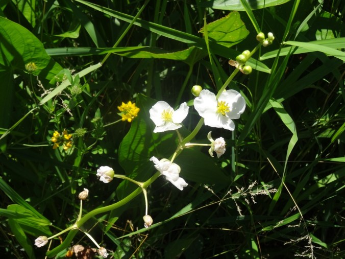
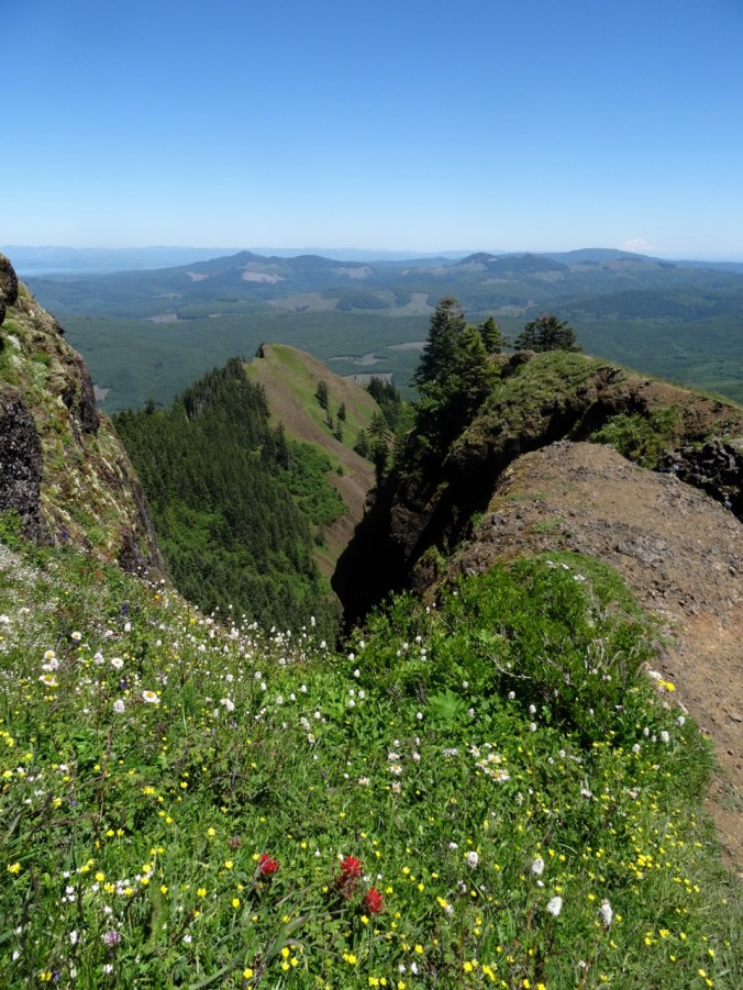
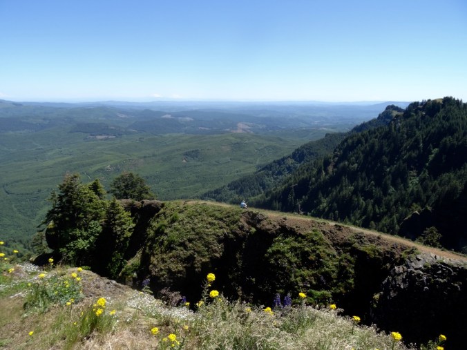
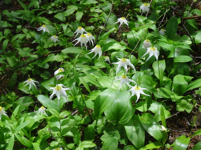
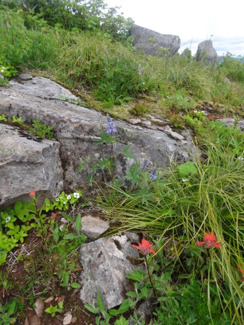
Though the landscape looks barren from a distance there were abundant flowers along the trail, some of them short or dwarf varieties.


I love to look at the shapes and textures of the glaciers:

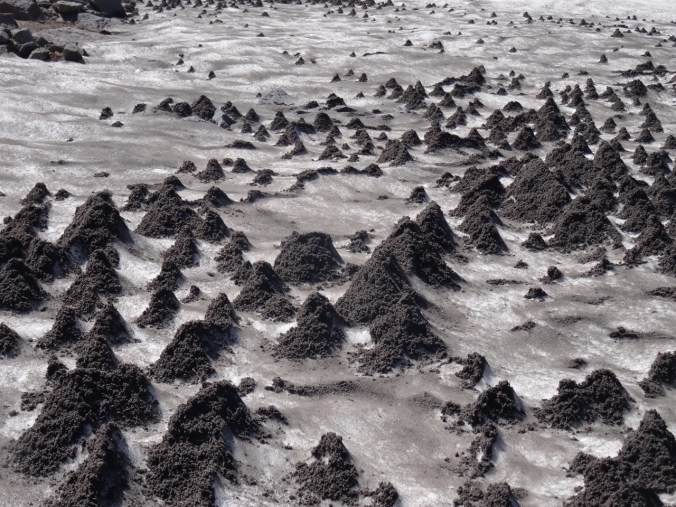
These suncups in a melting snowfield on the trail created an otherworldly landscape.

DSC06754DSC06751


We stopped to look at the stone Cooper Spur shelter, and get a better look at the upper part of the Eliot Glacier.


Our round trip hike for the day was about 6 miles and 1650 feet.

Lookback: We completed this same hike in October of 2015 with friends.  At that time there was an early winter dusting of snow, creating a frosted white landscape.  The clarity and blueness of the sky was remarkable that day, despite the patchy clouds, with Cascade peaks both north and south easily seen.

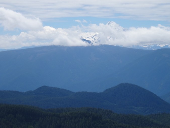
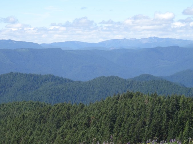
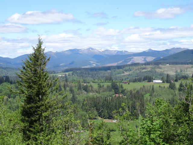
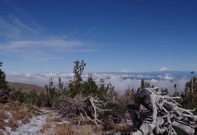
The three Washington peaks to the north from timberline:

DSC06789

July 2017

Version 2

October 2015

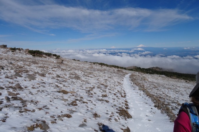
and from above timberline, with the Cloud cap shelter on the left:

Version 2 (1)

July 2017

DSC08293

October 2015

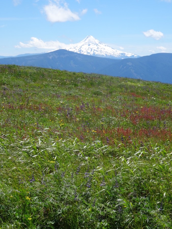
Mt. Hood from the Timberline trail high point lunch spot; Cooper Spur/Tie-In Rock on the right:

DSC06700

July 2017

DSC08338

October 2015

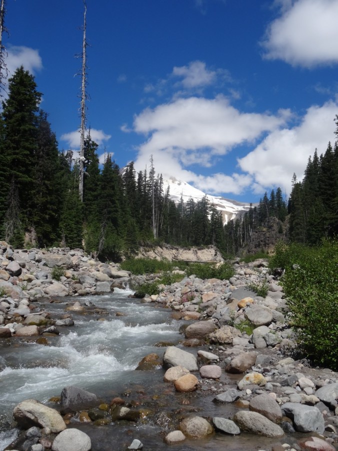
Looking down Tilly Jane Creek from the trail crossing:

DSC06630

July 2017

DSC08280

October 2015

Craft Update:

I made a key basket for my son, and added one and a half knitted tortillas to my collection:

14. Lupine at Elk Meadows, and a bit of Knitting, 7/22/2017

Elk Meadows, Mt. Hood   7/22/17  (#38)

This hike includes a lovely walk through the woods,

DSC06422

Lupine near the trailhead, with the tip of Mt. Hood in the trees.

DSC06418

Trailhead

a slightly harrowing crossing of Newton Creek,

DSC06444

Mt. Hood and Newton Creek

seven switchbacks up to the ridge top through woods and a hanging garden,

and a gentle descent to blooming Elk Meadows with views to the east side of Mt. Hood.

DSC06496

So many flowers in the meadows!

We circumnavigated the perimeter of the meadow through lupine carpeted forest.

DSC06515

Lupine in the woods

DSC06529

Mt. Hood

DSC06538

A million asters!

DSC06547

More lupine and asters

DSC06551

Bugbane and lupine

DSC06553

Another mountain view

We returned back down down the hanging meadow switchbacks, back over the rushing Newton Creek on tippy logs, and a quiet amble back to the trailhead.

It is about 5 miles to the meadow and back, and another 2 miles around the perimeter and exploring the meadow area, for a total of 7 miles/1200 feet.


Lookback: We have hiked Elk Meadows before, with different views each time.  I found photos from August 2013, where yellow flowers were prominent in the meadows, and once again, the top of the mountain was capped with clouds.  We hiked with microspikes to the meadow in March of 2015, an especially low snow year, and had a crystal clear view of the mountain across pristine white meadows.

DSC06839

August 2013

DSC03238

March, 2015

DSC06497

July, 2017

Knitting

Progress on a few knitting projects:

12. Ridgefield Wildlife Refuge

Kiwa Trail   7/4/2017  (#36)

We celebrated 4th of July with a midday stroll along the Kiwa Trail at Ridgefield National Wildlife Refuge, Washington. The  one and a half mile loop trail crosses through treed areas, open fields and wetlands.

Birders love this trail – we were surrounded by much birdsong and glimpsed a few, including redwing blackbird sentinels.  The trail is closed during winter nesting season, and I can easily imagine the fields full of swans and geese. Today was warm and dry with only a few clouds, so not much wildlife viewing.  We appreciated the vistas, the quiet,  the ambient sounds, and the splash of color from the midsummer wildflowers.

Sounds:

  • bullfrog – a deep bass mooing,
  • birds – higher pitched tweets, warbles, pips and chirps,
  • train – periodic horn blast and thrum of wheels on rails,
  • breeze in trees – intermittent light percussive ruffling,
  • country band – occaisional wafts from the Ridgefield 4th of July celebration, less than a mile away as the crow flies,

Critters: tree frog, turtle, butterfly, redwing blackbird, other birds.

I noticed wapato plants with acute triangular leaves and three petaled white flowers growing in one of the wetlands.  The bright green leaves reflect the sunlight in an array of pointed spaceships, ready for takeoff, and also shadowed transparency with interesting intersecting shapes in the bright sunlight.

The wapato blooms are  bright white with three petals.

DSC06265

Other blooming wildflowers/weeds were mostly dry season holdovers – many noted for growing in disturbed areas.  The refuge is a reclaimed pastureland, after all.

Preserving time by catching shadows behind leaves and light on grass, on water, and on a butterfly in a freeze frame photo.

11. Avalanche Lilies and Haunted Trees of Vista Ridge

Vista Ridge Hike   6/30/2017   (#35)

The Vista Ridge trail, trailhead at 4500′, is one of my favorite ways to hike to the summer alpine meadows along the Timberline Trail on the north side of Mt. Hood.  The area suffered a large forest fire in 2011, so much of the lower part of the trail is through a burned forest.  Each year the undergrowth in the burn zone has increased, and there are many huckleberry bushes now filling in the ashy ground, but there is little shade in the scorched forest.  We see glimpses of the stark white peak of Mt. Hood through the screen of burned trees, and each year we notice more fallen trees.  Usually we wait to hike until the snow has melted out up to the Timberline Trail at about 6000′, and we have noticed  abundant lily seed heads lining the trail through the burn zone.  We have also seen the social media posts about the incredible avalanche lily display that follows the snowline up the mountain. We have previously seen swathes of lilies in the upper trail area, but this year we went early enough to see the lower trail in full bloom.  With the heavy snowpack this year, it may be a while before the Timberline trail is snow free.

DSC06074

Dan hiking toward Mt. Hood in the lower lily fields, flowers fading to pink.

There were millions of lilies along the trail and throughout the forest floor. The lilies in the first patches we encountered were fading and turning pink, petals tips curling up. But soon enough we were surrounded by fresh blooming flowers with crisp white points and yellow centers. They were beautiful and amazing and the pictures speak for themselves.  It was lovely to be able to walk through them.  We hiked to about 5300′, where snow obscured the trail and the lily plants in the patches of snow free ground had not yet bloomed.

Meanwhile, we were walking among  the ghosts of a forest past – trees reduced to spiky trunks, sloughed black bark, chalky curled branches and ashen soil.   Trees with haunted sad faces, gaping mouths, and twisted empty eye sockets occasionally loomed above, watching us walk by. The contrast between blue sky and bare trees creates a starkly beautiful if tragic setting.

Two photos from previous year’s hikes show one of the tree faces that I couldn’t find this year, so it must have fallen.  The August 2014 photo shows abundant lily seed heads.  In March of 2015, a low snow year, I saw the same face with a snowy ground.

Returning down the trail, Mt. Adams seems to float  on the skyline, reminding me of Carl Sandburg’s Village of Cream Puffs.

There were only a few other wildflowers blooming on this day, including some seen along the road to the trailhead.  Our hiking mileage for the day was 4.2/800 feet.

10. Saddle Mountain with a bit of quilting and knitting

Saddle Mountain     6/23/2017   (#34)

Saddle Mountain is in the coast range, so has slightly different suite of flowers than what we see in the Gorge or Cascades. We have hiked Saddle Mountain in different seasons, and today we expected a mid-wildflower season bloom.  I found 66 different flowers that I could name, a new maximum for this year.  The trail switchbacks through both forest and open meadow slopes and cliffs, 5 miles round trip and 1600 feet elevation.

DSC05866

Top of Saddle Mountain as seen from the trailhead.

DSC05945

Dan in the cliff meadows on the way up.

DSC06056

Distinctive knob along the trail with views toward the ocean.

DSC06018

Looking north toward Mt. Rainier from near the top.

DSC05989

Our friend having lunch on the lower summit ridge, with Mt. St Helens and Mt. Adams beyond.

DSC06002

View from the top to Astoria and the ocean

DSC06011

View to the north from the summit with three volcanos

Some of the wildflowers that stood out to me:

Quilting progress:

IMG_1197

Sneak peak at my Jane Austen tribute quilt using Smithsonian reproduction fabrics, many years in the making, and now basted and ready for quilting.

Knitting progress:

Crazy eights dishcloth (pattern by Julie Tarsh, Ravelry), made from kitchen cotton.  The second photo is a compressed version of the picture in my quest for better blog photos.


9. Grassy Knoll and #Hearts4PDX

Grassy Knoll   6/17/2017   (#33)

Bear siting on the approach road

This lovely trail is not heavily used, possibly because the trailhead is a very slow 10 miles on a potholed road (6808) that is on a ledge above a steep drop down to Bear Creek.   We saw a bear on the road within the first mile after the end of pavement.  We drove around a bend, and there ahead was a large shaggy deep brown bear who looked back at us then hustled down the road around the next bend, away from us.  By the time we made our way to that spot in the road we could not see any sign of the bear.  There were steep, heavily forested cliffs above and below the road, but I have seen a bear run up a similarly steep mountainside in Yellowstone, so I have no doubt the bear could have gone either way.  This was the first time I have seen a bear in the Pacific Northwest.  I have seen them previously in Yosemite and Yellowstone.

Wildflower Hike

The trail begins by traversing a grassy slope that is full of wildflowers – buckwheat, lupine, paintbrush, penstemon, groundsel, bluehead gillia, and lots of mariposa lilies.

The next mile or so is very steep uphill through the shady woods. Dan compared the trail to the steep part of Dog Mountain. Forest flowers abound, especially windflower and Solomon seals.

The trail breaks out onto an east facing rocky view point with abundant bright pink cliff penstemon and views across Big Lava Flow to Mt. Adams and Little Huckleberry Mountain.

DSC05703DSC05709

Back into the forest and along the ridge top, there are views to Mt. Hood to the south, and more varied wildflowers in the dappled light.

The trail passes a mossy outcrop with lots of white onion flower, penstemon and phlox.  Last year this area was covered with Mariposa lilies and other kinds of onions.

Eventually, there is a view ahead to Grassy Knoll.

The trail switchbacks through a glorious meadow with abundant flowers, and increasing views of Mt. Hood to the south, and Mt. Adams to the east. At the top are the remains of a fire lookout.

DSC05759

Mt. Hood, Dog and Wind Mts. in the foreground

DSC05778

Mt. Hood and the lookout footings

DSC05767

Mt. Hood behind Mt. Defiance

DSC05796

To the west – Three Corner Rock is the point on the left, and Silverstar Mountain the double peak on the right of the skyline

DSC05782

Mt. Adams and Little Huckleberry Mountain

We continued up the trail for about a mile, through more forest and two more wildflower meadows.  We saw more flowers we hadn’t seen yet.

The uppermost meadow was covered in yellow glacier lilies and small pink western spring beauty.  Looking back from the high meadow we had another view of Mt. Hood before heading down the trail for the day.

We first hiked this trail last year about the same time in June, but on a rainy and overcast day, so we were glad to see the views this time.  Another difference is that last year was a low snow year so wildflowers were all much earlier, and the suite that we saw included later season bloomers, such as Clarkia and a lot more blooms from the onion family. Other than the Clarkia, we saw almost all the same flowers, plus a few early season extras in the upper meadows above Grassy Knoll, which we did not hike to last year.  Our total for this hike was 63 different wildflowers that I could identify, the highest total for this year.  We hope to go to both Saddle and Silverstar Mountains next week, where we may see even more different flowers.  This hike was about 6 miles and  1500 feet elevation.

DSC05837

Mt Hood from Grassy Knoll

IMG_1191

Flower list

Screen Shot 2017-06-17 at 8.42.50 PM

GPS track

Yarn Projects Finished

I retaught myself how to crochet, and made 6 #Hearts4PDX for the yarnbombing event planned for June 26th, in honor of the Hollywood Transit Center attack victims. I appreciated the opportunity to do something positive in response to this event.

DSC05653

#Hearts4PDX

I finished knitting a pair of socks from the pattern Ludwig by Stephanie van der Linden.  These have been my “on the go” knitting for a few months.

8. Three Corner Rock and Elgol Update

Three Corner Rock   6/11/2017   (#32)


DSC05591

Three Corner Rock is one of the high points and former fire lookout locations in southern Washington along the Columbia River corridor.  It is a relatively easy and well graded hike of about 4.5 miles round trip and 800 feet elevation to a high point of 3550 feet.  We started from the intersection of the Pacific Crest Trail and GG 2090 road, which is about a 10 mile drive along a well graded gravel road north from Skamania, Washington.

The trail leads through shady forest and early season flowers – Alaskan Bunchberry, the distinctive four-petaled white flowers of the Dogwood family, were especially abundant along the entire trail.  Also common were vanilla leaf, anemones, and fading trilliums.

After a few switchbacks we entered into avalanche lily territory, many dripping with water that made them looked like they were melting.

DSC05624DSC05560DSC05563DSC05566

There is one rocky lookout to the east along the trail. Full landscape views don’t really appear until saddle/summit meadow.  Three Corner Rock is to the north of the saddle, and a cell tower is to the south.  We were pleased to see our first blooming bear grass of the year in the summit meadow, as well as plenty of the dogwood, paintbrush, lupine and a few Queen’s Cup lilies.

DSC05605

View to west – Silverstar Mountain is the double peak on the skyline.

DSC05613

Dan, Three Corner Rock, blooming meadows

DSC05602

View to the east – Mt. Adams shoulders

DSC05598

Lupine, paintbrush and dogwood

We ate lunch near the top of Three Corner Rock – the path to the old lookout platform on the very top is a rock scramble that we did not feel the need to make.  To the east we could see the base of Mt Adams and part of the ridge line of the Goat Rocks/Dark Divide area.  We could see a bit of the Columbia River to the southeast, and SilverStar Mountain and the logged patchwork of the southern Gifford Pinchot National Forest to the west.  We will have to return on a cloudless day day to see the full cascade views.

On our drive back we stopped to see Steep Creek Falls.

DSC05638

Steep Creek Falls

Elgol Cross Stitch Update

In September of 2016 we spent 5 days on the Isle of Skye in Scotland. Dan had a photo workshop one day which included spending the evening on the beach at Elgol, looking across the sea to the Black Cuillin Mountains.  This was a remarkably beautiful location, with interesting rock formations and amazing light as the sun set behind the mountains.

I purchased an Elgol cross stitch kit designed by Isle of Skye Crafts from the shop in Portree.  It is a bit daunting in size and pattern – I think there are more than 20 different pink/purple thread colors.  I leave it out on a table where I can add a few stitches whenever I have a few minutes.  I have enjoyed watching the landscape appear from the cloth. I have been taking a picture about once a month.

DSC07923

This slideshow requires JavaScript.

7. Hamilton Mountain and Hollywood Transit Center Memorial

Annual Wildflower hike up Hamilton Mountain   June 2, 2017   (#31)

We started our annual hike up Hamilton Mountain, looking forward to the wildflowers,  waterfalls and views.  There were clouds in the gorge, but the weather report predicted a sunny afternoon.

DSC05366

Hamilton Mountain from the power line cut on the lower trail. The lower cliff lookout is on the far left cliff.

After about a mile, Pool of the Winds and Rodney Falls are near the bridge that crosses Hardy Creek.

DSC05377

Pool of the Winds

DSC05382

Rodney Falls

This was our first time trying the side trail to what surely must be called Little Hamilton Mountain – a grassy open summit above the lower cliffs.  This lower summit has better views of the Columbia River than the actual top, which is covered by trees and bushes.  Also, it is a lovely meadow full of phlox, death camas, paintbrush and other flowers, and would by itself be a perfectly satisfactory destination if you didn’t mind the upper cliffs of the mountain looming over you, calling you up.

DSC05438

Dan in the cliff top meadow

DSC05440

View east to Bonneville Dam

DSC05473

View west to Beacon Rock and Larch Mountain

DSC05441

Upper cliffs looming

The upper cliff switchbacks once again had plenty of Columbia lewisia, one of my favorite flowers, and cousin to the bitterroot.

DSC05456

Columbia lewisia (pink) and Oregon sunshine (yellow) on the upper cliffs

We stopped briefly on the summit to see Table Mountain, Mt Adams in clouds and Mt Hood, but the black flies were biting.

DSC05483

Table Mountain, Mt. Adams

DSC05484

Mt. Hood

Lewisia also grows on the saddle beyond the summit, where we spent a bit of time after lunch.  We continued on through the beautiful and quiet forest on Don’s Cutoff Trail, where bright white Columbia wind flowers popped out of the shadows.

DSC05500

Columbia lewisia along the saddle; Mt. Hood in the distance

DSC05503

Hamilton Mountain and Dan

We had lovely views and lots of flowers – the most ever for a hike this year. The hike is about 8.5 miles and 2000 feet elevation.


Hollywood Transit Center Memorial    Sunday, June 4th

We payed a visit to the Hollywood transit center in our neighborhood of NE Portland to pay our respects to Rick Best and Taliesin Myrddin Namkai-Meche who died, Micah Fletcher, who was wounded but is recovering, and the two young women who were harassed.  I brought five roses cut from our garden.  We spent some time reading the chalked words of tolerance, persistence, resistance, and love. Dan took this photo, which shows in pink chalk the last words of  Taliesin.

unnamed

Hollywood Transit Center memorial, photo by Dan.


SaveSave

6. Yachats Weekend

Mary’s Peak and Yachats 804 Trail  Friday, May 26   (#28)

We started our weekend by driving to Mary’s Peak in the central Coast Range just west of Corvallis.  The meadows near the trail head were full of yellow Pioneer violets.  There were glacier lilies and radio towers at the top, along with a view of the Oregon Cascades from north to south: Mt. Hood, Mt. Jefferson, Three Fingered Jack, Mt. Washington, the Three Sisters, Mt. Bachelor, and Mt. Thielson.

DSC04673

Dan at the top of Mary’s Peak, with the Cascade Mountains from Mt. Hood to Mt. Bachelor on the skyline.

IMG_1141

Flower list


After our short hike we continued on Highway 34 west through the Alsea River valley, twisting and winding through riparian landscape to the sea at Waldport, then south along Highway 101 to Yachats.  The Overleaf Hotel overlooks a black lava armored swash zone that was spouting waves at high tide.  We were also looking out on the 804 trail that outlines the edge of land there.  We walked along the trail after dinner, admiring the early summer wild flowers and exploring some of the coves and natural jetties as the tide ebbed.  We watched a red shrouded sun sink into the sea.

DSC04682

Spouting waves near our hotel

DSC04687

Another beach view

DSC04786

Sunset

Meanwhile, back in Portland, the terrorism had come to our neighborhood. Three honorable men defended two girls from an intolerant ranter on the Max train and were stabbed in the neck at close range, killing two of the men. We followed this horrific story from afar all weekend.

Cape Perpetua             Saturday, May 27         (#29)

We started at the Cape Perpetua Visitor Center, and hiked down to the tide pools at low tide, and then to the Cook’s Chasm area, but decided to return at high tide to see the wave action.

We then hiked up the St. Perpetua trail to the CCC stone shelter on the cliff. The trail passes through forest and hanging wildflower meadows.  The views were somewhat obscured by fog.

In the afternoon we returned to Cook’s Chasm at high tide, and saw the Spouting Horn, and Thor’s Well, and a lot more people.

Back in our room, we saw large sea creatures in the waves, and took photos with our zoom lenses.  At first we assumed it was a whale, or four.  But when I googled whales I could not find the fringed fins I was seeing.  After a little more searching, I realized we were seeing sea lions, whose tail fins look like fingers.  But we did see four of them from our window surfing the waves.

DSC04983

Sea lion or two

Later, we went for a delicious dinner at the Drift Inn in Yachats, and then a walked south from our room on the 804 trail.

DSC04986DSC04990

DSC05026

Sea thrift on the rocks

Heceta Head and Lighthouse, Hobbit Beach                 Sunday, May 28 (#30)

Washburne Beach was foggy as we started our hike.  We walked about a mile along the beach at low tide, few others about, and passed a bald eagle sitting in a snag above the beach.

The southern part of the beach is called Hobbit Beach, presumably because the sandstone bluffs are eroded into hobbit holes by water seeps dripping down.

This slideshow requires JavaScript.

The fog was lifting as we headed up from the beach through the rhododendron and Sitka spruce forest on Heceta Head.

DSC05138

Into the misty forest

DSC05141

rhododendron

DSC05142

Rhododendron forest

DSC05152

View back to Hobbit Beach

By the time we switchbacked down to the Heceta Head Lighthouse on the south side, we could see the lovely blue water and birds on the rocks.  We ate our lunch near the light house and took a brief tour through the lower part of the old building.

Then we retraced our trail back to Hobbit Beach, which by now had plenty of people and a higher tide.

On our way back to Yachats, we drove up to the CCC shelter that we hiked to yesterday.  Today, the skies were clearer and we could see the views we missed.  We also stopped for a look at the Devil’s Churn area, another place where the waves create large splashes as they are constricted in rock crevices.  In the evening, we sat in the spa pools at our hotel that overlook the beach.

DSC05219

Less foggy view from the Cape Perpetua shelter

DSC05234

Zoomed in, now I can see the Spouting Horn and Thor’s Well

DSC05237

Devil’s Churn


Yachats 804 Trail and home,      Monday, May 29

We took another low tide walk through the rocky headlands near our hotel.  There were sea stars clinging to the rocks at the lowest levels, giving us hope that the species will recover from the disintegration disease that wiped many of them out during the past few years.  Dan also saw a breaching whale while I poked around in the tide pools. Soon enough it was time to pack up and head home after a lovely weekend by the sea.

DSC05246

Spouting slot at high tide

DSC05270

Slot at low tide

A few more low tide beach views:

Flowers near the beach:


5. Cape Horn; Lewisia and Clarkia at Tracy Hill

Cape Horn    May 19, 2017    (#26)

We heard the larkspur might be blooming at Cape Horn, a hike near Washougal, Washington.  The trail is a loop, but this time of year the lower section is closed for peregrine falcon nesting.  We started in the middle, and hiked down to the waterfall overlook, then back up to Pioneer Point.  We did see some falcons flying below us.  The larkspur were blooming in the lower area near Hwy 14, but not in the upper trail near the Nancy Russell overlook yet – should be another week or so up there.  A beautiful day, and not too busy on the trail. (6.0/1200′)

DSC04456

Eastward view from the Nancy Russell overlook

DSC04487

Silverstar Mountain, with snow, looking north from near Pioneer Point

Tracy Hill  May 21, 2017  (#27)

Two years ago in February we hiked up Tracy Hill above Catherine Creek, and I noticed lots of Lewisia (bitterroot) foliage on the rocky patches as we made our way up the hill.  Knowing that the bitterroot is in full bloom now, I wanted to go back and see the handsome pink flowers along the trail.  The suite of wildflowers that bloom in the later, drier season were out, the green grasses and early blooms have faded and gone to seed, so the hills are less spring green, and more a blend of olive greens, browns, and pinks, in a lovely color wash.  The bitterroot were blooming, as expected, but more toward the end of the cycle, compared to two weeks ago, and we also saw a few pink slender Clarkia along the way.  Yellow monkey flower and purple lupine added pops of color to the landscape, and there were purple penstemon blooming along the cliff edge north of the arch.  It was hot (90 degrees) when we finished the hike.  This may be our last eastern gorge hike until fall. (6.0/1300′)

DSC04540

Bitterroot still in bloom


DSC04547

Looking south to Mt. Hood and the parking area