January 30, 2020 –
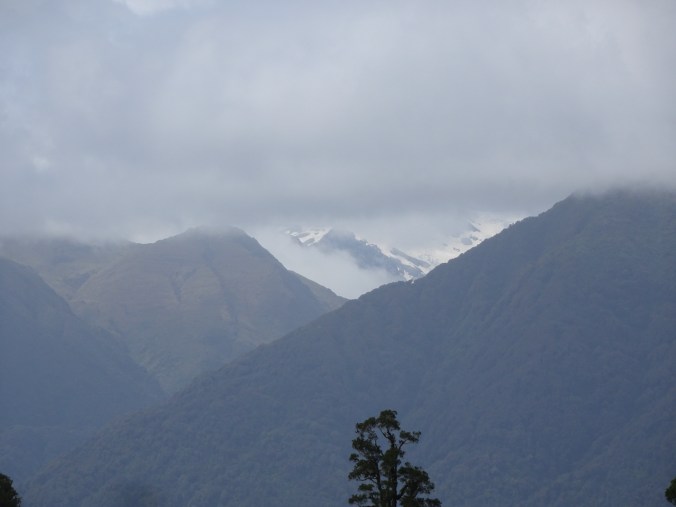
After our rainy drive yesterday, we were delighted to see the mountains above Franz Josef this morning.

Blue sky and snow capped peaks, Franz Josef, New Zealand.
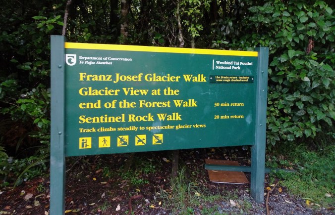
Franz Josef Glacier hike
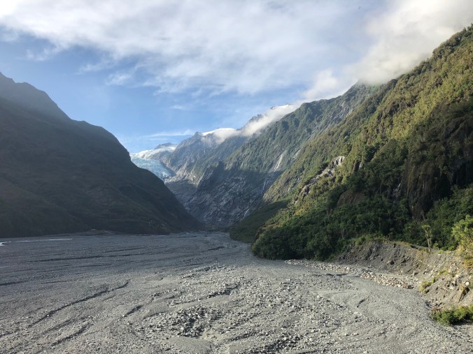
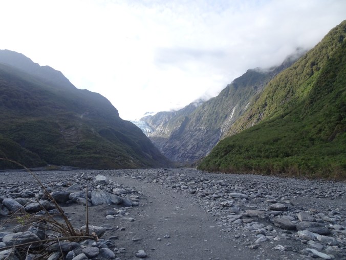
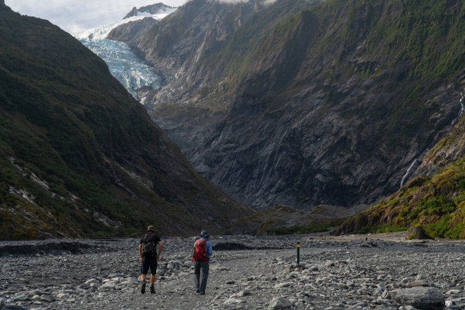
We had an early start for our walk to the Franz Josef Glacier viewpoint. I remember thinking, as we walked up the Waiho Valley, that this was our best hike so far!
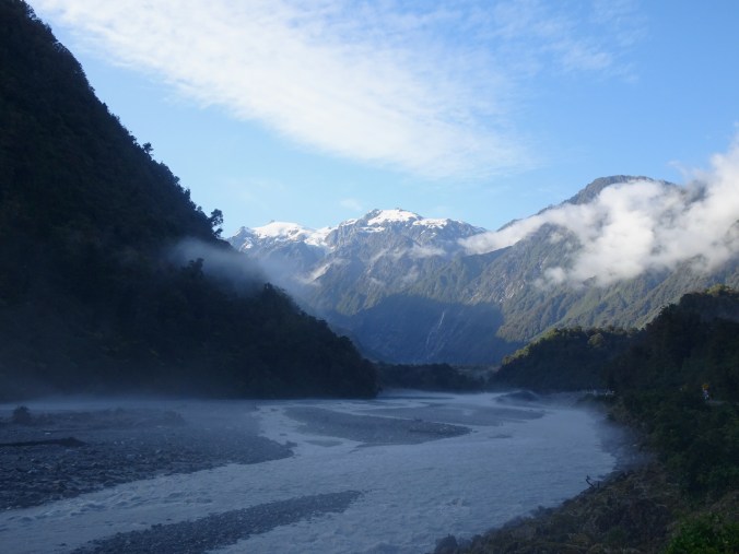
Waiho River Valley
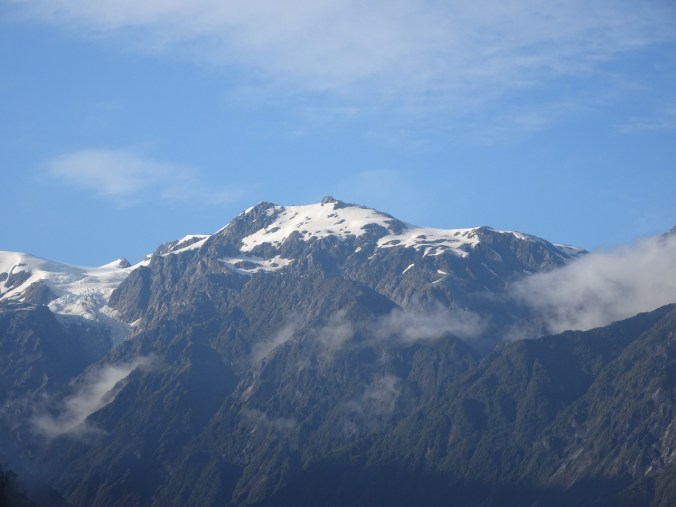
The glacier is filling the valley on the left.
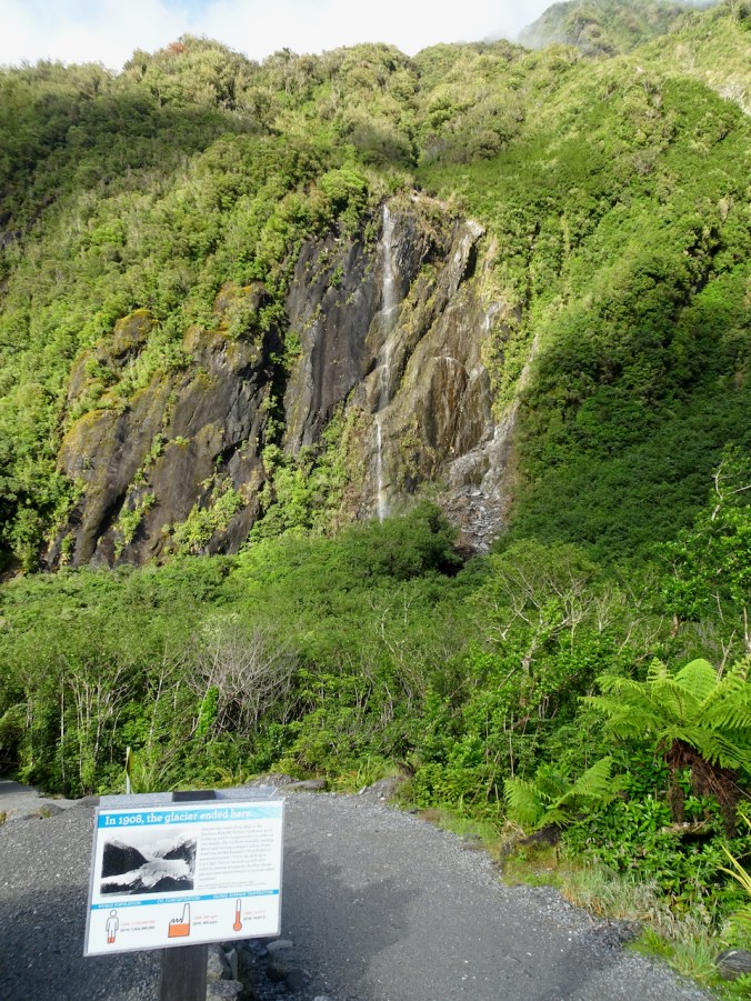
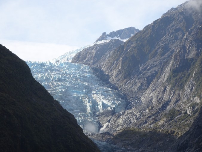
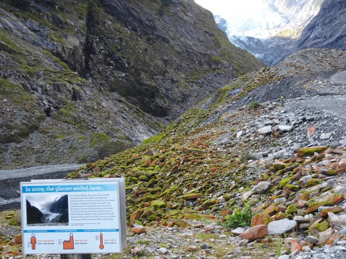
The trail emerges from the forest at an overlook that marks the advanced position of the glacier in 1908.
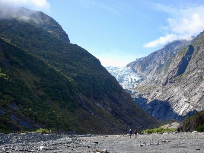
We still have a bit of a walk to get closer to the glacier.

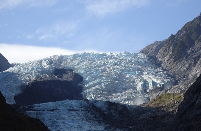
Zooming in on the glacier from the 1908 overlook.
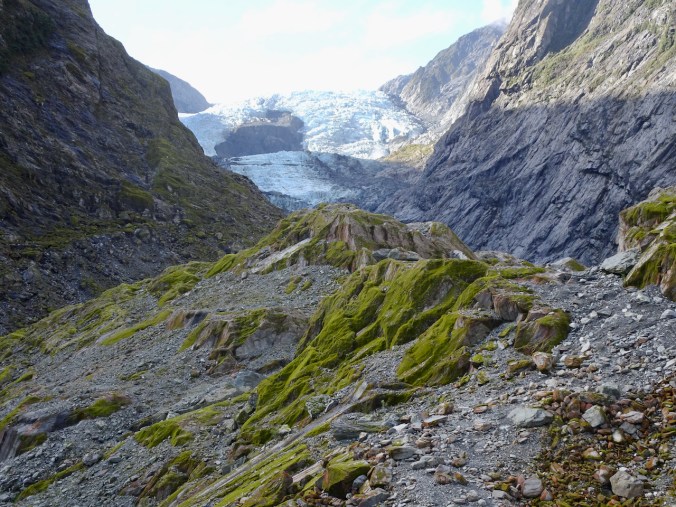
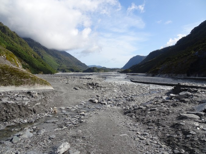
We continued walking up the glaciated Franz Valley on sediment eroded from the mountains above.

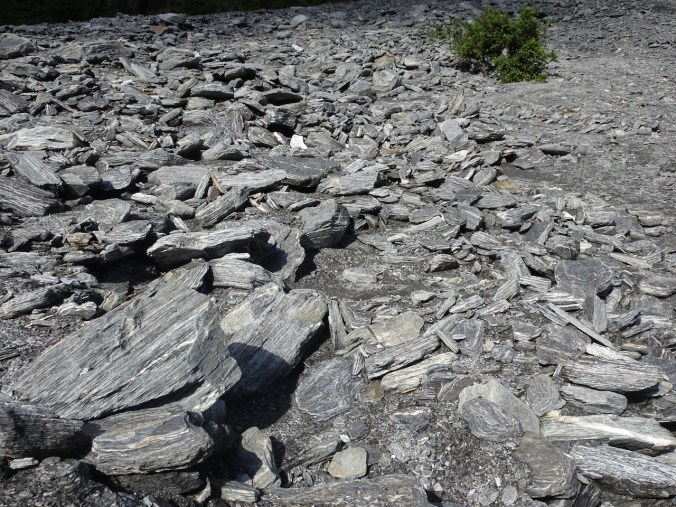
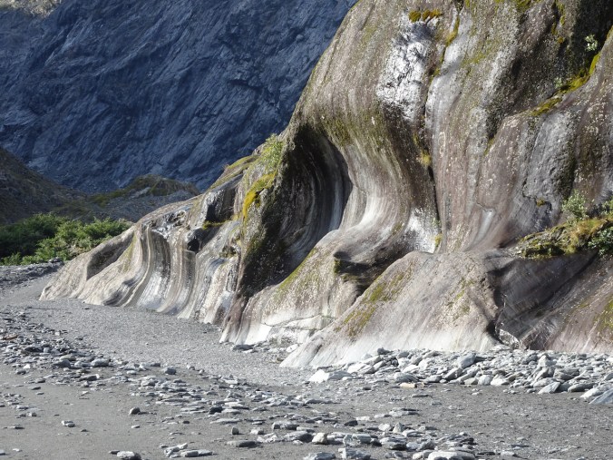
Haast Schists – beautiful metamorphic rocks!
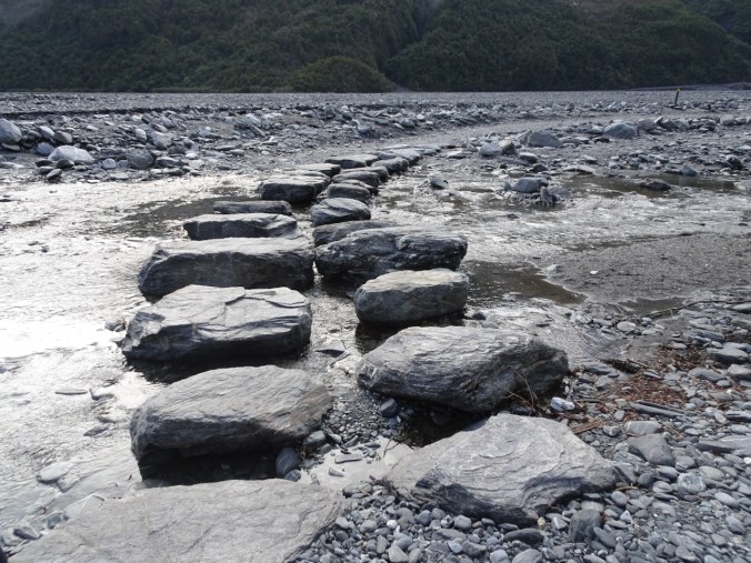
We reached the river crossing, and continued walking up the valley.
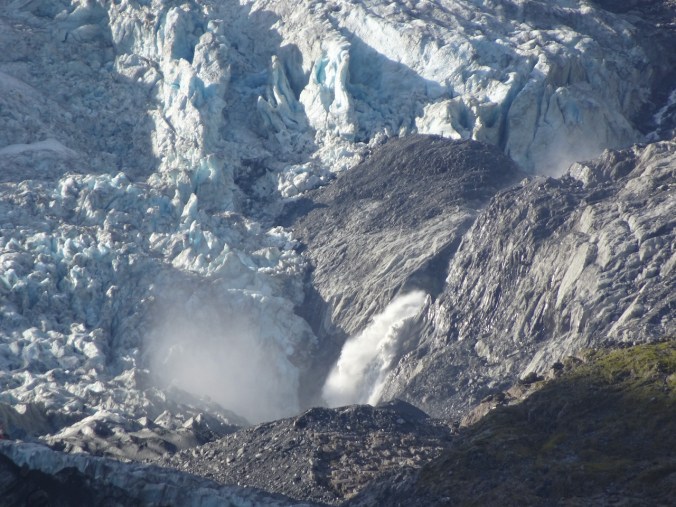
A huge waterfall is gushing out of rocks below the glacier on the right – we can see the mist cloud from here.

Jagged glacier surface
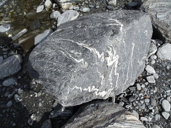
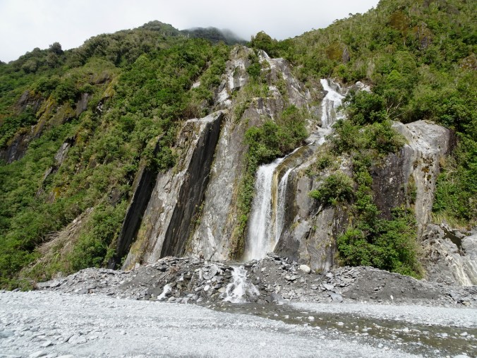
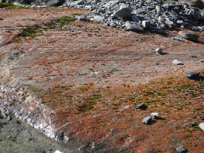
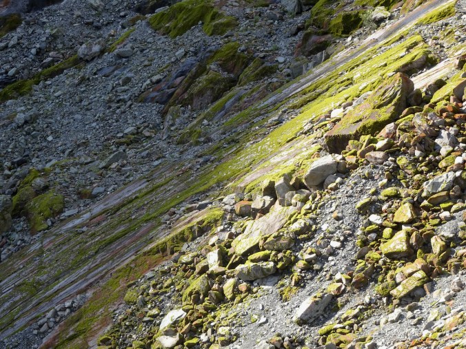
We passed waterfalls and beautiful, glacially polished schists in the valley walls.

The last viewpoint is ahead, on the low hummocks.
We reached the end of the trail, the closest viewpoint, due to safety concerns.
From here we can see the waterfall mist cloud, but not the waterfall. Helicopter tours were landing in front of the dark rocky area on the left side – they looked like ants from here.
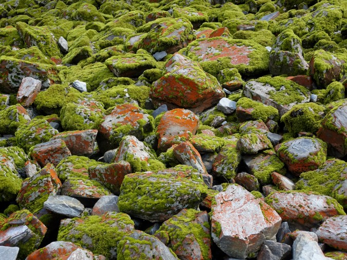
The bare scraped rocks and talus piles were covered in colorful lichens and mosses.
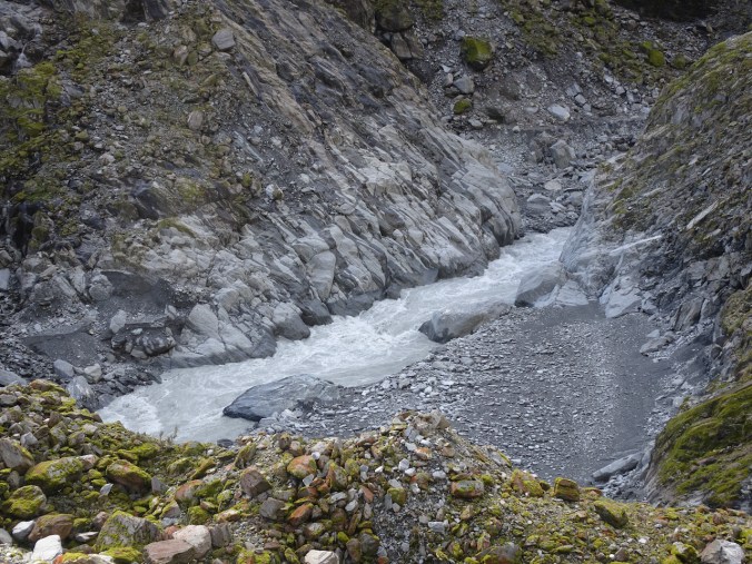
Turbulent water full of glacial dust in the outflow stream.
View down the Waiho Valley from the upper endpoint of the trail.
Last look back at the Franz Josef Glacier from the valley trail.
We continued walking on the local trail network to a couple of other viewpoints, first to Sentinal Rock.

Franz Josef Glacier from Sentinal Rock.

Winding Waiho River.
We continued on a short distance to Peter’s Pool.
Reflections in Peter’s Pool
By the time we were leaving the area, the clouds had moved in again among the peaks. I’m glad we got an early start to our day! (Hike#6, 5 miles, 400 feet)
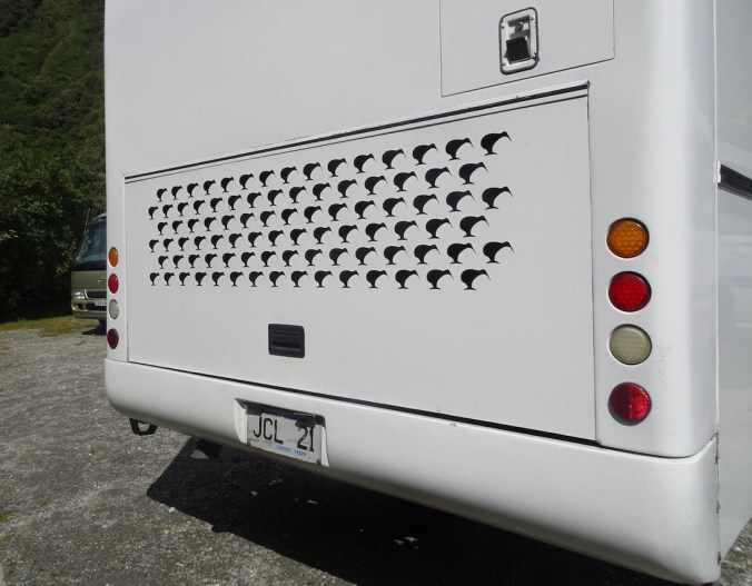
Car park view: I love that this tour bus has kiwi-shaped grill openings.
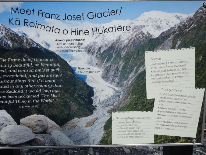
Alpine Fault geology interlude. I loved learning about New Zealand geology on this trip. I didn’t research much before our travels. As the landscape unfurled before me, I enjoyed looking, learning and speculating. Now I am investigating in more detail as I process my photos and thoughts. I learned in Franz Josef that the giant, active Alpine Fault runs right through the center of town. The Alpine Fault is a major transcurrent fault and tectonic plate boundary between the Pacific and Australian plates. The Southern Alps are constantly rising along the fault zone that connects subduction zones to the north and south. The metamorphic rocks I saw along the Waiho River were deformed along the plate boundary.
On with our tour:
After our hike we continued south on Hwy 6, with much beautiful scenery ahead for the day. Our guide spotted and pointed out many recent land slips in the mountains, and we had several road repair delays. There had already been flooding this year, with more to come! But we didn’t know that yet.
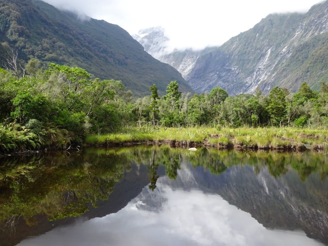
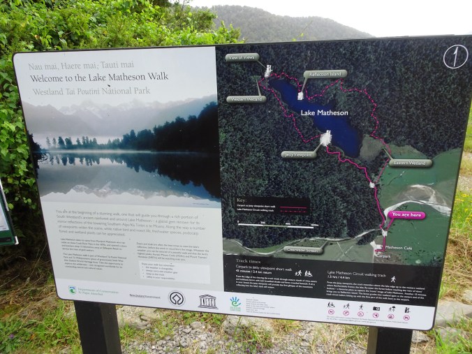
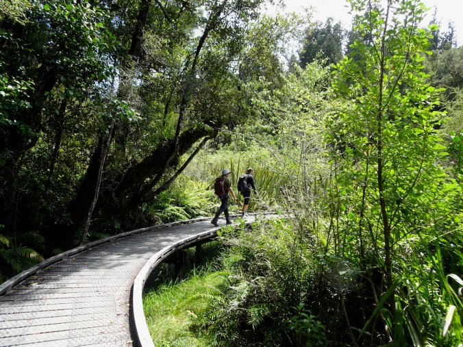
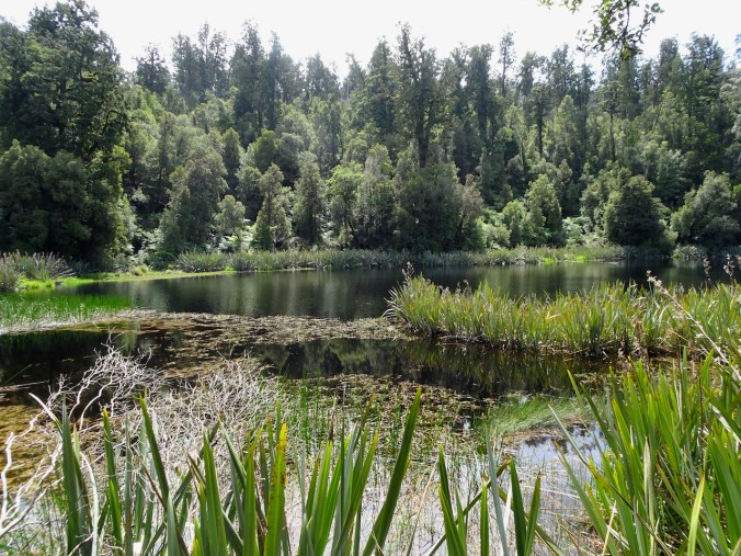
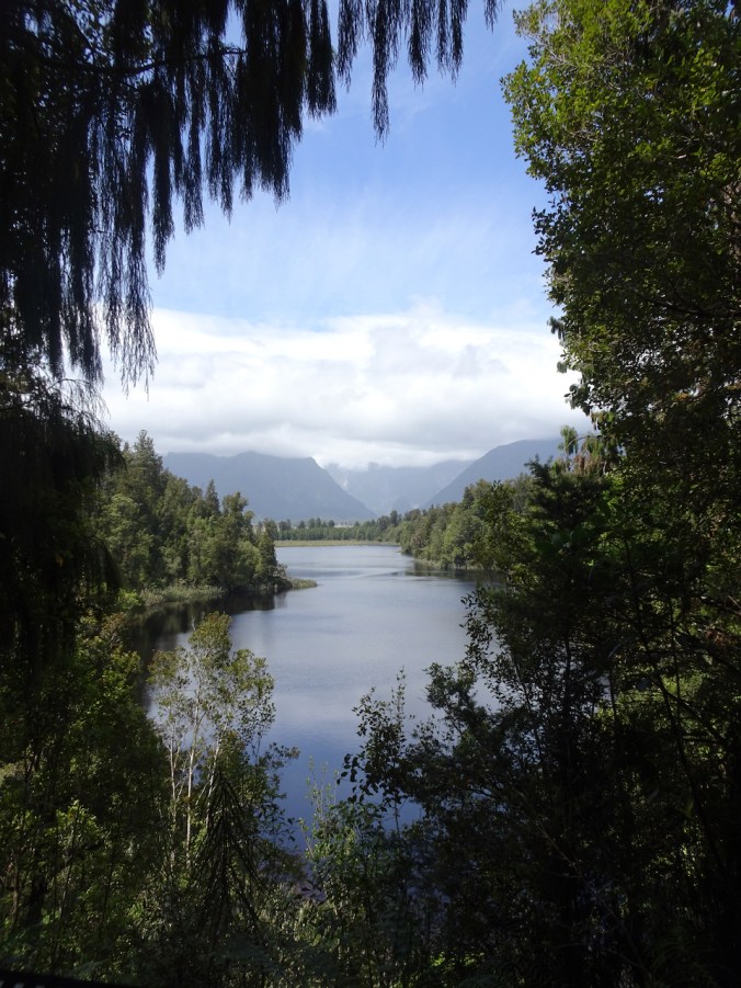
Lake Matheson
We stopped for a walk around Lake Matheson.
Hike #7, 3 miles, 200 feet.

New Zealand pigeon (kereru) posing near the trailhead.
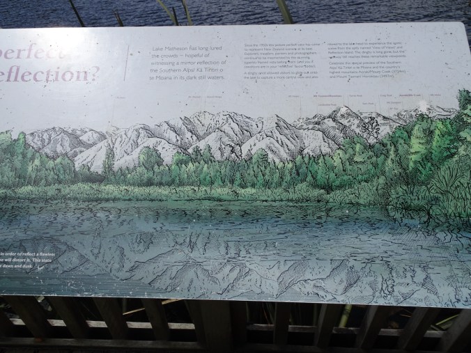
At this viewpoint, the Southern Alps may be seen reflected in the lake.
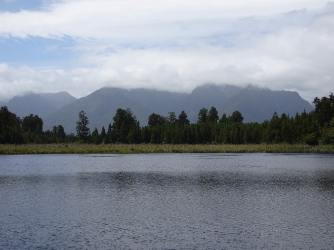
We were not so lucky today – the clouds had moved in.
It was a lovely hike, with beautiful lunchtime views of the lake, and interesting foliage to admire.

Kidney ferns
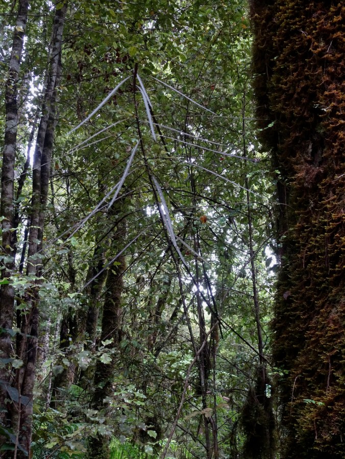
Lancewood


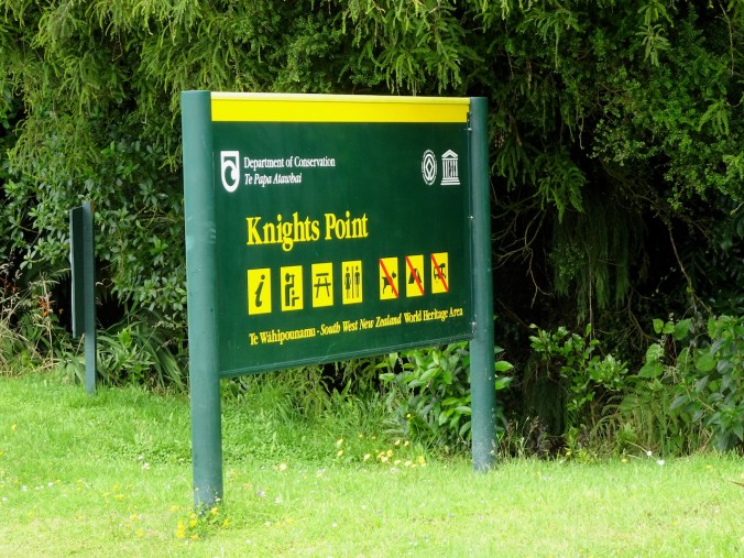
Knights Point
Farther south on Hwy 6, we stopped at this clifftop viewpoint over the Tasman Sea.
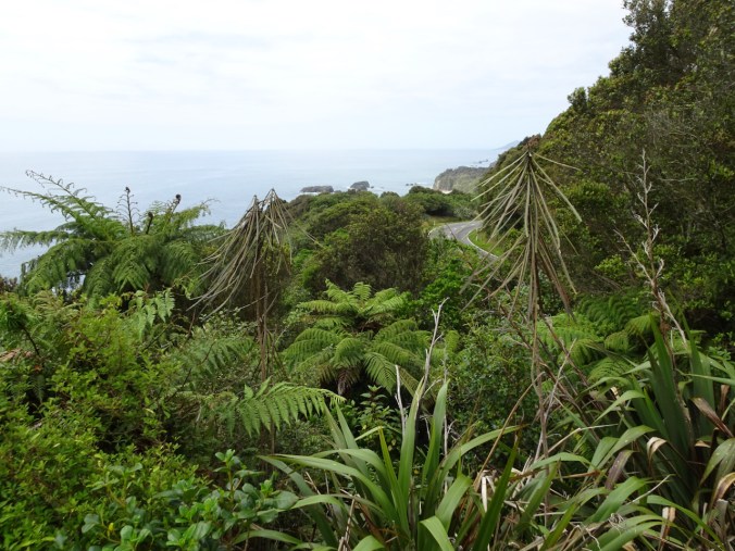
Treeferns, lancewood and flax covered the coastal cliffs to the north.

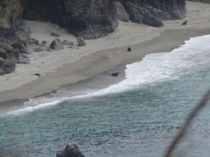
To the south we could see to a headland. When I zoomed in, I could see that some of the ‘rocks’ were actually Elephant seals.
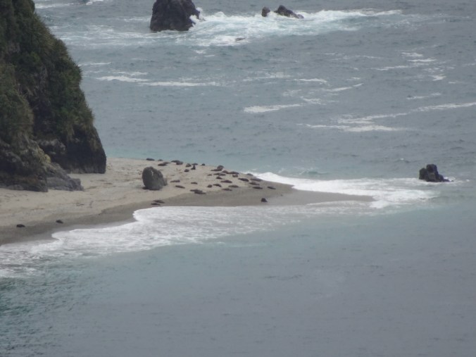
Elephant seals
Ship Creek
The highway descended back to sea level. Our stop at Ship Creek was our last chance to walk on a West Coast beach before we turned east to cross the mountains at Haast Pass. We climbed up the Observation Tower for a wide view, then spent a little time on the beach.

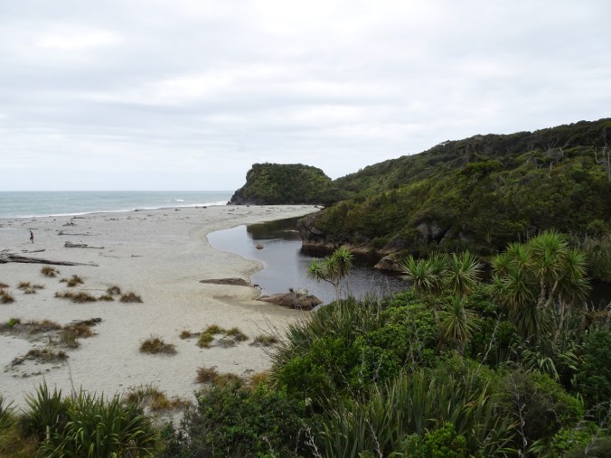
View of the beach from the Observation Tower.
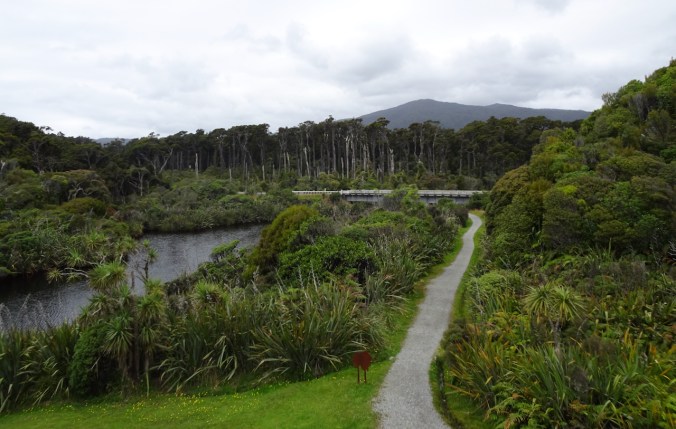
View inland from the tower.

Sand dunes
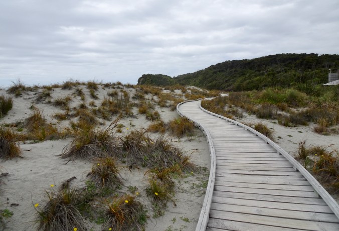
Beach boardwalk, going north.
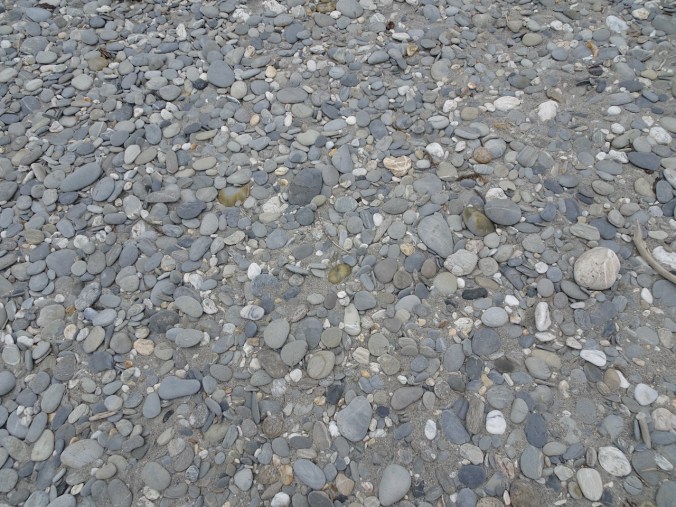
Pebbly shingled beach – great skipping stones!
Onward! Our views were diminished by clouds as we headed east into the mountains.

Driving view as we cross over the Haast River on the longest one lane bridge in New Zealand .

In Haast Pass, where rivers change direction.
We made a brief stop in Mt Aspiring National Park to see Thunder Creek Falls.

Thunder Creek Falls
Our overnight destination was a lodge at Makarora.

Evening sky above Makarora.
We would be headed to Lake Wanaka tomorrow.
Note: The most difficult thing about these posts is paring down the photos. I love to remember every view!

Pingback: NZ2020: Day 7, Lake Wanaka | Margaret Quilts