October 12, 2021 Eagle Creek Trail to Twister Falls
We had been planning to hike all the way to Tunnel and Twister Falls in the autumn of 2017, after the summer crowds cleared out. Alas, the Eagle Creek Fire started on Labor Day weekend that year, scorching 48000 acres of the Columbia River Gorge on the Oregon side of the river. After years of trail maintenance, the Eagle Creek Trail has reopened intermittently this year, occasionally reclosed by landslides. I was wary of hiking this trail, and many of the reopened Gorge trails, for just this reason. Burned trees will fall. Burned, denuded slopes, will slide. And yet… we have been waiting to hike this trail for years.

Map showing extent of 2017 Eagle Creek Fire. Our trail up Eagle Creek to Twister Falls shown in blue.
The trail extends for 13 miles up Eagle Creek, from the Columbia River, to its outlet on Wahtum Lake (elev. 3700′). We have hiked above this trail, from Wahtum Lake to Chinidere Mountain, many times. And we have hiked the lower trail, past various of the waterfalls, many times before the fire, but never all the way to Twister Falls, which is 6.5 miles from the trailhead.
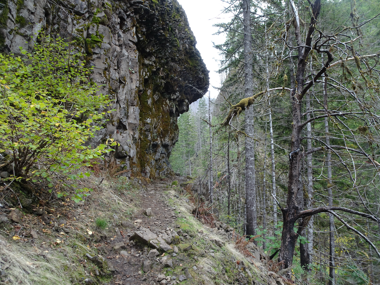
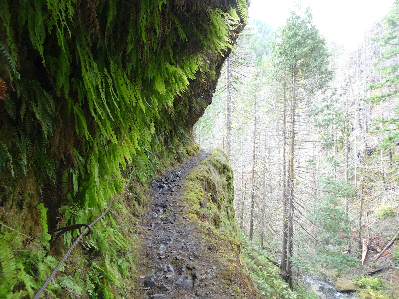
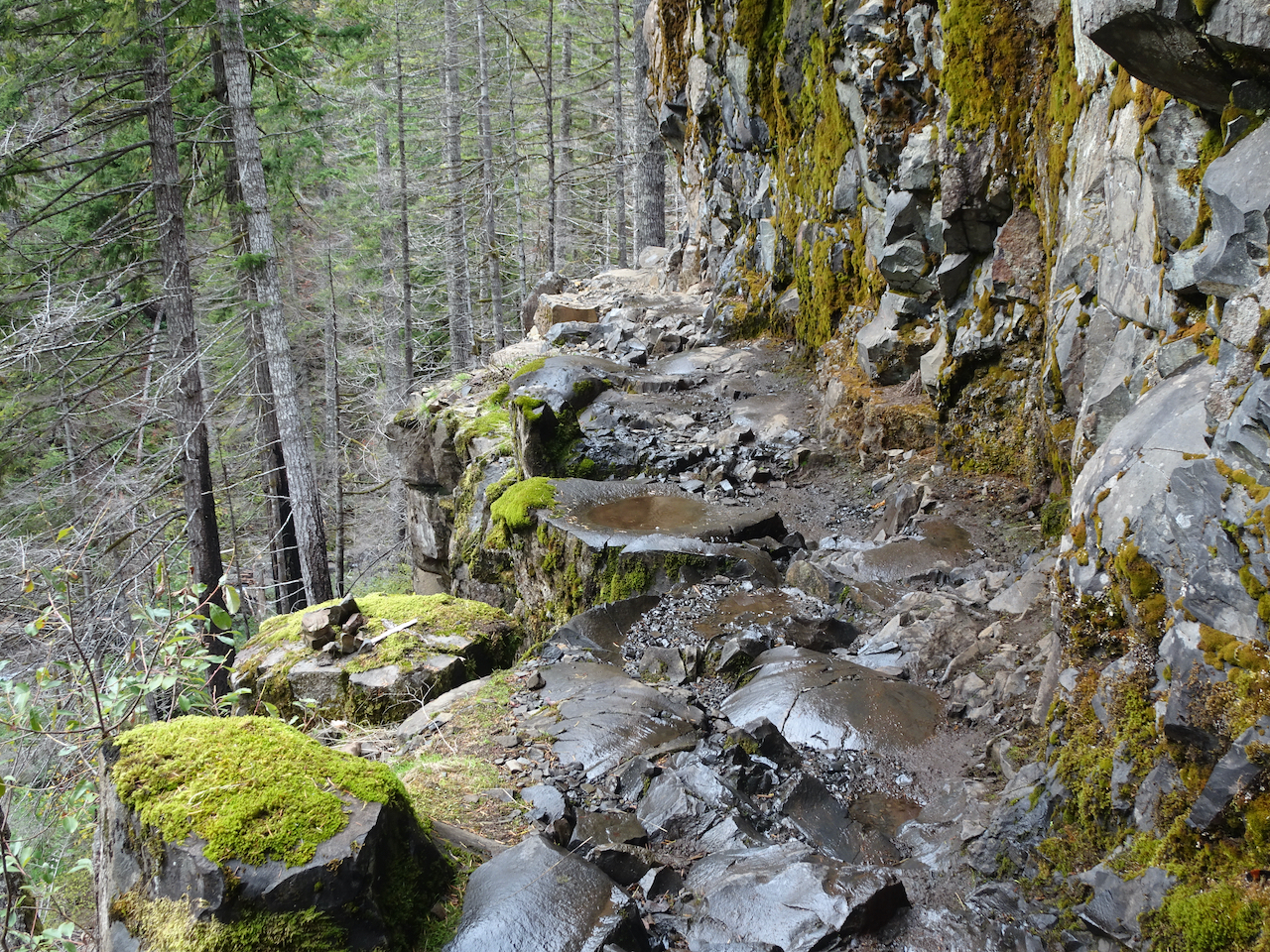
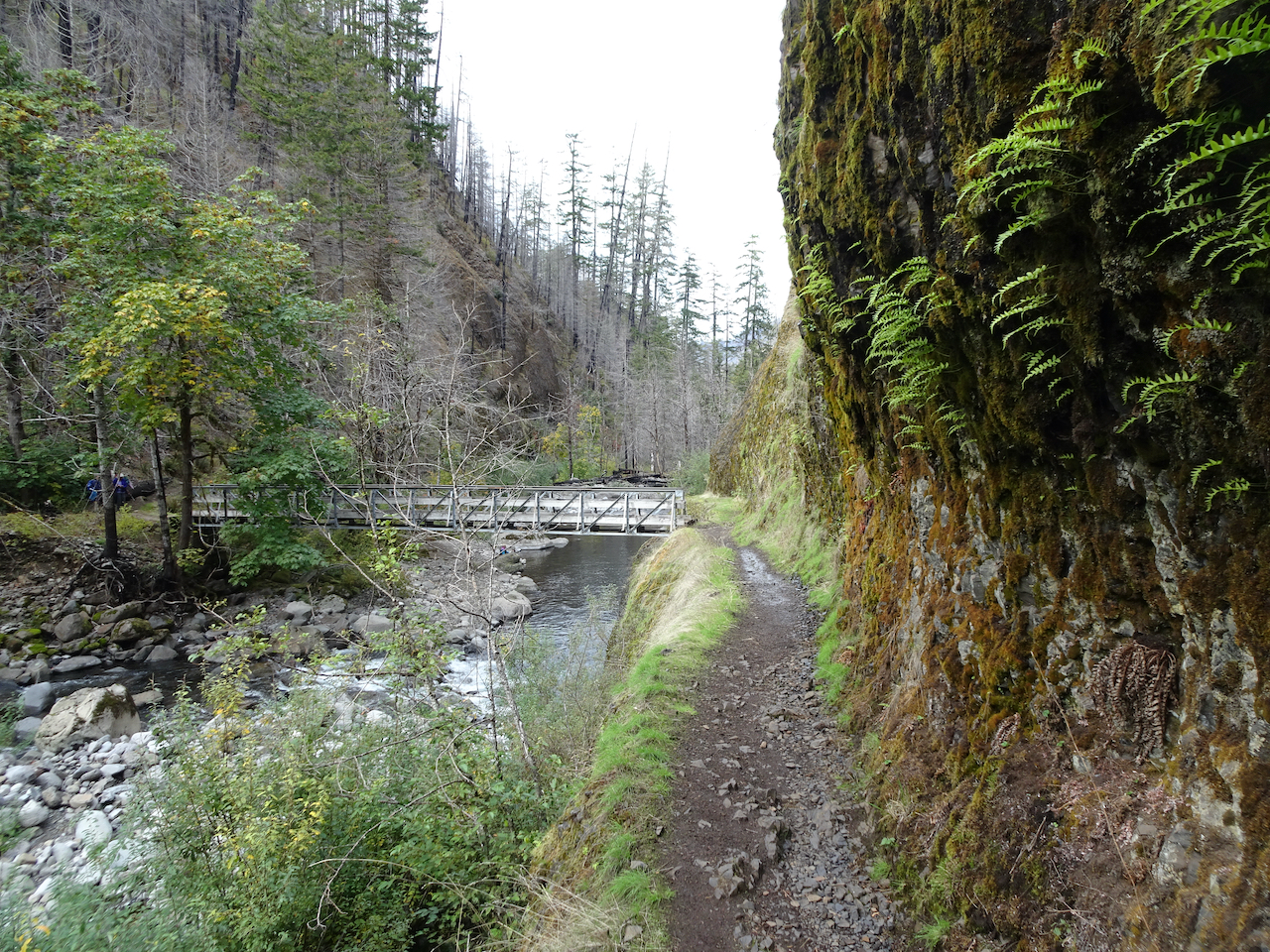
A notable feature of this trail is that several sections are carved out of the vertical basalt rock walls that line Eagle Creek. Trail ledges were blasted out of the cliffs in the early 1900’s, around the time the old Columbia River Highway was built. People with fear of heights do not like this trail.
We chose a clear fall day, no recent rain, and not windy. Onward!
The trail begins near the banks of Eagle Creek, but mostly stays well above the creek on the east bank.
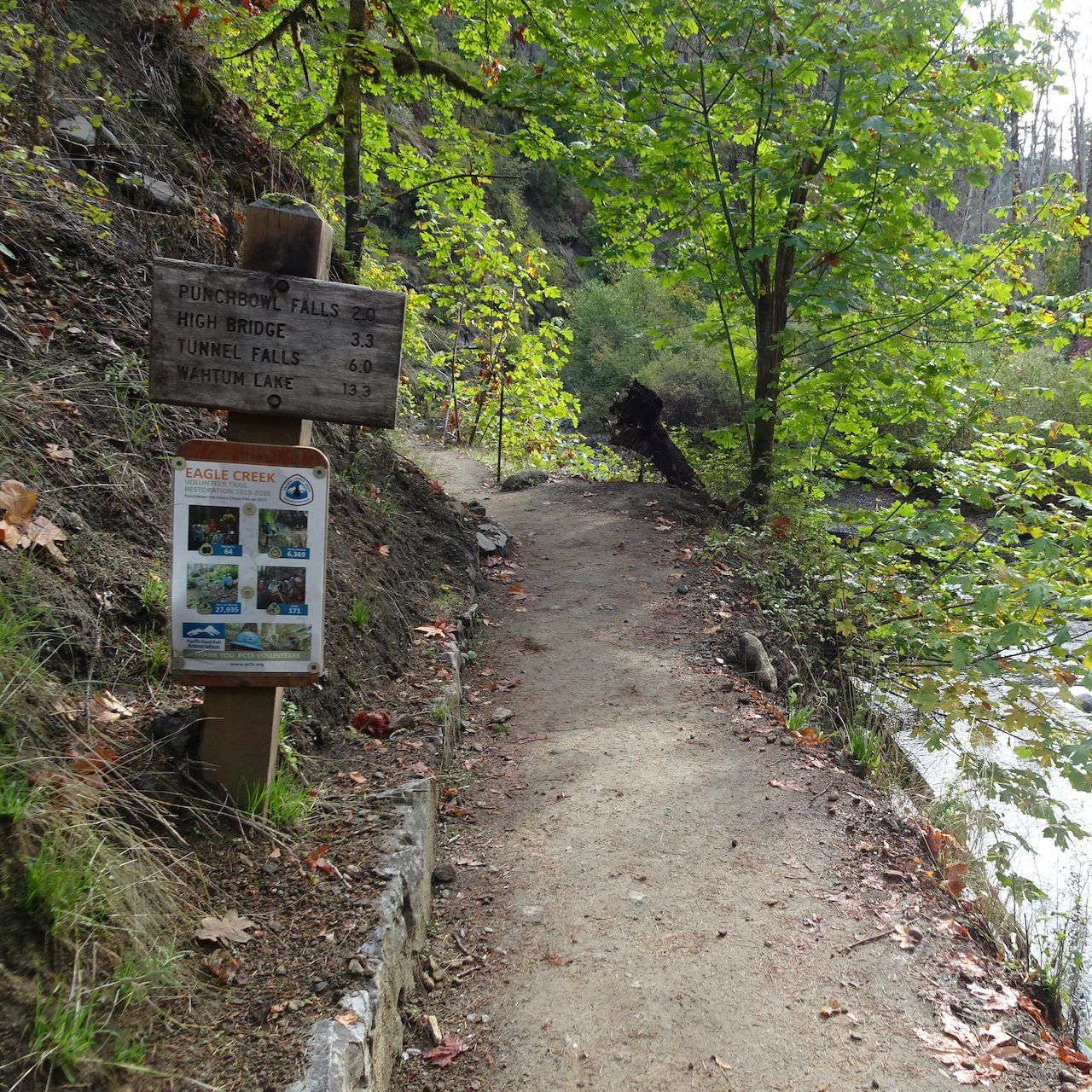
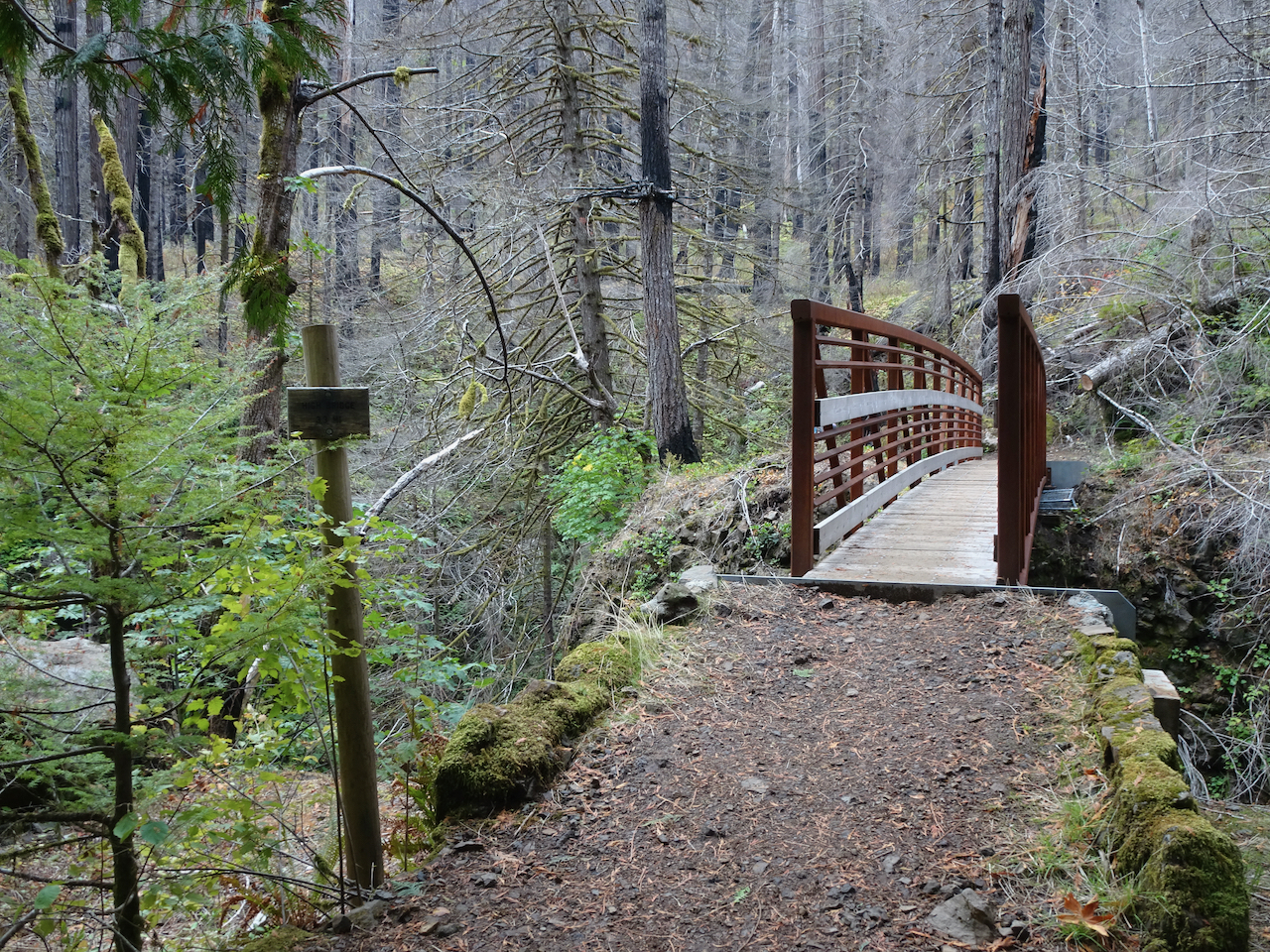
Trailhead

Eagle Creek trail along the cliffs
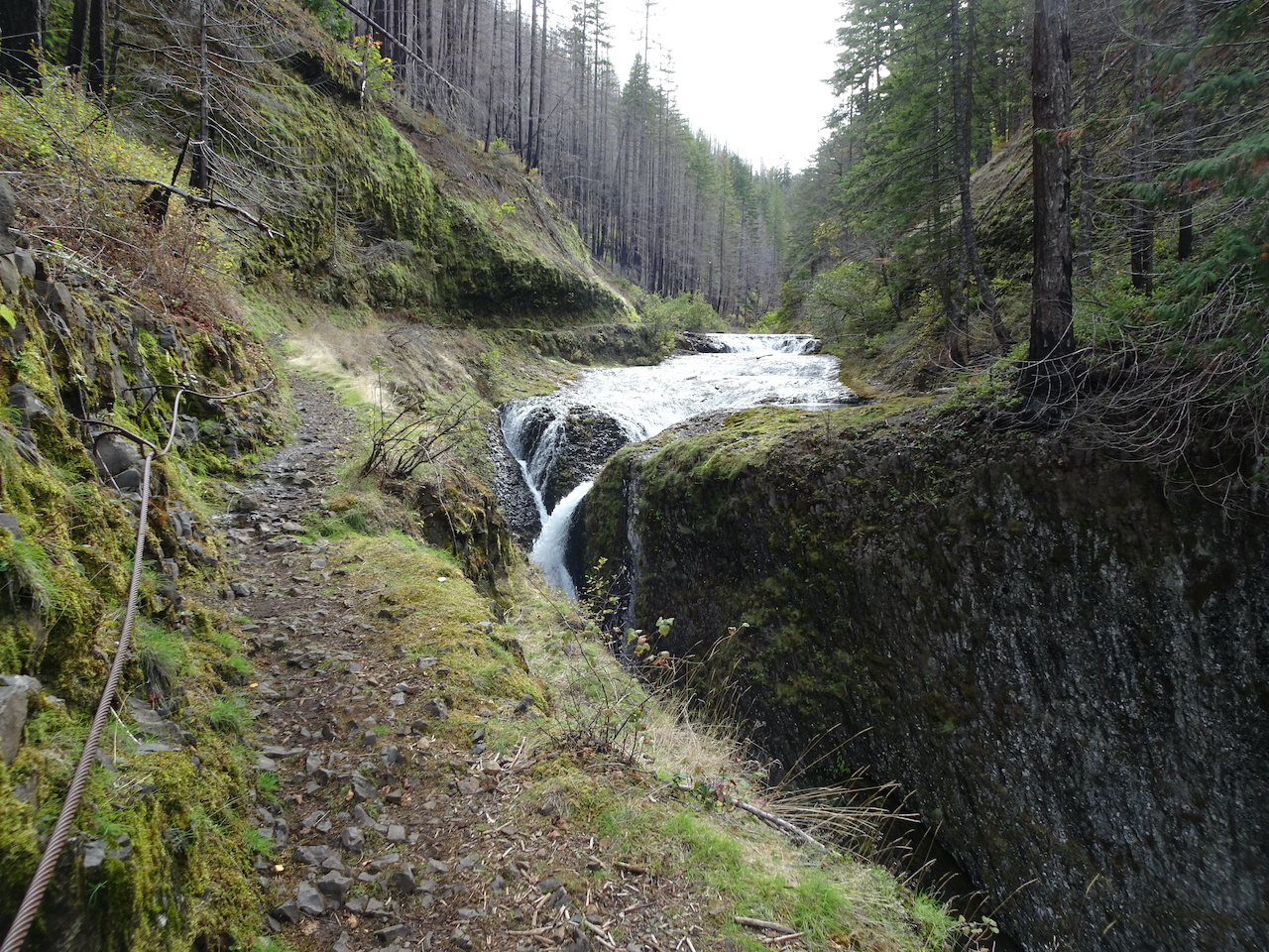
The trail passes by several waterfalls – we were not stopping much – keeping our end goal in mind.
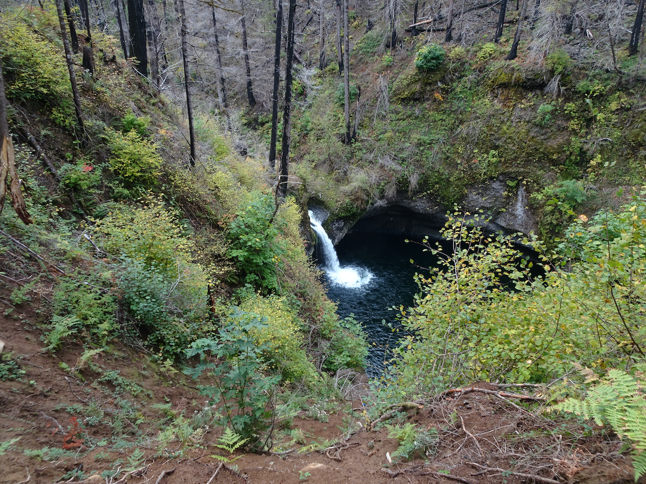
Punchbowl Falls
Almost to High Bridge

Loo Wit Falls, near High Bridge
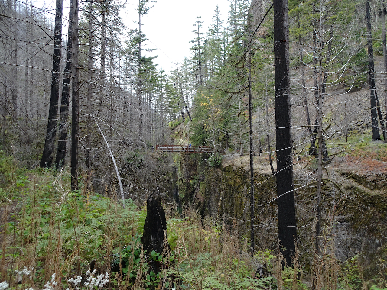
High Bridge, 3.3 miles
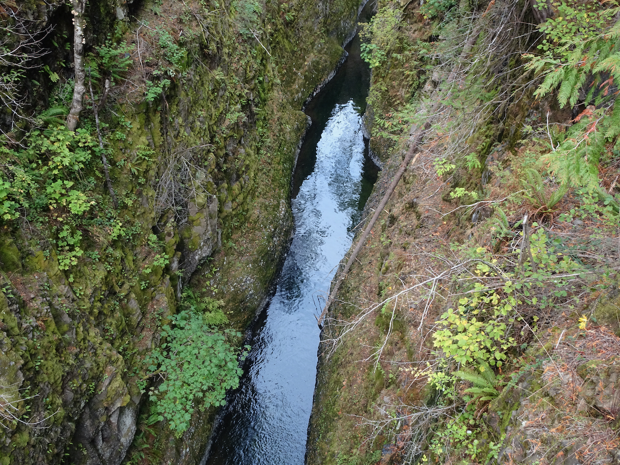
Looking down from High Bridge
After crossing High Bridge, the trail is on the west side of Eagle Creek.

New undergrowth in the burned forest beyond High Bridge

Skoonichuck Falls – the farthest we had been on previous hikes.
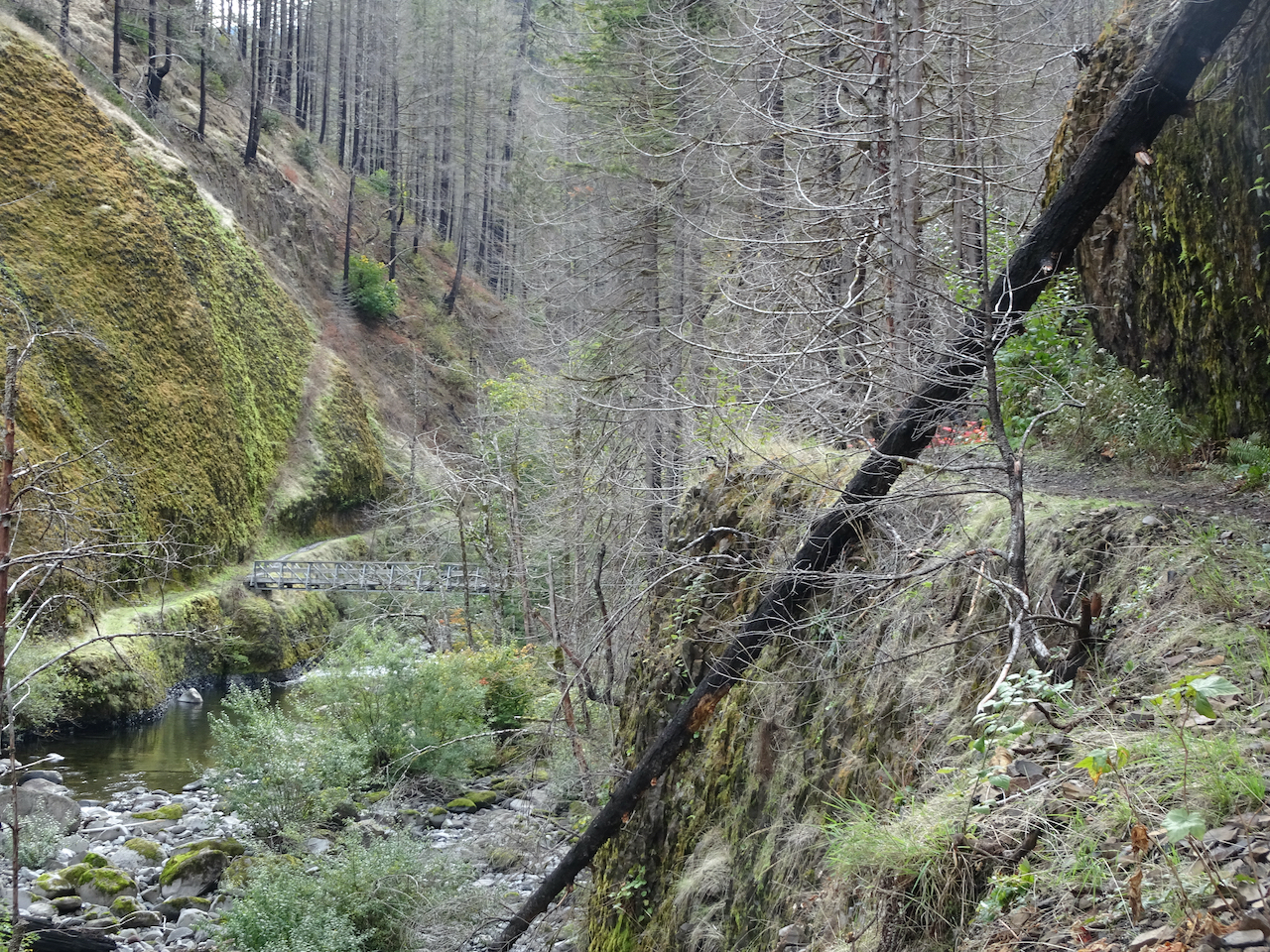
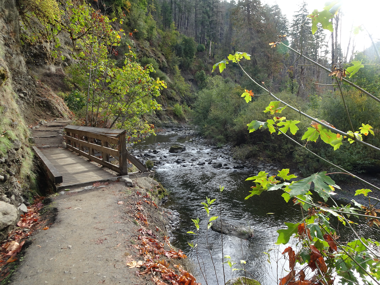
4.5 Mile Bridge – crossing back to the east side.
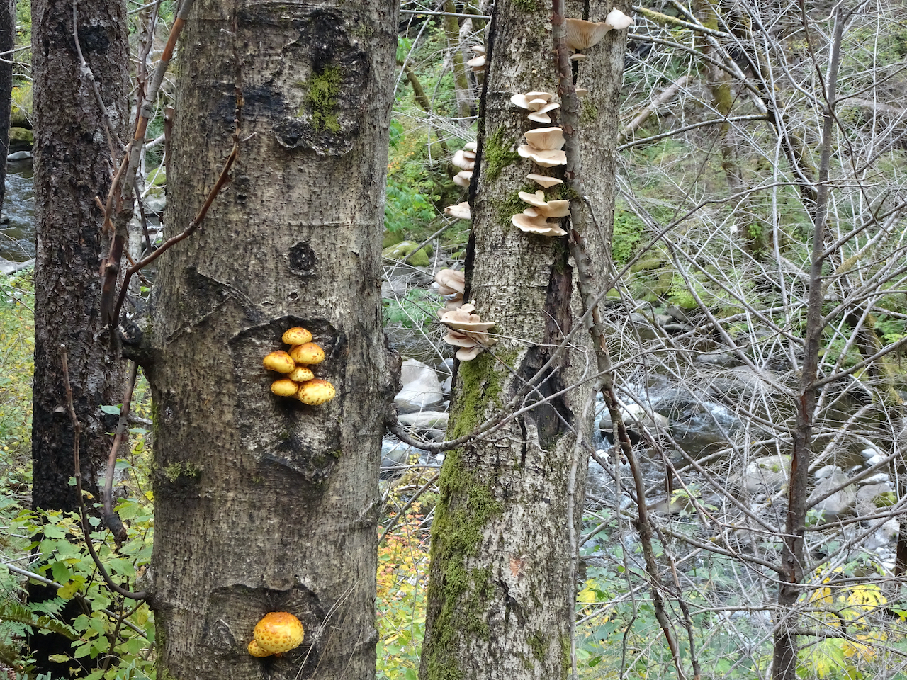
Fungi
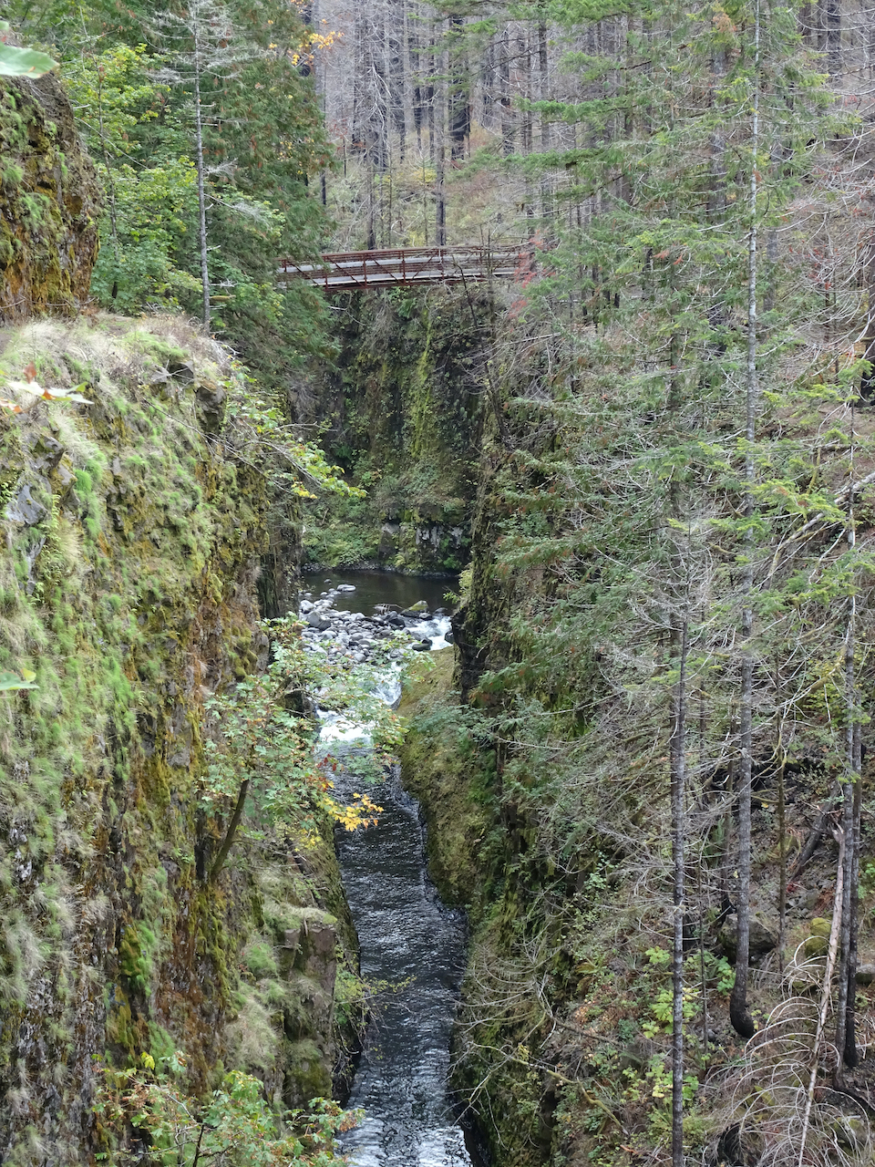
“Potholes” section
Grand Union Falls
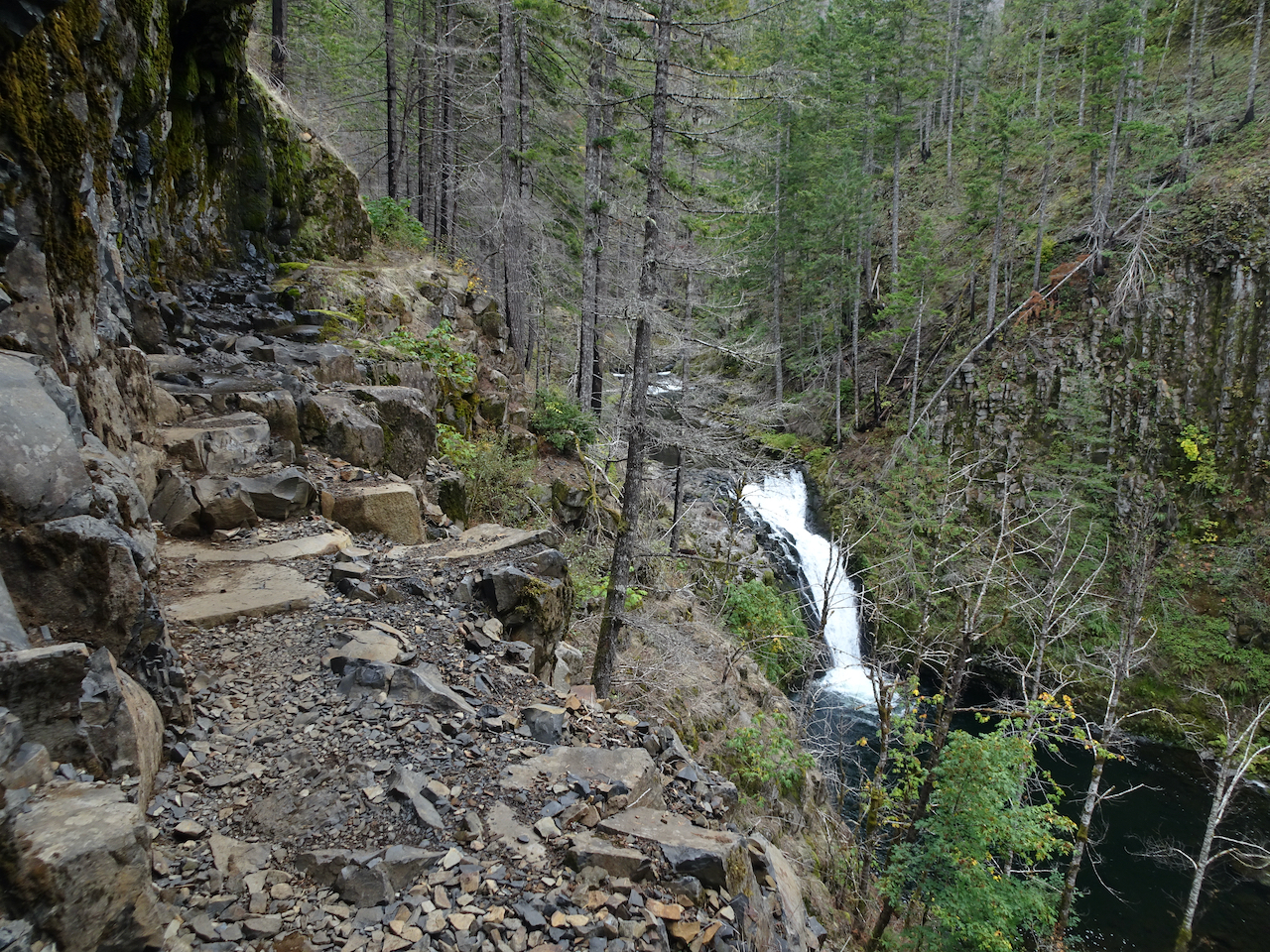
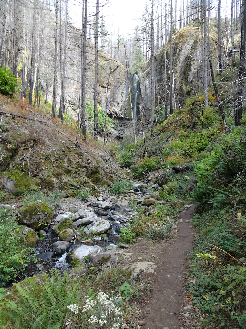
After 6 miles, we reached the first view of Tunnel Falls:

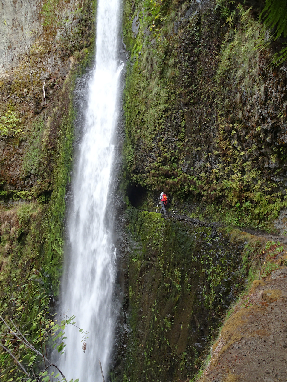
Tunnel Falls, East Fork of Eagle Creek, 175 feet.

Approaching the tunnel
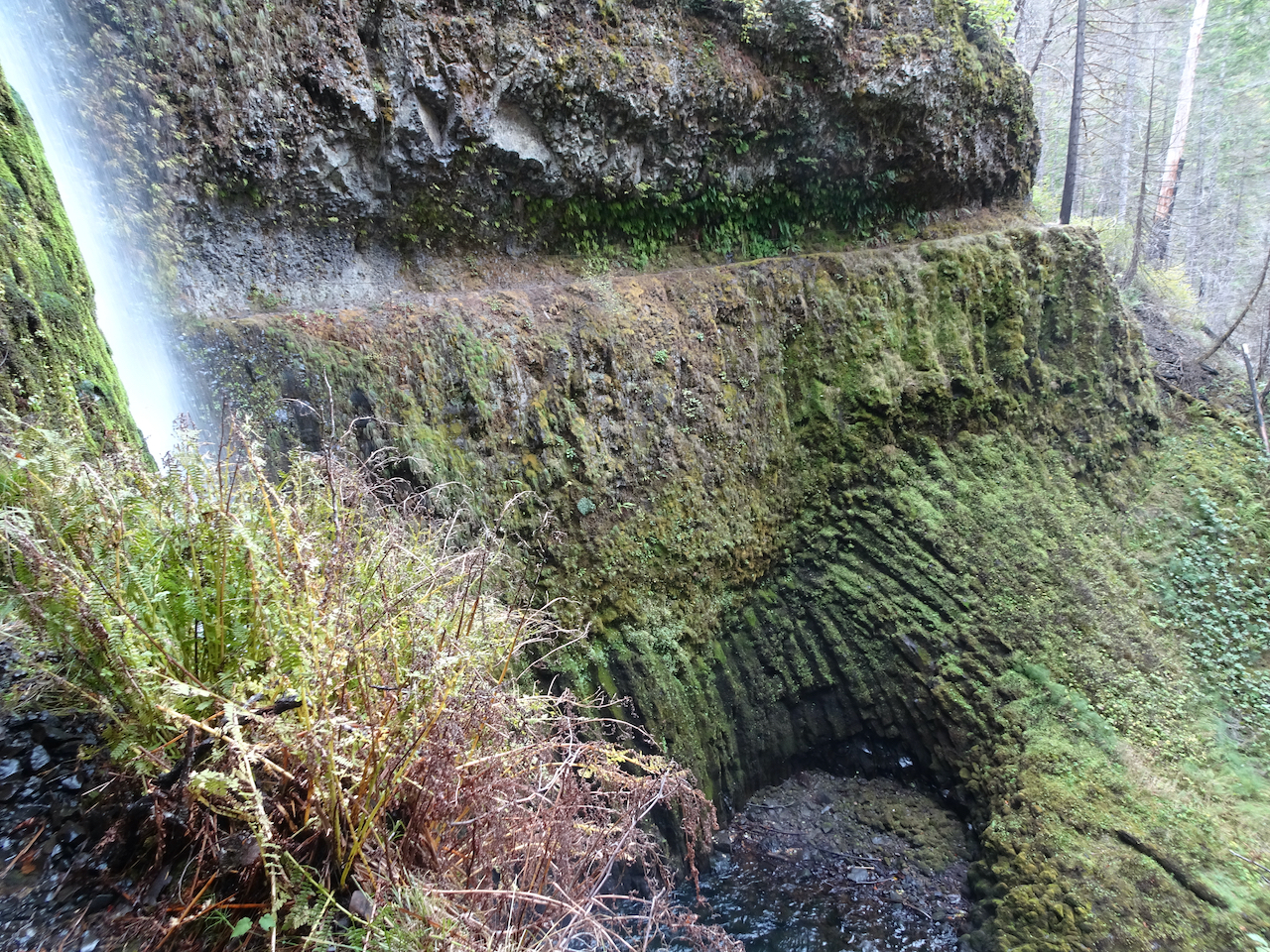
View across to the cliffs and ledge trail on the other side
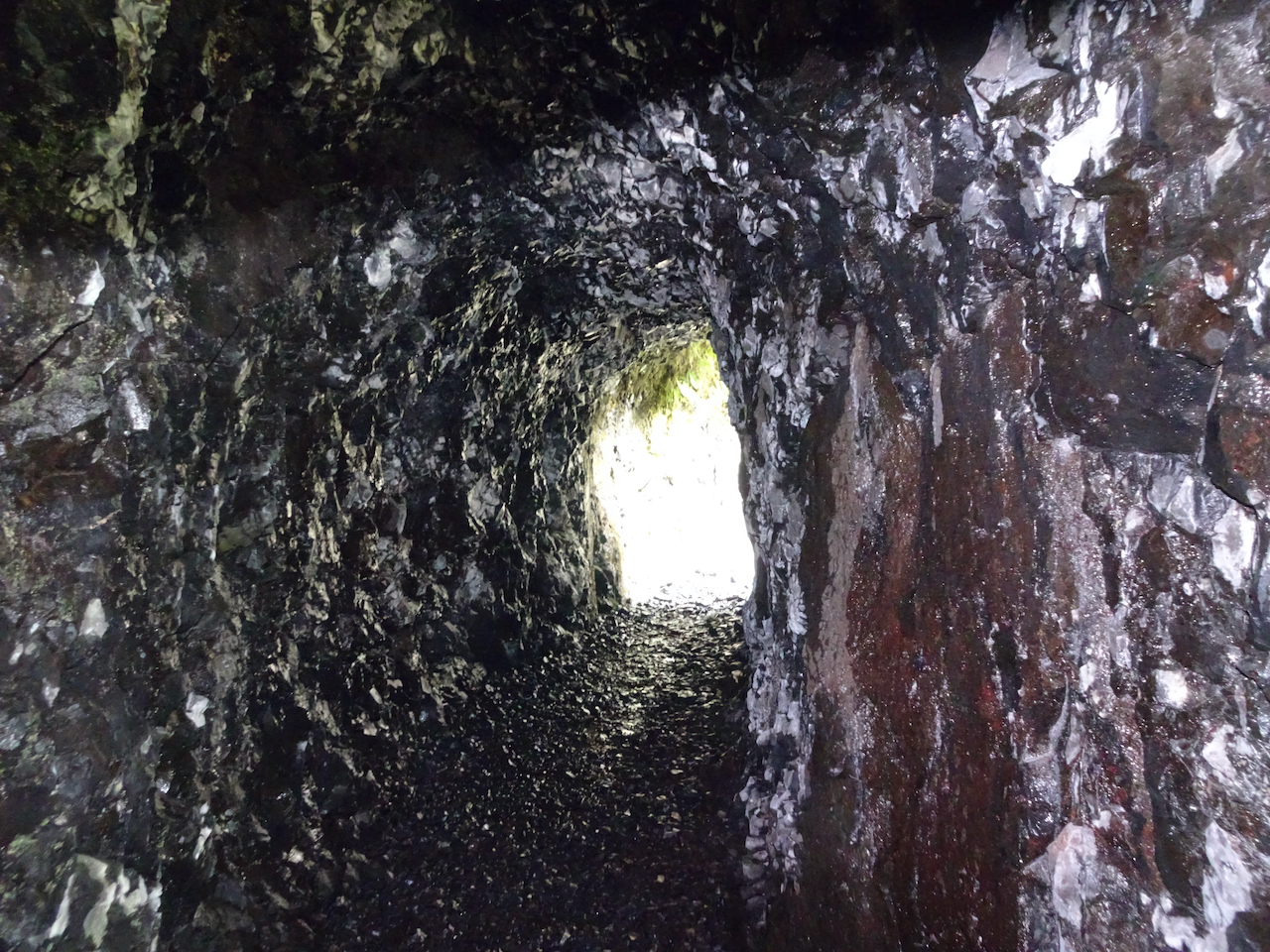
Into the tunnel

Looking up at the lip from the other side
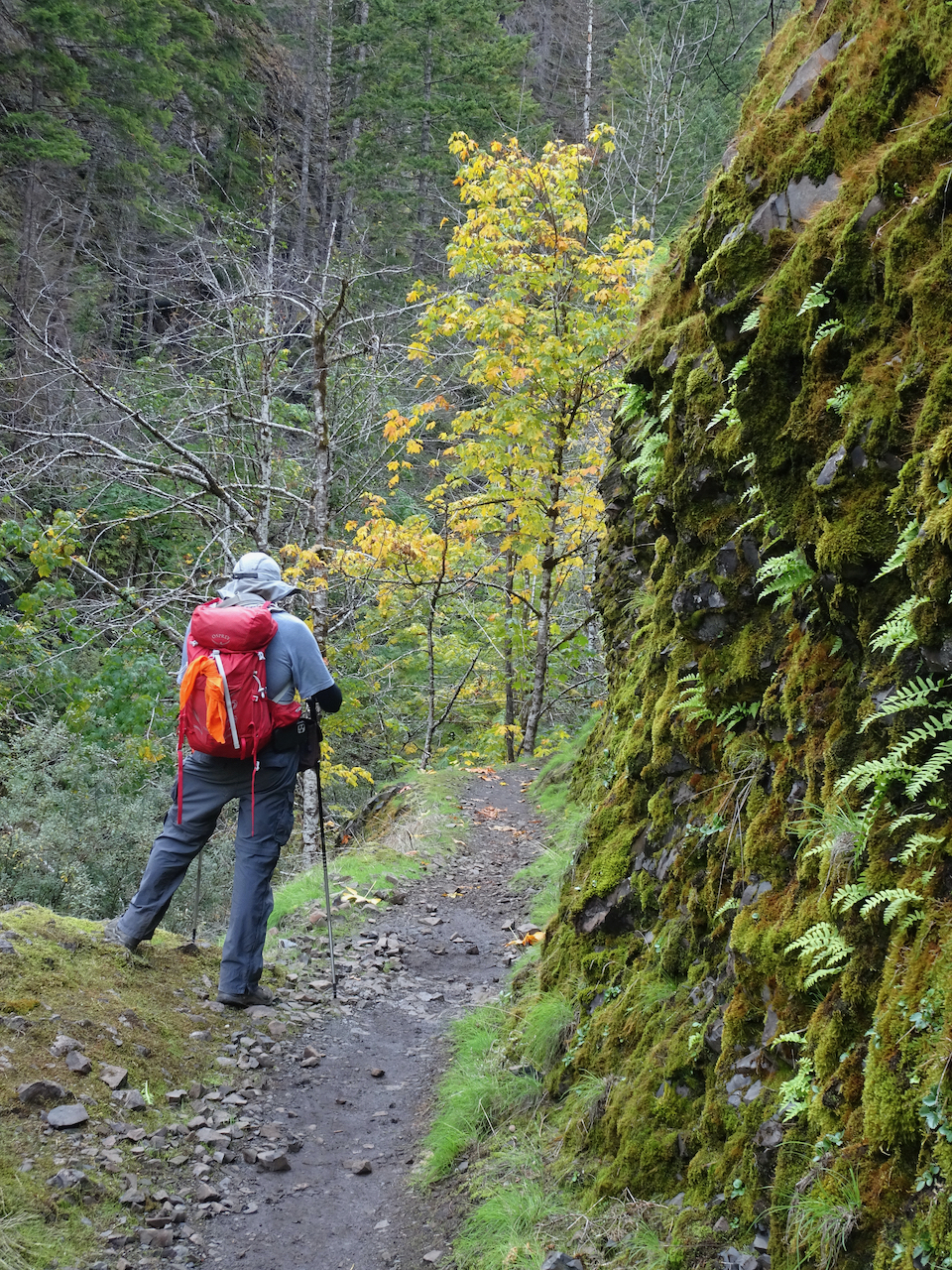
Fern-lined trail ahead

My husband took this photo of me after I walked through the tunnel.
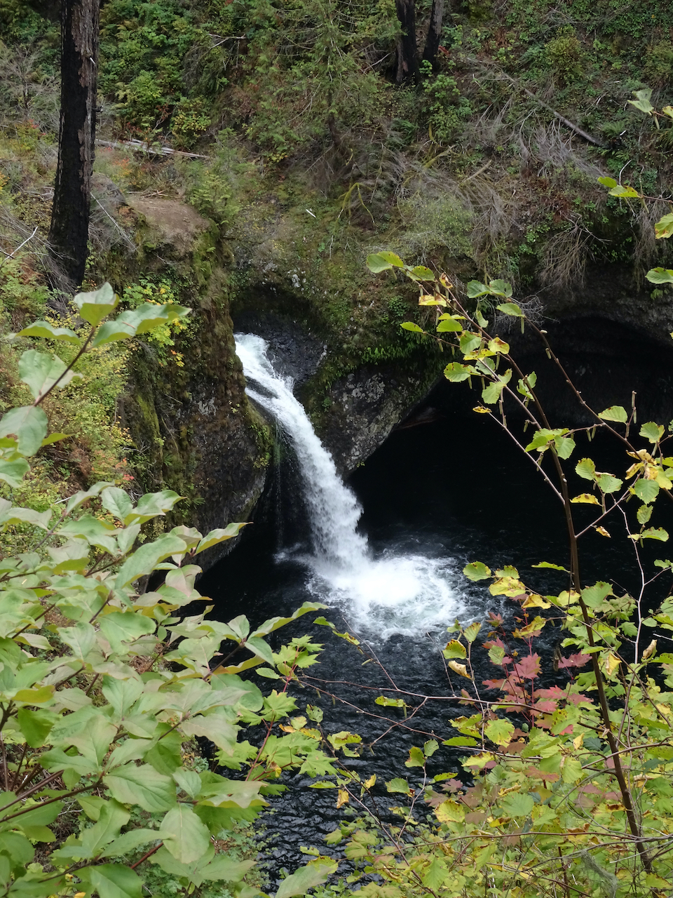
We continued around the corner, and upstream another quarter mile to Twister Falls:
Twister Falls, West Fork of Eagle Creek, 148 feet.

We couldn’t really get a good look at the full drop of this waterfall from the cliffside trail.

Eagle Creek, just above Twister Falls.
We found a quiet place beside the creek to rest and eat lunch before heading back down the trail.

Top of Twister Falls
Back through the tunnel,

and out the other side.

My turn…
Hiking back through the “Potholes”, where the trail surface is a parquet of columnar basalt:
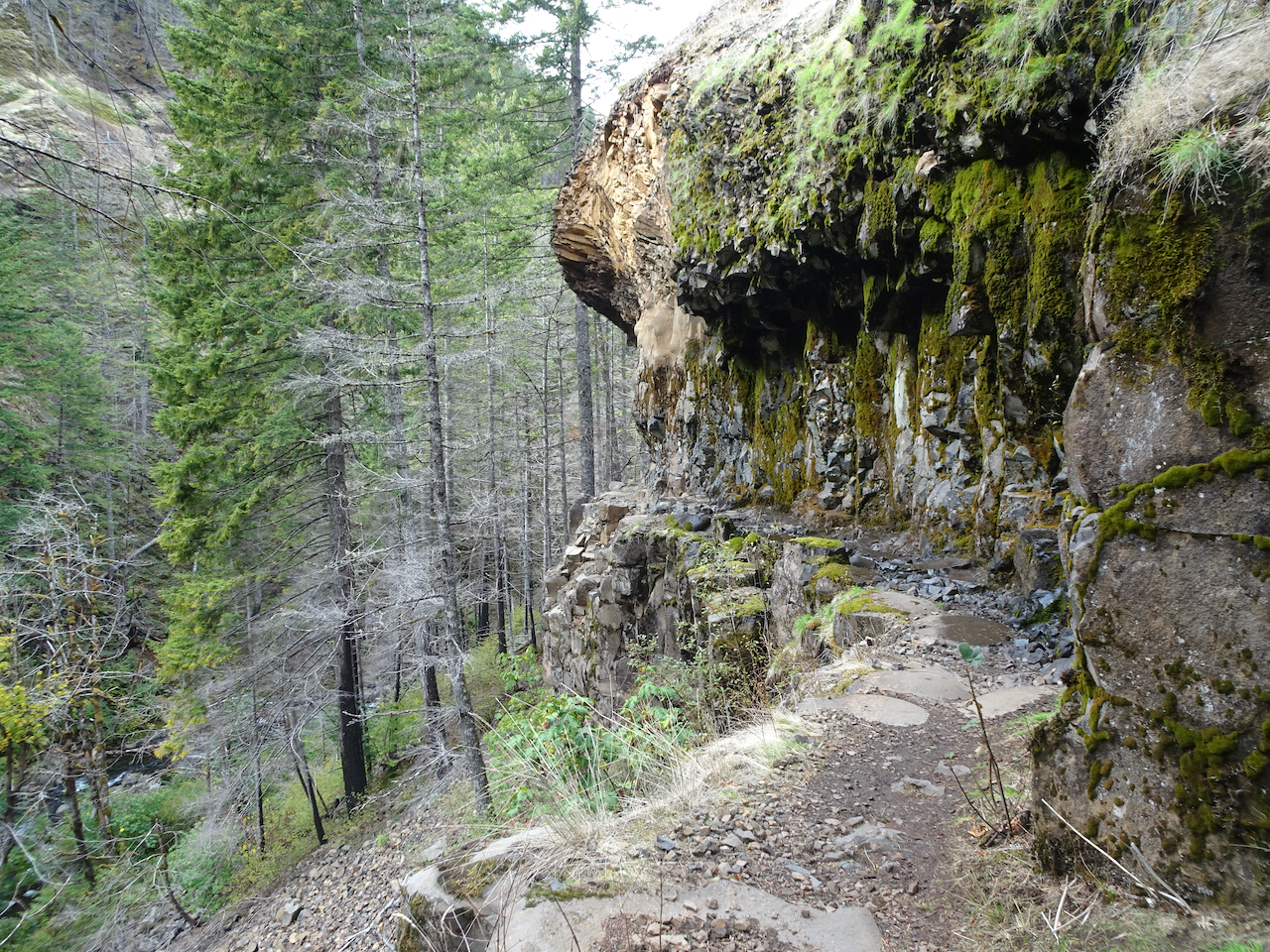
Potholes
Columnar basalts
 We continued hiking downstream:
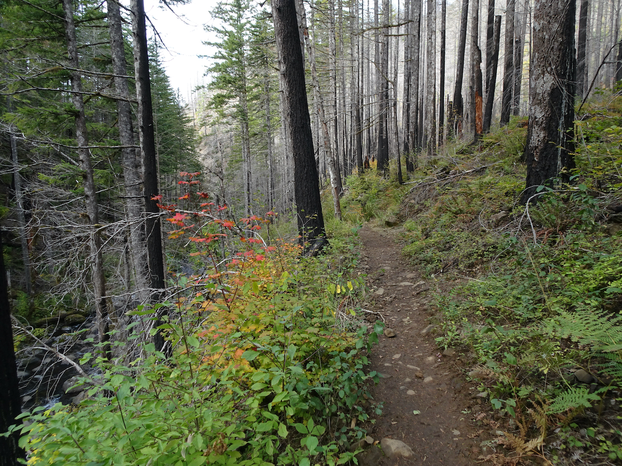
Vine maple turning orange in the burned forest
Big leaf maple turning yellow
We hadn’t noticed Wy’East Falls in a side canyon on the hike up.

Basalt cliffs on the east
4.5 mile bridge again.
There were many areas of obvious trail repair in the burned forest.
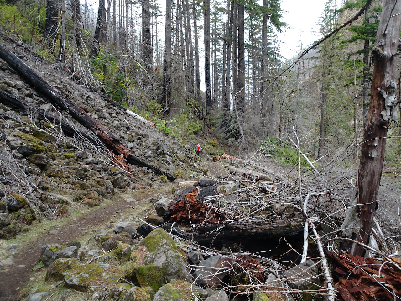
Scree slopes, burned and fallen trees

High Bridge again…
We successfully completed this hike – 13 miles, 1600 feet for the day. I was glad to have seen Tunnel and Twister Falls, but I also felt a bit of vertigo on that section of the trail, and thought that maybe I won’t need to repeat this hike. The week after our hike, the trail was closed again briefly after an atmospheric river event caused more trail damage (quickly repaired by the valiant trail-keeping organizations in the area). It is a special place, and I am glad to have finally been able to see it.
Last look at Punchbowl Falls.

Your “Back through the tunnel” photo is classic!
LikeLike